
The Forest and the Trees: Glacial Topography of the Central German Plain

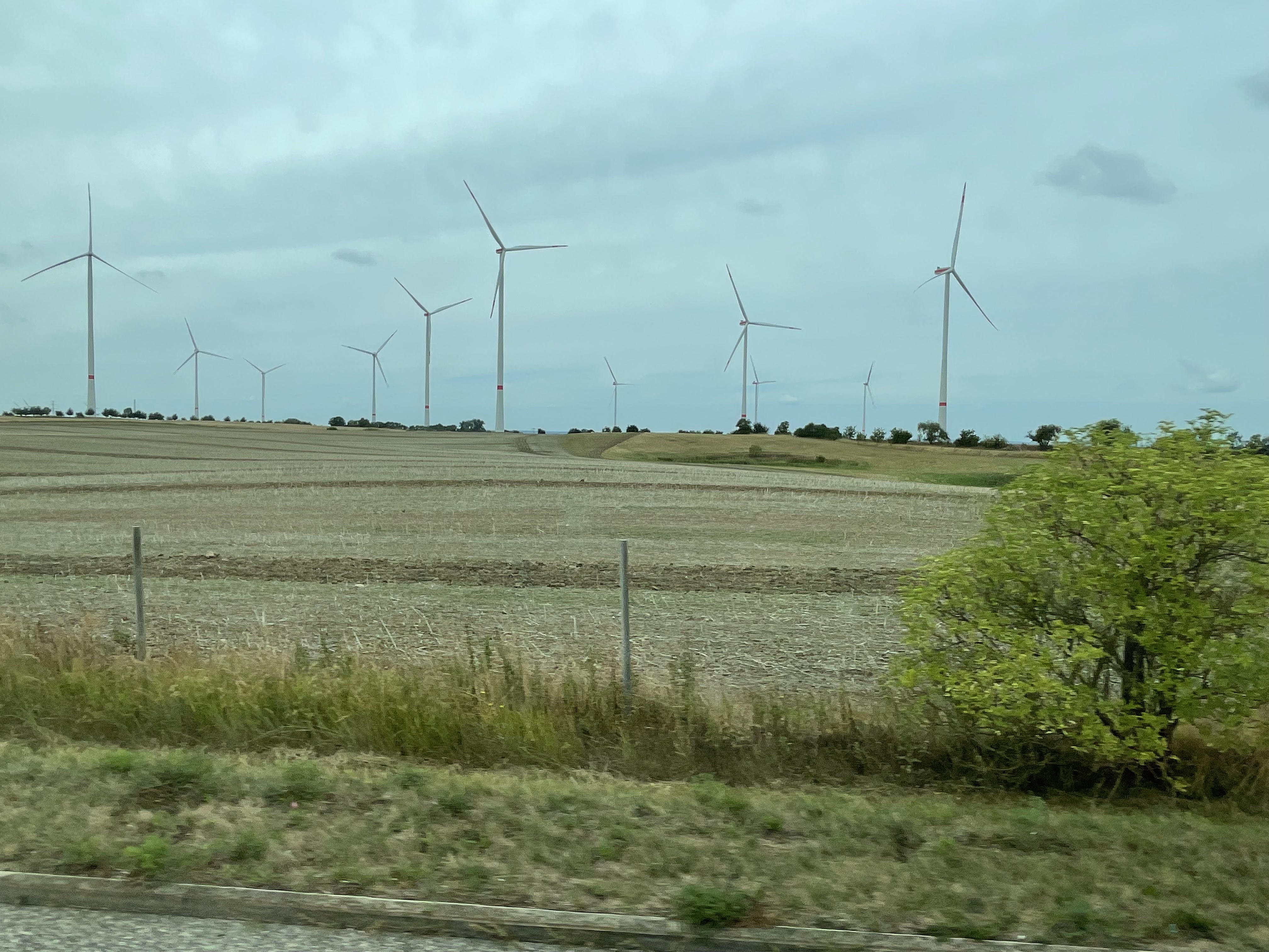
The wind blows pretty steady over the North German Plain and Central Uplands, so there are wind turbines everywhere, scattered among the hay fields (Fig. 1).

The topography of the Central Germany Plain is very similar to Nebraska, Kansas, and the Dakotas, because they were all created by the advance and retreat of multiple glaciers during the Pleistocene Ice Age. As we saw in the last post, advancing ice sheets as thick as a mile push rock and soil in front of them, before melting back for a few millennia, leaving piles of soil and boulders behind. They are like gigantic bull dozers.
As ice slides over the landscape, scraping off whatever gets in its way, the ice at its base can melt from the friction, creating streams that transport already ground-up rocks. The usual rules of sedimentology apply to these ice-encased streams. They can deposit their sediment load as eskers, which identify these sub-glacier streams, or as piles of scraped-off soil (terminal moraines). I don’t know which I’m looking at in Fig. 4, but this image gives a good impression of their impact on the landscape. Keep in mind that the ice was approximately ONE-MILE thick above the landscape shown in Fig. 4…

As I alluded to in the previous post, geology isn’t a sequence of static processes; there is always more than one cause of what we see today, and none of them are stationary. Thus, the landscape produced by the continental glaciers that advanced over the Central German Plain during the Pleistocene were constantly in competition with alpine glaciers created in the valleys and peaks of the Alps. The huge ice sheets had the power to overcome any obstacle…but they couldn’t surmount the steep slopes of the Alps.
The glaciers that originated in the Alps waited until the last retreat of the great ice sheets that originated in Scandinavia, before they could make their play in the Holocene. Vast quantities of easily weathered feldspar were washed down their steep slopes into a panoply of rivers, which cut through the moraines left behind during the retreat of the continental ice sheets, creating broad river valleys like that of the Saale River (Fig. 5). Germany’s central plain and uplands were cut to ribbons by these growing streams, resulting in one of the most water-navigable regions in the world.
You always have to watch your back…
An Erratic Path: Glacial Geology in Usedom, Germany
This post finds me on the Baltic Sea, although I never actually saw it first hand. But this report isn’t about coastal geology; instead, I will be talking about an unusual feature of glacial terrains.


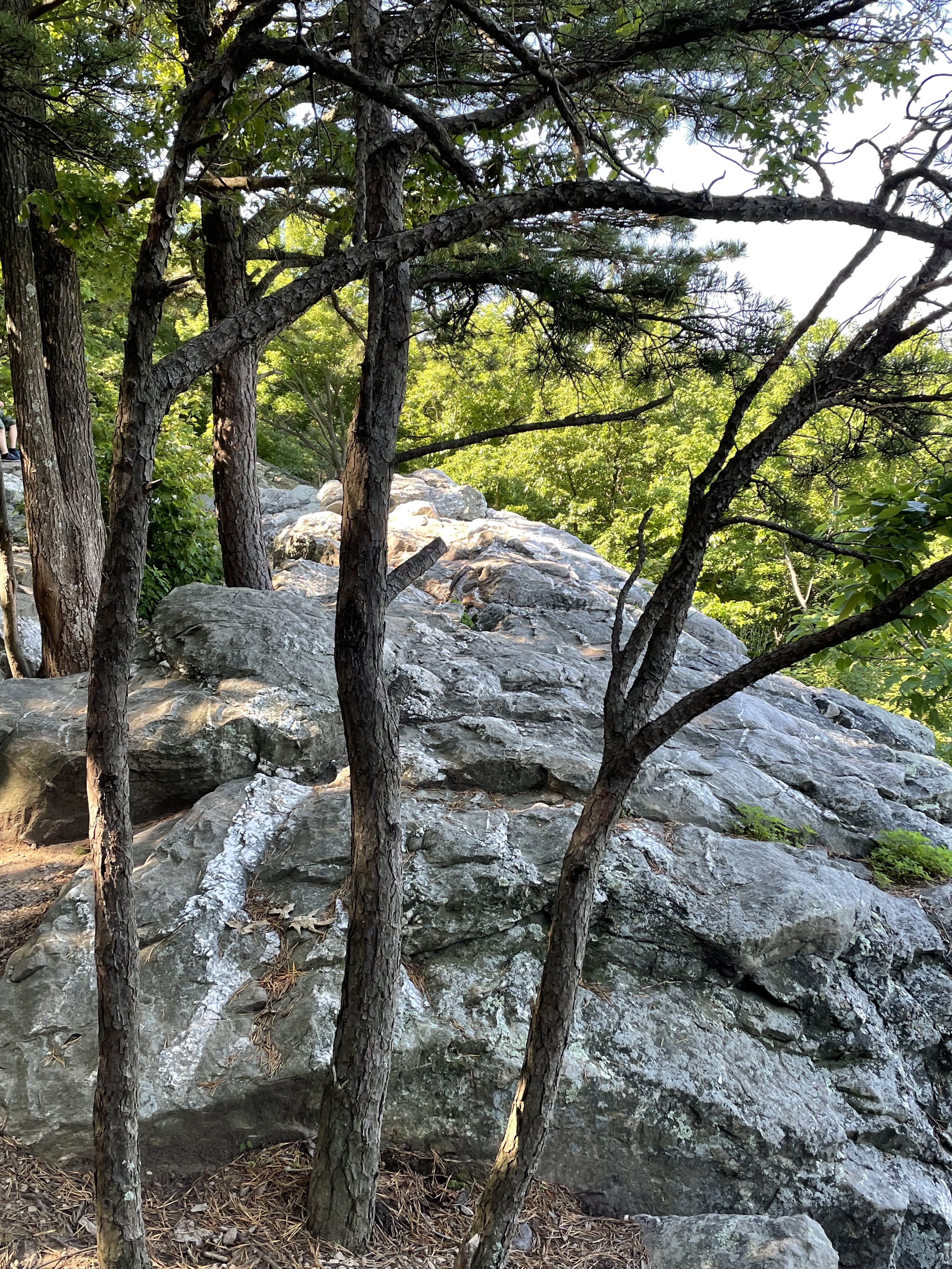
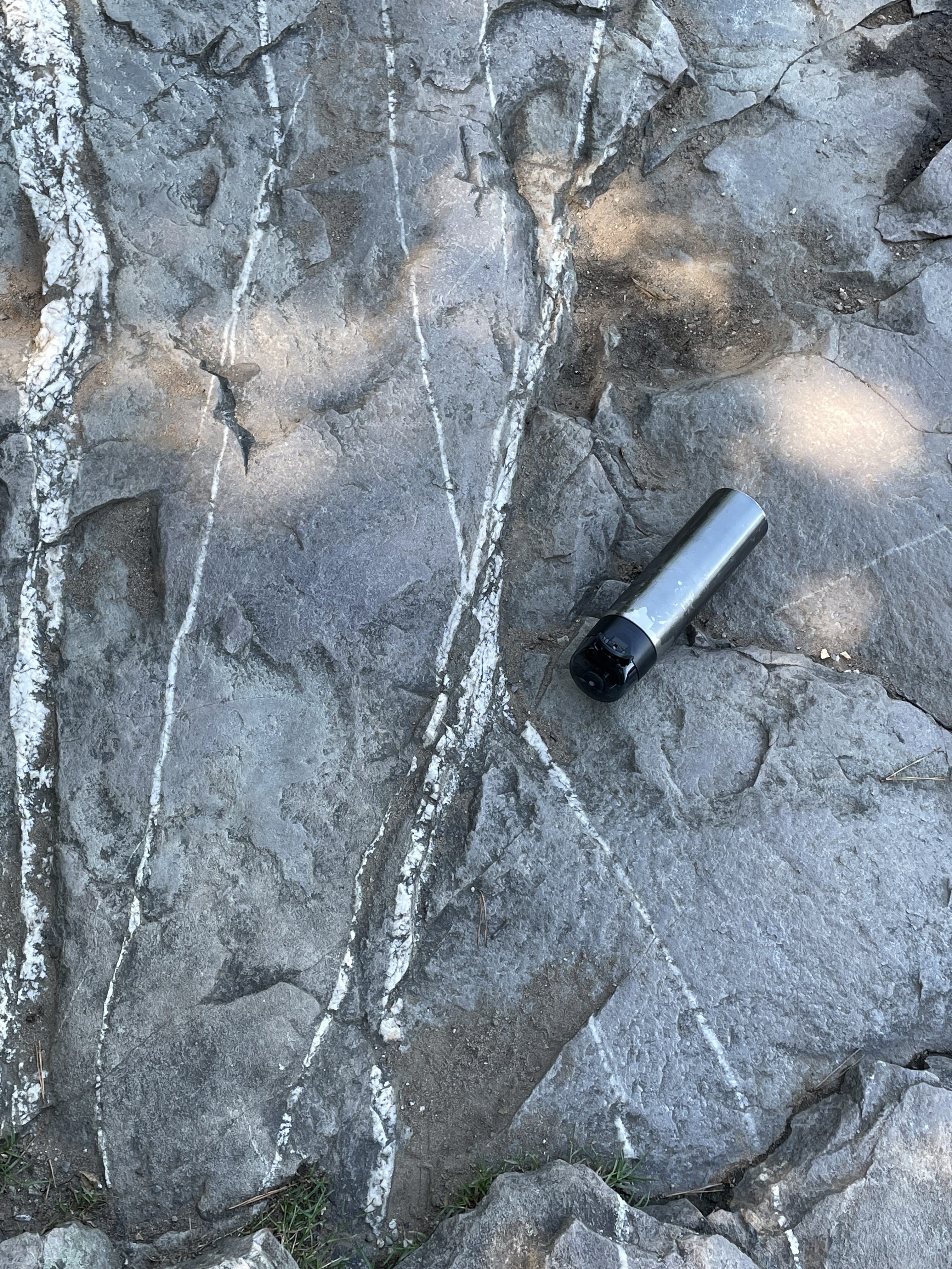
I haven’t explicitly described glacial terrains in previous posts, and this is not going to be a summary. As always, I’m only going to discuss what I saw with my own eyes. The flat, poorly drained topography of glacial areas (Fig. 1) is often interrupted by linear mounds of loose gravel, sand and silt. These features are called moraines and they are ever-present in northern Germany, especially in Usedom (Fig. 3).
The primary glacial feature I encountered on this trip is the titular Erratic–large, rounded boulders scattered around a featureless landscape (Fig. 4).

Let’s look at a couple of examples and see what they tell us about their source.

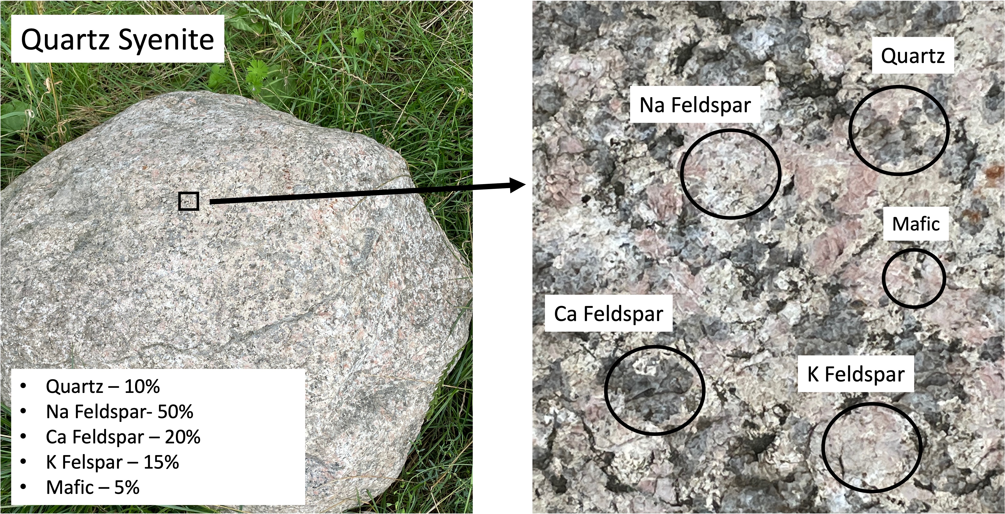
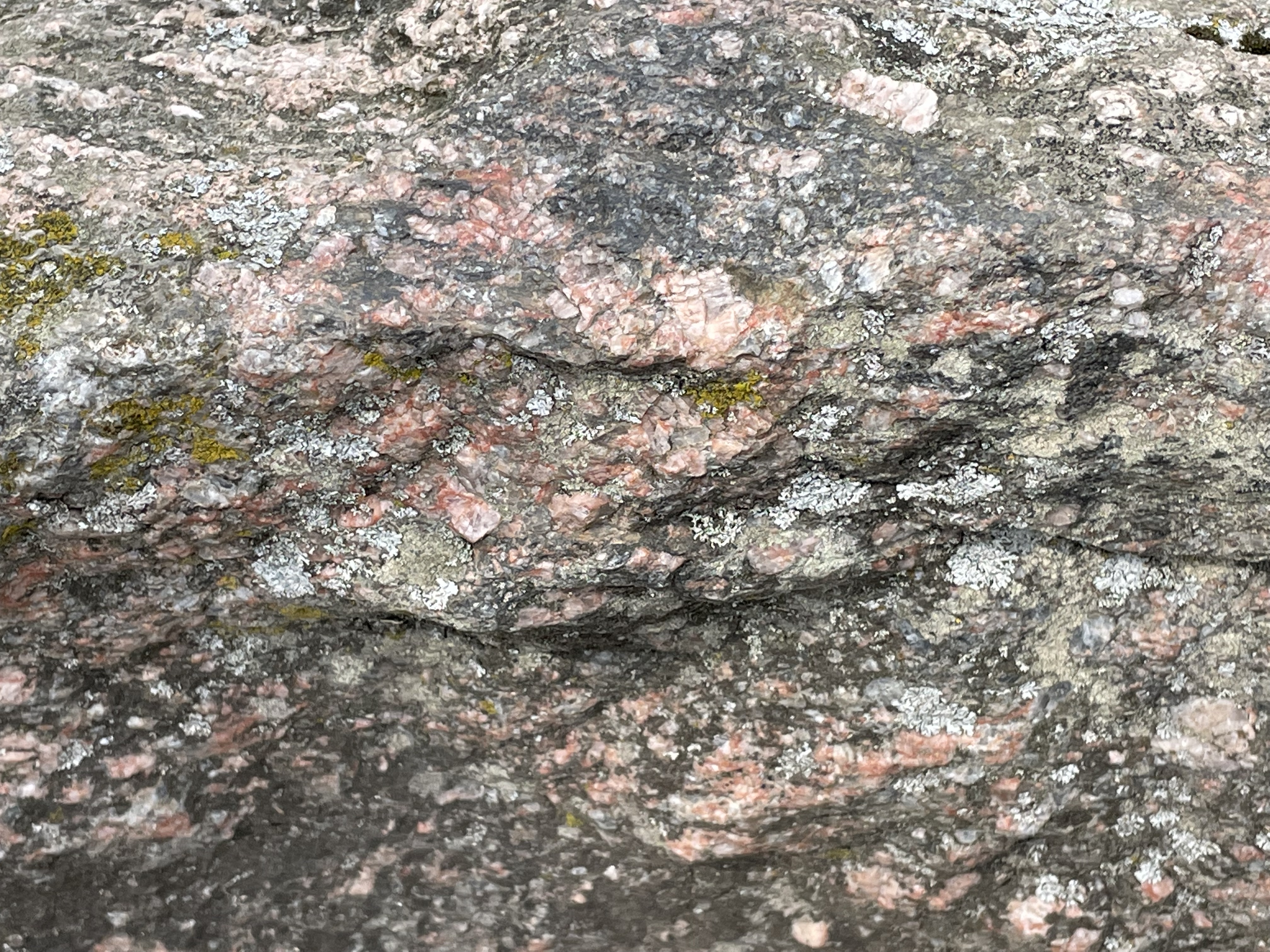
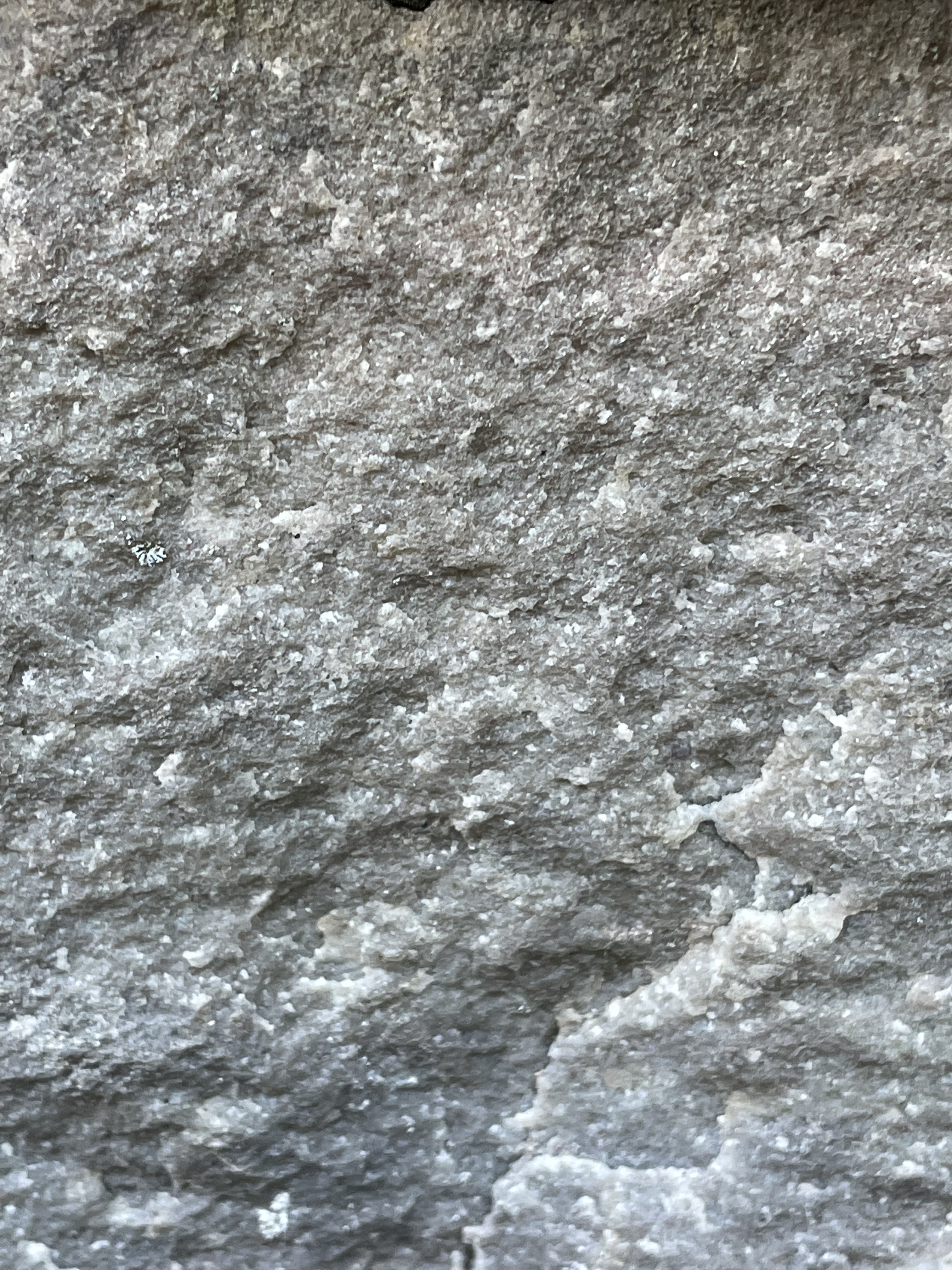
The first erratic boulder I found (Fig. 5) contains no more than 5% quartz (left photo caption), and is dominated by K-feldspar, which is unusual. The magma from which this rock formed (deep beneath the surface where it cooled for millions of years) didn’t contain very much water, which is indicated by the small amount of quartz. The chemistry of the magma is quasi-frozen in the minerals, the second-most-abundant of which is Na Feldspar. The feldspars form a continuum that depends on the relative abundance of potassium (K), sodium (Na), and calcium (Ca); K and Na both form lighter-colored minerals whereas Ca forms dark feldspar minerals. Based on the mineralogical composition of this rock (inset in left image of Fig. 5), this would be classified as a syenite (middle left side of Fig. 6).
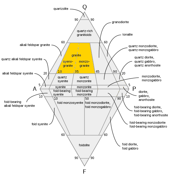
Syenites are formed in thick, continental crust. An example today would be the Alps (far beneath them) or the Himalayas, where subduction of denser oceanic crust is not occurring. In other words, the rock shown in Fig. 5 was created deep beneath the surface (~30 miles) when continents collided.
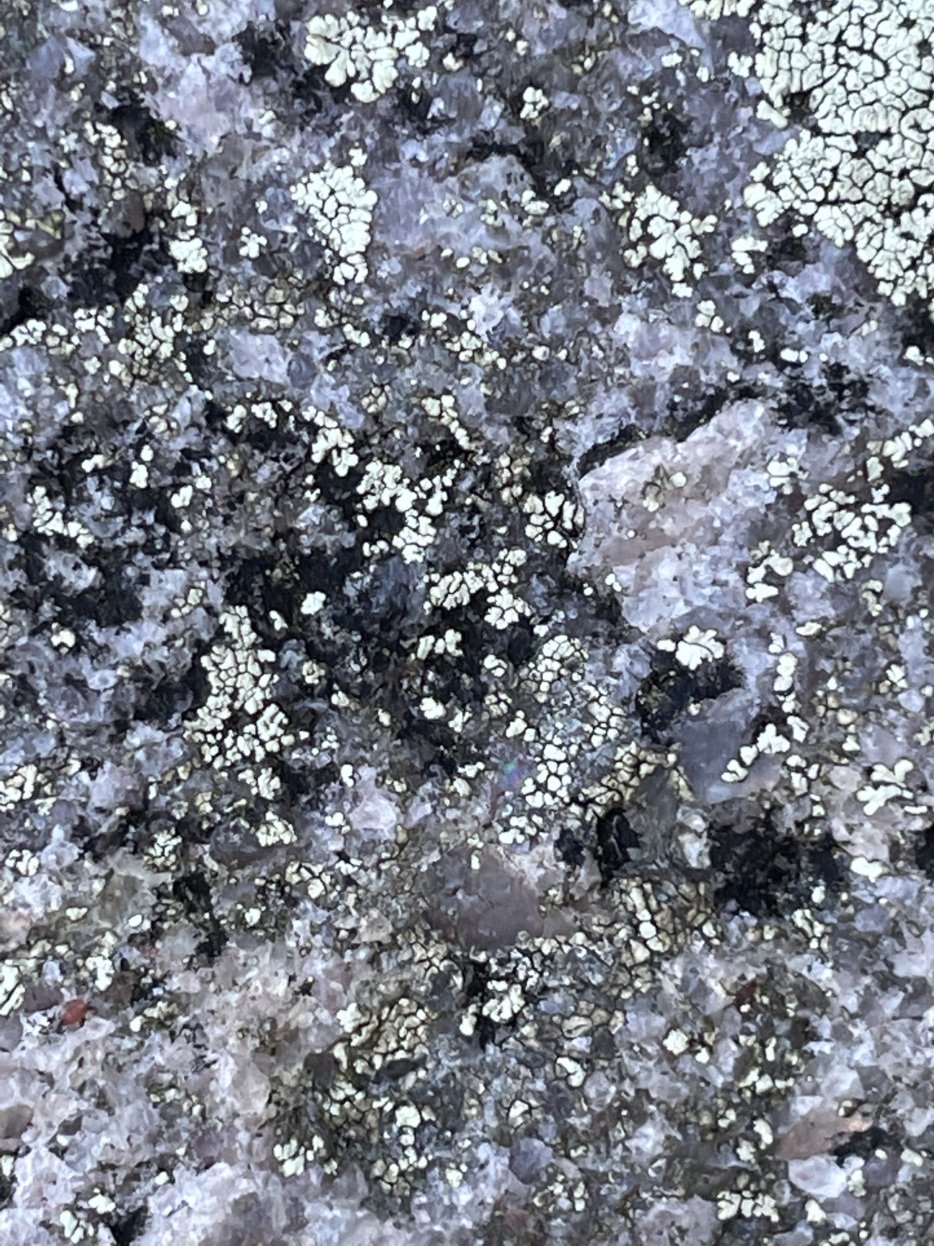
The boulders seen in Figs. 5 and 7 could have come from the same magma chamber because, as you would expect, there would be variations in local chemistry in a magma chamber tens of miles in diameter, and slow rates of convection wouldn’t mix the magma to a uniform consistency, even over millions of years. Magma, even when heated to 2000 F and buried tens of miles beneath the surface, is still thicker than molasses; it doesn’t mix well.

Phenocrysts like those seen in Fig. 8 are created in intrusive igneous rocks when they go through a multistep cooling process; for example, magma near the edge of the magma chamber loses heat to the surrounding rock and forms crystals like those seen in Fig. 8. These phenocrysts are then captured by the still-molten components of the magma and dragged along for probably hundreds-of-thousands of years (at a very slow speed, like inches per thousand years).
When the magma finally cools enough to become solid rock, it is uplifted as overlying rocks (of all kinds) are eroded by wind and water, not to mention ice. They are finally exposed in great mountain ranges like the Himalayas, where the rock breaks into smaller-and-smaller pieces along joints. When these pieces become small enough to be transported at the base of glaciers (you’ve heard the phrase glacially slow), they are dragged along, scraping over more rocks, sand, and gravel, which leaves evidence of their precarious journey (Fig. 9).

This post has been erratic, starting out looking at a glacial terrain (Figs. 1-4), then taking a detour into igneous petrology, the chemistry of magmas, and mineralogy, with a little plate tectonics thrown in. That’s how geology is; everything is an ongoing process that never quite reaches equilibrium (e.g. the phenocrysts in Fig. 8), and the journey is unending.
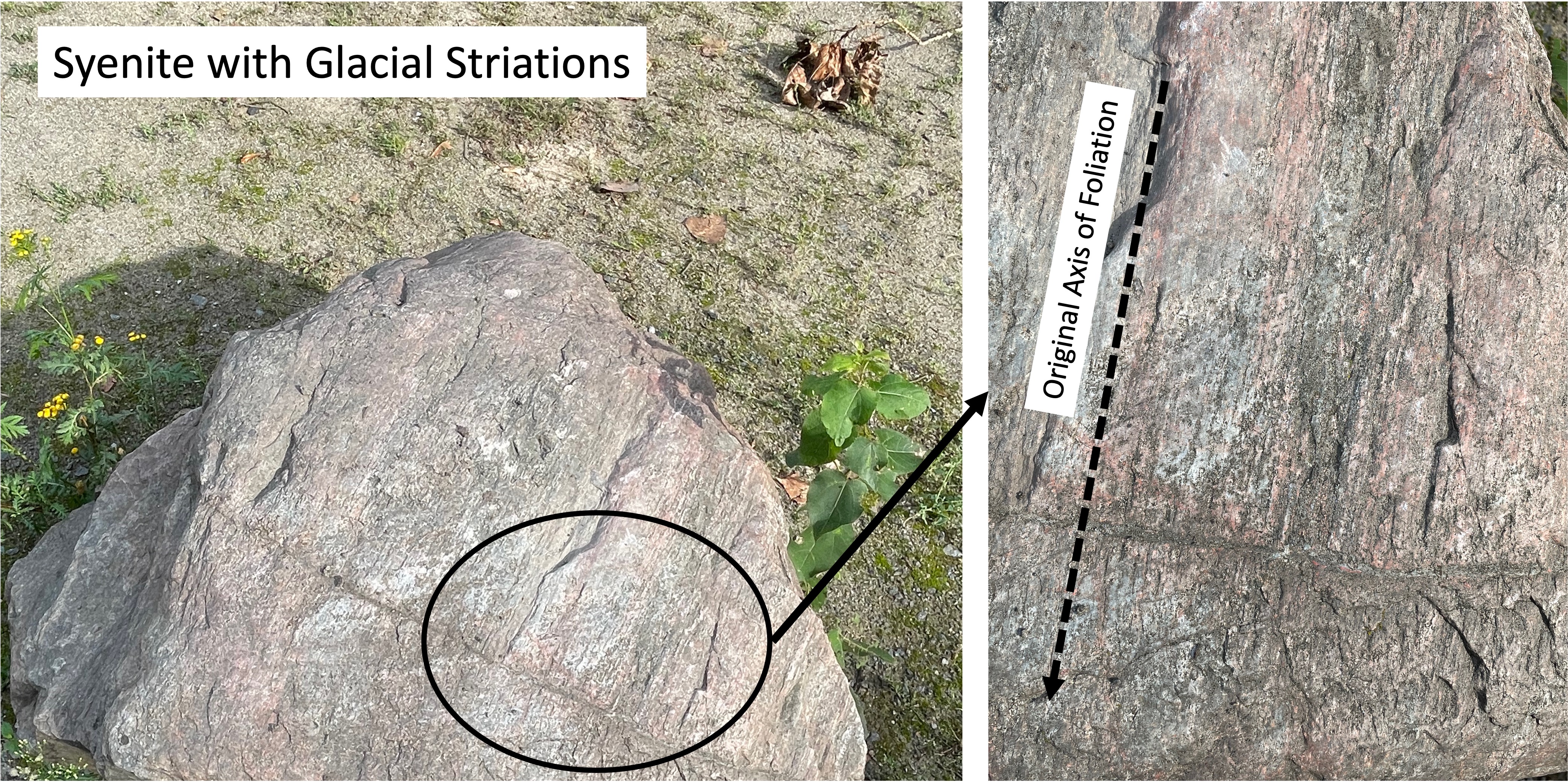
I didn’t investigate the origin of the syenite boulders examined in this post, but (if memory serves) they match the mineralogy of intrusive rocks from Sweden, which is a long way from Usedom.
Stockholm is about 500 miles north of Usedom…
Eidersperrwerk: Keeping Out the North Sea
My last post explored the mud flats bordering the North Sea in northern Germany, where we found conflicting methods applied to control and protect the levee system. This post investigates more aggressive measures implemented at the mouth of the Eider River. We will briefly look at the Eidersperrwerk, a gate system designed to control both storm surge incursion up the Eider, and river outflow
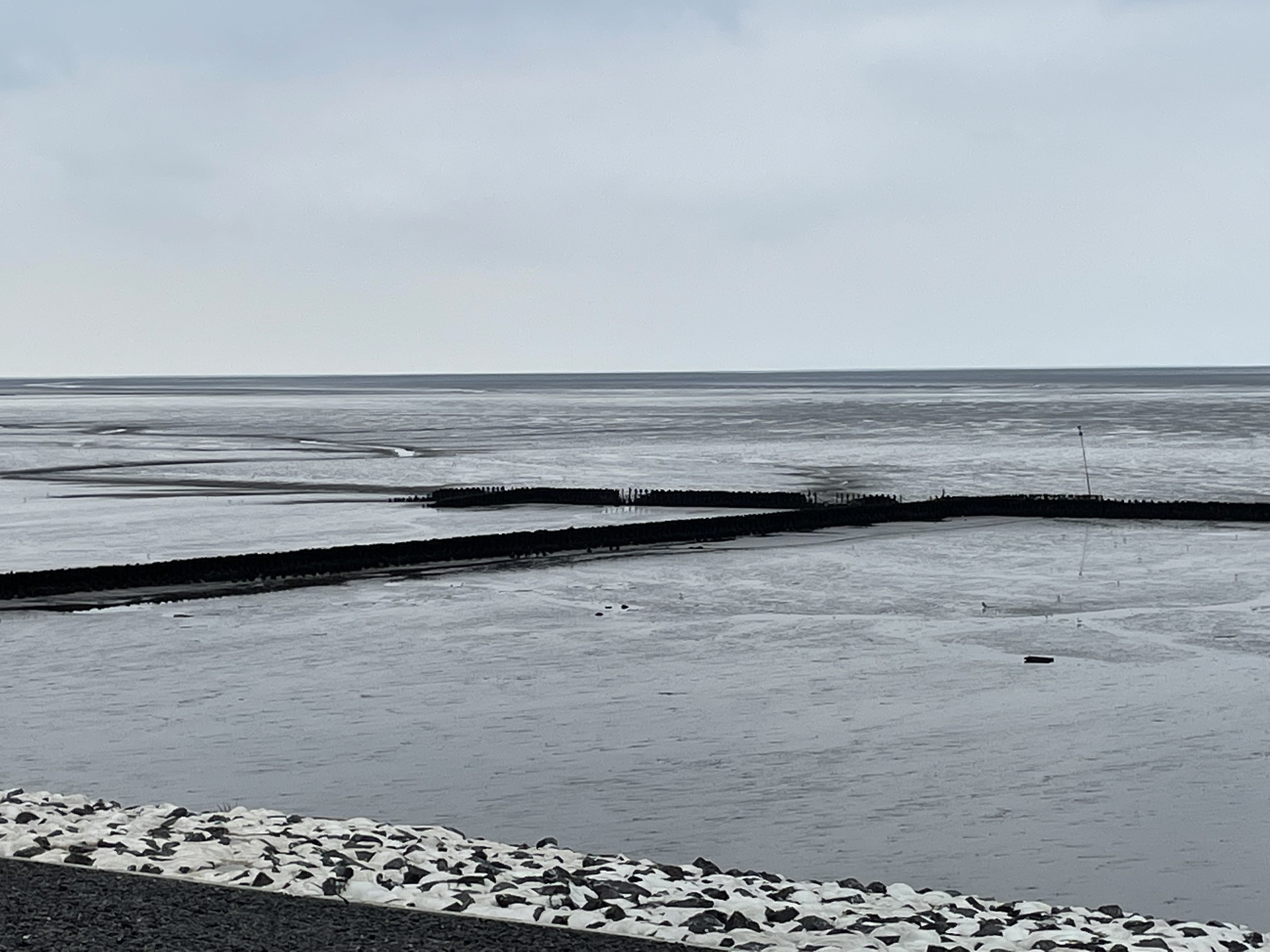
We will focus on the seaward mud flats in this post. Let’s take a look at the south side of the river first (upper-right of Fig. 1).


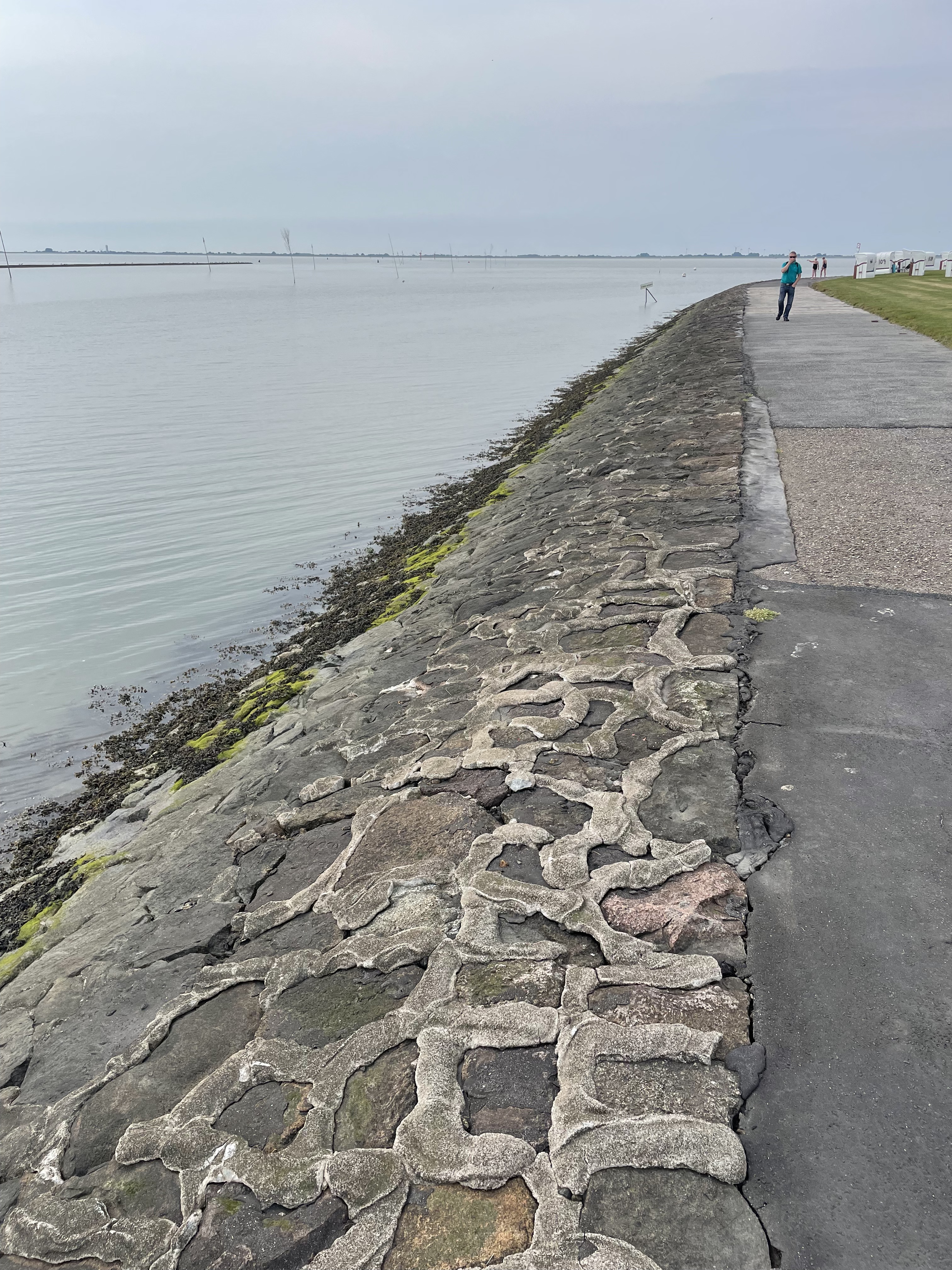
Comparing Fig. 1 to Figs. 2 and 5-8, we can see the effects of years (probably decades), during which interval the northern margin of the river mouth filled with sediment and grass was established (Fig. 5). Subsequently, it seems that erosion removed some of this soil and grass (Fig. 6). Meanwhile, storms have been slowly wearing away the boulders armoring the base of the levee (Fig. 8) and a semipermanent fair-weather berm was constructed (compare Figs. 1 and 7).
In summary, something appears to have changed in the dynamic environment around the mouth of the Eider. It should come as no surprise that constructing a gate system and cutting off a major sediment supply for at least half the time had dramatic effects on the nearshore. Mud flats are very sensitive to sediment supply, and it could have been either reduced alongshore transport from the north, or the almost-complete denial of rive-borne mud that led to the current situation.
Some scientists propose that storminess varies on many scales, from decadal to millennial as climate fluctuates…
Coastal Restoration on the North Sea
Today’s post takes me to the North Sea coast of Germany, the city of Husum, and to one of the famous mud flats from the region. Rivers running from the Alps drain Germany, transporting mud (silt and clay) to the north coast, where it is transported along the coast and stirred around by strong tidal flows. We are going to look at efforts to stop dramatic erosion caused by a reduction of sediment input, because of dams and coastal construction, leading to a serious threat to the levee protecting Husum from the North Sea (Fig. 2).
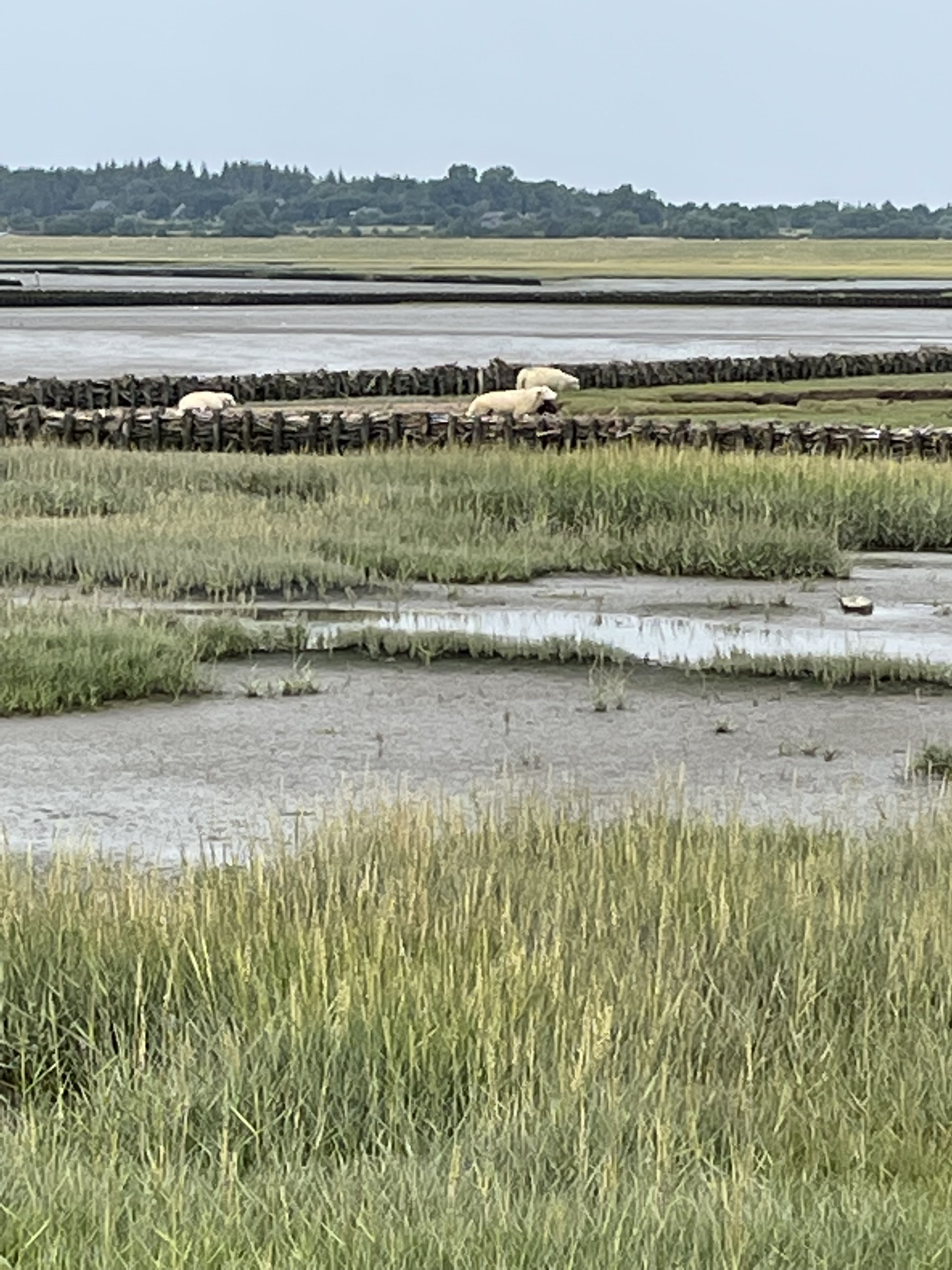
The mud flats schematically shown in Fig. 1 are covered with fence-like structures designed to catch mud brought in the the high tide (Fig. 3).

A quick look at the past. This area was covered by glaciers that filled the North Sea and transported rocks from Sweden to the north. These glacial erratics are rounded and scattered around the land in a random manner (thus the name). We found one used as street decoration in Husum (Fig. 4).
In addition to boulders transported during the ice ages (less than a million years old), there are remnants of sandy sediment from the Quaternary, before the area was overwhelmed by mud (Fig. 5).
The result of the sediment retention project can be seen in Fig. 6.

This are represents an attempt to reconcile the problem of coastal development (the port of Husum ships out grain) and the protection from storm waves provided by a wide mud flat (which dissipates wave energy). Another issue is the encroachment of sheep grazing, which appears to be legal (there are fences and gates, etc). And then there is entertainment; this is a popular swimming location during high tide. Not to mention environmental degradation and fish hatcheries. Several attempts at mixing these applications can be seen in the hardened and dredged channel leading to the port (Fig.7), and buried groins which were apparently intended to keep the shipping channel open (Fig. 8).

It is difficult to reconcile the many uses the coastline is required to fulfill. This trip revealed that it is unreasonable to mix methods designed to preserve the status quo (Figs. 7 and 8), and those intended to change it (eg. Fig. 6), especially when these techniques are mixed (Fig. 3). A difficult decision will have to be made soon, or the levee protecting the bustling cit of Husum will be in danger of breach during a severe storm, which is becoming more common in the North Sea.
The Last Few Miles
This is going to be a brief post, mostly because it is very difficult to convey what I want to communicate in photographs; the camera lens (on my iPhone) simply doesn’t capture image depth well. For example, Fig. 1 was actually pretty steep, but it looks as unintimidating as my driveway.
I’ve been talking about the bedrock exposed along the bed of the Potomac in several posts (e.g., Geological Bottleneck and Great Falls), but those are specific locations. Those significant drops in river elevation are part of a larger pattern, one that is displayed even at the scale of Fig. 1. It doesn’t take much of a drop to generate enough potential energy to spin a waterwheel (Fig. 3), which can do a wide variety of work–from grinding corn, to operating a machine shop.

The staircase structure of streams along the transition from crystalline rocks to coastal plains (aka the Fall Line) is so important to the ecosystem that artificial barriers were constructed within the park to ameliorate the impacts of road and bridge construction (Fig. 4).

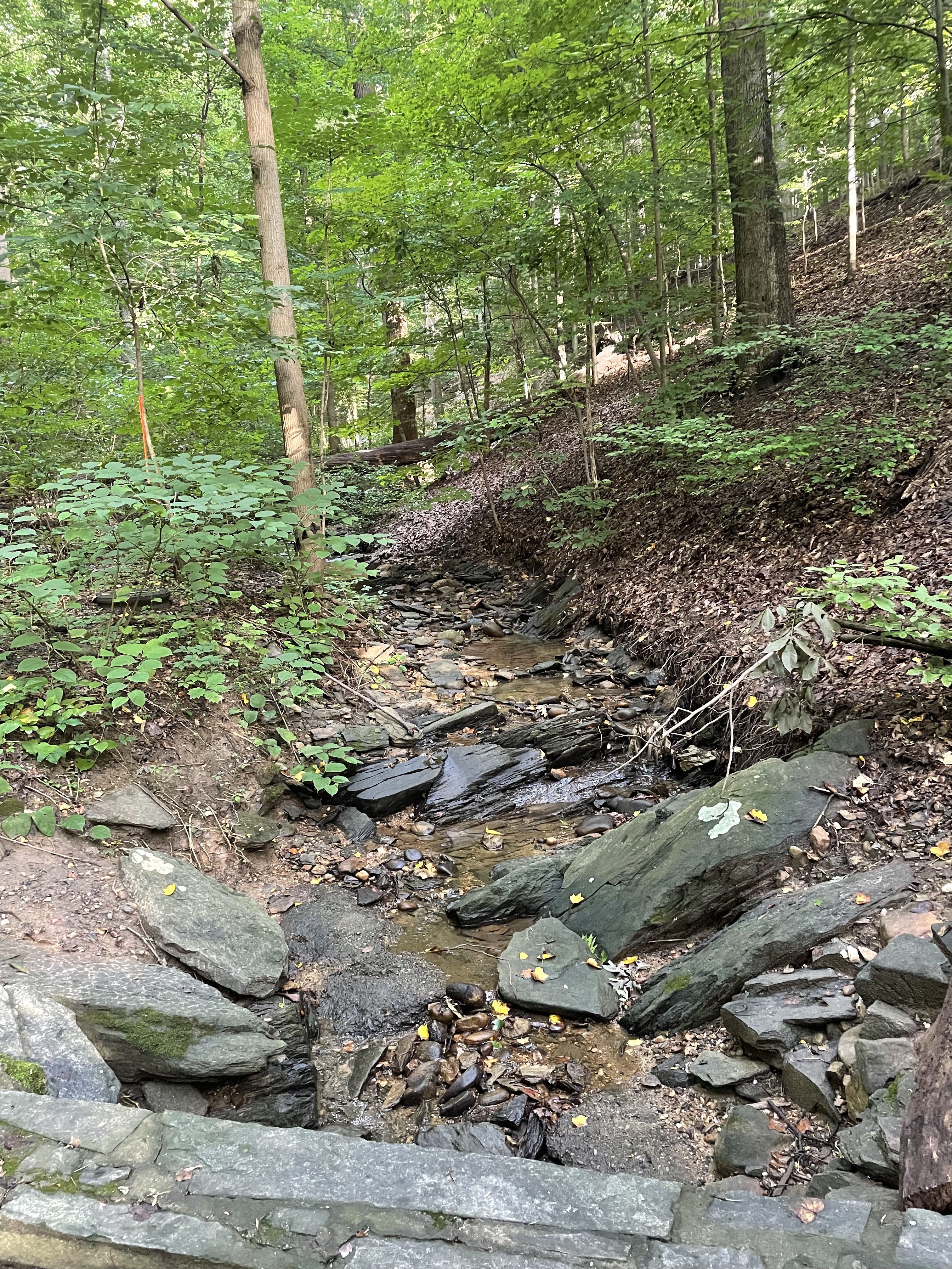
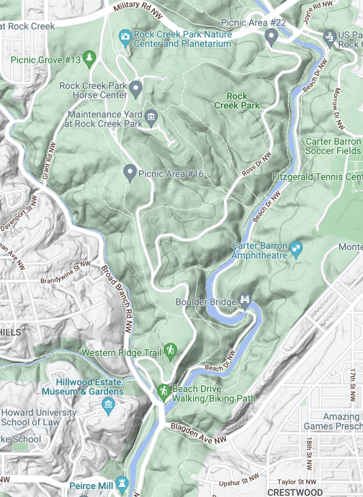
Rock Creek National Park deserves its name, not just because of its rock bed. Cambrian sedimentary rocks exposure along the steep tributaries leading to the creek (river?) suggest that bedrock lies not very far beneath our feet (Fig. 5).

Water has been struggling with rocks for the last 200 million years, always trying to reach the sea. It exploits every nook and cranny in the bedrock until it forms a stream, then a river, and it cannot be stopped. Thanks to the perseverance of water, driven by the steady pull of gravity, the first European immigrants to North America were able to establish a toe hold on what was (to them) a new land…
Recap…
This is a quick post to summarize what I said about modern Japan being an analogue to the Taconic orogeny. For example, here’s a photo of Mt. Fuji, seen from the ocean (Fig. 1). (Imagine being in the back-arc basin during the Cambrian period.)
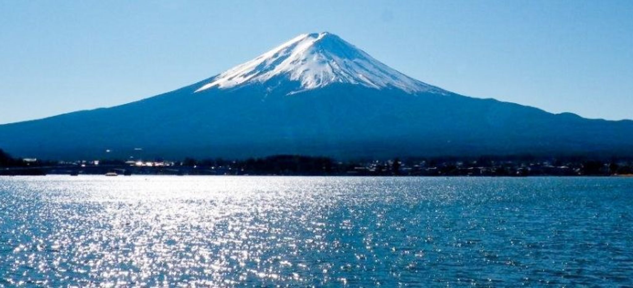
The Sea of Japan is more than 500 miles across at its widest point, so sediment eroding from the mountain chain that forms the backbone of Honshu is collecting along the western coast of Honshu as well as in deeper water offshore.
Here’s a schematic cross-section of the most-likely geography during the Taconic orogeny (Fig. 2). Imagine Honshu as the island arc shown offshore of the ancient North American continent (to the left in the cartoons).

Modern Honshu and the Sea of Japan are most representative of the Taconic orogeny earlier than 543 my, before subduction began on the western margin in the top panel. There is no subduction in the Sea of Japan today; in fact, spreading stopped about 20 million-years ago; details are hard to find because there are no easily accessible seismic sections of the Sea of Japan. Thus, to apply the cartoon from Fig. 2, ignore the subducting back-arc ocean crust (black layers) and focus on the deformed gray areas in the middle panel.
The lower panel is probably what will happen to Honshu in the distant future. For example, the Pacific plate is being subducted at ~10 cm/year (4 inches). We can use an average width of 1000 km (625 miles) to estimate that it will take 10 million years [1000 km/(10 cm/y)] for the lower panel of Fig. 2 to become reality.
With respect to the scale of the analogous processes occurring in the Japanese Islands and N. America (during the Taconic orogeny), we can do a simple comparison (Fig. 3).

This has been a very simple, hypothetical reconstruction, but I hope it helps you envision what the proto-north American continent was experiencing. The key point is that a massive mountain-building event, something like the Taconic-Acadian–Alleghanian orogenies, which lasted throughout the Paleozoic era, wouldn’t have been an earth-shattering event…
Deja Vu
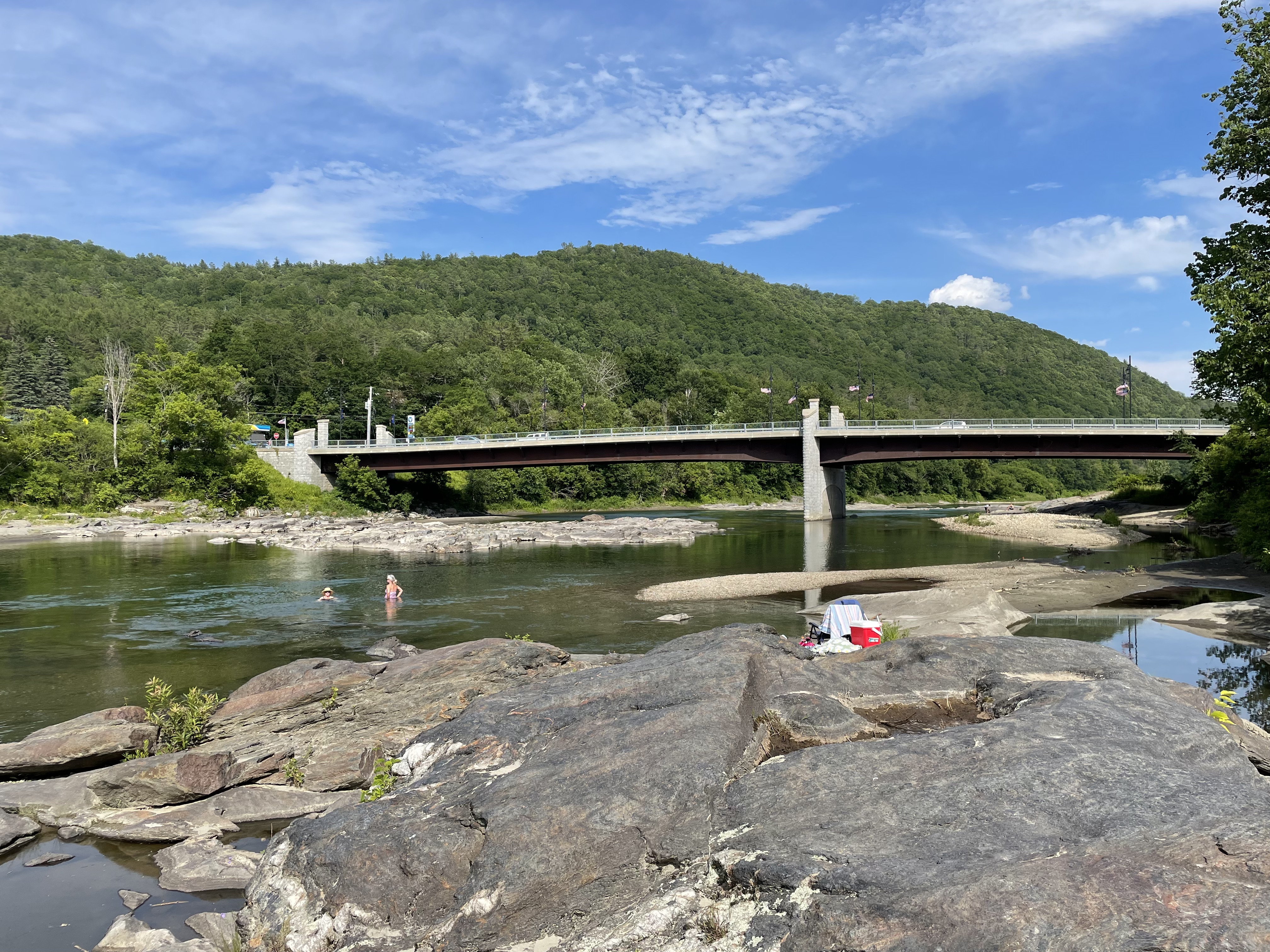
As we entered the Taconic Mountains on US 4 in Vermont, something didn’t look right, or it looked too familiar to be correct. It took a while to realized what was wrong with Fig. 1.

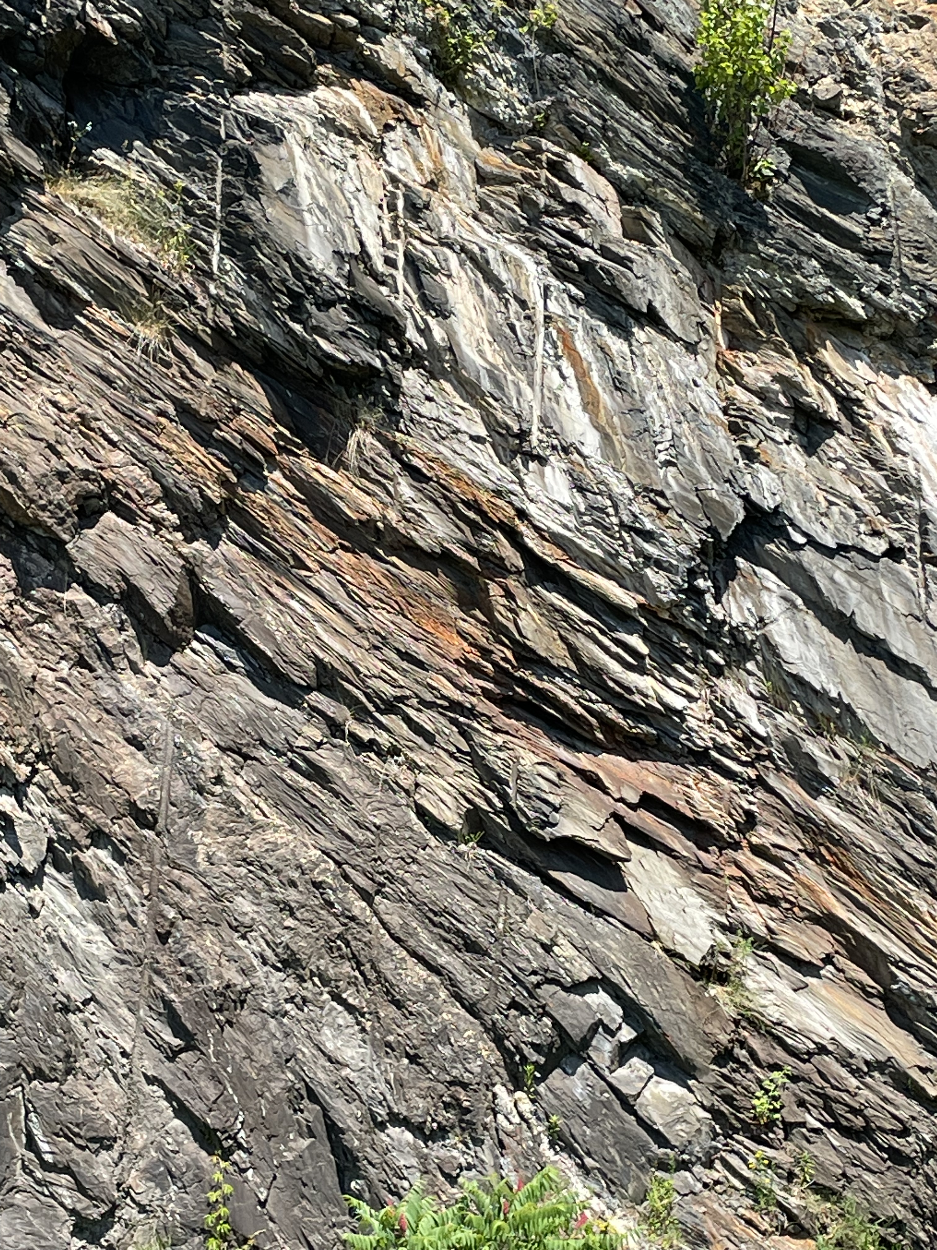
These are the mountains for which the Taconic Orogeny (550-440 Ma) was named. They were deposited as long ago as a billion years in a shallow sea (e.g. Sea of Japan) and then buried, before being compressed and heated, finally being pushed onto the porto-north America continent by 440 Ma. During this long period of metamorphism, the clay minerals comprising the bulk of the sediments recrystallized into mica (mostly muscovite), a platy mineral that creates both a sheen and a fissile texture, the tendency to flake apart (Fig. 2).

The Taconic Mountains are the remnants of a mass of metamorphic rock that was pushed over younger, less-altered rocks in this region. This occurs along low-angle thrust faults when the rocks are buried less deeply, so that they break rather than fold like putty. Speaking of ductile deformation, we saw plenty of evidence of that in the White River‘s exposed bed (Figs. 4-6).


This post is titled “Deja Vu” because we saw schist with a similar composition and orientation in the Potomac River, more than 500 miles to the south, in a band tens of miles across, centered on Great Falls, Virginia. Such a broad distribution tells us that a vast mountain belt eroded about one billion years ago, and then its erosional remains were buried so deep that they nearly melted. The subsequent collision was no laughing matter. I have been using Japan as an analogue for the Taconic Orogeny for two reasons: (1) Honshu, the largest Japanese Island is about 800 miles long and it is depositing vast quantities of mud into the Sea of Japan; (2) using a modern analogue demonstrates that mountain building is a slow process, barely noticed by the inhabitants of island arcs destined to be smashed onto the continents facing them.
Rocks like those seen in this post are already buried beneath the Japan Sea and deformation has no-doubt begun. We just have to wait 400 million years for them to come out of the oven…
The Outer Limits
This is the first of several posts, reporting the roadside geology of western New York and central Vermont. Today, we will visit Binghamton, New York. This small city (urban population less than 50 thousand) sits at the confluence of two perennial, gravel-bedded rivers (Fig. 1).


Enough of Holocene and Anthropocene geology. The fascinating thing about this region is that it preserves a huge volume of sediment eroded from mountains that were growing during the Devonian Period, about 350 million-years ago (Fig. 4).
We didn’t have the time or resources to go on a quest for rocks that would reveal what was happening during the Devonian Period, so we took some photos of charismatic blocks that had been removed from their original location and “deposited” along the path that followed the Chenango River through downtown Binghamton (Figs. 5 and 6).


The title of this post refers to the outer limits of a broad plain that was receiving gravel, sand, silt, and mud from a rapidly rising mountain belt–probably like western North America today (e.g. the Sierra Nevada mountains). It wasn’t a continental collision, but it was pretty massive, with elongate swaths of sediment subsequently buried by what came later.
I’m talking about a Clash of the Titans...
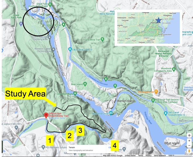
Difficult Run: Exploring Potomac Tributaries

This week we went exploring south of Great Falls, along a tributary that cuts through Precambrian metamorphic rocks, before joining the Potomac River.
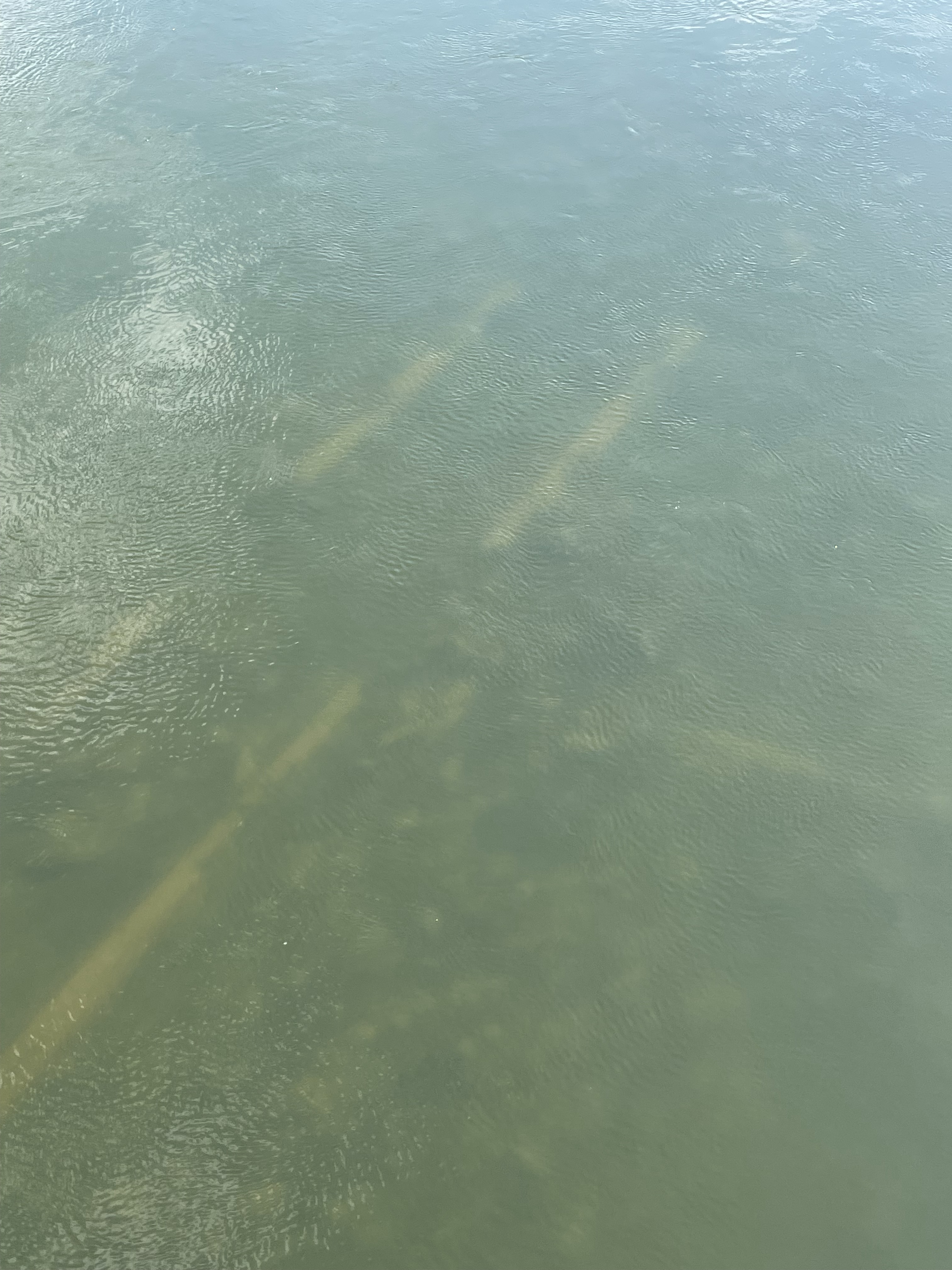
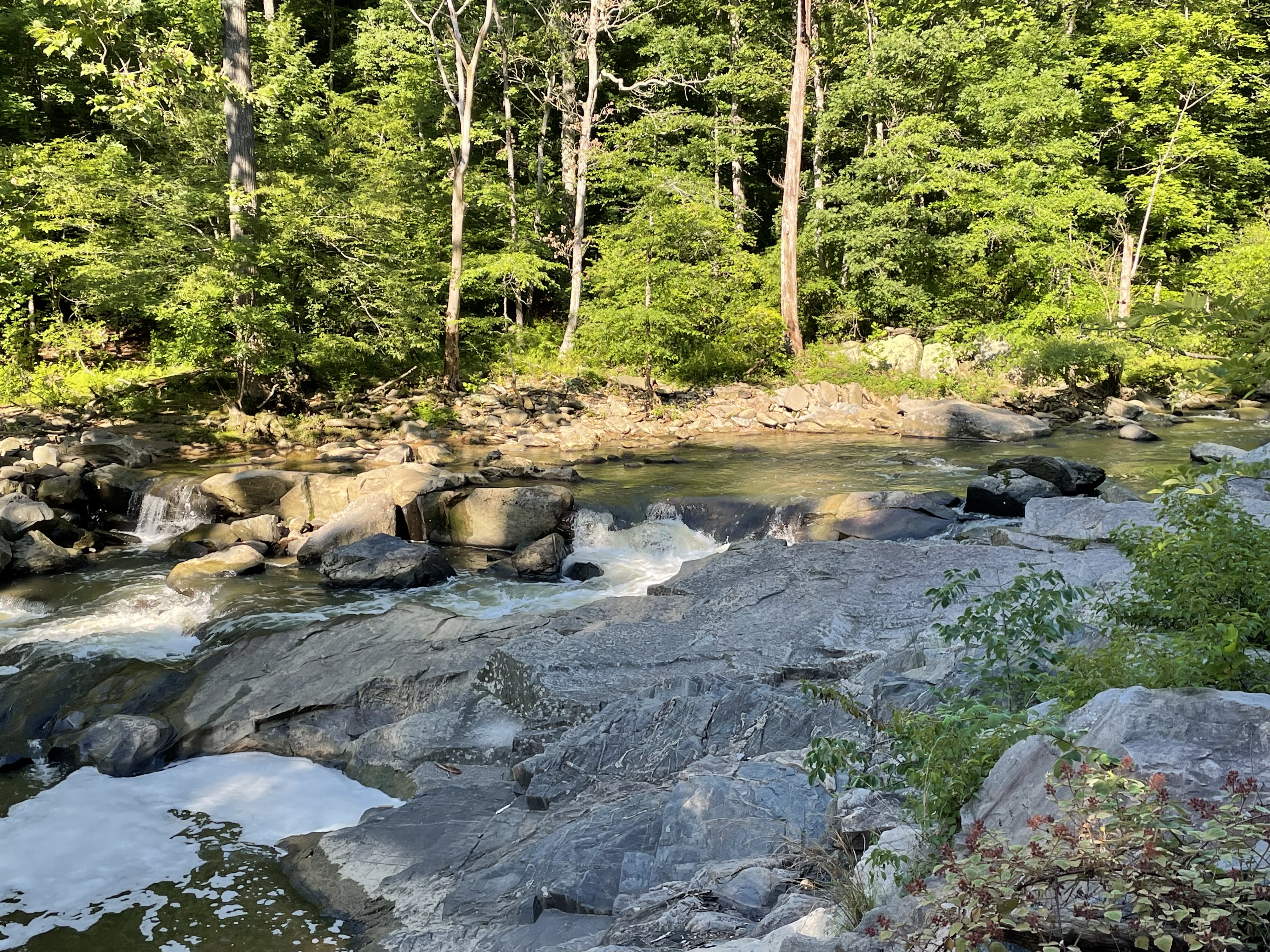
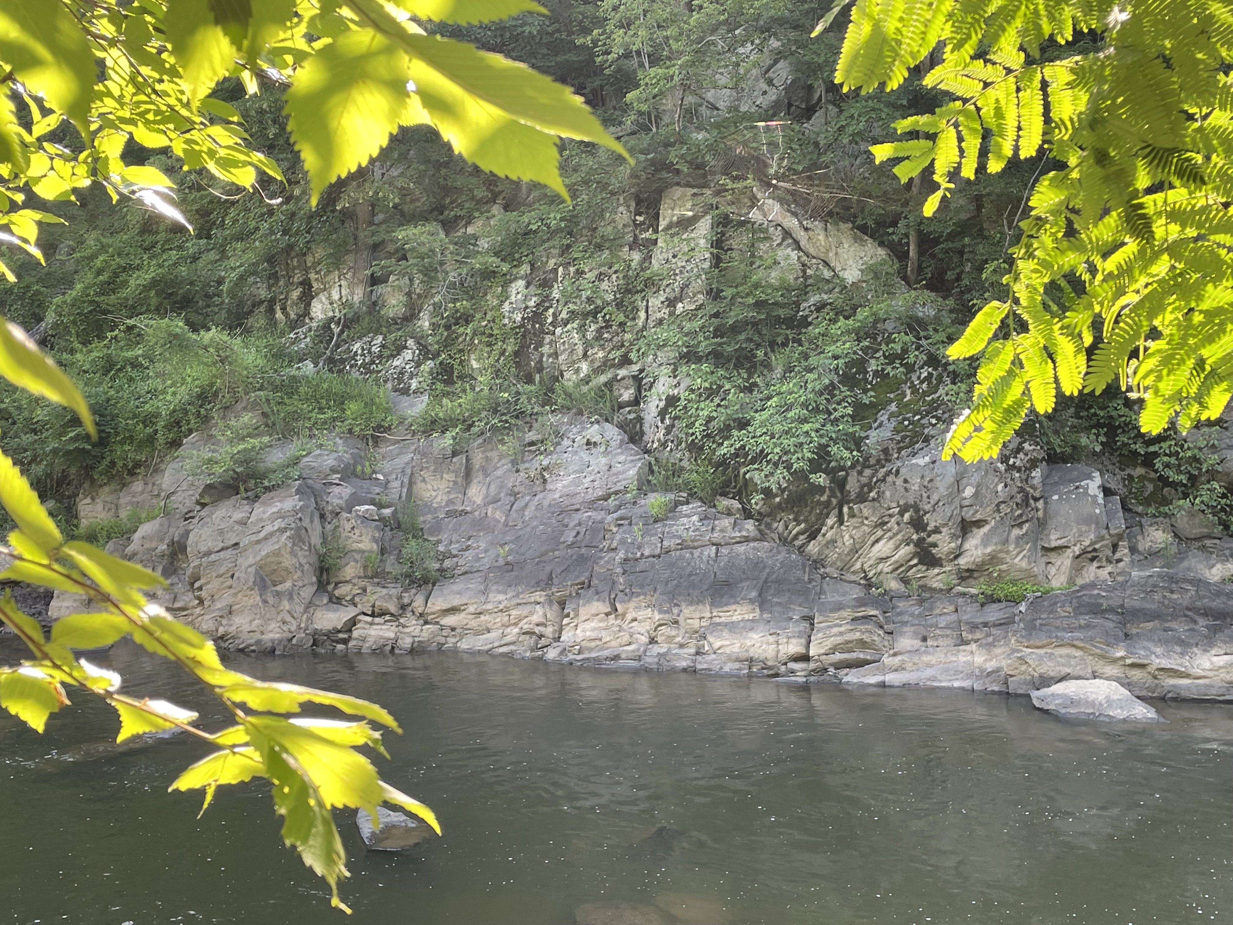
Difficult Run twists its way through a mass of hard rocks that we have met before, Precambrian Schist and gneiss, forming a series of quiet pools (Fig. 3) separated by resistant, rocky sections (Fig. 4).

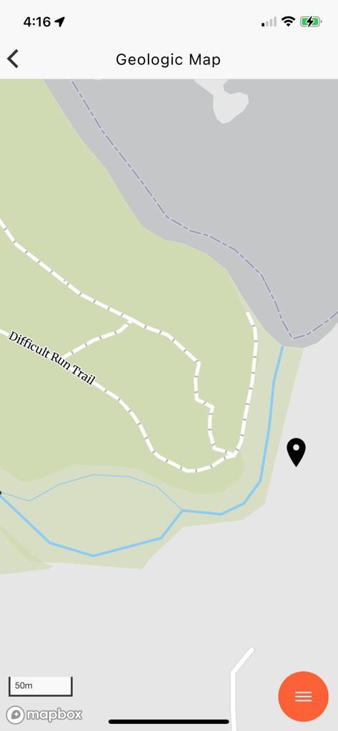
It was a shady walk beneath a tall canopy of mature hickory, ash, and other temperate forest trees. There was plenty of evidence of the recent spring floods. Large trees were jammed up on rocky outcrops and among the trees covering the floodplain. After a short hike, we came to what looked like an abandoned quarry (Fig. 4), which can be identified by the bright spot in the relief map of Fig. 2, just above the label for Site “2”.

I was able to examine several slabs of the rock exposed in the quarry and along the river bed (see Fig. 1 for appearance) at Site 2, revealing foliation and inclusions similar to other exposures of this rock (Fig. 5).

We’ve seen the structures displayed in Fig. 5 before, in this same rock, at Great Falls and other locations along the Potomac River. I’m presenting these examples to give the reader some idea of the scale of these processes. For example, the juxtaposition of foliation in Fig. 5A suggests a frenzy of activity, like in a pan of boiling water; that analogy is reasonable if we adjust the viscosity, temperature, pressure, and time scale from water on the stove to rocks buried deep beneath the surface, but heated from below–just like the pan of water. I’m speculating here but, just to get an idea of what I’m talking about, the crazy structures in Fig. 5A probably took on the order of ten-million years to form.
It might help to see the problem from a more god-like perspective.

As you might expect, the exposure of such a deformed and mineralogically diverse set of lithologies along the Potomac’s course produces features like Great Falls, as well as what we’re examining today.
There is more to these rocks than metamorphic structures, including folding, foliation, and inclusions. All of those were formed between 1000 and 500 million-years ago. After deep burial (maybe 15 miles) beneath an enormous mountain range, these rocks hardened and were exhumed by erosion of the overlying rocks. They were brittle and, as isostatic pressure relaxed, they cracked just like a cooling pumpkin pie, forming joints.

Confused by what I had seen so far (i.e. Figs. 4, 5, and 8), I followed the trail to the confluence of Difficult Run and the Potomac river (Fig. 9).

Looking across Difficult Run to the south at Site 4 (see Fig. 2 for location), I was once again bewildered.

It is tempting to assume that the overlying rocks in Fig. 11 are sedimentary, deposited on an erosional surface in the underlying metamorphic rocks (angular unconformity); however, the geologic map (Fig. 12) reveals that these are similar in age and lithology.
I summarized the geologic history of this area in a previous post, so I’d like to wrap up by demonstrating how pervasive deformation is, in this post. Imagine the deformation seen in Fig. 5A scaled up several orders of magnitude, to the scale of a bluff (Fig. 11). We also saw evidence of rotation of porphyroblasts at another location along the Potomac and again, more than a hundred miles to the south, in Lynchburg. This deformation actually extends to the microscopic scale, but we had neither proper samples nor a microscope to demonstrate it for these rocks.
Think of metamorphosis and ductile deformation as being like a peach pie, the contents trapped between the bottom of the pan (deeper, more resistant rocks) and the pie crust (overburden); the filling is boiling in the oven, overturning, even displacing smaller pieces of fruit. That is what’s happening miles beneath the mountains, on time scales of millions of years rather than minutes.
A Geological Mystery at Bears Den

Beautiful landscapes and geological wonders are never far from your door here in Northern Virginia. Today, we took a hike to meet the Appalachian Trail near the border of West Virginia (Fig. 2).
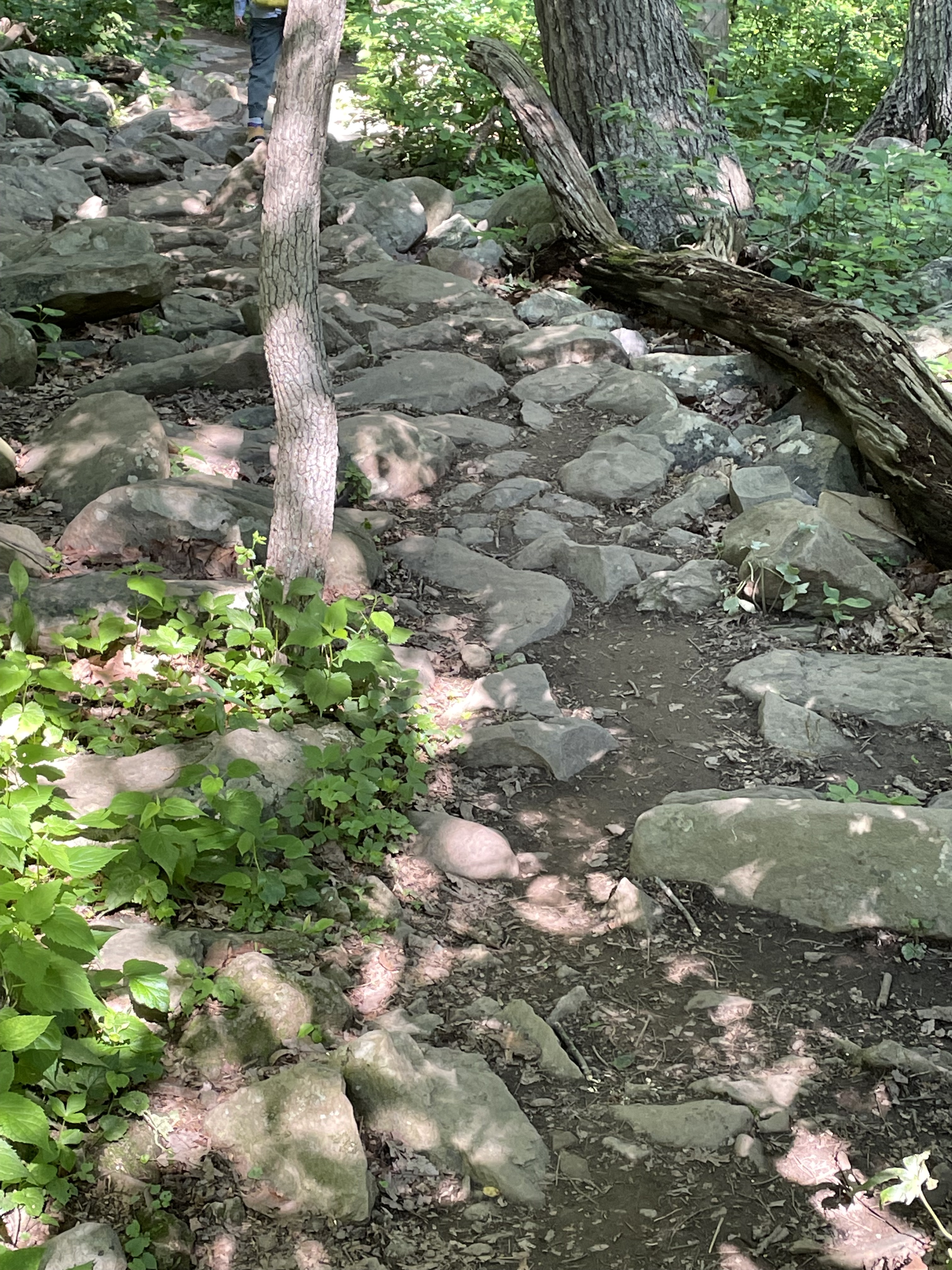
To reach the Bears Den rest area on the Appalachian Trail (see oval area in Fig. 2), we had to follow a winding path along one of the many irregular crests that define the Blue Ridge Mountains (Fig. 3).

Along the way, we noted that the trail followed the top of a deeply eroded landscape, littered with boulders and weathered rocks (Figs. 4 and 5).

We finally reached the rocky point from which Fig. 1 was photographed. A large outcrop crosscut with veins greeted us (Figs. 6-8).

Intersecting joints like those seen in Figs. 7 and 8 occur when rocks that have been deeply buried are exhumed as overlying rocks erode. The upper mantle relaxes and lifts its overburden in a process called isostatic rebound. Rocks thus uplifted are no longer soft but respond like a solid in brittle deformation. What is intriguing about these rocks (whose age we haven’t yet determined) and the joints that permeate them, is the origin of the quartz and feldspar filling the joints.
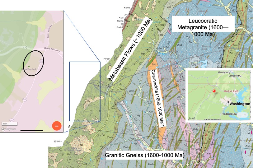
It’s time to talk about the host rock seen in Figs. 4-8. The west side of the oval outlined in the inset map of Fig. 2 reveals that these are fluvial-to-shoreface sedimentary rocks deposited between 541 and 511 Ma (source: Rock D lists many sources for this interpretation).

An intrusive magma filled joints (Figs. 7 and 8) and heated the country rock to the point of remineralization (Fig. 9), yet sedimentary textures are retained (Fig. 10). What’s going on?

Summary
There are some general rules in determining relative geologic age. For example, layered rocks are younger as you ascend in a stack of them. This rule applies to both sedimentary and volcanic rocks, although the contacts aren’t as uniform in the latter. Another rule is that rocks that cut through other rocks (i.e. veins and dikes) are younger than the rocks they invade.
The sedimentary host rocks at Bears Den were deposited where rivers fed coastal deltas and a sandy beach (shore face) about 500 million years ago, long after the granites we see to the east (Fig. 2) were intruded and metamorphosed to become metagranites. In other words, the quartz veins and granitic dikes (Figs. 7-12) did not occur when the older (1600-1000 Ma) igneous rocks were emplaced; these veins and felsic intrusions must be associated with the Taconic orogeny, which started about 440 million years ago. The geologic map (Fig. 2) doesn’t show any evidence of granitic intrusions from this period, which could have filled joints created by isostatic rebound in these rocks.
These sedimentary layers were laid down during the collision that created Pangea, so they would have had to be buried deeply enough to become lithified, exhumed to a sufficiently shallow depth to form joints (a sure sign of brittle failure and thus uplift), then invaded by an undisclosed intrusive magma at a very shallow depth (probably less than 5 miles).
Alternatively, they could have remain buried until the breakup of Pangea, beginning in the Triassic period and progressing in stages. Magmatism has been associated with this event in Northern Virginia.
All of this is plausible, given the immense span of time involved, but…
Where are the rocks?

Recent Comments