My last post explored the mud flats bordering the North Sea in northern Germany, where we found conflicting methods applied to control and protect the levee system. This post investigates more aggressive measures implemented at the mouth of the Eider River. We will briefly look at the Eidersperrwerk, a gate system designed to control both storm surge incursion up the Eider, and river outflow
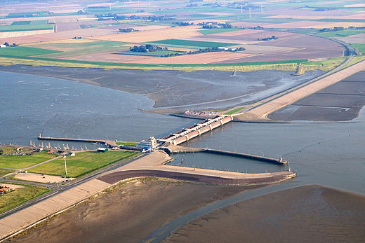
Figure 1. Aerial view of the Eidersperrwerk gate system, looking southward. The North Sea is to the right. We will examine the mud flats to the right of the roadway in this post. Note that more than half of the original mouth of the Eider River has been blocked by the levee.(Image from Wikipedia.)
We will focus on the seaward mud flats in this post. Let’s take a look at the south side of the river first (upper-right of Fig. 1).
Figure 2. Sediment retention fences on south side of Eider River. Note the erosion at the base of the fence running across the image from left to right (perpendicular to shore). They are intended to trap sediment, but that doesn’t appear to be happening.
Figure 3. Detail of gate on river side. The gates were closed when we visited at low tide, possibly to keep water depths navigable in the estuary.
Figure 4. Lock approach from seaward. This small enclosure was constructed with steel plates, but the lock gates were closed except to allow the passage of a tour boat, during our study.
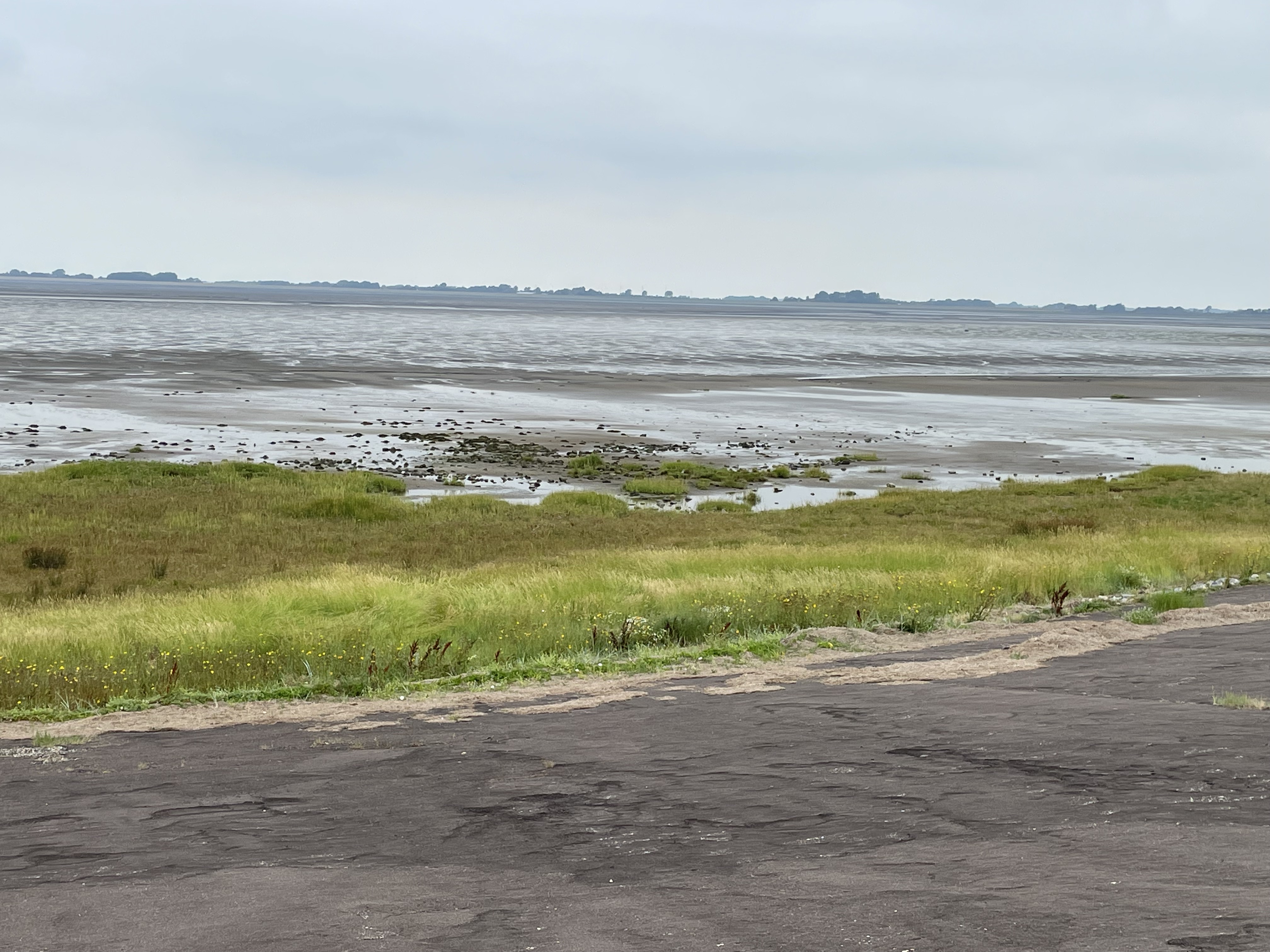
Figure 5. Looking north along the seaward side of levee (lower part of Fig. 1). Note the grass that has filled in where only mud was present before (presumably, Fig. 1 is an older image).
Figure 6. Close-up near the junction of levee and lock enclosure (see Fig. 1 for location), showing clumps of grass (center of image) surrounded by pieces of stone used to armor the levee. This looks like recent erosion to me, because the grass grass was probably contiguous with the thick growth near the levee toe.
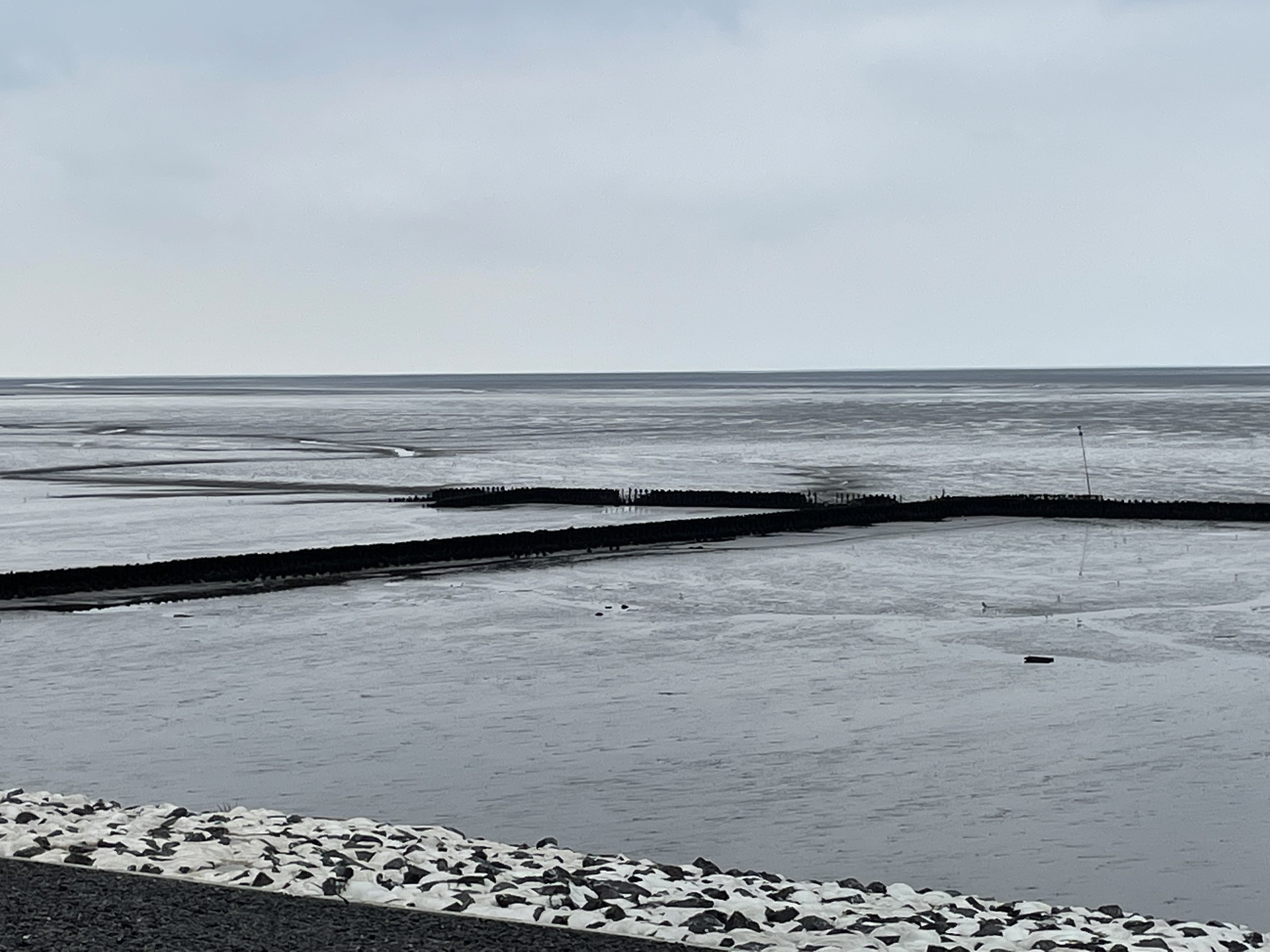
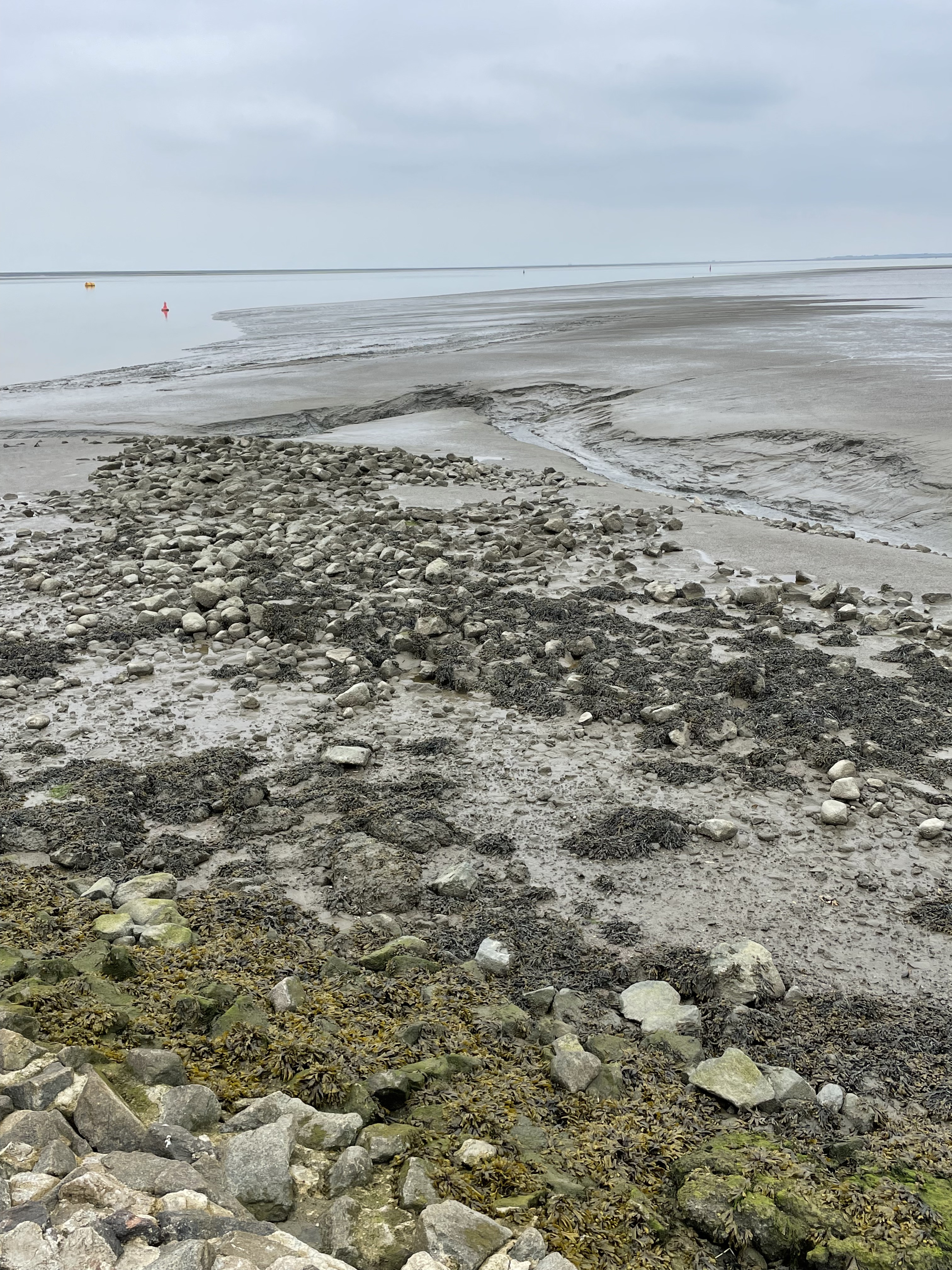
Figure 7. View looking north in the natural embayment (see Fig. 1 for location). Note the drier sediment near the top of the image. This is a berm that is semipermanent, formed of silt and minor sand by tidal and wave action. It is cut by multiple rivulets, formed as the tidewater drains from the nearshore area (to the right). The scattered boulders are evidence of intense erosion during storms.
Figure 8. View seaward from tip of lock embayment, showing eroded riprap, vegetation clinging to the toe of levee, runnel at low tide (strip of water running north-south in Fig. 1), and berm from Fig. 7 turning seaward.
Comparing Fig. 1 to Figs. 2 and 5-8, we can see the effects of years (probably decades), during which interval the northern margin of the river mouth filled with sediment and grass was established (Fig. 5). Subsequently, it seems that erosion removed some of this soil and grass (Fig. 6). Meanwhile, storms have been slowly wearing away the boulders armoring the base of the levee (Fig. 8) and a semipermanent fair-weather berm was constructed (compare Figs. 1 and 7).
In summary, something appears to have changed in the dynamic environment around the mouth of the Eider. It should come as no surprise that constructing a gate system and cutting off a major sediment supply for at least half the time had dramatic effects on the nearshore. Mud flats are very sensitive to sediment supply, and it could have been either reduced alongshore transport from the north, or the almost-complete denial of rive-borne mud that led to the current situation.
Some scientists propose that storminess varies on many scales, from decadal to millennial as climate fluctuates…


Recent Comments