
Coastal Restoration on the North Sea
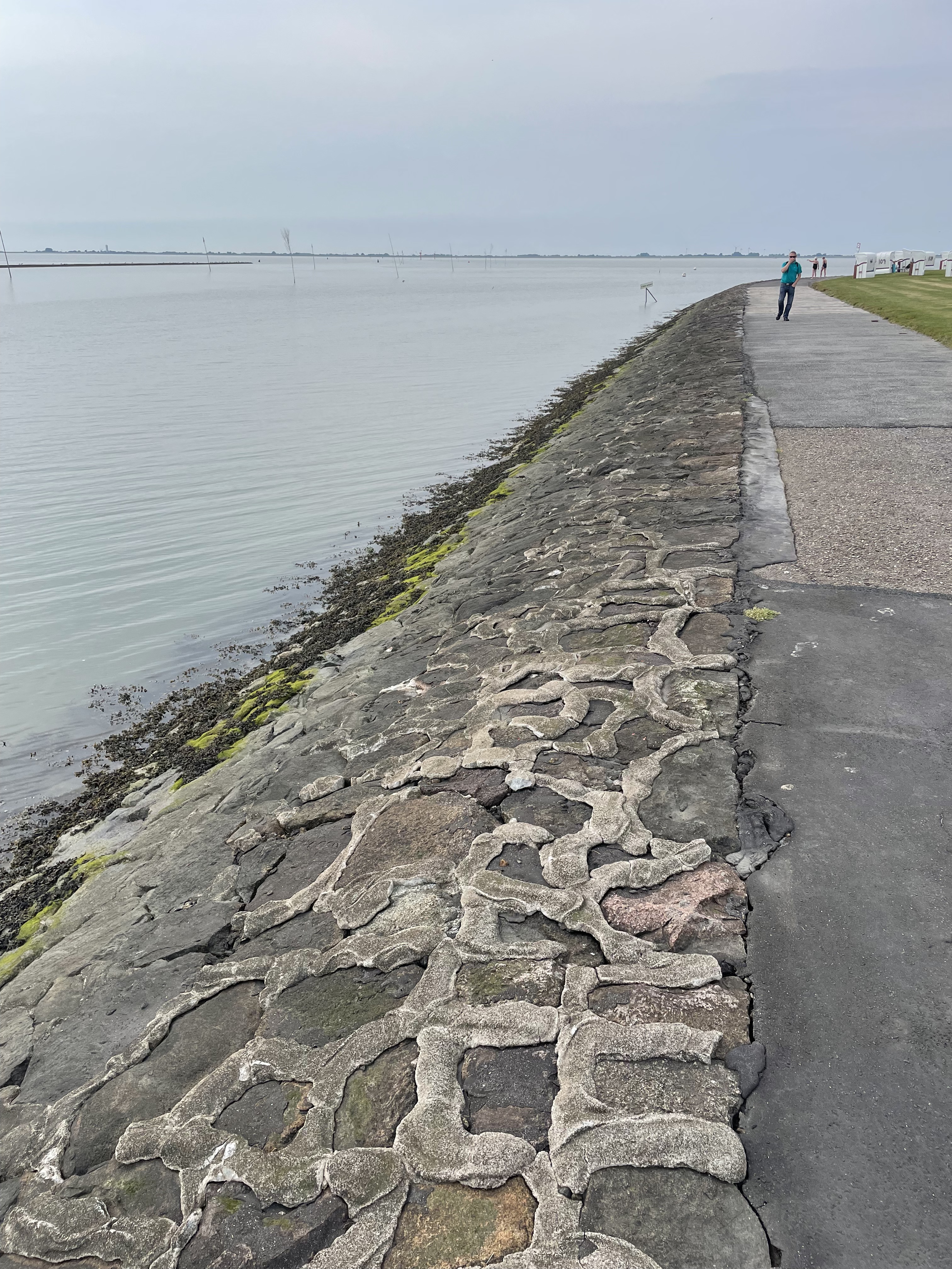
Today’s post takes me to the North Sea coast of Germany, the city of Husum, and to one of the famous mud flats from the region. Rivers running from the Alps drain Germany, transporting mud (silt and clay) to the north coast, where it is transported along the coast and stirred around by strong tidal flows. We are going to look at efforts to stop dramatic erosion caused by a reduction of sediment input, because of dams and coastal construction, leading to a serious threat to the levee protecting Husum from the North Sea (Fig. 2).
The mud flats schematically shown in Fig. 1 are covered with fence-like structures designed to catch mud brought in the the high tide (Fig. 3).

A quick look at the past. This area was covered by glaciers that filled the North Sea and transported rocks from Sweden to the north. These glacial erratics are rounded and scattered around the land in a random manner (thus the name). We found one used as street decoration in Husum (Fig. 4).
In addition to boulders transported during the ice ages (less than a million years old), there are remnants of sandy sediment from the Quaternary, before the area was overwhelmed by mud (Fig. 5).
The result of the sediment retention project can be seen in Fig. 6.

This are represents an attempt to reconcile the problem of coastal development (the port of Husum ships out grain) and the protection from storm waves provided by a wide mud flat (which dissipates wave energy). Another issue is the encroachment of sheep grazing, which appears to be legal (there are fences and gates, etc). And then there is entertainment; this is a popular swimming location during high tide. Not to mention environmental degradation and fish hatcheries. Several attempts at mixing these applications can be seen in the hardened and dredged channel leading to the port (Fig.7), and buried groins which were apparently intended to keep the shipping channel open (Fig. 8).

It is difficult to reconcile the many uses the coastline is required to fulfill. This trip revealed that it is unreasonable to mix methods designed to preserve the status quo (Figs. 7 and 8), and those intended to change it (eg. Fig. 6), especially when these techniques are mixed (Fig. 3). A difficult decision will have to be made soon, or the levee protecting the bustling cit of Husum will be in danger of breach during a severe storm, which is becoming more common in the North Sea.

Trackbacks / Pingbacks