
Coal Mine Classic: Epilogue
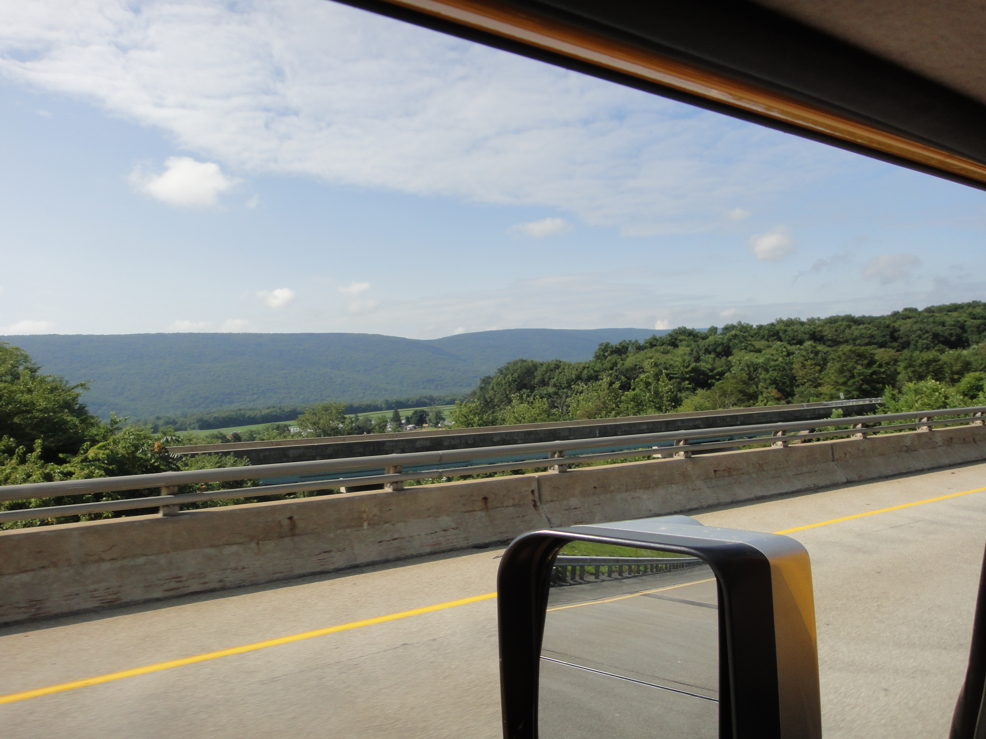
I left Twin Grove campgrounds on Sunday morning and took a detour along US-322 to State College in order to visit my advisor from Penn State, and thereby crossing the Valley and Ridge province from east to west. The rocks of the Pottsville Group are Pennsylvanian age (~320-300 mya), but the rocks get older as we travel westward. This is one of the most beautiful drives I have done, as we follow the Juniata River where it has followed weak points in the crust.
I stopped at a large road cut and collected my Texas-sized hand sample, which is a Devonian period (~420-350 mya) sandstone with a green hue and a combination of striations and minerals that indicate it has been subjected to a large stress from faulting. The texture and color indicate a nearshore marine depositional environment, like a modern beach or shallow water near the coast.

These rocks are exposed in the west because of sliding along deep nearly horizontal faults when Africa collided with N. America, which pushed deeply buried rocks like this westward during which they slid along more vertical faults. This trend continues until we get to Arch Rock, where Silurian period (~445-420 mya) thin sandstone and shale beds are exposed in road cuts. These small folds are superimposed on much larger ones.

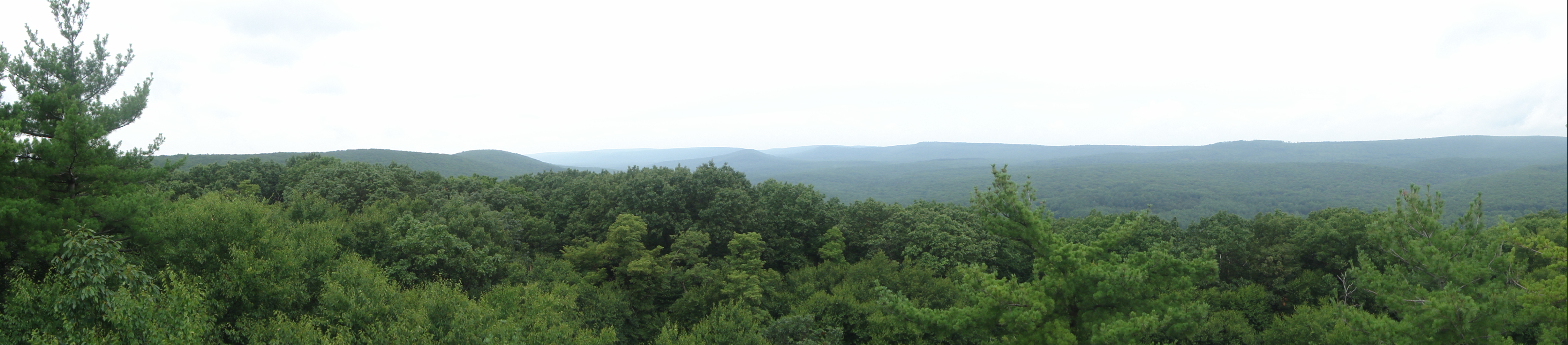
The exit to Arch Rock gives a nice view down the valley to the west. The ridges are oriented more to the NE in this location. As we travel westward, they become more north-south.

Finally, we cross the pass at Seven Mountains and drive down into Nittany Valley, which has perfect Ordovician Period (~485-445 mya) carbonate (limestone and dolostone) that are tilted about 30 degrees. Thus, during my two-hour drive I have traversed ~200 million years of sediments, and gone from river/stream sand/shale/coal sediments to the deep sea limestones that were disturbed by the Appalachian Orogeny. And it was all visible to the naked eye!
Coal Mine Classic: Day Four
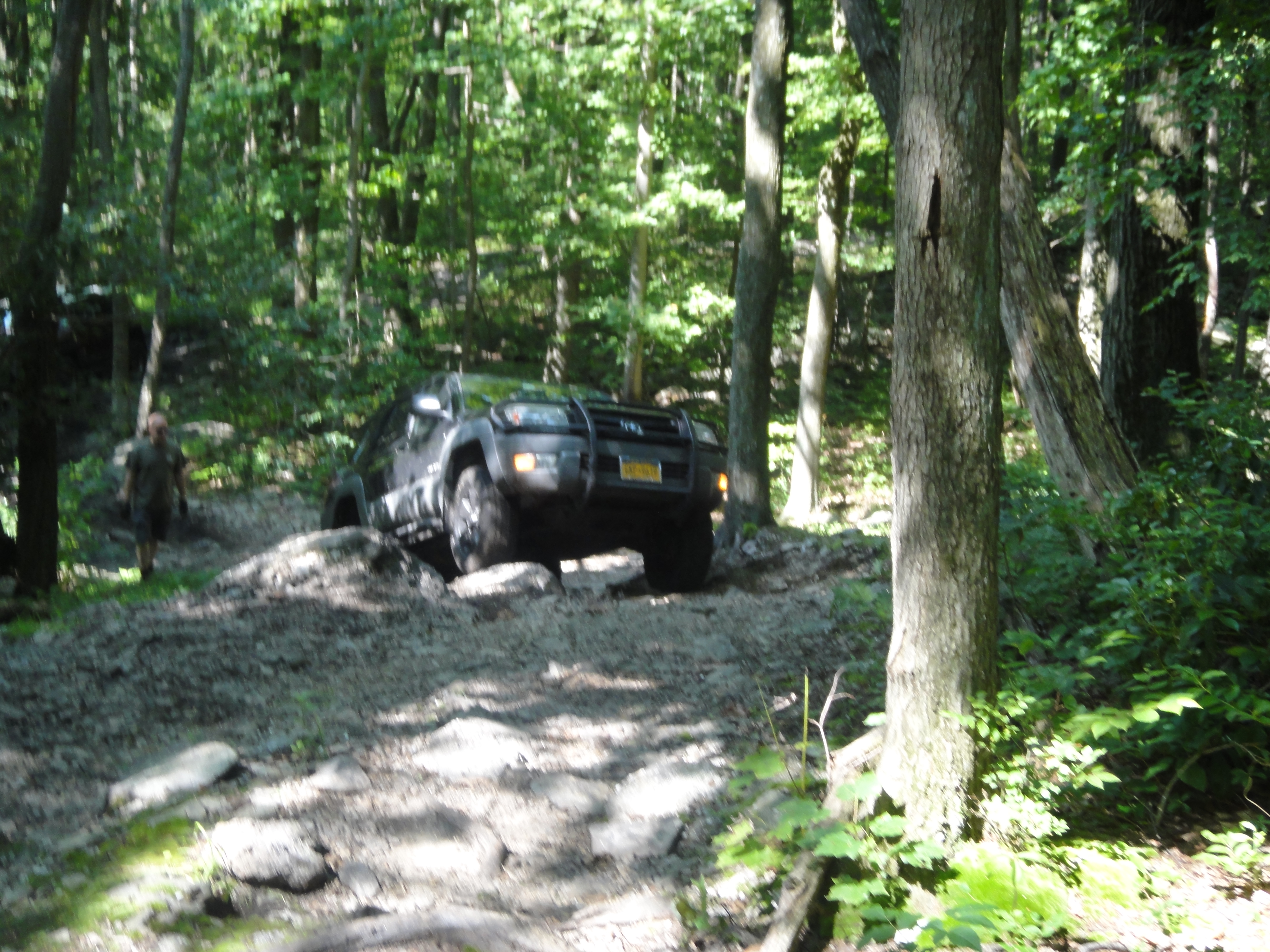
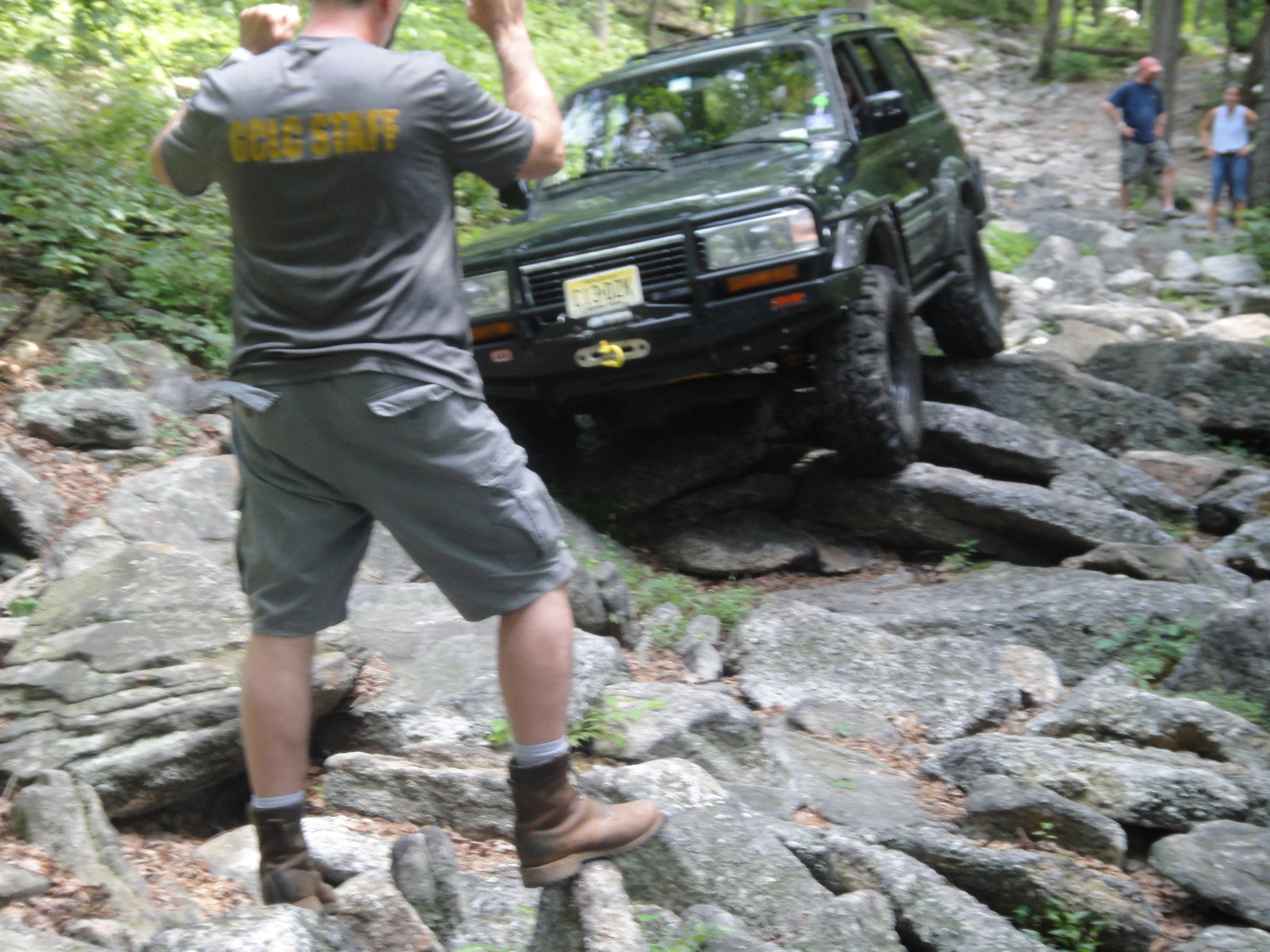
I used Brian’s tow vehicle (he trailers his trail rig) to get the final ingredient, a piece of 1/2 inch pipe, and joined some Virginia guys for some blue (big tires and lift) on the NE section of the park. The rocks here (still Pottsville Group) had more shale, which weathers to mud, and less coal but more corn fields. I rode shotgun with Patrick in his 80 series Landcruiser (the big, heavy ones from the early 90s), and saw a well-behaved trail dog, Tiki in action.
The good part of riding is that you can get out and take photos of rocks as well as wheeling. This day had some fun trails with needed assistance from crew to get these big rigs through tight spots.

The rocks were quite different as well. This photo shows very large particles (pebbles) in a muddy matrix, which we inferred from several real mud holes on the trails when the mud weathered out to form modern mud holes.

The episodic nature of sedimentation now and 350 mya is seen in this contact between the coarse-grained conglomerate over the silt/mud stone below.

I WISH I weren’t broken for these really great rock crawls over the conglomerate as we climbed up a series of broken ledges.
Finally, on BFG (don’t ask me what that means) there was no easy way out!

What a great day of wheeling (but not for me); however, it is a lot of fun to be able to get out of the vehicle and enjoy a different perspective. We all should do it now and then (hopefully, for fun).
Coal Mine Classic: Day Three :-(
I spent today getting the necessary equipment (no new parts) to make my rig (truck) roadworthy and hung around the camp. I met Ed of the Capital City Cruisers and purchased a raffle ticket for a vintage FJ-40 fully restored. It looks like this but with no rust, etc.
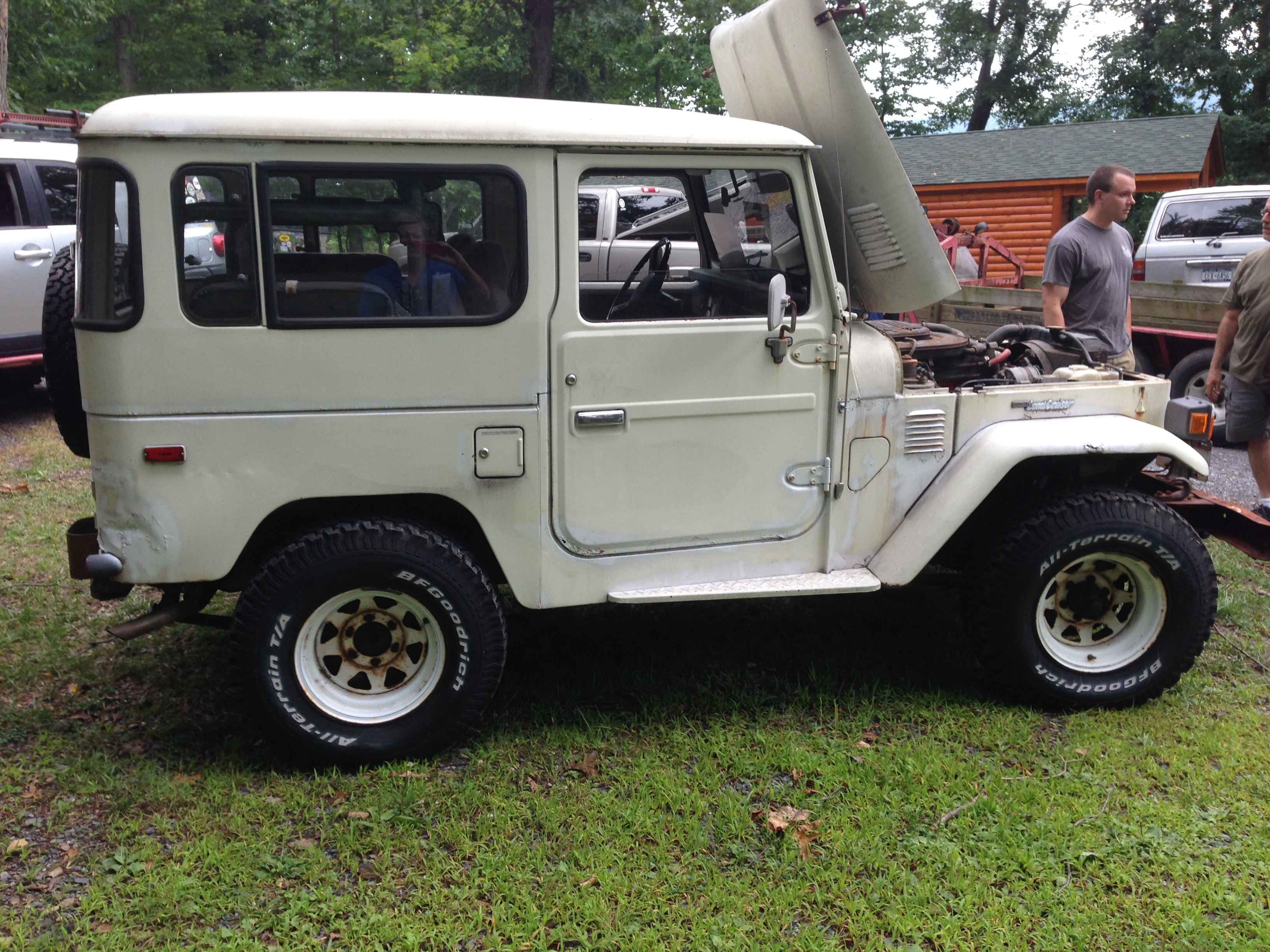
I told everyone that WHEN I win it, I will drive it up next year and go wheeling in it!
Coal Mine Classic 2014: Day Two
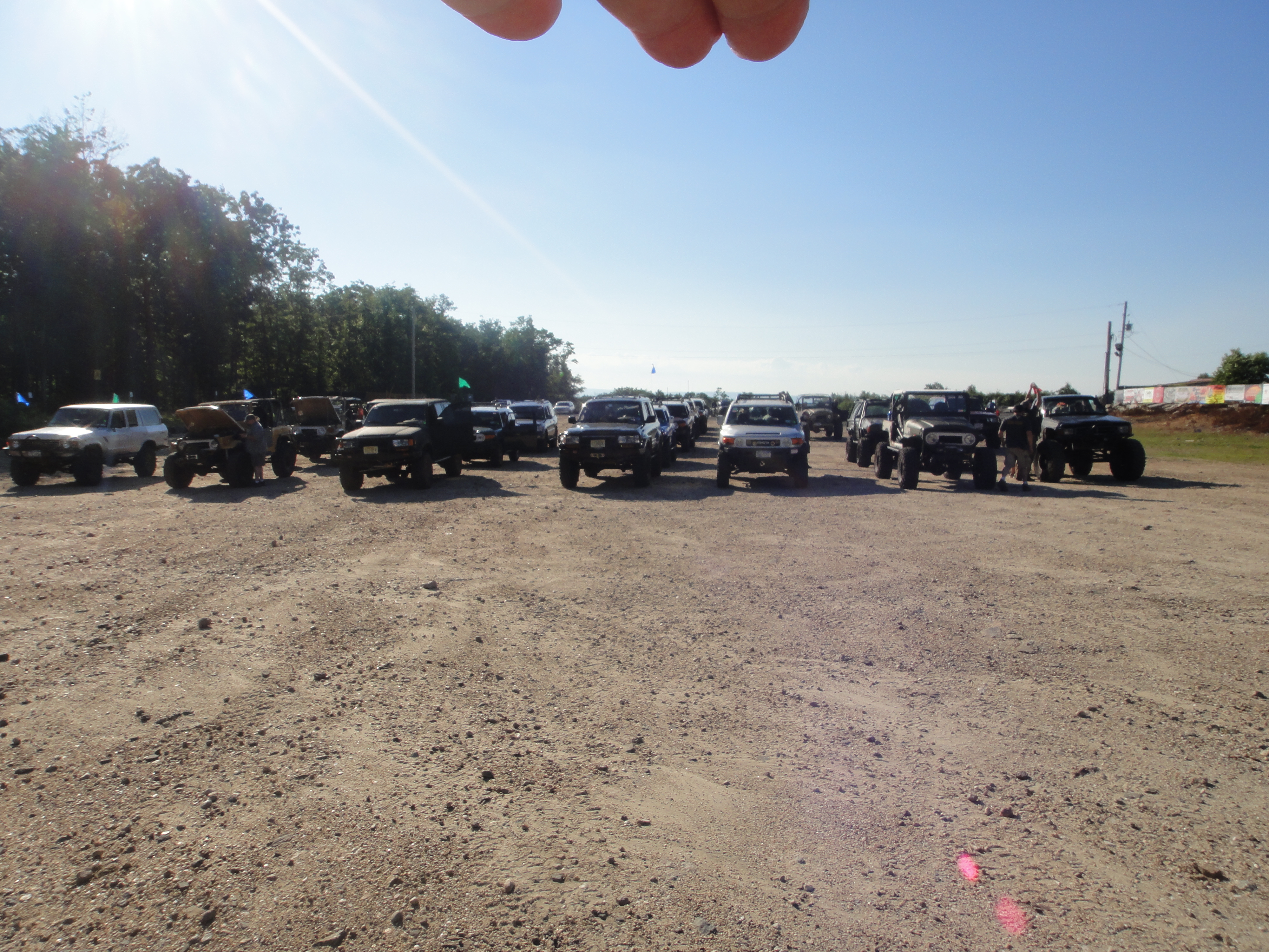
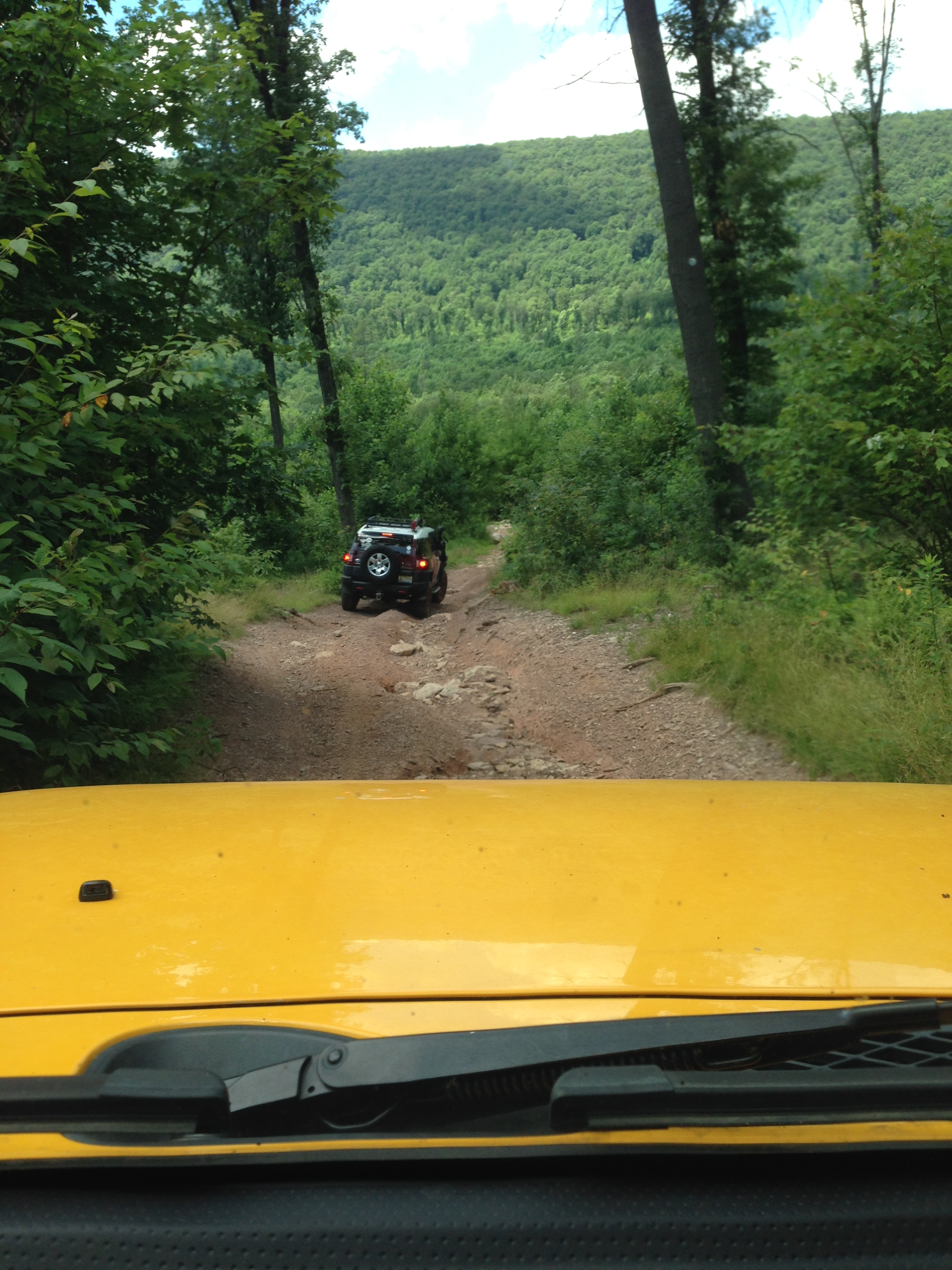
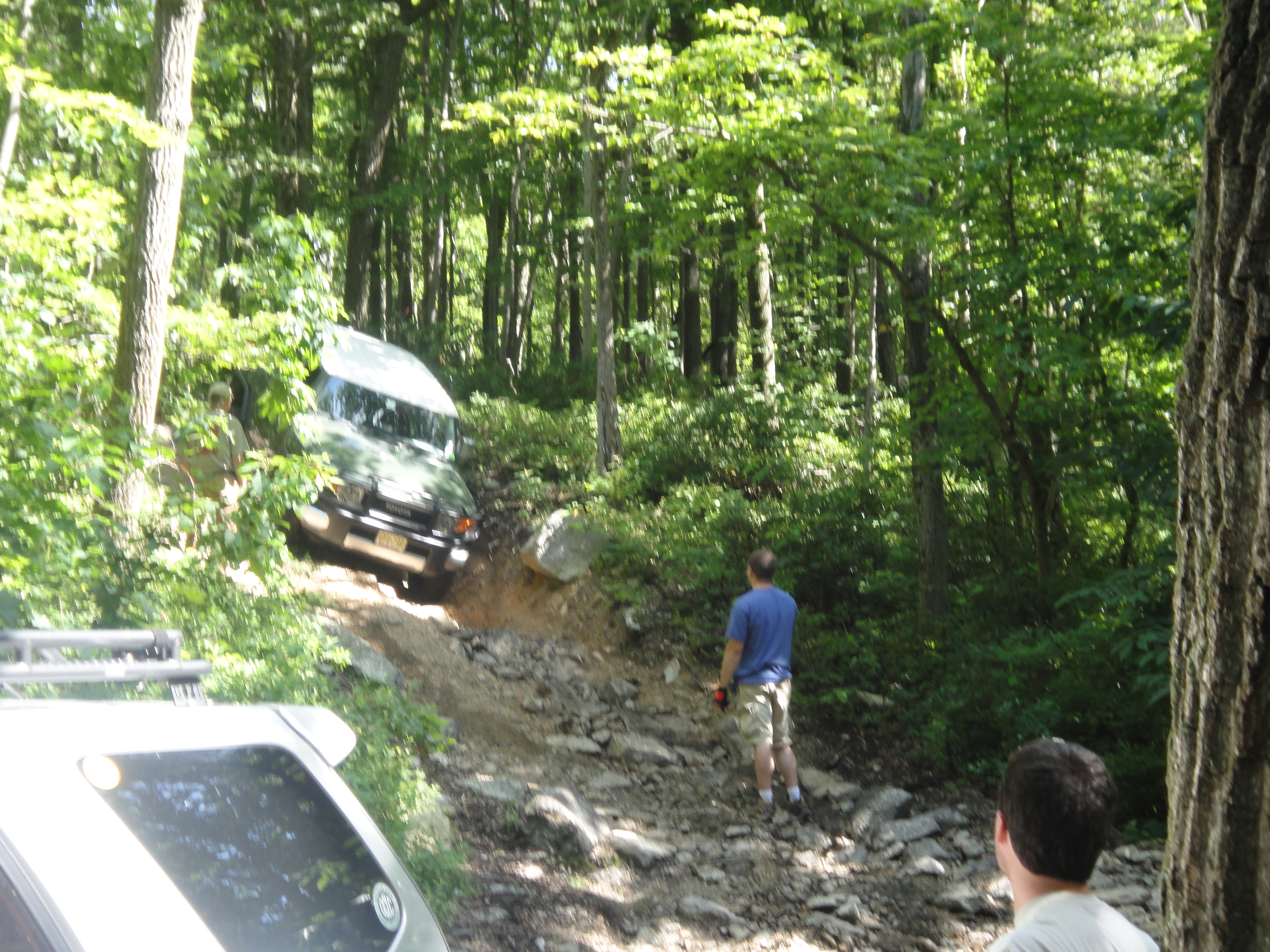
The second day, we split into smaller groups; I went with a “blue” group (big tires and lift) and we went to explore the western part of the park. Here is a photo of the groups lining up to depart.
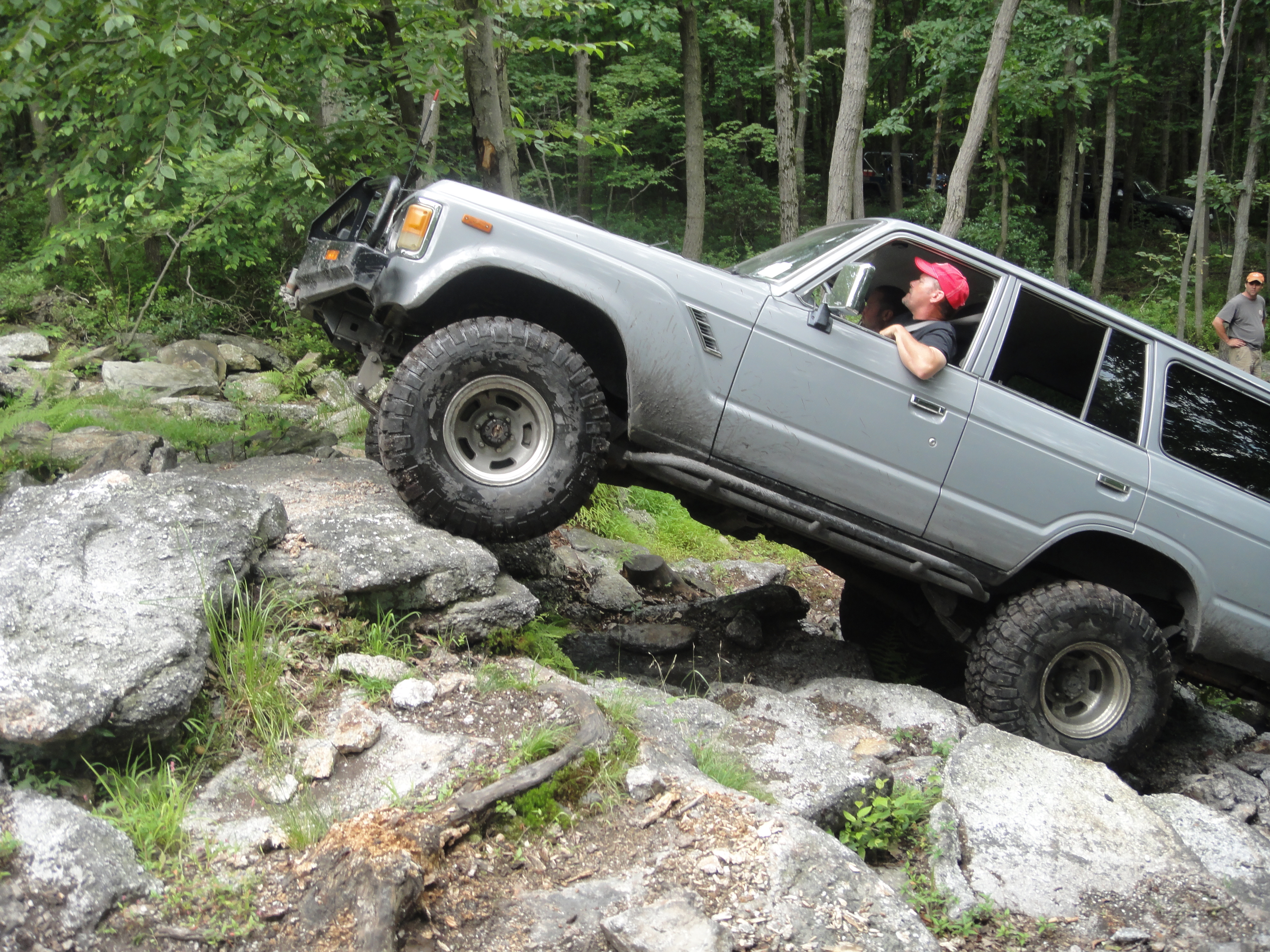
I was busy driving and didn’t get a lot of pictures, but the trails went over a more conglomerate part of the park with broken boulders and sand between. This means we had different traction on each wheel, which is difficult without locking differentials.
The photo above shows the smaller talus at mixed in with very large boulders as we climb up an old mining trail; however, we leave the trails and just drive over the rocks as best we can. The view from the top is great and worth the effort.
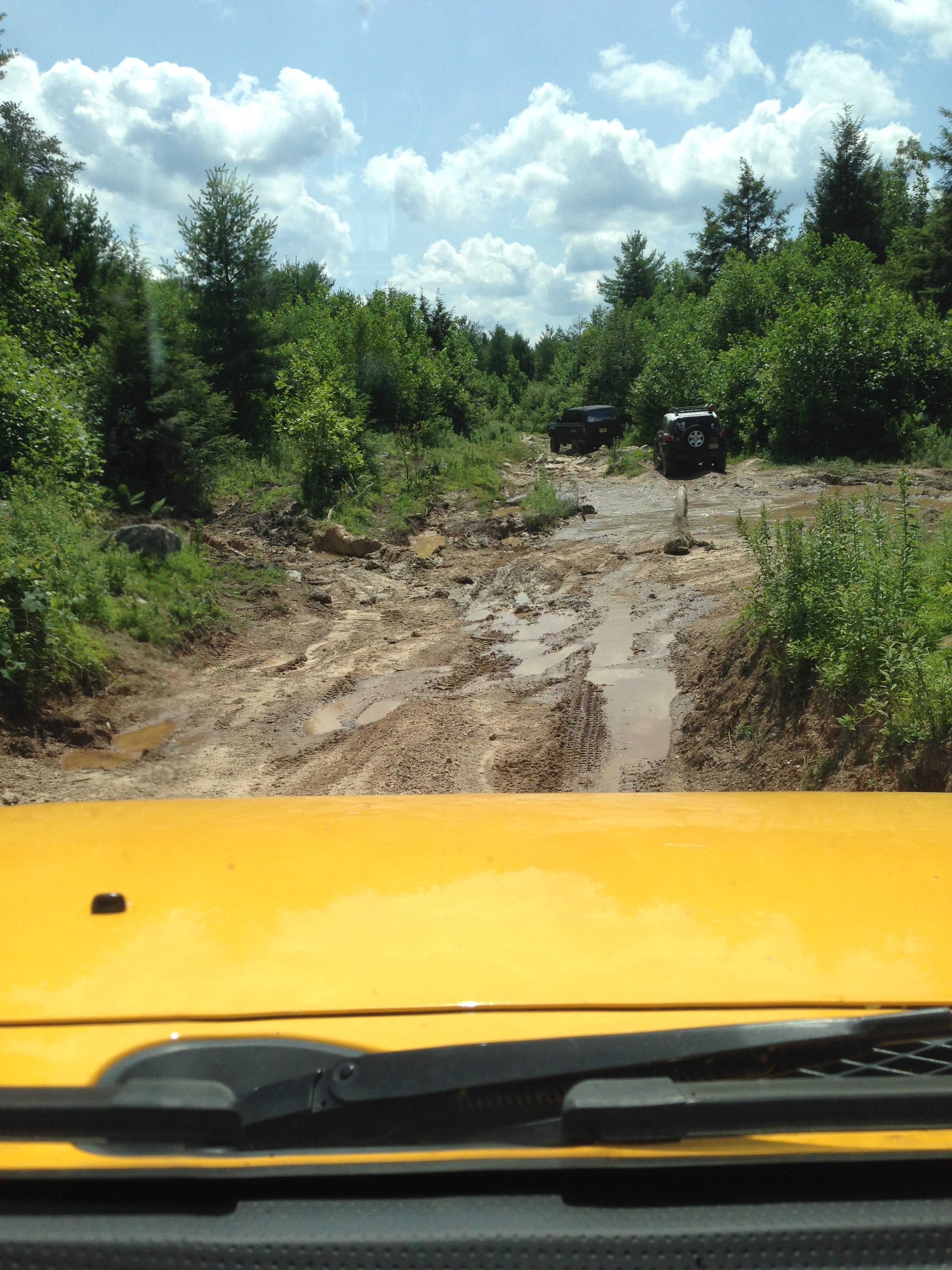
Then we drove down a very steep side of the ridge to a modern creek with real mud (thin) over the rock debris. Water and mud were everywhere, mixed in with boulders to clamber over.
We finished the day with a difficult climb over medium (~2 foot) boulders strewn amongst tree stumps and sand, which was challenging.

I was doing well without locking the rear differential and then….
My steering catastrophically failed (BANG…) and I was dead in the water. Rich and John (pres and vice-pres of the hosting club/ Gotham City Landcruisers) were there within 30 minutes. I was saved by Mark who had an alternator-driven arc welder. He took an hour (he was wheeling on the other side of the park). He welded the busted pieces back together on the trail (side of a mountain) and I was back to camp for dinner.
Coal Mine Classic: Day 1
A few people were ready on the first day so we ran some trails in the Rausch Creek ORV Park that were mixed for stock/big tire trucks. This park is an abandoned coal mine, but there was not enough coal to remove the mountain, which is typical for higher grade Anthracite mines (remember this coal was formed during an orogeny). We drove through some holes that were not (usually) deep, if filled with water, and had a black color that is a dead giveaway for coal dust (not mud).

These got as deep as 30 inches (the trail guides new the depths beforehand). However, there were some very deep holes where the miners had gone looking for a economically viable coal seam. These were unmarked and you don’t want to drive into one.

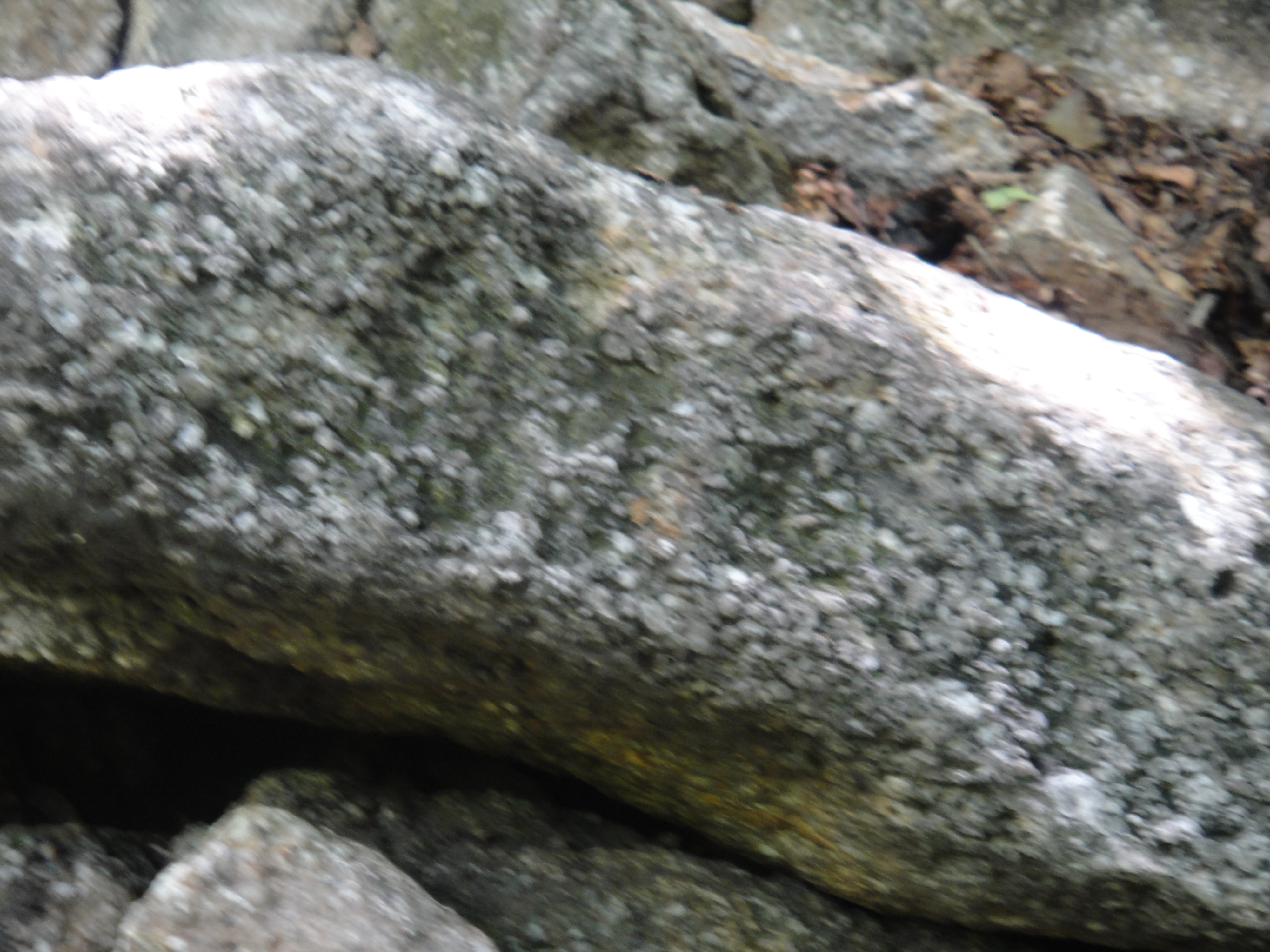
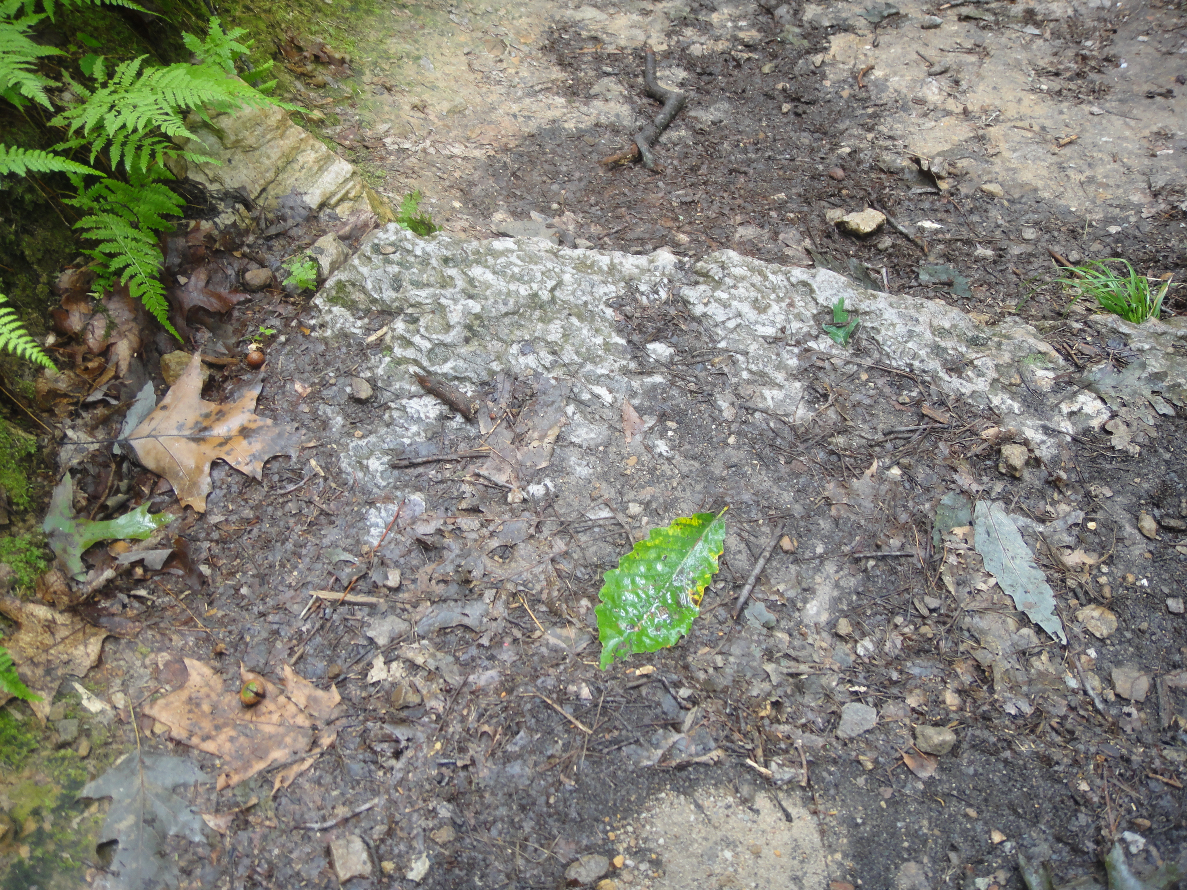
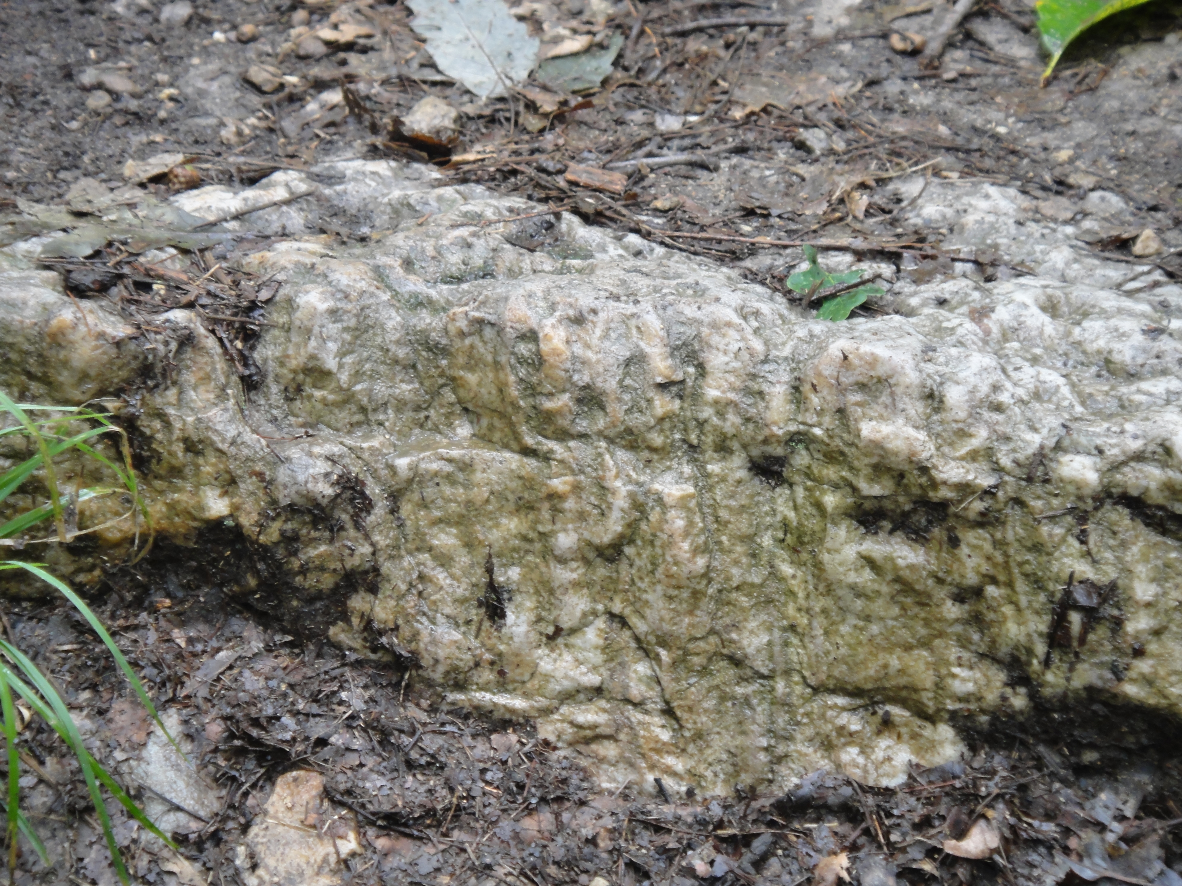
The Pottsville Groups has four main kinds of rock: coal, conglomerate, sandstone, and shale. The conglomerate has large (~.25 -.5 inch) pebbles in a matrix of sand and cement (calcite or silica). This picture shows the texture of these rocks.
Because we were a mixed group of eager-beavers (you just want to go wheeling!), a couple of trucks took a detour to do some rock crawling. The guy in front is the spotter, who tells the driver where to steer.
Eventually, the trail guide stepped it up a notch and we did some blue trails (bigger tires and lift), which freaked out the stock trucks, but they did fine with some help from expert spotters.
Looking forward to Day 2.
Coal Mine Classic 2014: Cumberland Valley/Ridge and Valley
This is a prologue to my short trip today, which will be lengthened by stopping to look at some of the interesting sites described in the Roadside Geology of Pennsylvania (B. B. van Diver, 1990, Mtn. Press, Missoula, Montana).
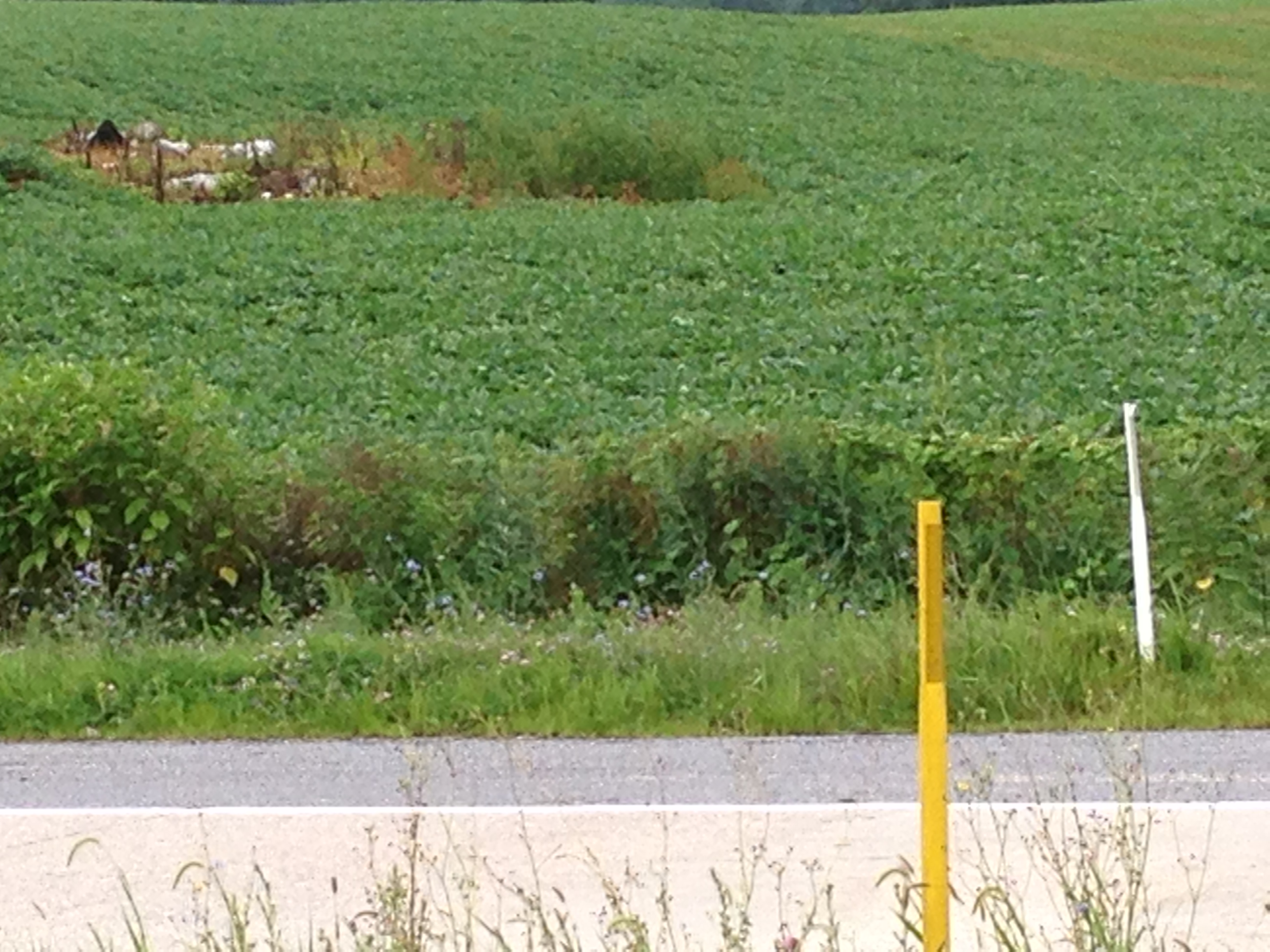
I will be passing through a Karst topography (sinkholes, pinnacles, and springs) from the MD line to mile 17 with the northern terminus of the Blue Ridge to the east. This ridge extends to GA and I have followed it on the previous day. I hope to find Pine Grove Furnace, which was used to produce iron from low-grade ore (limonite). Here is a picture of one of the pinnacles in a corn field.
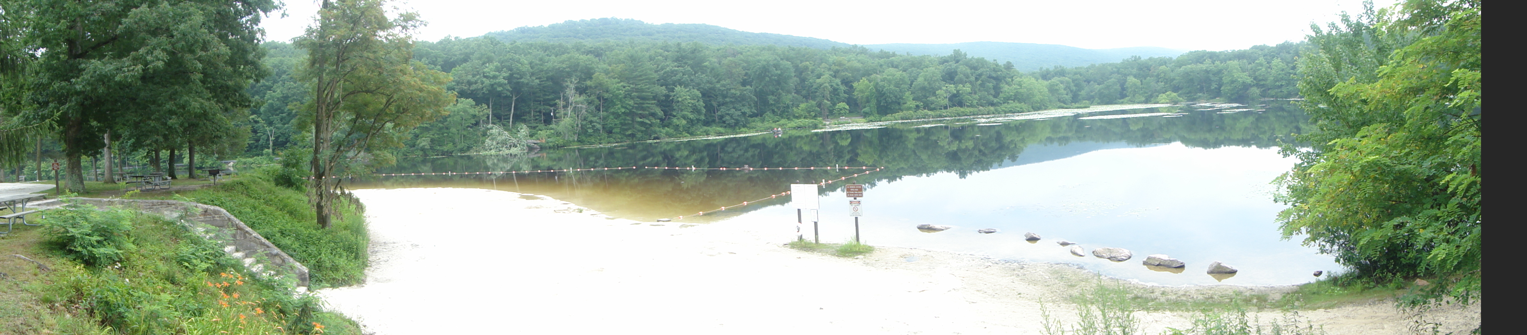
It is the white object. There were others but pics were hard to take from the interstate. I found the sign to Pine Grove Furnace and made a detour to see either the limonite, quartzite, and/or fossils. Here is an image of the lake near the quartzite. These lakes were created all over PA during the depression by the WPA; they are very popular for weekend outings.
I hiked about 1 mile up a steep grade to get these great images of the area and the Precambrian quartzite that was brought to the surface by the tremendous horizontal pressure and resulting uplift of the Appalachian/Alleghenian orogeny when Africa collided with N. America.
This is called “Steeple Pole” but don’t ask me why. It is a highly metamorphosed sandstone that was probably? deposited in either a beach or sand dune environment more than 1.5 billion years ago, which were metamorphosed BEFORE the Appalachian orogeny occurred (~400 my). This stuff is really HARD!

I also found something I didn’t expect to, some fossil burrows from worms (not known in the modern world) in ~400 my sandstones. The first image shows the surface of what would have been the seafloor (shallow) when the creatures were alive.
This image shows a section perpendicular to the seabed. The worm holes are quite visible because it sprinkled while I was hiking and water is excellent for exaggerating the contrast (remember the entrance to Cibola in National Treasure: Book of Secrets?
I didn’t make it toReservoir Park on US 22 for a good view of a water gap through the ridge because I was so hot and tired from the uphill hike to see Steeple Pole that I wanted to stay in the ACd truck! After crossing I-78, I hope to collect some Ordovician (~500 my) fossils at Swatara Gap, and then some Devonian (~400 my) fossils at Suedberg. From there to the campground, there is a good roadcut that shows coal beds in the Catskill Fm. The guide book I have is 30 years old and these fuzzy images of (maybe) brachiopods from the Devonian section are the best I could find before getting to the camp site.
The linear features in the middle are on the shell of a clam in modern benthic invertebrates. These are certainly not modern. I need to start taking the better camera along.
Coal Mine Classic 2014: The Appalachian Mountains
Today, I covered the southern Appalachians and drove along the axis of the famous Shenandoah Valley, which was settled in the 19th century. It is bounded by the Blue Ridge Mountains on the east and the Ridge and Valley mountains to the west. This is also the fast lane that General Lee used to drive the Union army crazy in the American Civil War. But before entering the Shenandoah, I had to drive up hill some more from my starting point in Chattanooga, TN (black square on the map) and cross a complex geologic province that includes the Roanoke Valley, which follows the Roanoke River in a general east-west direction. In other words, it cuts across the trend seen in the contours of this excellent Appalachian geologic map by Crop and Hibbard.
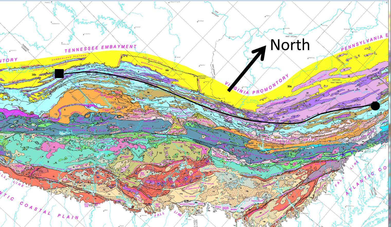
The circle is where I am staying tonight, Martinsburg, West Virginia. The black line is my approximate route up the southern Appalachian Mountains.
I must make a short interlude on Paleozoic limestones. There is no good single reference on this phenomenon but most of the eastern U.S. was covered by seas of varying depths between 500 and 250 million years ago (rough approximation). Sea animals like shrimp, oyesters, etc., lived in them as they do today and when they died, their shells settled. This went on for millions of years and eventually these shells were buried along with any sand/silt/clay that may have been brought into these seas from the eroding land (much like the plumes we see in modern rivers like the Amazon). These accumulation of shells and land-derived sediment were transformed into limestone over millions of years and deep burial (like 10 miles).
The primary rock I saw on this day’s journey was Paleozoic limestone. These rocks were deformed when the great continental collisions of the later Paleozoic occurred, like the Appalachian Orogeny. I saw these limestones as I passed Birmingham yesterday but now we seen them more deformed by folding and faulting during the Appalahcian Orogeny. This image shows them near the Roanoke Valley, where they are tilted in a southerly direction.
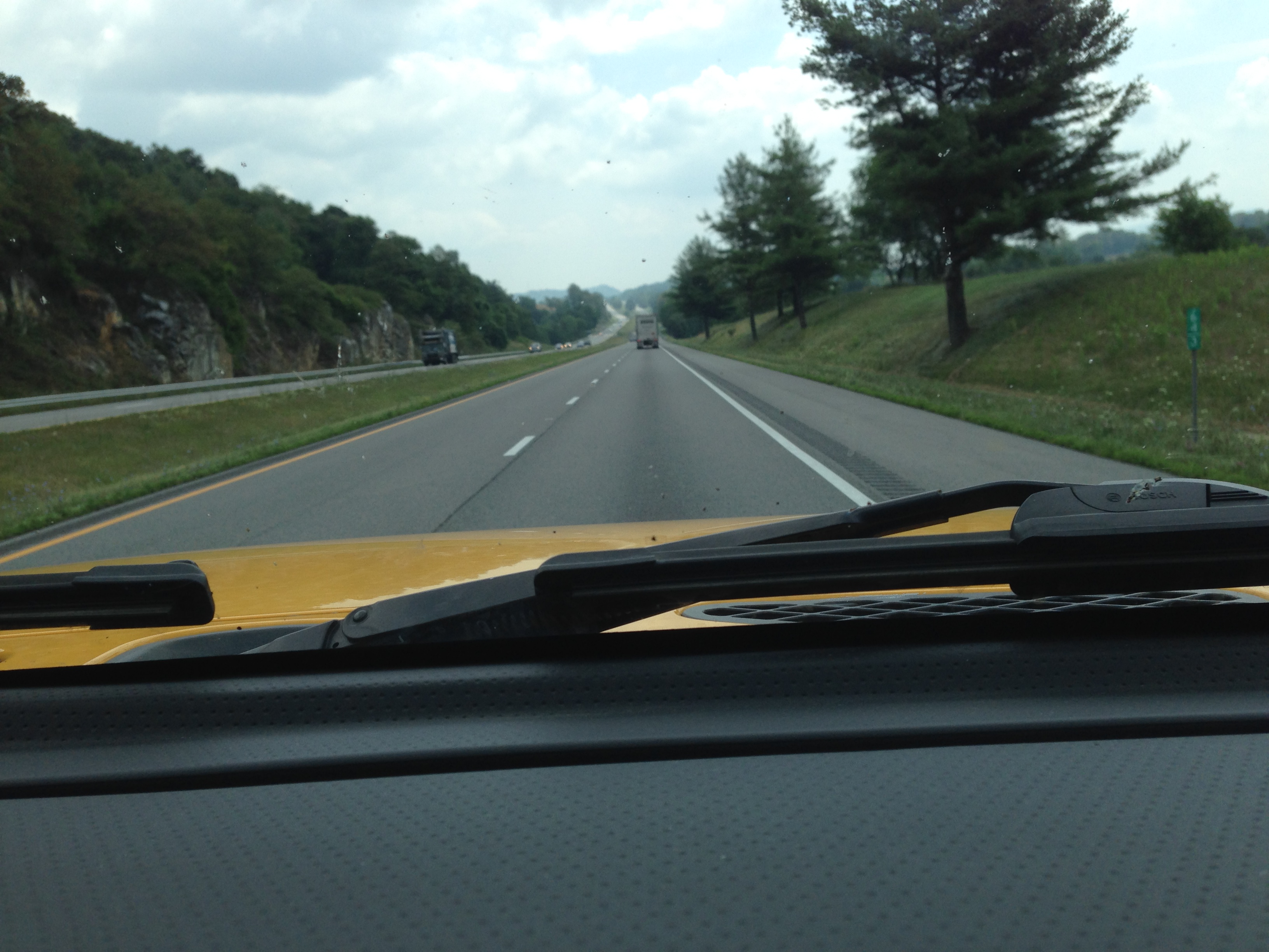
As I travelled northward and crossed several ridges I found these same (kinds of) rock were almost vertical or tilting to the east. This is within the Shenandoah Valley. They also varied from thin to thick bedded (obvious lines in the rocks are called bedding). I couldn’t get a picture of these but they were impressive over 10’s of miles. I also saw some thin (<3 feet thick) beds of shale (mud stone), which indicates contamination by land-derived sediment. This makes the limestone less pure and can contribute to poor strength, as well as breakage by faults. The result of these processes (and others I am not discussing) leads to road cuts like these.

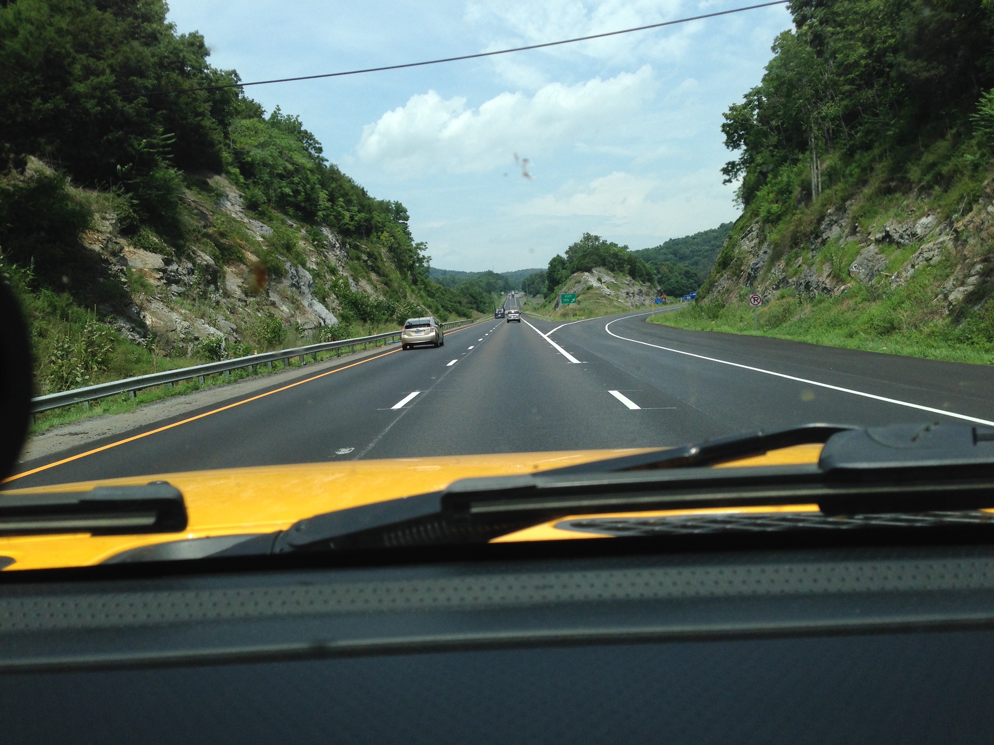
These were more common in the southern part of my drive (see path above). When I drove further north, however, the limestone was very strong and supported multiple road cuts for north and southbound lanes.
I wanted to stop and examine these exposures up close but my schedule didn’t allow it. Next time I will plan accordingly and do a better job of correlating my photos to the geologic and topographic maps (still not easy to do with an IPhone). One last note (of many I would like to make) is that I saw no more pine trees; I have left the pine woods of the coastal plane behind.
This is the beautiful world of the temperate deciduous forest (this time of year)!
Coal Mine Classic 2014: Climbing out of the Coastal Plain
Today I drove 450 miles and slowly climbed from the flat, pine-dominate, coastal plain province onto the gently rolling hills of central Mississippi and Alabama, which are a transition to the Appalachian Highlands, which are identified by the long hills coming into and immediately north of Birmingham, AL. This photo shows the features of this transition area.

These are the terrace and braided stream deposits we saw at Sicily Island, Louisiana previously. They look like stream gravel. This blog isn’t summarizing the geology of the areas as we drive through them, but the region around Birmingham is a Paleozoic basin with sandstone, limestone, and shales that has actually been a major source of iron ore (from the limestone.); this means, rocks. The next couple of images show how these limestones vary from thick bedded to very thin bedded (they even contain coal).

The causes of the variations in bedding are not exactly known buy thick beds are interpreted to be deeper water with no contamination by sand and/or shale. The following image shows where the road cut had to be sloped because the rock was not solid enough to form a cliff.

After I cross the state line into Georgia, however, these rocks become massive (i.e. little bedding visible) and form Table Mtn.

We are further from the coastline (in Paleozoic time) and the limestone is pure; dirt screws up the lithification process (rock forming). This traverse is seen in a geologic map of MS-AL. The overlapping terraces cover the underlying linear structure that was formed when these rocks were folded during the Appalachian Orogeny (~325-260 million years).

For reference, today I drove from the southwest (lower-left) to northeast (upper-right) of this map.
Coal Mine Classic 2014: Getting There
This is the first real-time post on this site and I am working out the kinks. This post is going to cover the preparation for the trip and the ride up, which takes a couple of days. Before embarking, I need to do some background work to understand where I am going. The rest of the posts on this trip will refer to this post, which introduces the geology of eastern Pennsylvania.
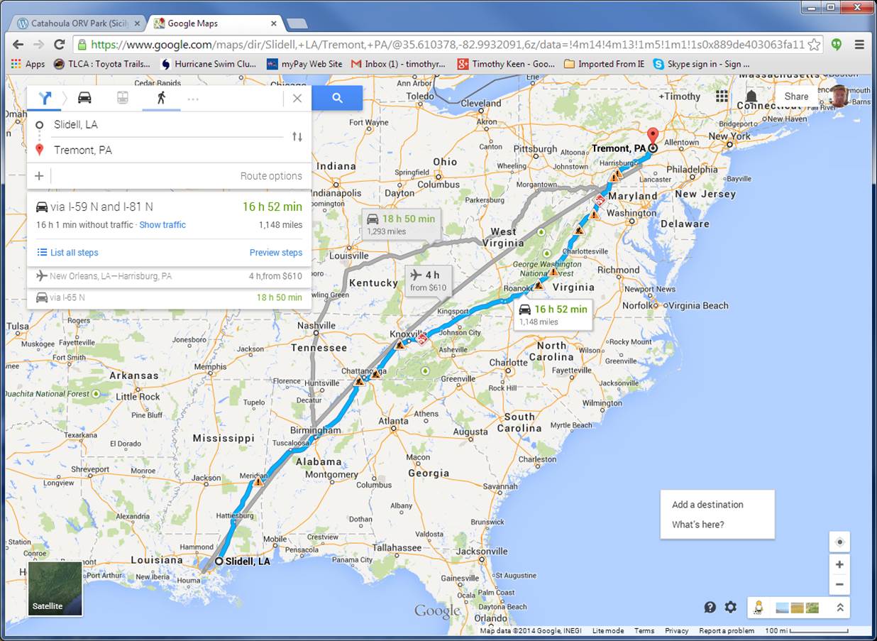
This image shows the trip route going (blue) and returning (gray). The aircraft route is shown for reference, but I couldn’t afford to fly my 5000 lb truck so I have to drive. As an overview, the eastern route follows the natural geography of the Appalachian Mtns after we get to Chattanooga. I will talk about this more later, but these are the roots of an ancient (~400 million year) mountain range when America collided with Europe.
The destination is at Tremont, PA (marked on map). As with previous excursions, we have to zoom in real close to see the tiny areas we are operating in. The following image from the official PA geologic map shows the area in a rectangle.

This is much larger than Rausch Creek ORV Park but it shows us that we are going to be off road in the Pennsylvanian Period of the past (~350-300 my). The tan-colored area is the Llewellyn Formation, which consists of sandstones at the bottom of sequences that are probably cyclothems, which represent alternating increases and decrases in local sea level. These rocks include coal seams, as reported by the Rausch Creek ORV management, i.e., they warn drivers they may drive into an open pit if unwary! Here is a close-up of the area.

I will try and get good exposures (no problem on a rock-crawling trip!) to verify the rock types. It is going to rain before the event so we will see if it is like Catahoula ORV Park!
The final point I want to make is the preparation for the trip. I used Google Map to find the area and checked Google Earth to see what the area looked like (so forested that the trails are not visible), and then checked for geologic maps. The last point yields many sources and there was a lot of work to focus on Tremont. I am not going to use satellite images (Google Earth) because of the number of trees! I will be referring to the Roadside Geology of Pennsylvania (B. B. van Diver, Mtn. Press Publ., Missoula, Montana, 1990) when I get to PA.

Recent Comments