
What’s the Difference?
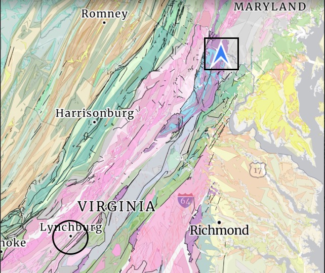
Recent posts have discussed metamorphic rocks found along the banks of the Potomac River in Northern Virginia, buried and deformed during closing of the Iapetus ocean, between 1000 and 500 Ma (million years ago). Those rocks are schist, which formed at depths of about 15 km (10 miles), and temperatures of approximately 500 C (about 1000 F). The original mudstone was ductile under these conditions and the sedimentary layers (bedding) were folded like taffy, while low-melting minerals like quartz were squeezed out and filled cracks and voids, to form veins and irregular, rounded bodies. As extreme as these conditions sound, these are intermediate-grade metamorphic rocks.
I took a trip to Lynchburg, Virginia (Fig. 1), to see some higher grade metamorphic rocks that were formed at about the same time.
I looked at three exposures of Precambrian rocks on this trip. I would love to show all of the photos I took of the metamorphic and igneous structures I saw, but I will have to restrain myself. (I’ll try anyway…)
The first locale we visited was Ivy Creek Park (Fig. 2), where there was an exposure of the Lynchburg Group that revealed one of its many facies.
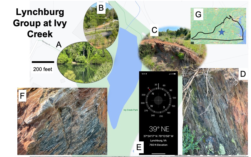
The rocks seen in Fig. 2 (especially Plate F) are probably either biotite schist or graphite schist. Without petrological analyses that are unavailable at this time, there is no way to tell–not that it would matter. The protoliths of these metamorphic rocks were fine-grained sediments, probably deposited in either a back-arc basin or continental subduction zone. They were buried to at least 10 miles and compressed by colliding tectonic plates; however, this small outcrop showed no evidence of ductile deformation (e.g., folds or quartz inclusions). Note that the strike of the foliation in these rocks (Fig. 2E) is consistent with the orientation of geologic trends seen in Fig. 1. So far, so good…
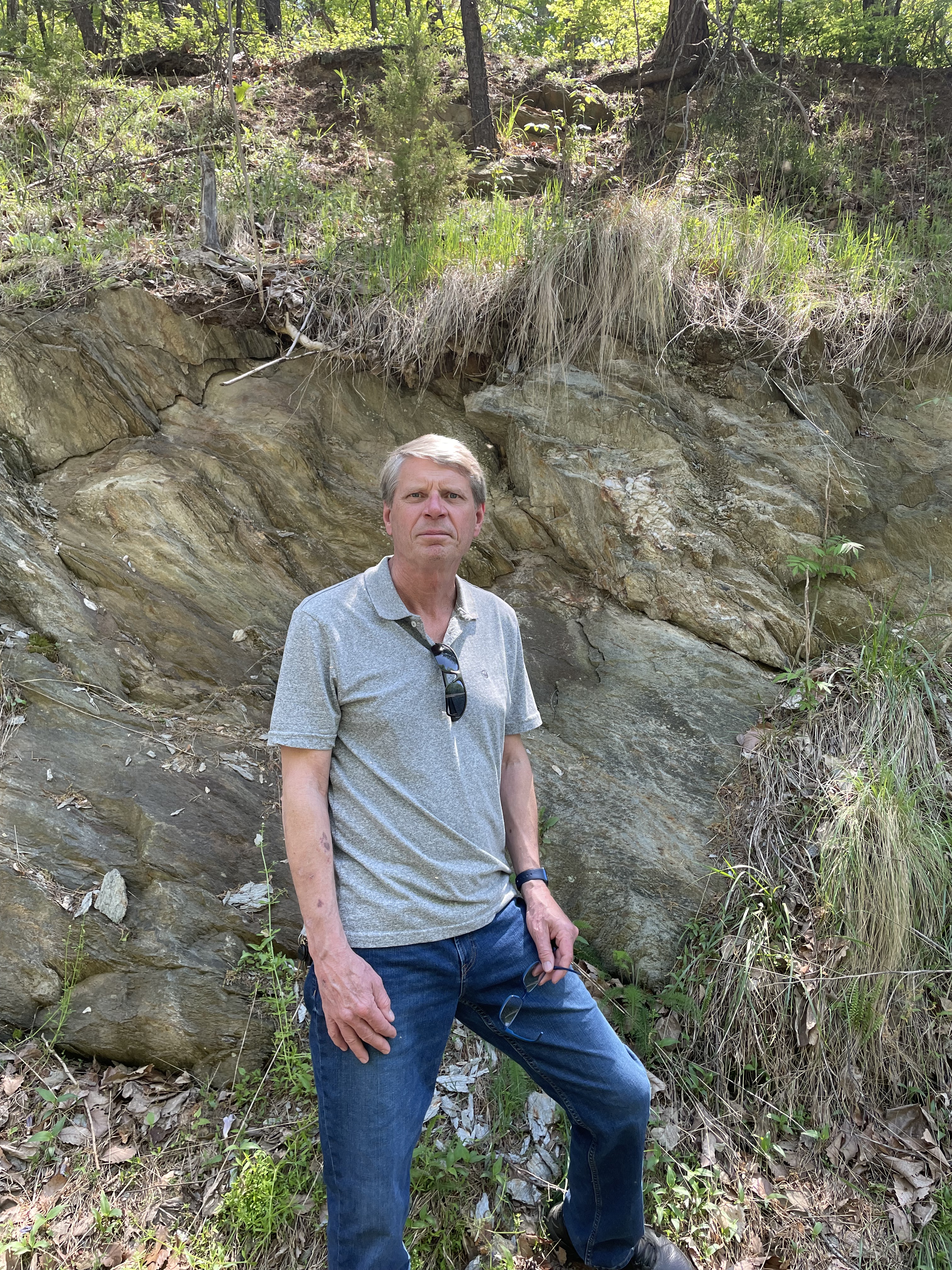
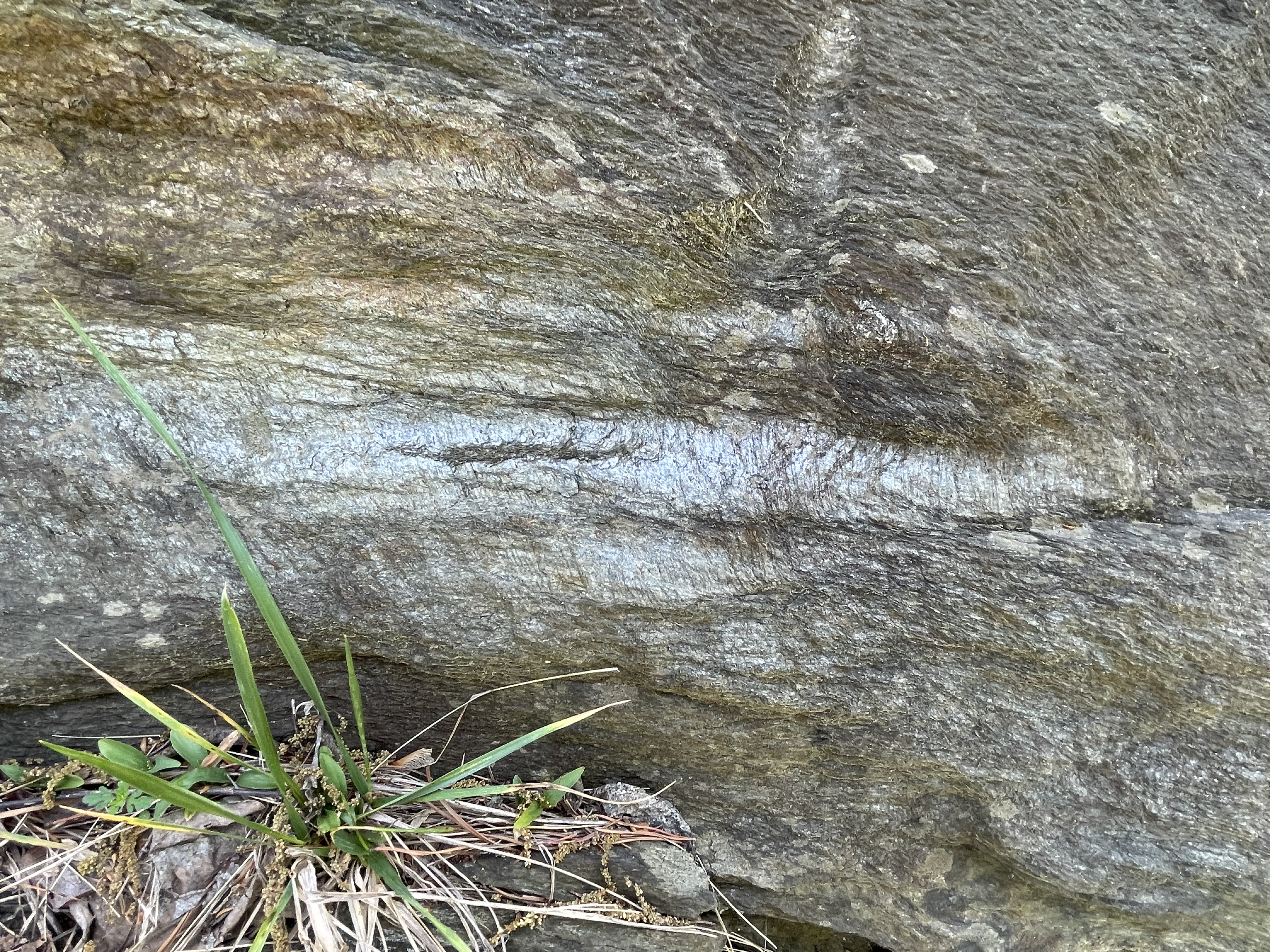
Our next stop took us to Candler Mountain, where a road cut exposed metamorphic rocks for more than 100 m along a narrow road, still part of the Lynchburg Group (Fig. 3).
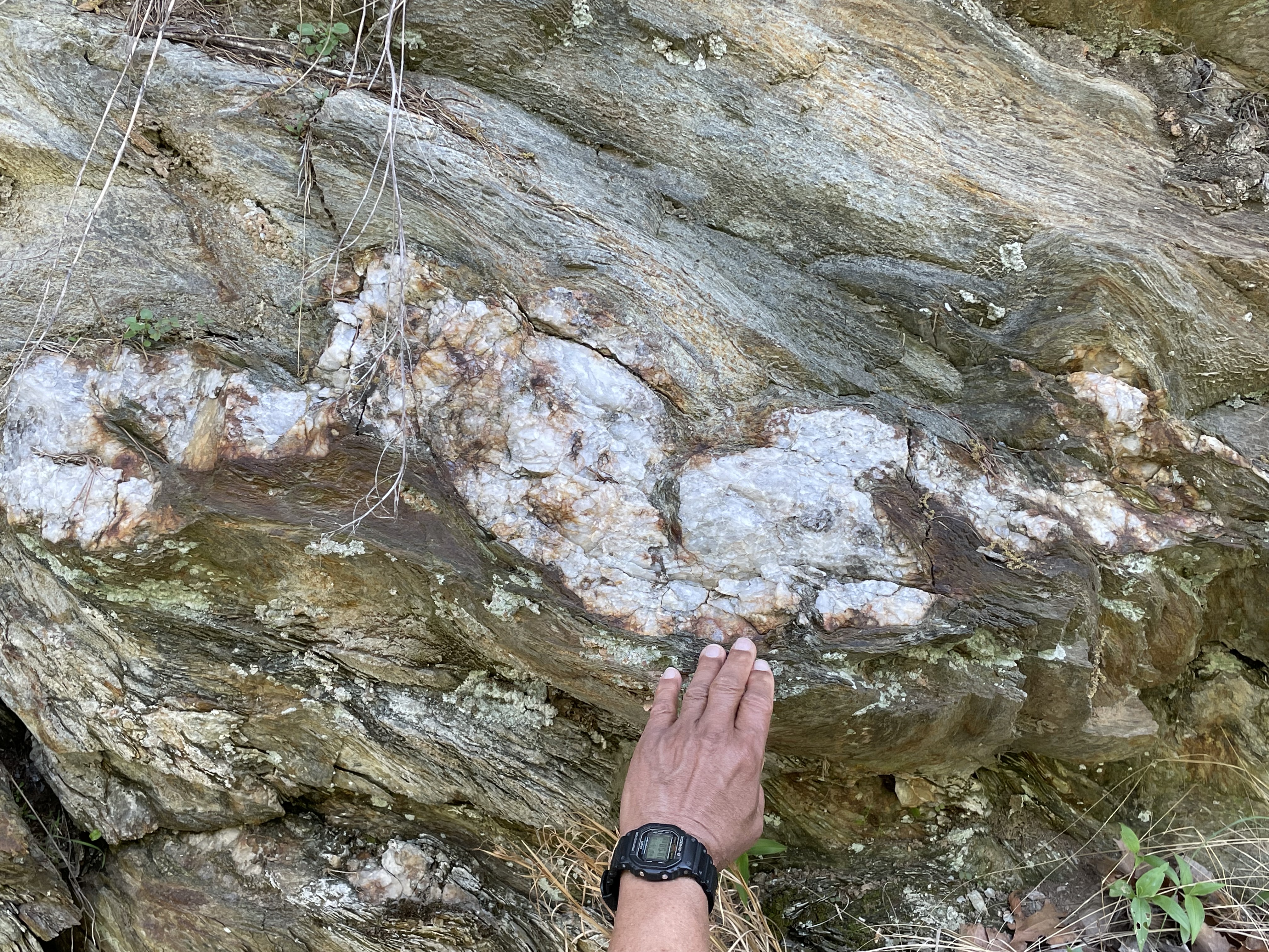
This exposure revealed many fascinating metamorphic textures–too many to share here. I’m going to focus on extensional features, which might not be expected since I just said that these rocks were deformed during collision of solid land masses, at least island chains like Japan of the Philippines, if not continents.
The context for this situation–stretched crust in a tectonic plate collision–is best illustrated in a cartoon (Fig. 4), which shows how the crust can actually stretch to release the stress caused by volcanism, as subducting crust melts under increasing pressure and temperature.

Keeping Fig. 4 in mind, let’s look at the rocks we found on Candler Mountain.

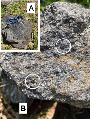
Phyllite is a low-grade metamorphic rock that forms from mud stone at fairly low temperature and pressure (Fig. 6). It is associated with convergent tectonic plate boundaries, and is found in both subduction zones (see Fig. 4) and continental collisions.

Focusing on extensional tectonics for this post, we can see some of the textures we’ve seen elsewhere on Candler Mountain.


The extensional features seen in Figs. 7 and 8 are consistent with these rocks being deformed as suggested in a back-arc basin (Site 1 in Fig. 4) but not buried too deeply (Site e in Fig. 6). However, they are not horizontal, as indicated by the steep dip seen in Fig. 8 (actually they are dipping at more than 60 degrees).
After being heated in the back-arc basin environment, they would have been crushed by the imminent collision of continental land masses, which cannot be subducted because of the low density of the granitic rocks that comprise them. During this compressional stress, they were folded and probably transported many miles along thrust faults, without being buried deeply enough to transform them into schist.
The tilting of these rocks is due to large-scale folding during this later compressional period. The rocks of this area are actually part of an anticlinorium–a region filled with anticlines of every scale, from inches to miles in width. There are a couple of additional superimposed structures I would like to mention before we move on.

There is one more piece of the puzzle that we observed on our field trip. Before we finish with a wave of our hands (and a good bit of conjecture), let’s review.

The dashed line in Fig. 12 is oriented approximately in line with the general lithological trends in Fig. 1, as well as several faults (solid lines in Fig. 1) that have been identified. This line is meant to delineate the schist and phyllite zones (~300 C isotherm in Fig. 6) within a back-arc basin. Schist is high grade. But what do we expect to find at Site C?
The last location we visited was a slope, the edge of a bulldozed lot covered by an apartment complex. None of the rocks we saw were in place, but they hadn’t been moved far, maybe a few yards. We weren’t looking for orientation data, so that wasn’t a problem. What we found was very interesting.
The exposure faced a ravine that had been partly filled to support a road, so we followed the slope until we found more loose boulders with a different lithology.

I cannot say, from the available photographs, which lithology in Fig. 14 is intrusive. However, those details are not the purpose of this post; between the high-grade (schist and gneiss) and low-grade (phyllite) metamorphic rocks we’ve observed, there is a line of intrusive and possibly volcanic rocks with the same general orientation (about 40 degrees east of north). We cannot say anything about post-emplacement deformation of these magmatic rocks, but it is curious that they lie between metamorphic rocks of different grade, in an area with several identified faults (see Fig. 1) having the same orientation.
I have followed one interpretation of the rocks discussed in this post, that they were deposited as muddy sediments about a billion years ago and deformed when volcanic processes stretched the crust. The subduction zone that created this tectonic environment was subsequently caught between opposing continental plates and crushed like a beer can. At some point–probably continuously until the final cataclysm–basaltic magma collected in a subterranean chamber and periodically emerged, creating submarine basaltic flows.
I had a lot of fun with this post (and crushed a few beer cans myself)…

Trackbacks / Pingbacks