Figure 1. View downstream in Difficult Run, towards the Potomac River. (See Fig. 2 for location.)
This week we went exploring south of Great Falls, along a tributary that cuts through Precambrian metamorphic rocks, before joining the Potomac River.
Figure 2. Topographic relief map of the Potomac River area southeast of Great Falls (circle at upper left). The irregular black line traces out path along several trails within the Difficult Run trail system. The photos were taken at the numbered points.
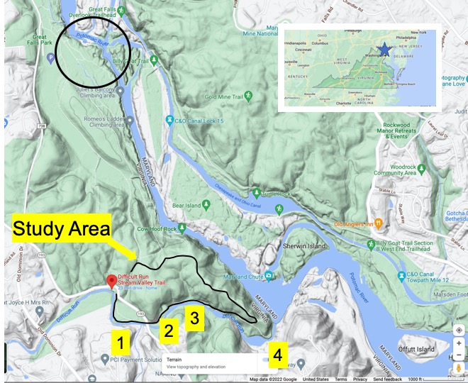
Difficult Run twists its way through a mass of hard rocks that we have met before, Precambrian Schist and gneiss, forming a series of quiet pools (Fig. 3) separated by resistant, rocky sections (Fig. 4).
Figure 3. Images taken at Site 1 (see Fig. 2 for location). (A) Gravel point bar deposited. (B) Flood plain about 10 feet above low-water level, incised with secondary channels, forming an anastomosing stream at high water. The floodplain sediment comprises mostly silt and mud, with minor sand, primarily in point bars. (C) Quiet pool formed between rocky sections.
It was a shady walk beneath a tall canopy of mature hickory, ash, and other temperate forest trees. There was plenty of evidence of the recent spring floods. Large trees were jammed up on rocky outcrops and among the trees covering the floodplain. After a short hike, we came to what looked like an abandoned quarry (Fig. 4), which can be identified by the bright spot in the relief map of Fig. 2, just above the label for Site “2”.
Figure 4. Photos of quarry located at Site 2 (see Fig. 2 for location. (A) The rear wall of the cutout was hidden between trees and vines, but the top of the ridge was irregular (blue line in Panel A). The white circle highlights some of the weathered rock from the area. Access was not possible. (B) Exposure in the east wall of the quarry, showing unconformity of contact between the reddish rock on the right, and the gray rock on the left of the yellow highlighter. Incongruous gray sediment is circled in white. Note the reddish sediment to the right of the hypothesized contact. This could be a fault or simply a change in lithology but apparent foliation across the contact was not uniform. The image is approximately 12 feet high.
I was able to examine several slabs of the rock exposed in the quarry and along the river bed (see Fig. 1 for appearance) at Site 2, revealing foliation and inclusions similar to other exposures of this rock (Fig. 5).
Figure 5. Close-up images of typical exposures of rocks along Difficult Run. (A) Loose boulders near their origin in the cliff. Note the juxtaposition of nearly original bedding (central part of lower rock), folded beds (upper part), and completely destroyed bedding accompanied by recrystallization. The white blebs in the lower part of the photo are feldspar minerals that formed from the original composition of the shales and siltstones before metamorphism. The boulder is approximately 2 feet across. (B) Close-up (4x magnification) of quartz squeezed out from a quartz-poor shale during metamorphism. (Image size is 2 inches). (C) Angular inclusions of feldspar (light-colored minerals) in a fine-grained matrix of Fe-rich minerals that weather to form a rust-colored surface. This area is analogous to the disrupted bedding in Plate A. The image is about 12 inches high.
We’ve seen the structures displayed in Fig. 5 before, in this same rock, at Great Falls and other locations along the Potomac River. I’m presenting these examples to give the reader some idea of the scale of these processes. For example, the juxtaposition of foliation in Fig. 5A suggests a frenzy of activity, like in a pan of boiling water; that analogy is reasonable if we adjust the viscosity, temperature, pressure, and time scale from water on the stove to rocks buried deep beneath the surface, but heated from below–just like the pan of water. I’m speculating here but, just to get an idea of what I’m talking about, the crazy structures in Fig. 5A probably took on the order of ten-million years to form.
It might help to see the problem from a more god-like perspective.
Figure 6. This is a hypothesized cross-section across Loudon County from west to east. It is based on thousands of geologic measurements. Note the pink/gray area with brown lenses pointing upward to the left. This represents the Neoproterozoic metamorphic rocks we’ve encountered all along the Potomac River. There are several points to note from this drawing: (1) the dominant foliation (brown lenses) is dipping to the east; (2) the contact with surrounding, older rock is folded (squiggly lines to the left); (3) it forms a massive bedrock structure that cuts the Potomac River almost at a right angle. (The Potomac would run approximately along the cross-section.) (4) It is filled with igneous intrusions from multiple orogenies, represented by the lenticular blebs and orange, white, and gray dikes trending up and to the left in the image (on the left side). All of that igneous activity supplied quartz and feldspar to fill voids. (The cross-section is approximately 25 miles across.)
As you might expect, the exposure of such a deformed and mineralogically diverse set of lithologies along the Potomac’s course produces features like Great Falls, as well as what we’re examining today.
Figure 7. Example, from Site 3, of a resistant ledge of metamorphic rock forming a cataract backed by a pool as in Fig. 3. The orientation of the ledge is approximately 30 degrees east, the same as the strike of the rocks we have examined throughout Virginia (so far). This is the regional structural pattern, which I discussed in previous posts.
There is more to these rocks than metamorphic structures, including folding, foliation, and inclusions. All of those were formed between 1000 and 500 million-years ago. After deep burial (maybe 15 miles) beneath an enormous mountain range, these rocks hardened and were exhumed by erosion of the overlying rocks. They were brittle and, as isostatic pressure relaxed, they cracked just like a cooling pumpkin pie, forming joints.
Figure 8. Analysis of joint sets from Site 3. The images have been rotated to approximately align with north and east. (A) Note the thin, white lines of (probably) feldspar filling joints, which are represented schematically by black lines labeled “X” and “Y” (east and north joints). I have no way of knowing what angle at which the joints intersected the surface of the outcrop, so this is speculative. (B) The same convention is used for labeling the joints, again seen as thin, intersecting white lines in the outcrop. Axes have been labeled “X'” and “Y'” for this photo (B). The northward joint is in good agreement between Plates (A) and (B), but there is a significant difference in the east joint. It was difficult to tell in the field, but my overall sense was that these two outcrops (separated by less than 100 feet), were oriented differently. I indicated my uncertainty with a question mark.
Confused by what I had seen so far (i.e. Figs. 4, 5, and 8), I followed the trail to the confluence of Difficult Run and the Potomac river (Fig. 9).
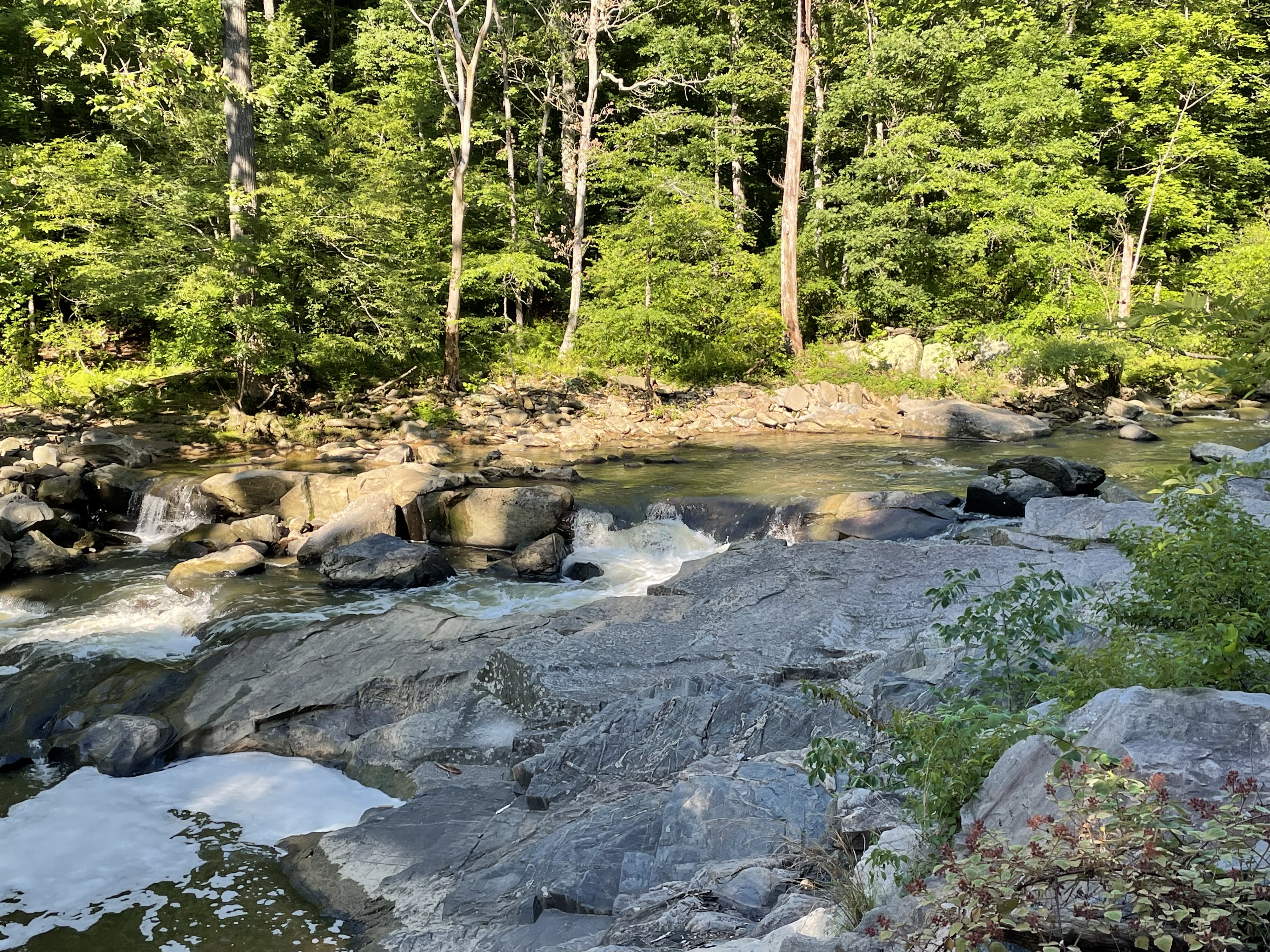
Figure 9. Difficult Run joins the Potomac River at a steep debouchment, with large boulders littering the creek bed at the large, angular bend in the Potomac (Site 4 in Fig. 2), seen in the background.
Looking across Difficult Run to the south at Site 4 (see Fig. 2 for location), I was once again bewildered.
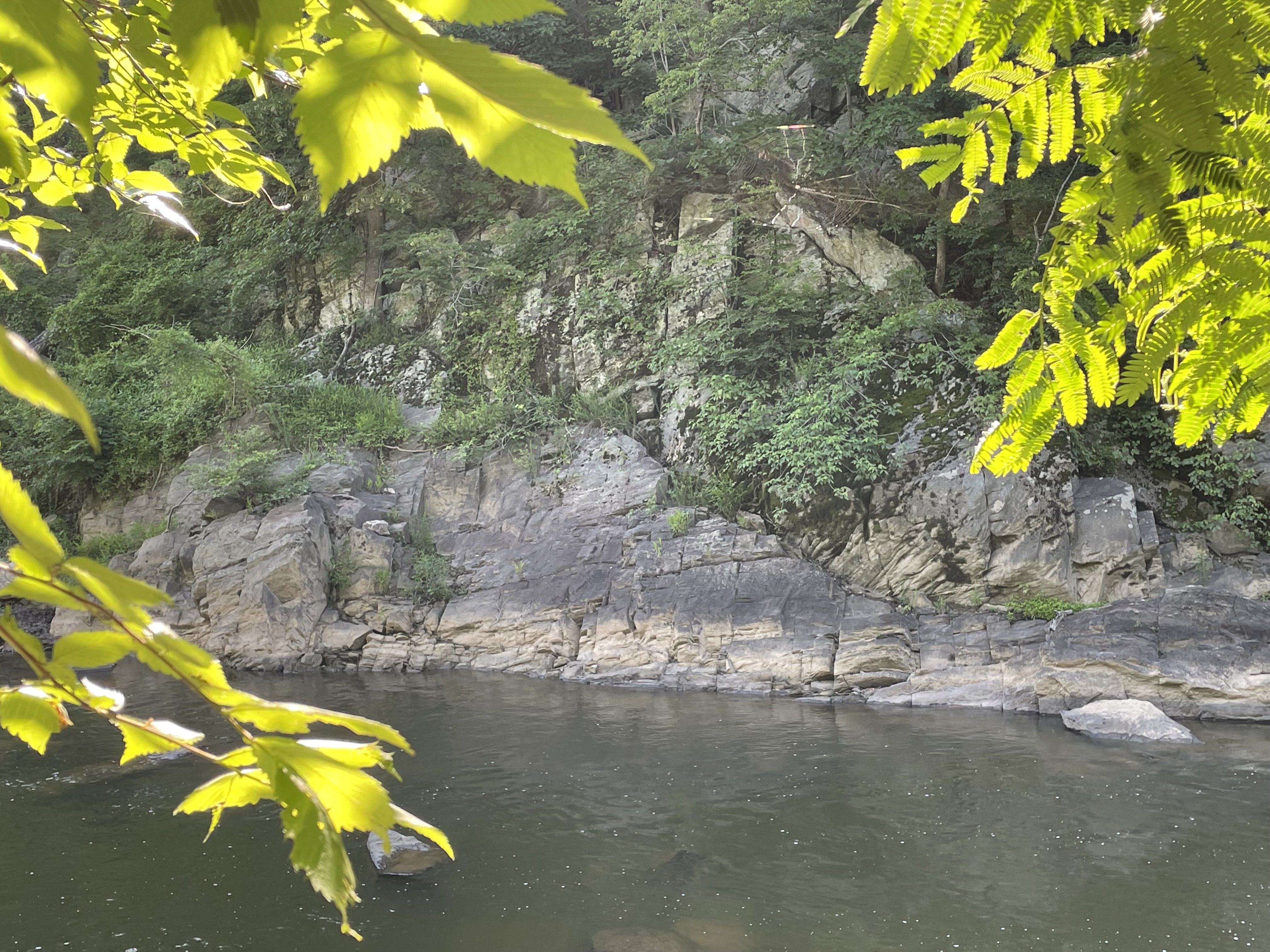
Figure 10. The south bank of Difficult Run at its confluence with the Potomac River at Site 4. Note the exposure of Precambrian rocks along the base of the steep slope, large boulders, and a shallow ledge at the creek’s mouth. Figure 11. Close-up image from Fig. 10, showing unconformity between the rocks with foliation (below the unconformity), apparently dipping about thirty degrees away from the camera, and overlying reddish-weathering rocks with similar orientation, except for the tan block, just to the right of center in the photo, which have an apparent dip of more than 45 degrees to the left.
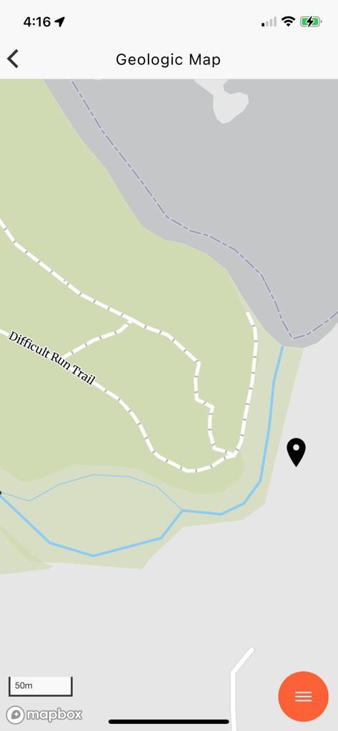
It is tempting to assume that the overlying rocks in Fig. 11 are sedimentary, deposited on an erosional surface in the underlying metamorphic rocks (angular unconformity); however, the geologic map (Fig. 12) reveals that these are similar in age and lithology.
Figure 12. Geologic map of the study area (from Rock D iPhone app).The location of Fig. 11 is shown by the black marker. This lithology is described the same as the green unit to the west of Difficult Run. These units were probably given (forgotten) unique names before they were found to be similar. Nevertheless, differentiation is useful considering the unconformity in Fig. 11.
I summarized the geologic history of this area in a previous post, so I’d like to wrap up by demonstrating how pervasive deformation is, in this post. Imagine the deformation seen in Fig. 5A scaled up several orders of magnitude, to the scale of a bluff (Fig. 11). We also saw evidence of rotation of porphyroblasts at another location along the Potomac and again, more than a hundred miles to the south, in Lynchburg. This deformation actually extends to the microscopic scale, but we had neither proper samples nor a microscope to demonstrate it for these rocks.
Think of metamorphosis and ductile deformation as being like a peach pie, the contents trapped between the bottom of the pan (deeper, more resistant rocks) and the pie crust (overburden); the filling is boiling in the oven, overturning, even displacing smaller pieces of fruit. That is what’s happening miles beneath the mountains, on time scales of millions of years rather than minutes.


Trackbacks / Pingbacks