
An Erratic Path: Glacial Geology in Usedom, Germany
This post finds me on the Baltic Sea, although I never actually saw it first hand. But this report isn’t about coastal geology; instead, I will be talking about an unusual feature of glacial terrains.


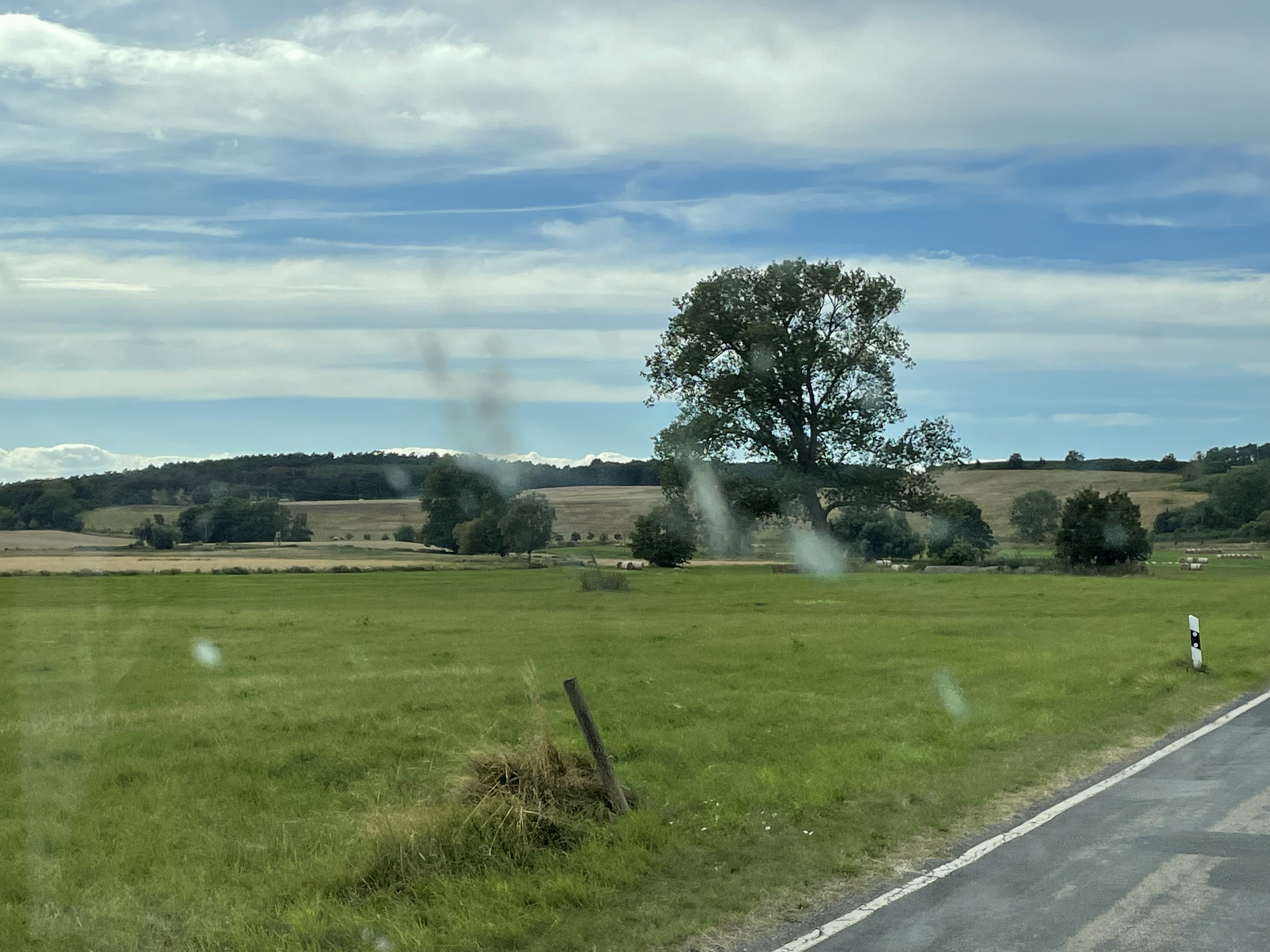
I haven’t explicitly described glacial terrains in previous posts, and this is not going to be a summary. As always, I’m only going to discuss what I saw with my own eyes. The flat, poorly drained topography of glacial areas (Fig. 1) is often interrupted by linear mounds of loose gravel, sand and silt. These features are called moraines and they are ever-present in northern Germany, especially in Usedom (Fig. 3).
The primary glacial feature I encountered on this trip is the titular Erratic–large, rounded boulders scattered around a featureless landscape (Fig. 4).

Let’s look at a couple of examples and see what they tell us about their source.

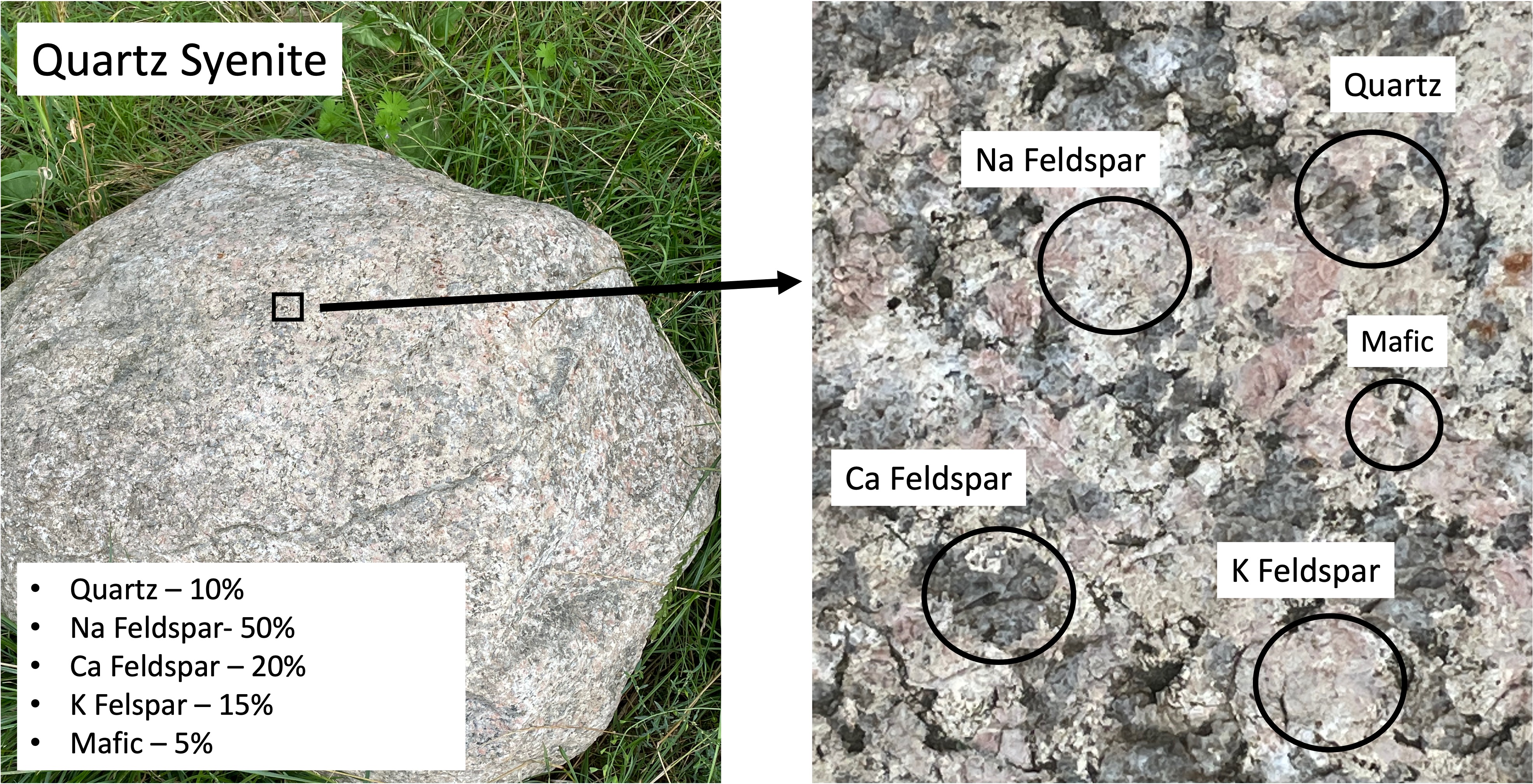
The first erratic boulder I found (Fig. 5) contains no more than 5% quartz (left photo caption), and is dominated by K-feldspar, which is unusual. The magma from which this rock formed (deep beneath the surface where it cooled for millions of years) didn’t contain very much water, which is indicated by the small amount of quartz. The chemistry of the magma is quasi-frozen in the minerals, the second-most-abundant of which is Na Feldspar. The feldspars form a continuum that depends on the relative abundance of potassium (K), sodium (Na), and calcium (Ca); K and Na both form lighter-colored minerals whereas Ca forms dark feldspar minerals. Based on the mineralogical composition of this rock (inset in left image of Fig. 5), this would be classified as a syenite (middle left side of Fig. 6).
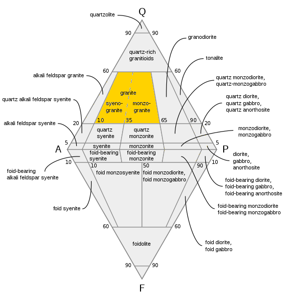
Syenites are formed in thick, continental crust. An example today would be the Alps (far beneath them) or the Himalayas, where subduction of denser oceanic crust is not occurring. In other words, the rock shown in Fig. 5 was created deep beneath the surface (~30 miles) when continents collided.
The boulders seen in Figs. 5 and 7 could have come from the same magma chamber because, as you would expect, there would be variations in local chemistry in a magma chamber tens of miles in diameter, and slow rates of convection wouldn’t mix the magma to a uniform consistency, even over millions of years. Magma, even when heated to 2000 F and buried tens of miles beneath the surface, is still thicker than molasses; it doesn’t mix well.

Phenocrysts like those seen in Fig. 8 are created in intrusive igneous rocks when they go through a multistep cooling process; for example, magma near the edge of the magma chamber loses heat to the surrounding rock and forms crystals like those seen in Fig. 8. These phenocrysts are then captured by the still-molten components of the magma and dragged along for probably hundreds-of-thousands of years (at a very slow speed, like inches per thousand years).
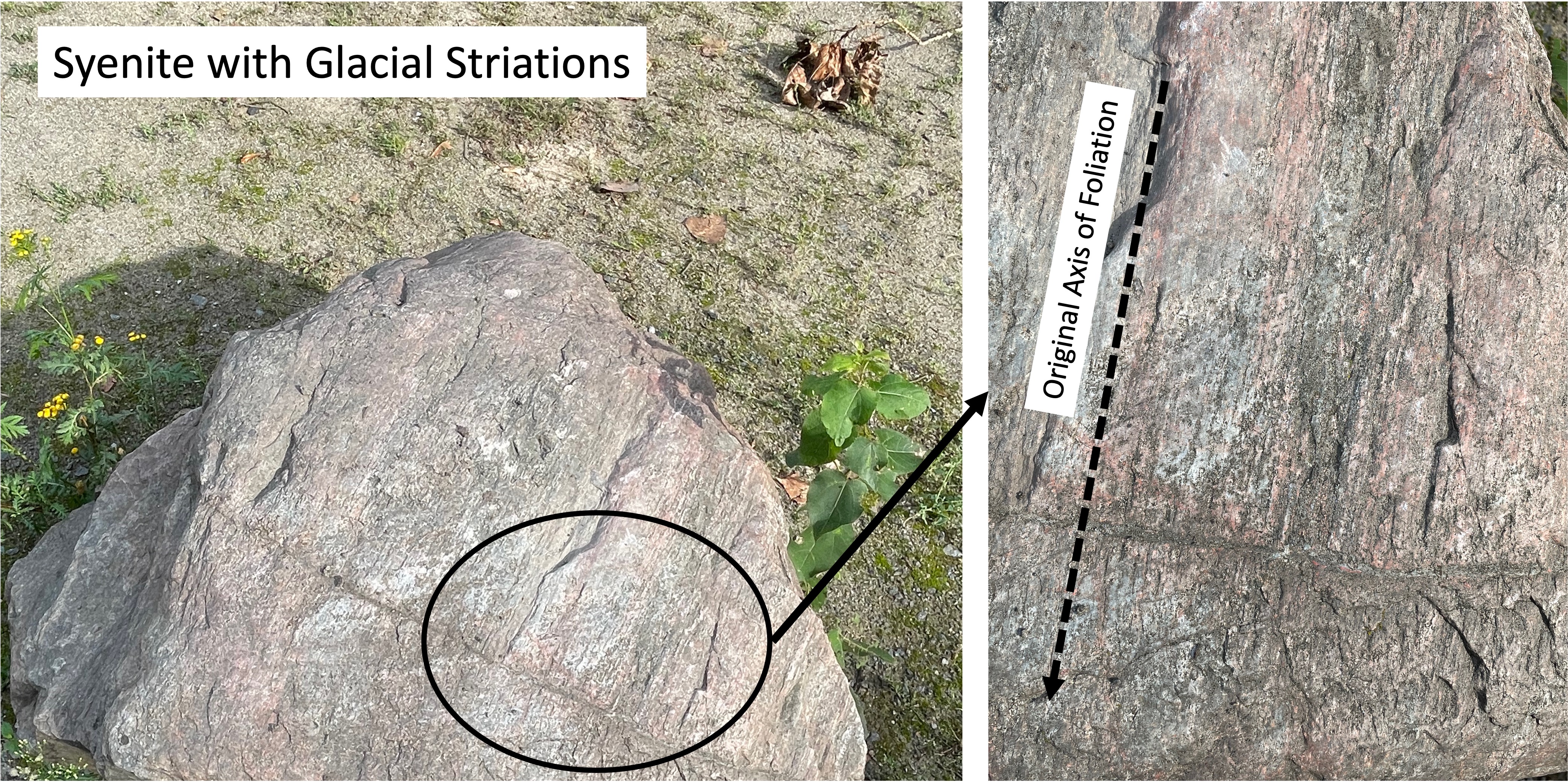
When the magma finally cools enough to become solid rock, it is uplifted as overlying rocks (of all kinds) are eroded by wind and water, not to mention ice. They are finally exposed in great mountain ranges like the Himalayas, where the rock breaks into smaller-and-smaller pieces along joints. When these pieces become small enough to be transported at the base of glaciers (you’ve heard the phrase glacially slow), they are dragged along, scraping over more rocks, sand, and gravel, which leaves evidence of their precarious journey (Fig. 9).

This post has been erratic, starting out looking at a glacial terrain (Figs. 1-4), then taking a detour into igneous petrology, the chemistry of magmas, and mineralogy, with a little plate tectonics thrown in. That’s how geology is; everything is an ongoing process that never quite reaches equilibrium (e.g. the phenocrysts in Fig. 8), and the journey is unending.
I didn’t investigate the origin of the syenite boulders examined in this post, but (if memory serves) they match the mineralogy of intrusive rocks from Sweden, which is a long way from Usedom.
Stockholm is about 500 miles north of Usedom…

Trackbacks / Pingbacks