
The Rest of the Story: The Harz Mountains
This post is a continuation of previous posts on northeast and central Germany, but we won’t be seeing direct evidence for glaciers in the Harz Mountains (Fig. 1).
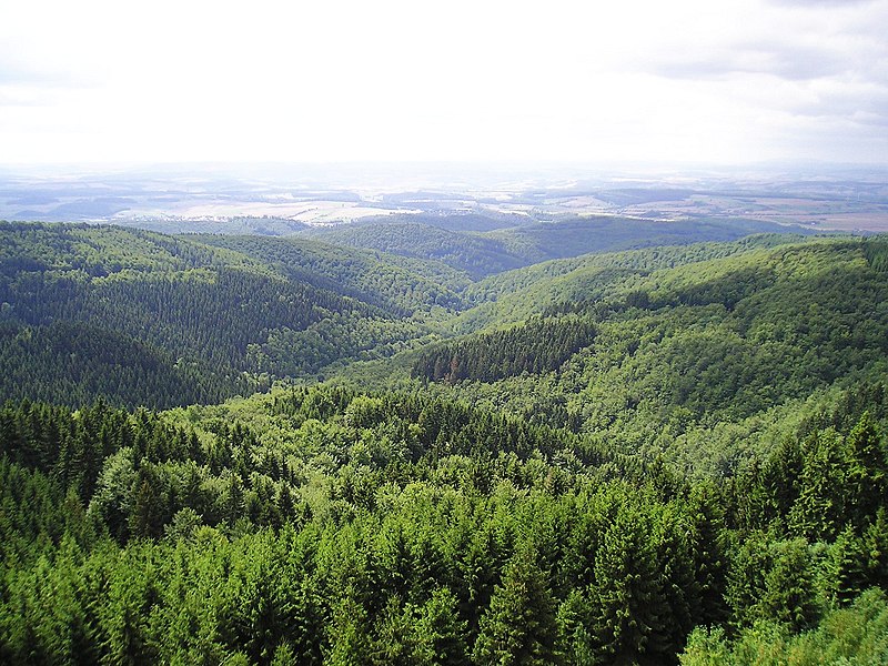
Today’s post discusses some of the rocks exposed in the valleys, gorges, and road cuts that dissect the Harz Mountains (Fig. 2).

We approached the Harz uplands from the east (site A in Fig. 2), where we encountered mines based on removing sedimentary rocks for use as building material (Fig. 3).

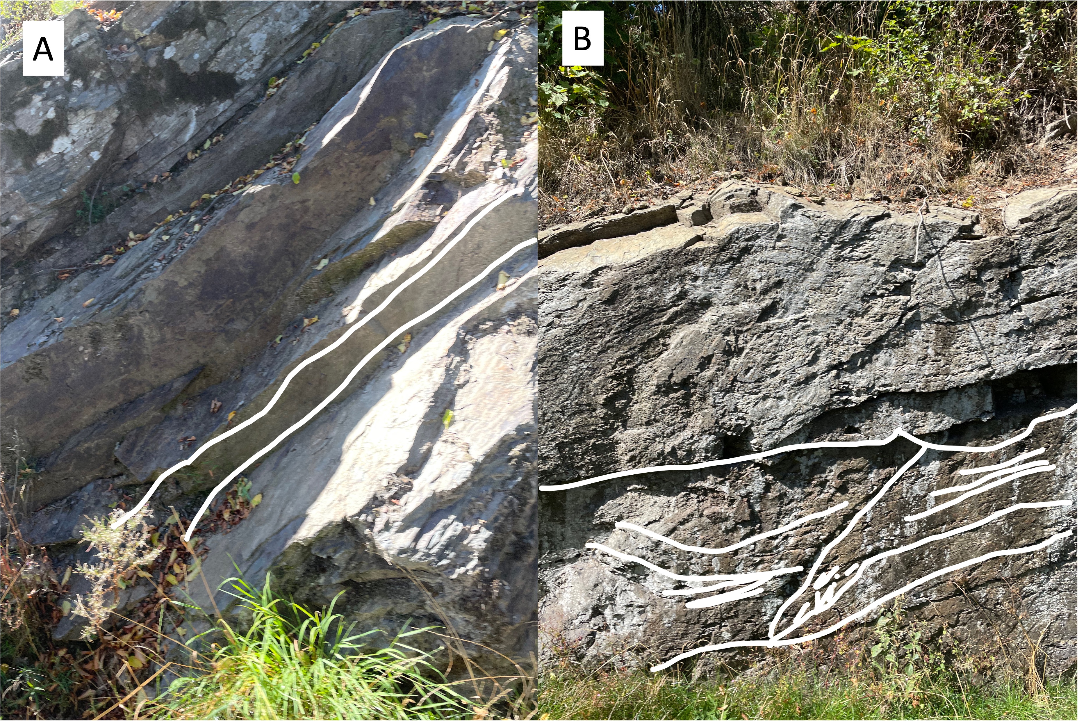
The mines in Fig. 3 were removing desired beds from the Tanner Graywacke ( age ~360-320 Ma), a poorly mixed sedimentary rock (e.g. graywacke) originally deposited in ocean trenches associated with volcanic island arcs. The Tanner graywacke ranges from mudstone to conglomerate. It forms medium beds with variable texture, and has been tilted to varying degrees (Fig. 4).
Our route east of the Harz Mountains (red line in the inset of Fig. 2) took us to site B, where we encountered more facies of the Tanner Graywacke (Fig. 5).

Our path (red line in Fig. 2 inset) led us into a valley between the small highlands where Figs. 4 and 5 were taken. This valley is filled with a lake, and probably follows a fault zone between Site B and the main Harz Mountains to the north (Fig. 6).

Our journey followed the southern margin of the Harz Mountains (red line in Fig. 2 inset), taking us by Site C, where we found nearly horizontal beds of Tanner Graywacke exposed along road cuts. We couldn’t stop until we found a rest area, where a large block was available for close examination (Fig. 7).

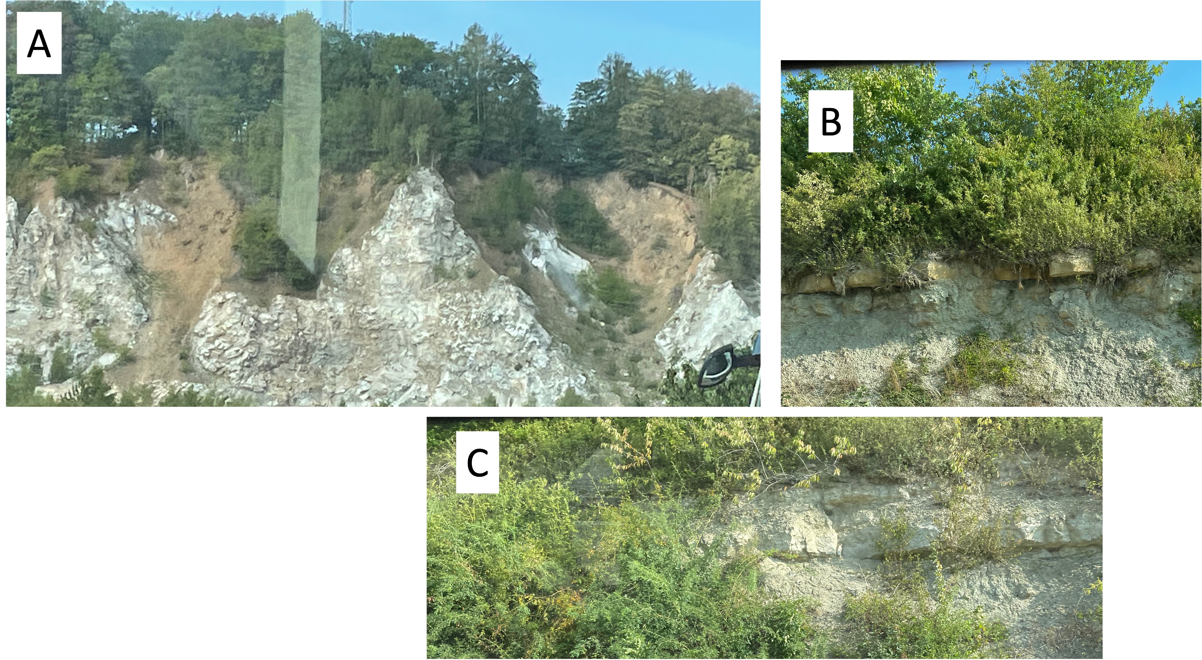
We continued around the western end of the Harz Mountains and found exposures of the marine deposits (including evaporites and carbonates) that underlay the town of Kelbra (Fig. 6), including a thick sequence of either salt or anhydrite (Fig. 8).
This post reveals rocks that are widely separated in time while being found near each other, supporting the Harz uplift as they do (Fig. 2). As the title of this post suggests, geology is not a series of isolated events. Let’s get the rest of the story.
The Tanner Graywacke was deposited in an island arc, a tectonic region in which oceanic crust is being subducted beneath either a continental (or less often an oceanic) tectonic plate, about 350 million years ago. What was happening on the opposite shore of this proto-Atlantic ocean (aka Iapetus)?
I have encountered rocks of similar age in northern Virginia and discussed them in previous posts. On the west side of Iapetus, during a mountain-building event called (in America) the Acadian Orogeny, a series of island arcs were being subducted/accreted to form a series of suspect terranes. This orogeny was only a phase of the collision of Laurentia (porto-north America) and Avalon (proto-Europe), which endured for most of the Paleozoic era.
The next problem is what happened during the ensuing 100 million years, between deposition of the Tanner Graywacke and the evaporites and carbonates we encountered west of the Harz uplands (Fig. 8)? The collision was completed and Pangaea had been born of two continents…
The mountains rose and they were eroded almost as quickly by wind, rain, and ice, creating massive layers of sediment to the east (modern Europe) and the west (e.g. the Catskill Delta in New York). By 230 million-years ago, the earth’s upper mantle changed its mind and tore the newly formed supercontinent apart, creating rift valleys like that of East Africa in what is now Virginia. Splitting a continent can take as long as building one, but this was a relatively rapid event in geological time; by 200 million-years ago, diabase dikes were injected into the sedimentary and metamorphic rocks created by the closing of the porto-Atlantic Ocean (Iapetus) and the split was well under way. Alluvial and fluvial sediments were collecting in isolated basins in what is now Virginia, and evaporites were settling to the bottom of lakes and brackish coastal waters in Europe, as the ocean invaded…
Jump ahead 200 million years…
I love it when I can understand what the rocks are telling me…
The Forest and the Trees: Glacial Topography of the Central German Plain

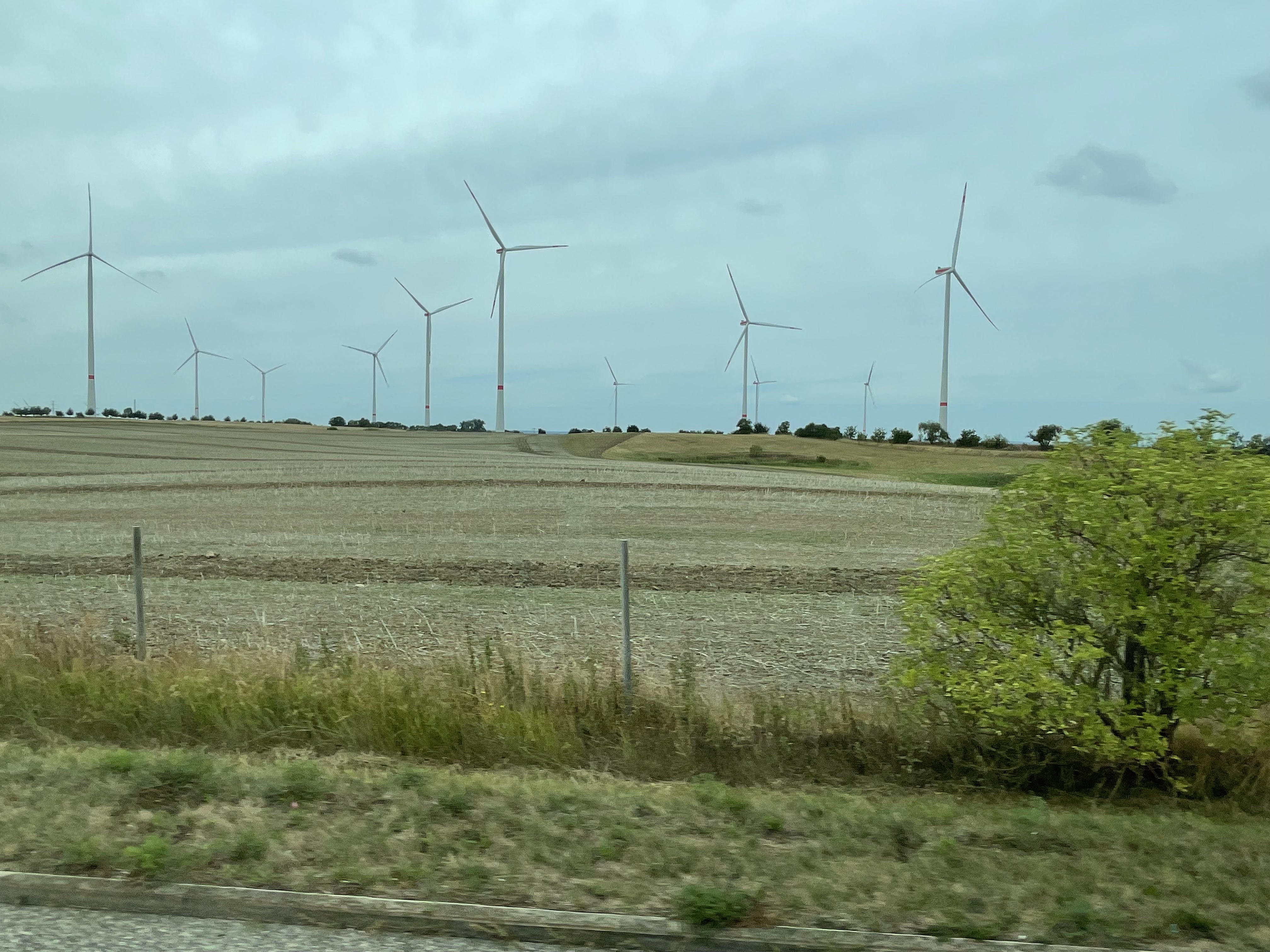
The wind blows pretty steady over the North German Plain and Central Uplands, so there are wind turbines everywhere, scattered among the hay fields (Fig. 1).

The topography of the Central Germany Plain is very similar to Nebraska, Kansas, and the Dakotas, because they were all created by the advance and retreat of multiple glaciers during the Pleistocene Ice Age. As we saw in the last post, advancing ice sheets as thick as a mile push rock and soil in front of them, before melting back for a few millennia, leaving piles of soil and boulders behind. They are like gigantic bull dozers.
As ice slides over the landscape, scraping off whatever gets in its way, the ice at its base can melt from the friction, creating streams that transport already ground-up rocks. The usual rules of sedimentology apply to these ice-encased streams. They can deposit their sediment load as eskers, which identify these sub-glacier streams, or as piles of scraped-off soil (terminal moraines). I don’t know which I’m looking at in Fig. 4, but this image gives a good impression of their impact on the landscape. Keep in mind that the ice was approximately ONE-MILE thick above the landscape shown in Fig. 4…

As I alluded to in the previous post, geology isn’t a sequence of static processes; there is always more than one cause of what we see today, and none of them are stationary. Thus, the landscape produced by the continental glaciers that advanced over the Central German Plain during the Pleistocene were constantly in competition with alpine glaciers created in the valleys and peaks of the Alps. The huge ice sheets had the power to overcome any obstacle…but they couldn’t surmount the steep slopes of the Alps.
The glaciers that originated in the Alps waited until the last retreat of the great ice sheets that originated in Scandinavia, before they could make their play in the Holocene. Vast quantities of easily weathered feldspar were washed down their steep slopes into a panoply of rivers, which cut through the moraines left behind during the retreat of the continental ice sheets, creating broad river valleys like that of the Saale River (Fig. 5). Germany’s central plain and uplands were cut to ribbons by these growing streams, resulting in one of the most water-navigable regions in the world.
You always have to watch your back…
An Erratic Path: Glacial Geology in Usedom, Germany
This post finds me on the Baltic Sea, although I never actually saw it first hand. But this report isn’t about coastal geology; instead, I will be talking about an unusual feature of glacial terrains.


I haven’t explicitly described glacial terrains in previous posts, and this is not going to be a summary. As always, I’m only going to discuss what I saw with my own eyes. The flat, poorly drained topography of glacial areas (Fig. 1) is often interrupted by linear mounds of loose gravel, sand and silt. These features are called moraines and they are ever-present in northern Germany, especially in Usedom (Fig. 3).
The primary glacial feature I encountered on this trip is the titular Erratic–large, rounded boulders scattered around a featureless landscape (Fig. 4).

Let’s look at a couple of examples and see what they tell us about their source.

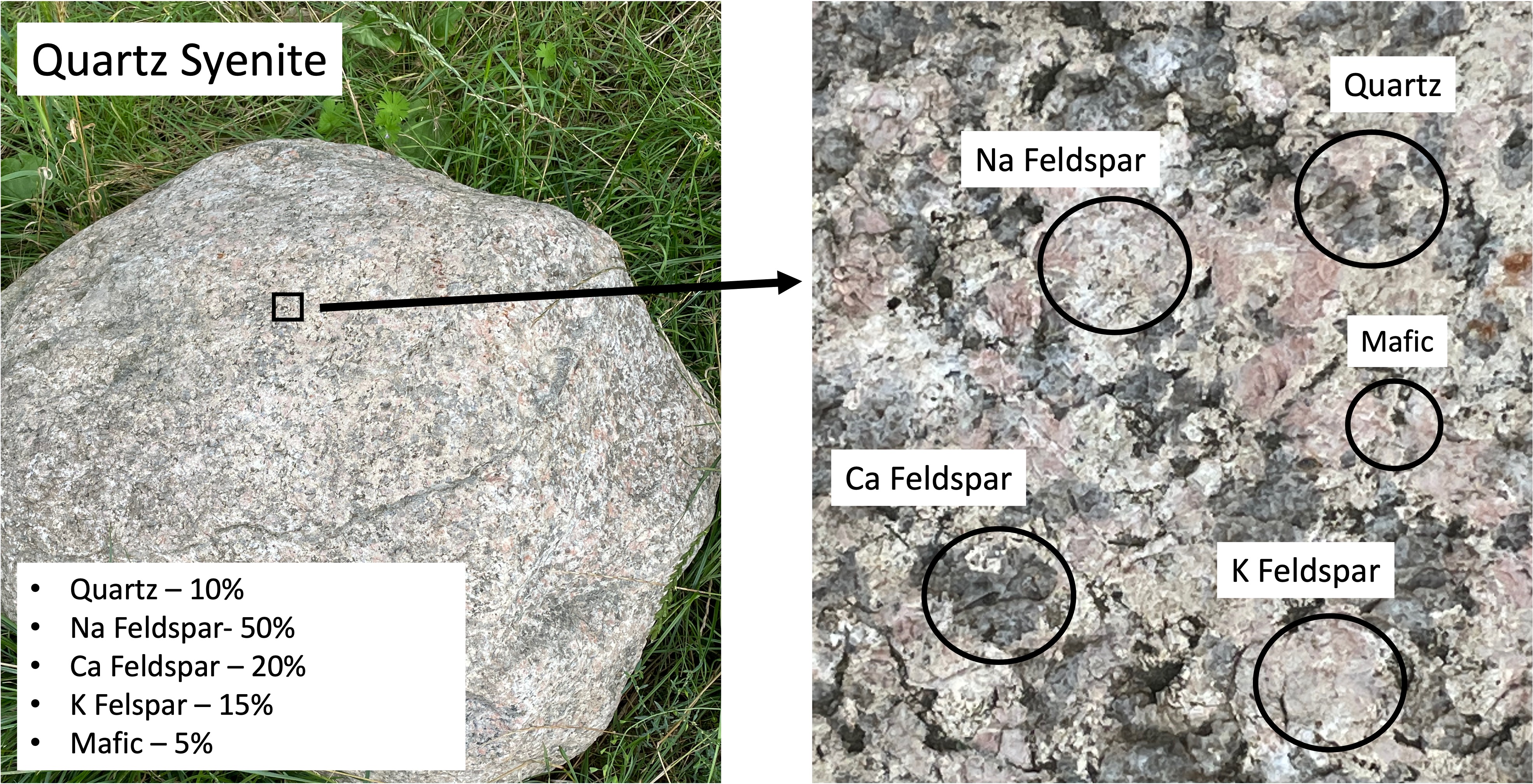
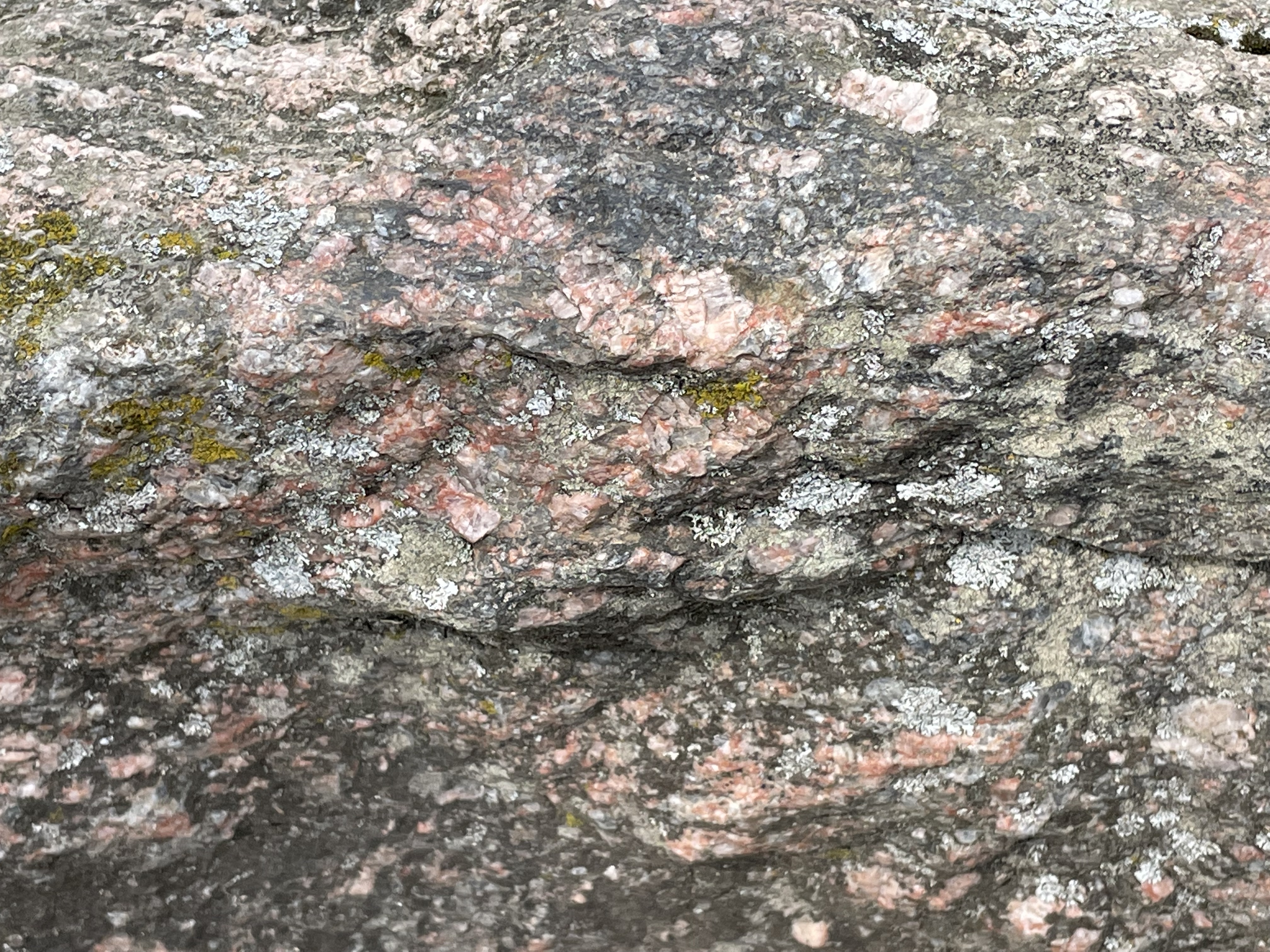
The first erratic boulder I found (Fig. 5) contains no more than 5% quartz (left photo caption), and is dominated by K-feldspar, which is unusual. The magma from which this rock formed (deep beneath the surface where it cooled for millions of years) didn’t contain very much water, which is indicated by the small amount of quartz. The chemistry of the magma is quasi-frozen in the minerals, the second-most-abundant of which is Na Feldspar. The feldspars form a continuum that depends on the relative abundance of potassium (K), sodium (Na), and calcium (Ca); K and Na both form lighter-colored minerals whereas Ca forms dark feldspar minerals. Based on the mineralogical composition of this rock (inset in left image of Fig. 5), this would be classified as a syenite (middle left side of Fig. 6).
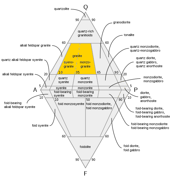
Syenites are formed in thick, continental crust. An example today would be the Alps (far beneath them) or the Himalayas, where subduction of denser oceanic crust is not occurring. In other words, the rock shown in Fig. 5 was created deep beneath the surface (~30 miles) when continents collided.
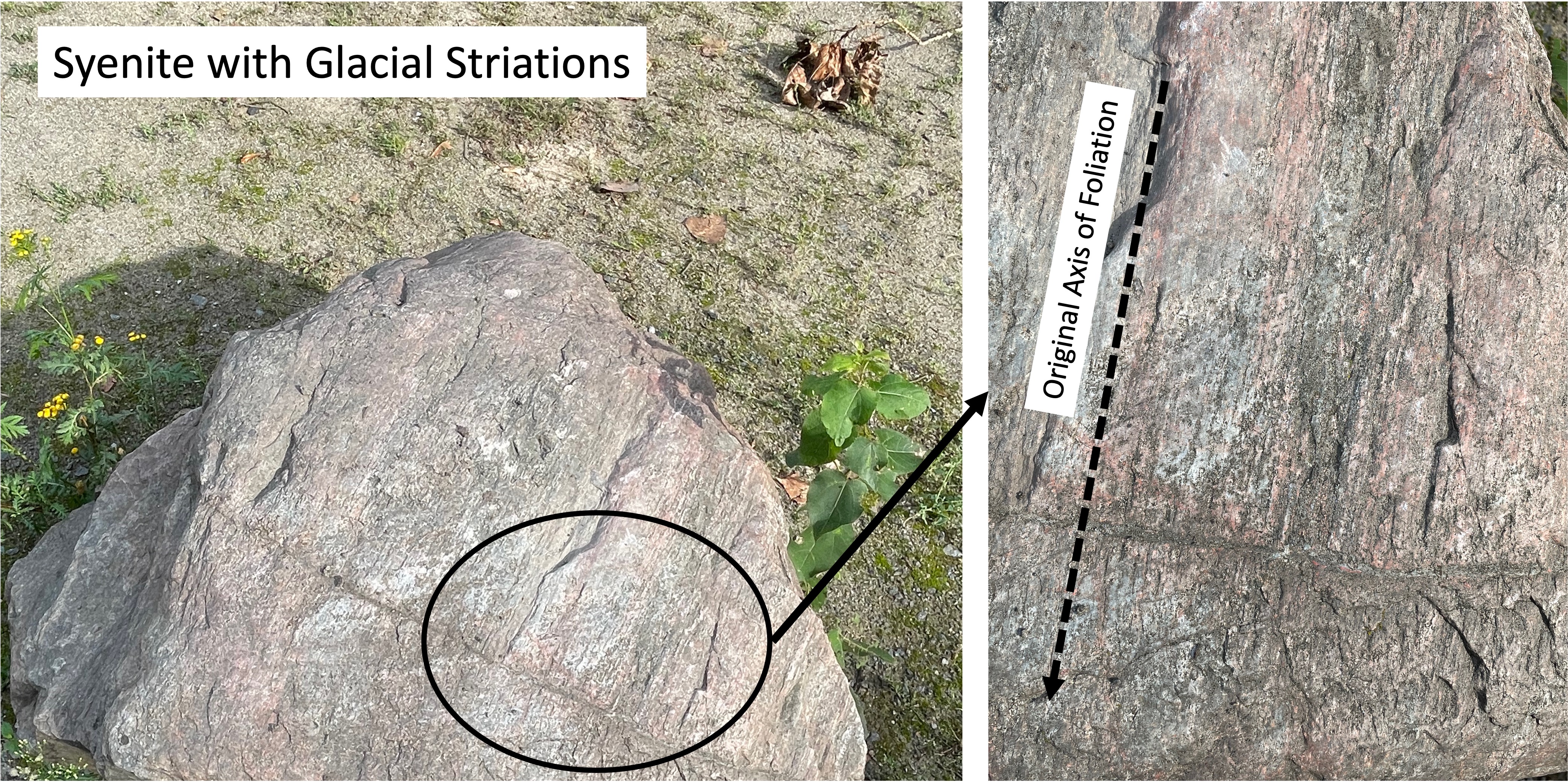
The boulders seen in Figs. 5 and 7 could have come from the same magma chamber because, as you would expect, there would be variations in local chemistry in a magma chamber tens of miles in diameter, and slow rates of convection wouldn’t mix the magma to a uniform consistency, even over millions of years. Magma, even when heated to 2000 F and buried tens of miles beneath the surface, is still thicker than molasses; it doesn’t mix well.

Phenocrysts like those seen in Fig. 8 are created in intrusive igneous rocks when they go through a multistep cooling process; for example, magma near the edge of the magma chamber loses heat to the surrounding rock and forms crystals like those seen in Fig. 8. These phenocrysts are then captured by the still-molten components of the magma and dragged along for probably hundreds-of-thousands of years (at a very slow speed, like inches per thousand years).
When the magma finally cools enough to become solid rock, it is uplifted as overlying rocks (of all kinds) are eroded by wind and water, not to mention ice. They are finally exposed in great mountain ranges like the Himalayas, where the rock breaks into smaller-and-smaller pieces along joints. When these pieces become small enough to be transported at the base of glaciers (you’ve heard the phrase glacially slow), they are dragged along, scraping over more rocks, sand, and gravel, which leaves evidence of their precarious journey (Fig. 9).

This post has been erratic, starting out looking at a glacial terrain (Figs. 1-4), then taking a detour into igneous petrology, the chemistry of magmas, and mineralogy, with a little plate tectonics thrown in. That’s how geology is; everything is an ongoing process that never quite reaches equilibrium (e.g. the phenocrysts in Fig. 8), and the journey is unending.
I didn’t investigate the origin of the syenite boulders examined in this post, but (if memory serves) they match the mineralogy of intrusive rocks from Sweden, which is a long way from Usedom.
Stockholm is about 500 miles north of Usedom…
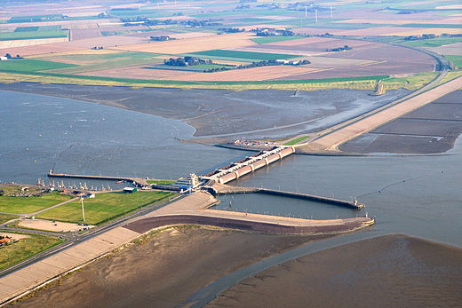
Eidersperrwerk: Keeping Out the North Sea
My last post explored the mud flats bordering the North Sea in northern Germany, where we found conflicting methods applied to control and protect the levee system. This post investigates more aggressive measures implemented at the mouth of the Eider River. We will briefly look at the Eidersperrwerk, a gate system designed to control both storm surge incursion up the Eider, and river outflow
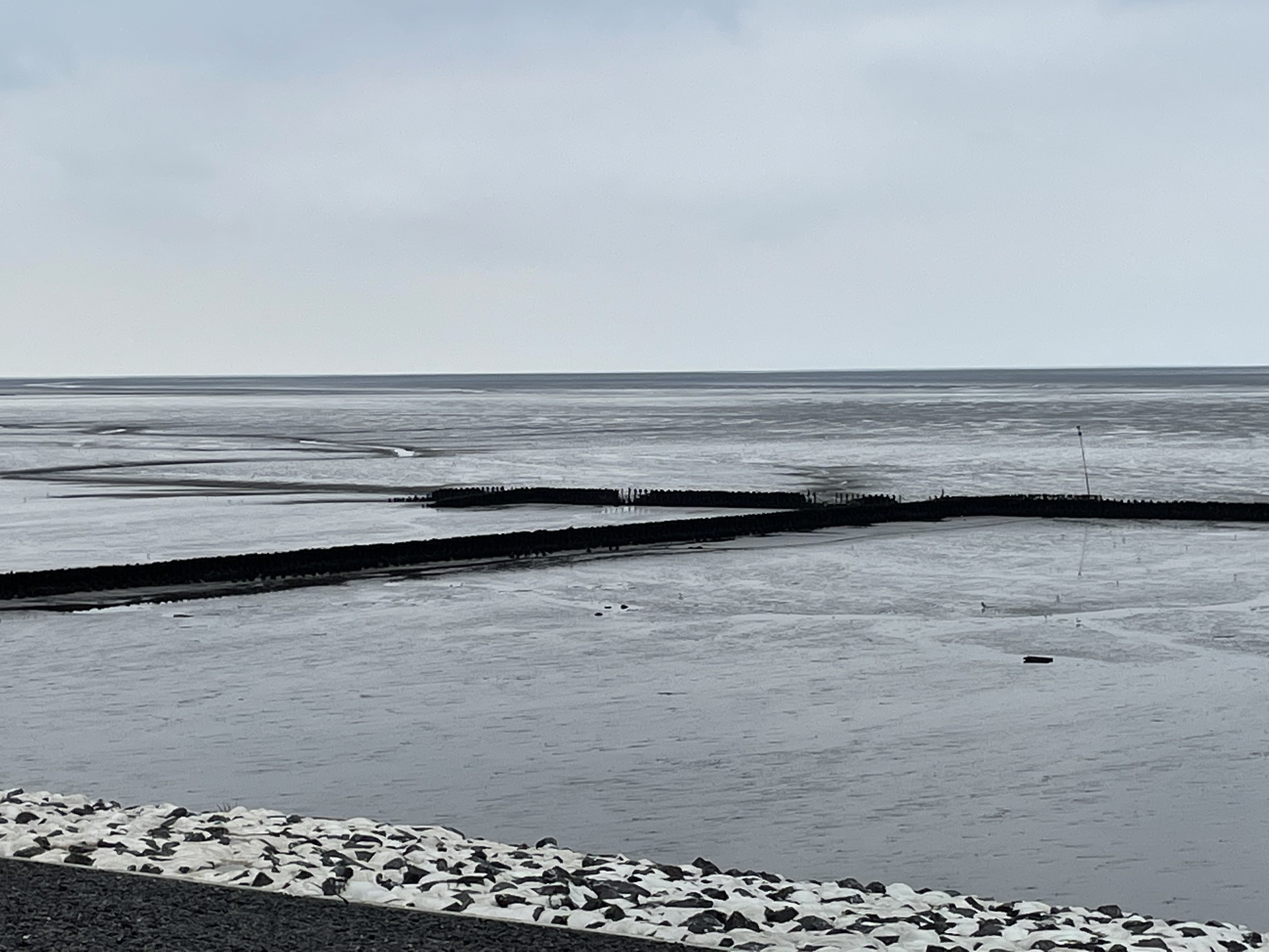
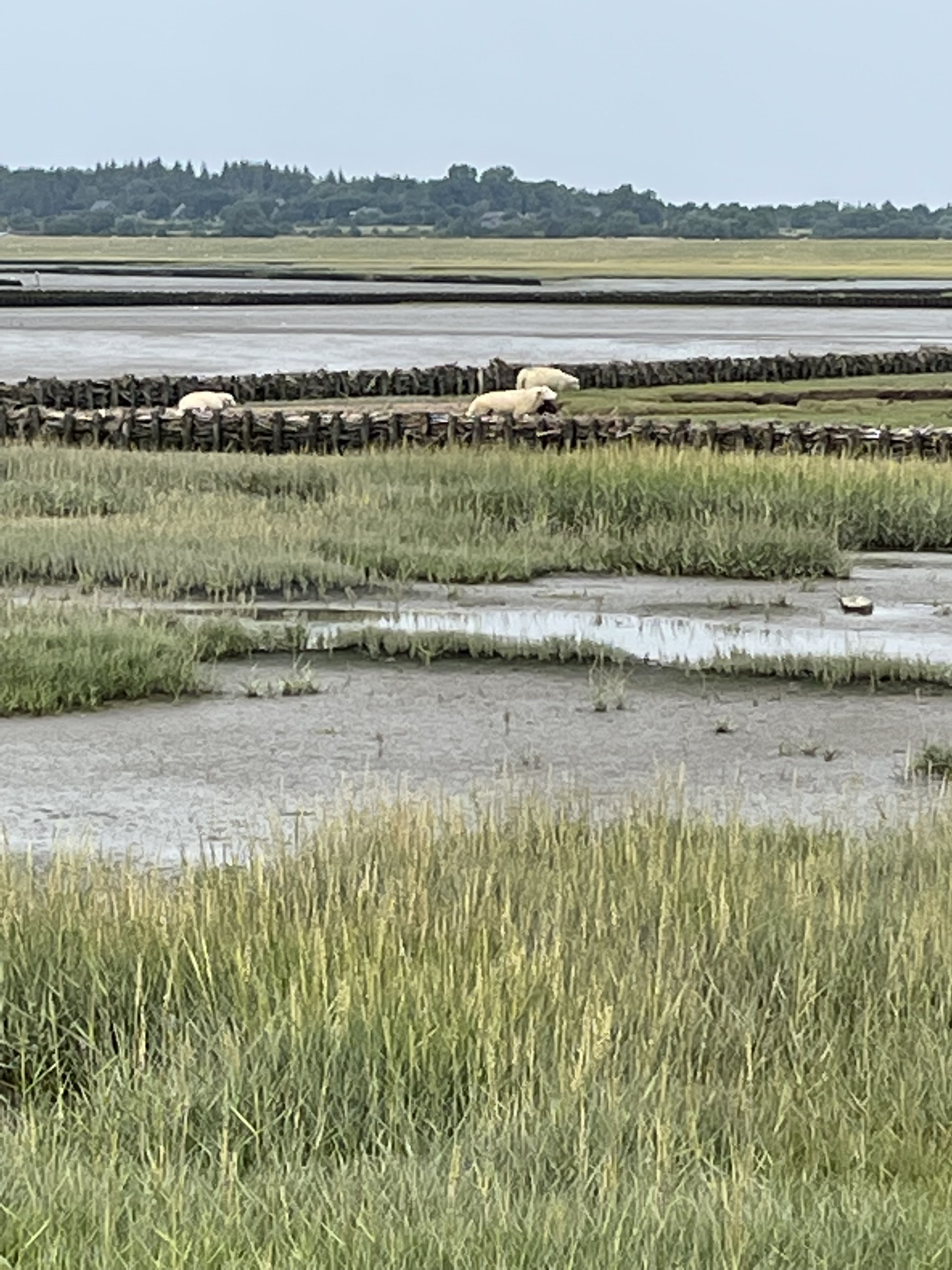
We will focus on the seaward mud flats in this post. Let’s take a look at the south side of the river first (upper-right of Fig. 1).


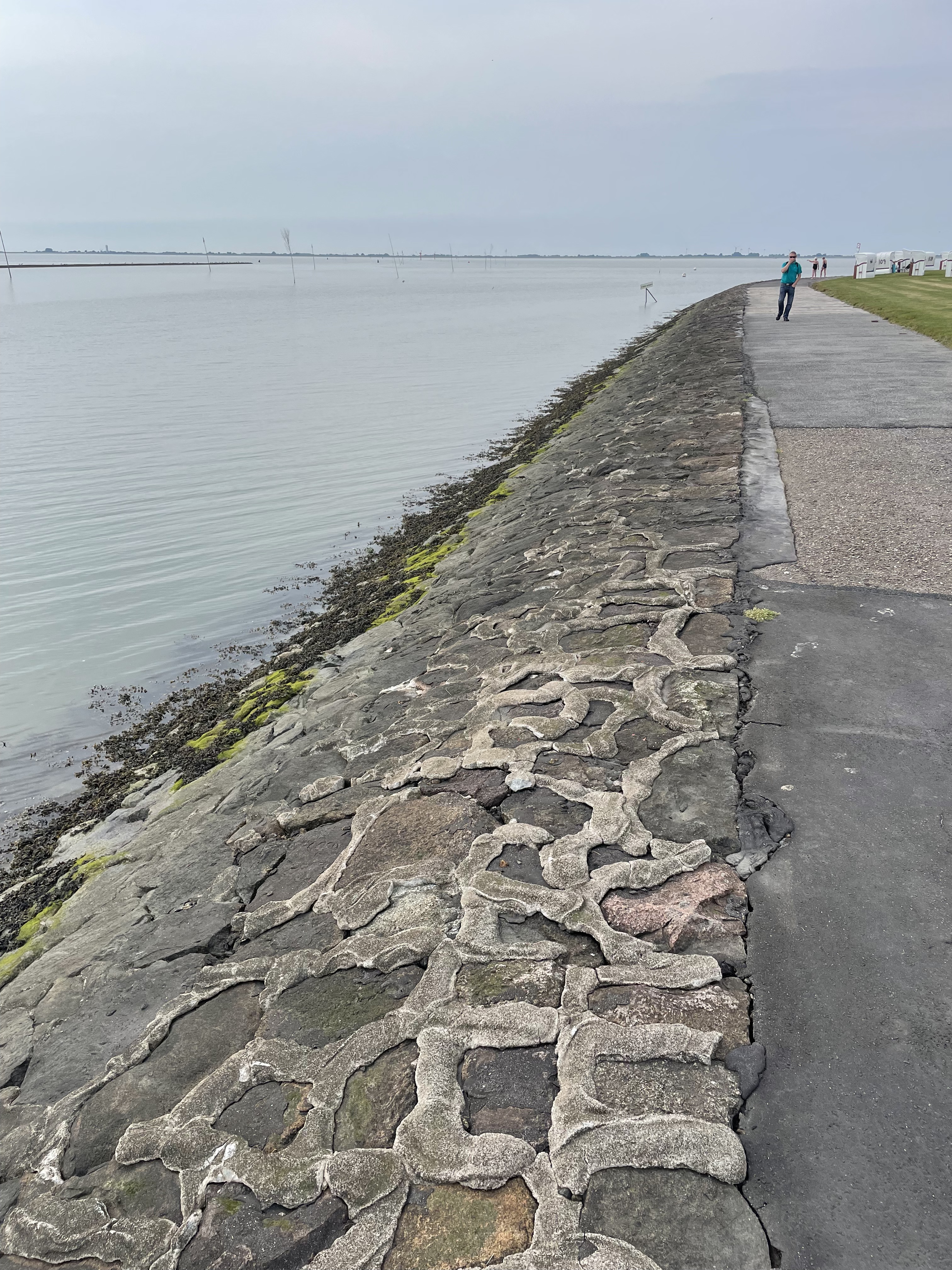
Comparing Fig. 1 to Figs. 2 and 5-8, we can see the effects of years (probably decades), during which interval the northern margin of the river mouth filled with sediment and grass was established (Fig. 5). Subsequently, it seems that erosion removed some of this soil and grass (Fig. 6). Meanwhile, storms have been slowly wearing away the boulders armoring the base of the levee (Fig. 8) and a semipermanent fair-weather berm was constructed (compare Figs. 1 and 7).
In summary, something appears to have changed in the dynamic environment around the mouth of the Eider. It should come as no surprise that constructing a gate system and cutting off a major sediment supply for at least half the time had dramatic effects on the nearshore. Mud flats are very sensitive to sediment supply, and it could have been either reduced alongshore transport from the north, or the almost-complete denial of rive-borne mud that led to the current situation.
Some scientists propose that storminess varies on many scales, from decadal to millennial as climate fluctuates…
Coastal Restoration on the North Sea
Today’s post takes me to the North Sea coast of Germany, the city of Husum, and to one of the famous mud flats from the region. Rivers running from the Alps drain Germany, transporting mud (silt and clay) to the north coast, where it is transported along the coast and stirred around by strong tidal flows. We are going to look at efforts to stop dramatic erosion caused by a reduction of sediment input, because of dams and coastal construction, leading to a serious threat to the levee protecting Husum from the North Sea (Fig. 2).
The mud flats schematically shown in Fig. 1 are covered with fence-like structures designed to catch mud brought in the the high tide (Fig. 3).

A quick look at the past. This area was covered by glaciers that filled the North Sea and transported rocks from Sweden to the north. These glacial erratics are rounded and scattered around the land in a random manner (thus the name). We found one used as street decoration in Husum (Fig. 4).
In addition to boulders transported during the ice ages (less than a million years old), there are remnants of sandy sediment from the Quaternary, before the area was overwhelmed by mud (Fig. 5).
The result of the sediment retention project can be seen in Fig. 6.

This are represents an attempt to reconcile the problem of coastal development (the port of Husum ships out grain) and the protection from storm waves provided by a wide mud flat (which dissipates wave energy). Another issue is the encroachment of sheep grazing, which appears to be legal (there are fences and gates, etc). And then there is entertainment; this is a popular swimming location during high tide. Not to mention environmental degradation and fish hatcheries. Several attempts at mixing these applications can be seen in the hardened and dredged channel leading to the port (Fig.7), and buried groins which were apparently intended to keep the shipping channel open (Fig. 8).

It is difficult to reconcile the many uses the coastline is required to fulfill. This trip revealed that it is unreasonable to mix methods designed to preserve the status quo (Figs. 7 and 8), and those intended to change it (eg. Fig. 6), especially when these techniques are mixed (Fig. 3). A difficult decision will have to be made soon, or the levee protecting the bustling cit of Husum will be in danger of breach during a severe storm, which is becoming more common in the North Sea.
The Last Few Miles
This is going to be a brief post, mostly because it is very difficult to convey what I want to communicate in photographs; the camera lens (on my iPhone) simply doesn’t capture image depth well. For example, Fig. 1 was actually pretty steep, but it looks as unintimidating as my driveway.
I’ve been talking about the bedrock exposed along the bed of the Potomac in several posts (e.g., Geological Bottleneck and Great Falls), but those are specific locations. Those significant drops in river elevation are part of a larger pattern, one that is displayed even at the scale of Fig. 1. It doesn’t take much of a drop to generate enough potential energy to spin a waterwheel (Fig. 3), which can do a wide variety of work–from grinding corn, to operating a machine shop.

The staircase structure of streams along the transition from crystalline rocks to coastal plains (aka the Fall Line) is so important to the ecosystem that artificial barriers were constructed within the park to ameliorate the impacts of road and bridge construction (Fig. 4).

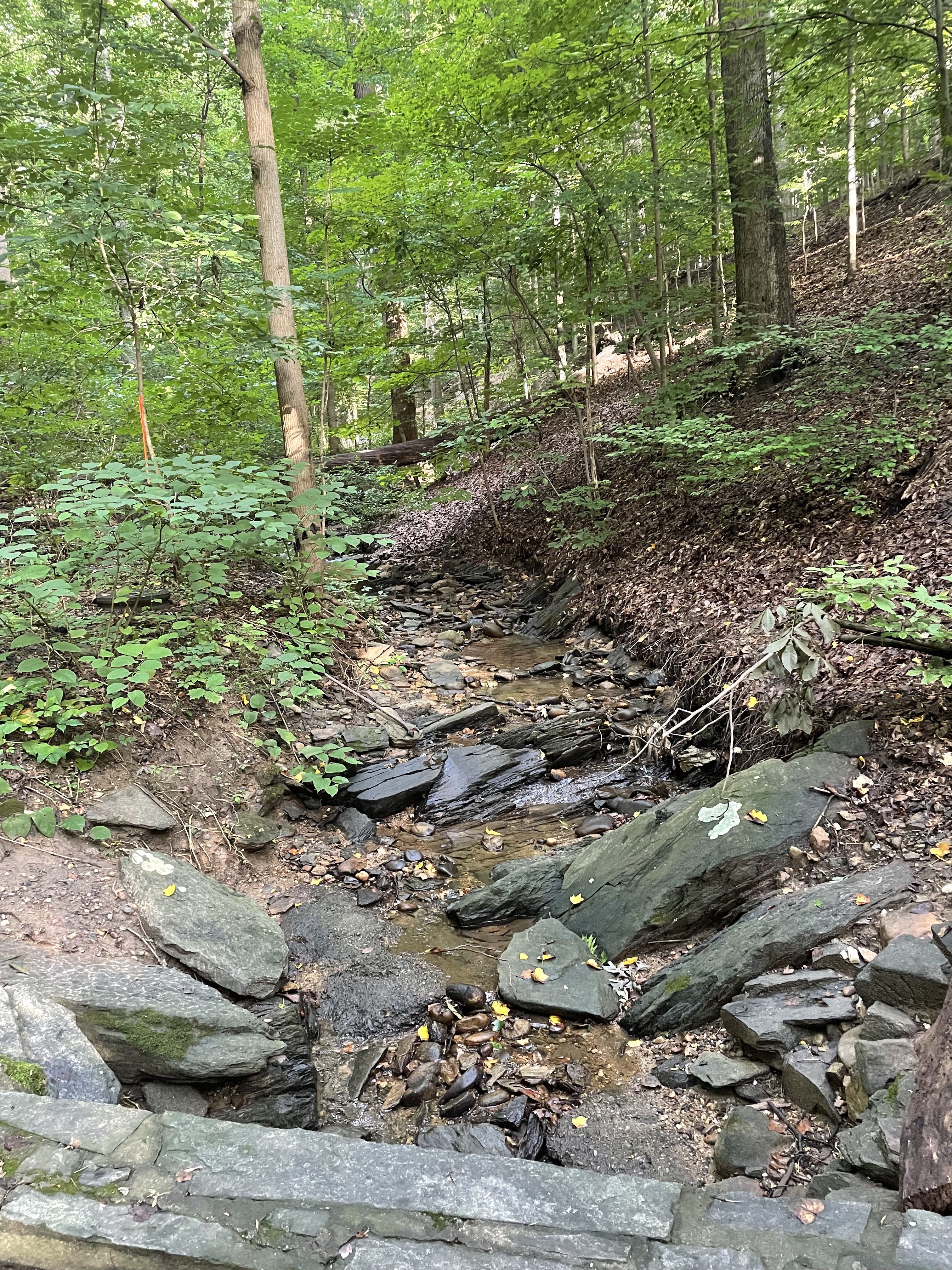
Rock Creek National Park deserves its name, not just because of its rock bed. Cambrian sedimentary rocks exposure along the steep tributaries leading to the creek (river?) suggest that bedrock lies not very far beneath our feet (Fig. 5).

Water has been struggling with rocks for the last 200 million years, always trying to reach the sea. It exploits every nook and cranny in the bedrock until it forms a stream, then a river, and it cannot be stopped. Thanks to the perseverance of water, driven by the steady pull of gravity, the first European immigrants to North America were able to establish a toe hold on what was (to them) a new land…
Ball’s Bluff Battlefield Requiem
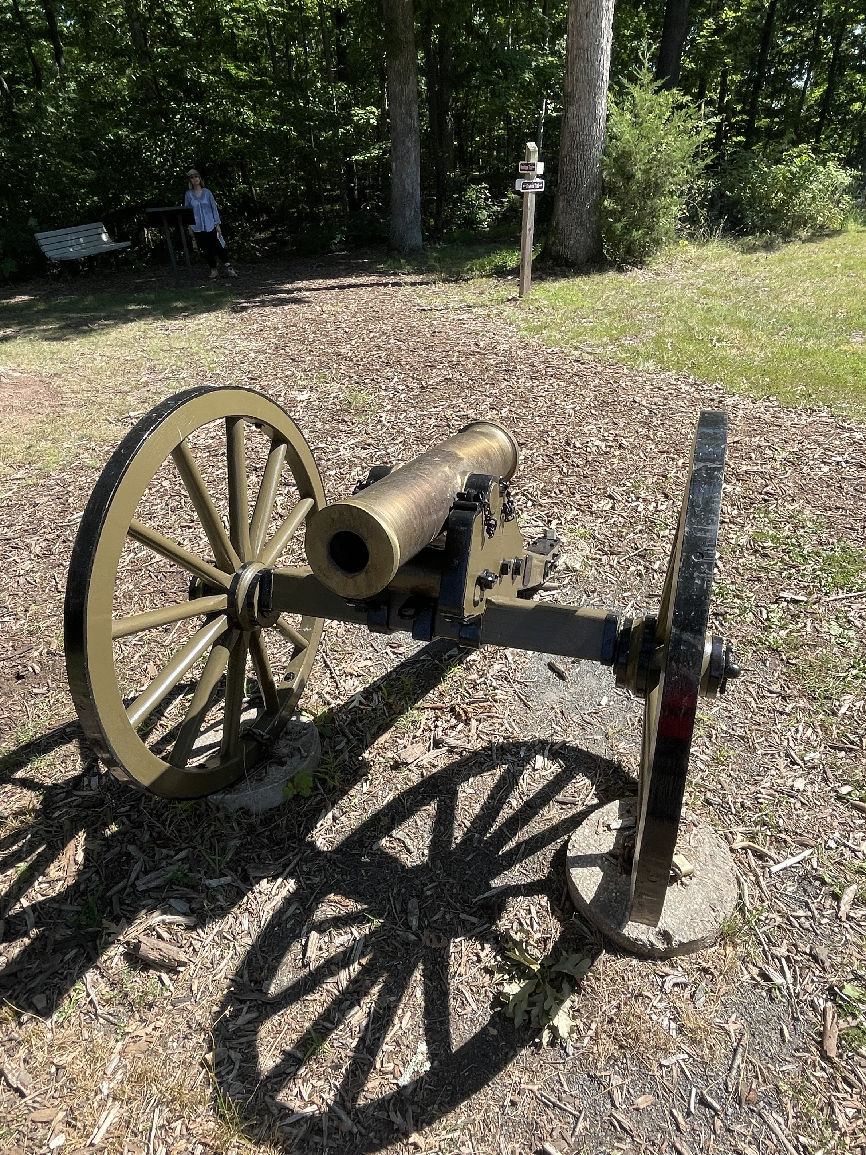
I reported on the geology of this area in a previous post, but I didn’t have much time to explore the area on that outing, so this trip I followed trails all the way around the park. This was the site of a battle early in the American Civil War, October, 1861. The cannon (Fig. 1) is a metaphor of how geology is always in front of us; it isn’t just about really old rocks, but also rivers and beaches, even gas and lava being belched out by volcanoes. That’s all geology too. For example, this battle took place in a field (Fig. 2) .
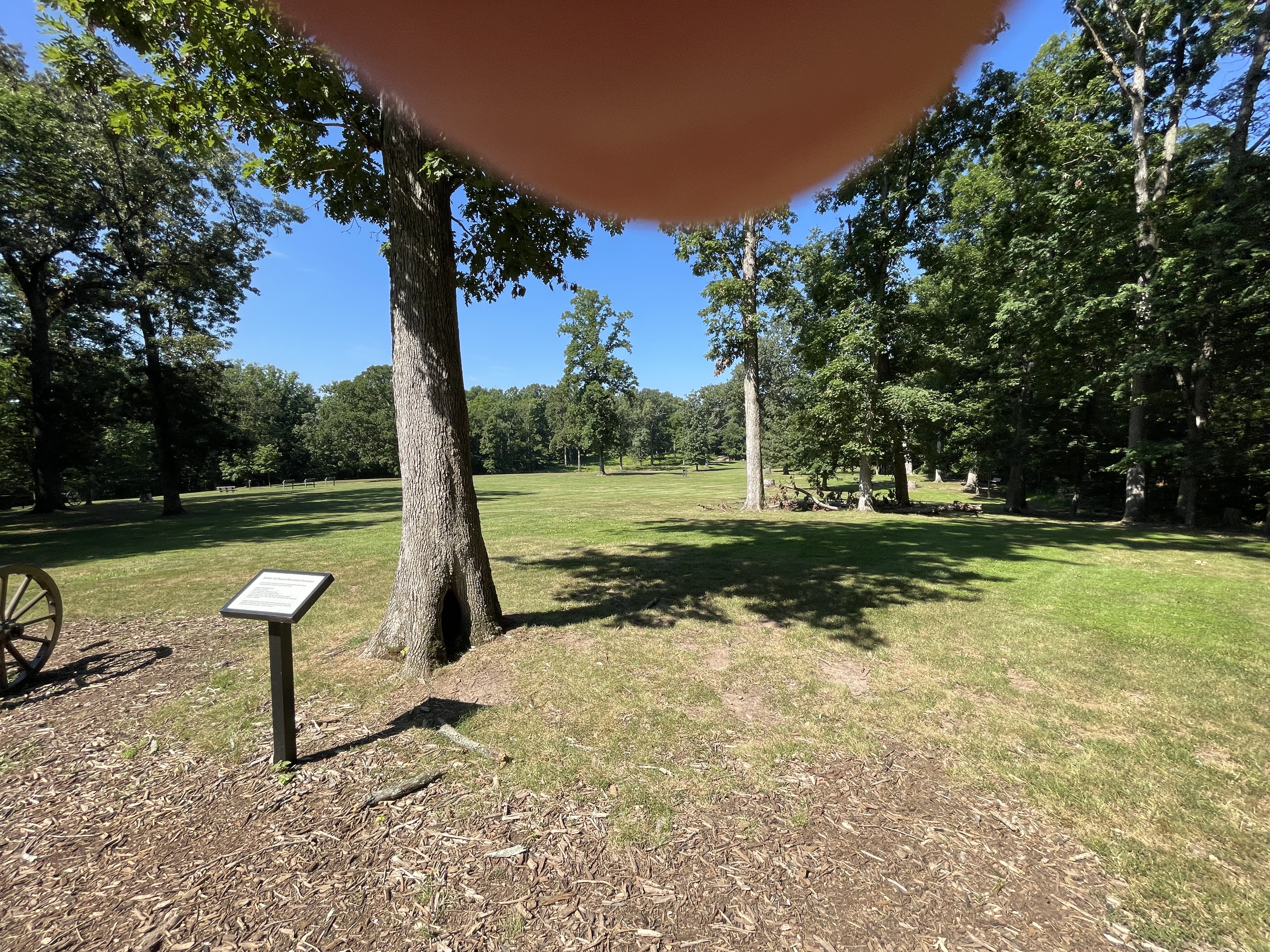
There isn’t much arable land along the Potomac River here because of the rocky soil, but there are a few pockets of land suitable for farming–flood plains left as reminders of the ancient river’s meandering, while it cut its way through rock, gravel, and mud to reach its current position (Fig. 3).

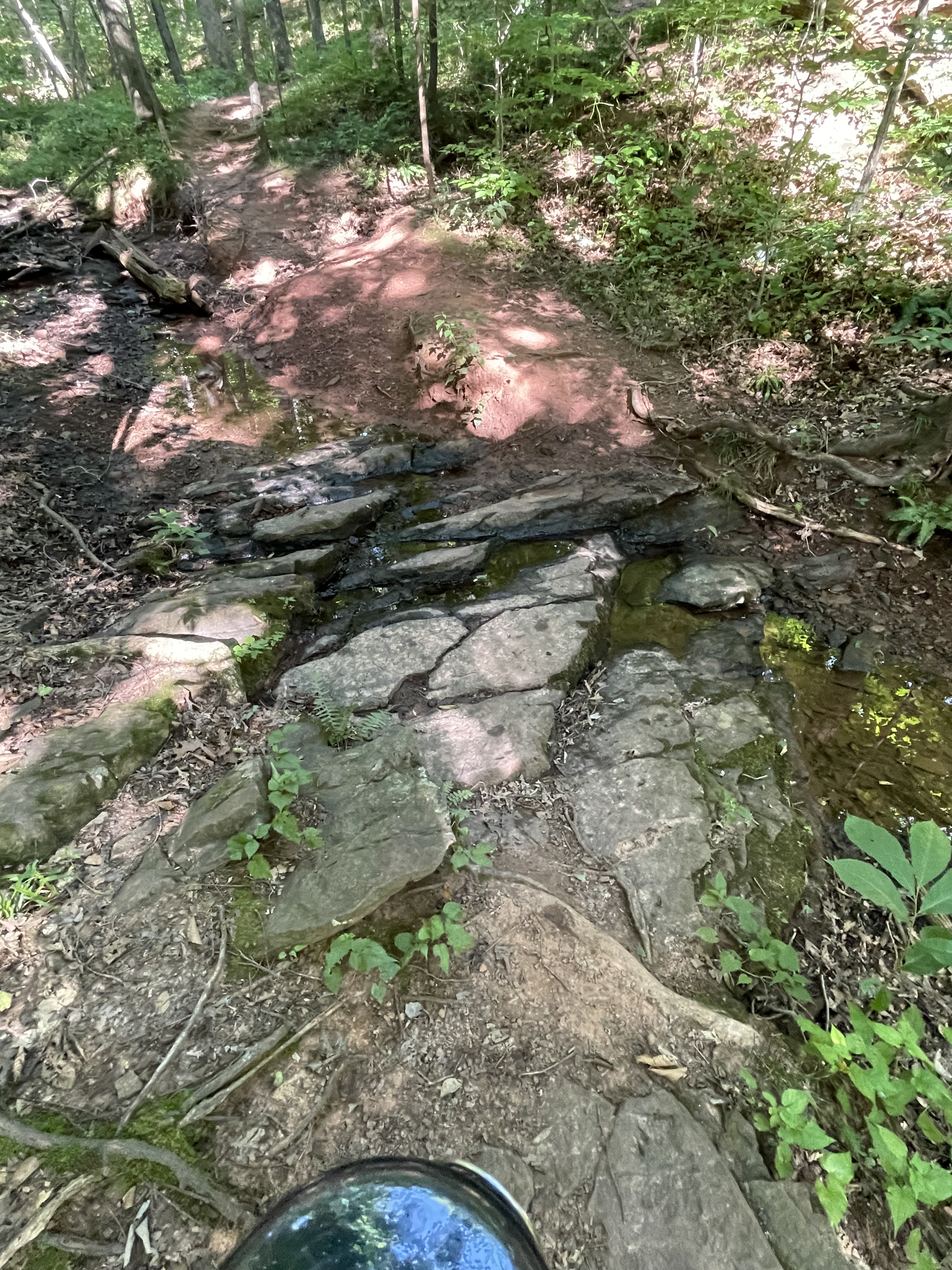
The bottoms of the gullies were paved with tilted layers of sandstone and siltstone (Fig. 4), sediment originally deposited in intermontane basins like those that occur in western North America (Fig. 5).

I’d like to finish this post with a thought experiment: Imagine the sediments being carried away from the camera in Fig. 5, passing into the distance to collect in the wide valley that fronts the major fault-block mountain range, seen in the distance; now, imagine everything you see in Fig. 5 being worn down by water and wind and ice, until the sand and silt filling the lowlands in front of the camera is buried beneath the erosional product of Piestewa Peak; imagine that pile of sand and silt and clay being buried many miles beneath the surface, for millions of years.
Can you imagine the rocks seen in Fig. 4?

Recent Comments