
Catahoula ORV Park (Sicily Island)
This post describes the nearest ORV park in Louisiana, Catahoula ORV park in Sicily Island, Louisiana. Sicily Island is like Manhattan, i.e., it is surrounded by rivers but is technically an island. The ORV park is located 5 miles west of town near the Ouachita River, in a well-developed drainage basin < 20 miles from the Mississippi R. The geologic map of LA shows why this park exists.
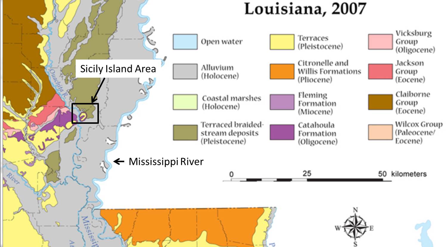
The rectangle outlines the general vicinity, which straddles the transition from Eocene (56-34 MA) rocks to the recent sediments of the coastal plain. The map scale does not allow us to see what we will encounter on the ground, however, and that is one of the purposes of this blog. The geologic map suggests that we should see Oligocene (34-23 MA) rocks of the Catahoula Fm. originally deposited in rivers and streams. These are sandy sediments, but the underlying Vicksburg (pink on the map) contains marine limestone. We don’t really expect to see any older rocks here because, despite the relief (~100 feet), there are no faults in this region, which would move rocks vertically and expose even older ones (see previous post).
The dominant geological feature is the southward (seaward) dip of Tertiary sedimentary rocks with erosion exposing ever older rocks towards the north. This tilt toward the Gulf of Mexico is associated with the Mississippi Embayment, which is of uncertain geological origin, although it is certainly valuable in terms of oil and gas buried deep within the Tertiary formations on the map.
A blanket of river sediment is deposited over it all (Pleistocene stream deposits and terraces on map). These sediments were eroded from the older rocks of the Tertiary (i.e. Pliocene, Miocene, etc.) and reworked by braided rivers like those seen in the arid southwest US. The higher sea level (~300 feet) during the Sangamon Ice age (see Florida posts) was not a factor even at these lower elevations (< 200 feet) because the elevation was much higher than now due to erosion of an uncertain amount of material eroded during the last million years.

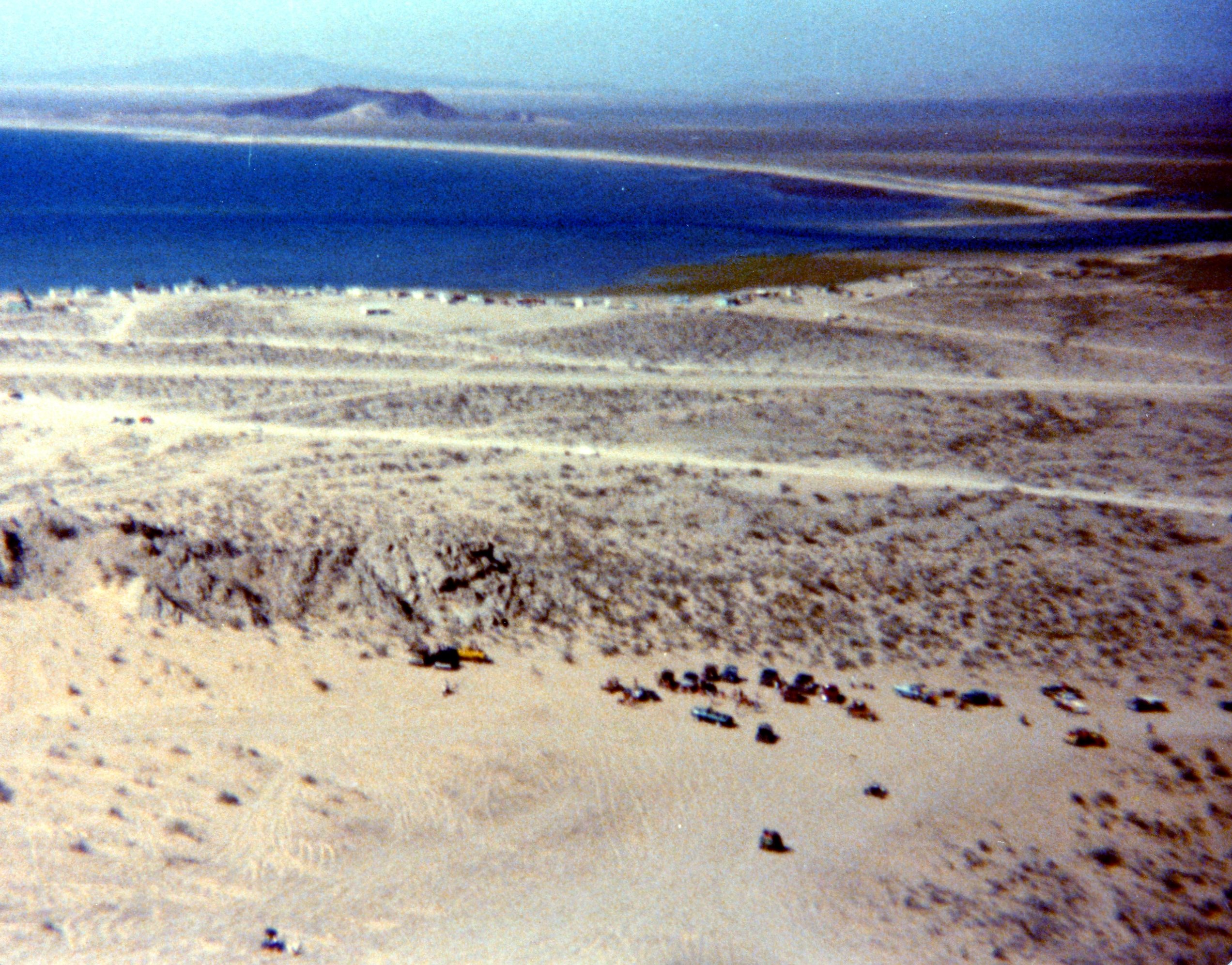
This image shows the approximate area of the inset on the geologic map. There is a creek (Main Creek) with a sandy bottom that is very nice to drive up. The rocky outcrop to the NE is probably Catahoula Fm., and it appears to be dominantly sandstone here. These are the best rock climbing trails from the creek (elevation ~80 ft) to the ridge at 180 ft. The bath house is at the Camp on the map. We set our tents up around this area, which was a sandy sediment.

The terraces are a nice quality sand for building material and there is a quarry along the ridge SW of the main creek. In fact, the park is an abandoned quarry and the creek doesn’t have an outlet, as indicated by the closed loop (dash line). At lower elevations, e.g., the Mud hole, it is very dicey getting through and sometimes we don’t make it.

Because of the mixed stream deposits of the Catahoula and the overlying terraces, even the muddy areas have rocky exposures for challenging climbing, with many loose boulders.

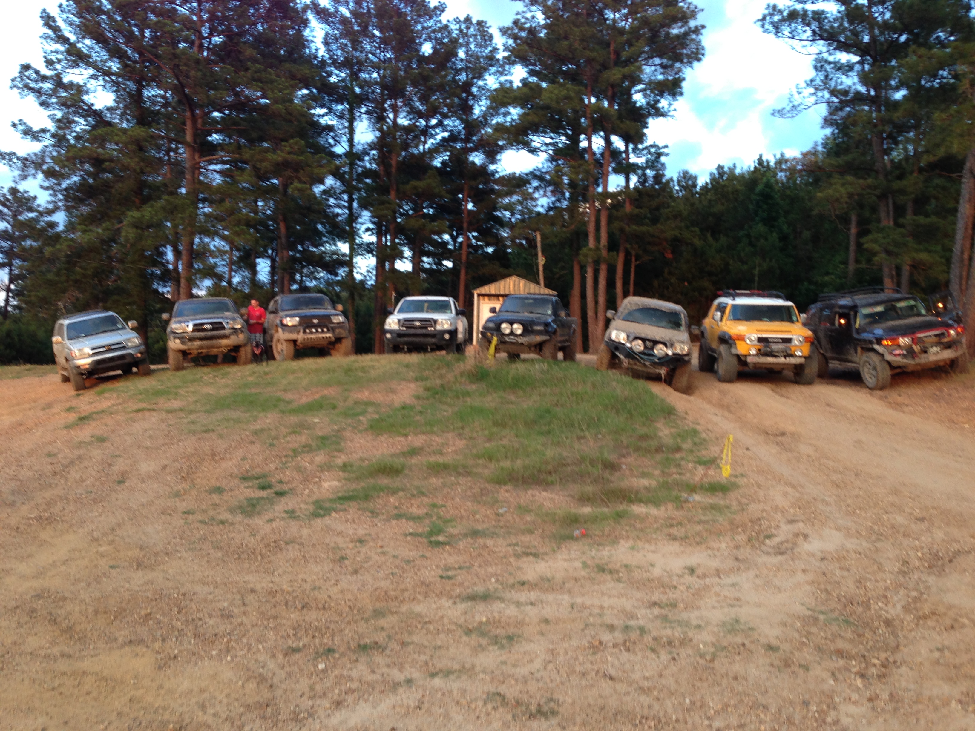
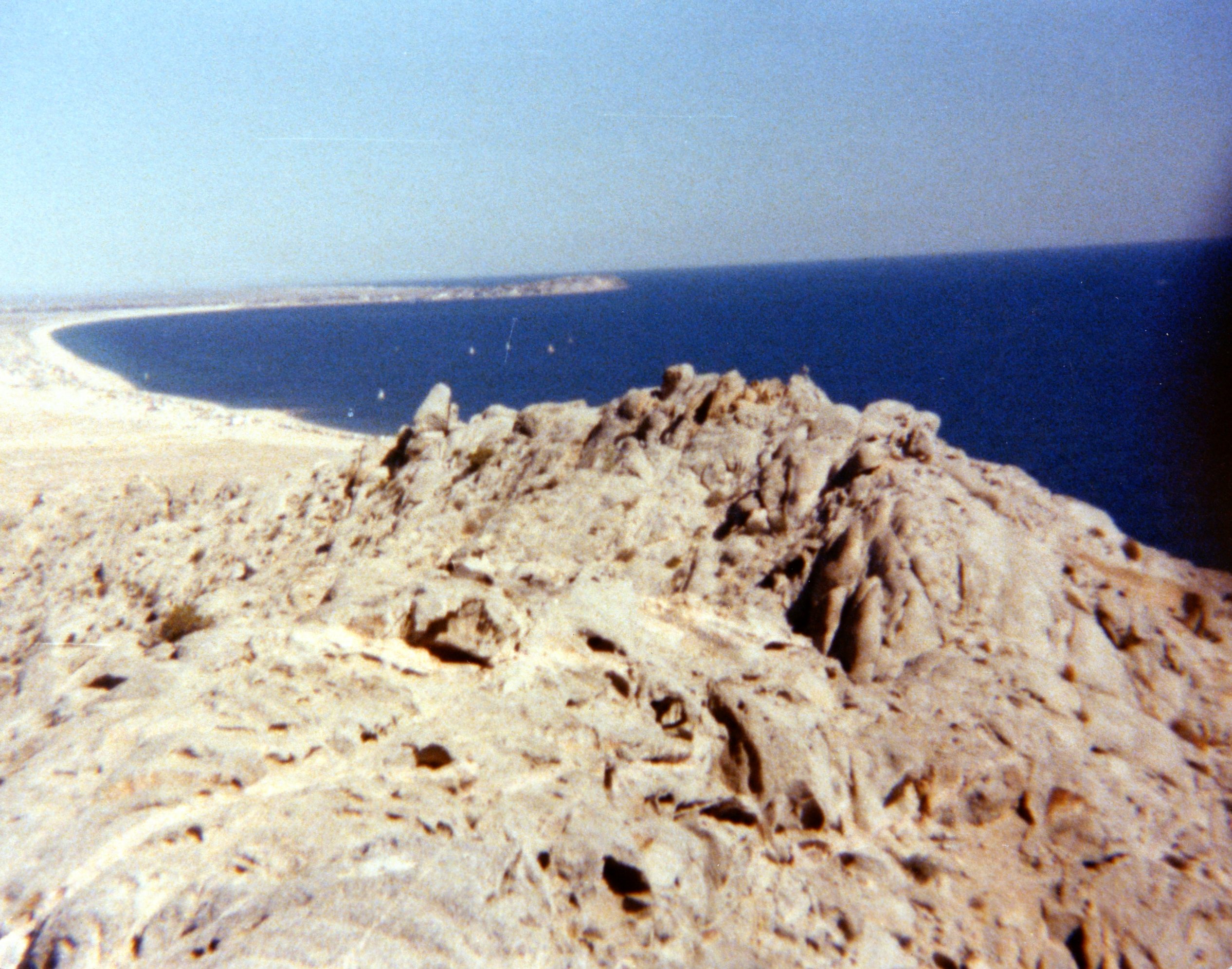
The texture of the terrace deposits can be seen in this final shot as we were preparing to depart for southern Louisiana, leaving the rocks of Catahoula behind.
IH8MUD: Red Creek ORV Park
This post describes a trip in 2012 to a local ORV (Off-Road Vehicle) park within an hour drive of home. I joined a couple of friends from work for a couple of hours in a relatively flat area north of Pascagoula, MS. This trip does not describe rocks because there are none. In fact, a geologic map of MS places this area in the Pine Belt, which basically tracks the U.S. coastline from Houston to New Jersey with interruptions for major rivers (e.g. the Atchafalaya River swamp of southern LA) and, of course, the Florida penninsula. This province is often called the Pine Barrens.
When we go off road here, we are dealing with sand (individual particles have a diameter D > 0.064 mm), silt (D > 0.004 mm), and clay (D < 0.004 mm) distributed by modern rivers like the Pascagoula River to the east of the Red Creek ORV park. The pine barrens of the gulf coast get ~50 inches of rain per year and they are covered with rivers, creeks, and swamps. This park is located in the Pascagoula drainage basin and it is heavily wooded.
Going off road here means we will see mud, which is a combination of silt and clay because these can both be carried by slowly moving water. The sand requires vigorous water to be moved. The result is a preponderance of mud everywhere. However, geological processes operate over really long periods of time and rivers move around. We also must note that the average elevation of Red Creek is < 100 feet, which means this area was covered by the ocean within the last 120,000 years when sea level was much higher. So there is leftover (relict) sand wherever a creek/river hasn't removed it just as in north Florida.
This trip shows us the resultant off-roading experience.
It is difficult to see most of the “trails” in Red Creek ORV park from a satellite. This image shows the main area but the trails in the woods cannot be seen from space.
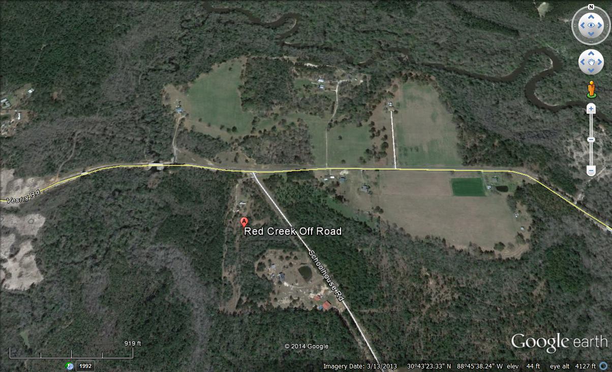
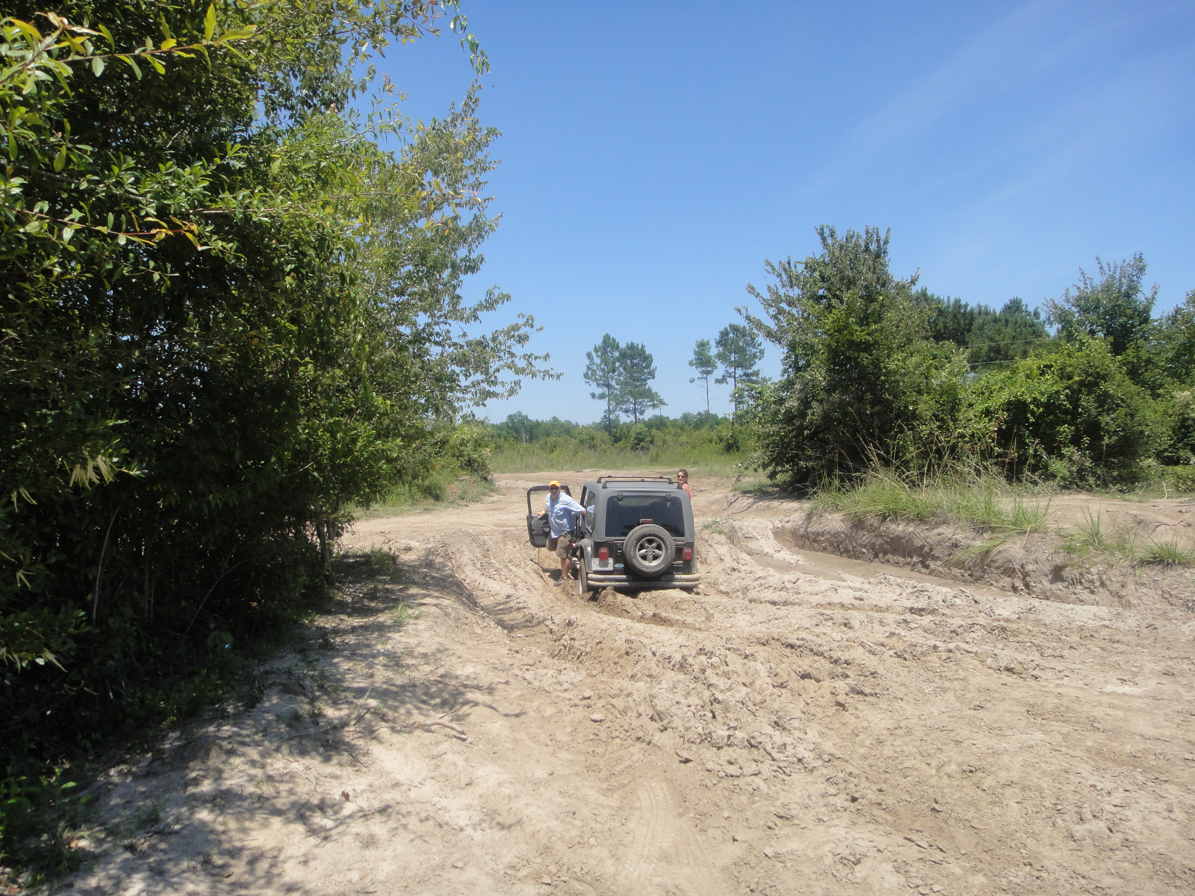
I think Red Creek is the slightly less wooded area west (left) of the park label. We never made it because of mud blocking our path, although we were allowed to go to the creek according to the park rules. After a run down a great sandy trail where we could hit 45 mph in 2WD, we meet our first MUD crossing, which wasn’t bad because this was a flood deposit from the creek on top of consolidated clay and sand.

This kind of mud is deposited during floods when high water level will deposit mud in usually dry areas. We found our way to a much sandier area that was much modified by ATVs running in circles (as well as intentional piling for ATV driver entertainment). Desperately seeking adventure, I found my vehicle’s limits on high centering.
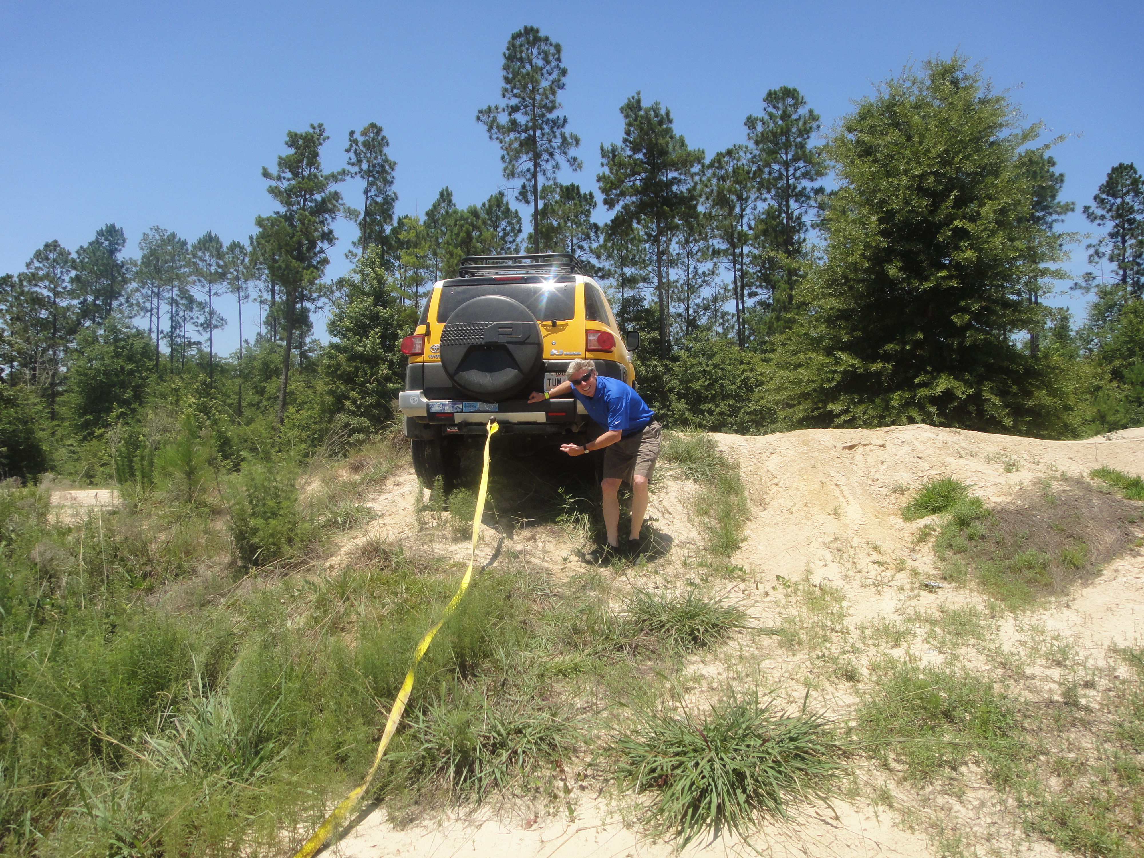
Because of the massive overbank deposits like those above, it was easy to find mud track created by ATVs and pickups with really BIG tires (~40 inch diameter), so another of our group needs a tow!

This park was originally for ATVs only, but most people get bored running in circles and they opened it up to larger vehicles (i.e. 4WDs). We drove around in circles but we found ourselves trapped and we had to break through some mud. Another one bites the dust and has to be towed out.
We never did find Red Creek, probably because of poor planning but also the need to deal with MUD everywhere. We all made it home, however, and one of us avoided mud more than the others!

I’m Sinking and I Can’t Get Out!
The other newsworthy geological process in Florida that has been going on (like an ox pulling a medieval plow) since Miocene time (23-5.3 MA) is the chemical dissolution of limestone (LS) by slightly acid rainwater. The geological term for these terranes is karst topography. The end products of this dissolution over geologic time are features we call sinkholes. But sinkholes are also a lot of fun!
The Fla. geologic map (below) shows that southeast of Tallahassee is a much older rock, the Miocene St. Marks Formation (symbol Tsmk on the map). These rocks are covered by a thin veneer of sand from when sea level was much higher (~300 feet at the max).

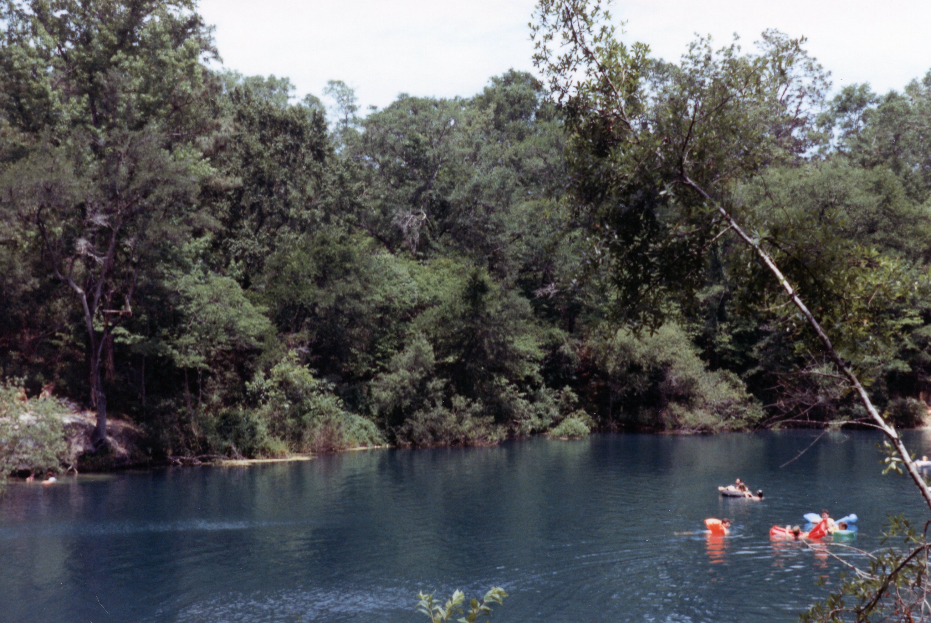
The St. Marks Formation is uneven at the surface and these sinkholes can be quite deep, as seen at this monster that was called “Big Dismal” by the locals.

If you had the nerve, you could leap from a pine tree ~75 feet into a blackwater hole with floating logs. I didn’t make it, I must admit. Of course, not all sinkholes are so dark and hard to find. Cherokee Sink, which is actually known to Google Earth, was a favorite hangout for everyone. Lots of family fun in the pine woods.
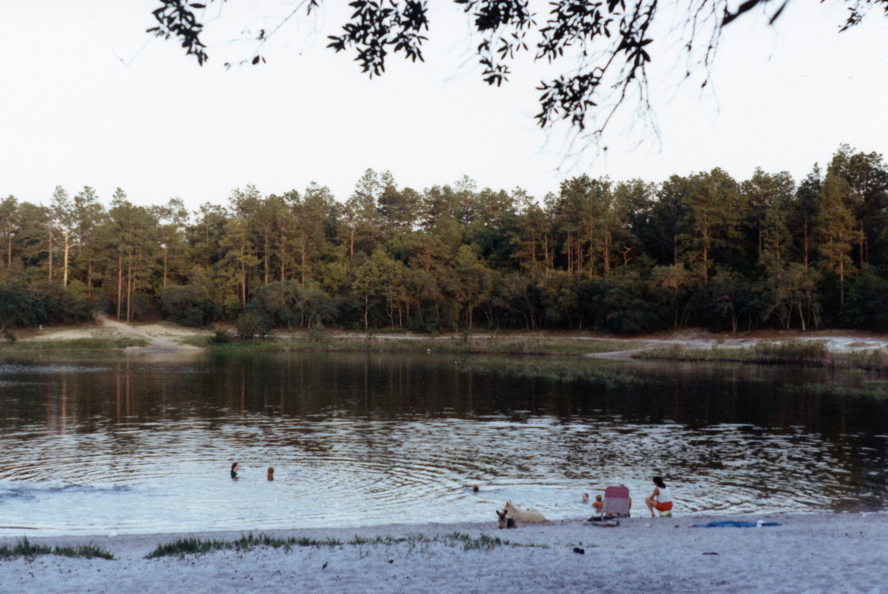
It was pretty easy to go out into the woods and need 4WD; I pulled a lot of 2WD vehicles out because the drivers’ miscalculated the lack of adhesion (and thus traction) in millions of individual quartz grains <1 mm in diameter. The Holocene sand sheet is slightly thicker west of Tallahassee (Qal on map) and has partly filled in sinkholes. This is also approaching the northern limit of the Miocene reef that produces the Karst terrane. A good example is the happy hour fun place called Turtle Lake (note it becomes a lake when filled with sand).
This post documents my last travel/geology/offroad activity for a few years but I am back…
Sun, Sand, and Water: Florida Fun!
The last posts showed that geology is everywhere and is going on today. It is easy to see when it occurs at short time spans like the ~12 hour tidal cycle in the Sea of Cortez (see previous post). This post continues this modern trend but adds some older geology too, and mixes water and sand some more in North Florida after I left Arizona and the Basin and Range for adventures east of the Mississippi River. I packed up my stuff into my Jeep and an old military trailer and headed down Interstate 10 for 1891 miles.

The geology of Florida is more varied than one might think, with visions of sand and sun, because it has a history just like every other place.
The Florida Geologic Survey map (below) shows several units that we will see on this trip. Actually, this post describes several day trips as well as long weekends.
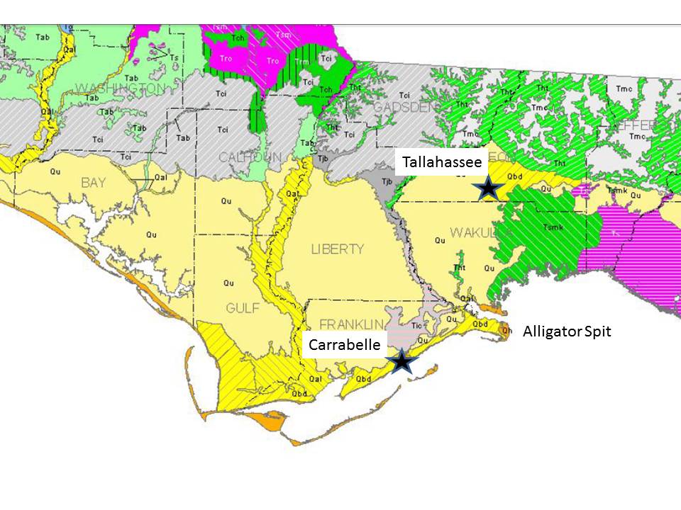
The rocks around Tallahassee consist of undifferentiated Pleistocene/Holocene sediment to the west (Qu on the map) and beach ridge and dune sands to the east (Qbd). The rocks are difficult to date so they are identified by context; these are younger than ~2.6 MA. The ribbon of Qal to the west is alluvium along the Apalachicola River, which is still a major waterway today. The first sediment we expect to see is a beach, right? This is what we get at Alligator Spit, where we are allowed to drive on the beach (speed limit is 10 mph…LOL).
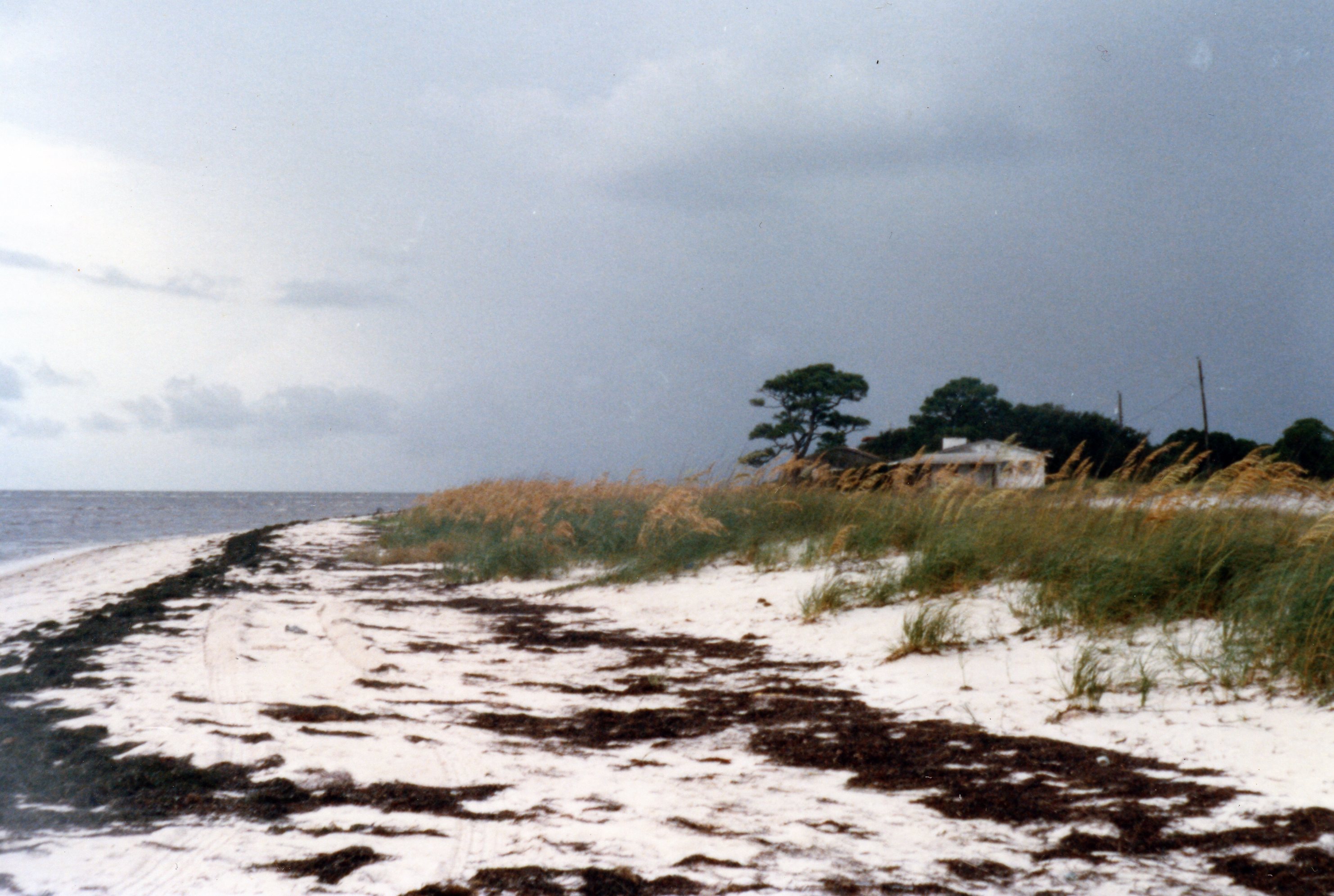
Note how white the sand is. This is the medium sand from the Florida panhandle’s famous beaches. The sand grains are white because they are free of contaminants (e.g. the cement that forms a sandstone from individual grains). No one know how many times they have been on a beach but it has been at least 200 MA since they were part of sandstones in the southern Appalachian Mtns. The individual quartz grains are probably much older, maybe pC like some of the metamorphic rocks we have seen.
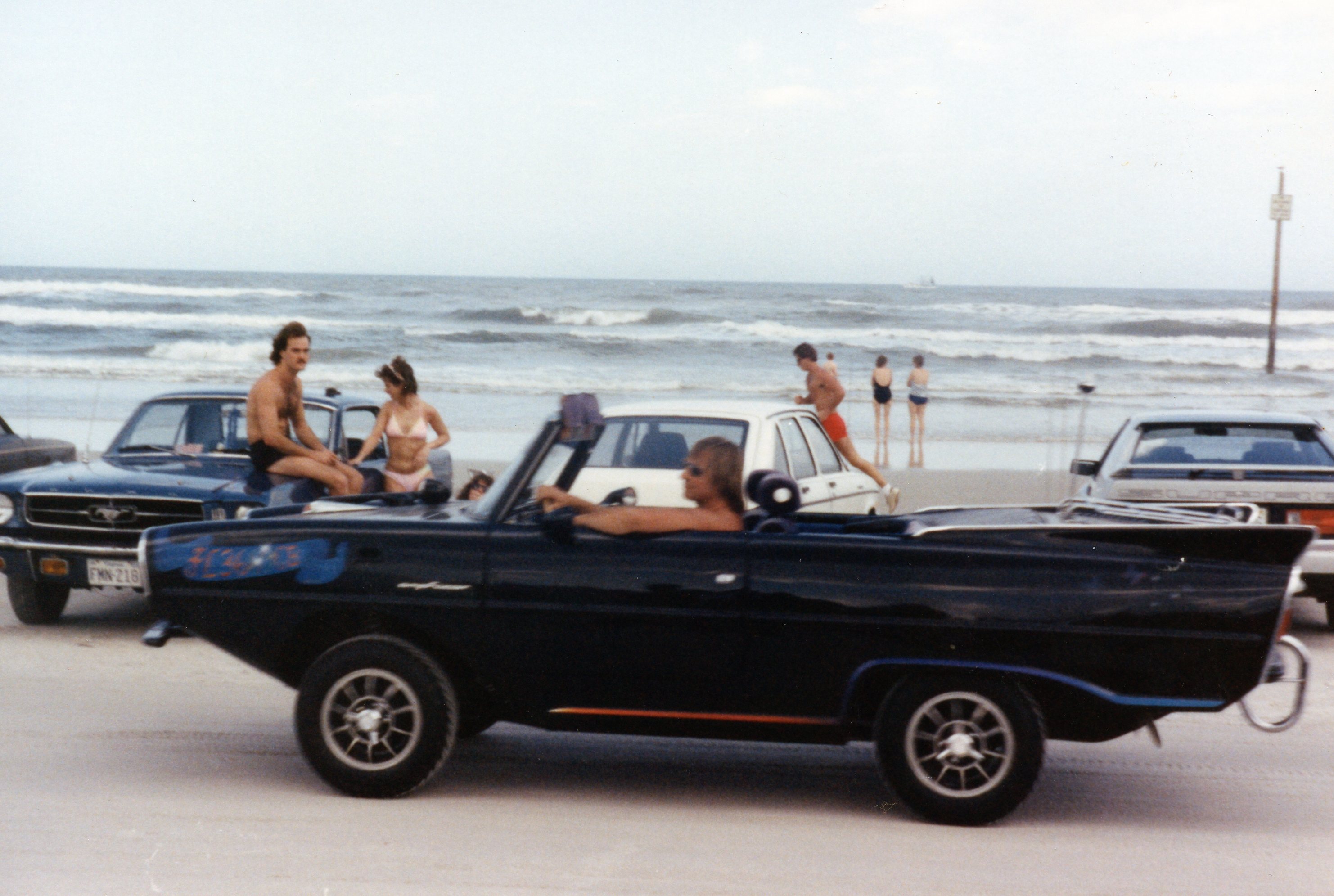
The beaches along the east coast are not clean; for example, the famous Daytona Beach is a typical reddish sand…

and, yes, you can go off-roading here too! I wonder if this guy is going boating?
The sand along Florida’s east coast has been transported southward along the U.S. coastline by wave action in what is called the “river of sand“. These processes are also present in the Gulf of Mexico, but hurricanes are also an important geological process along those beaches.
This photo shows a very low energy beach at Carrabelle (see photo above), but it doesn’t look low energy. That seaward bar looks a lot like the bars in the Sea of Cortez but the tidal range here is ~1.5 feet.
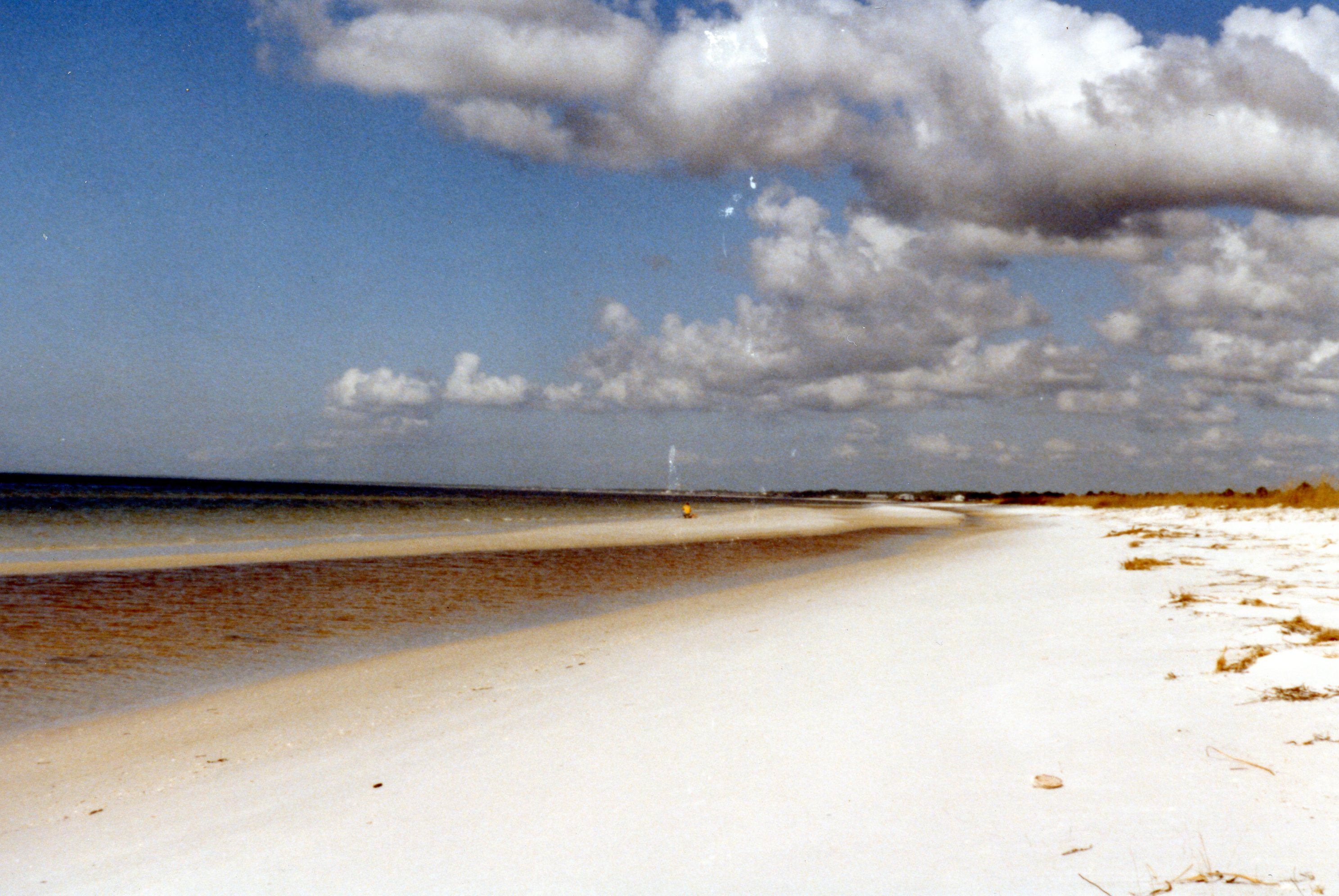
This feature was deposited by Hurricane Kate in November, 1985. It was so strange that I earned an M.S. at Florida State University from studying it (Journal of Coastal Research, 2000). And you can even drive on Carrabelle Beach in January when no LEOs are around!
>…
Beaches are a lot of fun and very active, geologically, but this is Florida and nature has other ways of surprising us in the Sunshine State.
Rivers, Tides, Wind, and Waves: Coastal Geology in the Sea of Cortez
This post summarize two trips to El Golfo de Santa Clara, Mexico, for Easter vacations in 1984 and 1985. El Golfo (American name) was a small fishing village back then but today it is a resort town. It is located at the mouth of the Colorado River, and the geology and offroad experience is different from that at Rocky Point. The CO River has deposited as much as 30000 feet of sediment into the northern Sea of Cortez and constructed a massive delta.
Because of the large sediment load (fine sand, silt, and clay) over millions of years from the CO River, this area has a lot of mud (mixed clay and silt) as well as sand. The tidal range is large (~16 feet) and extensive tidal flats have been constructed; they are dark in the image below. The tides are mixed but dominantly twice a day, which leads to dramatic changes in the coastal geology at short time scales.

This image also schematically shows some of the coastal geologic processes (in CAPS) inferred from the coastal geology. Geologists use the concept of uniformitarianism to infer how some of the rocks we have seen elsewhere were formed by analogy with these coastal and river processes.
This post will follow the coastline to the SE from El Golfo and show the kind of offroad experiences arising from the changing geology. The delta is too muddy to drive on but on the east side of the delta where we camped, we see the impact of relative vertical movement of the younger rocks and the ocean as we approach El Golfo on Route 3.
This photo shows ~20 feet of erosion of this alluviuum, which is probably < 1 MA old. This cliff is irregular because of surface erosion and wind-blown sand covering it in places. Younger alluvium hills are seen in the background of our 1984 camp on top of the scarp. The steepness of the gully is an indicator that this is actively eroding during infrequent rains.

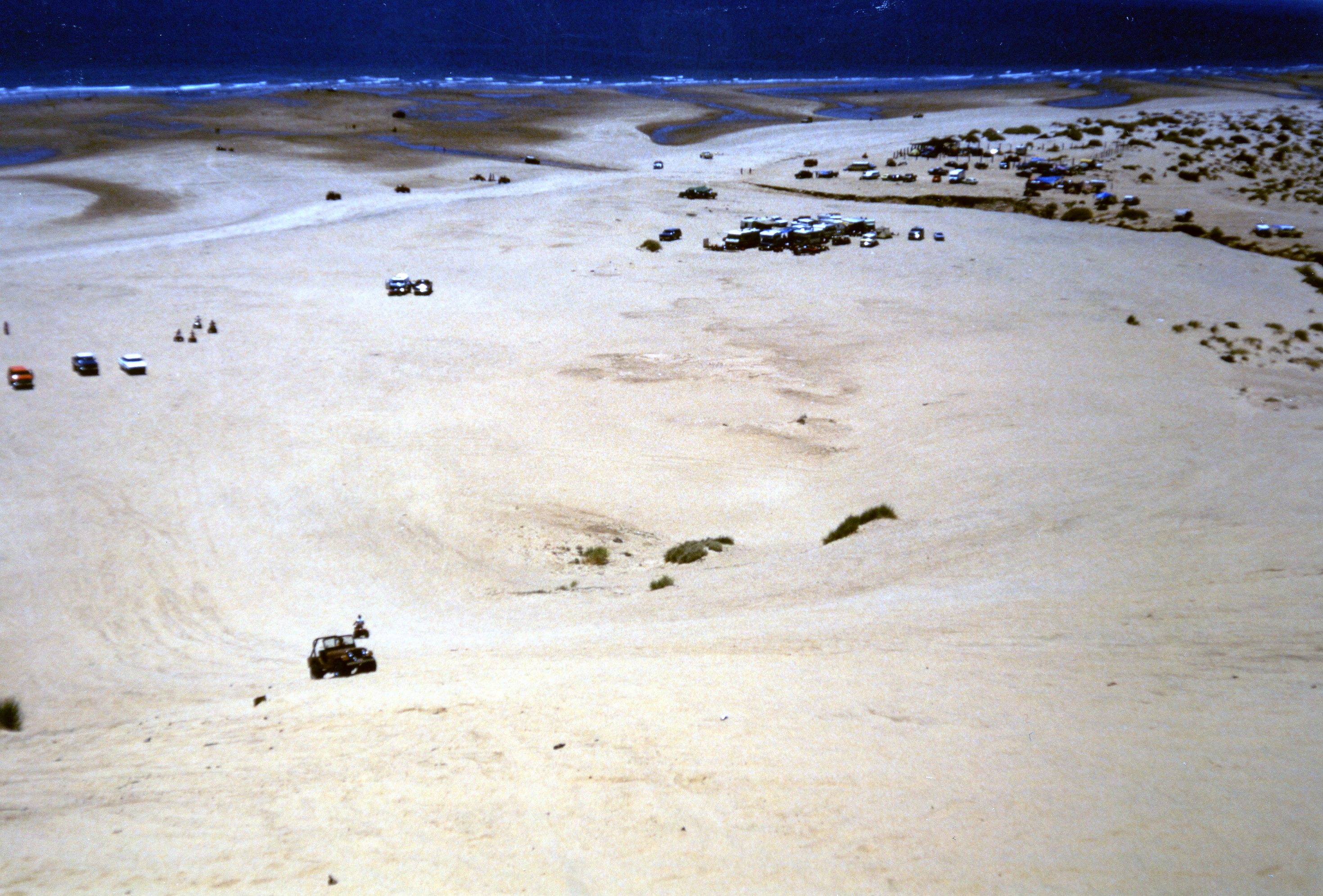
At places it was impossible to travel eastward during high tide and we had to wait for the ebb tide to continue along the beach as seen in this image looking to the SE.

RIVER sediment interacts with TIDES to form complex tidal flats. The presence of intertidal sand ridges, which are exposed at low tide can fool an offroader into thinking it is a sandy beach. We discovered this the HARD way, when a rambunctious friend charged out into the tidal flat during the rising tide (remember, 15 feet!). It took three vehicles, two winches, and 500 feet of heavy rope to finally extricate his Jeep as the rising tide was entering the cab…it doesn’t get any scarier than that!
This image taken from the top of a sand dune shows the complex intertidal morphology and introduces the next geological process, the WIND. The darker areas are muddy and the lighter are sand. It is important to keep up the speed when crossing the muddy swales.
The result of the combination of dominant SW wind in summer and copious sand within the wide intertidal zone is a sand dune field constructed on the beach. Further SE from El Golfo, a large sand dune field has developed that is moving landward over the desert. The entire field is seen as relief over most of this image. The dune field is outlined by Route 3, which must go around it.


The active dunes are as high as 150 feet. They are moving to the north and have separated from the beach in some areas while remaining at the coast in others. This makes for great hill climbs and views!

Further to the SE, the sand supply is lower as is the tidal range so not as much sand is available to construct dunes. This occurs near Rocky Point (Puerto Penasco), where barrier islands and spits grow from this alongshore transport (circled area to the east). WAVES dominate the sand transport in these environments, especially with a lower tidal range.
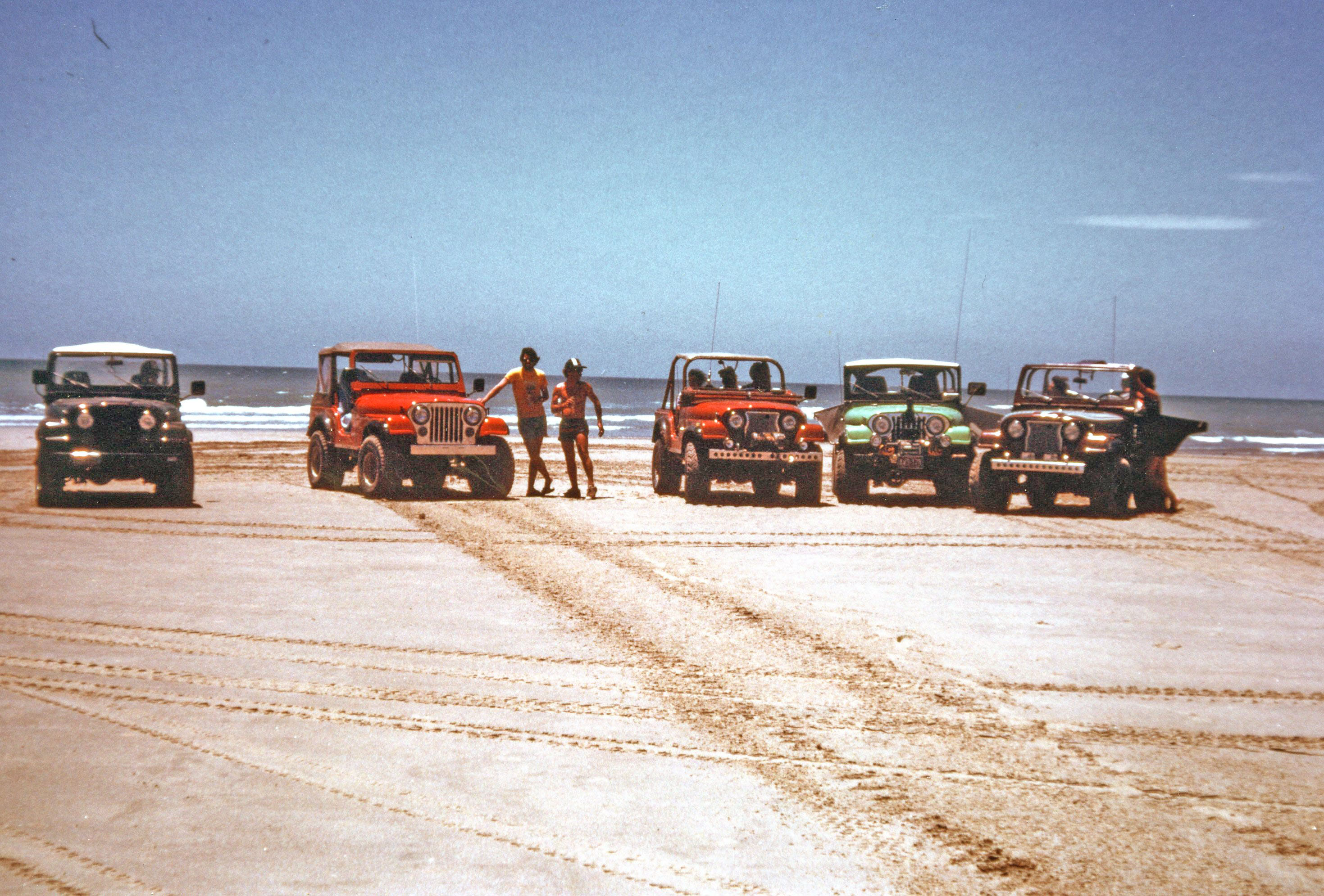
Plenty of afternoon happy hours on the beach!
Where Rocks Meet the Sea: Mexican Adventures
The next couple of posts are describing trips to northern Mexico between 1979 and 1985. This is a fascinating area where the Colorado River enters the Gulf of California (Sea of Cortez). It also overlaps with the southern extent of the Basin and Range (B&R) province, as evidenced at Rocky Point (Puerto Penasco), Mexico. The western margin of this region is defined by the San Andreas fault zone, which created the Sea of Cortez within the last 7 MA (Pliocene epoch) as Baja moved northward. The overall geological setting is briefly summarized by Eugene Singer. For our offroad interests, I will focus on coastal processes with some description of the southern extension of the B&R.
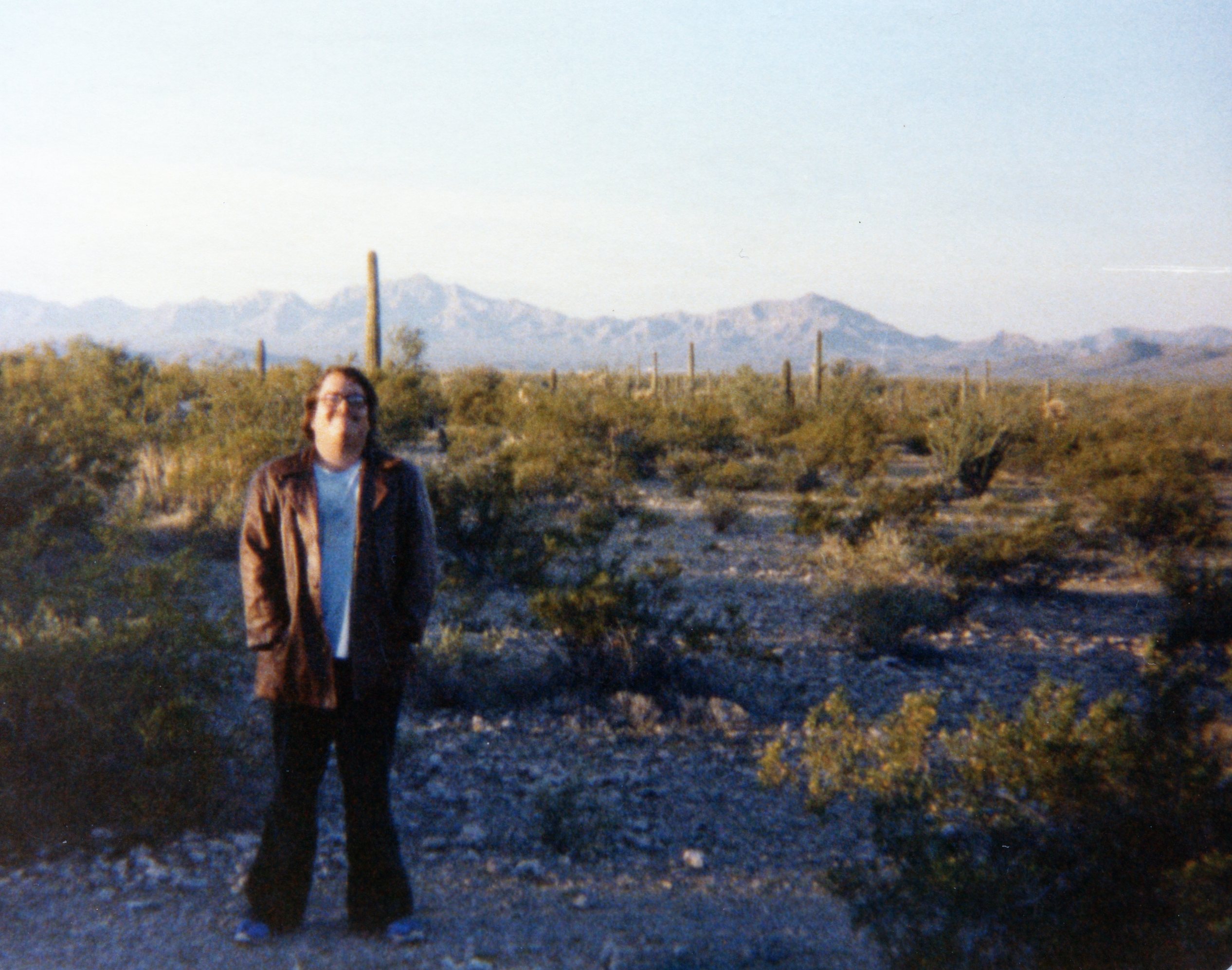
Subsequent posts will explore the coastline to the NW of Rocky Point. To get to Puerto Penasco, we cross the Sonoran Desert, which has numerous volcanic rocks and volcanoes; this image taken at the international border in 1979, shows some of the mountains in the southern B&R (probably Precambrian basement rocks).
When we arrive at the northern end of the Sea of Cortez, we find a range of geological features formed by the Colorado River, tidal currents, seasonal southerly winds, and alongshore transport at the coast by combined tidal, wind, and wave-forced flow. The image below shows the CO River to the NW and several Metamorphic Core Complexes (MCCs) and other basement rocks that were created as part of the B&R event. The Sierra Madre Occidental is an extensive mountain range to the southeast with elevations of <5000 feet.
Rocky Pt. is an alternate (colloquial American) name for the town of Puerto Penasco. This region has been explored for a variety of minerals, especially evaporates like borates.
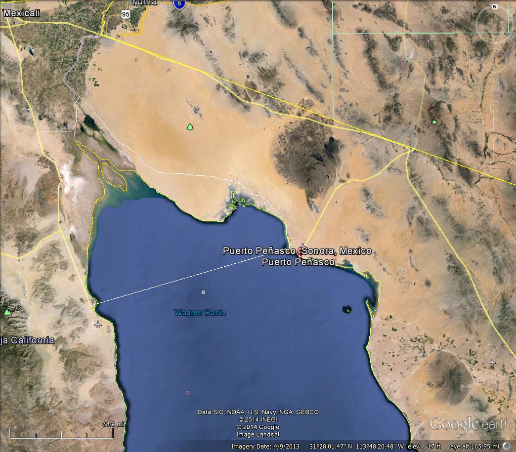
The town of El Golfo de Santa Clara is located at the mouth of the CO River. This is also a favorite resort area, which is near a field of large sand dunes at the coast. It will be discussed in the next couple of posts.
This close-up shows Cholla Hill, where thousands of Americans congregate every Easter and enjoy a wide range of water and land activities, including offroading.

The top of Cholla Hill is ~330 feet but it is located directly on the coast. Cholla Hill is an outlier of the B&R with pC granite and metamorphic rocks visible at the top. There is also a breathtaking view of the coast. The first image is looking to the NW towards the CO River. The degree of erosion of this quartz-rich (granite/metamorphic) rock is evident in the sandy ramp that leads almost to its peak, which is a favorite sand racing spot.
The image below is to the SE, with Puerto Penasco in the distance.
And a short jaunt takes us to the shore, where we can run down the beach in sand or sea…

This is a major spot today for U.S. holidays. The beach is very sandy at this location and the tides are not too large. We have a very different story in the next posts.
BHCC 2013: Full Size and Mixed Geology
This is the final post from the Black Hills Cruiser Classic in July 2013. I don’t know if the organizers planned it this way, but the final trail was mixed 4-5s over a varied terrane near the camp.

This trail started on some alluvium near a creek and climbed thru a fault zone with Paleozoic LS and pC basement rocks, but no granite on the outcrop map. We were too far north for the Harney Granite pluton to be exposed except possibly in faults…
Off we go, thru the creek, which was a sign of water everywhere but NO mud, for those who h8 mud!
and a stop in the vale to air down (most were using ~10 psi)…

I never saw the white pickup on the trail; I think there were plenty of exits on this trail…
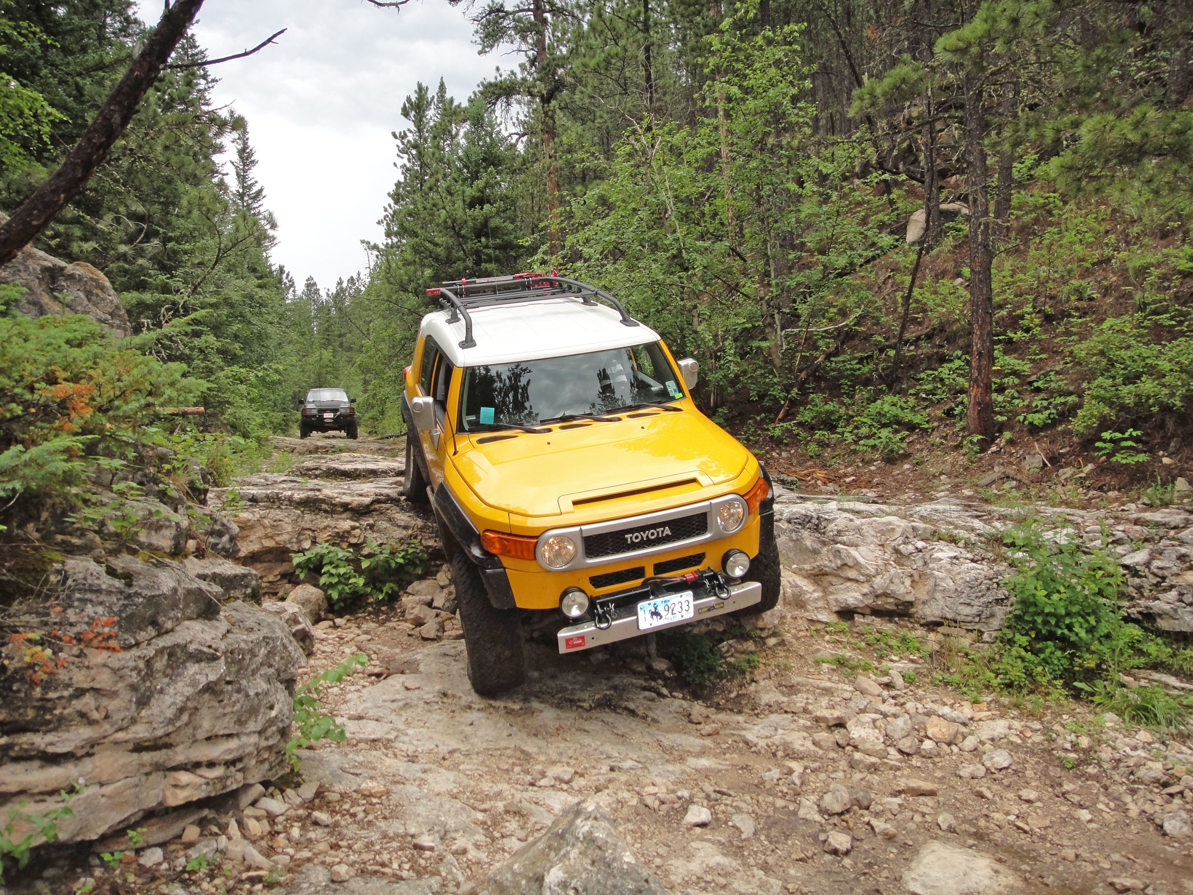
Then we traversed some faulted and weathered LS along several gullies. One of these had a 5 feet ledge for the left wheel and a LARGE rock (house size) on the right that gave a lot of problem to limited articulation suspension systems, e.g., a vintage FJ40 ahead almost never got over one. I made it but smashed the right rear corner. It was so scary I didn’t notice at the time.

Then we climbed out of the gully (i.e. fault zone) and were in pC crystalline basement (really HARD rock). I wimped out and took the easier routes after realizing the damage I had already done.

It was hard enough that a group of photographers collected.

I wish (almost) that I had done those 4+/5 challenges. Oh well, there’s always next time! These rocks were more like Jake from the first day. I didn’t get images from the “rock pile”, which was an erosional feature at the base of a cliff in the pC metamorphics, but I saw a lot of teetering (high centered on top of a pile of rubble) by those who opted for it.
BHCC 2013: The Iceman Cometh
The next day came with no permanent damage but a set of badly damaged wheels, seriously dented muffler and tailpipe, and pieces of FJ Cruiser plastic missing. Today we were doing the Iceman trail (rating 4), which means hard but not fatal most of the time. The same group showed up so we were getting used to it. Iceman is located in the Paleozoic limestones that form the sedimentary cover of the Black Hills Pluton/Batholith complex. Here is the overview image that shows where Iceman is located.

This trail starts out in a wide( ~300 yd) entrance to a gently sloping canyon. It traverses the nearly horizontal limestone and we negotiated a series of ledges that got progressively higher downhill. The trail ends at a very narrow entrance to a fissure that our guide, Raylon, said he walked once when he broke down here. He informed us it could not be negotiated by any vehicle and was difficult even on foot.

The limestone forms ledges where water flows over it and thus the name no doubt comes from attempts to negotiate this creek/stream/glacier? when ice is still present. We had an epic failure of the IFS on Rayon’s Forerunner and left it on the trail. I had to show you this image, which shows the extremes we go to when a non-field-repairable vehicle blocks the exit (like pushing a damaged aircraft over the side of a carrier).
We had to climb those LS (limestone) ledges to get out, and it was obvious that others hadn’t thought that far ahead from all of the ramps that had been constructed to ease the exit. Note the ramp built of cobbles used on this ledge as I descend it.
Two last points about LS; it is not as hard as granite (i.e. quartz, which has a hardness of 7.5), with a hardness of only 3.5 whereas steel is ~5-6. However, it has a higher density (specific gravity ~3.2) than quartz (sg =2.65), so it bends steel better than granite, which just cuts through metal!
It sprinkled and sleeted as we drove back up Iceman, thus earning the name, and the exit was now a slippery muddy slope that required full throttle by everyone to get out. The reward was happy hour at a drive-in straight out of Happy Days or American Graffiti.

One final word; only damaged the muffler some more and learned how to drive the automatic transmission over rocks while using the sliders to wedge the FJ through narrow openings.
BHCC 2013: When Geology and Offroading Meet
This post covers three trails that were part of the BHCC 2013: (1) Jake; (2) Iceman; and (3) Full Size. Each trail required most of a day and was located several miles from the main camp at Wild Bill’s near Deadwood. I am only going to discuss the relationship between the geology and the off-roading experience today. The maps below are approximately the same region; the projections are different so they don’t match exactly but I have labeled important locations that are shown in later photos.

The star indicates the location of the campground where the event activities and camping were located. Unlike some events, this one occurred in a national forest instead of an ORV (Off-Road Vehicle) park. Wild Bill’s is at the top of a long climb up from the mineralized zone around Lead and Deadwood. Many faults and dikes are visible in these roadcuts. This image shows 30 MA dikes (light colored) along bedding/structural weaknesses in >2 GA metasediments, which hit the angular unconformity at the Great Unconformity that separates ~1.5 GA rocks from 600 MA rocks. These Cambrian sediments are not metamorphic (no great heat or pressure) and they are nearly flat; the hot molten magma turns horizontal to follow their bedding surfaces.

Before hitting the trails, I drove south to Harney Peak and hiked to the fire tower at the top (~7300 feet). This is the backbone of the Harney Granite that was intruded ~1.6 GA. This image shows the trail and the overall shape of the pluton. The fire tower is above the word “Black” in the GoogleEarth image.

The complex relationships between the surrounding metasedimentary rock and the Harney Granite are seen in this image from the Mt. Rushmore monument.
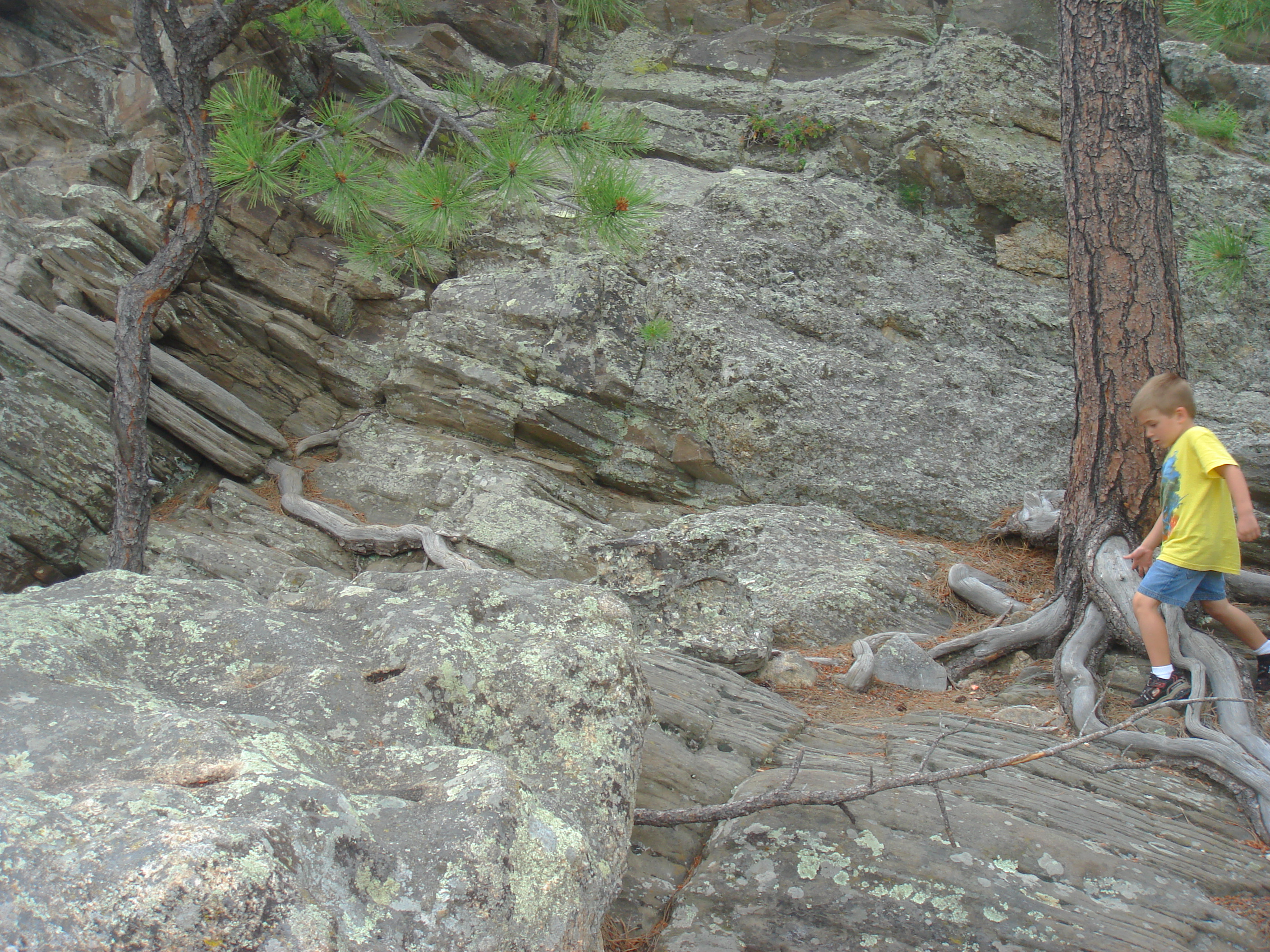
The first trail we followed was Jake (see image above). We drove into the pC metamorphic rocks and followed a forest service trail to a narrow gully that began climbing to the east. These rocks were originally deposited as mud/sand in nearshore environments like Louisiana ~2.3 GA and were buried. At ~1.5 GA the Harney Granite was emplaced (over tens of millions of years) and they were warped during the coeval orogeny. This occurred at about 8 miles below the surface. When they were uplifted at ~30 MA, they fractured into a common hexagonal fracture pattern that leaves their edges like knives. They are also very dense because of the high pressure. They form a truly tiring trail that sliced my aluminum wheels like butter.

Black Hills Cruiser Classic 2013: Getting There
The next couple of posts are describing a trip I made in July 2013 to the Black Hills Cruiser Classic (BHCC). This first post describes the geologic and social settings in getting there, which is ~1500 miles from home.
This post is kept brief by referring to our Family web page for a trip we took in 2010 (timkeen.net), as well as the excellent Roadside Geology of South Dakota (J. P. Gries, Mountain Press Pub., Missoula, MO).
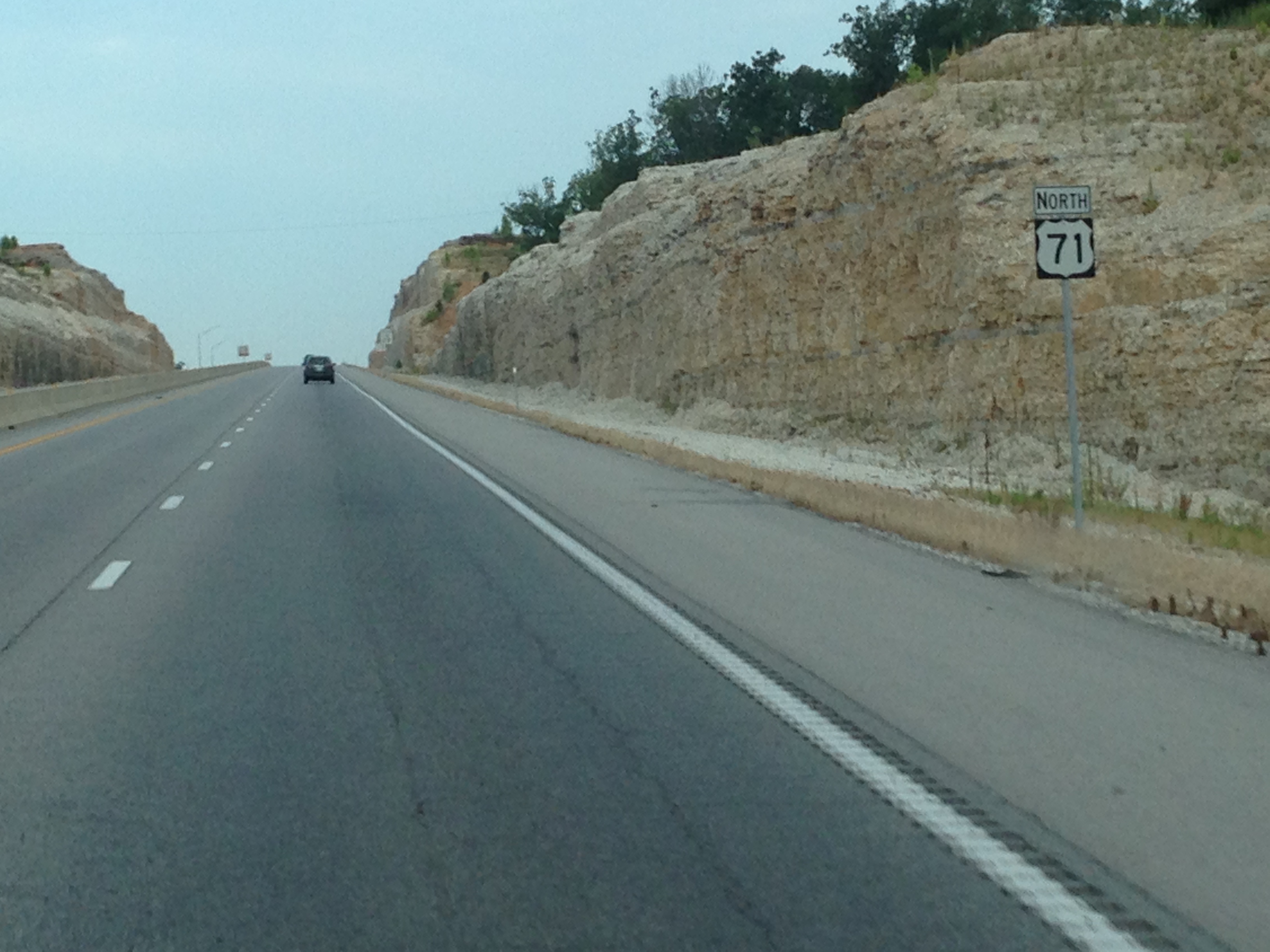
After driving across the coastal plain into Arkansas, I turned west at Hot Springs and drove along the axis of the Ouachita Mtns, which bisect AR. I began the northward trek when I intersected US 71 N and traversed the Arkansas Valley as well as the Ozark Mtns in the north. Paleozoic limestones are nearly horizontal in this area, with erosion being responsible for the steep grades seen in this image in the AR valley province (terrane).
I crossed the Missouri R. at Kansas City and stayed to the east of the Great Plains following the same route we did in 2010. This choice followed the bluffs along the western border of Iowa and stayed close to the river, which allowed me to review my history by visiting a MO stated park dedicated to the Lewis and Clark expedition. I wish I could go up the river in a boat like this reproduction; that would have been cool.

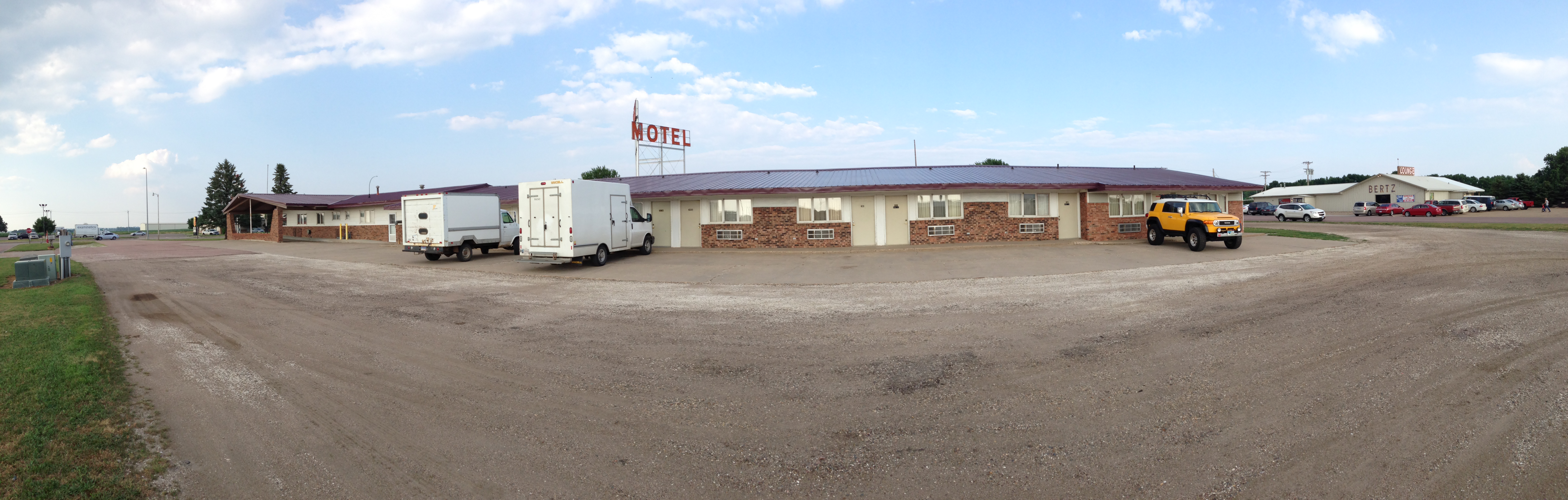
Instead, I continued north and spent the night at one of my favorite American traditions, a small motel in the middle of nowhere. I think I could have driven thru the walls, they were so flimsy–like the sign (does that say Bates Motel?).
The next day I crossed the northern Great Plains on the Pierre Shale. This is a Late Cretaceous (66-90 MA) mostly clay formation that was deposited by the inland sea that covered the entire central US at that time. It has irregular landscape because of glaciation between ~200 and 15 KA. It is just plain flat today, except for the Missouri R. valley (timkeen.net).
.
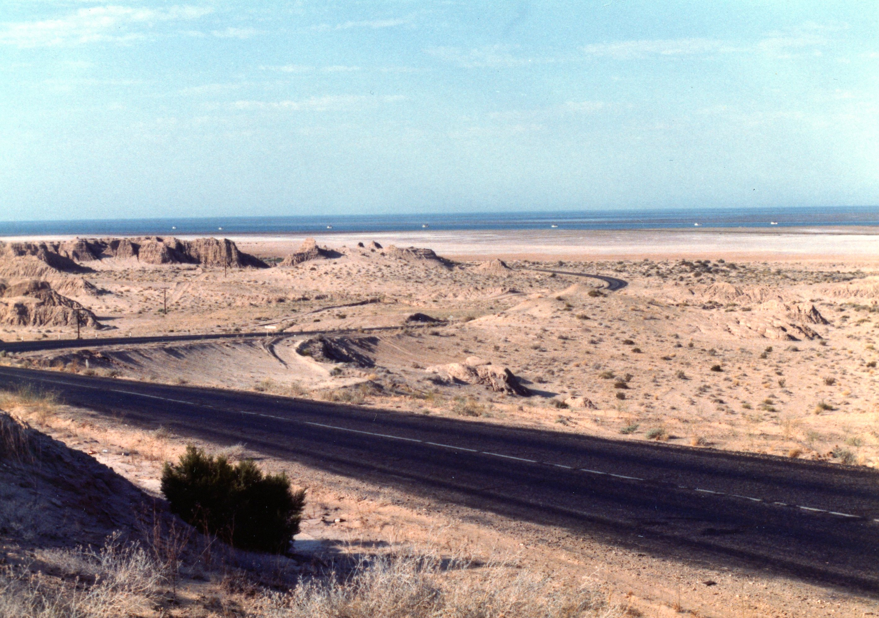
Stream gravel caps small buttes like these, indicating erosion of a younger surface above the current Pierre Shale topography. After Wall, SD, the land climbs because of the doming associated with the Black Hills…

Recent Comments