
Breaking Ground on the Rain Garden and Pond
This is going to be a long-term project, but that doesn’t mean I can wait for someone else to do the work. Actually, I enjoy working with soil and rocks, maybe because I’m a geologist. After 20 years living along the Gulf Coast, where rain falls by the bucketful, and the land is often flat and impermeable (when it isn’t waterlogged), I’m familiar with drainage projects like this. I prefer surface drainage over buried pipes because they are easy to monitor and keep clear of debris.
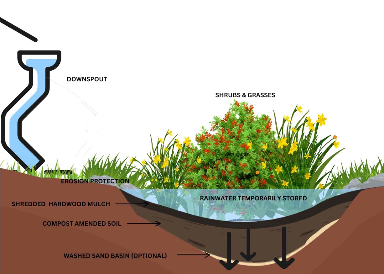
This schematic drawing of a rain garden pond summarizes our plan pretty well. The pond isn’t intended to have standing water, so it isn’t lined; instead the bottom is typically filled with a mixture of sand (easy for us) and compost or some equivalent material. We already have a lot of mulch for covering the area.

The hole is going to be about 18 inches deep in the center, and filled with a mixture of the removed soil and compost/mulch. I don’t need to increase infiltration or water retention; the soil contains a lot of silt and thus holds moisture surprisingly well, while being well drained. Inflow will be through a sluice cut into the soil from the deck (the shovel location) to the edge of the pond. I plan to use the stones collected from the soil to armor the inflow; from the looks of the refuse so far, I should have plenty.
Other than dealing with all the rocks I’m finding in the soil, it isn’t too difficult to remove.
The outline has been set with a couple of hours work, but now the hard work begins. I am going to remove the inner soil to match the perimeter depth, then cut a smaller area down six inches deeper. This process will be repeated until I reach the design depth. The refuse is being used to fill the 4-inch area where the mulch was removed; it will also be used to build a low berm.
The next few months are going to be slow going, but I’ll keep you posted.
Geologic Survey of Eastern Vancouver Island, British Columbia

Figure 1. View looking west along the coast from Beacon Hill, in Victoria. The cliffs on Vancouver Island are similar in height to those across Juan de Fuca Strait, in Washington. However, the bluffs are composed of glacial deposits further south in Seattle, rather than bedrock. The large tidal range (7-10 feet) exposes rocky platforms at low tide. I’ll examine several of these features in this post.
Introduction
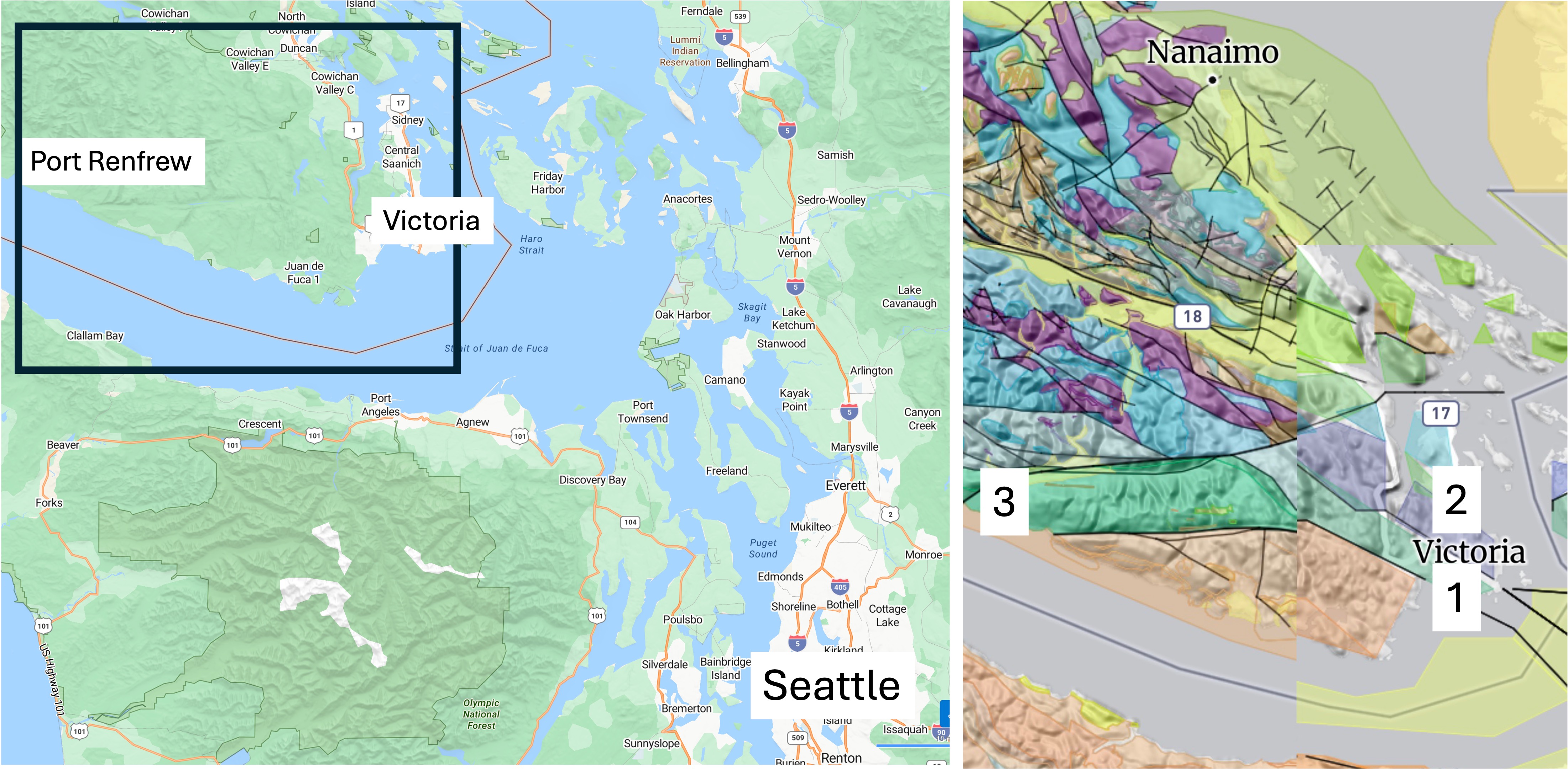
Figure 2. We drove to Port Angeles on the Olympic Peninsula and took a ferry to Victoria. We also drove about 70 miles west to Port Renfrew. The inset geologic map reveals a maze of faults and rock types. The rocks around Victoria comprise the Westcoast Crystalline Complex, which includes granitic and metamorphic rocks dated between 540 and 143 Ma (colored green). The purple area indicates a suite of granitic intrusions from the Jurassic period (200-160 Ma). The numbers indicate locations discussed below: (1) Beacon Hill; (2) Mount Douglas; and (3) Port Renfrew.
Beacon Hill
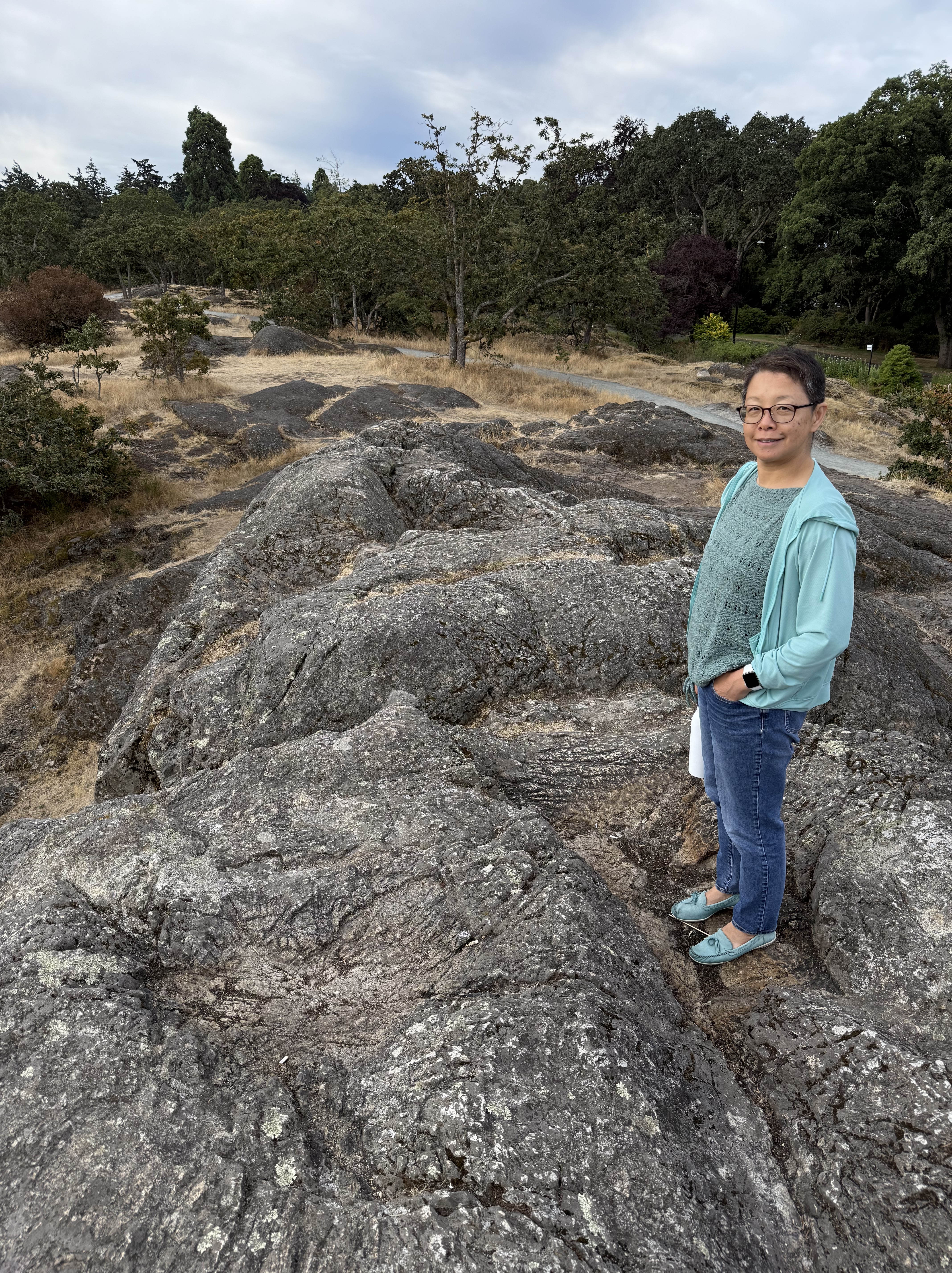
Figure 3. This exposure of the Westcoast Crystalline Complex at Beacon Hill Park doesn’t tell us much. These rocks are weathered and stained, making identification difficult without breaking off a fresh piece. We don’t do that here at Rocks and (no) Roads. Nevertheless, I am relatively confident that they are not sedimentary rocks.
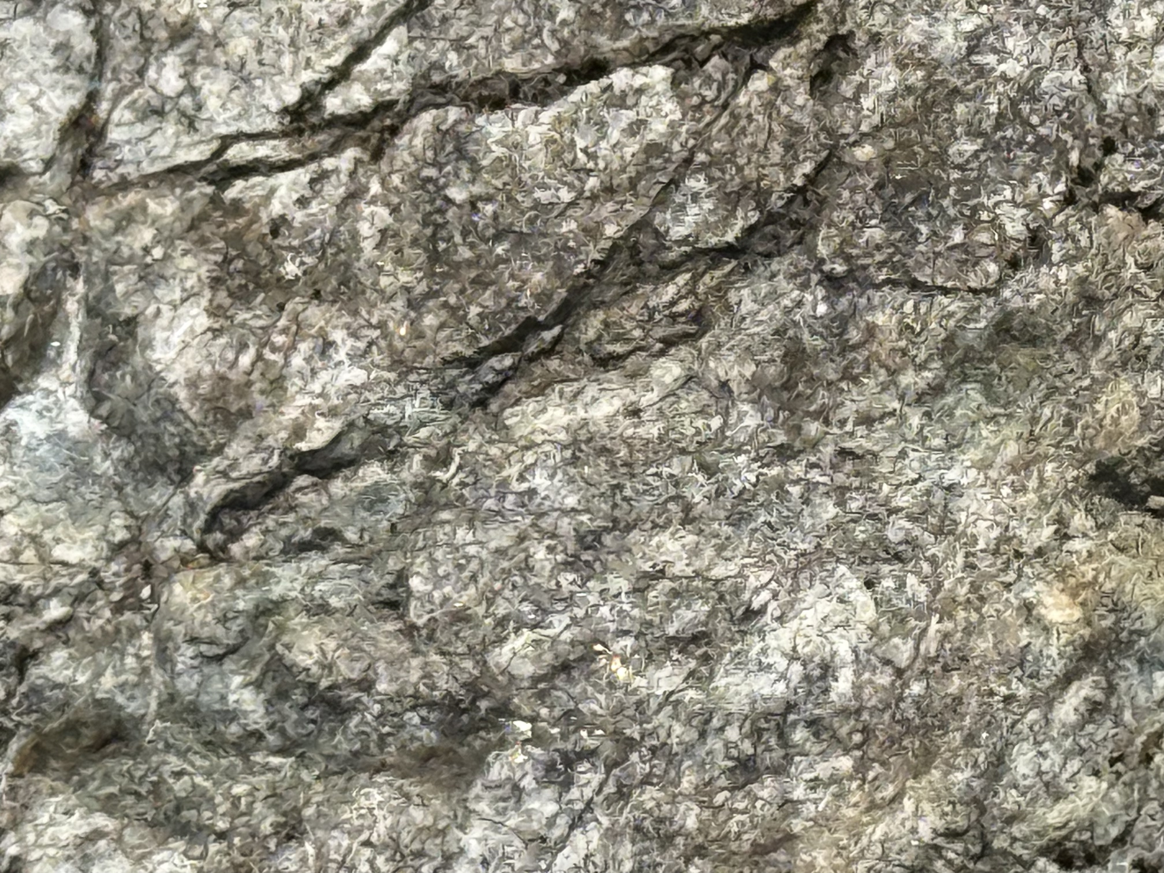
Figure 4. This photo uses a magnification of 10x, and the field of view is less than an inch. Individual crystals of feldspar can be seen throughout the image, recognizable by flat surfaces that form irregular boxes. These light-colored feldspars are indicative of continental intrusive rocks like you would find in a subduction tectonic environment. The gray blobs are quartz. Based on this brief examination, I think these are granodiorite, an intrusive rock rather than metamorphic.
Mount Douglas
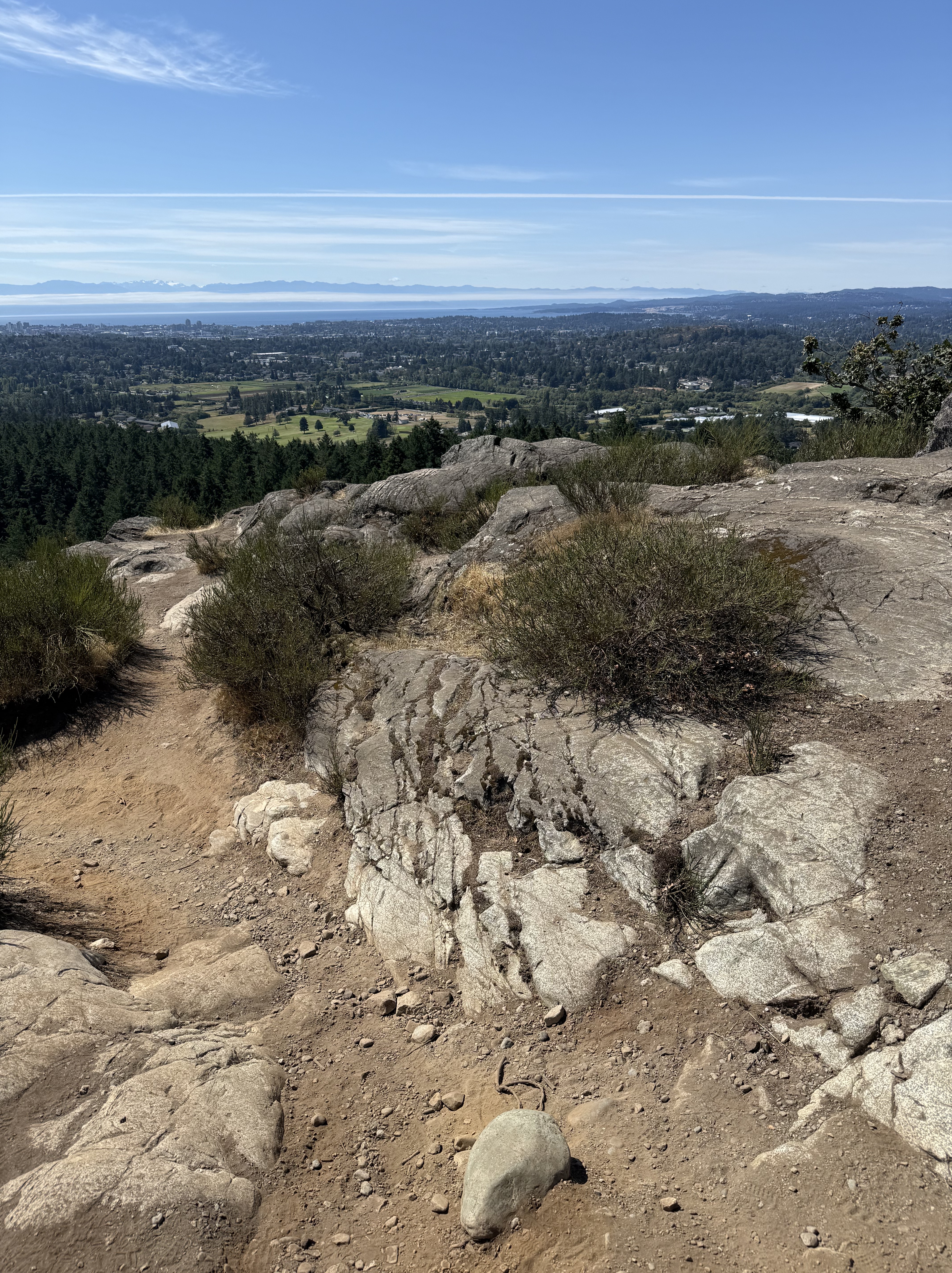
Figure 5. The view, looking south from the top of Mount Douglas (see Fig. 2 for location), reveals Mount Olympus (snow-covered peaks in the distance); and intrusive rocks with the characteristic salt-and-pepper color of granodiorite. This exposure also contains a set of joints (large X pattern enhanced by weathering) that would have appeared as the rock rose through the crust as overlying rocks were eroded. Victoria is visible in the distance.
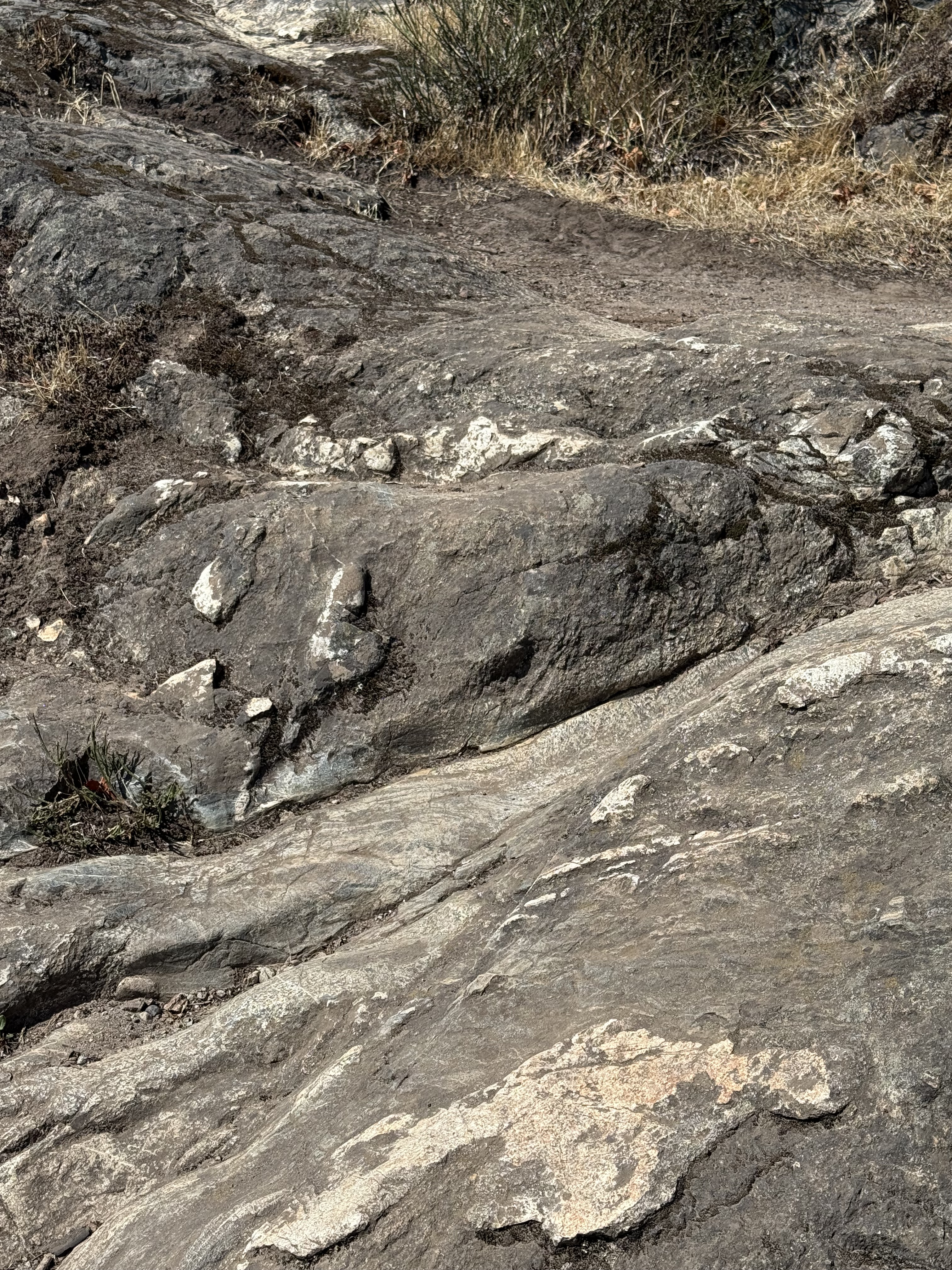
Figure 6. This image shows veins of quartz or feldspar (white material) that would have filled cracks and voids after the main magma had solidified (tens of miles deep), but residual liquids were still present.
Port Renfrew
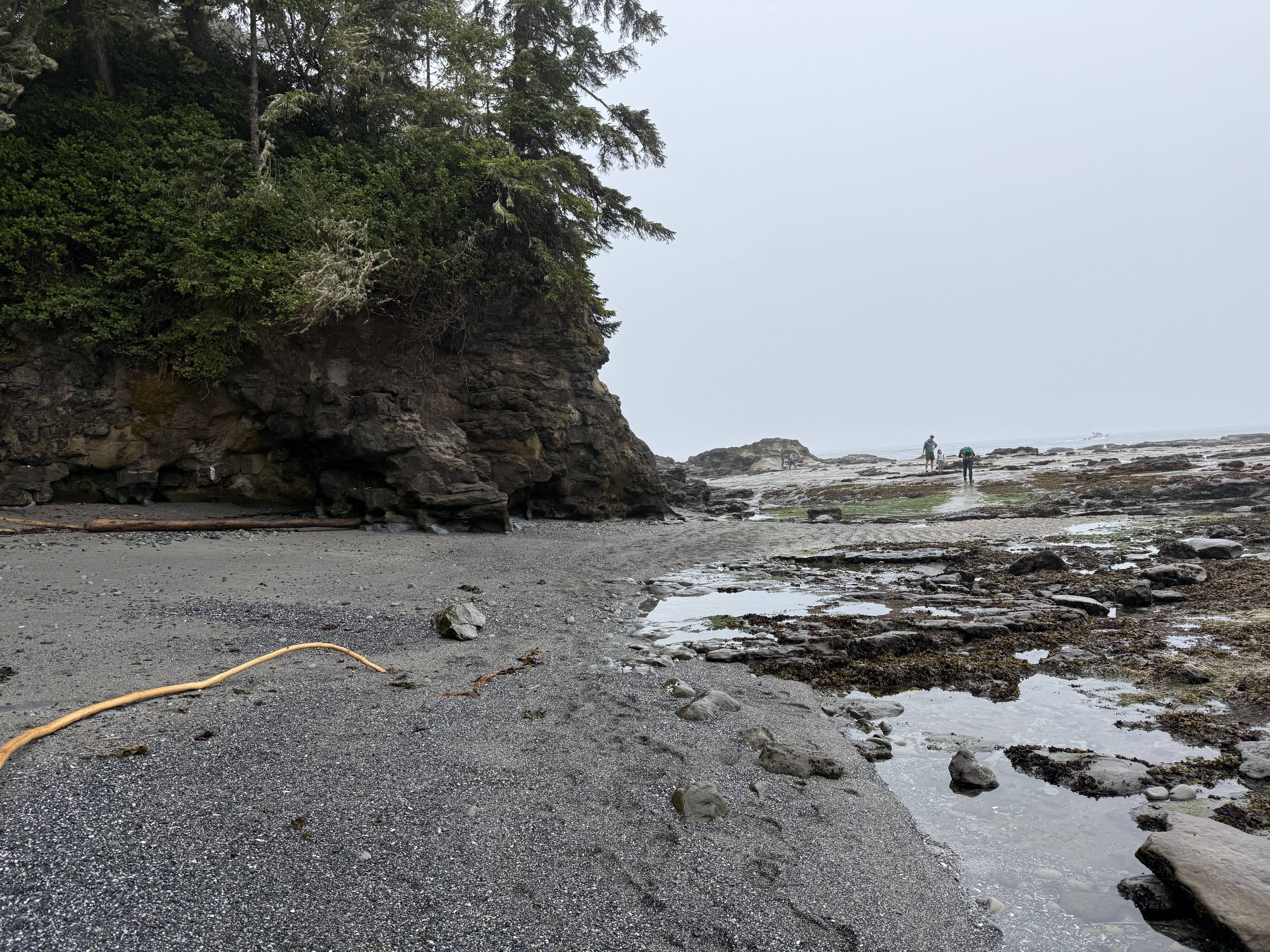
Figure 7. The cliffs at Port Renfrew are lower than in Victoria (compare to Fig. 1). They also don’t appear to be the same intrusive rocks we saw at Beacon Hill Park or Mount Douglas. The beach is covered with boulders and dark, coarse sand that couldn’t have originated from the erosion of granitic rocks. Let’s take a closer look.
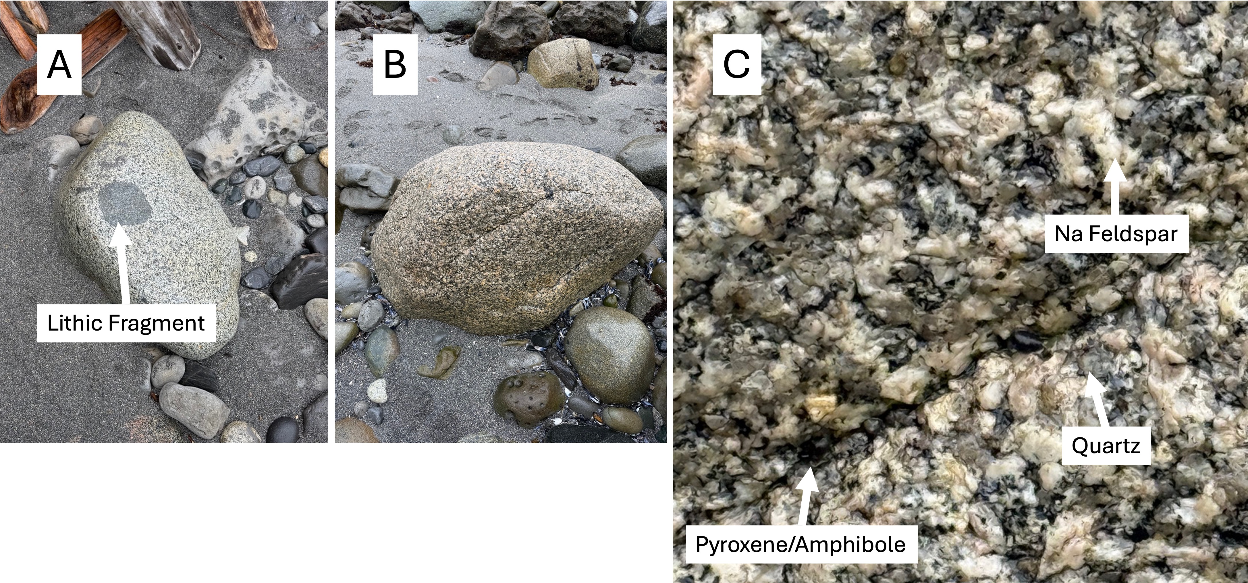
Figure 8. (A) This boulder includes a piece of the rock the magma was intruded into. The rounded edges suggest that the magma was still hot enough to partially melt the fragment; furthermore, the lack of a halo surrounding the inclusion implies that the melted material was incorporated into the magma by mixing. (B) This looks a lot like the granitic rocks in Fig. 5. (C) This boulder is fresh and individual minerals can be identified. Being wet enhances the contrast. The low quartz composition (I estimate it at ~20% from the gray blobs) suggests that this is either granodiorite or tonalite, depending on the amount of Ca-bearing feldspar. That requires either a chemical or mineralogical analysis. These boulders were transported along rivers from the center of the island, which is composed of granitic rocks (Fig. 2).

Figure 9. These ripples are almost a foot long, measured from crest to crest; and the troughs are filled with larger fragments of rock and shell. You don’t see these sedimentary structures preserved in the rock record very often, even if they do survive the vigorous tides on Vancouver Island.
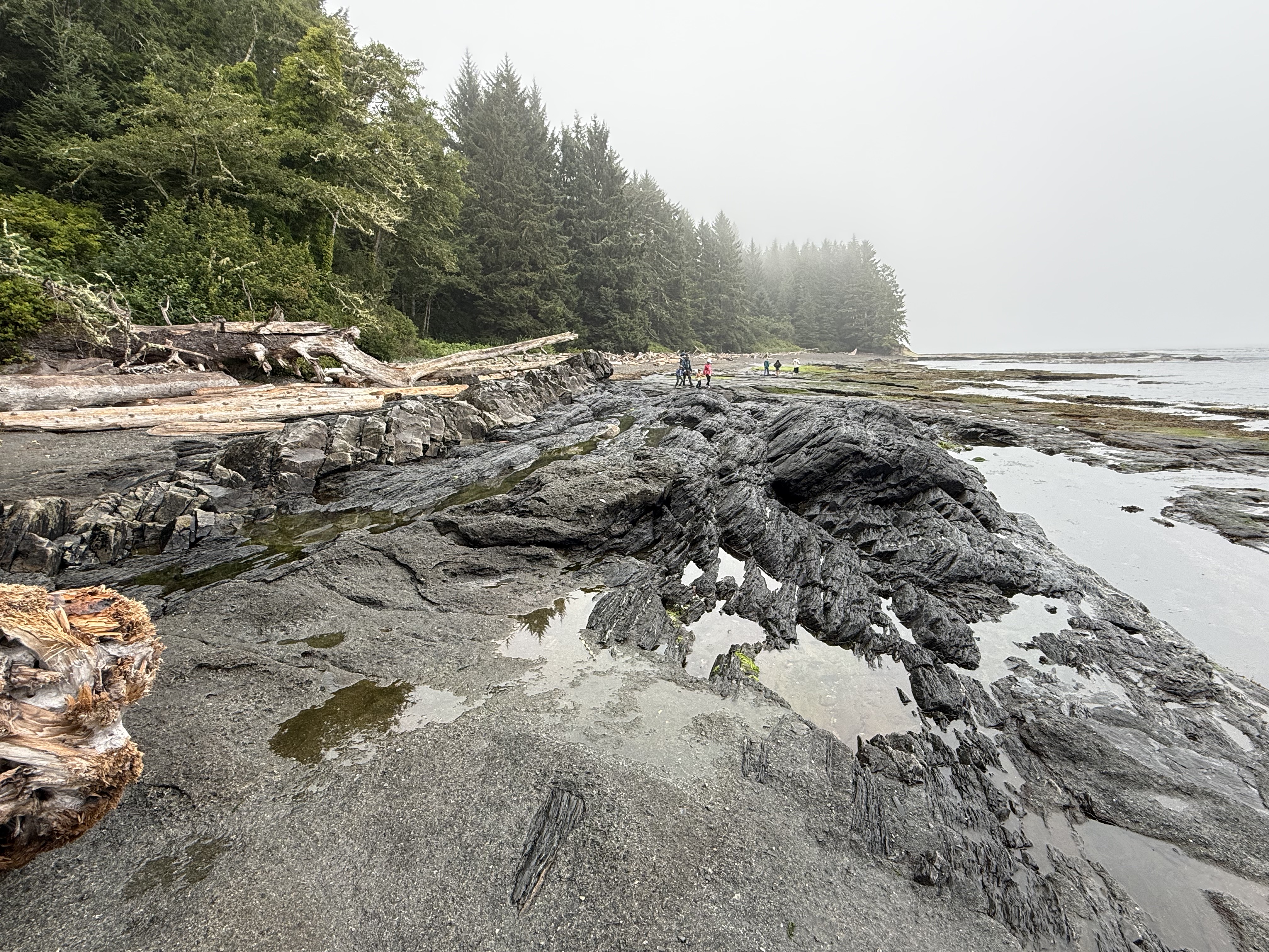
Figure 10. Exposures like this make geology fun. The darker rocks are tilted about 30 degrees to the left, but there are two distinct rocks types here: the lighter colored rock to the left is the same sandstone that makes up the cliff (Fig. 7); and the darker rock is schist, highly altered mudstone. In other words, a mildly altered rock is in direct contact with a metamorphic rock.
I checked with RockD, which integrates a global geologic map with location, and discovered I was standing on the contact between Leech River Complex metamorphic rocks (200-66 Ma) and Carmanah Group unaltered sedimentary rocks (37-23 Ma). This is a textbook unconformity that represents at least 29 million years.
The younger rocks are nearly horizontal, so I think this is an angular unconformity. During the missing millions of years, the older sediments were buried and heated enough to create schist; then uplifted and exposed to the sea, whereupon the younger rocks were deposited on a beach not that different from what we see today.
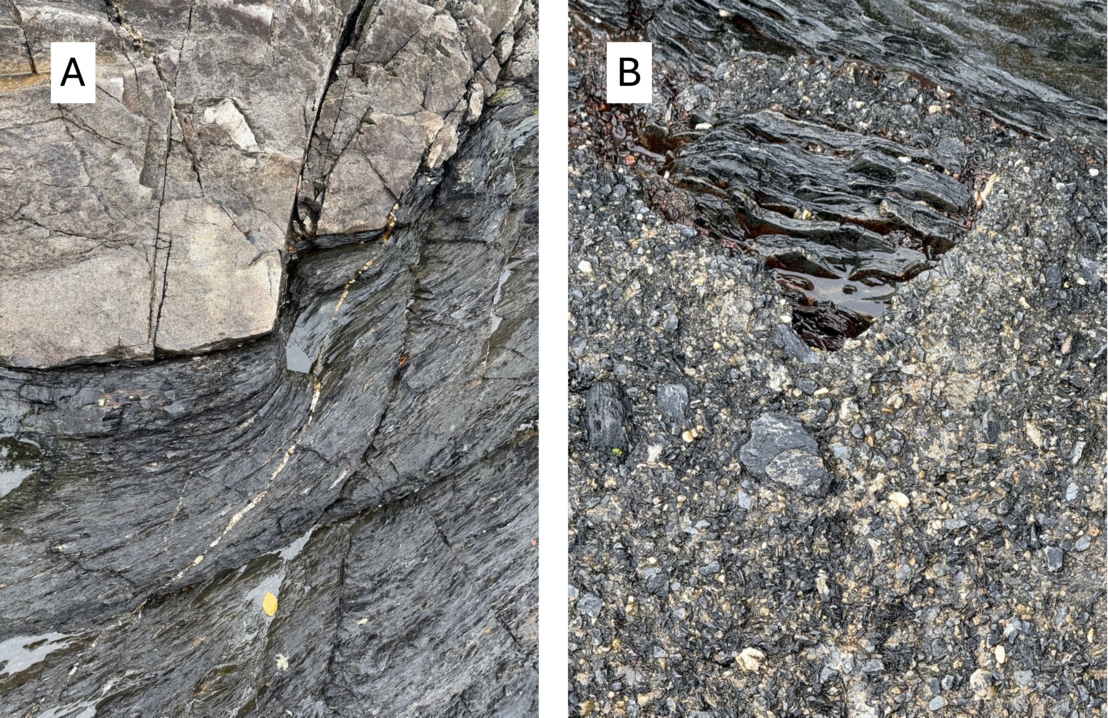
Figure 11. The devil is in the details, as shown in these images. (A) The older rock was folded during burial and, when exposed to the waves, eroded along relict bedding surfaces. Coastal sediments were then deposited in nooks and crannies like we see today. (B) Those dark fragments that look like they’re lying on the beach are actually cemented in place; the background pebbles aren’t modern sand, but instead sand frozen in time at least 29 million years ago.
Amazing.
Summary
Sometimes you can tell a story about the rocks you find, and this is one of those times. And it’s a story that unfolds across the globe. However, this story can’t be easily told because it unfolds on a sphere–the Earth. I’ll do my best.
For hundreds of millions of years, way back in the Paleozoic era, what we now call North America was drifting eastward and the West Coast (e.g. the Pacific Northwest) was a passive margin, like the East Coast is today. Suddenly, geologically speaking, the supercontinent, Pangea, which had been created from all the continents, split apart. North America reversed direction and the passive margin became a collisional plate boundary.
Ocean crust, and any islands or microcontinents that were in the way, were swallowed by the mantle or crushed by North America, creating the igneous rocks we saw at Beacon Hill Park and Mount Douglas. Muddy ocean sediments were swallowed and transformed into the schist we found at Port Renfrew. Volcanoes erupted all along the West Coast.
Then the story gets complicated and controversial.
Because the earth is not flat, crustal plates don’t slide beneath one another like sheets of paper. They crumple at the edges, forming transform faults (e.g. San Andreas fault of California) along which tectonic plates (or pieces of them) can slide past each other horizontally. This probably occurred between 200 and 66 million-years ago; if so, the rocks of Vancouver Island were originally deposited/intruded in Eastern Washington before sliding hundreds of miles to the NW.
When the crumpled edges of the colliding plates had taken up the slack, subduction resumed to the SE and the Cascades Range of volcanoes was born. This process continues to this day.
That’s the best story I’ve heard so far.
Three Days on Vancouver Island

If you’re ever in the PNW, you can drive to Vancouver Island on the M.V. Coho, a ferry commissioned in 1959, which plies the route from Port Angeles, Washington, to a berth in downtown Victoria several times a day. Victoria is the capital of British Columbia–that’s a province in Canada. In this post, I hope to show you how much there is to explore without venturing into the wilds of an island that is more than 280 miles long.
This is going to be a long post because the culture and geography are so intertwined that they cannot be experienced, much less discussed, in isolation. However, I will present my geological survey in a separate post.
Let’s do it!
Downtown Victoria
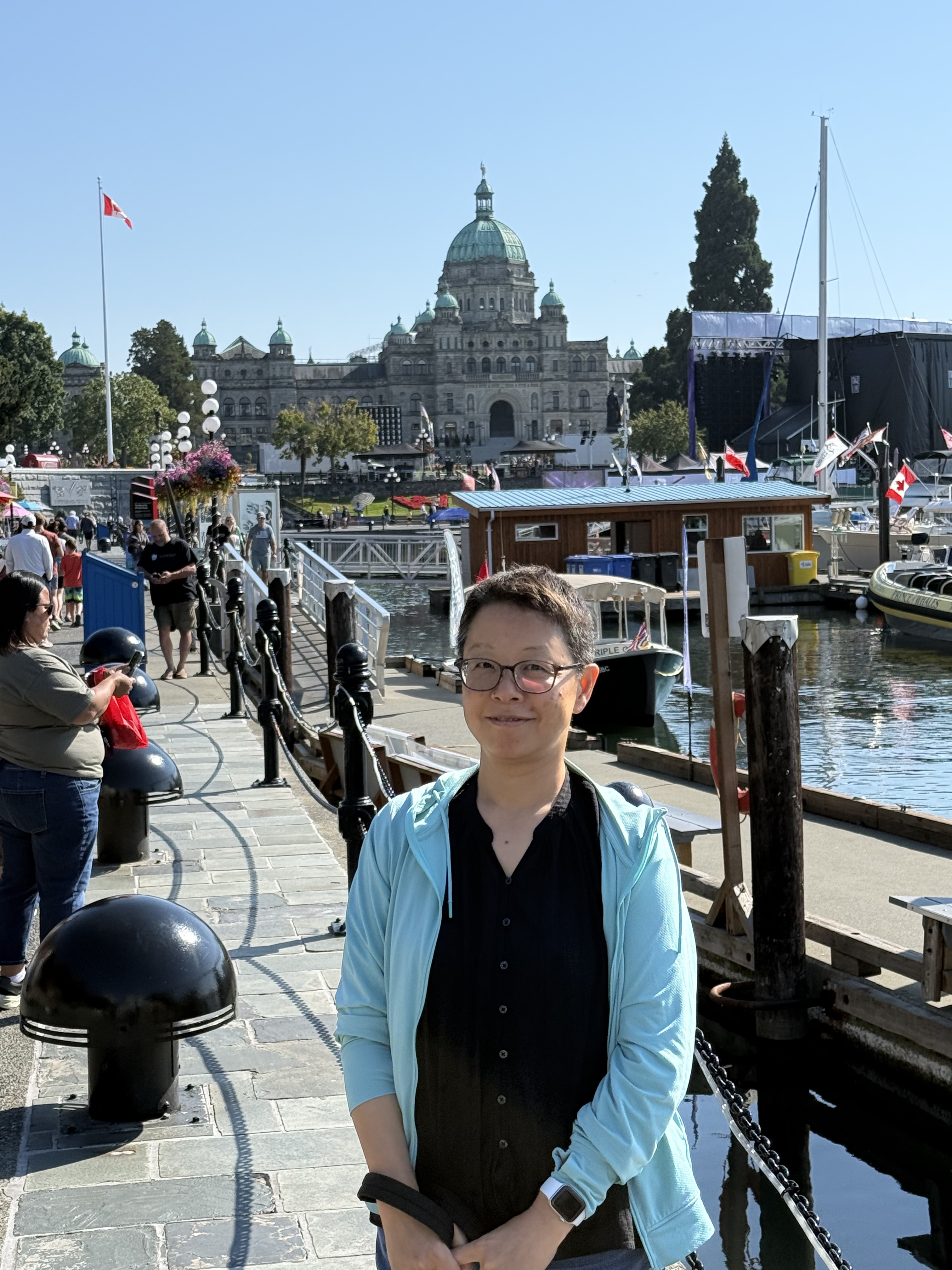
We stayed a couple of blocks from the waterfront, where British Columbia’s legislature meets (Victoria is the capital). On this particular weekend, which had spectacular weather, there was a free concert on the waterfront for David Foster, a Canadian music writer, publisher, etc, who comes from Victoria. They had a massive celebration, with Jay Leno as MC, beginning with an aerial display by the Snowbirds–the national aerobatics flying team–and ending with a fireworks display that lasted 30 minutes.
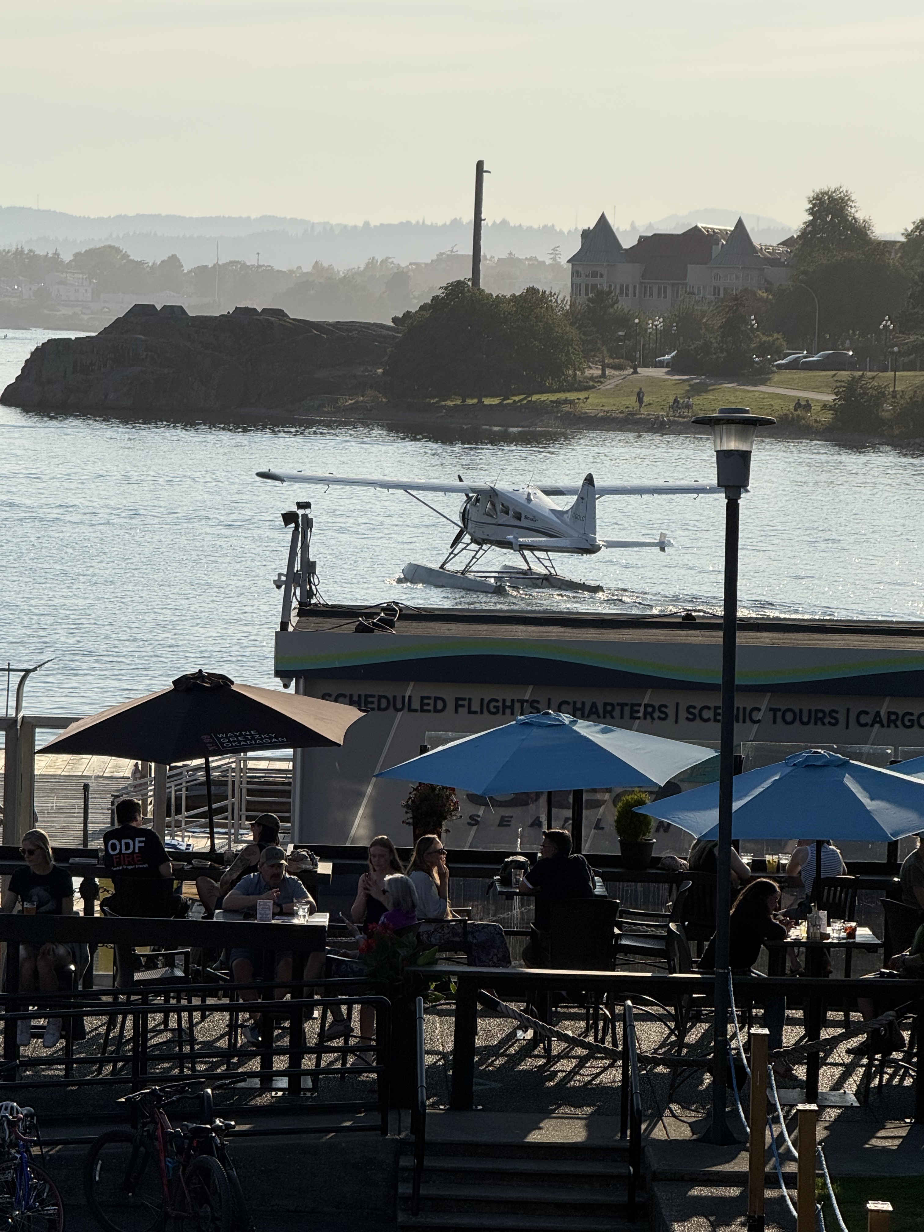
You can catch a tour in either a single- or twin-engine seaplane. They take off and land right in the harbor. That’s crazy, but somehow they don’t have enough incidents between aircraft and boats (including cruise ships), to make the news. I checked.
This is one of the most interesting waterfronts I’ve visited, probably because it is summer; however, Vancouver Island has the warmest overall climate in Canada. Food for thought.
Beacon Hill Park
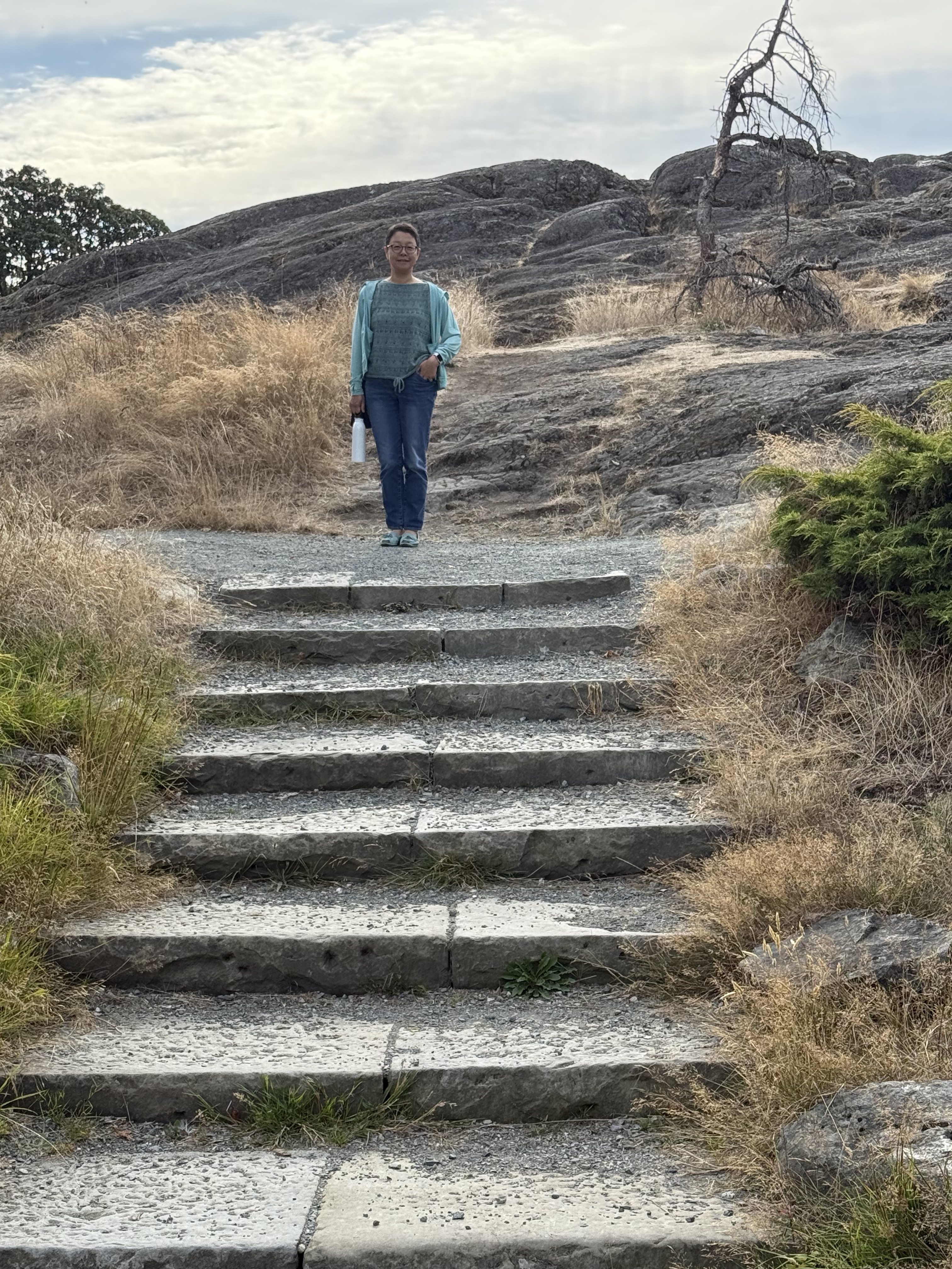
We like to walk, so we strolled towards the coast and discovered beautiful gardens and some of the bedrock exposed, with steps leading up to it; but this isn’t Beacon Hill proper.
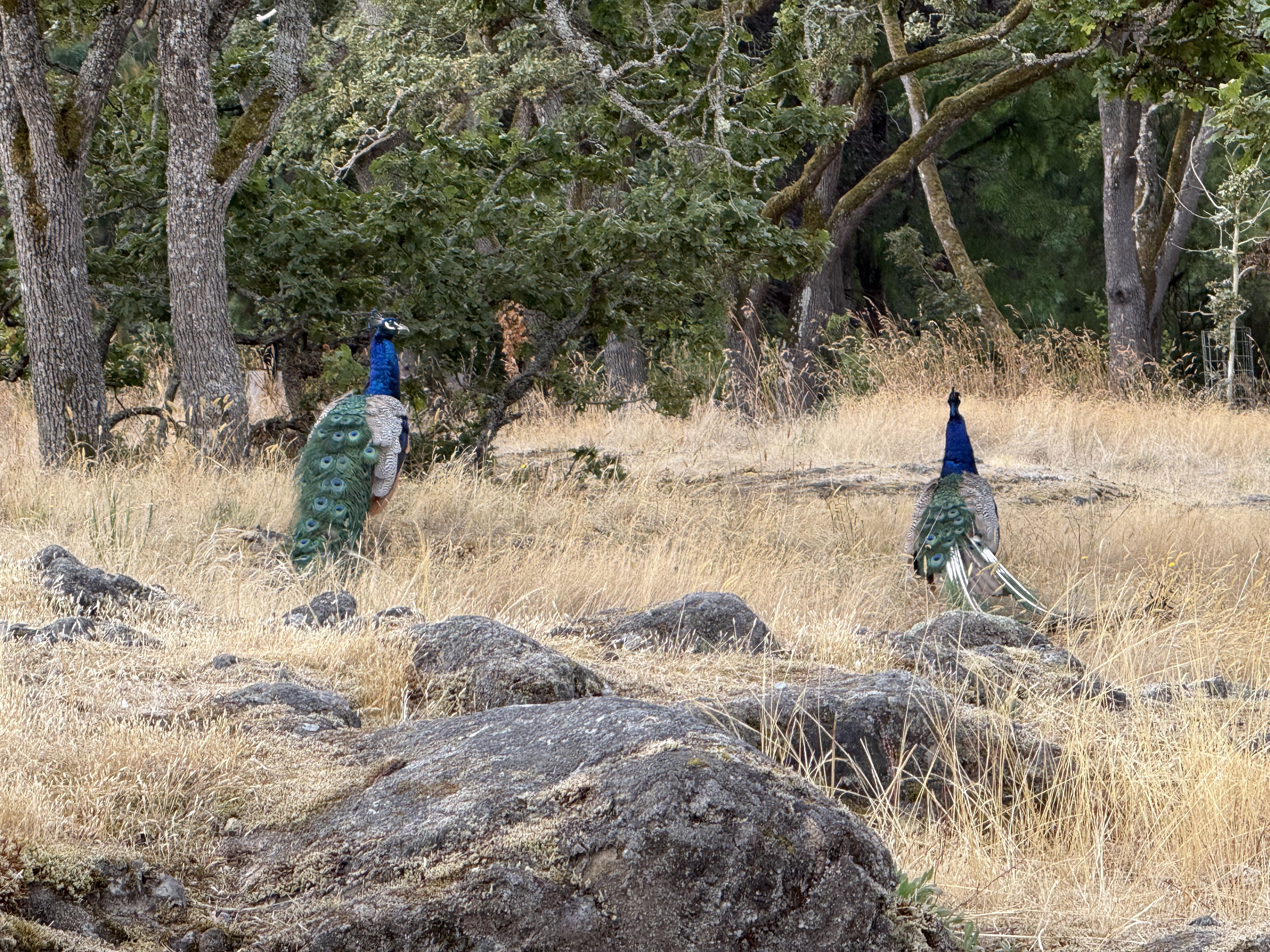
Beacon Hill Park is occupied by a flock of Indian peafowl (Pavo cristatus), which apparently are okay with the mild winters in the PNW.
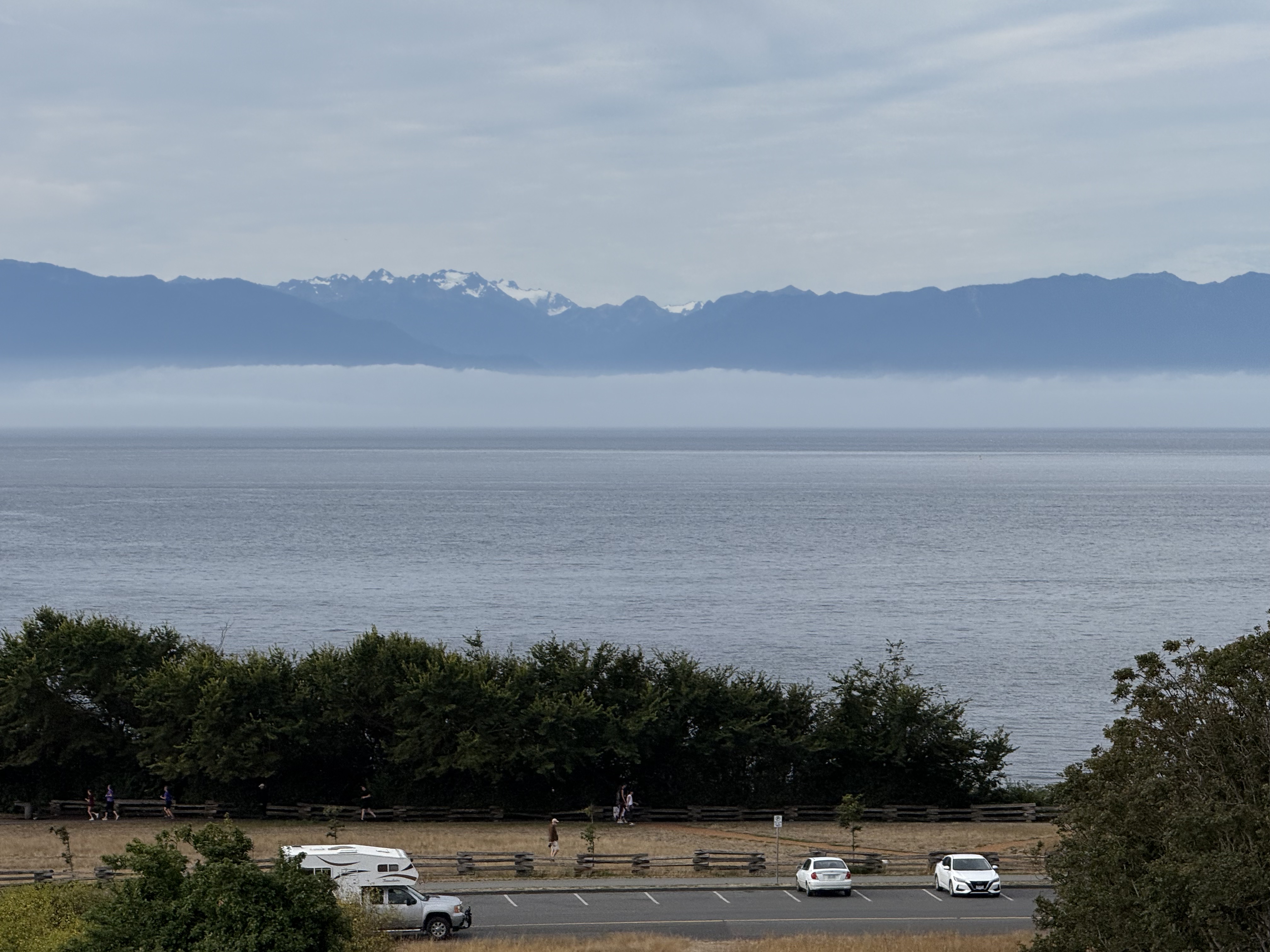
From Beacon Hill itself, you can see Mount Olympus (about 8000 feet elevation) across Juan de Fuca Strait. It is the snow-covered mountain, only forty-six miles distant.
Royal British Columbia Museum
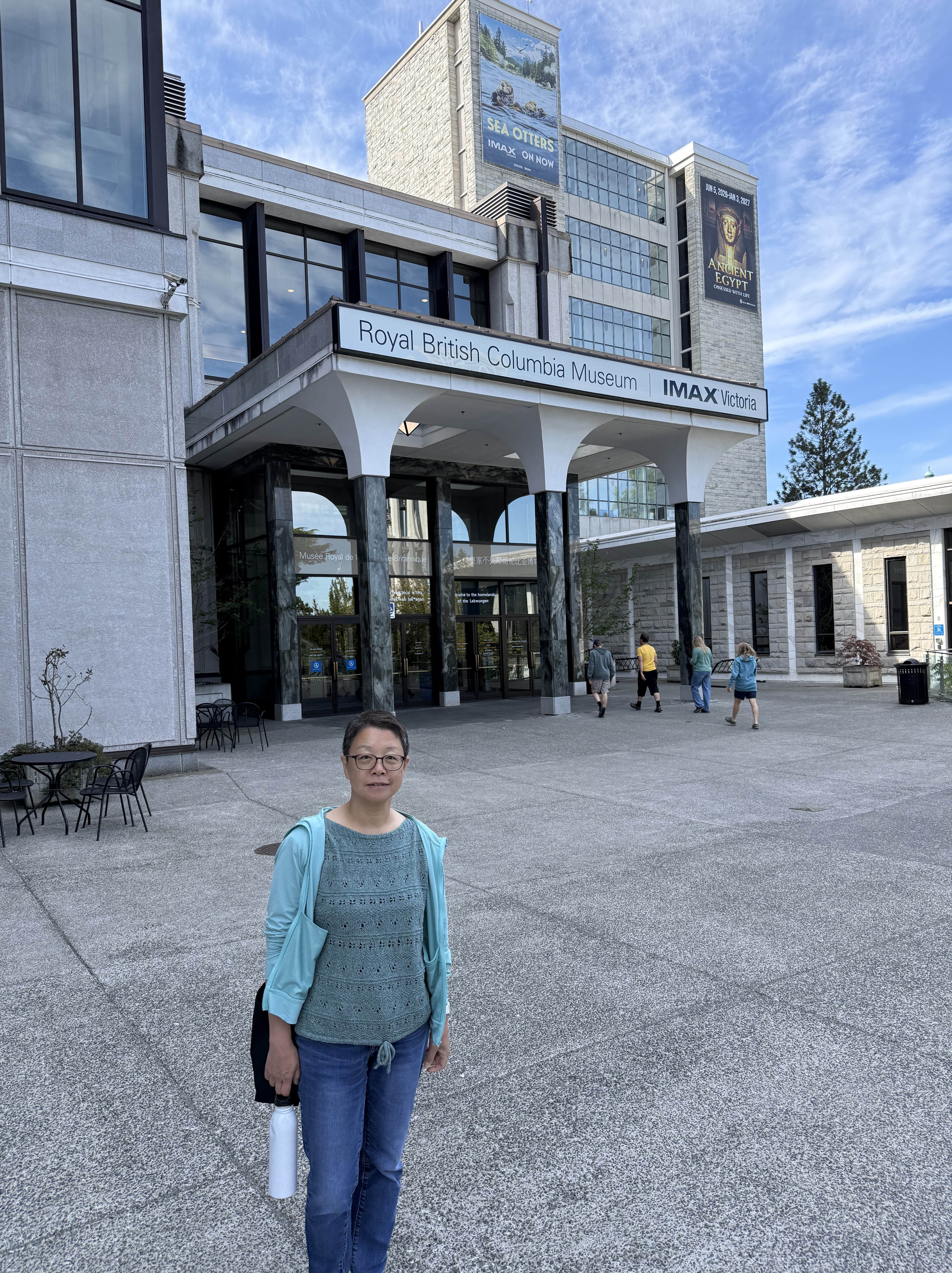
The museum had a display of Egyptian artifacts focused on death and the afterlife, but you can see something like that almost anywhere…
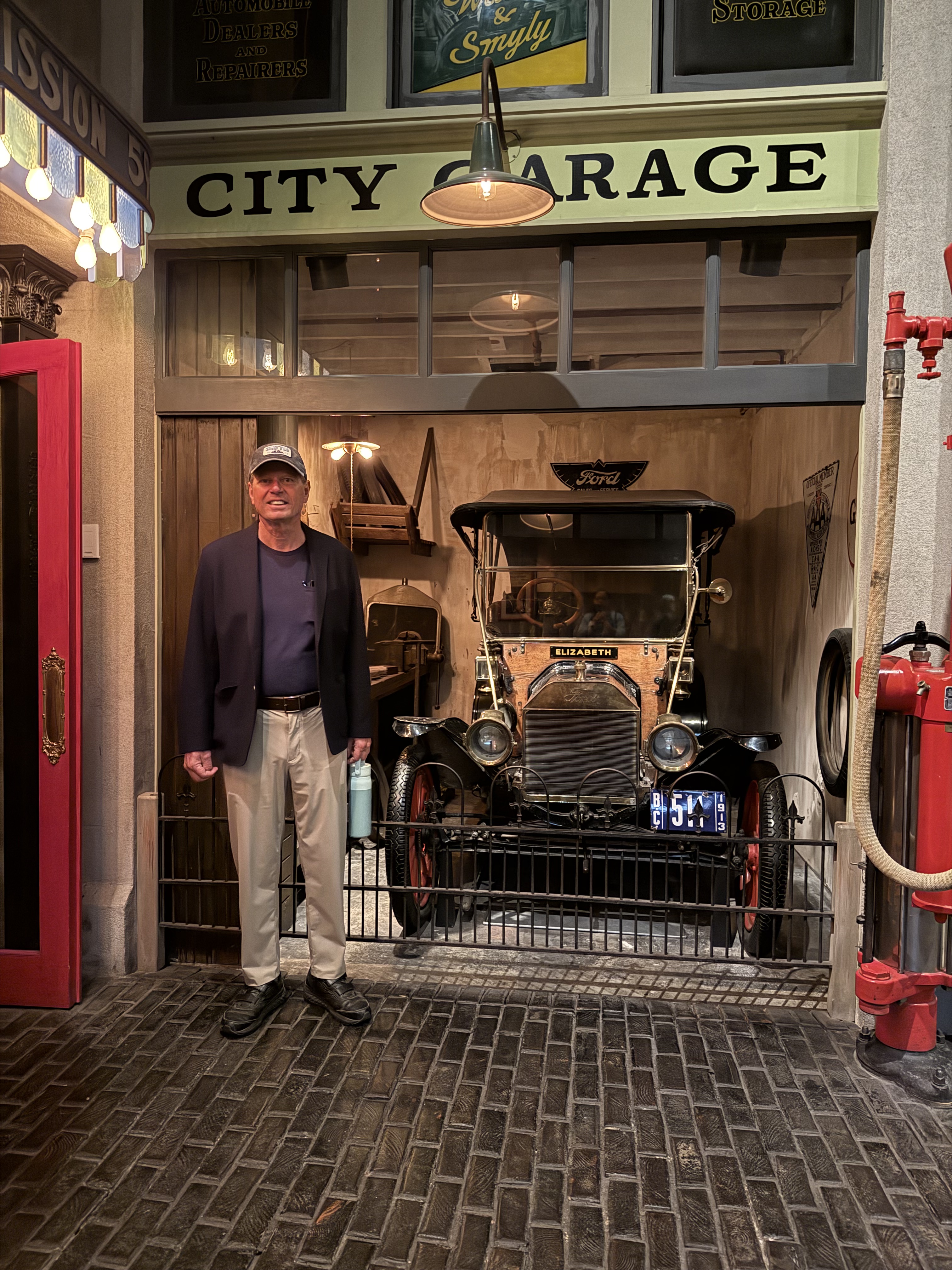
My favorite exhibit was an incredibly detailed recreation of life in Victoria about 100 years ago, which showed how the island evolved through the twentieth century. As an aside, I have a license to drive that Ford Model T, but that’s another story.
Craigdarroch Castle
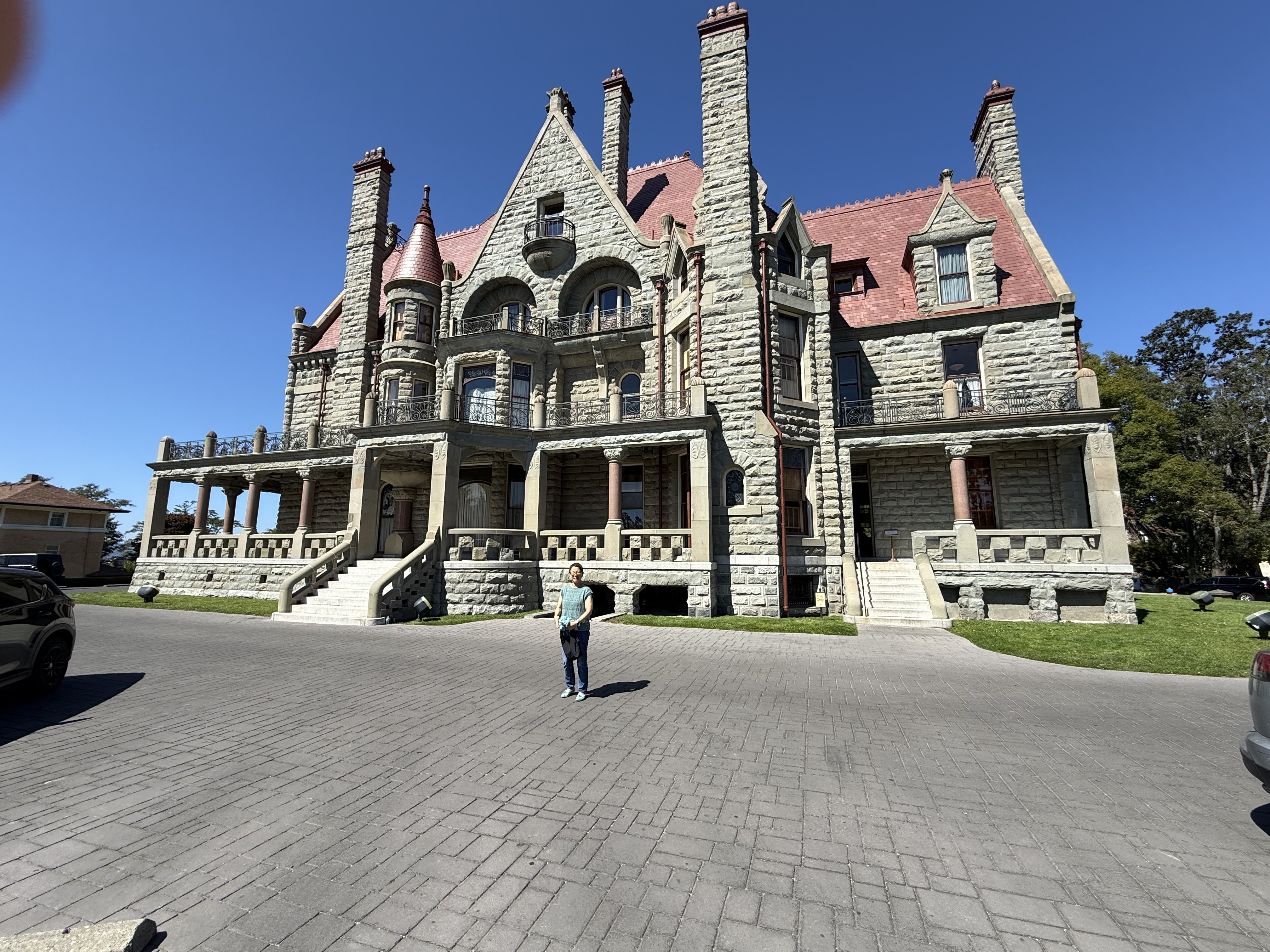
This luxurious estate (originally 28 acres) was built on a hill overlooking Victoria in the early 1900s by a coal baron, who didn’t live to occupy it. But his wife and children did. It served as a military hospital during WWI, which saw more than 200 thousand Canadian casualties. That’s a lot for a smaller country; those with long-term disabilities were sent to recuperate in places like this. The property fell into disrepair after the war, the property was divided into parcels for the surrounding homes, and eventually purchased by a non-profit society, who is restoring it to its original condition.
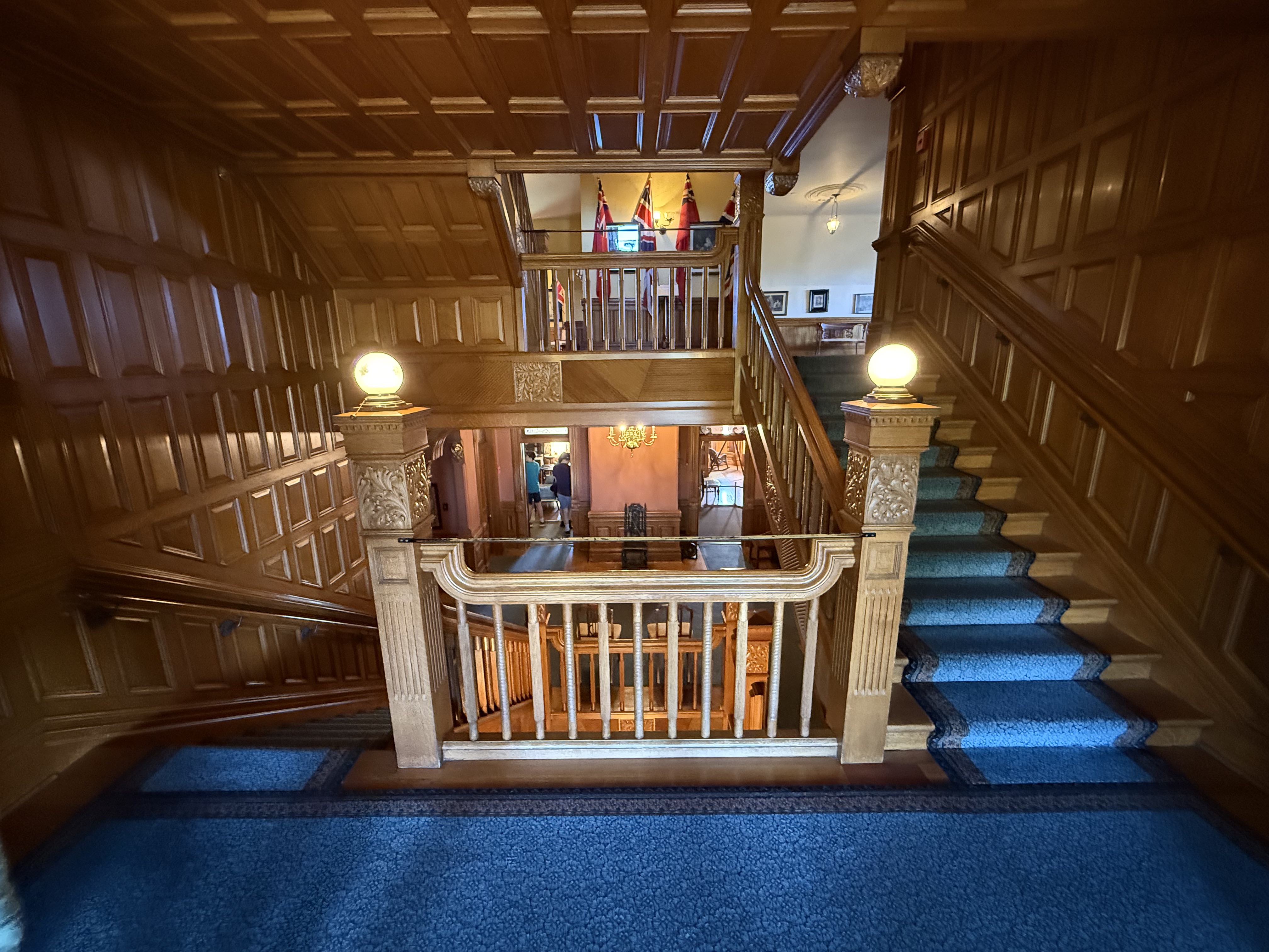
The interior is an eye-catching, and confusing, 4.5 floors of engraved wood and paneling, even the ceilings. The carpentry was completed by a Chicago company that had worked on several other mansions.
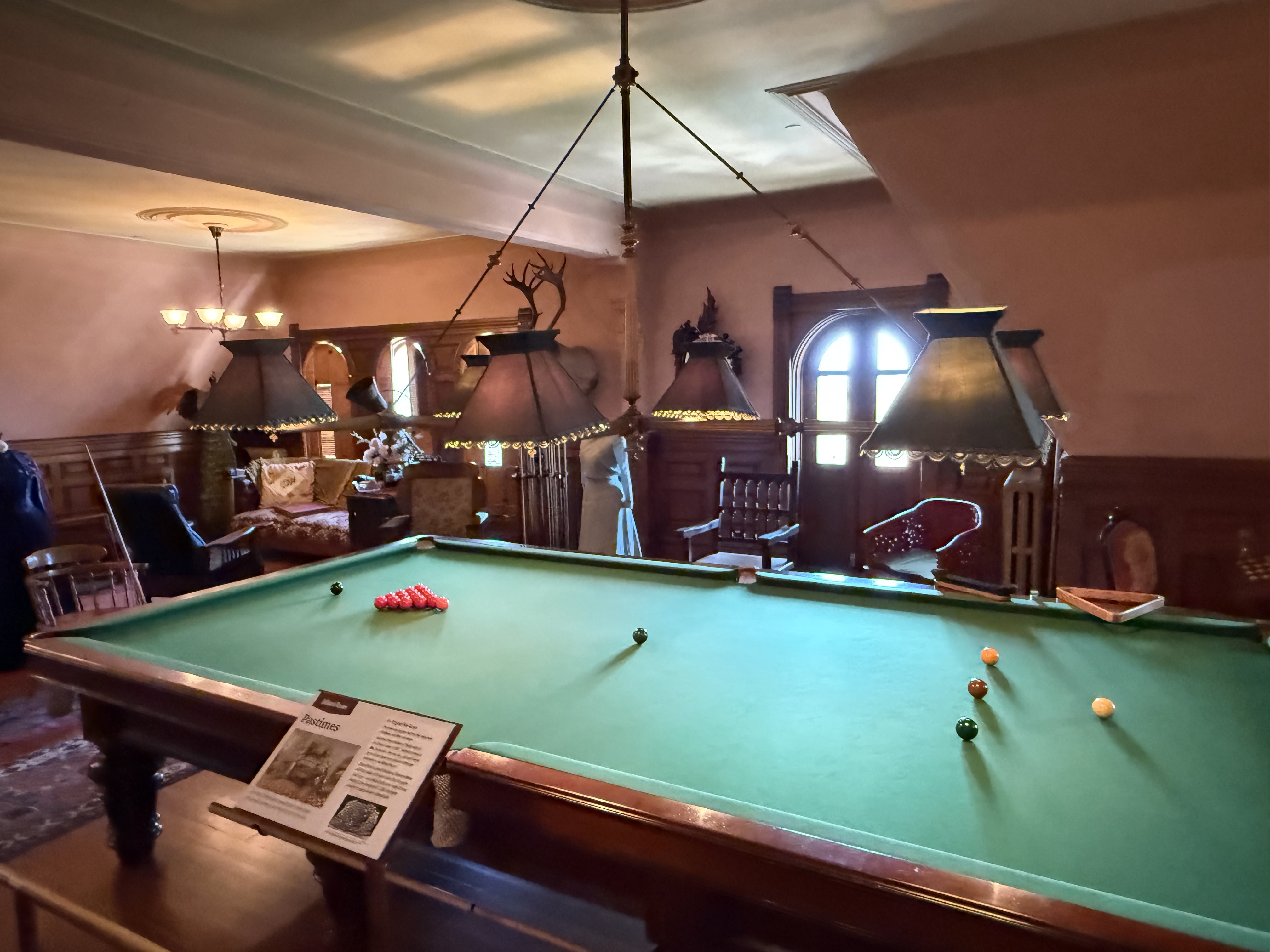
I’m sure that Robert Dunsmuir (the builder) would have enjoyed this oversized pool table. But the balls seem a little small–I guess it wasn’t for regulation play. The entire house was decorated to this detail.

Dinner is served. The kitchen has also been restored and tourists are encouraged to handle the stove and other appliances, but I wanted to keep this post as short as possible. LOL!
Port Renfrew
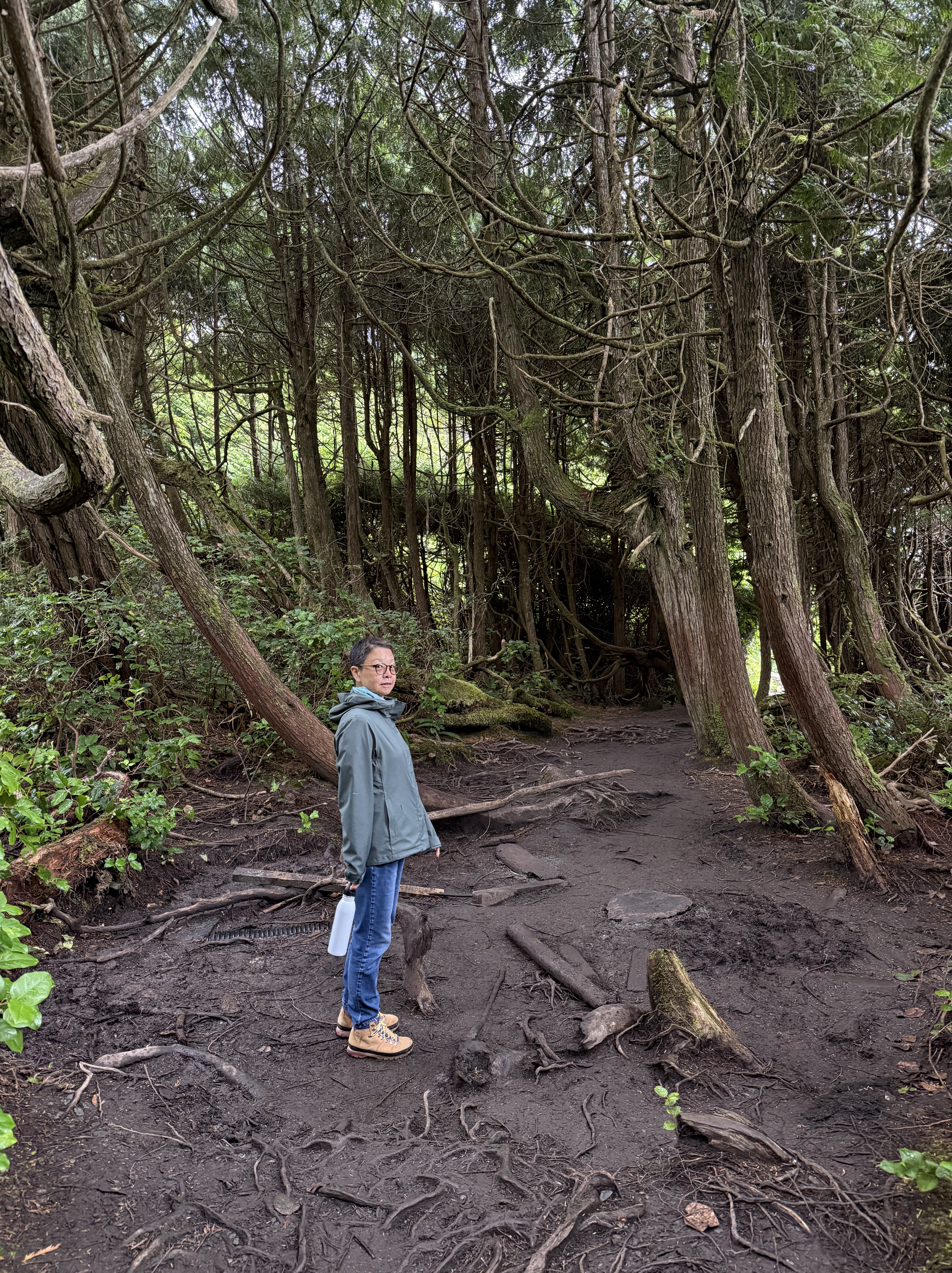
We finally used our car to drive the 68 miles to Port Renfrew. I don’t know why it’s called a port because it is a temperate rainforest with a few inhabitants, mostly catering to ecotourists. Obviously, this is not old-growth like Olympic National Park in Washington, but it’s working hard and fast to recover. We walked for a mile BENEATH a dense growth of ground cover, which had assumed monumental proportions. Surreal.
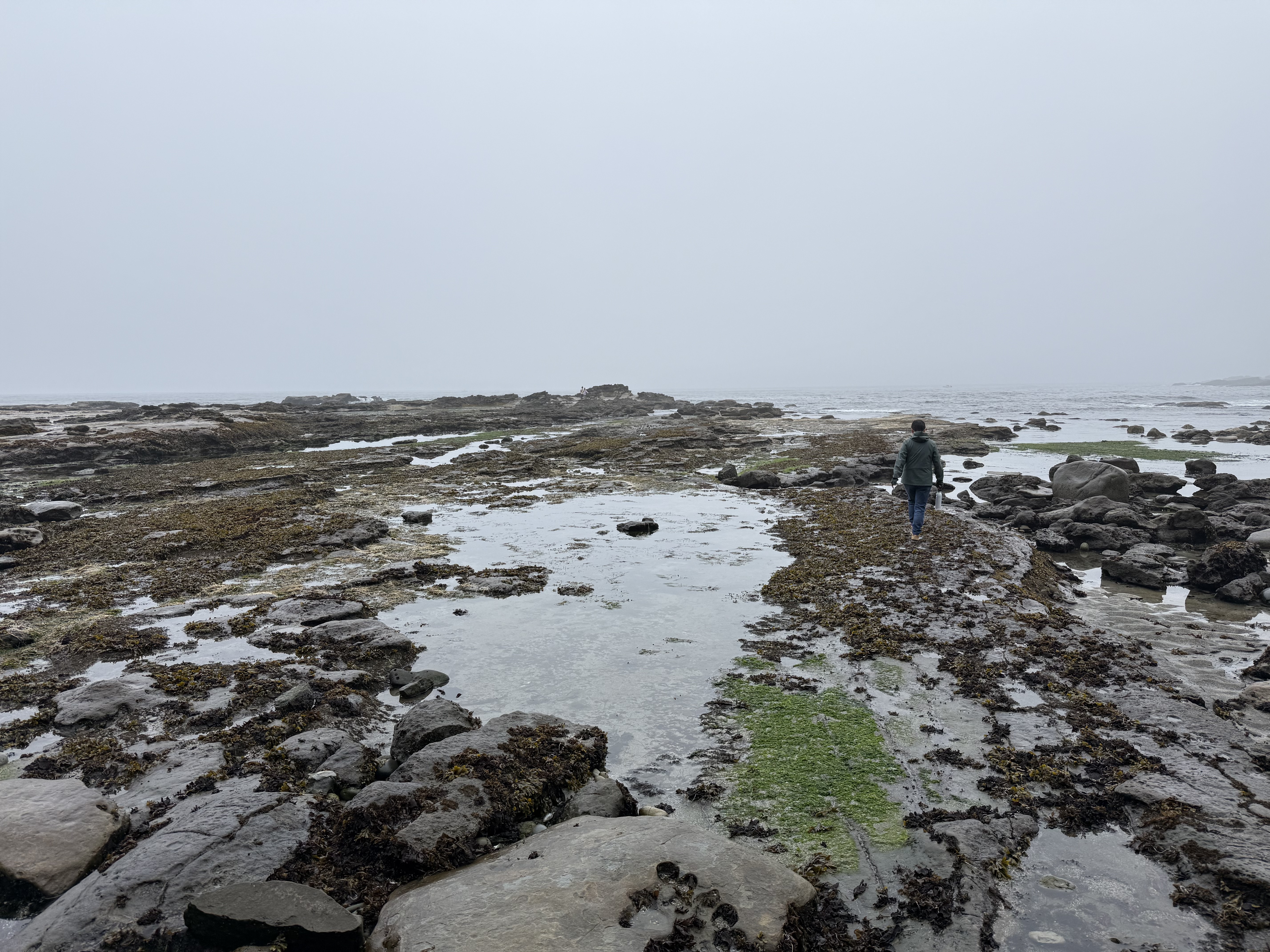
The tidal range is 7-10 feet, so a vast intertidal area exposes rock (I’ll address that in a later post) and a huge number of tidal pools, hosting a myriad of sea creatures.
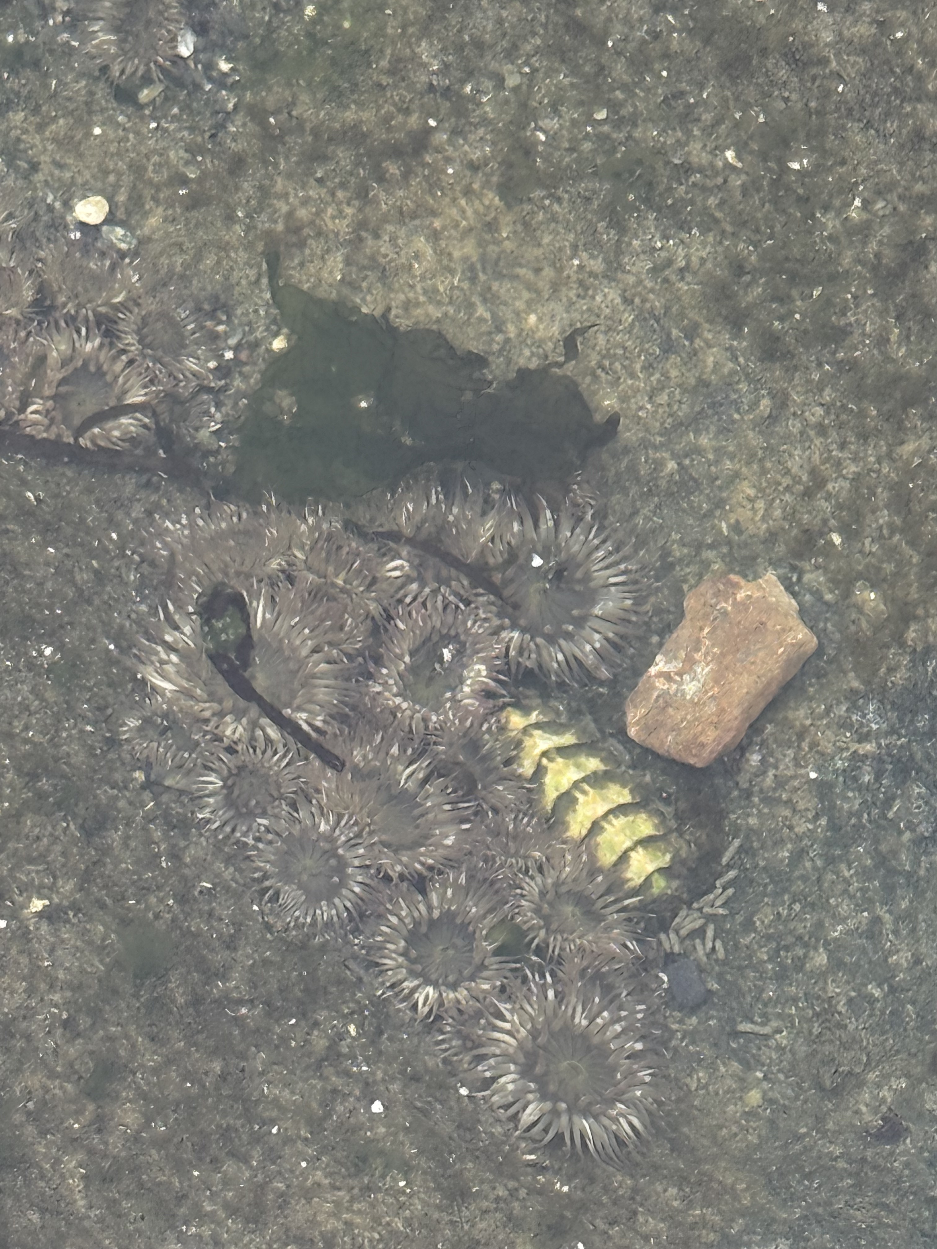
I took this photo in a tide pool scoured in sandstone, about two-feet across and one foot deep. According to ChatGPT the circular animals are sea anemones whereas the shiny critter is some kind of chiton (a distant cousin of snails and clams). While I was studying the rocks, everyone else was staring into the huge number of tidal pools scoured into soft rock, each a tiny world that is never dry because the tide comes in twice a day.
The Butchart Gardens
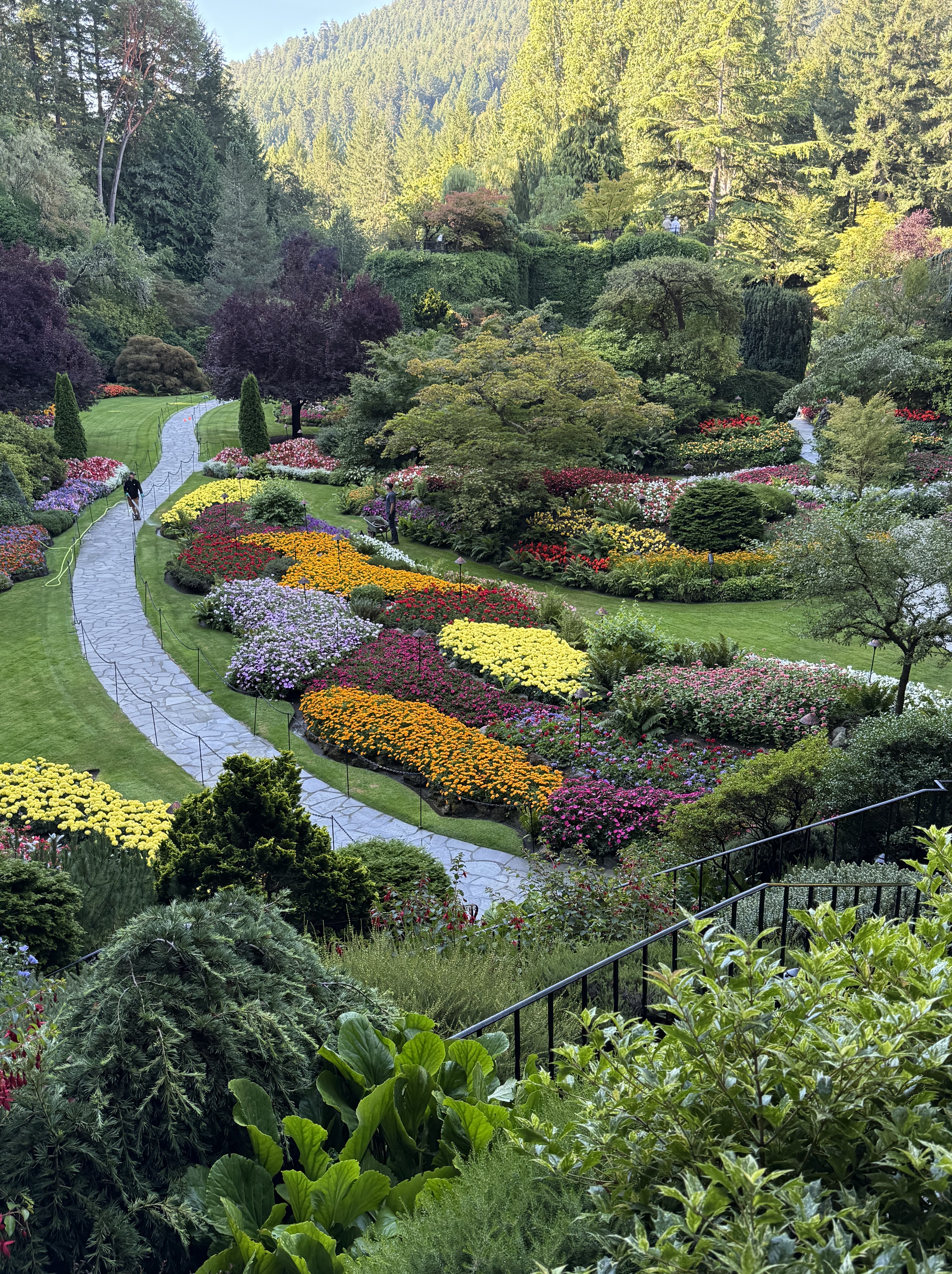
This incredible garden was constructed in and around an abandoned limestone quarry, by the owner of a concrete company–kind of like the castle built by a coal baron. They had a vision and a plan, which included international experts and a commitment by their children. This is the sunken garden. The meticulous care given this floral extravaganza was displayed by workers pulling weeds by hand, and dead-heading the flower in full public view–well worth the 46 Canadian dollar price of entry. No senior discount.
This display cannot be adequately shown in a video. The “pond” running through the sunken garden is 40 feet deep and pristine–and I mean PRISTINE. Ferns and other climbing plants were meticulously planted in cracks in the limestone walls of the quarry. It ain’t a quarry anymore.
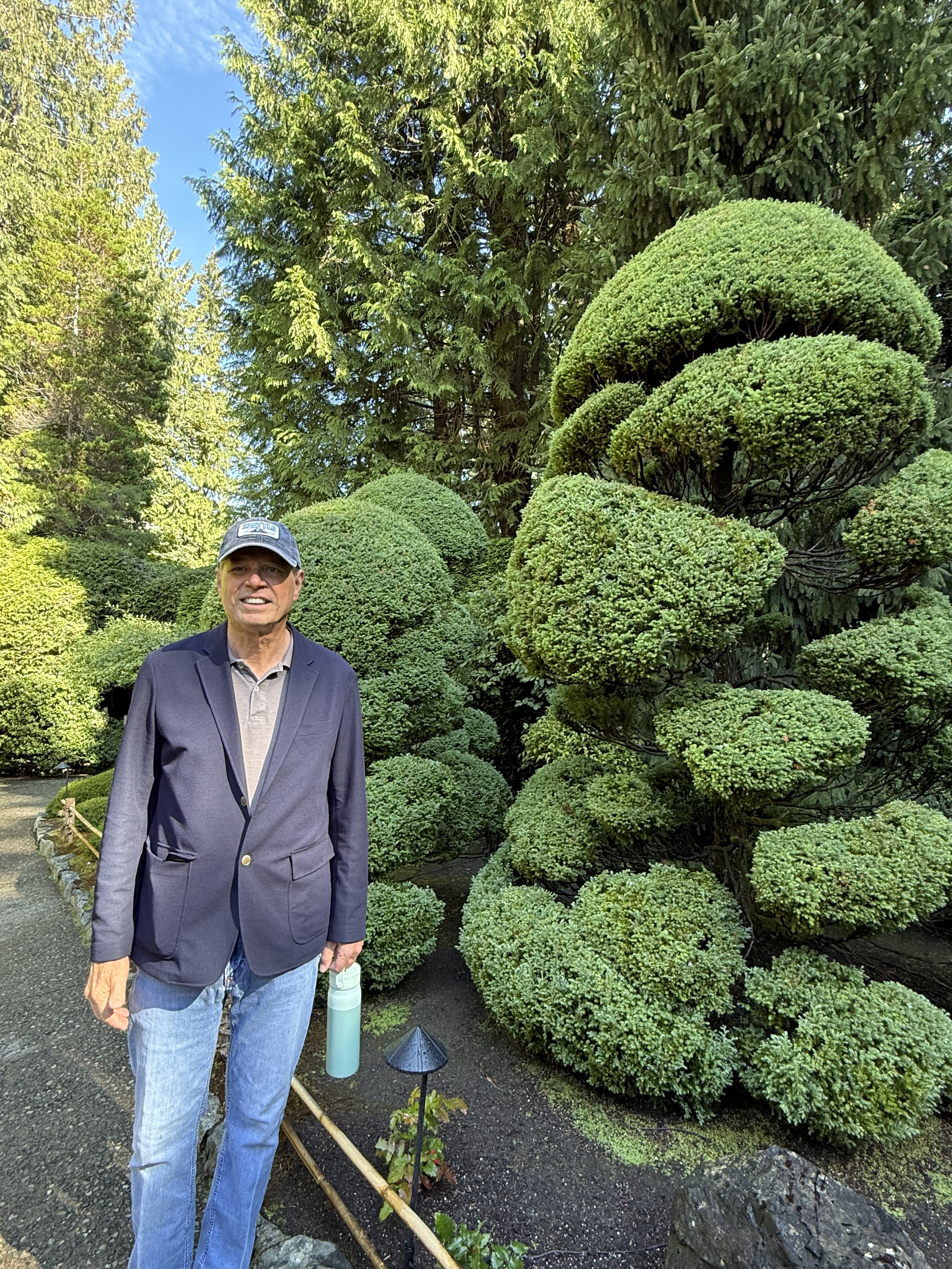
Butchart Gardens is more like an amusement park than a flower garden. Among the specialty gardens, I recall a Japanese garden with streams running throughout, the soft murmur of water encouraging me to take a seat on one of the many benches. There was a rose garden, with every plant labeled. An Italian garden. The topiary displayed in this photo was evident everywhere it was appropriate. And plenty of coffee bars…and washrooms (Canadian for toilet).
Mount Douglas Park
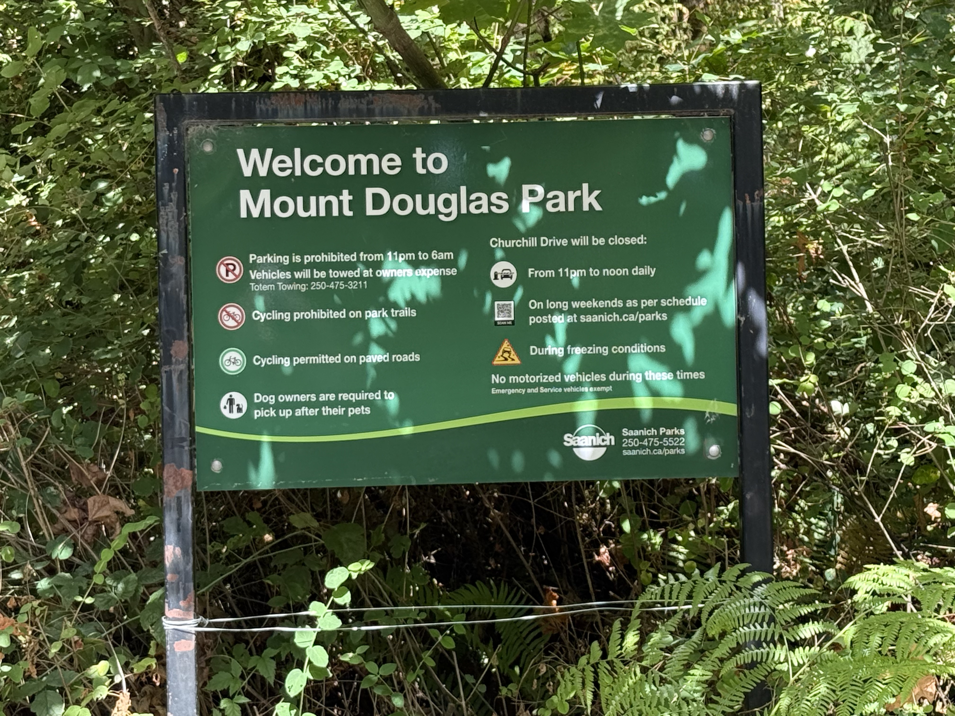
The sign welcoming us to Mount Douglas doesn’t say anything about blue trails or black trails. We learned about that when we climbed (not hiked) 600 feet in less than a mile–very similar to Piestewa Peak in Phoenix. By the time we found ourselves on a ledge overlooking Victoria, we figured out why the lettering was black on this trail.
It was a little scary, like riding The Hulk at Universal Studios the first time, but it was invigorating; neither of us got light-headed, except from the view…
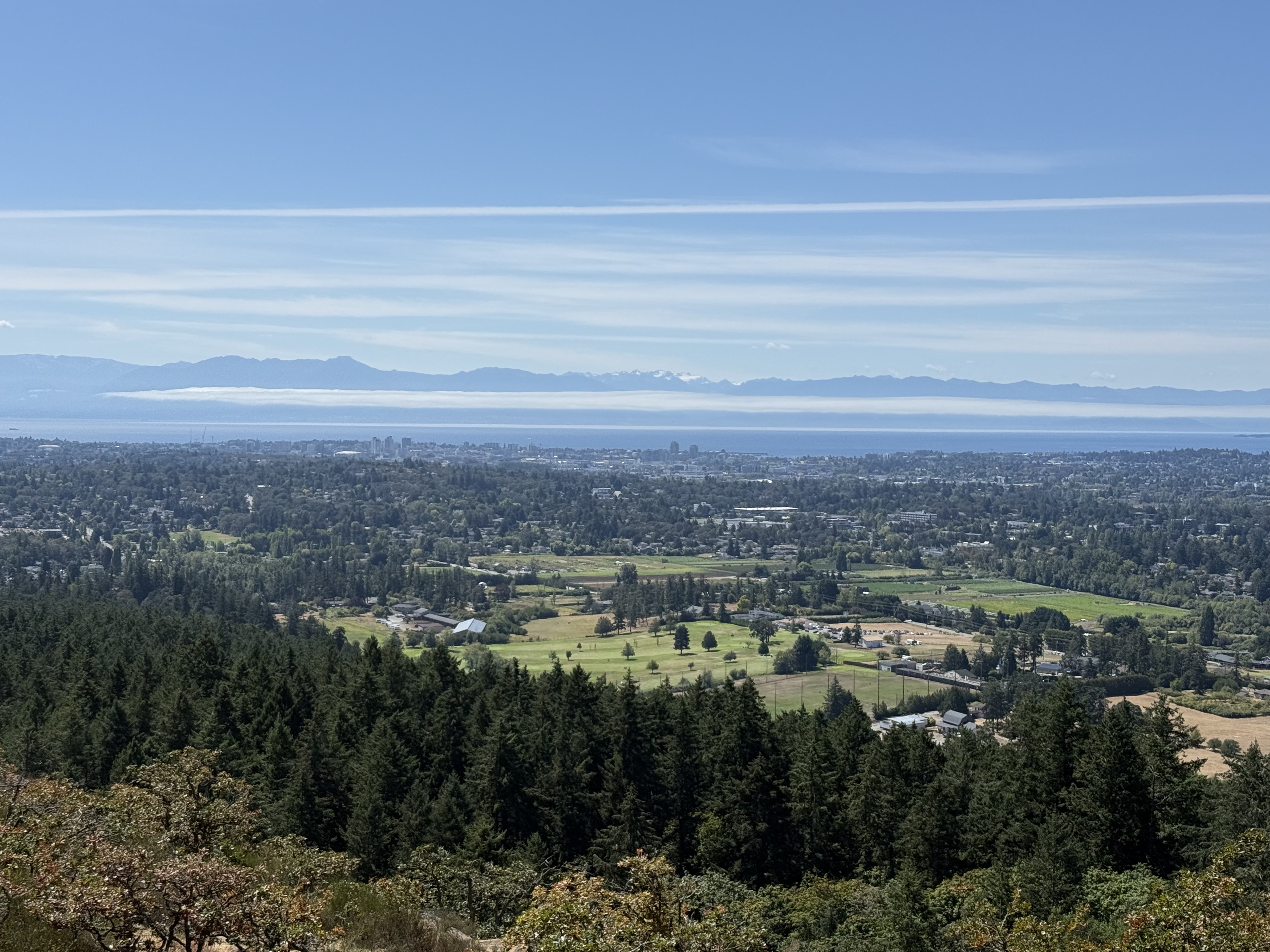
That is Washington across Juan de Fuca Straight. The low cloud bank covers the water between the U.S. and Canada. Snow-covered Mount Olympus can be seen in the distance.
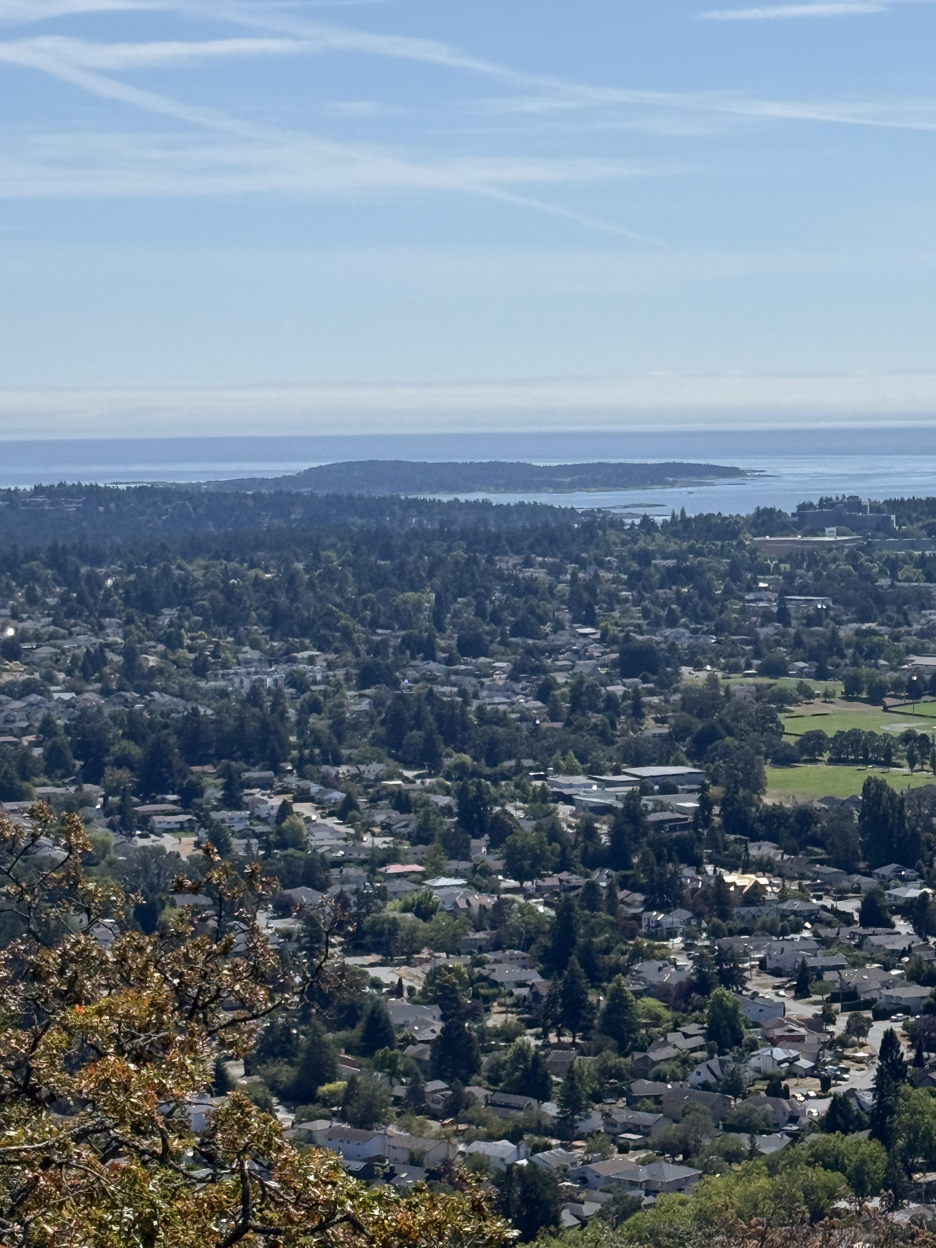
Looking east from the summit reveals a suburban landscape rather than a metropolis because Victoria’s downtown is north of Mount Douglas.
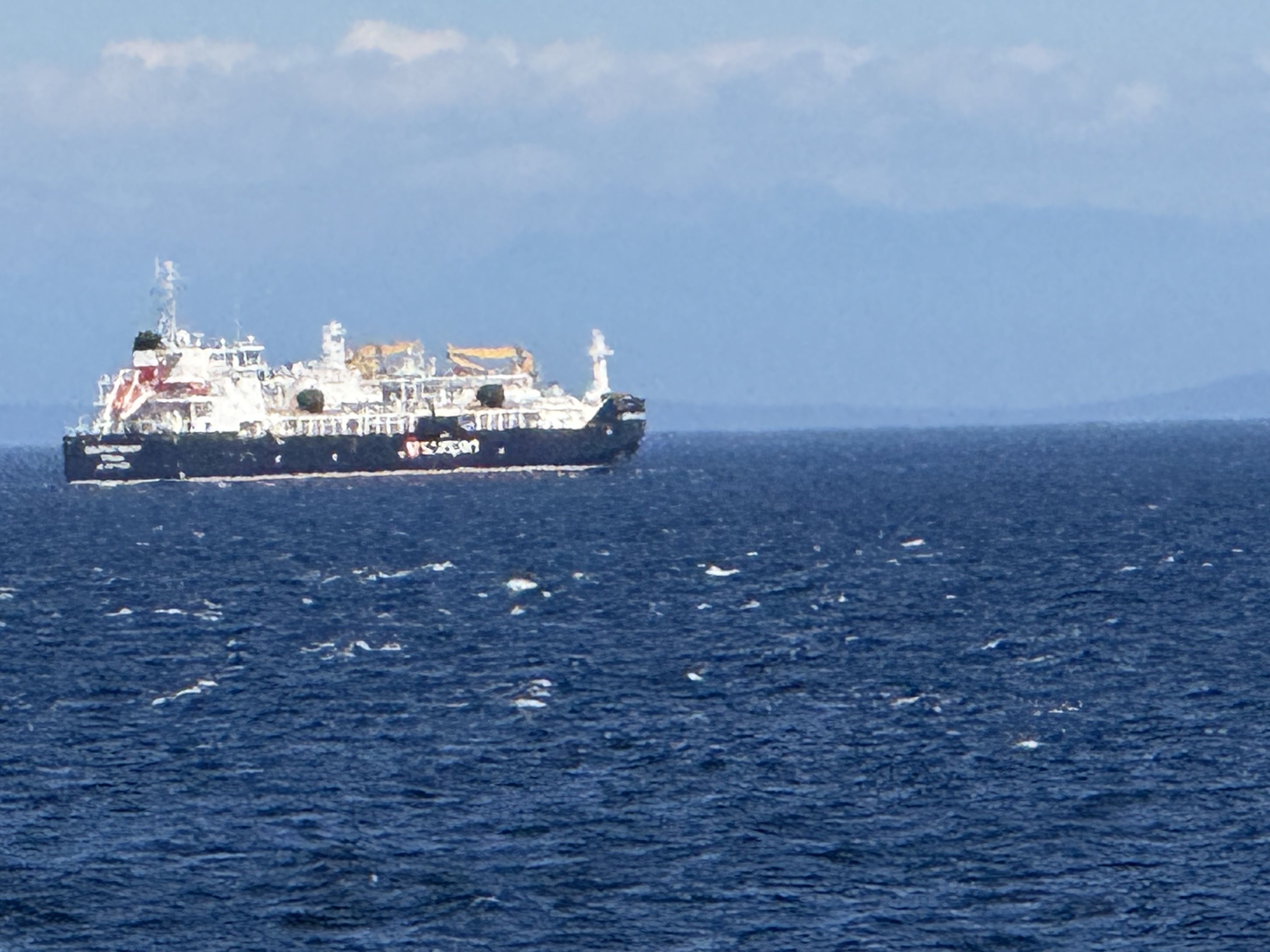
It was a busier day at sea on our return to Port Angeles. We saw two container ships, one smallish and one large, half-filled one, and this vessel. It was several miles from our ferry when I took this pixelated image, but ChatGPT identified it as probably the Seaspan Lions, an LNG bunker vessel; this is a new class that transfers liquified natural gas to larger, oceangoing vessels from Vancouver or other Canadian ports. I mention this because I’m fascinated by technology (real tech, not digital bullshit). These smaller vessels transport LNG from ports too small to accommodate large vessels, which are three times as long and ten times as heavy.
Final Thoughts
What a ride!
If you ever take a cruise to Alaska to see the glaciers, or even a cruise to Hawaii during the off season, take a couple of days to experience Vancouver Island. Despite being the capital of British Columbia, the only contact with North America is by boat, even from the city of Vancouver–British Columbia geographic names are confusing.
The best thing about this trip was that we never felt like we’d left home. Victoria feels like Washington, and even The United States in general. They don’t have the humorous Canadian accents I’ve seen on TV. They drive the same cars, shop in the same stores, and even go to the washroom–just like I did, growing up in Arizona in the 60s and 70s.
Best short vacation EVER!
Stormwater Retention Project
I always heard that the Pacific Northwest gets a lot of rain. Having lived in southern Louisiana for 25 years, I was a little skeptical. So when I moved here last year, to discover that all of the yards were brown, but the flowers and trees were flourishing, I became interested in the annual rain pattern. It doesn’t rain here in the summer. No thunderstorms twice a week. Nothing.
Water isn’t particularly expensive here, but I don’t like using clean tap water on plants. It turns out that most of Tacoma’s water comes from glaciers on Mount Rainier (Tahoma to natives). They melt naturally in the summer, so we aren’t using groundwater and have no control over their rate of melting.

We inherited a number of young fruit trees, which need a lot of water. Seeing how nice many of our neighbor’s yards were, we decided to collect plants. I watched water flowing out of the downspout during spring rains, flowing down the driveway into the street, and directly into Puget Sound. We installed a couple of rain barrels to collect some of it; you would be surprised how fast they fill during the light rains (compared to the Gulf coast) I’ve experienced here in Tacoma.
It turns out that Pierce County has a stormwater retention program, to prevent pollution of Puget Sound, and one can get free consultation on home projects that reduce storm runoff. There is even a competitive proposal system to get limited financial assistance. We jumped at the opportunity to contribute to the continued health of the place we’ve already fallen in love with.

The back yard was a basketball court at some point, complete with 3-4 inches of concrete. The previous owners removed the concrete (thank god!), but left some irregularly cut tree trunks. We were thinking about planting a garden in this area, but now we were part of something bigger than our back yard. We could get assistance on the whole project, from collecting rainwater to distributing it, and keeping it out of the pristine waters of Puget Sound.
But there were some engineering hurdles to clear…
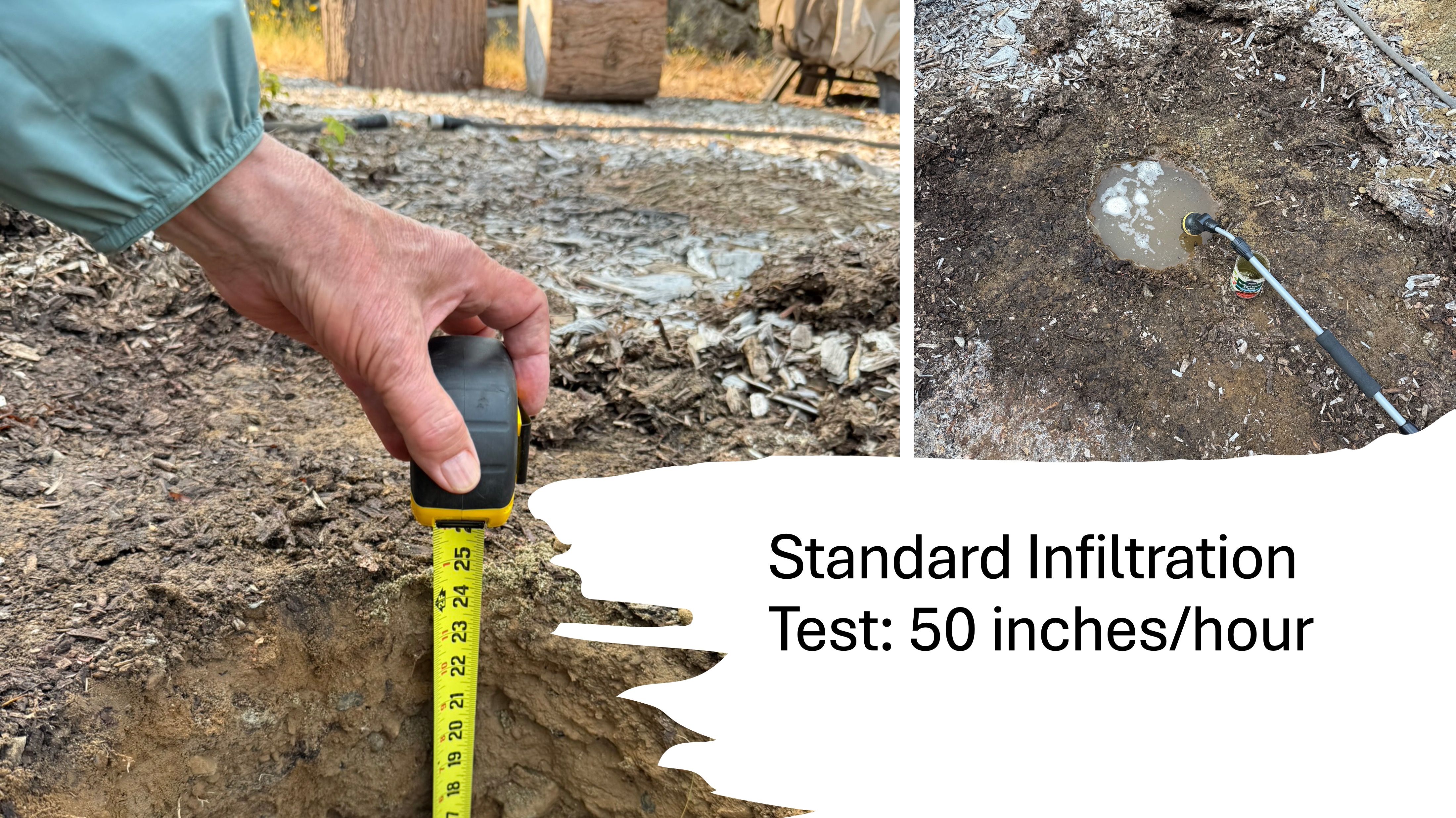
We had to demonstrate that the soil under our back yard would absorb a reasonable amount of rainwater, which necessitated digging a hole and filling it with water. That sounds easy enough. The catch is that the soil in the hole has to be saturated before the test can be conducted. To assure saturation for all soil types, this means keeping a two-foot deep hole full of water for three hours. I had to keep the garden hose running at half-volume, tweaking it constantly, to meet this standard.
I spent the morning babysitting a one-foot-diameter hole with a hose running constantly.
But I kept the hole full for three hours. Finally, I could conduct the test. I filled the saturated soil to 12 inches and waited, but not for long! As I already knew, it drained in 17 minutes, as measured by a stopwatch. We have well-drained soil (mostly sand with some clay and rock cobbles).
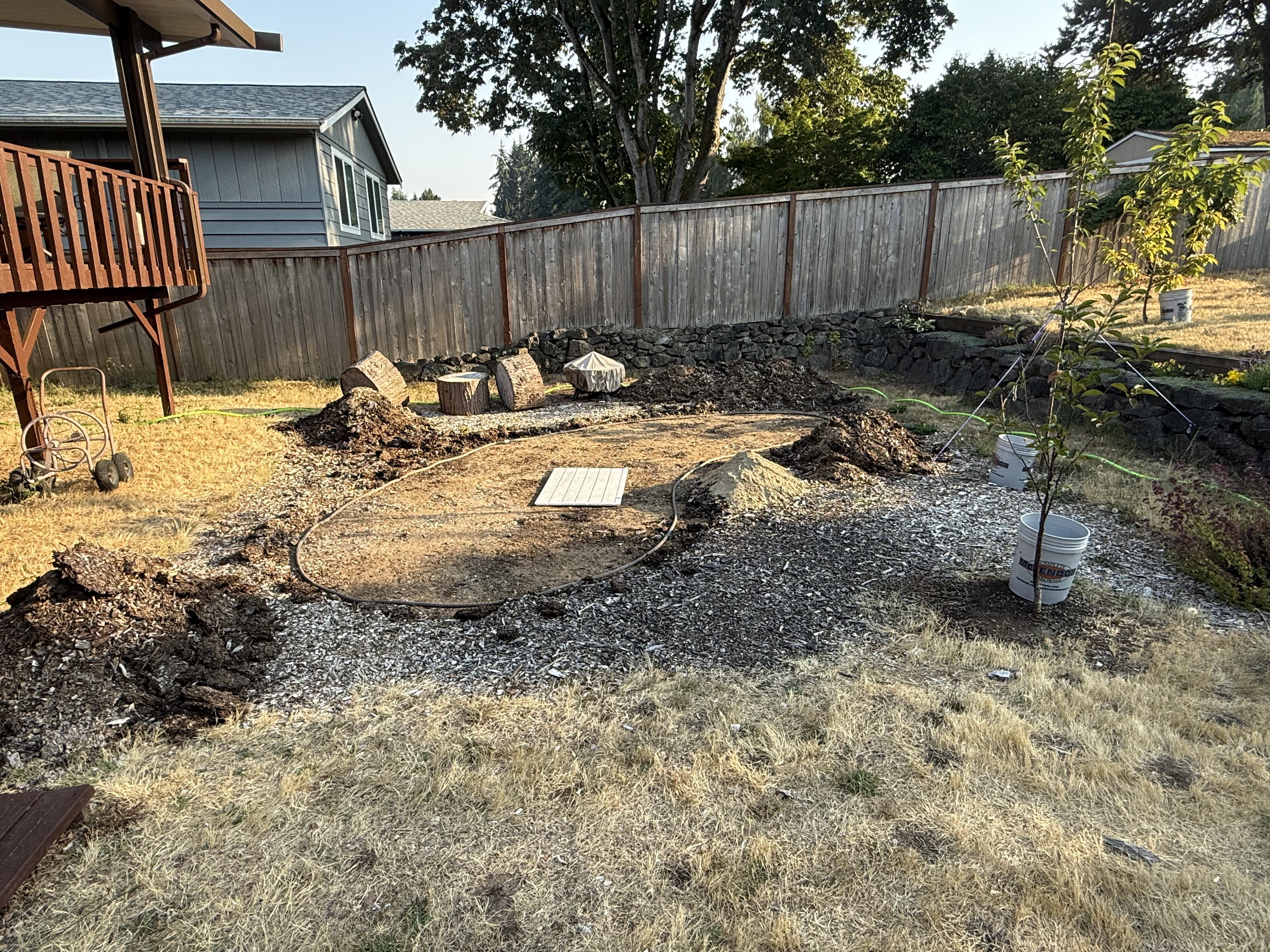
While my garden hose kept the ground saturated, I kept myself busy, removing 4 inches of mulch filling the 4-inch deep depression left by the basketball court. I’m going to keep the material on-site as much as possible, to avoid hauling it up the slope seen to the right in this photo, where it would (please, god, no!) be spread to form a slight hump in my back yard.
You would be surprised how fast soil is used to fill a 4-inch deep area the size of the remaining mulch seen in this photo.
I can’t wait to begin digging the pond. I’ll see you then.
Ecology Notes on Flaming Geyser State Park
This is my last post from Flaming Geyser State Park. I discussed the geology and the sights in previous posts. Today I’m going to look at some of the highlights in a riparian ecosystem that seems to be recovering from excessive logging; however, the area has been in private hands for more than a century, which allowed the maturing forest we find today to develop.

This paper birch (or red alder) caught my eye because of the bunches of small branches growing from the bark at different heights. ChatGPT says these are epicormic sprouts, areas where dormant stems wait for more sun or, possibly, stress to the tree.
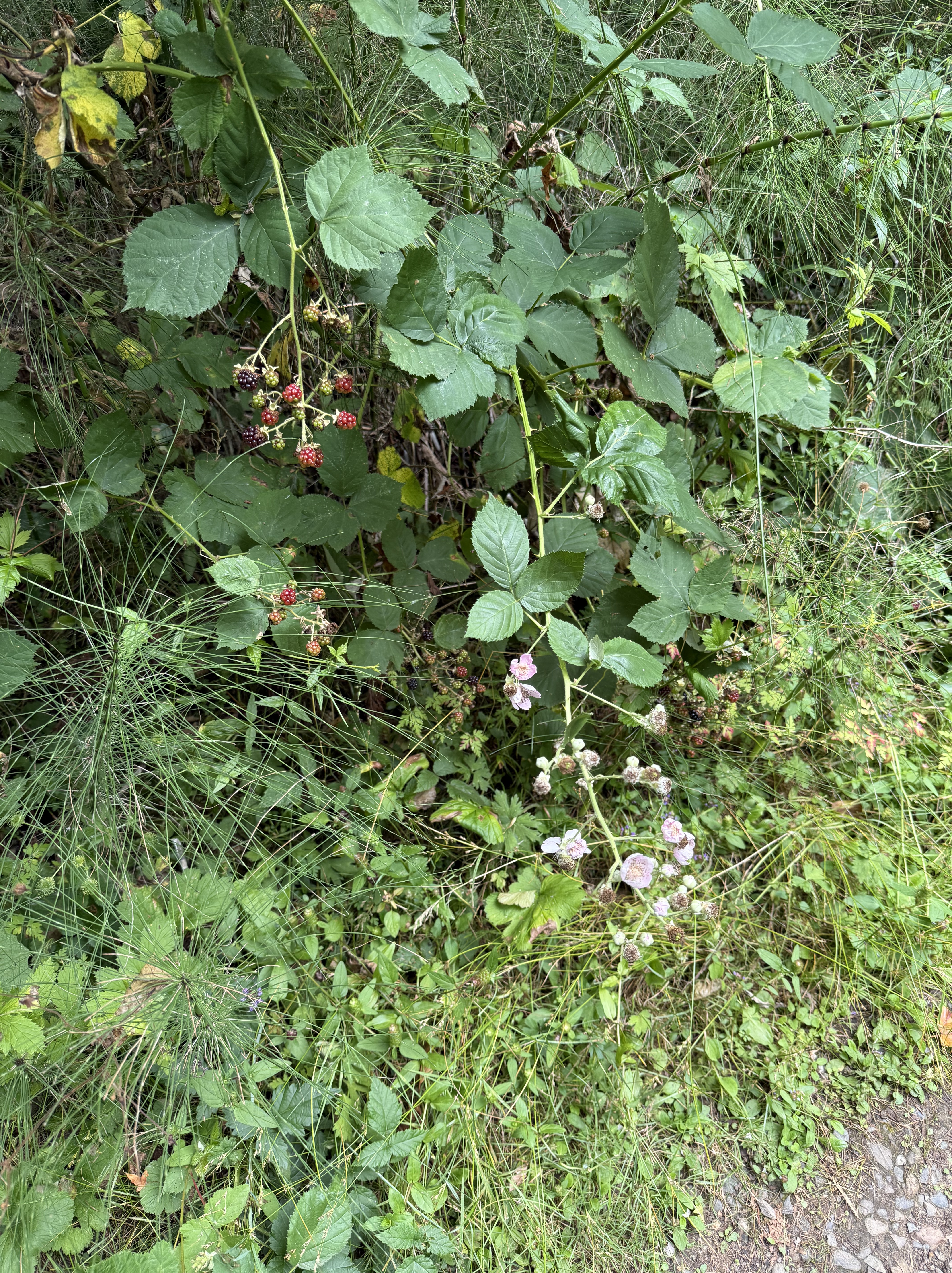
Himalayan Blackberry and Trailing Blackberry (with flowers) along the trail.
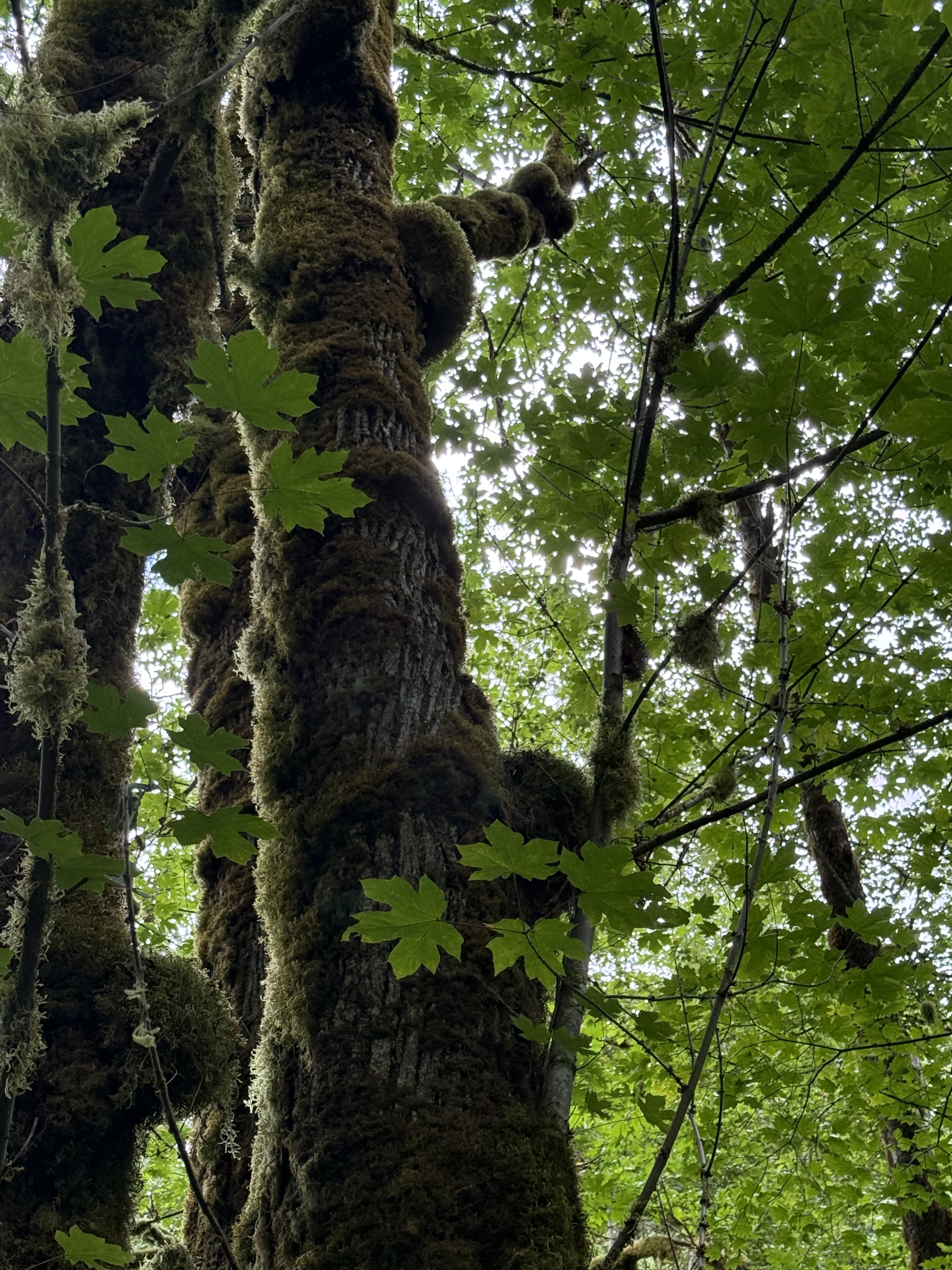
Big leaf maple covered with moss mounds on (probably) epicormic mounds, which have collected over the years but weren’t active; or else the new growth has died back.
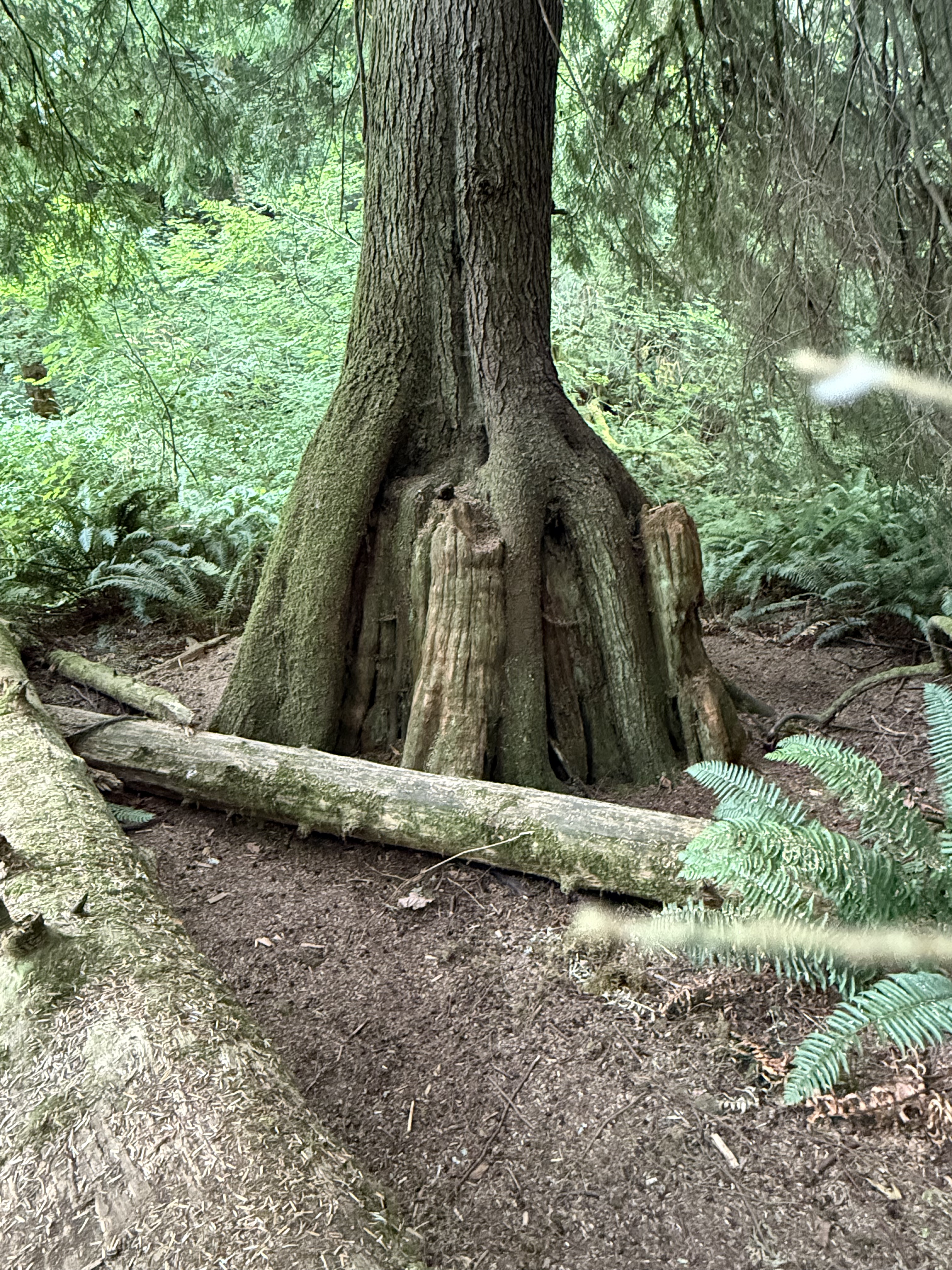
Douglas fir resting on the nurse stump where it grew from a seed. I’ve often seen examples of this phenomenon with roots projecting every which way, but this fir seems to have timed its growth perfectly with decay of the host.
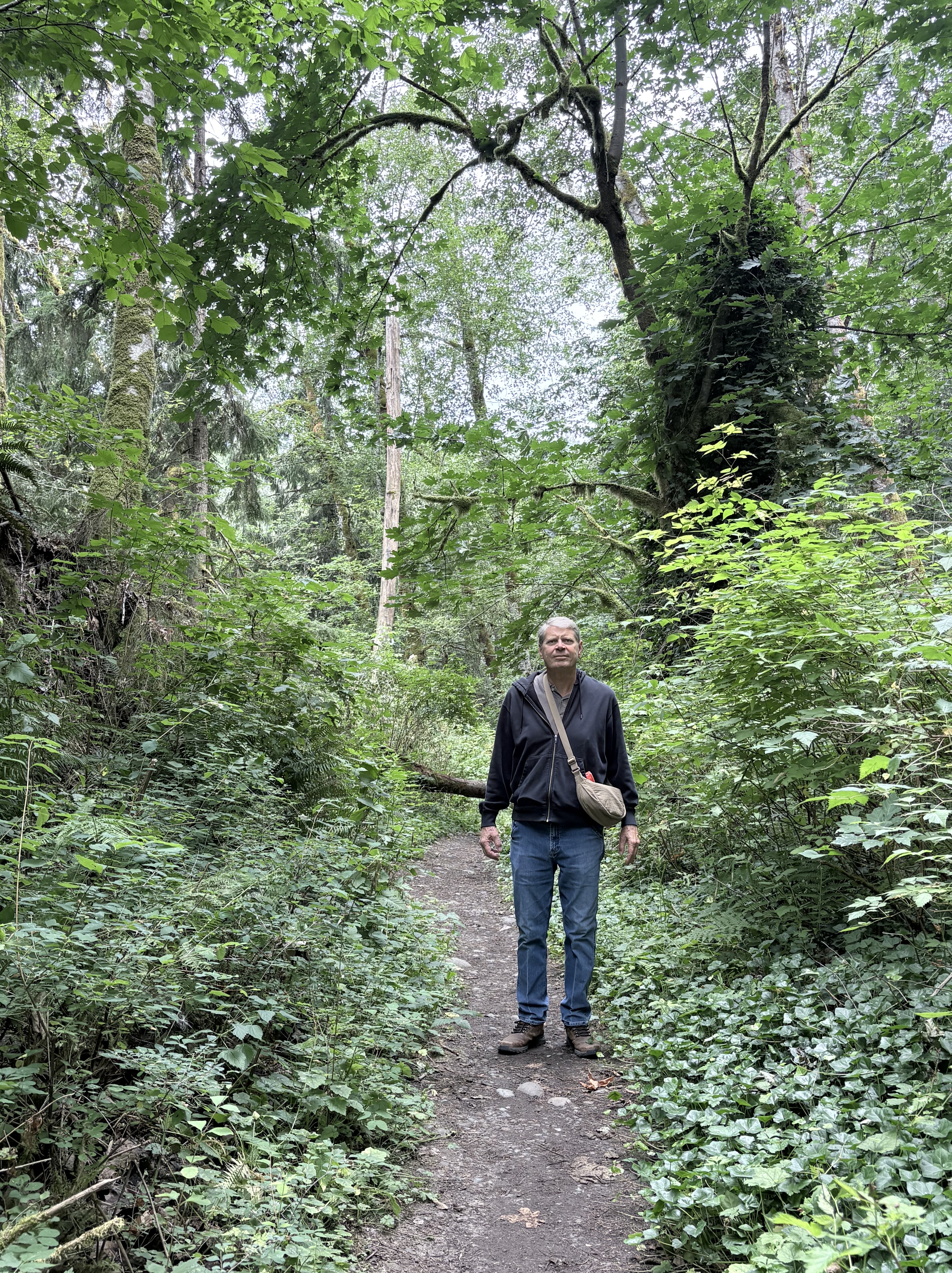
This photo shows me standing among a bunch of bushes. That’s how much I know about botany. So I asked ChatGPT what plants it could identify. It came up with a long list: Douglas fir and Bigleaf maple; Salmonberry, elderberry, and maple seedlings; English ivy, Sword fern, stinging nettle, and a variety of mosses. It pointed out that this stretch of the trail doesn’t reveal any Himalayan blackberry, which means that this is a natural ecosystem for the PNW.
Final Thoughts
Flaming Geyser State Park represents a classic riparian ecosystem in the PNW. It has been invaded by Himalayan blackberry, but the native plants seem to be holding their own…for now.
Flaming Geyser State Park
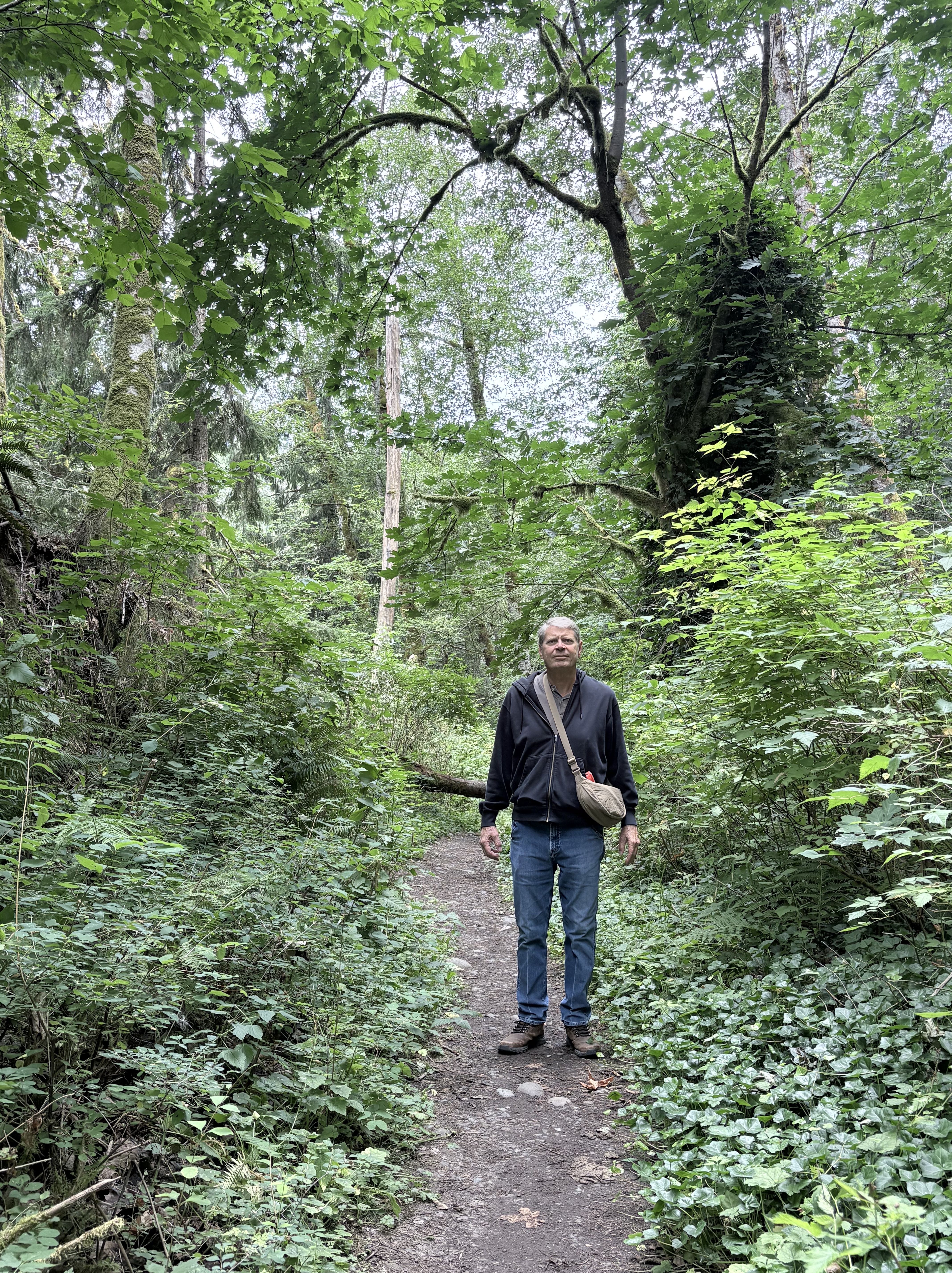
The park is located at the upstream end of Green River, where it enters a gorge. This is one of the best places I’ve seen anywhere for taking a stroll through nature; the path is moist but not muddy, and well trimmed, with breathtaking natural scenes like this. A veritable Garden of Eden. This post is an overview of the park; I discuss the geology and flora in other posts.

With a name like that, I’m expecting a spectacular show…
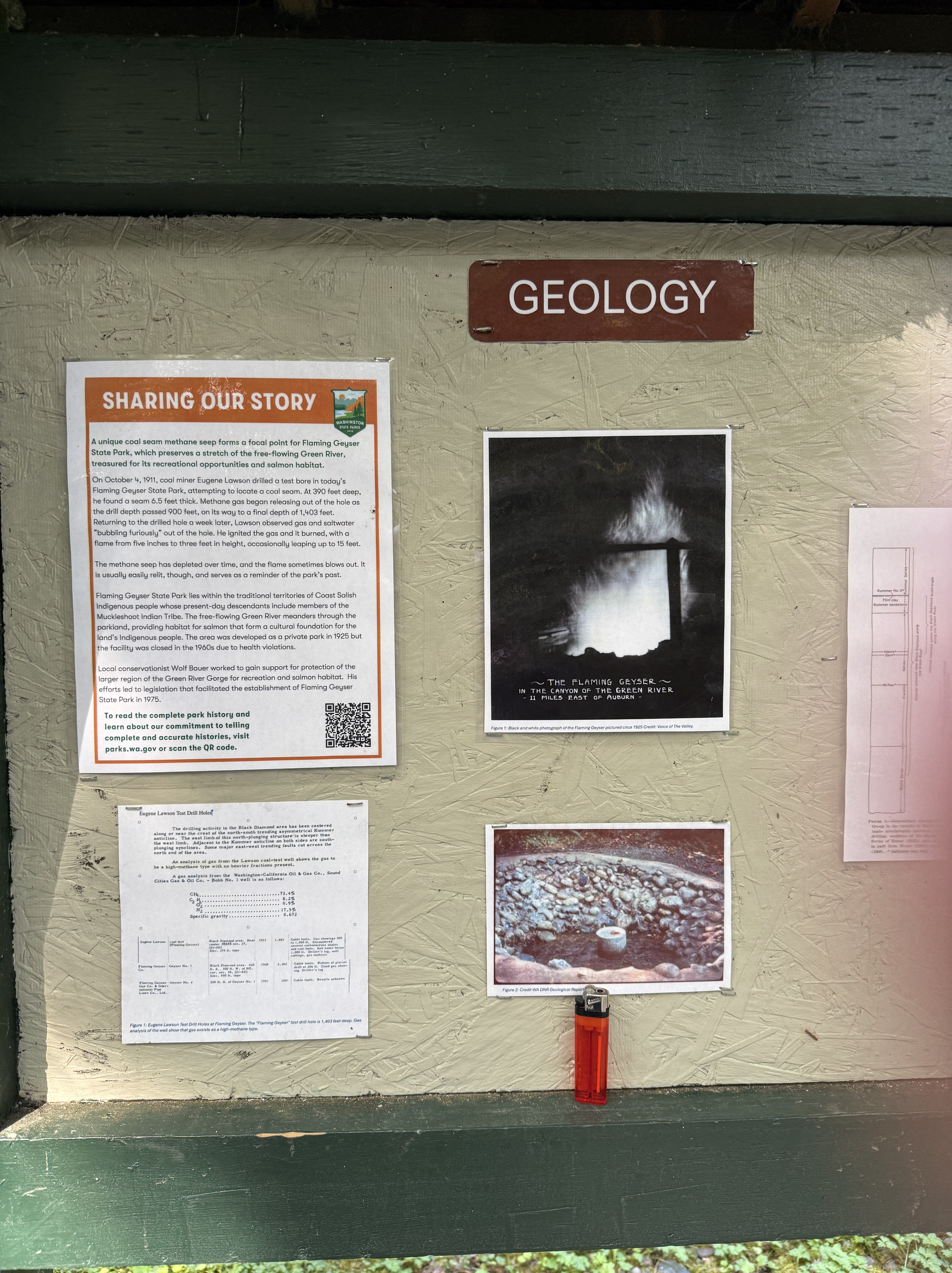
I’ll summarize what you can read if you zoom in on the information presented in this billboard. An exploratory well was drilled here about 100 year ago, looking for coal–they found it, along with methane (natural gas) and other gases produced by decaying vegetation at several hundred feet below the surface. The small well produced a flammable gas that has burned intermittently since it was first lit by a geologist.

Flaming geyser wasn’t very active when we visited, but it was burning. To repeat, this is NOT a natural seep, but the result of a well drilled a century ago. Nevertheless it has become a local tradition, and it is relit whenever it goes out.
Bubbling geyser is a lot more fun. This video shows small bubbles of methane, as well as hydrogen sulfide and other, unnamed, gases. Methane is odorless, but this area smelled strongly of H2S, which is added to natural gas to help detect leaks.
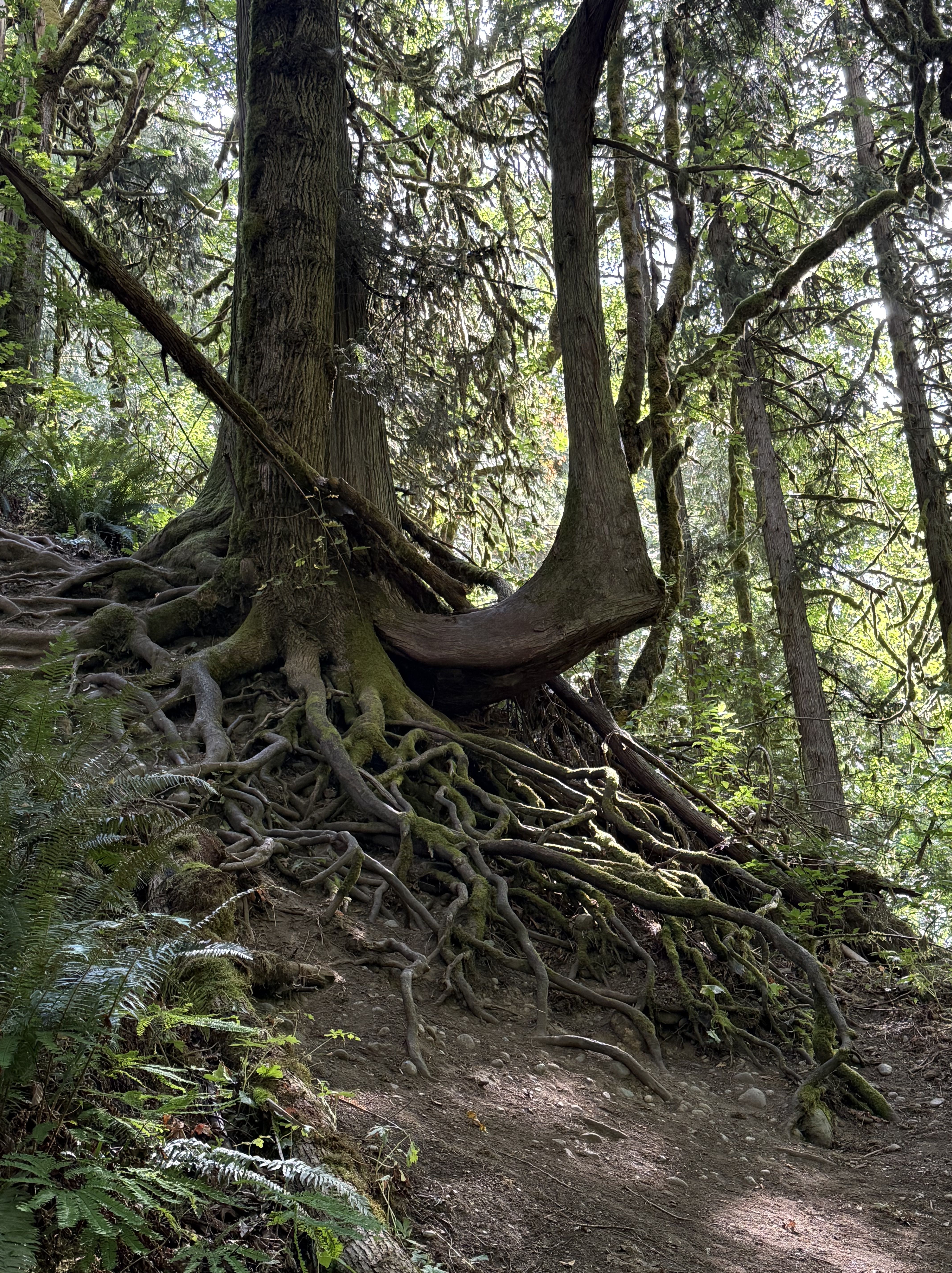
This is a beautiful example of survival. The surface roots have all been exposed by erosion, but the tree is thriving; its roots have turned into separate trunks. I read somewhere that these conifers in the PNW send their roots out for hundreds of feet, far beyond their canopies.
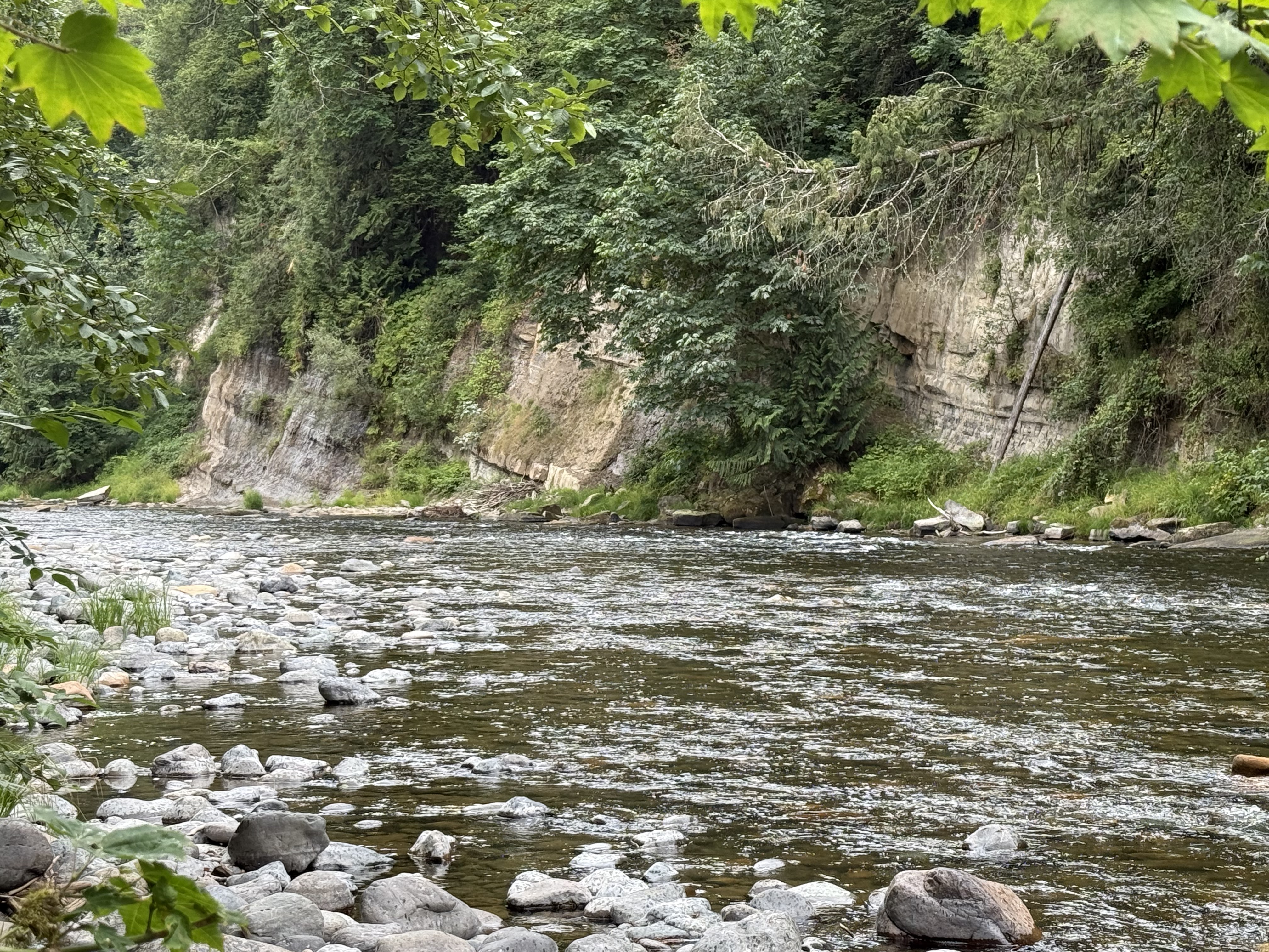
This is where Green River Valley turns into Green River Gorge. The water was perfectly clear, with a slight green tinge, even though there is no algae visible. It reminds me of Commencement Bay, which is also devoid of aquatic plants. And it is all natural, simply a unique ecosystem.
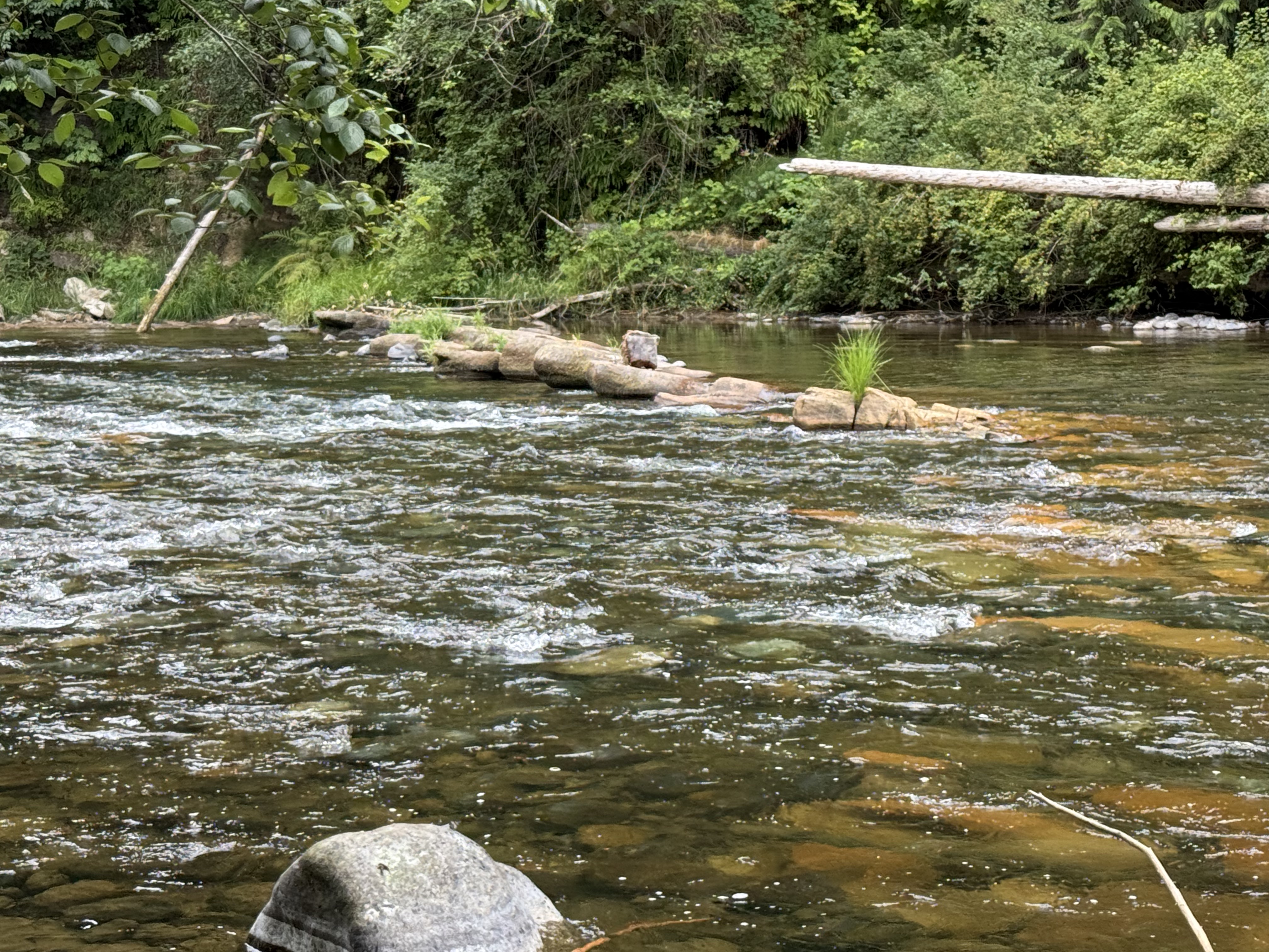
If you wear waders, you can walk on water here.
Final Thoughts
This is a place you have to visit for yourself, especially on such a gorgeous summer day. The temperature was in the mid-seventies, the sky was clear, and people were filling the huge number of picnic areas, carrying their supplies and tubes, ready for a fun day of floating down one of the best rivers I’ve ever seen.
You’ve got to see it for yourself.
Eocene Continental Sediments in Flaming Geyser State Park
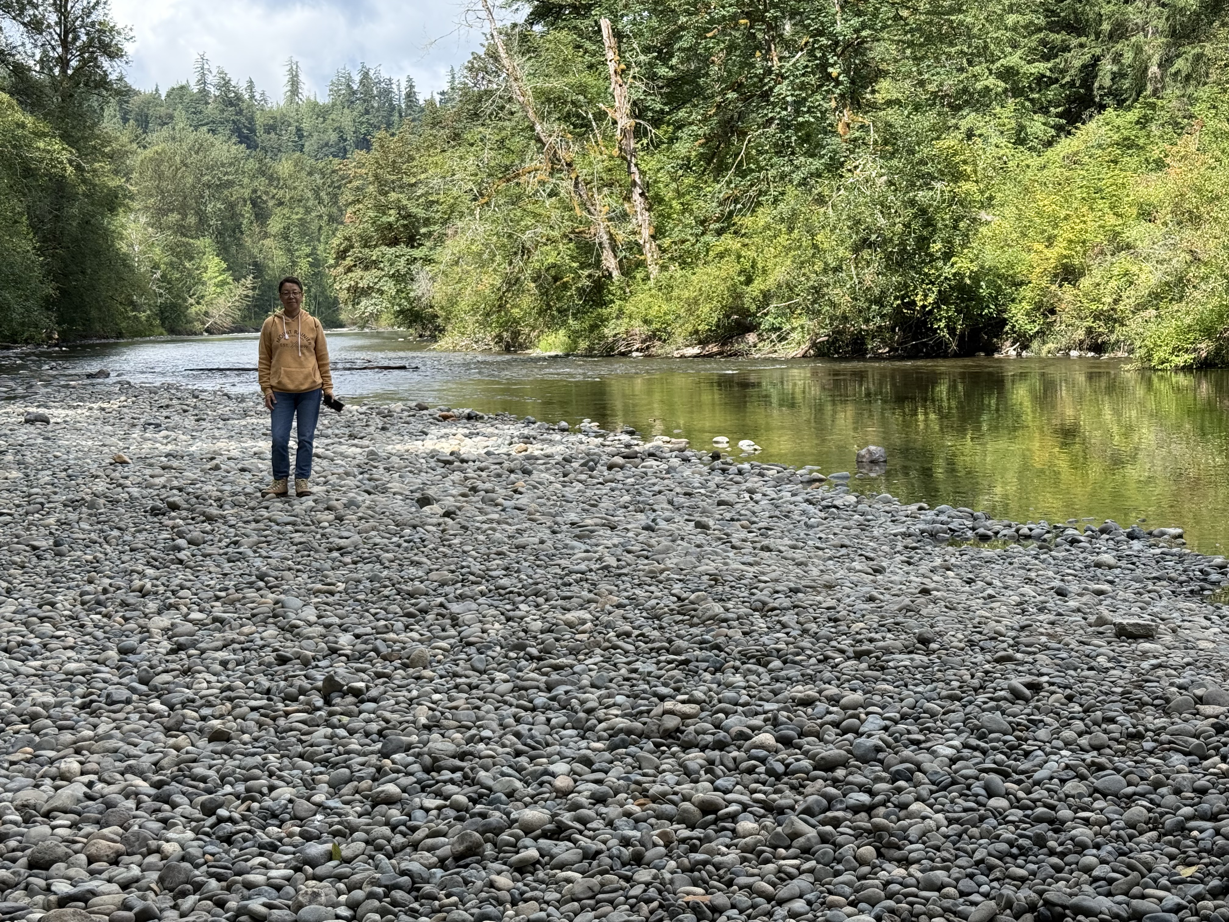
Figure 1. Flaming Geyser State Park is located along the Green River (see Fig. 2 for location), where its valley narrows and deepens. This photo shows a typical gravel stream, but there is plenty of sand and even clay available to construct a flood plain. The alluvial deposits downstream are rich farmland, where we saw a variety of vegetables growing.
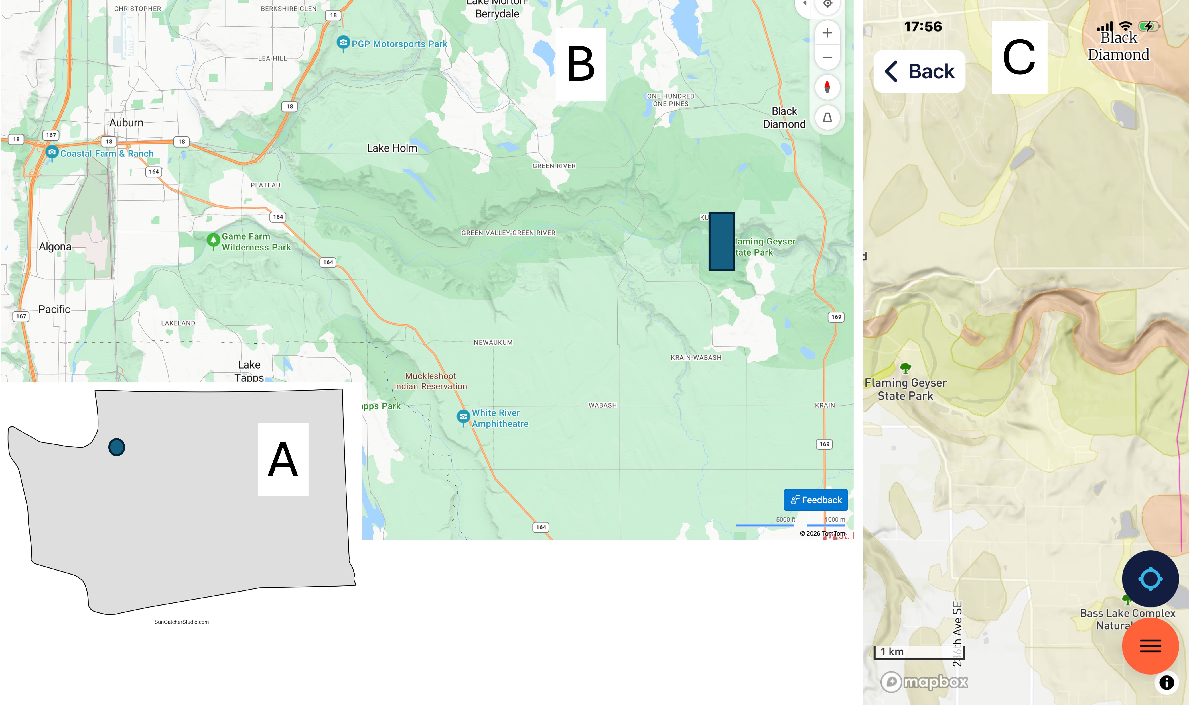
Figure 2. (A) Location of the study area SE of Tacoma in the foothills of the Cascade Range. (B) Green River has eroded a valley in the glacial till and bedrock along its path. The northern margin is steeper throughout its length. Flaming Geyser State Park is located upstream of the arable land, where the river becomes rocky and the valley narrows to a gorge. (C) The geologic map from Rock D reveals Eocene (56-33.9 Ma) continental sedimentary rocks along the stream bed whereas further north, Vashon till of Pleistocene age (2.58Ma – 11.7 Ka) covers the region in a thinning-eastward blanket. Just south of the river itself, Quaternary (2.58 Ma – Recent) fluvial and alluvial sediments have accumulated.
To the extreme east side of (C), a fault line can be seen running N-S. Faults are common, but often difficult to identify, within the region because the Cascades are the result of oceanic-crust subduction beneath the North American tectonic plate.
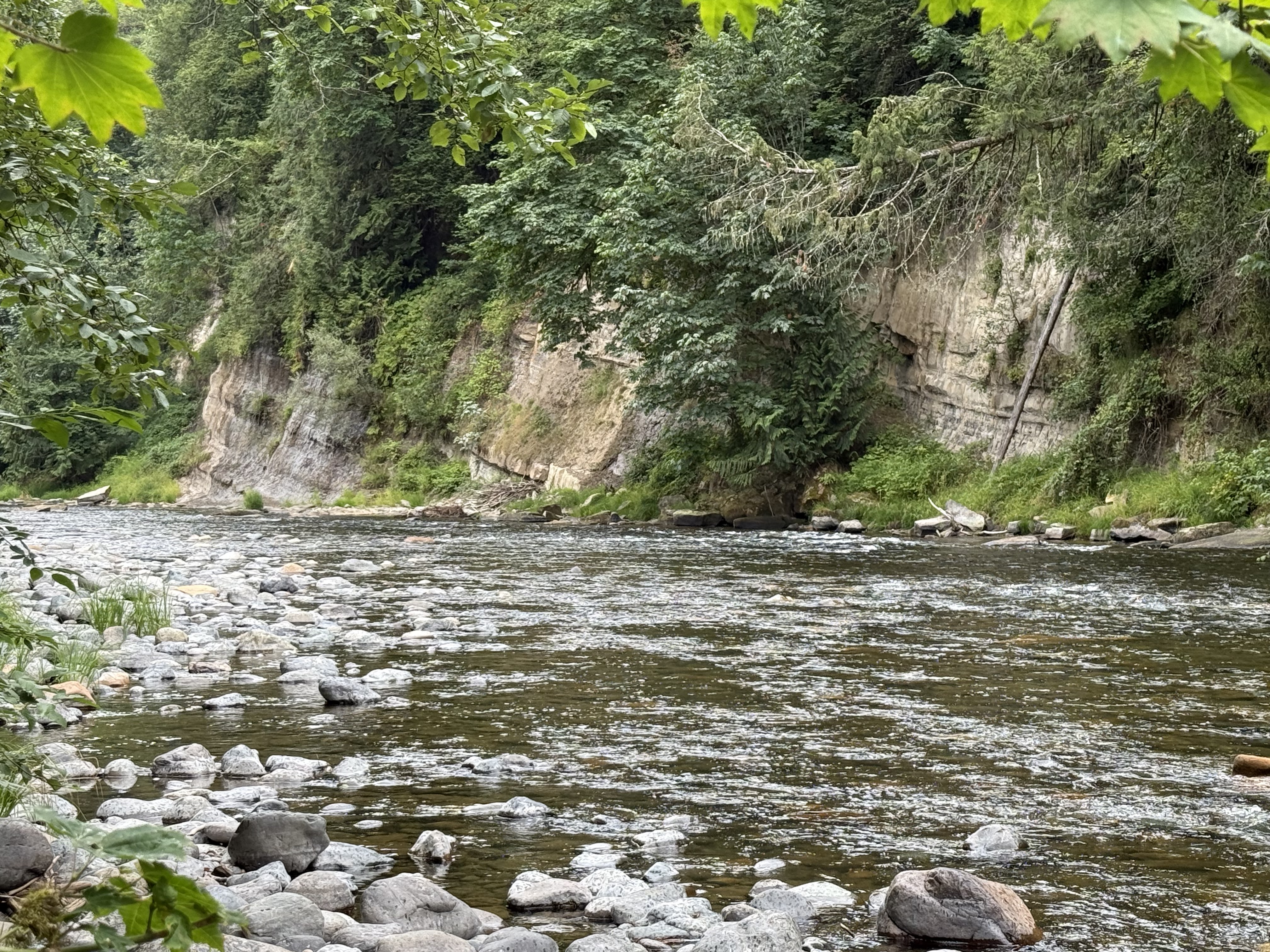
Figure 3. These layers of Eocene terrestrial sedimentary rocks have been tilted eastward (to the right), towards the fault seen in Fig. 2C, suggesting that it is a normal fault; however, their beds aren’t quite continuous, suggesting some slippage between them. The patches of foliage separating them may indicate minor faults, where the rock is ground into fine material suitable for plants to thrive. For example, the leftmost exposure is similar in stratification to the middle strata of the center exposure; the rightmost exposure doesn’t seem to be continuous with either, except for the thin, resistant bed immediately below the cliff on the right, and a similar “marker” bed a few feet lower in the middle exposure.
Following a horizontal line between them, the rocks are younger to the left, but not by much–possibly a few thousand years. This brittle deformation would have occurred a few miles within the surface when the faults were active; unfortunately, faults cannot be dated with precision.
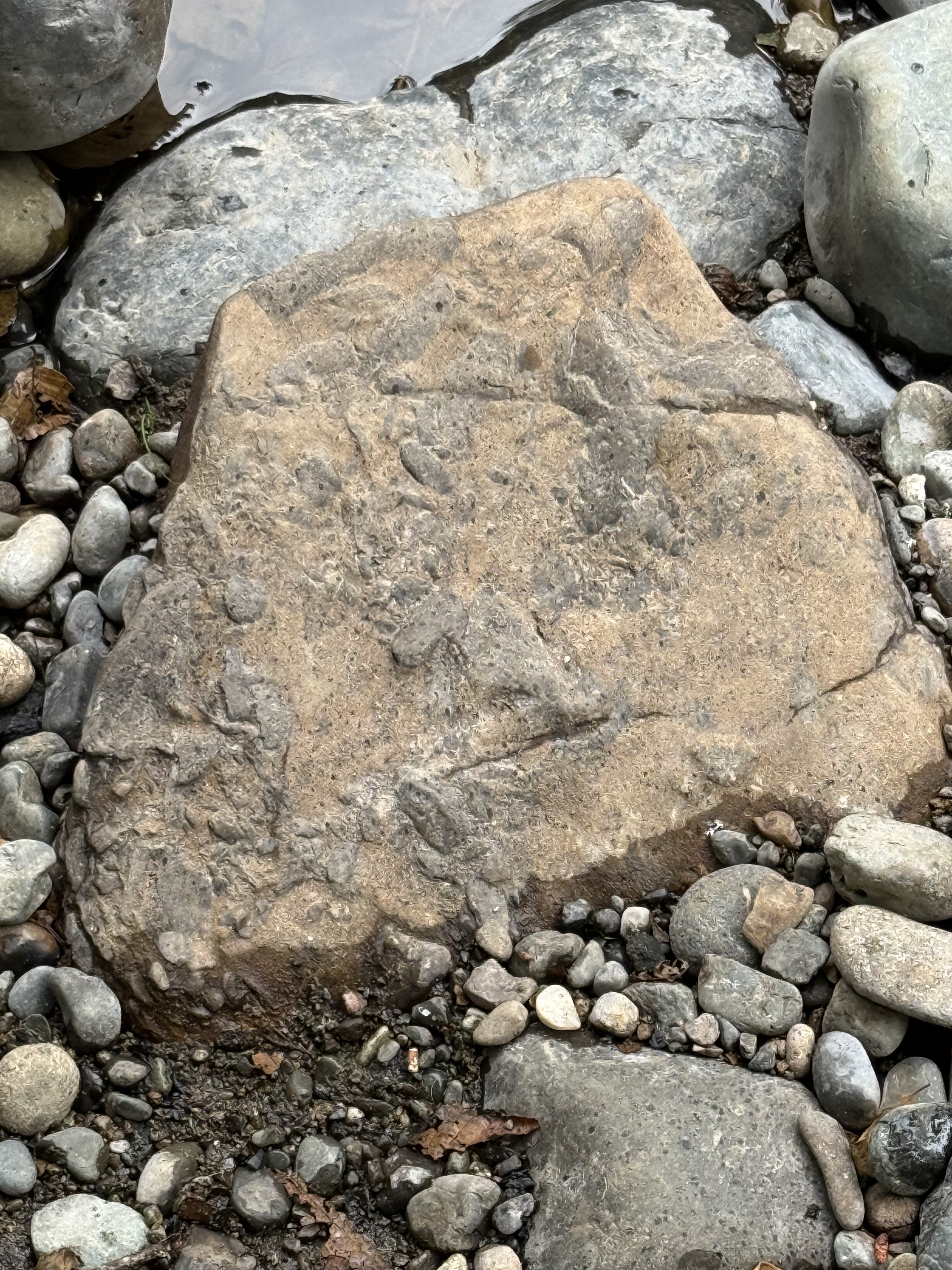
Figure 4. This is an interesting sample, which required some thinking, and a conversation with ChatGPT, to arrive at the most plausible explanation for the irregular blobs of darker material protruding from a reddish matrix. I’m pretty sure this texture arose from mingling of magmas with different compositions: the reddish one is andesite, and the darker material is something closer to basalt (there is a spectrum of chemical compositions); they were incompatible, but the magma wasn’t hot enough to totally incorporate the more basaltic material into the andesite.
We are seeing magmatic mixing processes frozen in time here.
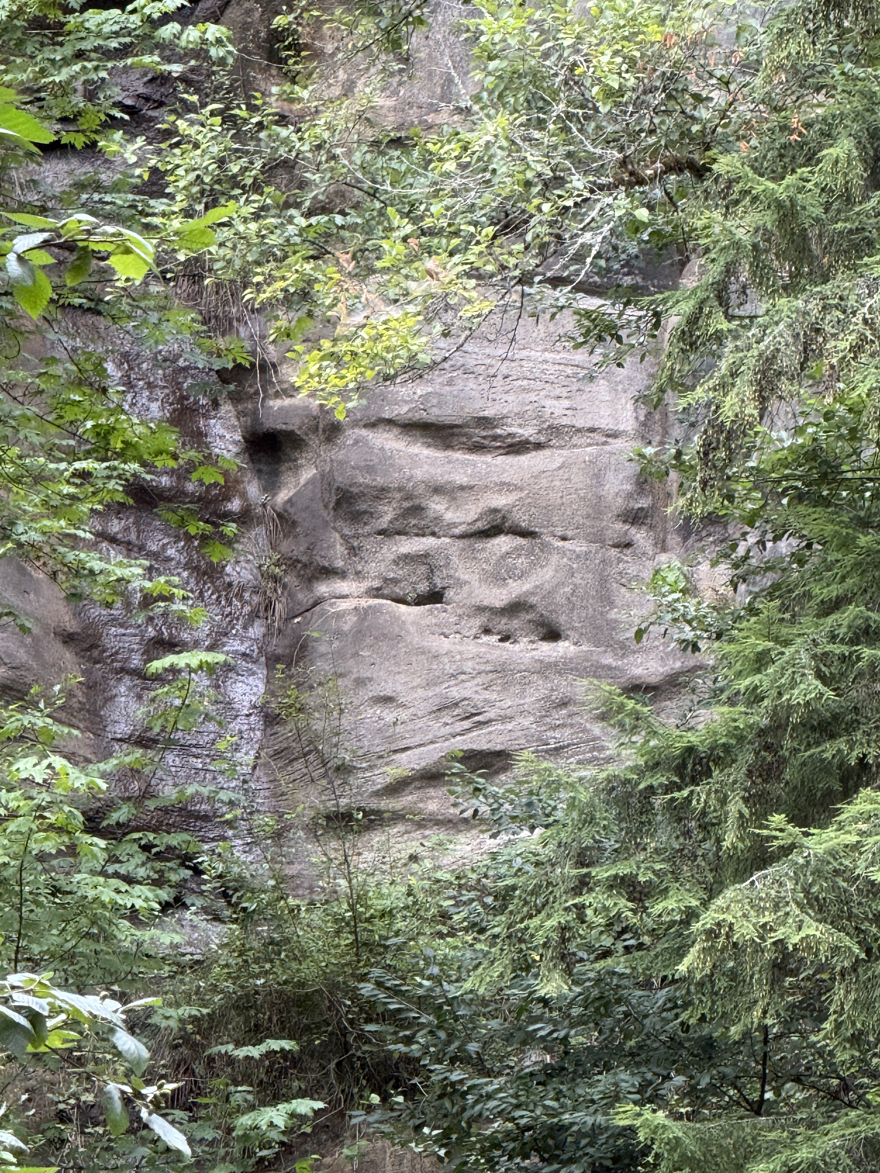
Figure 5. This photo reveals a cliff of Eocene sedimentary rocks across the river, probably 100 yards distant. I zoomed in to reveal the bedding. I estimate the height of the gray rock visible through the foliage to be at least thirty feet. The lower section contains two sets of cross-bedding, separated by an erosional surface, brought into relief by differential weathering. These large bed forms were created by water, probably in braided rivers or high-energy channels. The flow was to the left, westward in general.
This environment persisted for a long time although these rocks can’t be dated (no fossils or organic material); if we assume either a deposition rate of 1/8 inch per year (that’s a lot of sand), or a subsidence rate of similar magnitude (to make room for this stack of sand), we can estimate how long it took for 30 feet of sand dunes to accumulate. When we do the math, we see that this section could have been created in about 3000 years. This calculation is for illustration only. We don’t know the actual sedimentation rate here during the Eocene, nor do we know the amount of erosion.
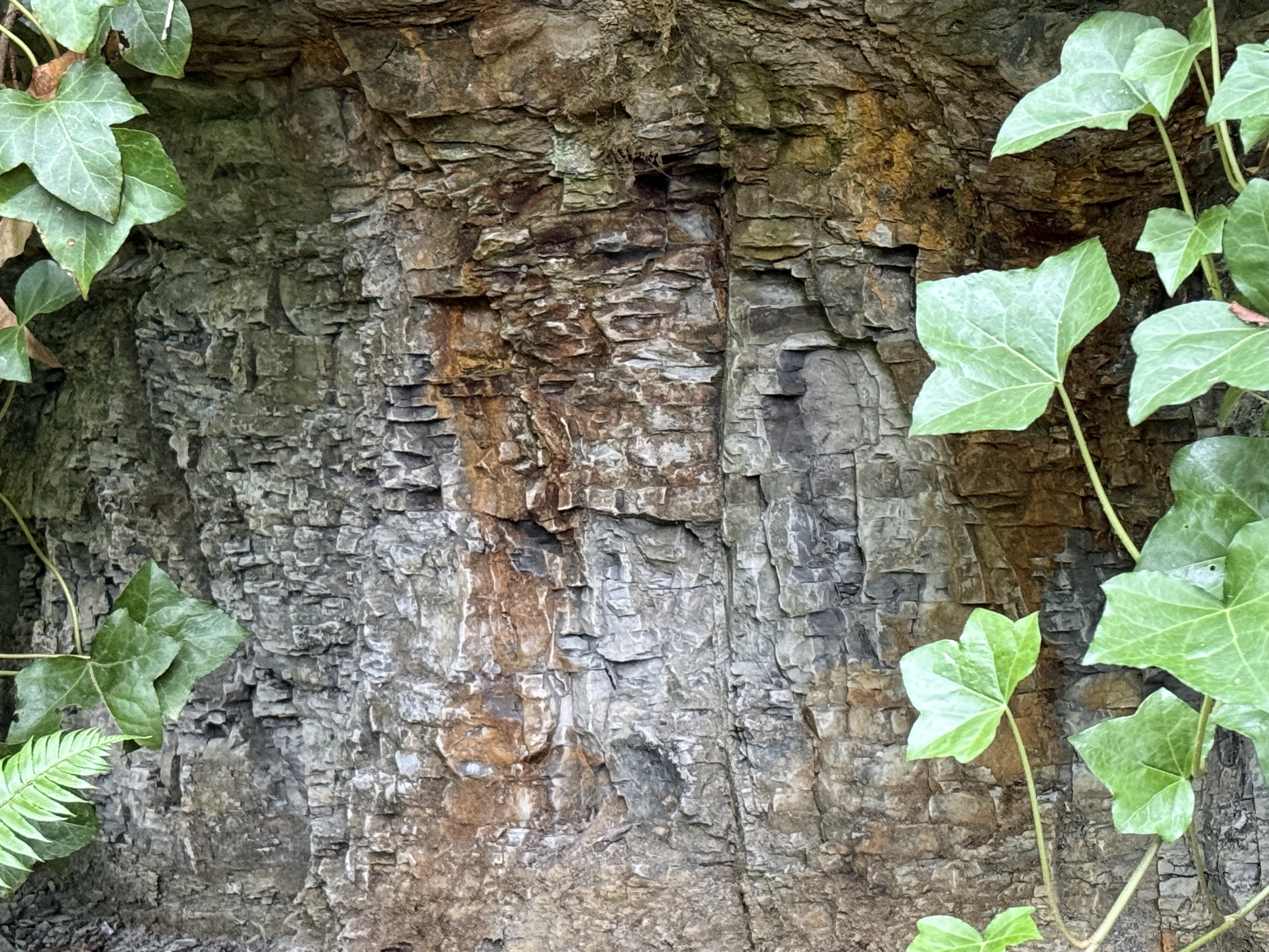
Figure 6. This photo from the south side of Green River shows some highly fractured rock beneath a stronger layer that forms a one-foot overhang. The overlying rock is staining the subjacent layers with a rust-colored material, probably from weathering of iron-containing minerals. Are these beds equivalent to those from Fig. 3?
I don’t know the answer, but the contact revealed in this photo is similar to that between the massive, cliff-forming rock from the rightmost exposure in Fig. 3, and the lower, gray layers. I wouldn’t be surprised if this rock is similar in age and environment as the gray rocks across the river.
Final Thoughts
Sometime, more than thirty-million years ago, large rivers drained the Cascades, depositing vast quantities of sand in braided rivers many miles from the coast, where finer sands and silt slid down submarine canyons and fans to be deposited as turbidites. I talked about those rocks in a previous post. Comparison of these rocks and those along the Olympic Peninsula coast allow us to reconstruct this small part of the world from a bygone age.
These Eocene sediments are similar to those we discovered a few miles to the south, along the Carbon River. This sedimentary environment wasn’t a local event, but rather part of a regional system that continuously removed the volcanoes and older rocks that were exposed by the upward pressure of the Pacific Ocean’s subducting slab. This was not an intermediate environment.
The wide range in dates for these rocks doesn’t allow geologists to be more specific than a few million years, but the earth doesn’t act very quickly, especially when the subduction zone that determines the geology of the PNW has been active for almost 200 million years.
We can afford uncertainties of a few tens of millions of years…


Recent Comments