
Geology of Carbon River Canyon, Pierce County, Washington
Today’s post reports on a brief survey of various geological features and processes that are revealed in a river that originates on the NW flank of Mt. Rainier. We’ll look at the types of rock found along its course, morphologic features, and discuss the processes that have created this natural area. We’ll also see some unintended consequences of deforestation.
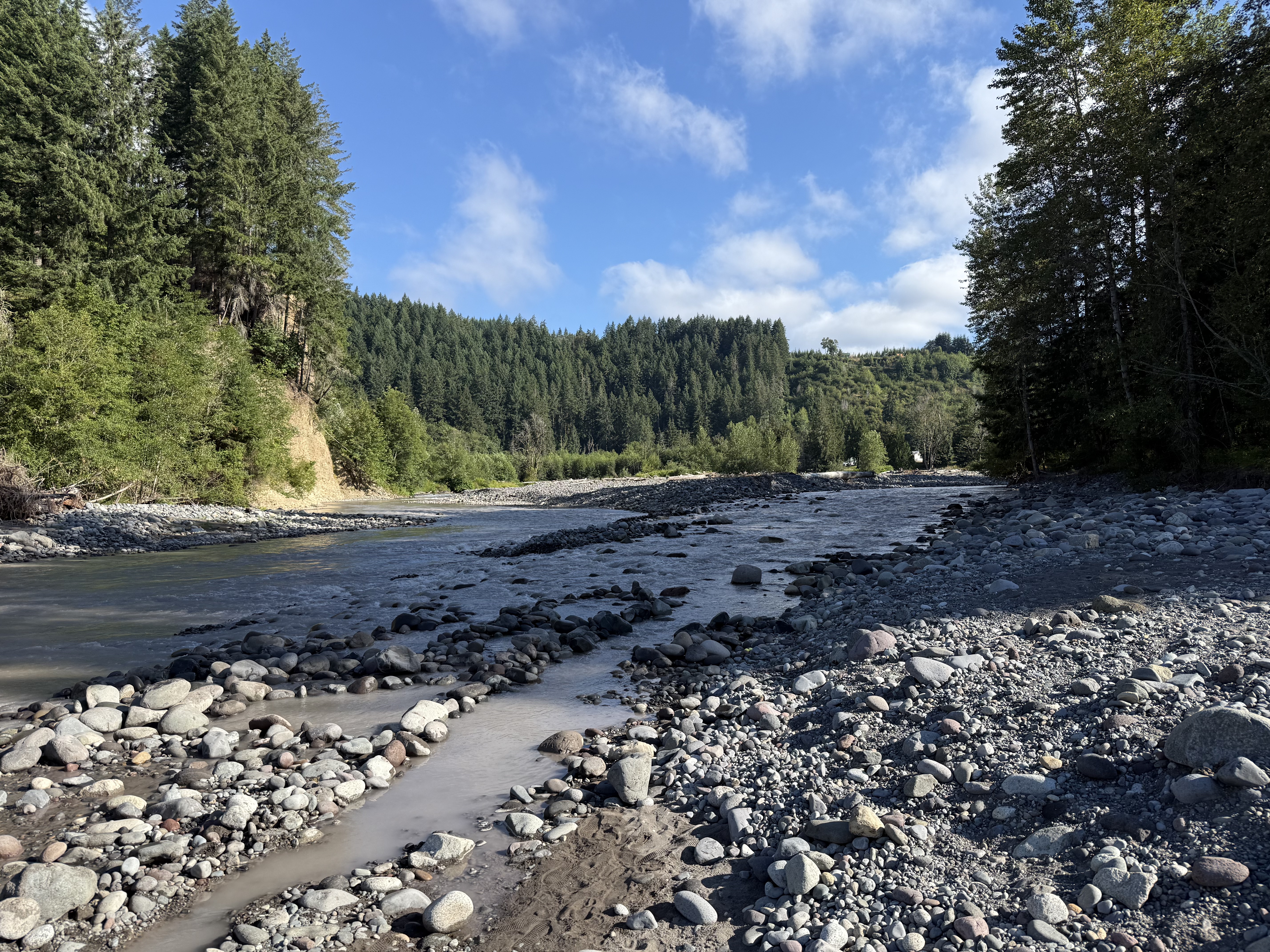
Figure 1. Carbon River flows northerly before joining the Puyallup River and emptying into Commencement Bay, in Tacoma. This stretch is dominated by boulders up to a foot in diameter. However, the water is unusually muddy; we’ll find out why during our walk three-miles up the canyon that contains the stream.
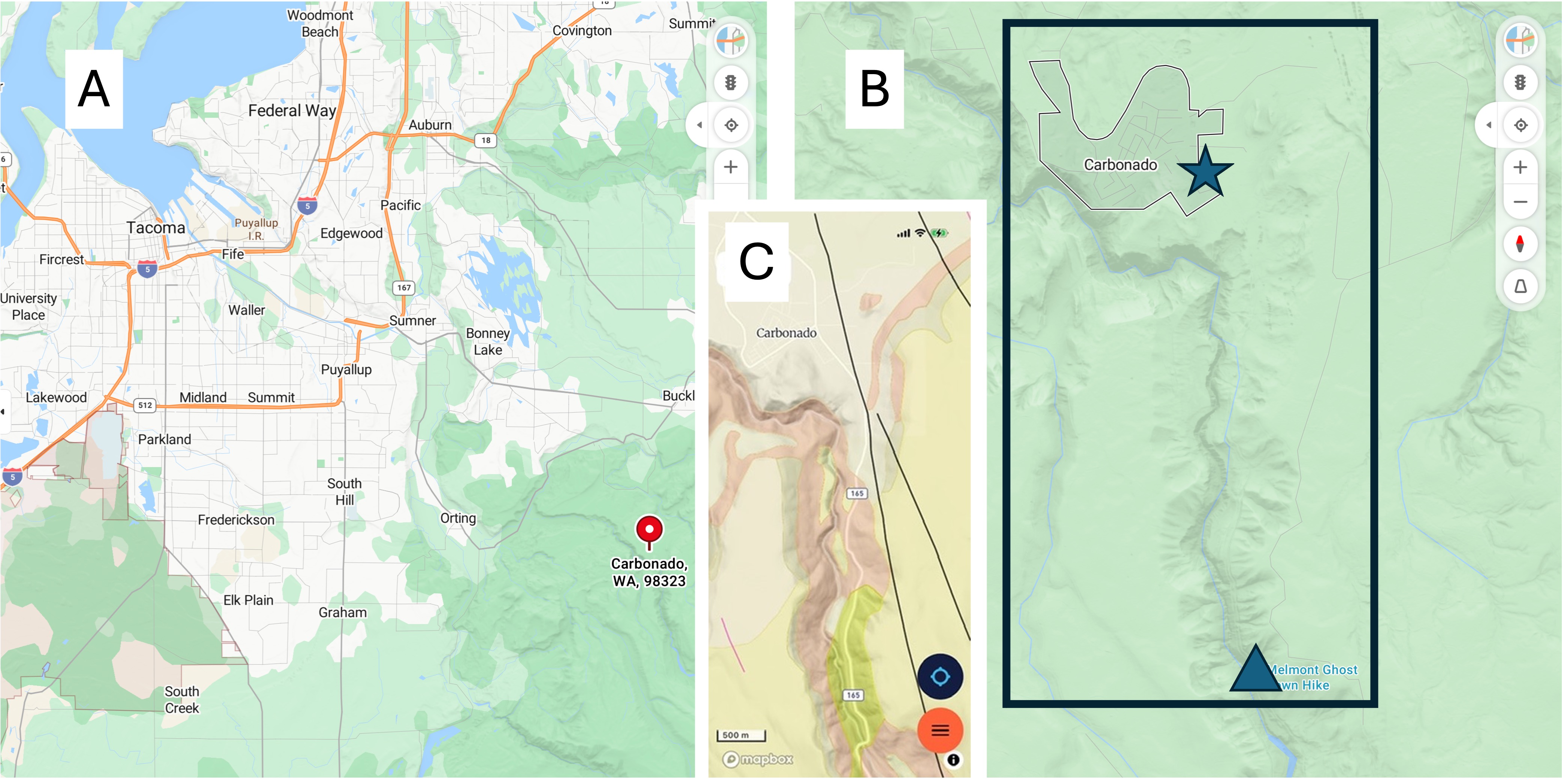
Figure 2. (A) Regional map, showing Carbonado (pinned), a forty-five minute drive from North Tacoma. (B) Local map showing the Carbon River, which we followed for three miles. The river has cut a gorge that begins at Carbonado (star) and deepens to 250-300 feet at Fairfax bridge (triangle). (C) The geologic map from RockD reveals four major rock formations: the tan, which dominates around Carbonado is glacial drift, mostly sand and gravel; The pink outlining the river is Eocene (56-33.9 Ma) sedimentary rocks of terrestrial origin – rivers, lakes, etc; the yellow is Miocene-Oligocene (~23 Ma) fine-grained andesite. Additionally, the yellowish unit on both sides of the river is Pleistocene (2.5 Ma to 12 Ka) glacial drift. We didn’t see any of that today.
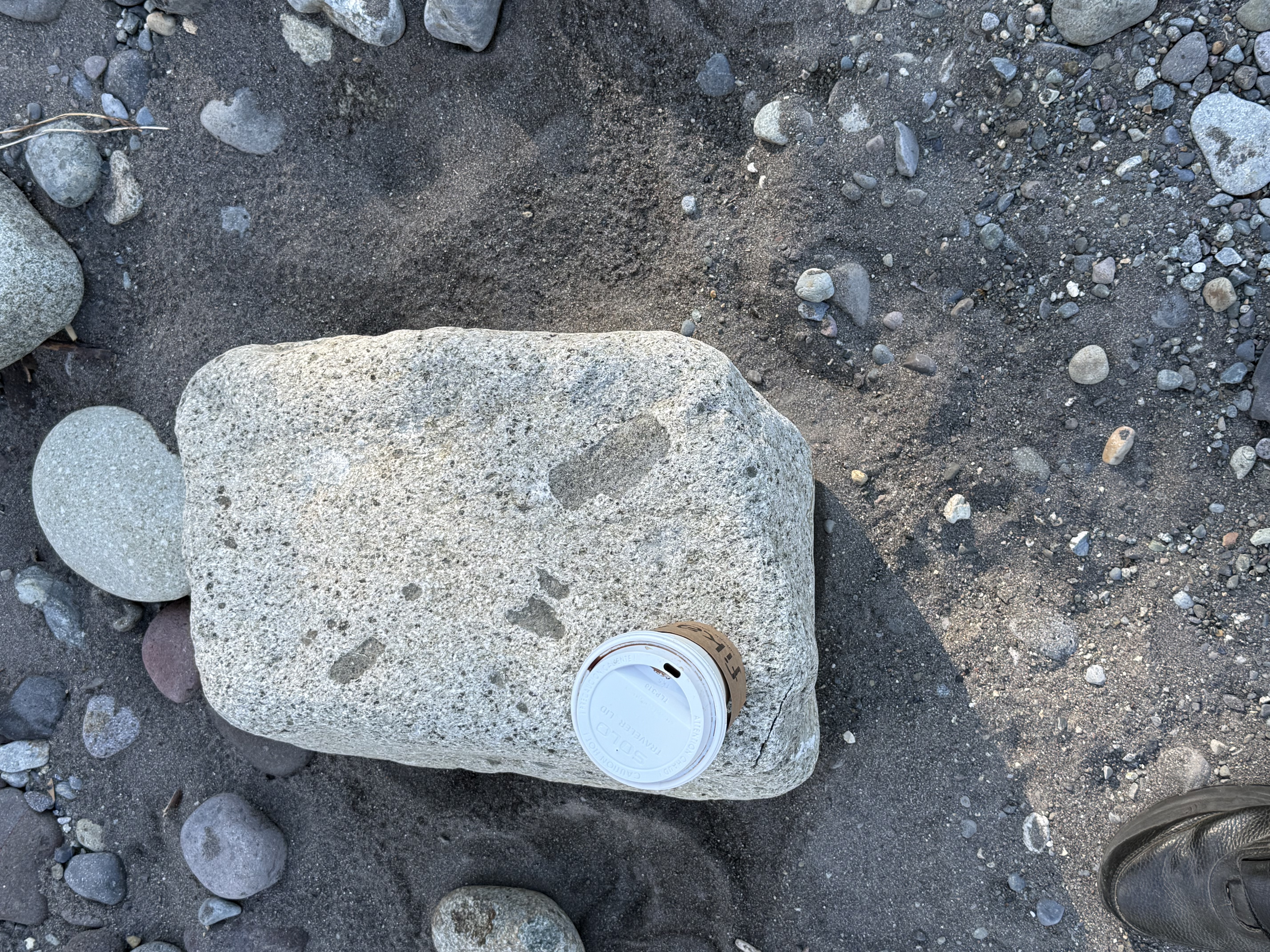
Figure 2. Our first stop was along the Carbon River near Orting (see Fig. 1A for location). River beds can be an excellent source of regional geology if they contain cobbles or boulders, which are good samples of source rock that may not be exposed.
This sample is of an intrusive igneous rock that contains lithic fragments (xenocrysts) of what looks like a darker, fine-grained rock. As magma moves upward through the crust, pieces of country rock are entrained, sometimes partially melting, but more often simple being captured by the cooling magma. This sample contains pieces of what I think is andesite. The host rock itself is probably also andesite, but its surface has been chemically weathered to form a white layer; this is a chemical process that involves the alteration of dark minerals like pyroxene and plagioclase into clays like kaolinite, which are light colored. Surface weathering also leeches out iron and magnesium, which darken a rock. This surface layer is usually only a few millimeters thick.
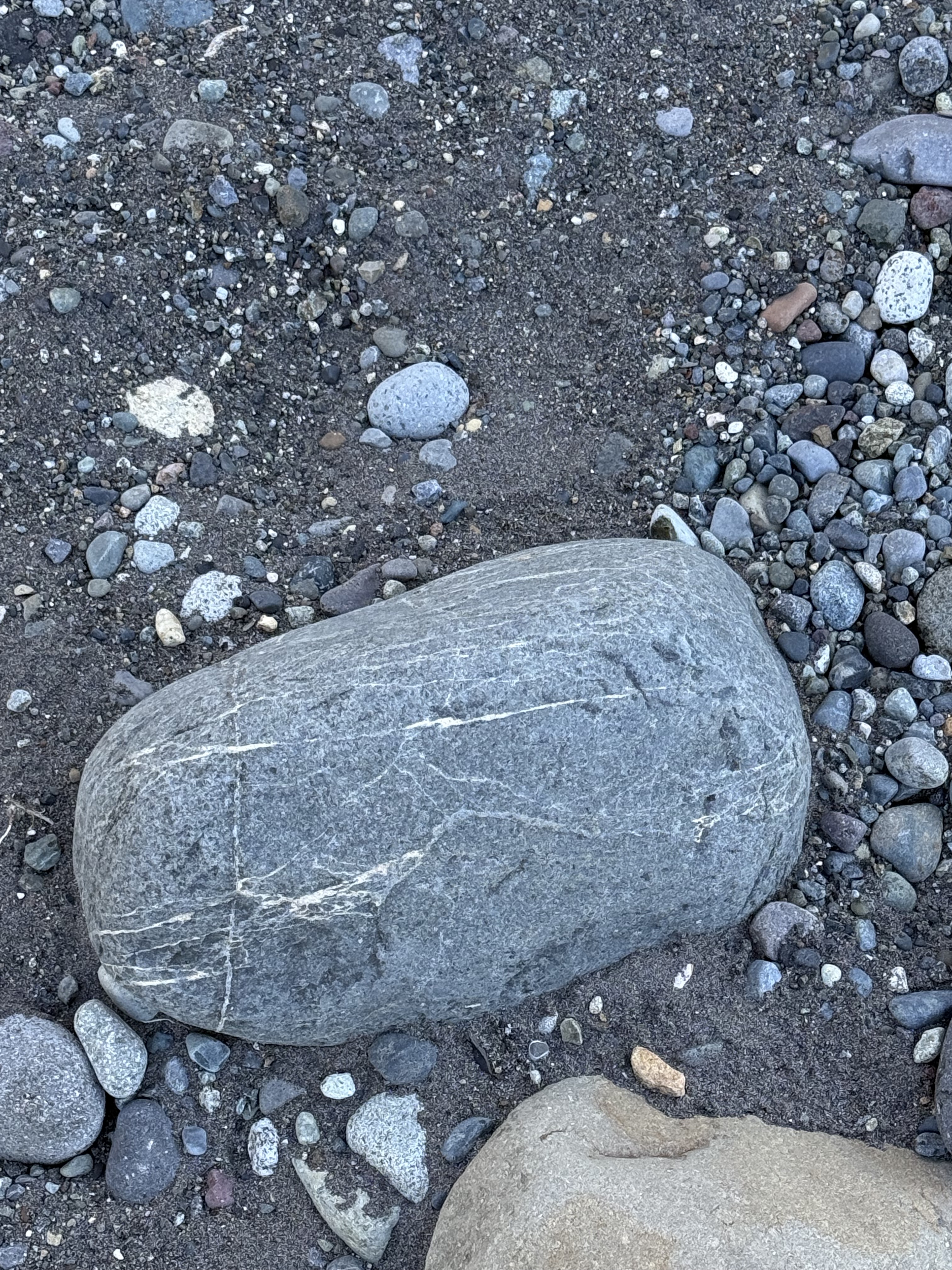
Figure 3. This sample tells a complex story. This is andesite (extrusive rock common to subduction zones), but any fractures within it were filled with magmatic fluids rich in Na, Ca and silica, by a later eruption. The result of this hydrothermal circulation is rocks that are neither extrusive nor intrusive; they are chemically altered by subsequent injections of magma at depths less than 1 mile, often even shallower.
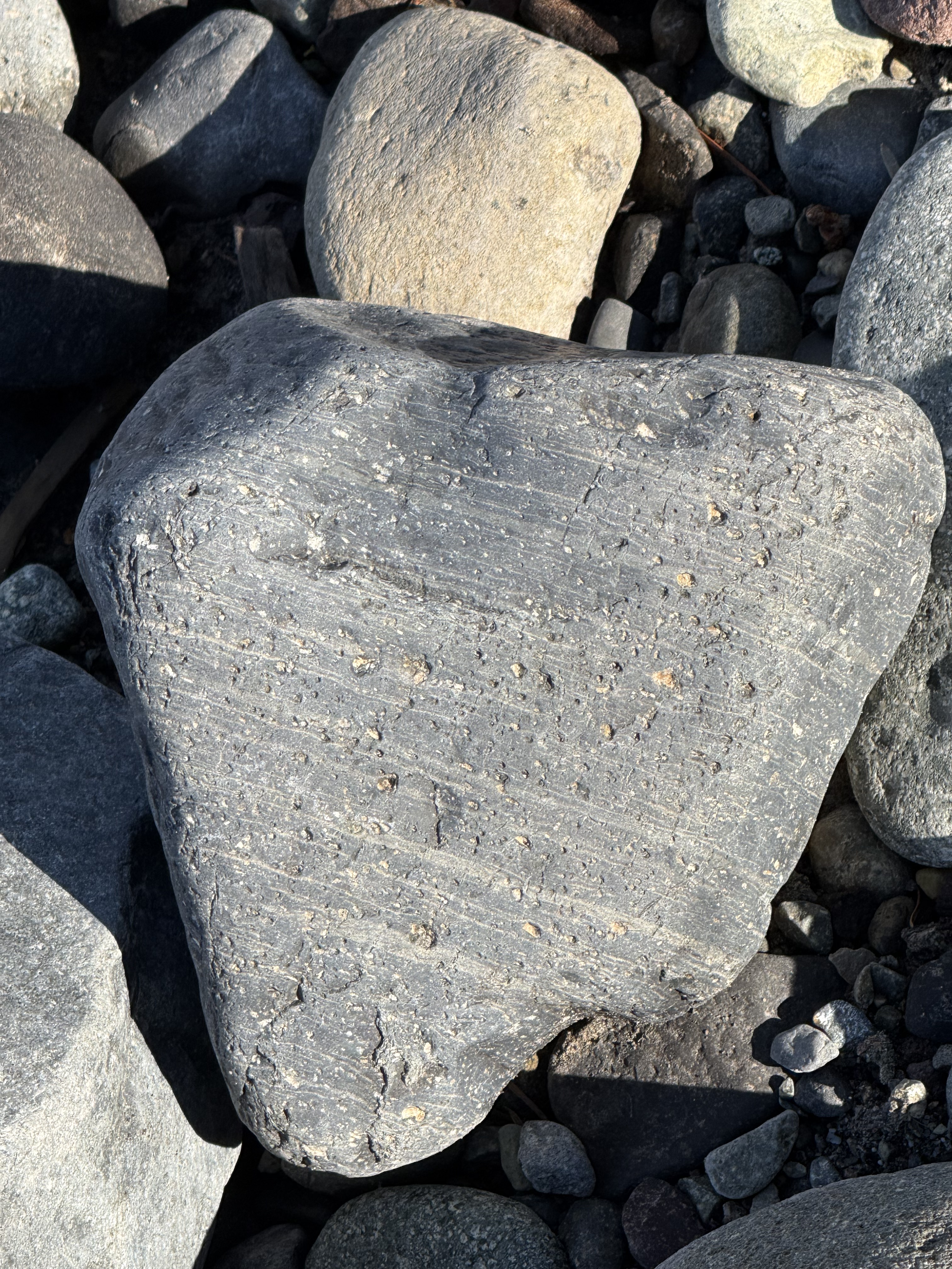
Figure 4. Another fascinating example, which tells a different tale. This andesite block wasn’t injected with magmatic fluids beneath the surface; this sample is the result of gaseous magma erupting within a few hundred yards of a vent. The laminae tell us that the composition was changing subtly on short time scales; this was the top of the boiling magma, and thus there was a lot of trapped gas (e.g. CO2, H2S) that formed the vesicles after the lava had settled–but not yet solidified.
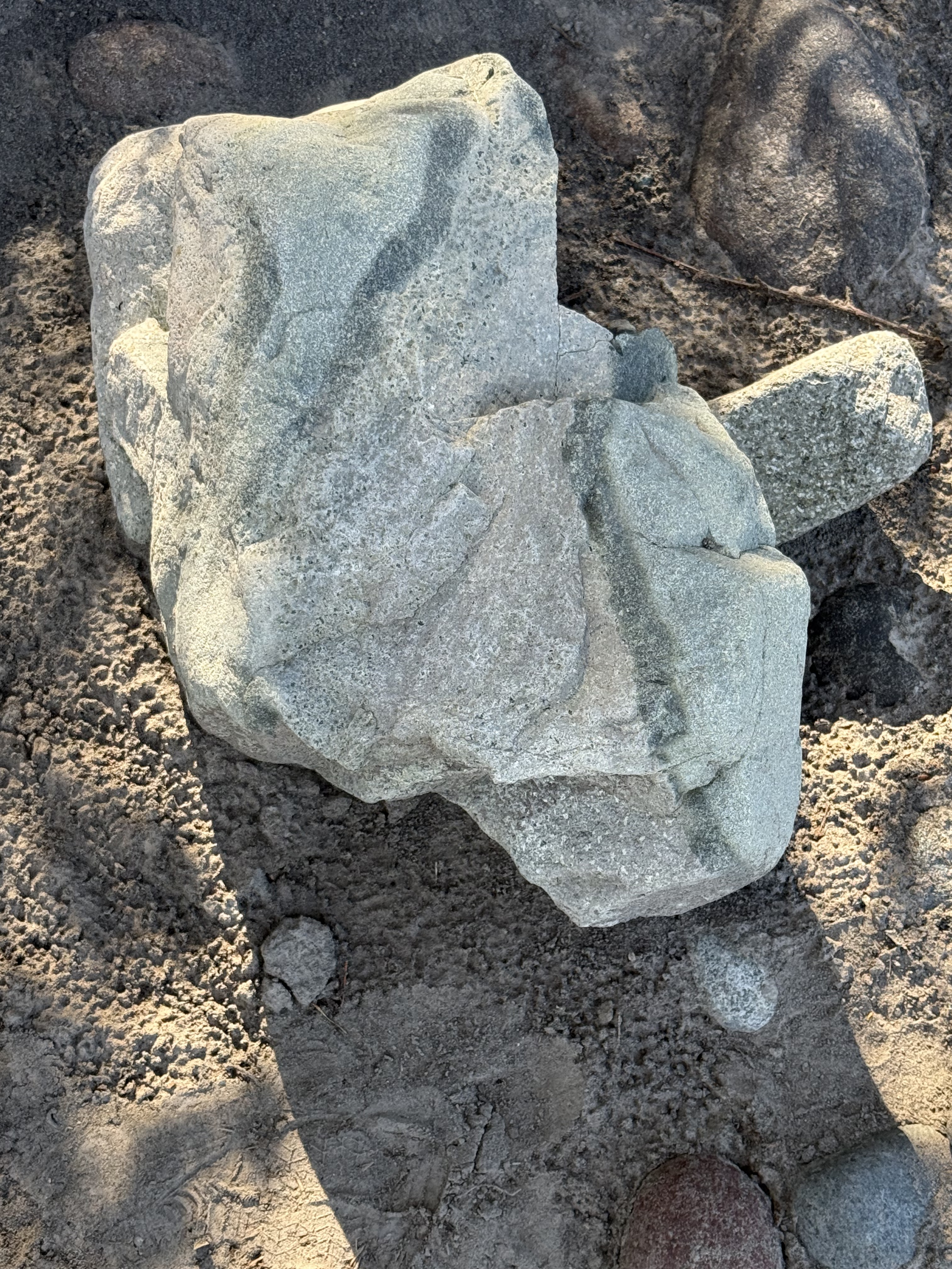
Figure 5. This irregular sample of andesite tells two stories: 1) The presence of phenocrysts (small white blebs at the bottom of the sample) implies slow cooling whereas the dark streaks imply a later stage of fast cooling, so that magmatic fluids with slightly different composition intermingled with the already hardening earlier stage. Imagine making taffy. 2) This sample wasn’t transported in the Carbon River more than a few miles. It would have broken along internal planes of weakness and become more like those we saw above. We aren’t far from the source.
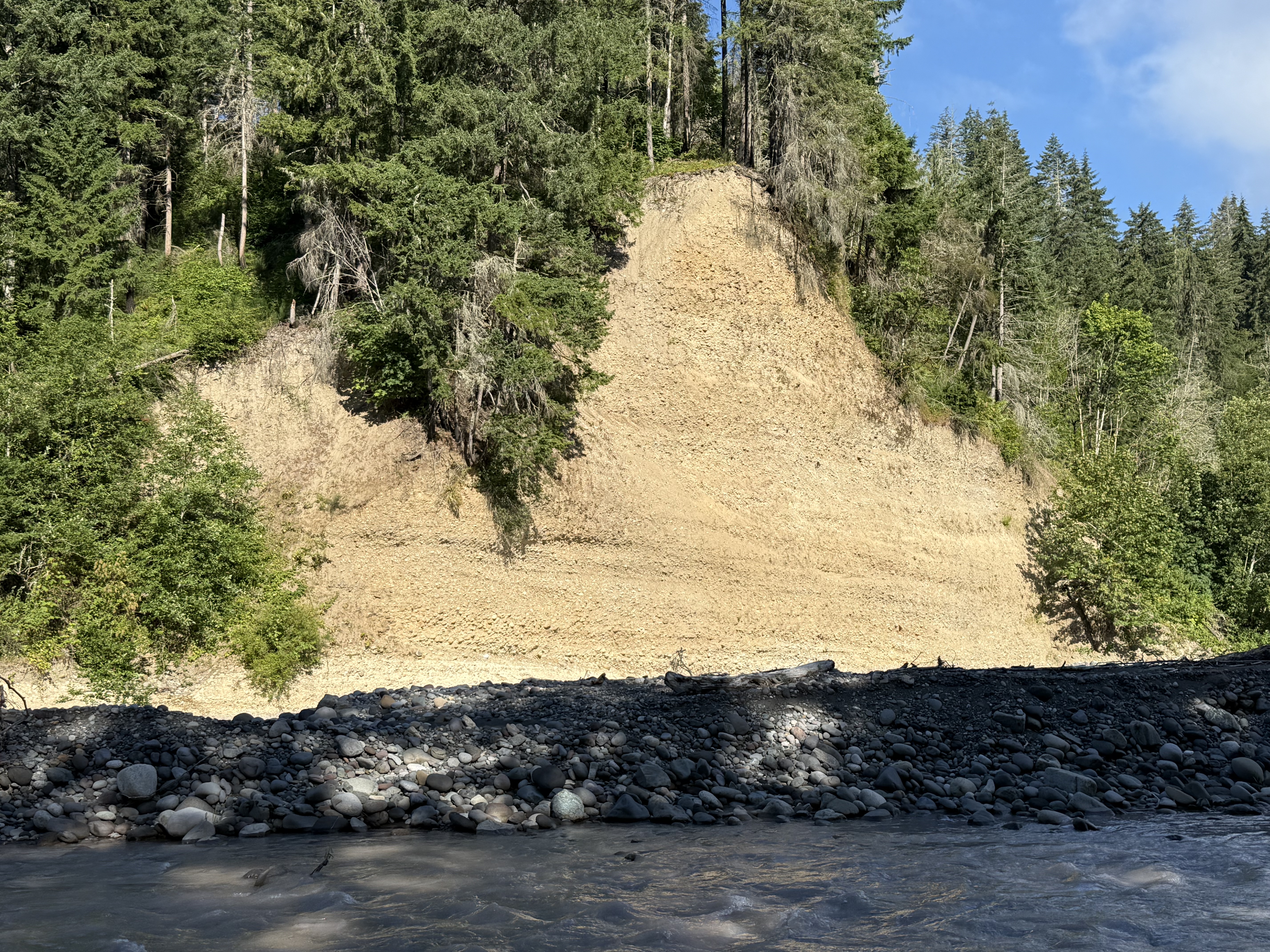
Figure 6. This is an excellent exposure in a cliff cut by the Carbon River. It could be dismissed as undifferentiated glacial till, but I’d like to give it a second thought: What if this location records the movement of continental glaciers through Puget Sound (i.e. the Vashon till), in addition to alpine glaciers moving down from the Cascades? Could we even tell the difference?
The bottom of this section contains cobbles in a sandy matrix deposited horizontally. The middle part is finer, as seen in the absence of large cobbles, but a channel containing larger clasts is visible in the center of the photo, forming a “V” that points towards the bright spot in the modern channel, slightly right of the center of the photo. The depositional environment must have changed quickly to produce such a contrast in lithology.

Figure 7. This is a close-up of the center of the cliff in Fig. 6, focusing on the contact between finer, sandier sediment to the left, and coarse material in the upper right. The unconformity contact between them was created by erosion, either by a glacier or a river like the modern Carbon River. Note the change in bedding between the lower part of the exposure and the irregular layers above the unconformity. The lower section reveals a fining-upward sequence; but this was partially removed and the entire upper part of the section is dominated by conglomerate.
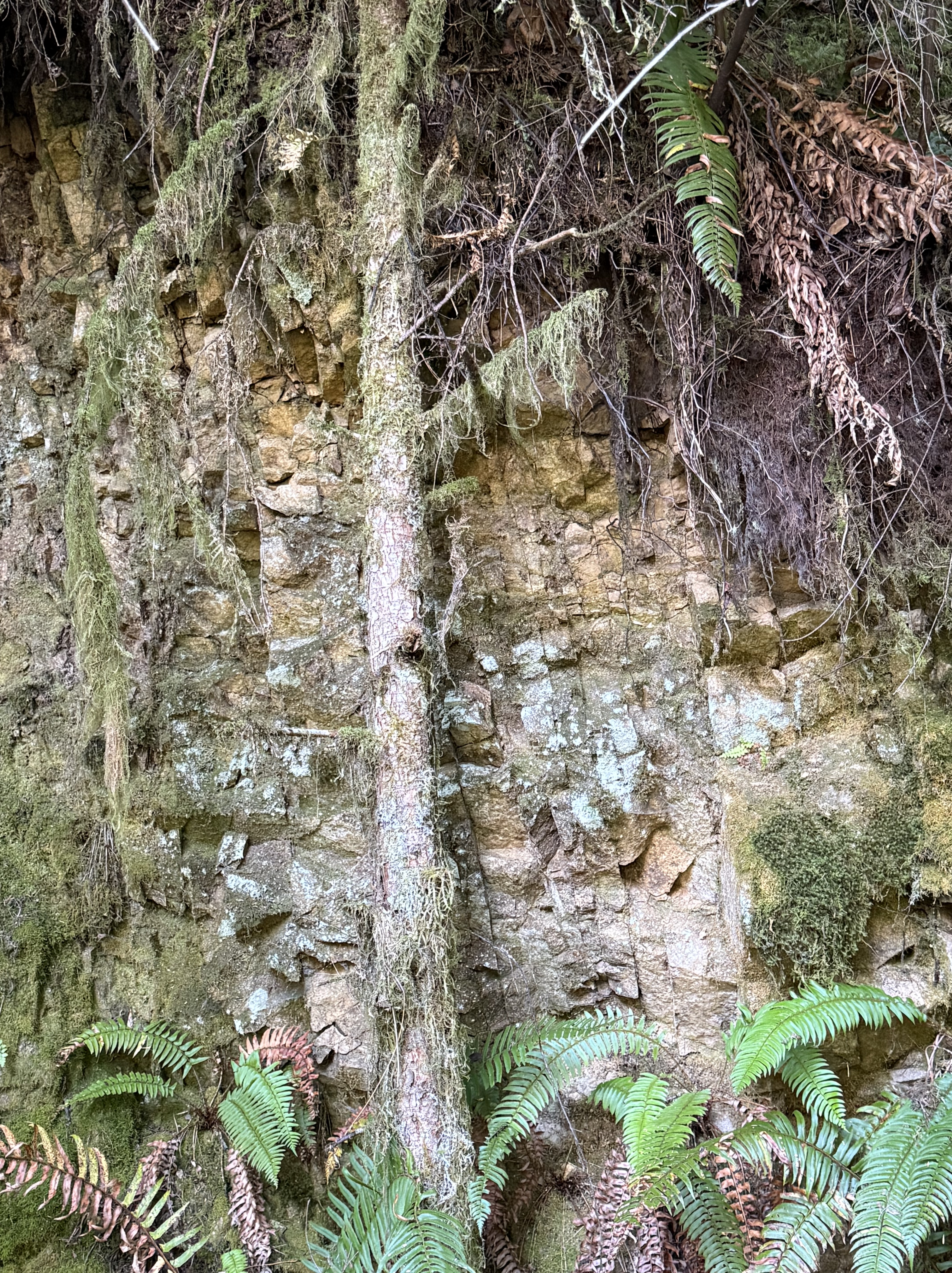
Figure 8. This photo was taken about halfway between Carbonado and the bridge (the star and triangle in Fig. 2B, respectively). The river was about 100 feet lower than the trail at this point. These bedded rocks are nearly vertical, as indicated by the dark, nearly vertical lines. They are Eocene terrestrial sediments that have been faulted and folded into their current orientation. They were probably deformed when the faults seen in Fig. 2C (thin lines on the geological map) were active.
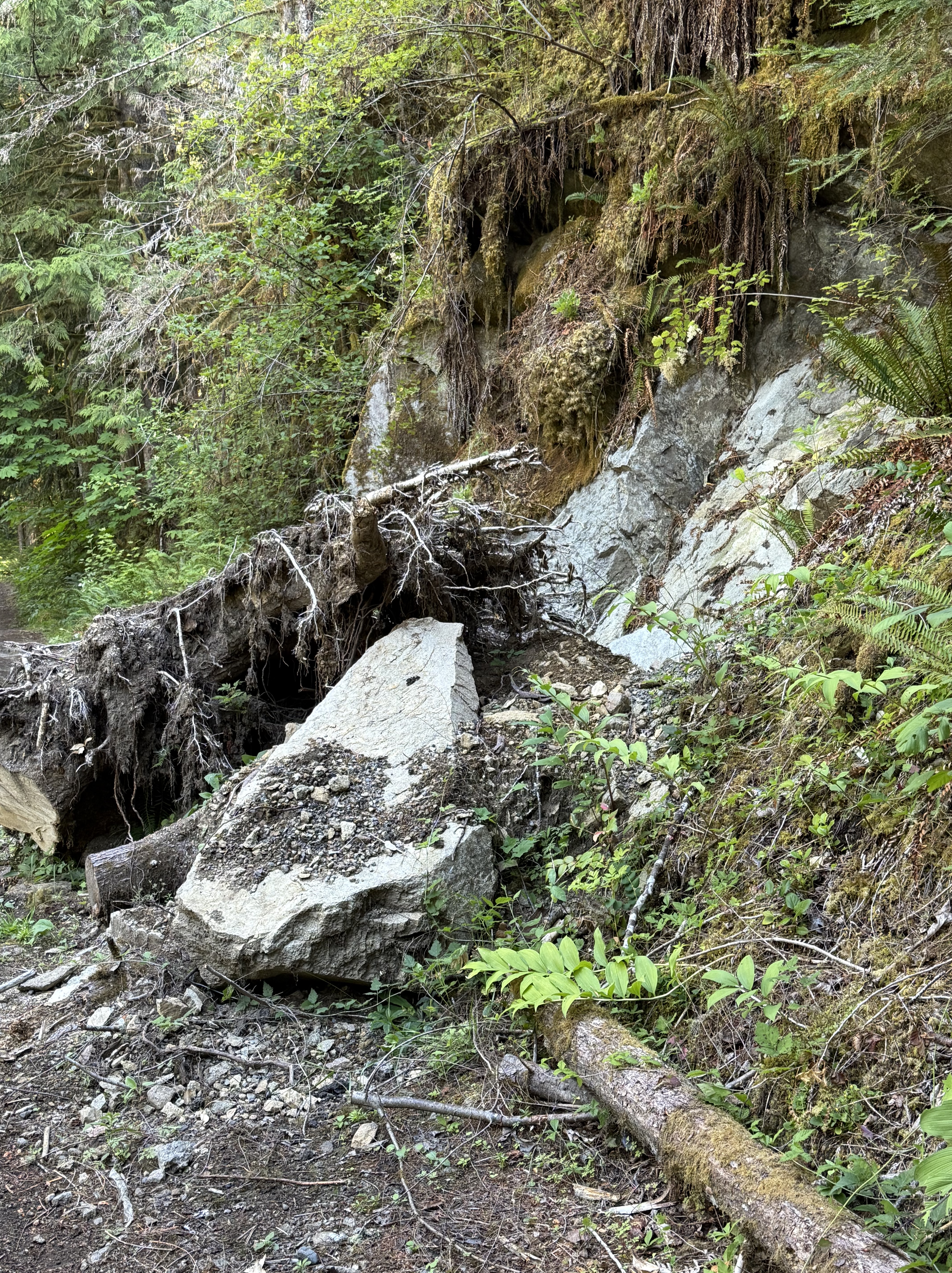
Figure 9. Further along the trail we encountered this small landslide. A tree that had rooted in cracks within the sedimentary rocks fell along with a piece (about 10 feet long) of rock. This is a great example of how erosion is a continuous process that never rests, inexorably removing mountains and transporting them to the sea.
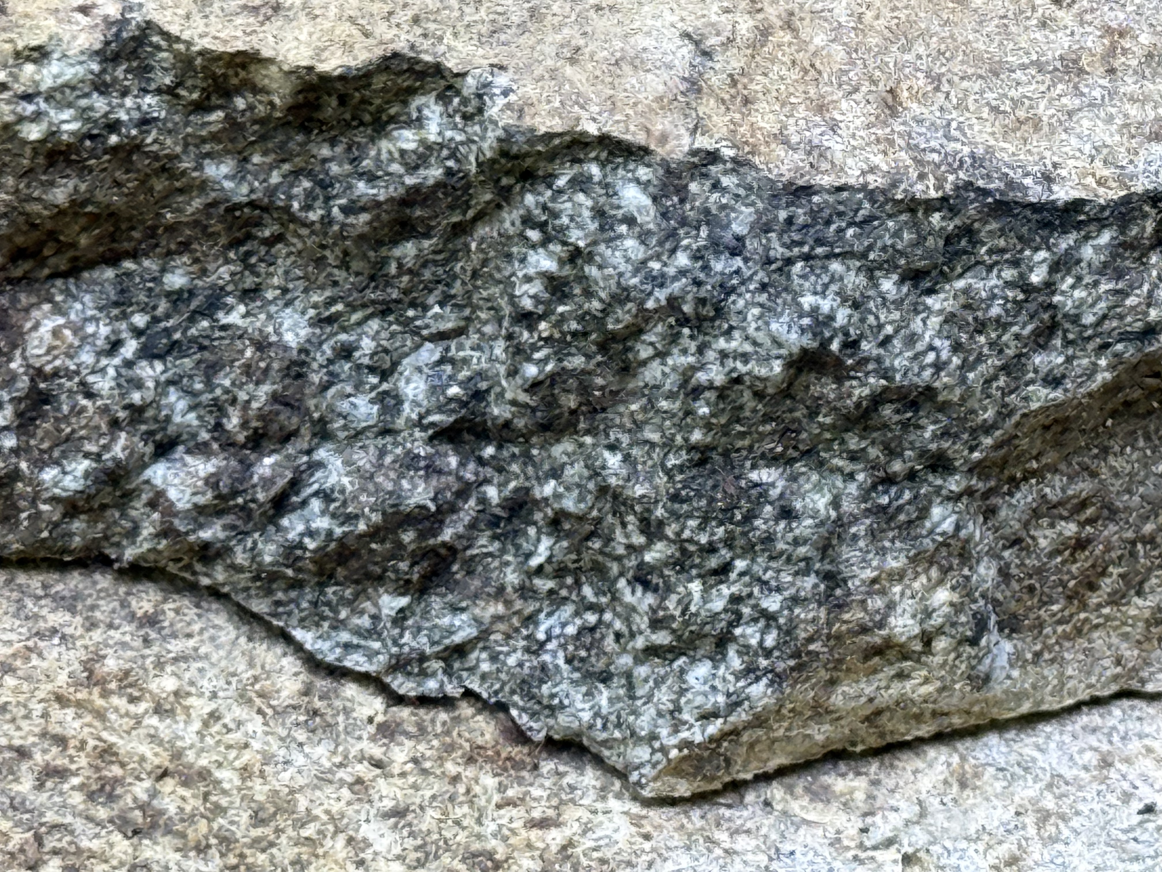
Figure 10. To the naked eye, this close-up of a recently broken piece of the slab in Fig. 9 looks like an intrusive, igneous rock, but it absolutely is not! Ignoring the dark coloration, which is either an organic stain or weathering product, I would say this is probably a coarse sandstone, possibly even a breccia or conglomerate. Breaking it with a rock hammer, to produce a fresh surface, would make identification easy; but we don’t do that in Rocks and (no) Roads. We use the geologic map instead.
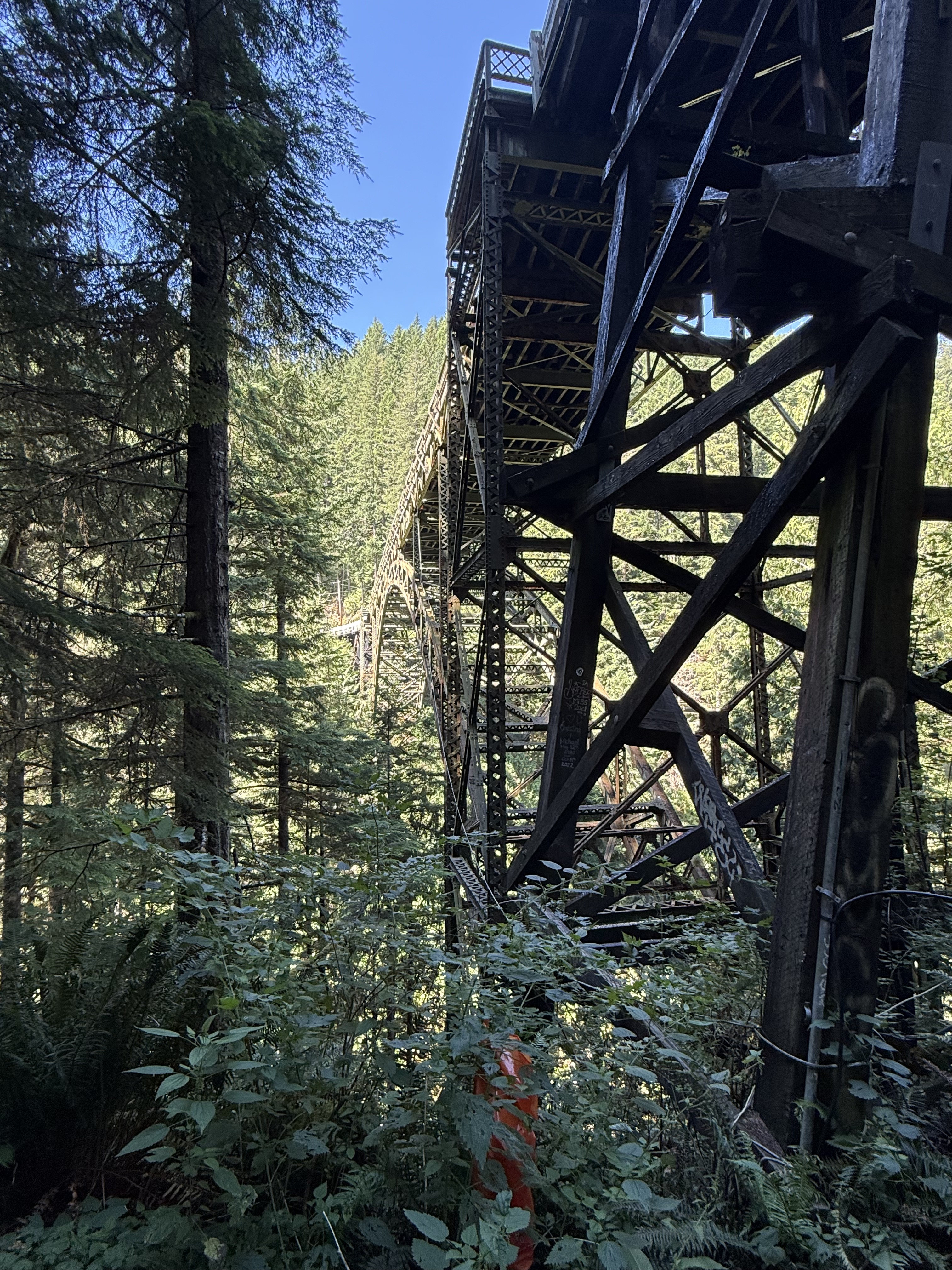
Figure 11. This is the end of the trail, where the road crosses Carbon River across the condemned Fairfax Bridge — closed even to pedestrian traffic. The canyon is 250-300 feet deep here. We climbed a trail to the bridge before we saw the signs on the highway declaring it unsafe for men or beasts.
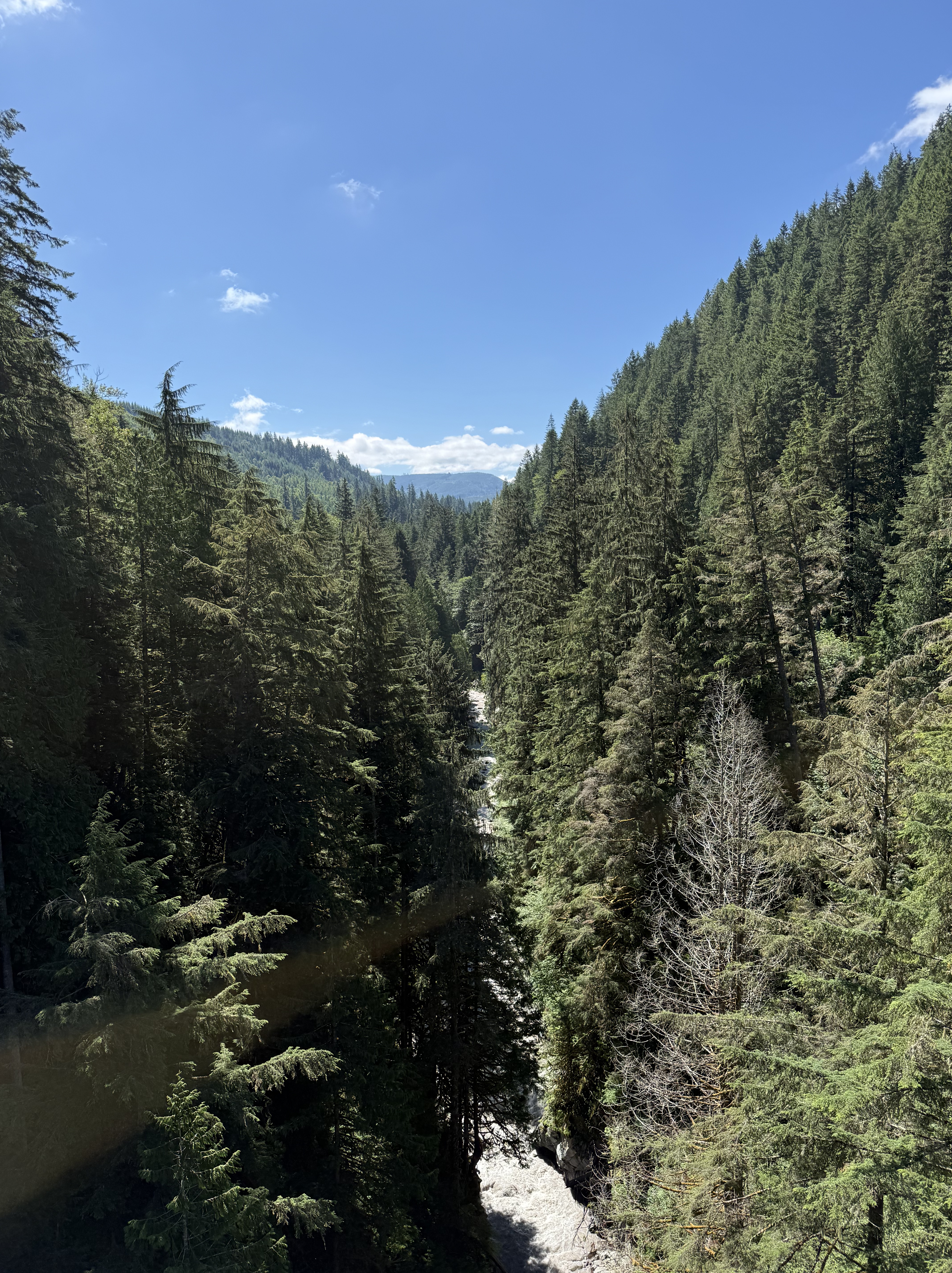
Figure 12. The canyon is very narrow at Fairfax Bridge, and Carbon River is forced into a bottleneck where it drops precipitously from the core of the Cascades. This entire canyon would have been filled with ice during the most recent glacial period. Compare this image, looking upstream, to those from the Nisqually glacier on Mount Rainier. That ice would have melted and advanced, pushing its way downstream, where it would have met the continental glacier covering Puget Sound.
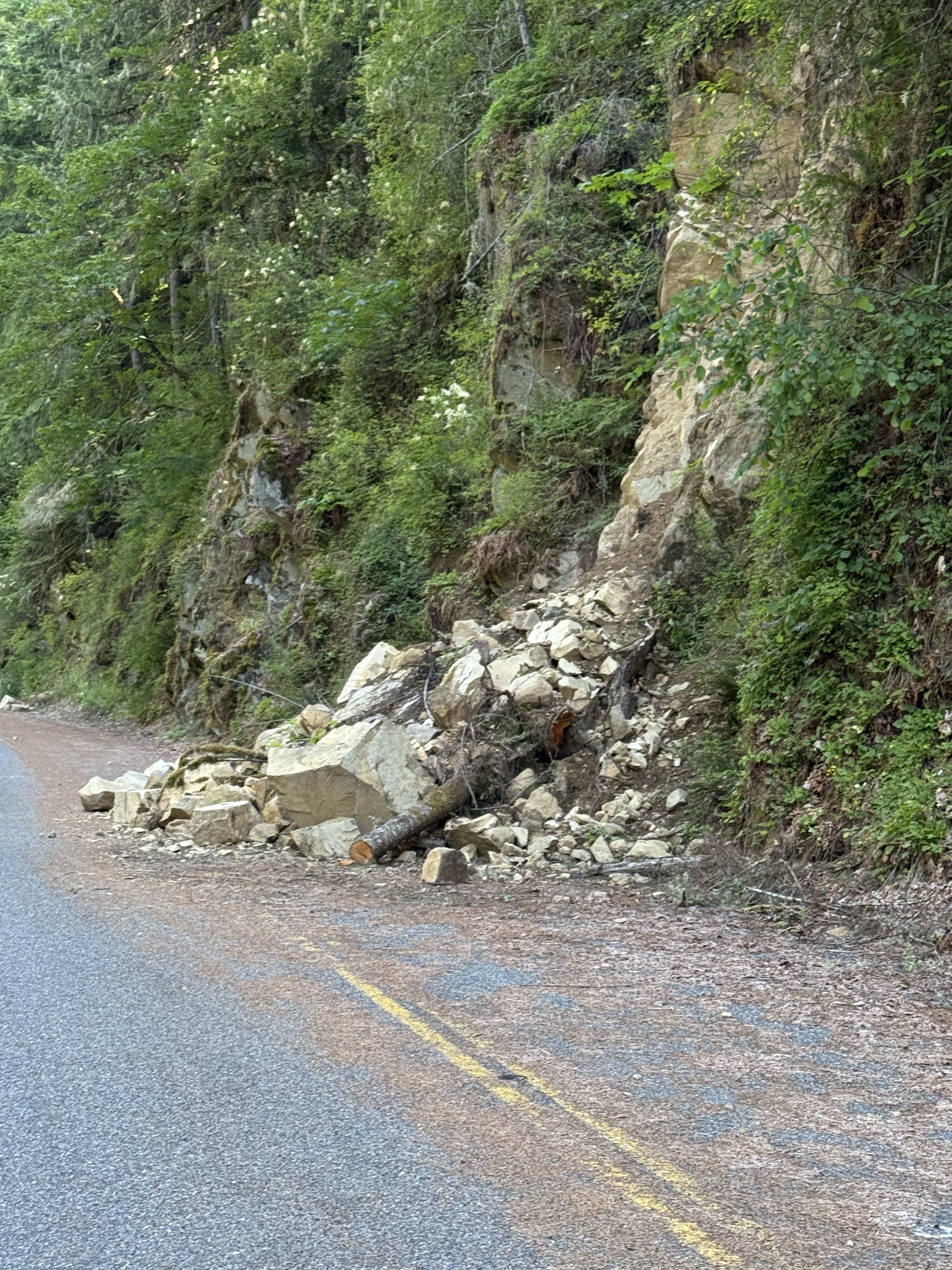
Figure 13. We took the highway back to Carbondale. However, Route 165 is closed and the highway department isn’t maintaining it, so slides like this one are left for geologists to examine. This block is, according to RockD’s geologic map, sedimentary; it looks like sandstone and I didn’t examine it at the time. Note the reddish face on the large block facing the camera; red means this rock was deposited with a lot of oxygen, which means it was in a river and not the ocean, which has a much lower concentration of oxygen.
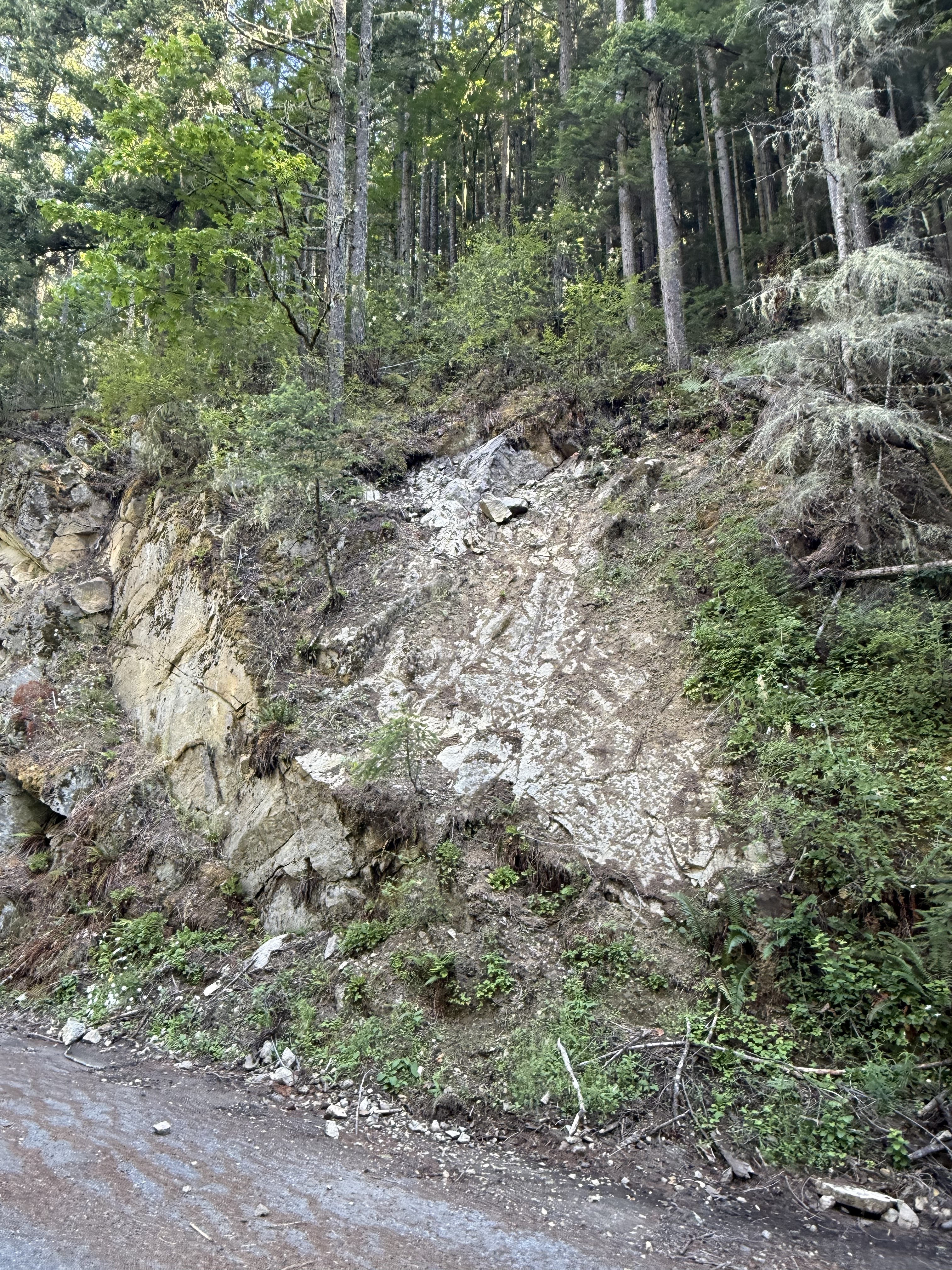
Figure 14. This photo presents a bizarre juxtaposition of geologic features. It was taken a few hundred yards downstream of Fairfax Bridge. The thick layer of sandstone to the left represents the unaltered strata, which has been tilted towards the NE, but not as much as the strata seen in Fig. 8. Such a sudden (spatially) change in orientation is probably why the geologic map (Fig. 2C) shows a fault along the river canyon.
Another interesting feature is the white patch in the center of the photo. I had several hypotheses about this but, after discussing it with CoPilot (aka ChatGPT), I’m going to go with the most plausible scenario: I think this is a layer of shale within the Carbonado Formation, which is both more easily weathered than sandstone, and a surface that can accommodate slippage on a fault more readily. The apparent bedding plane (i.e. the white surface) is an illusion, created by uneven weathering and the constant flow of water down an established channel.
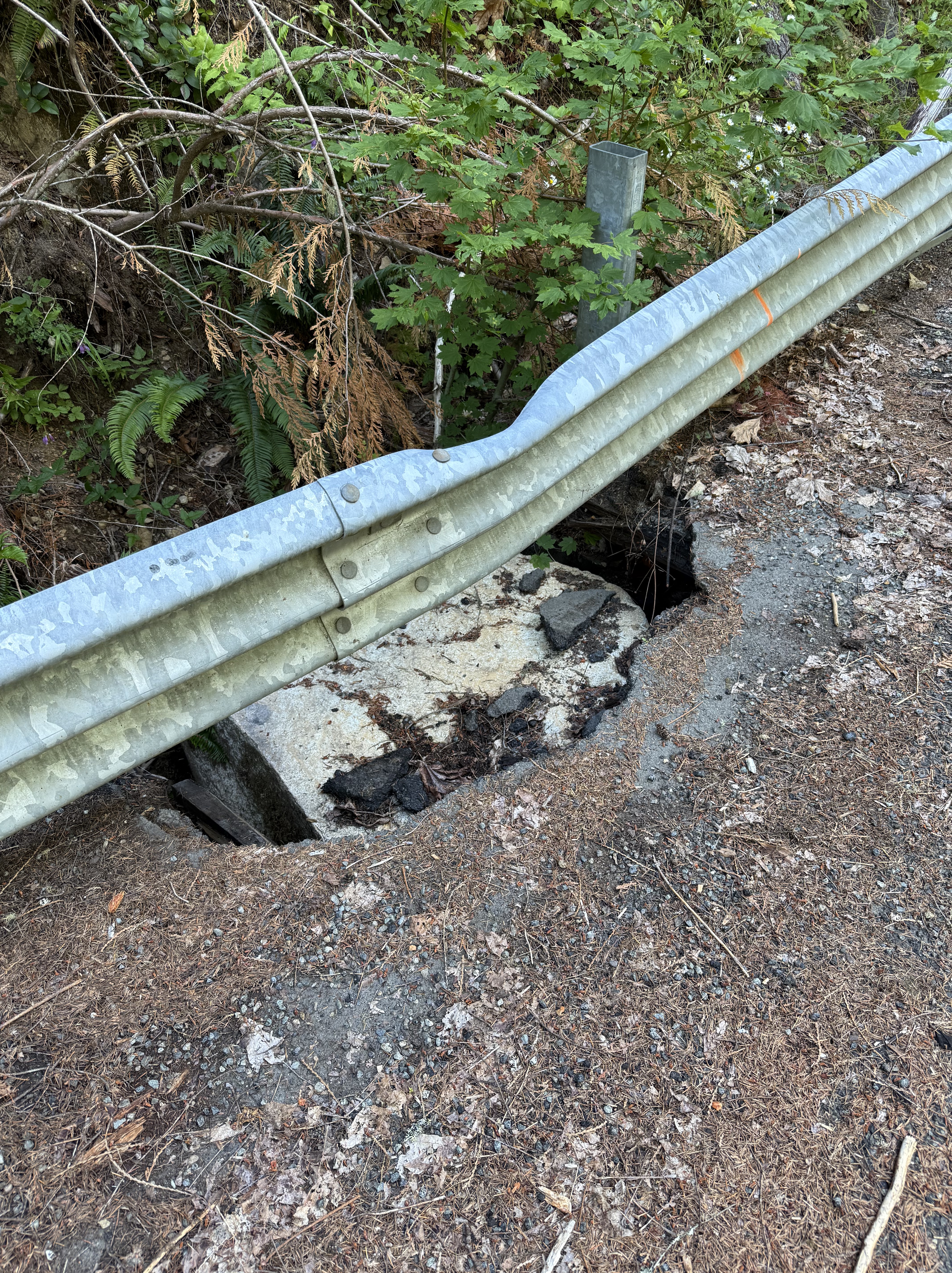
Figure 15. I had to include this image. A block of sandstone, weighing more than a ton, rolled down the steep slope, hit the guardrail, bending it, before slamming into the asphalt road that was weakened by erosion, and smashing into the underlying, water-saturated ground. We noticed several spots where the culverts draining the road were insufficient, allowing water to collect and weaken the roadbed.
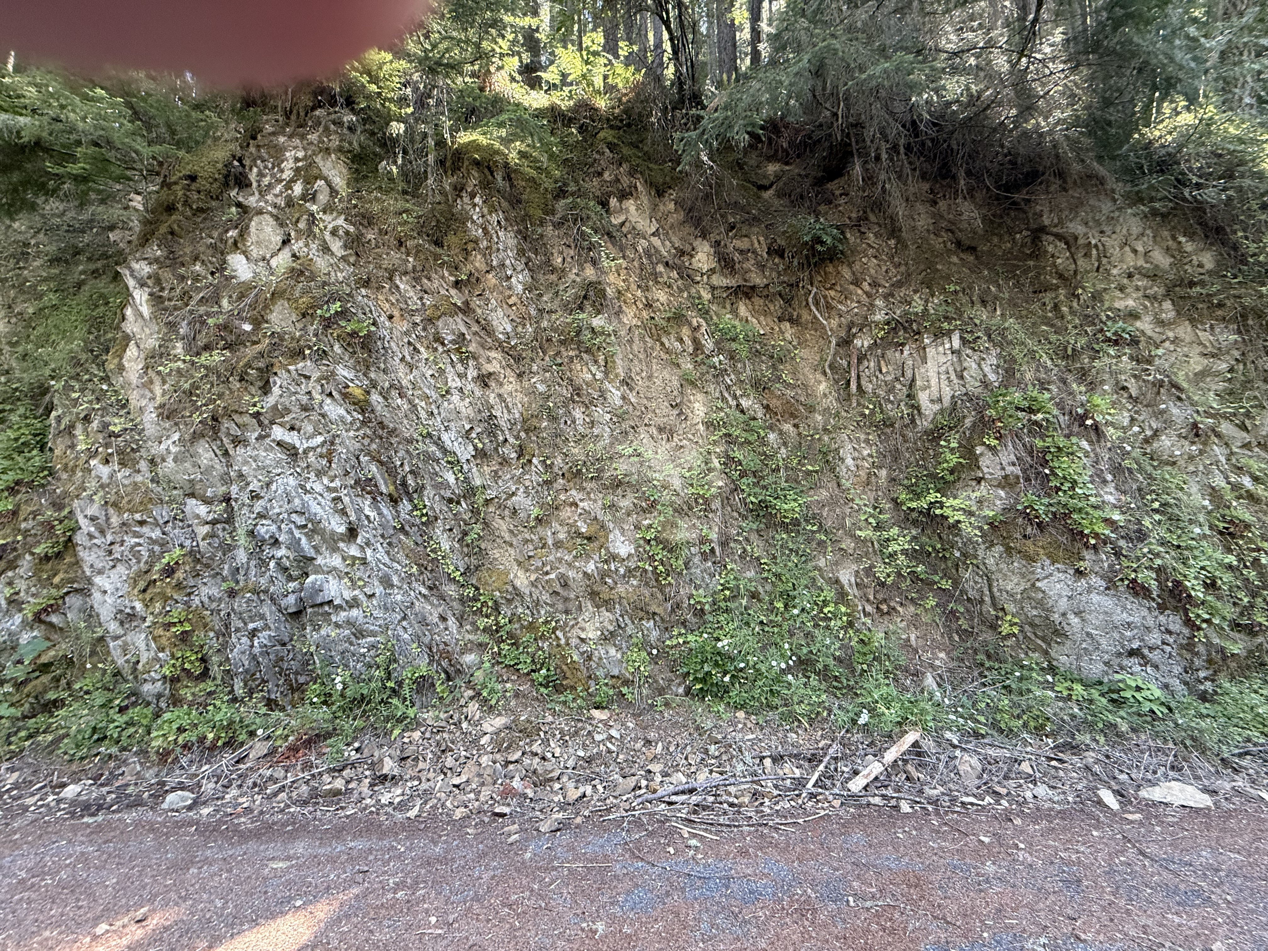
Figure 16. Another couple hundred yards further downstream (towards Carbonado in Fig. 2B), and we find thin layers of shale/sandstone nearly vertical, just like in Fig. 8. I didn’t measure my location precisely, but I wouldn’t be surprised if this is just above (uphill) the earlier observation. Note the layers of mud that resulted from differential weathering of clay layers within the Carbonado Formation.
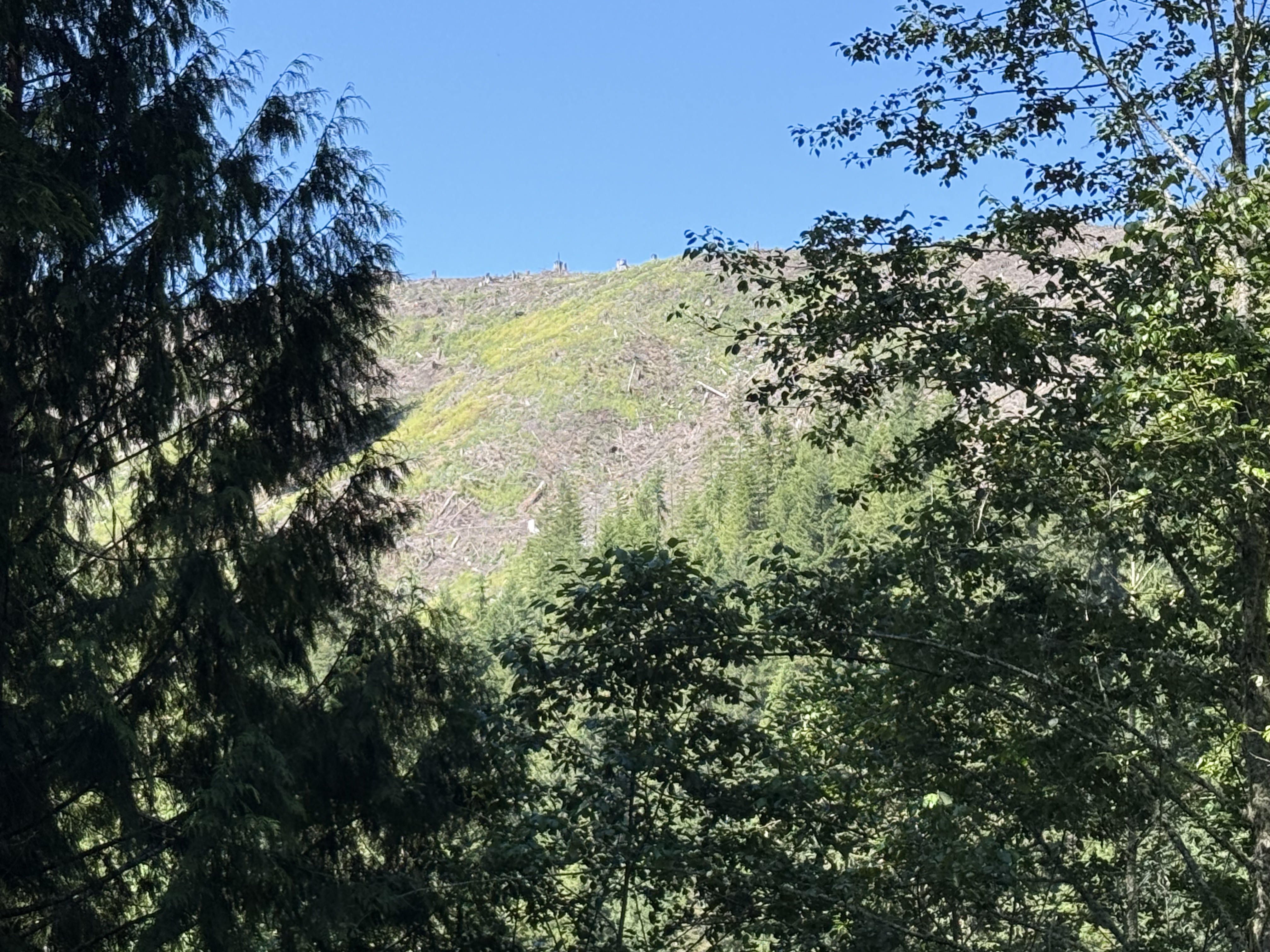
Figure 17. I included this image to explain why the Carbon River was so muddy a few miles downstream (Fig. 1). The canyon wall to the west has been clear cut recently, allowing massive erosion of soil into the Carbon River. This is an ongoing practice in Washington with no attempts to rein in such destructive deforestation — all for the sake of profits. It just pisses me off!
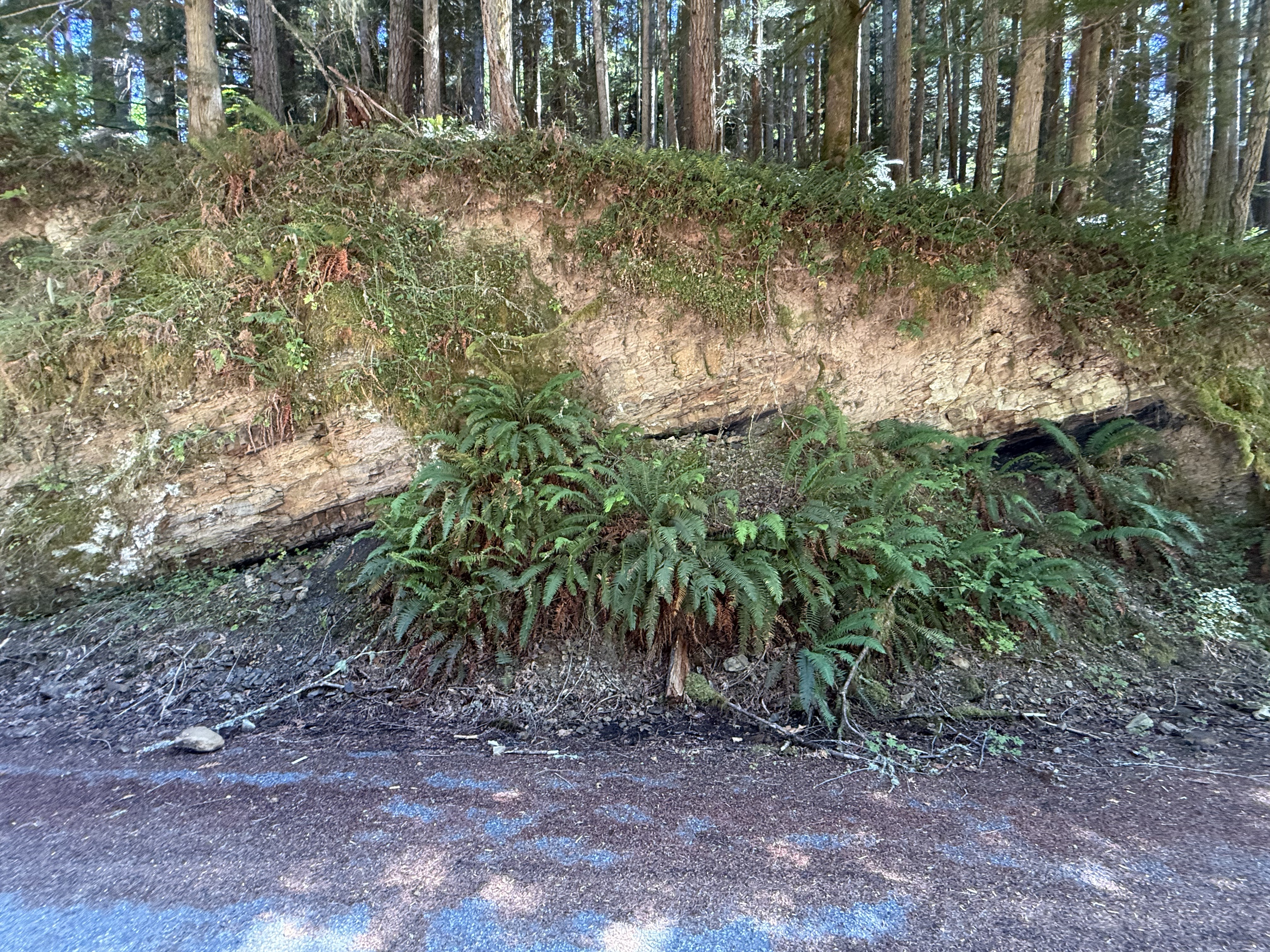
Figure 18. The main point of interest in this photo is that the Eocene sedimentary rocks are oriented differently from those in Figs. 14 and 16; these rock strata are dipping WNW(I didn’t measure strike and dip), rather than vertical or ENE. Faults don’t occur at the surface, but only shallow enough for the rock layers to break rather than bend. Identifying and mapping crustal faults is as much an art as a science because we don’t have the remote-sensing tools to see what lies beneath the surface, whether it is glacial till or bedrock.
Summary
We saw a lot more on this trip than I’d imagined during the 45 minute drive to Carbonado. I’ll put it all together into a chronology and try to relate it to other nearby locations we’ve visited. Let’s start as far back as the rocks will take us.
During the Eocene epoch, about 50 million-years ago, this area was covered with streams, lakes, and, presumably, forests. There were no rivers like the Carbon back then — the sediment consisted primarily of sand and silt, with a smattering of clay. These sediments were eroded from an active volcanic complex. Further west, along the Pacific coast of the Olympic Peninsula, contemporary rocks include turbidites deposited in deep water, probably submarine fans, and tectonic breccias. This tectonic environment has persisted to the present day. We examined one of these volcanoes, from the Miocene (~23-5 Ma), at Pinnacle Peak. We didn’t see any evidence of a nearby volcano today; instead, we saw several boulders that revealed what was going on within the magma chambers beneath the Cascades volcanoes.
Subduction didn’t end during the ensuing millions of years, but the earth changed. Ice sheets appeared during the Pleistocene (~2.4 Ma), covering the PNW while alpine glaciers formed in the valleys dissecting the volcanoes. Finally, about 500 thousand years ago, a really big magma chamber constructed Mt. Rainier; and Carbon River began to wind its way from the flanks of this monstrous volcano to the Puget Sound trough during interglacial periods. This entire canyon would have been filled with ice during cold periods. It was during this period that Carbon River would have emerged from the eroding, ice-covered terrain. It didn’t cut its canyon but inherited it, and transported the remnants of a permanently altered terrain.
During glacial retreat, thick blankets of sediment were deposited by rapidly flowing rivers fed by the glaciers. This occurred repeatedly for two million years, culminating in the most recent glacial deposits seen in Fig. 6. However, this process of glacial advance and retreat occurred within both the vast continental glacier and the alpine glaciers, resulting in overlapping layers of poorly sorted sediment.
One final word: the muddy water we saw in the Carbon River is probably caused by the clear-cutting of the steep slopes defining its canyon; however, glacial melt during the summer transports a lot of fine material from beneath the glaciers covering Mt. Rainier. When we visited the Nisqually glacier and viewed the headwaters of Nisqually River in December, the water was crystal clear. Maybe the water turns opaque every summer.
It has been a wild ride through the last 50 million years along the modern Carbon River.


Trackbacks / Pingbacks