
Eocene Continental Sediments in Flaming Geyser State Park
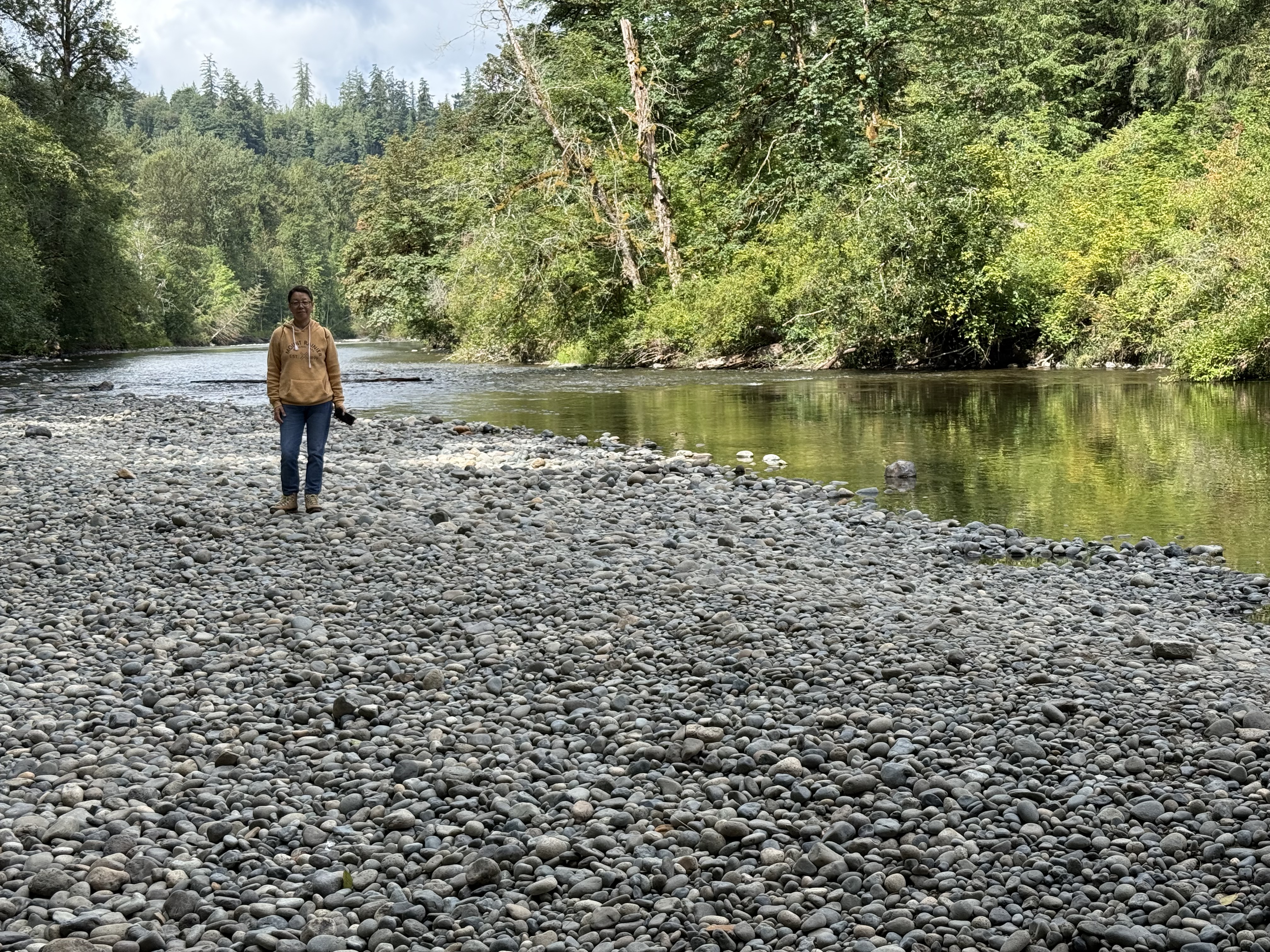
Figure 1. Flaming Geyser State Park is located along the Green River (see Fig. 2 for location), where its valley narrows and deepens. This photo shows a typical gravel stream, but there is plenty of sand and even clay available to construct a flood plain. The alluvial deposits downstream are rich farmland, where we saw a variety of vegetables growing.
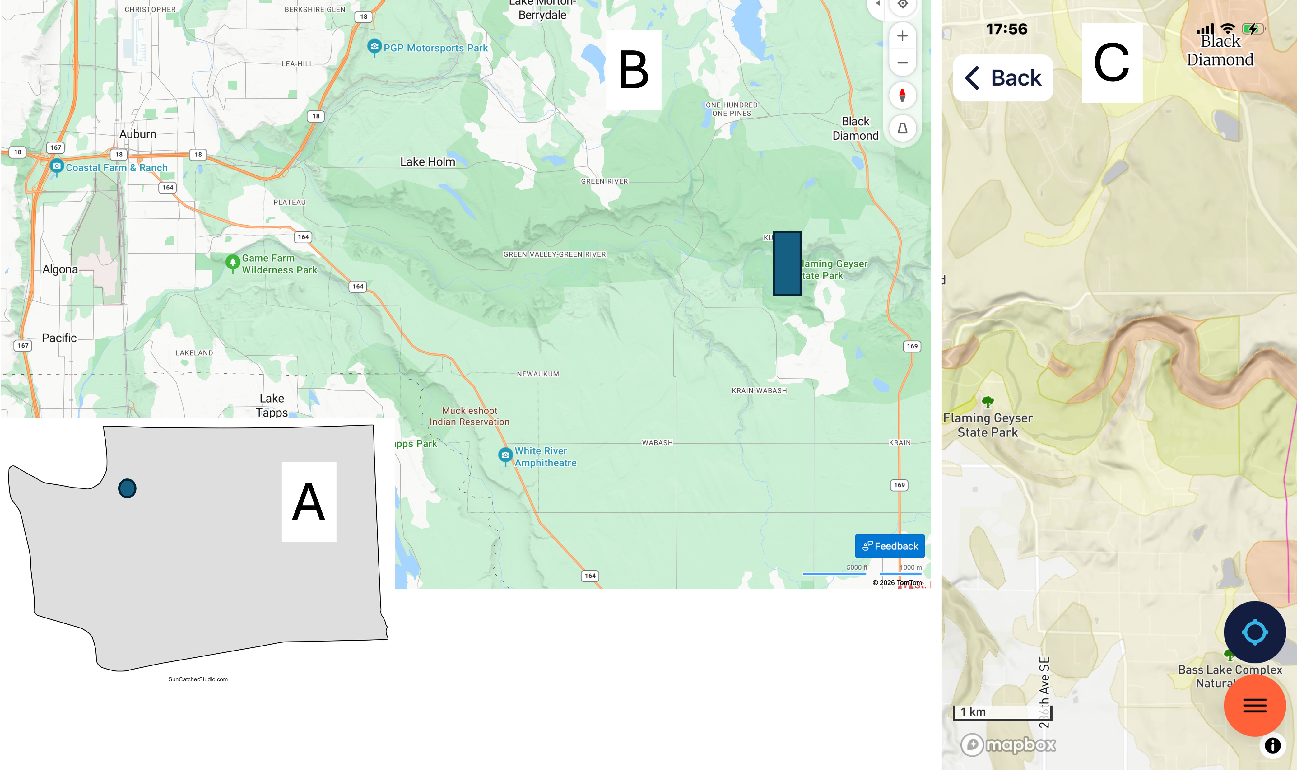
Figure 2. (A) Location of the study area SE of Tacoma in the foothills of the Cascade Range. (B) Green River has eroded a valley in the glacial till and bedrock along its path. The northern margin is steeper throughout its length. Flaming Geyser State Park is located upstream of the arable land, where the river becomes rocky and the valley narrows to a gorge. (C) The geologic map from Rock D reveals Eocene (56-33.9 Ma) continental sedimentary rocks along the stream bed whereas further north, Vashon till of Pleistocene age (2.58Ma – 11.7 Ka) covers the region in a thinning-eastward blanket. Just south of the river itself, Quaternary (2.58 Ma – Recent) fluvial and alluvial sediments have accumulated.
To the extreme east side of (C), a fault line can be seen running N-S. Faults are common, but often difficult to identify, within the region because the Cascades are the result of oceanic-crust subduction beneath the North American tectonic plate.
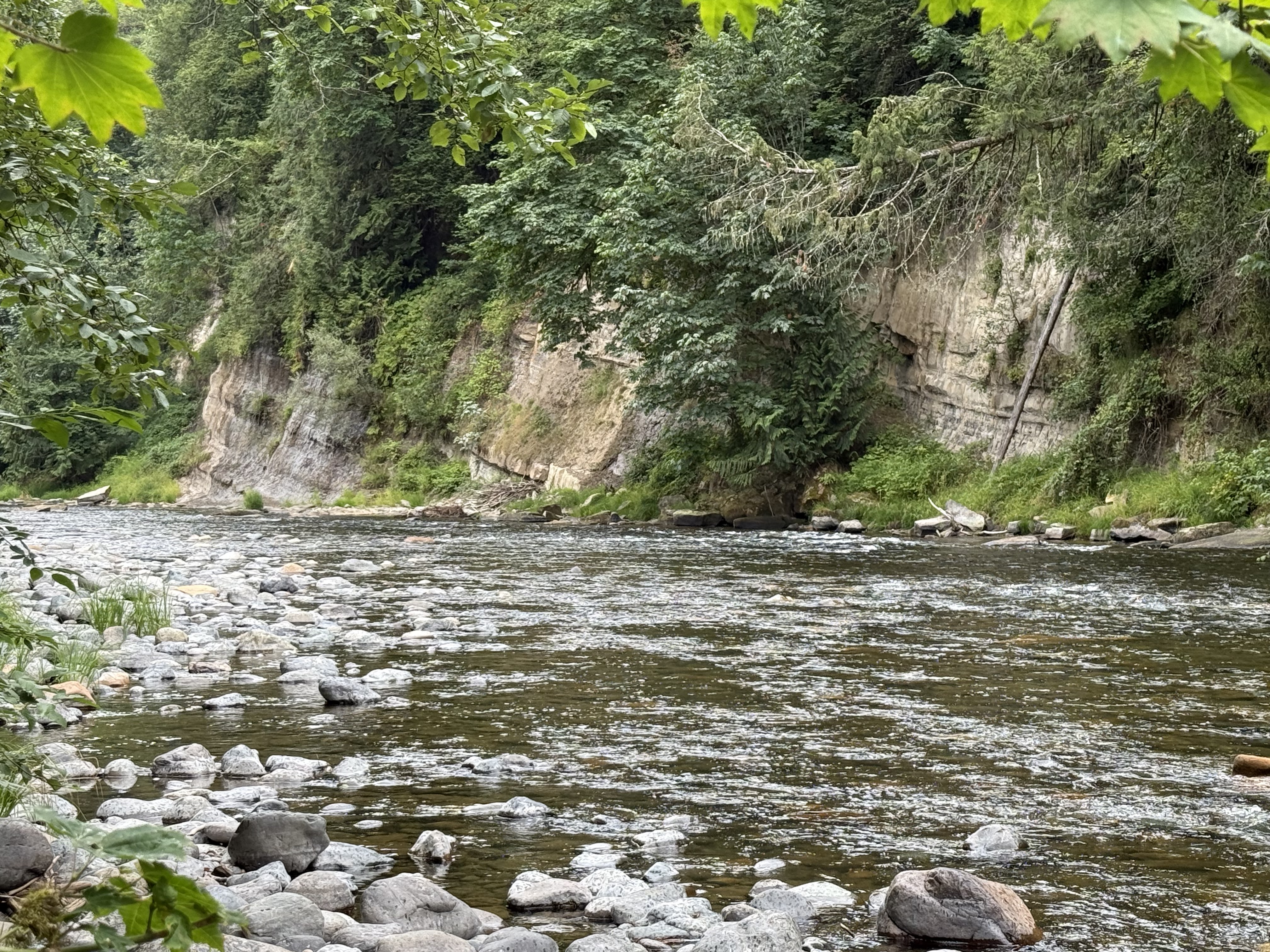
Figure 3. These layers of Eocene terrestrial sedimentary rocks have been tilted eastward (to the right), towards the fault seen in Fig. 2C, suggesting that it is a normal fault; however, their beds aren’t quite continuous, suggesting some slippage between them. The patches of foliage separating them may indicate minor faults, where the rock is ground into fine material suitable for plants to thrive. For example, the leftmost exposure is similar in stratification to the middle strata of the center exposure; the rightmost exposure doesn’t seem to be continuous with either, except for the thin, resistant bed immediately below the cliff on the right, and a similar “marker” bed a few feet lower in the middle exposure.
Following a horizontal line between them, the rocks are younger to the left, but not by much–possibly a few thousand years. This brittle deformation would have occurred a few miles within the surface when the faults were active; unfortunately, faults cannot be dated with precision.
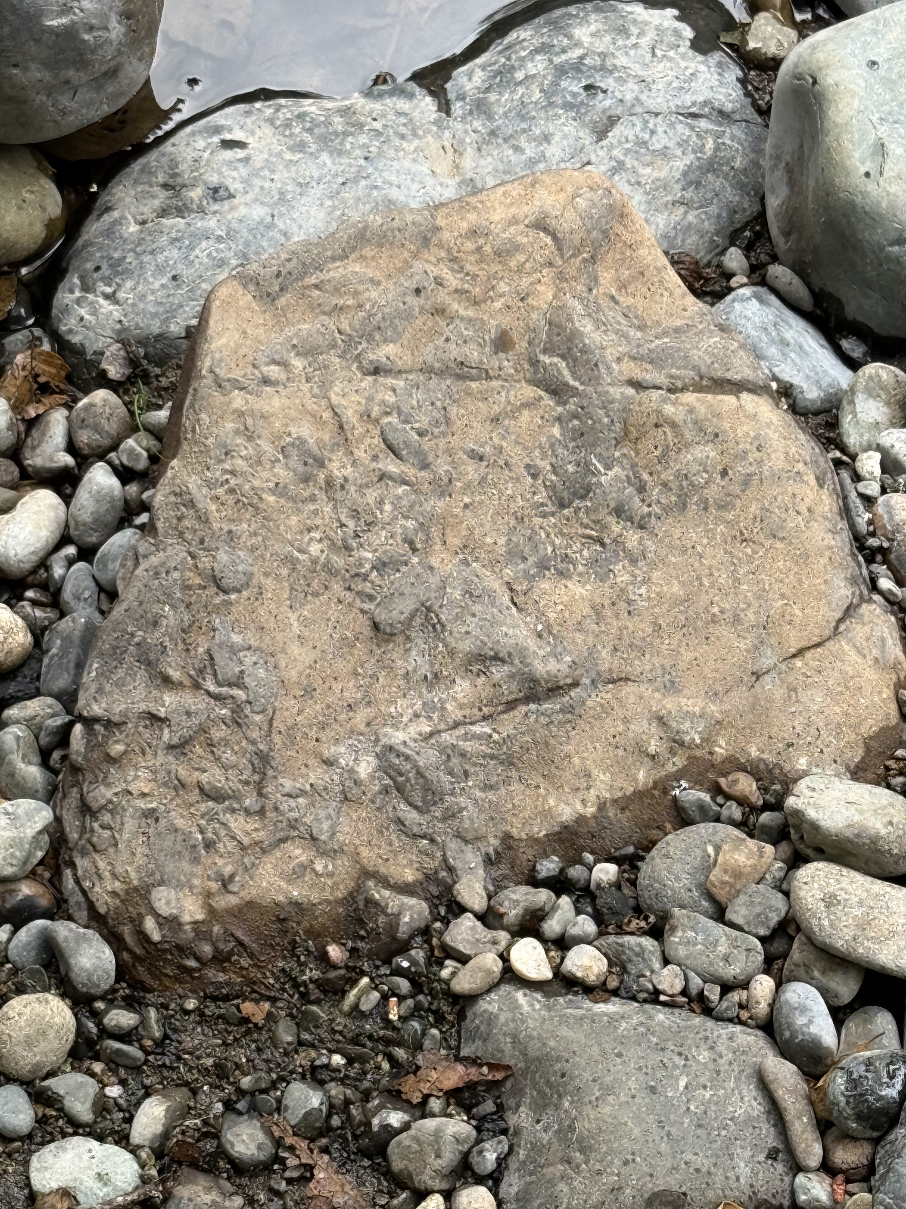
Figure 4. This is an interesting sample, which required some thinking, and a conversation with ChatGPT, to arrive at the most plausible explanation for the irregular blobs of darker material protruding from a reddish matrix. I’m pretty sure this texture arose from mingling of magmas with different compositions: the reddish one is andesite, and the darker material is something closer to basalt (there is a spectrum of chemical compositions); they were incompatible, but the magma wasn’t hot enough to totally incorporate the more basaltic material into the andesite.
We are seeing magmatic mixing processes frozen in time here.
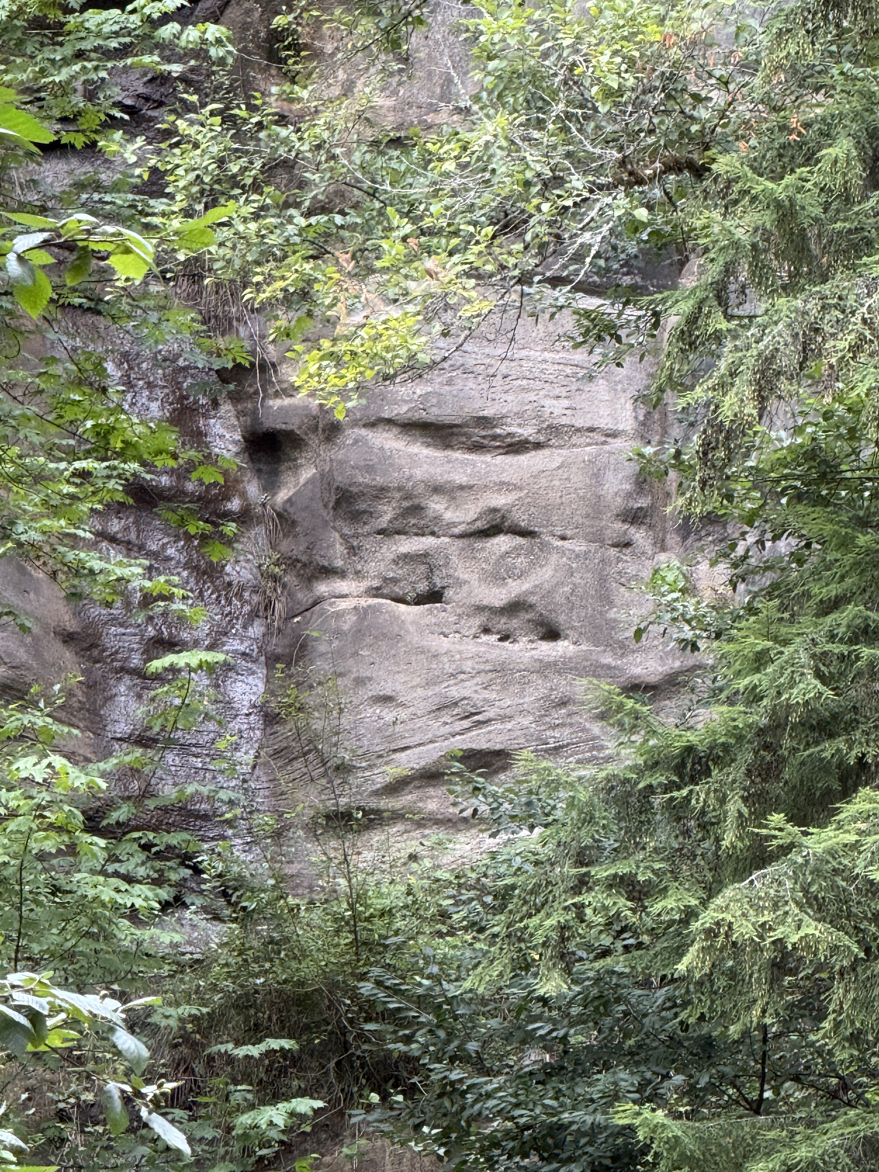
Figure 5. This photo reveals a cliff of Eocene sedimentary rocks across the river, probably 100 yards distant. I zoomed in to reveal the bedding. I estimate the height of the gray rock visible through the foliage to be at least thirty feet. The lower section contains two sets of cross-bedding, separated by an erosional surface, brought into relief by differential weathering. These large bed forms were created by water, probably in braided rivers or high-energy channels. The flow was to the left, westward in general.
This environment persisted for a long time although these rocks can’t be dated (no fossils or organic material); if we assume either a deposition rate of 1/8 inch per year (that’s a lot of sand), or a subsidence rate of similar magnitude (to make room for this stack of sand), we can estimate how long it took for 30 feet of sand dunes to accumulate. When we do the math, we see that this section could have been created in about 3000 years. This calculation is for illustration only. We don’t know the actual sedimentation rate here during the Eocene, nor do we know the amount of erosion.
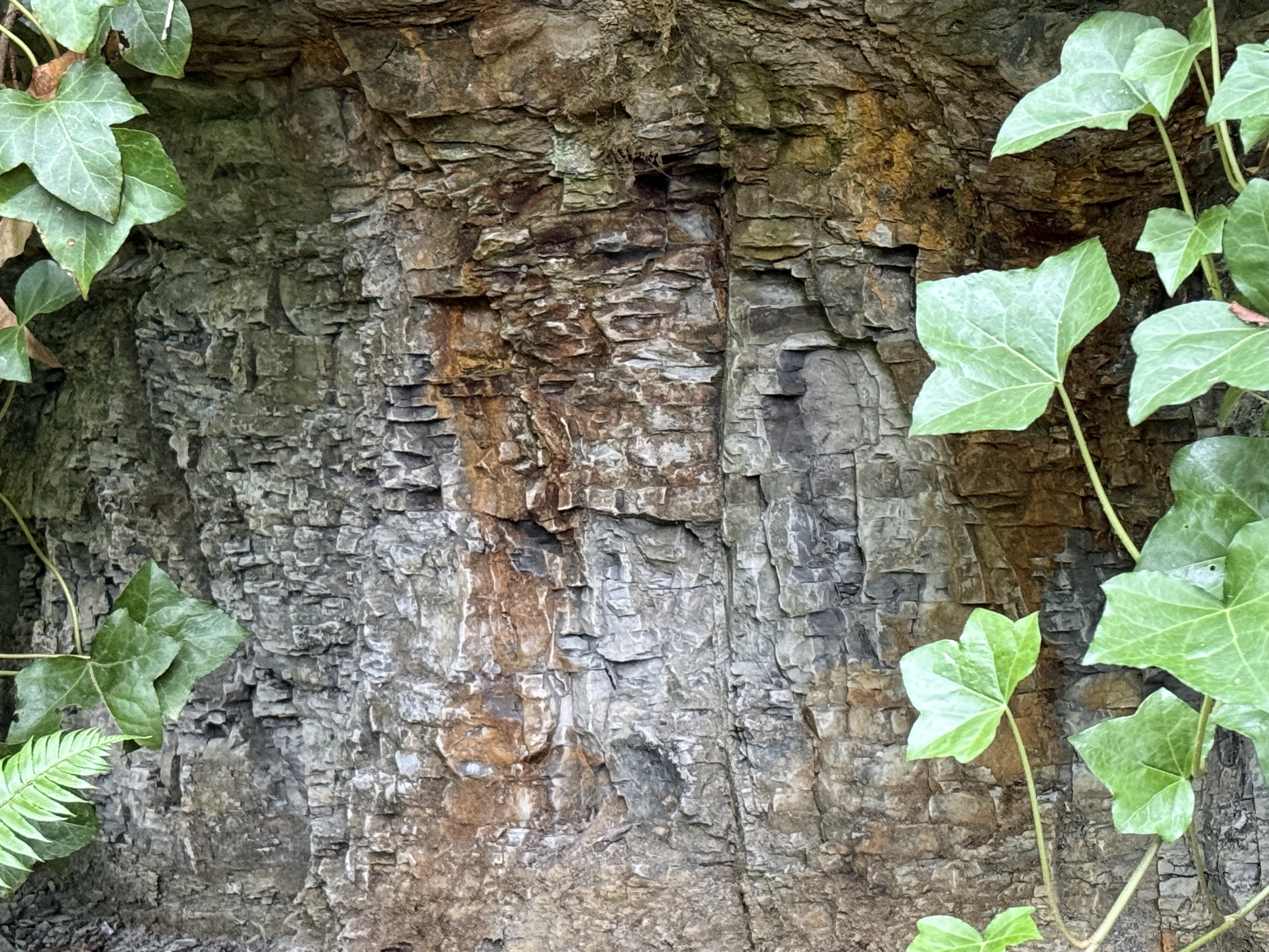
Figure 6. This photo from the south side of Green River shows some highly fractured rock beneath a stronger layer that forms a one-foot overhang. The overlying rock is staining the subjacent layers with a rust-colored material, probably from weathering of iron-containing minerals. Are these beds equivalent to those from Fig. 3?
I don’t know the answer, but the contact revealed in this photo is similar to that between the massive, cliff-forming rock from the rightmost exposure in Fig. 3, and the lower, gray layers. I wouldn’t be surprised if this rock is similar in age and environment as the gray rocks across the river.
Final Thoughts
Sometime, more than thirty-million years ago, large rivers drained the Cascades, depositing vast quantities of sand in braided rivers many miles from the coast, where finer sands and silt slid down submarine canyons and fans to be deposited as turbidites. I talked about those rocks in a previous post. Comparison of these rocks and those along the Olympic Peninsula coast allow us to reconstruct this small part of the world from a bygone age.
These Eocene sediments are similar to those we discovered a few miles to the south, along the Carbon River. This sedimentary environment wasn’t a local event, but rather part of a regional system that continuously removed the volcanoes and older rocks that were exposed by the upward pressure of the Pacific Ocean’s subducting slab. This was not an intermediate environment.
The wide range in dates for these rocks doesn’t allow geologists to be more specific than a few million years, but the earth doesn’t act very quickly, especially when the subduction zone that determines the geology of the PNW has been active for almost 200 million years.
We can afford uncertainties of a few tens of millions of years…


 Timothy R. Keen
Trackbacks / Pingbacks