
The Rest of the Story: The Harz Mountains
This post is a continuation of previous posts on northeast and central Germany, but we won’t be seeing direct evidence for glaciers in the Harz Mountains (Fig. 1).
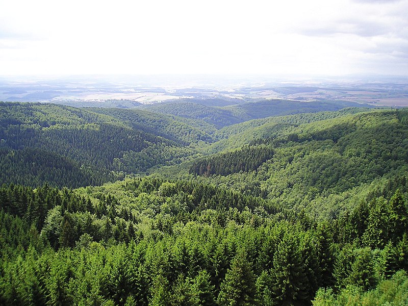
Today’s post discusses some of the rocks exposed in the valleys, gorges, and road cuts that dissect the Harz Mountains (Fig. 2).

We approached the Harz uplands from the east (site A in Fig. 2), where we encountered mines based on removing sedimentary rocks for use as building material (Fig. 3).

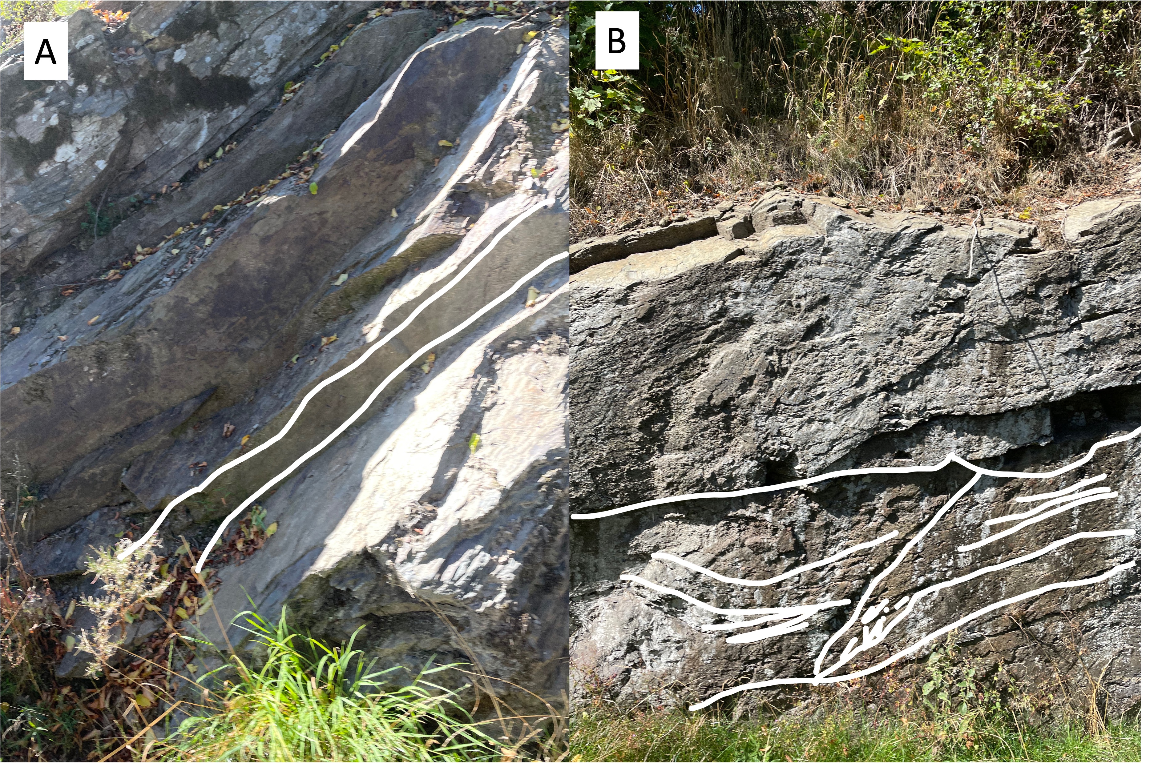
The mines in Fig. 3 were removing desired beds from the Tanner Graywacke ( age ~360-320 Ma), a poorly mixed sedimentary rock (e.g. graywacke) originally deposited in ocean trenches associated with volcanic island arcs. The Tanner graywacke ranges from mudstone to conglomerate. It forms medium beds with variable texture, and has been tilted to varying degrees (Fig. 4).
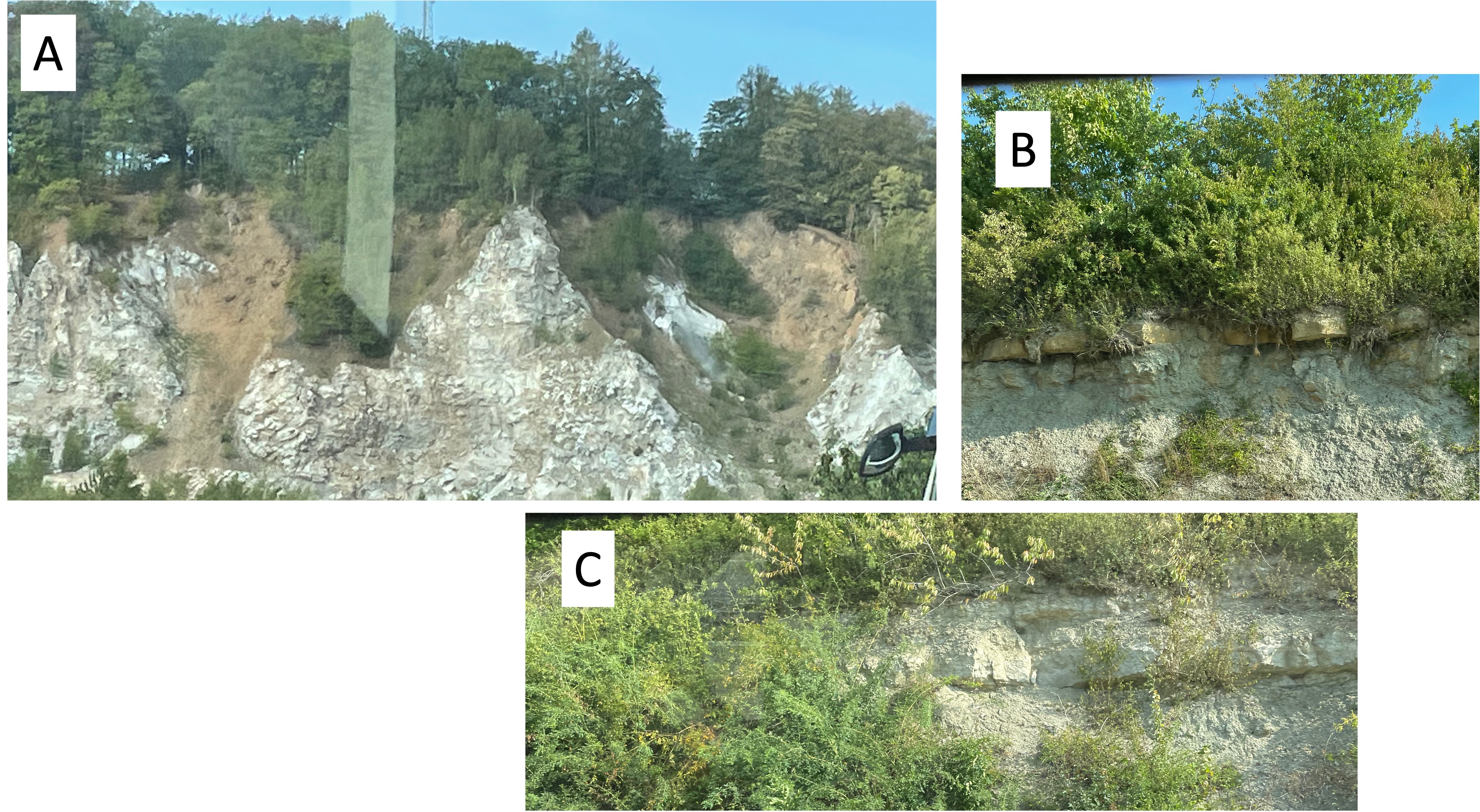
Our route east of the Harz Mountains (red line in the inset of Fig. 2) took us to site B, where we encountered more facies of the Tanner Graywacke (Fig. 5).

Our path (red line in Fig. 2 inset) led us into a valley between the small highlands where Figs. 4 and 5 were taken. This valley is filled with a lake, and probably follows a fault zone between Site B and the main Harz Mountains to the north (Fig. 6).

Our journey followed the southern margin of the Harz Mountains (red line in Fig. 2 inset), taking us by Site C, where we found nearly horizontal beds of Tanner Graywacke exposed along road cuts. We couldn’t stop until we found a rest area, where a large block was available for close examination (Fig. 7).

We continued around the western end of the Harz Mountains and found exposures of the marine deposits (including evaporites and carbonates) that underlay the town of Kelbra (Fig. 6), including a thick sequence of either salt or anhydrite (Fig. 8).
This post reveals rocks that are widely separated in time while being found near each other, supporting the Harz uplift as they do (Fig. 2). As the title of this post suggests, geology is not a series of isolated events. Let’s get the rest of the story.
The Tanner Graywacke was deposited in an island arc, a tectonic region in which oceanic crust is being subducted beneath either a continental (or less often an oceanic) tectonic plate, about 350 million years ago. What was happening on the opposite shore of this proto-Atlantic ocean (aka Iapetus)?
I have encountered rocks of similar age in northern Virginia and discussed them in previous posts. On the west side of Iapetus, during a mountain-building event called (in America) the Acadian Orogeny, a series of island arcs were being subducted/accreted to form a series of suspect terranes. This orogeny was only a phase of the collision of Laurentia (porto-north America) and Avalon (proto-Europe), which endured for most of the Paleozoic era.
The next problem is what happened during the ensuing 100 million years, between deposition of the Tanner Graywacke and the evaporites and carbonates we encountered west of the Harz uplands (Fig. 8)? The collision was completed and Pangaea had been born of two continents…
The mountains rose and they were eroded almost as quickly by wind, rain, and ice, creating massive layers of sediment to the east (modern Europe) and the west (e.g. the Catskill Delta in New York). By 230 million-years ago, the earth’s upper mantle changed its mind and tore the newly formed supercontinent apart, creating rift valleys like that of East Africa in what is now Virginia. Splitting a continent can take as long as building one, but this was a relatively rapid event in geological time; by 200 million-years ago, diabase dikes were injected into the sedimentary and metamorphic rocks created by the closing of the porto-Atlantic Ocean (Iapetus) and the split was well under way. Alluvial and fluvial sediments were collecting in isolated basins in what is now Virginia, and evaporites were settling to the bottom of lakes and brackish coastal waters in Europe, as the ocean invaded…
Jump ahead 200 million years…
I love it when I can understand what the rocks are telling me…

Recent Comments