
The Newark Supergroup: From Continental Rifting to Glaciation
We didn’t go very far from home today, just down the road to Frying Pan Park; the field area was the hill and a creek near a Baptist Church constructed in 1792 and still in original condition.
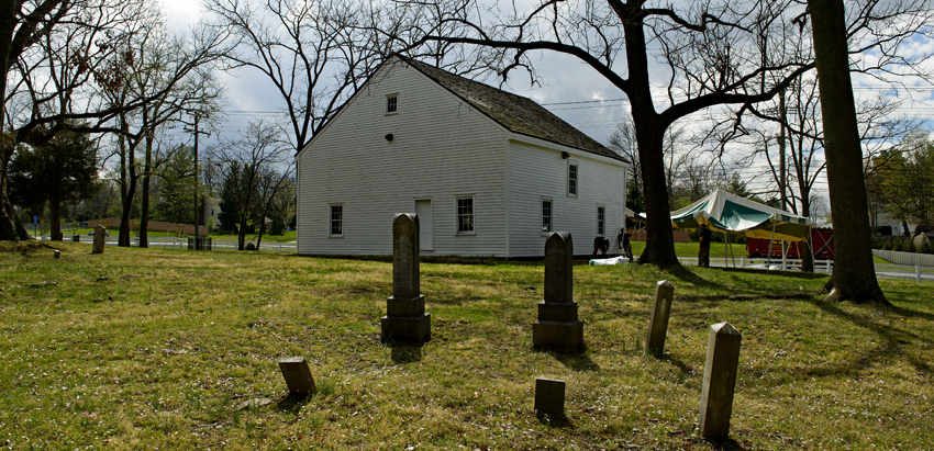
A small cemetery, with one gravestone as recent as 1938, marks the entrance to a series of trails wandering over the hilltop where Confederate soldiers bivouacked less than 20 miles from Washington DC. There were a few skirmishes but no battles.

The geologic map of the area identifies the rocks exposed on hilltops and along the creek (indicated in the center of Fig. 2) as being part of the Newark Supergroup. These rocks were originally deposited between 237 and 174 Ma in shallow basins defined by block-faulted mountains similar to the Basin and Range province of western North America. This was during the early stages of the breakup of the supercontinent Pangea. The sediments were thus immature, i.e., conglomerates, coarse sandstone, siltstone, etc, all mixed together in restricted basins and their deposition changing rapidly over time as the surrounding mountains eroded.
Not long after deposition in rapidly subsiding basins, magma from the upper mantle welled up and filled fractures within the crust. These diabase intrusions heated the sediments of the Newark Group and metamorphosed them by temperature. They were not deeply buried. Thus the rocks we found didn’t look that different from sandstones although they are technically metasedimentary rocks.

The beds are relatively flat here because the rocks were never subjected to compression, so they weren’t folded. Instead, as the crust split apart, they tilted slightly along normal faults to form grabens. In Frying Pan Park, they were horizontal. Zooming in on a bed we can see how sharp the edges are.

There are a couple of details to notice: First, the beds are about six inches thick; second, the rocks show a darkening that isn’t due to surface staining, seen in the block just right of center in the photo; third, the blocks have sharp edges. The darkening is caused by “cooking” of the original sediments when igneous rocks were injected into the pile of sediments. This process is called contact metamorphism. Another effect of coming in such close proximity to magma is that the mineral grains in the sediments become more tightly cemented, producing very hard rocks. Thus the sharp, knifelike edges.
In accordance with the “Rocks and (no) Roads” ethos, I don’t break open hand samples to examine the minerals. I accept what is available because this is about amateur geology, not data collection. There were no freshly broken samples so this is the best I could do.
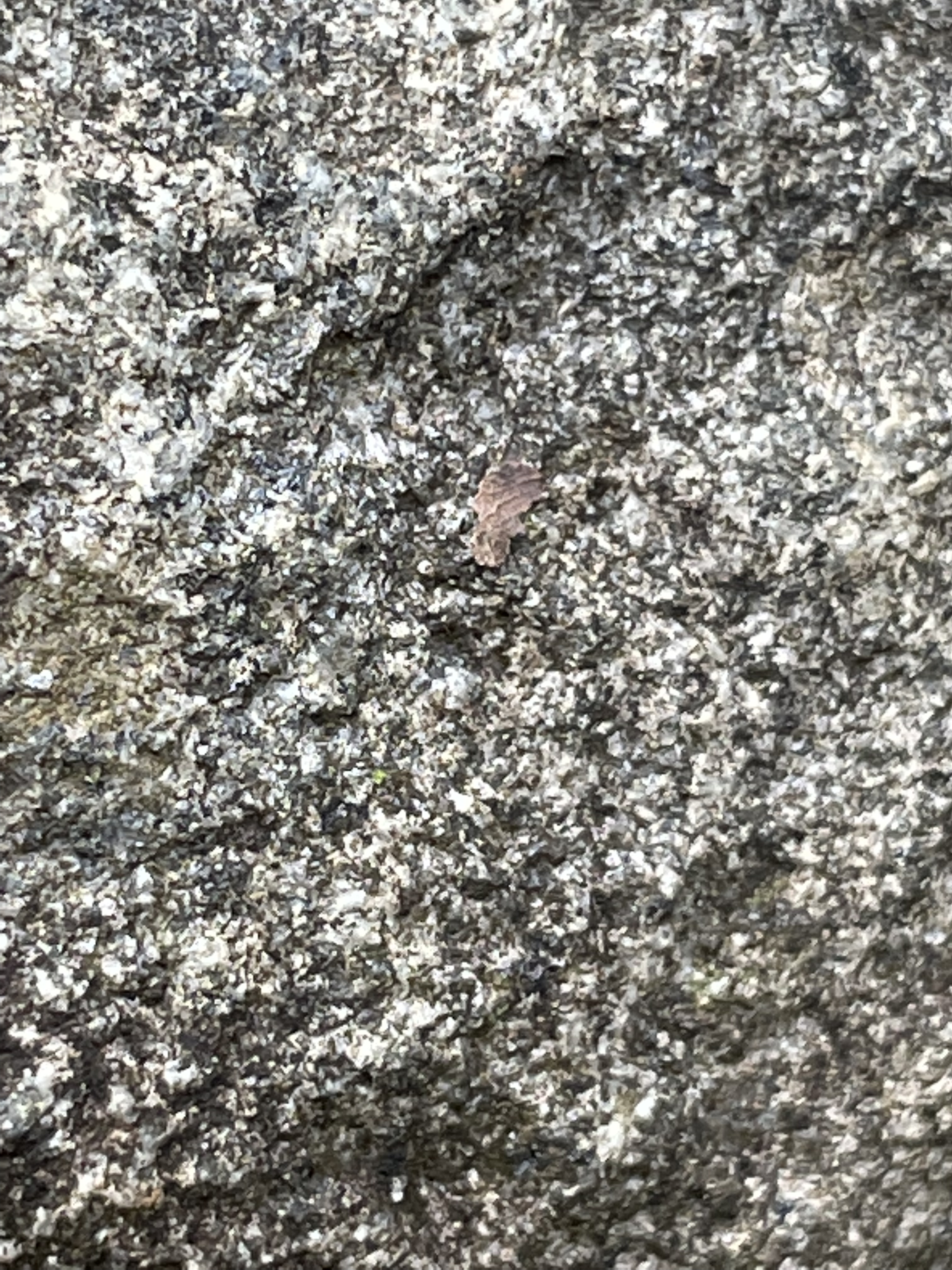
The salt and pepper color is caused by organic stains having nothing to do with the mineralogy. What can be gleaned from this poor field sample is that the individual mineral grains are not rounded and none of them appear to be large, so this is an immature sandstone (greywacke) and not a conglomerate. If it were from an environment like a beach, the grains would be visibly smoother, even to the naked eye. (For example, check out orthoquartzite.)
The sediments that comprise the Newark Group collected in intermontane basins. The Sierra Nevada is an example of what the topography may have looked like when these sediments were deposited about 200 million-years ago.

After being buried several miles (nobody knows exactly how deeply) beneath the surface for 200 million years, these rocks were exhumed when ice sheets advanced into Pennsylvania during the last ice age, which began at least 2.5 million years ago. Northern Virginia was never covered by ice, but it was within a hundred miles of an ice sheet that reached two-miles in thickness. Two miles! The result was felt far to the south, where massive seasonal floods at the leading edge of the ice would have transported very large blocks of stone down rapidly eroding valleys.
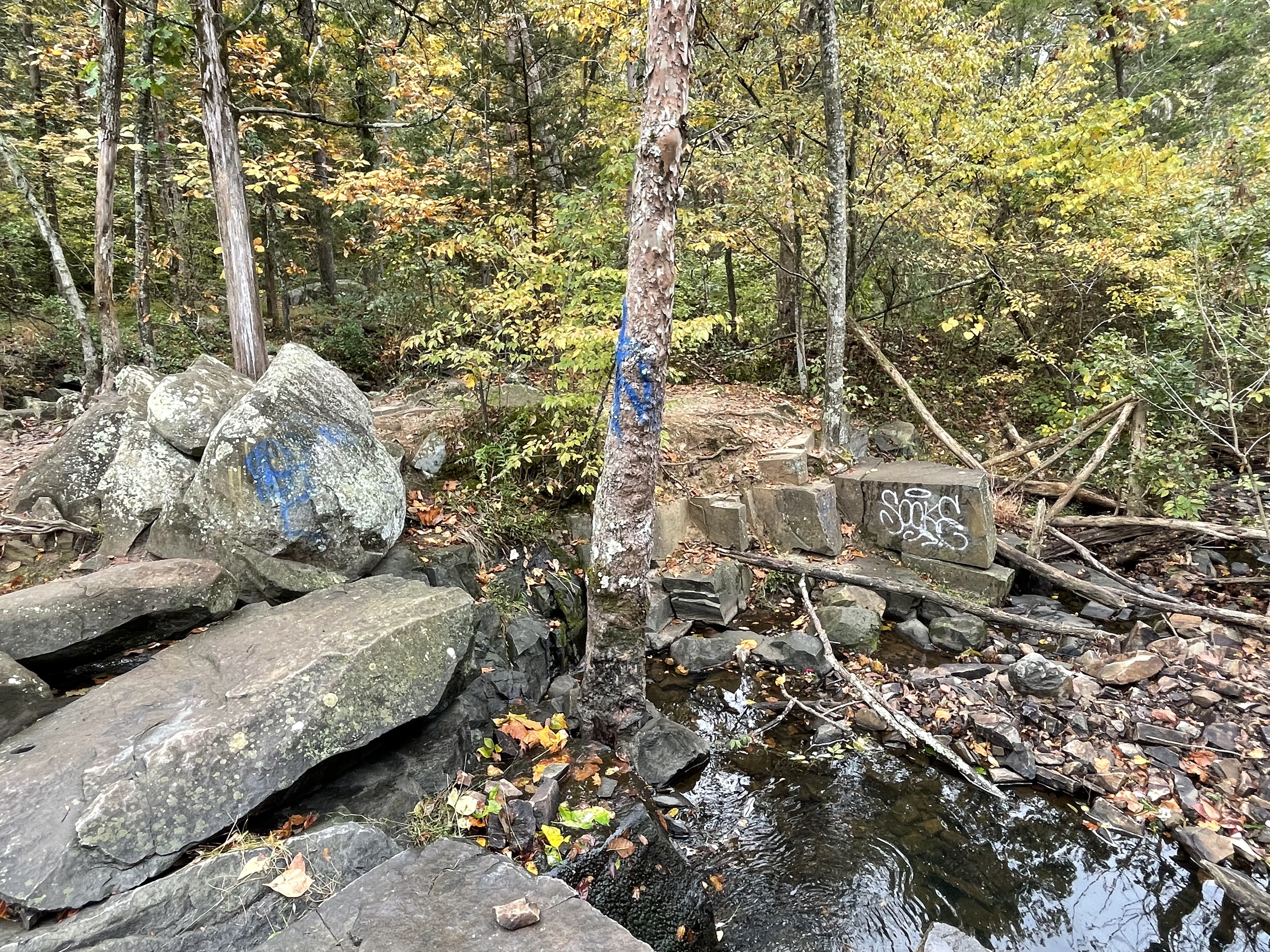
This is a great picture. Four things leap out of this pastoral image of a NoVA forest: (1) The graffitied block reveals bedding much thicker than that seen in Fig. 4, suggesting a dynamic environment, possibly an alluvial fan, when these grains were washed down the sides of rising mountains (see Fig. 6) and came to their final resting place; (2) the larger blocks show a joint pattern that determined how the rocks would break down and weather when the third event occurred; (3) the rounded blocks juxtaposed on top of the jointed bedrock outcrops indicate fast-flowing water that physically eroded them and transported them some distance (less than a mile); and (4) the modern creek flows weakly over its boulder-strewn bed. This short stream, its watershed consisting of a few hilltops, didn’t transport these behemoths anywhere.
But this creek isn’t relict, it’s simply operating on a different time scale.

This boulder field, littering a dry fork of Frying Pan Branch, suggests that the smooth flow over the upstream reach shown in Fig. 3 is capable of transporting large rocks; however, it’s all relative from a geological perspective. If I were to guess, I’d say that the boulders in Fig. 8 haven’t moved in several thousand years. My reasoning is that the clear path seen in Fig. 3 suggests that there are no more large stones to roll downhill and dislodge others, like dominoes. But we never know what comes next.
A summary of the impacts of the most-recent ice age in Virginia is available at this web site. Take a look.
See you next time.

Trackbacks / Pingbacks