Geologic Survey of the Northern Cascades: 3. Metamorphic and Igneous Rocks East of the Orogenic Core
Today’s post is a continuation of the last one, which explored the central core of the Northern Cascades. We followed the Methow River south until it joined the Columbia River through what is generally a region of marine sediments that have been dissected by faults (Fig. 1), and resemble the metasedimentary and metavolcanic rocks from the western region.
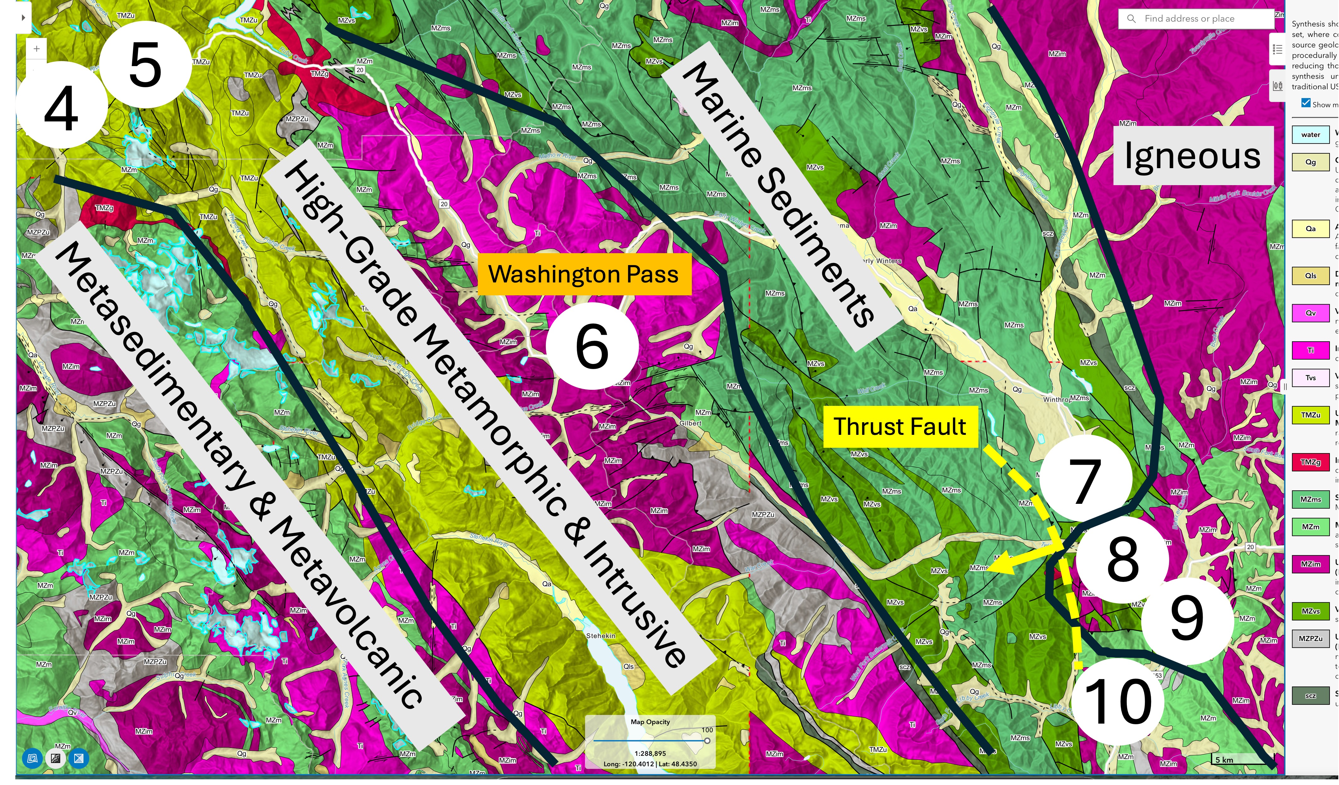
Figure 1. The Methow River follows the axis of a broad valley underlain by marine sediments (green area). We didn’t follow any of the side roads, so I can’t say anything about those rocks. We didn’t see any good outcrops until Site 7, so the story will pick up there. The eastern region is highly faulted (thin black lines on the geologic map), many of which are inferred to be thrust faults. One such prominent fault is outlined with a dashed yellow line because it delineates an area of anomalous high-grade metamorphic and igneous rocks similar to those within the central highlands. The curved regional contact with the Igneous province to the east reflects the resulting uncertainty.
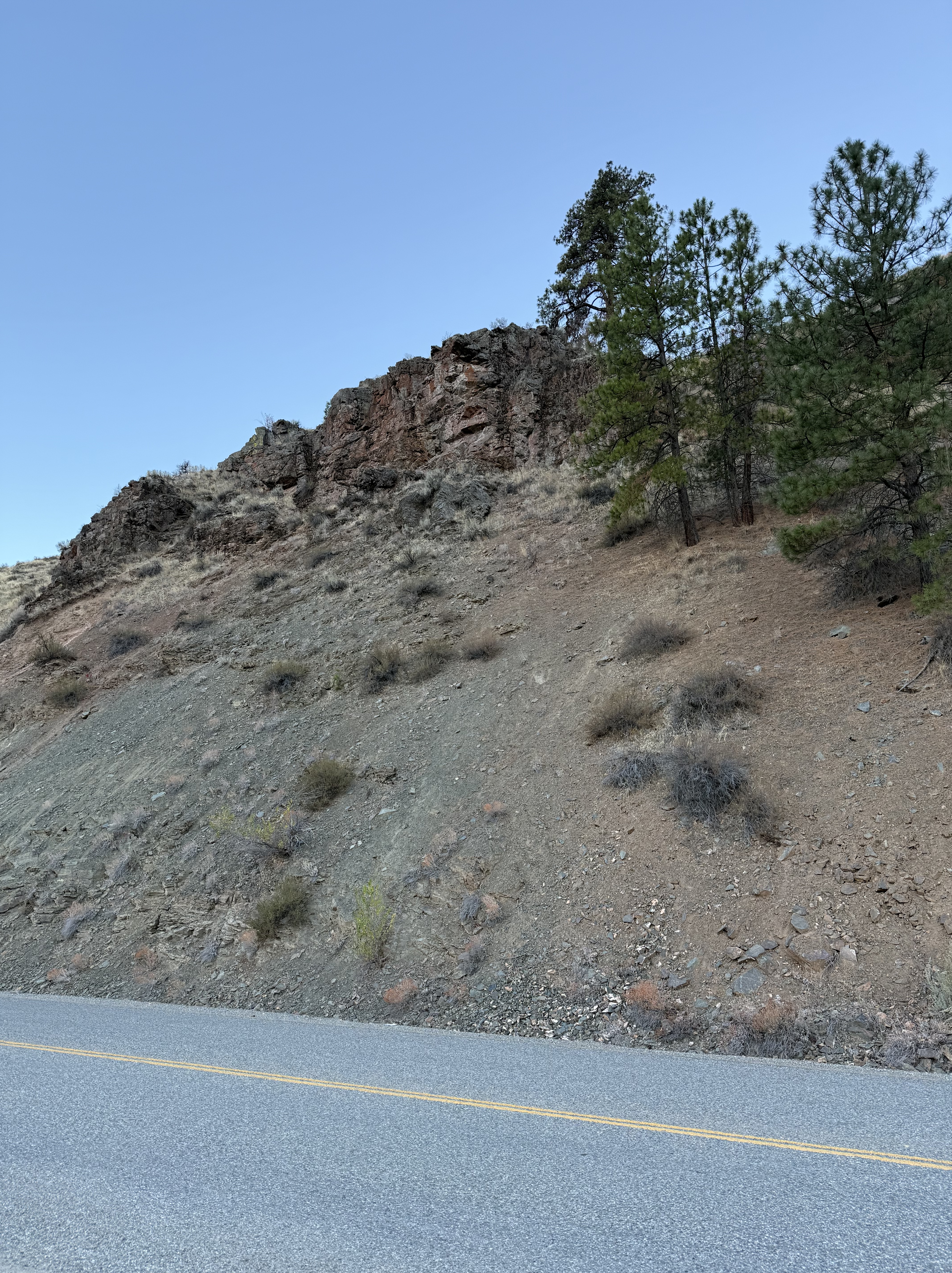
Figure 2. This is a typical exposure along the Methow River, Site 7 near Carlton. There are several horizontal lines visible in the outcrop, but it is impossible to say if this is an example of metasedimentary rocks or jointed metamorphic rocks, both of which are present in this complex geological environment.
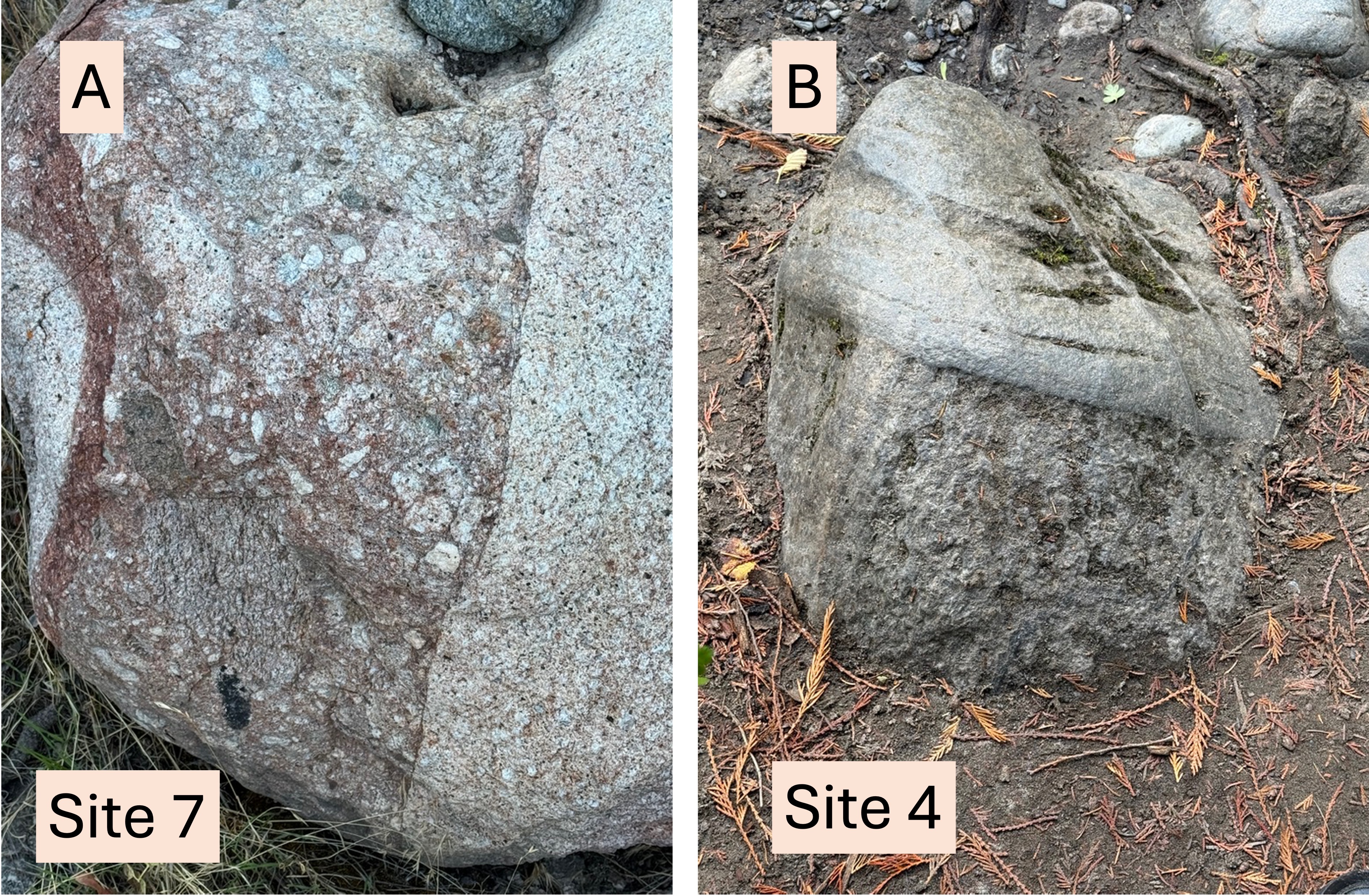
Figure 3. There were a lot of good exposures along State Route 153 so we stopped a lot. (A) This photo was taken a few miles SE of Fig. 2, where the geologic map indicates a sliver of Mesozoic (252-66 Ma) metamorphic and intrusive rocks. Of course, this boulder was in an old flood plain of the Methow River; the rounded nature of the sample (~two-feet across) suggests it was transported several miles from its origin.
(B) This boulder has a similar appearance but it was located on the western side of the Cascades, and is tens-of-millions of years older. Both samples are granitic in composition. It appears to be more weathered and beaten up by Skagit River, which is steeper than the Methow. I included it as an example of the continuation of several geological processes in the Northern Cascades for more than 100 Ma.
After a lengthy conversation with ChatGPT, the best I can say about the curious juxtaposition of different surface characteristics within these samples is that they may have resulted from differential weathering within fracture zones in the original igneous rock. The darker material is not a dike, but instead a zone of increased stress (possibly associated with faulting) where water preferentially altered some minerals into weaker products like clays.
Sometimes there isn’t a direct answer to a geological question.
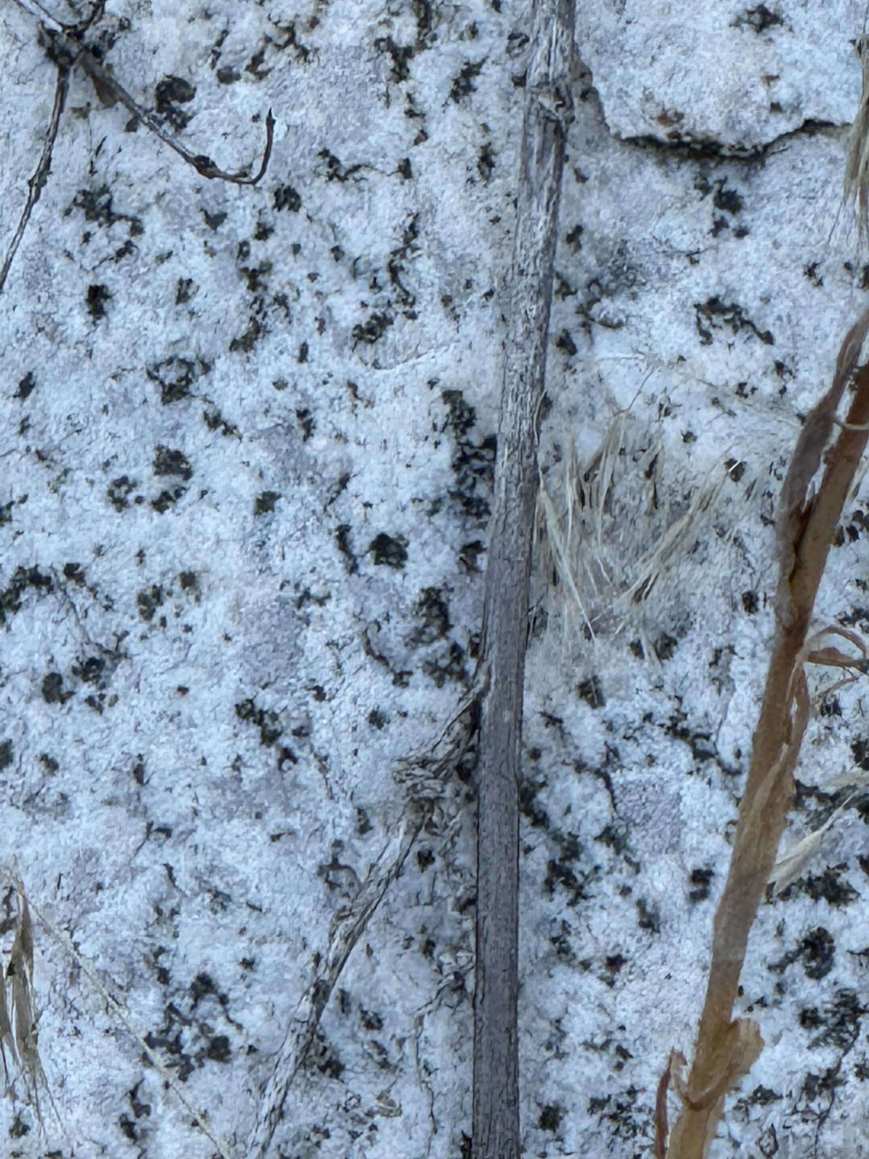
Figure 4. This is a high-resolution image (~10x magnification) of the dioritic igneous rock found in some areas along the Methow river. Grayish blobs are quartz whereas the visible white grains are feldspar; it is impossible to tell if they are Na, K, or Ca feldspar without a microscope. The dark areas are amphibole.
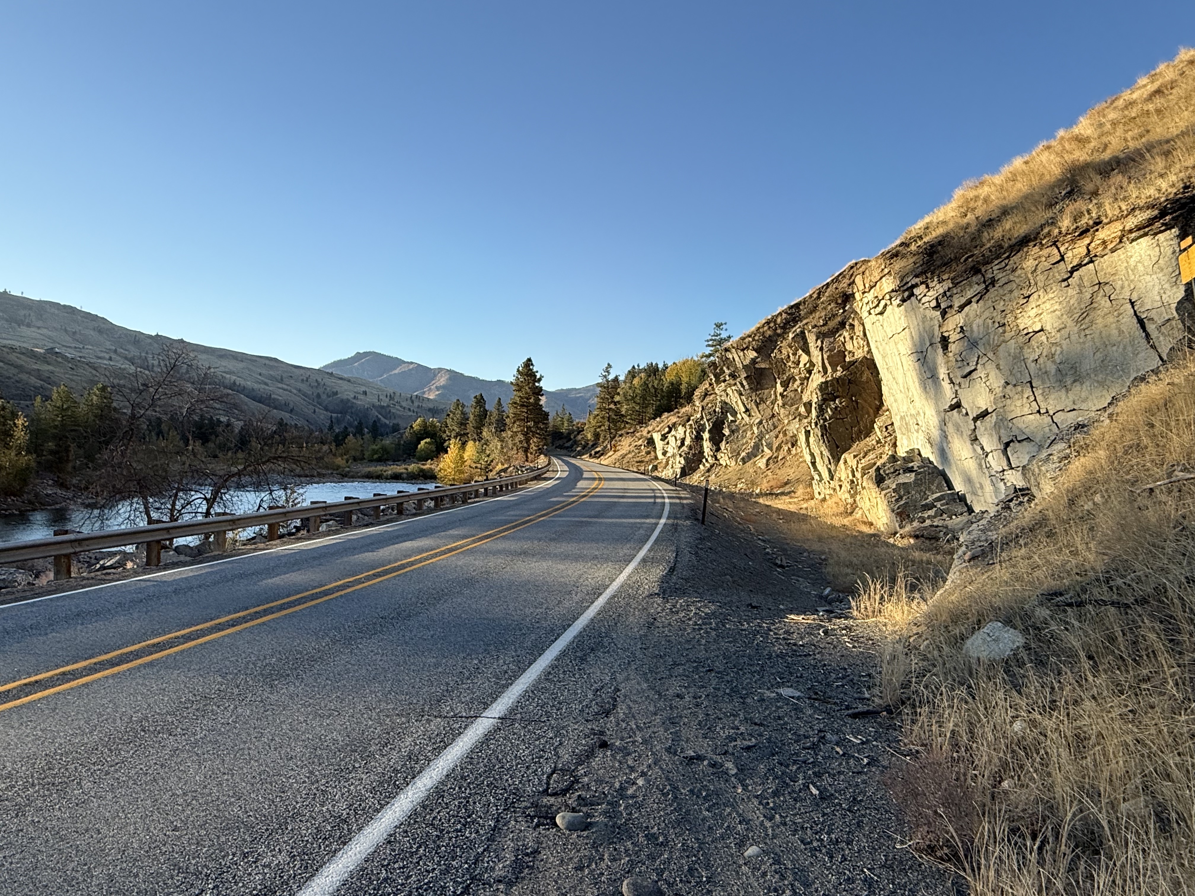
Figure 5. This excellent exposure along the Methow River (to the left) was visible at Site 8. The appearance of this rock is determined by a strong joint set. There are two candidates for preliminary guesses about its lithology from the geologic map descriptions: 1) Mesozoic orthogneiss (high-grade metamorphic rock derived from granitic rocks); and 2) Tertiary intrusive rocks of granitic type. There is a difference in their appearance.
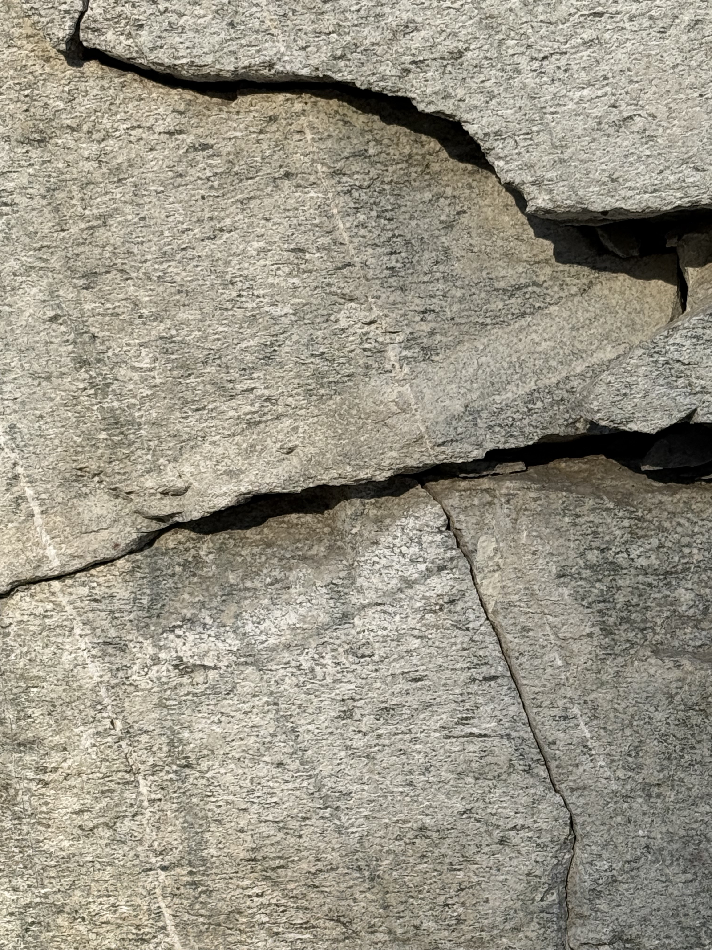
Figure 6. This outcrop looks like a gneiss to me. Note the near-horizontal layering (i.e. foliation); at high pressure, minerals become oriented parallel to the direction of least stress (i.e. they flatten). There are several large crystals protruding from the surface, however; these are porphyroblasts, which form when incompatible elements are squeezed out of the matrix.
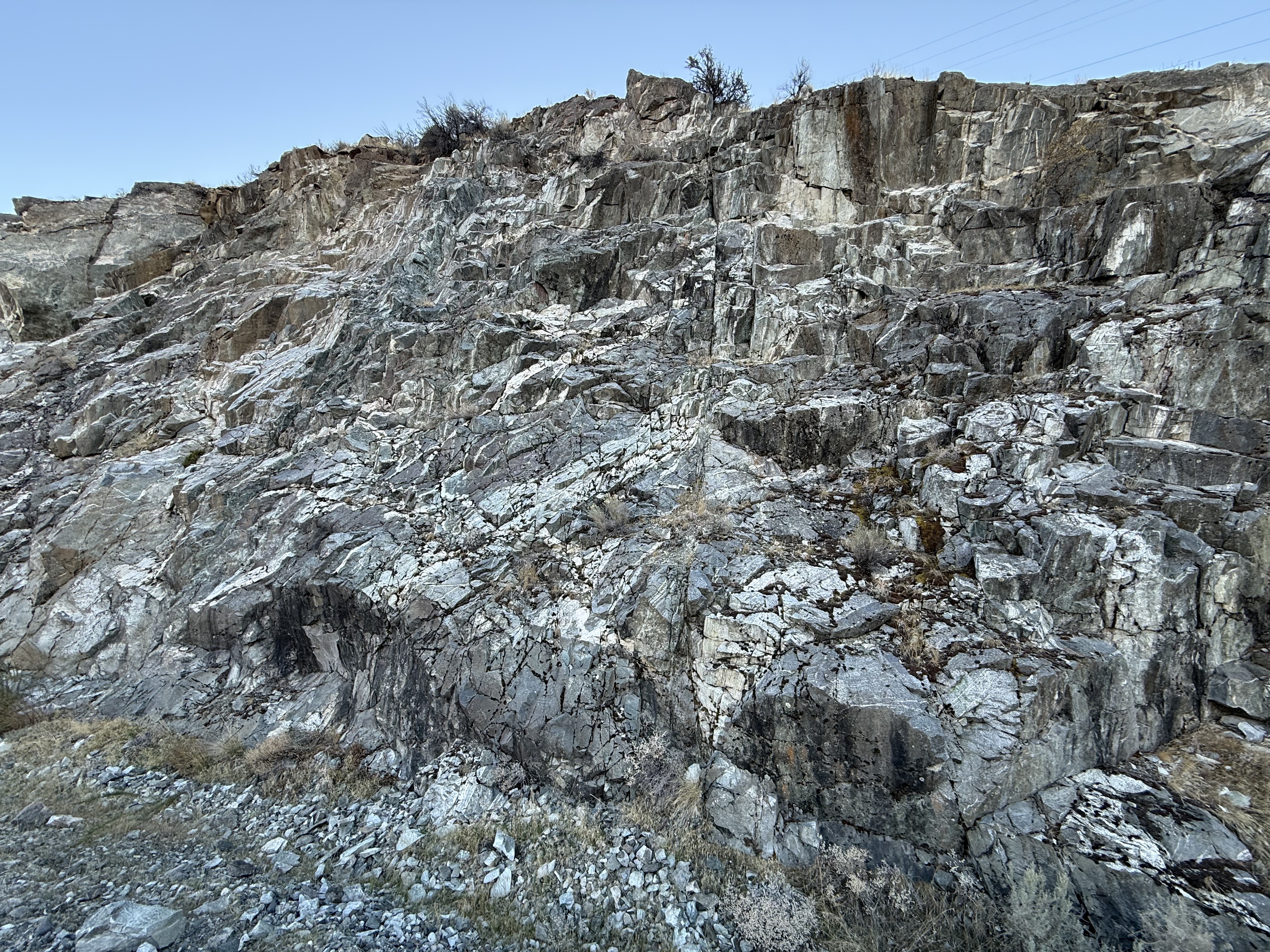
Figure 7. This highly fractured outcrop at Site 9, near Pateros, caught my eye because the rocks didn’t form a vertical wall like we saw in Fig. 5. According to the map this is another example of undifferentiated Mesozoic orthogneiss, which occurs in small blocks throughout the region (purple areas in Fig. 1).
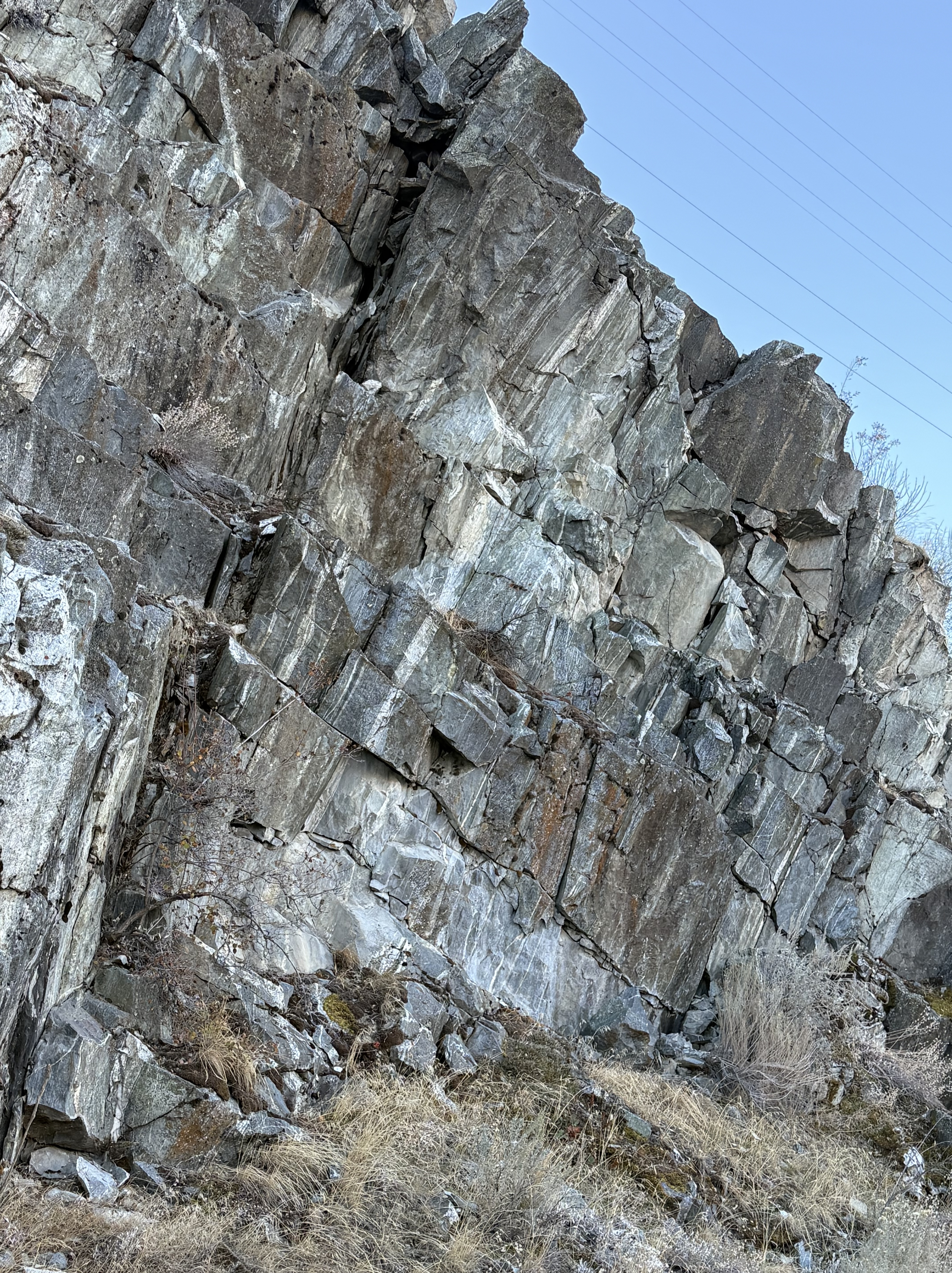
Figure 8. This face presents a pretty striking facade. The streaks of white against the dark surface look like sedimentary bedding; however, they are not bedding and never were. What I don’t see in this exposure are folds, where foliation has been warped into oscillating patterns that often reverse direction at this scale.
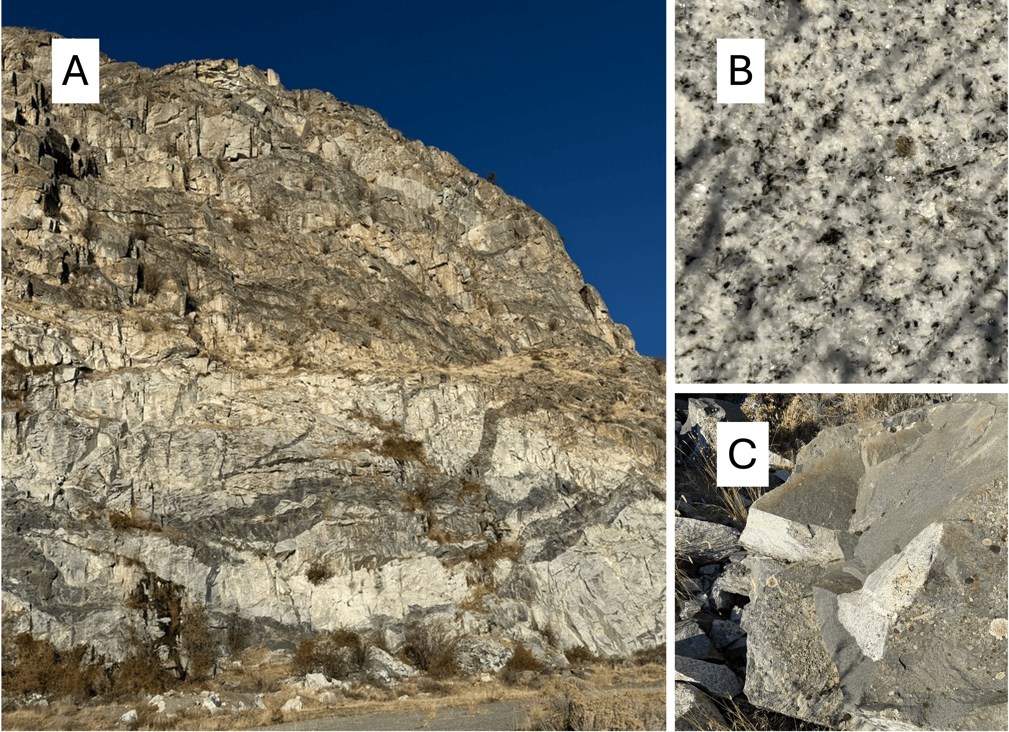
Figure 9. (A) Site 10 is located within a mile of the Columbia River. This road-cut is at least 60 feet high. This looks like more Mesozoic orthogneiss. All of those lineations are metamorphic foliations. Slight variations in local mineralogy create a complex pattern, especially on the surface.
(B) This close-up (~10x magnification) shows that some part of this mass of rock is undeformed diorite–that is, it hasn’t been smashed into orthogneiss.
(C) The edge of this sample was recently broken, revealing granitic rock beneath the surface. The dark lines in (A) are, in many cases, no more than surface weathering phenomena. We saw this a lot during this post. I can’t explain it, but it no-doubt entails surface chemistry, probably involving air temperature/humidity and imperceptible alterations in mineralogy during burial and exhumation over tens of millions of years.
Final Thoughts
We didn’t see any metasedimentary rocks on our trip along the Methow River, despite the preponderance of these rocks on the geologic map (green areas in Fig. 1). What we saw were a lot of slivers of granitic rocks and their metamorphic products. That’s probably because these rocks are very durable whereas lightly altered metasedimentary and metavolcanic rocks weather relatively quickly.
Glance back at Fig. 1 now that you’ve seen the rocks, noting the large number of faults (thin black lines), and ask yourself how Mesozoic rocks that were once buried miles beneath the surface pop up like wack-a-moles in this gently undulating terrain.
Maybe the Cooperative National Geologic Map is right to list every possible rock type in the geological metadata.
What a mess!


Recent Comments