
Deja Vu
As we entered the Taconic Mountains on US 4 in Vermont, something didn’t look right, or it looked too familiar to be correct. It took a while to realized what was wrong with Fig. 1.

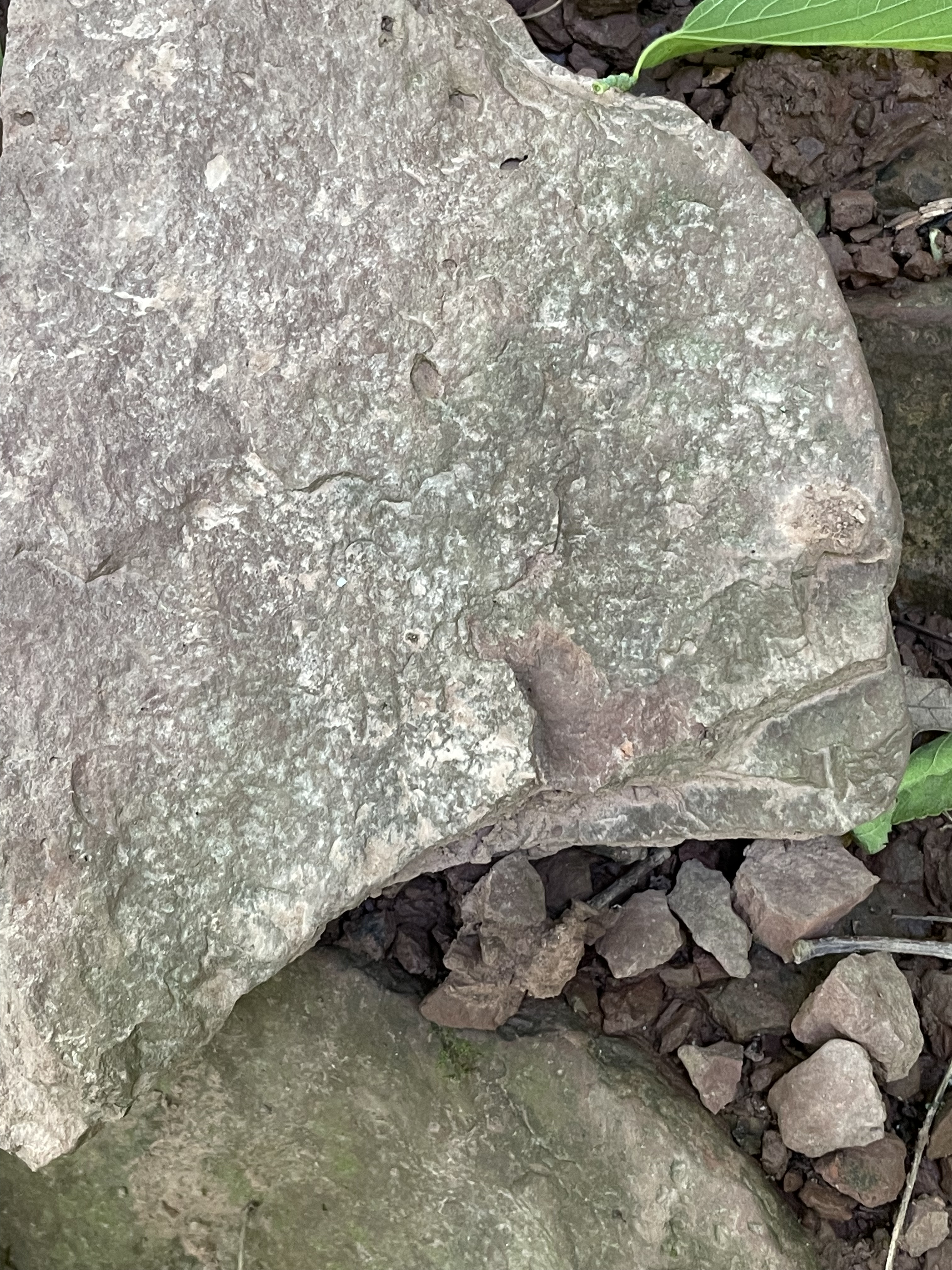
These are the mountains for which the Taconic Orogeny (550-440 Ma) was named. They were deposited as long ago as a billion years in a shallow sea (e.g. Sea of Japan) and then buried, before being compressed and heated, finally being pushed onto the porto-north America continent by 440 Ma. During this long period of metamorphism, the clay minerals comprising the bulk of the sediments recrystallized into mica (mostly muscovite), a platy mineral that creates both a sheen and a fissile texture, the tendency to flake apart (Fig. 2).
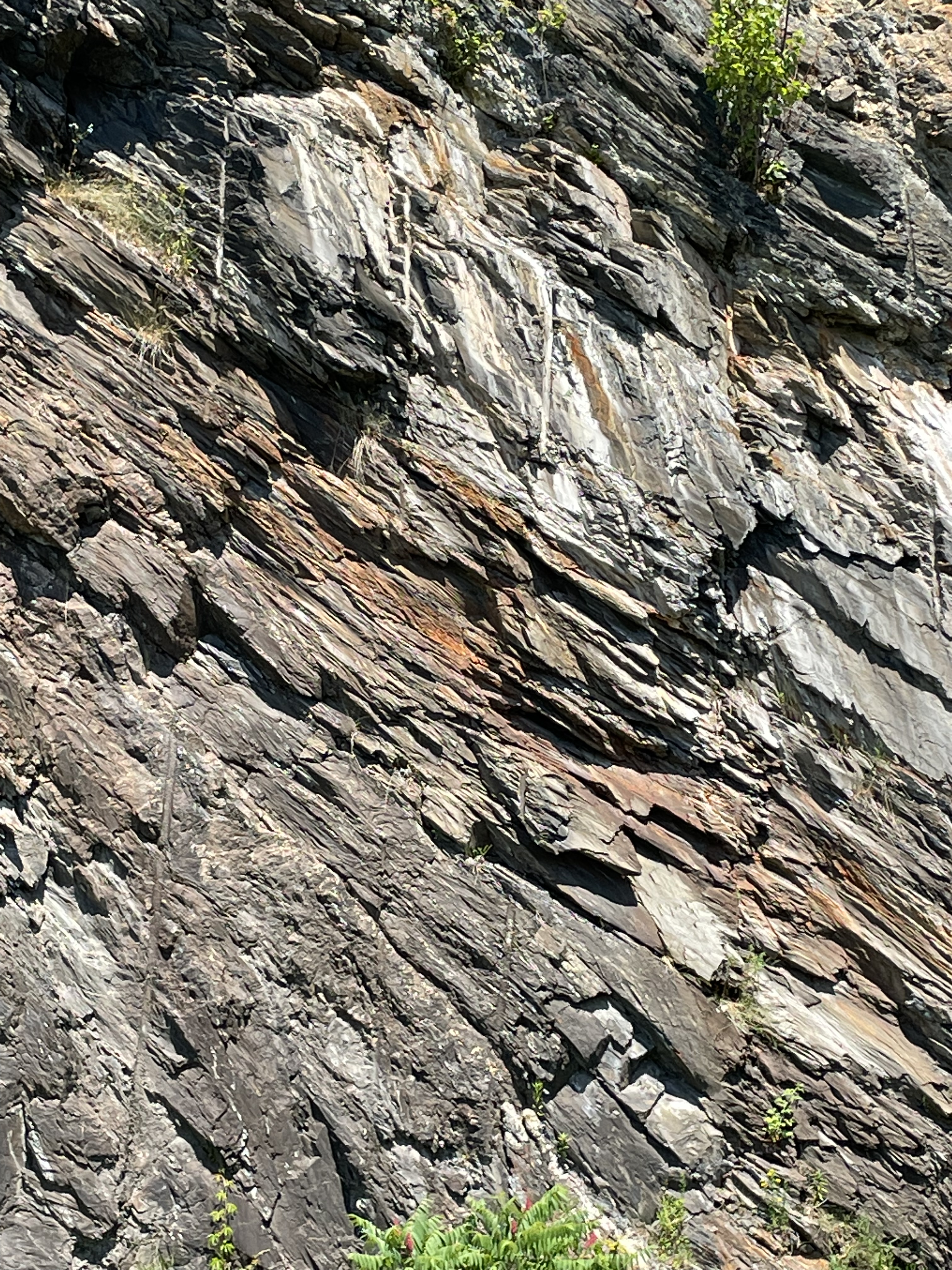

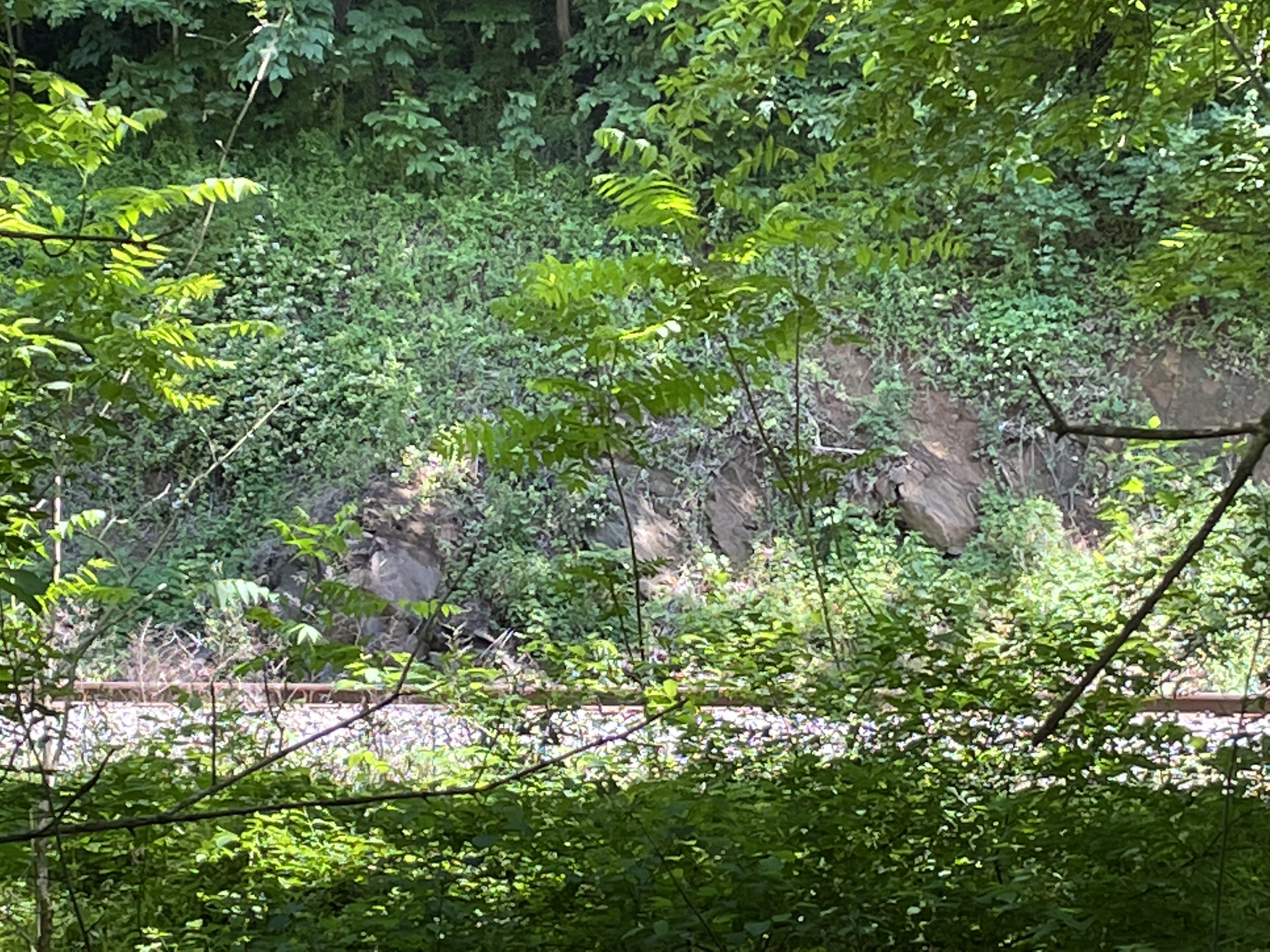
The Taconic Mountains are the remnants of a mass of metamorphic rock that was pushed over younger, less-altered rocks in this region. This occurs along low-angle thrust faults when the rocks are buried less deeply, so that they break rather than fold like putty. Speaking of ductile deformation, we saw plenty of evidence of that in the White River‘s exposed bed (Figs. 4-6).


This post is titled “Deja Vu” because we saw schist with a similar composition and orientation in the Potomac River, more than 500 miles to the south, in a band tens of miles across, centered on Great Falls, Virginia. Such a broad distribution tells us that a vast mountain belt eroded about one billion years ago, and then its erosional remains were buried so deep that they nearly melted. The subsequent collision was no laughing matter. I have been using Japan as an analogue for the Taconic Orogeny for two reasons: (1) Honshu, the largest Japanese Island is about 800 miles long and it is depositing vast quantities of mud into the Sea of Japan; (2) using a modern analogue demonstrates that mountain building is a slow process, barely noticed by the inhabitants of island arcs destined to be smashed onto the continents facing them.
Rocks like those seen in this post are already buried beneath the Japan Sea and deformation has no-doubt begun. We just have to wait 400 million years for them to come out of the oven…
The Outer Limits
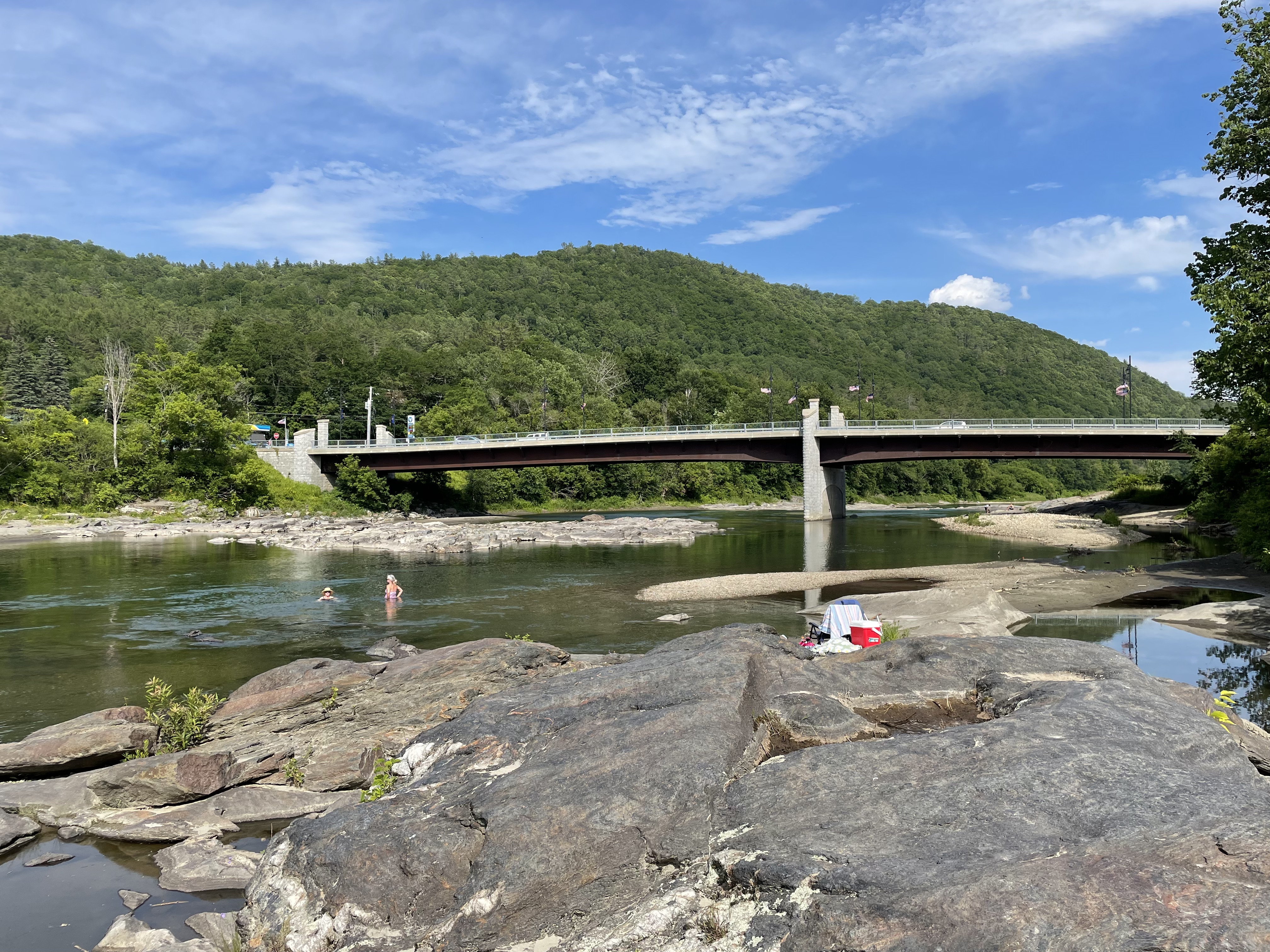
This is the first of several posts, reporting the roadside geology of western New York and central Vermont. Today, we will visit Binghamton, New York. This small city (urban population less than 50 thousand) sits at the confluence of two perennial, gravel-bedded rivers (Fig. 1).


Enough of Holocene and Anthropocene geology. The fascinating thing about this region is that it preserves a huge volume of sediment eroded from mountains that were growing during the Devonian Period, about 350 million-years ago (Fig. 4).
We didn’t have the time or resources to go on a quest for rocks that would reveal what was happening during the Devonian Period, so we took some photos of charismatic blocks that had been removed from their original location and “deposited” along the path that followed the Chenango River through downtown Binghamton (Figs. 5 and 6).


The title of this post refers to the outer limits of a broad plain that was receiving gravel, sand, silt, and mud from a rapidly rising mountain belt–probably like western North America today (e.g. the Sierra Nevada mountains). It wasn’t a continental collision, but it was pretty massive, with elongate swaths of sediment subsequently buried by what came later.
I’m talking about a Clash of the Titans...
Difficult Run: Exploring Potomac Tributaries

This week we went exploring south of Great Falls, along a tributary that cuts through Precambrian metamorphic rocks, before joining the Potomac River.
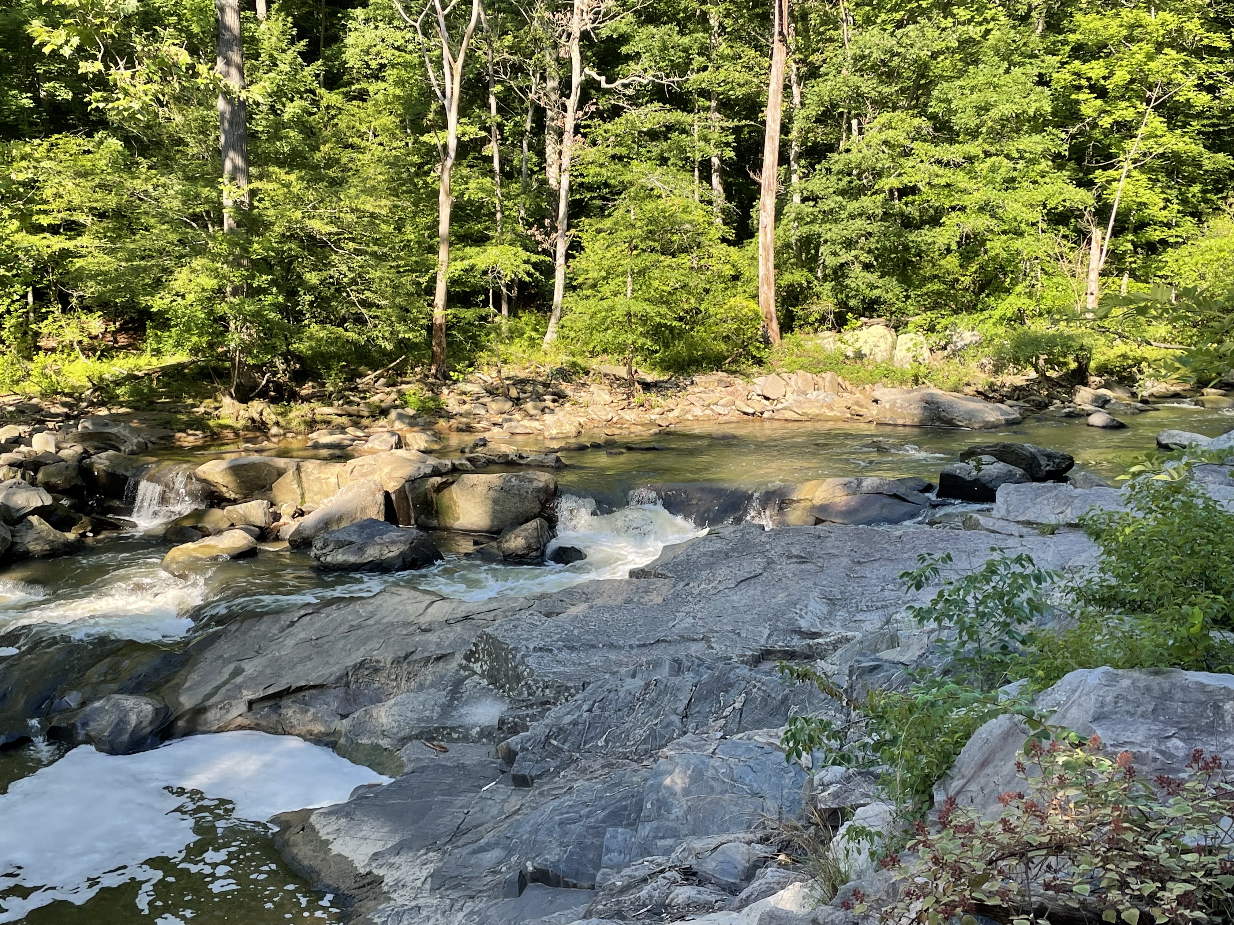
Difficult Run twists its way through a mass of hard rocks that we have met before, Precambrian Schist and gneiss, forming a series of quiet pools (Fig. 3) separated by resistant, rocky sections (Fig. 4).

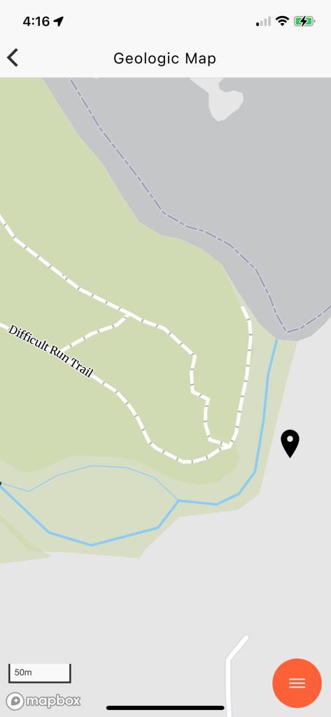
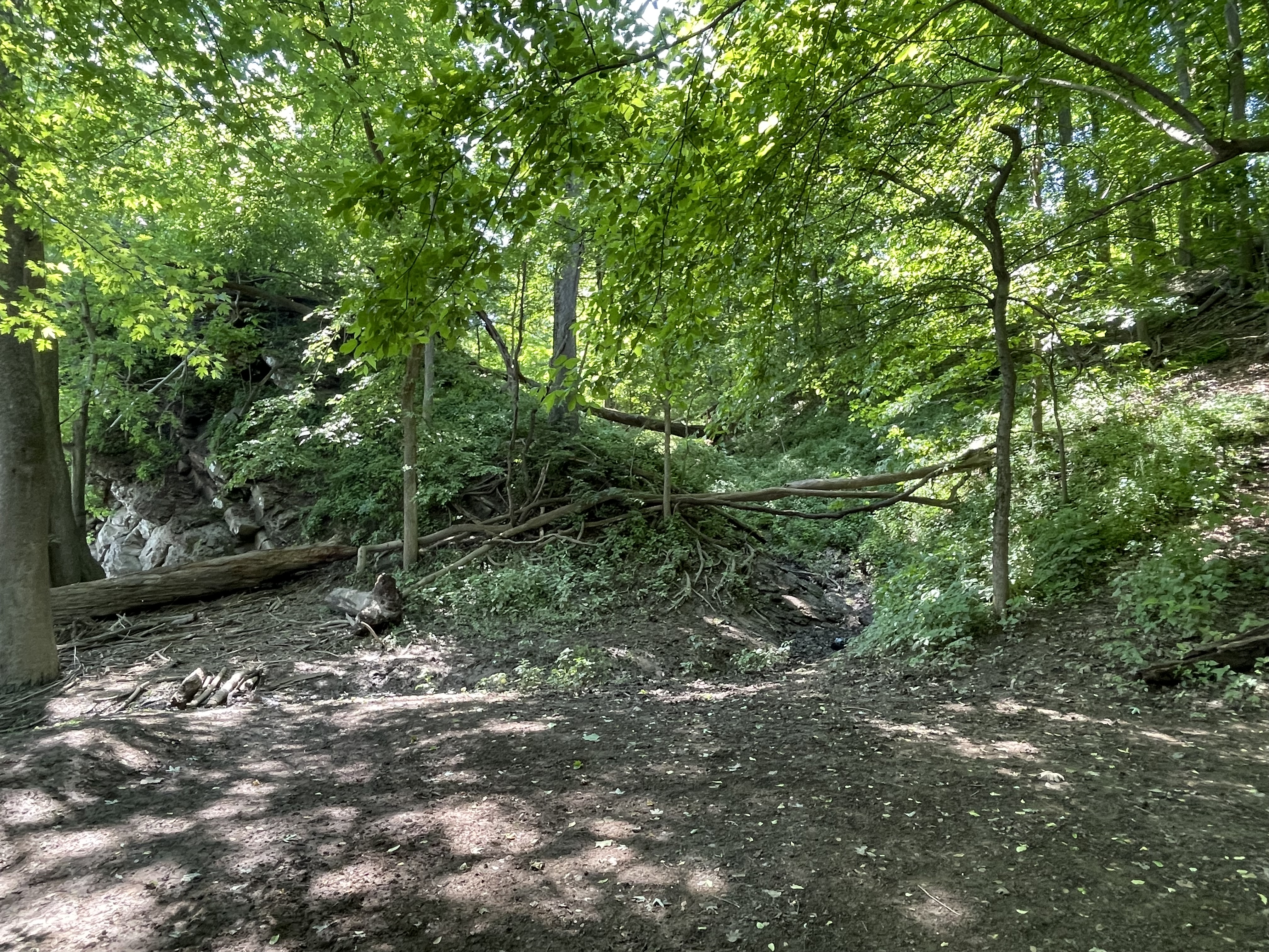
It was a shady walk beneath a tall canopy of mature hickory, ash, and other temperate forest trees. There was plenty of evidence of the recent spring floods. Large trees were jammed up on rocky outcrops and among the trees covering the floodplain. After a short hike, we came to what looked like an abandoned quarry (Fig. 4), which can be identified by the bright spot in the relief map of Fig. 2, just above the label for Site “2”.

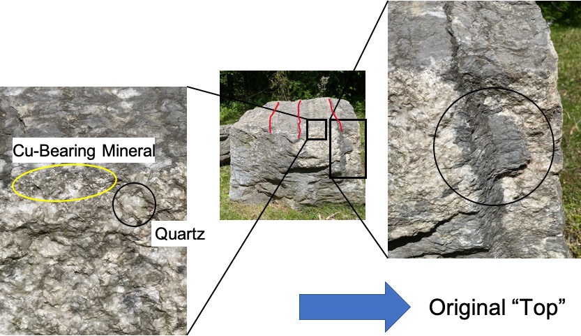
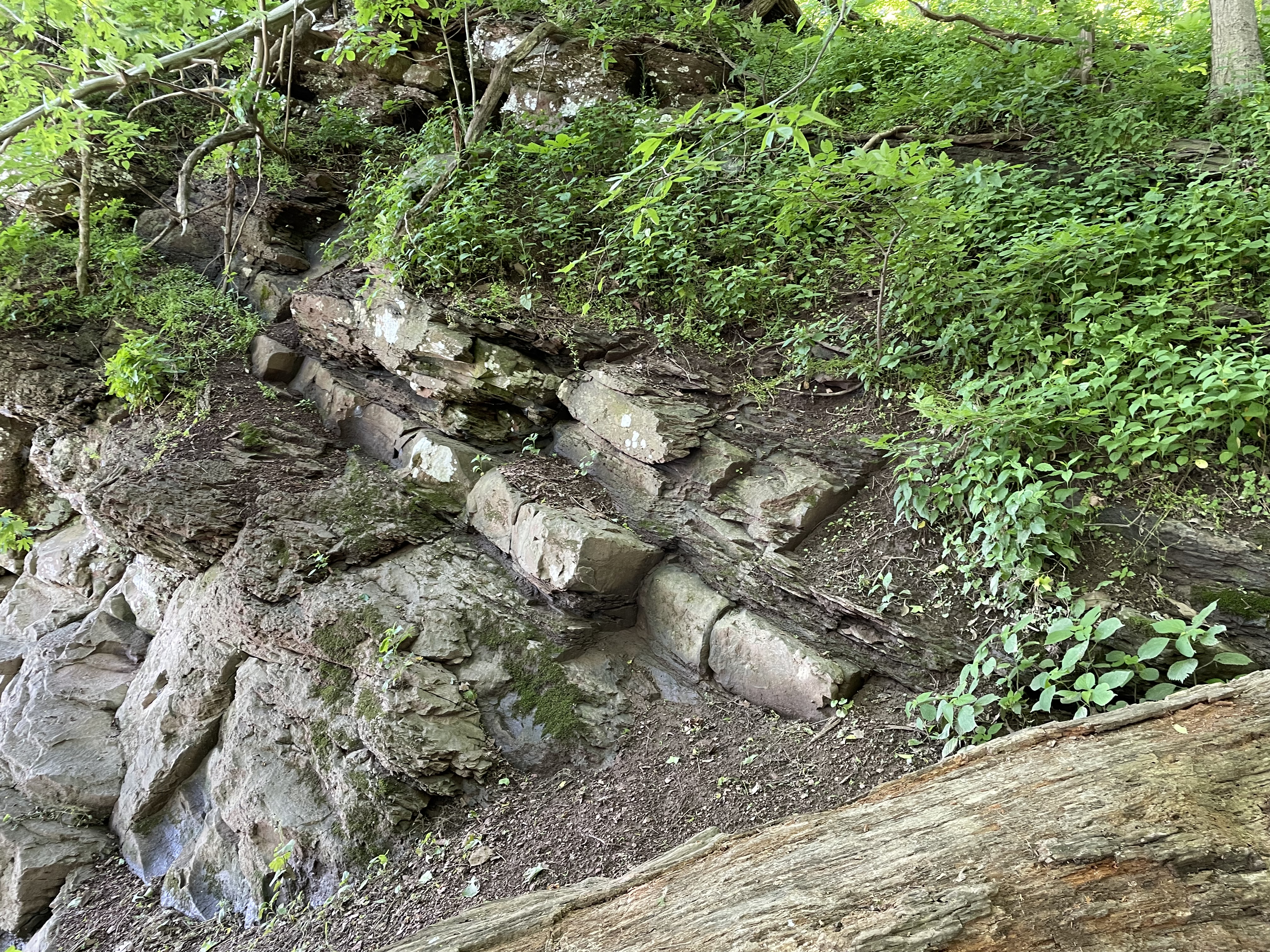
I was able to examine several slabs of the rock exposed in the quarry and along the river bed (see Fig. 1 for appearance) at Site 2, revealing foliation and inclusions similar to other exposures of this rock (Fig. 5).

We’ve seen the structures displayed in Fig. 5 before, in this same rock, at Great Falls and other locations along the Potomac River. I’m presenting these examples to give the reader some idea of the scale of these processes. For example, the juxtaposition of foliation in Fig. 5A suggests a frenzy of activity, like in a pan of boiling water; that analogy is reasonable if we adjust the viscosity, temperature, pressure, and time scale from water on the stove to rocks buried deep beneath the surface, but heated from below–just like the pan of water. I’m speculating here but, just to get an idea of what I’m talking about, the crazy structures in Fig. 5A probably took on the order of ten-million years to form.
It might help to see the problem from a more god-like perspective.

As you might expect, the exposure of such a deformed and mineralogically diverse set of lithologies along the Potomac’s course produces features like Great Falls, as well as what we’re examining today.
There is more to these rocks than metamorphic structures, including folding, foliation, and inclusions. All of those were formed between 1000 and 500 million-years ago. After deep burial (maybe 15 miles) beneath an enormous mountain range, these rocks hardened and were exhumed by erosion of the overlying rocks. They were brittle and, as isostatic pressure relaxed, they cracked just like a cooling pumpkin pie, forming joints.

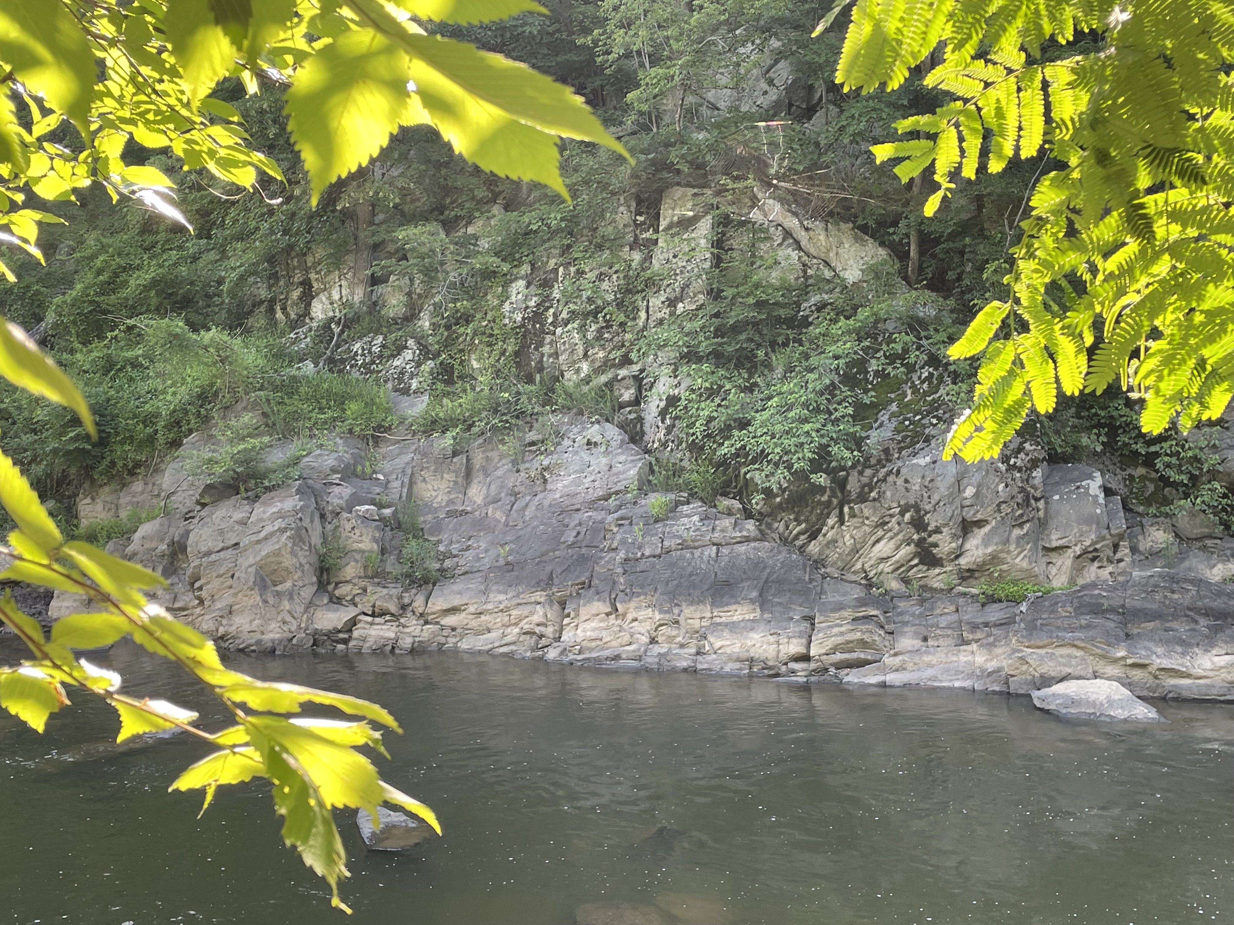
Confused by what I had seen so far (i.e. Figs. 4, 5, and 8), I followed the trail to the confluence of Difficult Run and the Potomac river (Fig. 9).

Looking across Difficult Run to the south at Site 4 (see Fig. 2 for location), I was once again bewildered.

It is tempting to assume that the overlying rocks in Fig. 11 are sedimentary, deposited on an erosional surface in the underlying metamorphic rocks (angular unconformity); however, the geologic map (Fig. 12) reveals that these are similar in age and lithology.
I summarized the geologic history of this area in a previous post, so I’d like to wrap up by demonstrating how pervasive deformation is, in this post. Imagine the deformation seen in Fig. 5A scaled up several orders of magnitude, to the scale of a bluff (Fig. 11). We also saw evidence of rotation of porphyroblasts at another location along the Potomac and again, more than a hundred miles to the south, in Lynchburg. This deformation actually extends to the microscopic scale, but we had neither proper samples nor a microscope to demonstrate it for these rocks.
Think of metamorphosis and ductile deformation as being like a peach pie, the contents trapped between the bottom of the pan (deeper, more resistant rocks) and the pie crust (overburden); the filling is boiling in the oven, overturning, even displacing smaller pieces of fruit. That is what’s happening miles beneath the mountains, on time scales of millions of years rather than minutes.
Review of “The Stainless Steel Rat’s Revenge” by Harry Harrison

I vaguely recall the Stainless Steel Rat series when I was in high school (Harrison wrote more over the following decades). I didn’t read it or the first one because the covers looked kind of childish to me at the time. I was reading more “mature” SF authors like Heinlein and Asimov. I think this was meant for young teens, which I’m not above reading.
As with every other book I’ve reviewed, the grammatical errors increased after the halfway point, but they still weren’t distracting. The writing style wasn’t that different from the probable target audience, i.e., long-winded sentences that sometimes changed topic unexpectedly. The witty comments reminded me of the Spiderman comics I read in middle school.
The protagonist is a spy who works for some kind of galactic overseer agency, saving planets with help from gadgets and his sidekick/wife. From Jim diGriz’s repeated escapes from the same sinister empire, I’d say his imagination exceeds the author’s although it mostly relied on smoke grenades and perfect timing. The “action” was nonstop but highly repetitive. I was hoping for a surprise ending–the hero getting killed.
It was, however, interesting to see how limited an author’s imagination can be, especially in a genre like SF. For example, Harrison couldn’t imagine wireless devices (this was in 1970), and the cars (far in the future on another planet) sounded like the big-block V-8s that were popular when he wrote this book. And, despite the existence of warp drives (this was after Star Trek), the spaceships were apparently constructed of steel, and rusted. There are no drones, but there is a driverless cab and robot house cleaners.
This would probably be okay for a very narrow audience today, mostly boys between 10 and 13, because it doesn’t contain any sex but lots of junior-high innuendo (e.g. large bosoms and his jealous wife).
I’m glad I didn’t read it when it first came out because I probably would have thrown it in the trash can, wasting a few of my scarce dollars…
Awkward Meeting
I will never forget how I met Dr. Zola Brown. My thesis advisor, Dr. Daniel Greeman, wanted us to meet in a setting she would find comfortable because, apparently, she didn’t like meeting new people outside of the classroom. From his description of her personality, I expected the soon-to-be outside member on my Ph.D. thesis committee to resemble my fourth-grade teacher, who happened to have the same surname; that’s a thing about being African-American with a lineage that extends into the slavery period of American history. We all have similar surnames, like Washington, Jefferson, Lincoln, Brown (you can guess where that one came from), and Wilson, which happens to be the appellation associated with my family’s distinguished lineage. The resemblance between Mrs. Brown and Dr. Brown didn’t end with their last names.
Dr. Greeman had declined to tell me why he wanted me to meet Dr. Brown incognito, in disguise as an undergraduate enrolled in Physical Geology at San Francisco State University, on a field trip to Marshall’s Beach. I had done some research because I didn’t know if he was playing a prank on a colleague or making a fool of a new graduate student—some kind of initiation rite to the halls of academia. I was determined to play along because, to be honest, I was overwhelmed by the halls of academia and wanted nothing more than to have fun while joining the two-percent of Americans with a Ph.D., and if that meant pretending to be someone I wasn’t in order to meet an antisocial future collaborator, I was all in.
“What are you doing here?”
Oh yes, Dr. Brown and Mrs. Brown had a lot in common. She examined me from head to toe. She frowned at my makeup, shook her head at my large earrings and nose pins, scoffed at my form-fitting top and jeans; and her jaw dropped in shock at the high-heel pumps that adorned my feet.
I smiled nervously (easy to do under the circumstances) and replied, “I’m a new student. I missed the van and drove so that I wouldn’t miss the field trip. This is really important to me.” That part turned out to be true, but I’ll get to that later.
Her response caught me off guard.
“You look like a Klingon at a Death Ritual. What were you thinking, coming on a geology field trip dressed like that?” Her downturned nose hid what must have been nostrils flared with righteous indignation, her eyes indicating that I would probably fail her class.
I grinned at her comment, pleased that she appreciated my carefully applied makeup. I had always been enthralled by the Klingons and their culture, in which women were the equals of men, willing to kill and die for their honor. Furthermore, the Klingons are dark-skinned, not pasty like their Vulcan cousins, although my complexion isn’t as dark as Dr. Brown’s, which is probably why my surname is Wilson.
“Take me to your leader.”
I was certain I would become accustomed to her abrupt demeanor, but I was surprised when a rock hammer was suddenly thrust at me, along with a pair of safety glasses. “Join the others and let’s see if you can tell dip from strike.”
I accepted the heavy tool and tiptoed through the tall, wet grass fronting the low bluff, inwardly grimacing that I would probably ruin my new shoes in the muddy soil. The students were confused by the twisted mass of shale and what was probably sandstone; some of them were pouring dilute hydrochloric acid on the unresponsive silicate rocks (HCL fizzes on limestone); others, mostly guys, were beating the rock to death with their cheap hammers. I joined a mixed group of men and women who were peering through tiny magnifying glasses at what I had learned from Wikipedia was a melange of sand and mud, buried deeply enough to harden into rock, and then scraped off as the Pacific Ocean’s seafloor plunged beneath North America. Feeling empowered by this knowledge, which the undergraduate students enrolled in Dr. Brown’s class apparently lacked, I nevertheless refrained from sharing my wisdom and instead acted as confused as they.
“It’s all messed up,” a man with dark skin and close-cropped curly hair exclaimed in frustration.
A white girl with dark, straight hair, who could have lost a few pounds, added, “I don’t know if it’s sandstone or shale.”
I pointed to a chunk of shale, embedded in a matrix of mudrock, and tossed out, “How can sediments like this, deposited on the seafloor, become so tangled?”
A black girl who had been studying one of the lightly colored sandstone blocks exposed along the bluff put her hands on her hips and declared, “I can’t tell what this is. I don’t see any bedding like in the shales, even the pieces we’ve been looking at.” She poured some more dilute HCL on the shiny, unspeaking rock and added, “It isn’t limestone.”
“I think it’s a schist,” announced a white guy who looked like he hadn’t gotten enough sleep the previous night.
I shook my head in frustration and corrected him. “Schist would have foliation that would be continuous. These rocks look like pieces that were mixed up together.” I looked towards the Pacific Ocean, hoping they would get my drift.
Another student joined our group, a black guy who had been diligently pounding on the helpless rock. “This is fucked up!”
It was time to collect their observations and come to a conclusion. “Let’s put it all together.”
They looked at me blankly. It was hard to believe I had been just like them only a few years earlier. Before I could elaborate on my statement, Dr. Brown’s commanding voice broke everyone’s train of thought. “Okay, you’ve had enough time to make your observations. Does anyone know what we’re looking at?”
A few hardy souls spoke up about it being igneous or metamorphic, but the guy who had called the rocks “fucked up” held his hand up, before quickly lowering it and, with a grimace that said a lot about his classroom experience with Dr. Brown, offered, “It’s all mixed up, some shale, a little of maybe granite or sandstone, something like that, but now it’s all confused…a mishmash, like my mom’s surprise dinner on Saturday night.”
There were a lot of laughs at his analysis.
Dr. Brown corrected him. “You are correct, Damon, but we call it melange. However, that isn’t granite, but only recrystallized sandstone that was mixed in with the shale matrix. It lost its original bedding when it was buried, every rock has its own chemical signature and responds differently to changes in pressure and temperature. But what caused it to look like this? To become a mishmash—a melange?”
The overweight girl looked at me, then at the calm Pacific Ocean, and offered, “It was caught in the subduction zone.” She pointed towards the sea and, with the others nodding enthusiastically, added, “It got all tangled up and was dragged along…” She grimaced and waved her hands as if imagining being dragged along with the subducting Pacific plate.
I guess she was taking Geology 101 as a science requirement for a performing arts major.
Dr. Brown then strode to the outcrop and proceeded to show her students the details that revealed the complex history of what is now called San Francisco, a tumultuous interval that began more than 150 million years ago and continues to this day. I was as fascinated by her recitation of the Mesozoic past of Northern California as any of the undergrads. I was smiling in anticipation of sharing my discovery with Dr. Greeman as I handed the heavy-duty hammer back to Dr. Brown while the students filed back to the van.
She looked at me with narrowed eyes as she said, “You aren’t on my class roster. I don’t mind an interested observer joining my field trips occasionally, but I don’t like disruptions…you fit in well with the others and seem to know strike from dip. I can see that you are serious but, still, don’t make a habit of it. You should register for the class if you want to take part in future field trips. I would welcome your participation.”
I finally found the appropriate response to her earlier comment about my uninvited appearance on her field trip. I showed her my best Klingon smile and said, “We Klingons do not believe in wasted effort or time, and we have no tolerance for foolishness or idle talk…”
She was still watching me, her jaw agape, as I climbed into my antique Toyota Corolla.
Review of “The Knowledge Machine: How Irrationality Created Modern Science,” by Michael Strevens

The author is on the faculty of the Philosophy Department at New York University and has been writing about a range of issues relevant to the scientific enterprise for more than twenty years. Some of his essays and papers sound quite technical, but this is a book written for entertainment as much as the serious ideas it presents.
First things first; the grammar was a little clumsy at times and I had to reread several paragraphs. This is a typical complaint I have with science writers; I think our thoughts jump before the pen has caught up. I noted (for the umpteenth time) that the number of (blatant) grammatical errors increased towards the end, as if he just wanted to get it finished. Still, it was well written overall.
I enjoyed the general approach used; setting out to debunk two of the more famous ideas about science is a great attention getter. He did a good job of it too. However, I’m not sure if the basic tenet (I’m not giving it away) justifies a book of this length. Some of the examples used to present his ideas weren’t very convincing although I agree with his conclusions (in general). Of course, I am a scientist, so maybe…actually, I would go further than he does in criticizing the practice of science .
The author goes out of his way not to offend anyone; all of the examples he uses are from the physical sciences, e.g., physics and chemistry, but social sciences like sociology and economics aren’t discussed. However, by neglecting disciplines that don’t have the clarity of conceptually simple measurements, his discussion can be interpreted as either chauvinistic or overly simplistic. The closest thing to a discussion of social sciences is taking aim at two famous philosophers of science, as the thesis of the book. This omission makes the author’s premise less convincing, possibly even reducing it to no more than biased speculation after an evening searching the internet for anecdotal stories.
I read this book on a Kindle, so I couldn’t easily go back and search for something forgotten. Thus, despite the repetition of several stories and ideas, I don’t recall exactly what “The Iron Rule” is.
That may be because I’m stupid, but still, shouldn’t even the densest reader get the main point to a book-length discussion of what is basically a simple idea?
Despite my criticism, I recommend this as light reading, especially for non-scientists who may mistakenly think that SCIENCE knows what it’s doing. I think the author paints a pretty accurate picture of how scientific inquiry proceeds, despite his bias.
As the author concludes, science is an unthinking golem, despite being practiced by the most intelligent animal on earth…
A Geological Mystery at Bears Den

Beautiful landscapes and geological wonders are never far from your door here in Northern Virginia. Today, we took a hike to meet the Appalachian Trail near the border of West Virginia (Fig. 2).
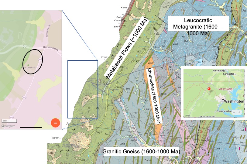
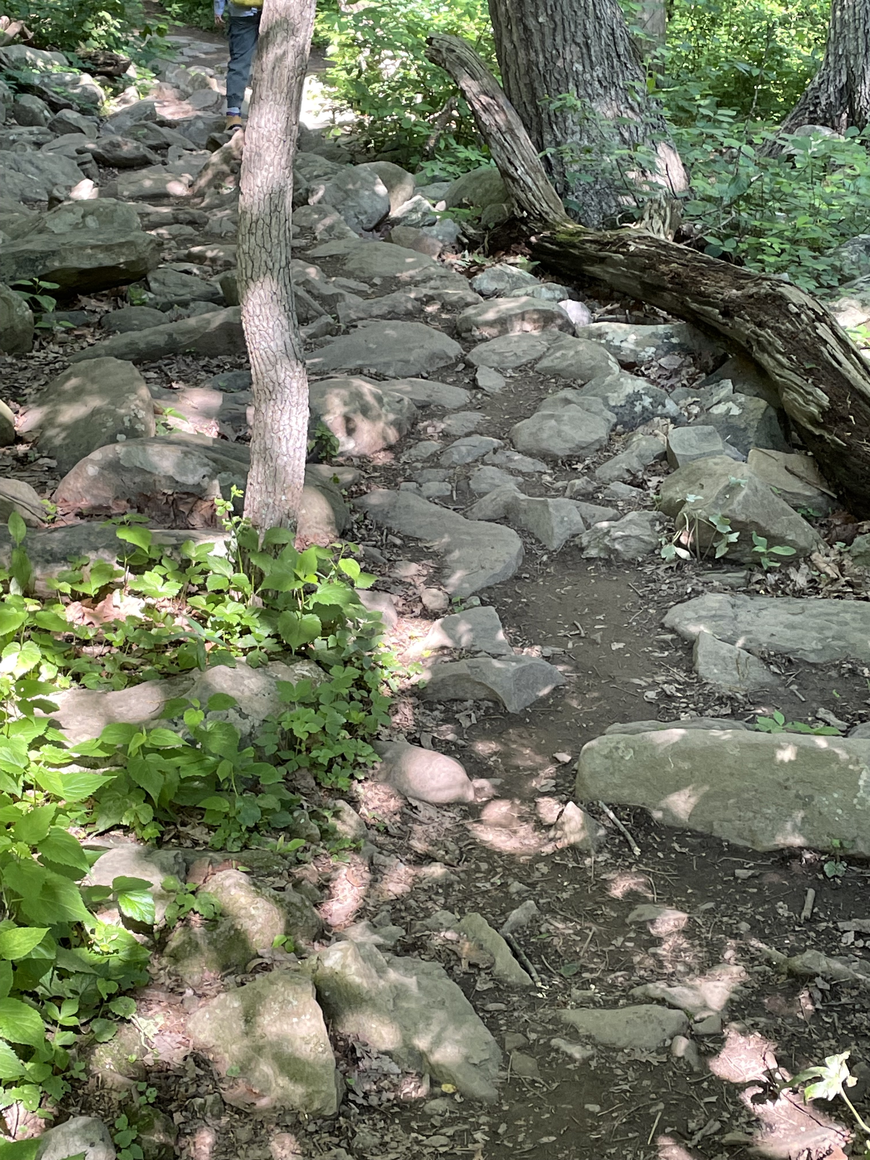
To reach the Bears Den rest area on the Appalachian Trail (see oval area in Fig. 2), we had to follow a winding path along one of the many irregular crests that define the Blue Ridge Mountains (Fig. 3).

Along the way, we noted that the trail followed the top of a deeply eroded landscape, littered with boulders and weathered rocks (Figs. 4 and 5).

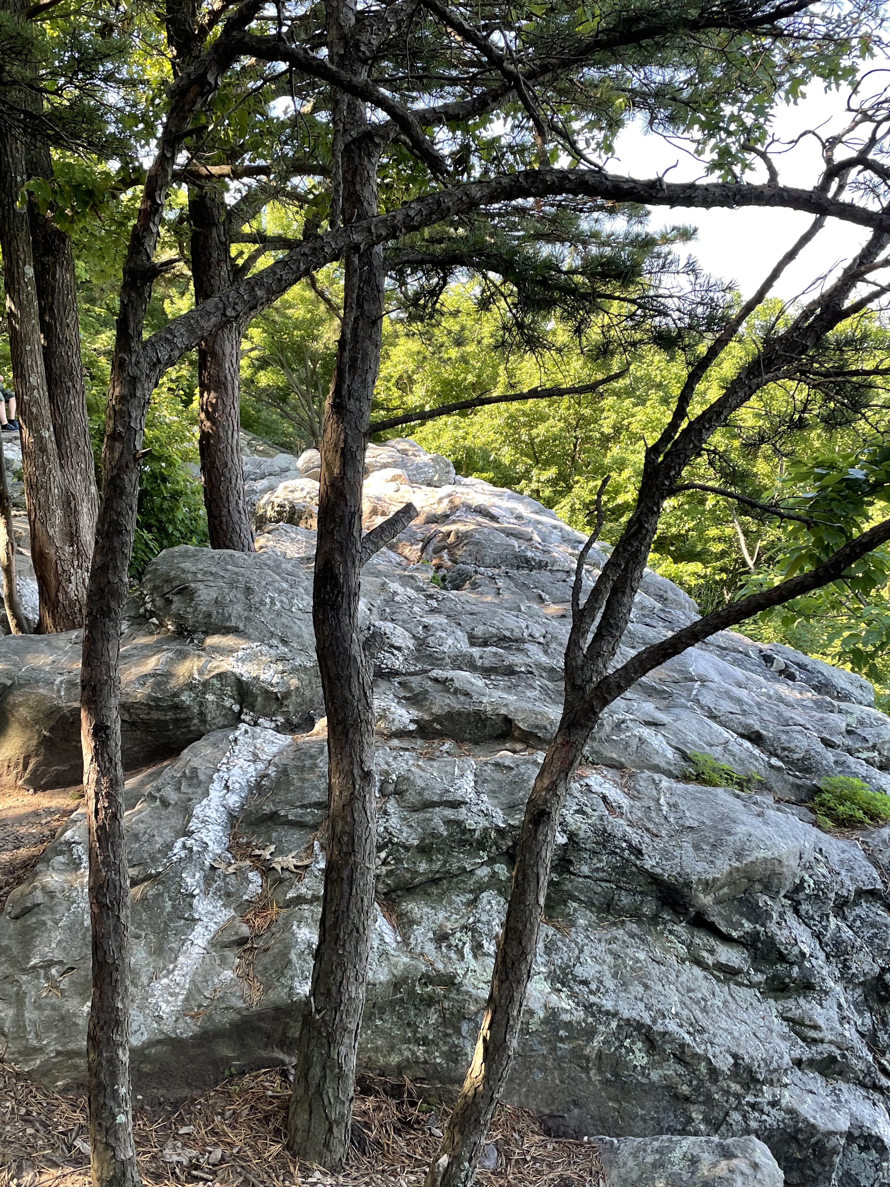
We finally reached the rocky point from which Fig. 1 was photographed. A large outcrop crosscut with veins greeted us (Figs. 6-8).

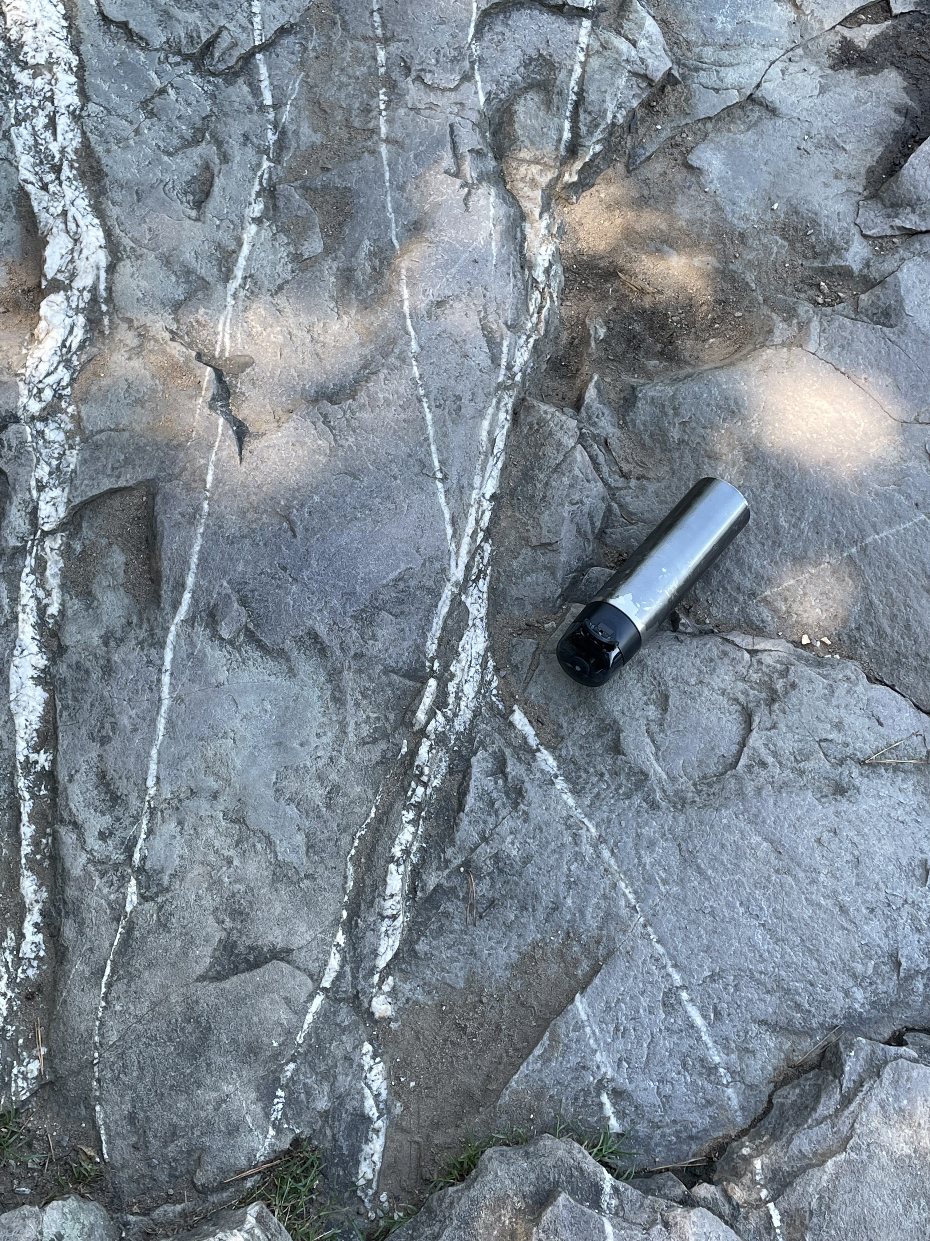
Intersecting joints like those seen in Figs. 7 and 8 occur when rocks that have been deeply buried are exhumed as overlying rocks erode. The upper mantle relaxes and lifts its overburden in a process called isostatic rebound. Rocks thus uplifted are no longer soft but respond like a solid in brittle deformation. What is intriguing about these rocks (whose age we haven’t yet determined) and the joints that permeate them, is the origin of the quartz and feldspar filling the joints.
It’s time to talk about the host rock seen in Figs. 4-8. The west side of the oval outlined in the inset map of Fig. 2 reveals that these are fluvial-to-shoreface sedimentary rocks deposited between 541 and 511 Ma (source: Rock D lists many sources for this interpretation).

An intrusive magma filled joints (Figs. 7 and 8) and heated the country rock to the point of remineralization (Fig. 9), yet sedimentary textures are retained (Fig. 10). What’s going on?

Summary
There are some general rules in determining relative geologic age. For example, layered rocks are younger as you ascend in a stack of them. This rule applies to both sedimentary and volcanic rocks, although the contacts aren’t as uniform in the latter. Another rule is that rocks that cut through other rocks (i.e. veins and dikes) are younger than the rocks they invade.
The sedimentary host rocks at Bears Den were deposited where rivers fed coastal deltas and a sandy beach (shore face) about 500 million years ago, long after the granites we see to the east (Fig. 2) were intruded and metamorphosed to become metagranites. In other words, the quartz veins and granitic dikes (Figs. 7-12) did not occur when the older (1600-1000 Ma) igneous rocks were emplaced; these veins and felsic intrusions must be associated with the Taconic orogeny, which started about 440 million years ago. The geologic map (Fig. 2) doesn’t show any evidence of granitic intrusions from this period, which could have filled joints created by isostatic rebound in these rocks.
These sedimentary layers were laid down during the collision that created Pangea, so they would have had to be buried deeply enough to become lithified, exhumed to a sufficiently shallow depth to form joints (a sure sign of brittle failure and thus uplift), then invaded by an undisclosed intrusive magma at a very shallow depth (probably less than 5 miles).
Alternatively, they could have remain buried until the breakup of Pangea, beginning in the Triassic period and progressing in stages. Magmatism has been associated with this event in Northern Virginia.
All of this is plausible, given the immense span of time involved, but…
Where are the rocks?
The Race to Ohio
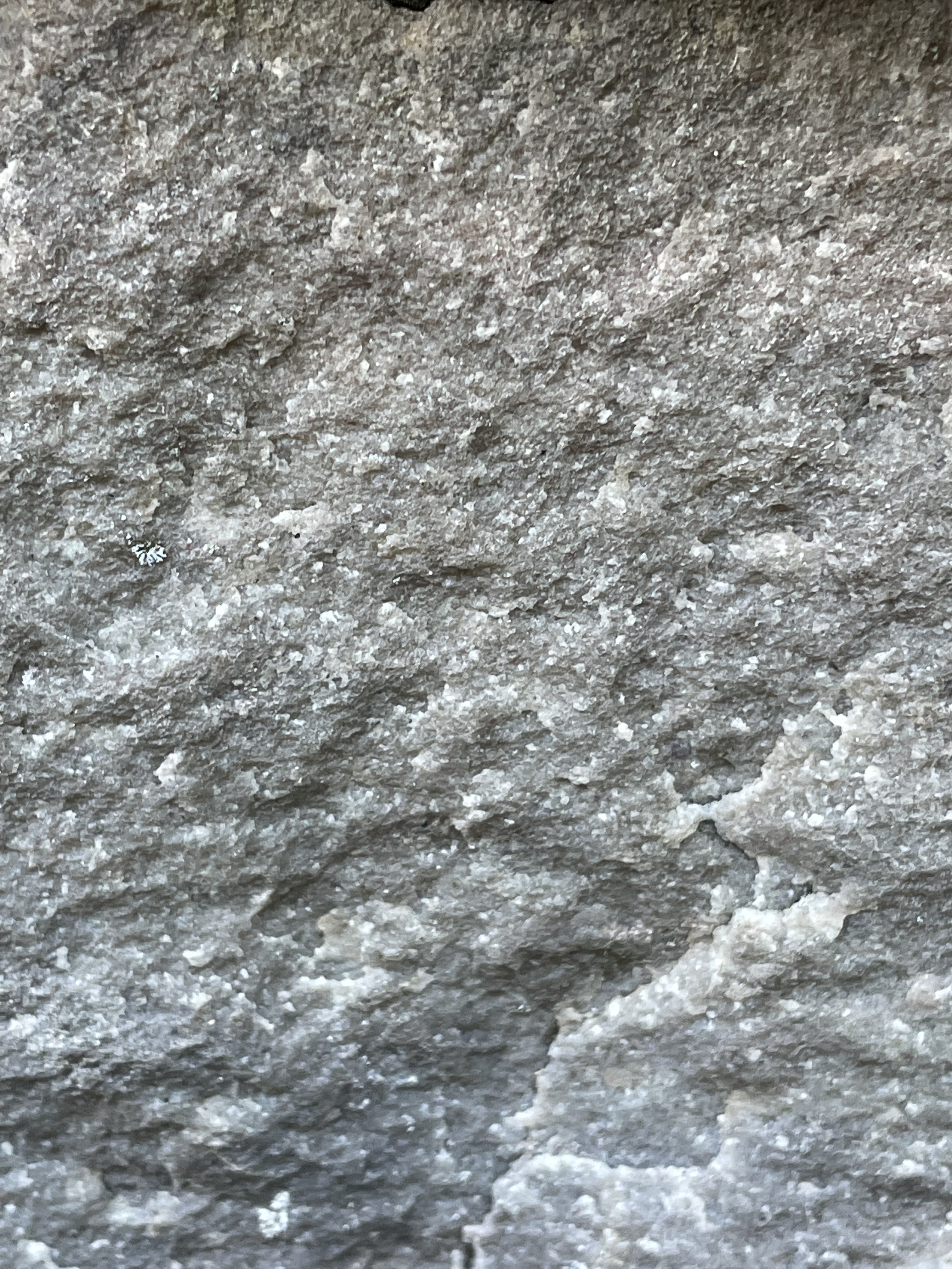
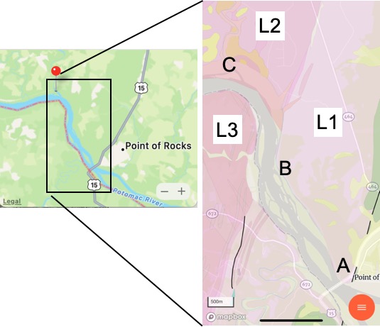
Several of my posts in Northern Virginia have noted the presence of old canals which were part of the earliest transportation system to reach beyond the Atlantic Seaboard (e.g. The Potowmak Canal and Goose Creek canal). Today we crossed the Potomac River and followed the Chesapeake & Ohio Canal for several miles (between Locks 28 and 29), which took us along a scenic path through a metamorphic terrain in Maryland.

The cut for the tunnel (Fig. 1) reveals a dark rock with foliation oriented nearly vertical in the plane of the cut (Fig. 3) with blebs of pink and white material (Fig. 4).


These basalts originally flowed out of fissures and volcanoes, probably at the seafloor, during rifting of a continent (according to Rock-D‘s summary). The origin of magma can be correlated to tectonic regime (e.g., mid-ocean ridge, rifting continent, island arc) based on the chemical signature of the whole rock (not minerals, which are altered during metamorphosis). At any rate, the age range of the Catoctin Formation (1000-541 Ma) spans the final closing of an unnamed ocean to form a hypothesized supercontinent called Rodinia during the Grenville Orogeny between 1100 and 900 Ma — and the subsequent rifting of Rodinia, which occurred between 750 and 633 Ma. Unraveling that time discrepancy is beyond the scope of this blog.
Let’s just say that these basalts (and minor sedimentary rocks) were created during the tumultuous assembly, pleasant life, and violent breakup of a hypothesized supercontinent.


The Catoctin Formation (basalts with some sediments) were buried deeply and metamorphosed by heat and burial pressure but not compressed, at least not enough to produce folds visible at the scales of Figs. 3 through 6. This suggests that Rodinia wasn’t created by huge horizontal forces, crashing tectonic plates together like putty.
Jumping ahead in time to the present, we see these rocks still controlling the Potomac and the development of transportation during the early days of the United States.

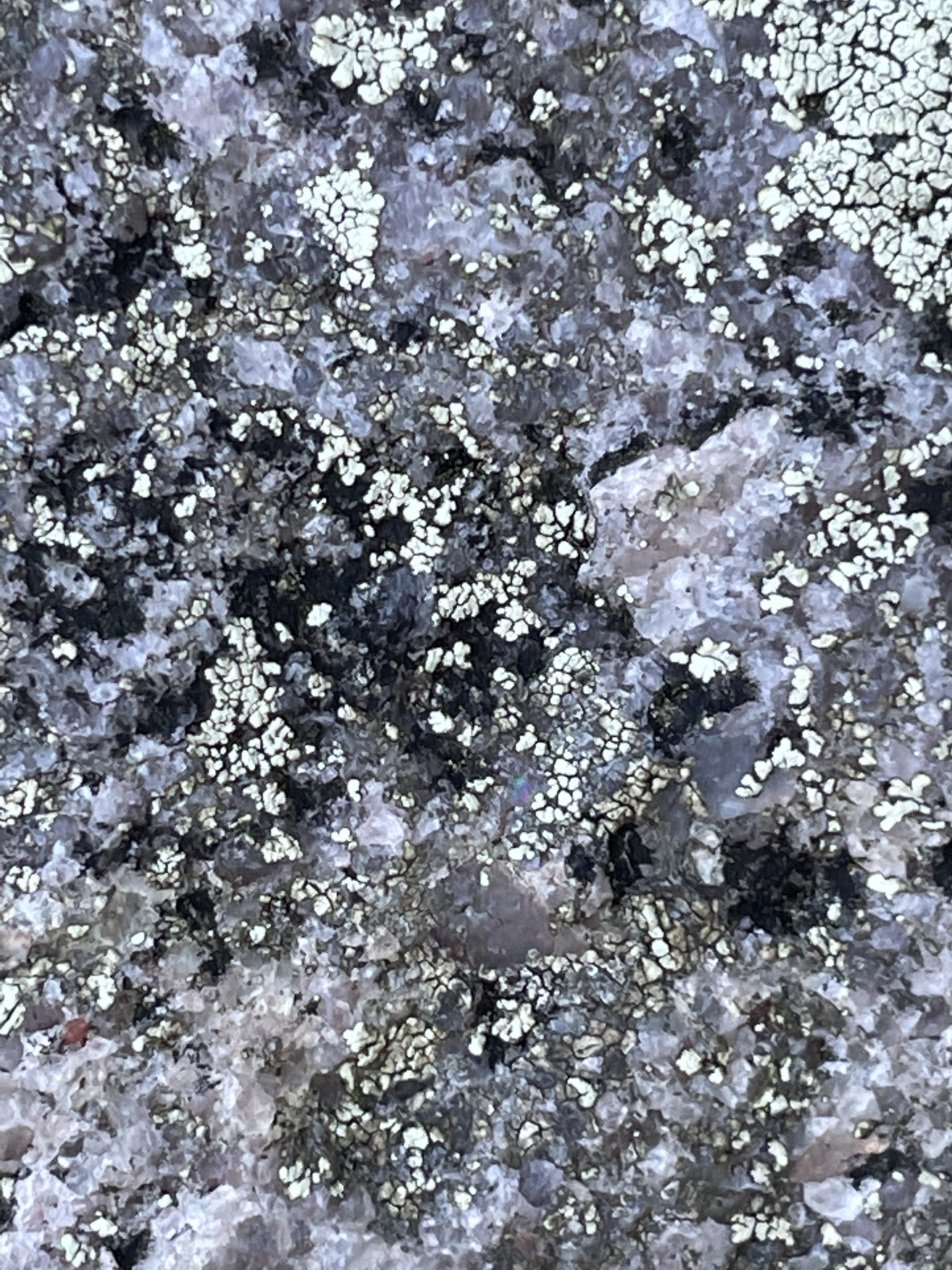
The outcrops seen in Fig. 7 occur very near the contact between the Catoctin Formation and a Pink leuocratic metagranite (1600 – 1000 Ma) with gneissic foliation (L3 in Fig. 2).
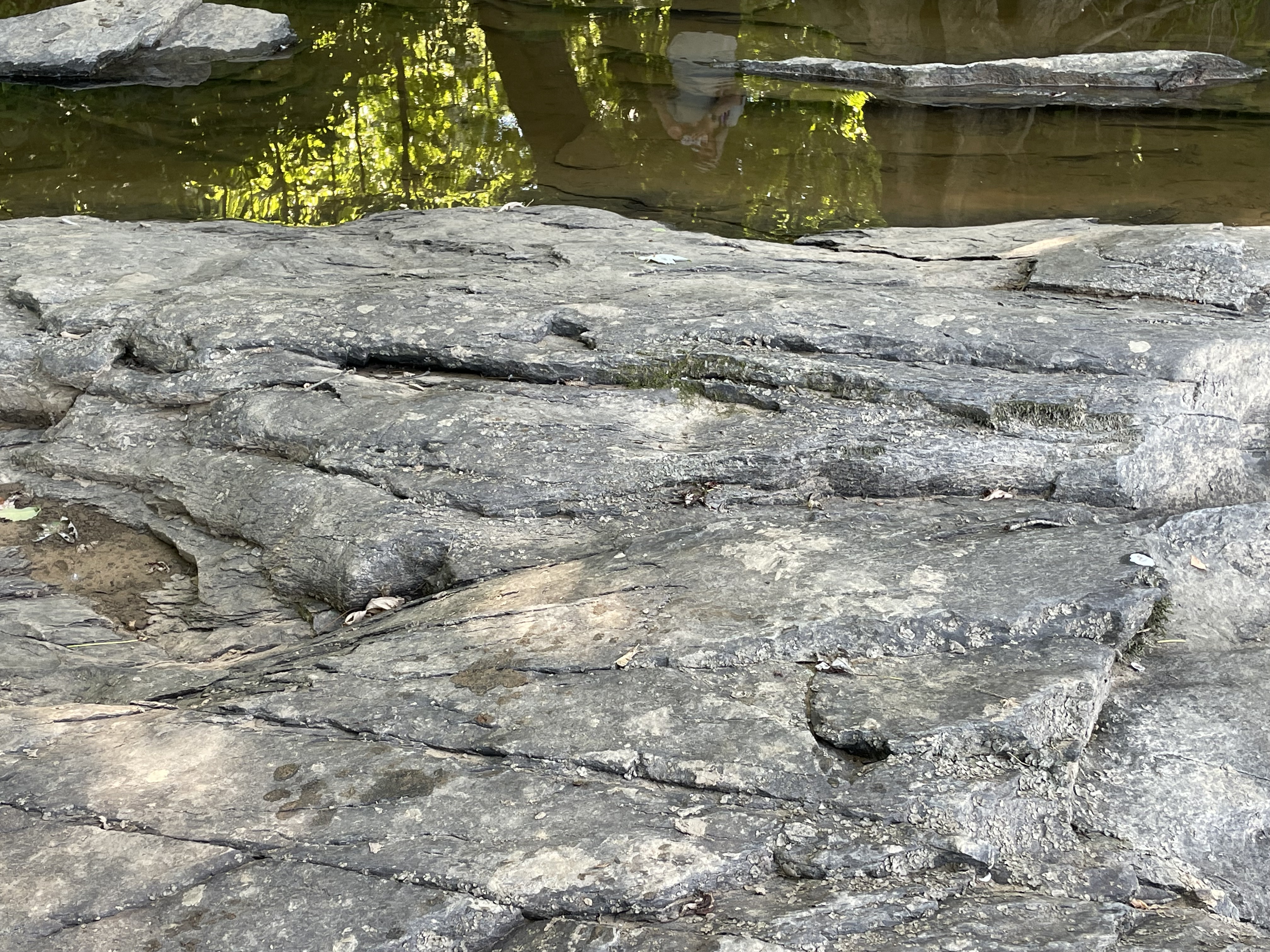
It is important to note that the outcrop in Fig. 8 has been exposed to the vagaries of the Potomac since the Pleistocene, so its irregular surface is not unexpected. Nevertheless, the estimated orientation is radically different than that of the Catoctin Fm, which is nearly vertical (see Fig. 6). One possibility is the presence of a fault between the two rock formations, as suggested by the geologic map (Fig. 2). The fault (indicated by the nearly vertical, black line south of Site B) may extend under the alluvial sediments around the Potomac and not be visible in Maryland.

We have one last stop today, Site C (see Fig. 2 for location), where we will try and get some closure on the fate of Rodinia (pun intended).


Let’s take a look at some samples that were conveniently made available by the Maryland DOT, probably during construction of the park.

The rocks we saw today were of similar ages (determined by radiometric dating, not guesswork), and were deposited, deformed, and intruded during the Grenville Orogeny. In other words, based on my brief examination of the literature, these rocks represent the collision of continents to form Rodinia (1100-900 Ma), its long lifespan (900-750 Ma), and its breakup to form the precursor of the Modern Atlantic Ocean (Iapetus) between 750 and 633 Ma.
I’m going out on a limb here (again). It is significant that there aren’t a lot of sedimentary rocks (even metasediments) here, which means they were removed by erosion. Keep that in mind, when I add that even the oldest metamorphic rocks (the granite gneiss, L2) aren’t folded like the schists at Great Falls. These rocks were buried deeply, relative to the impact they survived, which apparently didn’t affect the deeper parts of the crust (at least not along the modern Potomac River). There probably was a lot of folding of the sedimentary rocks that covered these igneous and metamorphic rocks, but they were eroded away during the 150 million years that Rodinia was a (quasi) stable supercontinent. That’s a long time. The youngest of the Catoctin rocks (~540 Ma) were deposited just as the so-called Taconic Orogeny was starting up in modern-day New England…
It is extremely difficult to wrap our minds around such four-dimensional events playing out on such long time scales but, to make it even more fun, the mantle and core are dancing to their own tune and directly influencing everything we experience and can observe from our perilous seat atop the earth’s crust.
Just look at all those canals we dug to avoid the rocks…
Goose Creek
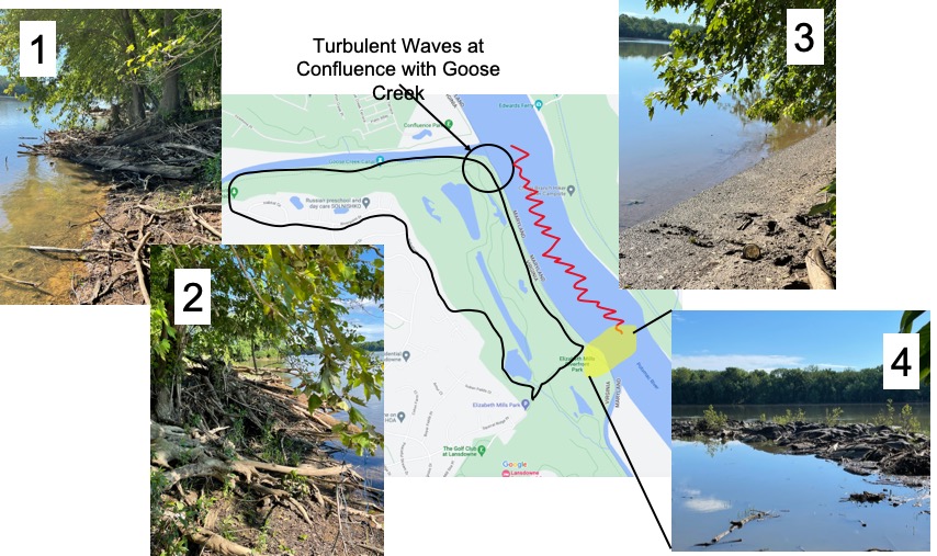
This week we didn’t have to go far to find a quiet place on the Potomac River, its confluence with Goose Creek, where low bluffs of reddish sedimentary rocks watched over the calm water of this sometimes violent tributary (Fig. 1).
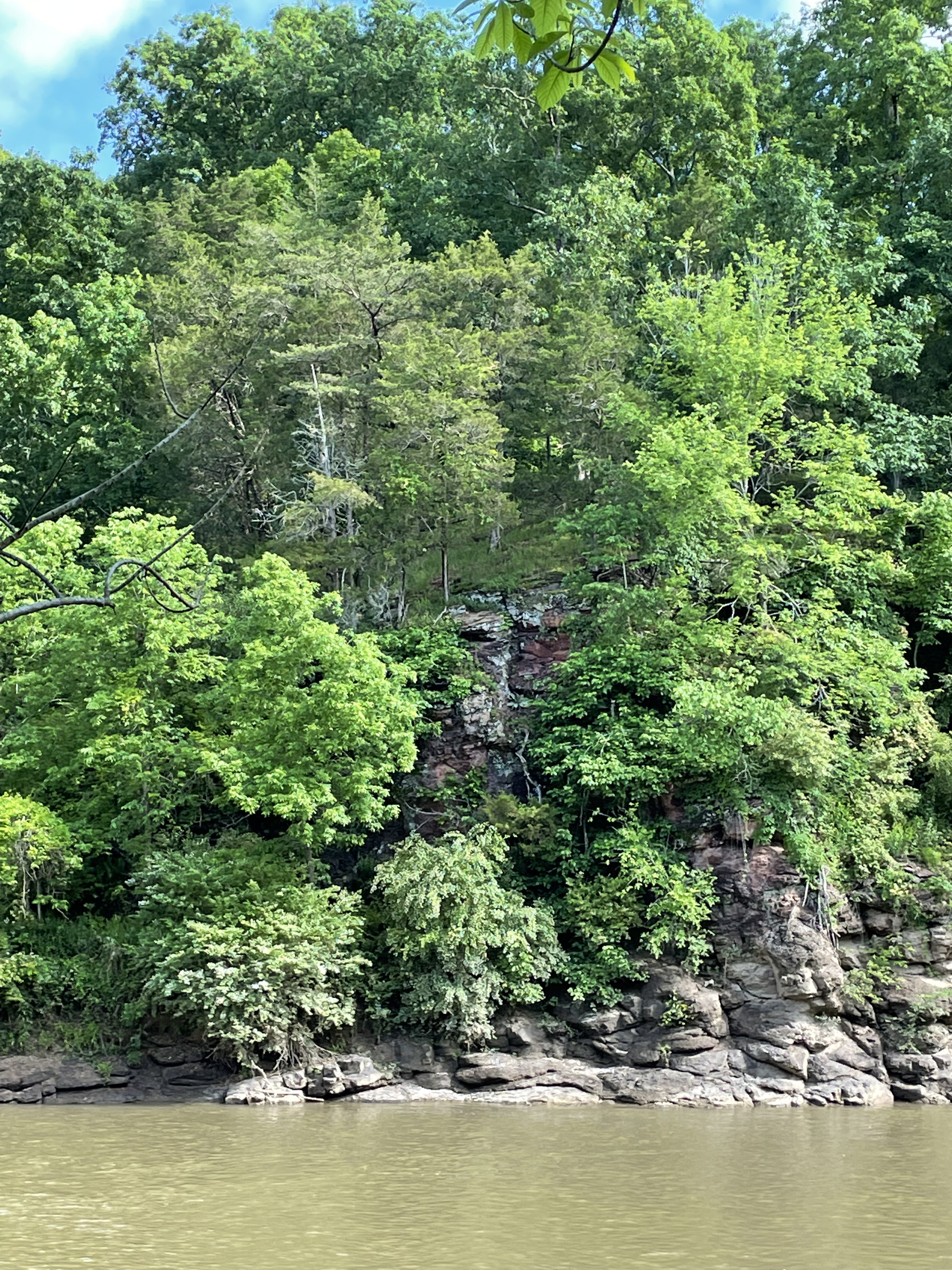
However, things aren’t as geologically simple as the sedate image in Fig. 1 would suggest. This photo was taken within a few hundred feet of the contact with thermally metamorphosed sedimentary rocks that were probably part of the original Balls Bluff Siltstone (Site C in Fig. 2).

We saw diabase in an earlier field trip. Those dikes and sills were part of the same intrusive episode, when North America split away from Europe. Diabase is a fine-grained, intrusive rock with a chemical composition like basalt.
I was unable to measure the orientation of the sedimentary rocks seen in Fig. 1, but my “field estimate” is that they were dipping ~30 degrees away from the camera, with a strike of about (you guessed it) 30 degrees east of north. Such an orientation is consistent with what we saw in a previous post.
The presence of diabase crossing Goose Creek (see Site C in Fig. 2) is indicated by shallow water and a rocky bottom just west of Site C (Fig. 3).

Because of the shallow water over the diabase intrusion in an otherwise navigable stream, a canal was constructed to run from this point downstream to deeper water, parallel to the stream seen in Fig. 2. This was the Goose Creek Canal, finished in 1859 to reach grain mills as far as twelve miles upstream.


Moving back to the Potomac River, there are a few more surprises for us on this field trip (Fig. 8).
This post worked forward in geologic time, in reverse to the counterclockwise path we followed (thin black line seen in Fig. 8). I was surprised to find so much geologic history on a short walk along the shore, surrounded by golf courses and million-dollar houses.
To summarize, as Pangaea began to be torn apart, the mixed sediments of the Balls Bluff Siltstone were deposited in grabens for millions of years, until oceanic crust intruded as diabase dikes and sills, heating these now-deeply buried sediments and altering them into what is called a hornfels metamorphic rock. The rocks we saw today were deposited and thermally metamorphosed between about 237 and 145 Ma (equivalent to millions of years), which is a very long time. But that 88 million-year span was brief compared to the 145 million years that have elapsed since these diabase intrusions forced their way into the picture.
As we’ve seen everywhere along the Potomac, modern fluvial processes are struggling to overcome tectonic events from a bygone era…
Exploring the Potomac: Red Rock and Balls Bluff
Observations at Red Rock Park
I have been exploring the Potomac River from Washington to Harpers Ferry in stages in recent posts. Most of the rocks we’ve seen were Precambrian schists, sedimentary rocks deformed during the closing of the precursor of the modern Atlantic Ocean (The Iapetus). The Potomac River has eroded into the roots of the ancient mountain range that was created by this event, superimposing floodplain processes on these metamorphic rocks. Today I travelled a little further upriver and found different basement rocks, which are the reason I’m excited about today’s post.
Accessing the river at Red Rock park required a short walk along a narrow ridge, left by erosion of gullies into the rocks.
Figure 1 was taken at Red Rock park, after following a steep trail about 100 feet to the river bed (Fig. 3).

A close-up of the outcrop seen in Fig. 1 reveals medium-to-thin bedded, fine-grained sedimentary rock with a reddish hue (thus the name of the park), as seen in Fig. 4.

The sedimentary environment implied by the siltstones and mudstone we see in Figs. 4-6 has (coincidentally) been reproduced today, with weathering of these same rocks and others found further west.


Summary of Red Rock Park
Fine-grained sediments were transported along rivers similar to the modern Potomac about 200 Ma and deposited on a flood plain like we see today. This was when the modern Atlantic Ocean was just beginning to form as the supercontinent Pangea was being torn apart. There would have been mountains much higher than the modern Blue Ridge to the west, and a narrow but widening (~1 inch/year) ocean to the east. Erosion of the ancestral Appalachian Mountains continued for the next 200 Ma, creating thick piles of sediment on the continental shelf of North America, depressing the earth’s crust and burying even terrestrial sediments deep enough to create the Balls Bluff siltstone from mud and silt. As erosion wore these mountains down, the crust rebounded to expose these ancient rocks to the ravages of water and ice. Now, these sedimentary rocks are being eroded as the process continues.
Requiem: Balls Bluff National Battlefield
A little further upstream (see Fig. 2 for location) is the probable type-locale of the Balls Bluff siltstone, but good exposures weren’t accessible because the bluff is higher and the bank narrower, there being no floodplain as we saw elsewhere (Fig. 7). In fact, the only rocks we saw were at the top of Balls Bluff (Fig. 10) and along a trail that led to the river, where I was able to estimate strike and dip.

These rocks contained original sedimentary layering and I was able to estimate that they were dipping to the WNW at about 20 degrees, with a strike similar to the rocks at Red Rock park (i.e. about 30 degrees east of north). This is an important finding, because this is the opposite to what we saw only a few miles downriver. I’ll try and summarize this interesting observation briefly.
Tilting of layered rocks like these siltstones can occur by either folding or faulting. Check out the links to understand these processes. Folding creates great arcs of rock, like sine waves, or ocean waves, as lithified sediments (hard rock) are compressed from both ends. This is what led to the steep folds we saw in the Precambrian rocks at Great Falls and in Lynchburg; our limited observations can’t allow us to decide what happened to these rocks on our own, but we can turn to reliable resources. The sediments that formed the Balls Bluff siltstone have never been compressed; we know this because the Atlantic Ocean is still spreading at a slow and steady rate of about 1 inch/year.
Rocks also become tilted when the earth’s crust is stretched. Even though buried deeply, if they are not in a metamorphic pressure-temperature regime, rocks break and slide around to form faults. This is a well-understood phenomenon that is occurring today in the Basin and Range province of western North America. It doesn’t take much imagination to picture new ocean crust appearing while a continent (Pangea) is being torn apart, snapping rocks buried several miles beneath the surface, like a slab of concrete being removed by a bulldozer.
Crustal stretching produces a series of opposing normal faults that create grabens. These collapsing structures occur at every scale, from outcrops to the birthplace of Humans.
Closing Thoughts
It was good to see some younger rocks, especially Triassic river sediments that are direct evidence for the splitting apart of Pangea. It was a bonus to discover evidence of block-faulting of these same sedimentary rocks after they had been buried several miles beneath the surface. Geological processes occur on time scales of millions of years, with annual displacements of inches or less. Because of the juxtaposition of fast, river-based erosion and deposition and the slow pace of plate-tectonic movements, these rocks record their entire life cycle.
And it continues to this day, as slivers of quartz and oxidized clay minerals are transported yet again towards the same ocean into which they were originally flowing, before being trapped on a primordial floodplain.
Maybe they’ll make it this time…


.jpg)
Recent Comments