
The Dynamic Potomac
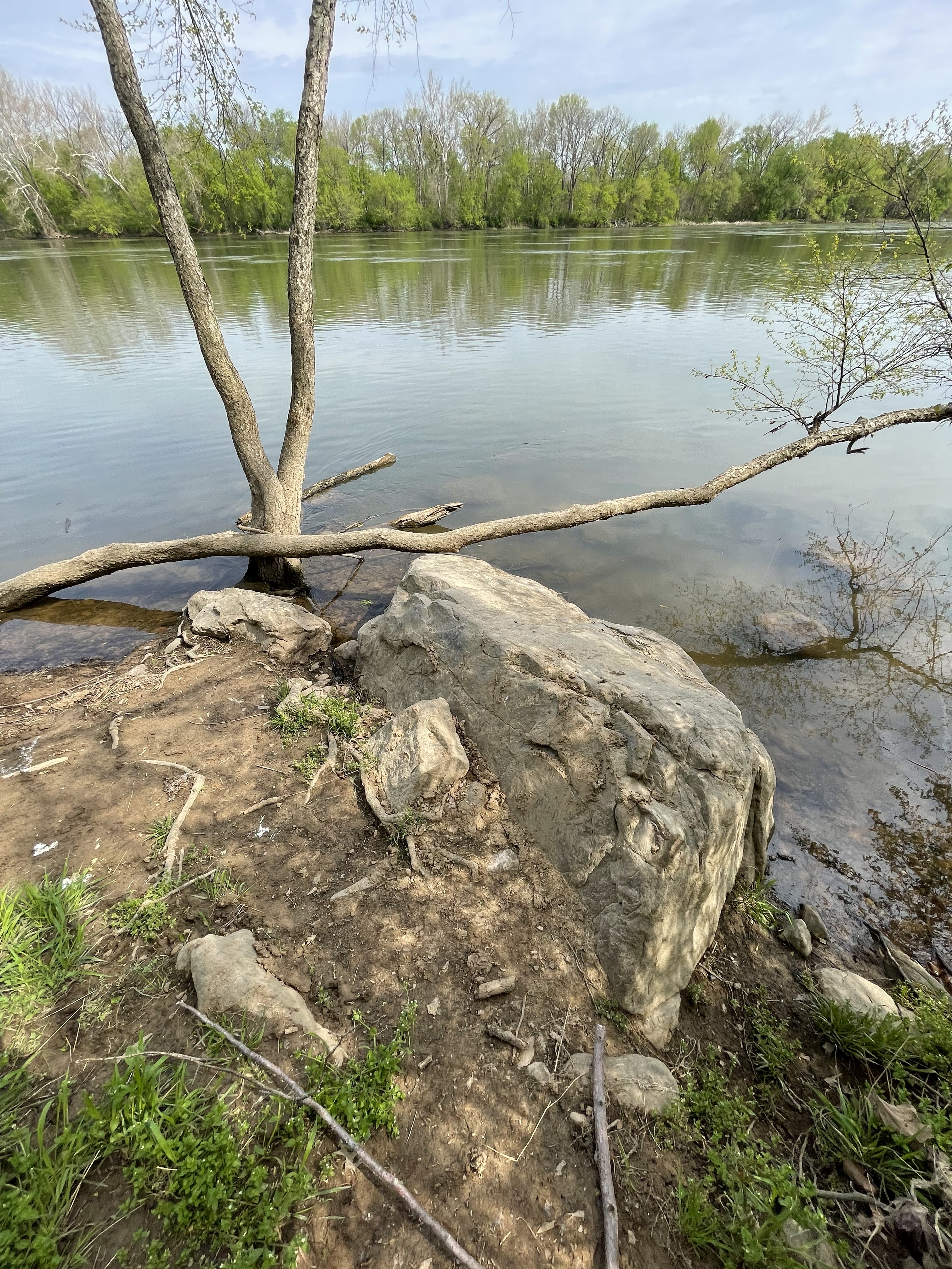
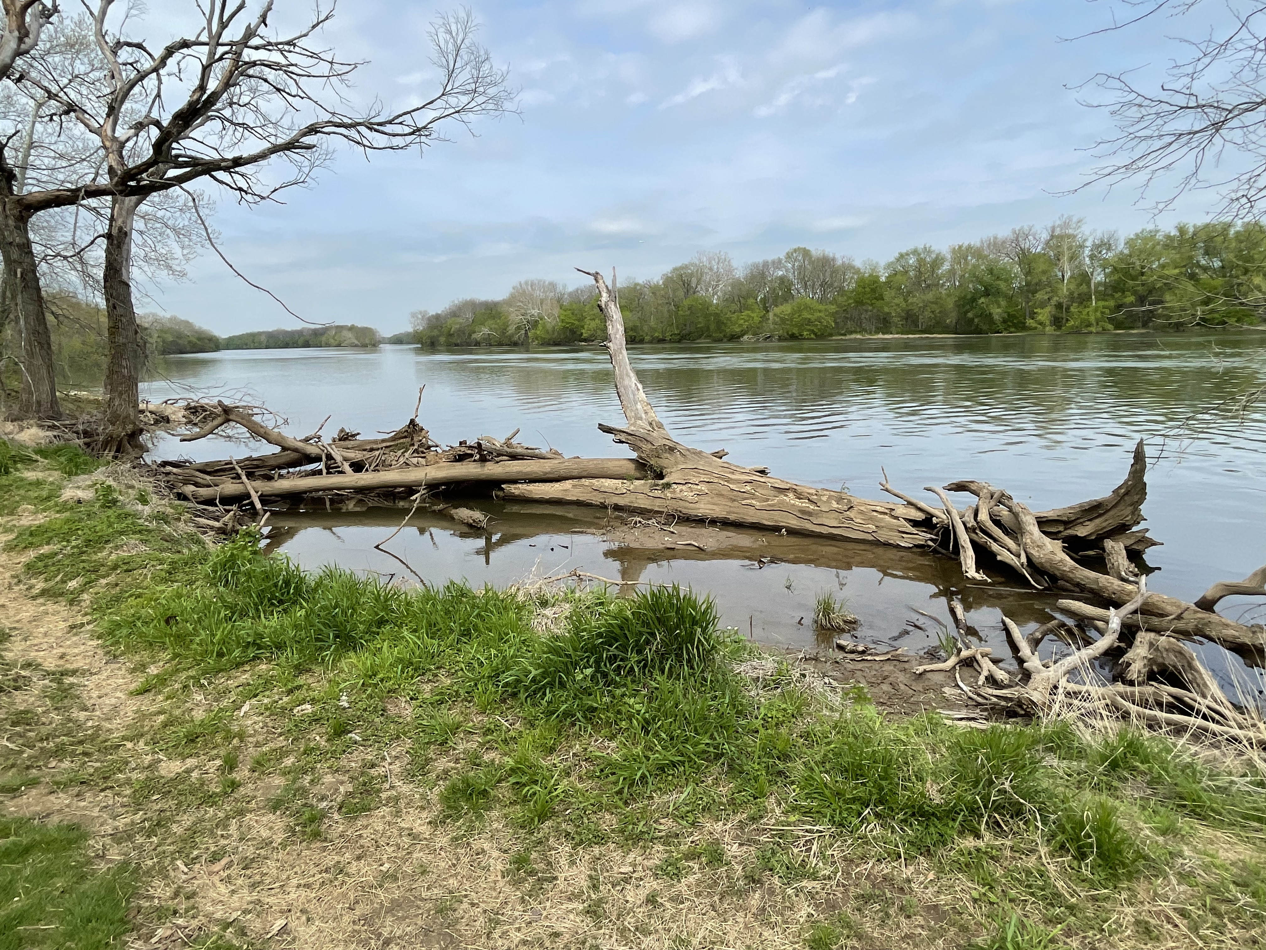
This post returns to the Potomac River. We have previously discussed several features along this stretch of the famous waterway: Precambrian metamorphic rocks at Great Falls; sediment contributed by tributaries as well as erosion; and emplacement of intrusive rocks during rifting of Pangea to form the Atlantic Ocean. This time we’ll see evidence of recent erosion, as evidenced in Fig. 1, which shows a large block of stone that has collapsed along the steeply eroded south bank. The bank consists of silt and clay just like further upstream.
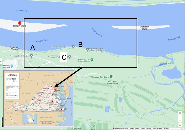
Site A (see Fig. 2) is where Fig. 1 was taken. The meandering stream to the east in Fig. 2 is Sugarland Run, which we examined further south, near its headwaters, in a previous post. The Rock-D geologic map suggests that the river is underlain by a Triassic (237-203 Ma) fining-upward sedimentary sequence consisting of sands to shales. A close-up image of the boulder at Site A (Fig. 3), despite a covering of mud and some biological material, reveals no apparent bedding. This is contrary to the description of the Balls Bluff (sedimentary) Member of the Bull Run Formation, contemporaneous with the Newark Supergroup although no longer considered stratigraphically equivalent.
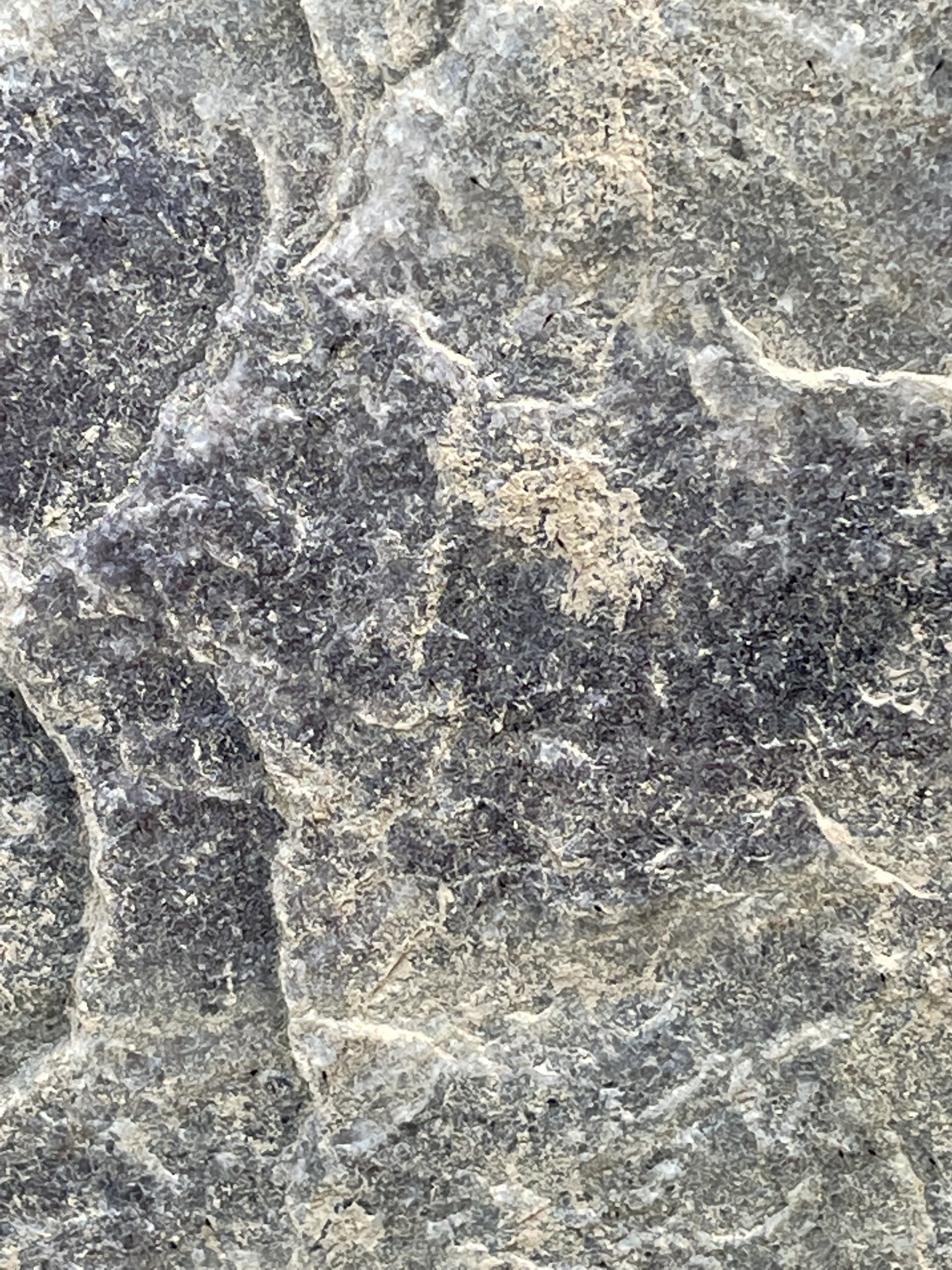
Figure 3 doesn’t look sedimentary to me, but more like the diabase we saw further upstream on Sugarland Run. The streak of white material in the upper-left corner looks like quartz. If these are Triassic sedimentary rocks, they wouldn’t have been metamorphosed, so this exposed block is anomalous. It is possible that this is an outlier of sedimentary rocks that were thermally altered when intrusive rocks were emplaced during Triassic. The area consists of faulted and folded diabase, sedimentary rocks, and metasediments–intruded, deposited or altered, respectively, during the breakup of Pangea during the Triassic period.
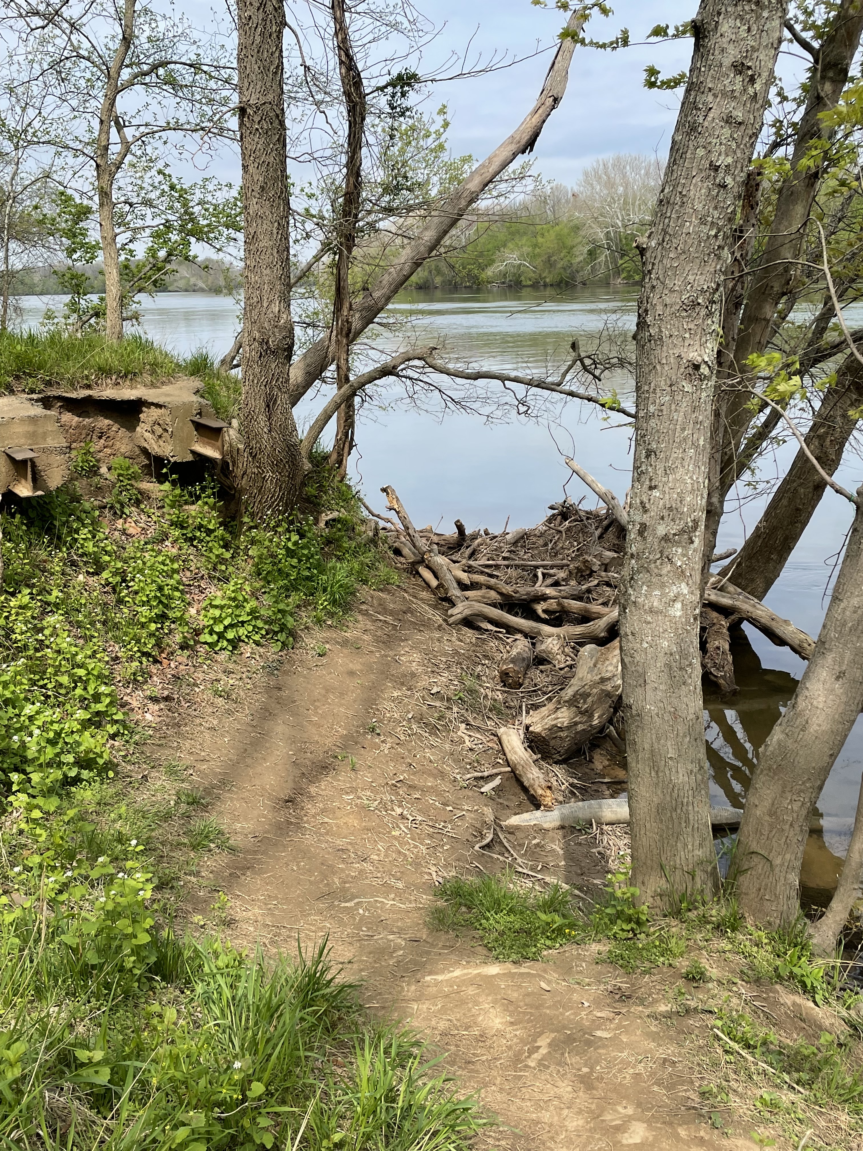
The bank is steeply eroded with trees collapsing into the river, indicating rapid lateral erosion during the lifetime of a typical tree (less than a century).

This section of the southern flank of the Potomac River is characterized by a wide floodplain covered with hummocks that represent bars on the original river bed. Superimposed on this older morphology is a natural levee (Fig. 7) that varies in height, steepness, and distance from the modern channel along the river. This landscape has been cut by numerous streams that drain the Pleistocene highlands overlooking the incised river.
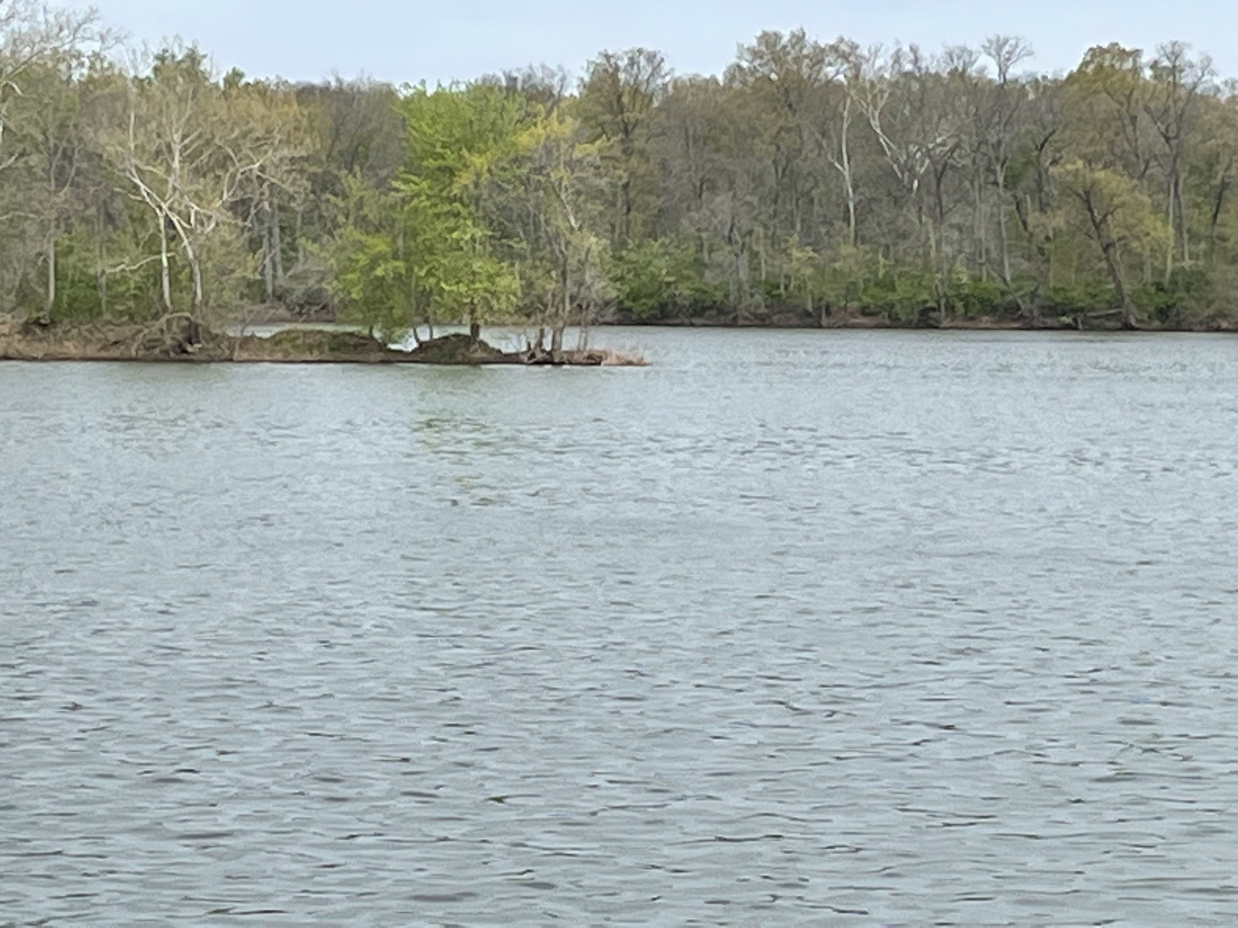
Substantial islands (Figs. 5 and 6)divide the Potomac river into two anastomosed channels (see Fig. 2) that have become unstable during the last ten thousand years, as demonstrated by rapid downcutting and lateral instability (Figs. 1 and 4).

Trackbacks / Pingbacks