
Survey of Coastal Geology of Point Loma, California
This report is from nine years ago, when I was in San Diego. I never got around to posting it on Rocks and (no) Roads, but I’m sharing it now because it dovetails nicely with the coastal geology of Washington.
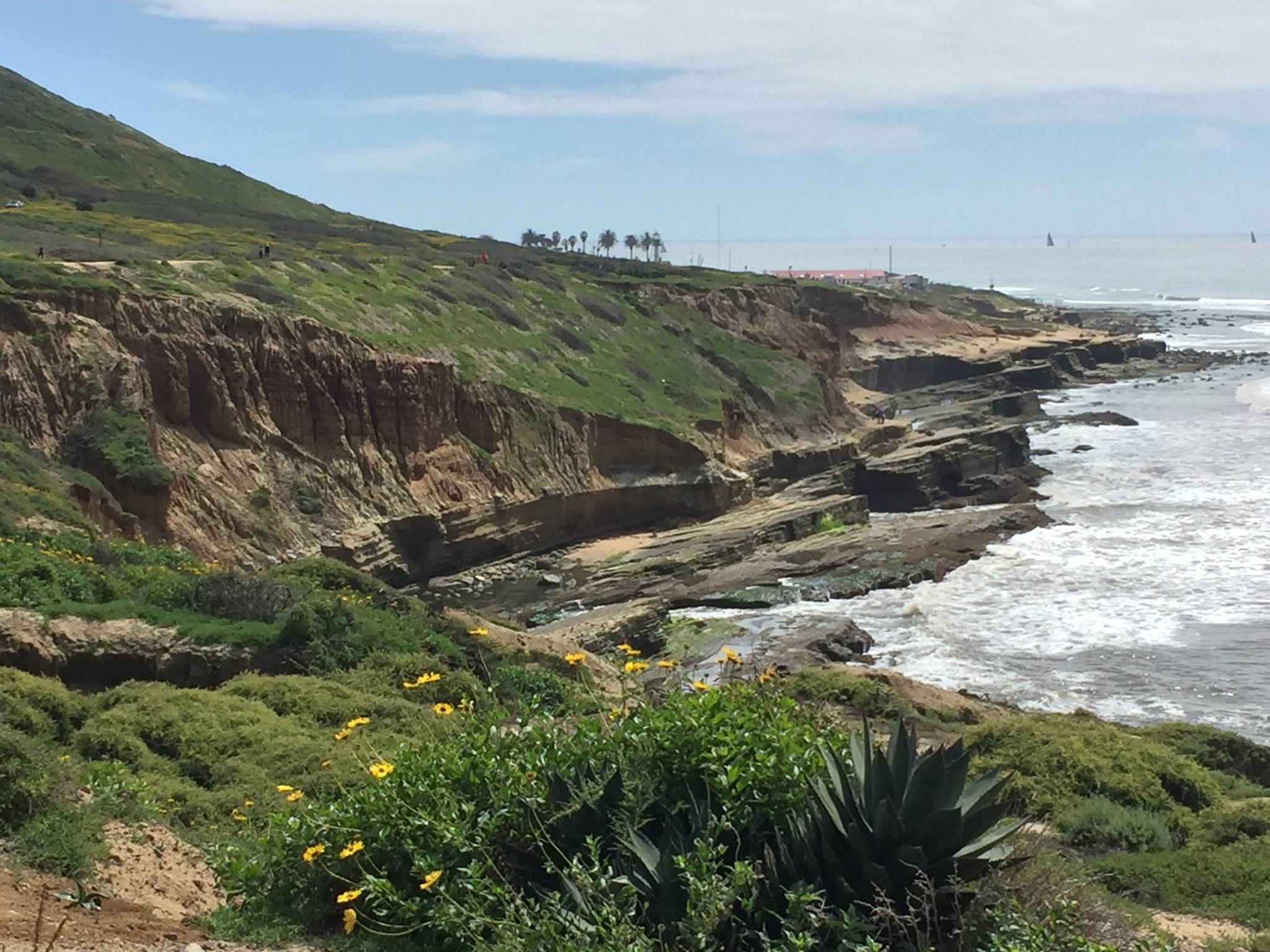
Figure 1. Point Loma is defined, stratigraphically, by: 1) Late Cretaceous (100-66 Ma) Point Loma and Cabrillo Formations (~600 feet thick), pale yellow sandstones with gray siltstone and conglomerate; and 2) Middle-Late Pleistocene (774-11.7 Ka) reddish siltstone, sandstone, and conglomerate. The older rocks are dipping about 10 degrees to the left (east); an angular unconformity separates them from much younger Pleistocene deposits, which are horizontal. This unconformity is about 60 feet above current sea level, but it is a moderately complex relationship.
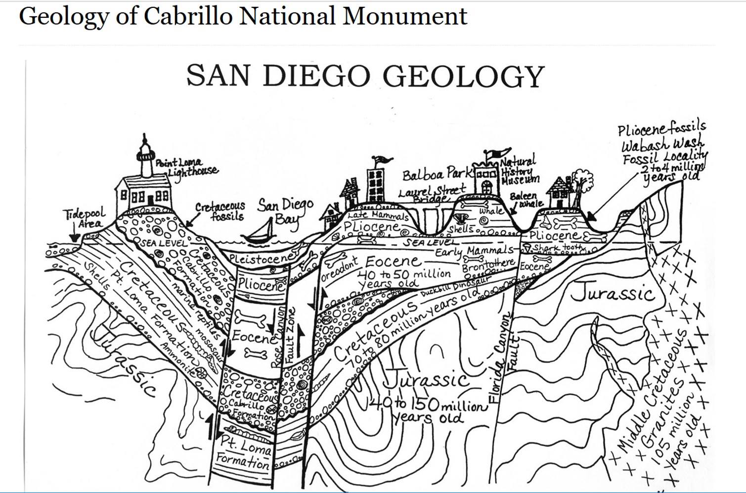
Figure 2. This idealized cross-section across Point Loma reveals complex, subsurface geology, including folds in the Jurassic rocks, which are unconformably overlain by the Cretaceous Pt. Loma and Cabrillo formations. Normal faults, indicated by arrows, have lowered younger rocks in a graben to form San Diego Bay, leaving Point Loma peninsula standing alone. Note that Pleistocene sediments are located along the seaward margin of the peninsula as well as at the tops of the ridges. This occurs because younger material was deposited on wave-cut benches that developed as sea level fluctuated, in addition to regional uplift rate of 4-8 inches/thousand years (0.1-0.2 mm/year).
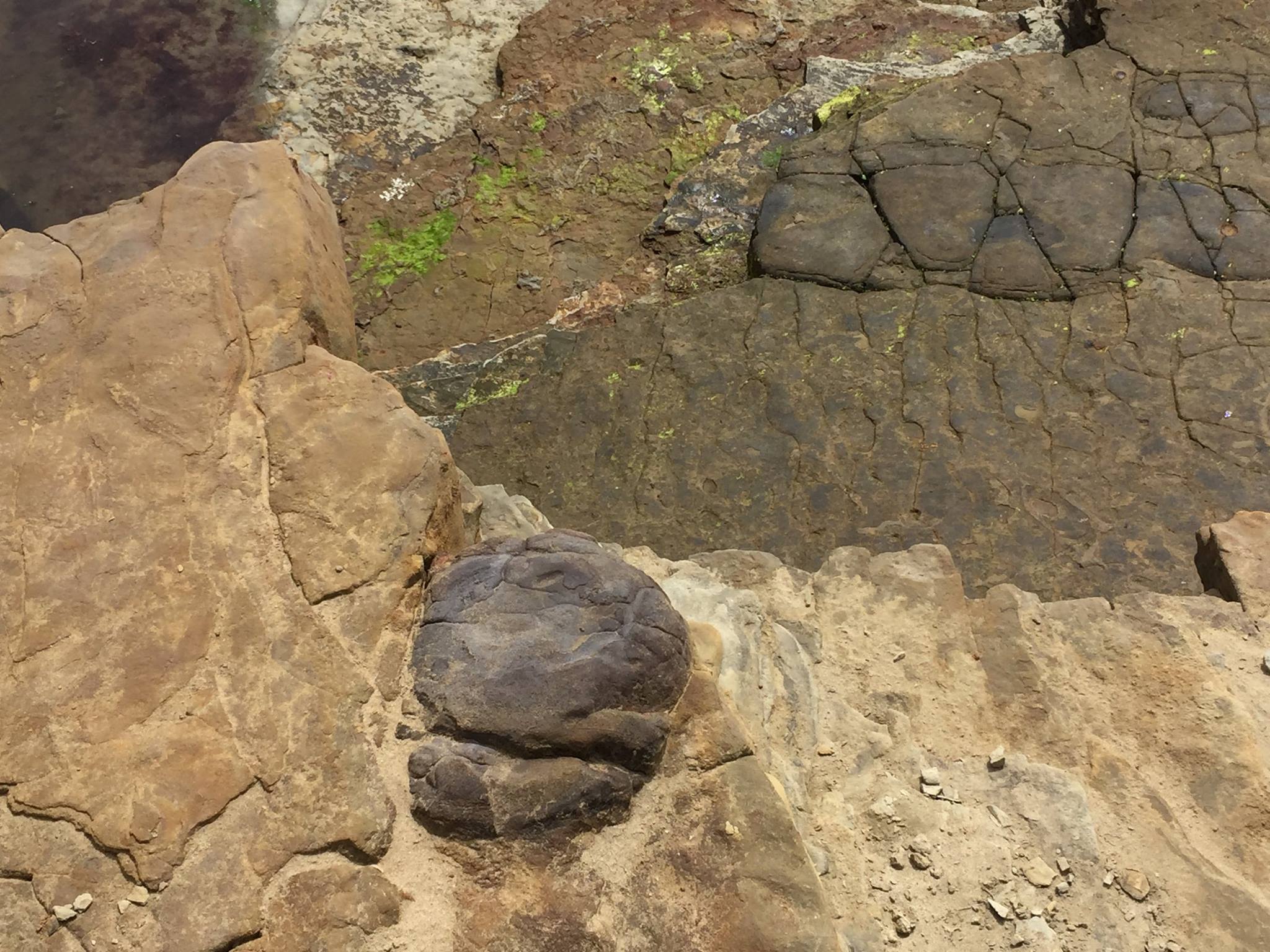
Figure 3. Bedding surface of Pt. Loma Formation sandstones near sea level. The dark boulders are part of the rock rather than lying on the surface. They have been interpreted as basalt flowing into the sea from a nearby volcanic vent. I observed large erosional remnants of lava flows in other parts of these rocks along the coast.
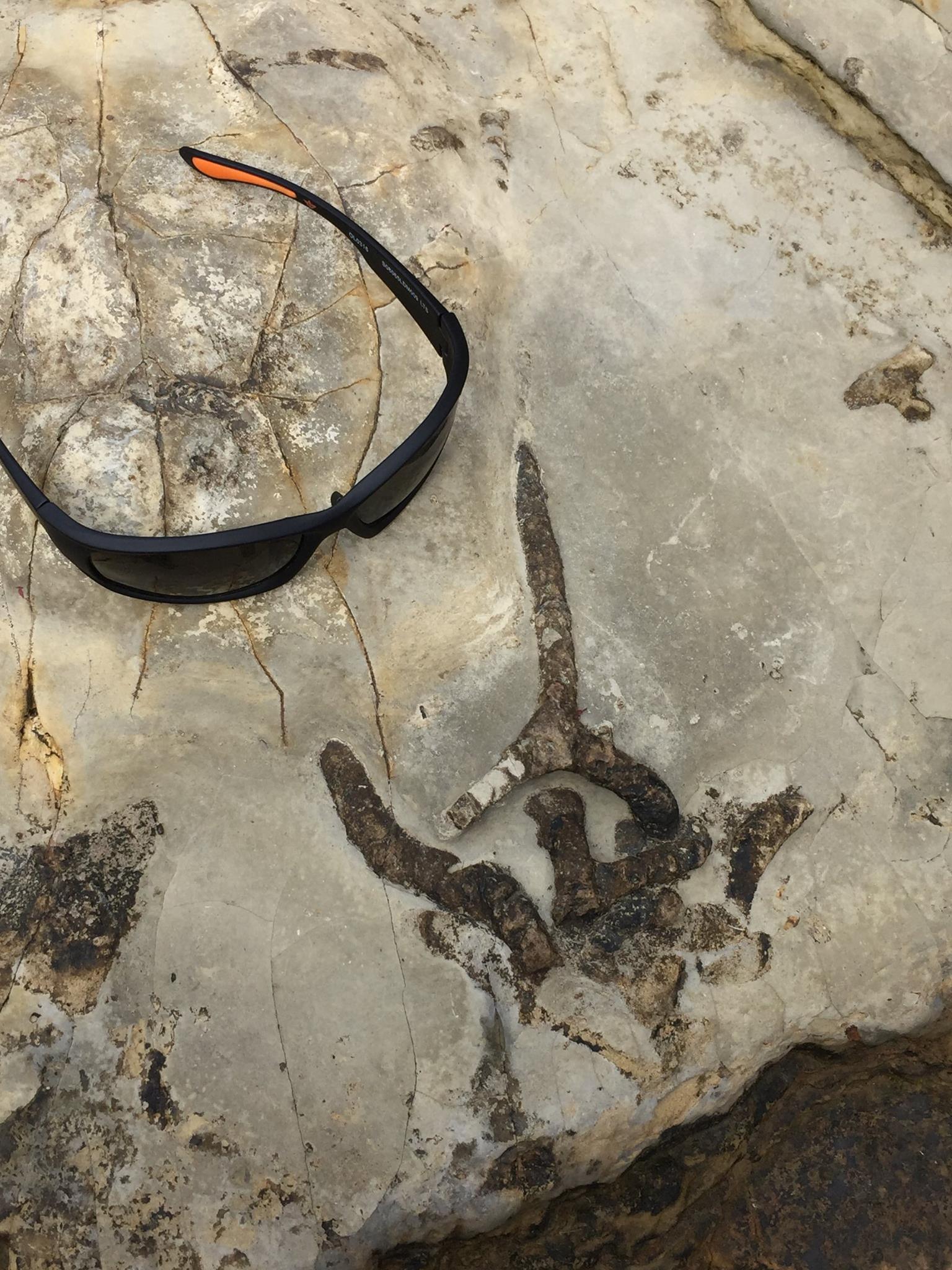
Figure 4. Trace fossils of worm burrows (e.g. Skolithos) on the bedding surface a few feet above sea level. They were very common and well preserved. They can’t be used to date the rocks but they are indicators of a low-energy environment, probably below fair-weather wave base or maybe within the swash zone. I saw no evidence of cross-bedding.
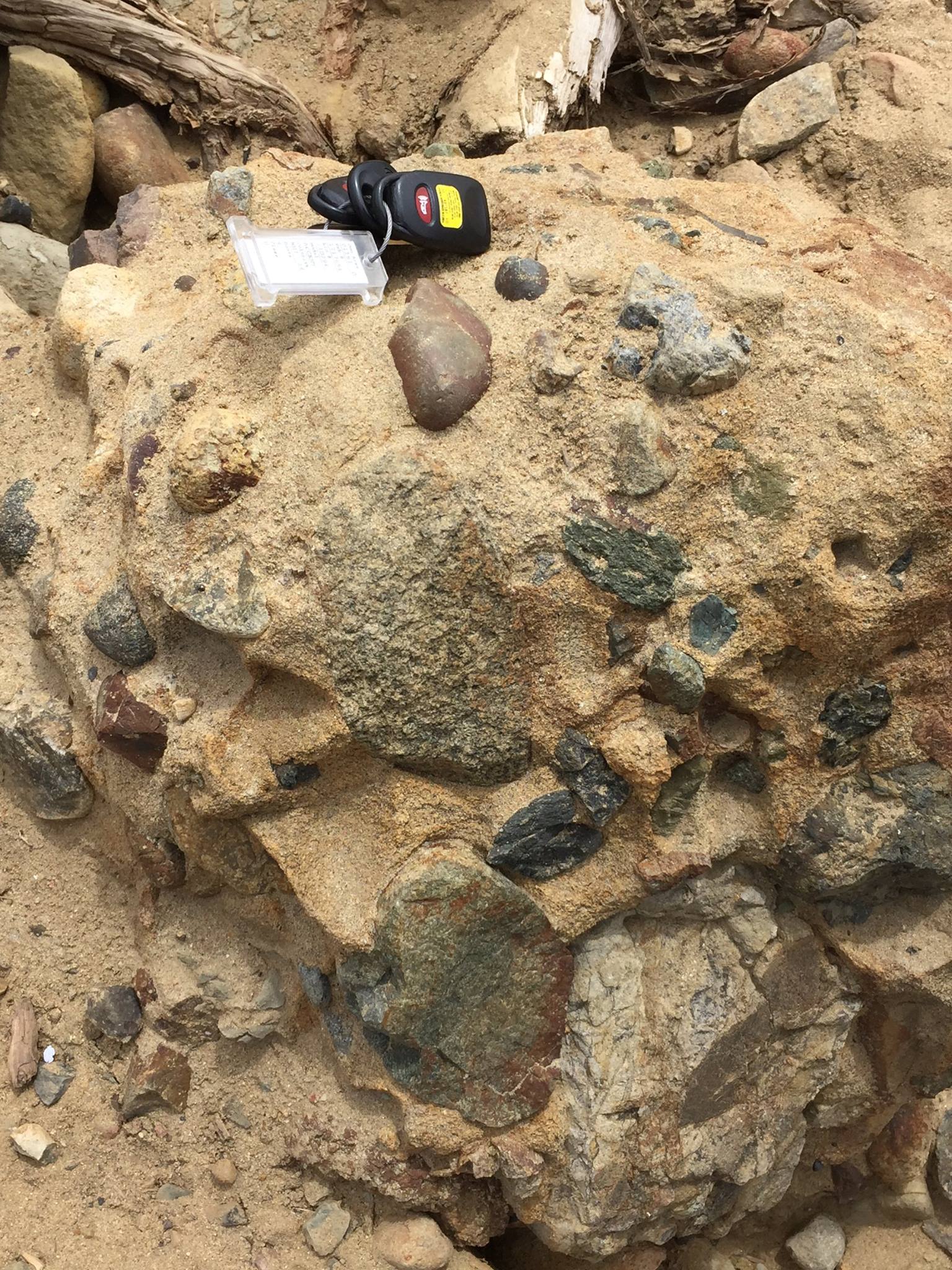
Figure 5. Photo of well-cemented conglomerate boulder lying loose near sea level. I don’t think this is Pleistocene because it is very well cemented (literally hard as a rock) rather than being friable, which is more common with younger rocks. Thus it is probably Cabrillo Formation. There were no worms burrowing on this beach! The clasts are not all rounded, but many are highly angular; thus, it might be classified as a breccia. This is a significant difference because conglomerates are deposited some distance from their source, after the rocks have been broken and rounded to a relatively uniform size. Breccias, however, collect near steep slopes and the rocks are irregular in shape and size; these rocks indicate a nearby highland. The clasts include, by my estimation: basalt; granitic intrusive rocks; metamorphic rocks; and of course a plethora of sand-sized quartz as the matrix.
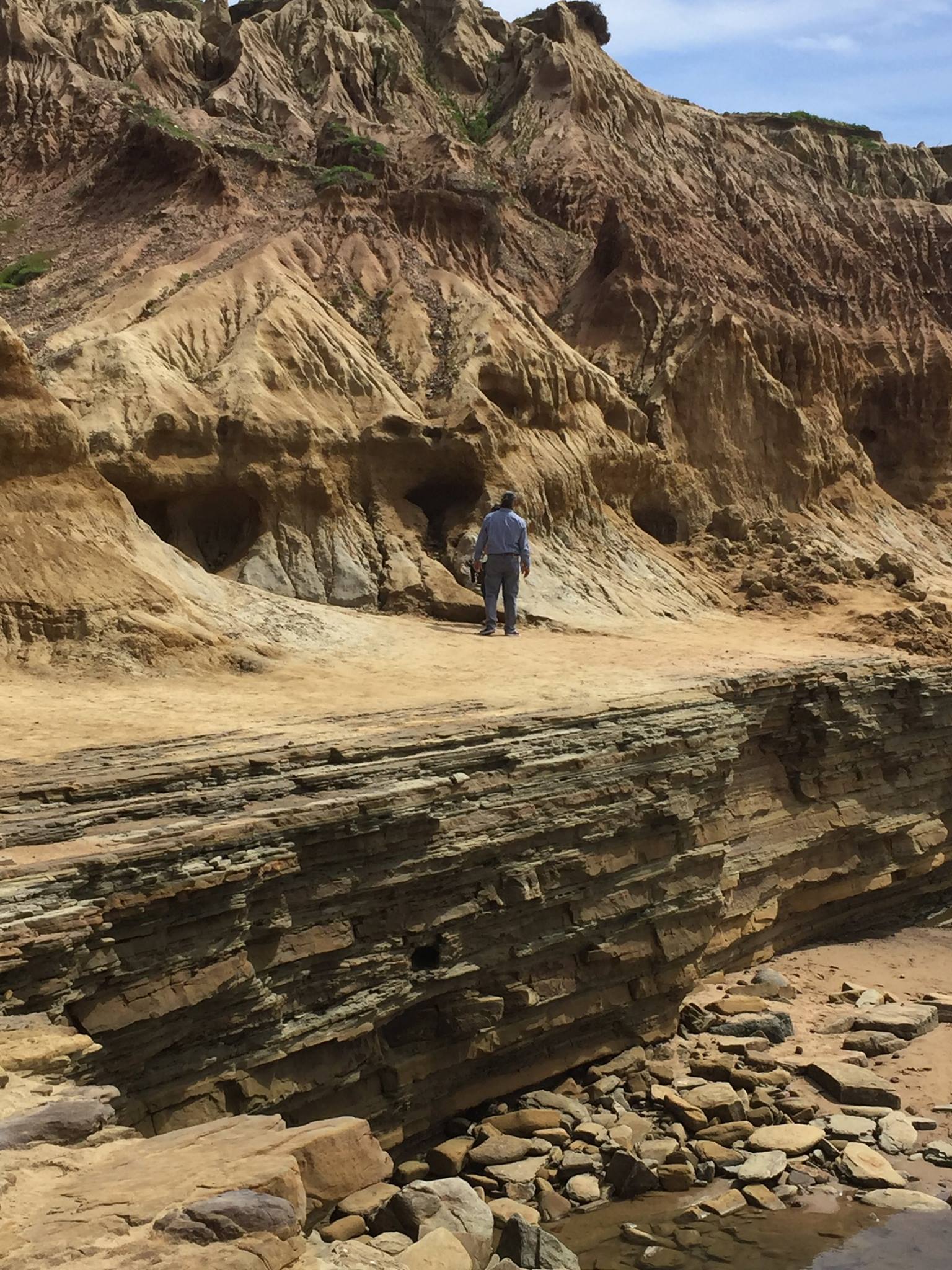
Figure 6. The man is standing on a wave-cut terrace about 20 feet above the high tide line. The angular unconformity is present at this location because Pleistocene sediment was deposited on this erosional surface, even though the older rocks are present at a higher elevation, as indicated in Fig. 2.
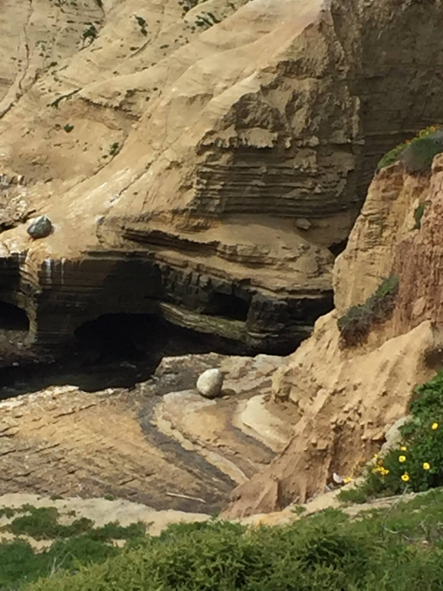
Figure 7. The sea cave was closed because of recent rockfalls from the cliff. Nevertheless this photo shows the change in bedding style, from massive in the lower (Pt. Loma Fm) rocks to thinner bedded in the Cabrillo sediments. The total thickness of these formations is approximately 200 m (~700 feet); using a bulk depositional rate guesstimate of 1 m/ thousand years, they could have been deposited in as little as 200 thousand years. My point is that, whatever time interval they represent, something was happening that supplied volcanic rocks and a variety of rock fragments that indicate unroofing of a batholith. That something involved tectonic uplift, which has decreased substantially in modern times.
Summary.
I wanted to revisit this field trip because the Cretaceous world in which the Pt. Loma and Cabrillo sandstones were deposited was similar to the Tertiary environment in which the rocks we saw at Kalaloch Beach were first laid down. In fact, the entire west coast of N. America has been part of a convergent plate boundary for more than 200 Ma, but subduction is not uniform in time or space.
Between 100 and 66 Ma, sandy sediment was being deposited on this coastline, culminating in tectonic uplift and volcanism. This was followed by sixty million years of erosion. That’s a long time. During this lengthy interval, subduction ended here when the oceanic spreading axis was subducted and a transform fault developed about 10 million years ago. The N. American and Pacific tectonic plates are now moving horizontally past each other, whereas the Cascadia subduction zone remains active.
There are no active volcanoes in Souther California because there is no subduction, but evidence for them is apparent. Ancient San Diego was very similar to modern Kalaloch Beach and other locations I will explore in the next few posts…

Recent Comments