
Mount Saint Helens Revisited: Ape Cave
We made it to our destination (Fig. 2) and explored a rare lava tube at Mount Saint Helens. This lava was erupted 1900 years ago as part of the same sequence that destroyed the forest a short distance away.
A full discussion of this fascinating natural feature is available from Washington Department of Natural Resources.
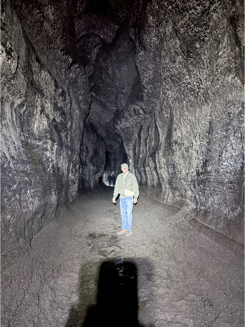
Figure 1. This lava tube is a lot larger than the tree casts we described in the last post. This immense cavern, which is more than 2.5 miles long, was created when a single basaltic lava finger flowed over the landscape. The outer material cooled in the air and insulated the interior, like an oven, allowing the remaining lava to exit the end of the tube. This left a void to be filled by subsequent lava flows. According to the information displayed at the site, the entire eruption lasted about 100 days.
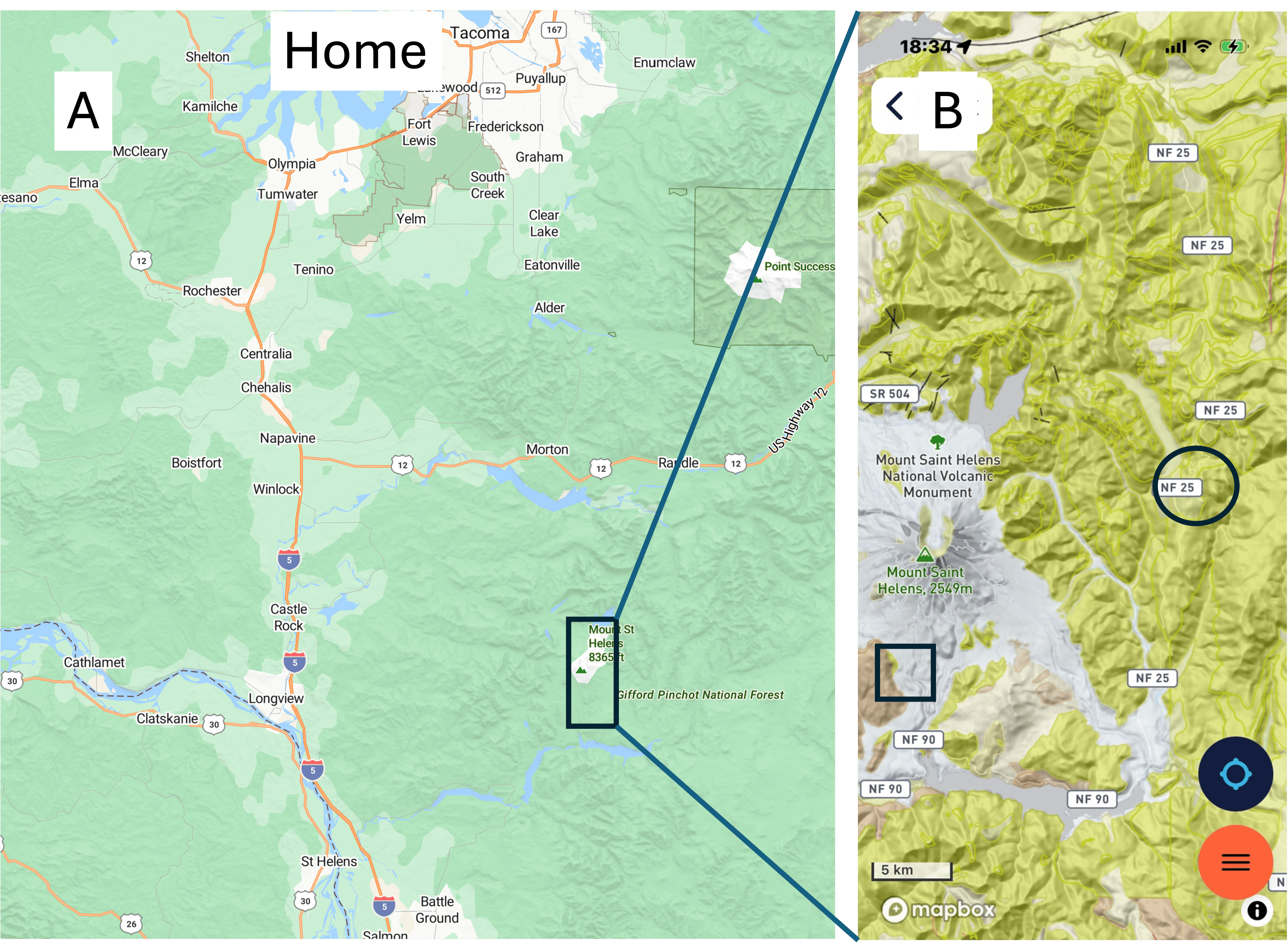
Figure 2. Ape Cave is presumably named after the first eruption sequence of Mount Saint Helens, dated about 40 Ka. I didn’t find an explanation for this confusion, but it might have something to do with the Bigfoot legend associated with Ape Canyon, not far away. At any rate, the lava tube is indicated by the square in (B).
This video captures the scale of one of the many chambers better than any image. My narration isn’t very technical.
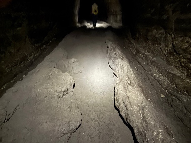
Figure 3. These parallel ridges running along the bottom of the cave near its terminus are the remnant of the last flow to use this conduit to reach open air.
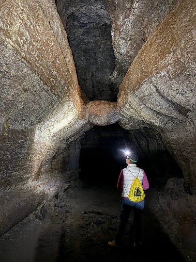
Figure 4. A block of basalt transported through this narrow passage became stuck where the walls of a previous flow almost meet, leaving it stranded. It looks like it partially melted into the walls, however.
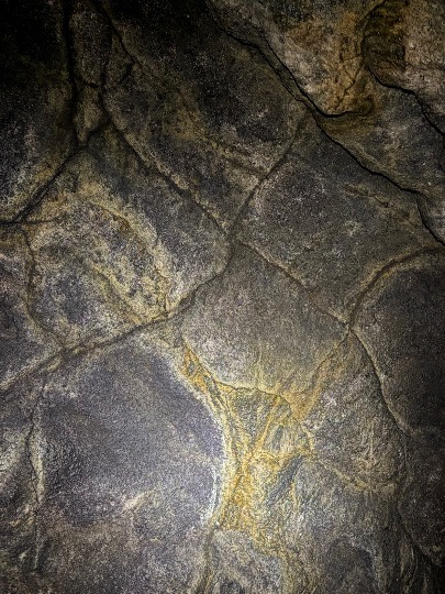
Figure 5. This view of the ceiling reveals a joint pattern caused by cooling of the outer layer of lava. Several generations of fractures occur throughout the cave, created as individual flows cooled differentially.
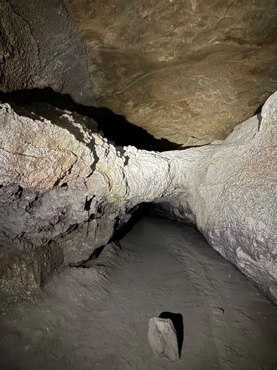
Figure 6. This is the end of the tube as it exists today. Apparently, there is no modern opening; it probably collapsed during the last 1900 years.
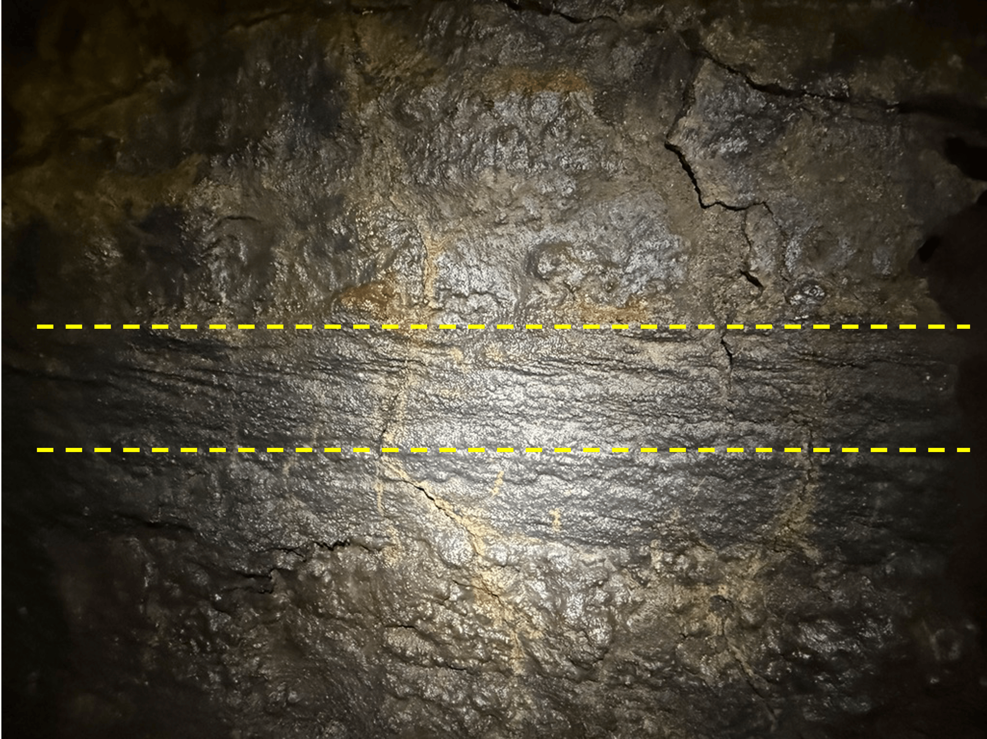
Figure 7. As a retired sedimentologist, I immediately noticed the layer outlined by the dash lines. This looks like cross-bedding; the layer fills a depression below the line, and is truncated by an overlying flow. This is interesting because cross-bedding is associated with particles being transported by wind or water; how it appears in a lava flow is an intriguing problem–perhaps heavy minerals like pyroxenes and lighter plagioclase feldspar?
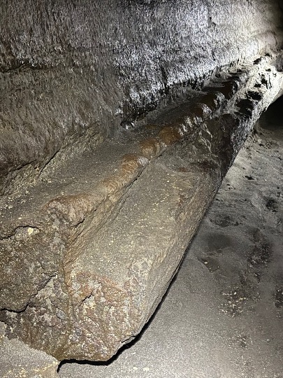
Figure 8. This is a good time to briefly explain how the ledges seen in Figs 1, 4, and 6, and the video, were formed.
Once the lava tube was created by cooling of the surface of the original flow, subsequent flows ran through, but didn’t fill, an insulated tube. Their surface was usually below the original ceiling. The coolest parts of this conduit would have been the sides (heat dissipates more quickly through older, cooler basalt than the superheated air above the lava river). Thus, ridges like these formed where the molten basalt hardened. Of course, these subsequent flows were of different volumes and the rules of stratigraphy cannot be applied. Geologists have worked out these relationships but that is beyond the scope of this report.
Let’s just say that many rivers of magma flowed through this channel, like stormwater through a sewer pipe–some larger than others.
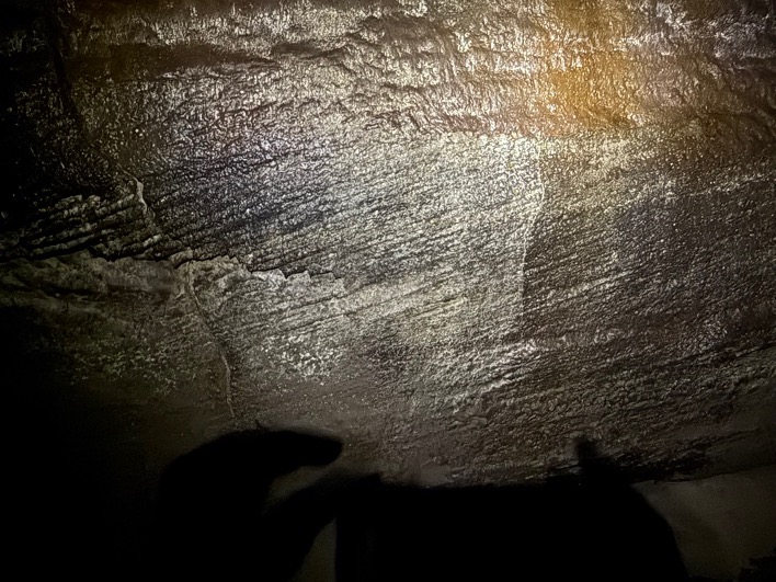
Figure 9. This is an enigmatic photograph because I don’t remember which wall it was on. I didn’t notice the detail when I took the photo, and now I can’t say if this is an excellent example of cross-bedding (always tilts downstream) as in Fig. 7. or a total mystery. My only excuse is that it was TOTALLY BLACK in the cave and I was disoriented the entire time.
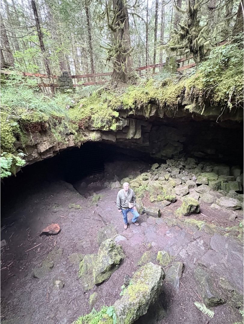
Figure 10. We made it out without spraining an ankle or hitting our heads. This cave-in is the only entrance/exit for the downstream part of the tube. There is another one 1.5 miles upstream, but that route is difficult (according to the park information).
Final Thoughts
The Ape Cave lava tube, and the missing forest from my previous post, are part of the Spirit Lake eruption phase of Mount Saint Helens, which began about 1900 years ago and continues to this day. The magma chamber didn’t erupt at the center of the stratovolcano, but instead found an opening along one of the many cracks in the thick pile of volcanic rock that had accumulated during at least 50 million years.
Lava tubes present a unique eruption environment. Ground water that finds its way into the magma chamber cannot escape, thus pressurizing the conduit and altering the lava’s behavior. Imagine lava as thin as water surging through this passage, sloshing around, encountering obstacles, rushing headlong downhill towards what apparently was a small opening, if Fig. 6 is any indication of the narrowing channel.
It was a great drive through a wild terrain to reach Mount Saint Helens, and the destination was worth the effort.
Mount Saint Helens Revisited: A Missing Forest
My last post reported on Miocene (23-5.3 Ma) volcanic rocks on the eastern flank of Mount Saint Helens. Those rocks predate the creation of Mt St Helens, however; we reached our destination and, before exploring a lava tube called Ape Cave, we examined some interesting geology that is part of the most recent eruptive stage of this active stratovolcano. The Spirit Lake stage began about 4500 years ago. There were three earlier stages, beginning about 40,000 years ago; each lasted less than 5000 years.
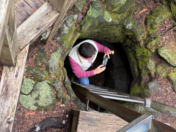
Figure 1. About 1900 years ago, a large amount of basalt lava flowed from a fissure on the south flank of the volcano (indicated by a square in the inset map of Fig. 2). The lava was hot (~1200 C or 2200 F) and set the forest on fire; when the wood had been turned to charcoal, the lava cooled to leave casts of the trees. My wife is taking a photo of a small-diameter tube we’ll examine it more closely below.
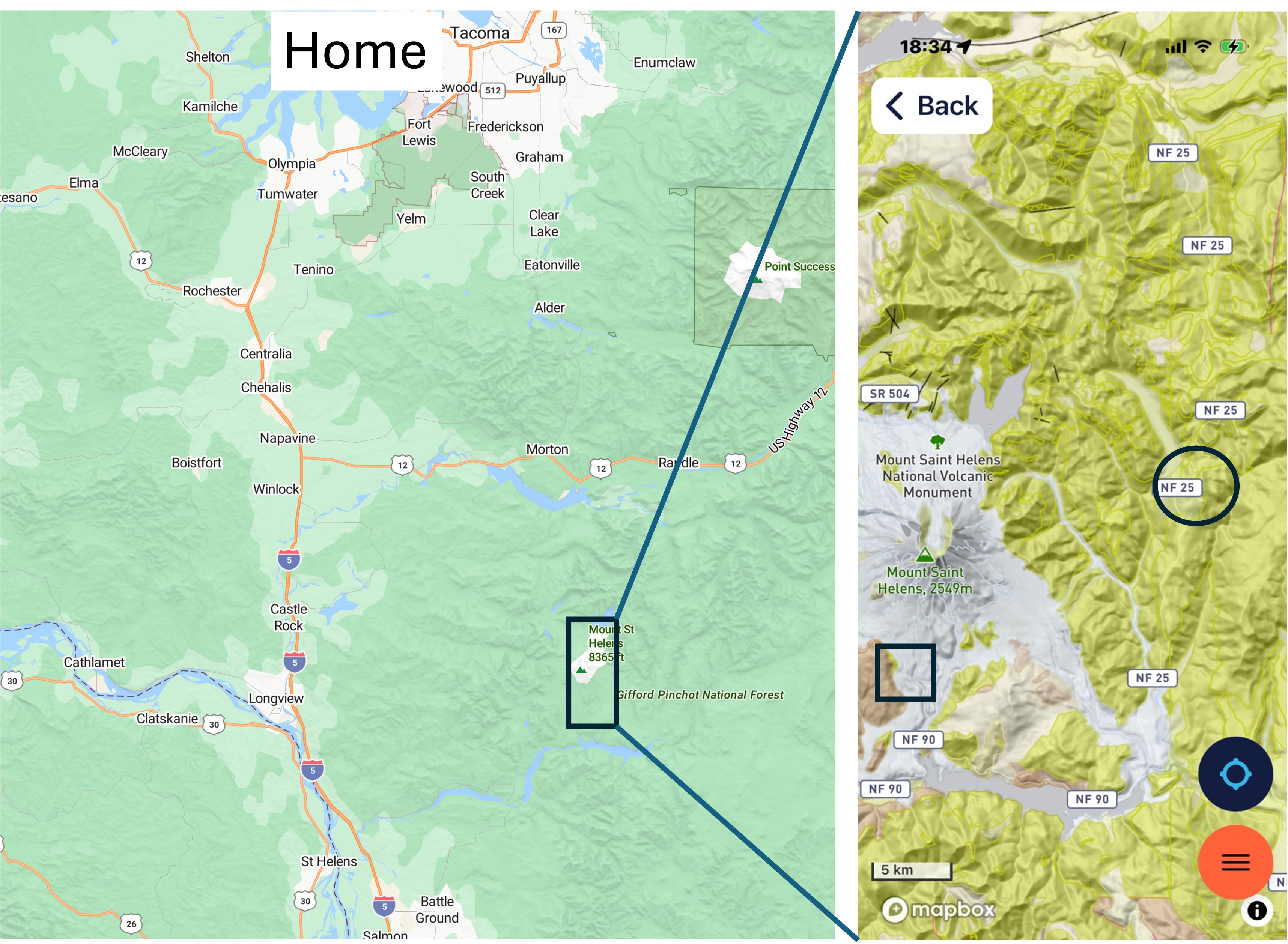
Figure 2. Mount Saint Helens is about 70 miles south of Tacoma (Home in the right map), but the route we followed, around the north and east flanks, takes 3.5 hours to drive. The yellow areas in the inset map are mostly andesite lava flows older than 5 Ma. The circle is where we looked at them in the last post.
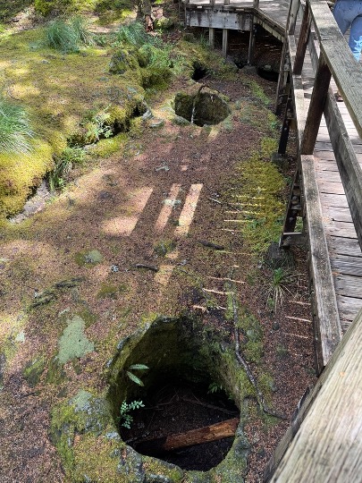
Figure 3. These holes were everywhere, forming a hazard for people walking, so a walkway was constructed over the area where the tree holes are densest. They haven’t been cleaned out and most are 3-4 feet deep.
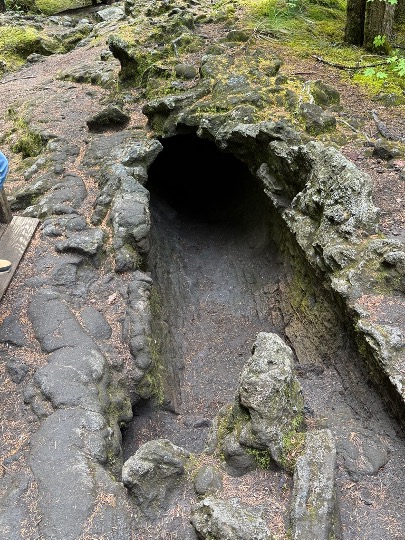
Figure 4. This is the cast of a fallen log. The entrance is shown in Fig. 1; visitors are encouraged to crawl through it, about 40 feet, but it was too tight for us. However, several children I met there had braved the dark, tight tunnel.
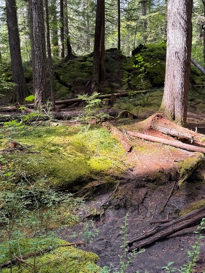
Figure 5. This photo was taken a couple-hundred yards from the missing forest. The background reveals the leading edge of a lava flow that’s about ten-feet high. The foreground shows a stream being incised into the landscape, probably created along a collapsed lava tube. Regrowth of the forest is slow in the lava surface; however, there was no mention of whether or not this area was logged in the last century–it probably was, given the documented greed of the forest industry when it came to cutting down trees. However, I didn’t see any large stumps, so maybe it wasn’t worth the effort.
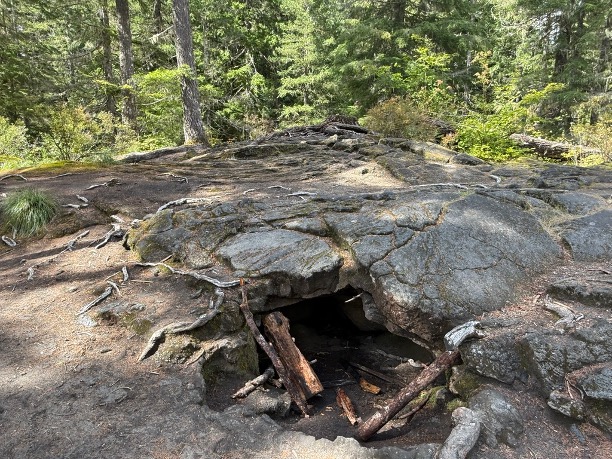
Figure 6. This is a mound of lava projecting up to 8 feet above the surrounding landscape. Several features are worth mentioning: 1) it is circular in plan and about 30 feet in diameter; 2) the upper-center of the image shows concentric bands of ropy lava known as pahoehoe, from its common occurrence in Hawaii; and 3) there is a small cave beneath it where lava ran out of the hardened surface. We’ll see a lot more of that in my next post.
Final Thoughts
Our journey along the backroads took us through a vast terrane of andesitic volcanism created more than five-million years ago. Then, about forty-thousand years ago, a new phase of volcanism began and Mount Saint Helens was created from this rugged ground.
Stratovolcanoes don’t just erupt at their summit, even though that is exactly what Mt St Helens did in 1980; more often they leak lava from the myriad faults and fissures surrounding them, especially in an active subduction zone where the earth’s crust is being compressed, twisted, and warped by tectonic forces.
Life is difficult in such an environment and we are fortunate to have a moment in time frozen for us to contemplate how immense the forces are that constantly reform the surface. Eruptions like the one that destroyed this forest are unlikely to kill many people, but they are crucial in reforming the environment. A new forest grows, possibly inhabited by different species of fauna and flora, and life goes on.
My next post will examine this same eruption event, but at a scale that dwarfs what we saw today.
Mount St. Helens Revisited: Miocene Volcanic Rocks
I couldn’t stay away from this fascinating active volcano. I reported on the recovery of the north flank, after the 1980 eruption, in a previous post. Today I visited the eastern and southern flanks, which were spared the devastation of an enormous explosion.
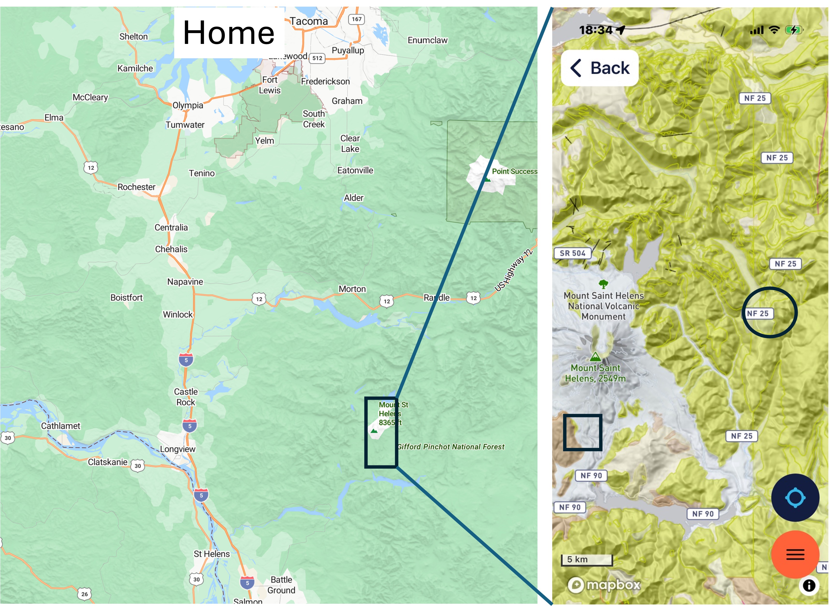
Figure 1. Mount Saint Helens National Volcanic Monument is about three-hours from Tacoma (Home in the left plate). We took back roads and circumnavigated the volcano today, following NF 25 (seen in the right plate), which took us through a volcanic terrain constructed during the last 23 million years. The circled area is the focus of this post. The rock types vary widely, but they are predominantly andesitic flows, ash layers, and breccias. The usual mixed bag of volcaniclastic rocks we expect in a subduction zone plate margin.
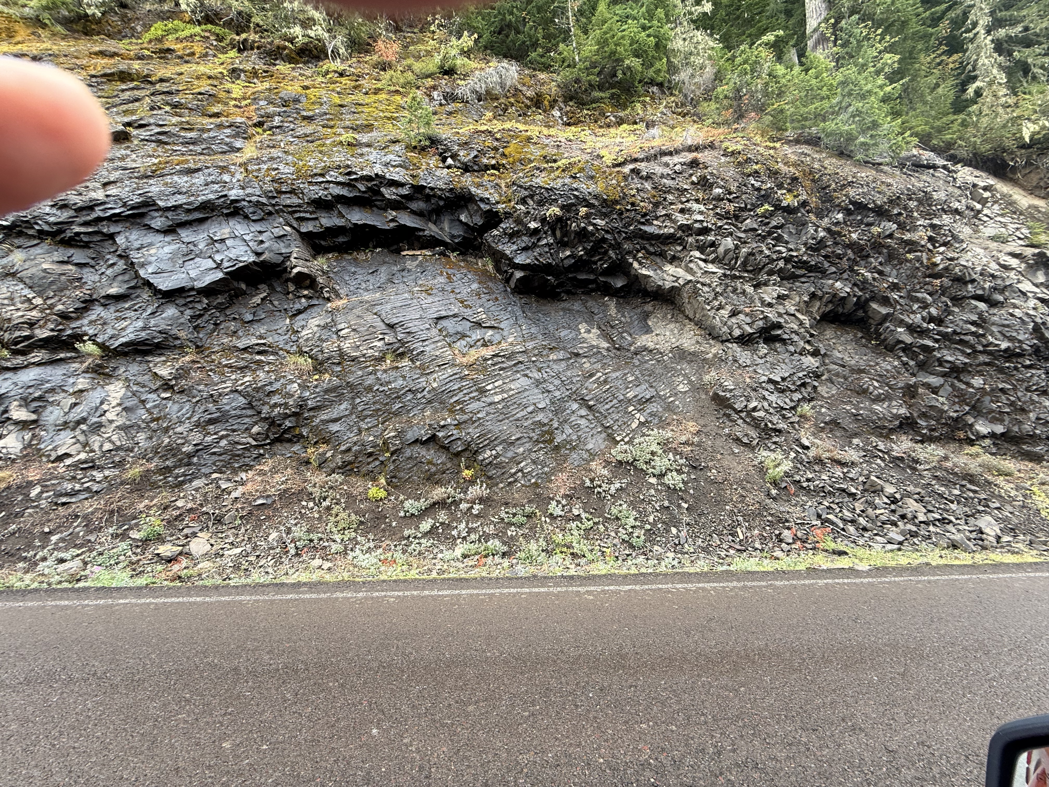
Figure 2. This photo reveals a series of thin beds that suddenly dip towards the road. They are highly fractured to the right of the image. Obviously, these were not recently erupted; they have been deformed in the last twenty-million years.
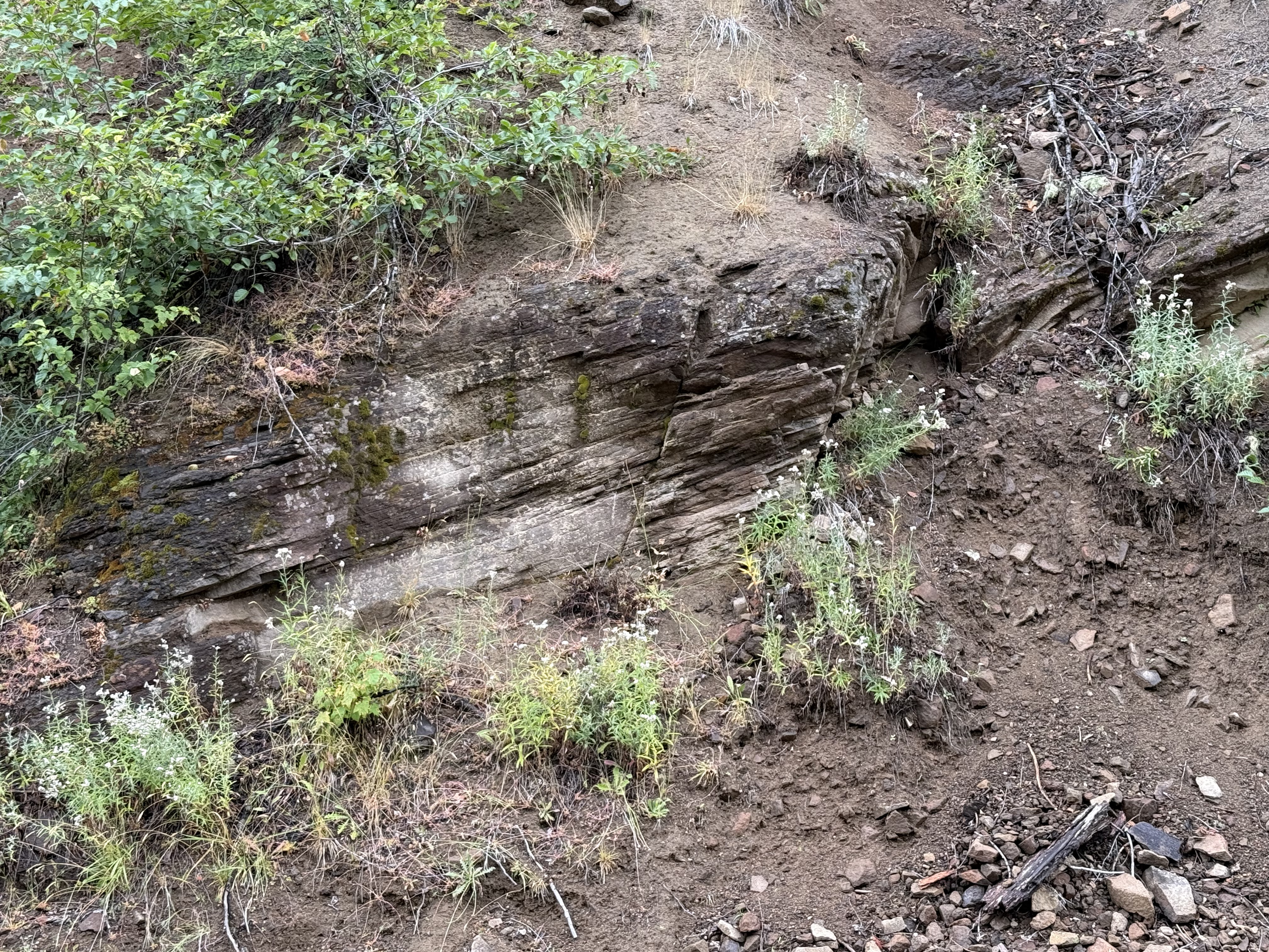
Figure 3. This image shows layers of volcanic ash that are weathering to reveal how thin the laminae are.
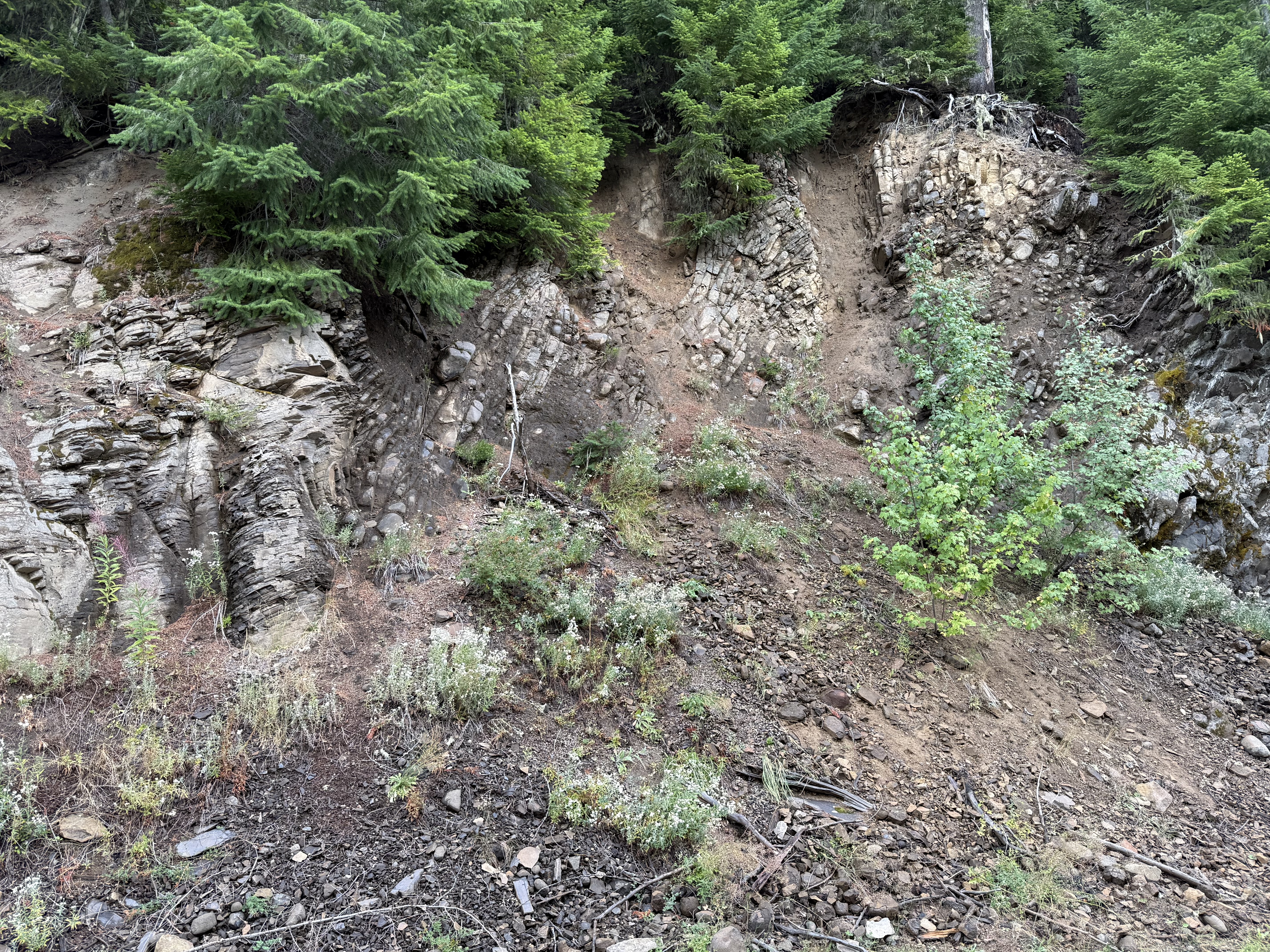
Figure 4. This photo dramatically reveals how much can happen in 10-20 my (million years). It was taken a few hundred yards from the previous photo. To the left are layers of ash that dip away from the camera–juxtaposed with steeply dipping layers that curve to the right and become almost horizontal (in the plane of the image) in the upper-right image quadrant.
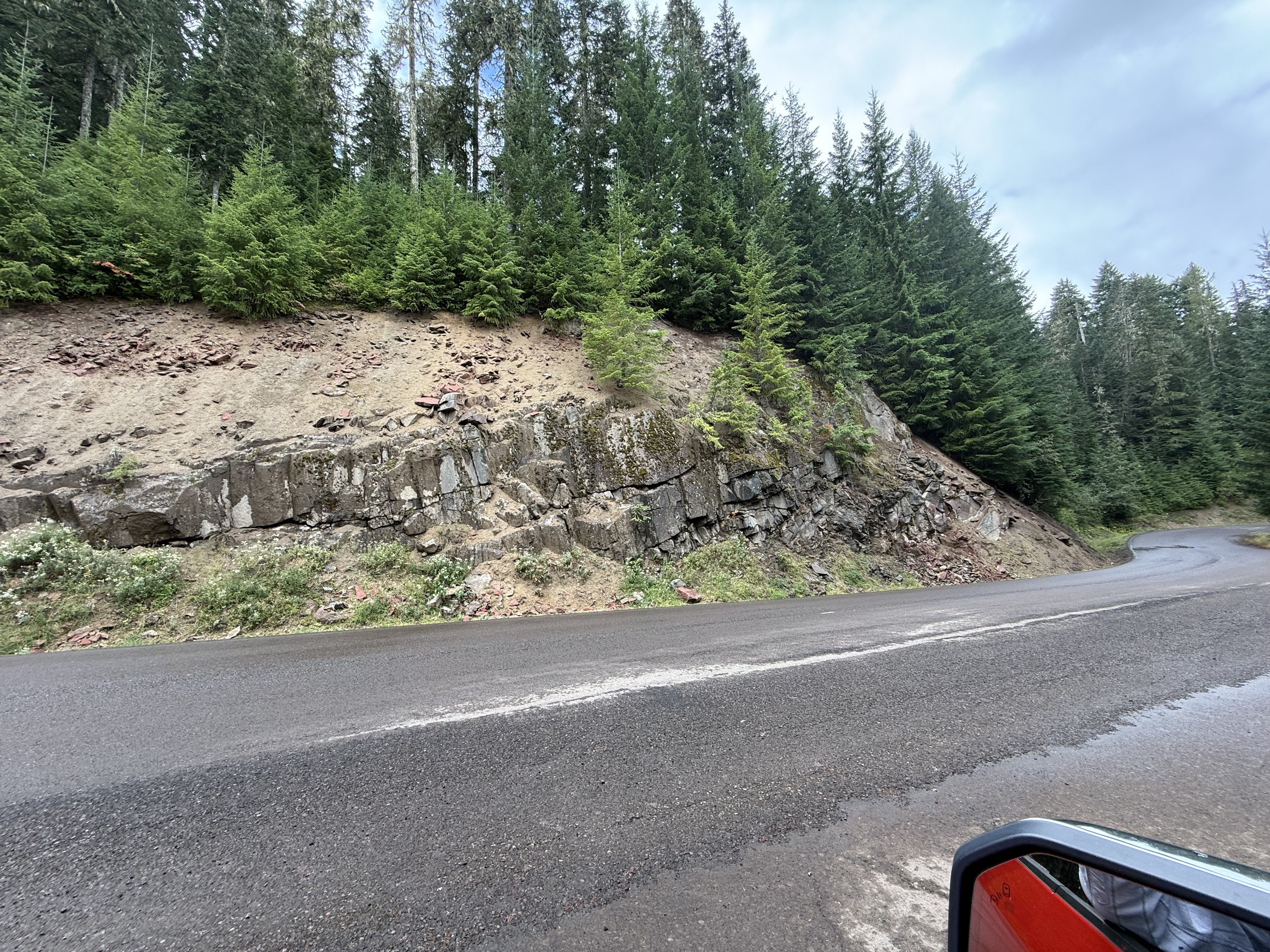
Figure 5. This image, taken less than a mile from Fig. 4, reveals thick layers of ash and flows. I didn’t examine them closely, but the middle-right of the photo shows a substantial change in bedding.
Final Thoughts
Mount Saint Helens is part of the Cascades range, an elongate series of volcanoes that have been active for the last 60 my because oceanic crust is being subducted beneath the North American tectonic plate. The rocks we saw today are from an earlier phase of volcanism; they were buried to depths of several miles, deep enough to become cemented, but not deep enough to become ductile. Thus, they failed in brittle fracture as they were compressed by the huge pile of volcaniclastic rocks created along the ocean margin.
What comes up must go down. This simple phrase means that the earth’s upper mantle (including the subducting ocean plate) melted and produced a lot of magma, which rose because of its lower density and high pressure, filling every fracture, expanding them into magma chambers. The mantle collapsed because of these voids and the weight of the recently extruded magma. A balloon being repeatedly inflated and deflated.
Meantime, the compression was inexorable. The recently buried volcanic rocks broke along faults, creating the juxtaposition of volcaniclastic material we see in Fig. 4.
These aren’t geologically old rocks. This is a continuous process that we are able to witness in real time throughout the world.
We’ll see this continuous process in closer detail with my next post.


Recent Comments