
Mount St Helens After Forty-Five Years
Introduction
I was a geology student at Arizona State University in May, 1980, when Mount St. Helens made the headlines. It is the largest volcanic eruption in North America, and when one-cubic-mile of mountain collapsed, it became, and remains, the largest landslide in human history. I followed the progress of geological investigation into the eruption with interest as I pursued my education, but progress was slow. It isn’t easy to reconstruct an event that occurred in a few minutes. The area was too dangerous to approach for more than a year because of gas explosions from within the pile of debris, which reached 600 feet in thickness.
Mount St. Helens faded from memory for decades, eventually becoming just another geologic event in a long chain of cataclysms covering billions of years. I never thought about it until I found myself living less than 100 miles from ground zero. I had to check it out. This post is a brief summary of what I found when I visited Mount St. Helens National Volcanic Monument. I hope I can convey some of the excitement I felt at stepping on ground that was literally on fire less than fifty years ago.
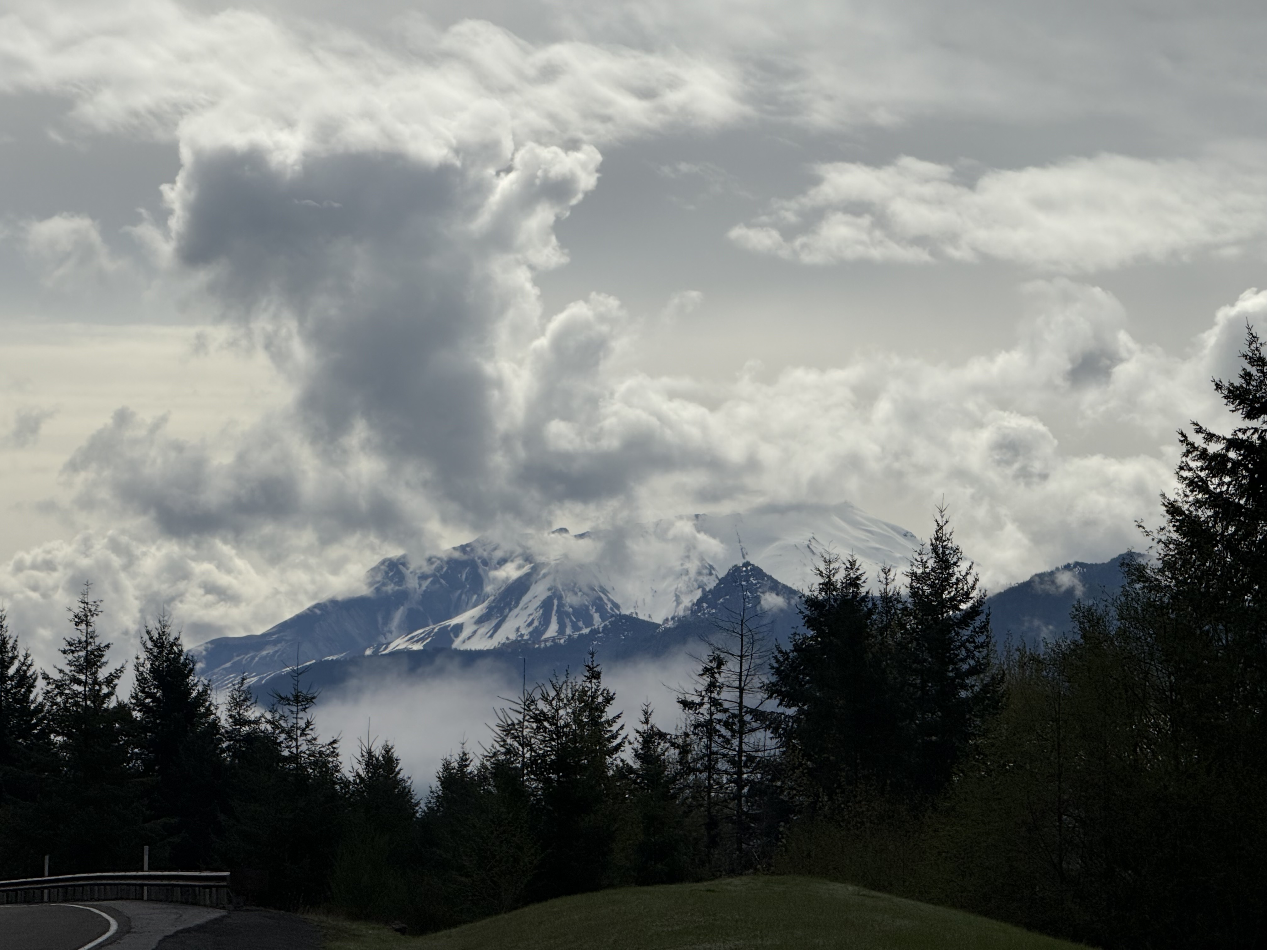
Figure 1. I arrived at about 10:30 in the morning and got this image before low clouds settled in, accompanied by fog later in the day. The characteristic volcanic cone is missing; the top of the mountain slants slightly upward to the right in the center of this image. That isn’t a lake in front of St. Helens, just fog collecting in the valley that feeds the Toutle River.
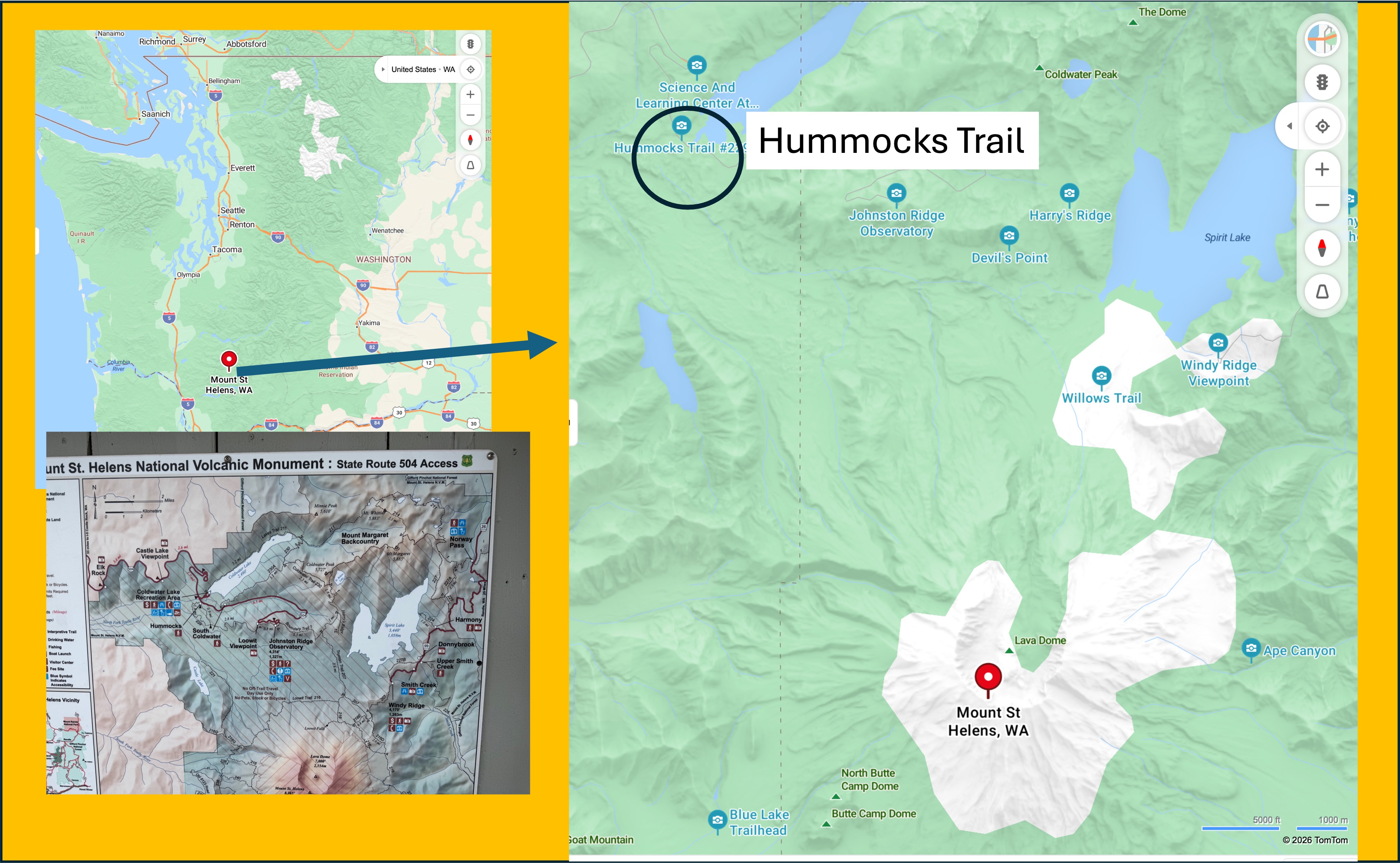
Figure 2. Mount St. Helens is about 2.5 hours from Tacoma. The closest you can drive is Hummocks Trail, but a four-mile hike will take you to the rim of the caldera. Maybe another time.
Older Volcaniclastic Rocks
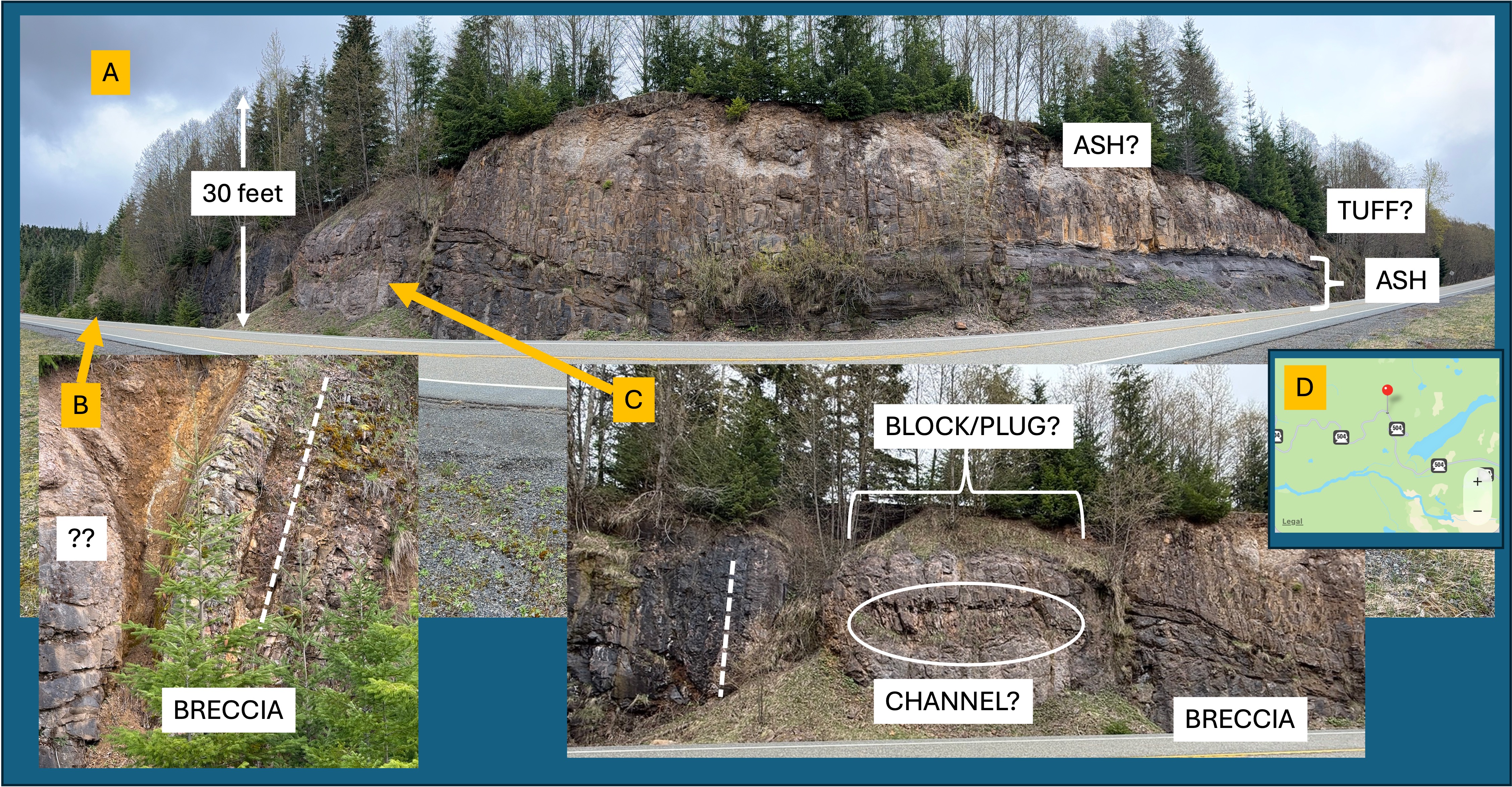
Figure 3. Mount St. Helens is less than forty-thousand years old, but it is constructed on a thick sequence (~2 miles thick) of volcanic rocks as old as 300-thousand years. Beneath these Pleistocene volcaniclastic rocks mixed rocks of uncertain age that comprise “bed rock” in this area; however, these igneous and sedimentary rocks are much older–spanning the Oligocene epoch (~34-23 Ma). I stopped to look at several road cuts along the new Highway 504 (the original is buried under debris).
A. Exposure of andesite volcanic rocks showing a complex eruption history, which includes ash layers and what looks like tuff (ash so hot it melted together to form a glass-like volcanic rock).
B. Close-up from the left side of (A) showing a layer of volcanic breccia that is now vertical. Individual clasts are visible but there is very little matrix. The dashed line indicates the approximate bedding plane of the layer. The rounded block labeled with ?? is about 12 feet in diameter. This is a puzzling structure. My guess is that there was a collapse of one or more volcaniclastic layers into a ravine after deposition. A jumble of material.
C. Photo of a complicated structure separating the left side of the exposure (tilted beds and blocks) from the right side (horizontal ash layers). The dash line is meant as a reference to the vertical beds in (B), but it was difficult to determine orientation. However, a clear change in texture suggests a depression, which may have been a conduit for volcanic material to erupt. The BLOCK/PLUG label reflects this interpretation. Within this “BLOCK” there is a discrete region of thin, irregular bedding that I’ve labeled (for convenience) as a CHANNEL? The question mark reflects my doubts about this identifier. Nevertheless, this road cut exposes a sequence of events: lava and ash being erupted onto an irregular volcanic landscape; probable surface erosion for some period of time; physical disruption and collapse, probably while still hot, of some part of later volcanic material. I don’t have enough experience with volcaniclastic sediments to say anymore than that.
D. The pushpin shows the location of this road cut. The blue ribbon is Coldwater Lake, where Hummocks Trail is located (see Fig. 2); this exposure is more than ten miles from the caldera, and hundreds of feet above the valley floor.
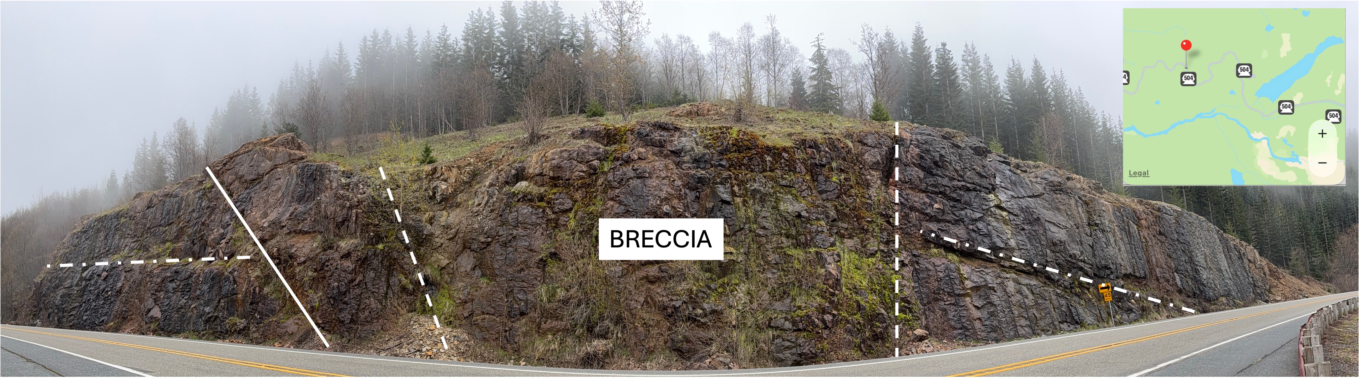
Figure 4. This post-eruption road cut is a mile or more further from the caldera. The solid line was a striking lineation that could be a fracture or possibly a contact between eruption beds. The dash-dot lines are apparent bedding planes between andesite flows. There is no ash present at this location. The dash lines delineate what I’m calling a BRECCIA because there is no evidence of bedding and the overall appearance is irregular; also, some large blocks were evident, although they could be a result of differential weathering. Lava flows are notoriously difficult to trace any distance laterally. Nevertheless, this exposure is similar in appearance to Fig. 3 with respect to the discontinuity between identifiable volcaniclastic deposits.
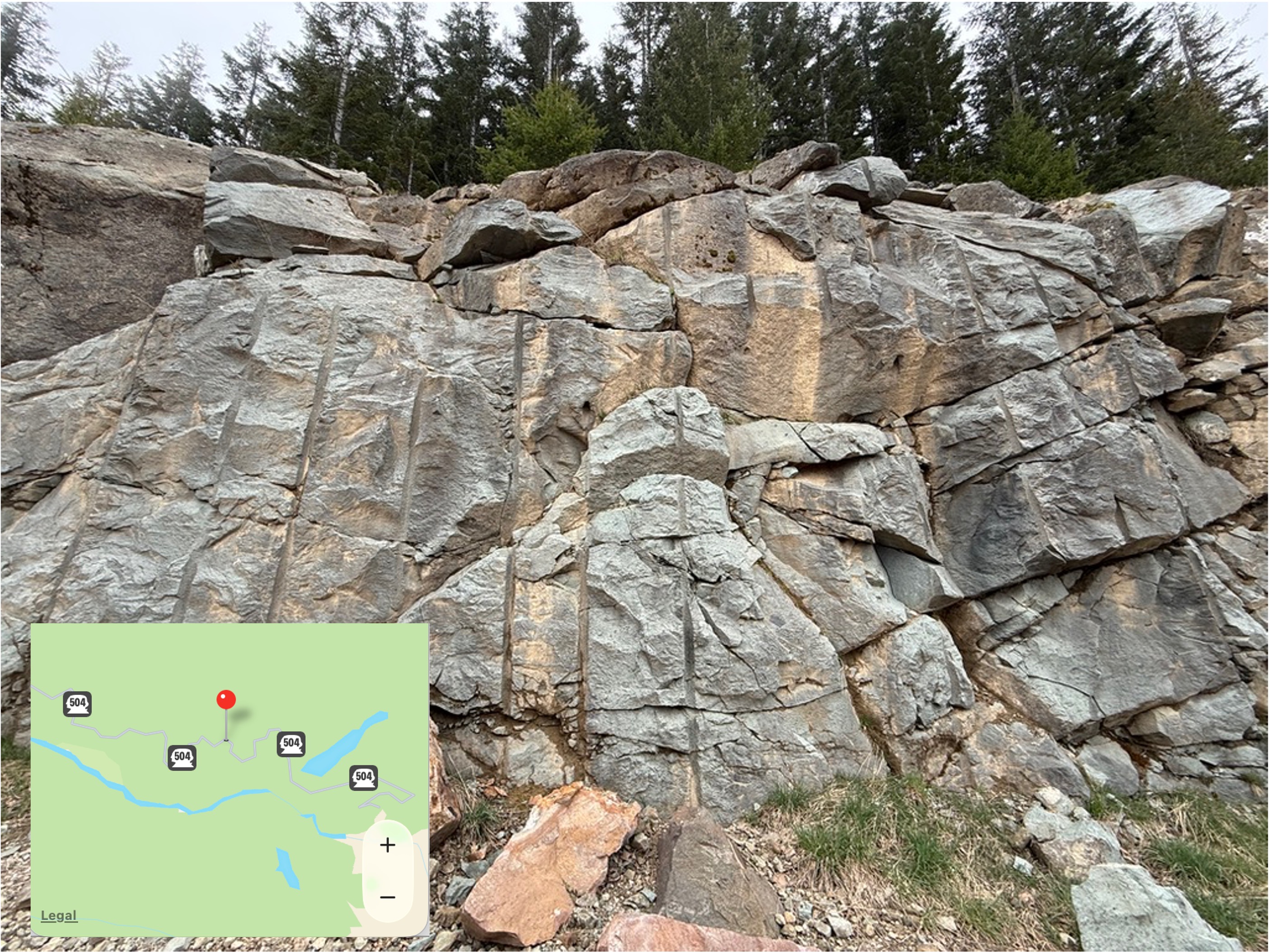
Figure 5. This road cut is located (see inset map) in an area the geologic map (Rock D) identifies as volcaniclastic rocks of Oligocene age (33.9-23.04 Ma). This is a smaller exposure than seen in Figs. 3 and 4, but it is also very different in appearance. That could be an optical illusion; close examination of the photo (I took it from my vehicle stopped in the middle of the road) suggests to me that this is ash that was so hot it formed what is called a welded tuff when it fell, after being blown into the atmosphere by an eruption. The light color suggests a magmatic composition more like granite than gabbro, or even diorite. That wouldn’t be surprising in the complex magmatic environment of a subduction zone, where partially melted, oceanic crust (e.g. gabbro and basalt) chemically mixes with continental crust (e.g. granite and diorite).
This completes my survey of older volcanic rocks near Mount St. Helens. There are no rocks exposed that explain the apparent hiatus in volcanism between about 23 and 2 million years ago. That is a story for another day…
Volcaniclastic Deposits from May 1980 Eruption
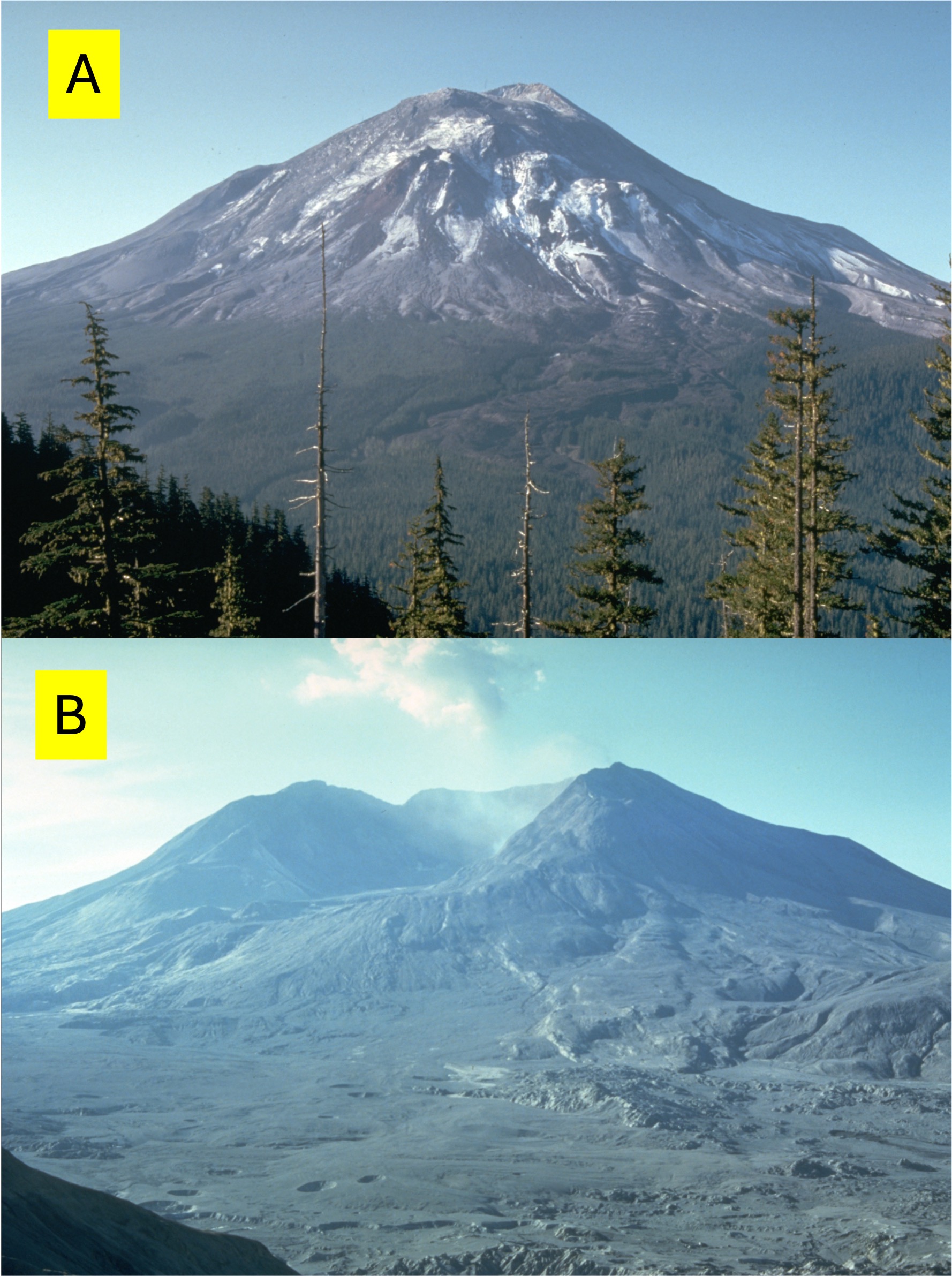
Figure 6. Photo A was taken a few days before the eruption in May, 1980. Image B was taken a few days afterward. The pre-eruption volcano was 9677 feet tall, but the obliterated peak is only 8365 feet. The total volume of material displaced exceeded one cubic mile, most of which was rock that collapsed during the rock slide preceding the actual eruption. The flat area fronting the volcano in (B) is a large fraction of the previous peak, which filled in several channels originating at the volcano. Note the holes in (B), which are probably blow-outs of gases trapped in the debris.
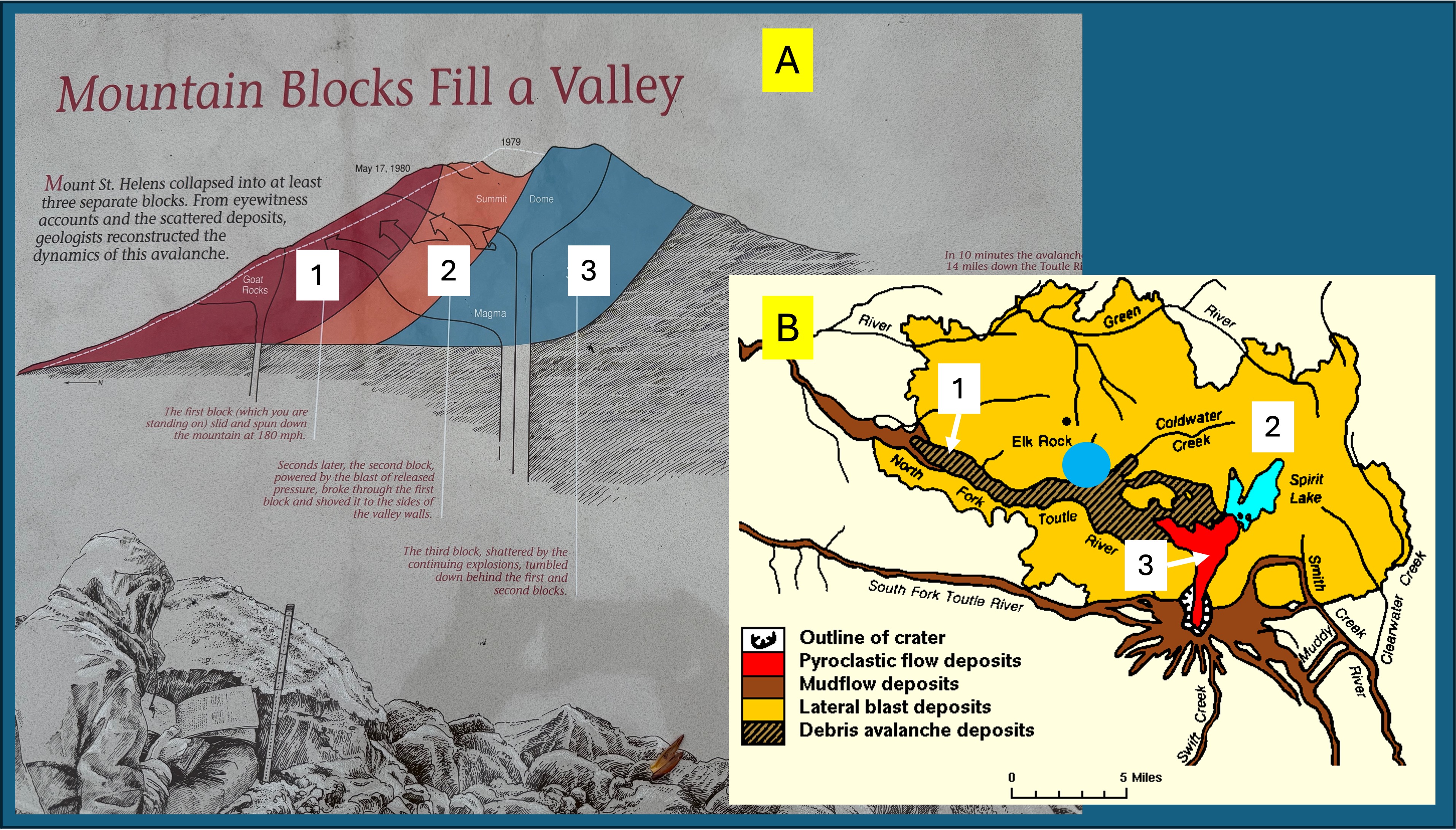
Figure 7. (A) This plaque was located along Hummocks Trail. I’ve supplemented it with the map of volcaniclastic deposits shown in (B). I will focus on the three major volcaniclastic deposits I encountered at Hummocks Trail (blue circle in B), which are numbered 1-3 in both figures.
The first stage was collapse of the north flank of Mount St. Helens (brown in A and cross-hatched in B). This was a run-of-the-mill massive landslide that followed existing drainage, until stage two occurred.
When the rock containing the highly pressurized magma was removed. The resulting release of pressure created an explosion equivalent to 10-50 megatons of TNT; although a volcanic eruption is not analogous to a nuclear explosion, the energy released was roughly 1600 times the energy of the Hiroshima atomic bomb. It moved a lot of rock. This blast occurred seconds after stage 1 began; the hot gases overtook the rock slide, driving rock and debris up the sides of the valley, removing everything, including top soil, within a few miles of the volcano. The orange area in B shows how widespread this explosion was.
Stage 3 was a pyroclastic flow (red in B), which was limited to the immediate vicinity of the caldera; however, what goes up must come down, so several inches of ash were deposited as far as Spokane, Washington–400 miles distant.
Video 1. This video shows debris from the landslide (Stage 1) that was pushed at least 300 feet from the original valley floor to the ridge by the unimaginable blast of Stage 2. The main slide followed Toutle River (North Fork), but with this impetus, debris was launched over the canyon walls. That’s what this video shows. It’s like the heavy stuff collected at the top of the ridge whereas the sand/gravel-sized debris was blown miles further.
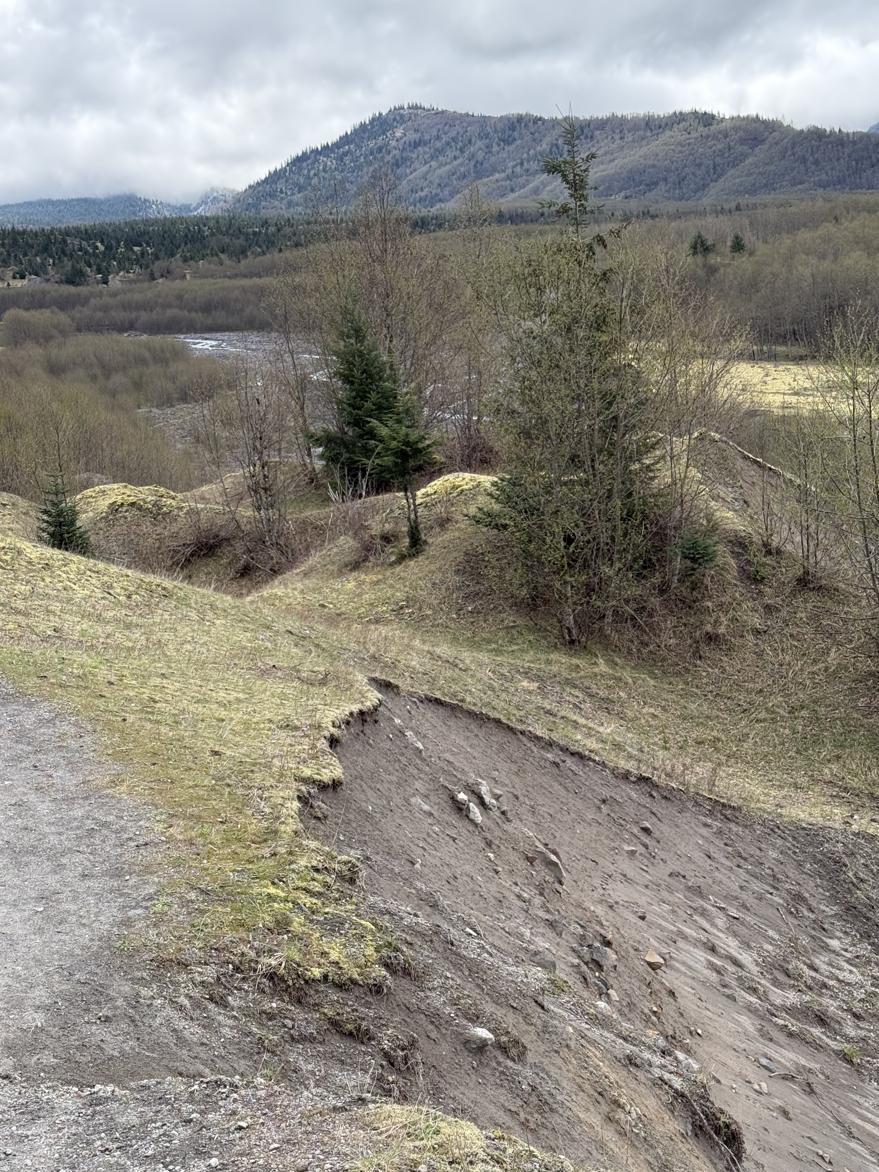
Figure 8. This photo is looking south towards Mount St. Helens from Hummocks Trail (see Figs. 2 and 7B for location) along the Toutle River (North Fork), which is more than a hundred feet lower, even after being filled with debris from the 1980 eruption. Note the difference between this scene and the deposit from Video 1. It’s difficult to comprehend the dynamics of a blast (Stage 2) capable of pushing rock (Stage 1) up this slope; when the explosion lost energy it simply dumped its load, creating a surreal landscape. The debris has very little clay and is thus non cohesive; thus slumps like this are common. Note the small hill and “ridge” in the middle of the photo. This terrain makes no sense, other than erosion has been etching it for 40 years.
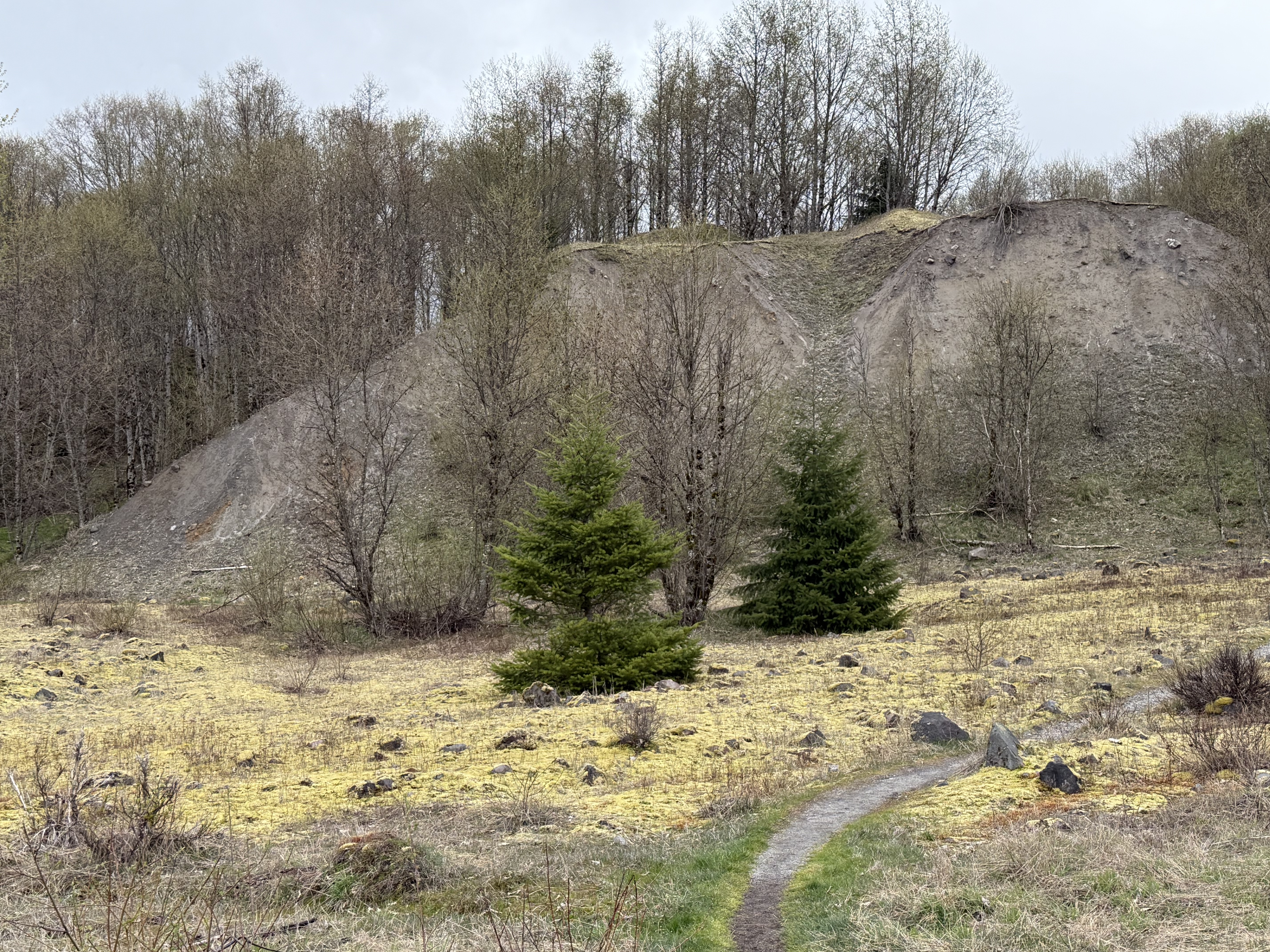
Figure 9. This layer of ash I encountered along the Hummocks Trail is a remnant of a vast sheet originally deposited during Stages 2/3–breaking such a continuous eruption sequence into stages is useful but not particularly elucidating. It all happened too fast to comprehend. You might call this an “over-bank” deposit, like when a river tops its natural levee and deposits fine-grained sediment on its floodplain.
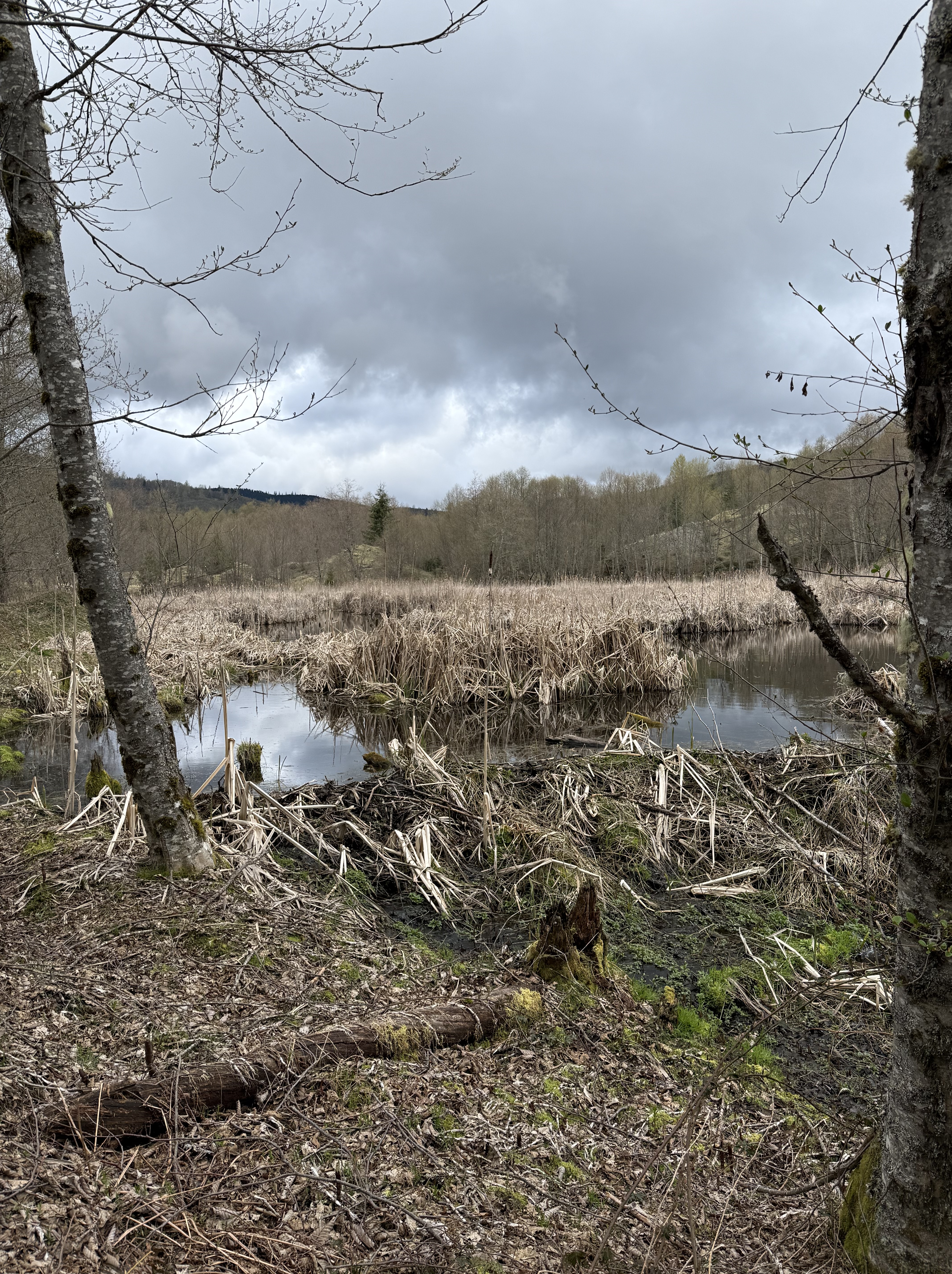
Figure 10. Hummocks Trail followed a small stream through a bizarre landscape comprising multiple small ponds like this one. A dam constructed of eruption debris (left-to-right in the center of the photo) has blocked the stream flow, creating a meandering channel during low-water conditions; but I can imagine all those dormant grasses erupting later this spring. I encountered several of these marshes, each one defined by water trying to find a way out of this labyrinth. According to Fig. 2, this is the outflow from Coldwater lake; the eruption partially blocked its path but nature is finding a way through this discombobulated landscape.
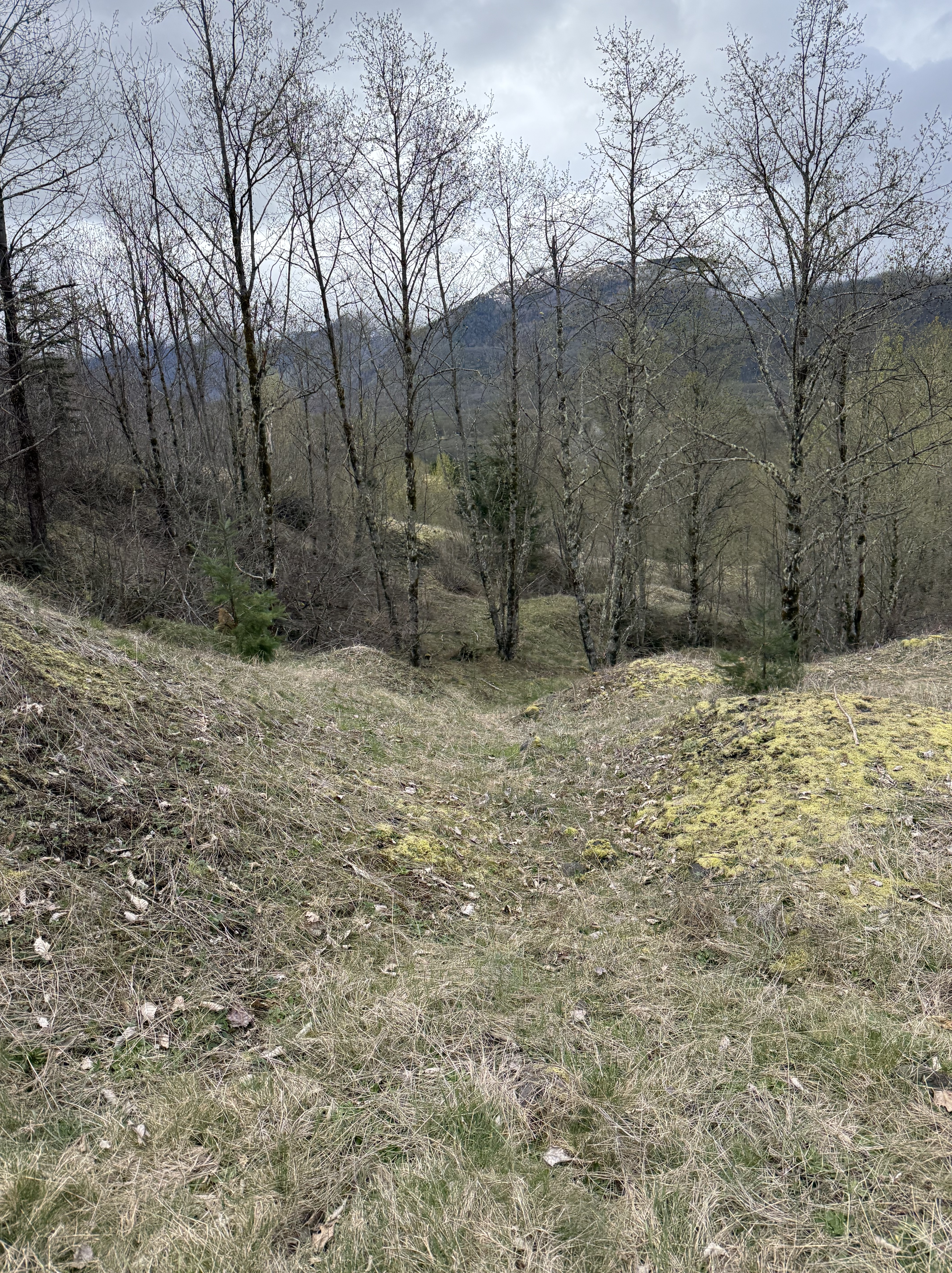
Figure 11. This photo perfectly captures the topography of Hummocks Trail. This is the northern end of the trail, which is a little higher; the Toutle River (North Fork) is more distant and the cliffs we saw in Fig. 8 have receded, replaced by moderate slope; however, note the fine-scale nature of the hummocks here. They are ubiquitous but contain only a few scattered boulders.
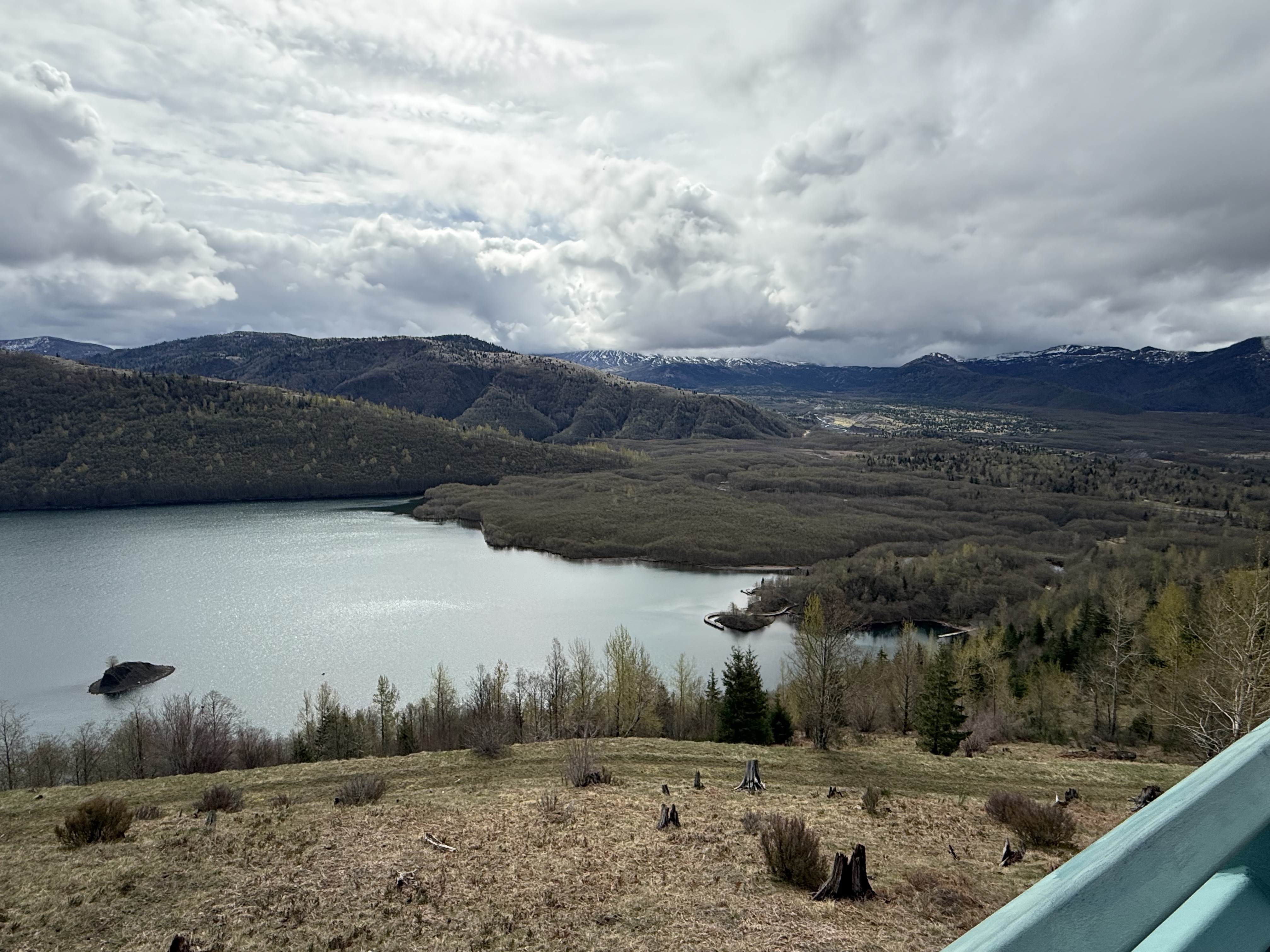
Figure 12. This is a view of Coldwater Lake from the visitor center, looking south towards Mount St. Helens. There are two things to note from this image: 1) the Toutle River valley is a broad, flat plain because it was filled with debris from Stage1; 2) the overflow deposits (e.g. Video 1) have blocked the lake and raised its level. The source of water we saw in Fig. 10 is evident in the center of the photo. This isn’t a sedimentary dam, created by flood deposits, or even a glacial dam produced from the debris scraped up by thick ice sheets. The shoreline was modified when Mount St. Helens collapsed and then exploded with unbelievable violence.
Final Thoughts
The eruption of Mount St. Helens in 1980 gave geologists a rare opportunity to see how Earth produces sausage. Let me explain my metaphor.
Ocean crust is denser than continental crust it encounters at a convergent plate boundary, and at a lower elevation. It is thus overridden by the continent, forcing it to dive into denser and hotter rocks at depths of hundreds of miles. This obviously displaces hot and ductile rocks, heating the subducting rocks even more; the sausage-making operation has begun. Still pushed from behind by the conveyor belt of oceanic crust being subducted, this basalt/gabbro mixture heats enough to boil off the water contained in its sedimentary cover as well as any constituents with a reduced melting point (e.g. silicon-rich minerals). This superheated material rises through tens-to-hundreds of miles of crust, heating it and producing a mixture of oceanic and continental crust.
Plate tectonics keeps turning the crank on the sausage machine for tens (even hundreds) of millions of years. The molten mass of magma keeps rising because it is less dense than the rocks through which it is passing, until the pressure has decreased enough for it to find cracks in the solid crust. The magma fills these cracks, which often lead to fissures in the surface; the magma erupts. The magma cools and begins to solidify, forming a pluton at depths of several miles to tens of miles.
This process keeps operating, in fits and starts, until the tectonic plates change direction. In the meantime, the upper crust has been filled with multiple plutons (solidified magma chambers), sometimes squeezed into the volcanic rocks from previous eruptions. Individual magma chambers/plutons are about one mile in diameter, although they take many shapes, and remain active for less than one-hundred-thousand years (often much less). These are injections of fluid rising through weak points in the crust, driven by pressure paths–not missiles launched from the mantle. They are like the sweat on your brow after a hard workout.
Mount St. Helens has released a lot of pressure, although it is still very dangerous at human scales. Chances are that this magma chamber will solidify within the next hundred-thousand years; but the unstoppable sausage machine will continue cranking out more mixed material in a molten form until it has filled every nook and cranny in the upper crust. That’s how mountain ranges like the Sierra Nevada were formed. It takes a really long time.
Mount St Helens probably won’t erupt again at the scale of the 1980 event, but that doesn’t mean much if you happen to be camping near the caldera when a smaller eruption occurs. After all, the magma chamber is still extruding lava in an unsteady process that is currently pretty slow. However, we humans can’t see fractures in bed rock; thus, the next and the next, etc, magma chamber could appear anywhere from Northern California to British Columbia. There are plenty of young volcanoes in the Cascades that haven’t blown their tops yet.
Who’s next?

Recent Comments