
The Foothills Trail along Carbon River, Pierce County, Washington
This post is a humorous (I hope) addendum to my posts on the geology and flora of Carbon River. I have noticed a lot of quirky, regional trends, both in decoration and signage, here in the Pacific Northwest (PNW) during our nature walks. The Foothills Trail was no exception.
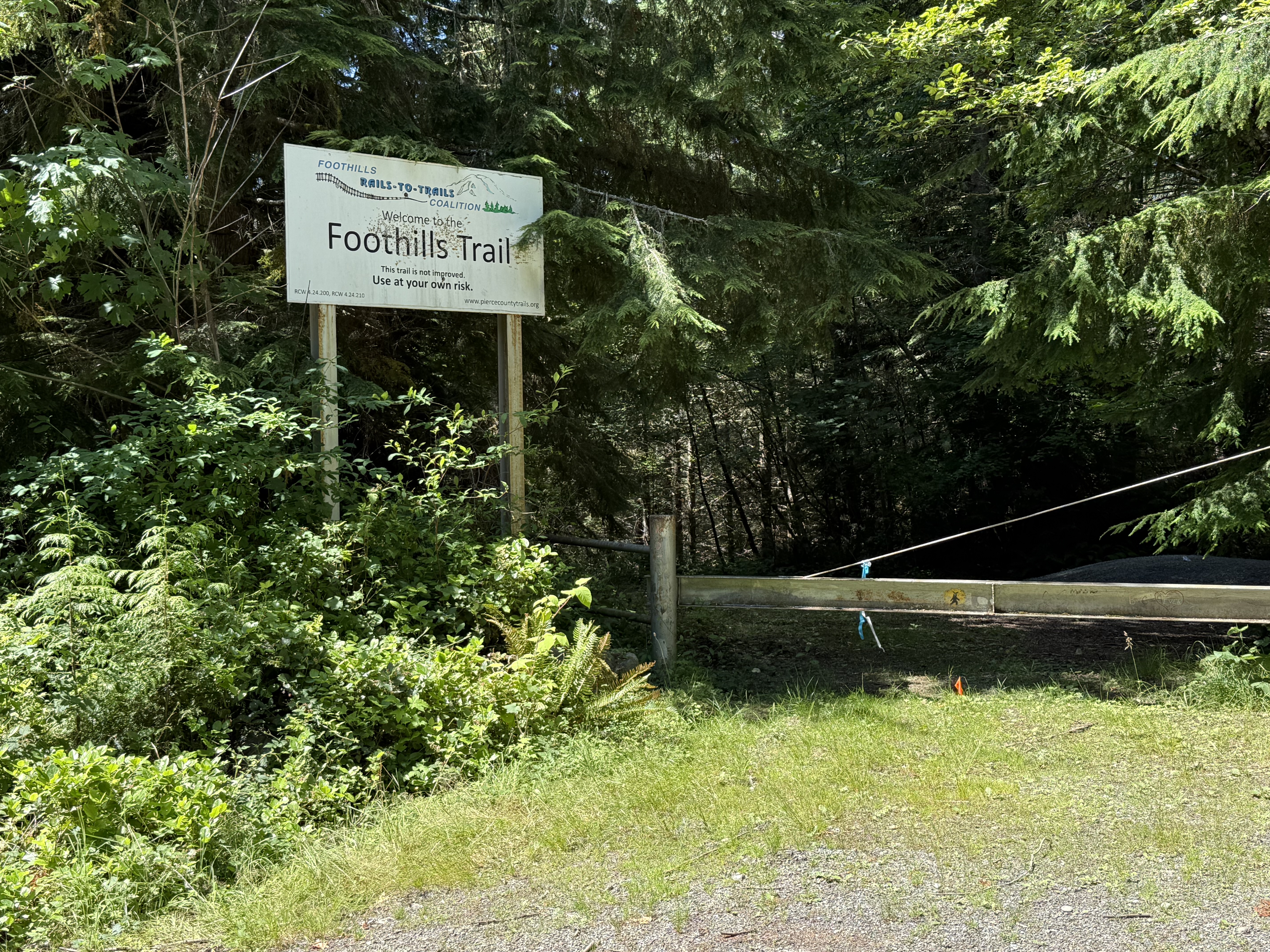
There are several access points to the trail, but this was the only sign. It ends with a serious warning: Use at your own risk. What lies ahead in that darkness?
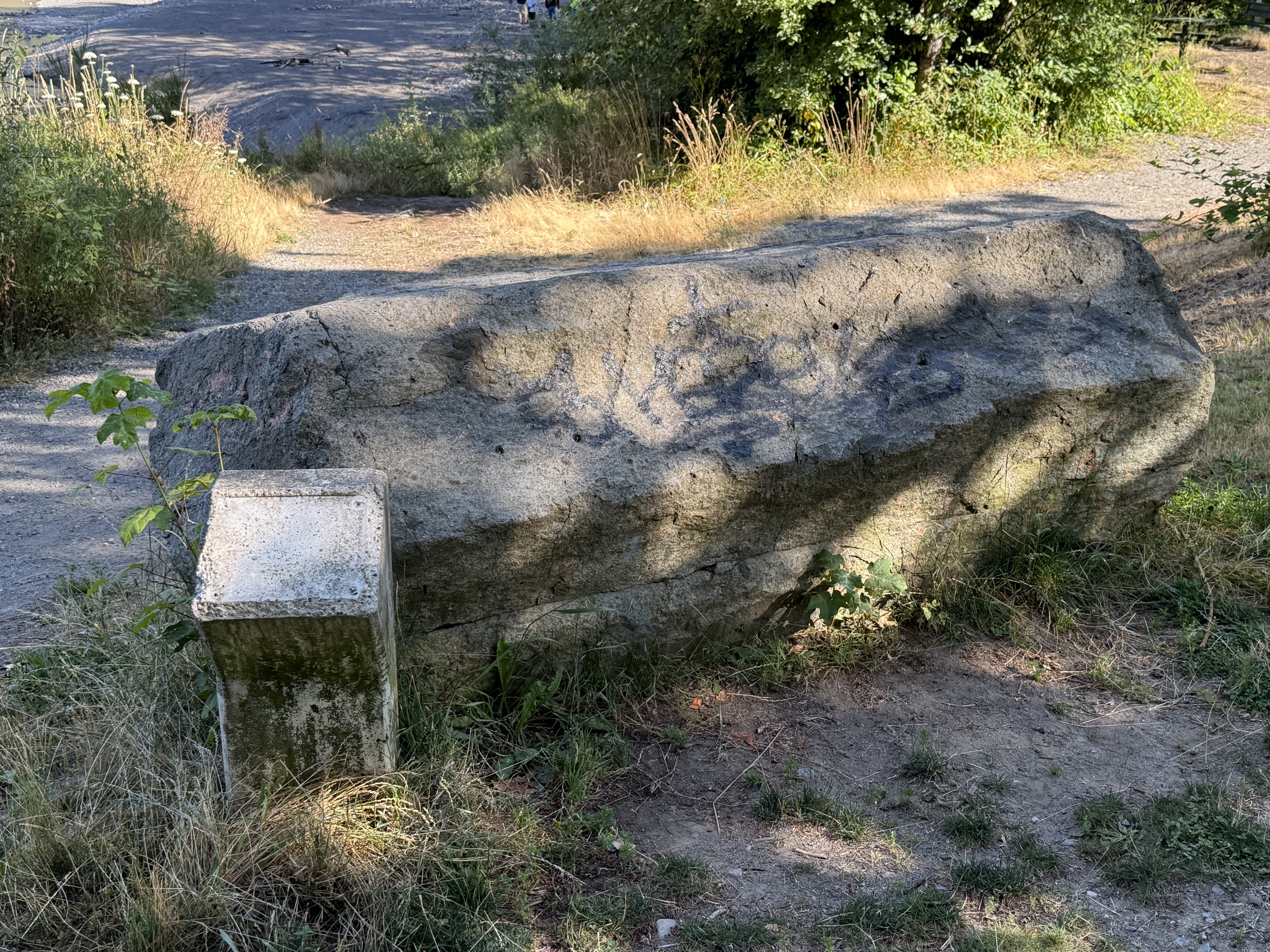
A couple miles downstream from the “official” trailhead, we stopped along the Carbon River. This is a piece of ubiquitous columnar andesite that was apparently placed here as a decorative piece. Unfortunately the sign is long gone.
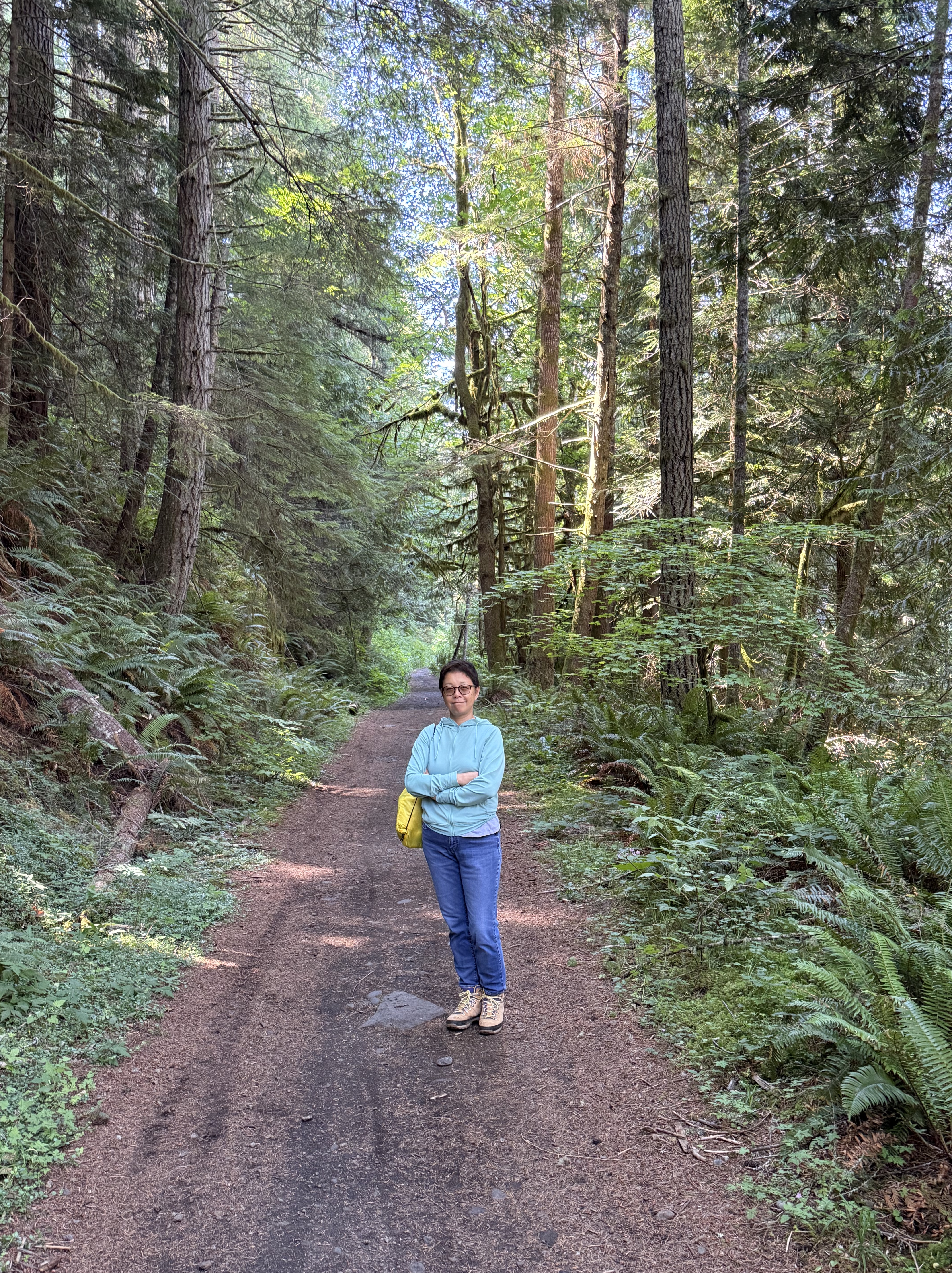
The trail is wide and easy to access on foot. I don’t know about a wheel chair although it is flat all the way.
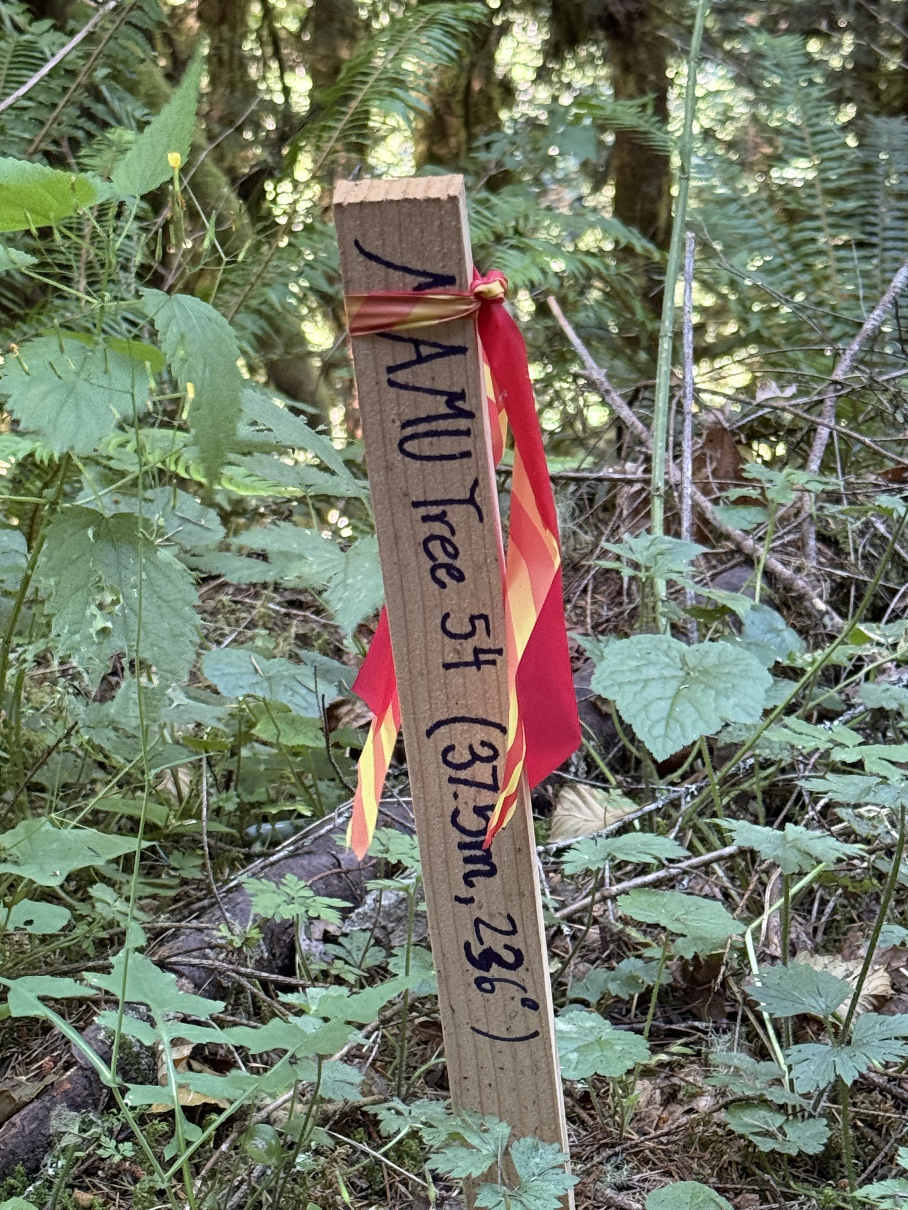
We saw several of these marker stakes along the trail. I looked it up and, to the best of my knowledge, this is indicating a tree where a pair of Marbled Murrelets are nesting. They are an endangered species and extremely difficult to locate, but there is an ongoing survey program. That sounds reasonable to me; the sign gives both a distance and compass heading to the tree.
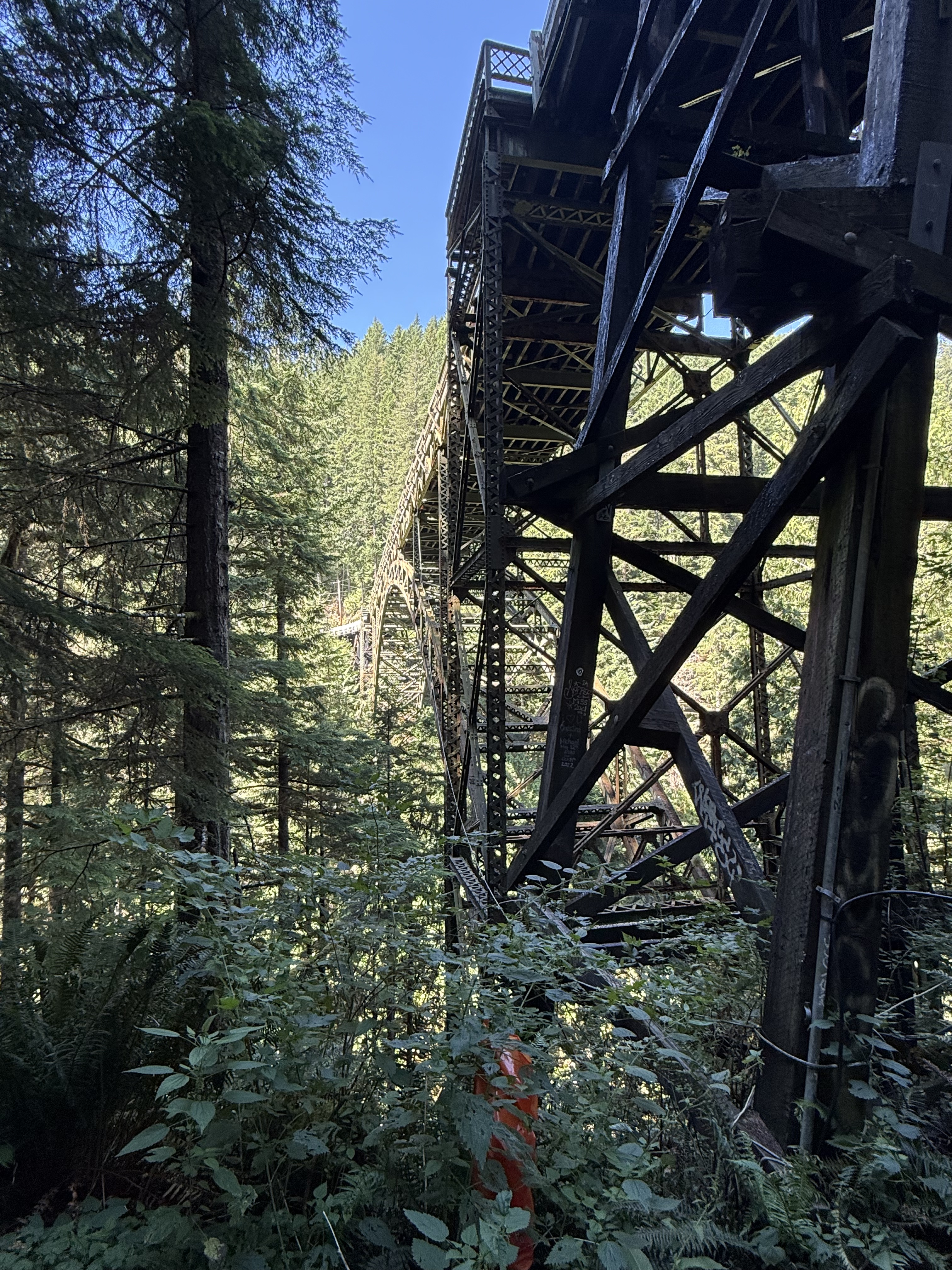
The trail intersected the Franklin Bridge, which is indefinitely closed to traffic.
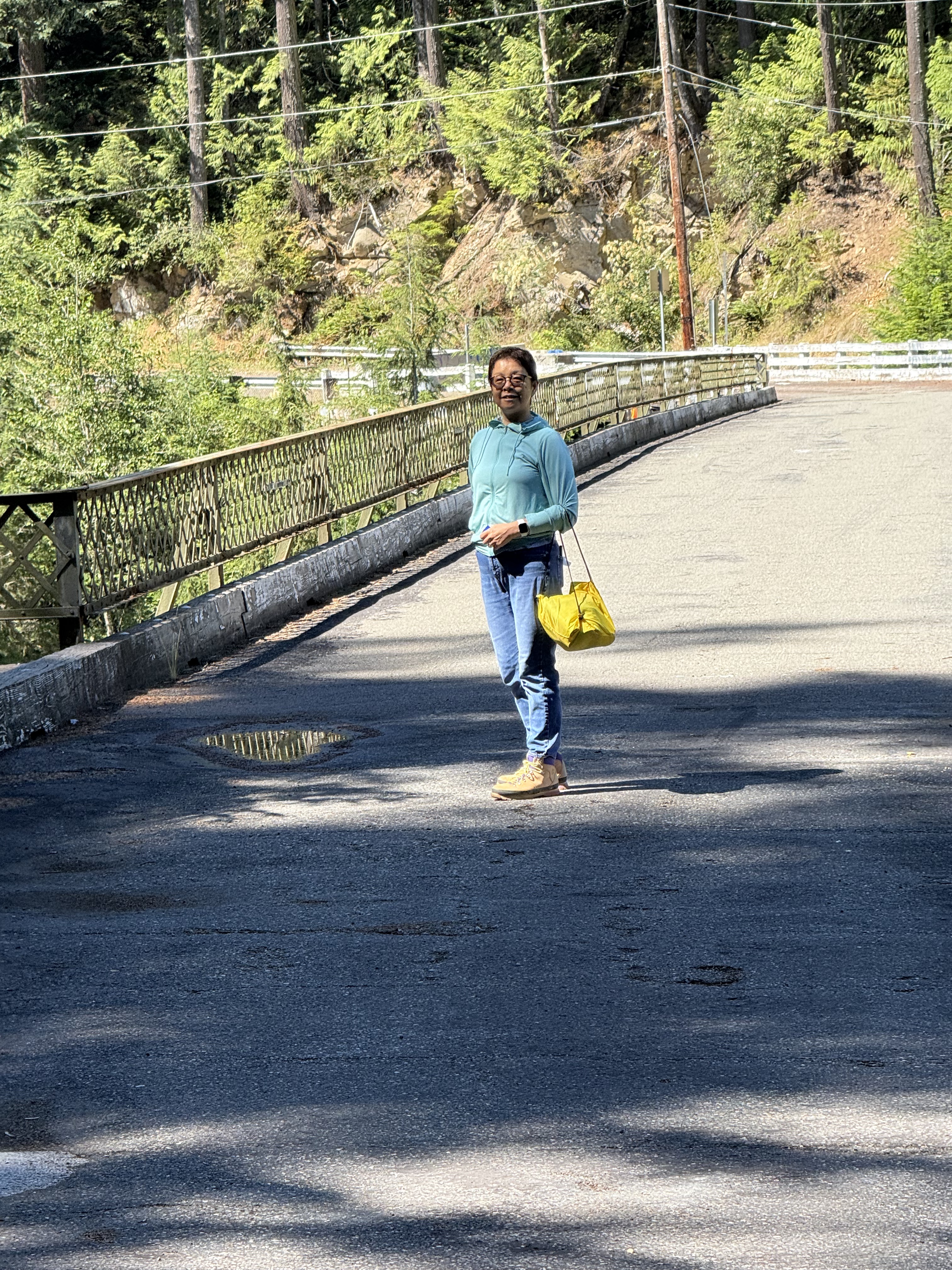
We climbed a steep slope, with the help of sturdy handles attached to wire rope, and took some photos on the bridge.
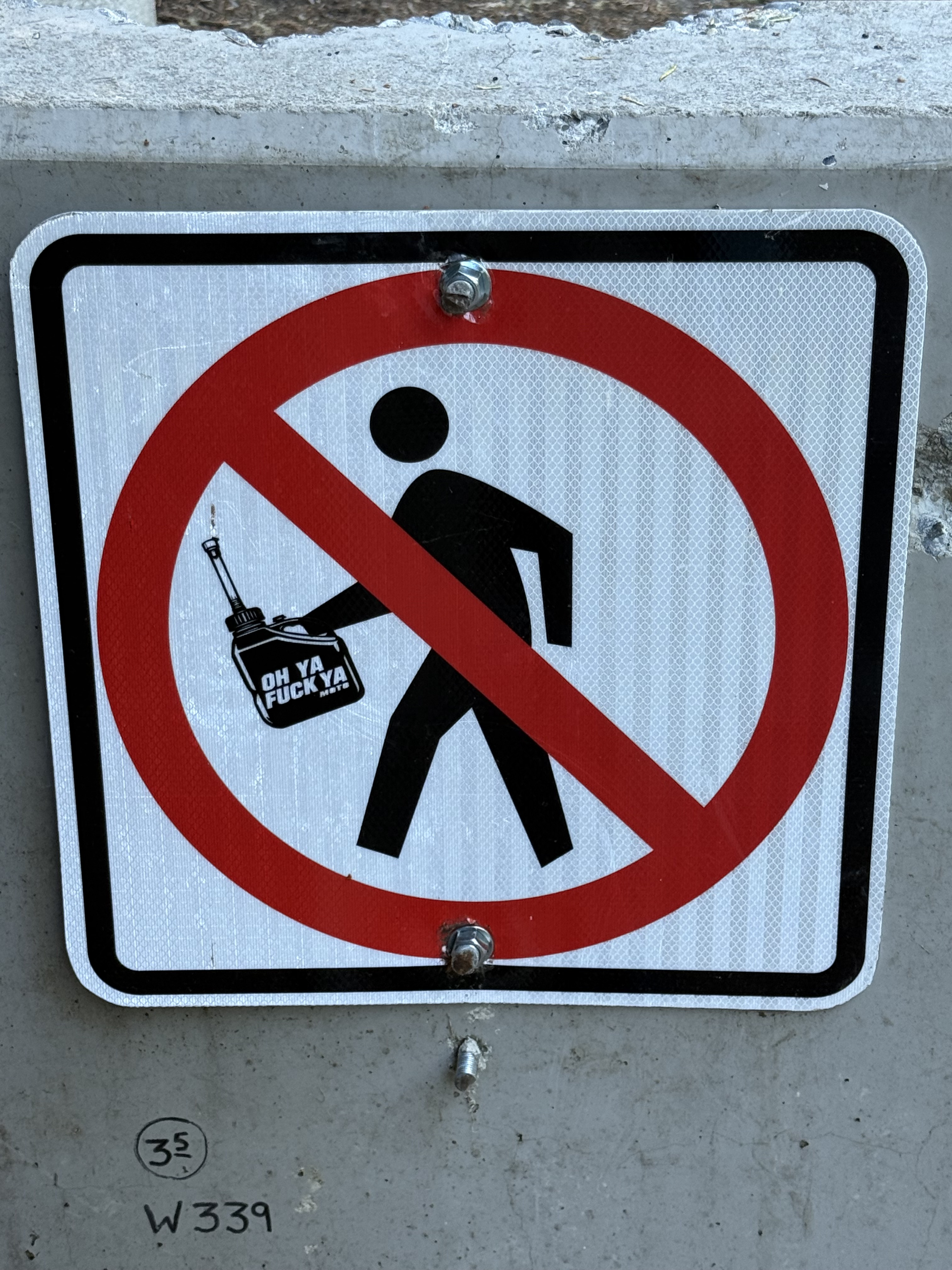
After we finished on the bridge, we passed the concrete blocks obstructing the road. Several signs made it clear that the bridge is closed to cars, bicycles, and pedestrians. Apparently someone disagreed with the DOT restrictions, and modified the sign. Don’t ask me why the figure is carrying a gas can that says, “Oh ya fuck ya.” I guess they’re thumbing their nose at anyone who would dare condemn what looks like a perfectly useful bridge — at least for people and wild animals.
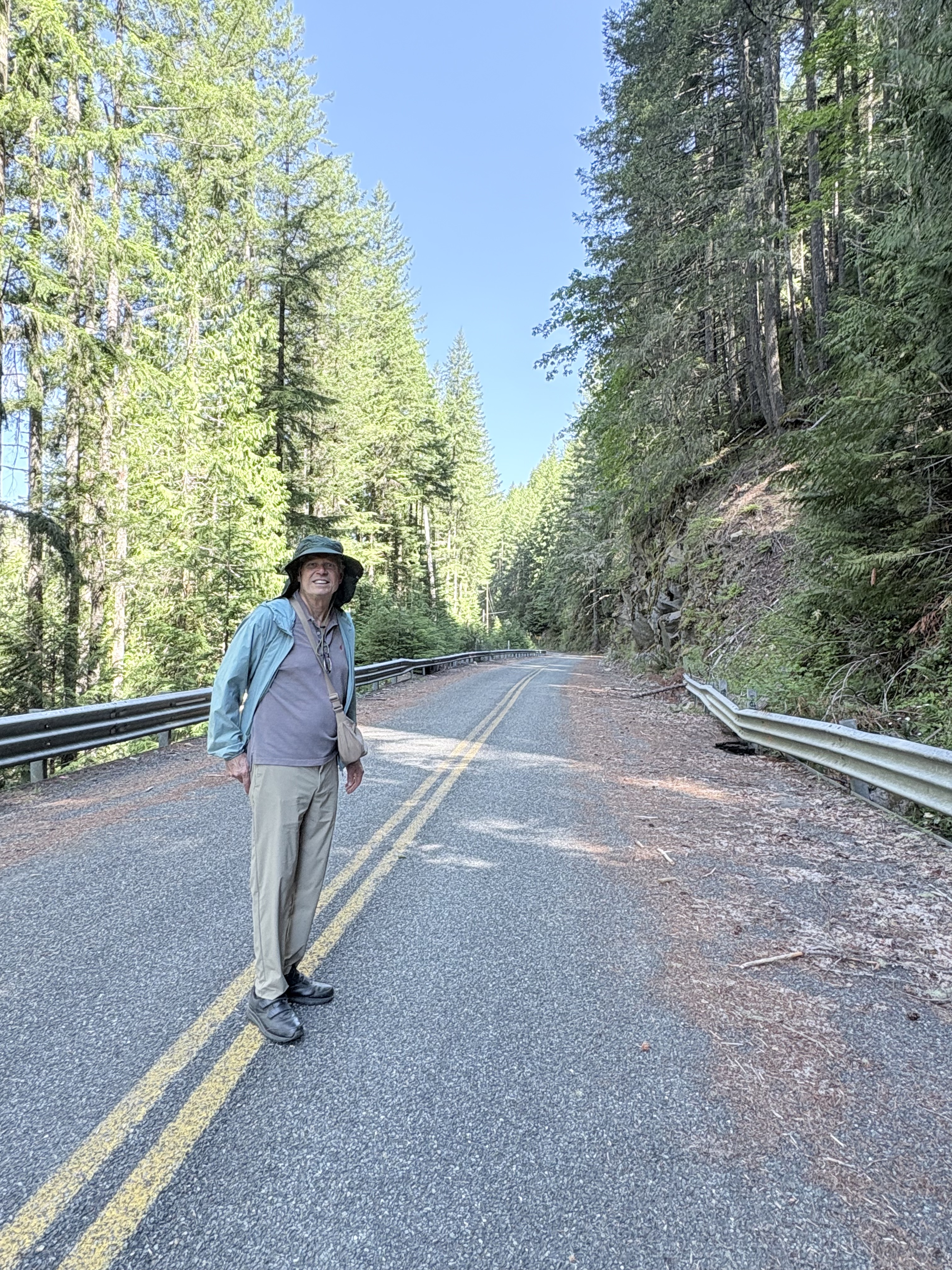
We walked the three miles back to our car along the abandoned road. There were several rock falls and damage to the guardrails. In this image, a large boulder smashed through the eroded roadbed. It was like a post-apocalypse movie. Pretty cool … and quiet.
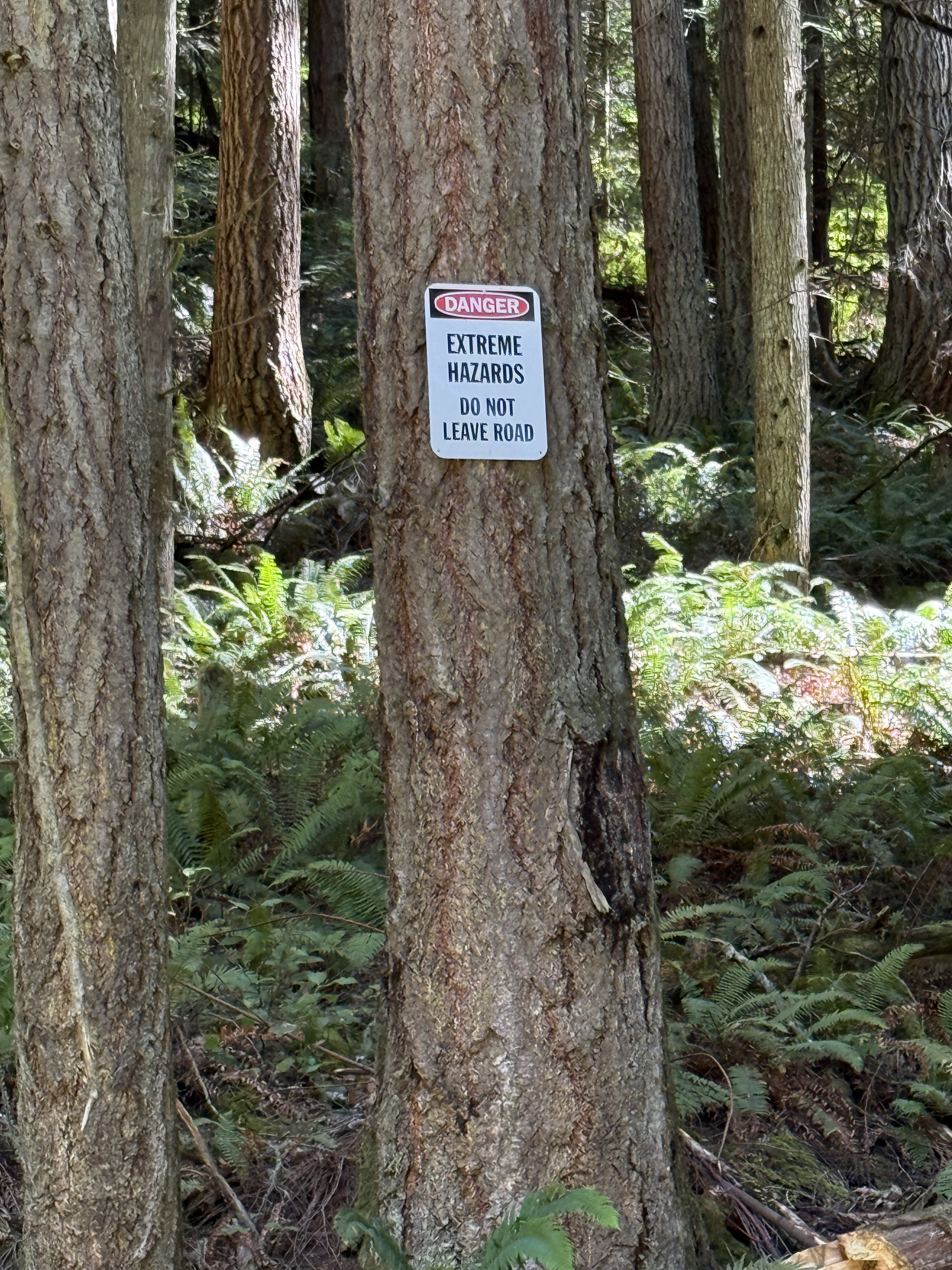
These relatively new signs were posted randomly on trees on the hill of the road. Hazards. Not hazard. Maybe Western Rattlesnakes, poison ivy or … dare I say it? Bigfoot. Stay out of the woods. But we just walked three miles through the woods. Damn!
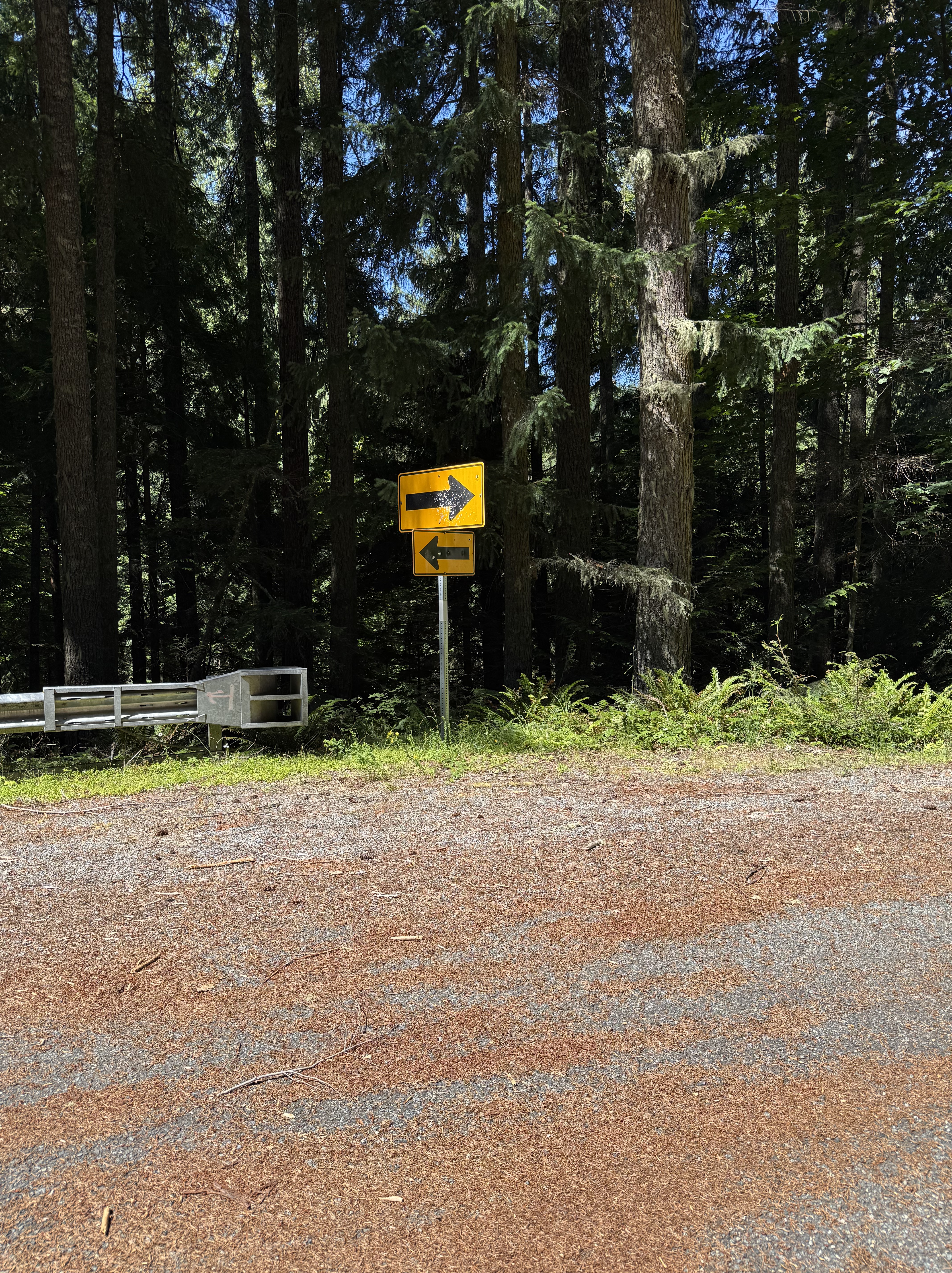
These opposite-pointing signs were on a curve. Nevertheless, I have to wonder why the guardrail stops in the middle of the curve, but reflective signs were felt necessary. Short sightedness? Budget constraints? Stupidity?
The Flora of Carbon River, Pierce County, Washington
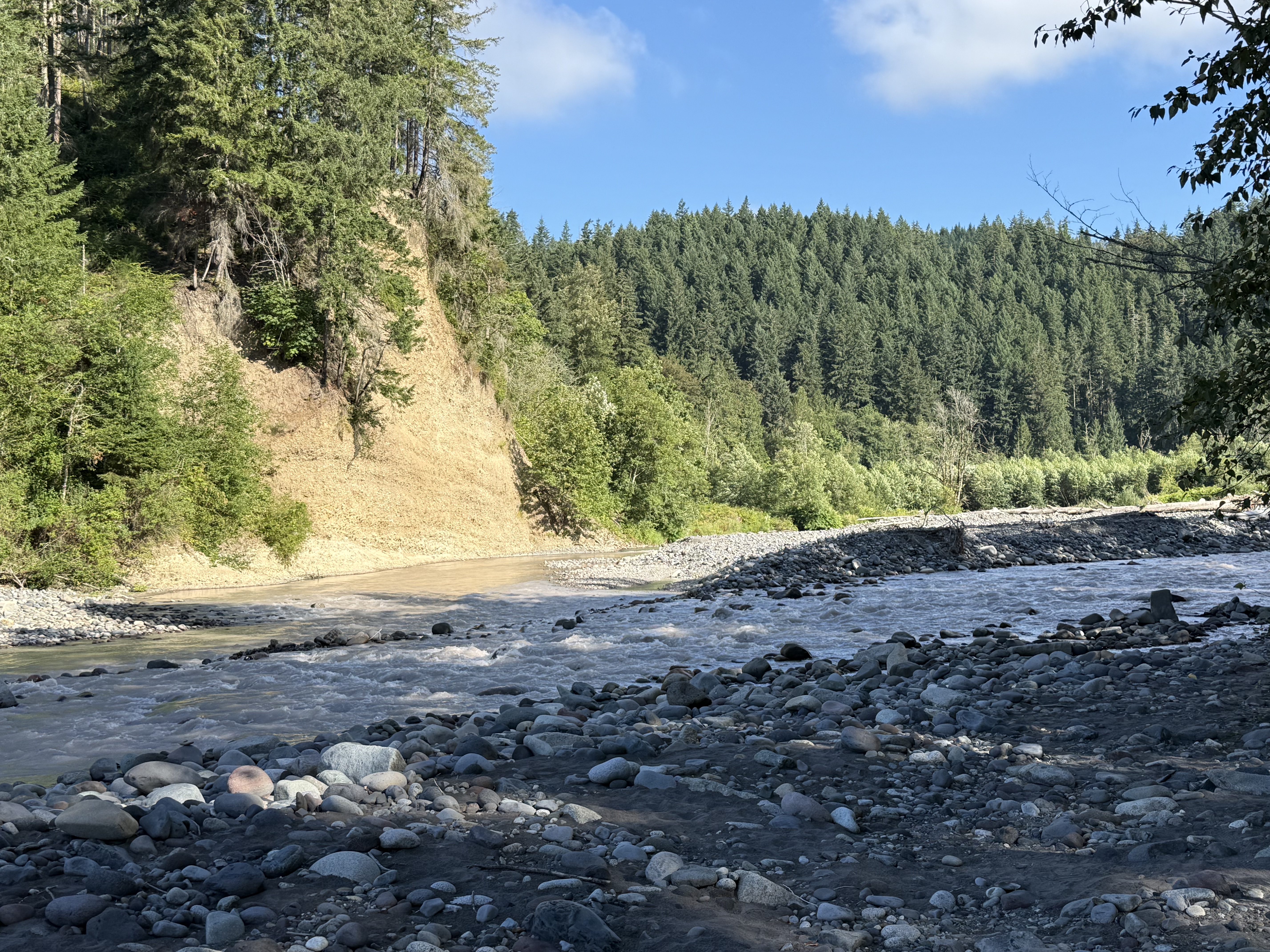
Plate 1. Our first stop was at Carbonado, where the Carbon River exits the canyon that has constrained it from its origin on Mt. Rainier. It immediately forms multiple channels as it cuts through glacial till on its circuitous path to Commencement Bay.
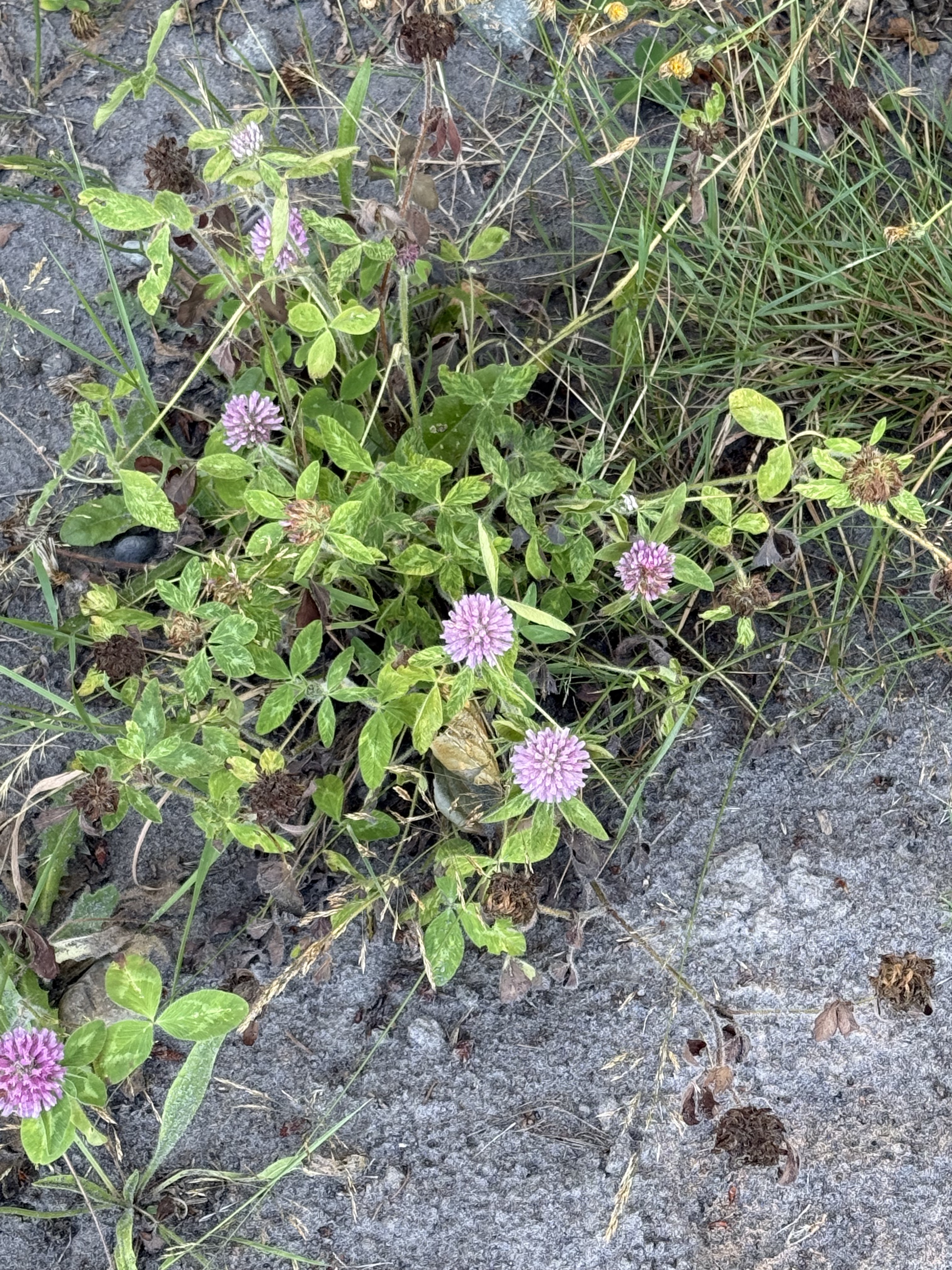
Plate 2. This lovely flower is red clover (Trifolium pratense), a common wildflower along rivers.
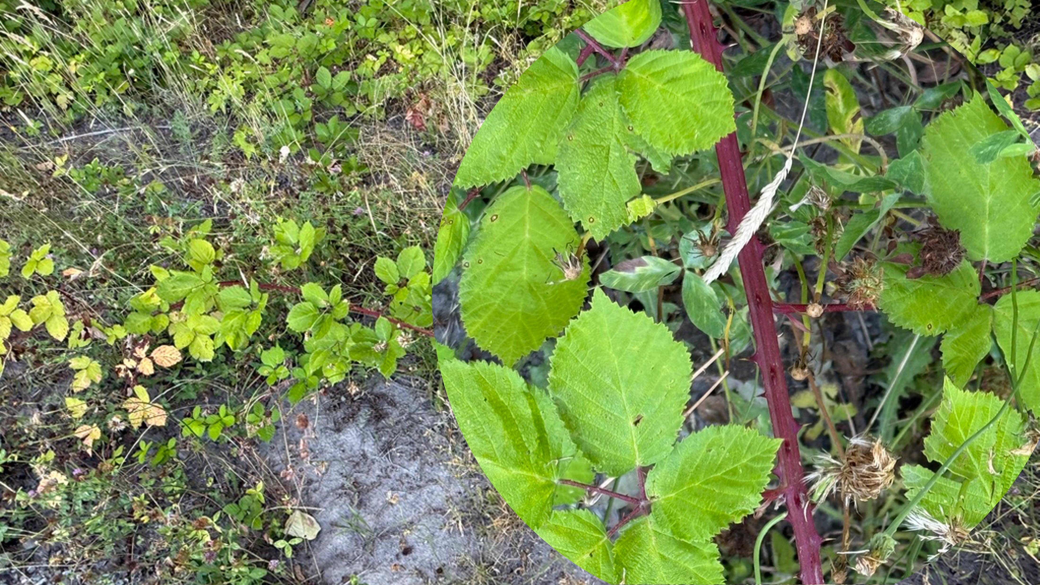
Plate 3. CoPilot and I argued too long about this one, but, after some back and forth, I decided it might be a genus of Spiraea. They are another common shrub in this ecosystem, but they aren’t in flower in July. Note the shriveled flowers in the right image. Too late to be sure. That’s why I’ve always ignored these bushes.
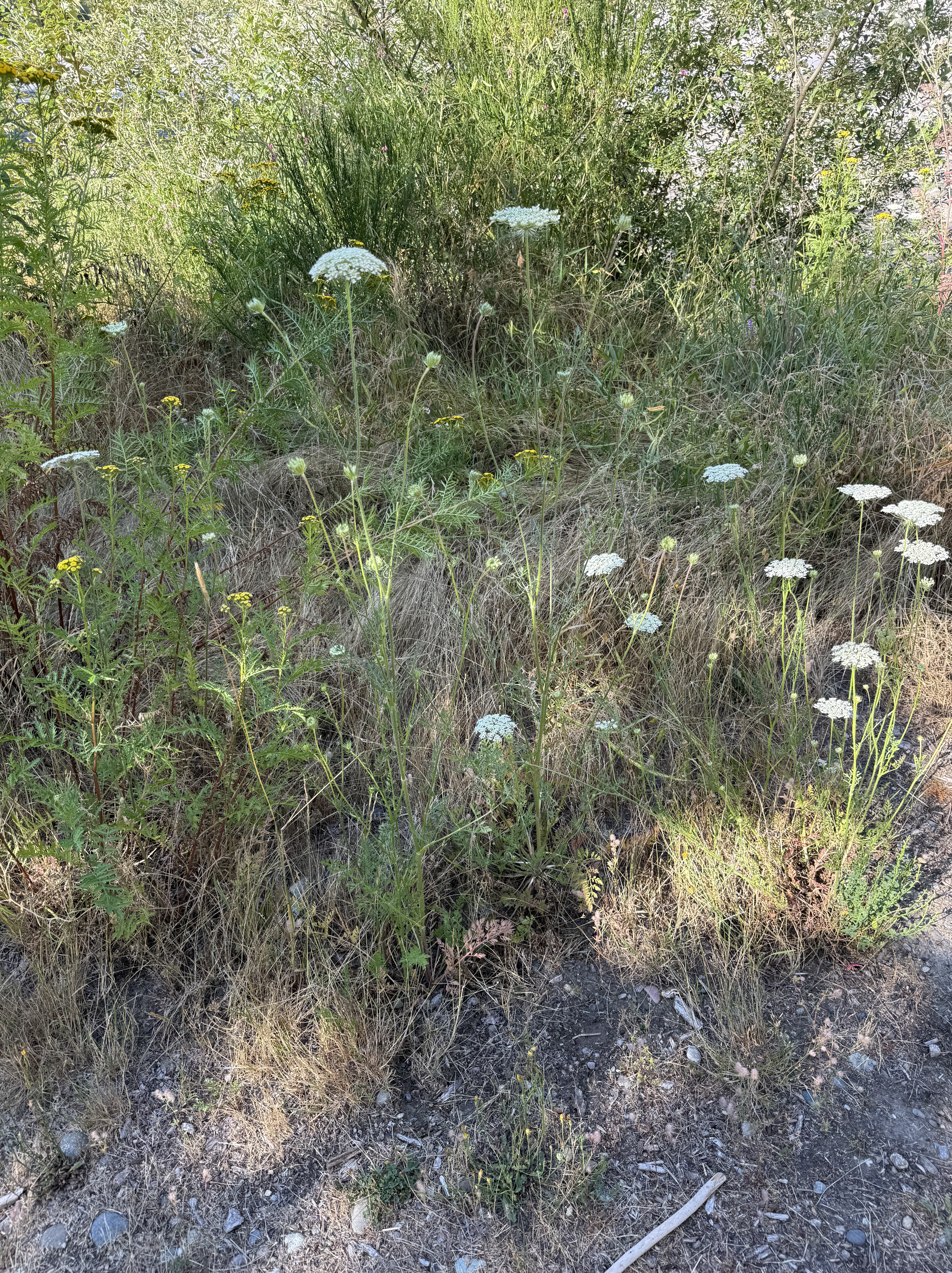
Plate 4. Cow parsnip (Heracleum maximus) is a common wildflower in meadows and roadsides in Washington.
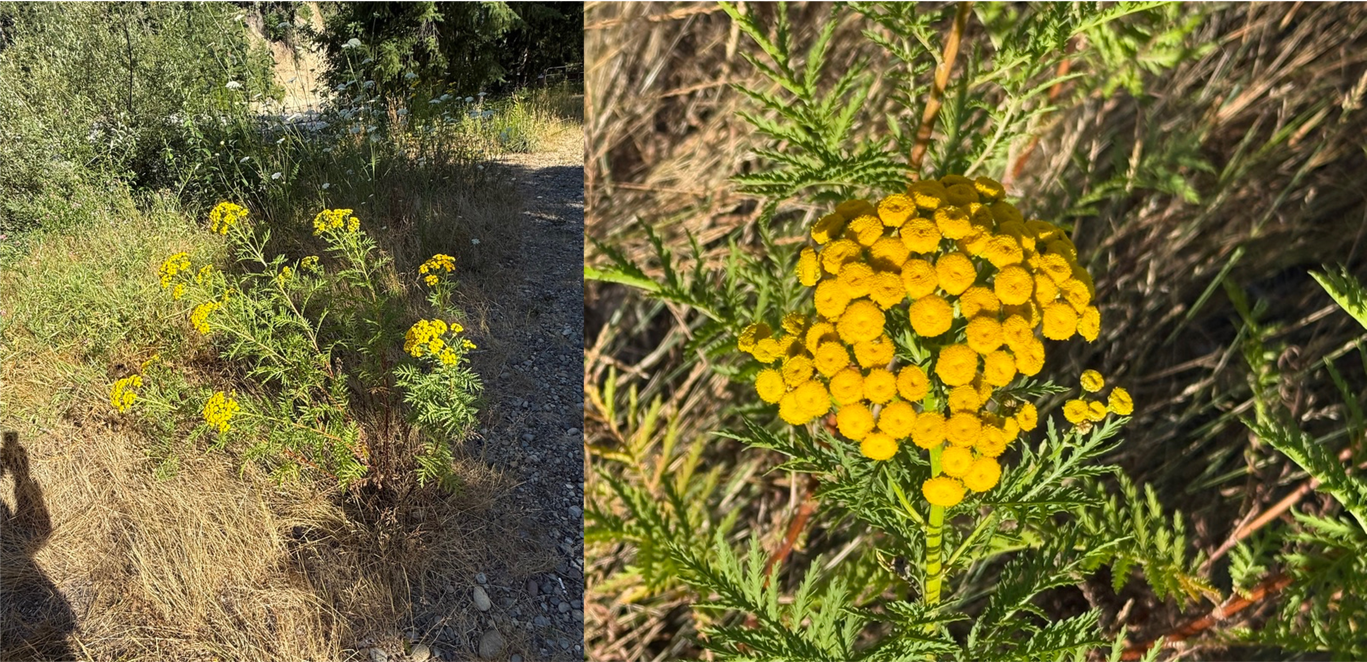
Plate 5. Tansy (Tanacetum vulgare) is a common wildflower along the Carbon River corridor.
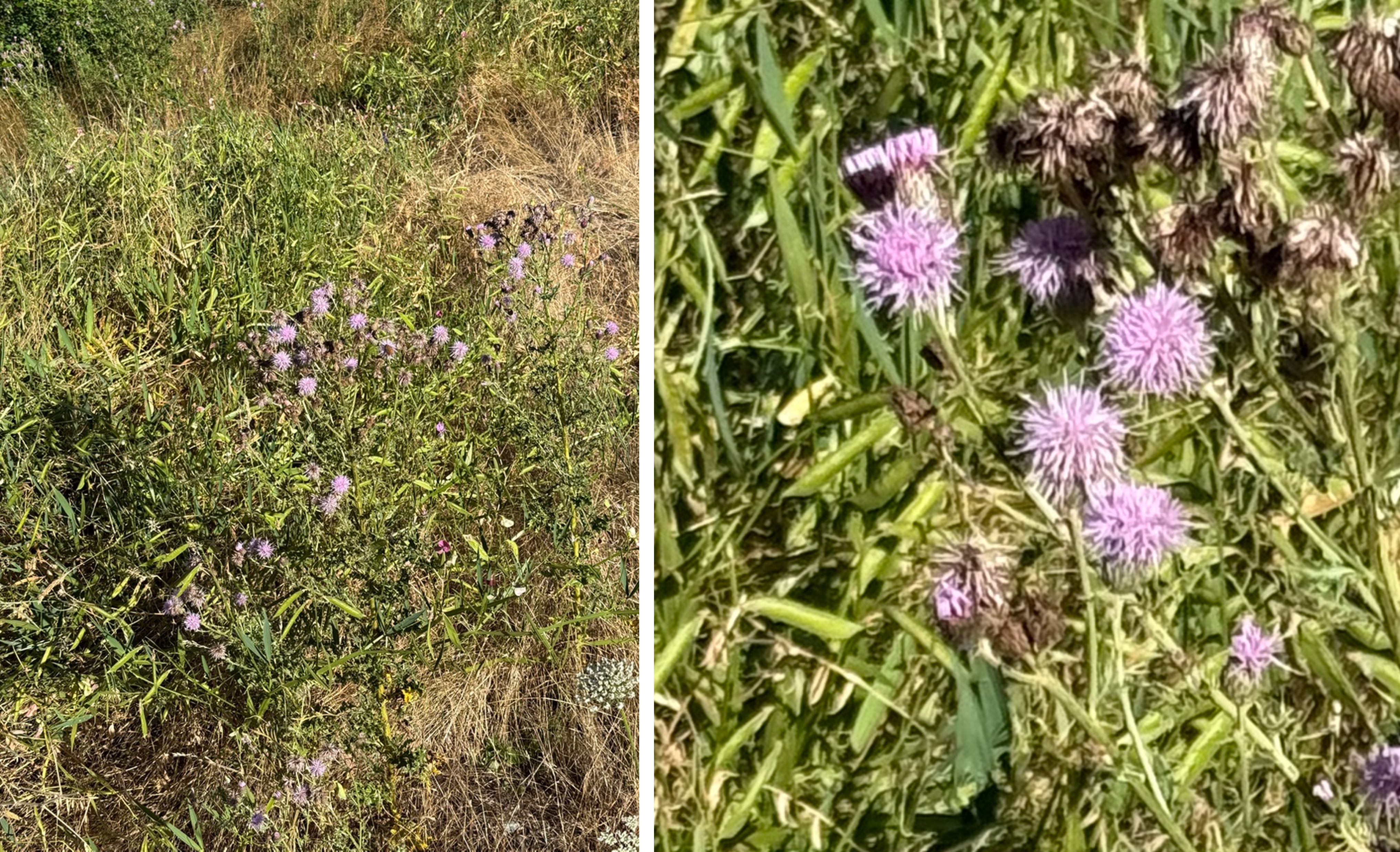
Plate 6. I thought, when putting this post together, that this was red clover (Plate 2), but CoPilot identified it as Canada thistle (Cirsium arvense). It loves disturbed areas like river edges. I did detect some spines when I zoomed in on the second photo. Why am I not surprised? If it’s pretty it will have spikes ready to draw blood from any inquisitive passers by.
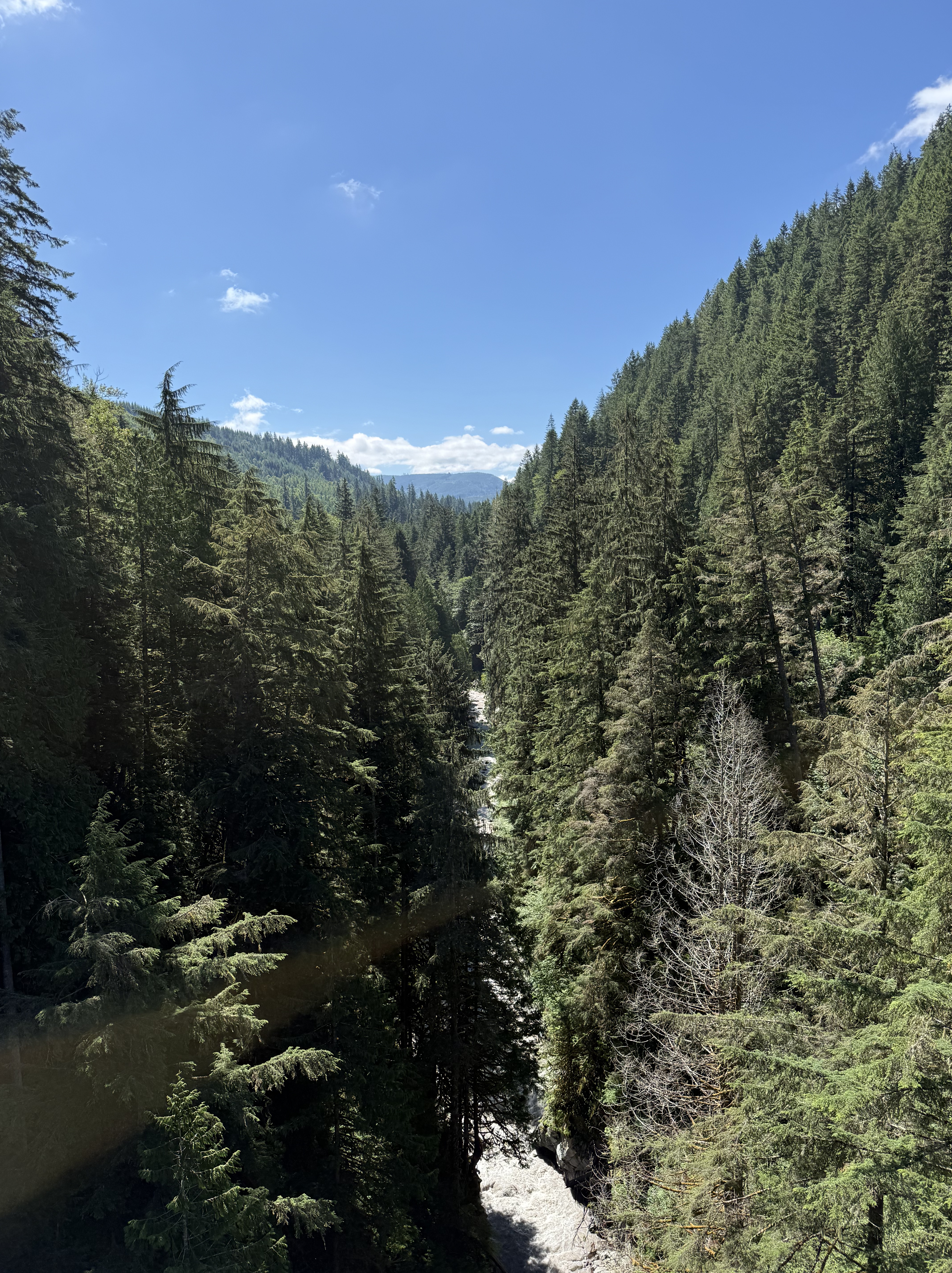
Plate 7. This view is looking downriver from Franklin bridge, which is permanently closed. I’ll now describe some of the flora we encountered as we followed the river along a steep slope.
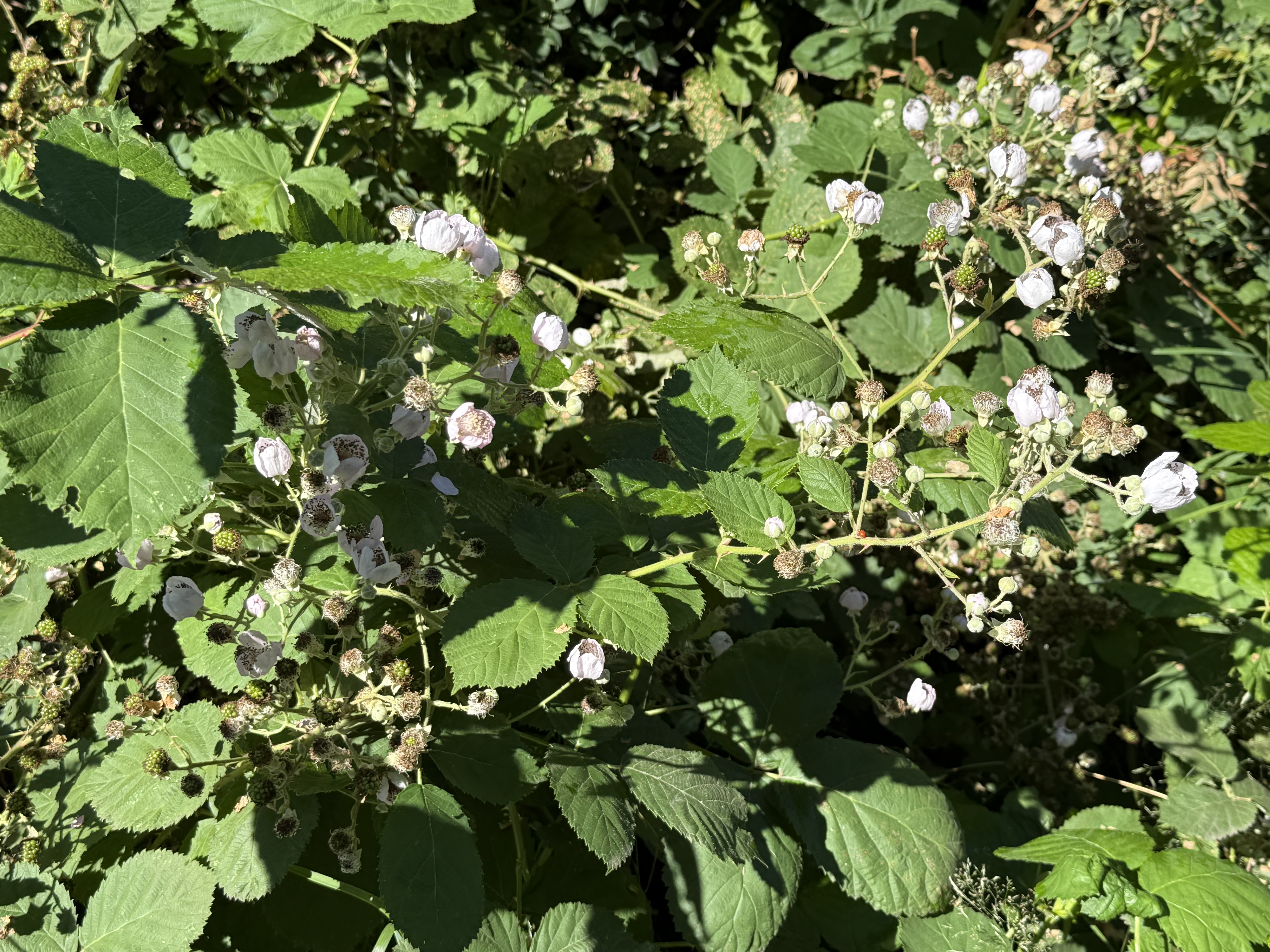
Plate 8. I (kinda) got this one right. This is a wild rose, Nootka rose (Rosa nutkana). This is another plant that waits for an opening in the forest canopy to grow, and then it colonizes like crazy — until the forest canopy catches up with it. Moist but well-drained soil pretty much sums up Carbon River canyon.
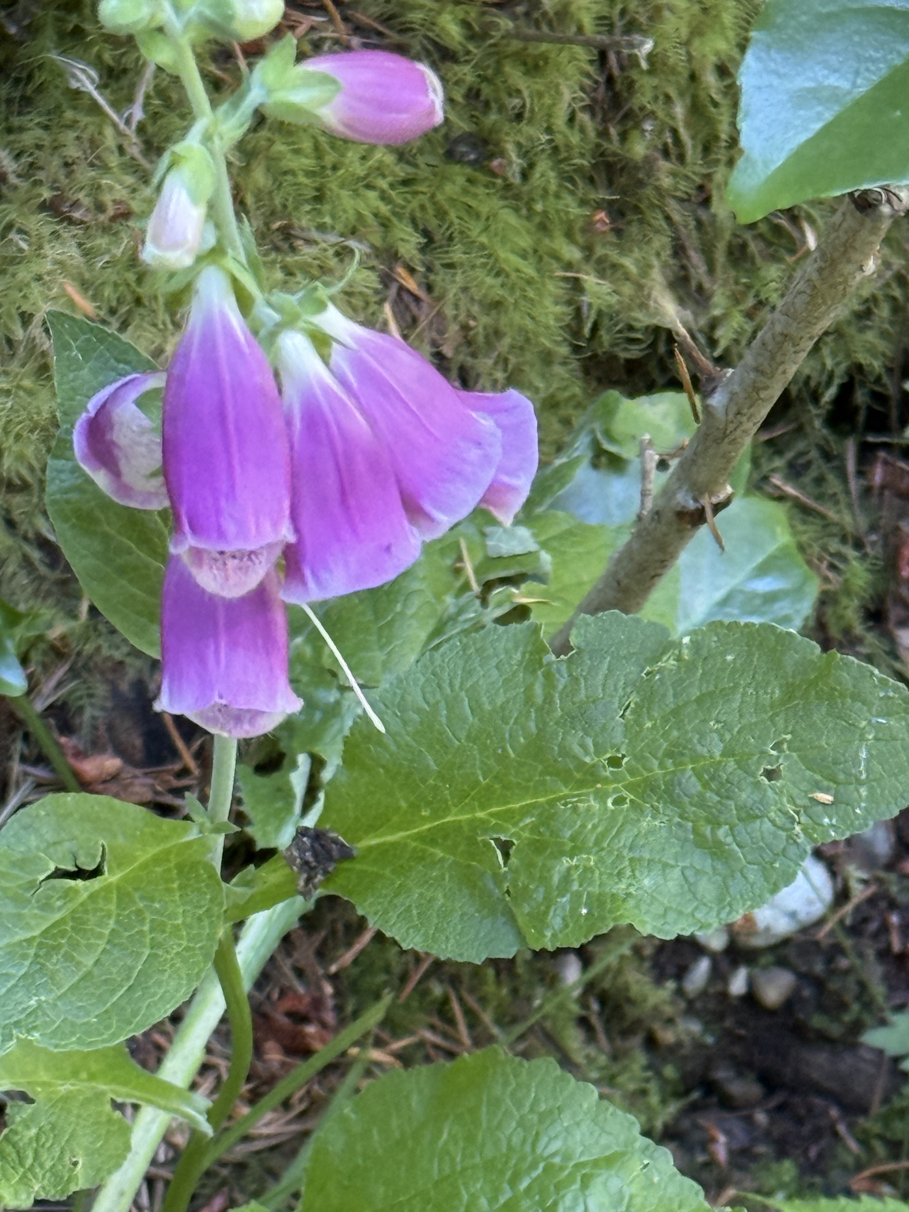
Plate 9. This familiar flower is foxglove (Digitalis purpurea), introduced from Europe; but it is so naturalized that it behaves like a native plant, similar to Cascade penstemon (see Plate 11), thriving in disturbed ground at the edge of conifer forests and in temporarily sunny areas.
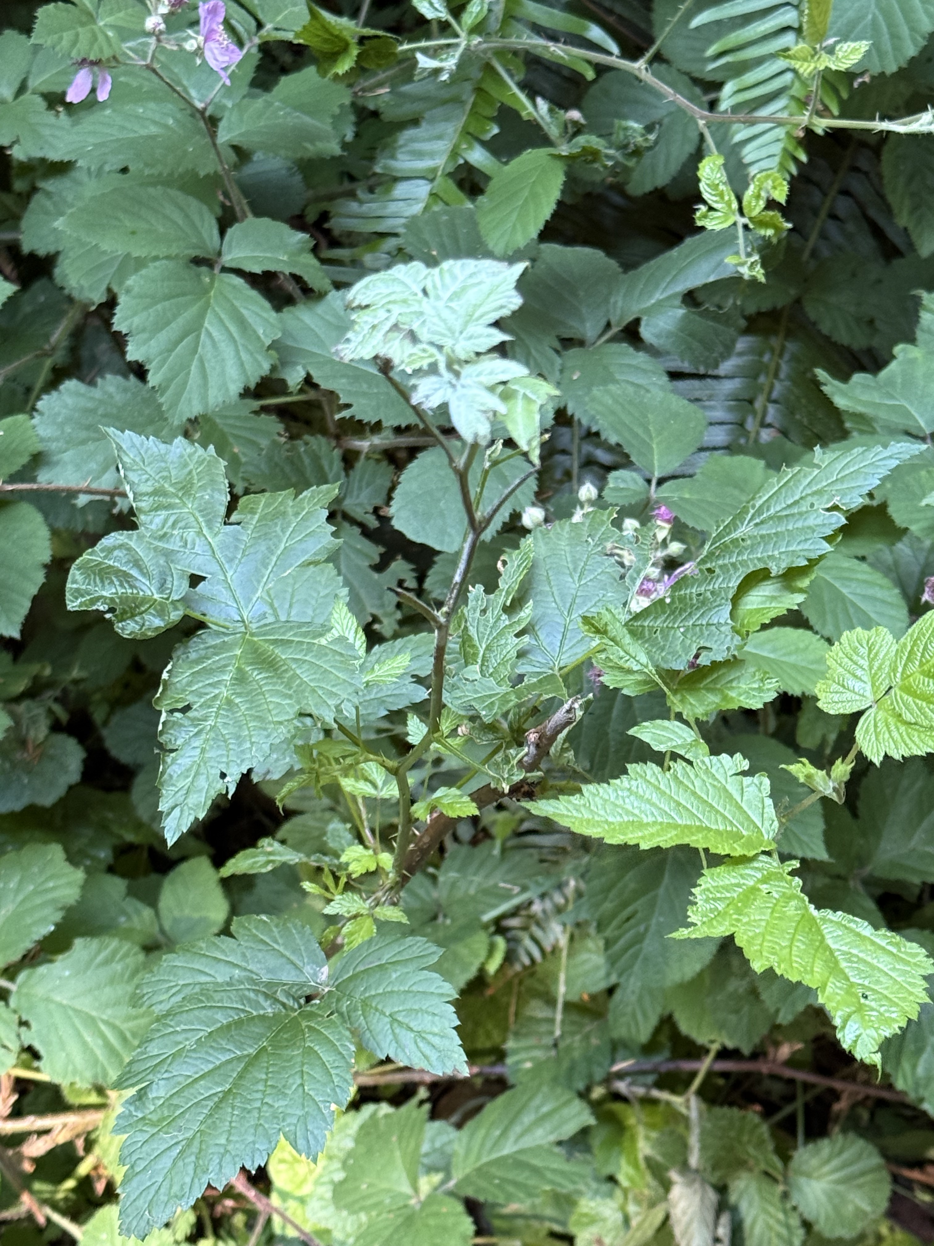
Plate 10. Besides white flowers, I am also fixated on thorns; however, I don’t know anything about thorns except that roses have them, as well as many of the shrubs I’ve encountered on my nature walks. This is probably Himalayan blackberry (Rubus armeniacus), an invasive species to Pierce County. I guess that’s why it isn’t called Washington blackberry, or some such. I checked a previous post from Point Defiance, and there it was! Invasion of the forest snatchers.
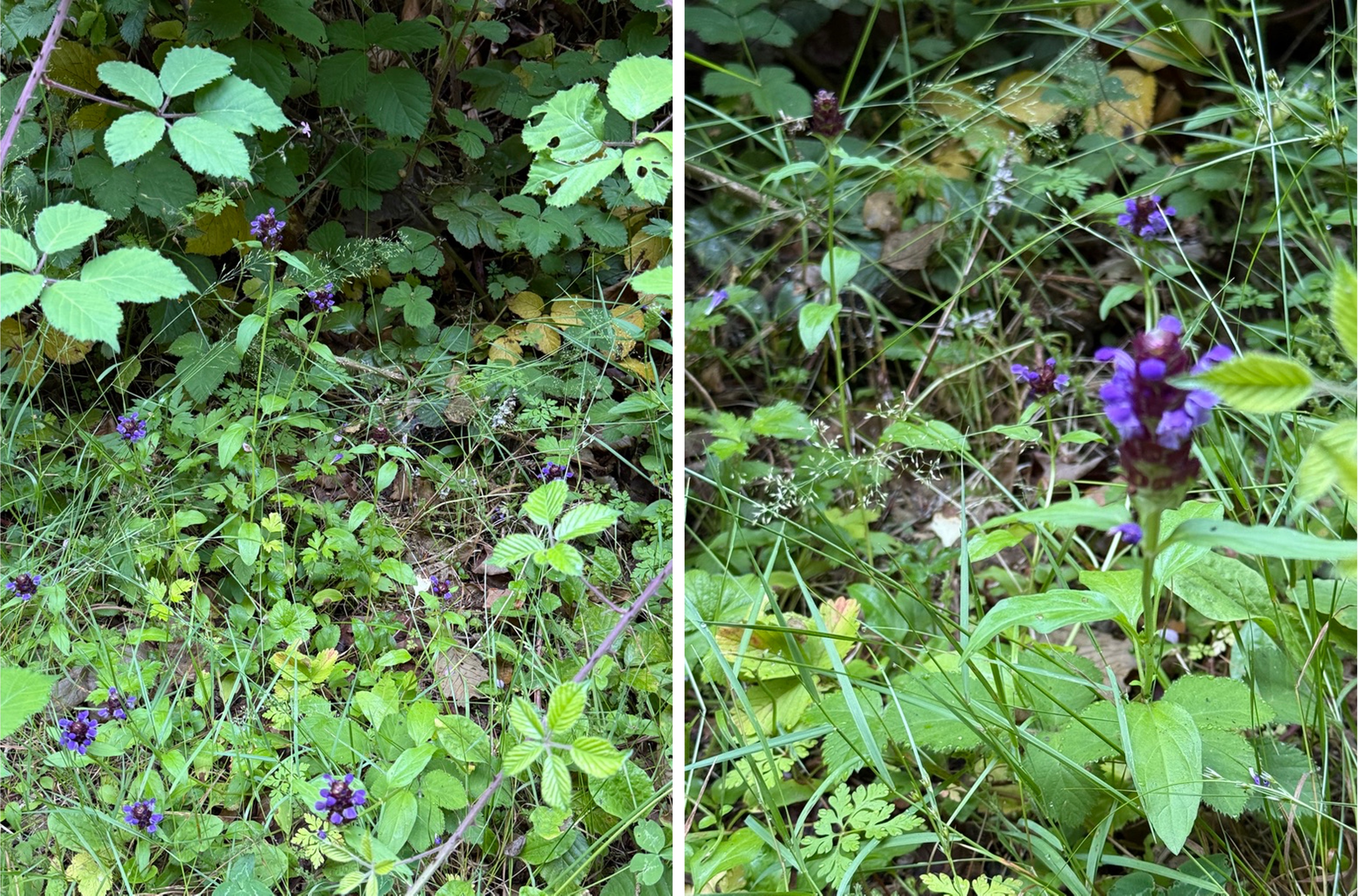
Plate 11. This purple wildflower is probably Cascade penstemon (Penstemon serrulatus), a native to the PNW. It is what CoPilot calls an ecotone plant — one that thrives where a conifer forest is encroaching on a prairie environment. We encountered it where the conifers hadn’t yet blocked out the sun along the trail.
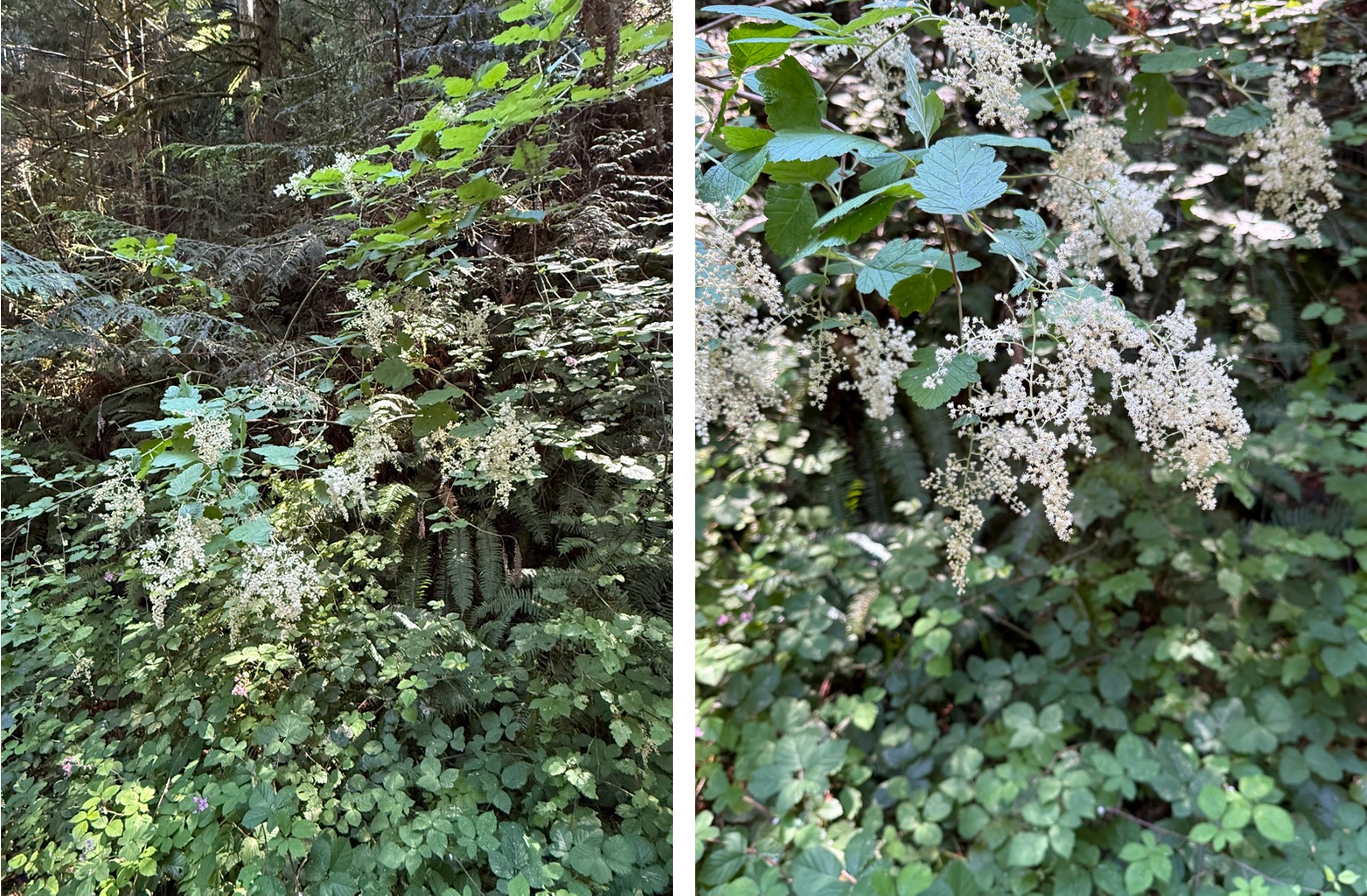
Plate 12. I’m easily fooled by white flowers. This non-woody shrub is False Solomon’s seal (Maianthemum racemosum). It grows in the understory of a conifer forest, which is a good description of Carbon River canyon.
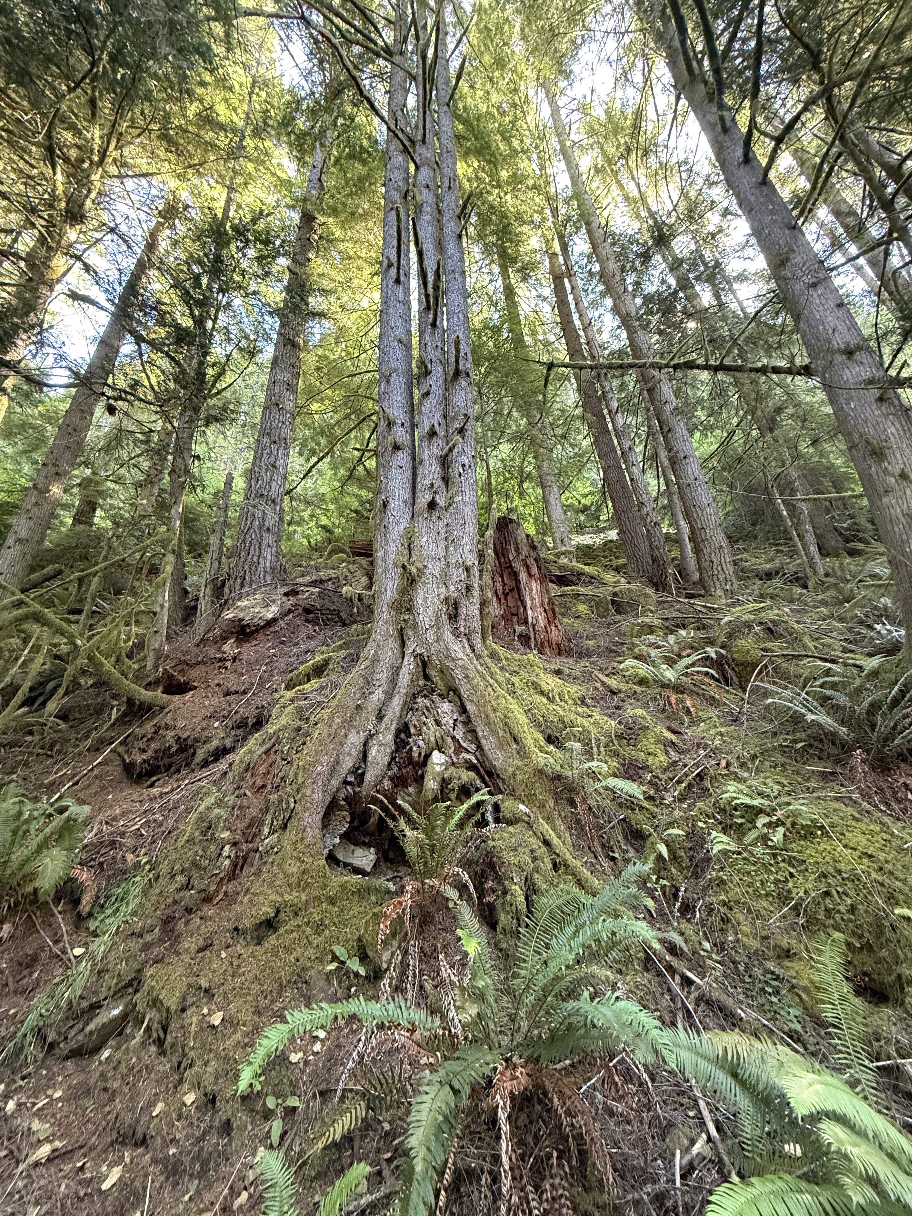
Plate 13. This is the first triplet I’ve seen from a nurse log. These young hemlocks will certainly compete for sun and nutrients. There can be only one survivor.
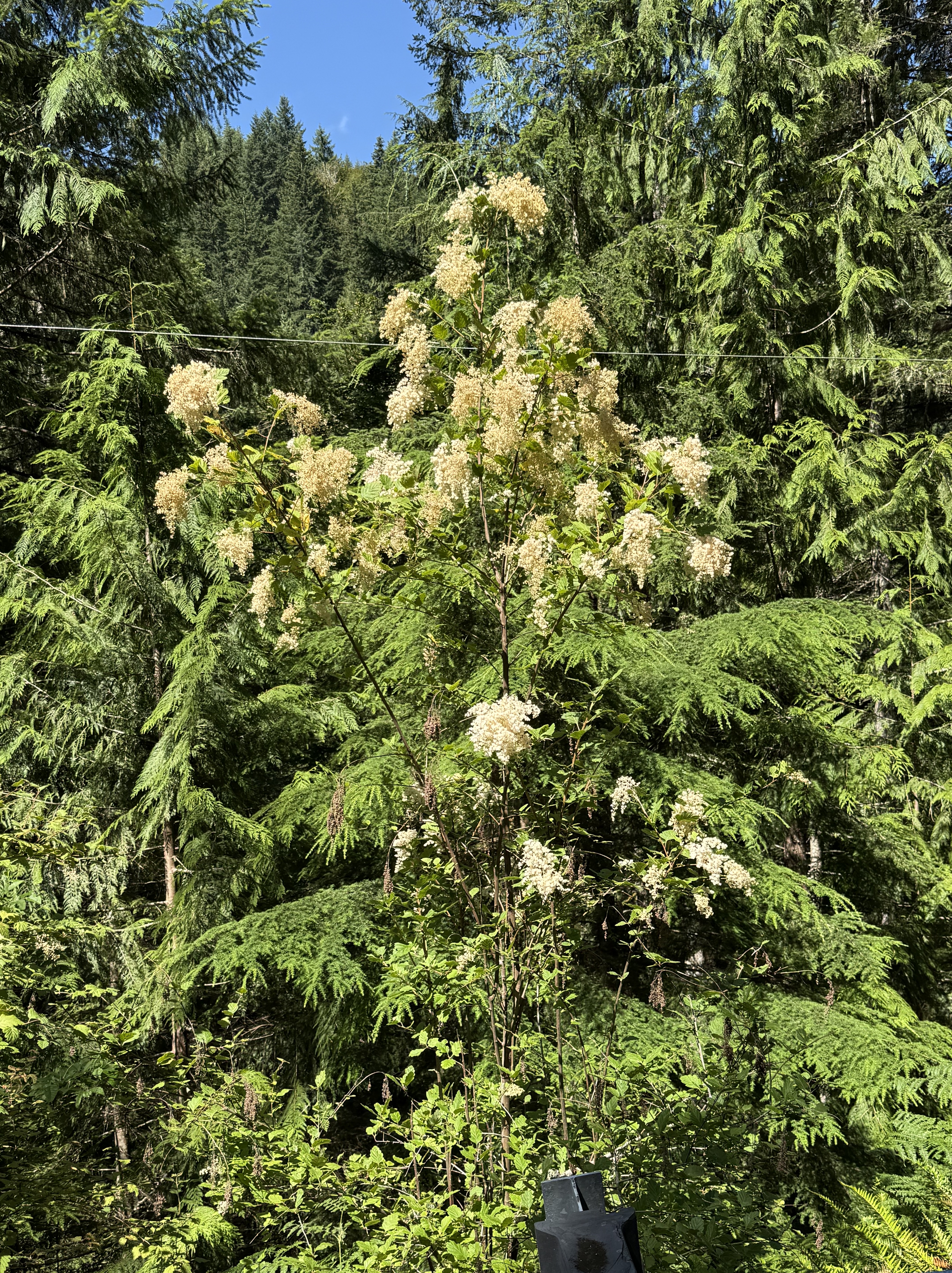
Plate 14. I thought this was cow parsnip, but CoPilot identified it as ocean spray (Holodiscus discolor). The white flowers were all I needed to see, but this tall, woody shrub (6-12 feet) is completely different from the weed in Plate 4.
Final Thoughts
The only thing I can add to the photos is that Carbon River is part of a transitional ecosystem, not unlike Mima Mounds. I Imagine this borderland environment is also alternating between a lowland/prairie and an upland/conifer forest, depending on conditions. However, much to my disappointment, the plants here were different from those we saw before. Furthermore, there were far more species along the Carbon River corridor. We were fortunate to visit when many of the flowers were in bloom.
I enjoy taking pictures of flora and learning about the ecosystem, but this is too complex for me. I’m only a simple geologist.
The Flora of Point Defiance Park
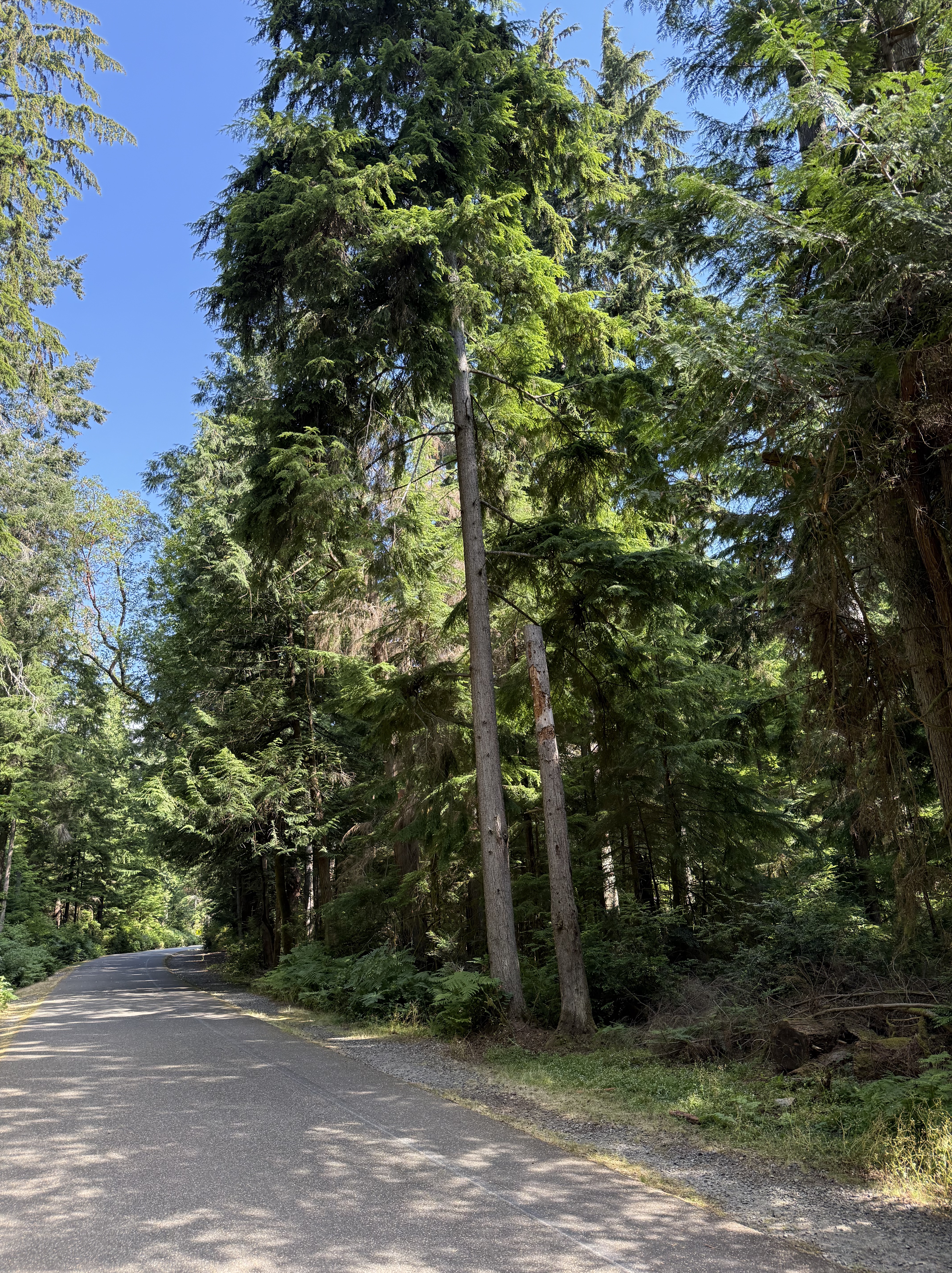
This beautiful, mature second‑growth coastal temperate rainforest is only ten minutes from my house. I should get there more often, and perhaps I will after taking an interest in ecosystems in addition to geology. Today’s outing was an opportunity to begin acquainting myself with the ecosystem I inhabit, so I made an effort to identify several plants along Five Mile Drive, a road that circumnavigates the forest and is permanently closed to auto traffic. When I started walking along this path, this forest was nothing but a lot of green trees and stuff. My perspective changed over an hour or so, and about 2.5 miles.
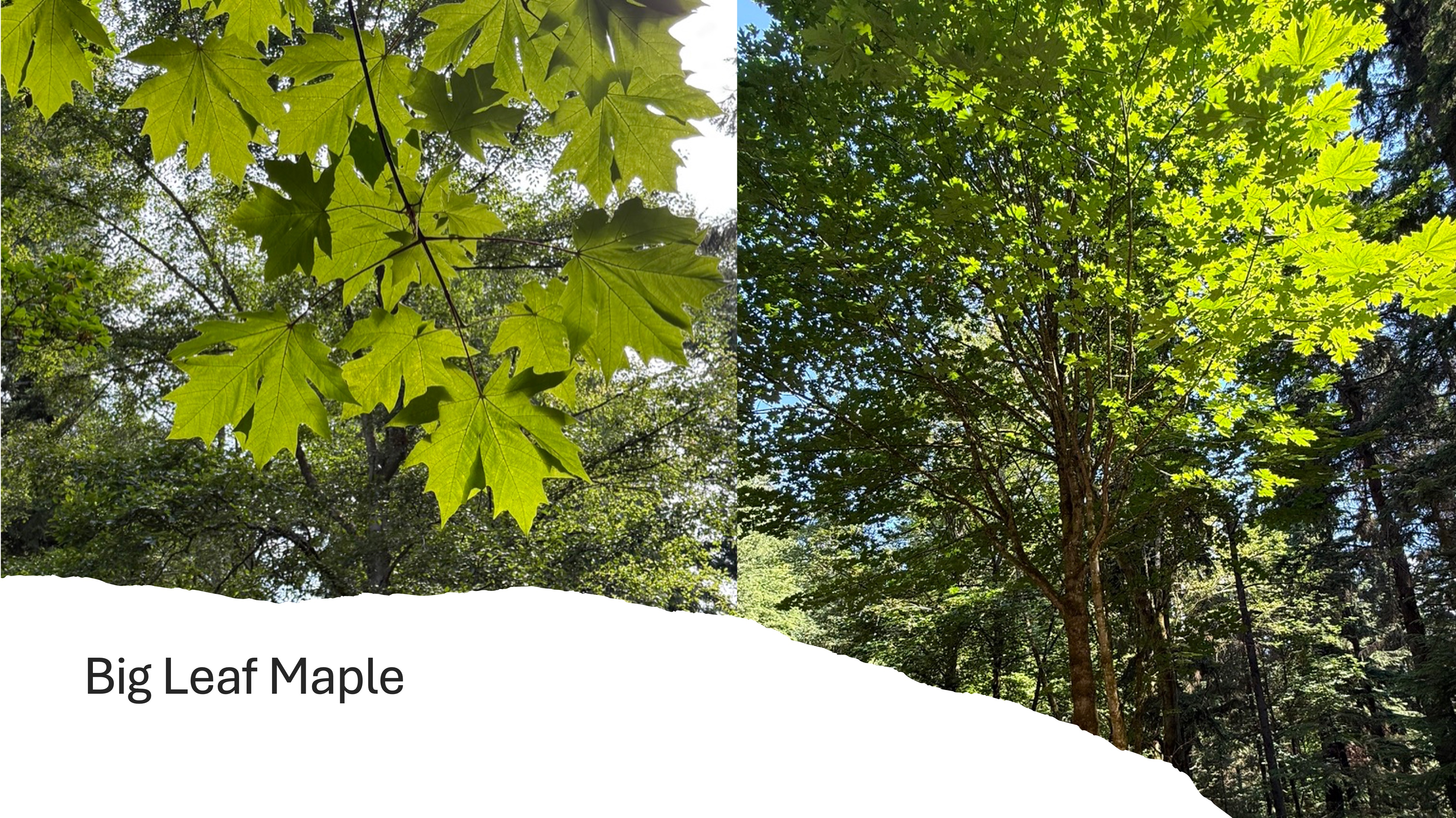
This colorful maple tree is a native to Puget Sound. It earns its name because those deeply lobed leaves are up to a foot across. But what are its roles in this forest? CoPilot had a lot to say about that. The Big Leaf Maple is fundamental to this ecosystem because it creates a huge amount of leaf litter that contributes to the forest floor and thus supports a vast microbiome, as well as a nurturing environment for conifer seedlings. This large tree (50-150 feet) fills in gaps in the forest canopy, supplying shade and catching rainwater, as well as dew. Its dappled shade creates a diverse understory for new growth. It is important in the success of birds, insects, bats, squirrels, and deer. They all hang around it and depend on its large mass for homes and meals. Its large root system contributes to hydrologic stability by stabilizing slopes, slowing runoff (and erosion), retaining moisture, improving soil infiltration.
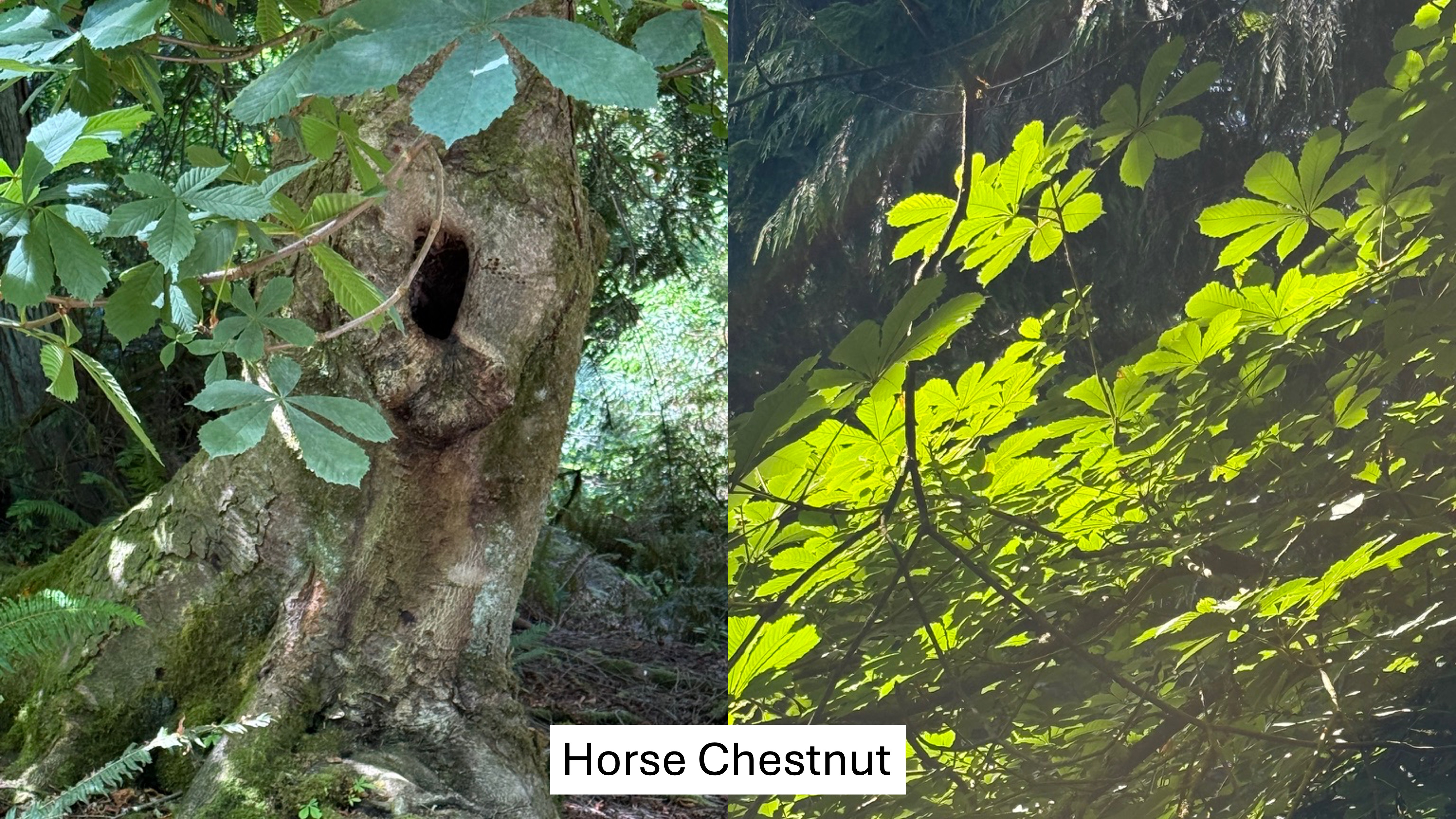
This large tree is native to SE Europe and they were introduced after the logging boom led to immigration. However, it is not an aggressive invader; this lovely tree does not form thickets, outcompete conifers, spread wildly, alter soil chemistry, suppress understory diversity, or create monocultures. In CoPilot’s words, “It’s a polite non-native.”
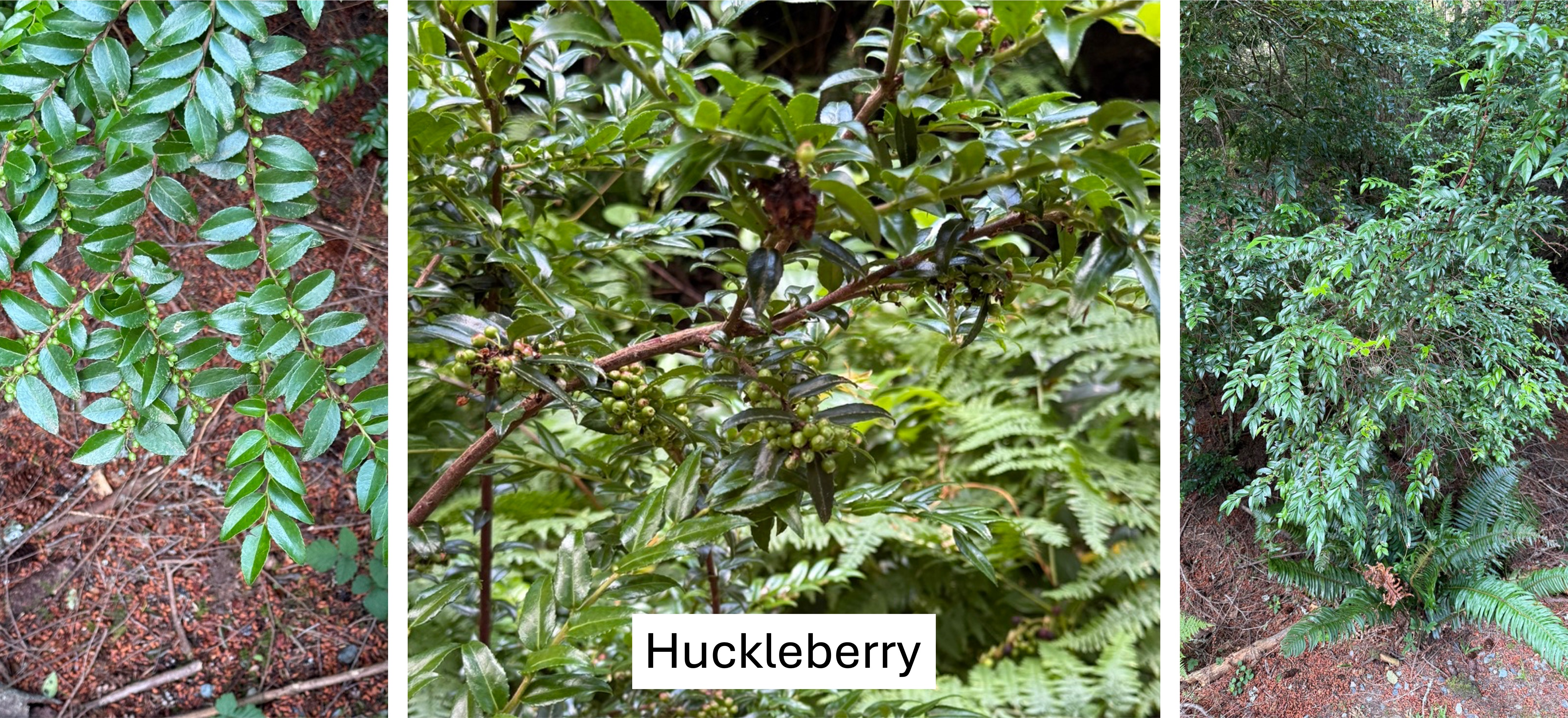
This nondescript shrub gives the forest its lush, evergreen understory identity. It is one of the top berry producers in the Puget Sound lowland forest but, more importantly, its berries ripen later in the season, extending the berry window into early fall. It also thrives in the acidic soils Douglas fir and hemlock create, in turn moderating soil conditions. It bridges the gap between ecological disturbance (i.e. logging) and late-successional forest. One could say that it serves as a node in the forest’s ecological web. This is an unrecognized keystone species in the understory.
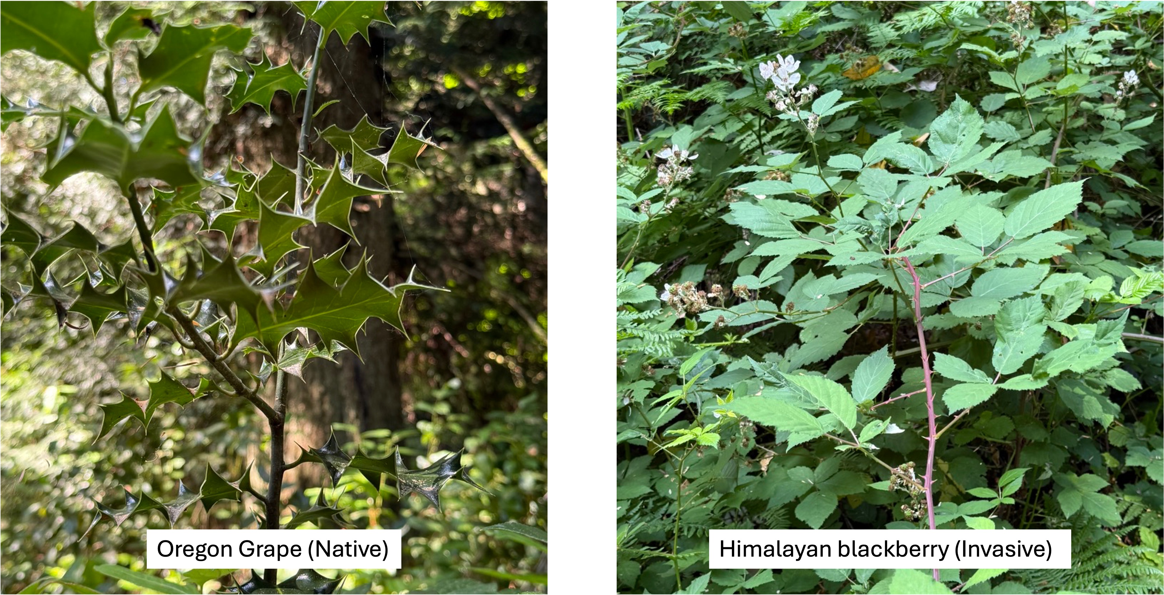
Oregon grape is the huckleberry’s silent partner in keeping the understory secure because it is also an evergreen shrub. In addition, it supplements the food web by blooming in March-April, providing nectar when few other shrubs are in bloom. Its berries ripen by mid-summer, bridging the gap between early berry producers like salad and late huckleberries. It precedes huckleberry in forest succession but persists as the canopy creates a shadier understory.
Himalayan blackberry is less like the fruit-bearing huckleberry and Oregon grape, and more like the Trojan Horse. The fruit are abundant and sweet, produced for a long season, and loved by all the denizens of the forest; thus, they are spread like wildfire, colonizing the entire forest–without predators in Pt. Defiance. The result of this invasion includes impenetrable thickets, root masses that choke other species, spreading by long, arching canes, and monocultures. It kills all the other stabilizing shrubs and creates a single mass of Himalayan blackberry. If left unchecked it can destroy an entire ecosystem, including the conifers. Holy shit!
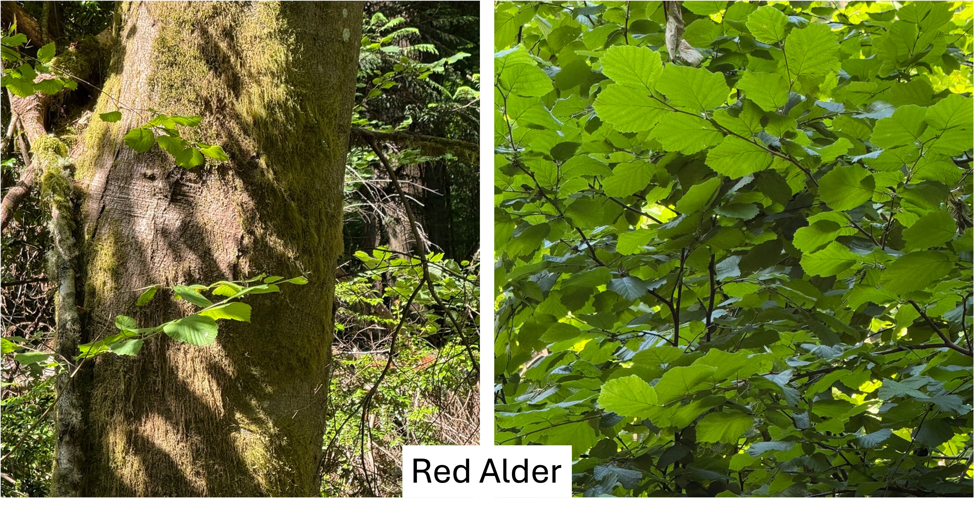
This nitrogen-fixing tree is the first responder when the forest is disturbed. As such it enriches soil, accelerates forest recovery, feeds the next generation of conifers, increases understory diversity, boosts fungal activity, and generally improves growth rates of proximal plants. Alder is the first tree to reoccupy damaged land, preparing the site for the conifers that will come later. Wherever alder stands exist, the biodiversity of the forest is increased. Because it gives so much to the forest, alders only live 40-60 years, thus acting as a continuous healing agent as a forest recovers from an environmental shock. This is the pioneer tree of the lowland forest. I hope it can defeat the Himalayan blackberry.
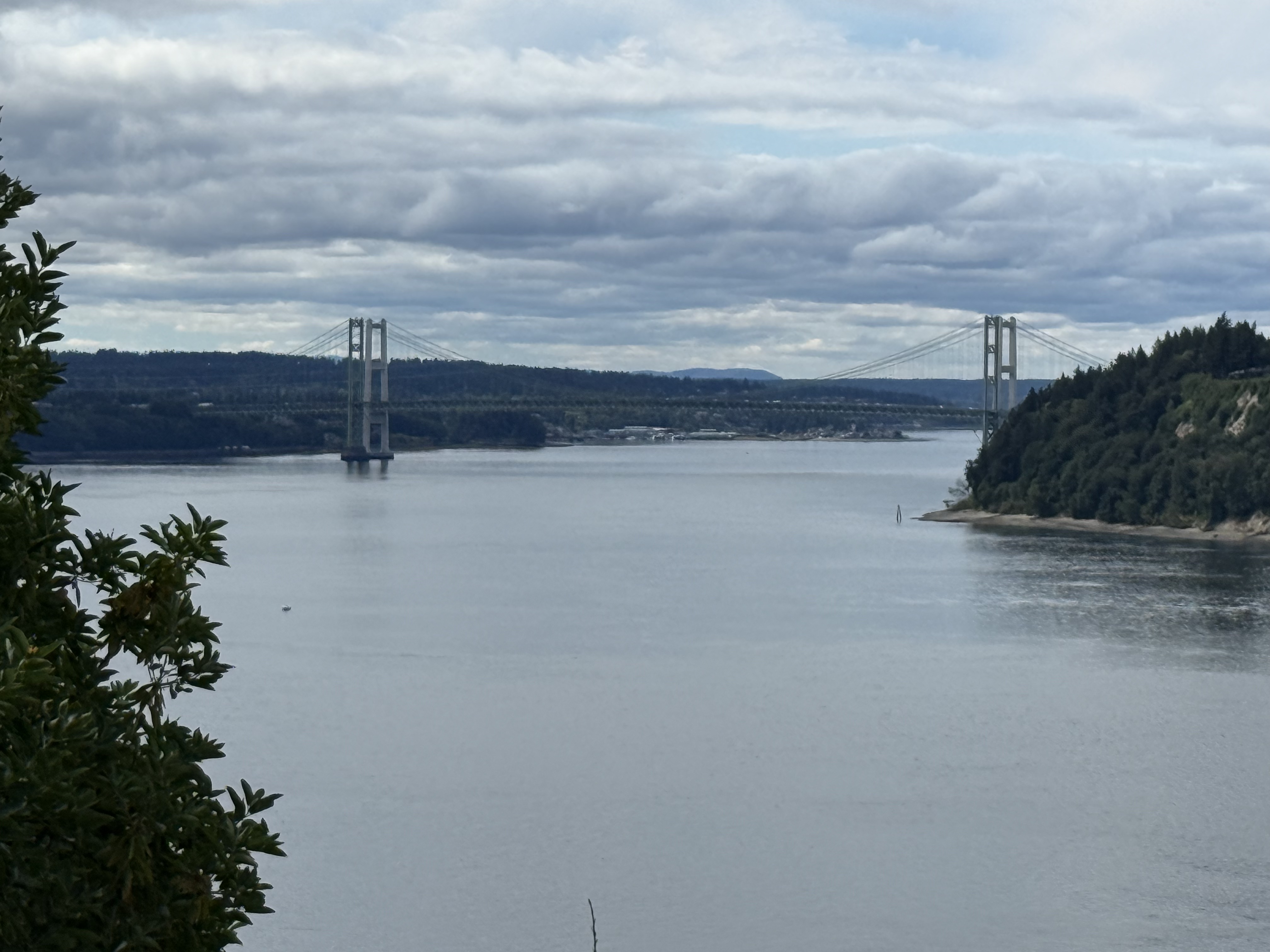
This view of the Tacoma Narrows bridge through the thick forest reveals a green landscape perched atop high bluffs overlooking Puget Sound. As far as the eye can see, from this vantage point, the forests were clear-cut to make profits and fuel the economic development of the Pacific Northwest.
But at what cost?
Mima Mounds Natural Area Preserve
It was unbelievably gorgeous weather here in the Pacific Northwest (PNW), with a high of 74 F, so we took a look at a couple of nearby natural areas.
Mima Mounds
This exceptional area isn’t unique but it is an unsolved geological problem. It is also peculiar in being a transition zone between active prairie and forest ecosystems. I’ll try to explain this with photos, and some help from CoPilot, Microsoft’s version of ChatGPT. However, I won’t solve the geological conundrum, which may never be fully explained.
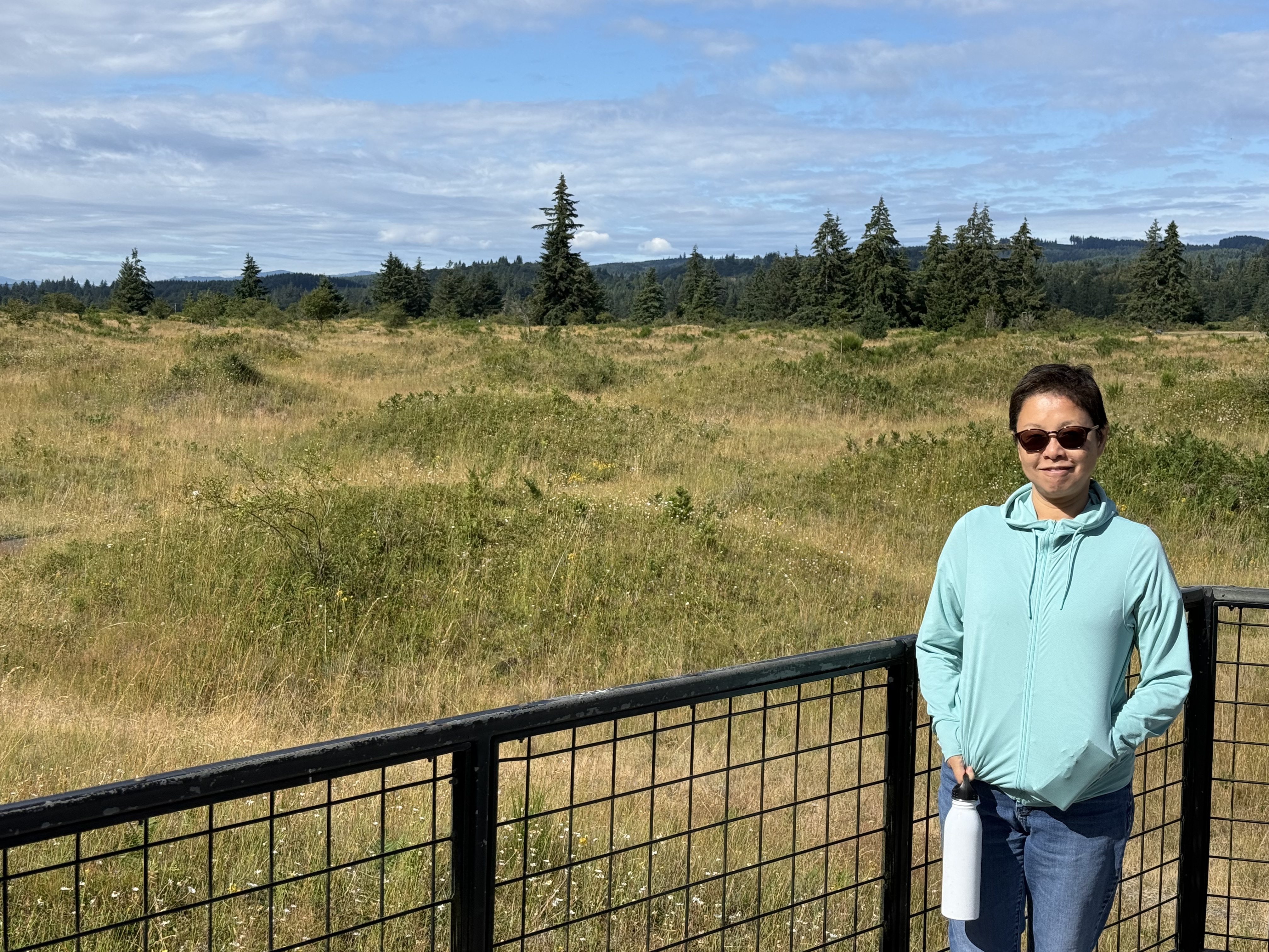
The Mima Mounds are about 16500 years old. They formed as the last continental ice sheet retreated from Washington. The mounds you see in this photo sit atop a gravel surface created at the southern extremity of this glacier. People, including the native Americans who have lived here for tens of thousands of years, have been perplexed by this bizarre topography.

There is a 1.9 mile trail that goes through the area; however, when European Americans first came here, this topography extended for more than twenty miles. Most of it has been demolished.
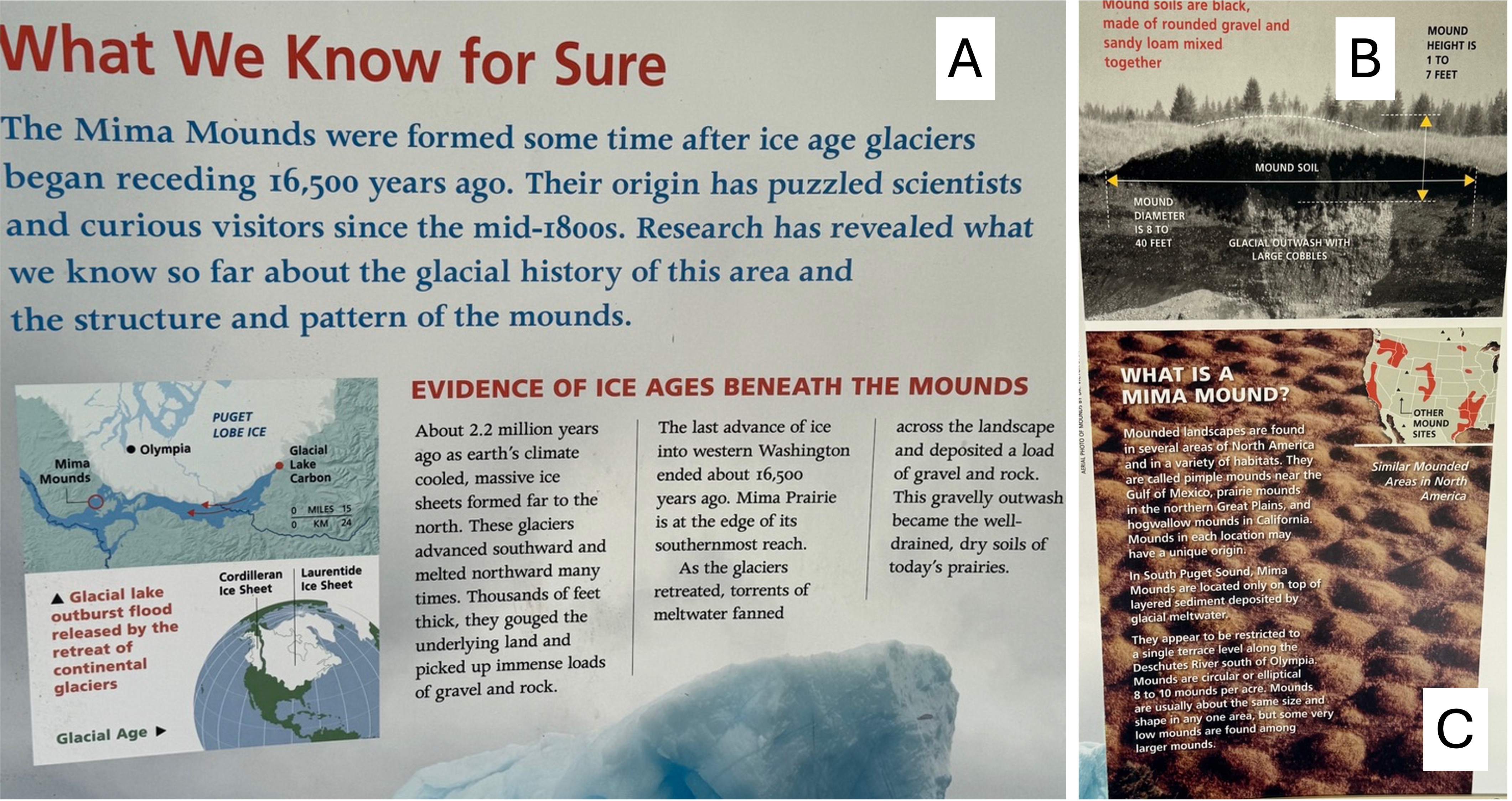
This is a portion of the information board at the interpretive center. (A) The Mima Mounds were constructed after the ice sheets began to retreat for the last time. The inset map shows the location of the NAP relative to the glacier and modern cities. This was the absolute furthest south of thick ice, but that doesn’t mean it was warm. (B) This is a rare photo of a cross-section through a mound. The dark soil is organic-rich and excellent potting soil. The subjacent glacial outwash is gravel. (C) This is a photo from the air, which shows their regular spacing. This is the geological problem. How could they have formed over about 400 square miles?
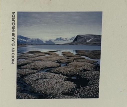
There are many theories for the origin of the Mima Mounds, and other mounds found in N. America and elsewhere. These are summarized on the Wikipedia page. I included this photo because it was on the poster; and the size/shape of these blocks of permafrost from Scandinavia are a good match to the mounds we saw. And they are in a similar, post-glacial environment.
Prairie Ecosystem
I’m discussing both the geology and ecology of Mima Mounds together in this post because they are inextricably connected. There are two ecosystems competing for space in this lumpy prairie environment. The result is there for anyone to see, if they ask the right questions.
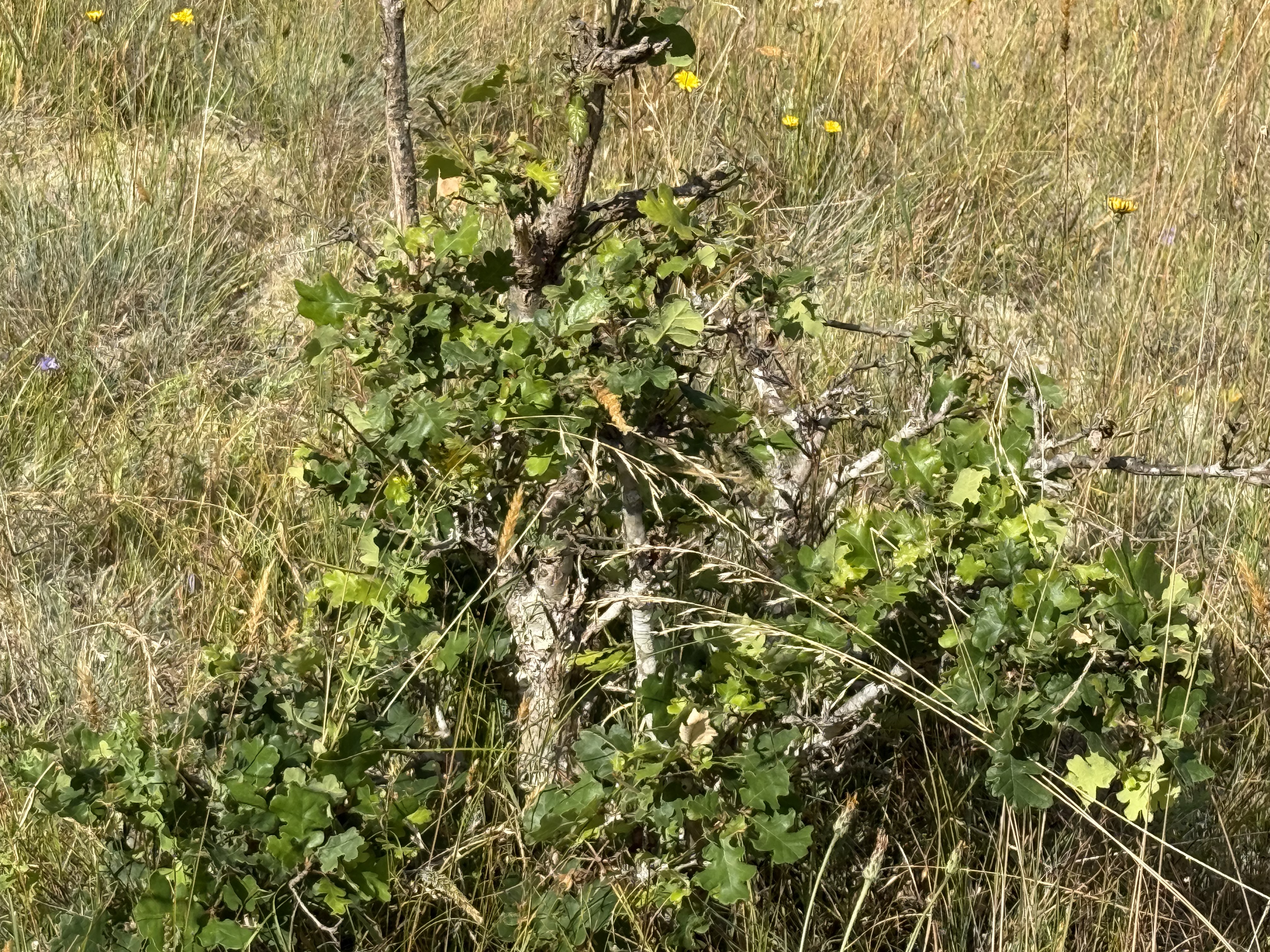
This low shrub was identified by CoPilot as snowberry, which is a staple of the prairie. I only saw them on the mounds, their roots in good soil, but apparently they also do well in the sandy glacial soil. From my perusal of the internet, I can’t disagree.
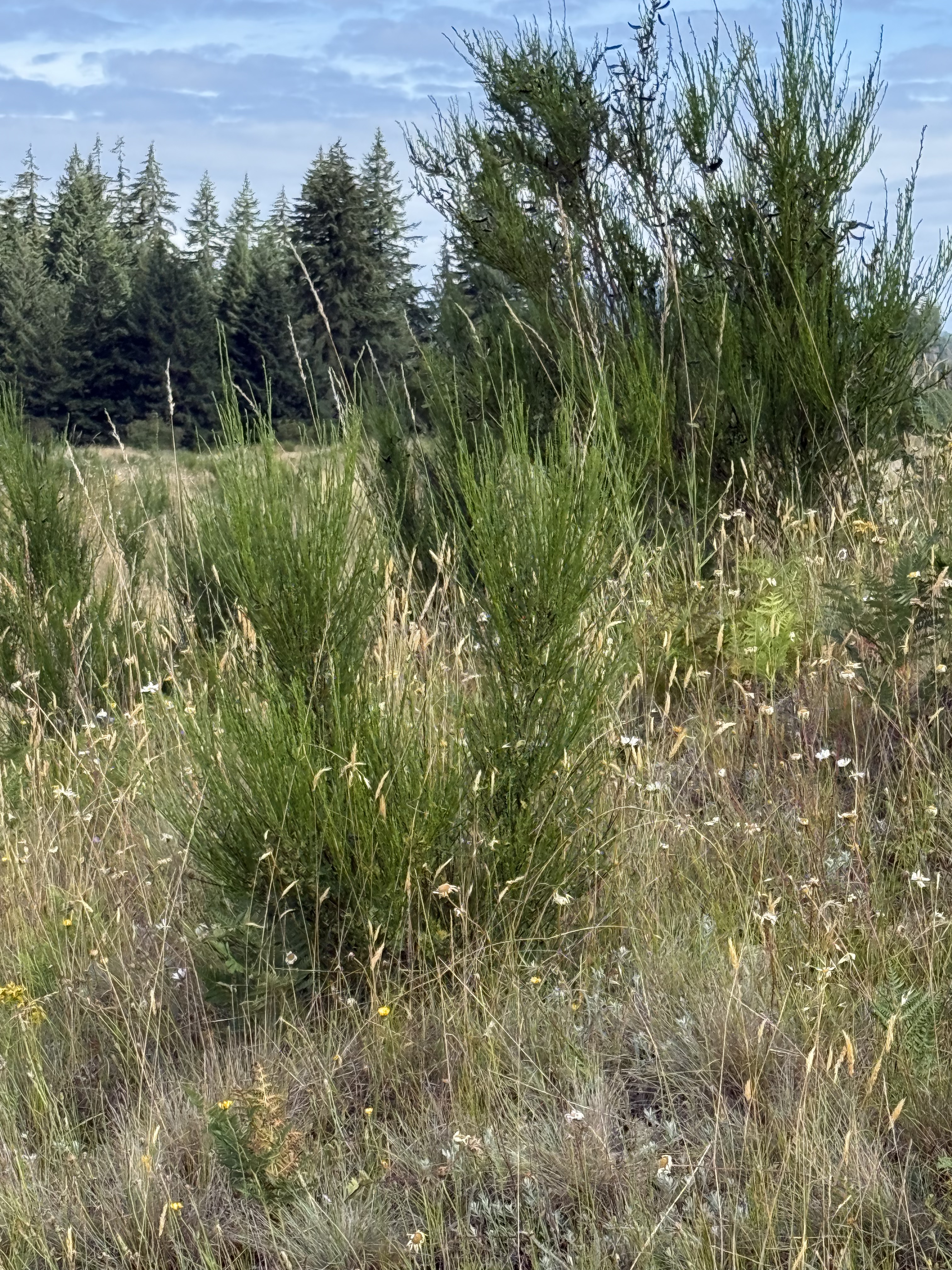
My ignorance is hilarious. I thought this was some kind of wildflower … but CoPilot identified it as a Douglas fir seedling. They were growing only on the mounds, sometimes in clusters. This is evidence (to me and CoPilot) that this is a dynamic transitional environment where forest species coexist with prairie flora.
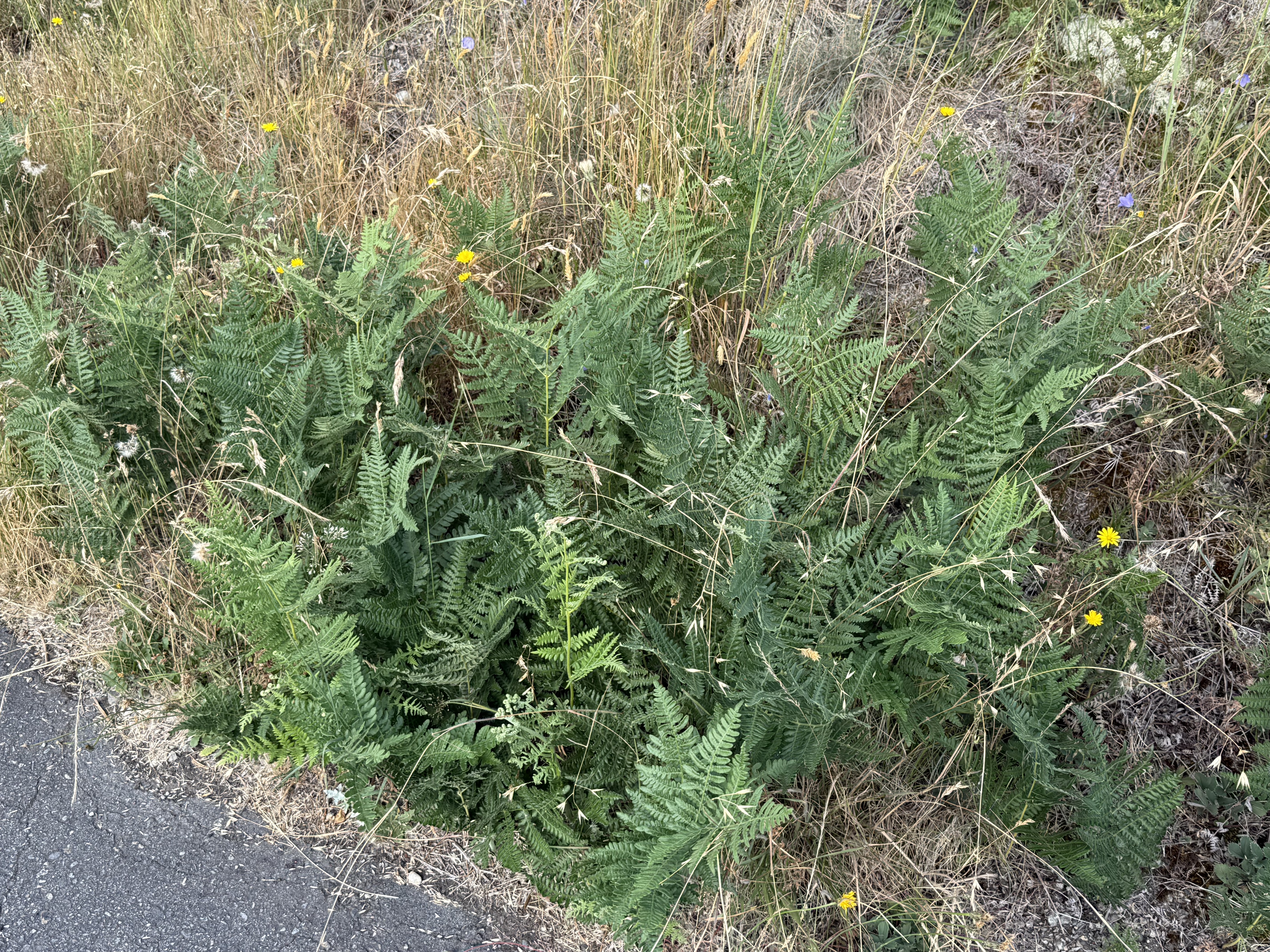
This fern caught my eye because it is not a natural inhabitant of a prairie ecosystem. However, the mounds are near a forest, so … CoPilot thinks it is a bracken fern, which is native to the area but not a prairie environment. It often behaves as an aggressive colonizer in disturbed edge habitats. That last phrase gets my attention because this preserve is at the edge of a mature forest.
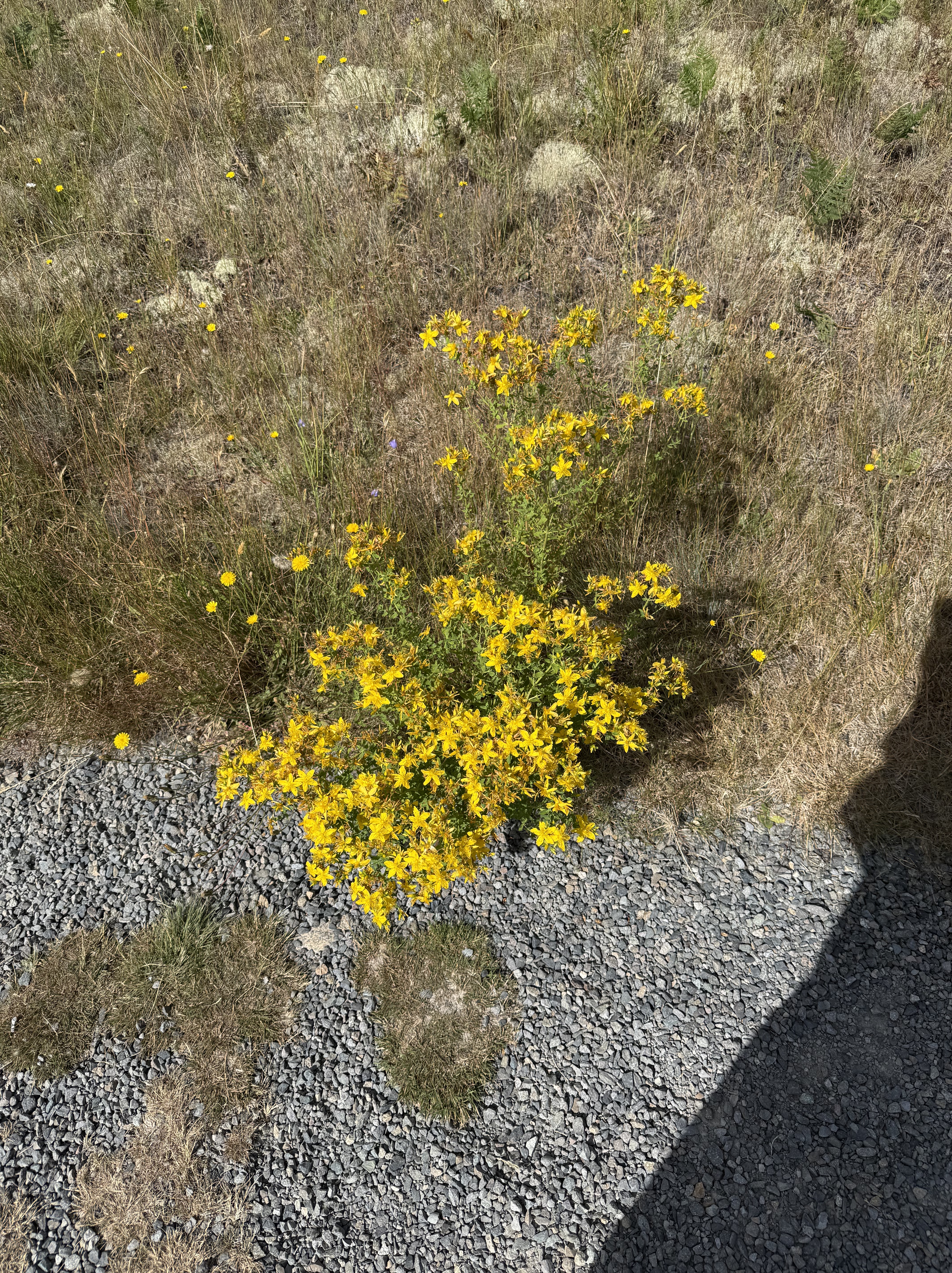
This lovely flowering shrub was identified by CoPilot as a species of Lotus, commonly called Spanish Clover, deervetch, or trefoil. It grew in the sandy areas between the mounds. My quick check can neither confirm nor deny this identification, but this common variety of clover is native to the PNW.
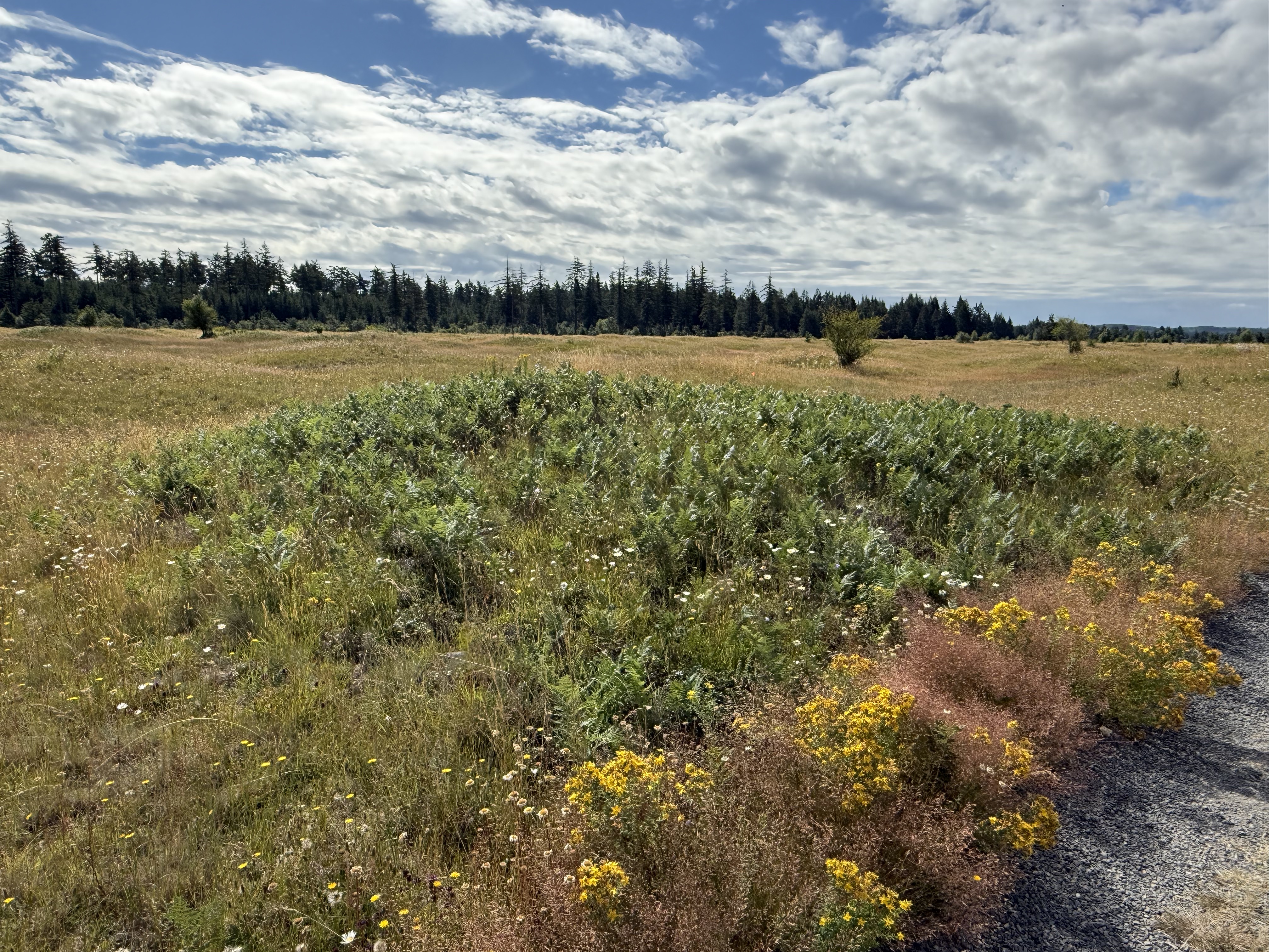
This mound is populated by bracken ferns, crowding onto the area with good soil.
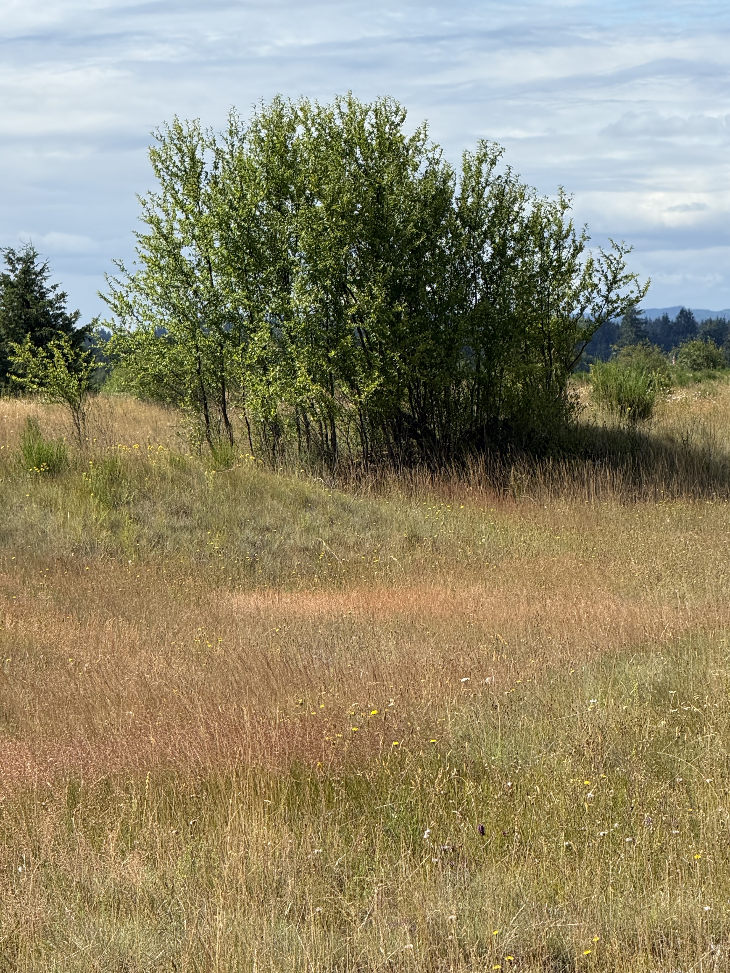
I don’t know what species this copse of young trees is, but it is obviously encroaching on the prairie ecosystem.
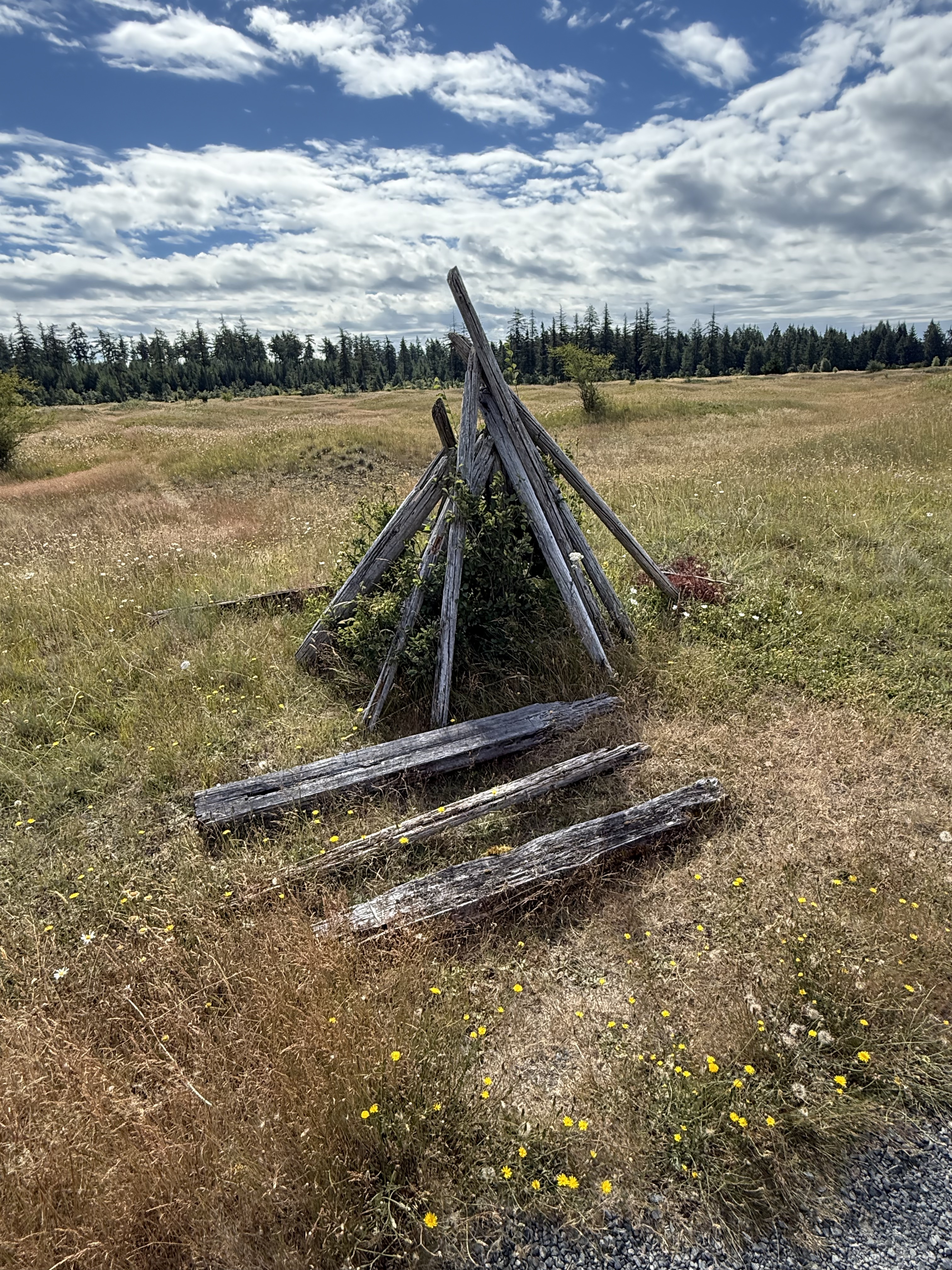
You never know what you’re going to find when you go outdoors. According to CoPilot, this is probably the result of NAP’s policy of not removing human artifacts that don’t interfere with the environment. Manpower shortages, policy priorities, etc. Mima Mounds was established in 1976, so it’s fair to say that this structure is at least that old. I guess NAP hasn’t gotten around to it yet, which fits my nascent sense of priorities in the PNW.
Bill Frank Jr. Nisqually National Wildlife Refuge
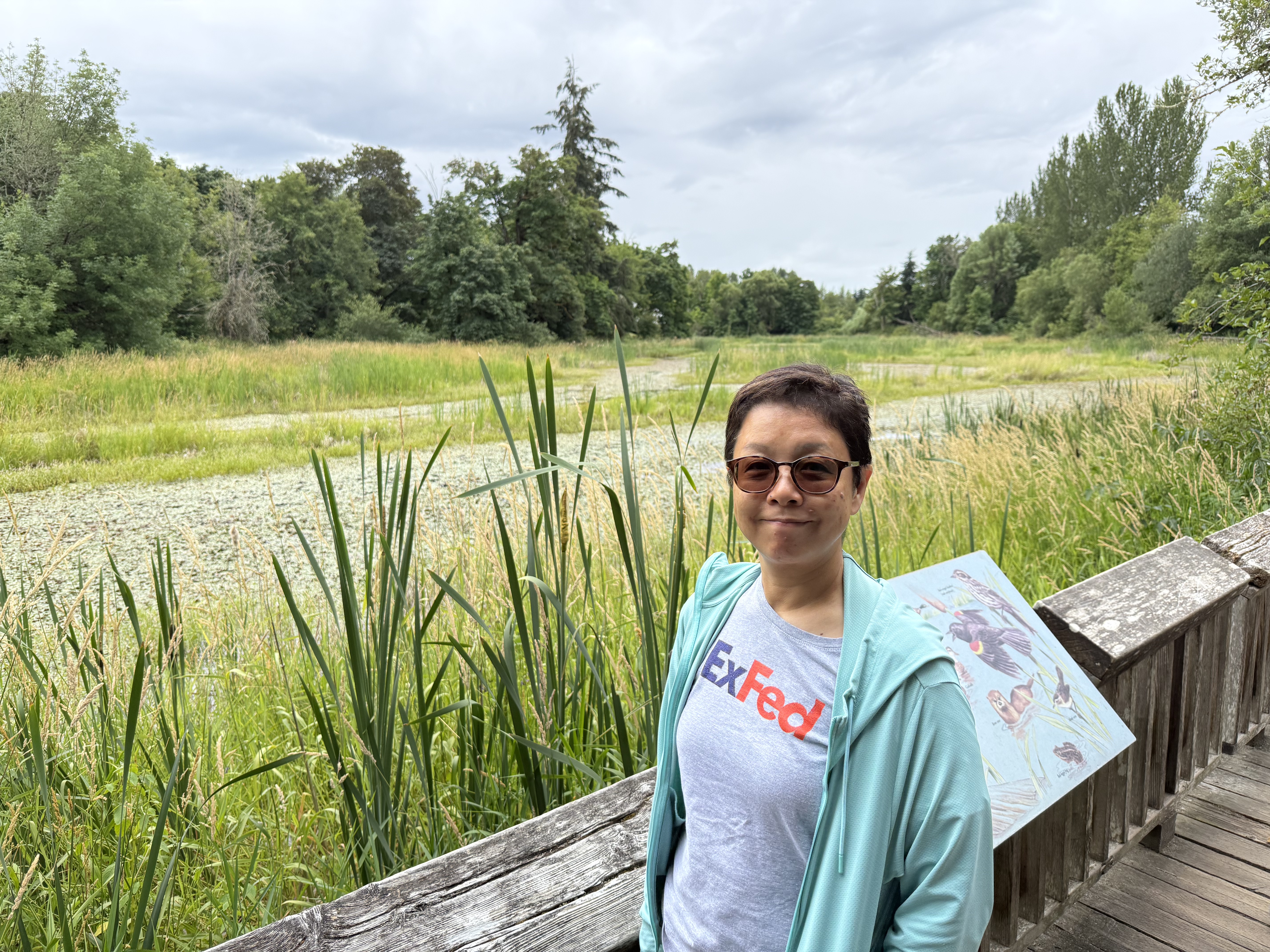
We stopped for a quick visit, which turned into a one-mile death march (for me, after walking 4 miles on uneven ground), to see where the Nisqually River empties into Puget Sound. It originates from the face of an alpine glacier above 6000 feet on Mt. Rainier. This is a tributary stream that forms a series of algae-covered ponds.
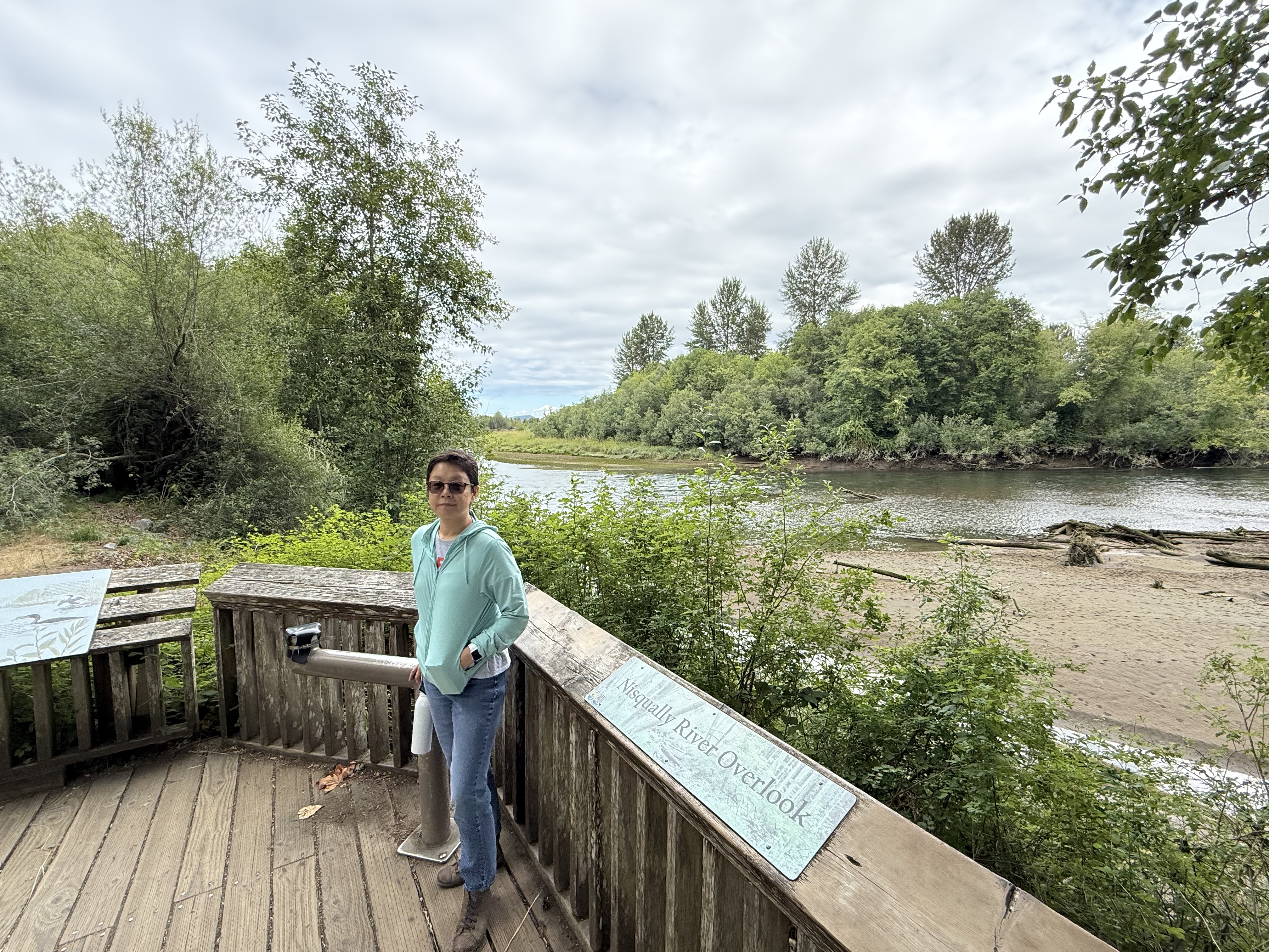
Here we are, less than a mile from the Nisqually River’s delta in Puget Sound. There is a lot of downcutting and the creation of sand bars, but no boulders or even cobbles. This glacial river has been tamed by nature over a distance of about eighty miles, but it is still flowing pretty fast. We didn’t make it to the delta … maybe next time.
Summary
This was a great day trip to a fascinating and beautiful area, where the prairie and the forest compete for space on the top of mounds of top soil whose origin is a mystery. This back-and-forth movement of plants on timescales of years to decades suggests that the PNW is alive and well, the flora responding to minute changes in soil and air temperature/moisture, precipitation, wind, etc. Let’s hope these two thriving ecosystems can continue their dance without further human interference.
I have my own hypothesis about the formation of the Mima Mounds, which is consistent with the facts. 1) As the glacier melted and retreated, over thousands of years, shallow lakes developed in local depressions. These lakes were shallow, perhaps twenty feet deep, and limited in extent. 2) Fine-grained sediment (i.e. mud) and organic debris settled in them to depths of no more than ten feet. They were ice covered for part of the year. 3) As the glacier retreated further, streams began to superimpose their beds onto this landscape, but they weren’t like a glacial river (e.g. Nisqually River). These were weak streams flowing over a post-glacial landscape, meandering and not cutting new channels. 4) This mild erosion was superimposed on a landscape dominated (in this area) by an antecedent pattern like that seen in the Arctic (see above photo). Fine-grained sediment was removed, following a suture pattern until only irregular bumps remained. 5) This process of sheet-flow erosion continued to the present day, leaving us with these paradoxical mounds.
I am a sedimentologist, so I think in terms of turbulence and flow as interconnected processes that alter a landscape slowly, one grain of sand at a time. There wasn’t enough turbulence to strip away the veneer of clay over this basin in the time allowed, so it chipped away at the weak edges of lumps of soil that were probably held together by the roots of plants.
In other words, the thawing of permafrost created the pattern, and turbulent flow polished it to what we see today.
Prove me wrong…
Hood ornaments through the ages: A visit to Lemay–America’s Car Museum
This wasn’t my usual visit to the local automobile museum. Instead of glimpsing the big picture, as seen through the evolution of car bodies from wagons to sleek, steel superstructures sitting on rapidly changing chassis, I am going to take a rather myopic view of automobile development in the twentieth century. Cars and airplanes co-evolved once lightweight, powerful motors were developed; but, unlike aircraft, autos weren’t substantially influenced by wars. In fact, the redirection of civilian manufacturing to wartime needs was an impediment to progress in land transport. Nevertheless, similar lofty ideas influenced automotive design, especially their adornment with signs of the modern, technological age.

Inspiration for this post came from my son, whose attention to detail constantly reminded me to focus on the details. Thus, this post begins with a ~1903 Studebaker electric buggy, which has no adornment despite being painted an eye-catching red.

By 1913, International Harvester designed a logo for the radiator of this cargo wagon.

Pierce Arrow added a bit of flair to the insignia. A good part of this post will focus on the development of radiator caps, from fancy adornment of the cap, which was required to add water for the internal combustion engine, to …. let’s see what happened.


Graceful designs appeared early, as in this 1920s Cadillac. I think the flowing pattern behind this woman’s head represents water as she burst from the surface of the sea, as suggested by the fluted base. She is taking flight.

Lincoln turned to the graceful greyhound on the radiator cap to imply beauty and speed. Note the lean ribcage, coincidentally similar to the louvers used for cooling in early models.

The Nash corporation created the Metropolitan car to compete in European markets during the 1950s. Small, economical, but stylish, it nevertheless had an ornate hood ornament that was no longer attached to the radiator cap.

No long hair streaming in the wind here. This idealized female figure wears her hair in a bun and is … I don’t know what she’s lying on, but it looks like some kind of jet pack.

Chevrolet caught my attention because of the evolution of their logo. This 1940s grill looks like an idealized shield, i.e., coat of

By the 1950s the Chevrolet “coat of arms” had become wider to fit the full-body designs made possible by improvements in metal working, but they still added meaningless details like the crown icons on this design. Accompanied by a V that filled that gap in the wider hood.

By the 1960s the emblem was surrounded by an ellipse, which made it easier to attach it to the larger grill required for more powerful engines.

This 1950s Ford integrates several elements from different eras: The name of the model, the stylized coat of arms, and an icon representing the jet age–the hood ornament is reminiscent of the iconic F86 Sabre, the hero of air combat during the Korean conflict (it was never officially declared as a war).


This 1950s Oldsmobile integrates similar emblems: It adds a map of the Western Hemisphere, and updates the fighter jet to a bomber.

Mercury takes another twist by updating the old “coat of arms” to a minimalist Mercury icon (the head wearing wings on his hat), combined with a stylized M to fill that wide hood.

This 1930s Plymouth attempts to represent a mythical past by including a Valkyrie taking flight with what looks like a Mayflower ship–probably homage to the name, “Plymouth”.

This 1950s Ford looks like it has a pistol attached to the hood.

The color scheme on this 1930s Ford may not be original, but it is obvious that Ford wanted to advertise that this car was powered by an eight-cylinder motor, probably the famous flathead V-8 which they introduced to the working class.

Ford purchased Lincoln and claimed their greyhound, added a V8 emblem to make it clear this was NOT a straight eight, which was a powerful but problematic motor, and glommed their still-in-use emblem onto the grill of this late 1930s/early 1940s era car.

This early 1930s Ford dropped the decorative, exposed radiator cap but included a support bar to get the message out that this was a V-8 automobile.

When pressurized cooling systems were introduced in the early decades of the twentieth century, it was necessary to monitor water temperature, but in-dash gauges hadn’t been invented yet. This radiator cap incorporates a thermometer. This photo shows the side that the driver didn’t see: in a time before owner’s manuals, it tells the operator what the proper temperature range is. The other side, which faces the driver, shows hot water filling a bulb.

This temperature gauge is the only example I saw of a biplane, and it’s supplied by the instrument manufacturer.


According to ChatGPT, this youth is drawing a bowstring on the radiator cap of a Pierce Arrow (circa 1930). Note the bow he’s sitting on. I don’t quite understand the position, but I’m not an archer. It makes more sense than a child about to ride a slide, and it explains the curved, cylindrical object he’s sitting on. Who would’ve thunk…

The Buick Riviera, introduced in about 1962, had this unimpressive R set in a groove in the hood.

A couple of stylistic changes to Lincoln in the 1940s: The greyhound was swapped for what looks like a ball and bat; and the coat of arms became a body-sized shield.

The driver has to read this temperature gauge from behind the steering wheel. The strange symbols around the edge look like fish bones or trilobites …

Bentley wanted to be certain that people next to you at the traffic light knew how wealthy you were.

This 1950s car mixed a jet aircraft symbol with knight holding a shield.

This 1940a hood ornament pre-dated jet aircraft, but that androgynous figure is going pretty fast…


The proud owner of this 1920s Buick receives a crown (of thorns?) from an angel.


I wonder what this wading bird is looking for? According to ChatGPT, it is the Packard “Goddess of Speed”, an art deco representation of coiled power about to explode. I guess people looked at things differently in the 1930s…


International Harvester incorporated only their iconic IH symbol on the Scout’s hood in the 1960s, but culture doesn’t wait for corporations to add their own “art deco”. I don’t know how much more of this I saw at the museum, including all those Motometer temperature gauges…

This 1950s Pontiac Bonneville sports a jet on each fender instead of only one.


What the hell? CoPilot (aka ChatGPT) thinks that the weird arrowhead on top was just that–meant to imply as fast as an arrow. That’s a long way from an airplane or valkyrie. This bizarre hood ornamentation might explain why Hudson went out of business in the 1950s.

Since Earth doesn’t have any rings, this 3D circle must represent a satellite’s orbit. Pretty advanced for the mid-1950s. Too bad Oldsmobile didn’t make the cut when it was time to downsize GMC in 2004. Bummer.


They barely had room for the coat of arms between the jet intake and the aircraft on the hood on this 1950/51 Studebaker Champion. Despite the optimistic ornamentation, this car had a six-cylinder with about 100 hp. Bummer.


Mercedes added a badge for those who weren’t familiar with its iconic star.


There’s a lot going on here: a pair of “8”s for, presumably, the straight-eight engine that was a real powerhouse in the 30s; wings; an explicit acknowledgement of both Dodge boys; a Star of David; and a set of pipes, maybe for an organ, on the radiator cap.
Final Thoughts
If you made it through this long post, I hope you enjoyed the journey as much as I did. I have never examined one aspect of the evolution of automobiles in such detail before. It was worth it, even if hood bling isn’t as exciting as engines, brakes, body styles, and all the other mechanical components.
Two concepts seem to have been central during the twentieth century: having a coat of arms was probably an extension of custom-made coaches to horseless carriages; and associating cars with flight, either through birds, mythic creatures, or airplanes. The combination was often ludicrous but always entertaining. The phrase, “They don’t make them like they used to,” is nowhere more applicable than to stylistic choices in bodies and the chrome trim they sport.
The Geology of Franklin Falls
Washington has more than 3000 catalogued waterfalls, so we stumble onto them regularly. Waterfalls form wherever there is a change in the lithology of the crustal rocks: along crustal faults, which naturally create vertical planes; where weaker rocks lie beneath strong ones and are reached by a downcutting river; and of course where glaciers have sculpted the land. These natural features create spectacular views as well as revealing glimpses of deep time.

Plate 1. Franklin Falls is about 70 feet high. The reddish rocks forming the cliff are Eocene sandstones and volcanic rocks (56 – 34 Ma). The park follows the South Fork of the Snoqualmie River along I-90. The parking lot is quite large and we found a parking space, even though it was great weather; more than one million people visited the site in June.
The rocks in this photo don’t reveal well-defined bedding although there is a suggestion of bedding to the right side of the image. However, I think the bedding marker is the vertical, dark streak that is slightly wavy. This curvature suggests that these rocks were deformed while ductile (buried deep enough to bend rather than break). The geologic map identifies an anticline in the area, and I think I found it.

Plate 2. Franklin Falls is located just west of Snoqualmie Pass, at an elevation of about 3000 feet. The Northern Cascades are very rugged and access is limited, especially in the winter. The topography shown in this map reveals steep slopes, especially through this pass, which I assume is the easiest route through this rugged terrain.

Plate 3. The geologic map from Rock D shows three distinct rock units, which reveal the general geological history of this area. The oldest rocks are part of the Jurassic melange belt (201 Ma), comprising metasedimentary and metavolcanic rocks that were originally deposited in deep water, possibly on a submarine fan. These sediments were buried and then scraped off the subducting ocean plate. This process deformed them as if they were put in a blender; hence the name, melange.
Almost 150 million years are missing before Eocene volcanic and sedimentary rocks were deposited in a continental setting, possibly a river or lake not too close to mountains; the rocks seen in Plate 1 don’t contain any large boulders like we see in the modern river bed below them.
Granodiorite is an intrusive igneous rock containing light-colored feldspars like albite, and slightly less quartz than granite. This batholith was emplaced during the Miocene (23-5.3 Ma) into rocks much like the Eocene rocks exposed along the river (Plate 1). However, granodiorite magma does not produce andesite, which is the most common volcanic rock in the Cascades. All those plutons being shoved into the upper crust exhibit a lot of chemical variety because the magma mixes with continental crust as it rises.
The final piece of the puzzle is the normal fault shown on the geologic map. The NW block of melange is labeled with a “U” to indicate that it moved upwards relative to the SE block of sandstone/volcanics. This displacement brought the older (Jurassic) rocks upward, eroding the rocks that were deposited above them. The fault isn’t shown as extending into the granodiorite, however; it is very difficult to identify a fault (usually by displaced stratigraphic units) in relatively uniform intrusive rocks, which contain no layering. If the field geologist saw evidence of this fault extending into the granodiorite, they would have used a dash line to indicate uncertainty. This line stops cold…

Plate 4. This photo is looking NW, across the fault, towards the melange. This peak is a block of Jurassic rock that was once tumbled in the accretionary wedge after it was scraped off the subducting ocean crust. The peak further back is Denny Mountain, Oligocene (34-23 Ma) volcaniclastic deposits. They are older than the granodiorite. We couldn’t hike around these mountains to see the rocks up close, but fortunately, gravity has made our job easier.

Plate 5. These are small boulders of the Jurassic Melange that rolled down the steep slope (i.e. face of the fault) and landed in the river bed (see Plate 1). (A) Mud deposited in the deep-sea trench was buried deeply enough to squeeze quartz and feldspar into veins (thin white lines in the image). However, it is probable that the thick layer of light-colored minerals were injected along weak points when the Miocene granodiorite was emplaced. Note that the vein becomes more orange to the right of the sample; this is probably a local concentration of K-feldspar (e.g. sanidine). (B) This sample looks like it was spun in a blender because the thin layers of light-colored minerals are twisted rather than approximately following original bedding (which has been obliterated).

Plate 6. This rounded boulder of granodiorite is about 18 inches in diameter. The large, white phenocrysts are plagioclase feldspar with a low Ca content whereas the darker ones with blurred sides are hornblende. The matrix is fine-grained plagioclase with a higher Ca content (feldspar composition varies with potassium-sodium-calcium). Calcium is associated with dark, potassium with pink, and sodium with white-colored crystals.
Summary
Today’s field trip was a unique opportunity to integrate the large scale observations (Plates 1 and 4) with hand samples (Plates 5 and 6) using a geologic map (Plate 3) as a guide to understanding the geologic history of the Cascades Range. Let’s try to create a simple, plausible geological history from what we know.
I’m going to list a series of geologic events because I don’t feel like finding/creating schematic cross-sections to pictorially demonstrate what I’m saying. I’ll start from oldest and proceed to the youngest.
- About 200 Ma: Muddy sediments were deposited in a subduction trench, which was approximately aligned N-S along the axis of the later Cascades range. Over the next 10-20 Ma these sediments were buried miles beneath younger erosional debris, until they were snagged by the overlying NA tectonic plate and deformed like putty.
- Between 120 and 60 Ma: It is unclear exactly what occurred, but subduction ceased, probably because several large crustal blocks slid to the NW along a series of transform faults. The melange we see in Plates 4 and 5 missed the boat and remained buried, slowly inching their way to the surface.
- About 60 Ma: Subduction resumed and a series of volcanoes produced lava, which mixed with sandy sediments in a continental environment. Volcanism continued for 30 Ma, creating a mixture of fresh lava and sandy sediments, which were buried while erosion continued — a delicate balance of tectonic uplift and isostatic sinking.
- Between ~30 and 23 Ma: Tectonic uplift increased, bringing the Jurassic melange and Eocene rocks (Plate 3) into the crust’s brittle fracture zone, driven by a combination of subducting plate dynamics and upwelling magma, as the ocean plate melted. This agglomeration of different rock types began to fracture along contacts, while still deforming plastically internally. The normal fault seen in Plate 3 would have occurred along such a seam during this complex exhumation process.
- A series of hot, rising plumes of magma originating at the top of the subducting ocean slab eventually reached these rocks, possibly within a few miles of the surface, between 23 and 5 Ma. The granodiorite filled every fracture and fault, creating the complex pattern seen in Plate 3. The thick veins of quartz/feldspar seen in Plate 5A would have been injected during this interval.
- Exhumation has continued, from 5 Ma to the present, modified by glacial scouring of the ancestral Snoqualmie River canyon. Today we see these rocks conveniently frozen in time, from our perspective.
Identifying the contacts between these many rock facies is a laborious task that will take decades, if not centuries, to complete. Nevertheless, it is obvious that a lot has occurred in the last few million years. The earth’s surface is a conveyor belt on which the pile of soil/rock is constantly removed by wind/rain/snow/ice…
That’s my story…
The Oregon Zoo in Portland
We drove a couple of hours to visit The Oregon Zoo. I don’t like zoos much, lately, because they house imprisoned animals, but I am aware that they do a lot of good work towards saving endangered animals from extinction. So I was ambivalent about this trip; nevertheless, I was pleasantly surprised at the quality of this particular zoo.
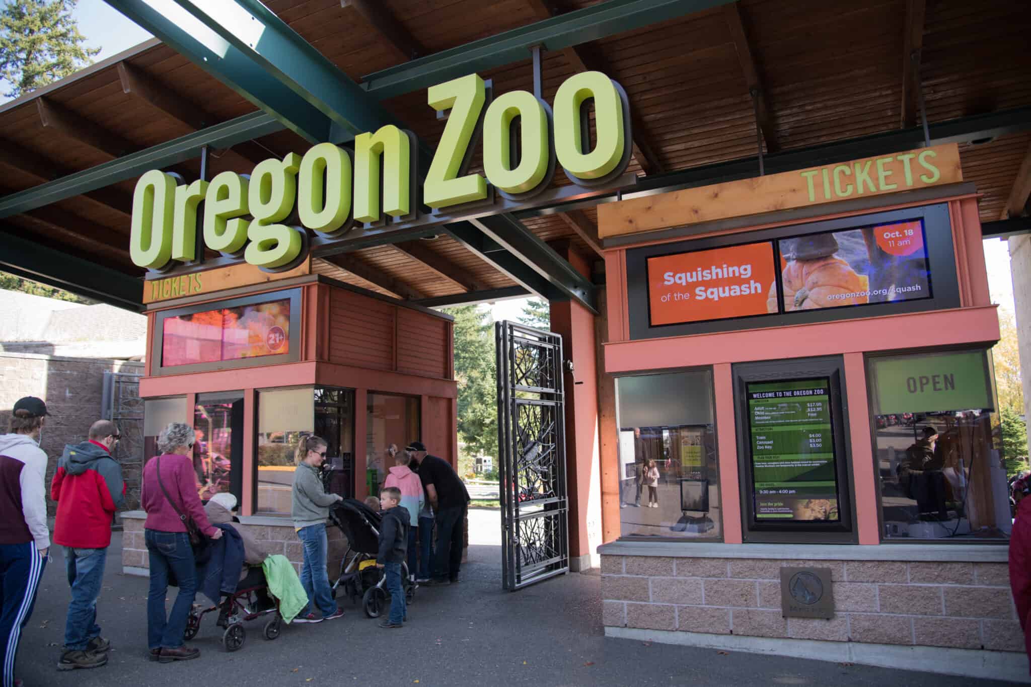
I bought a ticket for the 11:00 a.m. window from a kiosk, which printed my bar code–all without a hitch and no line.
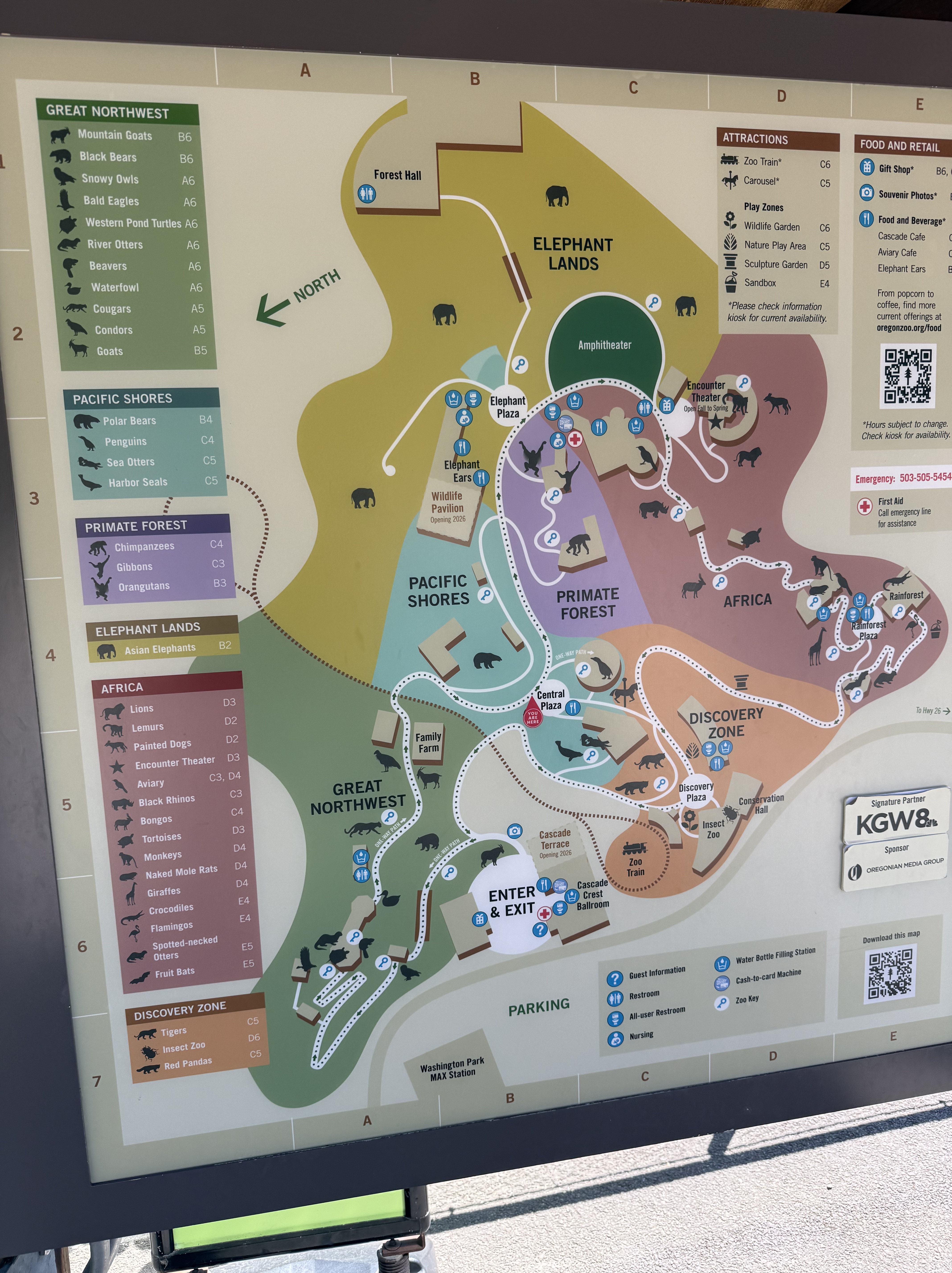
It was a beautiful day, so the parking lot was full; but we parked at the overflow parking lot and rode a free school bus for a quick trip to the entrance. It was better than parking in the regular lots. The arrows show the one-directional flow of people that is encouraged by the layout. It’s about two miles and takes 2-3 hours.
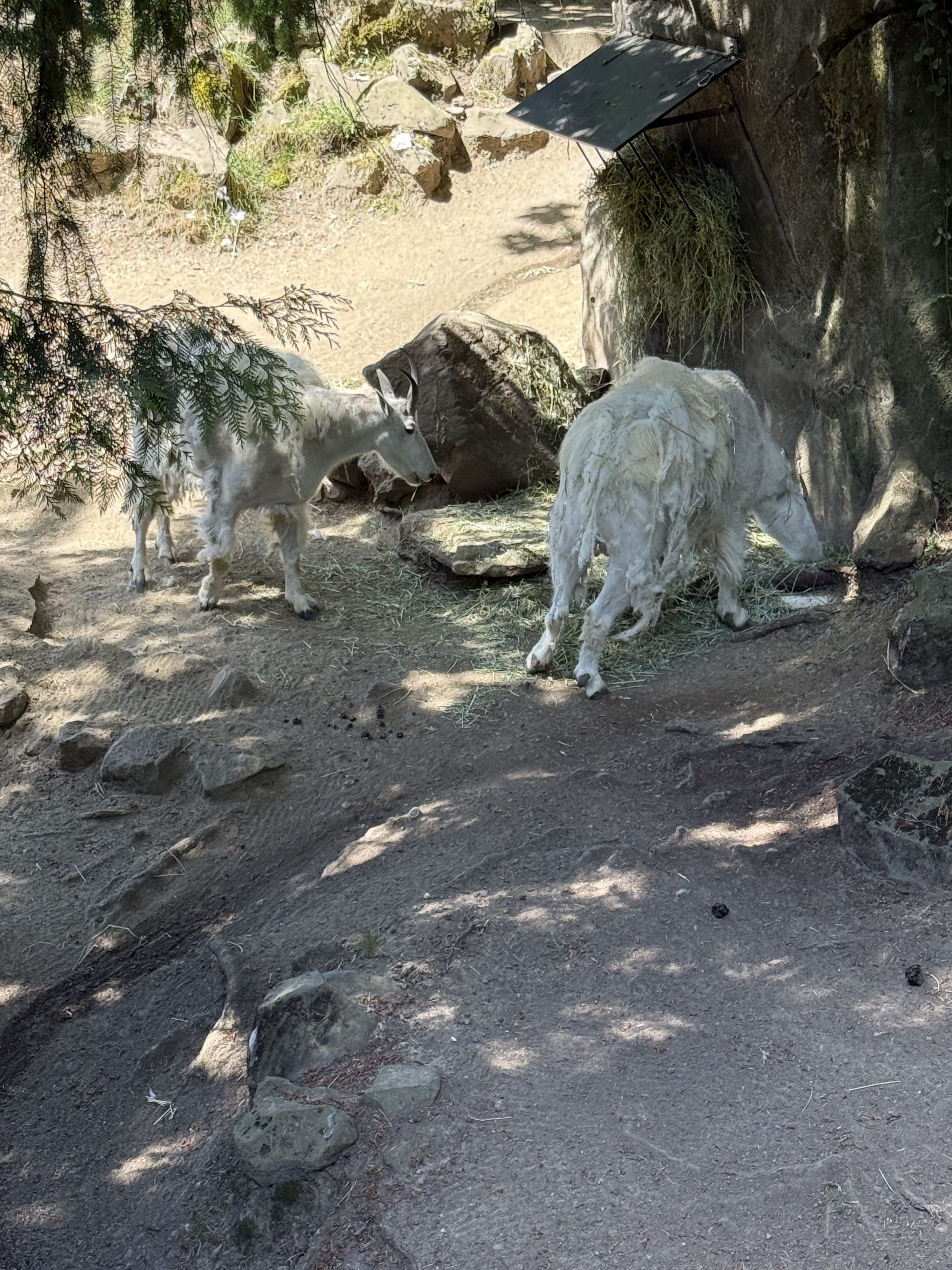
There is a mountain goat exhibit at the entrance with artificial rock piles, but its inhabitants were having lunch. They look pretty ragged, I guess because they’re losing their winter hair (or is it fur?).
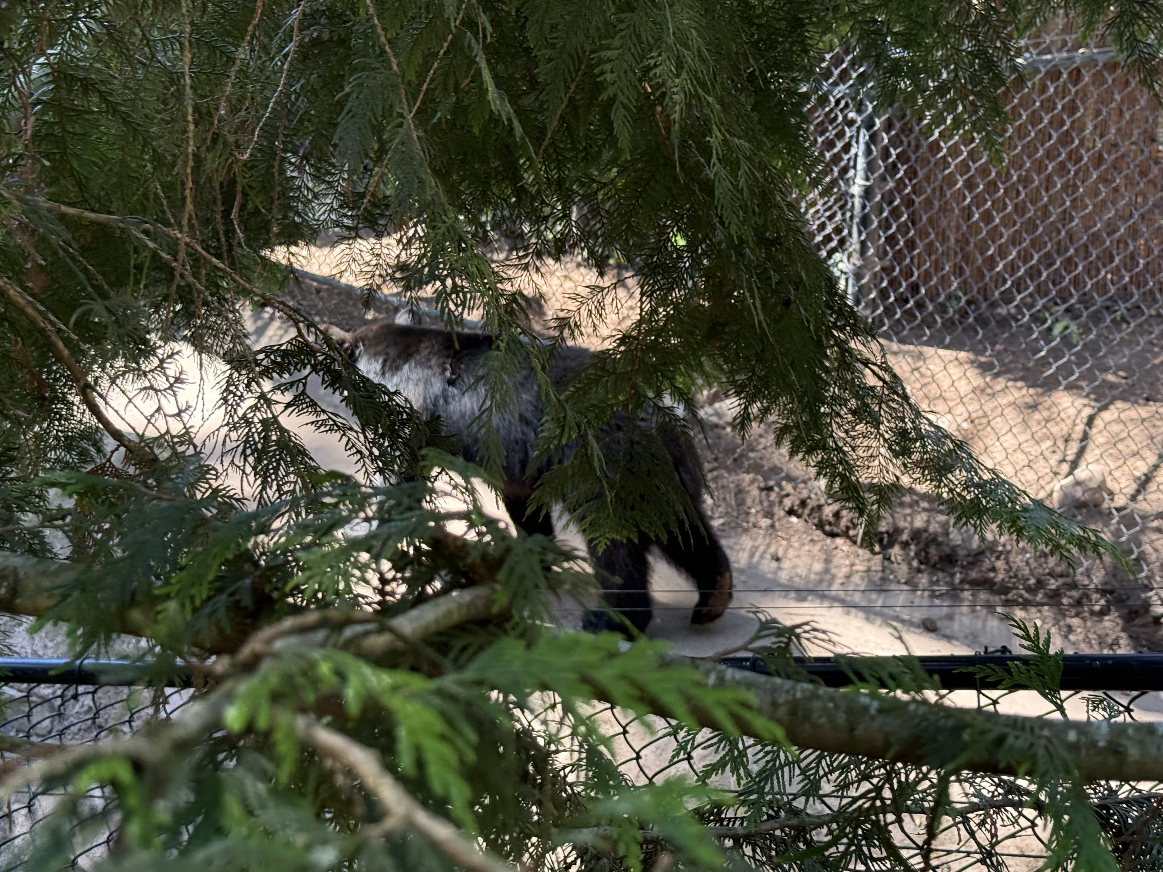
The Pacific Northwest was a grouping of regional species, including three black bears. I missed a lot of opportunities to photograph them interacting because I was confused by their enclosure, which was very large. It covers the side of a hill and includes several personal areas in addition to available shared “dens” where they could get some privacy from prying eyes.
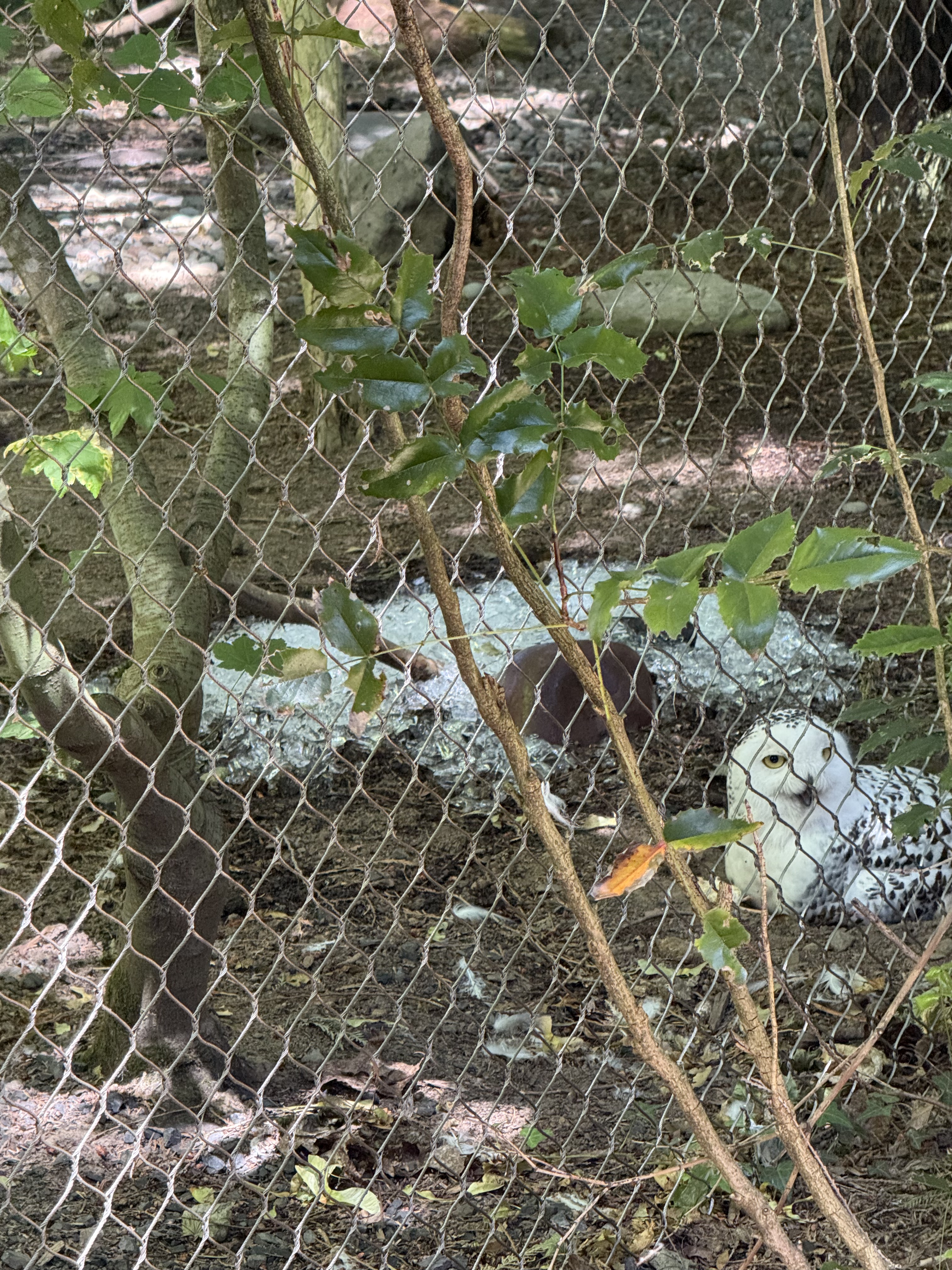
The owls seemed to enjoy sitting on the ground, even on a pile of ice, even though they had plenty of branches to hang out on.
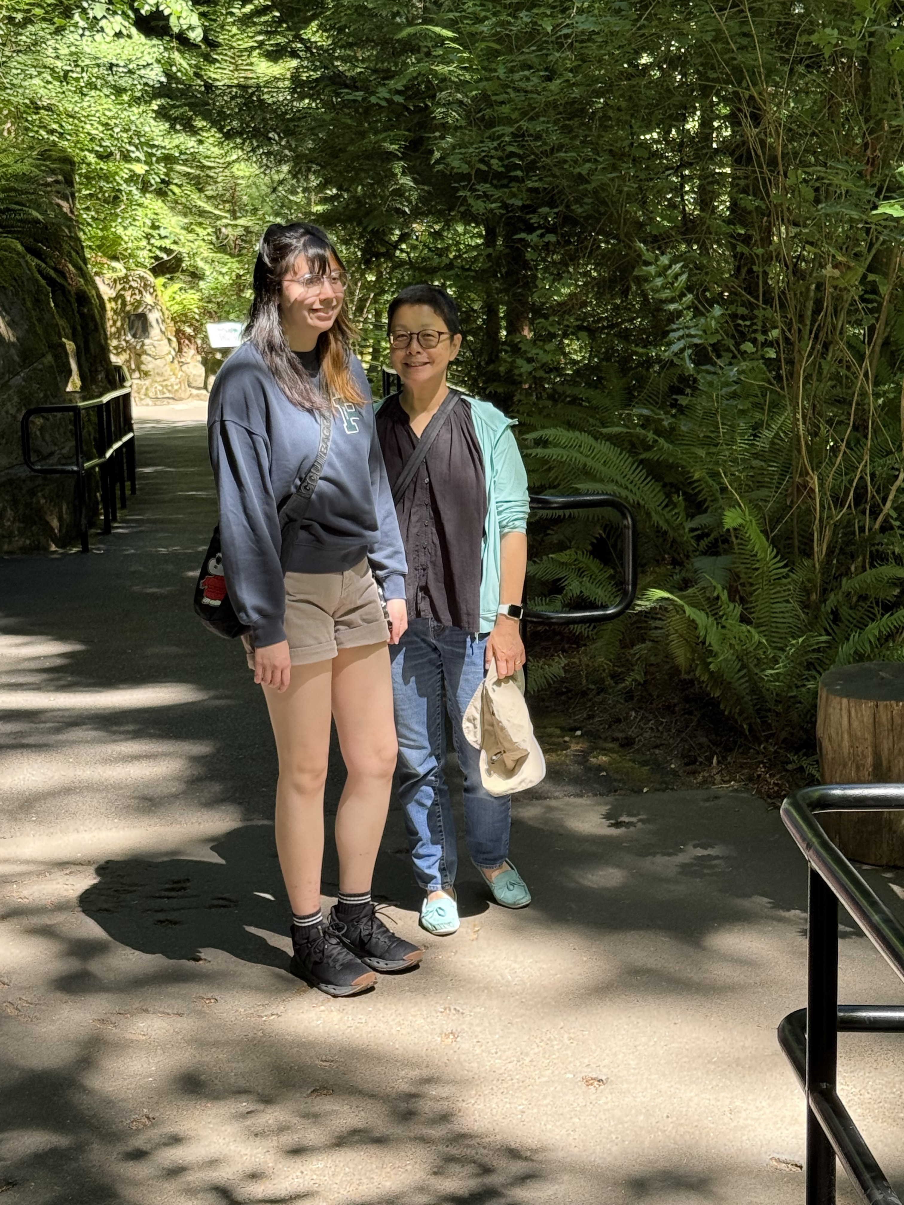
There was plenty of shade available for the inhabitants as well as the visitors.
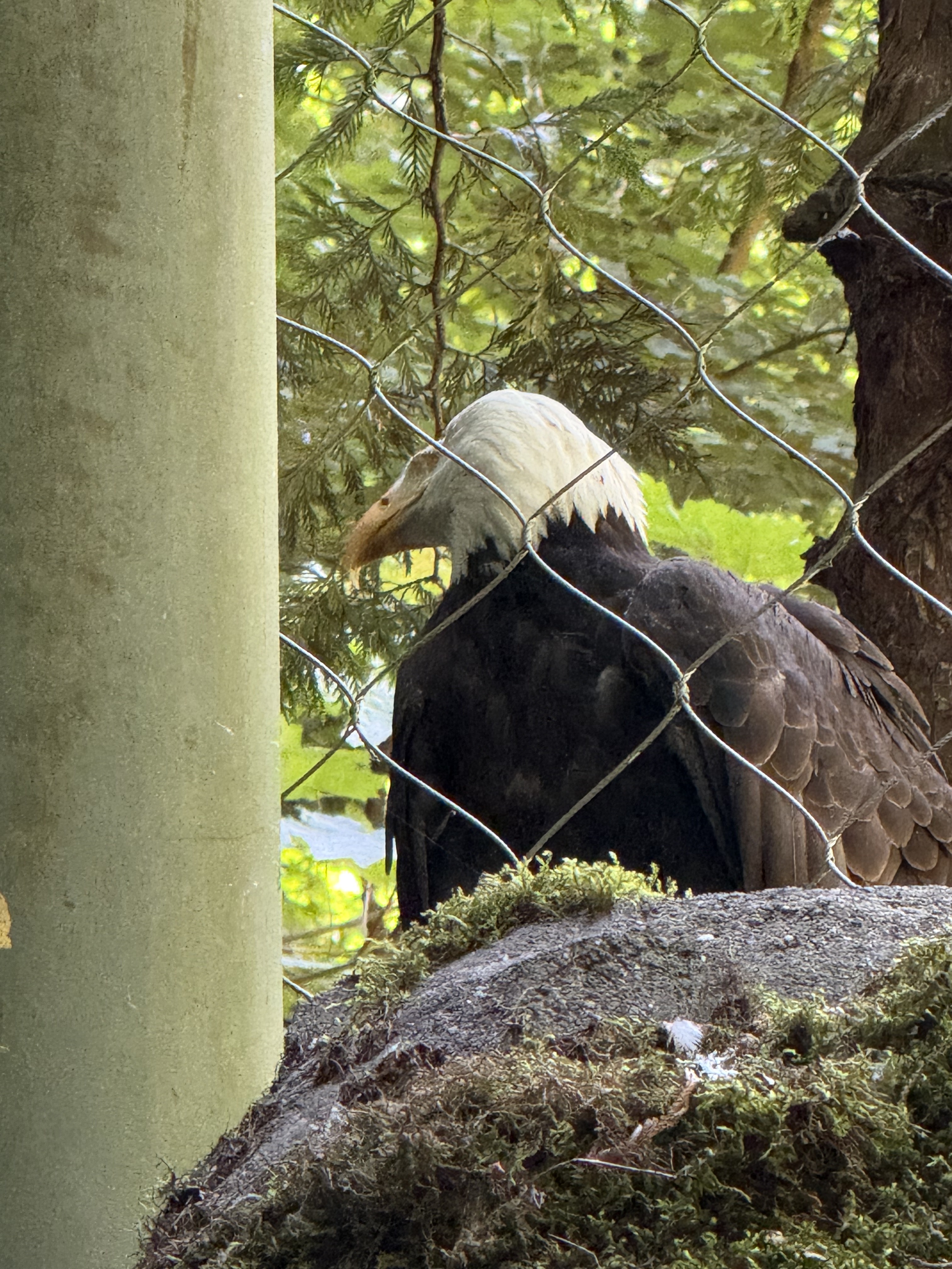
The bald eagles were rescued and are unable to fly properly, so I guess this is an “assisted living” facility.
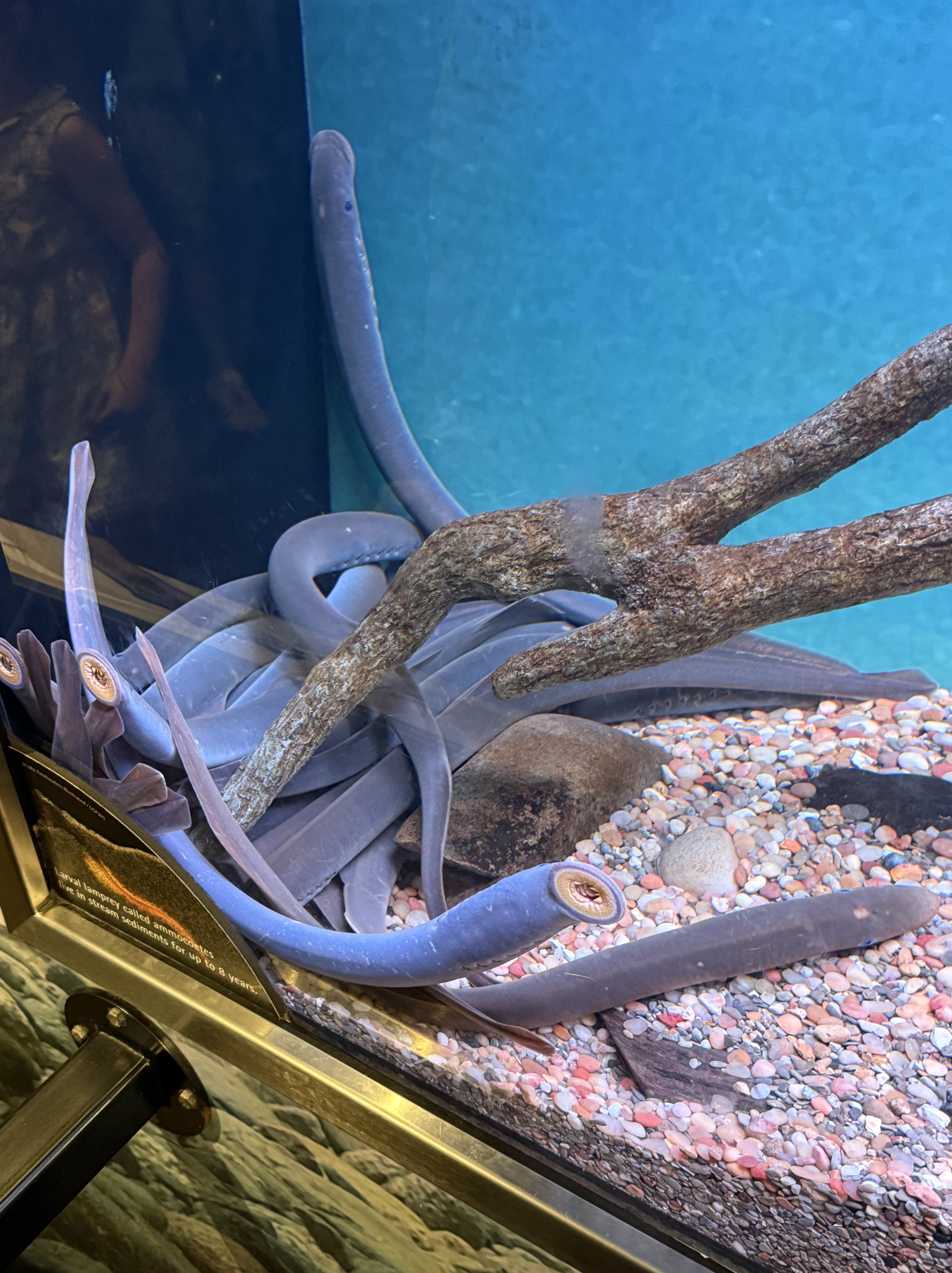
The lampreys were lying together in one end of a smallish tank. I guess it’s difficult to know whether they care about their surrounding or not. This is one strange fish.
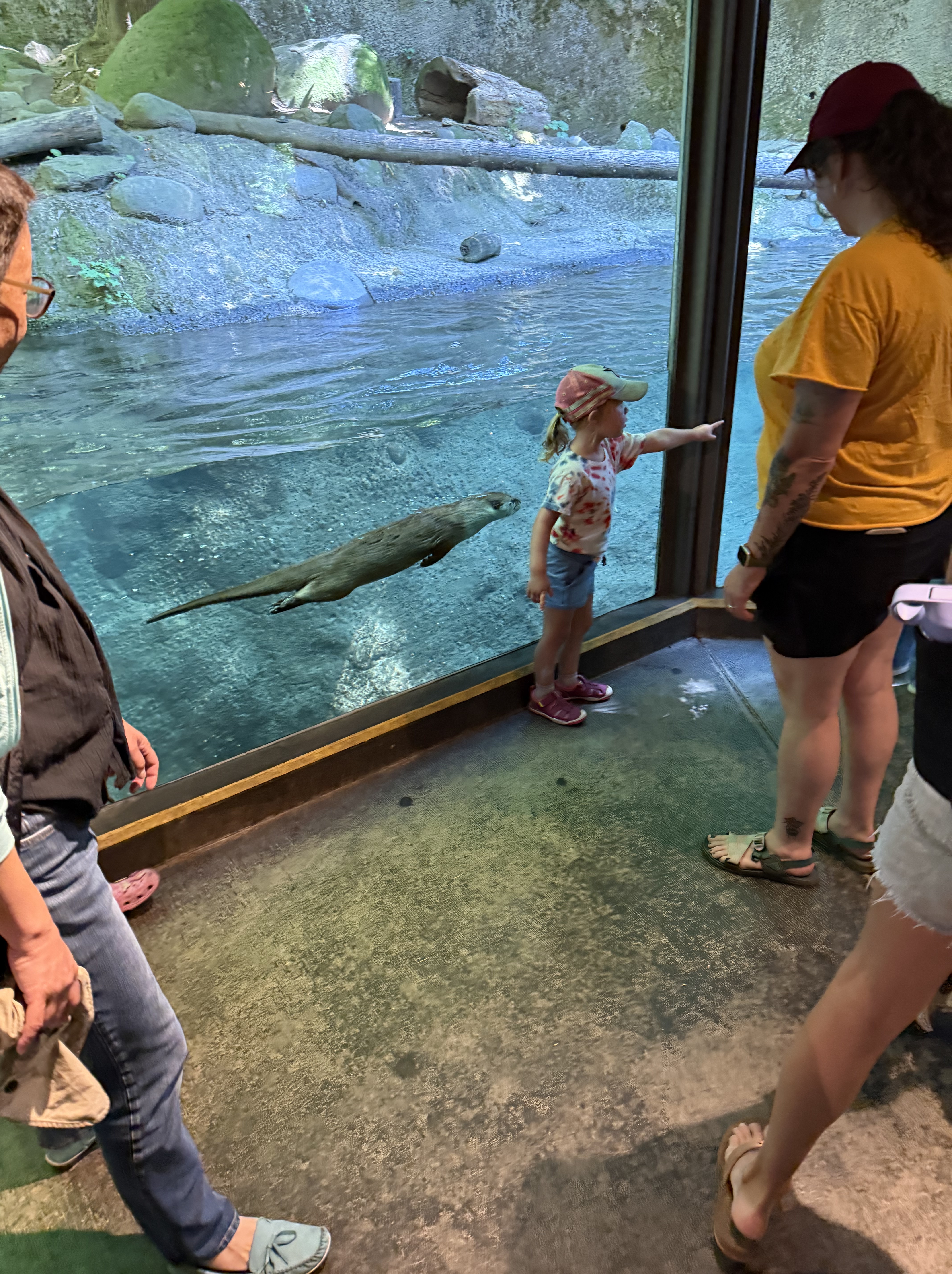
I never like to see free-wheeling animals like otters in captivity, even if they have cooled water to swim in. And I didn’t see any fish swimming around for them to catch. The phrase “feeding time” really bothers me, but I suppose we primates need to see the animals we share the world with in person to recognize them as being living beings. No one knows what an otter thinks…
This video shows a couple of otters cavorting in a viewing room. They had private places available, so I guess they don’t care if we reading monkeys watch them; but I wish that woman hadn’t kept her fat head so close to the window.
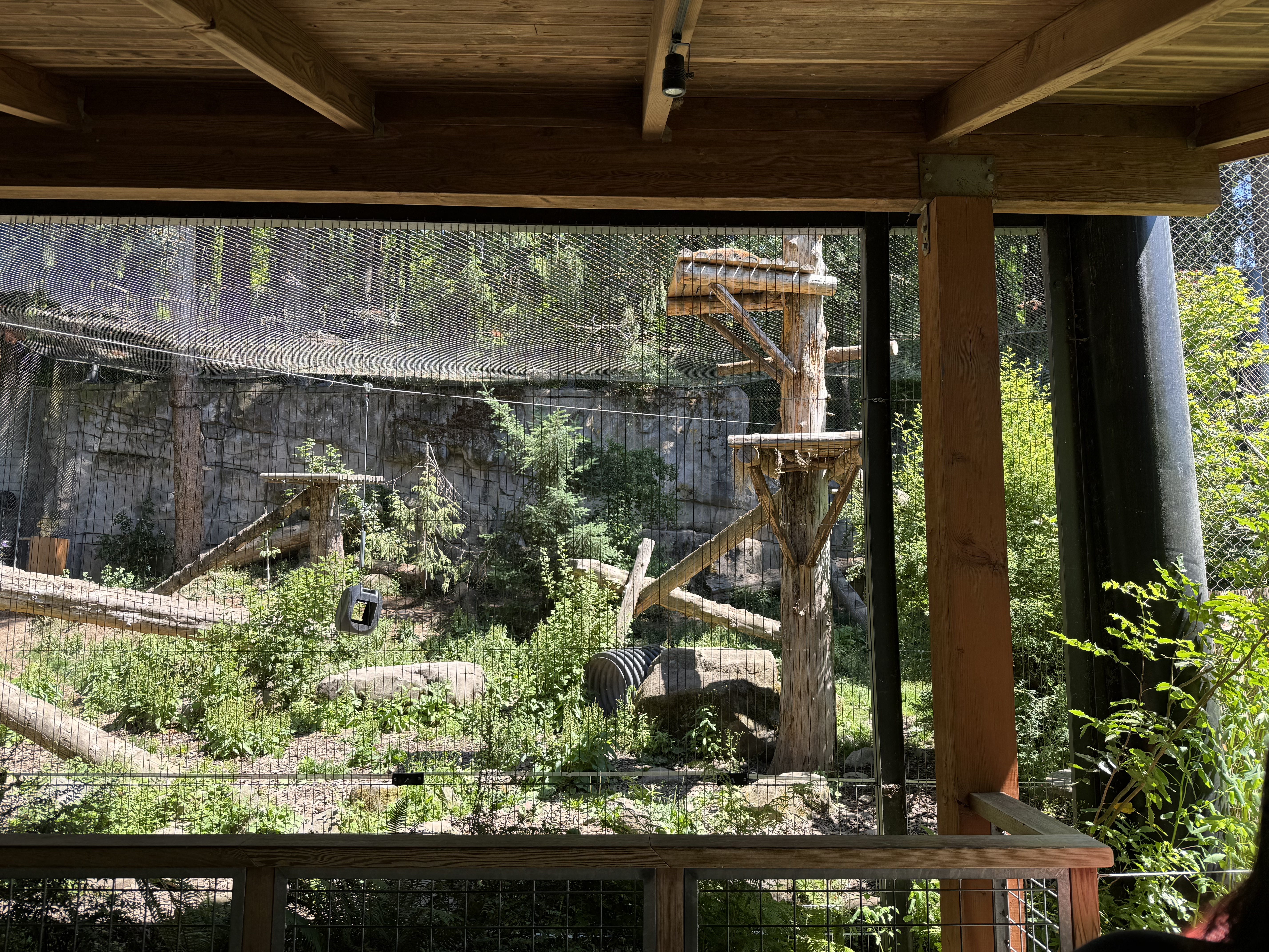
The mountain lion/cougar/etc is on the highest platform taking a nap, so I guess they’ve gotten used to life in a cage with a net ceiling. These big cats, native to all of N. America, aren’t endangered, but, obviously, we can’t see them this close. They are pretty dangerous.
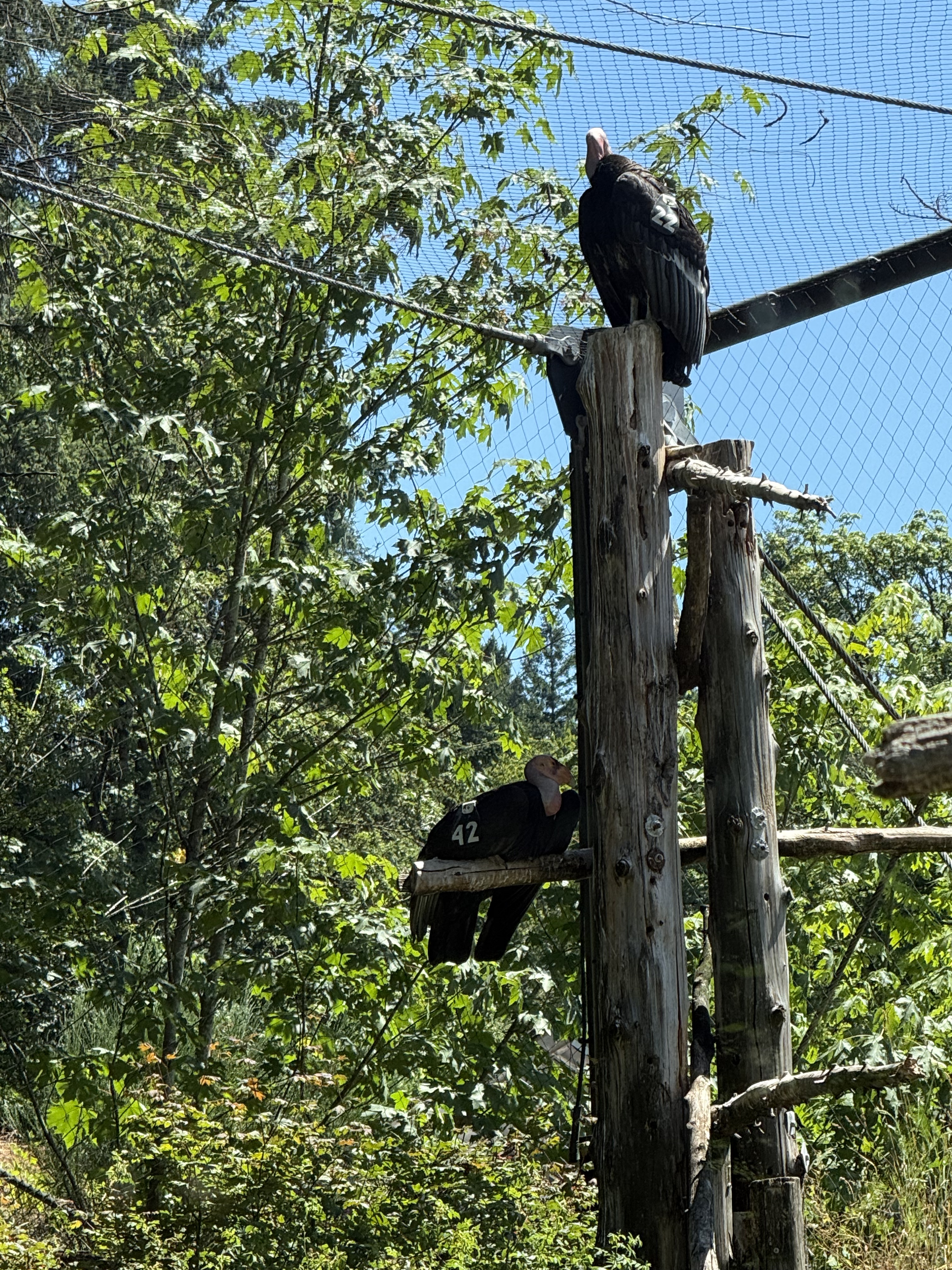
I was feeling pretty bleak about the whole zoo concept until I saw the condors. They were actually EXTINCT in the wild until the efforts of zoos reintroduced them; now they are coming back, each one wearing a team number and a radio transmitter. I guess this is their “halfway house” before winning their freedom.
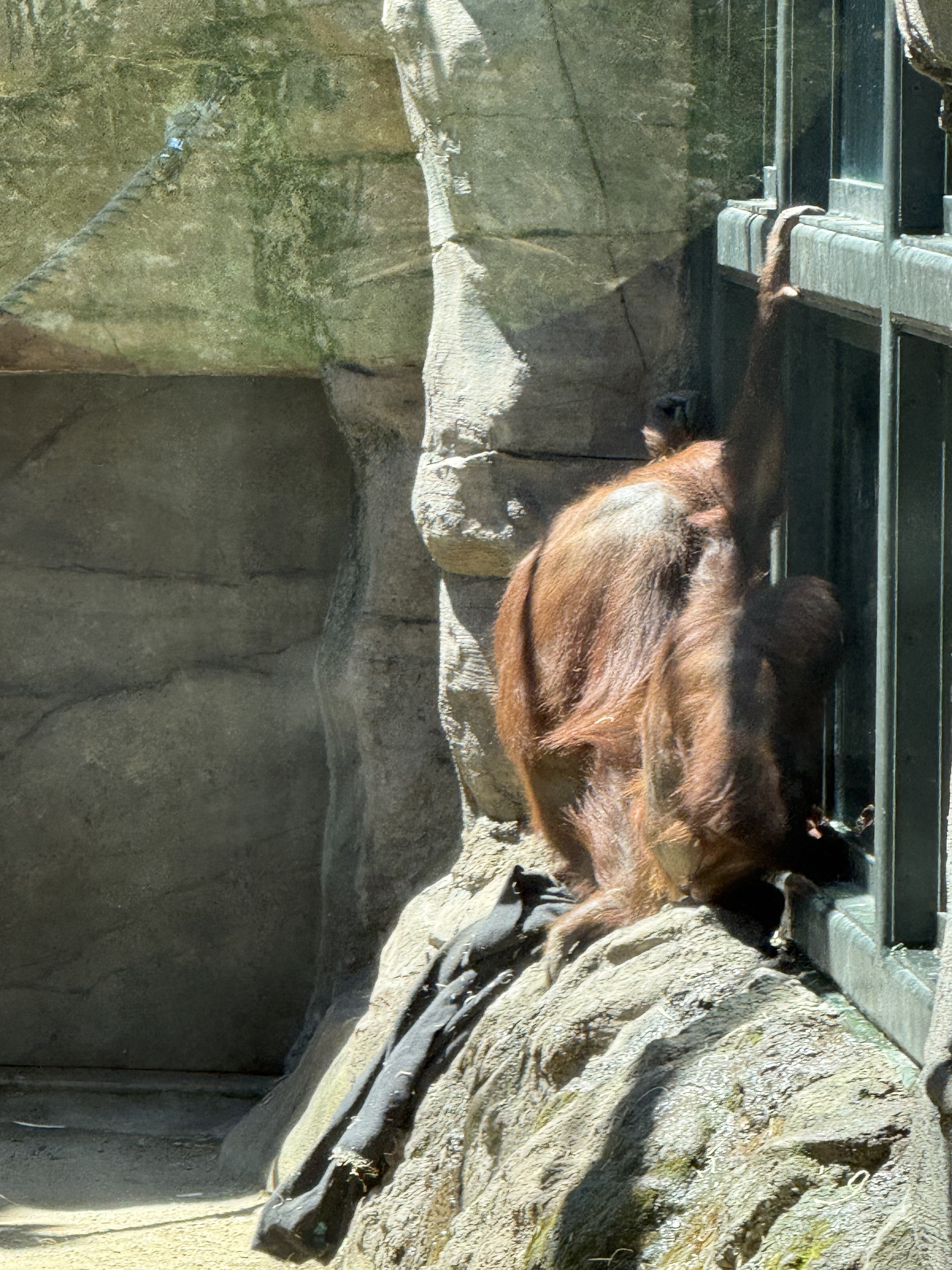
The primates have a series of habitats. Unlike some of the other prisoners, they take an interest in their captors’ antics; these orangutans are watching their human helper clean their bedding (airing and replacing straw). The looking glass works both ways…
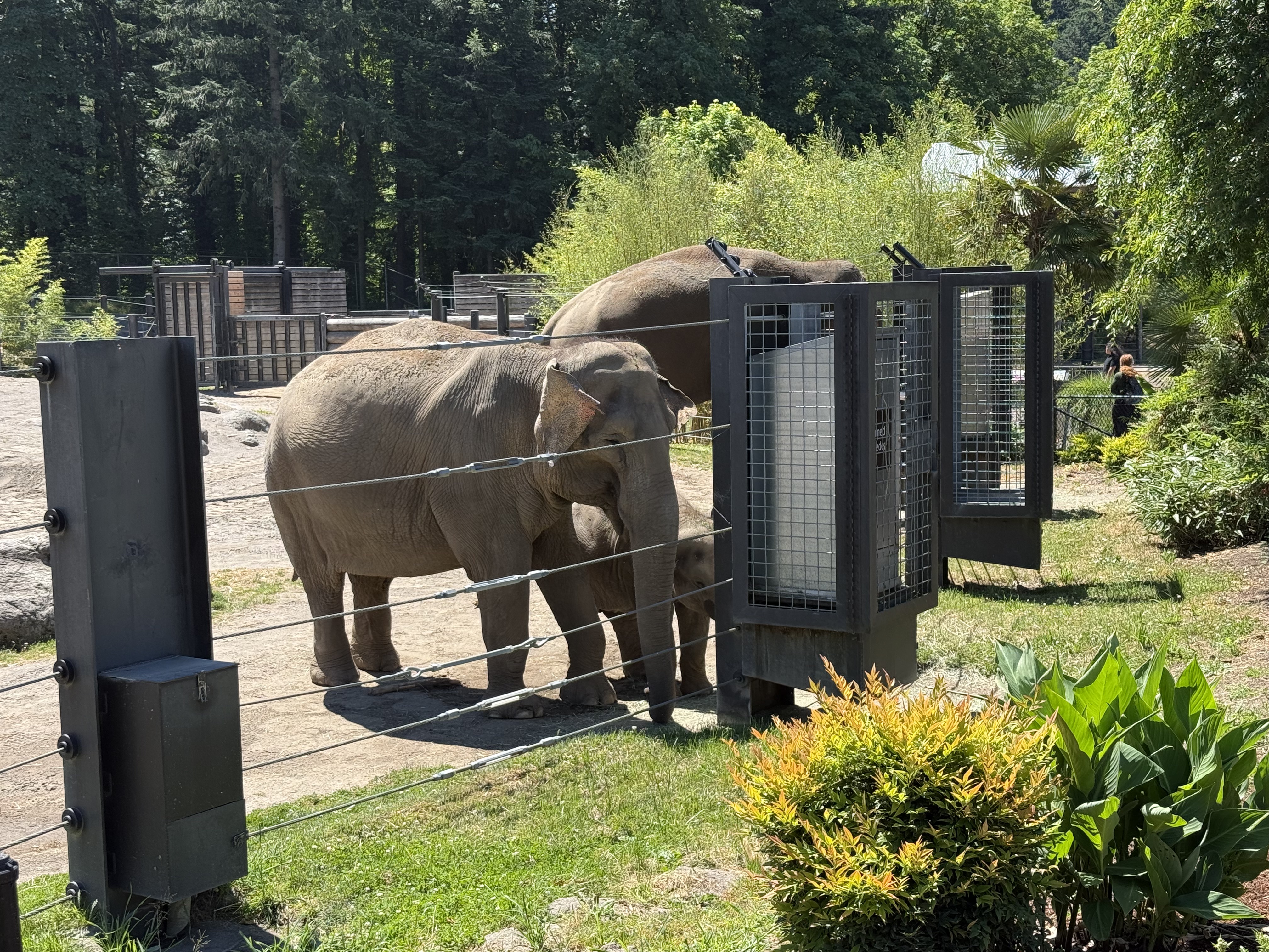
The zoo has named their “guests” because they are trying to support social systems like these elephants would have in the wild. Thus they have family groups (even in animals that don’t have “nuclear” families). For example, one of the males was in a sexually provocative state and isolated in the enclosure seen in the background so that he couldn’t fight with the other males, or injure the young one; but another who was considered “safe” was mixing with the “herd” while feeding in a separate “males only” trough until…
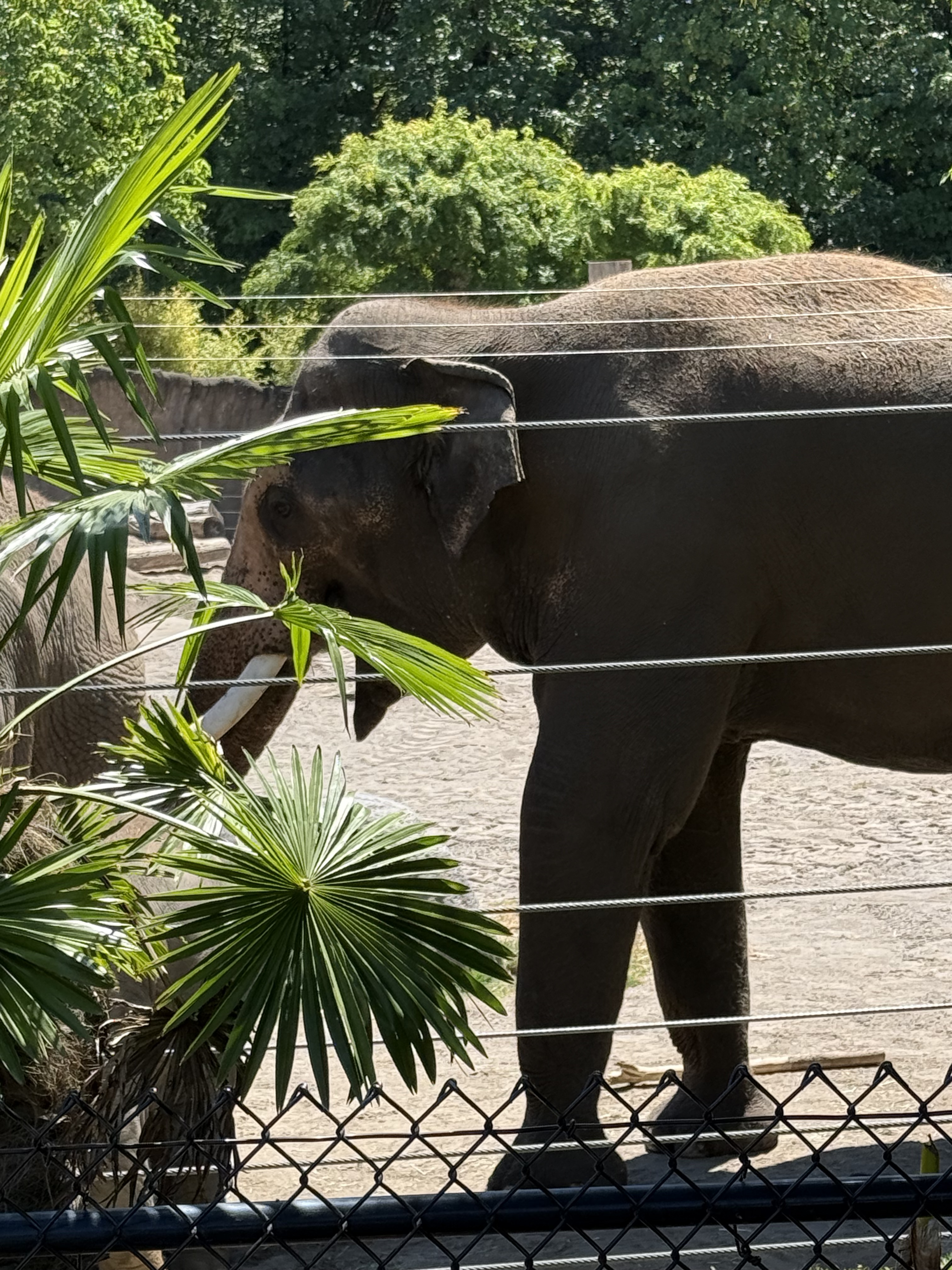
He finished his plate and pushed the others, including the young one, aside to eat their food. These large animals really need many square miles to live. This situation is like having your entire family living in a studio apartment, which people do in some parts of the world; nevertheless, elephants are at the top of my list for animals that will be eradicated by humans because they simply require so much SPACE to live, and they consume massive amounts of resources. I hope they don’t follow the path of the condors, and I applaud efforts like these–hope for the best but prepare for the worst-case scenario…
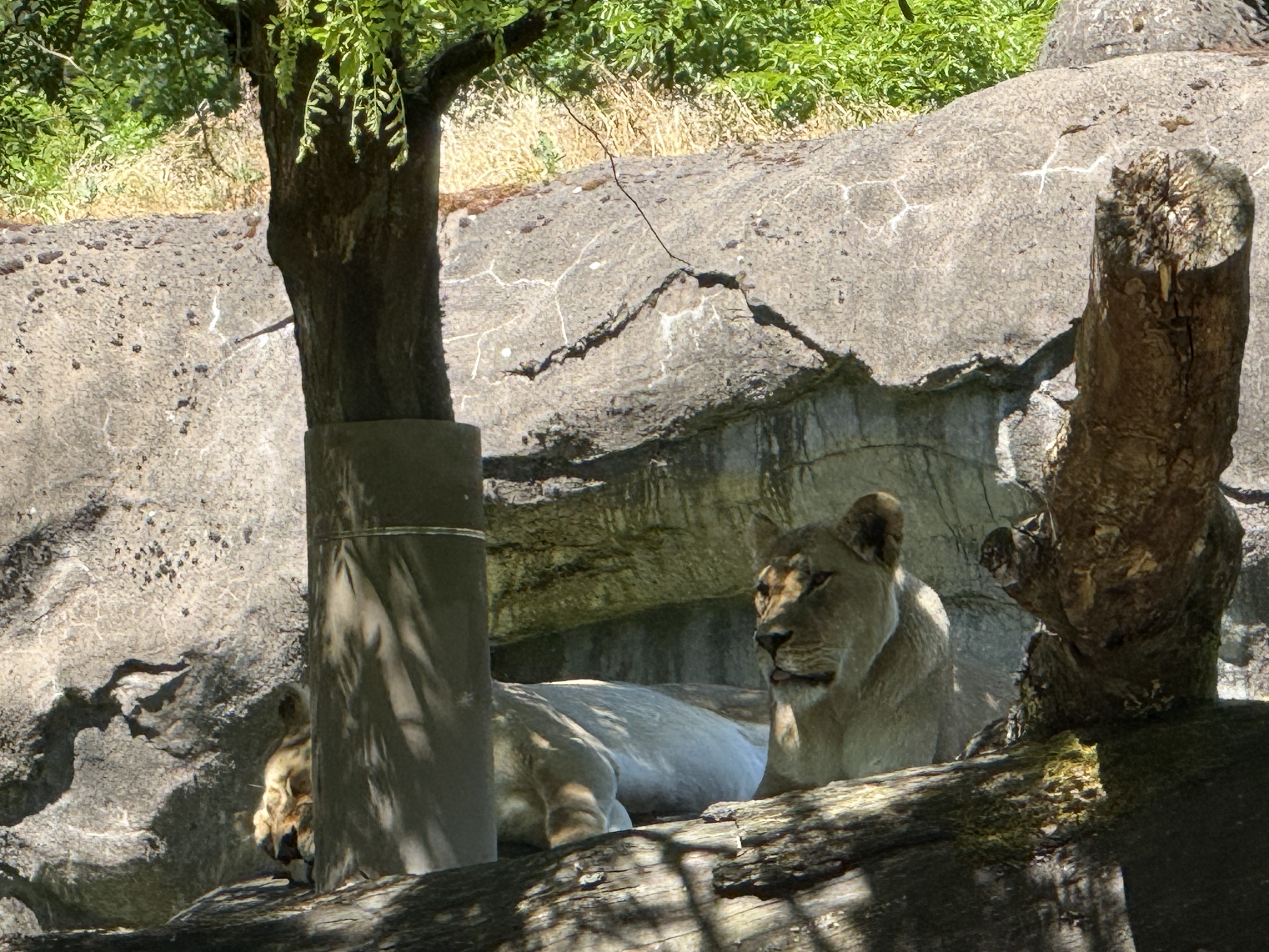
I could barely see these lions, but my phone’s camera caught this image. Words fail me to describe what might be going through this loin’s mind…
These lemurs don’t seem to care that a bunch of primates are watching them as they wake from a nap…
This monitor’s tail is half as long as its enclosure. A photo can’t convey its situation as well as a video, even thought it isn’t doing anything dramatic, but–what is it thinking? I have no idea; maybe it is perfectly happy–well fed, as cool or warm as it desires…
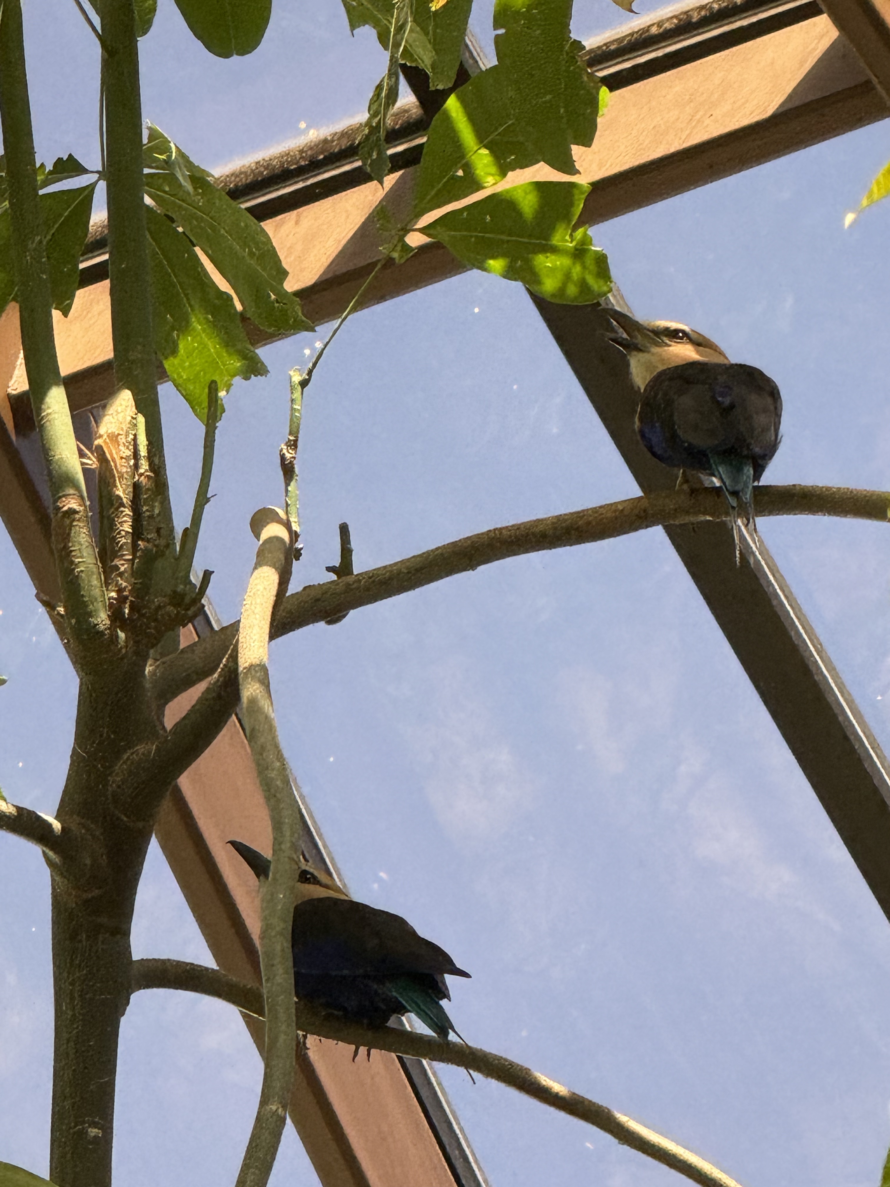
There were a lot of birds in the bird enclosure–small ones that could fly around, larger, flightless ones that hung around the door as if waiting for a chance to escape.
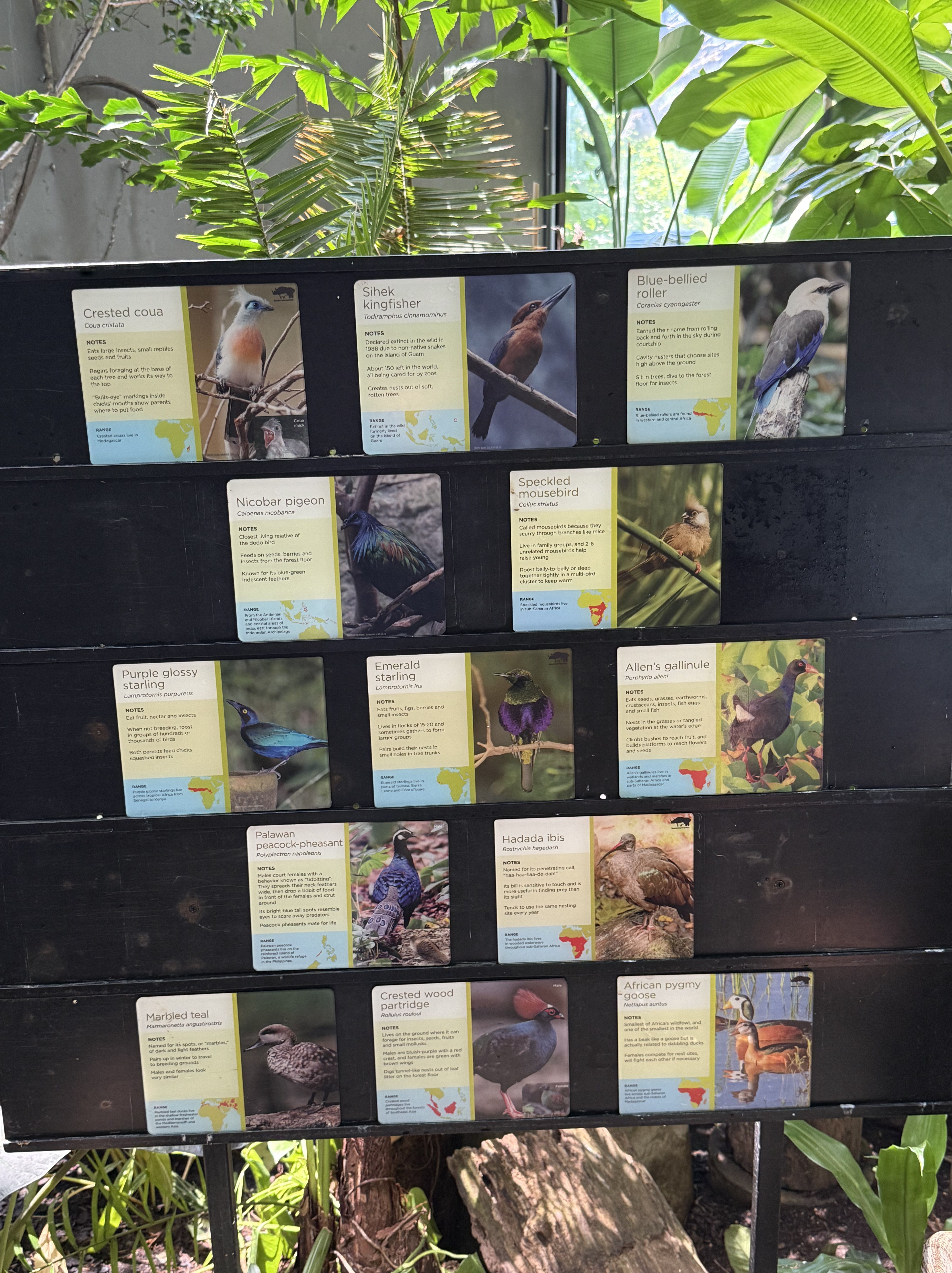
I saw several of these, but they didn’t pose for photos. None of them looks like the birds from the previous photo, but I don’t know anything about birds. Maybe the listing is out of date…or maybe I’m a typical modern Homo sapiens, who is so unaware of the physical world that…
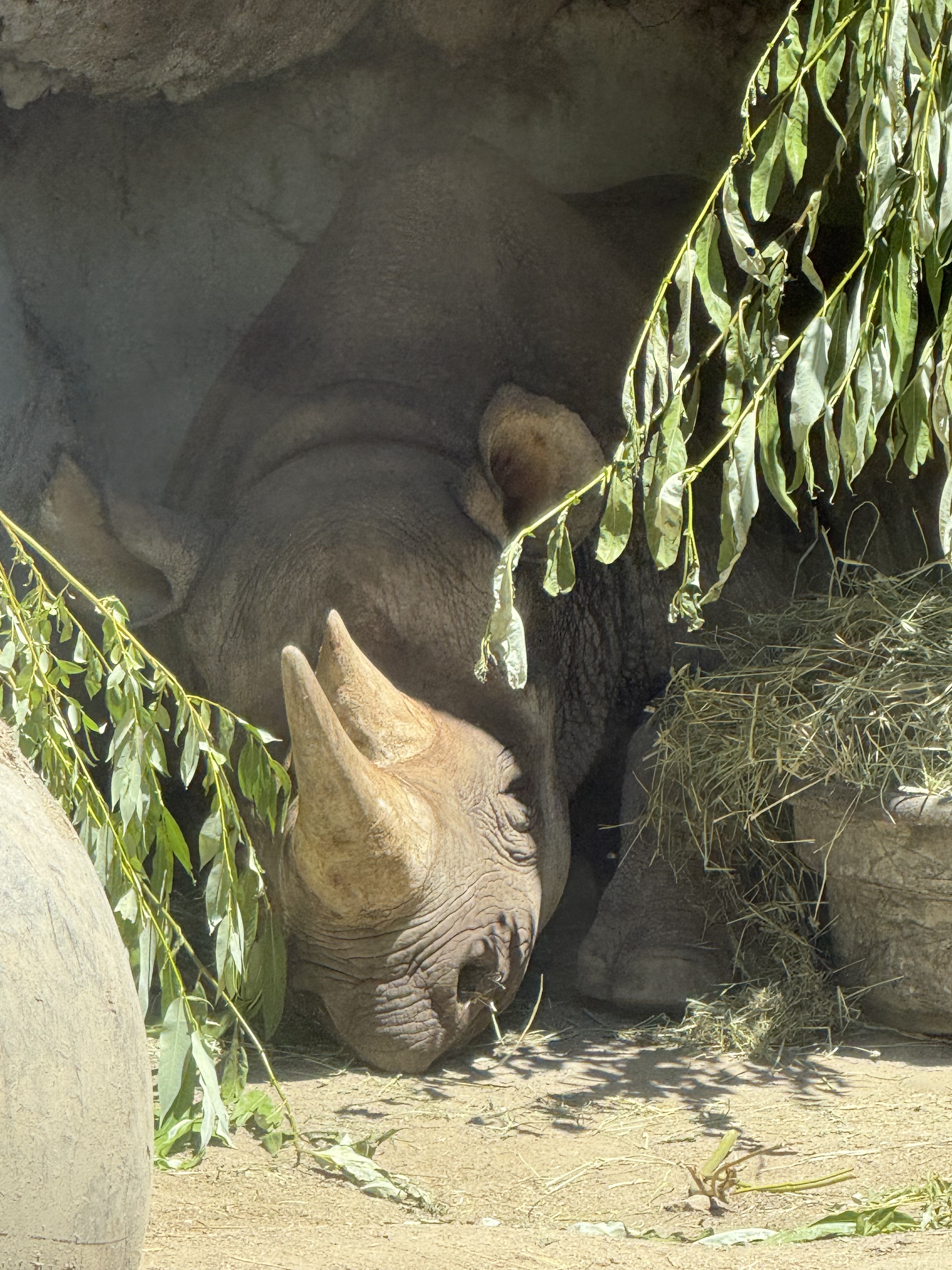
Thank god my phone could see in extreme contrast. I never saw this rhinoceros lying in the shade, apparently listening to every word we primates were saying. This is another example of an animal that requires a lot of SPACE to live; the Oregon Zoo did its best with what was available, even creating a “family” environment with several animals living together.
This tiger doesn’t say much, but their stately demeanor says more than words…

I got this image without seeing what I was photographing. With the light/shade contrast, I was blind but my camera wasn’t. What is this magnificent creature’s expression conveying?
I try not to anthropomorphize because none of the animals held captive in the Oregon Zoo are human. They aren’t stupid, intelligent, emotional, sociopathic, or anything else we sapiens self-classify ourselves as. They are simply not in a position to influence the physical world as dramatically as we. Lions and tigers don’t create cages to hold their prey before they become a meal. They hunt when they are hungry and eat what they can catch.
I don’t think my feelings about zoos have changed after my visit to this excellent repository of the animal world. Nevertheless I understand the conflict between humanity’s claim to dominance, as the top global predator, and the responsibility that comes with this natural order; what I mean is that we are the children of Earth, just as is the tiger and the bacteria. However, with great power comes great responsibility, and it is incumbent on us to accept the difficult challenge of preserving life to the extent of our abilities.
Every animal I saw in the Oregon Zoo is, or will soon be, threatened by humans. Maybe we are the cause of the next great extinction–if so, such an ominous responsibility should be treated with great circumspection. This is no light matter.
Whether we like it or not, we are responsible for the fate of life on Earth…
A Day Trip to Yakima
We wanted to see what was on the other side of the mountain, so we headed east from Tacoma and crested the Cascades at Chinook Pass. It was snowing at the pass and fog/clouds obscured what were probably majestic views. We pushed on to Yakima and found the Cowiche Canyon recreation and conservancy area.
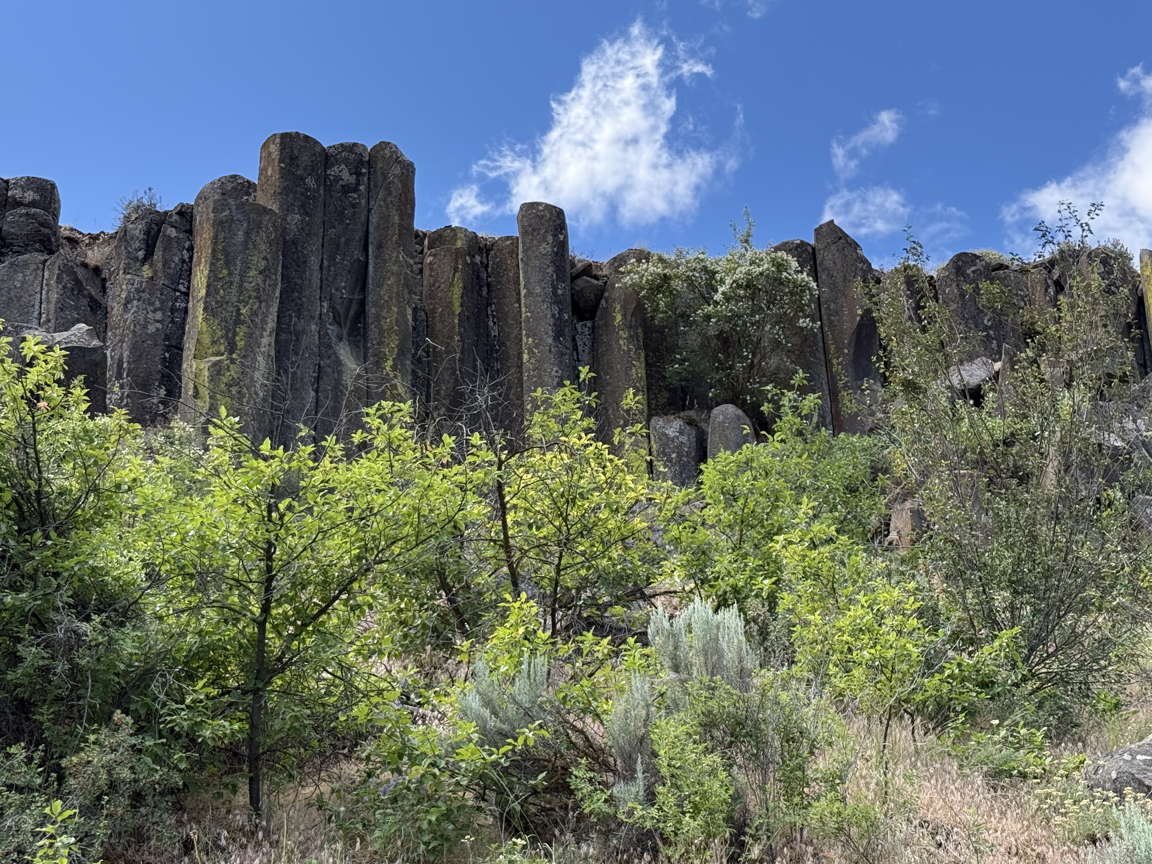
This is a typical view from the trail, which follows an old rail line that was used for seventy years to haul apples out of the area. I have discussed the columnar basalts and vegetation in previous posts. It was late spring and all of the plants were showing their color while water rushed past in the creek at the bottom of the canyon.
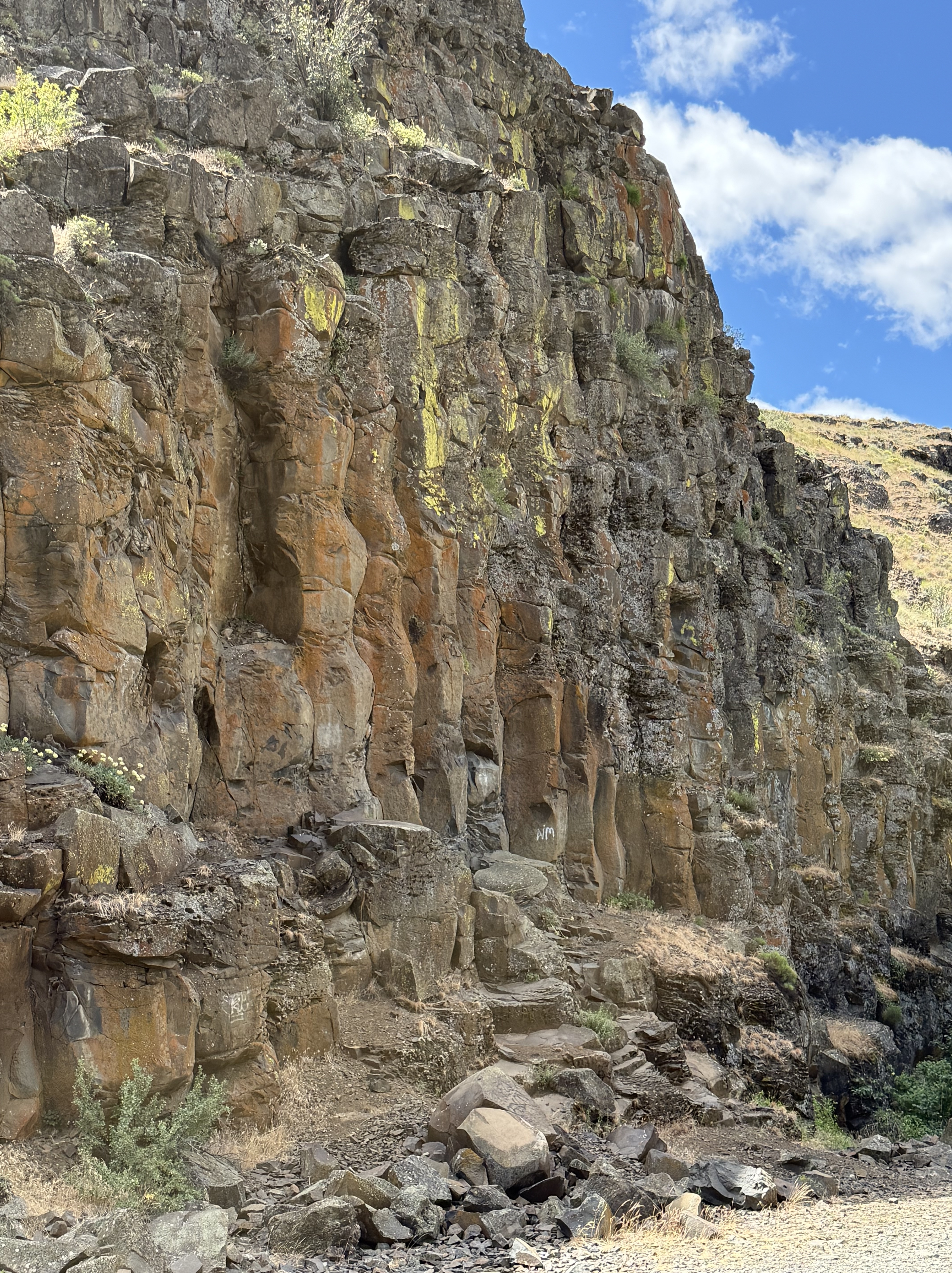
This undulating columnar basalt caught my eye because of the color and its wavy appearance.
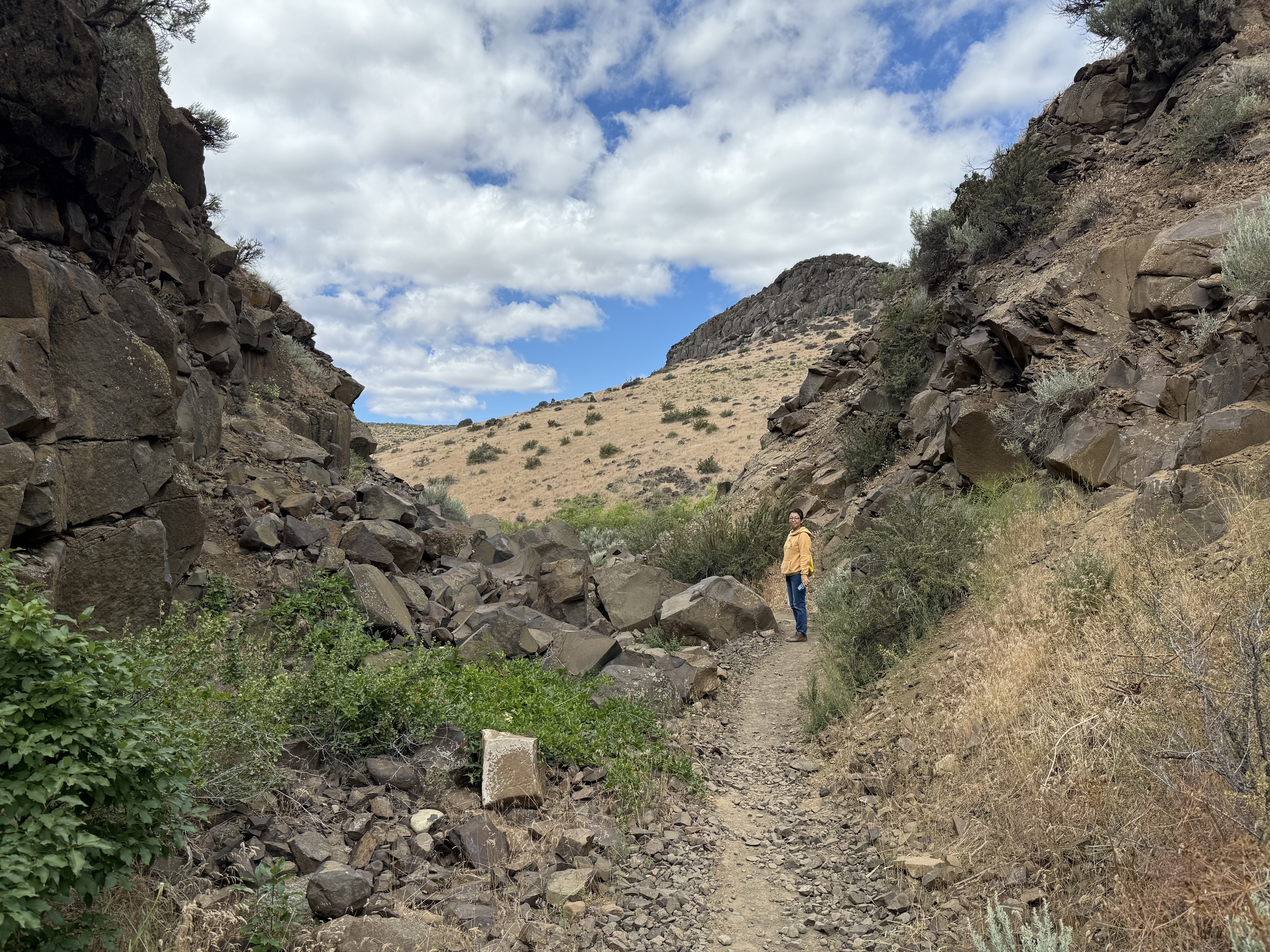
The Burlington Northern railroad wasn’t afraid to use explosives to create a path through what was described at the time as, “A dry, rocky canyon good for nothing except a railroad.” The rails have been removed, but the eleven bridges required to construct a rail line to cover the 3 miles of the trail system are mostly still in place.
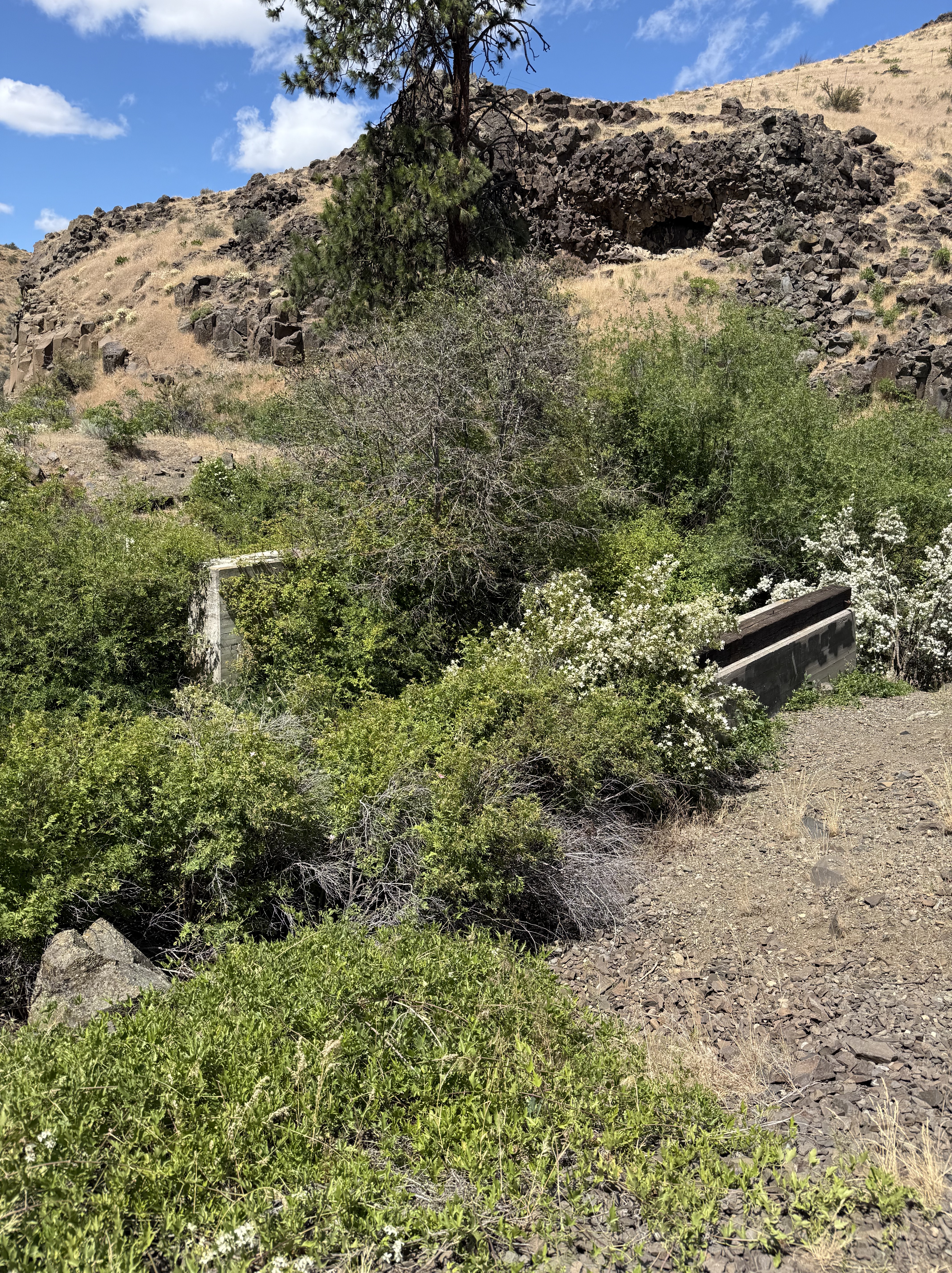
Here’s one that didn’t last. It was replaced by a pedestrian bridge constructed by the Cowiche Canyon Conservancy and the Bureau of Land Management.
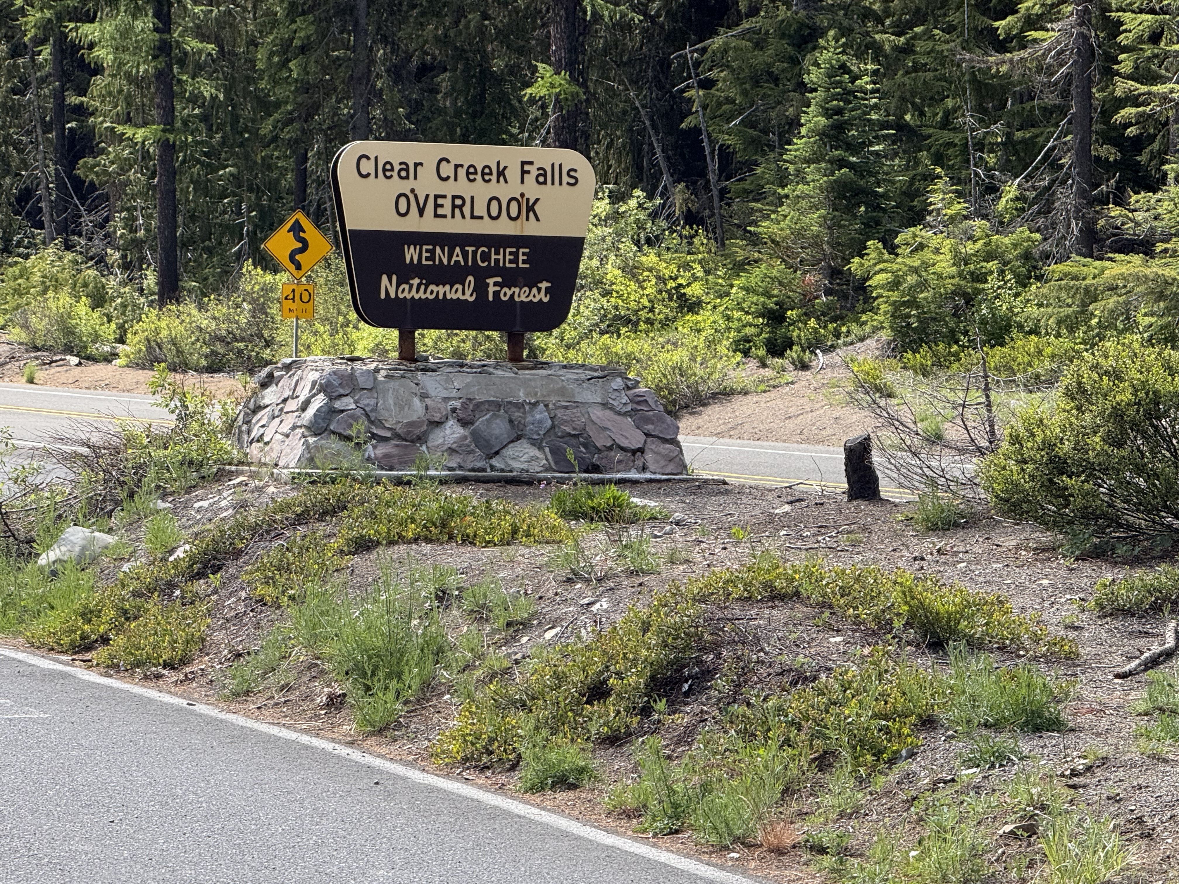
We took a more circuitous route back to Tacoma using US12 through White Pass. It didn’t snow, and we got a look of one of the many water falls in Washington.
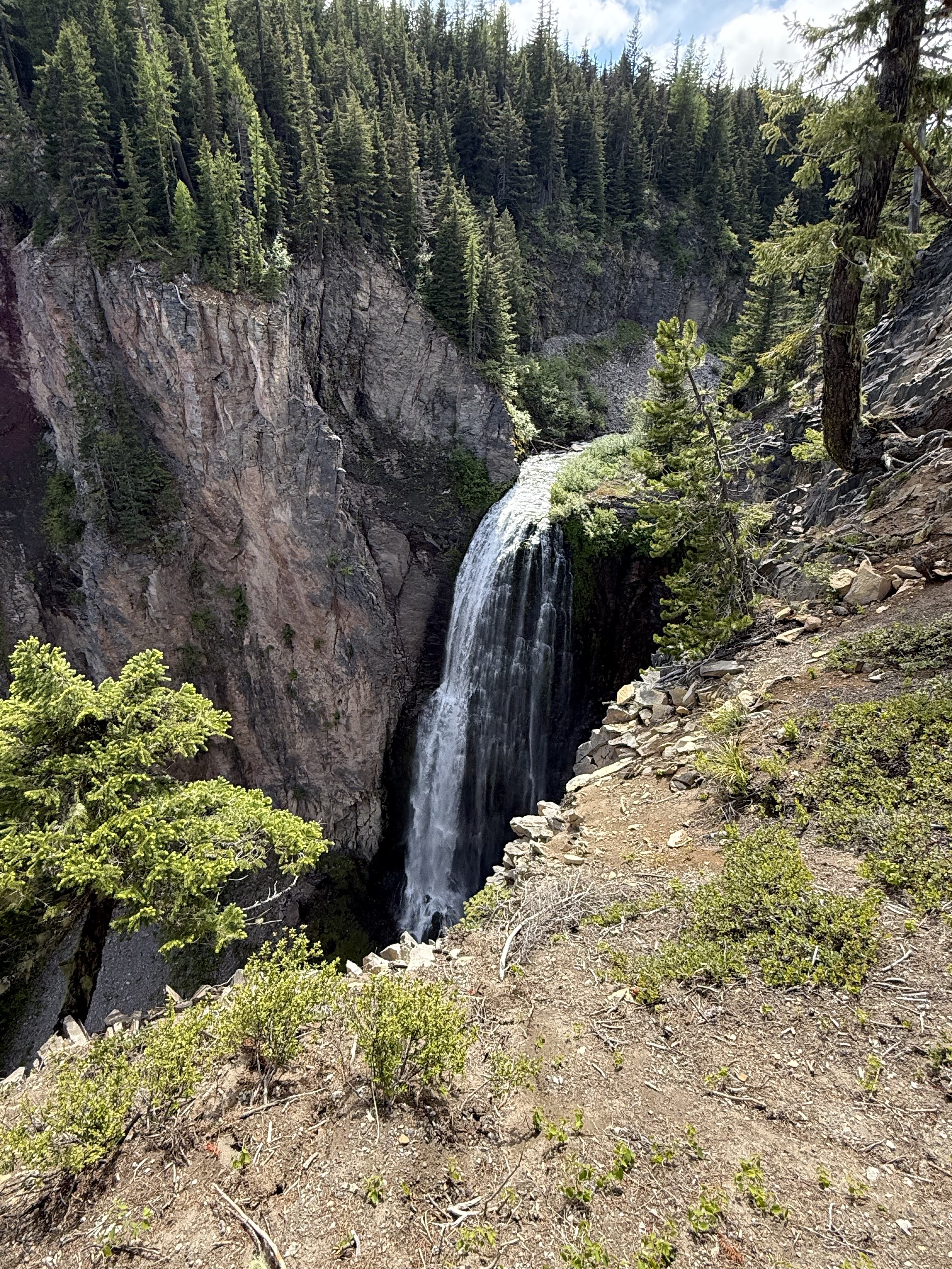
This was the best angle I could get, and I still couldn’t see the bottom! It turns out that Washington has more than 3000 catalogued water falls, more than any other U.S. state. Clear Creek is rather small at only 300 feet, so I guess there is some more air down there.
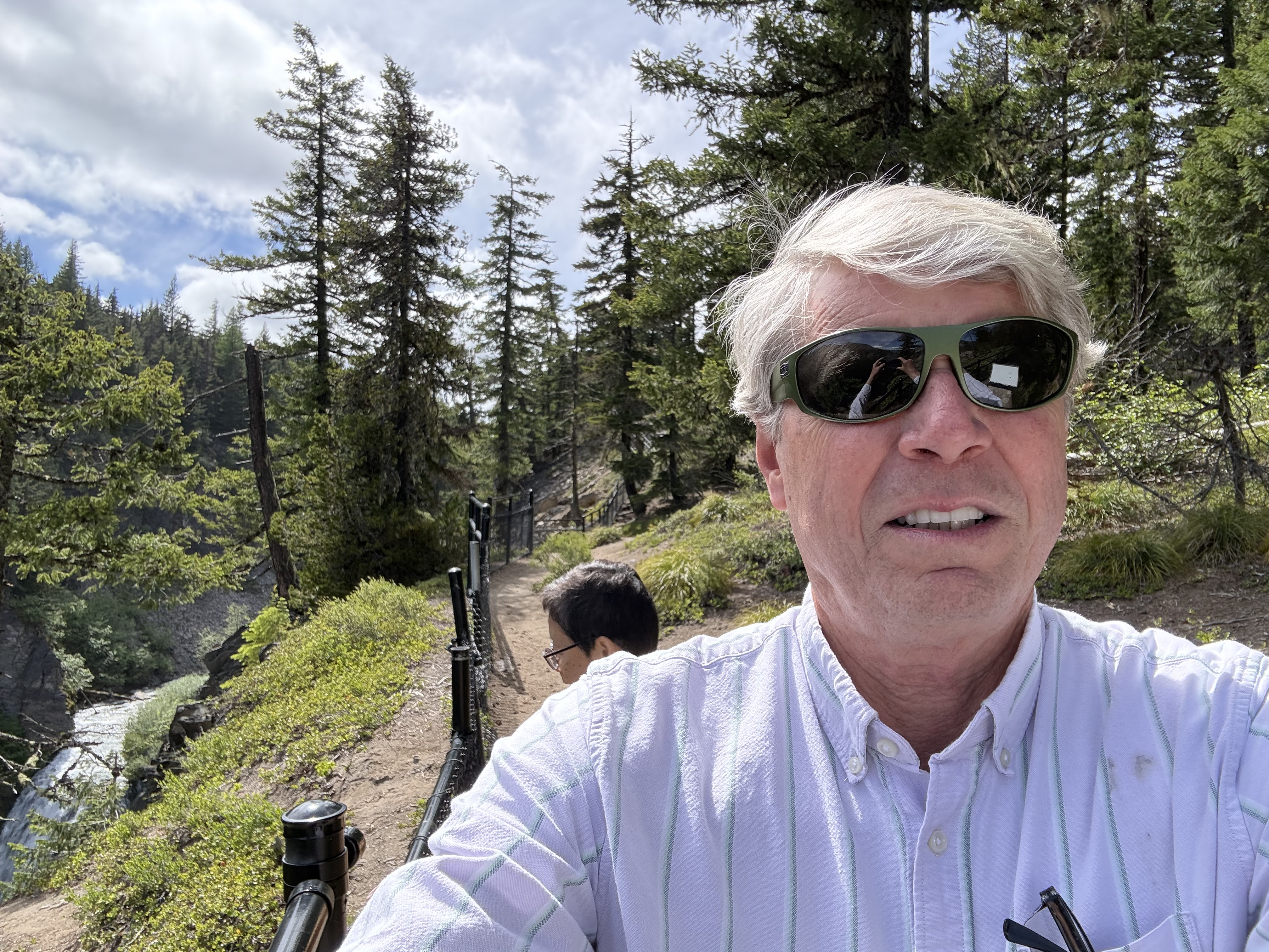
It was a beautiful day in the Pacific Northwest, including the snow flurries. A ten-hour day trip took us from coastal Washington, over a 6000 foot pass, into dry eastern Washington, where we hiked through a canyon filled with native plants and rocks (hahaha), and back over the Cascades past a magnificent water fall in Wenatchee National Forest.
This is undoubtedly the most beautiful place I have ever lived…
Ecological Notes from Cowiche Canyon
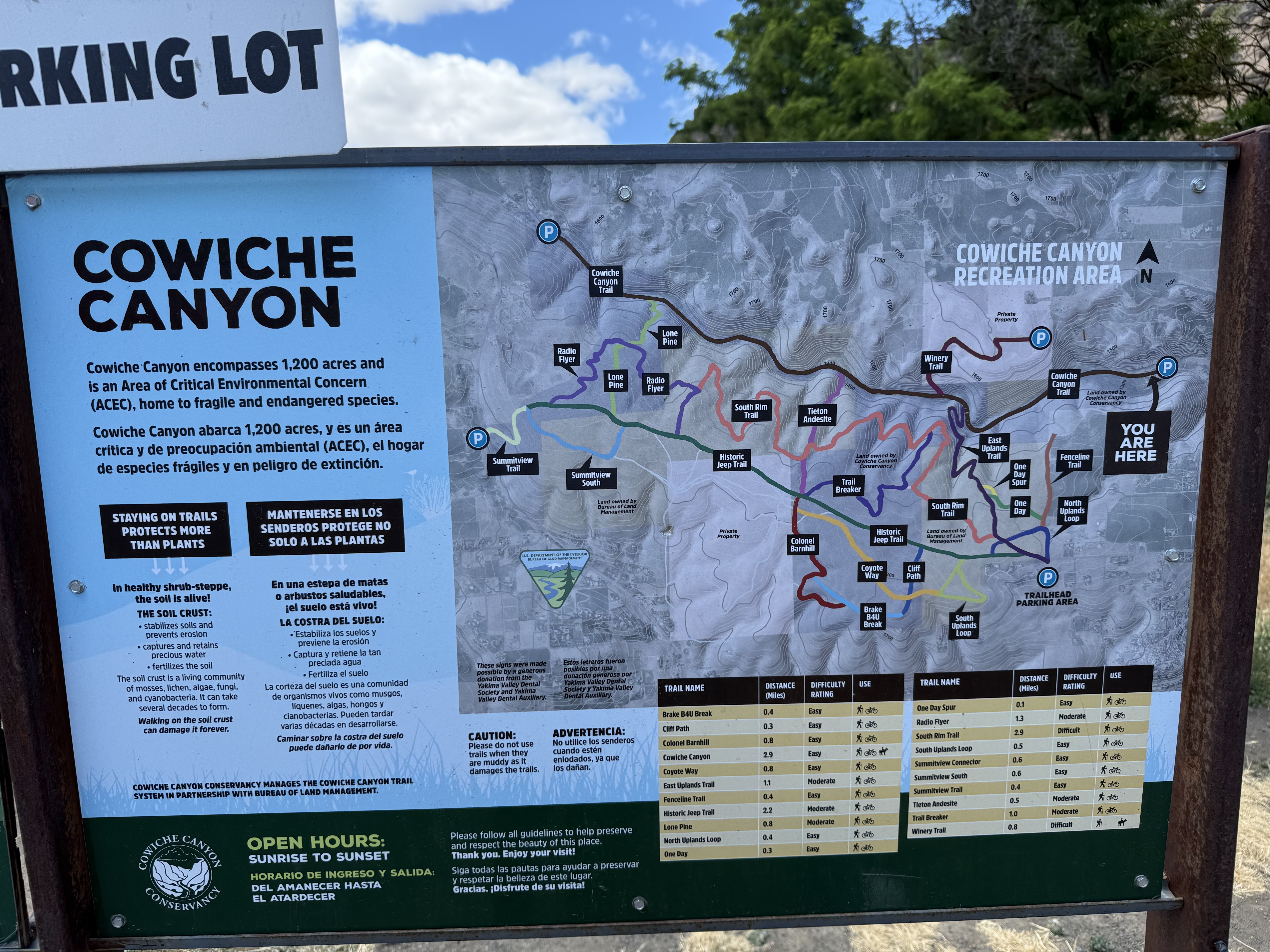
Cowiche Canyon Recreation Area is located on US12 just west of Yakima, Washington. The region receives 9-14 inches of rain per year, making it a dry area; thus, the trail system includes both shrub steppe (uplands) and riparian (along Cowiche Creek) habitats. We followed the main trail along the path of a rail line that was in use between 1913 and 1984 along the creek; however, the wetland is very narrow, in places constricted to less than 100 yards. Thus, I encountered plants from both environments.
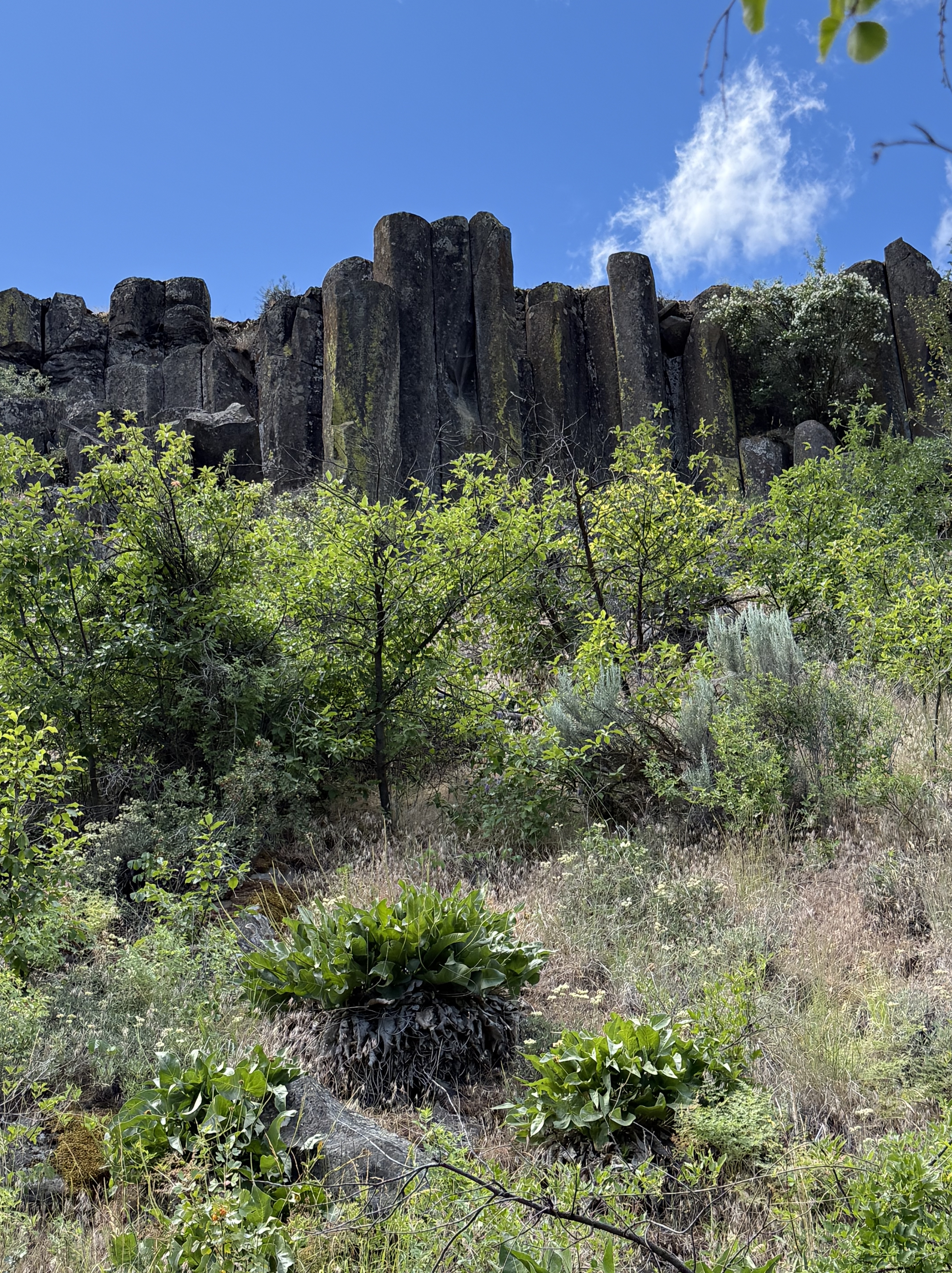
The canyon walls are composed of a series of basalt ledges with intervening slopes covered by talus and colluvium, which are part of the shrub-steppe habitat. I discussed the geology of the area in another post.
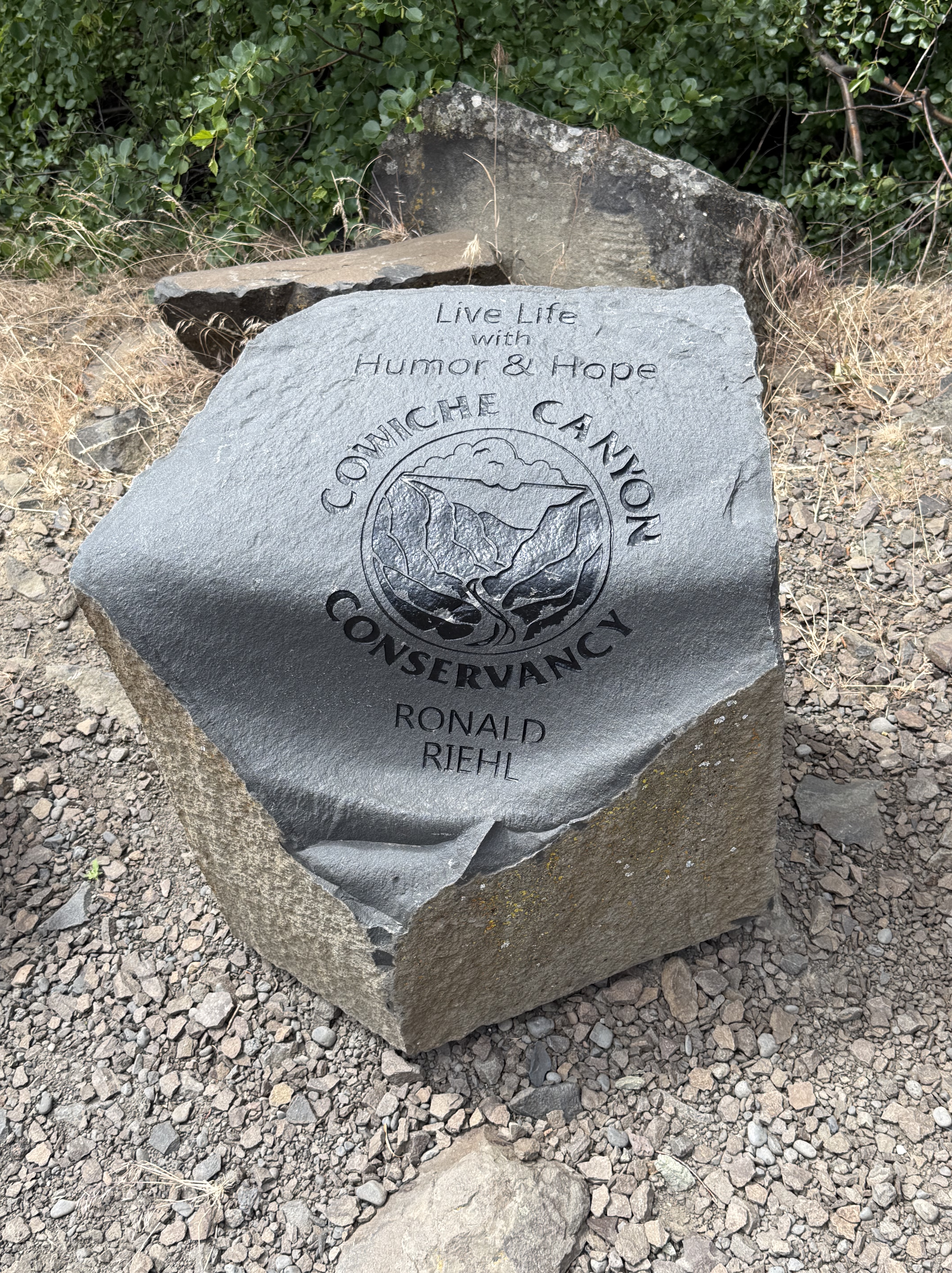
The recreation area is maintained by the Cowiche Canyon Conservancy in partnership with Bureau of Land Management. This stone is a piece of the columnar basalt that lines the canyon.
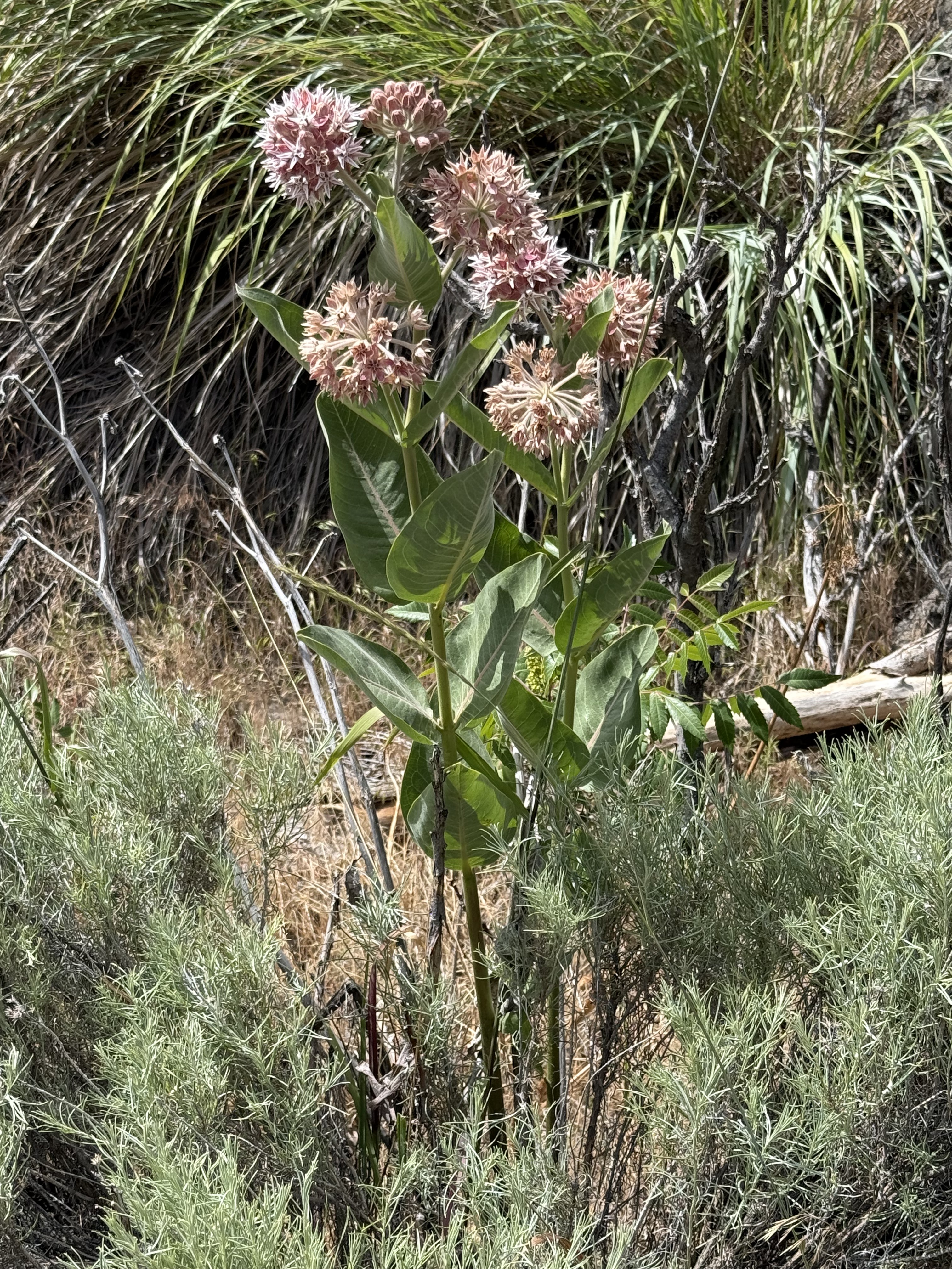
It’s fortunate that I visited this area during spring, which lasts a little longer here in the Pacific Northwest. As always, I used CoPilot (AKA ChatGPT) for identification while I try to remember scraps of the huge amount of information presented in this mixed environment.
This is Asclepias speciosa, also known as showy milkweed. It is native to Yakima county and is a host species for Monarch butterflies.
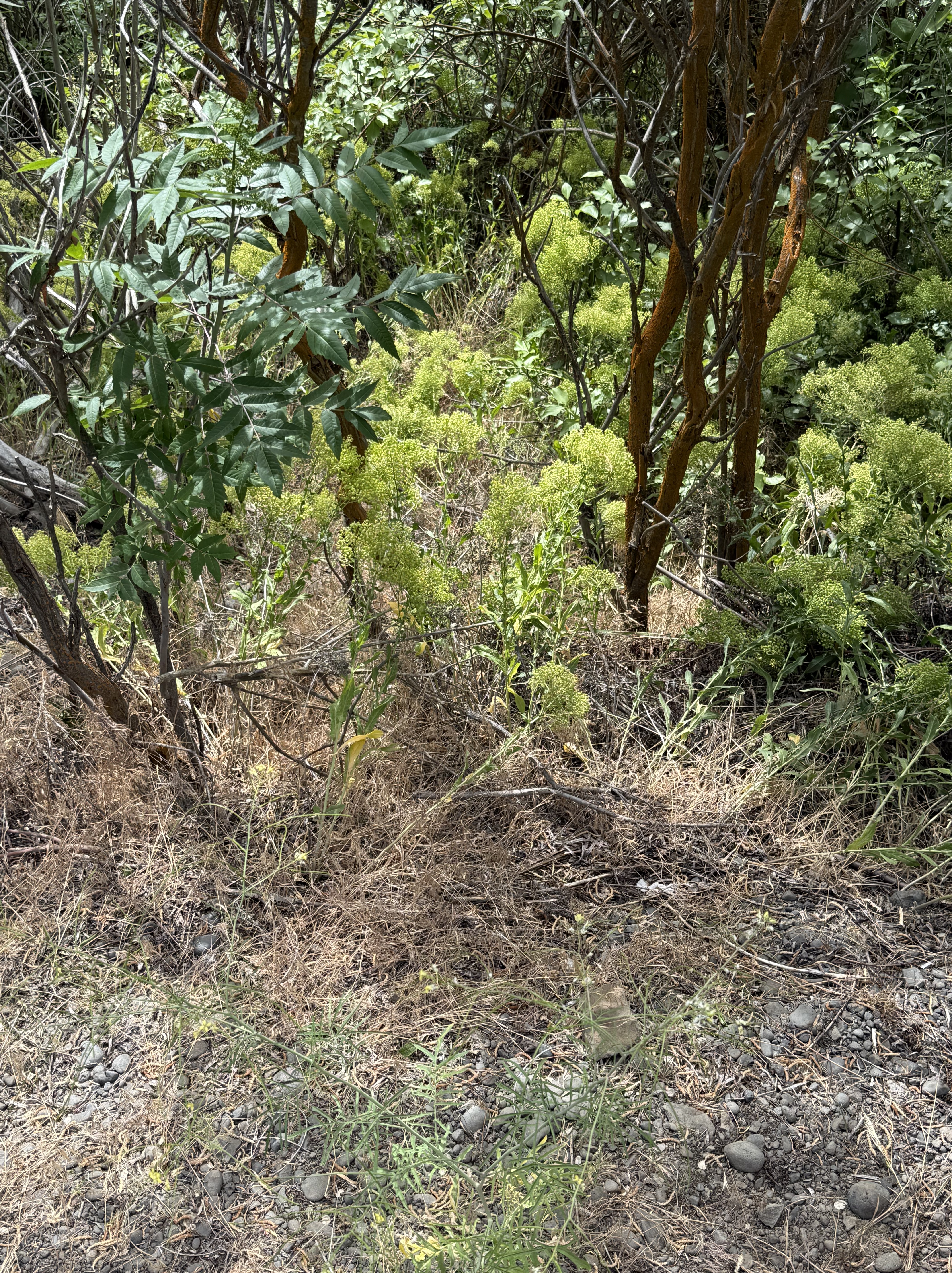
The leafy shrub with dark leaves is snowberry–Symphoricarpos albus (or possibly S. oreophilus, which also occurs around Yakima).
The low, brightly colored shrub with straight stalks is probably wax currant (Ribes cereum). The bright green is small leaves and the small patches of pink–barely visible in the photo–are the flowers. These are both native plants.
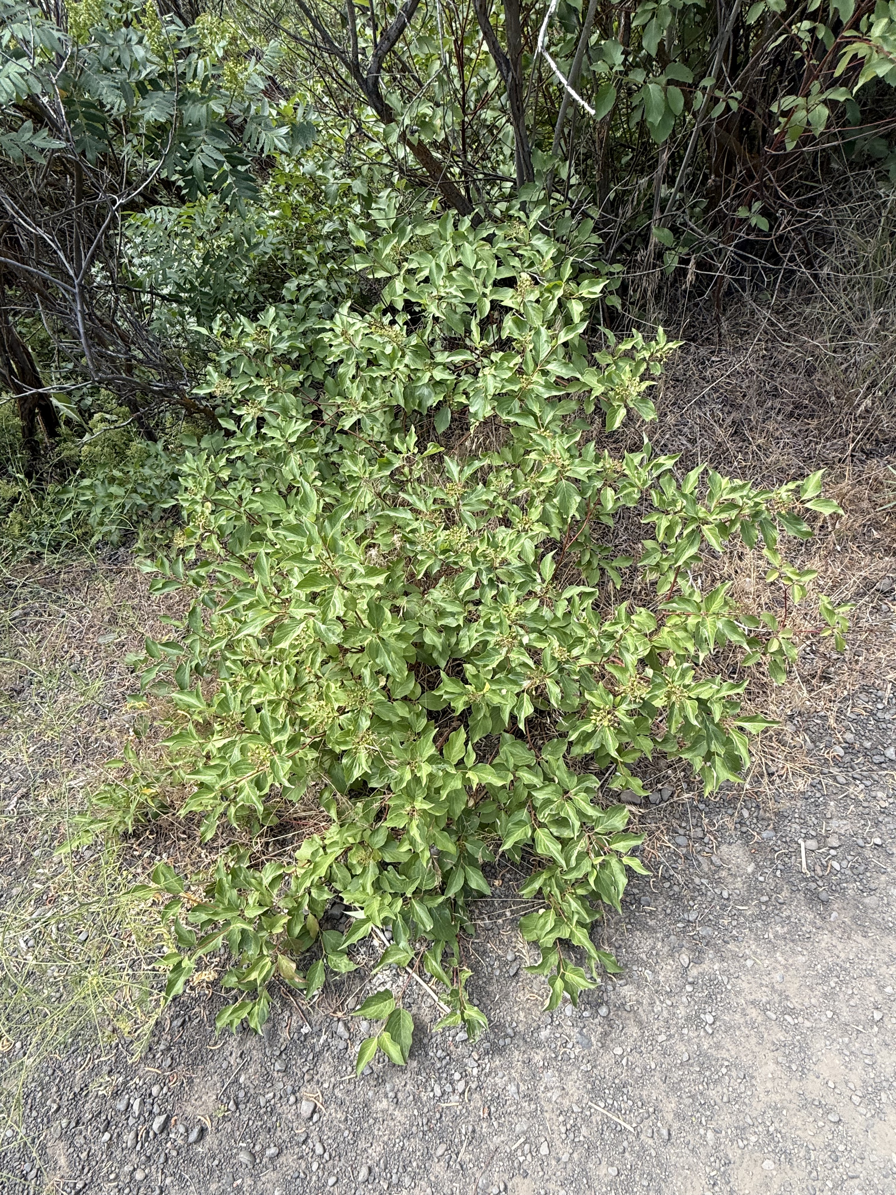
CoPilot wasn’t so sure about this, but it might be Creek or Red-osier Dogwood (Cornus sericea). This specimen was growing in the bottom of the canyon, not far from Cowiche Creek, which is a natural location for this native riparian species. It will probably become a small tree.
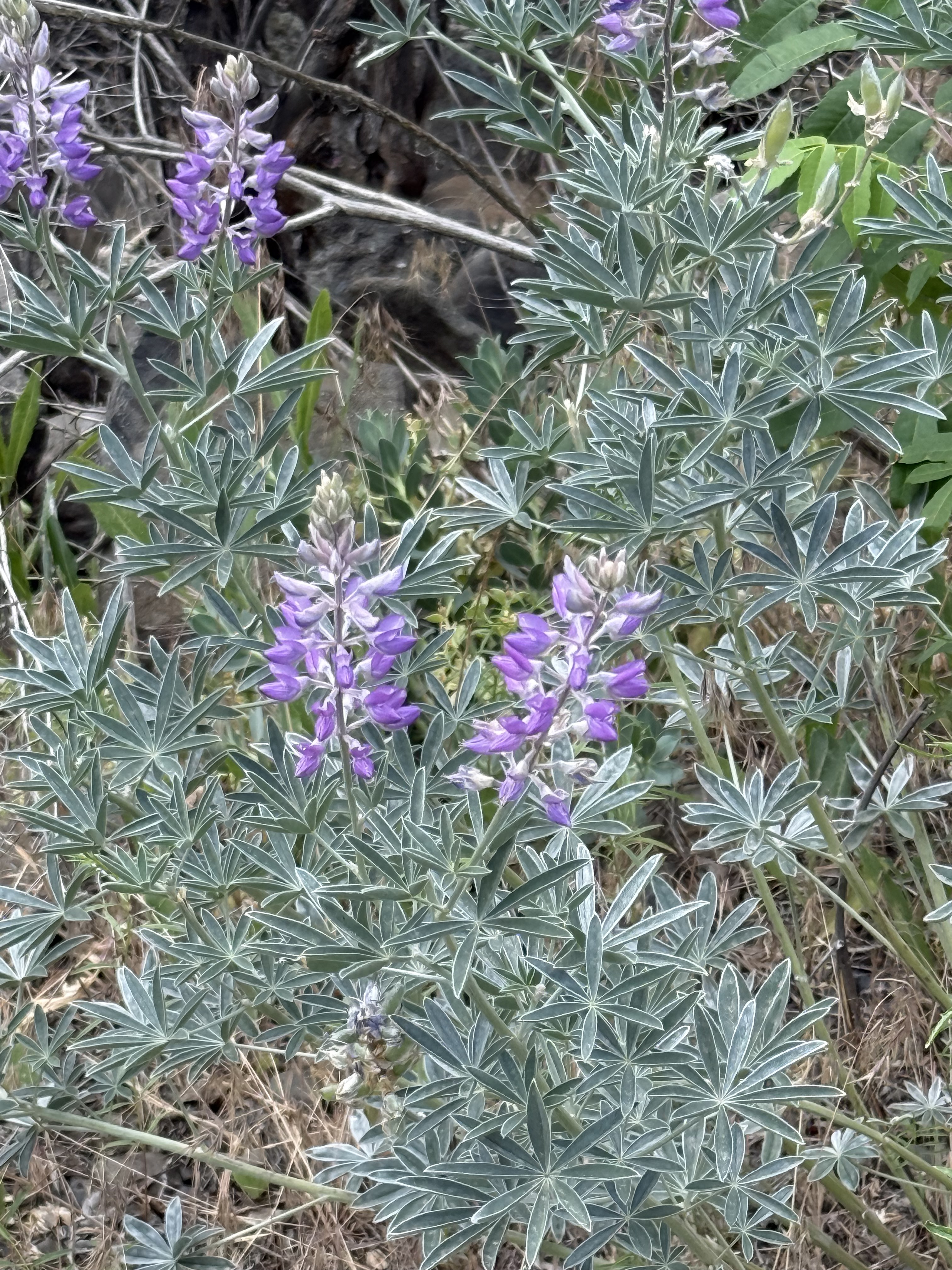
This is my favorite from the walk. Silky lupine (Lupinus sericeus) is one of the signature wildflowers of eastern Washington. I sure am glad we caught them in bloom.
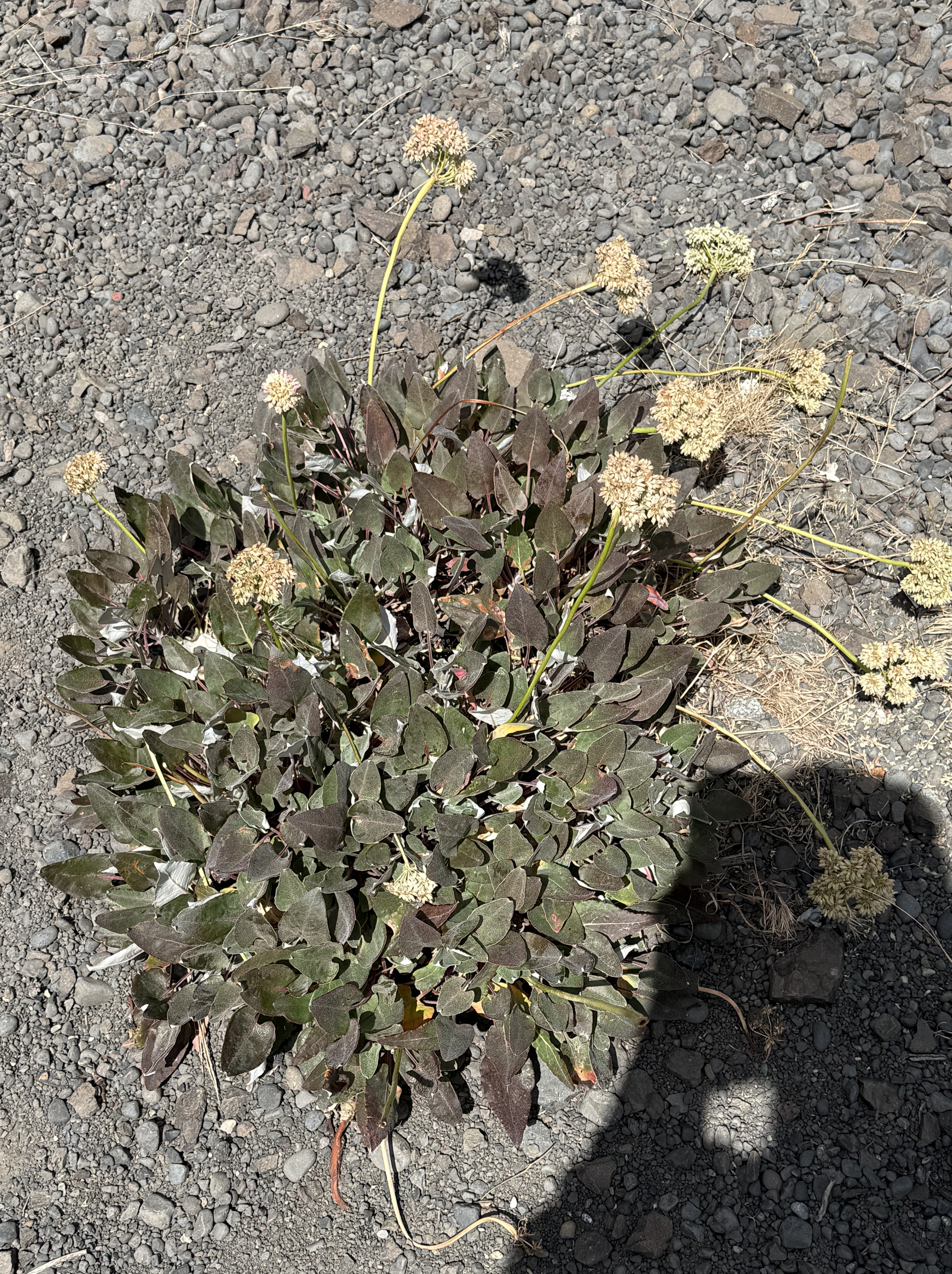
This looks like Pale‑stem buckwheat (Eriogonum heracleoides), another native wildflower to the shrub-steppe habitat.
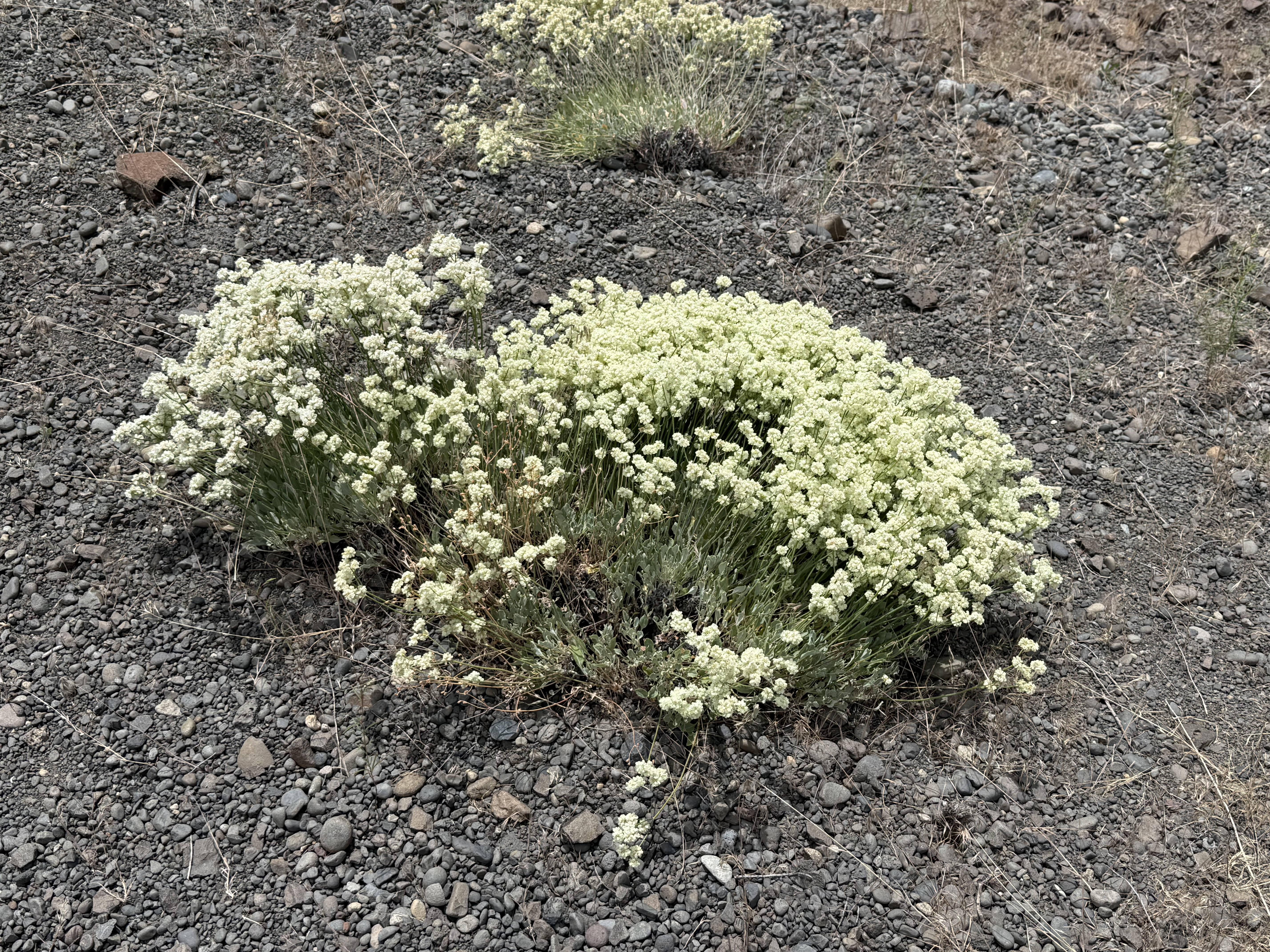
My untrained eye thought this was Pale-stem buckwheat, but CoPilot pointed out the different leaf pattern and color. This is (probably) Sulphur Buckwheat (Eriogonum umbellatum), another common wildflower to Yakima County’s uplands.
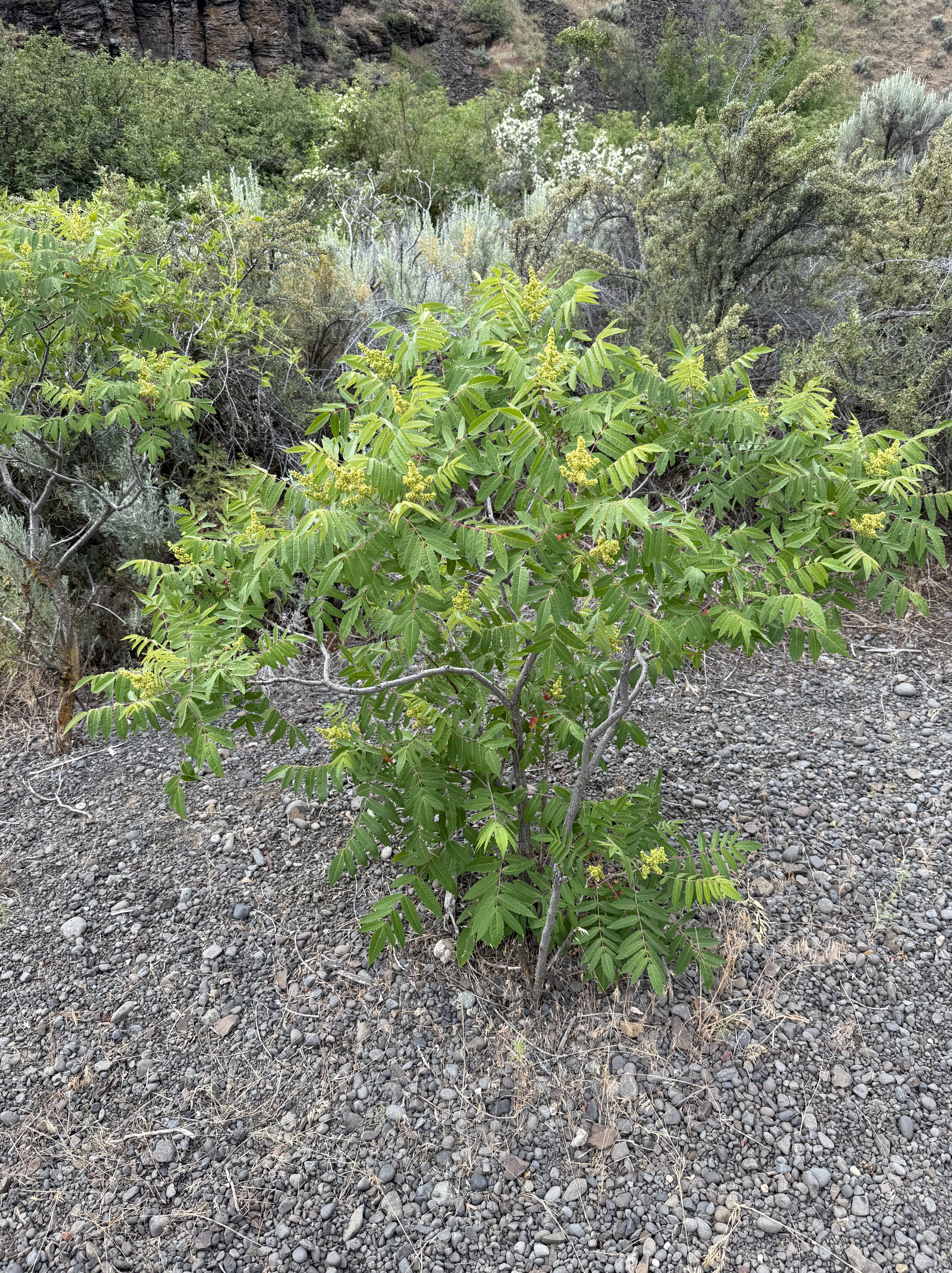
Antelope bitterbrush (Purshia tridentata) is a foundation species of the steppe. This young one had lots of flowers, but the old ones have bare branches; and groups of them grow and die together in cohorts after a disturbance like a wildfire. Yet another native plant.
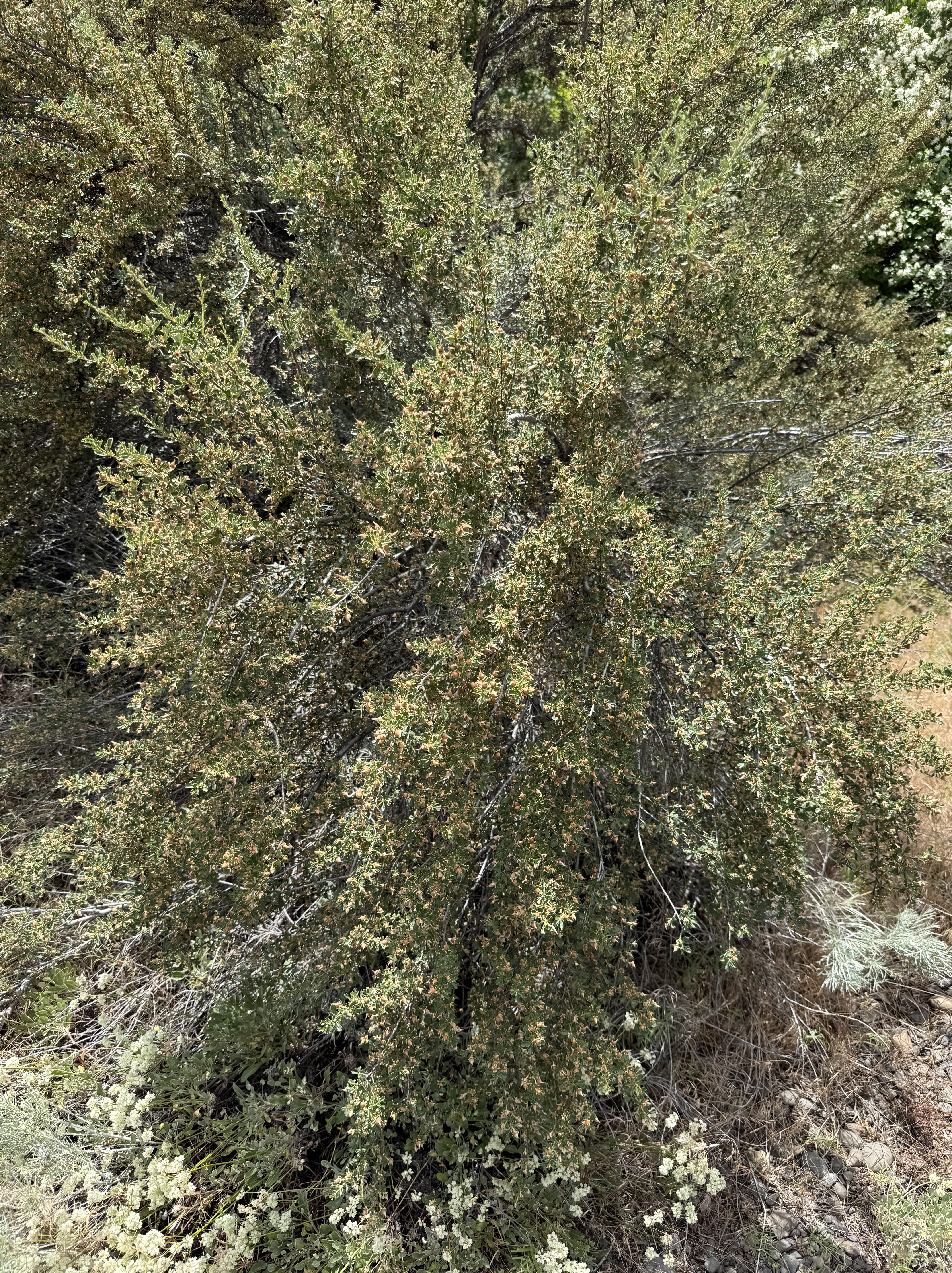
After some discussion, and sharing a close-up, CoPilot swears (hahaha) this is Woods’ rose (Rosa woodsii). However, its justification fits what I see with my own, somewhat confused eyes.
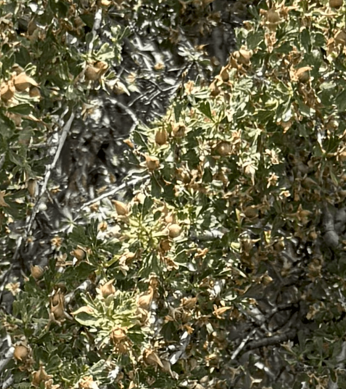
Here’s a close-up of the fruit. The shrub is covered with small nuts that have a distinctive shape, and are definitive for a wild rose. This is another native species to the steppe habitat of Eastern Washington.
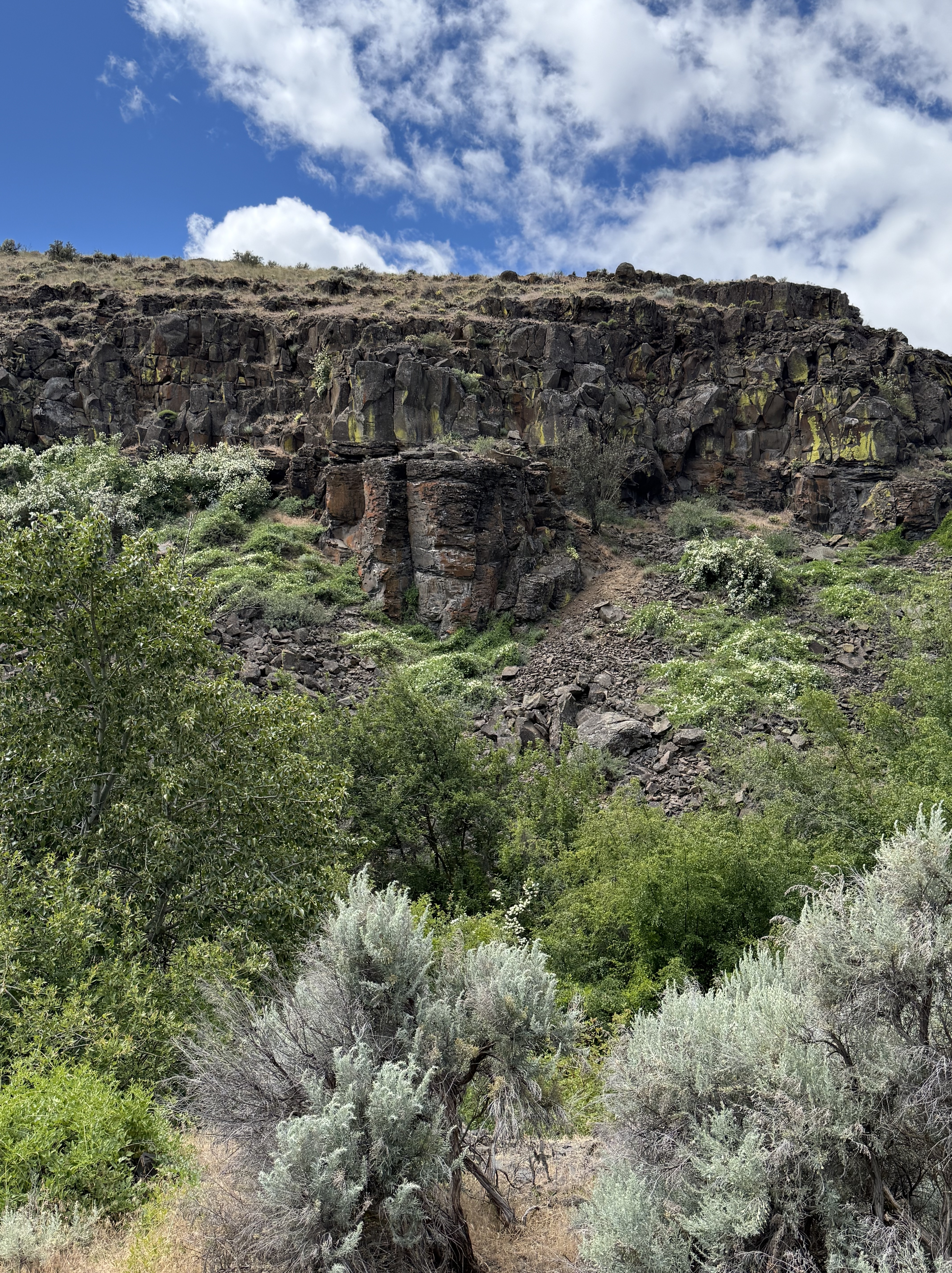
This photo, looking across Cowiche Creek, puts it all together for me. On the other side of the canyon we see columnar jointed basalt, several plant species similar to snowberry, bitterbrush, and buckwheat. Along the creek are dogwood and wild rose; and in the foreground is (maybe) big sagebrush (Artemisia tridentata).
When I took this picture, all I saw was a bunch of plants. After carefully examining them with CoPilot, it has become a mixed riparian-shrub-steppe habitat. However, I didn’t see/hear any birds or other animals, even though it was a cool day with temperatures in the mid-sixties.
CoPilot was a great help, but it is not infallible–more like working with someone who has studied some biology/ecology. After all, it is only a Large Language Model, not an AI system trained on recognizing plant species. Nevertheless, it was a great collaborator and I learned a lot from our collaboration.
Ecosystem Notes from Quinault Rainforest
Introduction
I’ve spent the past few months wandering the Olympic Peninsula with my attention fixed mostly on rocks—tilted beds, breccias, sea stacks, and the stories they tell about deep time. But along the way I’ve been noticing the living world with the same quiet fascination. I’m not a biologist and I don’t pretend to be; I can’t name any of the plants I pass. What I can see is how each organism plays a role in the larger system, the way geology shapes life and life responds in turn. These are simply notes from a wanderer paying closer attention.
I’ll try to remember to label these environmental posts as NOTES to avoid any confusion, especially on my part. This first post arises from a short walk on a semi-muddy trail through the Quinault Rainforest, on the Olympic Peninsula. I won’t have much to say about the photos, and all identification will come from CoPilot (aka ChatGPT). I’m certain its identifications will be better than mine after hours of searching the internet.
Quinault Rainforest in Olympic National Park
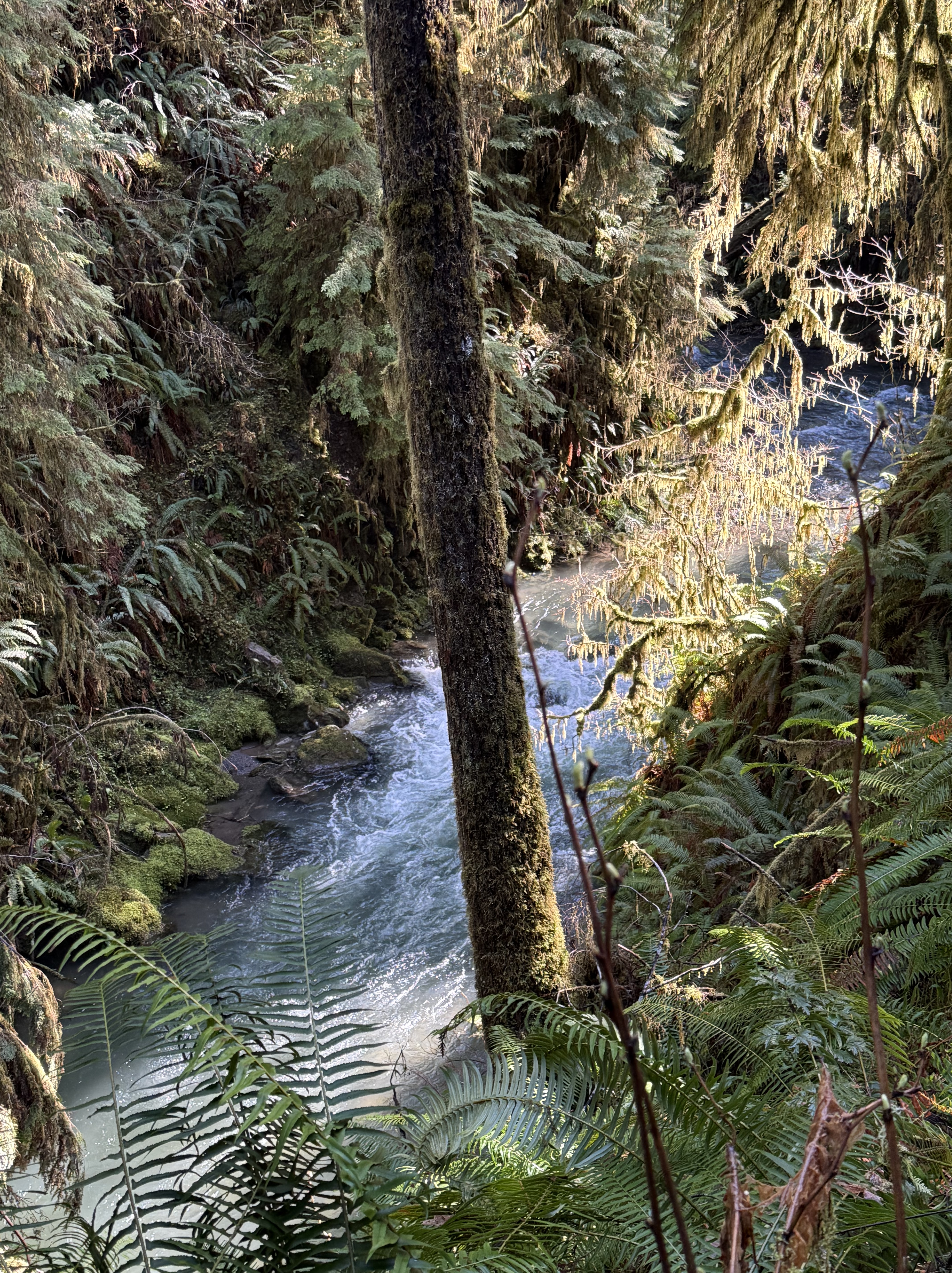
Plate 1. That raging stream about 50 feet below me is one of hundreds draining this temperate rainforest, which gets about 12 feet of rain per year. Note the ferns, which are everywhere, even in the temperate forests of northern Virginia. Ferns must be the most common plant in cooler forests. I am in a narrow strand of Olympic National Park that has never been logged. This is primordial nature, viewed by a geologist, but I’ll do my best.
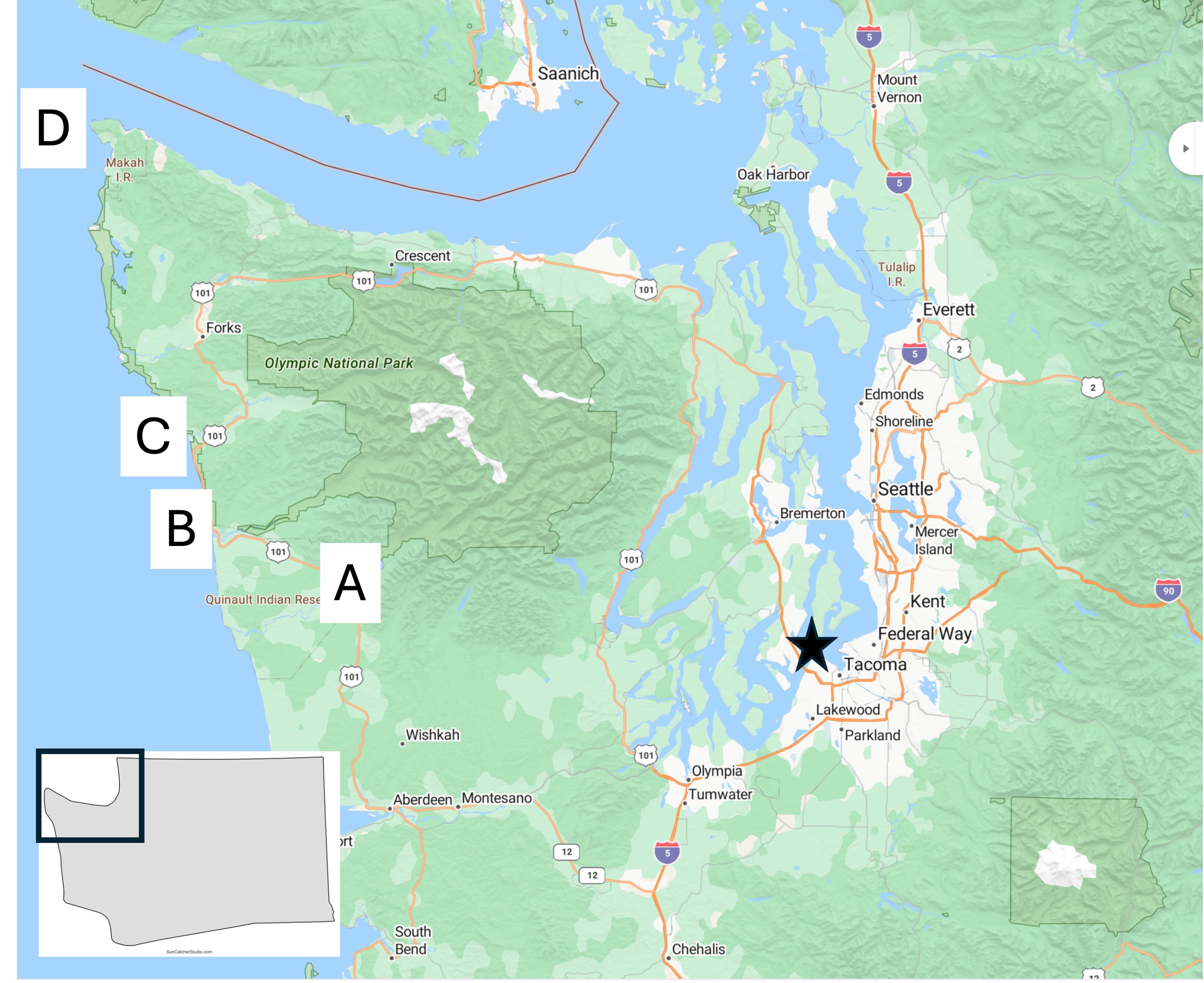
Plate 2. Map of the Olympic Peninsula showing the areas I reported on in previous posts. I’m going to be focusing on Site A today, with a few photos from D.
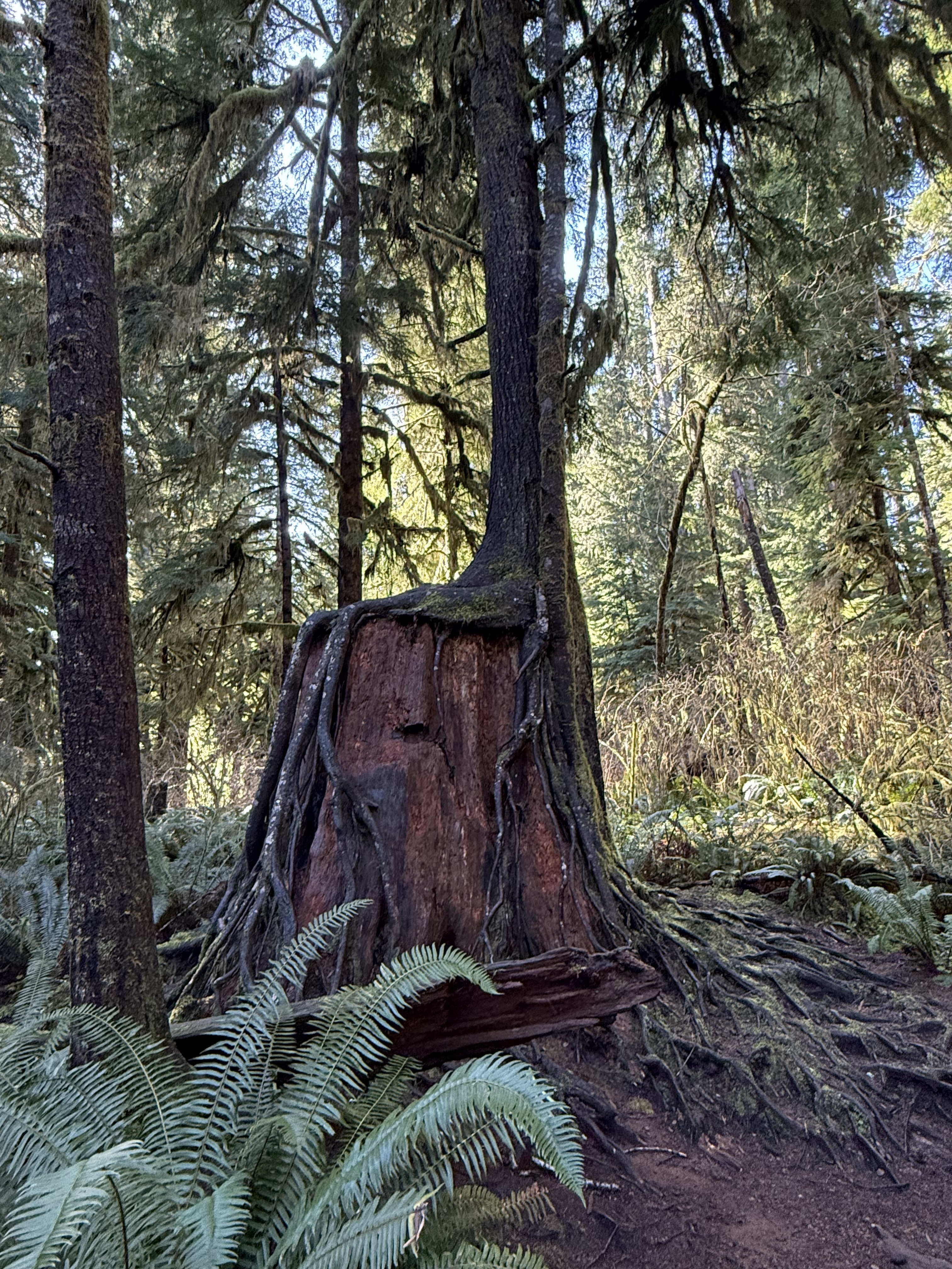
Plate 3. I haven’t seen this anywhere else I’ve lived, not even northern Virginia, but they occur everywhere here in Washington. Apparently this is a common occurrence in rainforests, where the ground is a dangerous place for seeds. I couldn’t identify the species in this photo, but this practice is very common for hemlock.
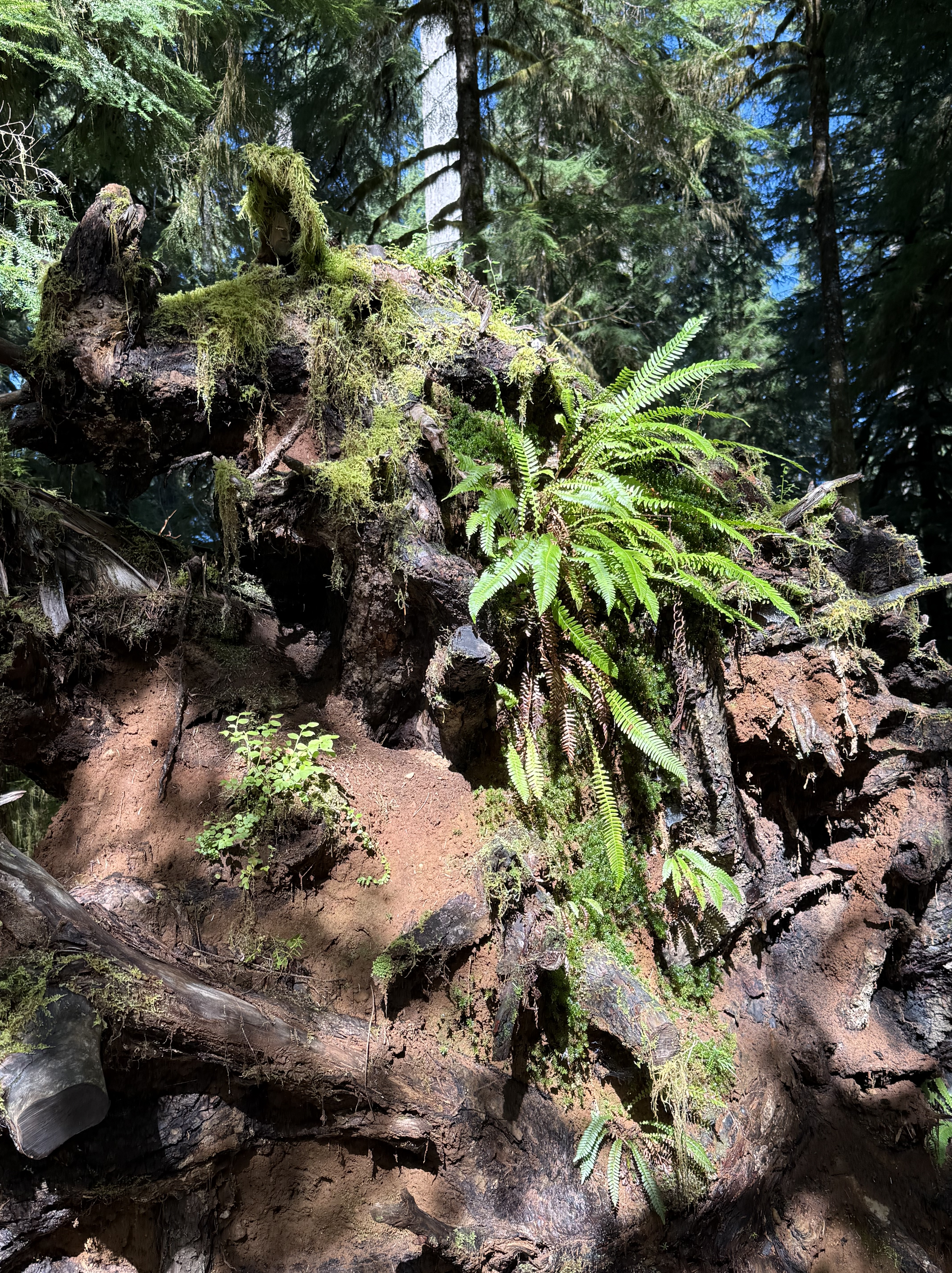
Plate 4. This pile of debris is a large log turning into compost and supplying nutrients to a variety of plants. The top of the photo shows the base of a young tree growing out of all this chaos. According to CoPilot and the Olympic National Park map, this area has never been logged, so I am in wonder of this pile of “forest garbage”. Is that sandy soil I see? Where did it come from? I don’t know.
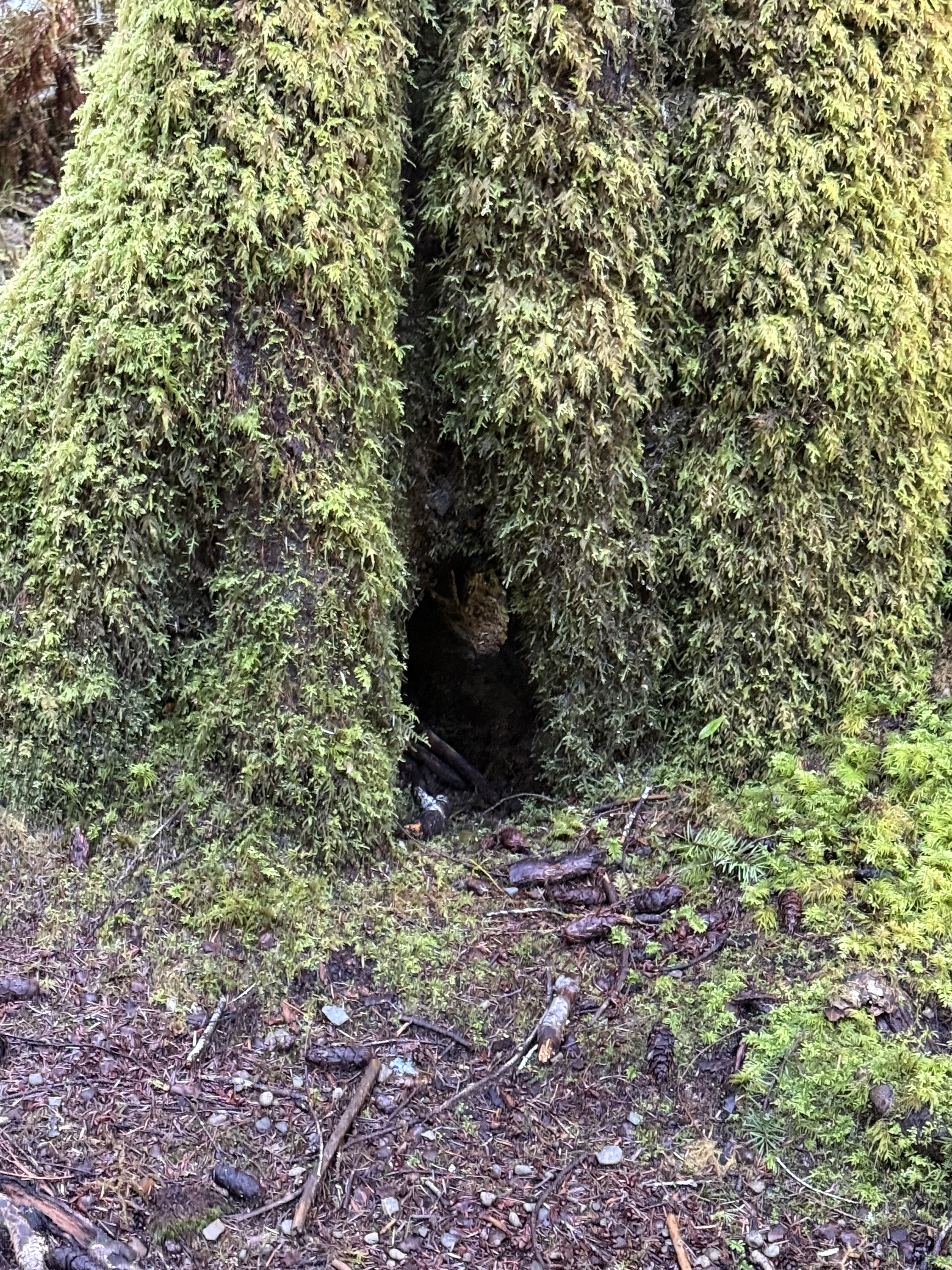
Plate 5. If you look close in the exact center of this photo, you’ll see daylight on the other side of the base of this unidentified tree. It’s about six-feet in diameter and covered with an epiphyte community of mosses and liverworts. Those aren’t leaves or fronds, but communities that mimic ferns–for their own reasons.
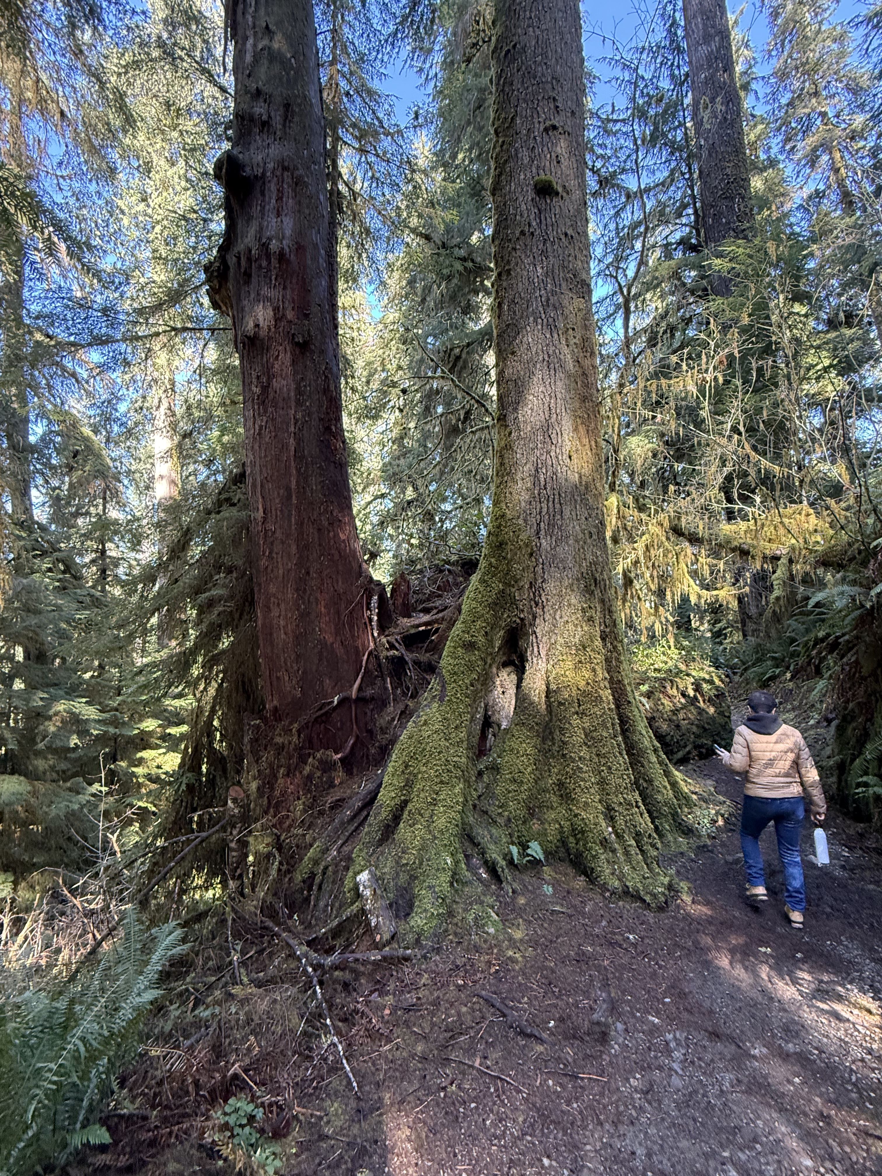
Plate 6. Here’s an example of a Western Red Cedar that has grown into a mature tree after being nursed by a stump. I guess it will eventually absorb the rotting stump and grow to full height, but this is the largest I’ve seen so far in the region.
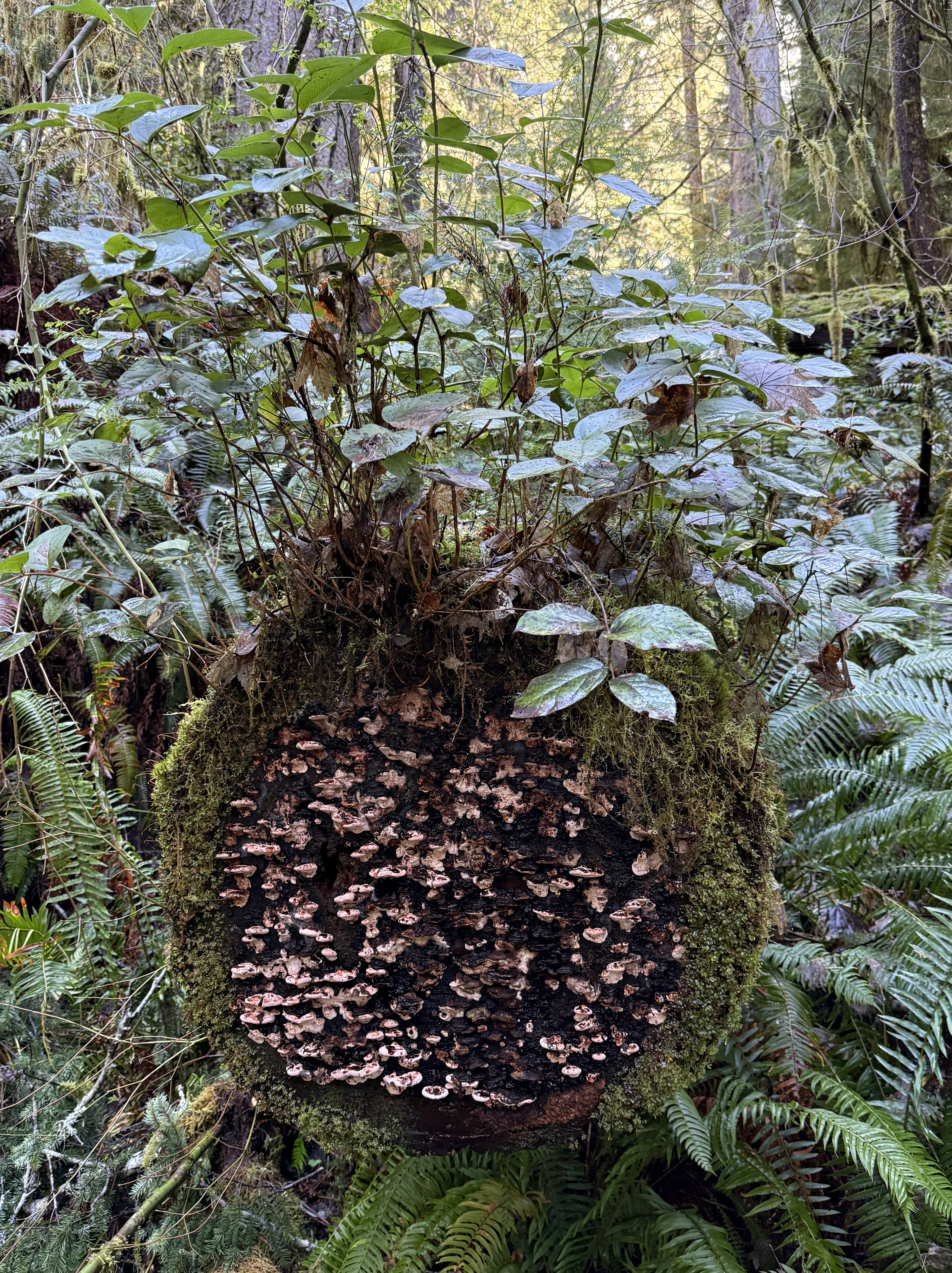
Plate 6. This miniature ecosystem caught my eye, but I had to turn to CoPilot to get an idea of what’s going on. As a tree trunk decays it goes through five stages: 1) moss; 2) liverworts; 3) fungi; 4) shrubs; and 5) young trees. This one seems to be in stages 1-4. I didn’t see any seedlings on it. The shrub is probably huckleberry and the mushrooms a bracket fungus, probably Trametes or Stereum.
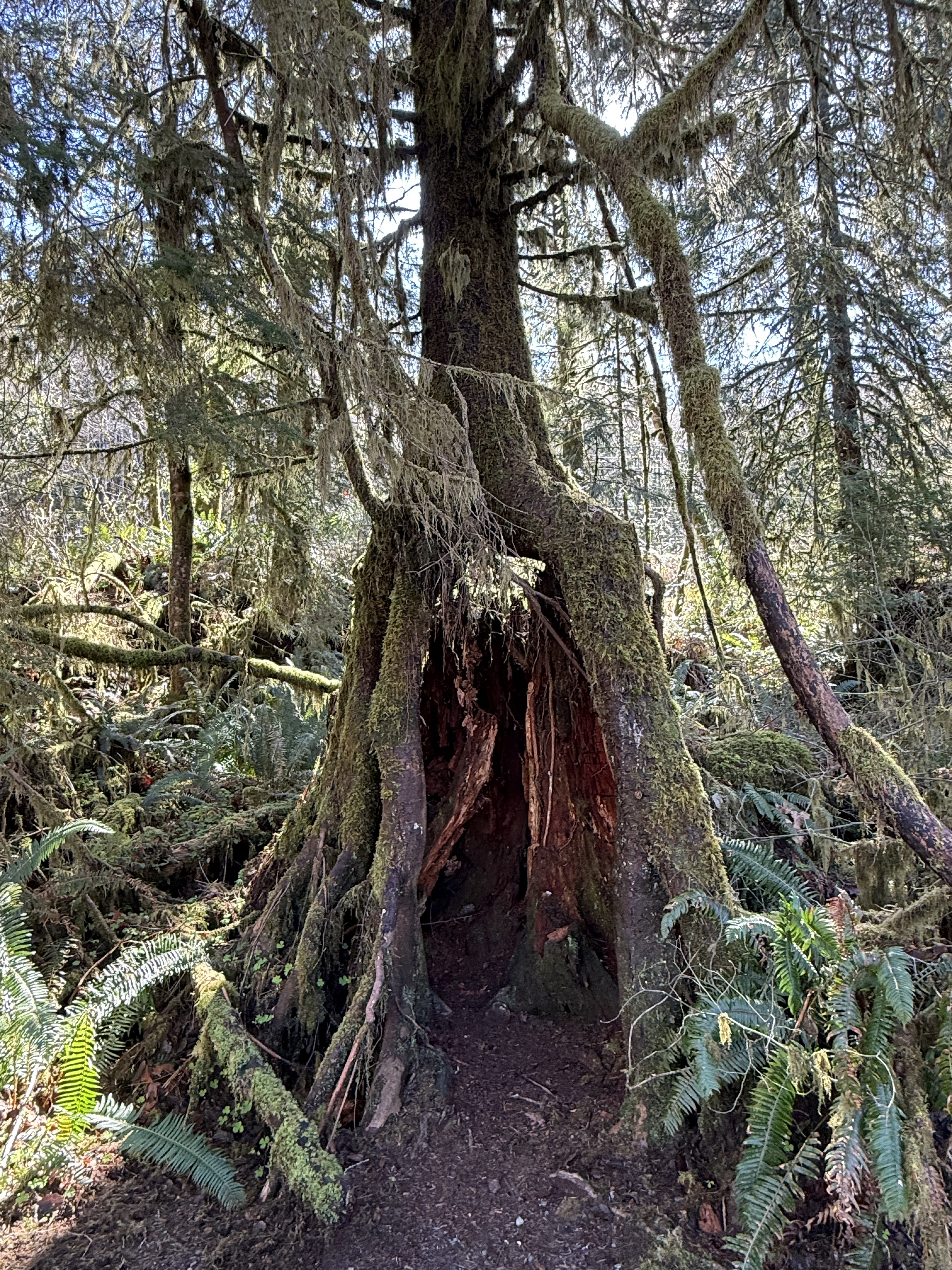
Plate 7. I am fascinated by these nurse trees after seeing species of fig trees in Australia that devour living trees, like a giant fungus or alien. These are nursing on dead trees, however, so it isn’t as gross; but this one is now standing on its own legs after the original stump has begun to collapse.
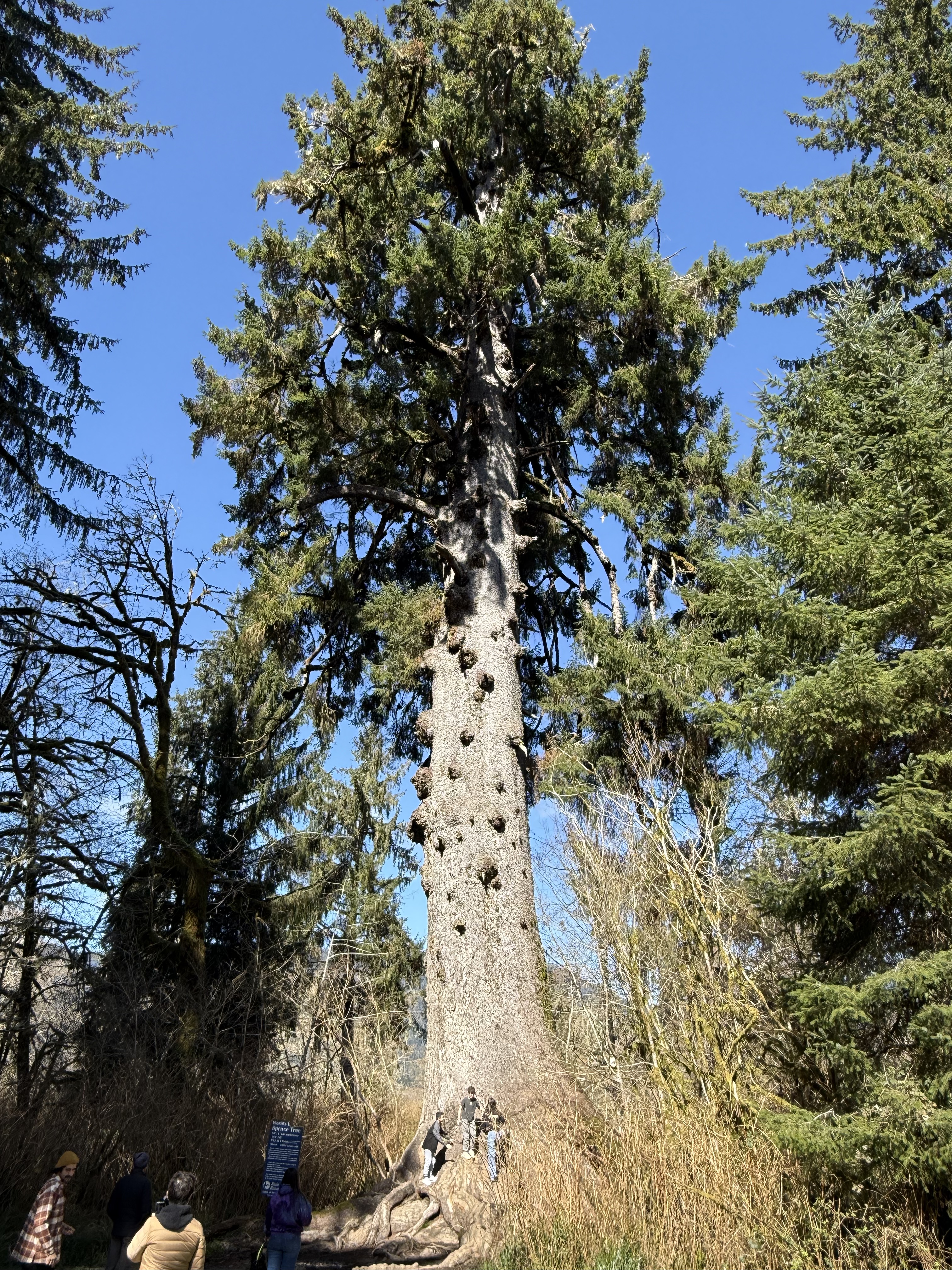
Plate 8. This is the largest Spruce tree in the world. It’s 191 feet tall and about 1000 years old. It is growing in a swampy wet land at the inflowing stream to a glacial lake, Lake Quinault.
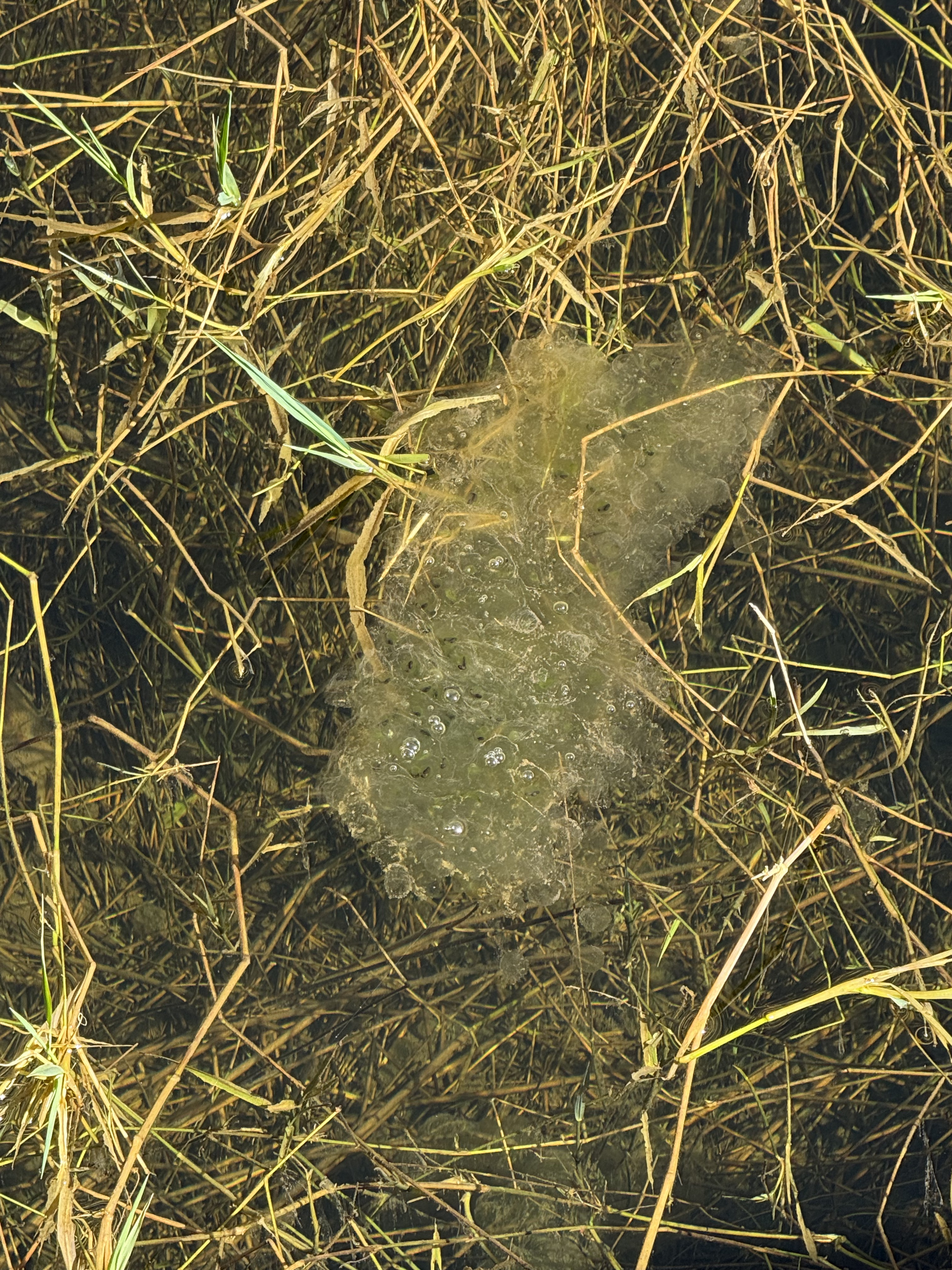
Plate 9. I thought this was toxic waste until CoPilot took a look at the photo: this is a mass of frog eggs (probably northern red-legged frog). There were several more at the shallow, marshy wetland where a stream fed Lake Quinault. The water is so clear you can see the bottom, which is only a couple of feet down.
Kalaloch Beach in Olympic National Park
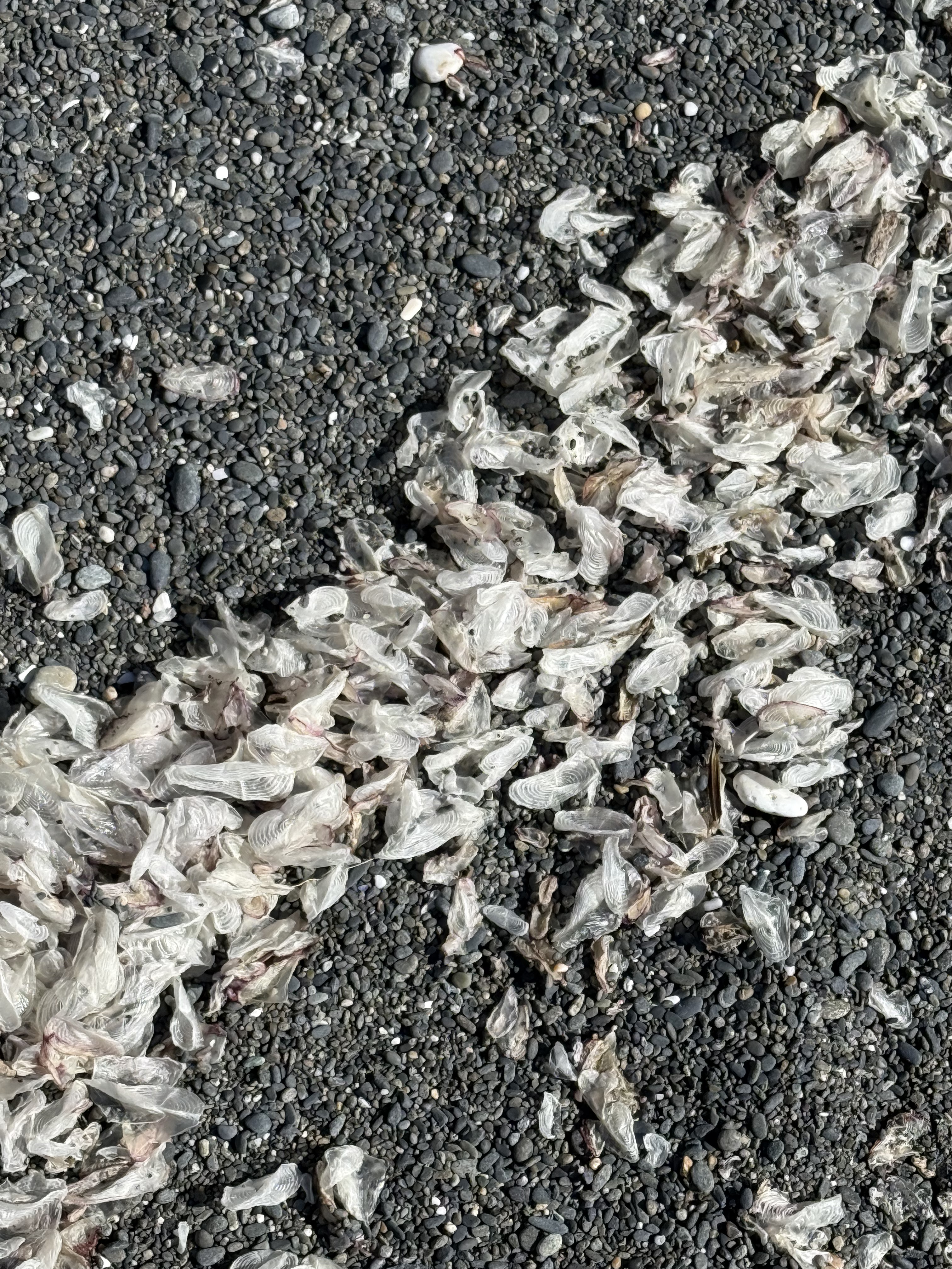
Plate 10. This one was a doozy. These objects are one-two inches long, thin, translucent, and oval in general shape. At first, CoPilot suggested insect wings (until I told it the size), then gull secondary feathers (until I said, “no way”), then settled on small fish cranial bones–e.g. the opercula, the bone that covers the gill. I asked for references, but it supplied me with titles and no links (how did it find them?). I spent longer on this photo than I wanted to. I don’t fault CoPilot for its ambiguous response because I found nothing when I looked very specifically. This phenomenon is either so common that no one bothers mentioning it, or infrequently observed that no serious beachcombers have stumbled across it. I’m going to have to agree (for now) with CoPilot that these are small bones from a school of fish that was decimated by either predation, coastal fishing, or disease and only these translucent cranial bones survived by floating, until waves concentrated them on this beach. This is the only beach where I saw them. I guess there are no easy answers to some questions–unless someone who reads this is a marine biologist.
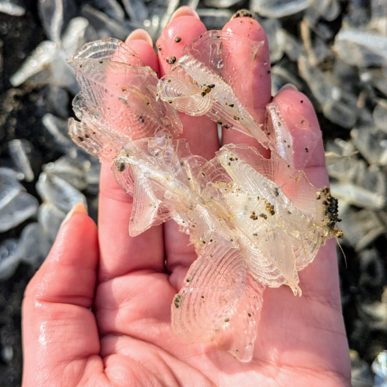
Plate 11. I solved the mystery of the white objects on the beach (Plate 10). I spoke to an ecologist I know who suggested they are a Hydrozoa called Velella-velella, which floats on the ocean like a jellyfish. They are a colonial organism that is blown about by the wind. They don’t swim so they are easily blown onto a beach and carried by waves. (Here’s a good article about them.)
Cape Flattery
I reported on this amazing location in a previous post. You can scan that post to get an idea of where these photos were taken.
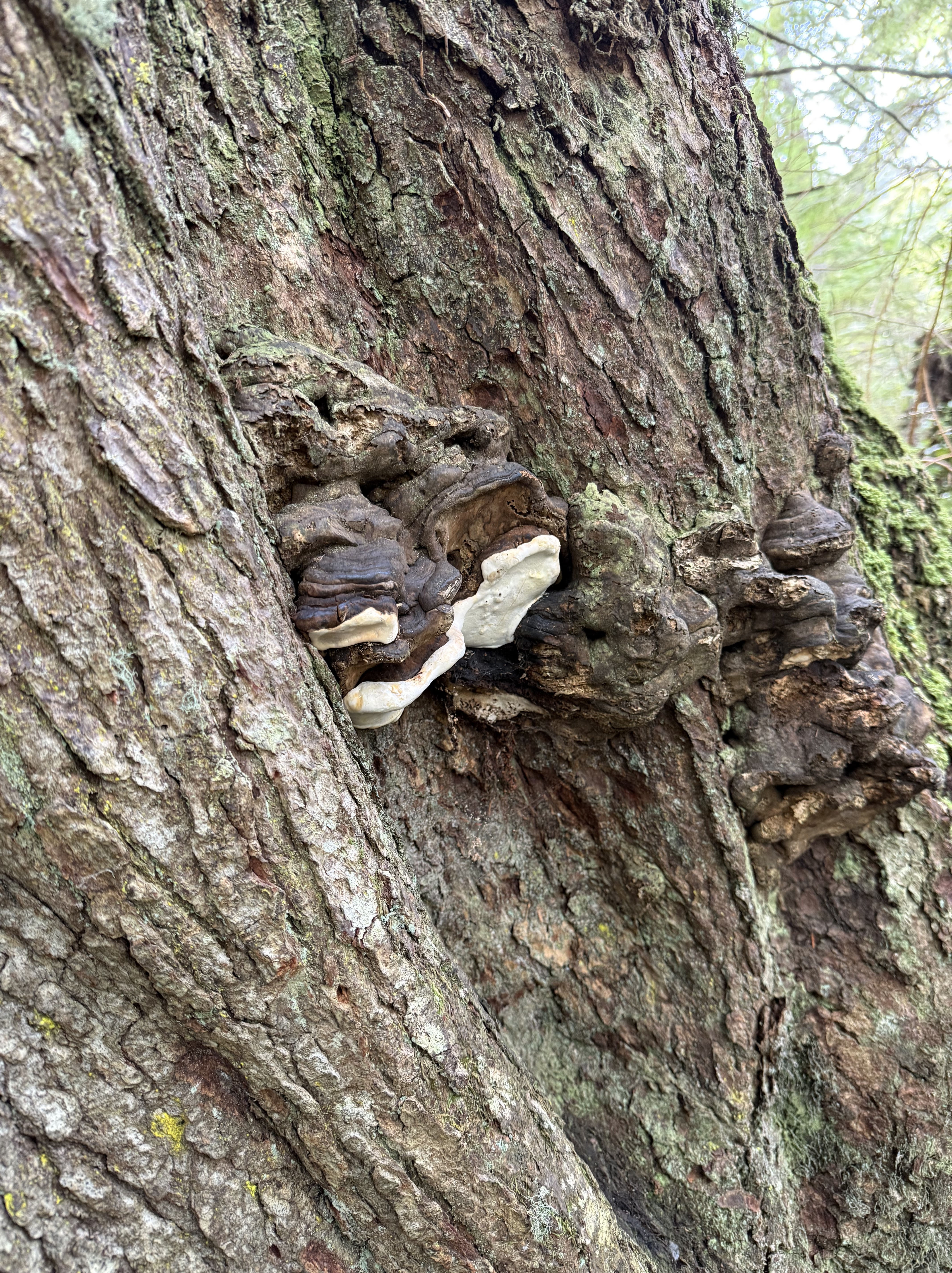
Plate 11. I don’t know if this living (it looked healthy to me) tree was stressed or not, but CoPilot thinks these are perennial bracket fungi, which favor environmentally stressed conifers. There were only a few on this tree. I noticed that this forest didn’t show nearly as many signs of decay as Quinault Rainforest, despite its exposed location.
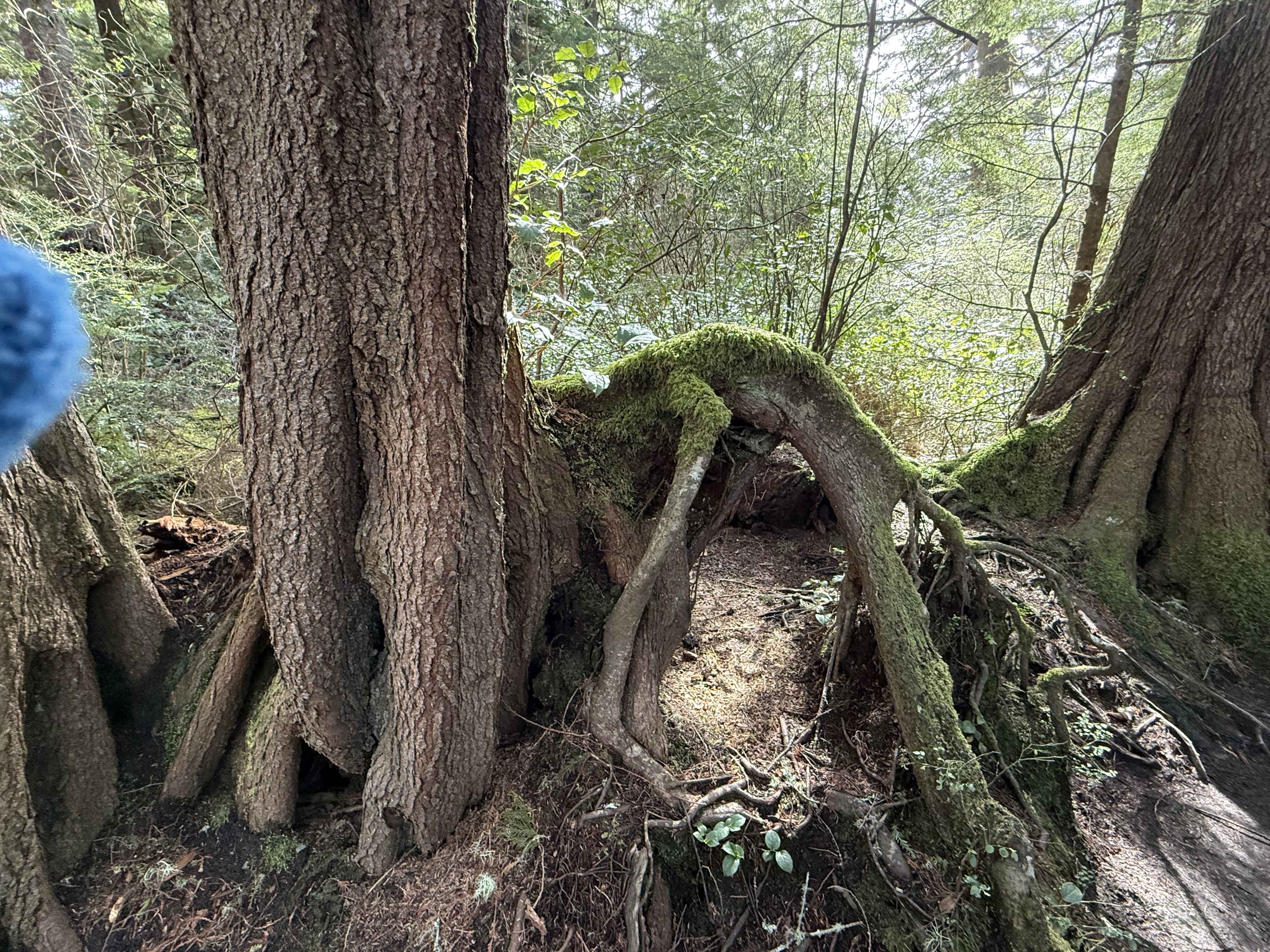
Plate 12. I had to throw this photo in because the root growing out of the tree(s) on the left looks like a dog that got its head caught in a hole, and died there. Its limbs of limp. Overactive imagination, I know. Nevertheless, this is a bizarre image because the dog is lying on top of a mound of soil. I’d bet there was a stump there that has decayed because the trees visible in this image are both composed of multiple trunks. A large tree died here (like the dog) and these are its adopted offspring. I would add that Cape Flatters, which is part of the Makah Reservation, has never been commercially logged. This is old-growth forest and this is a naturally occurring phenomenon.
Summary
Moisture drives everything on the Olympic Peninsula, soaking old volcanic and sedimentary foundations until the forest grows straight out of its own decay. Fallen logs become elevated nurseries, their wood breaking down under fungi and mosses until they’re more sponge than tree. Hemlock, cedar, and huckleberry take root on these platforms, sending roots around stumps and into the thin soils draped over ancient bedrock. Even the beaches tell the same story: waves sorting bones, shells, and driftwood carved from headlands shaped by tectonics and storms. It’s an ecosystem built on slow collapse and constant renewal.
Acknowledgment
I am experimenting with using CoPilot (aka ChatGPT) to help as I pursue my growing interest in ecosystems. I have been up front about where it contributed. It has been a great help, as well as an inspiration; if not for CoPilot, I wouldn’t have had the time of inclination to add these ecosystem NOTES to Rocks and (no) Roads. In fact, I’m tired of this entire series of posts, for which I get no compensation other than sharing my observations of the world. As a final note, CoPilot wrote the Summary and I stand by it.
Now I have to think about more than just rocks…


Recent Comments