Stormwater Retention Project
I always heard that the Pacific Northwest gets a lot of rain. Having lived in southern Louisiana for 25 years, I was a little skeptical. So when I moved here last year, to discover that all of the yards were brown, but the flowers and trees were flourishing, I became interested in the annual rain pattern. It doesn’t rain here in the summer. No thunderstorms twice a week. Nothing.
Water isn’t particularly expensive here, but I don’t like using clean tap water on plants. It turns out that most of Tacoma’s water comes from glaciers on Mount Rainier (Tahoma to natives). They melt naturally in the summer, so we aren’t using groundwater and have no control over their rate of melting.

We inherited a number of young fruit trees, which need a lot of water. Seeing how nice many of our neighbor’s yards were, we decided to collect plants. I watched water flowing out of the downspout during spring rains, flowing down the driveway into the street, and directly into Puget Sound. We installed a couple of rain barrels to collect some of it; you would be surprised how fast they fill during the light rains (compared to the Gulf coast) I’ve experienced here in Tacoma.
It turns out that Pierce County has a stormwater retention program, to prevent pollution of Puget Sound, and one can get free consultation on home projects that reduce storm runoff. There is even a competitive proposal system to get limited financial assistance. We jumped at the opportunity to contribute to the continued health of the place we’ve already fallen in love with.

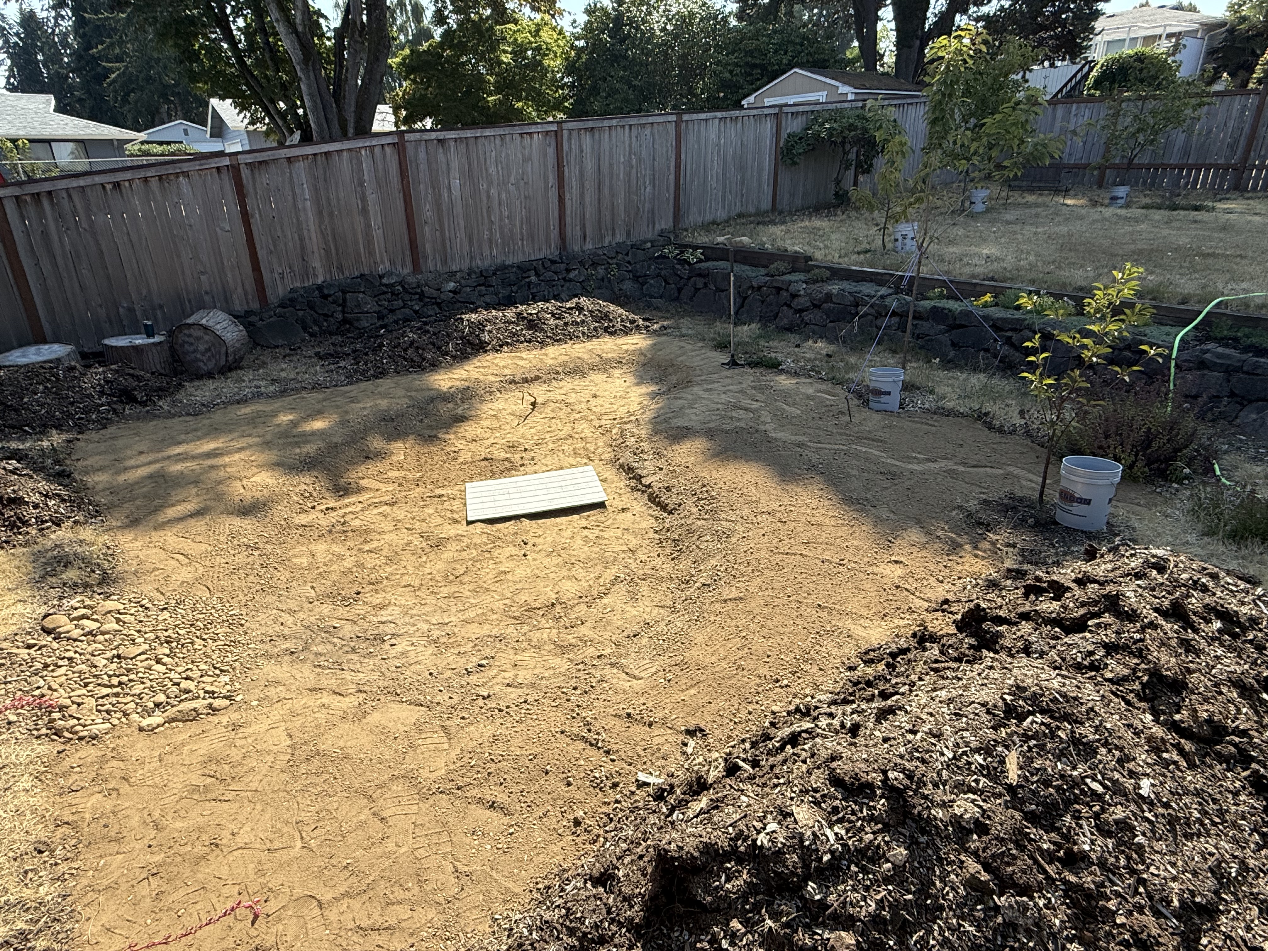
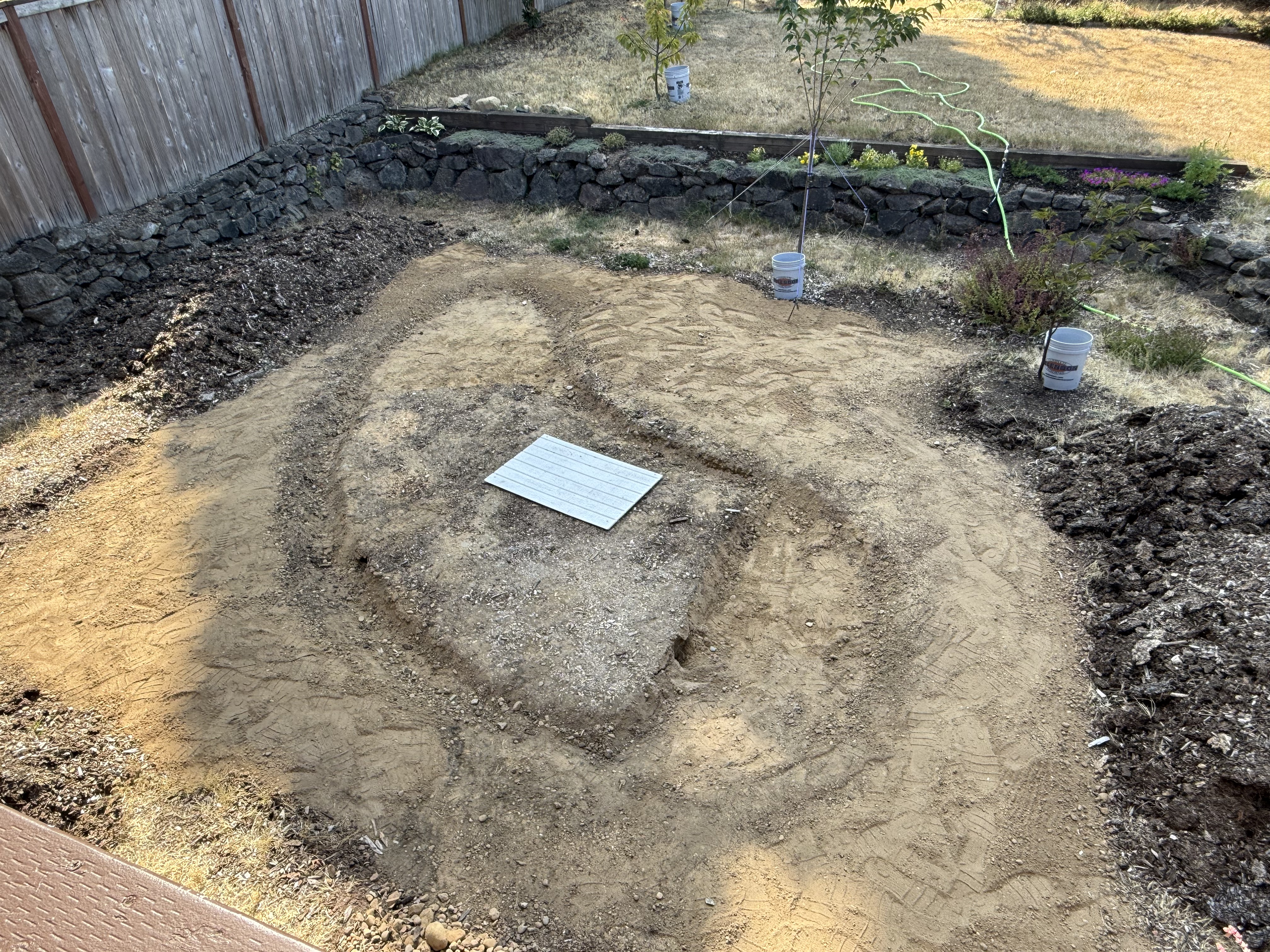
The back yard was a basketball court at some point, complete with 3-4 inches of concrete. The previous owners removed the concrete (thank god!), but left some irregularly cut tree trunks. We were thinking about planting a garden in this area, but now we were part of something bigger than our back yard. We could get assistance on the whole project, from collecting rainwater to distributing it, and keeping it out of the pristine waters of Puget Sound.
But there were some engineering hurdles to clear…

We had to demonstrate that the soil under our back yard would absorb a reasonable amount of rainwater, which necessitated digging a hole and filling it with water. That sounds easy enough. The catch is that the soil in the hole has to be saturated before the test can be conducted. To assure saturation for all soil types, this means keeping a two-foot deep hole full of water for three hours. I had to keep the garden hose running at half-volume, tweaking it constantly, to meet this standard.
I spent the morning babysitting a one-foot-diameter hole with a hose running constantly.
But I kept the hole full for three hours. Finally, I could conduct the test. I filled the saturated soil to 12 inches and waited, but not for long! As I already knew, it drained in 17 minutes, as measured by a stopwatch. We have well-drained soil (mostly sand with some clay and rock cobbles).

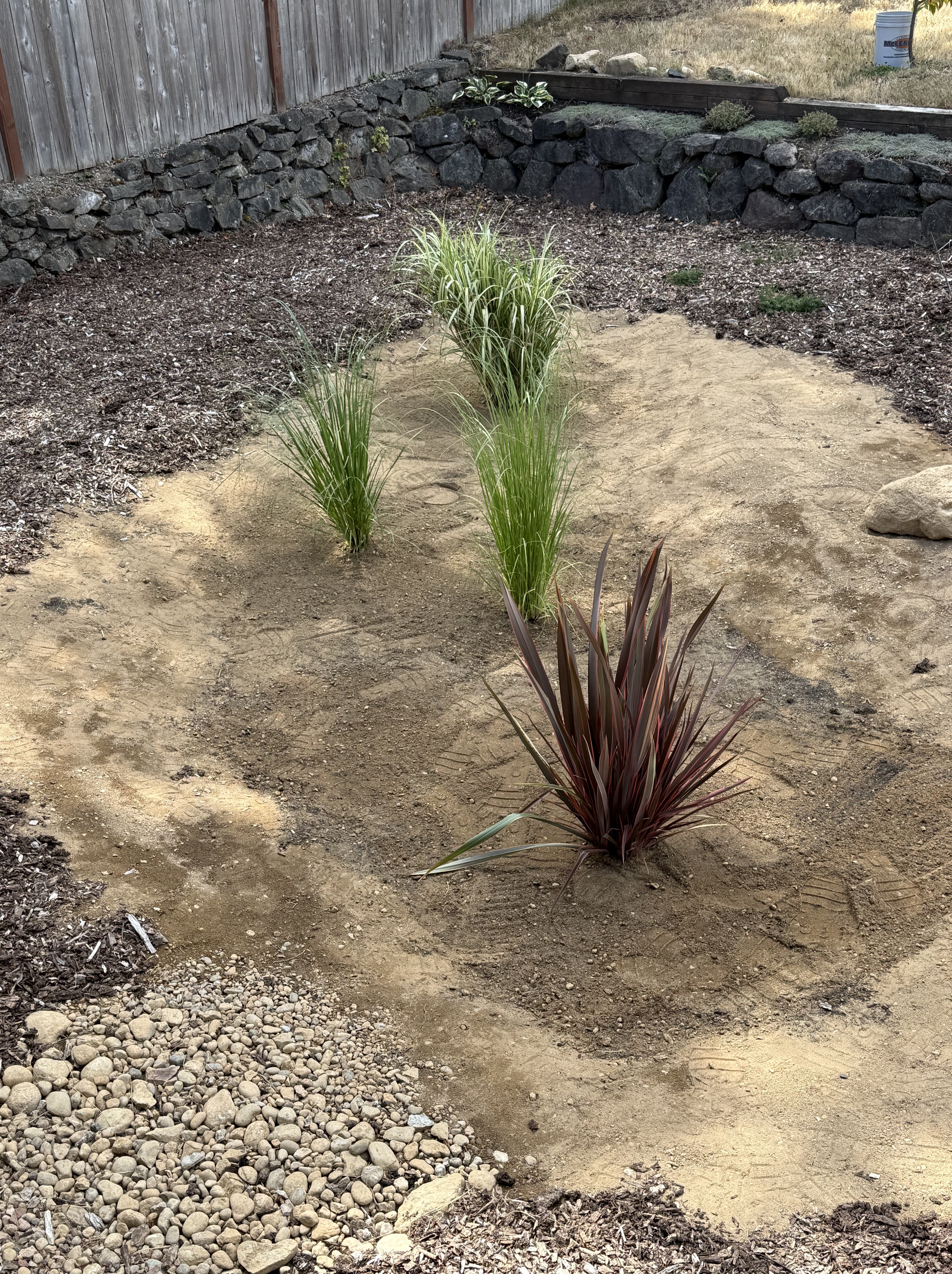
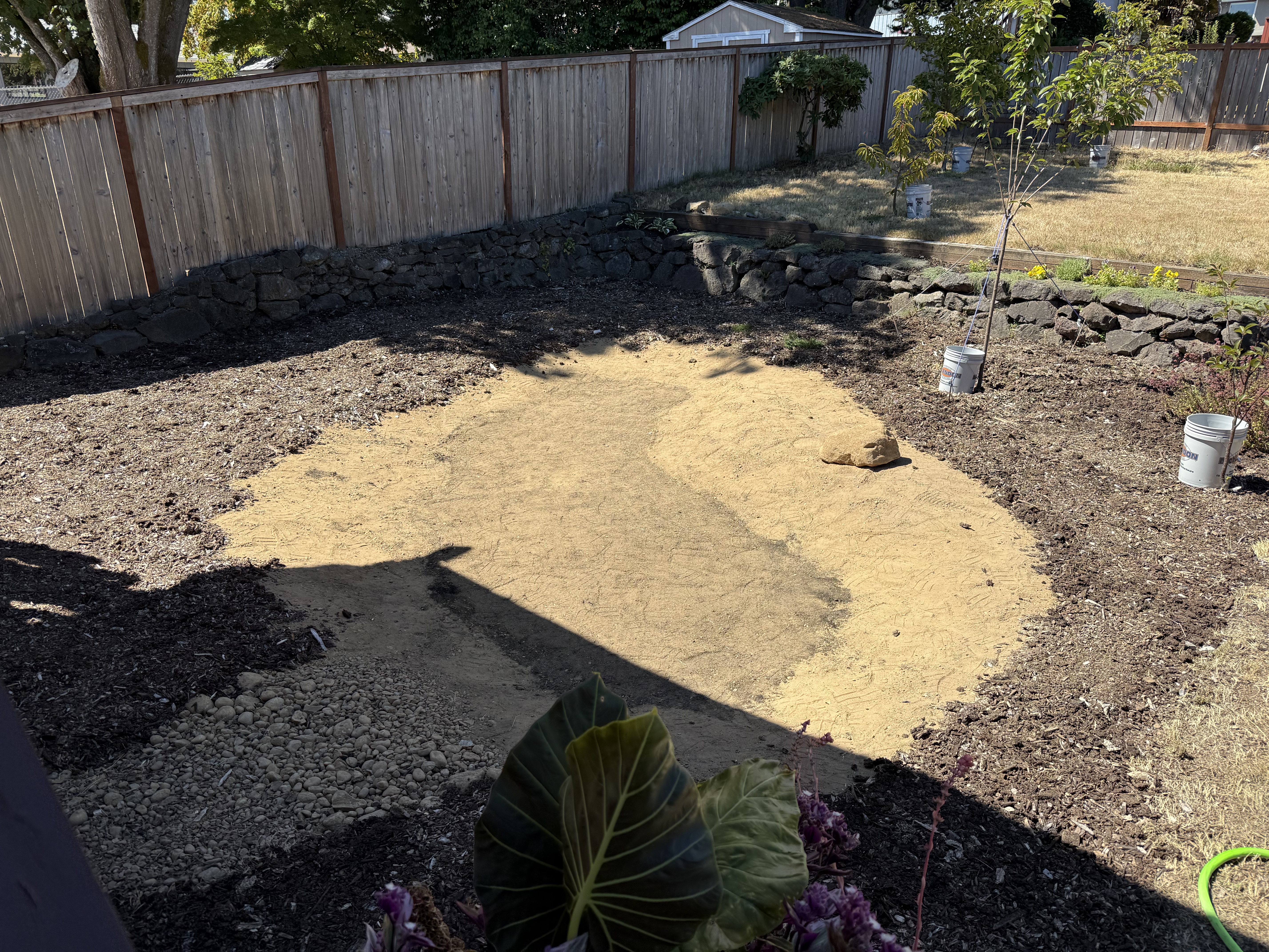
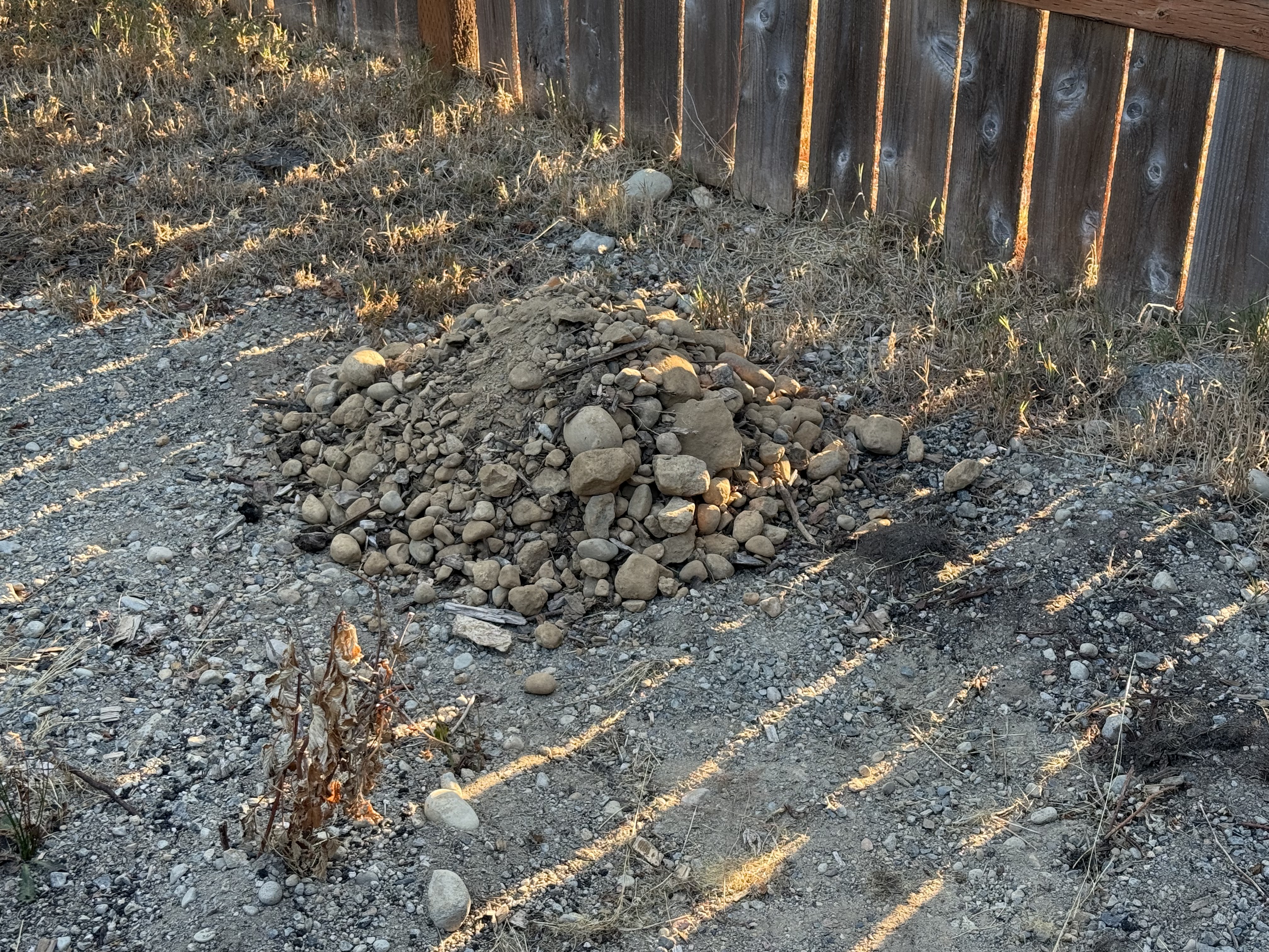
While my garden hose kept the ground saturated, I kept myself busy, removing 4 inches of mulch filling the 4-inch deep depression left by the basketball court. I’m going to keep the material on-site as much as possible, to avoid hauling it up the slope seen to the right in this photo, where it would (please, god, no!) be spread to form a slight hump in my back yard.
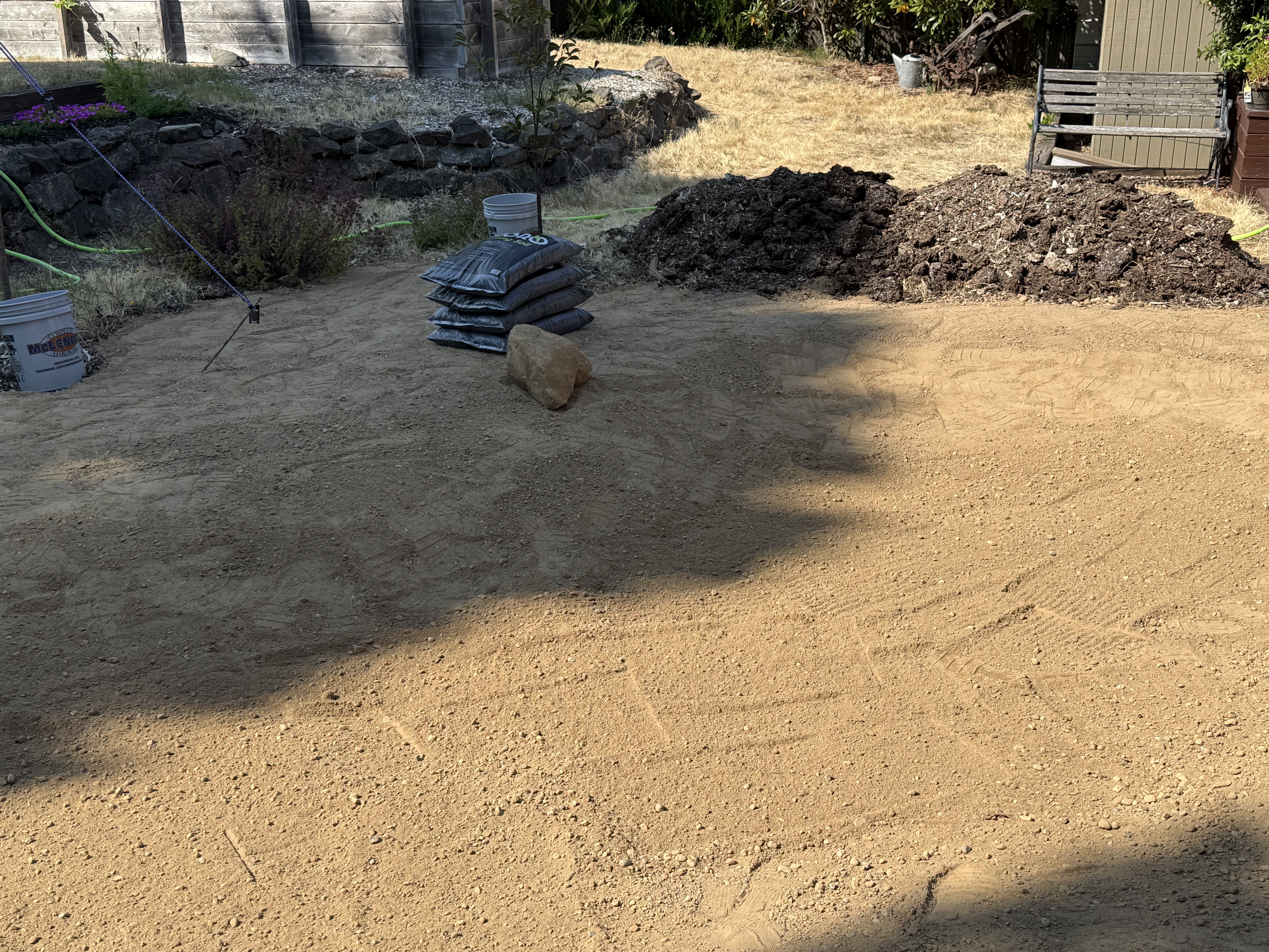
You would be surprised how fast soil is used to fill a 4-inch deep area the size of the remaining mulch seen in this photo.
I can’t wait to begin digging the pond. I’ll see you then.
Ecology Notes on Flaming Geyser State Park

This is my last post from Flaming Geyser State Park. I discussed the geology and the sights in previous posts. Today I’m going to look at some of the highlights in a riparian ecosystem that seems to be recovering from excessive logging; however, the area has been in private hands for more than a century, which allowed the maturing forest we find today to develop.

This paper birch (or red alder) caught my eye because of the bunches of small branches growing from the bark at different heights. ChatGPT says these are epicormic sprouts, areas where dormant stems wait for more sun or, possibly, stress to the tree.

Himalayan Blackberry and Trailing Blackberry (with flowers) along the trail.

Big leaf maple covered with moss mounds on (probably) epicormic mounds, which have collected over the years but weren’t active; or else the new growth has died back.

Douglas fir resting on the nurse stump where it grew from a seed. I’ve often seen examples of this phenomenon with roots projecting every which way, but this fir seems to have timed its growth perfectly with decay of the host.

This photo shows me standing among a bunch of bushes. That’s how much I know about botany. So I asked ChatGPT what plants it could identify. It came up with a long list: Douglas fir and Bigleaf maple; Salmonberry, elderberry, and maple seedlings; English ivy, Sword fern, stinging nettle, and a variety of mosses. It pointed out that this stretch of the trail doesn’t reveal any Himalayan blackberry, which means that this is a natural ecosystem for the PNW.
Final Thoughts
Flaming Geyser State Park represents a classic riparian ecosystem in the PNW. It has been invaded by Himalayan blackberry, but the native plants seem to be holding their own…for now.
Flaming Geyser State Park

The park is located at the upstream end of Green River, where it enters a gorge. This is one of the best places I’ve seen anywhere for taking a stroll through nature; the path is moist but not muddy, and well trimmed, with breathtaking natural scenes like this. A veritable Garden of Eden. This post is an overview of the park; I discuss the geology and flora in other posts.

With a name like that, I’m expecting a spectacular show…

I’ll summarize what you can read if you zoom in on the information presented in this billboard. An exploratory well was drilled here about 100 year ago, looking for coal–they found it, along with methane (natural gas) and other gases produced by decaying vegetation at several hundred feet below the surface. The small well produced a flammable gas that has burned intermittently since it was first lit by a geologist.

Flaming geyser wasn’t very active when we visited, but it was burning. To repeat, this is NOT a natural seep, but the result of a well drilled a century ago. Nevertheless it has become a local tradition, and it is relit whenever it goes out.
Bubbling geyser is a lot more fun. This video shows small bubbles of methane, as well as hydrogen sulfide and other, unnamed, gases. Methane is odorless, but this area smelled strongly of H2S, which is added to natural gas to help detect leaks.

This is a beautiful example of survival. The surface roots have all been exposed by erosion, but the tree is thriving; its roots have turned into separate trunks. I read somewhere that these conifers in the PNW send their roots out for hundreds of feet, far beyond their canopies.

This is where Green River Valley turns into Green River Gorge. The water was perfectly clear, with a slight green tinge, even though there is no algae visible. It reminds me of Commencement Bay, which is also devoid of aquatic plants. And it is all natural, simply a unique ecosystem.

If you wear waders, you can walk on water here.
Final Thoughts
This is a place you have to visit for yourself, especially on such a gorgeous summer day. The temperature was in the mid-seventies, the sky was clear, and people were filling the huge number of picnic areas, carrying their supplies and tubes, ready for a fun day of floating down one of the best rivers I’ve ever seen.
You’ve got to see it for yourself.
Eocene Continental Sediments in Flaming Geyser State Park

Figure 1. Flaming Geyser State Park is located along the Green River (see Fig. 2 for location), where its valley narrows and deepens. This photo shows a typical gravel stream, but there is plenty of sand and even clay available to construct a flood plain. The alluvial deposits downstream are rich farmland, where we saw a variety of vegetables growing.

Figure 2. (A) Location of the study area SE of Tacoma in the foothills of the Cascade Range. (B) Green River has eroded a valley in the glacial till and bedrock along its path. The northern margin is steeper throughout its length. Flaming Geyser State Park is located upstream of the arable land, where the river becomes rocky and the valley narrows to a gorge. (C) The geologic map from Rock D reveals Eocene (56-33.9 Ma) continental sedimentary rocks along the stream bed whereas further north, Vashon till of Pleistocene age (2.58Ma – 11.7 Ka) covers the region in a thinning-eastward blanket. Just south of the river itself, Quaternary (2.58 Ma – Recent) fluvial and alluvial sediments have accumulated.
To the extreme east side of (C), a fault line can be seen running N-S. Faults are common, but often difficult to identify, within the region because the Cascades are the result of oceanic-crust subduction beneath the North American tectonic plate.

Figure 3. These layers of Eocene terrestrial sedimentary rocks have been tilted eastward (to the right), towards the fault seen in Fig. 2C, suggesting that it is a normal fault; however, their beds aren’t quite continuous, suggesting some slippage between them. The patches of foliage separating them may indicate minor faults, where the rock is ground into fine material suitable for plants to thrive. For example, the leftmost exposure is similar in stratification to the middle strata of the center exposure; the rightmost exposure doesn’t seem to be continuous with either, except for the thin, resistant bed immediately below the cliff on the right, and a similar “marker” bed a few feet lower in the middle exposure.
Following a horizontal line between them, the rocks are younger to the left, but not by much–possibly a few thousand years. This brittle deformation would have occurred a few miles within the surface when the faults were active; unfortunately, faults cannot be dated with precision.

Figure 4. This is an interesting sample, which required some thinking, and a conversation with ChatGPT, to arrive at the most plausible explanation for the irregular blobs of darker material protruding from a reddish matrix. I’m pretty sure this texture arose from mingling of magmas with different compositions: the reddish one is andesite, and the darker material is something closer to basalt (there is a spectrum of chemical compositions); they were incompatible, but the magma wasn’t hot enough to totally incorporate the more basaltic material into the andesite.
We are seeing magmatic mixing processes frozen in time here.

Figure 5. This photo reveals a cliff of Eocene sedimentary rocks across the river, probably 100 yards distant. I zoomed in to reveal the bedding. I estimate the height of the gray rock visible through the foliage to be at least thirty feet. The lower section contains two sets of cross-bedding, separated by an erosional surface, brought into relief by differential weathering. These large bed forms were created by water, probably in braided rivers or high-energy channels. The flow was to the left, westward in general.
This environment persisted for a long time although these rocks can’t be dated (no fossils or organic material); if we assume either a deposition rate of 1/8 inch per year (that’s a lot of sand), or a subsidence rate of similar magnitude (to make room for this stack of sand), we can estimate how long it took for 30 feet of sand dunes to accumulate. When we do the math, we see that this section could have been created in about 3000 years. This calculation is for illustration only. We don’t know the actual sedimentation rate here during the Eocene, nor do we know the amount of erosion.

Figure 6. This photo from the south side of Green River shows some highly fractured rock beneath a stronger layer that forms a one-foot overhang. The overlying rock is staining the subjacent layers with a rust-colored material, probably from weathering of iron-containing minerals. Are these beds equivalent to those from Fig. 3?
I don’t know the answer, but the contact revealed in this photo is similar to that between the massive, cliff-forming rock from the rightmost exposure in Fig. 3, and the lower, gray layers. I wouldn’t be surprised if this rock is similar in age and environment as the gray rocks across the river.
Final Thoughts
Sometime, more than thirty-million years ago, large rivers drained the Cascades, depositing vast quantities of sand in braided rivers many miles from the coast, where finer sands and silt slid down submarine canyons and fans to be deposited as turbidites. I talked about those rocks in a previous post. Comparison of these rocks and those along the Olympic Peninsula coast allow us to reconstruct this small part of the world from a bygone age.
These Eocene sediments are similar to those we discovered a few miles to the south, along the Carbon River. This sedimentary environment wasn’t a local event, but rather part of a regional system that continuously removed the volcanoes and older rocks that were exposed by the upward pressure of the Pacific Ocean’s subducting slab. This was not an intermediate environment.
The wide range in dates for these rocks doesn’t allow geologists to be more specific than a few million years, but the earth doesn’t act very quickly, especially when the subduction zone that determines the geology of the PNW has been active for almost 200 million years.
We can afford uncertainties of a few tens of millions of years…
Review of “Eyeless in Gaza” by Aldous Huxley

This was a difficult review.
Gaza is never mentioned in the book, but apparently (according to ChatGPT) it is taken from rom Milton’s Samson Agonistes. How appropriate. I never read Milton, but its fundamental influence supports the theory that this book is a pseudo-autobiography. I admit to bias when I saw Huxley’s picture, in his thirties (maybe?) on the back cover. He looks like the central character … let’s get to it.
This is a troubling story about a young man who is a member of the British elite in the 1930s. Anthony Beavis is an intellectual who finds hedonistic pleasure in reading and seducing women. He is not pleased with his lifestyle, but it satisfies his urges, so he sees no reason to change. The conflict arises as he recognizes the dissatisfaction he feels from this lifestyle. That’s where the story begins to fall apart.
The story of Anthony’s self-realization is one of disillusionment in his social status. The story is told, not in actions, but rather by inaction. He can never act, not because he doesn’t know the proper response to events, but because he is encased in concrete — social and personal. The entire novel is about his struggle with recognizing other people as being human and not objects to be avoided or exploited. This makes the author’s job more difficult because he must try to change Anthony without invoking supernatural effects.
He fails in this primary objective, in my humble opinion. The protagonist (Anthony) never truly confronts the obvious problems with his social behavior.
Anthony himself says that divine intervention caused him to meet Dr. James Miller, a physician who just happened to be approaching the hamlet where Mark was dying of gangrene. I have seen this kind of writing time and again. How do I transform this incorrigible person into the saint I want them to be? No problem. Invoke a miracle. Voila! Anthony is a new man, except …
The story ends with the same old Anthony, but with a slight adjustment: he is willing to risk his life for something he doesn’t really believe in.
The grammar is okay but relies, to an excessive level, on commas. I think Huxley lost track of some of his prepositionally dominated sentences. I’ve seen that before.
This is a story that follows a meandering path through the past to lead to a present that is no different from the past. Maybe that was the author’s intent. We struggle with our thoughts but fail to control them, barely managing, if we’re lucky, to nudge them in a slightly different direction.
I recommend this novel to anyone who has ever wondered if other people are as confused and misinformed as them.
A Quick Visit to the Lemay Family Collection
I visited the Lemay Family Collection of automobiles. It is affiliated with the Lemay America’s Auto Museum, but it more low key. Nevertheless, it contains a lot more than antique cars; this post is sharing some of the more mundane aspects of the development of automobiles as a major form of transportation.

The lower shelf of motor oil contains many familiar products; but the upper shelf will probably get your attention. How about putting some skunk oil in your motor? I wonder about their marketing campaign. Note that there are no plastic bottles here; every container is 100% recyclable, heavy cardboard (not corrugated) and metal rings.

I discovered the motometer recently. These devices are thermometers mounted to the radiator cap, which was exposed until the late 1920s. This is an assortment of these important gauges but, unfortunately, they aren’t labeled.

The major oil companies started adding tetraethyl lead to gasoline to prevent premature detonation in the 1920s, but they knew lead was dangerous, so they formed a new company called the Ethyl Gasoline Corporation; the word “lead” never appeared in advertising, but people loved the new gas, even though they had no idea what was in it. They thought it was high octane. You gotta love mass marketing in the twentieth century.

They don’t make BMWs like this anymore. Note the door on the front.

This is a horse-drawn road grader. Th operator stood on a missing platform and turned the wheels to adjust the blade. Some of them were adapted to be pulled by tractors. Not a very satisfactory solution …

This is a motorized road grader from 1925-1930. The gasoline engine is beneath the large tank in front of the cab. It was basically a tractor with an extra axle behind, and a long frame in front. This was before hydraulics were available, so the controls are all manual.

This is a Fordson road roller circa 1930-38. Note the smooth engine, reflecting the art-deco design craze sweeping the country.

ChatGPT and I agree that this is probably a road oiler (for asphalt surfaces) from the 1930-50s. We’ve all seen trucks with large tanks spraying oil on asphalt roads.

I recently posted about hood ornaments over the decades after a visit to the Lemay auto museum. This one, from a 1937 Packard 120 Coupe, caught my eye because the winged, female figure seems to be holding a wheel and tire assembly or maybe a disk. This is one of two optional ornaments, the Goddess of Speed; the other was a cormorant. Optional hood ornaments! Who would have believed it.
Final Thoughts
I always enjoy looking at old automobiles because they reflect the non-military development of a new technology, unlike aircraft. Part of this evolution was progress in road machinery — cars need good roads, unlike horses and buggies.
Disarray Along Commencement Bay
This morning we went for a walk along the western shoreline of Commencement Bay, which was home to many sawmills, even a smelter, between the 19th and late 20th centuries. Rather than removing all of the industrial debris, the city has left the remaining infrastructure as a kind of museum. There are signs explaining a lot of the history and even a piece of sculpture integrated with an original saw.
The shoreline is a dynamic environment where plants struggle to keep up with the sea and weather. Thus, pioneer plants dominate the flora.

This view is looking to the NE. This is the last sawmill site along the bay, but it doesn’t have any signage explaining its history. Nevertheless, this image, taken at low tide, says a lot: The large concrete structure was the foundation for a piece of heavy equipment like a saw or winch; the piling stubs reveal where it was connected to land, where a receiving platform (left of image) was constructed. The remnants of a dock are in the lower right. There are a line of pilings further seaward that demarcate a dock that would have served as a wharf for ships.

Most of this structure would have been submerged at high tide (7-10 feet, twice a day). This reinforced concrete structure probably was the base for the saw, the channel likely designed for pulleys, chains, etc, that ran the saw or pulled trees (up to 14 feet in diameter) into it. The sawmills often located their saw heads offshore to make processing logs, which arrived by raft, easier.

This bramble caught my eye, so I took a closer look. It is a mixture of two pioneer plants. Sweet peas of different species are native to the PNW (I don’t know which exactly this is), but Himalayan blackberry is invasive and threatens ecosystems across the region. They are fighting it out, so I’m cheering for the sweet pea — to fend off the foreign invader.

This wild rose species caught my eye because of the huge fruit (golfball sized), which is apparently edible. Just put enough gravy on it and it’ll taste fine.

I thought these bright, yellow flowers looked familiar. I checked a previous post to discover that the flowers are not common tansy. The flowers are curved upward and the centers are large, orange domes. It is invasive and toxic to animals (and people), so it is actively monitored. This example is growing in a thicket along with Rugosa Rose, which is also invasive; and yes, there are native plants that thrive in a coastal environment but they have natural controls that are lacking for these alien species.
Final Thoughts
I didn’t mean to photograph anything today, but the flowers are so eye-catching. And I love old industrial sites.
The Northwest Native Garden


Like the (rare) sign says: Trillium likes moist coastal forests.

This common PNW shrub thrives in moist coastal forest environments.

Vine Maple is an understory tree, which doesn’t grow high enough to compete for full sun; instead, it grows beneath the conifers and gives even more shade to the shrubs. This sapling is just starting to get some height. Moist coastal forest.

This is Salal (Gaultheria shallon). It grows in an environment similar to Vine Maple, in nutrient-rich, well-drained soils, often near water. Moist coastal forest.

This shrub forms colonies in mesic forest patches, where partial sun is available although it is shade tolerant. The identification is difficult because of so many plants with similar leaf shapes, but I agree with CoPilot. A denizen of moist coastal forests.

This plant is common to shrub thickets and riparian edge habitats.

This distinctive plant is Bigleaf Lupine (Lupinus polphyllus). It thrives at the edges of meadows in a full-sun environment with moist to dry soil. Those lovely appendages are seed pods, so I don’t know what the flowers look like. This plant thrives in prairie/oak woodland habitats.

This slender, flowering plant is thriving in the prairie section of the garden. Prairie/oak woodland environments.

This vine is Perfoliate Honeysuckle (Lonicera caprifolium). It is a non-native variety that is commonly planted on trellises and fences. This one was hard to identify; CoPilot failed completely but, with help from Claude (Anthropic’s AI), we finally figured it out. We could still be wrong, however.

This flowery shrub grows in meadows like the micro-environment at the Northwest Native Garden. Prairie/oak woodland habitats.

These non-native (to Tacoma) columns of volcanic rock show up everywhere in the PNW. They originate within the Cascades Range, near volcanic vents and volcanoes.

This lovely flower, growing through some ferns, is Douglas Aster (Symphyotrichum subspicatum). It is common in moist meadows and forest edges. I verified the identification from CoPilot. Common in moist woodland/forest edge habitats.

There is a small, articficial stream flowing through the garden and feeding a small pond. I don’t know where the water comes from … is it natural or recycled? No idea.

This is a rare non-native species planted in the garden for contrast. I checked this myself, and this variety is variegated.
Final Thoughts
The Northwest Native Garden is a great place to see many of the ecosystems in the PNW in one place. However, the lack of identification is a problem, which I addressed using CoPilot. But I had to check it a lot because it is a Large Language Model, not a specific plant-identification model. Nevertheless, it always got me into the ballpark; and it is easy to work with, like collaborating with a human who knows a lot but tends to jump the gun sometimes.
We spent about an hour strolling through four PNW environments, which was a lot easier than driving around. It reminded me of a Japanese garden, like the one in Portland. Very peaceful and colorful.
I hope that anyone who got this far enjoyed my trip through the Northwest Native Garden as much as I did. I plan to revisit it and learn about some more native PNW flora.
The Foothills Trail along Carbon River, Pierce County, Washington
This post is a humorous (I hope) addendum to my posts on the geology and flora of Carbon River. I have noticed a lot of quirky, regional trends, both in decoration and signage, here in the Pacific Northwest (PNW) during our nature walks. The Foothills Trail was no exception.

There are several access points to the trail, but this was the only sign. It ends with a serious warning: Use at your own risk. What lies ahead in that darkness?

A couple miles downstream from the “official” trailhead, we stopped along the Carbon River. This is a piece of ubiquitous columnar andesite that was apparently placed here as a decorative piece. Unfortunately the sign is long gone.

The trail is wide and easy to access on foot. I don’t know about a wheel chair although it is flat all the way.

We saw several of these marker stakes along the trail. I looked it up and, to the best of my knowledge, this is indicating a tree where a pair of Marbled Murrelets are nesting. They are an endangered species and extremely difficult to locate, but there is an ongoing survey program. That sounds reasonable to me; the sign gives both a distance and compass heading to the tree.

The trail intersected the Franklin Bridge, which is indefinitely closed to traffic.

We climbed a steep slope, with the help of sturdy handles attached to wire rope, and took some photos on the bridge.

After we finished on the bridge, we passed the concrete blocks obstructing the road. Several signs made it clear that the bridge is closed to cars, bicycles, and pedestrians. Apparently someone disagreed with the DOT restrictions, and modified the sign. Don’t ask me why the figure is carrying a gas can that says, “Oh ya fuck ya.” I guess they’re thumbing their nose at anyone who would dare condemn what looks like a perfectly useful bridge — at least for people and wild animals.

We walked the three miles back to our car along the abandoned road. There were several rock falls and damage to the guardrails. In this image, a large boulder smashed through the eroded roadbed. It was like a post-apocalypse movie. Pretty cool … and quiet.

These relatively new signs were posted randomly on trees on the hill of the road. Hazards. Not hazard. Maybe Western Rattlesnakes, poison ivy or … dare I say it? Bigfoot. Stay out of the woods. But we just walked three miles through the woods. Damn!

These opposite-pointing signs were on a curve. Nevertheless, I have to wonder why the guardrail stops in the middle of the curve, but reflective signs were felt necessary. Short sightedness? Budget constraints? Stupidity?
The Flora of Carbon River, Pierce County, Washington

Plate 1. Our first stop was at Carbonado, where the Carbon River exits the canyon that has constrained it from its origin on Mt. Rainier. It immediately forms multiple channels as it cuts through glacial till on its circuitous path to Commencement Bay.

Plate 2. This lovely flower is red clover (Trifolium pratense), a common wildflower along rivers.

Plate 3. CoPilot and I argued too long about this one, but, after some back and forth, I decided it might be a genus of Spiraea. They are another common shrub in this ecosystem, but they aren’t in flower in July. Note the shriveled flowers in the right image. Too late to be sure. That’s why I’ve always ignored these bushes.

Plate 4. Cow parsnip (Heracleum maximus) is a common wildflower in meadows and roadsides in Washington.

Plate 5. Tansy (Tanacetum vulgare) is a common wildflower along the Carbon River corridor.

Plate 6. I thought, when putting this post together, that this was red clover (Plate 2), but CoPilot identified it as Canada thistle (Cirsium arvense). It loves disturbed areas like river edges. I did detect some spines when I zoomed in on the second photo. Why am I not surprised? If it’s pretty it will have spikes ready to draw blood from any inquisitive passers by.

Plate 7. This view is looking downriver from Franklin bridge, which is permanently closed. I’ll now describe some of the flora we encountered as we followed the river along a steep slope.

Plate 8. I (kinda) got this one right. This is a wild rose, Nootka rose (Rosa nutkana). This is another plant that waits for an opening in the forest canopy to grow, and then it colonizes like crazy — until the forest canopy catches up with it. Moist but well-drained soil pretty much sums up Carbon River canyon.

Plate 9. This familiar flower is foxglove (Digitalis purpurea), introduced from Europe; but it is so naturalized that it behaves like a native plant, similar to Cascade penstemon (see Plate 11), thriving in disturbed ground at the edge of conifer forests and in temporarily sunny areas.

Plate 10. Besides white flowers, I am also fixated on thorns; however, I don’t know anything about thorns except that roses have them, as well as many of the shrubs I’ve encountered on my nature walks. This is probably Himalayan blackberry (Rubus armeniacus), an invasive species to Pierce County. I guess that’s why it isn’t called Washington blackberry, or some such. I checked a previous post from Point Defiance, and there it was! Invasion of the forest snatchers.

Plate 11. This purple wildflower is probably Cascade penstemon (Penstemon serrulatus), a native to the PNW. It is what CoPilot calls an ecotone plant — one that thrives where a conifer forest is encroaching on a prairie environment. We encountered it where the conifers hadn’t yet blocked out the sun along the trail.

Plate 12. I’m easily fooled by white flowers. This non-woody shrub is False Solomon’s seal (Maianthemum racemosum). It grows in the understory of a conifer forest, which is a good description of Carbon River canyon.

Plate 13. This is the first triplet I’ve seen from a nurse log. These young hemlocks will certainly compete for sun and nutrients. There can be only one survivor.

Plate 14. I thought this was cow parsnip, but CoPilot identified it as ocean spray (Holodiscus discolor). The white flowers were all I needed to see, but this tall, woody shrub (6-12 feet) is completely different from the weed in Plate 4.
Final Thoughts
The only thing I can add to the photos is that Carbon River is part of a transitional ecosystem, not unlike Mima Mounds. I Imagine this borderland environment is also alternating between a lowland/prairie and an upland/conifer forest, depending on conditions. However, much to my disappointment, the plants here were different from those we saw before. Furthermore, there were far more species along the Carbon River corridor. We were fortunate to visit when many of the flowers were in bloom.
I enjoy taking pictures of flora and learning about the ecosystem, but this is too complex for me. I’m only a simple geologist.

Recent Comments