
Sugarland Run: Reaching Towards the Potomac
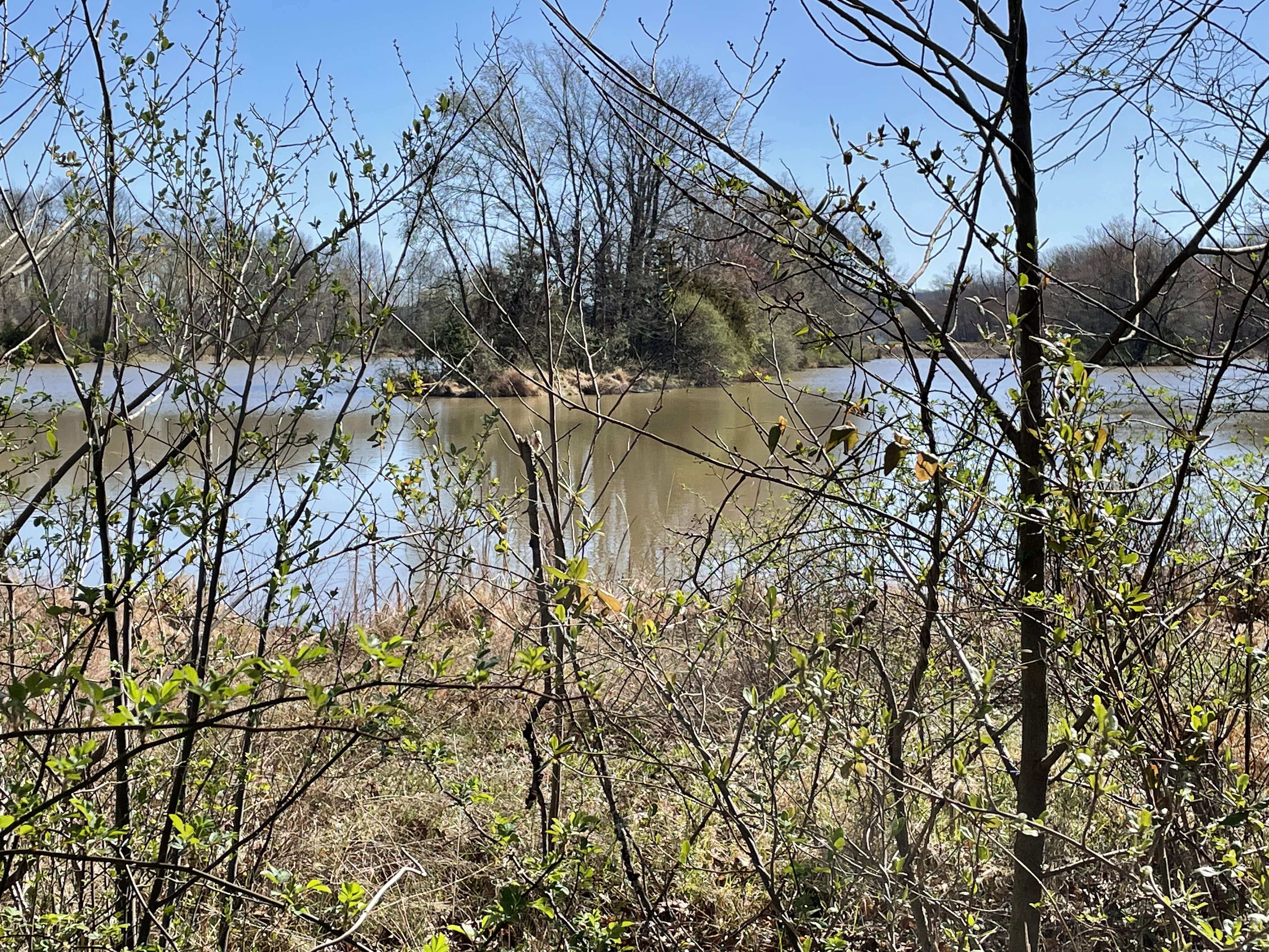
The confluence of Sugarland Run (left) and the Potomac River (right). This is where today’s trip ends. The trees haven’t recovered their foliage yet because it is late March. We’re going to start upriver about a mile and end up here.

The last post covered the area inside the blue ellipse. We encountered 200 Ma shales and sandstones of the Balls Bluff shale. we expect to see similar rocks today, but we’ll be entering the Potomac flood plain. The red ellipse is where we are in this post. The numbers will be referred to later as the locations where photos were taken. The dashed lines for “rock” and “gravel” are approximate locations where the bed of Sugarland Run changed composition. It should be interesting.

Here at Site 1, the bed consists of large, angular boulders with rounded corners. These rocks didn’t travel far, probably eroded from now-gone cliffs like we saw upstream. This location, as with similar rocky transits we saw upstream, represents a point where the stream flows over an exposed ledge of bedrock. This is very common for streams in this area.
View looking downstream (north) at Site 1. Note the dramatic change in stream bed composition. The bar on the right consists of silt and gravel. Note also the eroded, soft bank on the left. We have entered the ancestral Potomac flood plain.
At Site 2 (see map above for location) gravel bars like this were found where a smaller stream entered Sugarland Run. It is probable that the current stream is cutting through ancient sediments because there is no source for gravel like this anywhere around. These are recycled deposits.

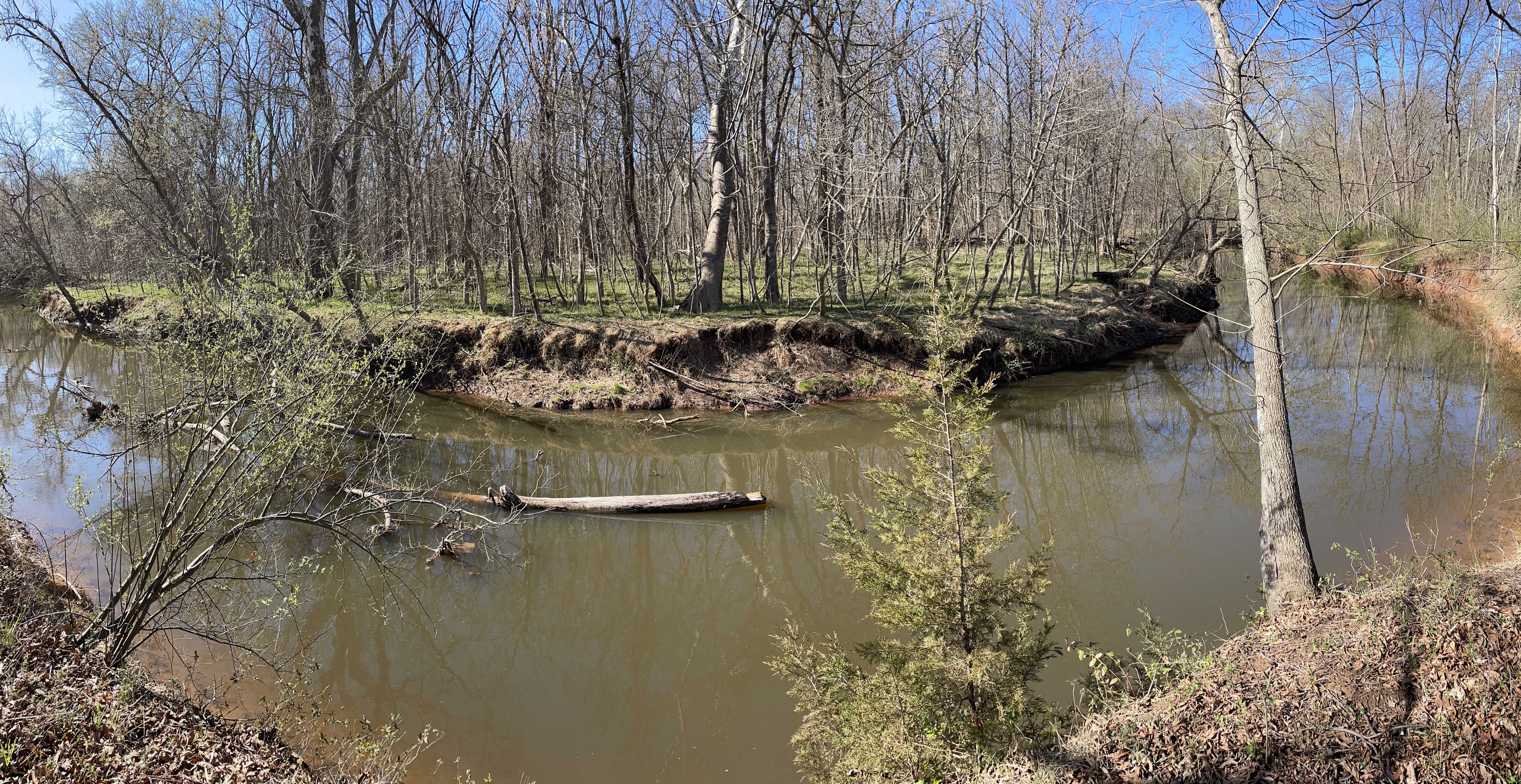
Confluence of Sugarland Run and a side channel at Site 2. Channels like this criss-cross the ancient flood plain. These are larger than those we saw further upstream on the Potomac in a previous post.
This photo from Site 2 is the last appearance of bedrock in the stream bed. Note the flat surface across the stream that tilts slightly towards the camera. This is a bedding surface for the Balls Bluff Siltstone. Upstream, these rocks form low cliffs and are tilted away from the modern stream. It is likely that overlying beds have been eroded after tens-of-millions of years by the ancestral Potomac River. The change in dip suggests, further, that there is a structural feature between this location and a mile upstream. There is some evidence for a fault that runs along Sugarland Run several miles upstream. It was probably part of regional adjustment during uplift over the last 200 my.

As with other streams on the Potomac River flood plain, there has been rapid erosion. This example from Site 3 can be dated by the age of the tree. I don’t know how old it is, but it is certainly less than a century. What is unusual is that this erosion is occurring inside a bend. Usually streams cut on the inside of a meander and deposit point bars on the outside. We’ve seen this at every scale in previous posts. From what I’ve read there has been rapid erosion in the last few decades because of urbanization. We saw an extreme example in the last post. The field data suggests that Sugarland Run is widening but not meandering. This is not a natural process in unconsolidated sediments like these. The ancestral Sugarland Run certainly does meander (see map above), but this rapid erosion unaccompanied by channel migration is not natural.
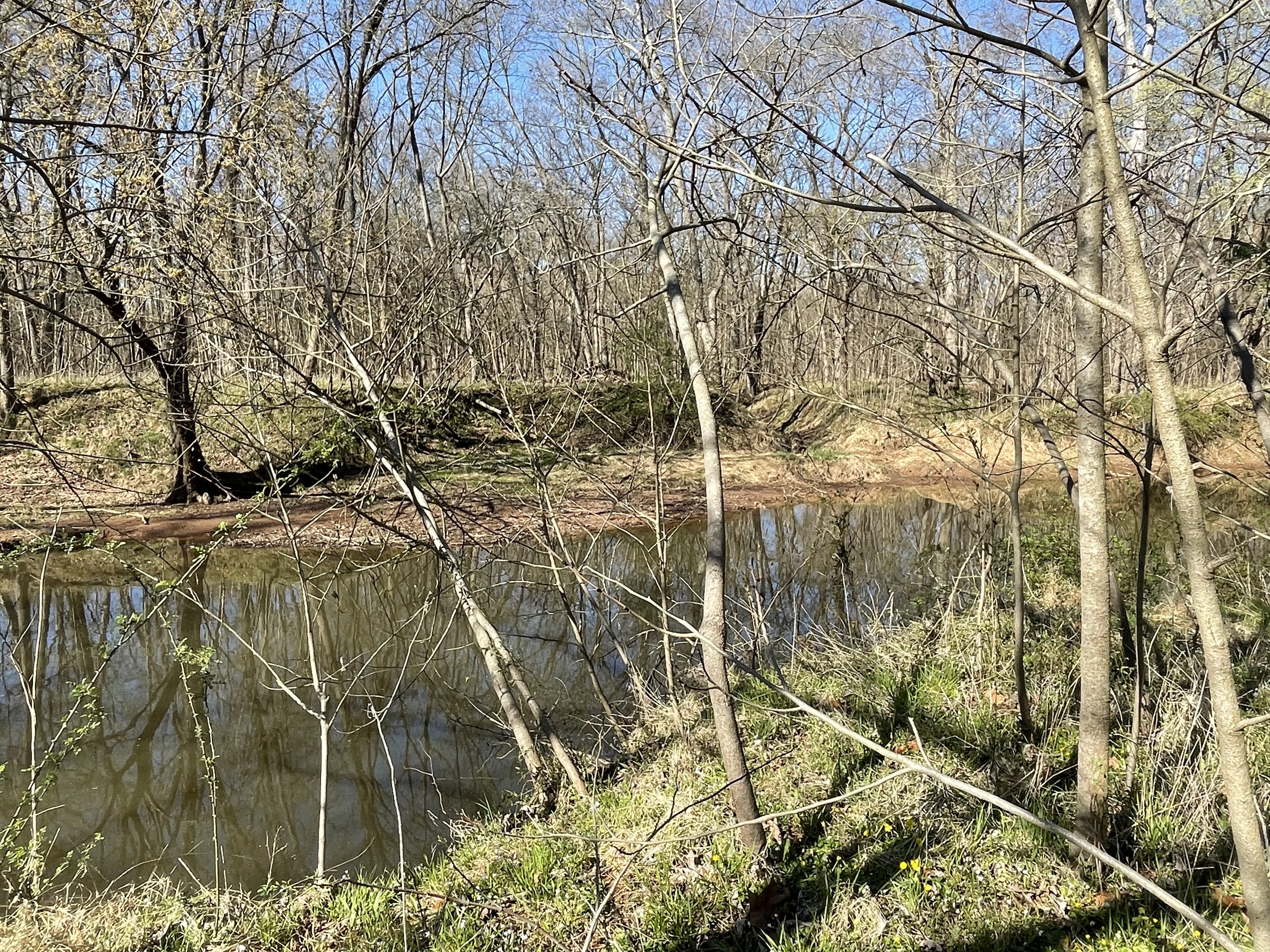
There are several small lakes near the modern Potomac River, such as this one (just north of the Site 3 label in the map above). Sugarland Run passes it within 100 yards, through unconsolidated muddy sediments. Features like this are difficult to understand because the age relationship between the stream and lake cannot be unambiguously identified through radiometric dating. Both developed in sediments of the same age, older than either feature. These lakes (see map above) don’t look like oxbow lakes. Given the common occurrence of depressions throughout the area, which form small ponds and lakes during the wet season, the geological fact that the Potomac floodplain has wandered across a wide swath of the area (see for example a previous post), and the lack of any outflow to a modern stream (see map), it is probable that these lakes represent undulations in the ancient flood plain and Sugarland Run is younger. It just happened to miss the lake as it cut down through the soft sediments without meandering.
This meander at Site 3 shows how Sugarland Run is becoming incised rather than following a typical meandering trajectory, as at Horseshoe Bend on the Colorado River. The scale is drastically smaller but the processes are similar; the stream lacks the energy to erode the banks and becomes “trapped”, so it cuts downward as the upriver source is uplifted relative to the outflow. In addition, this small stream appears to be widening, as seen in the eroded tree on the bank in a previous photo.
Another interesting feature we saw between Sites 3 and 4 was a couple of elevated flat surfaces like this one, seen in the center-left of the photo, about halfway between the current stream bed and surface. These benches were small in area (less than 100 feet) and at the current water level of the stream. My best guess (a common occurrence in geology) is that they were point bars when Sugarland Run was smaller and are relict features on the modern Potomac flood plain.

Here we are about 100 yards from the Potomac. There is no delta associated with Sugarland Run but there is a bar at its mouth (see first photo).
Sugarland Run is an intermediate-sized stream flowing into the Potomac River. Goose Creek is one of the larger ones, which supplies drinking water for the region, whereas Horsepen Run is a small one. Despite the difference in flow between these tributaries, they display similar geomorphic features (e.g. meandering, point bars, gravel and muddy beds, recent erosion and entrenchment) because they all cross the wide, ancient Potomac floodplain composed of mixed sediment types. The modern Potomac River itself is less than four-million years old although there is evidence of the ancestral river flowing though this area back 20 my. The supply of sediment has decreased over the eons as the ancestral Appalachian Mountains eroded, so we don’t see the kind of sedimentation today that would have been occurring several million years ago.
The sediments being eroded by modern streams like Sugarland Run record a climate and topography very different from what we see today. However, the physical processes were the same and the landscape was shaped, ultimately, by geological processes occurring deep within the earth’s crust. These same constraints produced the ice age that is closing in our times and associated fluctuations in sea level, adding nuances and new themes to the unfolding story of our Earth.

Recent Comments