
Sugarland Run: Downstream at Algonkian Parkway
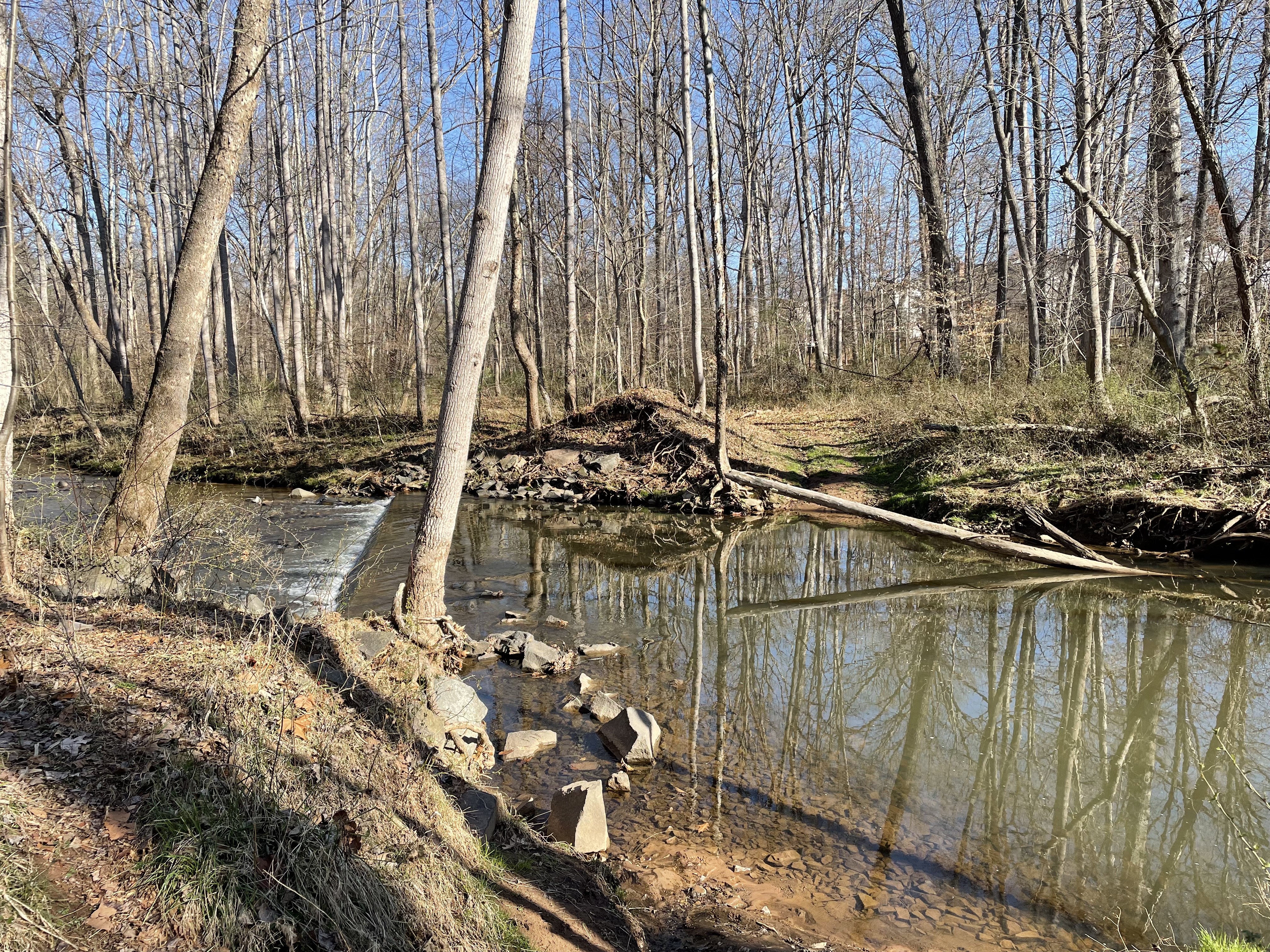
This adventure followed Sugarland Run (aka Creek) a mile or so, where it flows through a wide spot between ledges of sandstone. The area has been developed for a long time and the creek is crossed by weirs (white water in this photo). I don’t know if they were to maintain water levels or as roads.

This geologic map from Rock-D shows the starting point our walk (blue circle), which ends at Route 1582 (Algonkian Pkwy). The pink rock seen to the left of the creek (tan color running N-S) is Balls Bluff siltstone. It consists of of predominantly shale but we’ll see some coarser sediments today. These sediments were originally deposited in lakes during the early stages of rifting of the supercontinent Pangaea about 220 Ma (million years ago), when the modern Atlantic Ocean was first opening. We encountered this rock at its type locale, and again in Goose Creek.

This is our first glance of Balls Bluff siltstone. Note how it holds up the ridge that borders Sugarland Run.
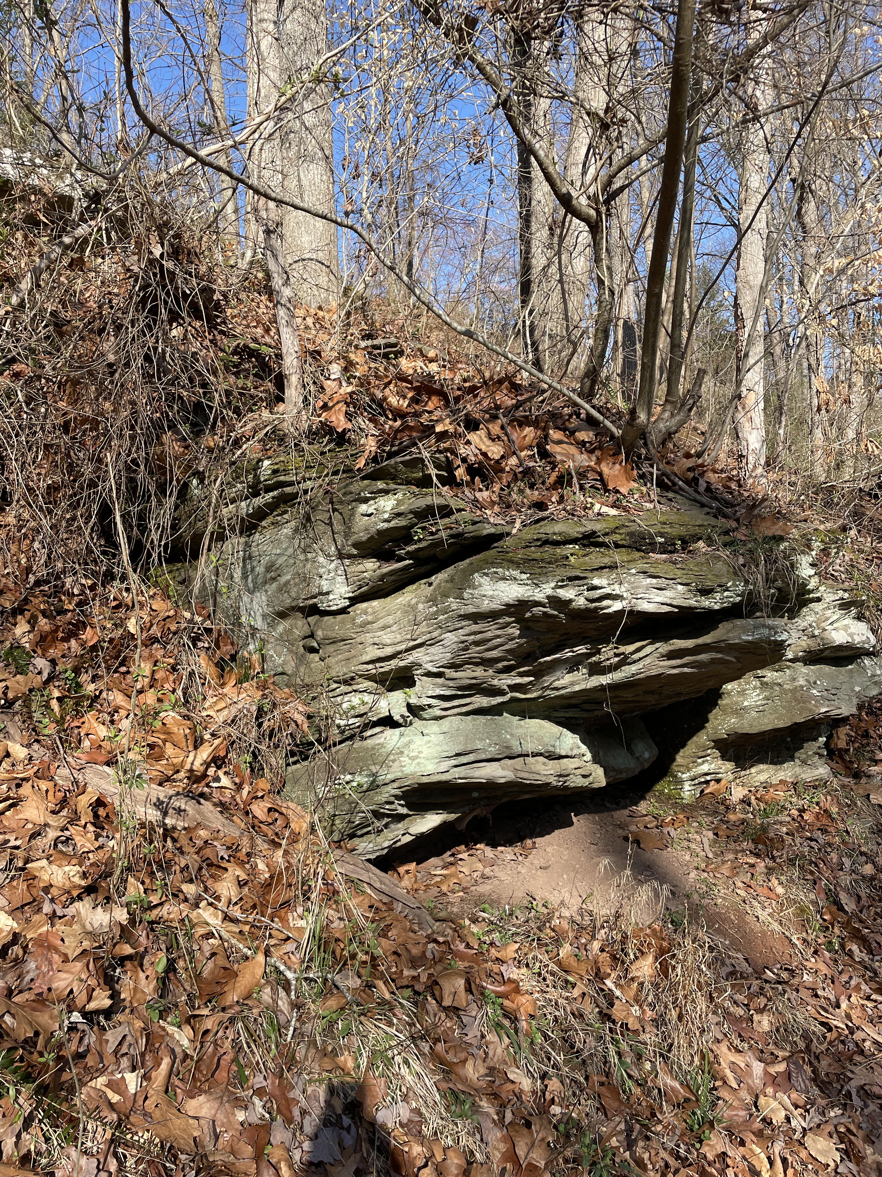
Exposure of cross-bedded siltstone about twenty feet above the creek level. Note that it is dipping to the west at less than 30 degrees west. The strike follows the regional trend of ~30 degrees northeast. This is the orientation (rotated over the last 200 my) of the rift that tore Pangaea apart.

This close-up of the previous image reveals a well-sorted sandy texture. There are no large pebbles or angular rock fragments visible and it was rough to the touch. Like sandpaper.

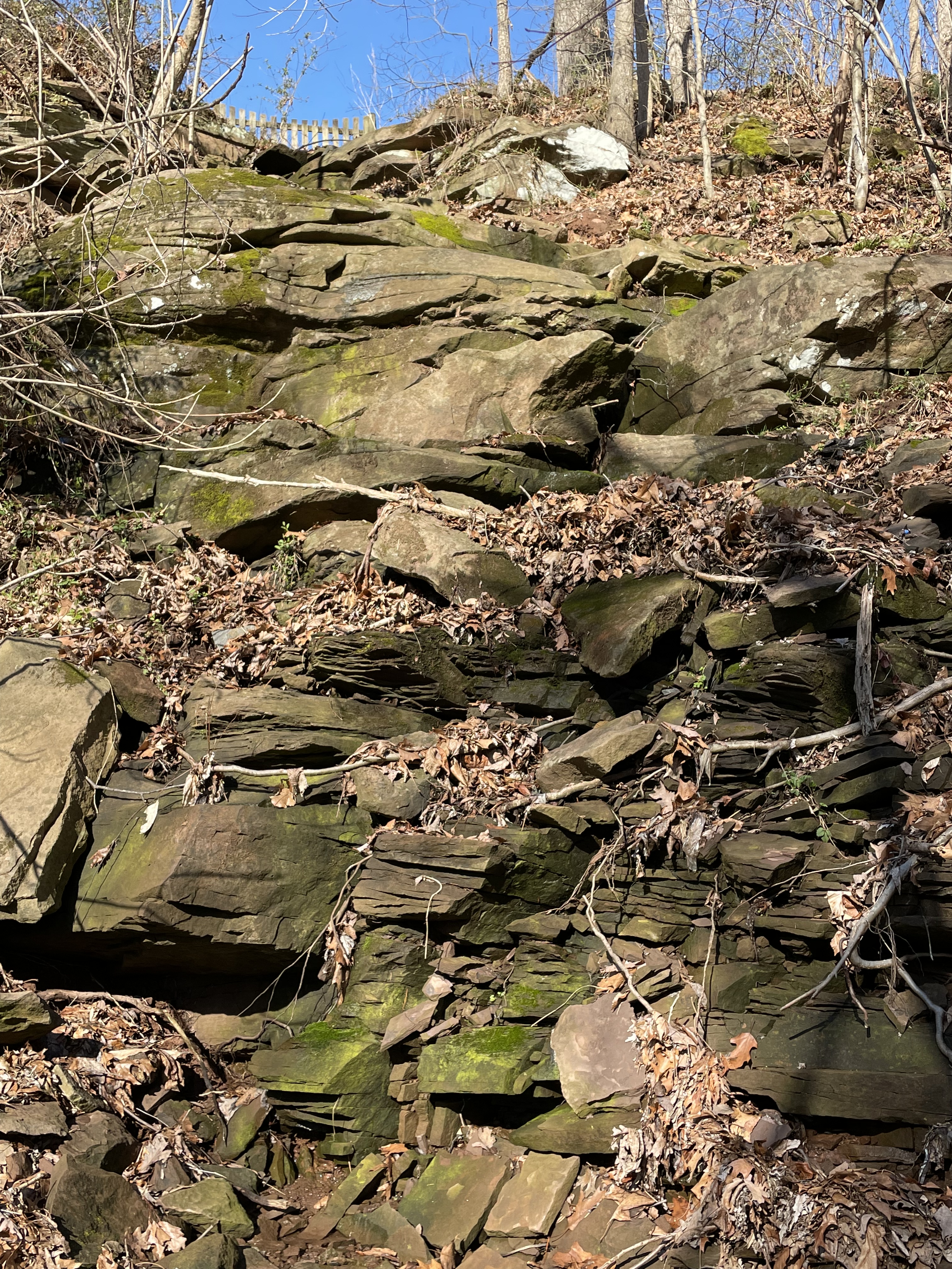
This is a nice view looking up-section. The total thickness represented in this side-creek/drainage channel is more than 50 feet, which is not available in exposures elsewhere in the area. The lower part (note the stream bed near camera) is blocky sandstone whereas shale predominates up the section (noted by slopes rather than ledges). The sandstone/siltstone beds become thinner up-section but are present.
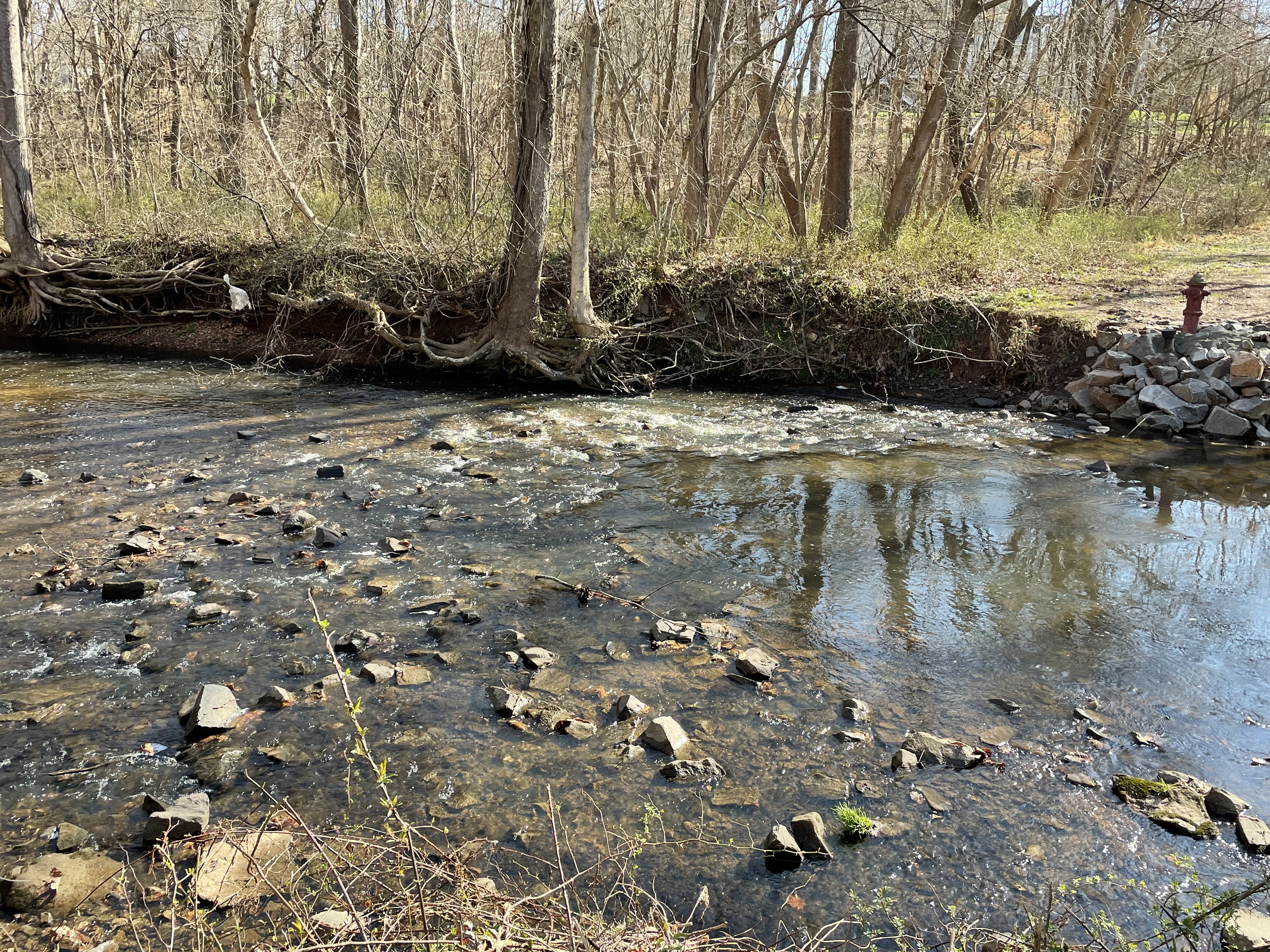
We didn’t only encounter 200 Ma lake sediments along Sugarland run; this photo shows a fire hydrant and a road that has been eroded by recent erosion. Apparently, someone wanted to keep the hydrant because the bank has been stabilized with blocks of riprap. Note the rounded, angular boulders lining the creek bed. They were eroded from the nearby cliffs.

The stream bed is defined by periodic rapids (see above photo) and pools of quiet water, as seen in this image. The flood plain is a couple hundred yards across here and the creek is meandering in soft sediments. The underlying rock is not uniform, which leads to this alternating pattern.

This photo shows the thin-bedded coarser sediments (upper left) at the top of the section.
The thick-bedded sediment in the lower section can be seen in this image to consist of both cross-bedded layers (lower right) and massive beds (just above the center and left-lower). This variability could be due to thin layers of mud, which weathers easily distributed irregularly when the sediments were deposited; or the thick layers could be channel deposits, for example. This kind of variation at the outcrop-scale suggests a dynamic environment; a likely scenario is rapidly changing channels at a delta where a stream originally entered a lake. These channels can change during a single flow event (e.g. a heavy rain) or every few years.
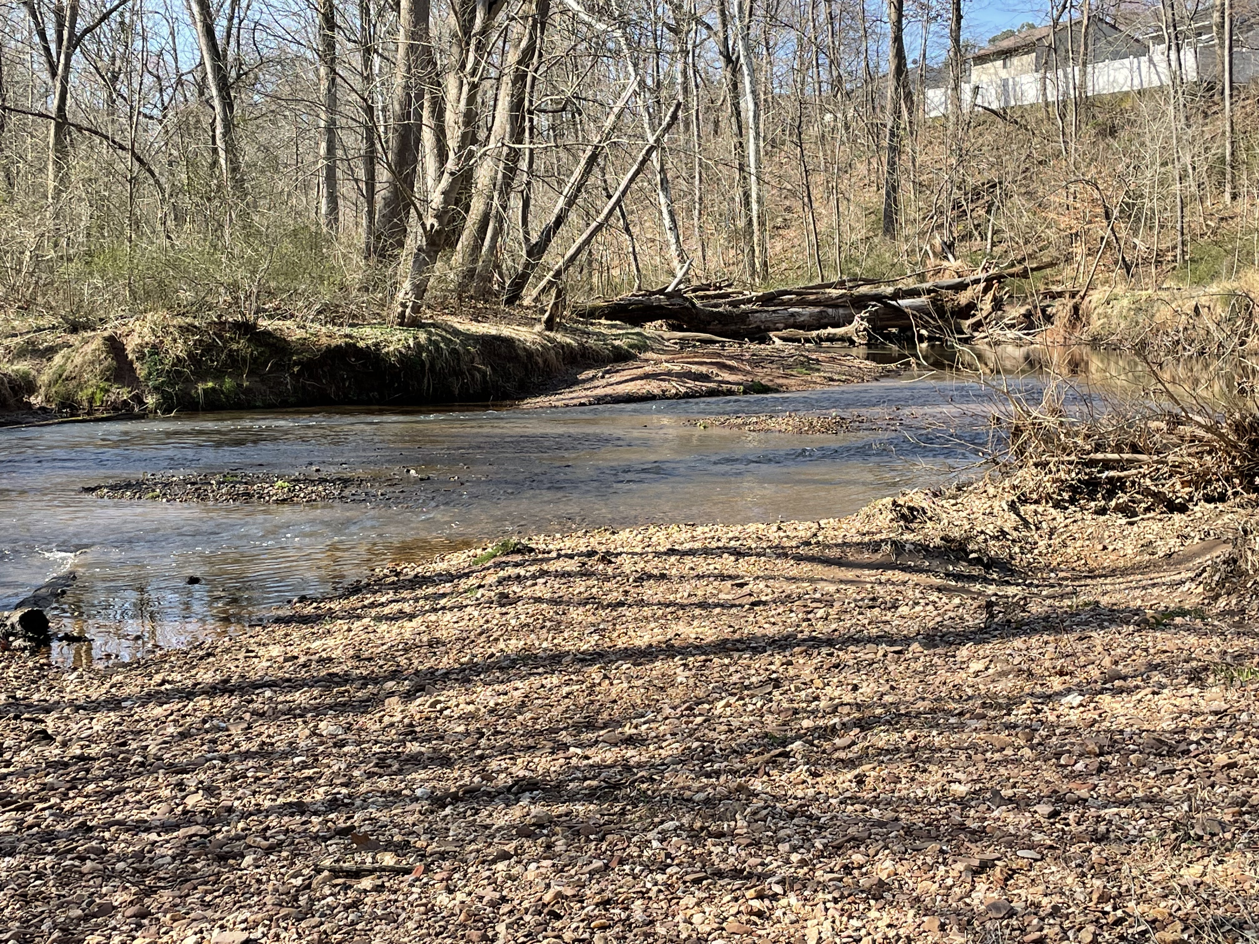
Many of the processes recorded in these rocks are at work today. This image was taken from a gravel point bar, looking upstream. The gravel clasts were rounded and probably were transported many miles from upstream, in the recent past. They are not from the original sediment, but were broken loose from exposed rocks within the last few million years and transported to this location. Note the large, fallen tree forming a temporary dam in the upper part of the image.

Because of the obstruction seen in the previous photo, flow and sediment delivery downstream is reduced temporarily (until the tree rots and collapses). The creek bed is exposed, showing multiple channels that predate the obstruction. Creeks never follow a single channel like a canal. Sugarland Run is a braided creek at this locality. This morphology is dynamic because of high sediment load and can change rapidly, unlike a more stable anastomosing river. The Potomac is an example of the latter. Of course, a river can change character in different sections of its channel, which we’ll see in my next post.

Much of Sugarland Run’s banks are deeply eroded, reflecting rapid erosion because of regional uplift. The previous image shows this on the east (right) bank. However, erosion and deposition in braided streams occurs at many time and space scales. This photo shows erosion of the stream bed on very short time and spatial scales, probably in response to the reduced sediment flow caused by the fallen tree obstructing sediment more than water.

At the end of our walk we met Algonkian Parkway, where the Balls Bluff sandy sediments have been removed (or were absent to begin with), creating a wide flood plain near a point where another creek joins Sugarland run (not shown). This major boulevard follows a natural rise to the south, the dividing point between highlands and the ancient flood plain of the Potomac River.
Today’s walk followed a braided stream about a mile between ridges supported by sandy sediments that were deposited about 200 Ma in lakes, when the supercontinent Pangaea began to split apart. It is very likely that this stream is following an ancient fault zone associated with that event. The orientation of these rocks and their lack of folding supports the inference that this area was being stretched and the rocks, which were still buried many miles beneath the surface, fractured to accommodate the crustal extension. In fact, intrusive rocks cut through the Balls Bluff sediments elsewhere in the area.
The sedimentary processes occurring along Sugarland Run today are not that different from when these sediments were first deposited in lakes more than 200 my ago. There is one critical difference in their depositional regimes, however; this region is experiencing uplift today whereas this was a sinking basin when Pangaea was torn asunder. Consequently, the original sediments were fine-grained, eroding from distant mountains whereas the gravel and boulder seen today is the crumbling remains of those ancient sediments.
We’ll see what happens when Sugarland Run reaches the Potomac next time …

.jpg)
Trackbacks / Pingbacks