
Best of All Lookouts
This is the photo I couldn’t take.

As part of an ongoing series, we have been exploring the geology of Victoria in several posts, and recently spent some time on describing the geological history of Tasmania. This post explores the geology of Queensland, focusing on the southeast part of the state, near the city of Brisbane (pin marker in Fig. 1).
 Fig. 1
Eastern Australia’s geology is dominated by collision and orogeny from the late Proterozoic through the Paleozoic, followed by extension tectonics and volcanism during the Mesozoic. We’ve seen this from our travels through Tasmania and Victoria. So we won’t be surprised to see similar rocks in Queensland. Our first day’s travel was from the Brisbane Airport to Springbrook National Park, ending up at the Gold Coast (Fig. 2).
 Fig.2
Fig.2
We didn’t stop to look at the rocks around Brisbane, so this post begins in Area 1 (see Fig. 2). We’ll get to Brisbane next time. The black rectangle outlines the approximate area contained in Fig. 3, a geologic map from the Rock-D app.
 Fig. 3
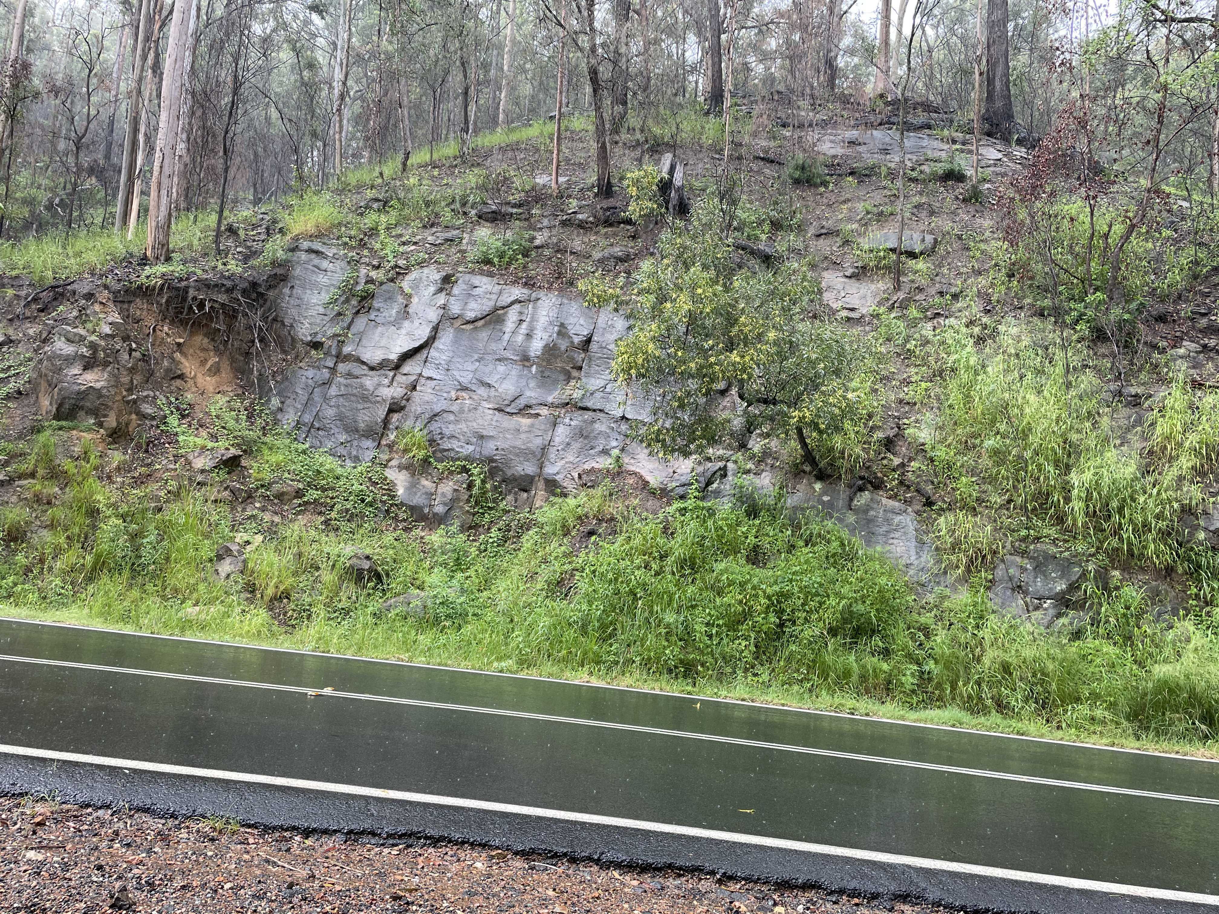
Location 1 is at the upper-left (NW) corner of Fig. 3. It was a rainy day, we were on a narrow road with few opportunities to pull over, and there was heavy Sunday traffic with many people from Brisbane heading to the country for the day, despite the miserable weather. Nevertheless, we got some photos of exposures of sedimentary rocks. Note that the rocks in Fig. 4 are wet, so color isn’t as useful because hues change in subtle ways. Rocks are like that.
Figure 4
 A
A  B
B
The geologic map (Fig. 3) indicates complex lithology in Area 1 (see Fig. 2 for location), including thick-bedded sandstone with finer grained sediments and high organic content (Fig. 4A). Road cuts also revealed interlayered thin beds of sandstone and shale (Fig. 4B). Between 237 and 201 MYA, this area was receiving mixed sand and mud while accumulating enough organic matter to create coal beds.
Still within Area 1, we move into a volcanic zone (yellow regions in Fig. 3) of much younger age (23 – 16 MYA) that includes basalt flows and rhyolite (Fig. 5).
Figure 5
 A
A
 B
B  C
C
Some of these volcanic beds are quite thick, forming bluffs up to thirty feet or more in height (Fig. 5A). At this location, a few miles east of Fig. 4, a waterfall had formed. These rocks also displayed incipient columnar jointing (Fig. 5B) similar to that seen in a previous post. Where eroded, these rocks formed blocks that formed steep slopes and gathered in the bottom of canyons (Fig. 5C).
The next observation area (Area 2 from Fig. 2) took us back to the Late Devonian to Mississippian (383-323 MYA), where metamorphosed clastic sediments with some volcanics (Fig. 6) are exposed. This is distributed as a broad swath running from north to south on the entire eastern half of Fig. 3.
Figure 6
 A
A  B
B
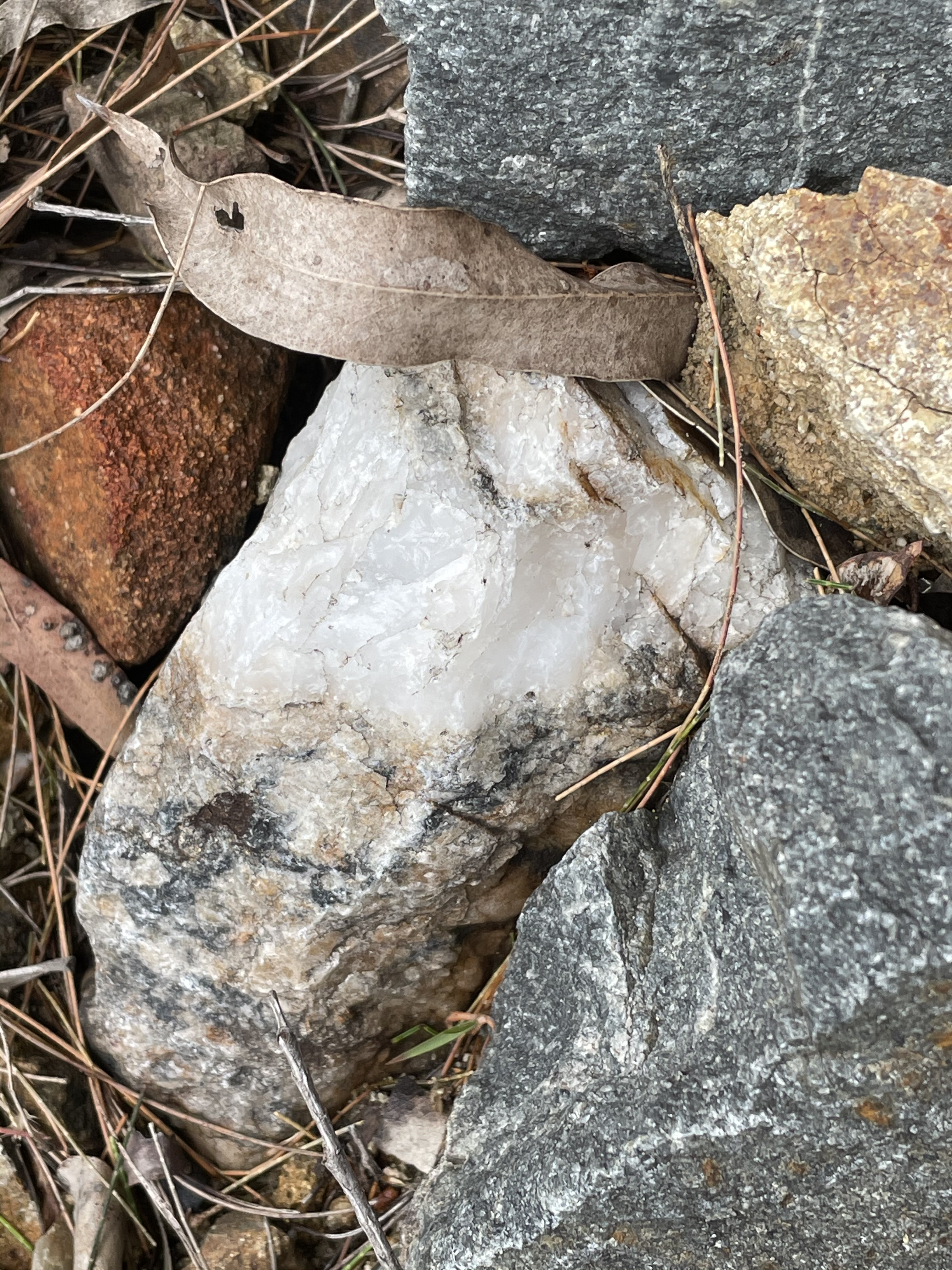
These beds were tilted and there was evidence of faulting throughout the area. Figure 6A shows thicker beds of sandstone whereas Fig. 6B is dominated by fine-grained sediment. These photos were taken within a mile of each other. This is a complex sequence of metamorphosed rocks that doesn’t form cliffs so good exposures were hard to find. However, I did manage to examine some of the sandstones (Fig. 7).
 A
A  B
B
 C
C  D
D
There is no evidence of sedimentary texture (Fig. 7A) and examining the photo up close reveals that it looks more like an igneous rock than sedimentary. Recrystallization during cementation reveals quartz filling fractures (Fig. 7B) and partial melting (Fig. 7C). The rocks reveal fissile texture (Fig. 7D) similar to a schist.
We travelled through these rocks until reaching Area 3 (see Fig. 2 for location) and Purling Brook Falls (Fig. 8), a 300 foot drop over a rhyolite cliff.
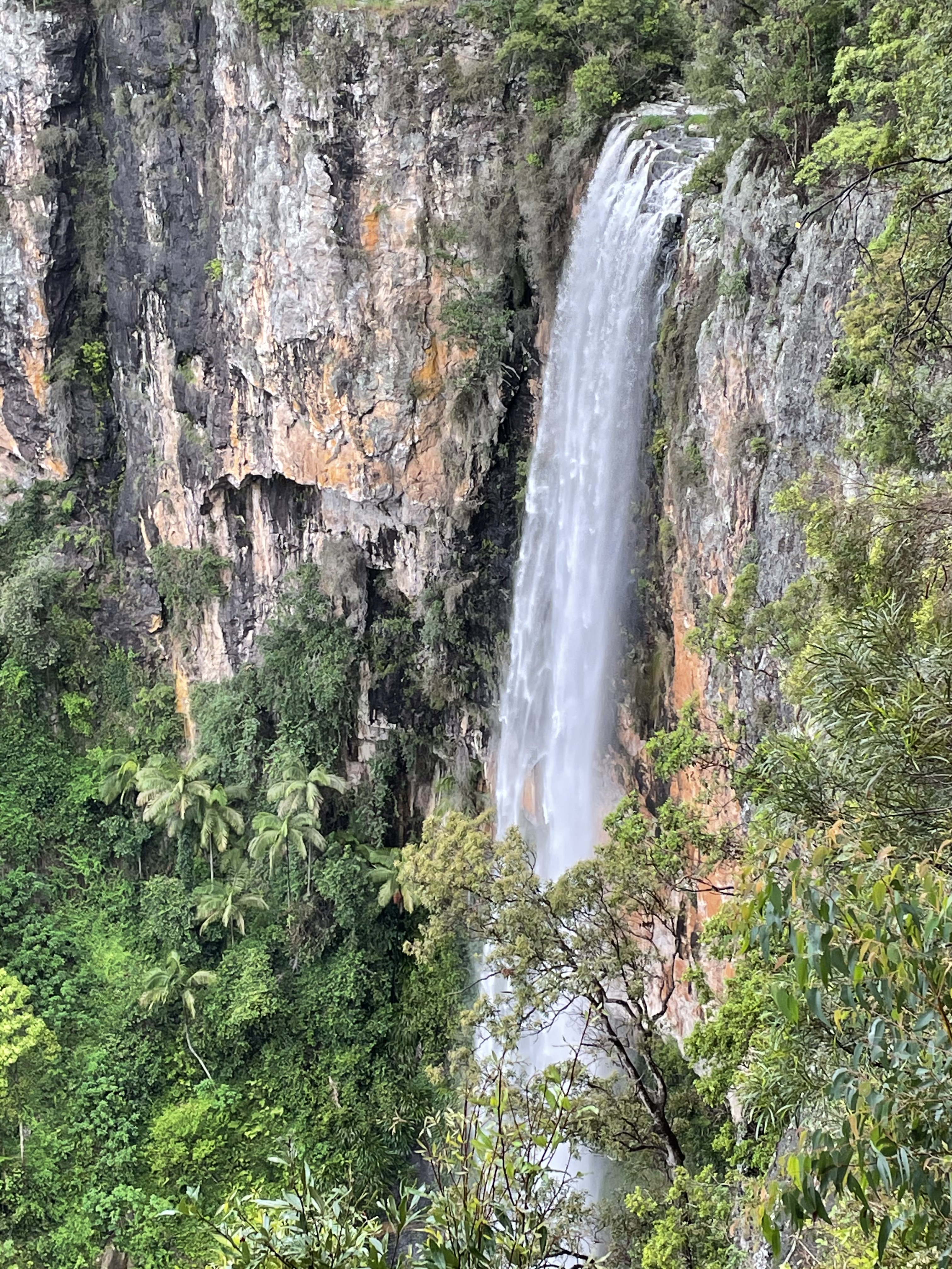 Fig. 8
These rocks are more of the Early Miocene (23-16 MYA) rocks we saw before (yellow in Fig. 3). The stream is retreating along the edge of the 300-foot-thick sequence, which quickly erodes so that there is no canyon downstream. Close observation shows fine flow and depositional features (Fig. 9A) and phenocrysts (the white grains in Fig. 9B).
Figure 9
 A
A 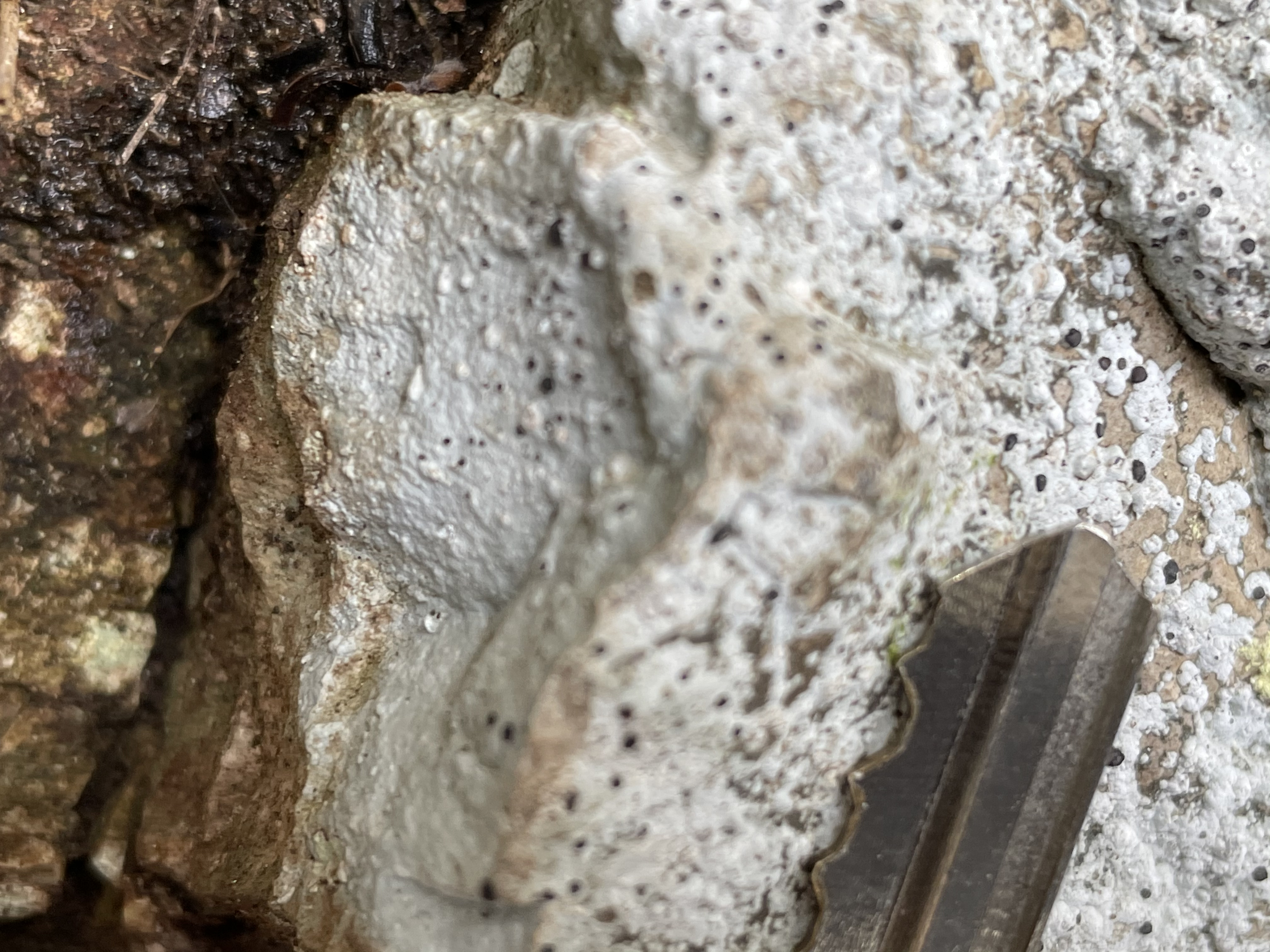 B
B
Let’s summarize what happened in SE Queensland over the last four-hundred-million years. We rambled across time during our drive, so we’ll put the rocks in chronological order.
The oldest rocks we saw were Devonian to Mississippian (383-323 MYA) sediments and volcanics (Figs. 6 and 7). At that time this was a shallow sea with volcanism occurring intermittently. Australia was a peninsula attached to Gondwana with SE Queensland an open-ocean margin. During the subsequent assembly of Pangea, more mountain building occurred, until the early Mesozoic. These oldest rocks were buried and metamorphosed, almost to the point of becoming high-grade metamorphic rocks.
During the early Mesozoic (237 and 201 MYA), a nearshore environment obtained, with the collection of sandy and muddy sediments, along with the accumulation of organic matter to later form coal beds (Fig.4). These rocks also probably contained some basalt but we couldn’t identify it from poor exposures and bad weather conditions. This was when Pangea was breaking up.
A global system of mountains eroded after this as the modern ocean basins formed. Here in Queensland, the next rocks we find are volcanics from Miocene (23-16 MYA). These are well preserved (Figs. 5, 8 and 9). They were erupted from a caldera that we reached at the southerly end of our trip today (Fig. 10). This was a period of volcanism throughout SE Australia, as we saw in a previous post.
 Fig. 10
I couldn’t take the photo myself because “Best of All Lookouts” is at 3800 feet and we were in the clouds. The floor of the caldera is ~500 feet, so it was a serious drop. There was a volcano in the center, as shown in Fig. 11.
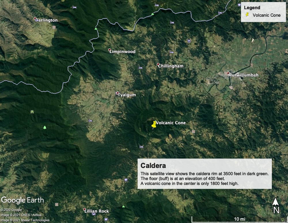 Fig. 11
Figure 11 shows about half the original caldera, the eastern margin having been eroded more, leaving a few mountains and the central volcano.
That does it for today. Considering the crummy weather, we were pretty successful.

Trackbacks / Pingbacks