
Cool Pleistocene Basalts
The title of this post, besides being a bad pun, refers to the fascinating secondary fabric we found in some basalt flows not far from our house in Melbourne. An hour-long car ride took us to Organ Pipes National Park, near the Melbourne International Airport. The sign at the park entrance gives an overview of the park (Fig. 1). We’re going to see some of this for ourselves.
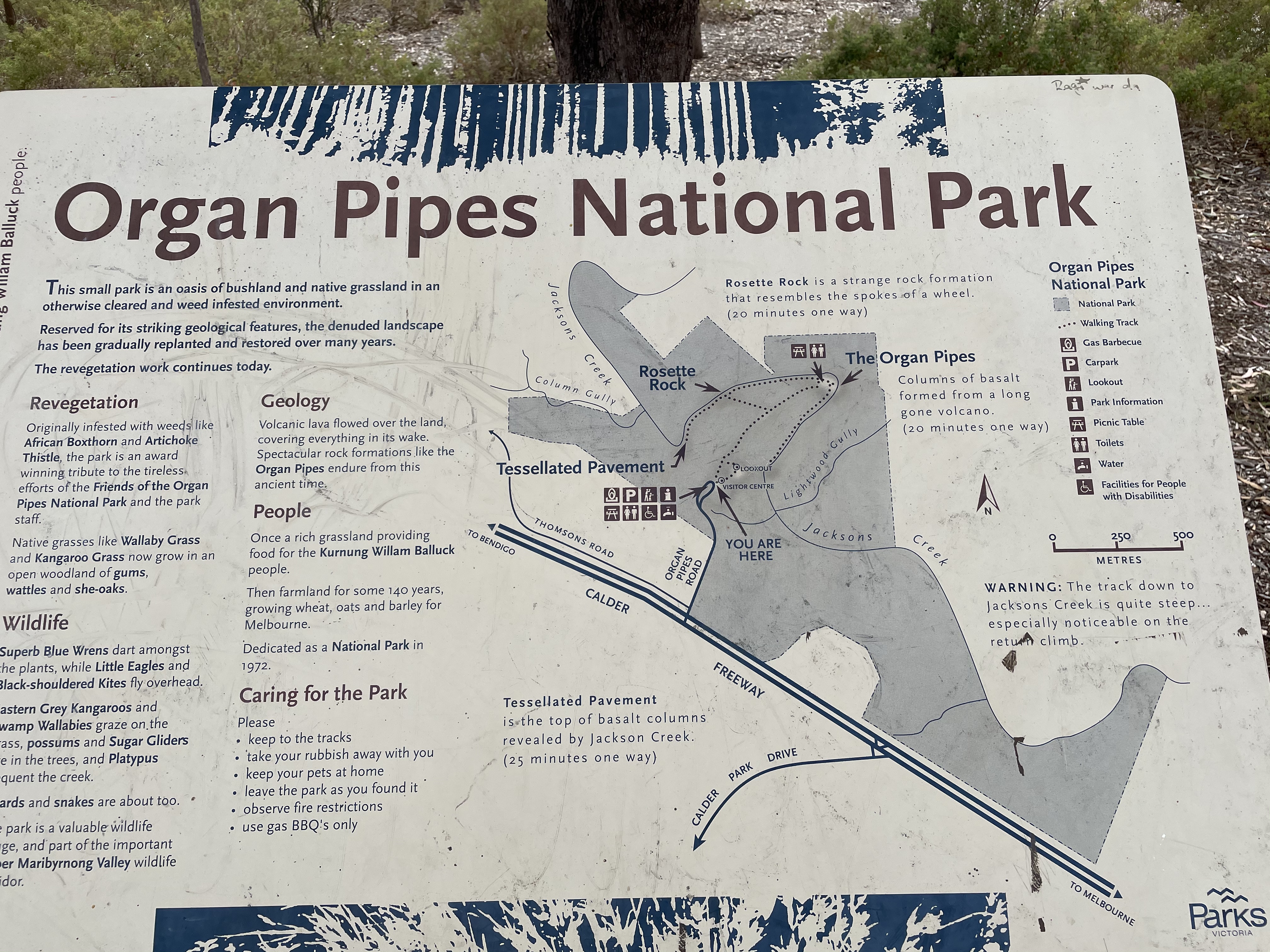 Fig. 1
The now-familiar Victoria geologic map (Fig. 2) reveals that the park is located well within the Pleistocene volcanic field, with radiometric ages of approximately 700 ka to 1 ma. Note also the thin slice of Paleozoic sedimentary rocks in the area (indicated by the purple color). We’ll see those as well today.
 Fig. 2
The terrain consists of a plateau dissected by streams like Jacksons Creek running through Organ Pipes National Park (OPNP). The flat surface was created by the lava flows that emanated from numerous volcanic cones. The landscape seen in Fig. 3 hasn’t changed that much since these flows covered the land, filling creeks and leveling the terrain.
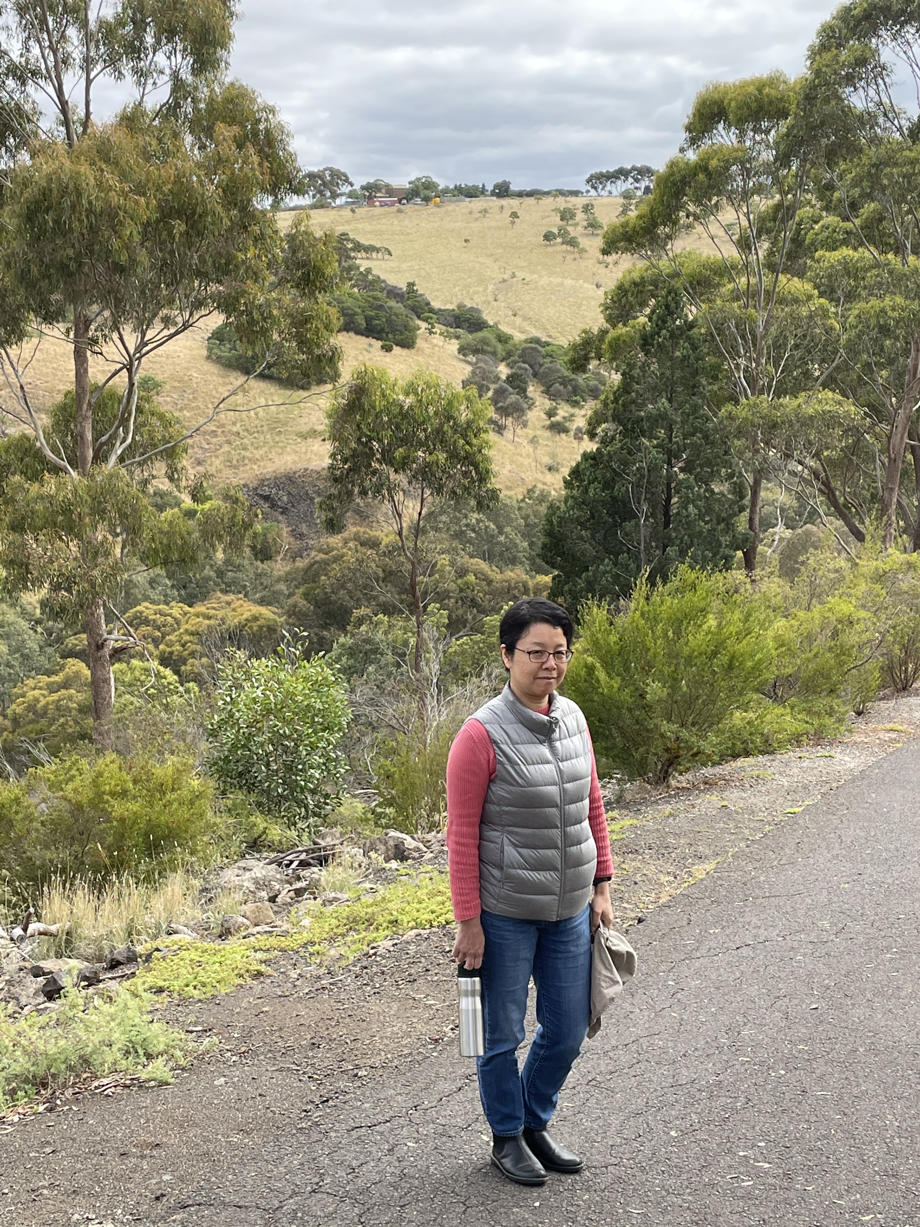 Fig. 3
The asphalt path seen in Fig. 3 leads down a steep slope to Jacksons Creek, ~150 feet below the pediment level. We’ll take a look at the basalt from the top of the plateau later. This week, we’re going to start from the oldest rocks and work our way upward. So let’s get going.
Jacksons Creek, about twenty feet wide and probably no more than a few feet deep, winds its way along the canyon. On the other bank, where we couldn’t get, we discovered Silurian sandstones (according to the park info about 420 million years old), with an apparent dip of more than 60 degrees to the NE (Fig. 4 is looking towards the SE).
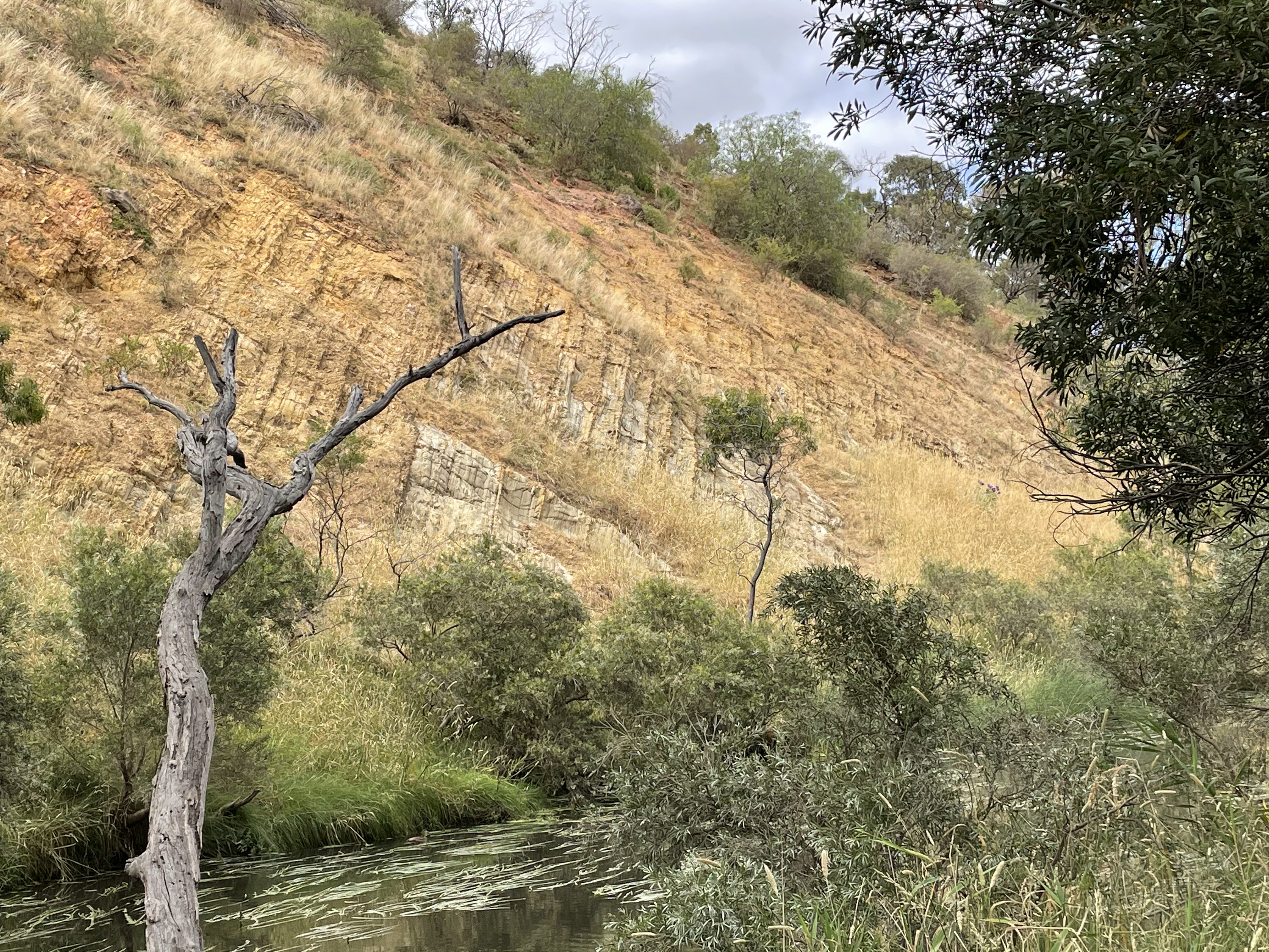 Fig. 4
This is as close as we could get. These sedimentary rocks were tilted (folded and faulted) during collision with suspect terranes and finally Gondwana throughout the Paleozoic, ending in the early Mesozoic period (about 200 MY ago). The red color of these sediments suggest that they were nonmarine, probably deposited in a river floodplain, which is consistent with the nearshore marine depositional environment we saw in Ordovician rocks we encountered in a previous post. Those were of late Ordovician age, only a few million years before these nonmarine sediments were deposited. The land was rising (relative to sea level) about 400 MY ago, but not suddenly.
The Ordovician marine rocks from the last post were also tilted and even overturned. They showed evidence of compression shifting from SE early to SW during a later episode of deformation. We can’t be certain of the direction of compression of these Silurian rocks, but it appears to have been (in OPNP anyway) directed along a NE line, i.e., about 90 from the viewing direction of Fig. 4. Before we leave this fragment of the distant past, let’s see what else we can get out of these rocks. Figure 5 shows a very simple analysis of the compression directions I have estimated from these rocks and the Ordovician sediments from last week.
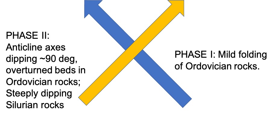 Fig. 5
This analysis comes with (at least) two warnings: 1) deformation has nothing to do with the age of the rocks except that it couldn’t have occurred for millions of years after deposition of the youngest deformed rocks (Silurian); and 2) I have put an arrowhead on the stress line for Phase I based on what I know of the Tasman Orogeny. Phase I occurred first and was mild, based on low-angle anticlines seen at Yarra Bend Park. Phase II was later and stress was towards the NE (present coordinates) because of the steep dip angle of an anticline axis at Yarra Bend. This is for certain. The Silurian rocks at OPNP may reflect Phase I deformation, but we couldn’t see them, or any evidence, from across Jacksons Creek. However, they are consistent with strong compression towards the NE.
No younger sedimentary rocks are found in the area, so it is assumed that whatever rocks were deposited or erupted (volcanic) in this area between Silurian and Pleistocene were eroded away. So, we’ll skip over the Mesozoic and focus on this post’s titular rocks.
Figure 6 shows an unconformity between the tilted Silurian rocks and younger volcanic rocks that overlay them. This could probably be called an angular unconformity because lava is deposited in layers, just like sediments.
 Fig. 6
The viewing angle is different from Fig. 4, but the general bedding of the Silurian sedimentary rocks is indicated by yellow hand-drawn lines. The black line is the approximate contact between the older rocks and the Pleistocene volcanics. That was the approximate land surface ~one million years ago. Pretty cool (another bad pun). The white square indicates Fig. 7.
 Fig. 7
The viewing angle has changed again, but the bump of the black line in Fig. 6 is the point in Fig. 7. The angular fragments of basalt in Fig. 7 indicate the thin soil that has developed over a million years in this semi-arid climate. It isn’t very often that a contact like this can be seen, a hiatus of more than 300 million years unobscured by soil and vegetation. Alas, it was hidden from us by logistics and our unwillingness to find a way to get over/around the creek, in violation of the law, to get a closer look. Before we move on, I want to share an interesting photograph of this exposure (Fig. 8). It demonstrates how dangerous it is to use color in assessing a rock from a distance. The white exposure is the same as the yellow rock but something was different when it was buried and became cemented…diagenesis is a complex process.
 Fig. 8
Moving upstream, and higher into Pleistocene basalt, we see some interesting features of this particular lava flow in this particular location. This is tricky because we don’t know how thick the flow is; nevertheless, let’s go to the feature that gives the park its name to begin.
 Fig. 9
This is classic columnar jointing. It is thought to occur during uniform cooling of igneous rock. A famous example is Devil’s Tower, Wyoming. The rocks of OPNP are definitely extrusive, unlike other examples. We have seen the contact between this basalt and the surface it flowed over. If experts cannot agree on how an igneous rock that never saw the light of day formed this unique structure, they certainly aren’t going to agree on these basalts, especially the more spectacular fabric seen throughout the park.
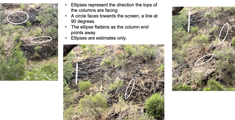 Fig. 10
This is a back-of-the-envelope estimation of the orientation of the columns visible at the main exposure along Jacksons Creek. I’m not going to talk about the mechanics of the analysis because there are some notes on the figure. The white ellipses, representing the ends of columns, tell a story too unbelievable to accept if the pictures weren’t telling the story. Within a few hundred yards (at most) from their contact with the land surface this basalt flowed over, they were cooling so uniformly that these elongate fractures formed. More unbelievable, the cooling joints are twisted. It gets more bizarre.
Figure 1 indicates a site called “Rosette Rock.” We went to take a look. Figure 11 shows what we found.
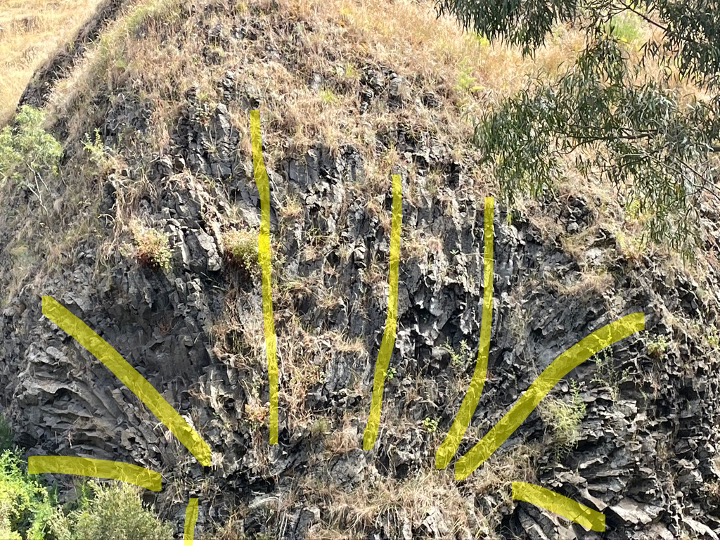 Fig. 11
For scale, this is an exposure of basalt approximately 50 feet in height, along Jacksons Creek. The yellow lines represent the directions of the cooling joints. I didn’t use ellipses because there was very little variation out of the plane orthogonal to an axis pointing at the observer. In other words, this is a wheel, with the joints radiating from a central point, a hub if you like. I have no more explanation of this now than I did when I first saw it in person. I don’t think anyone does. This makes Devil’s Tower look like a stick figure. We followed the creek to see these curious structures up close.
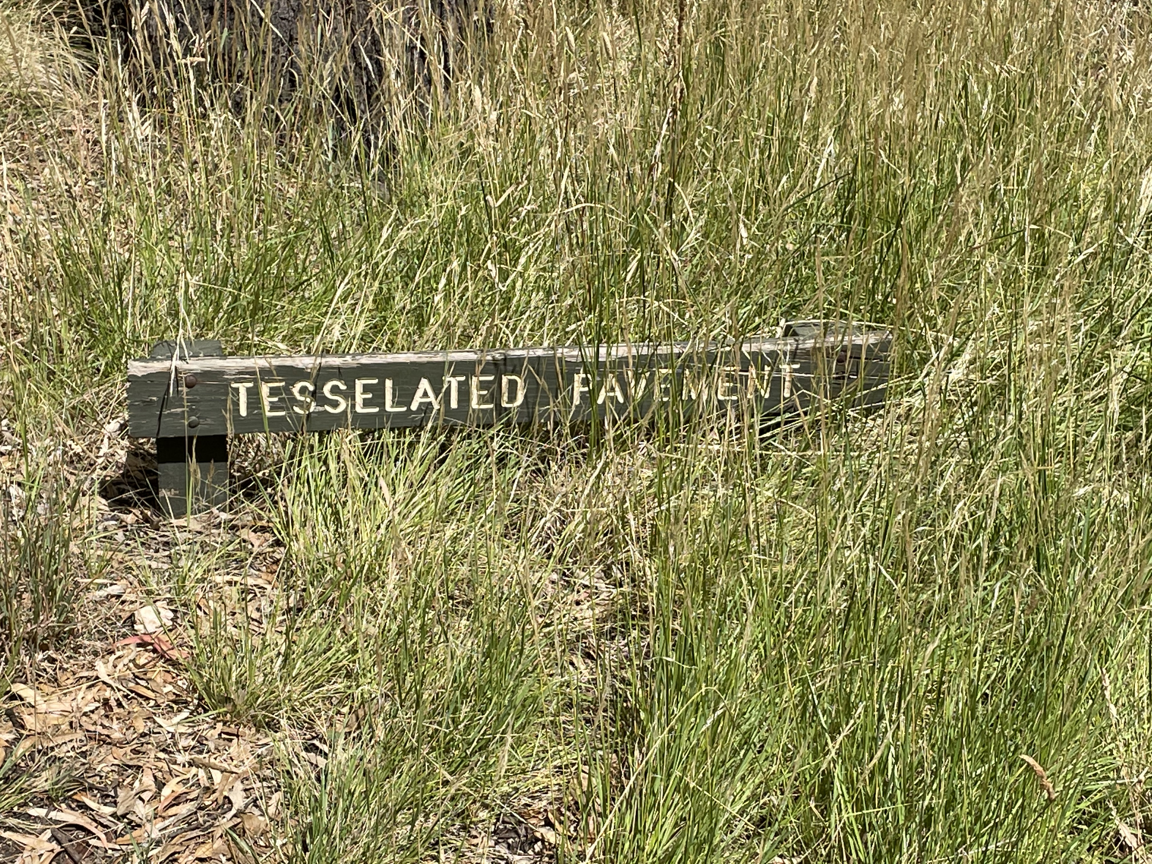 Fig. 12
About 500 yards upstream, around a meander (See Fig. 1), we came upon the “Tesselated Pavement” (Fig. 12), a “bedding plane” of the basalt probably created by the pounding of basalt boulders and pebbles over the millennia (Fig. 13).
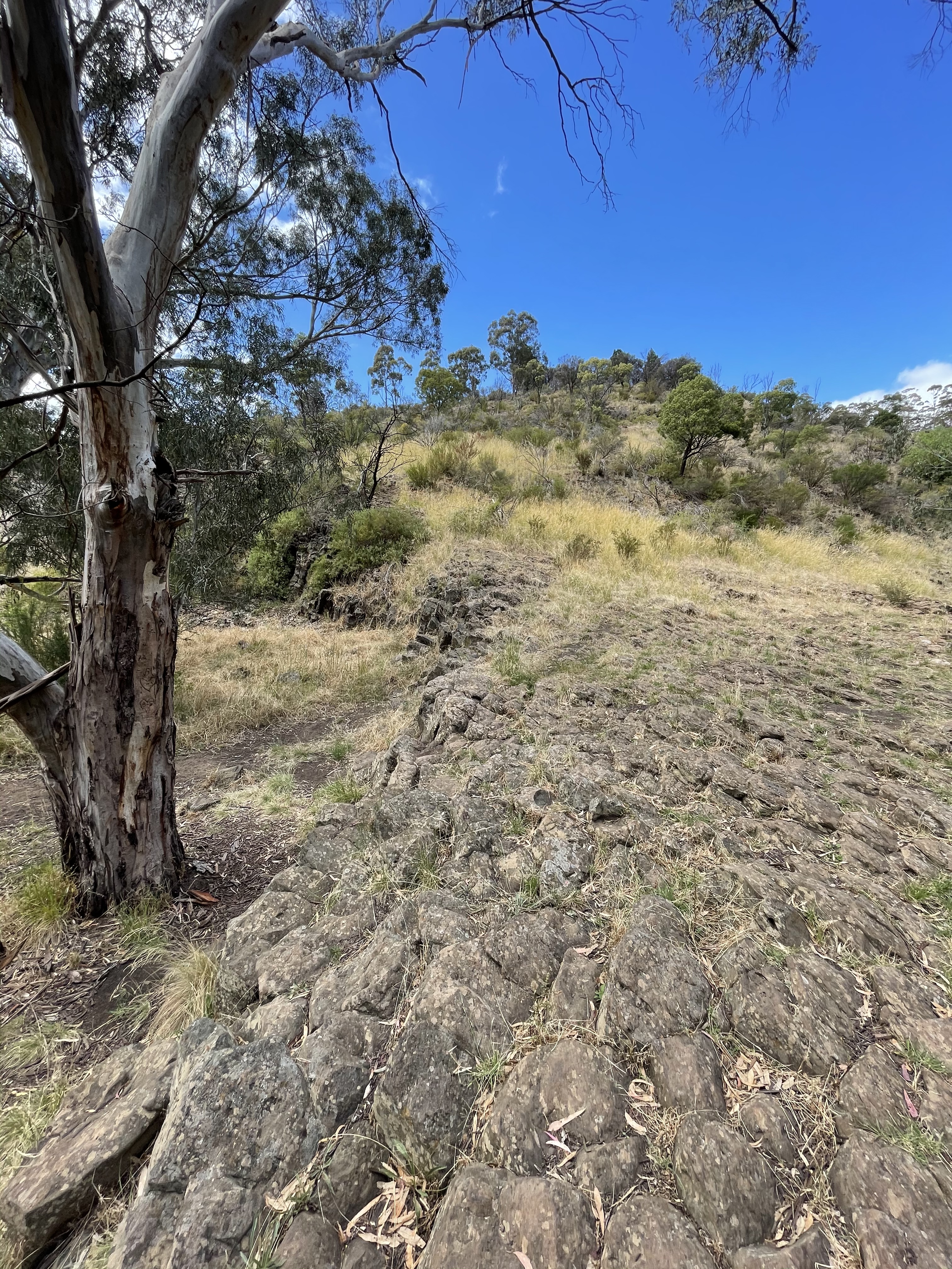 Fig. 13
This exposure seemed to be part of a resistant tongue protruding from the thick flows supporting the hill in the background of Fig. 13. There were several other such resistant tongues along a couple of hundred yards of Jacksons Creek’s quiet surface. The exposure in Fig. 13 was continuous with the massive outcrop seen in Fig. 14.
 Fig. 14
This rock wasn’t as columnar and it was fractured badly. It was threatening to collapse on the trail. The length of Jacksons Creek was a surreal geological experience. For example, the rocks shown in Fig. 14 were crumbling, yet there is no scree collected at the base of the low cliff. Very strange, especially in a protected national park. The smooth surface in Fig. 13 was less than 100 feet from Fig. 14 and at the same elevation, at creek level. Very strange. It’s as if someone built a scene for a movie but didn’t understand geological processes. Very strange, especially in a semiarid environment.
I looked for evidence of paleosol within the basalt, but all I found were irregular areas of remineralization (Fig. 15).
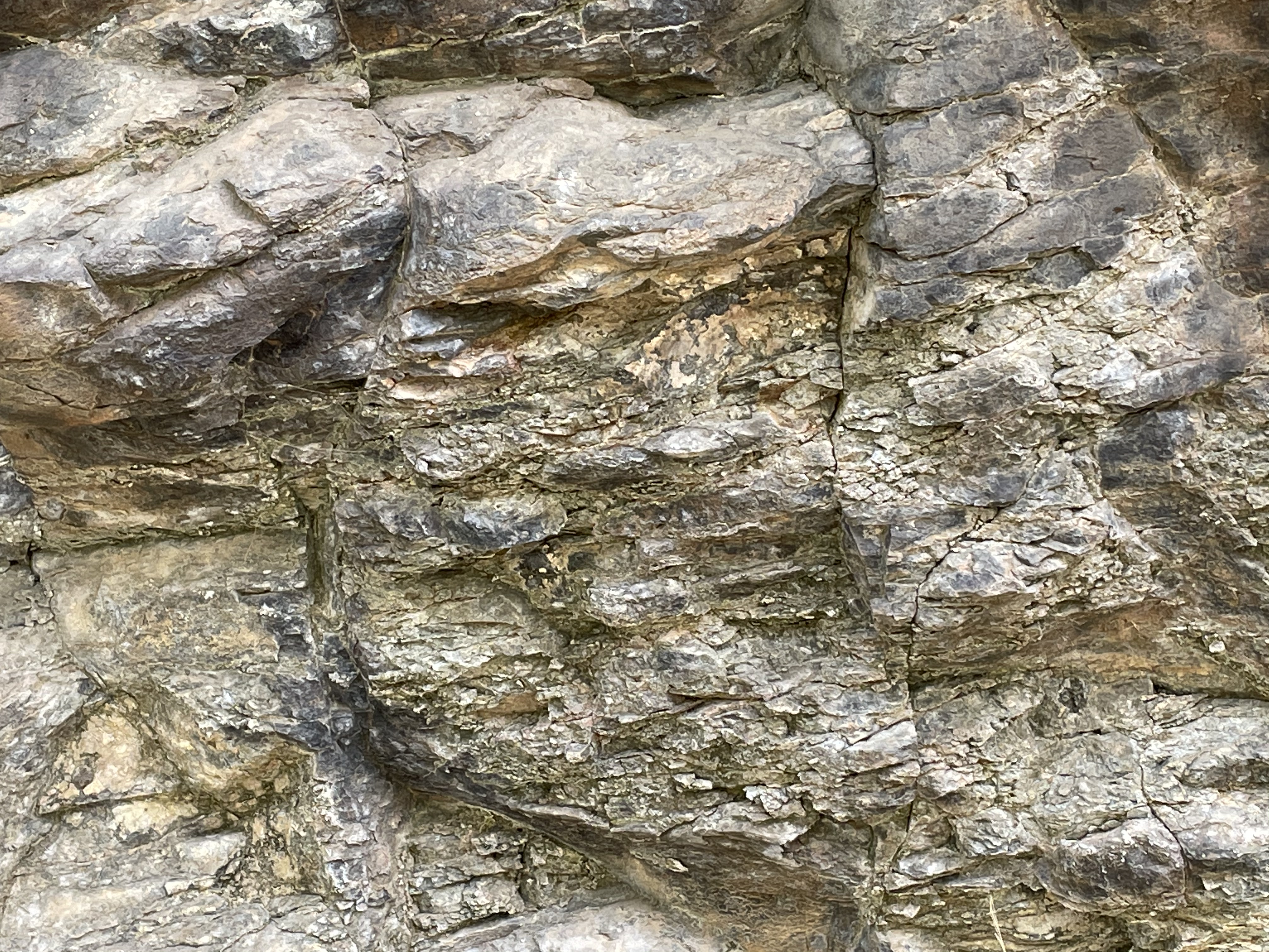 Fig. 15
This was either a single flow, or a series that occurred before weathering had proceeded enough to leave evidence. However, the erosional terrace seen in Fig. 9 suggests that there were multiple flows. We retraced our steps back to the top of the basalt flow at OPNP and noted changes in the rock that support rapid deposition of all of the basalts observed in the area.
Figure 16 reminds us of the columnar jointing deeper within the flow. Note the top of the photo shows the present surface.
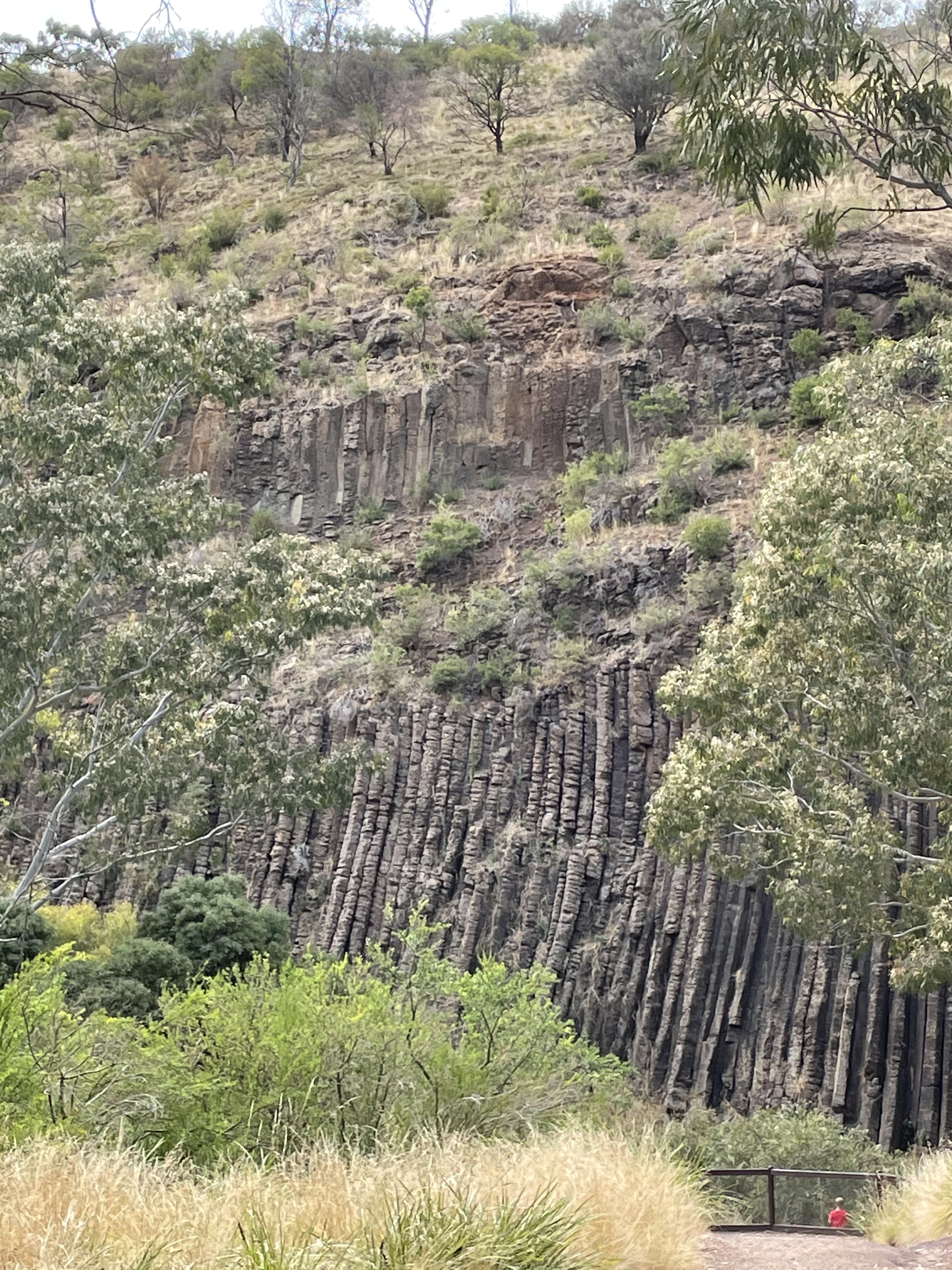 Fig. 16
Here are some photos of exposed basalt from near the top of the sequence (Fig. 17). Note brittle fractures (left photo), and thin bedding reminiscent of the blocks seen in Fig. 14, but weathered.

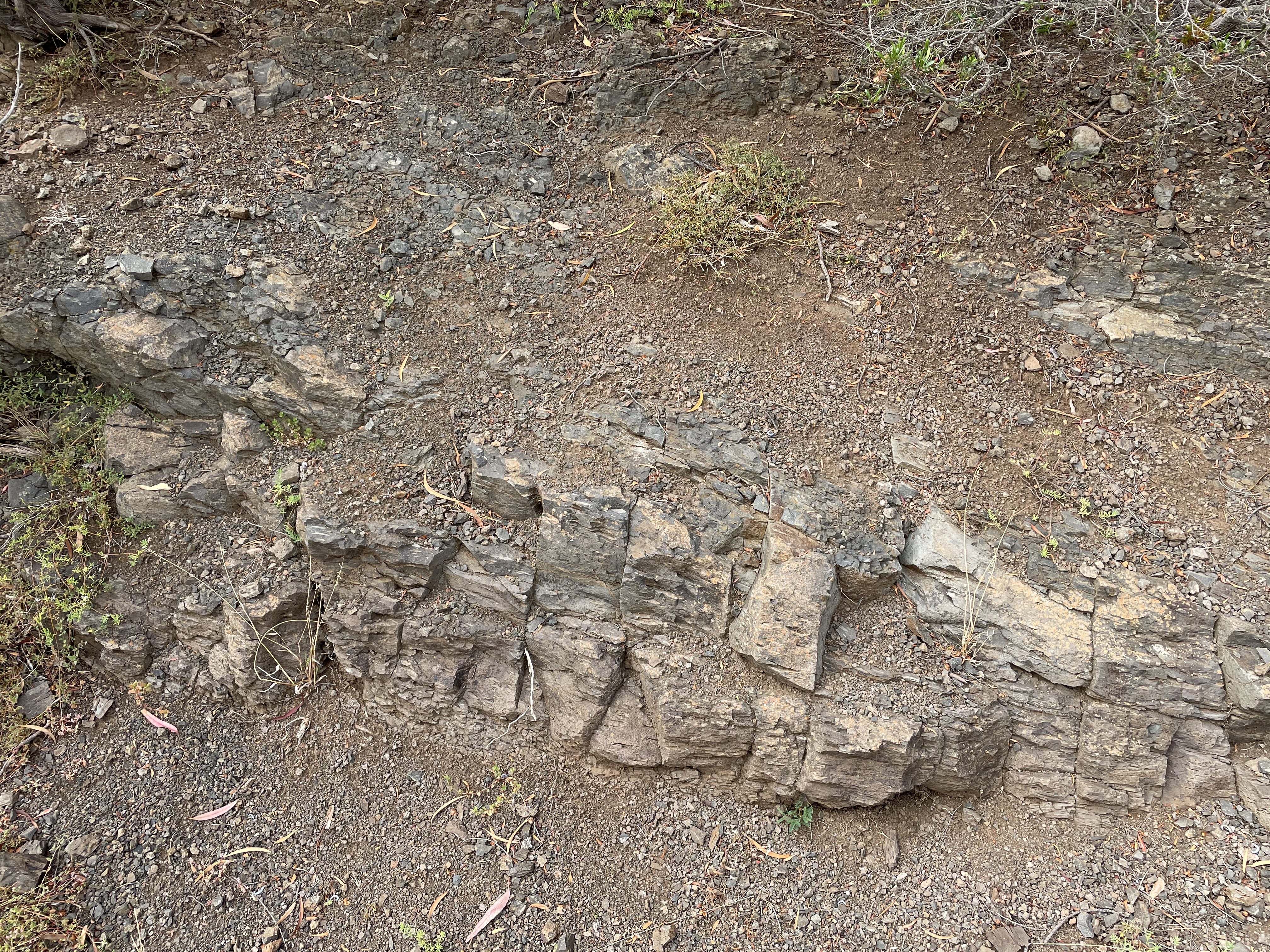 Fig. 17
A close-up view of the rocks seen in Fig. 17 reveals vesicles and a hint of depositional flattening, as if the lava were dense enough to condense (Fig. 18).
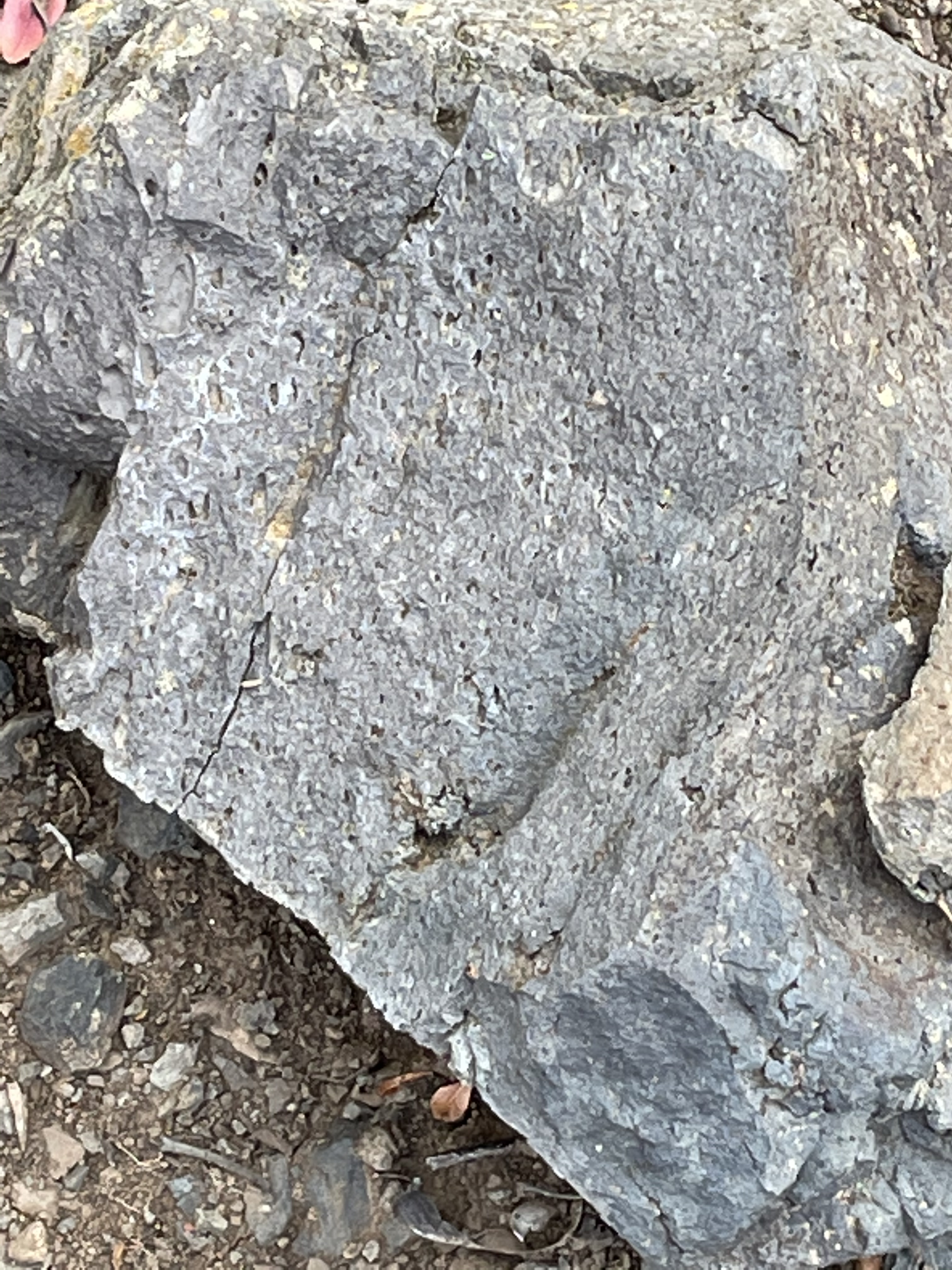 Fig. 18
At the top of the plateau, the basalt contains more vesicles and shows no sign of compression under its own weight (Fig. 19).
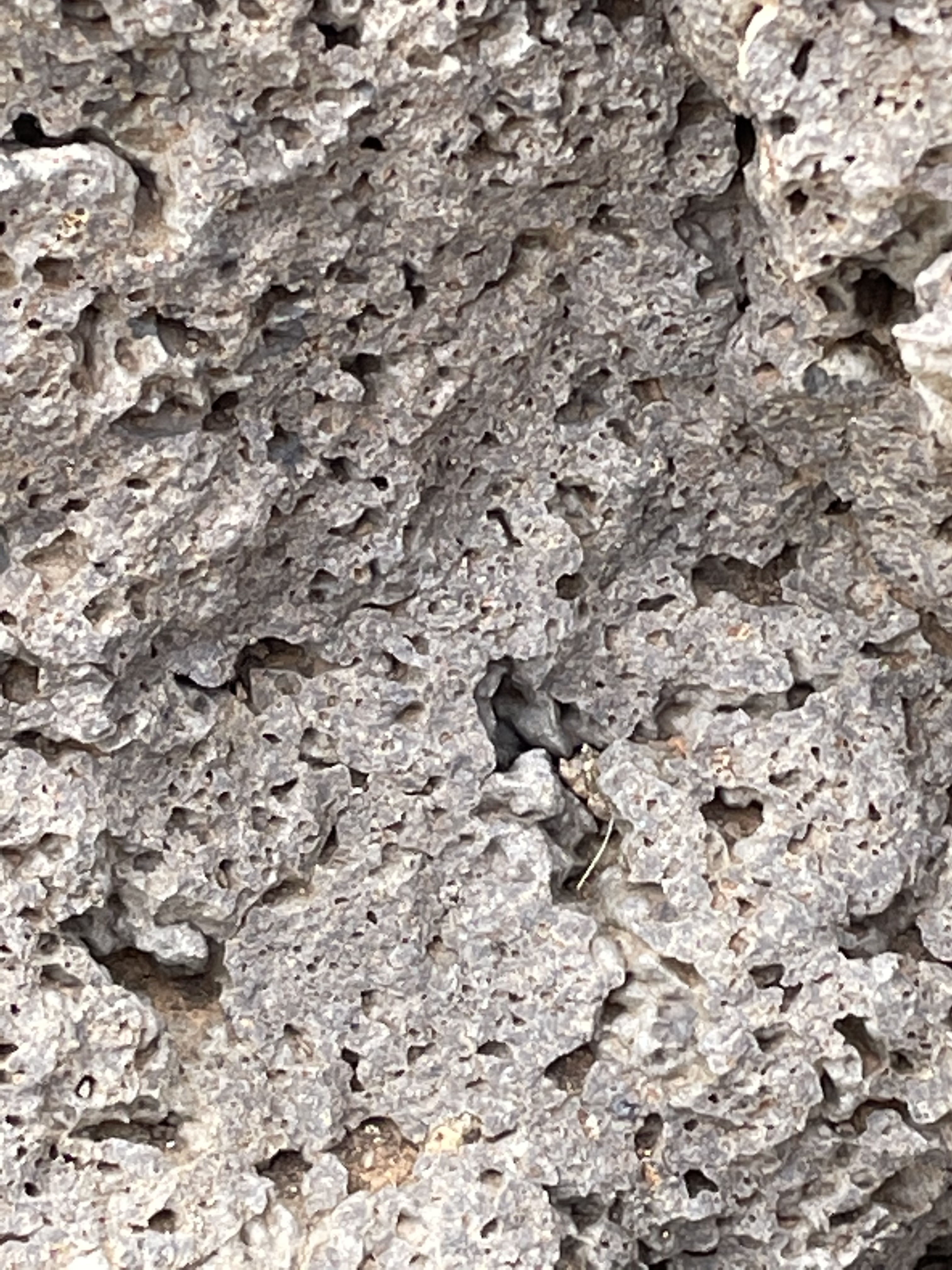 Fig. 19
To summarize this trip, which covered more than 400 million years, most of it unrecorded, what is today Organ Pipes National Park was a river plain that was buried before being deformed by the pressure of tectonic plates colliding to form Gondwana. This took several hundred million years. Whatever rocks were pushed up to form mountains were long gone, leaving an erosional surface not unlike that today, which was covered by lava flows that filled every gully, creek, and canyon in the area. Erosion had to begin again to erode Jacksons Creek anew. It seems to me that OPNP is filled with a single flow that ended with gaseous magma capping a fine-grained volcanic rock that cooled and later fractured by mechanisms that are not well understood.
The rocks tell us it is so.
5 responses to “Cool Pleistocene Basalts”
Trackbacks / Pingbacks
- - December 26, 2020
- - December 29, 2020
- - February 2, 2021
- - March 2, 2026

I kept waiting for Rocky Road ice cream to be addressed. Not even a mention.
LikeLike