
Kangaroo Point
This post didn’t require driving anywhere to collect our field data. We just looked out the window of our hotel room. Kangaroo Point is a famous rock-climbing spot, where climbers come to hone their skills; the city even put in powerful spotlights for night climbing. It’s also a fascinating rock exposure, revealed in a meander of the Brisbane River (Fig. 1).
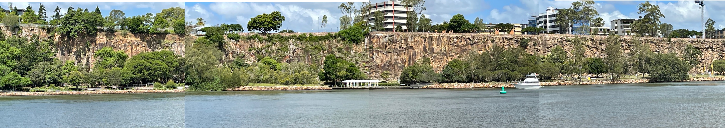 Fig. 1
Figure 1 is the attention getter because it is so massive (60 feet high), but it isn’t completely uniform. Towards the left of the photo collage the rock is more massive and the cliff higher, although it is also set back a little with buildings along the river. It abruptly drops. The slope is less to the right. This may mean nothing, but I also noted that there is more visible structure in the exposure to the right. I had to get closer.
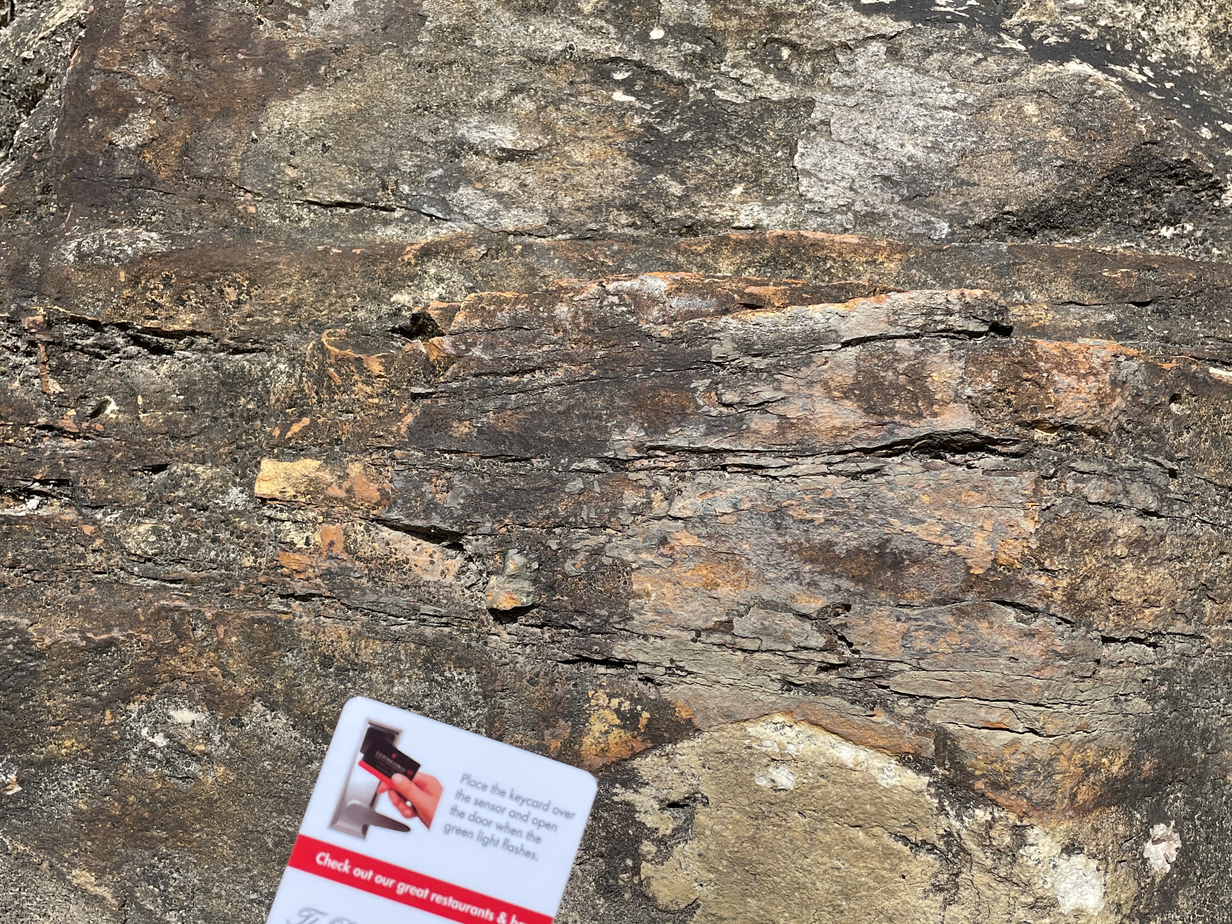
Our investigation began where the hill began to rise, about 200 yards to the right of Fig. 1. Here we find a possibly thin bedded, highly weathered grayish rock (Fig. 2), that does not support a ledge.
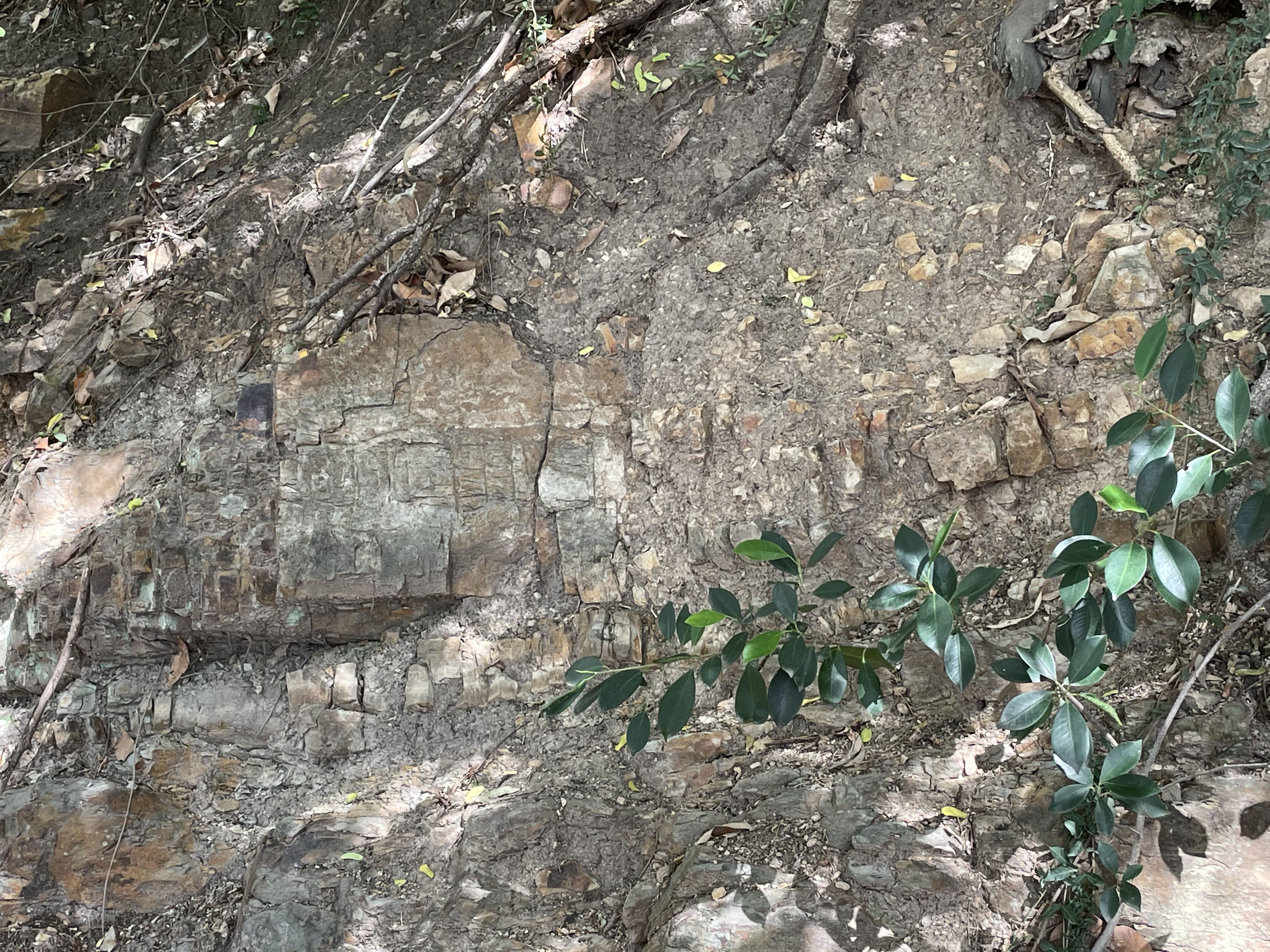 Fig. 2
The square block in the center of the photo is ~12 inches across. There are no sedimentary structures and no visible grains. However, it is highly weathered and no fresh surfaces were available for examination. The character of the exposed rock changes within 100 yards to a nodular form (Fig. 3).
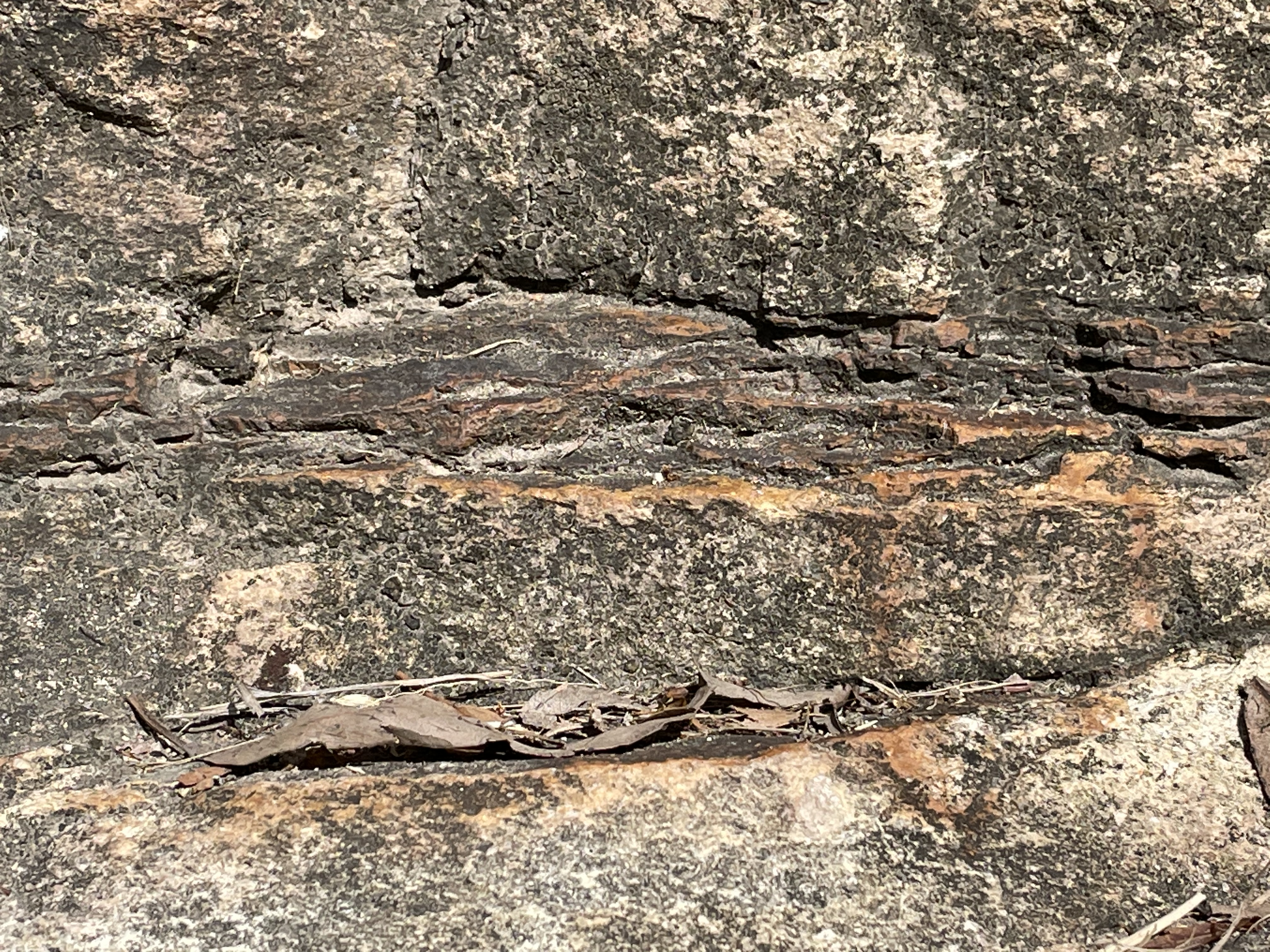
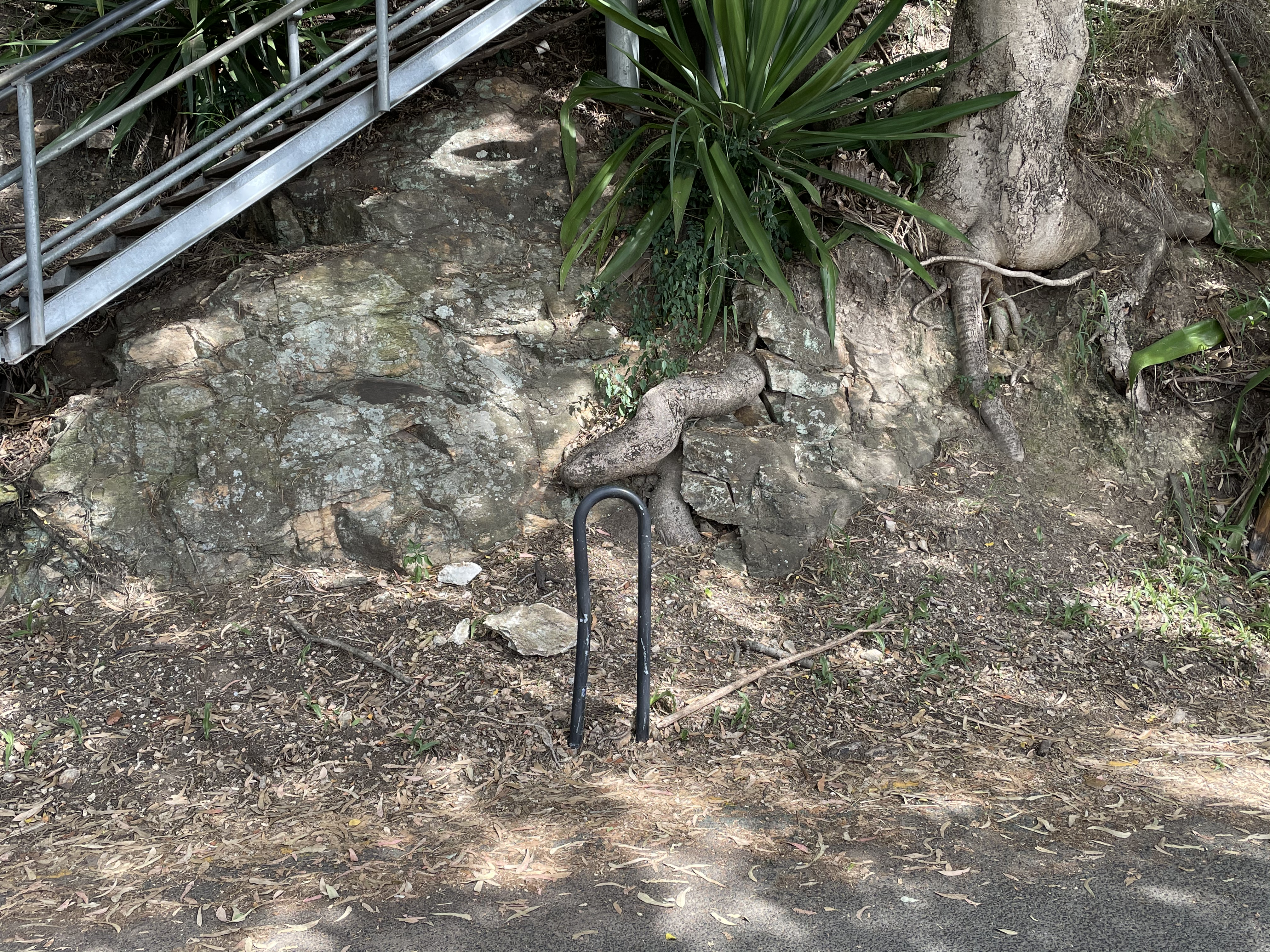 Fig. 3
The angular faces are rounded here, some into nodular forms. Without bedding it is impossible to be certain, but I get the feeling that these “beds” are approximately horizontal. There is no evidence of original texture. A few hundred yards further and the rock was forming ledges (Fig. 4).
 Fig. 4
At this time I’m certain that I’m looking at a Paleozoic metamorphosed sandstone because we’ve seen several examples on the previous day. So I keep looking for evidence of depositional texture.
By the time I made my way to the halfway point of Fig. 1, the only visible texture was fractures and differential weathering (Fig. 5).
Figure 5
 A
A 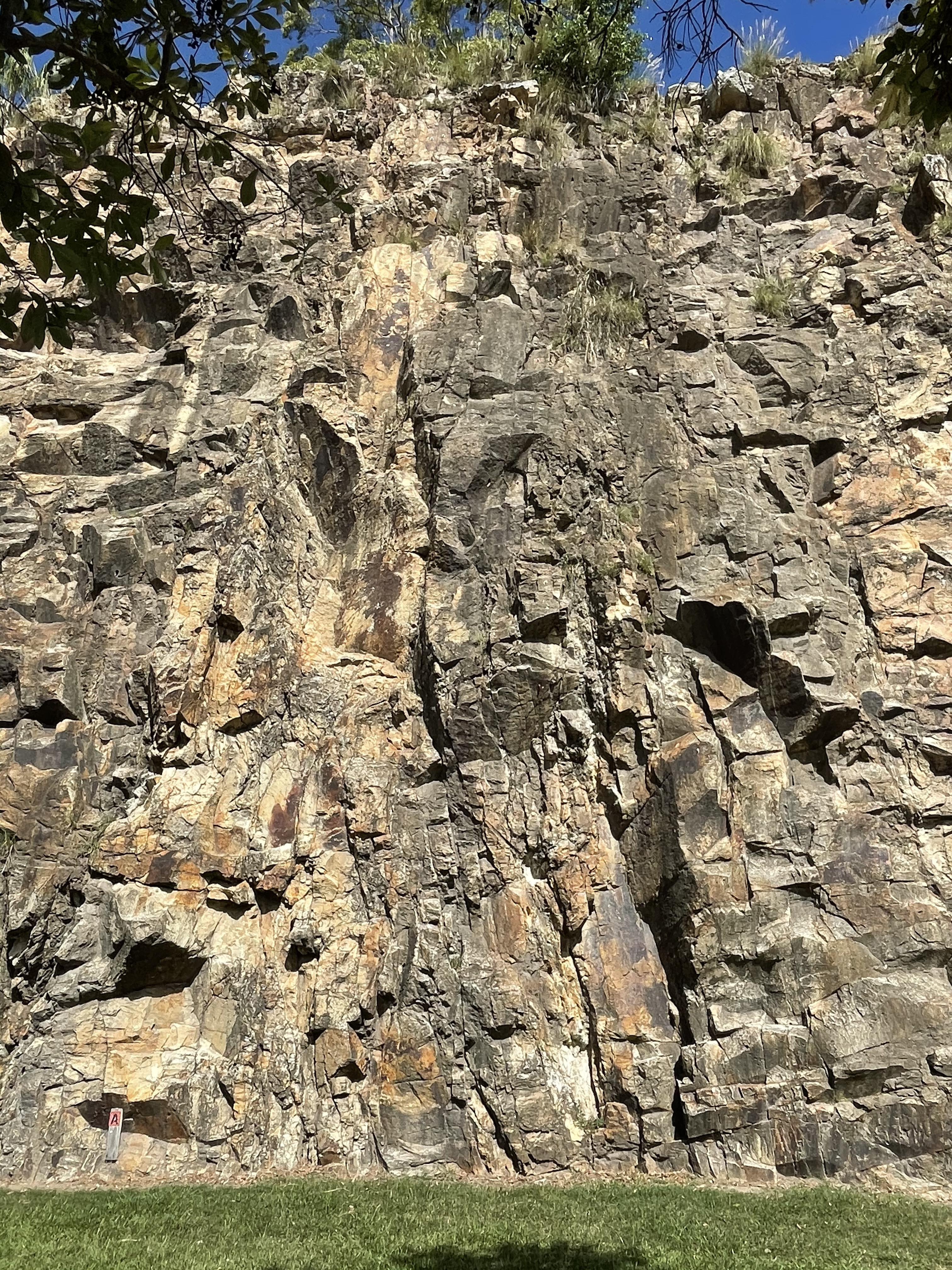 B
B
Figure 5A is dominated by vertical fractures delineating blocks of solid rock where’s Fig. 5B is dominated by what appear to be vertical bedding, weathered to a rounded appearance. I was convinced by what I’d already seen that these were not images of vertical beds, but rather fractures that weathered at different rates due to differences in mineralogy and water infiltration.
This interpretation is supported by examining the exposure another hundred yards further (estimate only), as seen in Fig. 6, which shows low-angle joints, angling down to the right.
 Fig. 6
I can’t make sense of this exposure, which should have given me the answer to what type of rock I was examining. Unfortunately, I have a terrible memory. Thus, I kept looking for bedding features and found a continuous, undulating fissile layer that could pass for a layer of fine-grained sediment (Fig. 7).
Figure 7
 A
A 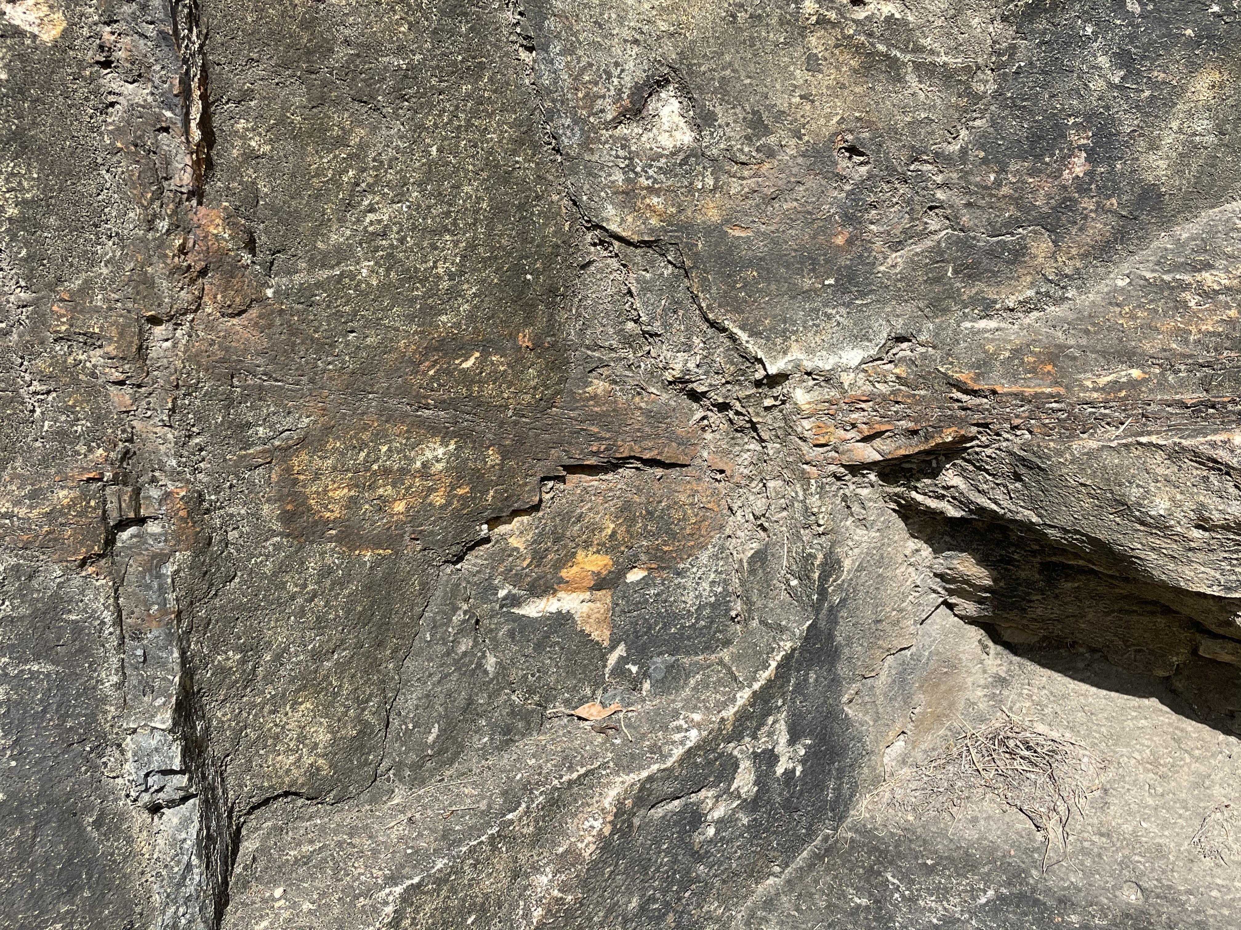 B
B
 C
C
These three photos were taken within 12 feet. Figure 7A suggests crossbedding of an ephemeral nature, like during a flood, some mud that was buried quickly and forgotten. The layering thinned but was continuous with Fig. 7B, which suggests a pinching and swelling process (i.e., nodule formation). This hypothesis was consistent with the multiple, fissile layers seen in Fig. 7C.
The deposition of a single layer of mud in a nearshore bar (marine environment of massive sandstone) or point bar (fluvial depositional environment) is nil, so that should have been the end of it. Sufficient pressure and heat to destroy primary fabric would have recrystallized any clays that somehow found their way into these sediments. I had originally thought this was a sequence of metasedimentary rocks, but this hypothesis is contradicted by the layers seen in Fig. 7 and the lack of visible grains anywhere. This is a very fine-grained rock.
Of course, in the field, I hadn’t thought of all of these factors yet, so I found another piece of inconsistent evidence (Fig. 8).
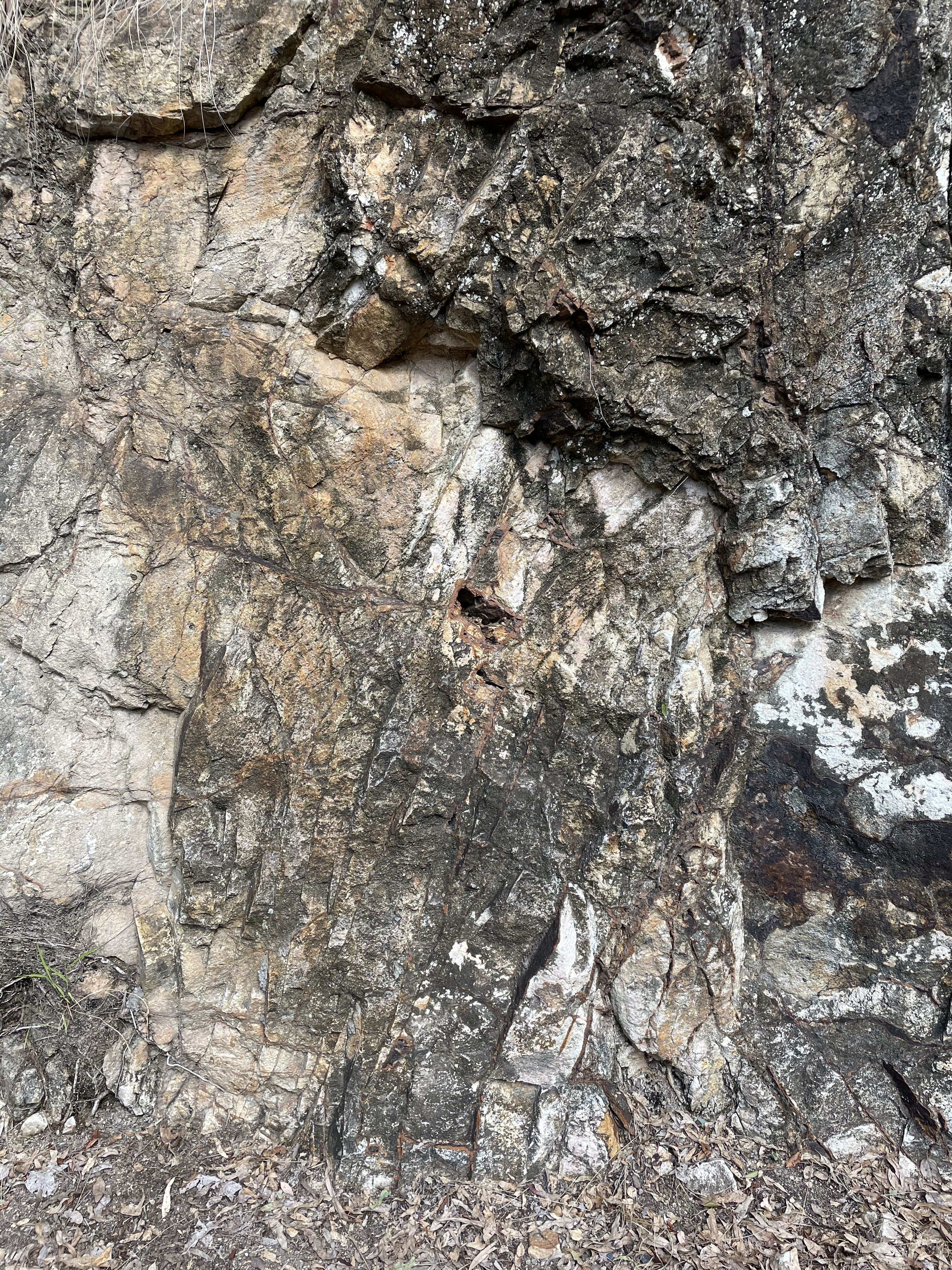 Fig. 8
A feature like the juxtaposition of unaltered, leucocratic rock and highly weathered, dark rock in this image is not associated with sedimentary rocks. This is the kind of relationship associated with hydrothermal processes in isolated pockets, like along fracture zones. There is no evidence of quartz injection into veins in these rocks, as we saw in metasediments from a previous post. There is no sign of magmatism or the proximity of a major fault, which would produce a range of fine-grained minerals as products of hydrothermal alteration.
We can never rule out slippage along fractures (see Figs. 5 and 6), lubricated by surface water, however, so Figs. 7 and 8 are probably the result of weathering along fracture zones.
The conclusion of this analysis of the field data should have leapt to mind immediately because I have seen rocks just like these many times. These are not sedimentary rocks and they never were. They are not metamorphic. They are not plutonic. We’ve run out of rock types, but one.
I admit that I cheated.
Kangaroo Point is famous and even has a Wikipedia page. The Brisbane Tuff was deposited during the Triassic Period (~230 MYA). The rock doesn’t show fine lamination or phenocrysts like we saw in much younger rhyolite (23-16 MYA) because it was created when melting-hot pieces of ash fell to the earth and formed what is called a welded tuff, not quite volcanic glass.
This outing was a wild goose chase in that I was “expecting” to find sedimentary rocks from the Paleozoic. It was only field work, which contradicted my expectations, and the hard work of previous geologists, that revealed the depth of my ignorance. This should have been a no-brainer and here’s why:
- Figure 1 shows no overwhelming structure. Nothing shouts out, “Sedimentary” or “Metamorphic” or “Plutonic.”
- Figures 2 and 3 are ambiguous; such close-up analysis of an unknown stratigraphic unit is problematic, jumping the gun so to speak. These could be older rocks on which the tuff was deposited. They do resemble some of the poor exposures from our trip to the caldera.
- Figures 4 through 6 should have sealed it because they “suggest” bedding going every way – coincidentally, just like the fracture patterns.
- Figures 7 and 8 nailed the coffin shut because the geological requirements to create such juxtapositions have never been reported (to my knowledge).
The one legitimate error I would have made is the age. Without knowledge of stratigraphic relationships between this unit and those above and beneath it (structurally and chronologically), I probably would have guessed it was age equivalent to the rhyolite we saw at Purling Brook Falls.
The bottom line is that this area received ~150 feet of ash over an unknown period of time about 200 MYA, but not from the caldera we visited before. The source of this volcanic rock is buried beneath the ash it produced. It was a tumultuous time.

Recent Comments