
Coming Ashore
The low hills of the north Tasman coast loom in the distance beyond a calm sea as we approach Devonport (Fig. 1).
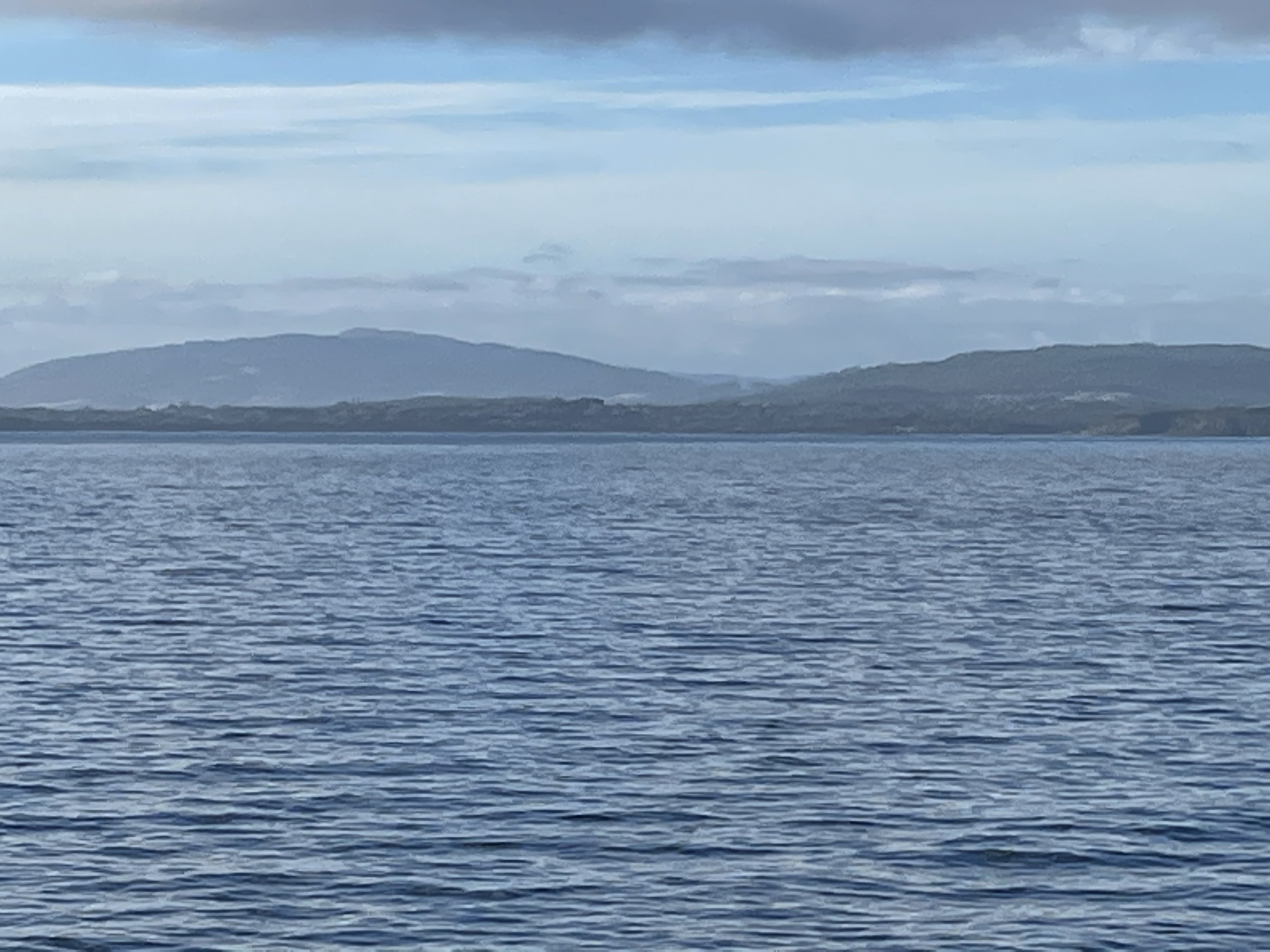 Fig. 1
Figure 1 is looking toward the left side of Fig. 2, just to the right of the word “coast.” Thus, chances are that the hills are associated with the volcanic sequences in Fig. 2.
 Fig. 2
We disembarked and headed west along the coast, passing a series of low hills (actually knolls) like those seen in Fig. 3.

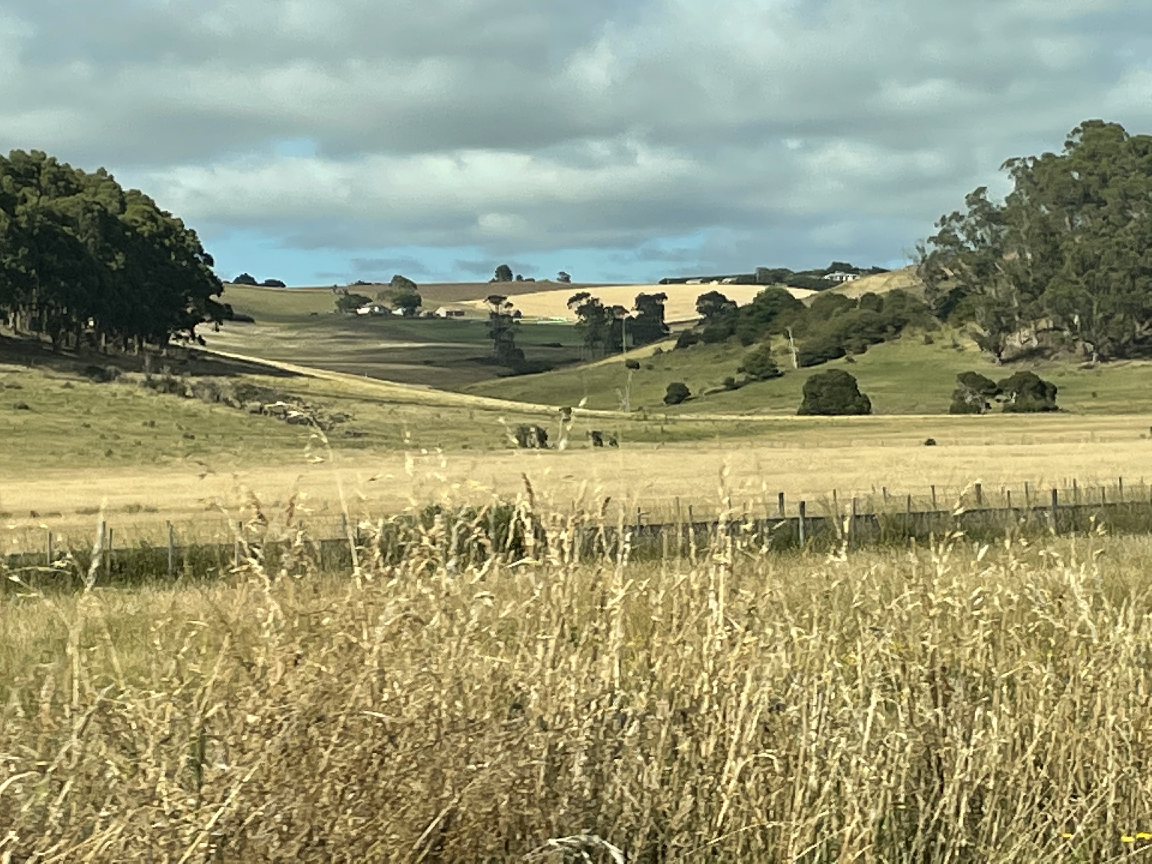 Fig. 3
The left image shows the abruptness of these knolls and the right photo shows how closely they were spaced. There are going to be different causes for any landform like this, but it is very likely that glacial erosion was significant in Tasmania. Figure 4 shows just how extensive ice was during the last glacial maximum; the entire island was buried under ice.
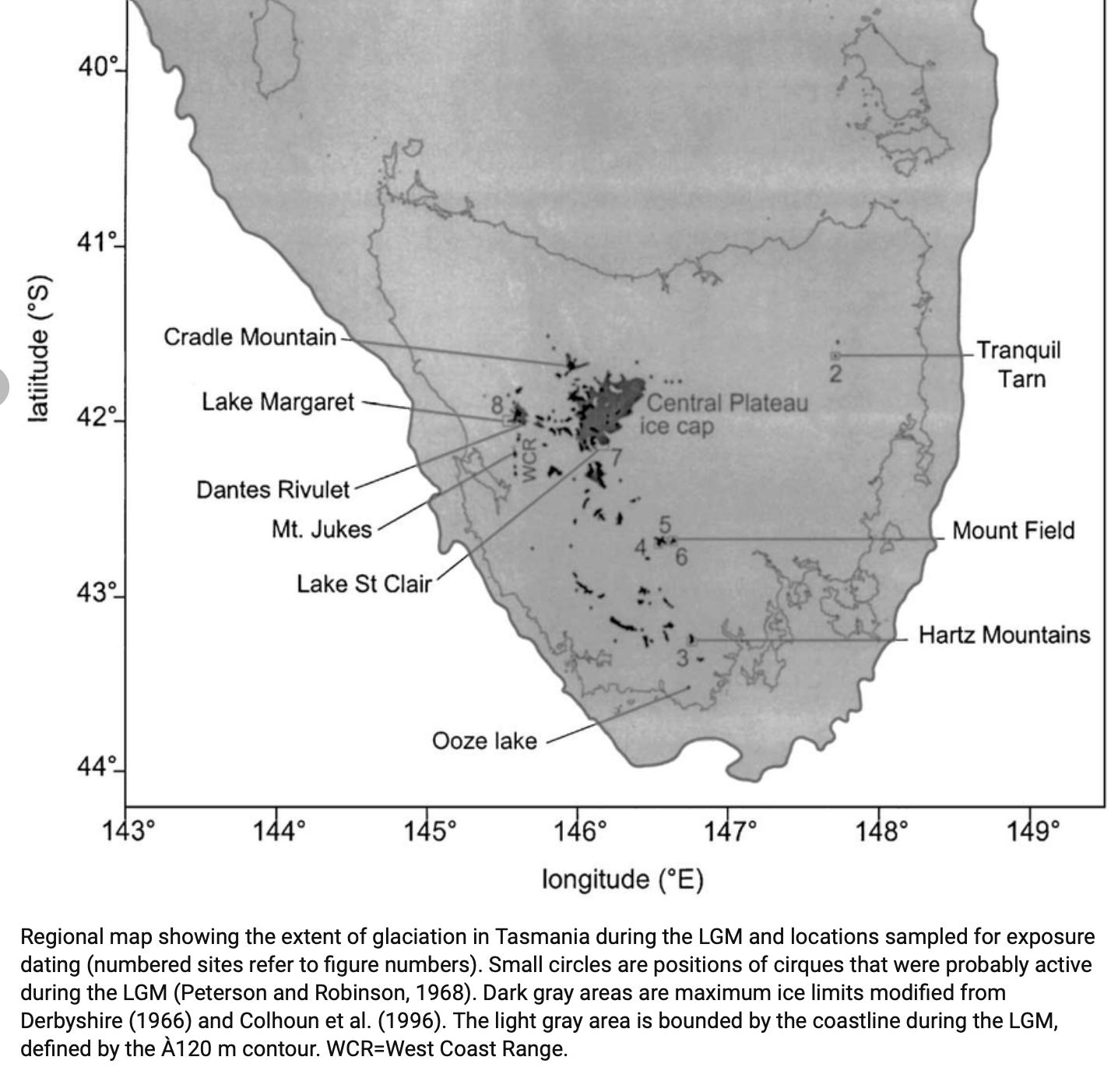 Fig. 4
Shading indicates ice extent. The coast of Tasmania is shown by a thin line and several locations we will be referring to later are labeled, such as Cradle Mountain (Our destination for Day 1). I am not suggesting that the hilly features in Fig. 3 are moraines. We’ll see those features later. But they were probably partly created by the removal of weaker rock by ice action.
When rock is worn down by pieces of rock carried by the ice (rock is much harder than ice, but not rock embedded in ice), and then the ice sheet melts, a variety of materials are left behind. Rocks deposited in this way, which don’t fit into the region’s general geology are called erratics.
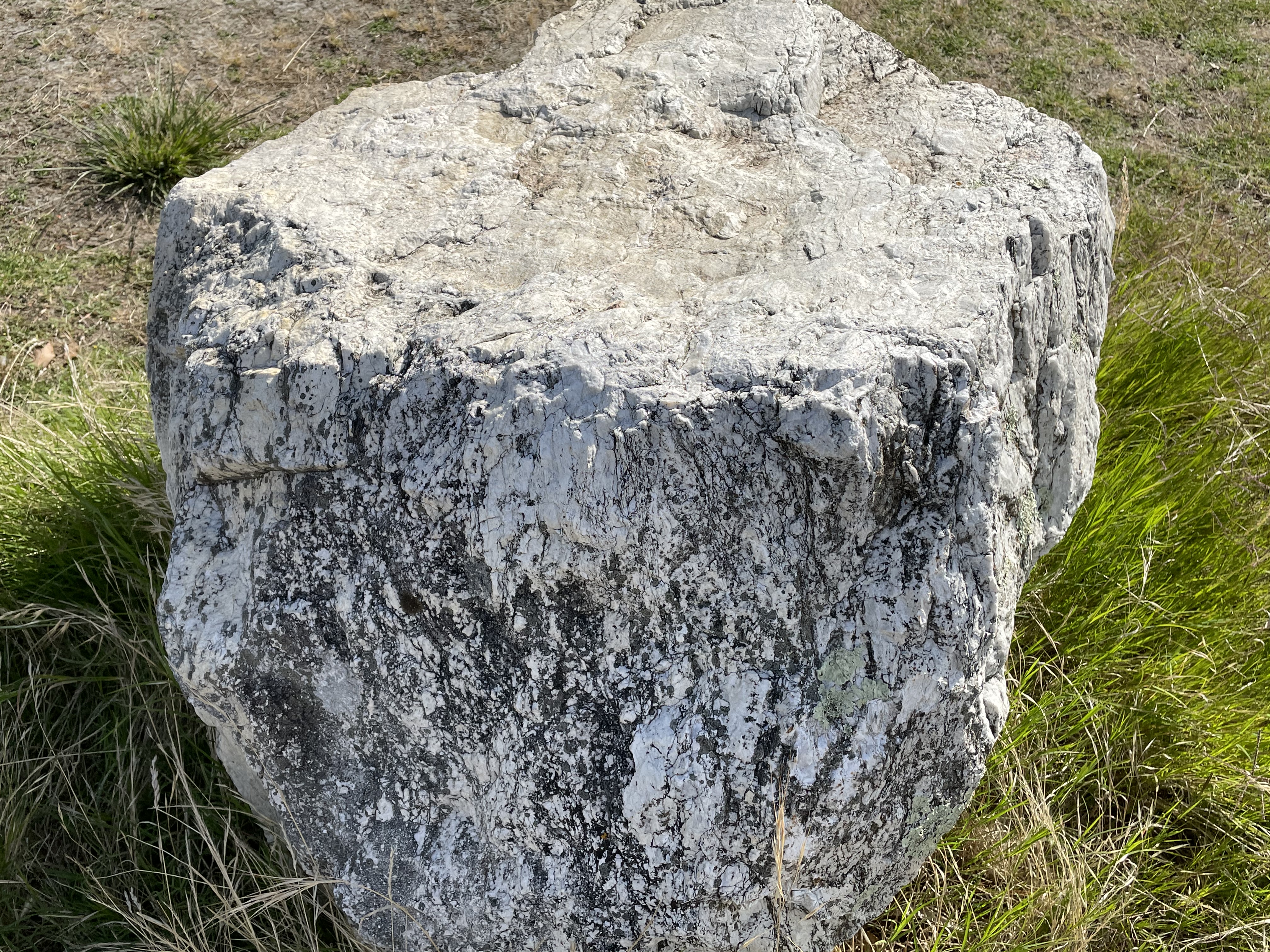 Fig. 5
Figure 5 shows a block of quartzite about 3 feet in diameter. This was a very smooth, hard rock that was sitting next to the parking lot of a public beach called Turners Beach (Fig. 6).

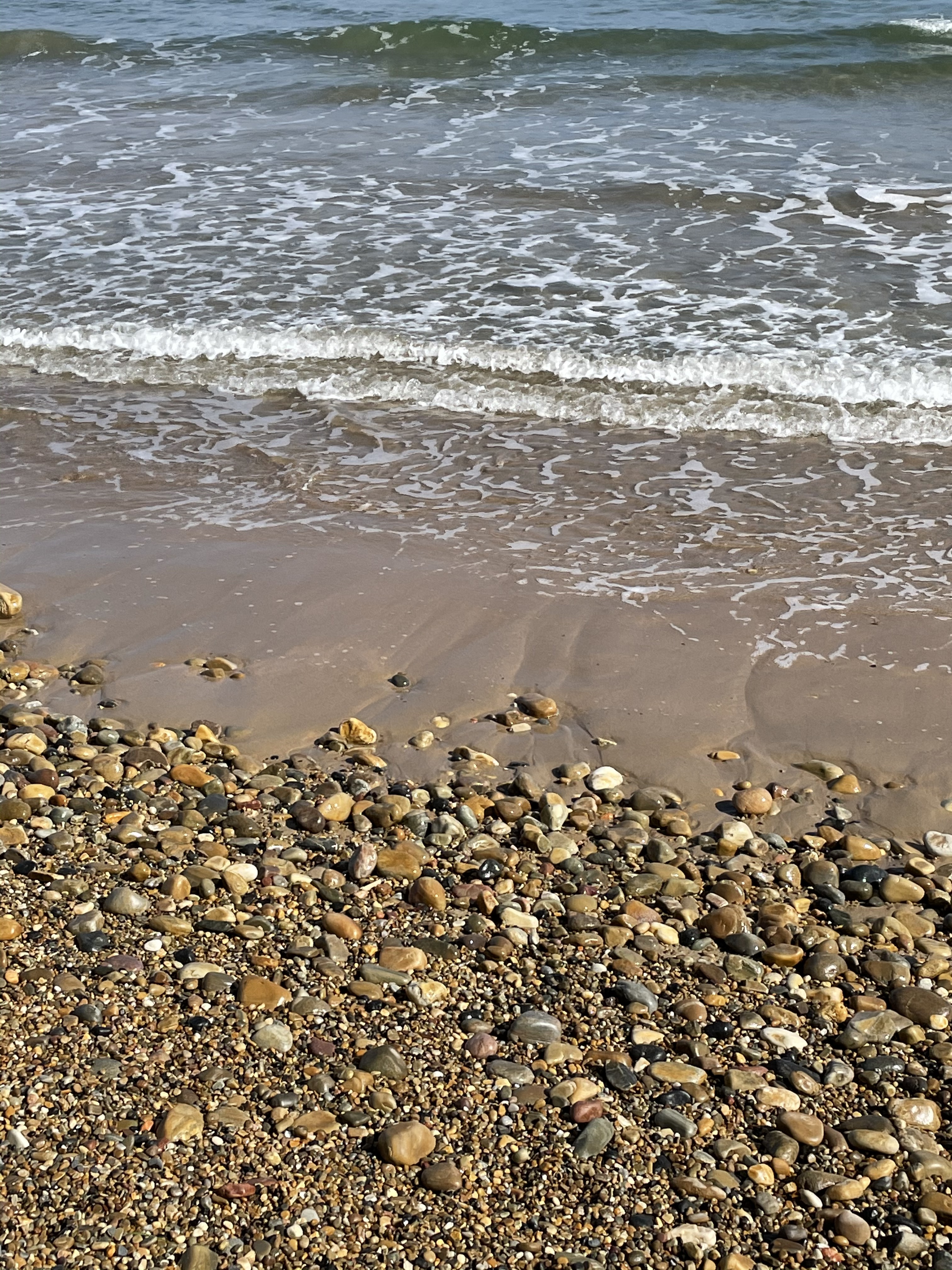 Fig. 6
Turners Beach is a cobblestone beach but it has an interesting feature seen in the right photo of Fig. 6; the swash zone (where the waves lap on the shore) is sandy. The cobbles are covered by sand in the wave-dominated zone. This suggests that the cobbles are being reworked and there is no current source, which of course there isn’t. There are no bluffs of conglomerate being eroded. There is no fast flowing river, fed by seasonal ice melt at the front of a glacier. There is no active source of sediment along this stretch of coast and everything is relict (leftover), so the fine-grained material is being winnowed on the shoreface as the cobbles look on with disinterest, piled into an armored berm by occasional storm waves.
Let’s take a closer look at the cobbles, to see what they tell us about the source of these sediments (Fig. 7).
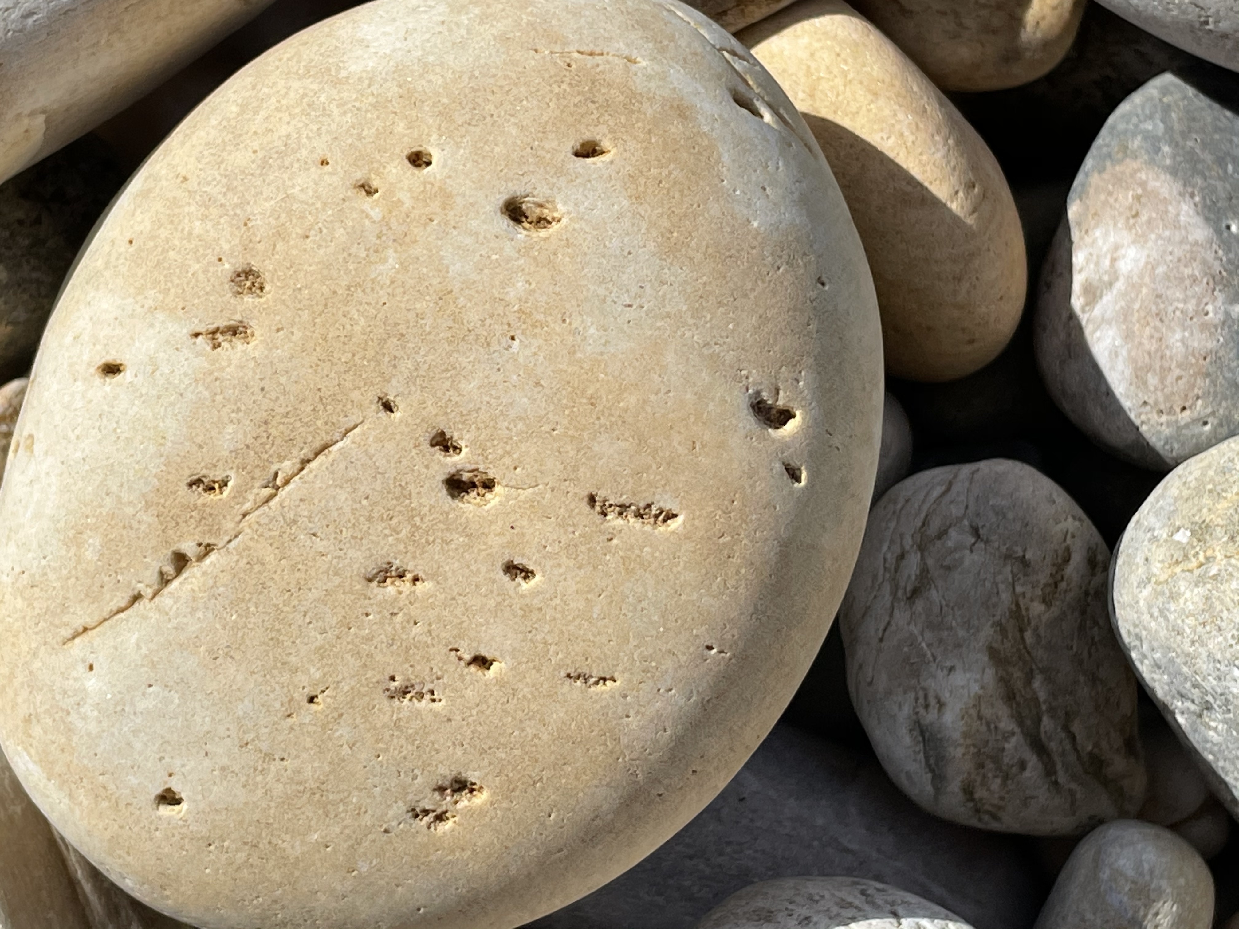
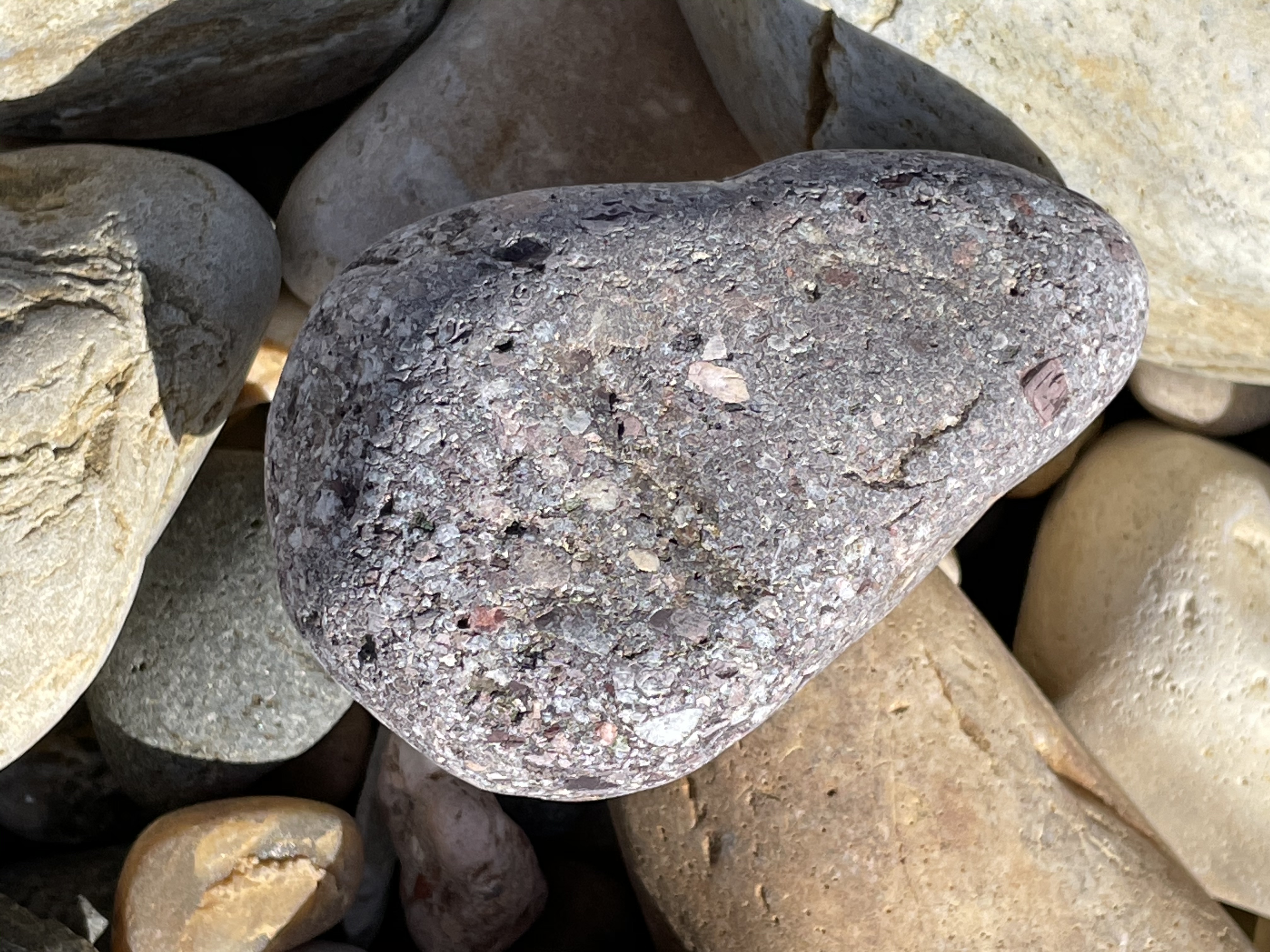 Fig. 7
Without thin-sections or a fresh hand sample, broken with a hammer and examined with at least 10x magnification, I can only speculate, but I’ll cheat a little. The left image is probably derived from a source like the boulder shown in Fig. 5. To go from a block to a rounded cobble about 4 inches in diameter requires ~10 miles of transport in a rocky, high-flow stream (I’m trusting my memory so this is an estimate). The second image shows a dark rock that is more irregular in shape. This is probably a metamorphosed volcanic rock.
Not all of the cobbles were sub-round, however; Fig. 8 shows elongate rocks, both light and dark colored, and a range of sizes. This suggests multiple sources, with respect to transport path, and different residence times in the transport system of steep creeks and rivers.
 Fig. 8
Keep in mind when looking at Figs. 5 through 8, that the world in which they were broken away from older rocks was exposed to thick ice that was spreading from the central part of the island (at higher elevation) and sliding towards the coast. Even during an ice age, there would have been catastrophic melting at the edge as the ice moved northward (see Fig. 4). This movement would have continued for millennia, with transport beneath the ice sheet in buried streams.
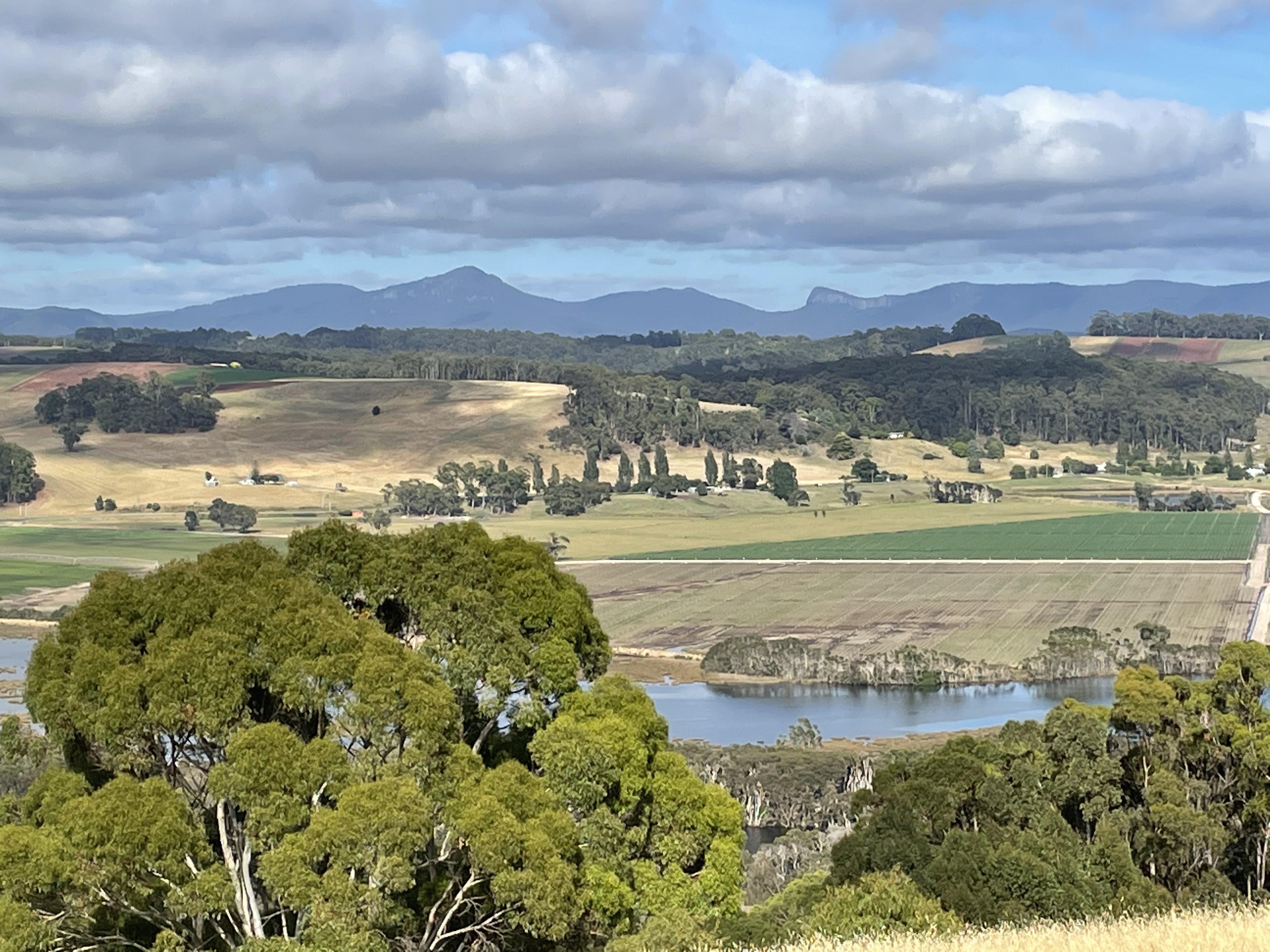 Fig. 9
Figure 9 shows the resulting topography from thick ice flowing (glacially, excuse the pun) over rocks as old as 1.2 BY, which had already been metamorphosed and damaged by brittle deformation during several orogenies. There were weak points, which gave way to the relentless advance of the ice.
I’ll stop here before we get into the source of the cobbles we saw at Turners Beach.

Trackbacks / Pingbacks