
Queenstown to the Continental Divide: Proterozoic Sedimentary Rocks
The second day of our field excursion covered quite a bit of the geological history of Tasmania, so we’re going to continue discussing this very long day (from Cradle Mountain to Hobart) in this post. To summarize, we saw exposures of Proterozoic (1600-540 MY) and Cambrian (509-485 MY) sedimentary and volcanic rocks between the coast and Cradle Mountain (see Fig. 1 for final location). These were metamorphosed and indicative of hydrothermal activity in the region, as discussed in a previous post.
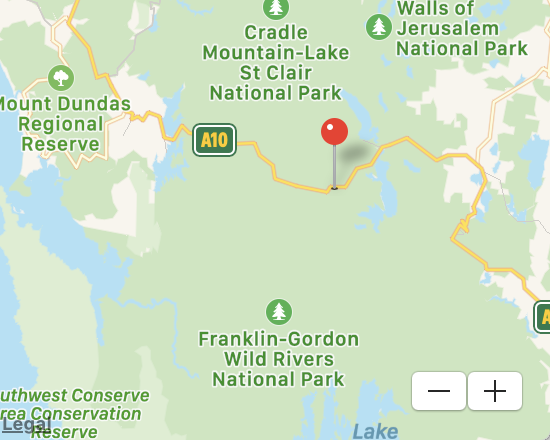 Fig. 1
The last post discussed remineralization and granitic intrusion into these rocks, especially Paleozoic rocks, culminating in the extensive mining activity centered on Queenstown, the “top of the world” so to speak, because these are some of the highest elevations in Tasmania.
Today’s post is going to take us from Queenstown to Tasmania’s official continental divide. Most of the included photos were taken about 30 miles east of Queenstown, where the pin in Fig. 1 is located. We will be examining rocks primarily from the Tyennan Group, but not as strongly deformed and metamorphosed. We are moving east of the Paleozoic trough where most ore bodies were emplaced. The sediments consist of fine-grained (pelitic) schist and quartzite (sand-sized particles), and some conglomerate deposited between 1600 and 541 MY ago.
The road cuts exposed rocks that are tilted but relatively undeformed (Fig. 2), such as this sequence of fine-grained sediments, with thin sandstone layers interbedded.
 Fig. 2
Examined up close, the sandy layers have lost their original bedding but have not developed the strong visible layering (foliation) commonly associated with what are called schists (Fig. 3).

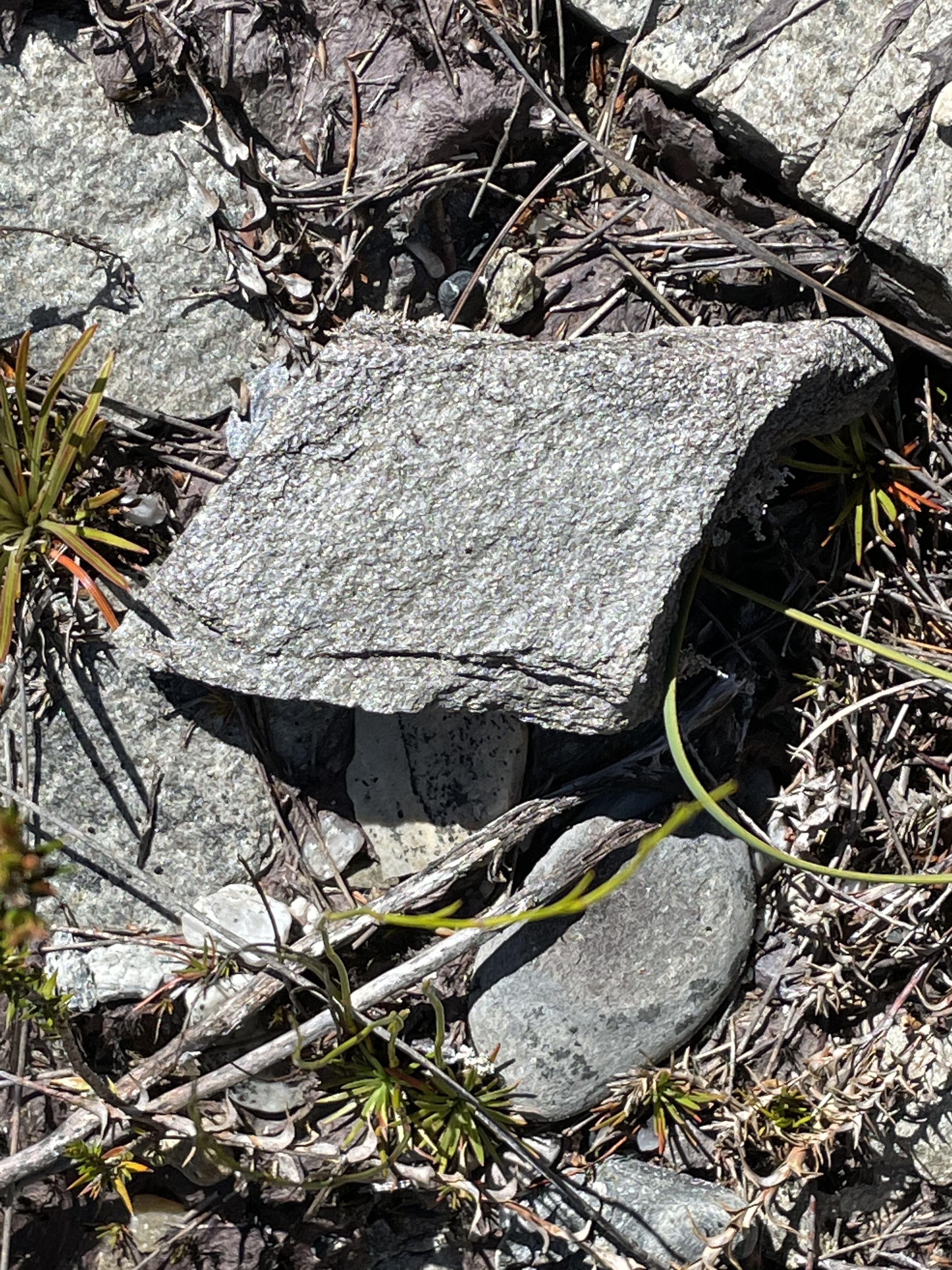 Fig. 3
These sediments varied substantially, as seen in Fig. 4, which shows more sandy layers and a reduced volume of fine-grained sediments.
 Fig. 4
The area in Fig. 1 contains many faults associated with volcanism and intrusion during the late Proterozoic and early Paleozoic (~1600-500 MY). In some places the rock layers of this area are vertical (Fig. 5).
Fig. 5
 A
A 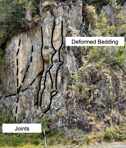 B
B
Figure 5B has been annotated to better show some features of deformation without strong remineralization. The irregular lines showing deformed bedding are more-or-less original variations in particle size and/composition (i.e., sedimentary layering) that has been squeezed and had the grain size of crystals increase in response to heat and pressure. The joint pattern has nothing to do with this but came later, as the rocks cracked from cooling and reduced pressure (similar to mud cracks).
A closer look reveals how far this process can go without leading to remineralization and the replacement of original minerals by new ones (e.g., pyritization or chloritization) as new elements are introduced by hydrothermal circulation.
 Fig. 6
The lighter areas in Fig. 6 are probably quartz recrystallized from sand grains whereas the darker zones are very likely quartz and muscovite that result when water is removed from clays. The heat and pressure weren’t sufficient to form new mineral crystals with larger size, however, so the mixed mud-sand assemblage remains identifiable.
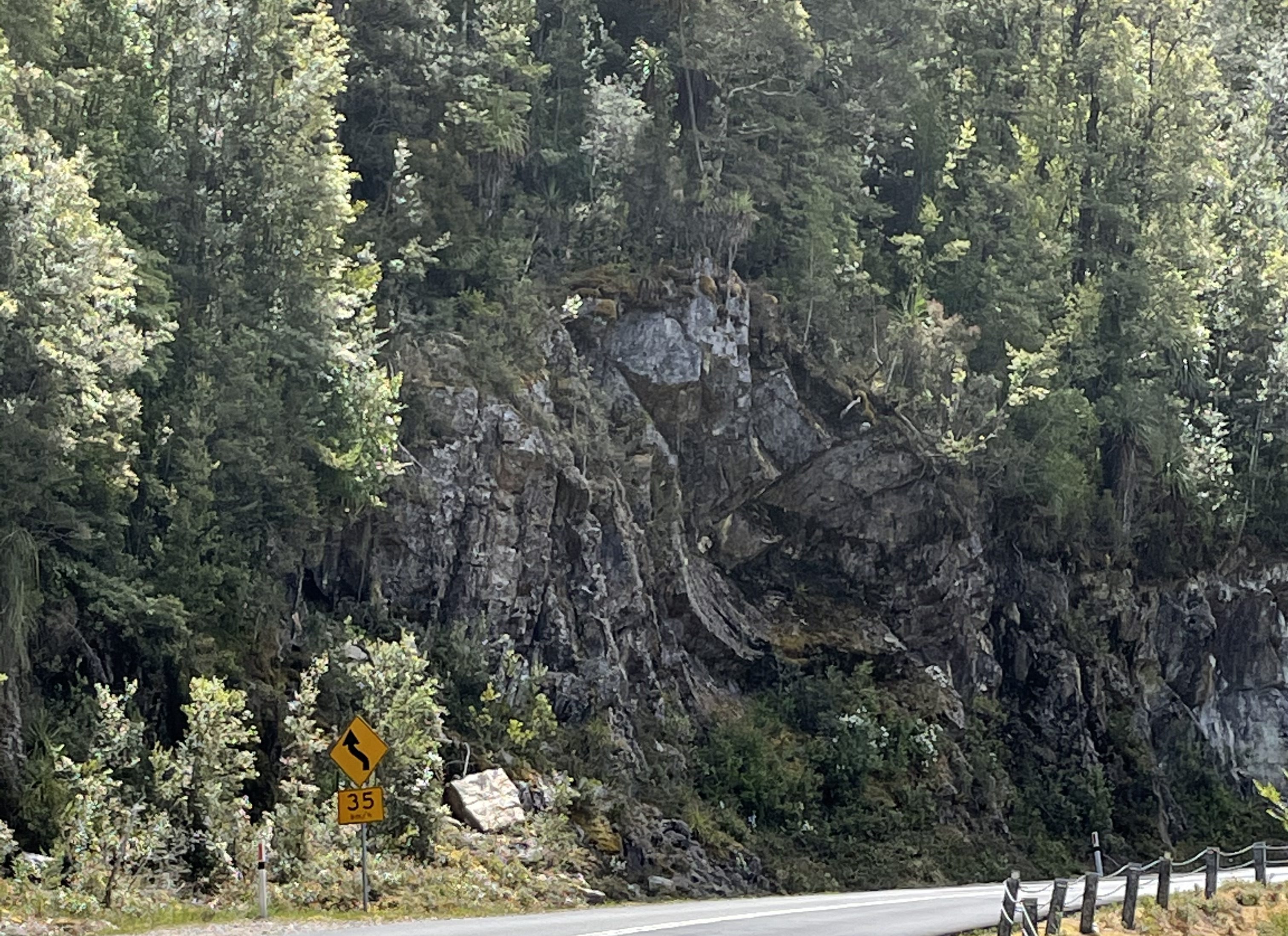
These rocks were folded during compression, when some of the faults certainly occurred. We saw an outstanding example in a road cut (Fig. 7).
Fig. 7
 A
A 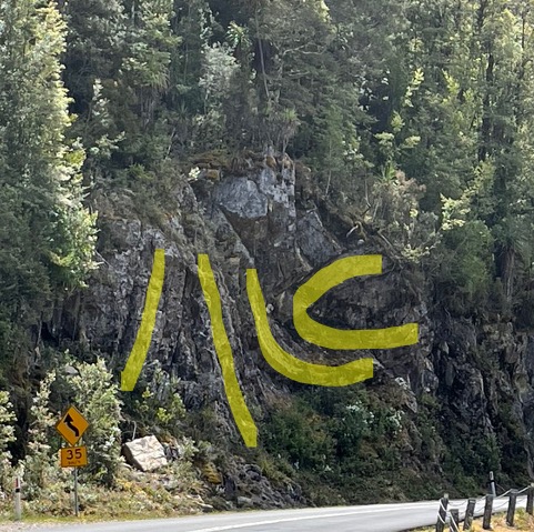 B
B
Figure 7B has original bedding highlighted. This shows a tight fold on its side (recumbent) and juxtaposed against vertical bedding. There are certainly some faults present between these layers. The rocks were brittle enough (i.e. shallow burial) to break and slide against one another. Zooming in closer on the “C” in Fig. 7C, we see that there was no remineralization in these tightly folded rocks (Fig. 8).
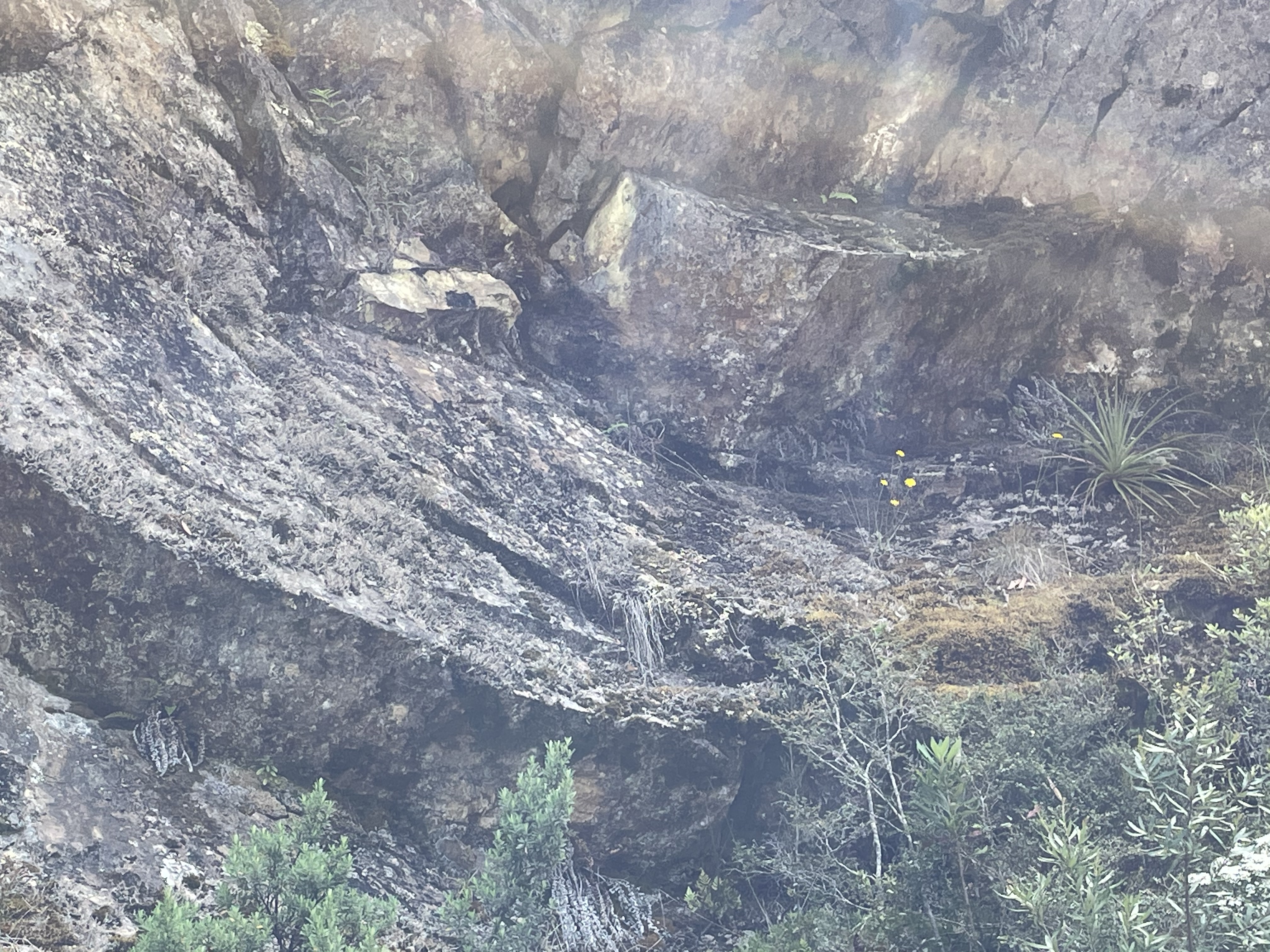 Fig. 8
But if we look at the more outward layers surrounding this structure, we see signs of substantial brittle fracture (Fig. 9) and remineralization. The former is shown by the small size of (much less than 1 foot) of individual blocks of stone (Fig. 9A) and the latter by the weathered appearance and lack of structure in some areas (Fig. 9B).
Fig. 9
 A
A  B
B
Soon after this we left the central mining district and the rocks deposited and deformed during the collision of Tasmania with Gondwana (~500-370 MY). In the case of Tasmania, the Continental Divide is between the rainy western half and the dry eastern half. Another way to look at it is that the western half was created when Gondwana was formed and the eastern half when it was pulled apart.

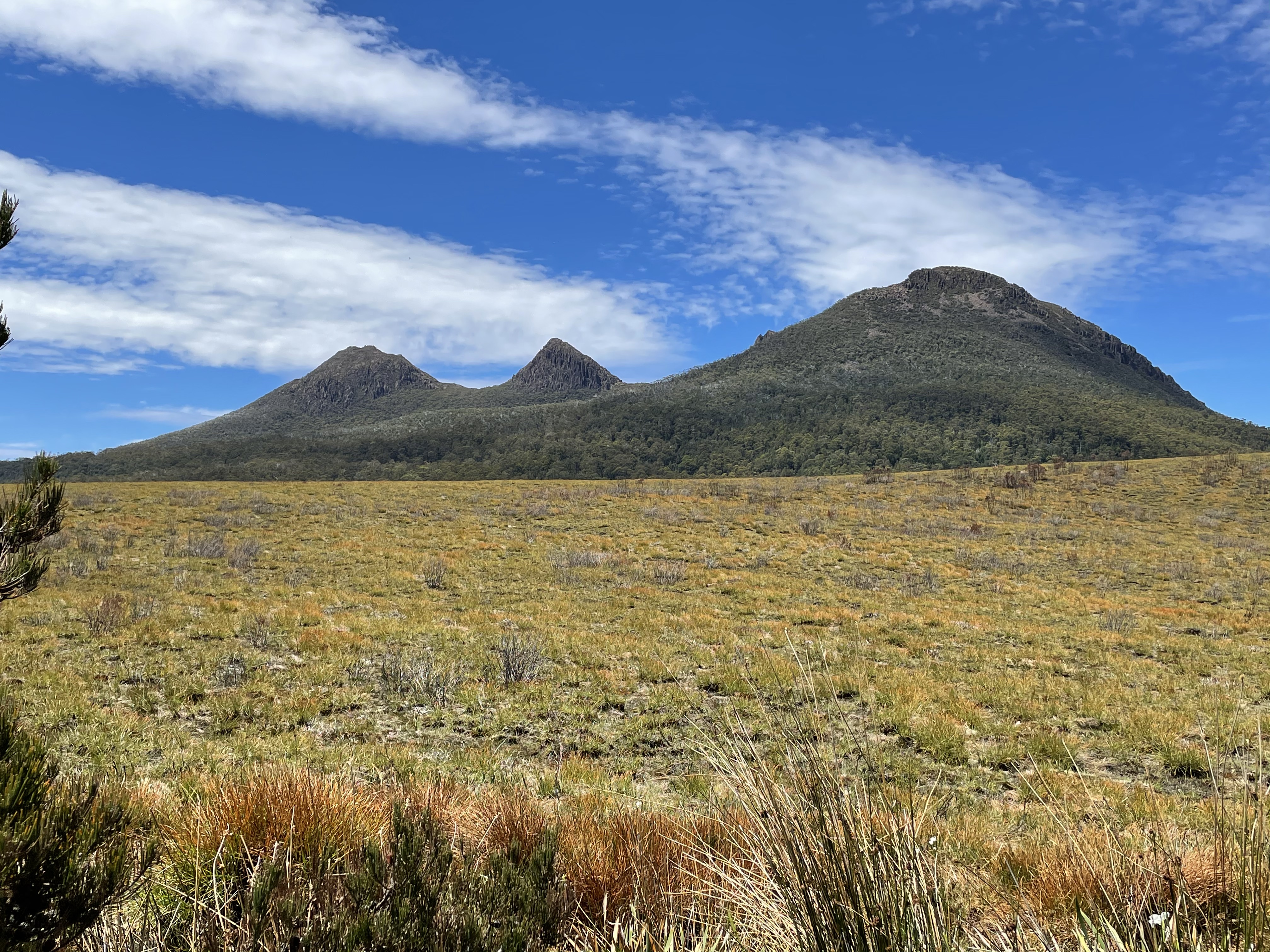
And finally, the King William Range, comprising peaks of fault blocks pointing to the east and a different geologic regime…

Trackbacks / Pingbacks