
Mount Saint Helens Revisited: A Missing Forest
My last post reported on Miocene (23-5.3 Ma) volcanic rocks on the eastern flank of Mount Saint Helens. Those rocks predate the creation of Mt St Helens, however; we reached our destination and, before exploring a lava tube called Ape Cave, we examined some interesting geology that is part of the most recent eruptive stage of this active stratovolcano. The Spirit Lake stage began about 4500 years ago. There were three earlier stages, beginning about 40,000 years ago; each lasted less than 5000 years.
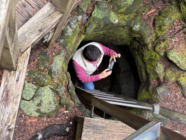
Figure 1. About 1900 years ago, a large amount of basalt lava flowed from a fissure on the south flank of the volcano (indicated by a square in the inset map of Fig. 2). The lava was hot (~1200 C or 2200 F) and set the forest on fire; when the wood had been turned to charcoal, the lava cooled to leave casts of the trees. My wife is taking a photo of a small-diameter tube we’ll examine it more closely below.
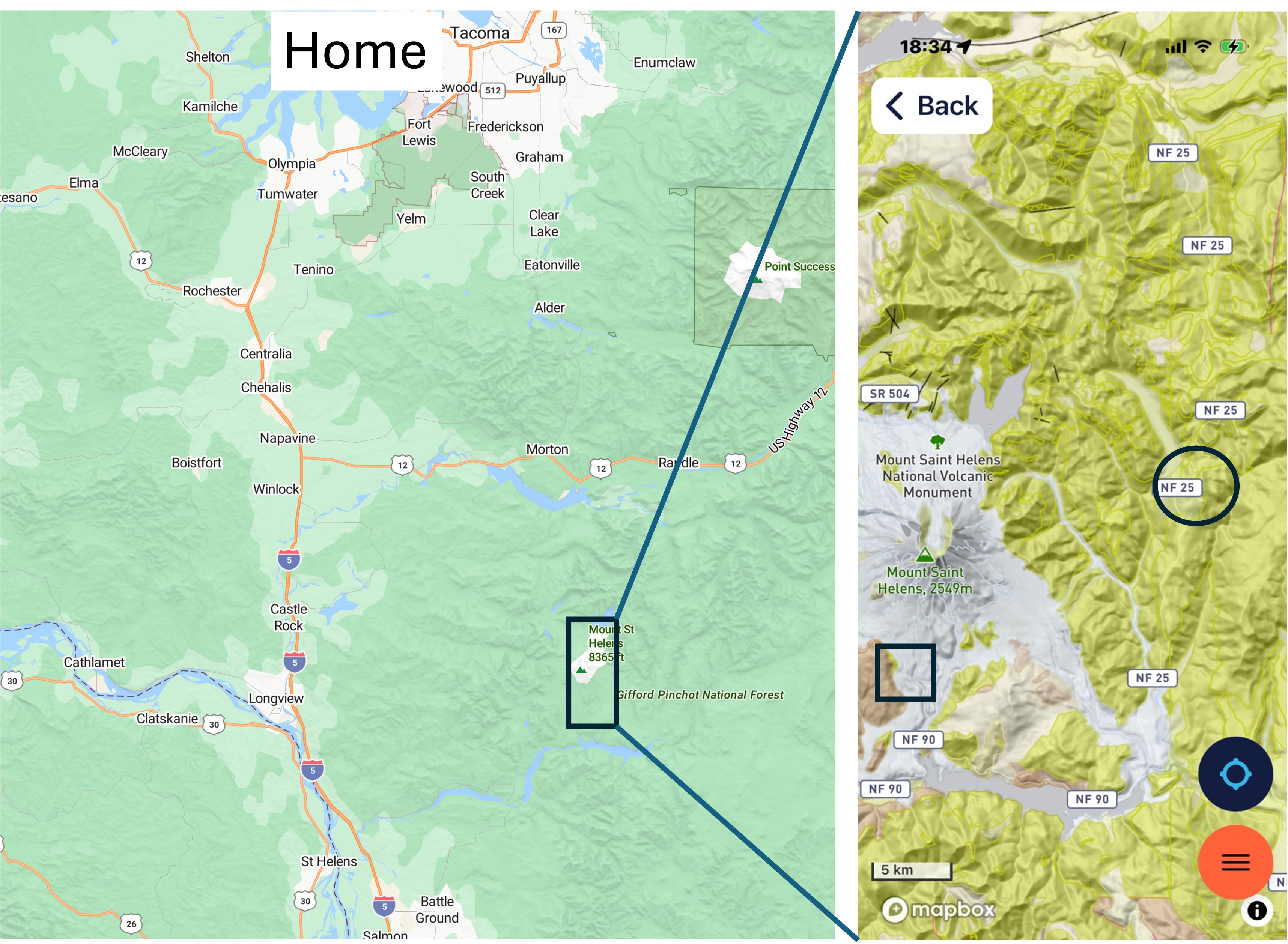
Figure 2. Mount Saint Helens is about 70 miles south of Tacoma (Home in the right map), but the route we followed, around the north and east flanks, takes 3.5 hours to drive. The yellow areas in the inset map are mostly andesite lava flows older than 5 Ma. The circle is where we looked at them in the last post.
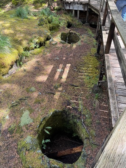
Figure 3. These holes were everywhere, forming a hazard for people walking, so a walkway was constructed over the area where the tree holes are densest. They haven’t been cleaned out and most are 3-4 feet deep.
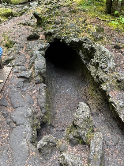
Figure 4. This is the cast of a fallen log. The entrance is shown in Fig. 1; visitors are encouraged to crawl through it, about 40 feet, but it was too tight for us. However, several children I met there had braved the dark, tight tunnel.
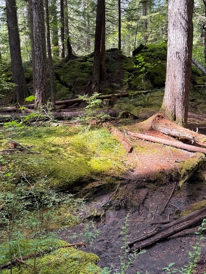
Figure 5. This photo was taken a couple-hundred yards from the missing forest. The background reveals the leading edge of a lava flow that’s about ten-feet high. The foreground shows a stream being incised into the landscape, probably created along a collapsed lava tube. Regrowth of the forest is slow in the lava surface; however, there was no mention of whether or not this area was logged in the last century–it probably was, given the documented greed of the forest industry when it came to cutting down trees. However, I didn’t see any large stumps, so maybe it wasn’t worth the effort.
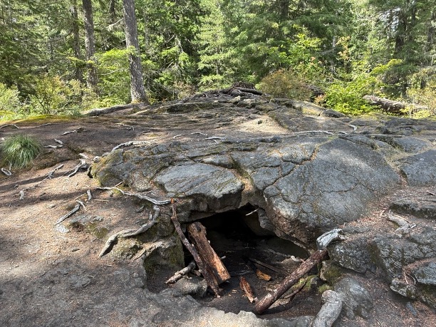
Figure 6. This is a mound of lava projecting up to 8 feet above the surrounding landscape. Several features are worth mentioning: 1) it is circular in plan and about 30 feet in diameter; 2) the upper-center of the image shows concentric bands of ropy lava known as pahoehoe, from its common occurrence in Hawaii; and 3) there is a small cave beneath it where lava ran out of the hardened surface. We’ll see a lot more of that in my next post.
Final Thoughts
Our journey along the backroads took us through a vast terrane of andesitic volcanism created more than five-million years ago. Then, about forty-thousand years ago, a new phase of volcanism began and Mount Saint Helens was created from this rugged ground.
Stratovolcanoes don’t just erupt at their summit, even though that is exactly what Mt St Helens did in 1980; more often they leak lava from the myriad faults and fissures surrounding them, especially in an active subduction zone where the earth’s crust is being compressed, twisted, and warped by tectonic forces.
Life is difficult in such an environment and we are fortunate to have a moment in time frozen for us to contemplate how immense the forces are that constantly reform the surface. Eruptions like the one that destroyed this forest are unlikely to kill many people, but they are crucial in reforming the environment. A new forest grows, possibly inhabited by different species of fauna and flora, and life goes on.
My next post will examine this same eruption event, but at a scale that dwarfs what we saw today.


Recent Comments