
Ecological Notes from Cowiche Canyon
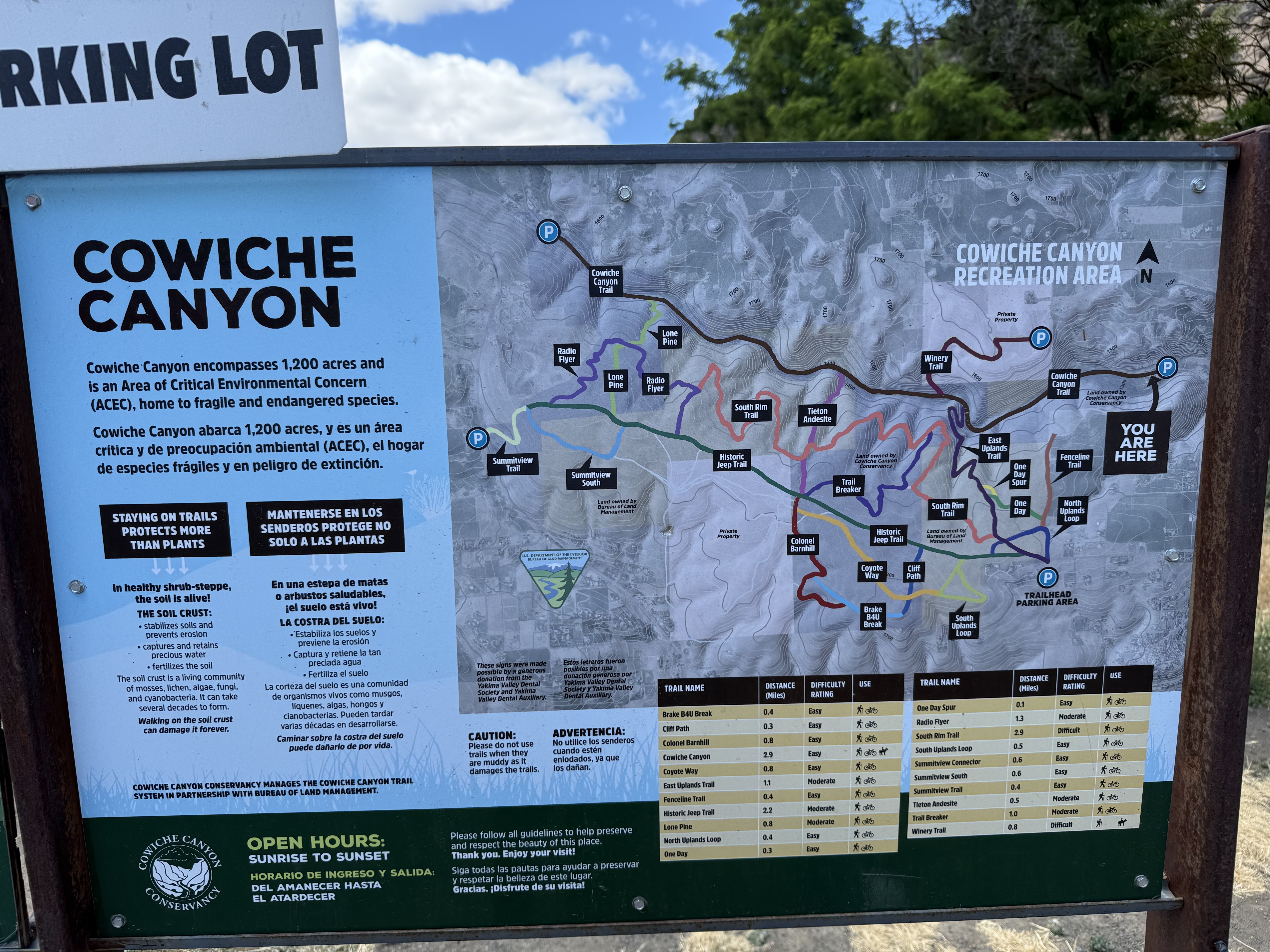
Cowiche Canyon Recreation Area is located on US12 just west of Yakima, Washington. The region receives 9-14 inches of rain per year, making it a dry area; thus, the trail system includes both shrub steppe (uplands) and riparian (along Cowiche Creek) habitats. We followed the main trail along the path of a rail line that was in use between 1913 and 1984 along the creek; however, the wetland is very narrow, in places constricted to less than 100 yards. Thus, I encountered plants from both environments.
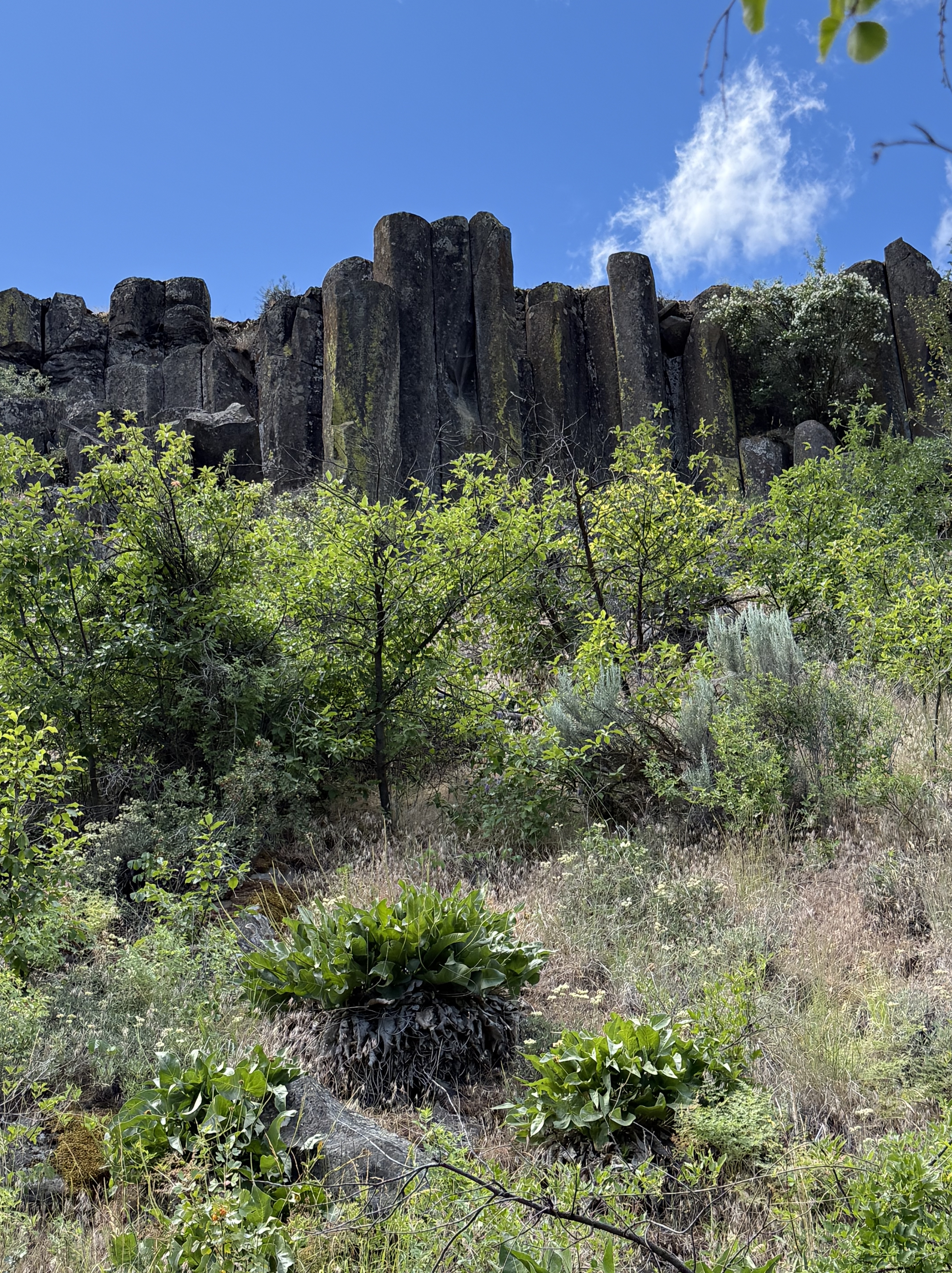
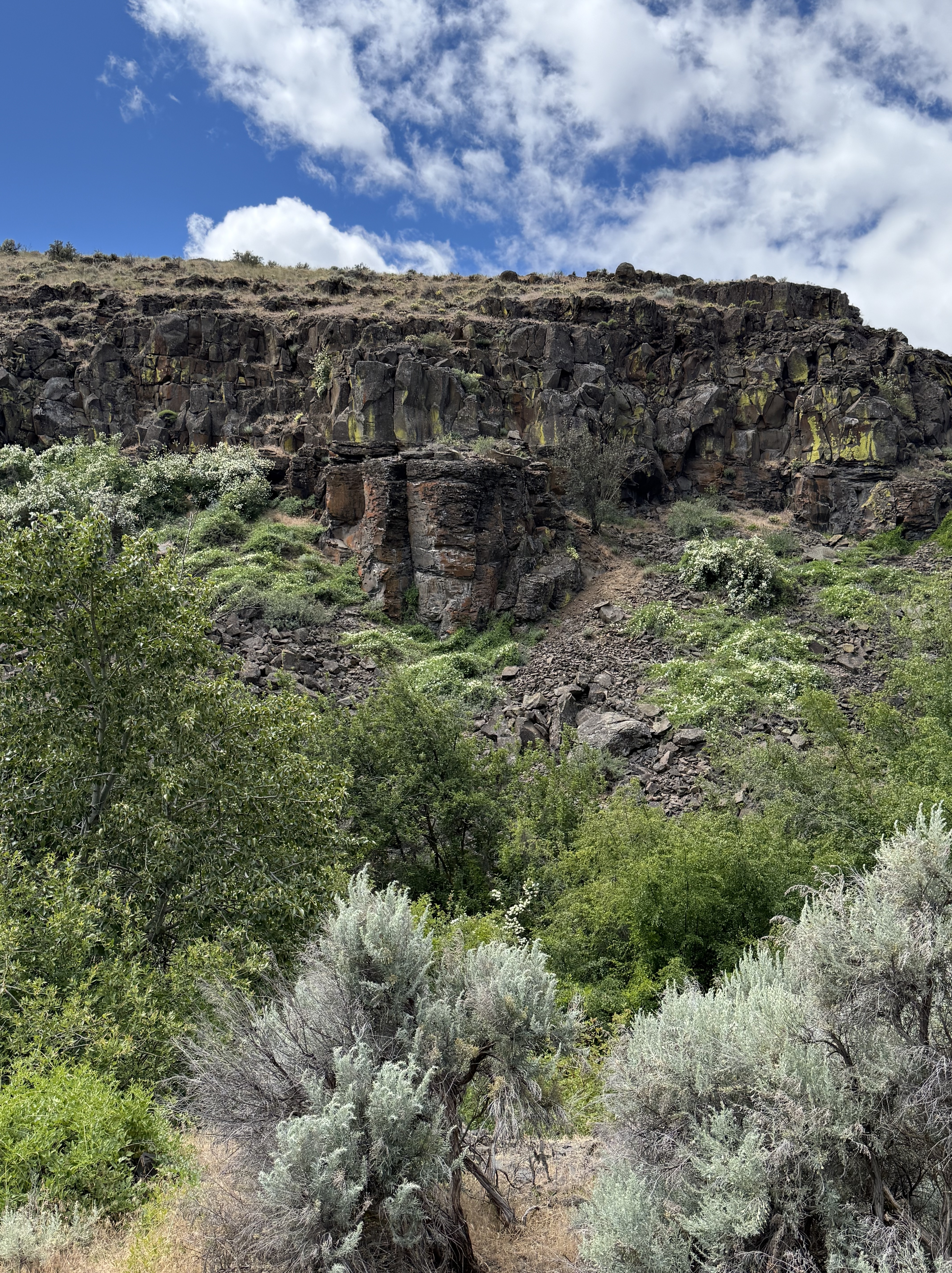
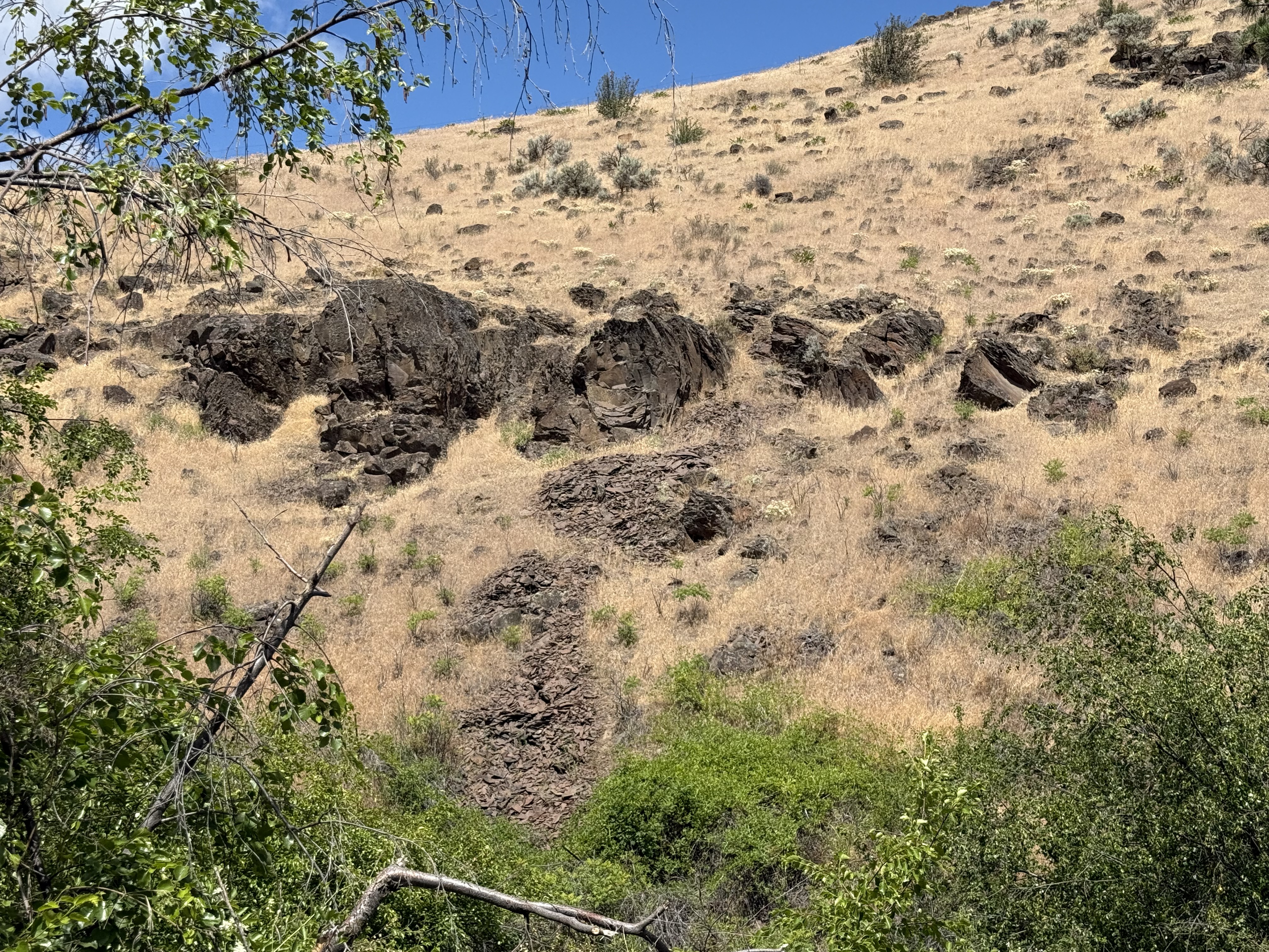
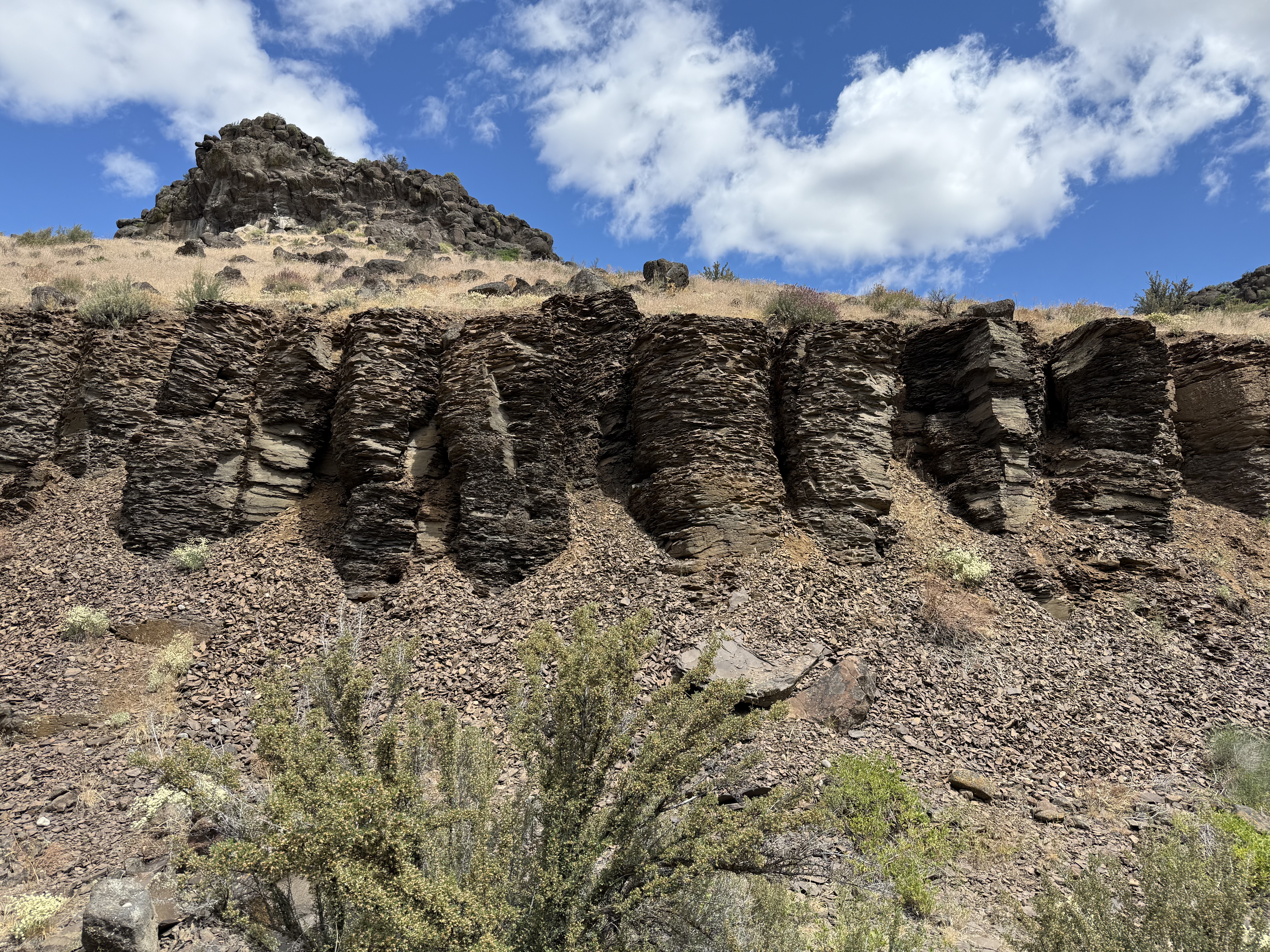
The canyon walls are composed of a series of basalt ledges with intervening slopes covered by talus and colluvium, which are part of the shrub-steppe habitat. I discussed the geology of the area in another post.
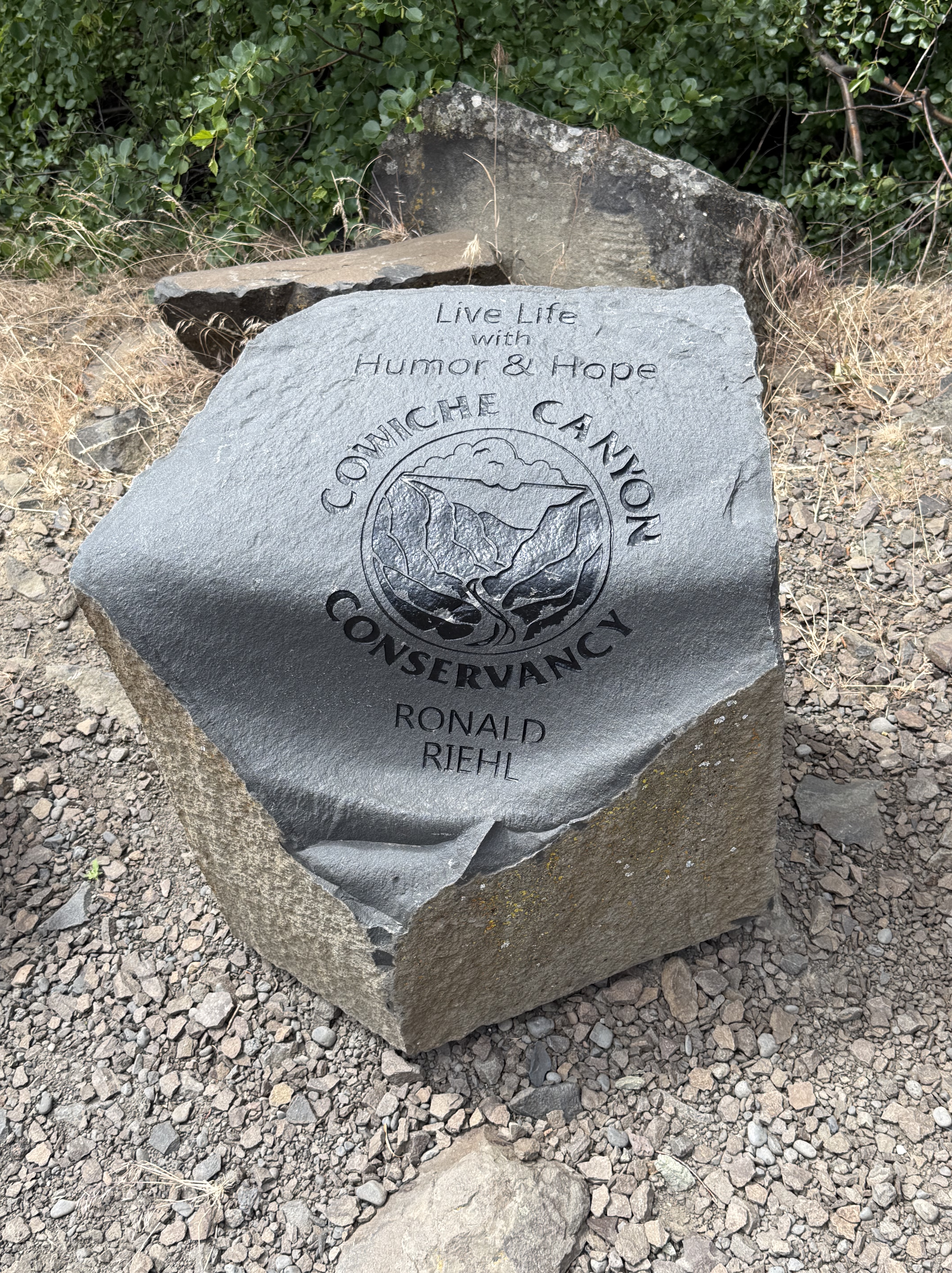
The recreation area is maintained by the Cowiche Canyon Conservancy in partnership with Bureau of Land Management. This stone is a piece of the columnar basalt that lines the canyon.
It’s fortunate that I visited this area during spring, which lasts a little longer here in the Pacific Northwest. As always, I used CoPilot (AKA ChatGPT) for identification while I try to remember scraps of the huge amount of information presented in this mixed environment.
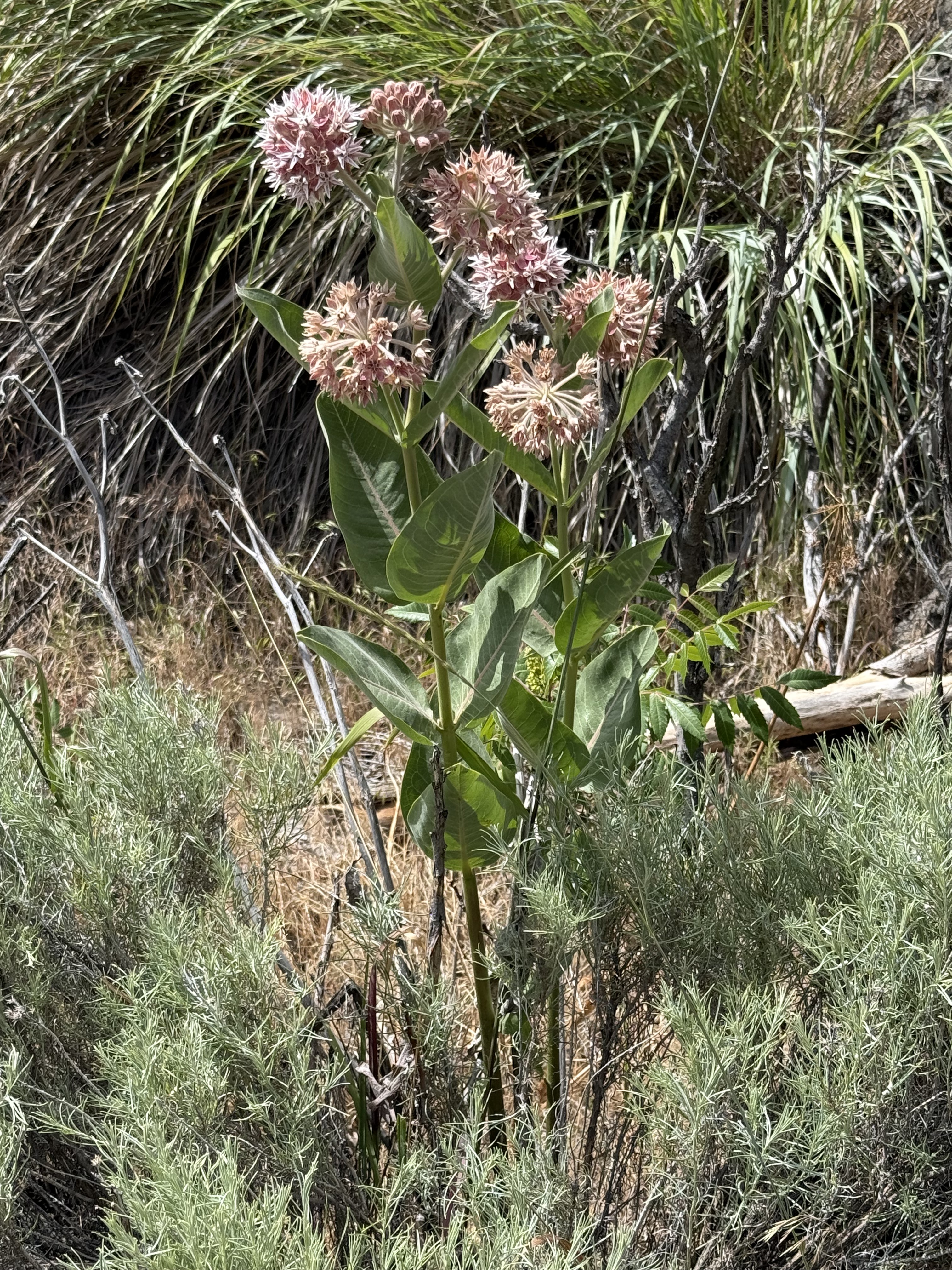
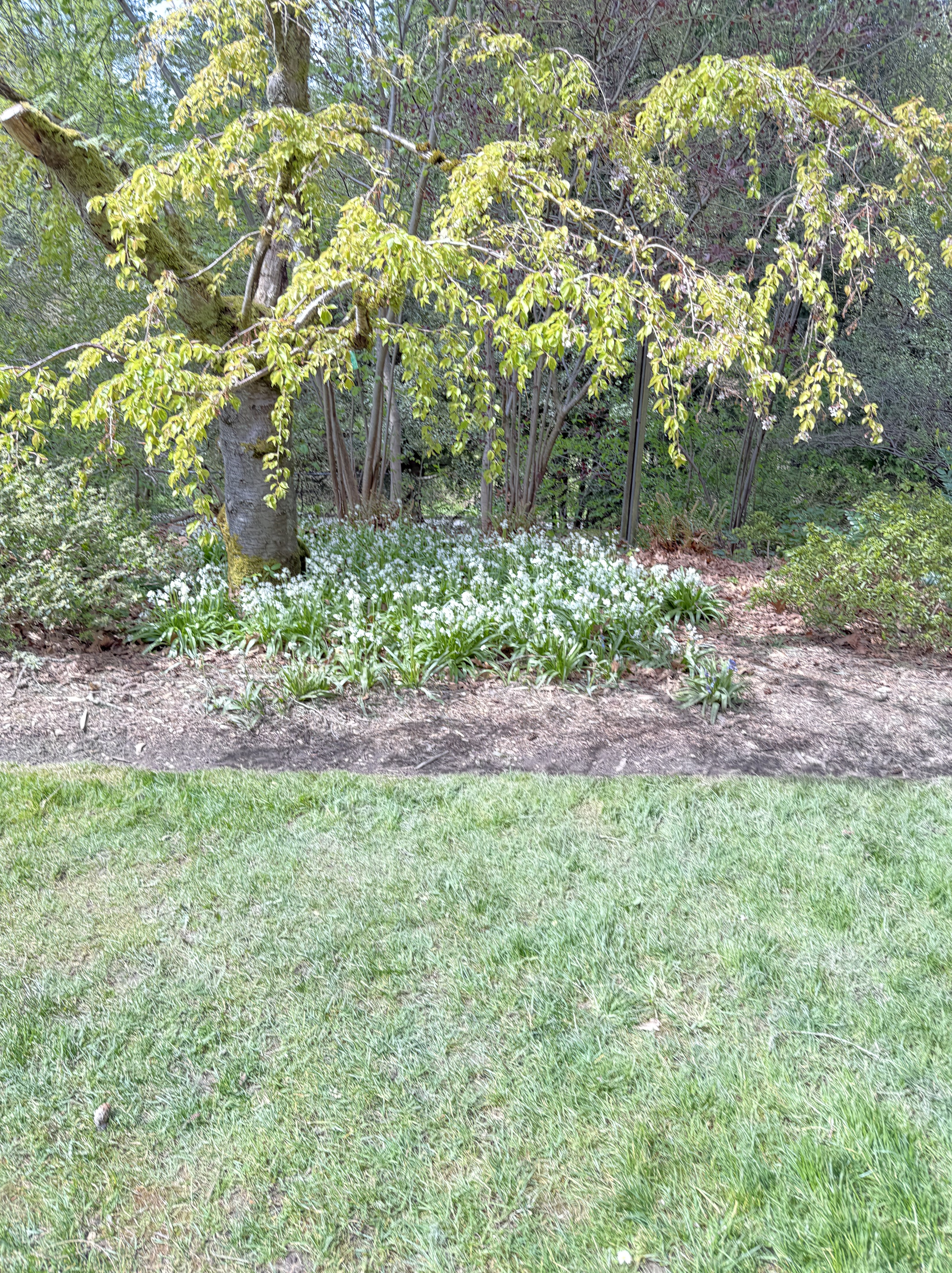
This is Asclepias speciosa, also known as showy milkweed. It is native to Yakima county and is a host species for Monarch butterflies.
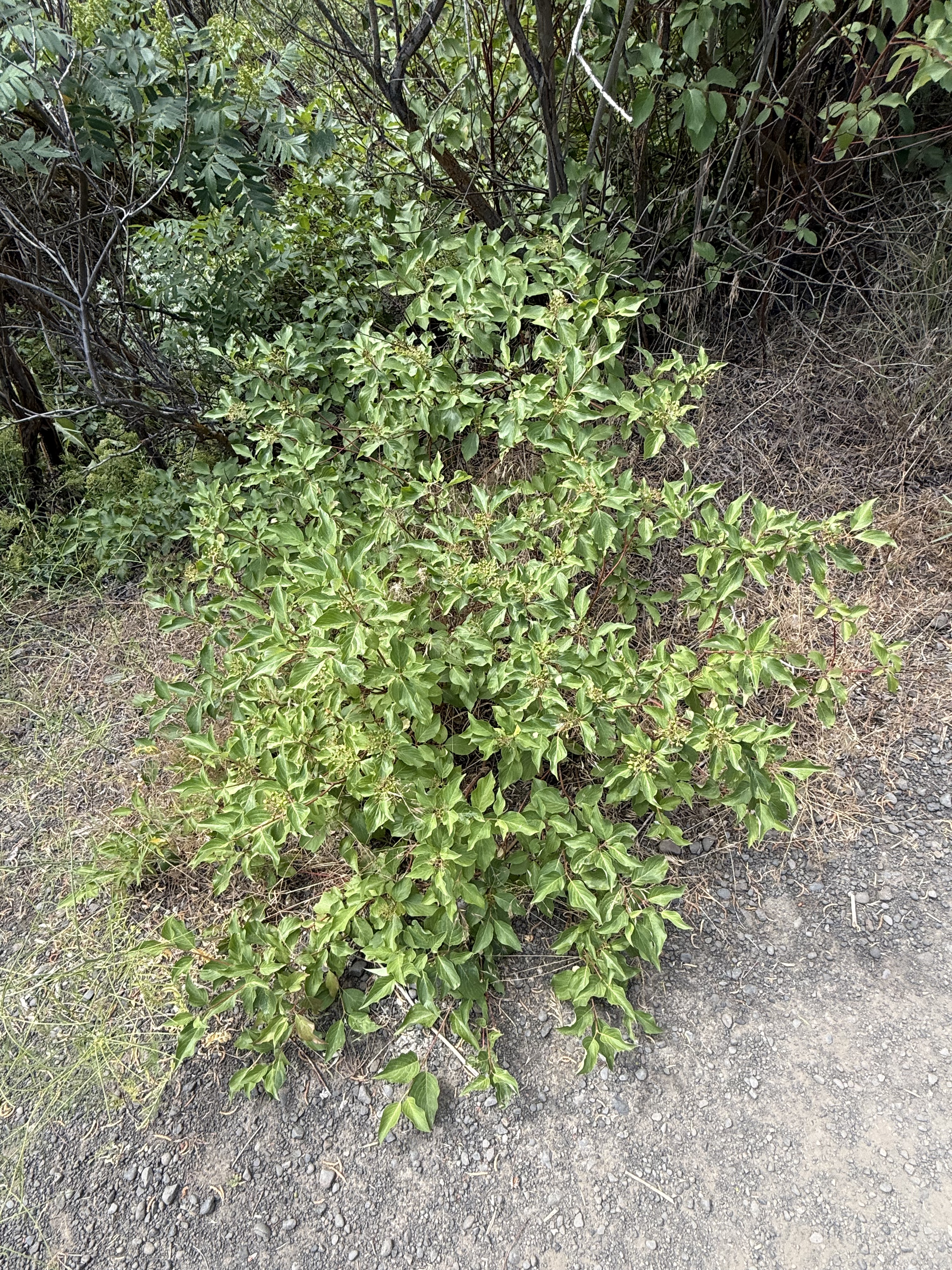
The leafy shrub with dark leaves is snowberry–Symphoricarpos albus (or possibly S. oreophilus, which also occurs around Yakima).
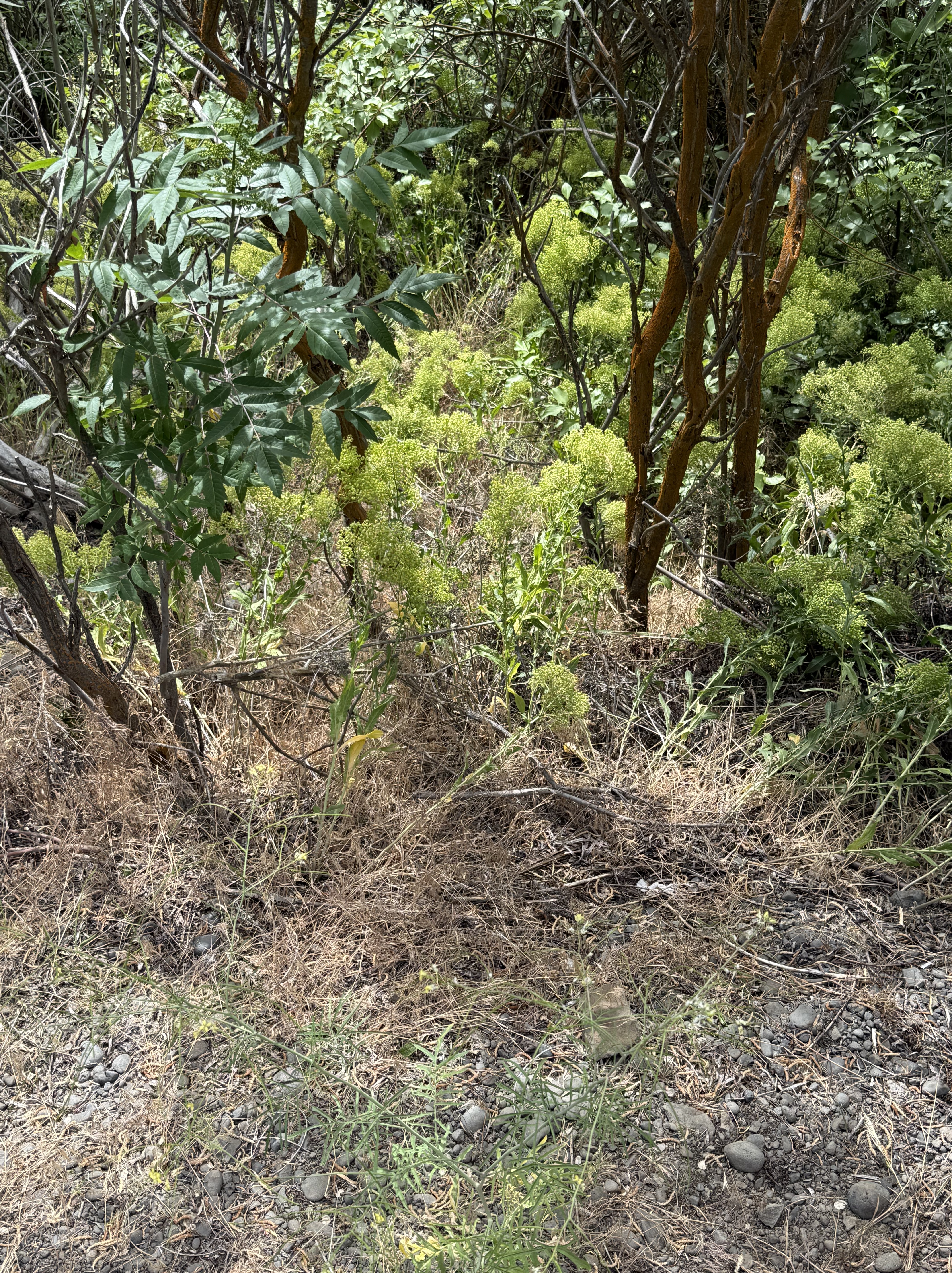
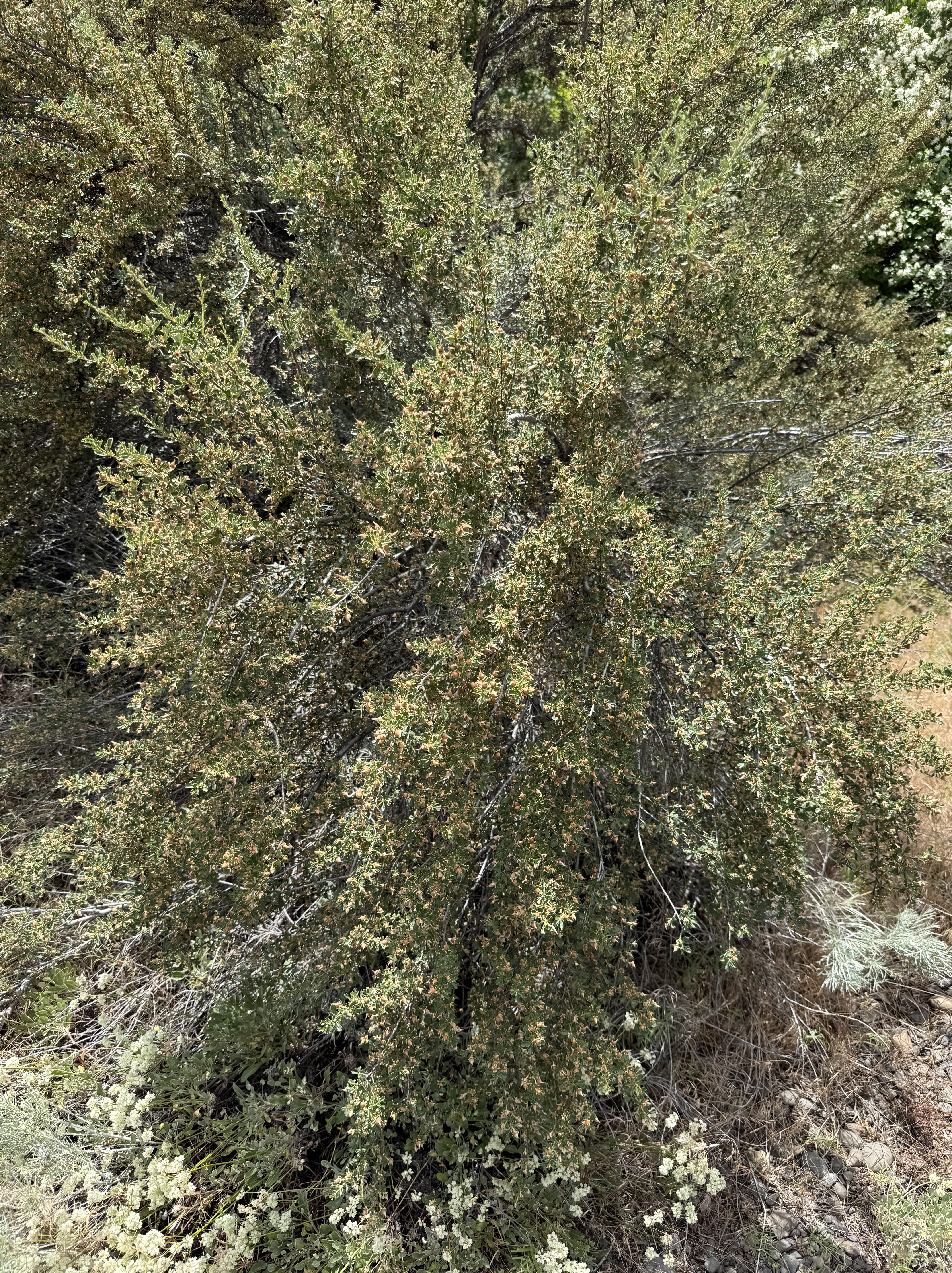
The low, brightly colored shrub with straight stalks is probably wax currant (Ribes cereum). The bright green is small leaves and the small patches of pink–barely visible in the photo–are the flowers. These are both native plants.
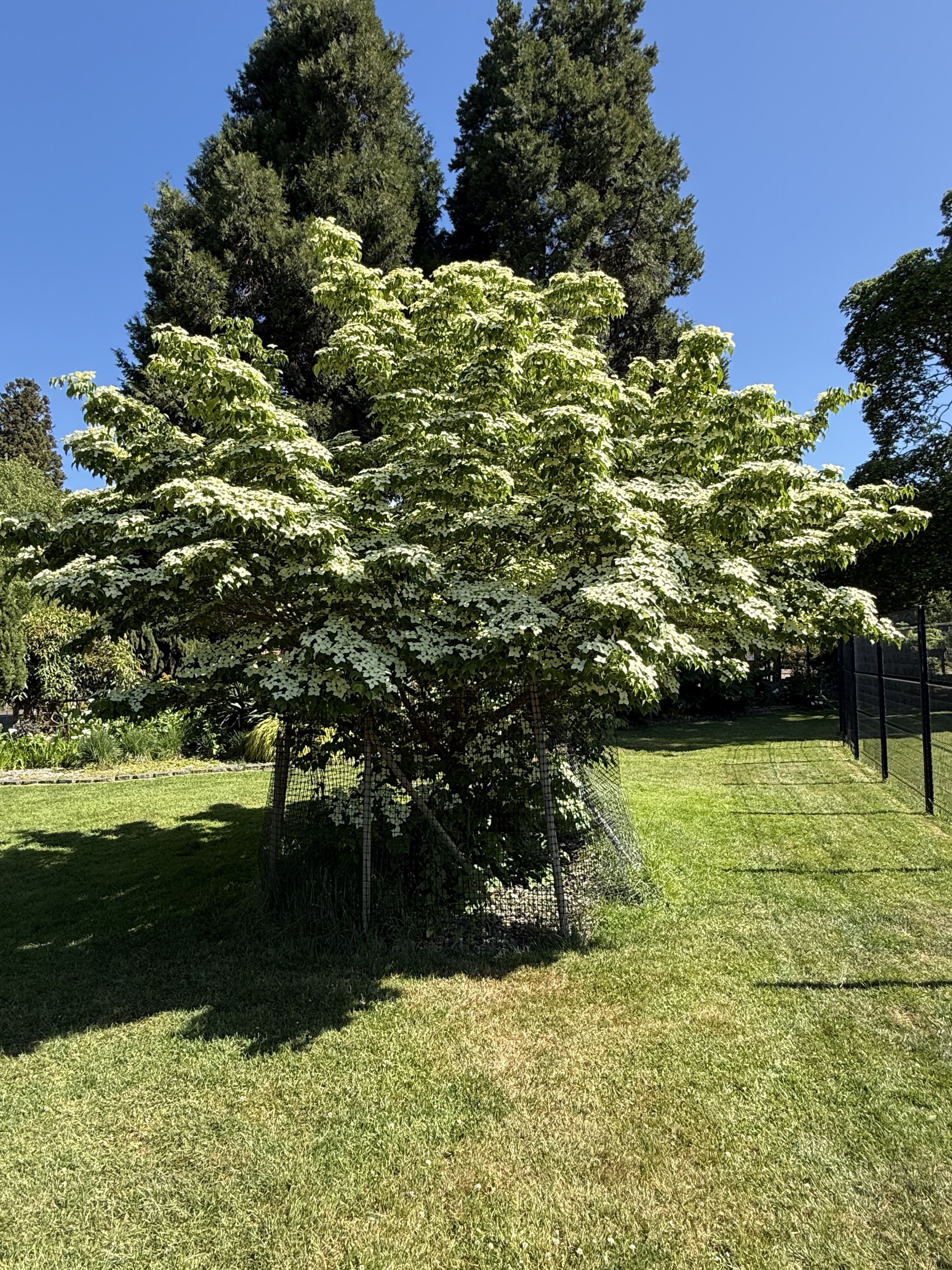
CoPilot wasn’t so sure about this, but it might be Creek or Red-osier Dogwood (Cornus sericea). This specimen was growing in the bottom of the canyon, not far from Cowiche Creek, which is a natural location for this native riparian species. It will probably become a small tree.
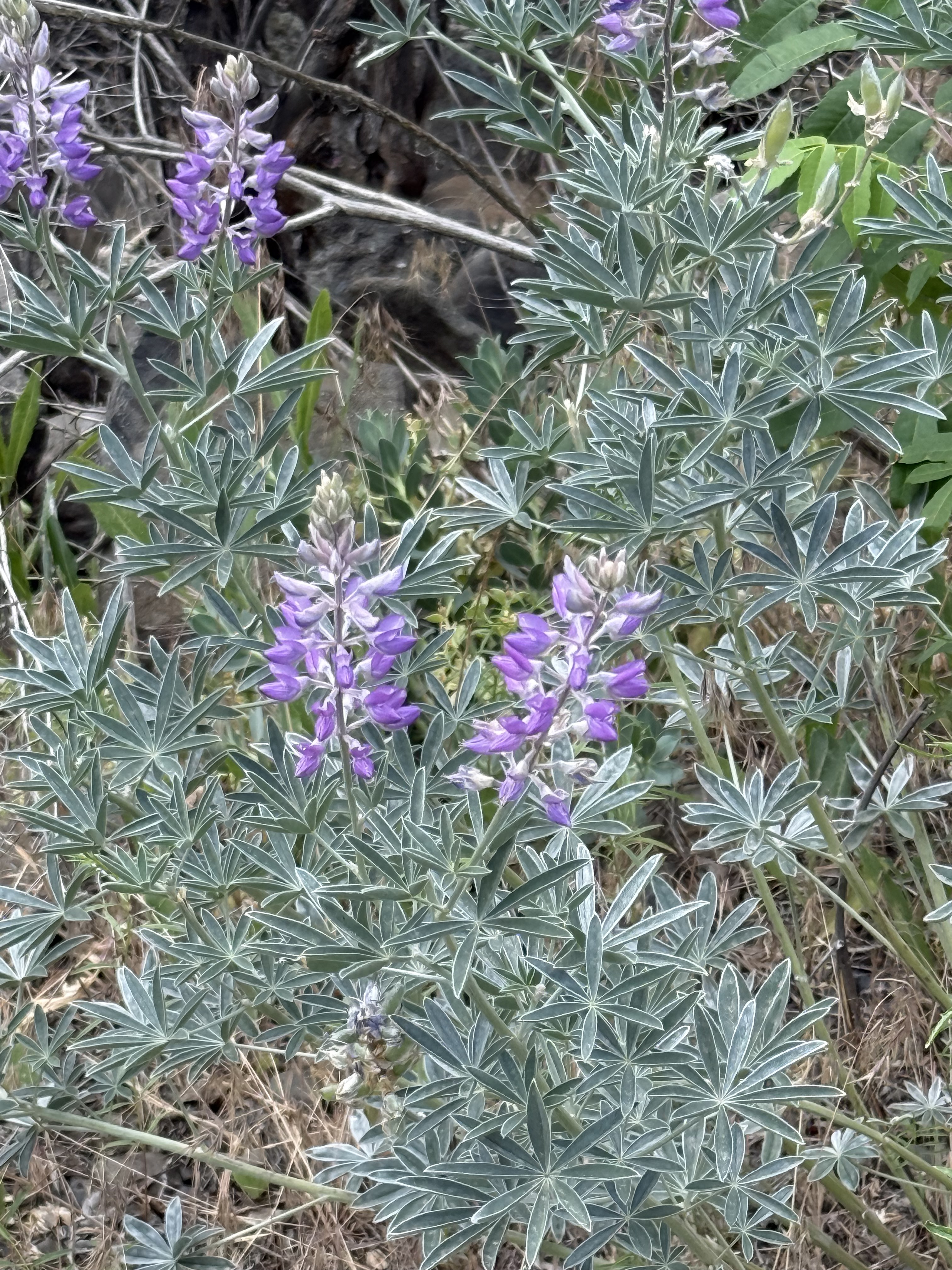
This is my favorite from the walk. Silky lupine (Lupinus sericeus) is one of the signature wildflowers of eastern Washington. I sure am glad we caught them in bloom.
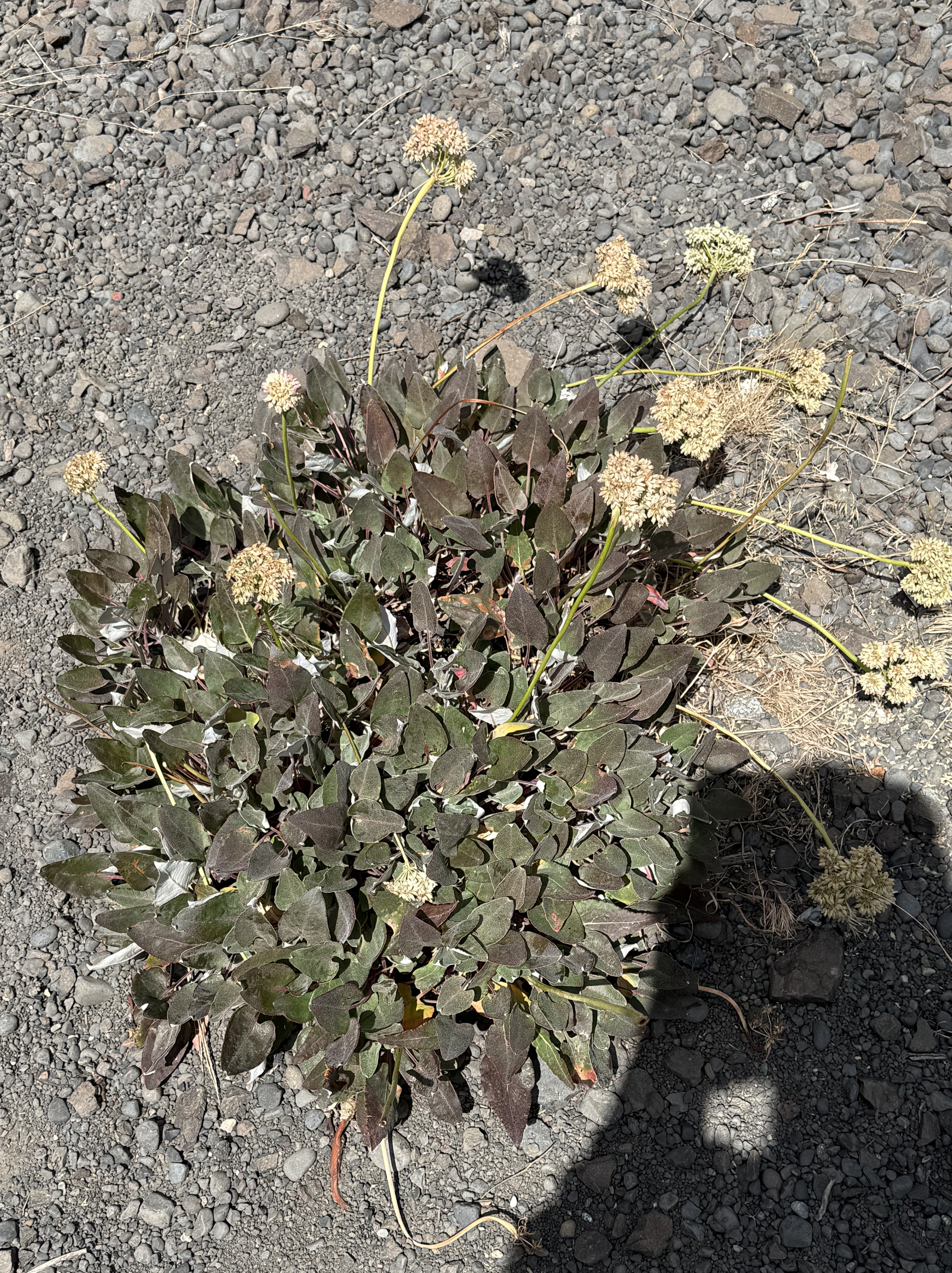
This looks like Pale‑stem buckwheat (Eriogonum heracleoides), another native wildflower to the shrub-steppe habitat.
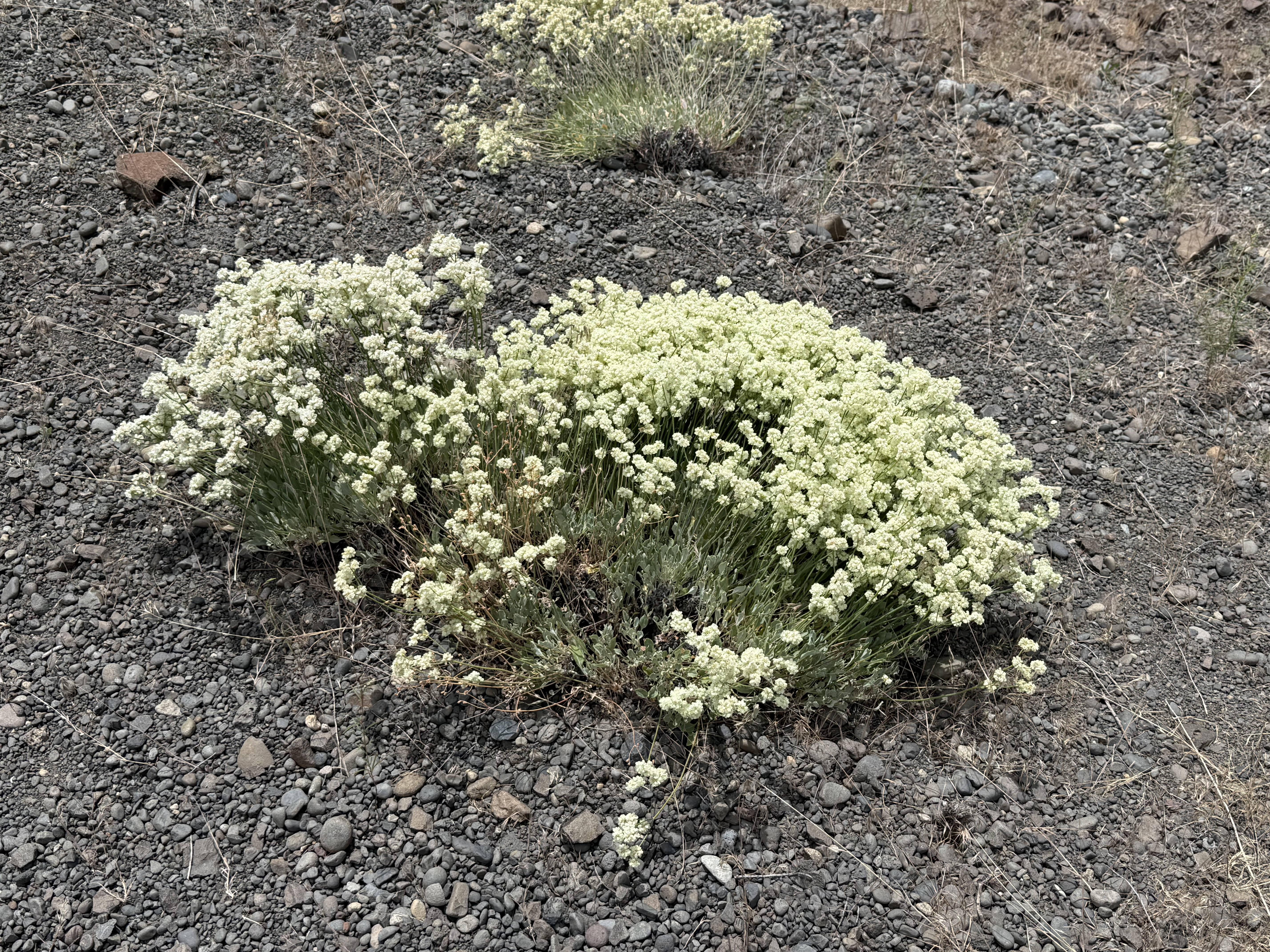
My untrained eye thought this was Pale-stem buckwheat, but CoPilot pointed out the different leaf pattern and color. This is (probably) Sulphur Buckwheat (Eriogonum umbellatum), another common wildflower to Yakima County’s uplands.
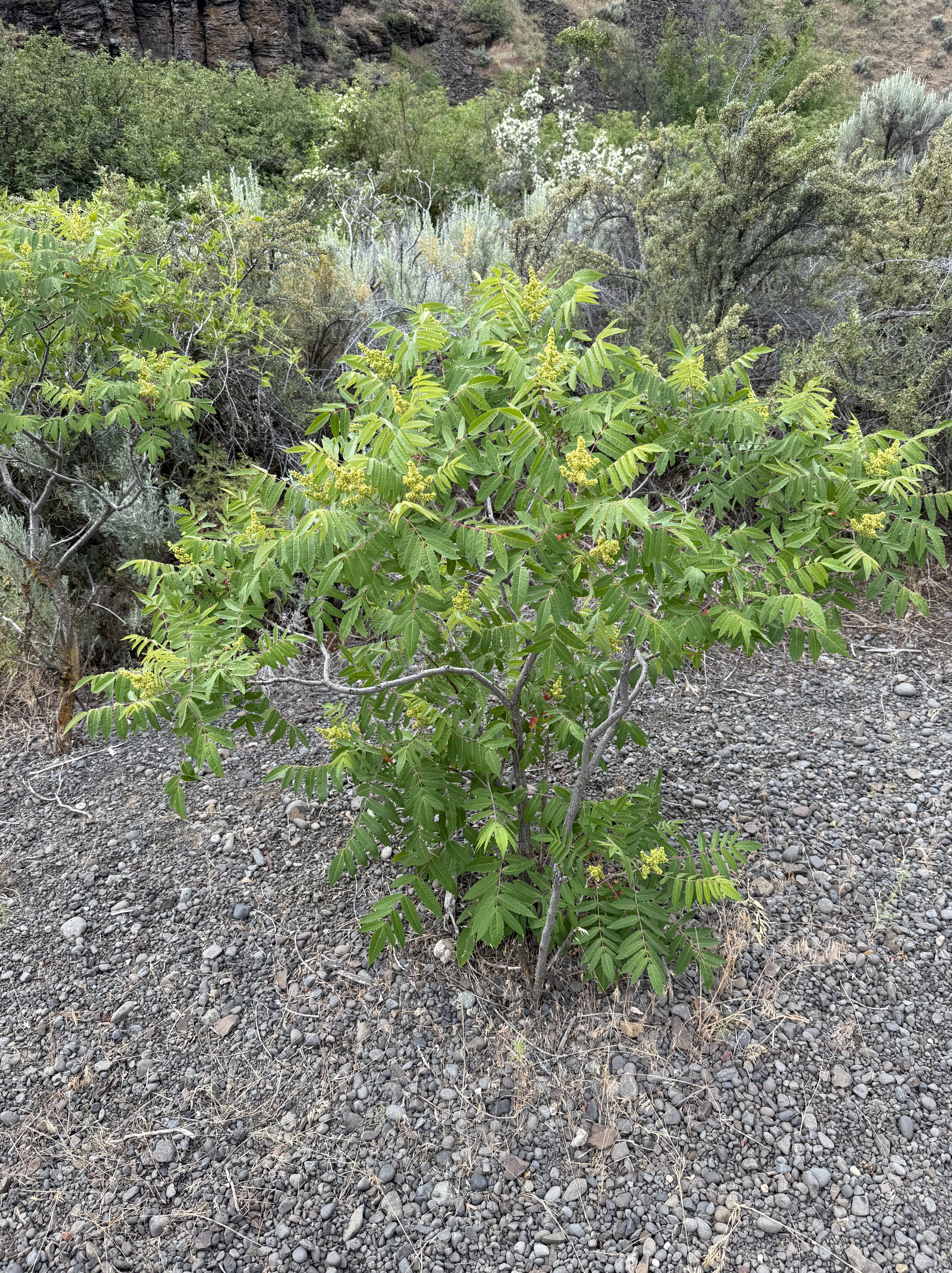
Antelope bitterbrush (Purshia tridentata) is a foundation species of the steppe. This young one had lots of flowers, but the old ones have bare branches; and groups of them grow and die together in cohorts after a disturbance like a wildfire. Yet another native plant.
After some discussion, and sharing a close-up, CoPilot swears (hahaha) this is Woods’ rose (Rosa woodsii). However, its justification fits what I see with my own, somewhat confused eyes.
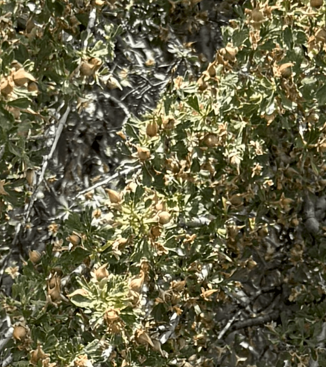
Here’s a close-up of the fruit. The shrub is covered with small nuts that have a distinctive shape, and are definitive for a wild rose. This is another native species to the steppe habitat of Eastern Washington.
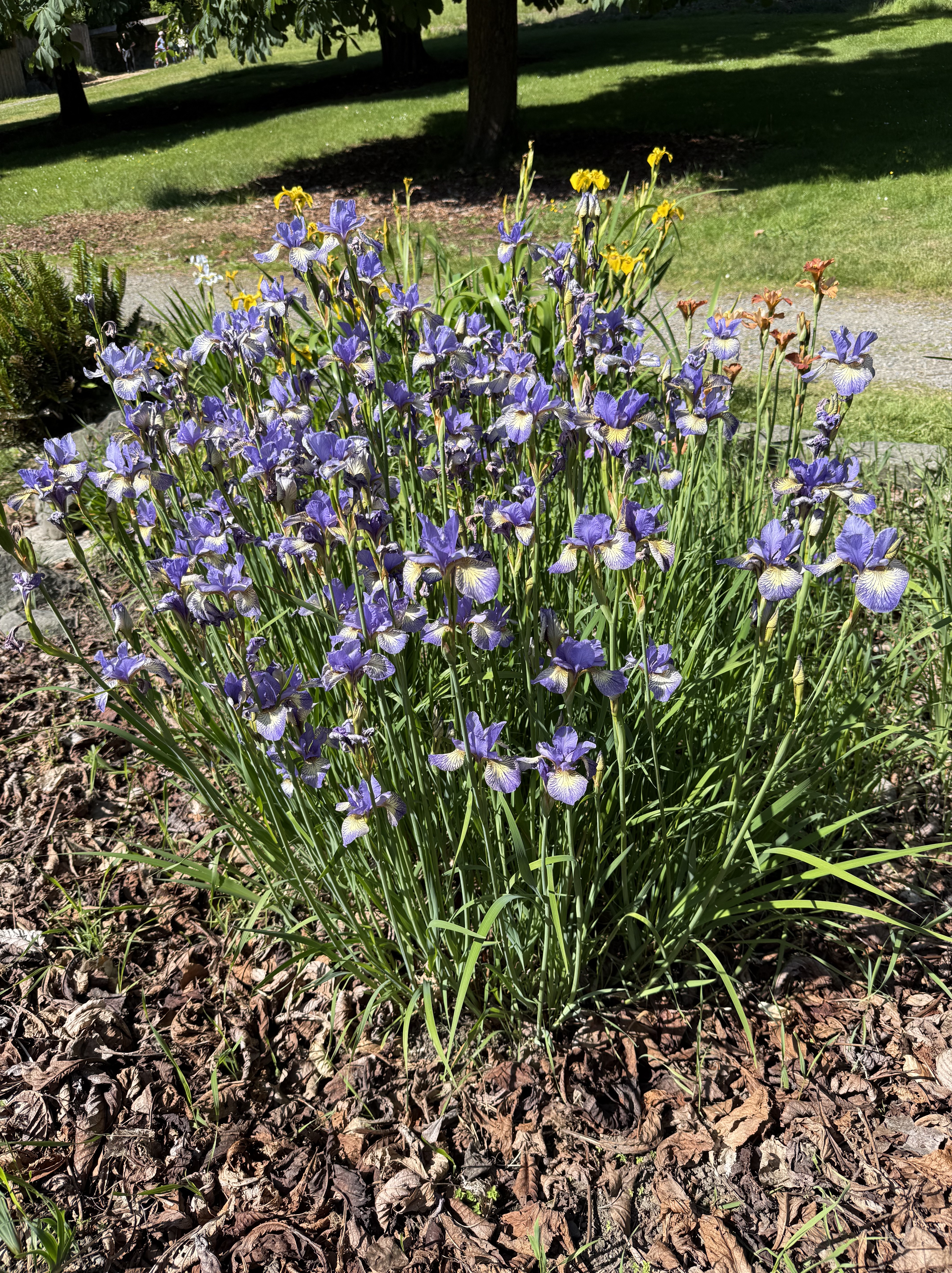
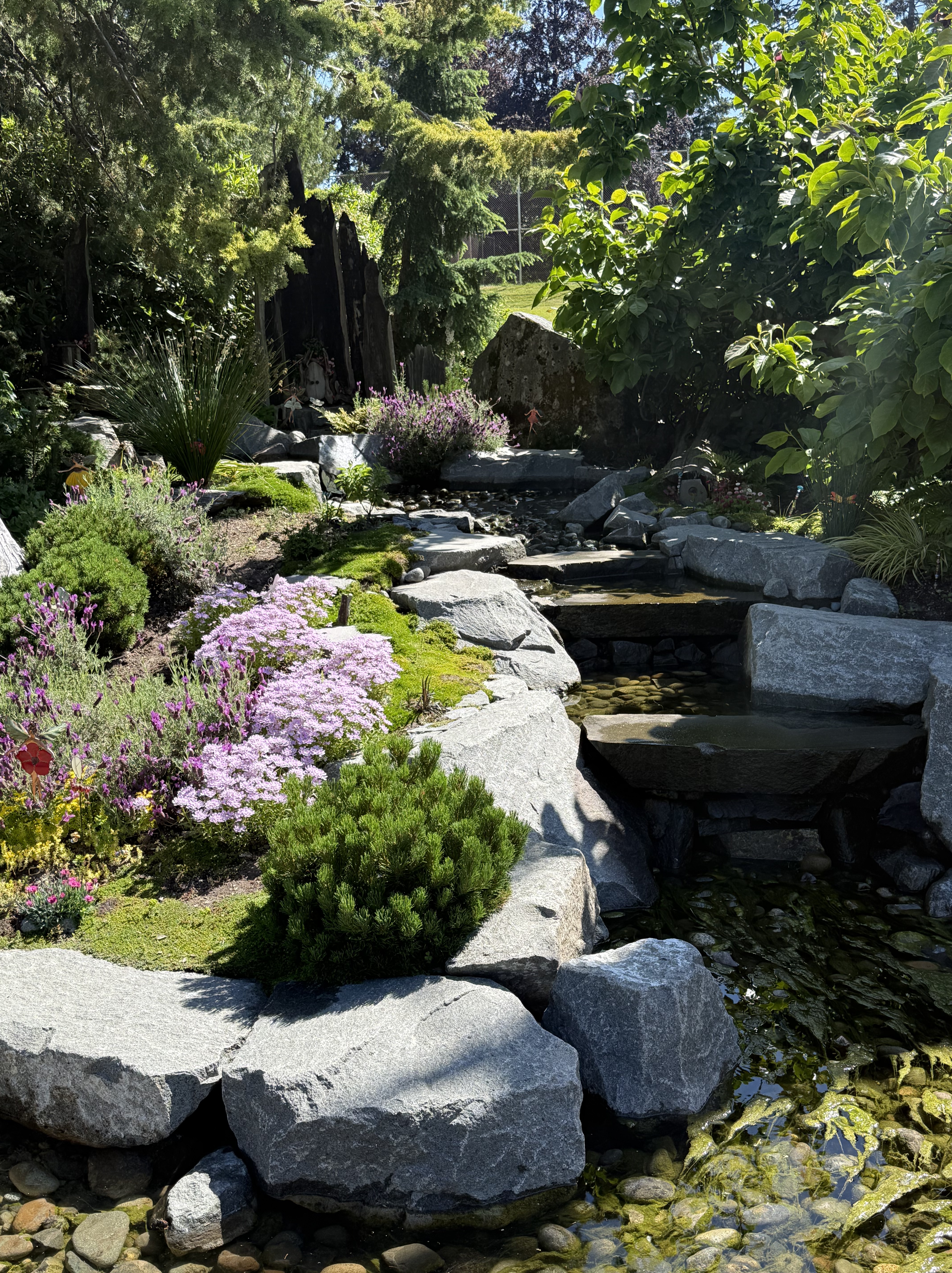
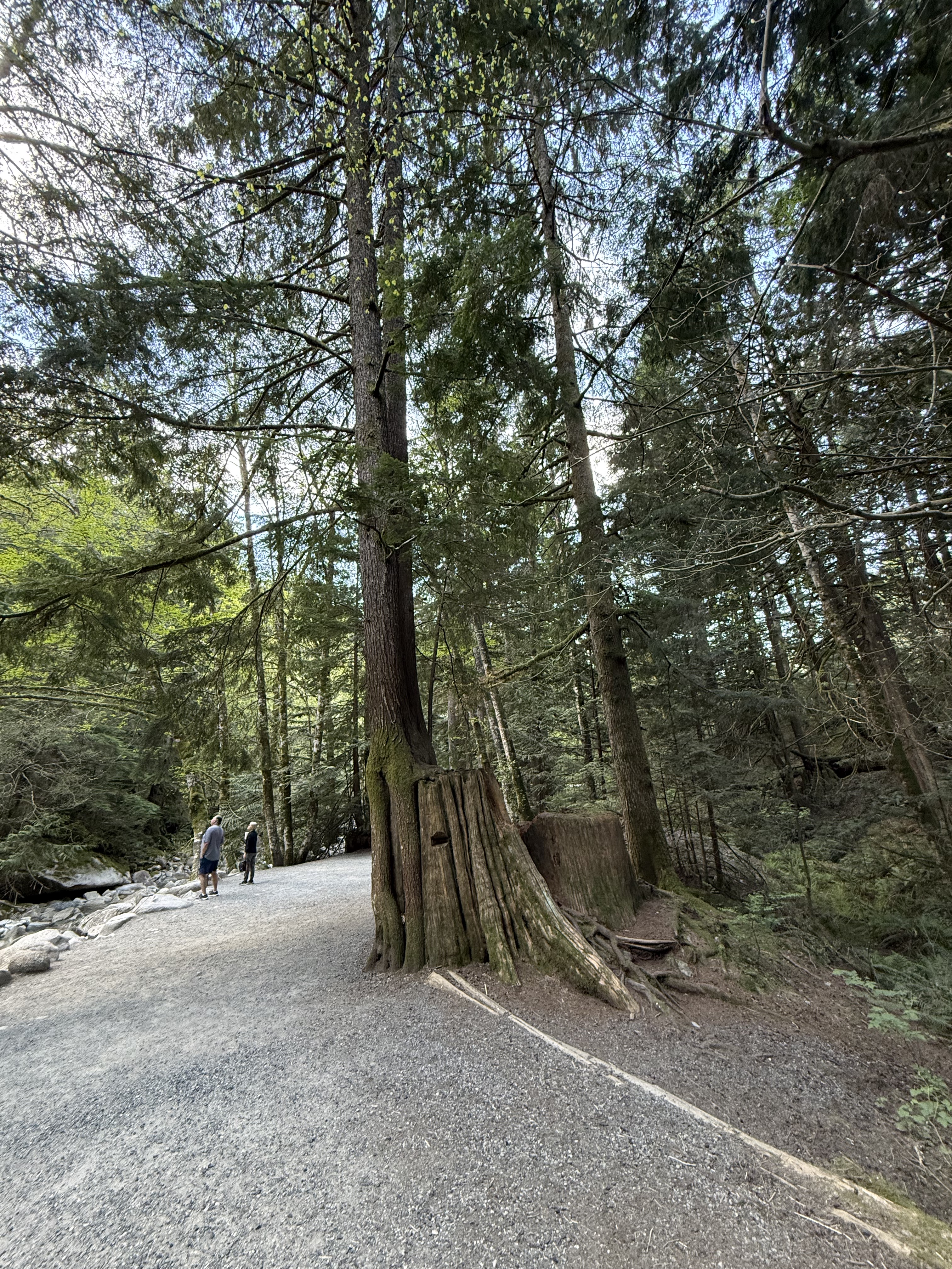
This photo, looking across Cowiche Creek, puts it all together for me. On the other side of the canyon we see columnar jointed basalt, several plant species similar to snowberry, bitterbrush, and buckwheat. Along the creek are dogwood and wild rose; and in the foreground is (maybe) big sagebrush (Artemisia tridentata).
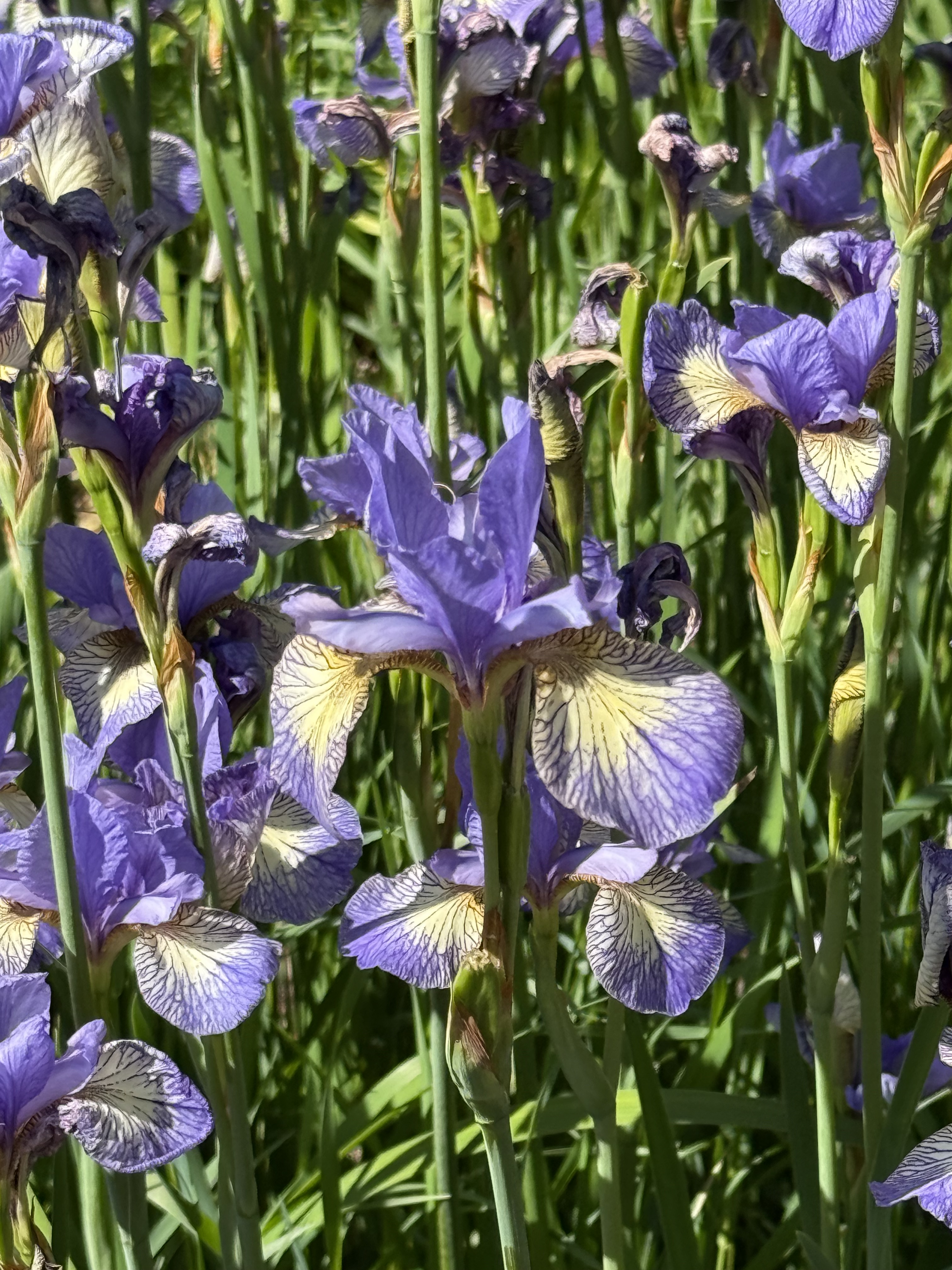
When I took this picture, all I saw was a bunch of plants. After carefully examining them with CoPilot, it has become a mixed riparian-shrub-steppe habitat. However, I didn’t see/hear any birds or other animals, even though it was a cool day with temperatures in the mid-sixties.
CoPilot was a great help, but it is not infallible–more like working with someone who has studied some biology/ecology. After all, it is only a Large Language Model, not an AI system trained on recognizing plant species. Nevertheless, it was a great collaborator and I learned a lot from our collaboration.
Volcanic Rocks at Cowiche Canyon
Introduction

Burlington-Northern Railroad built a line through Cowiche Canyon in 1913 to transport apples, but it was abandoned in 1984 and the land was acquired by the Cowiche Canyon Conservancy for a non-motorized vehicle trail system. The main trail extends 2.9 miles along the South Fork Cowiche Creek, crossing the 11 bridges constructed for the railroad line.
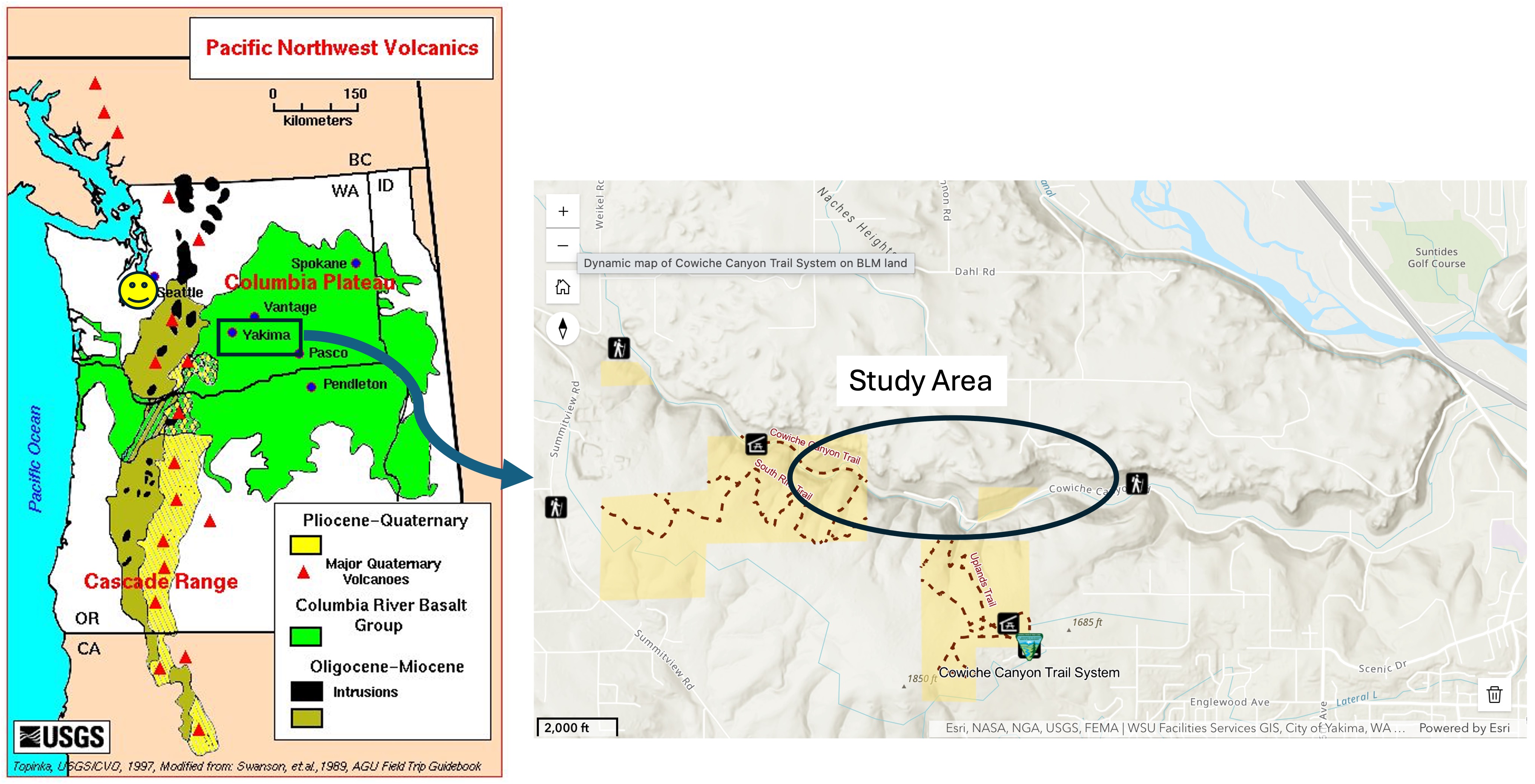
The left panel shows the distribution of Columbia River flood basalts, deposited between 16 and 6 Ma. Yakima and Cowiche Canyon are outlined by a rectangle. These volcanic rocks were erupted in overlapping flows with erosion and landslides occurring between individual layers, which are irregular and not shown in this map. The ages from the USGS national geologic map are Tertiary (66-2.6 Ma). Tacoma is marked by a smiley face.
The right panel shows the Cowiche Canyon trail system and the specific area discussed in this post. The stream itself hosts a riparian habitat whereas the uplands comprise a shrub-steppe environment.
Observations
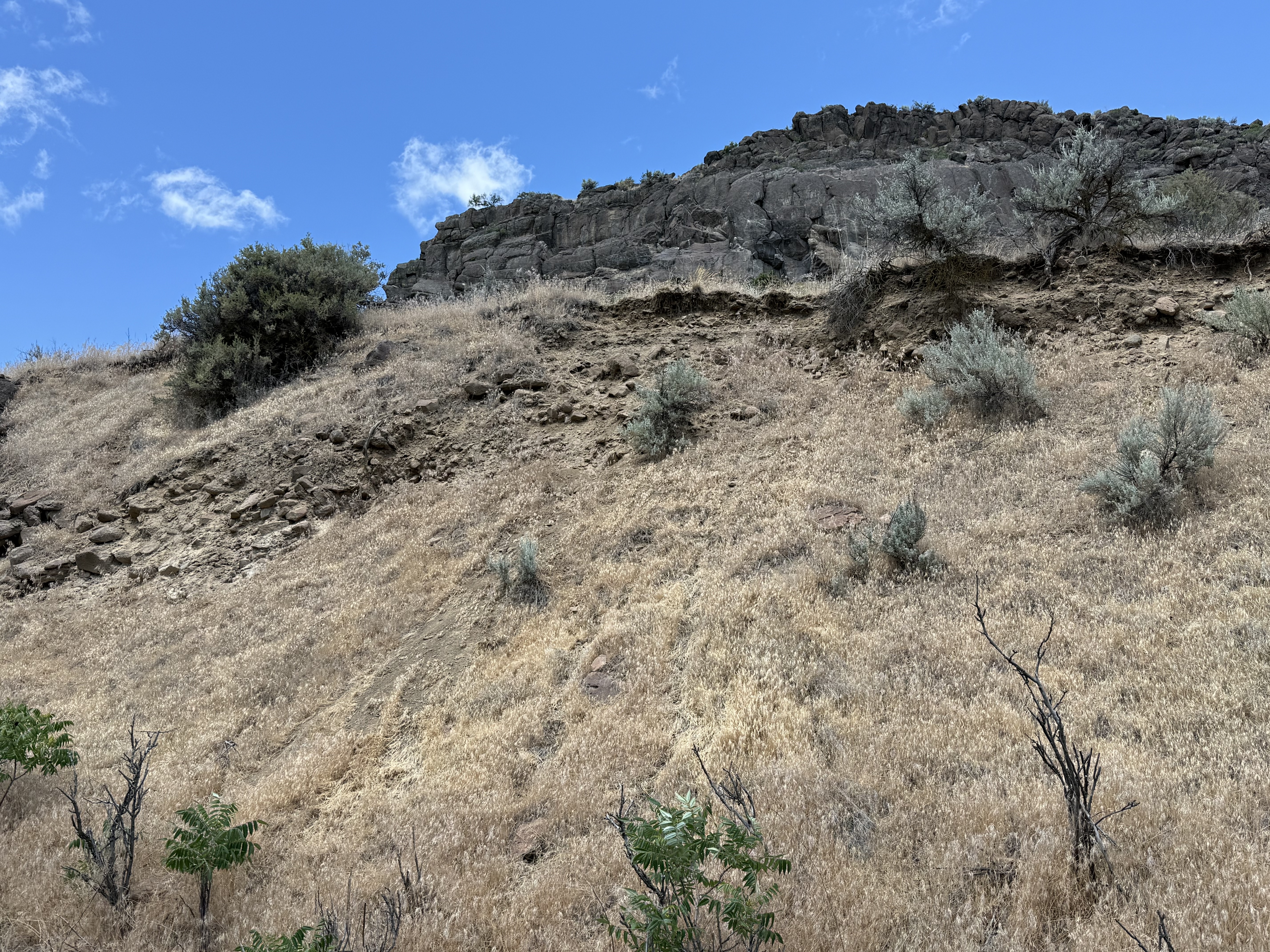
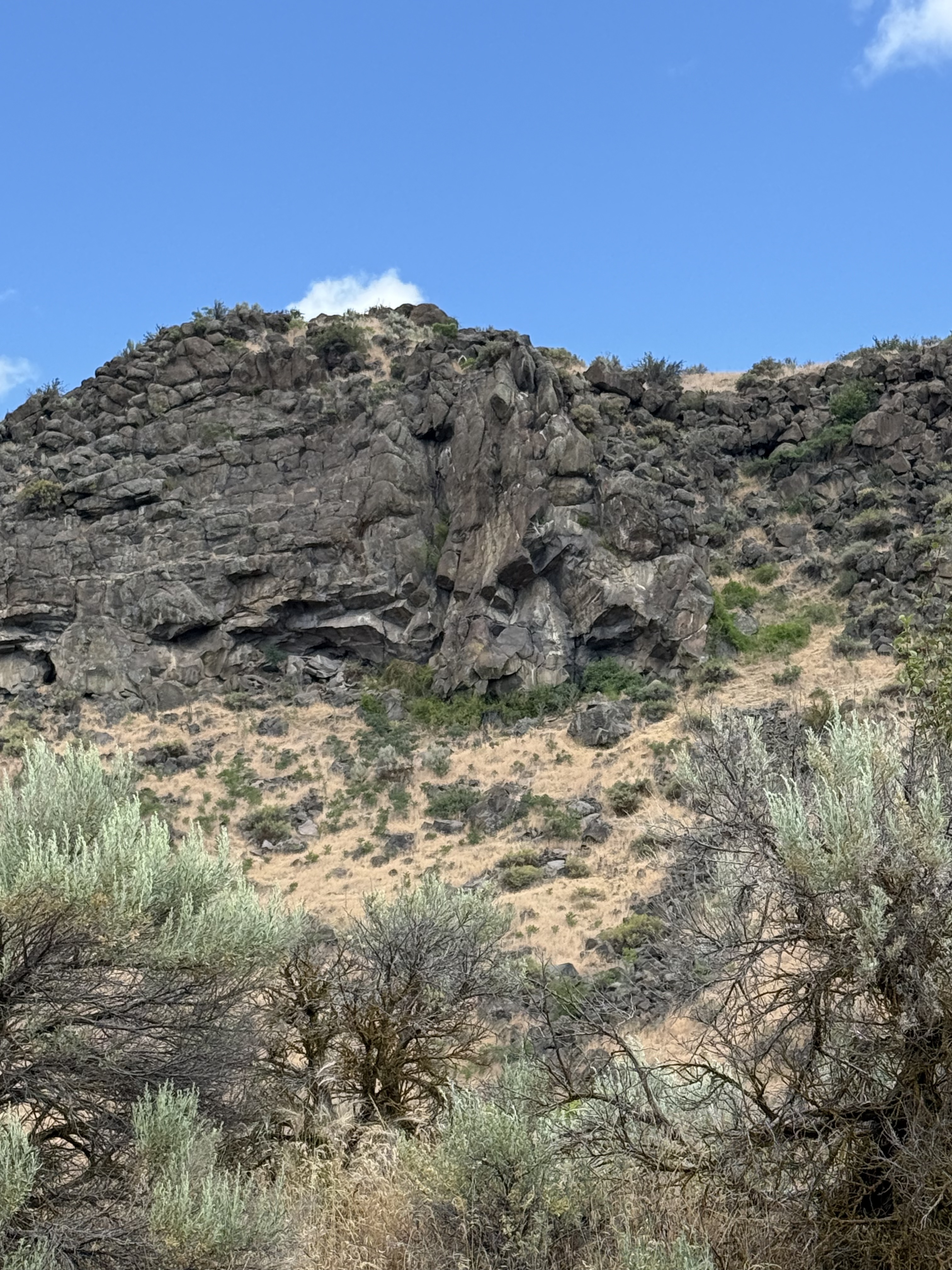
The canyon walls consist of a series of ledges like this with eroded slopes between them. The ledges are erosional margins of basalt flows and the slopes consist of talus and fine sediments weathered from the mafic rocks.
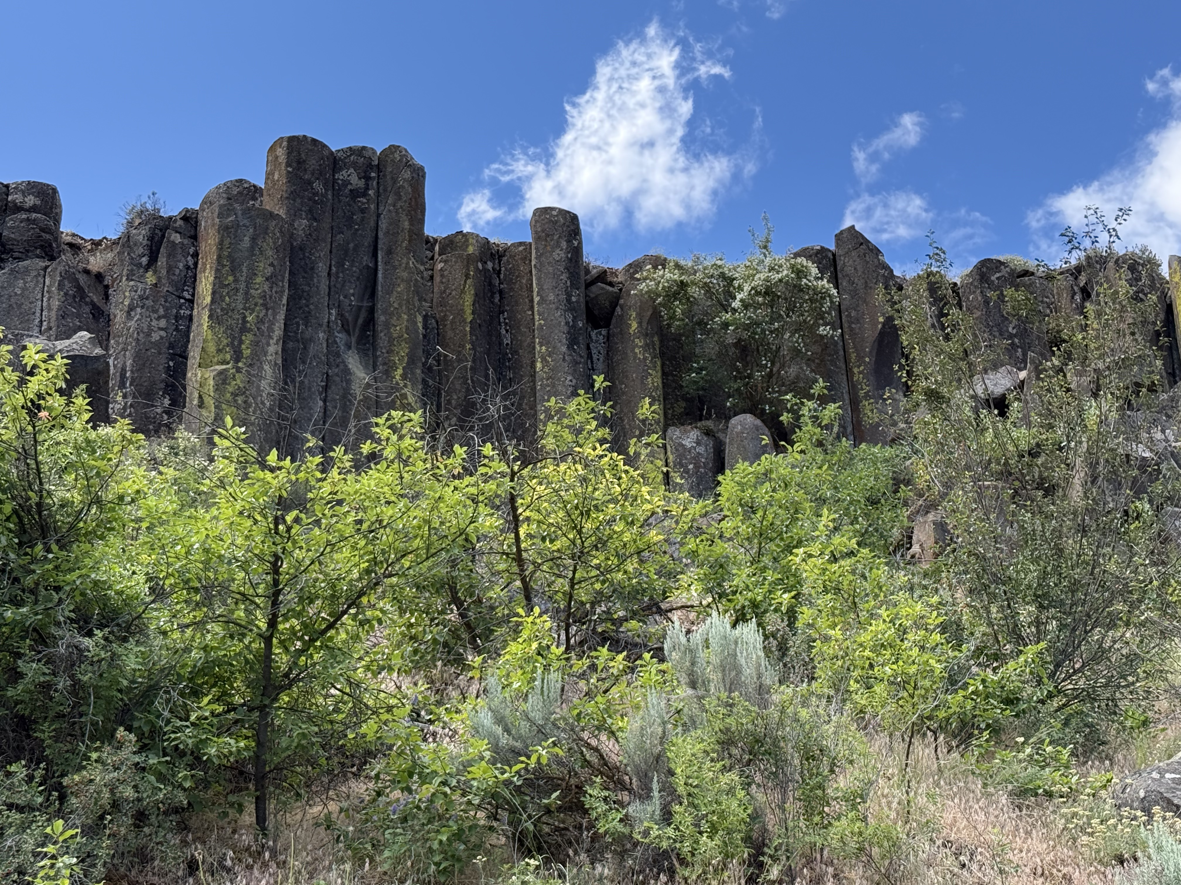
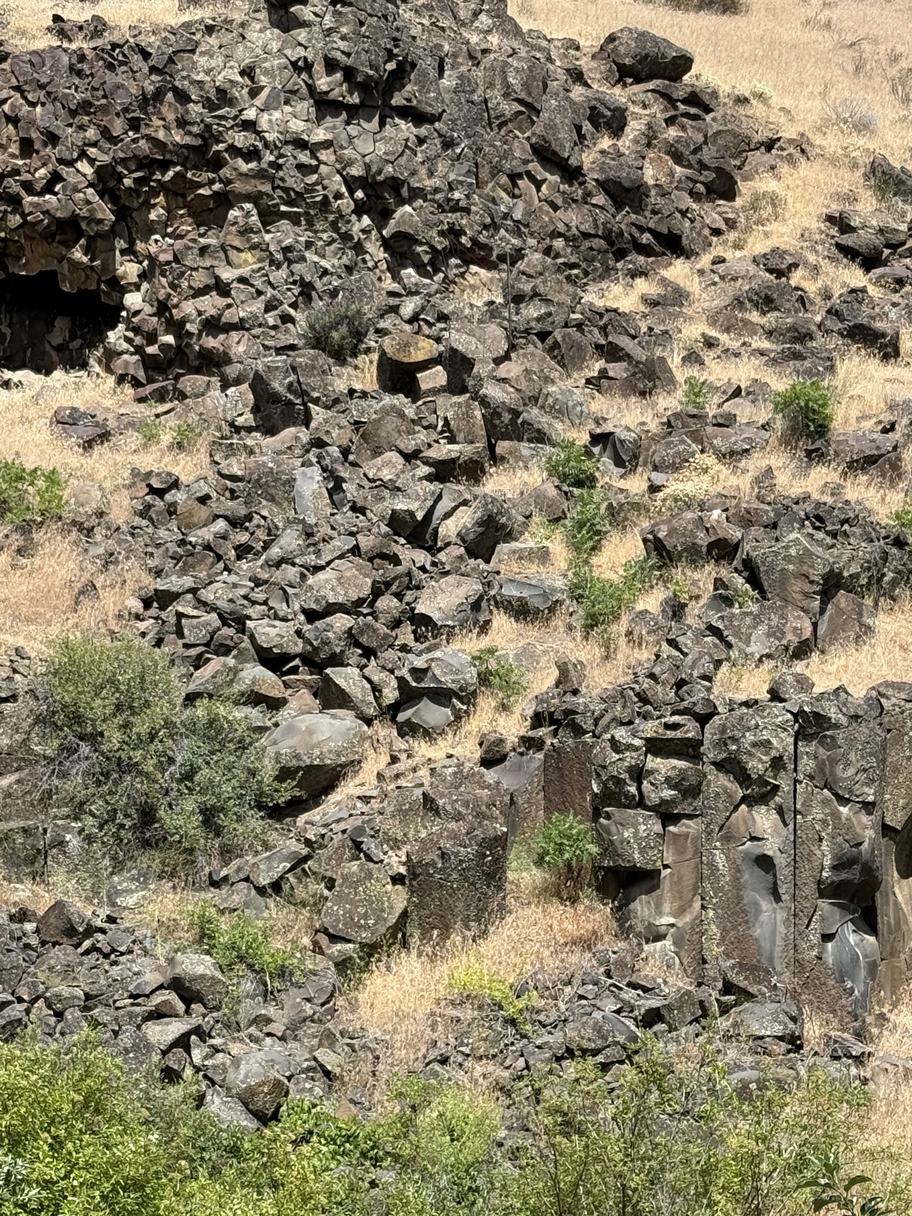
As we traveled west up the canyon, columnar-jointed basalt began to appear in the ledges overlooking the trail. Several pieces had rolled down the slope into the stream bed; these were about three-feet in diameter. Columnar jointing results from slow cooling of a uniform basalt flow, which causes joints to form hexagonal blocks like these because of thermo-mechanical failure during a decrease in volume.
These semi-circular blocks got my attention because, if you look closely, they appear to be eroded hexagons I estimate to be more than six feet in diameter. These are very large basalt columns that have either toppled or…
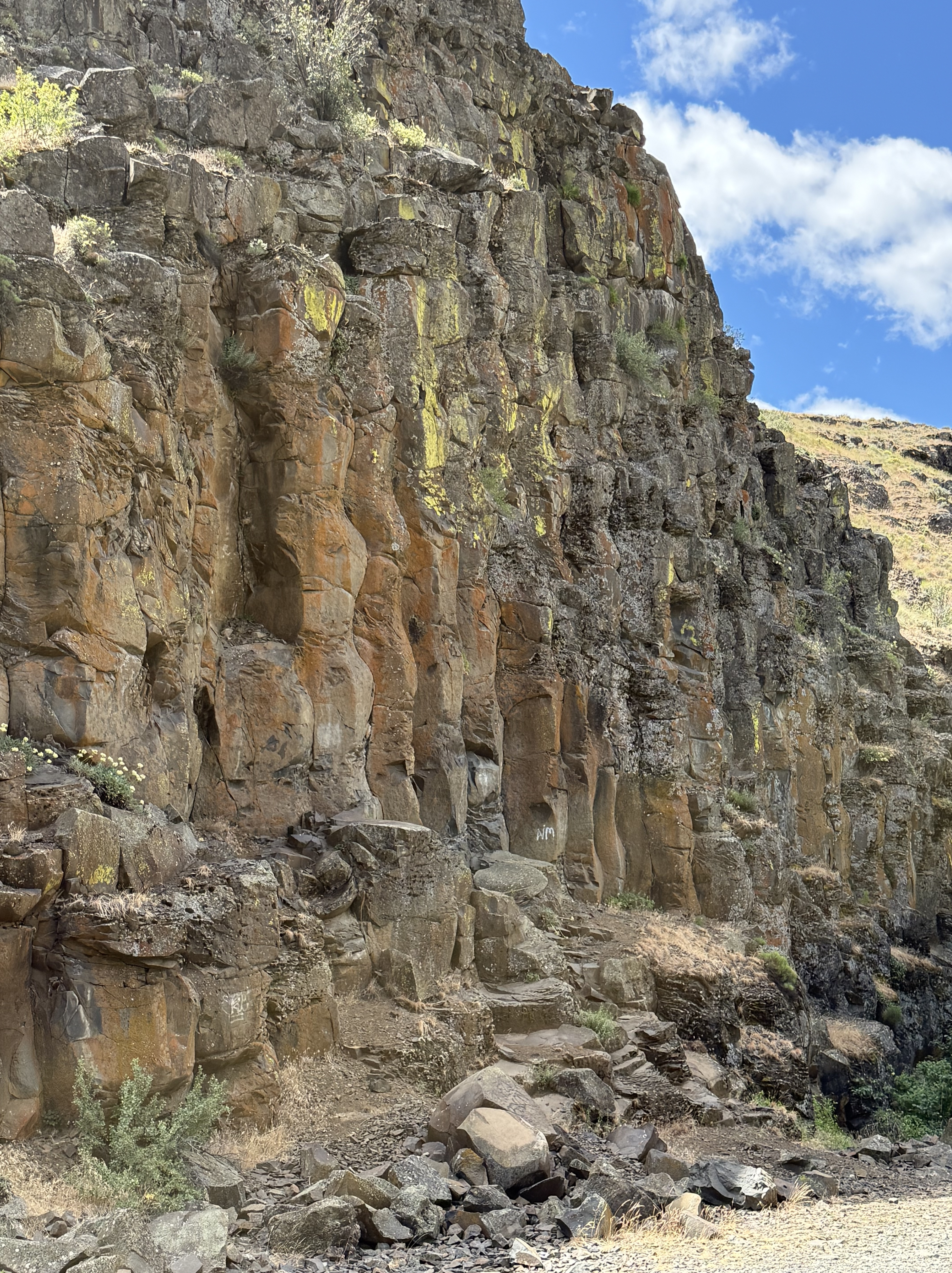
The top of this photo shows a birds-eye view of columnar basalt blocks because of their horizontal position. The size varies from smallest on the left to the largest blocks on the right. I reported on similar, horizontal columnar joints in a previous post and proposed that the lava flowed down a slope before solidifying.
The lower-right part reveals columnar basalt in a vertical position. This juxtaposition suggests (if my model is correct) that the lava from multiple flows covered an irregular landscape–sometimes flowing into canyons like Cowiche Canyon, and somtimes over fairly level ground.
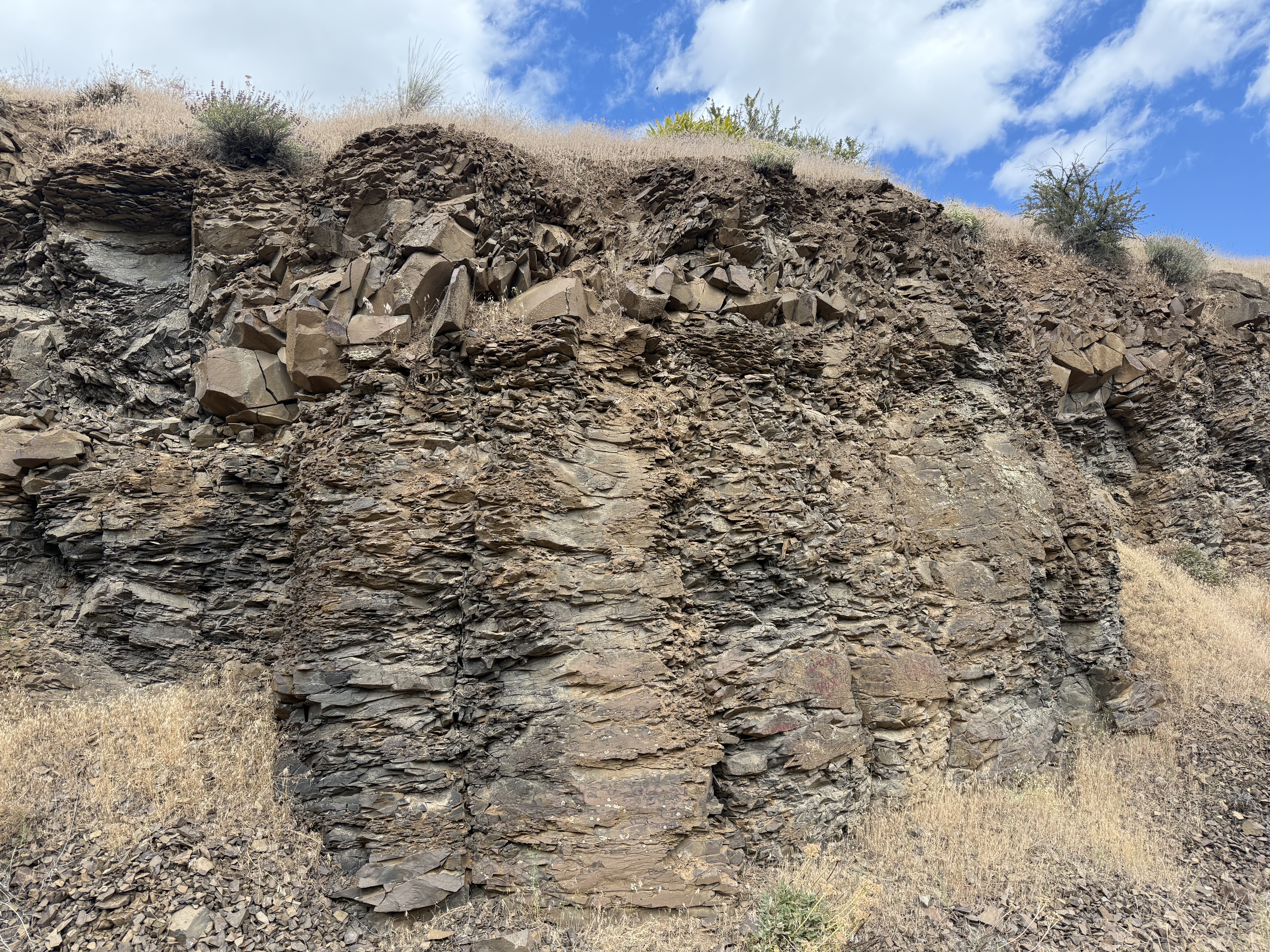
This remarkable set of columnar joints got my attention because of their undulating form. I’ve never seen anything like this before. This style of jointing (supposedly) results from uneven cooling and weathering; for example, a heavy load on the layer during cooling leads to pinching and swelling at fairly uniform spacing. That sounds reasonable to me.
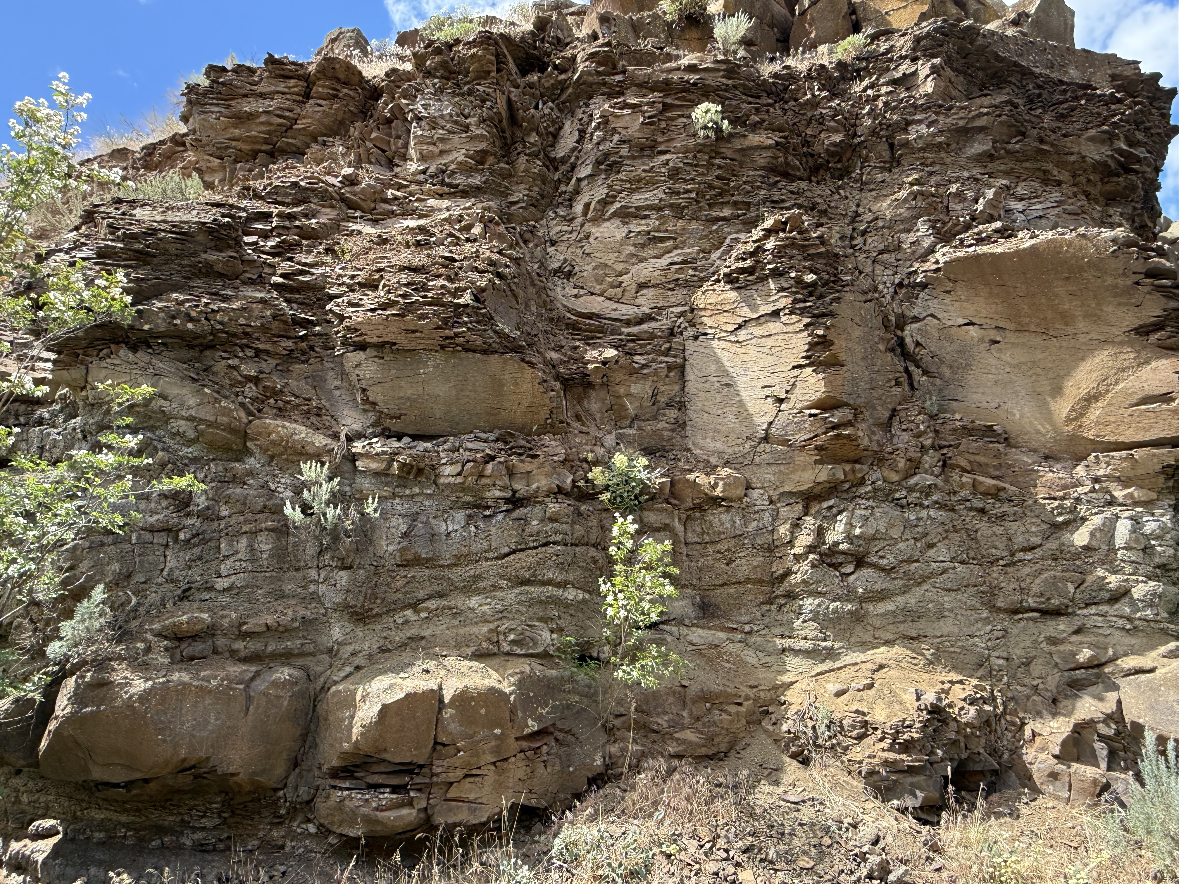
Another weathering feature of these rocks is the fissile structure revealed in this image. More solid blocks are interspersed with flaky layers, possibly (I’m speculating here) associated with necked and wider segments of an individual column. For example, the wider sections might undergo shear during stretching, resulting in microscopic shear layers within the minerals comprising the original lava. These weak layers would permit water to penetrate and weather the mafic minerals of which basalt is made.
These highly weathered columns are more than six-feet in height. They suggests an alternative mechanism, shear from flowing as the basalt cooled; this might disrupt the microscopic structure without interrupting the macroscopic jointing process. Maybe…
This photo really got my attention. It reveals horizontal columnar joints abutting vertical ones in the upper-center of the image. There’s a lot going on as hot lava flows over an irregular landscape, but I think this is a vent where more magma flowed out; not a large eruption, but enough to have a separate cooling history from the rock it penetrated. I should note that the Columbia River basalts flowed from fissures rather than point sources like volcanoes. The entire area shown in the map above was cut by fissures that led to a shallow magma chamber, which is still down there although it has probably solidified by now. Or not…
I like this picture because it reveals how much weathering can change the appearance of what was once molten lava in only a few million years. Note the layer of angular blocks sandwiched between weathered columns.
Conclusions
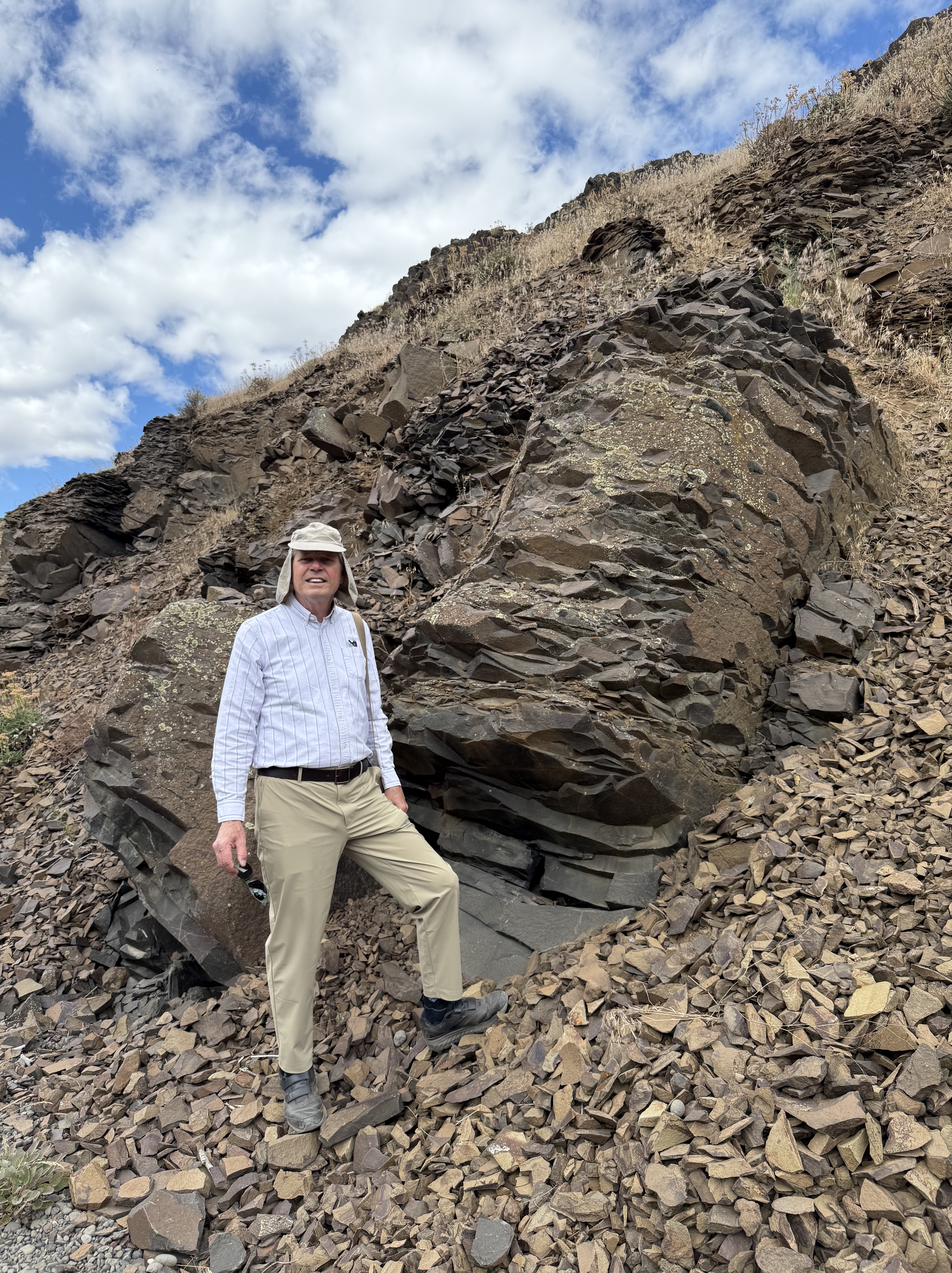
This is a typical basalt column that isn’t as weathered as some of the others. All those shards I’m standing on resulted from the breakdown of the rock by water seeping into its internal structure, where it altered the mafic minerals (e.g. pyroxene, plagioclase feldspar, biotite), which are susceptible to chemical weathering. This is where all the mud in the world comes from.
It was a great day to drive over the Cascades at Chinook Pass, where it snowed on us (in June), and explore the Columbia plateau. I’ve never seen so much variability in basalts before. The magma chamber underlying central Washington was a giant chemical reactor that released pressure by erupting a mix of fluids that cooled to form minerals and then these magnificent rocks. These rocks tell us how the magma chamber evolved over several million years; and once they were exposed to the atmosphere, they began to record the slow process of being reduced back to their basic constituents (fine-grained minerals like clay), which can remain suspended in water and begin their long and perilous journey to their final resting place–sometimes a lake but, ultimately, the ocean.
Everything eventually returns to the sea…
Point Defiance Rose Garden
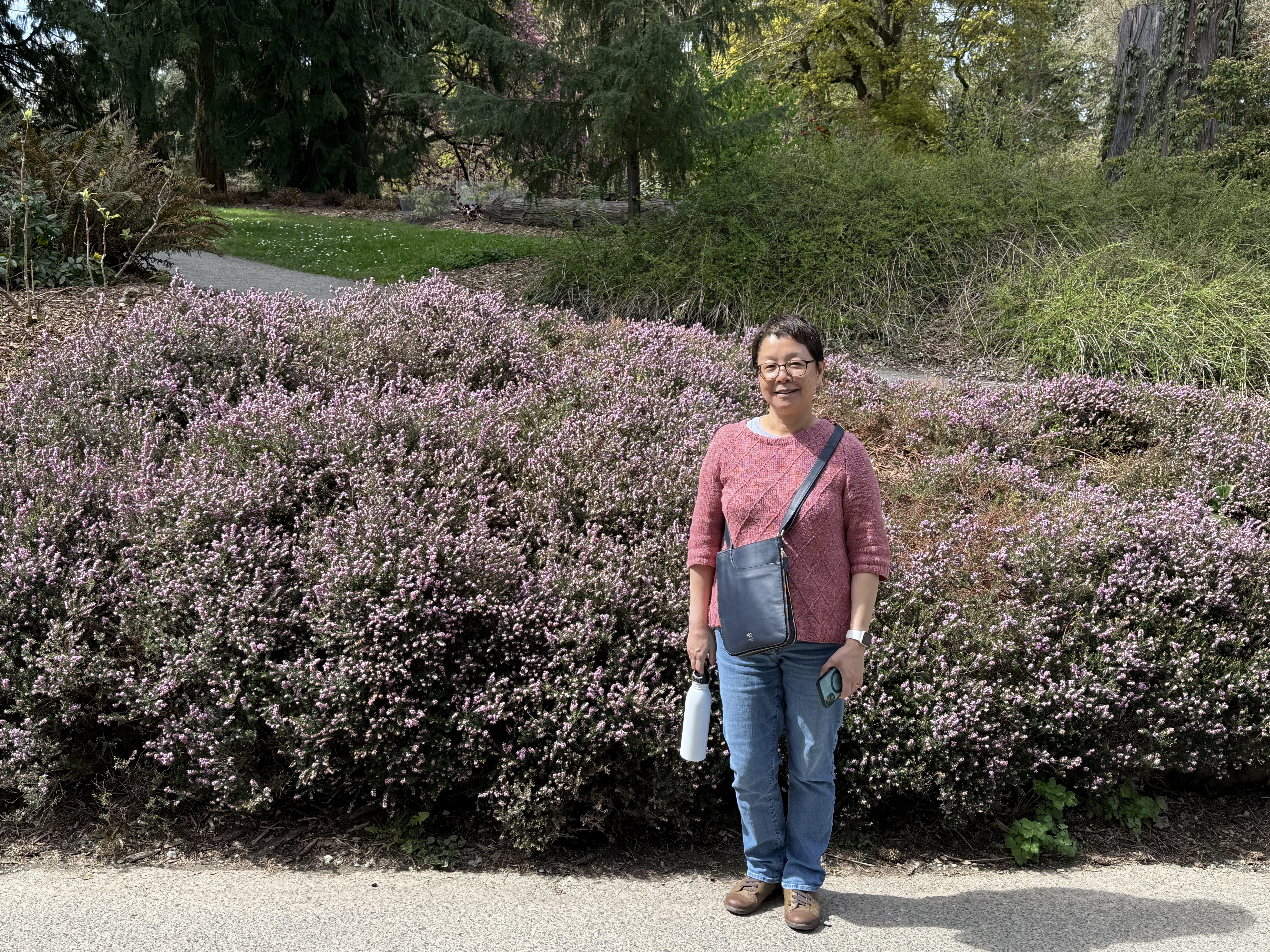
Spring is a great time to be outdoors in the Pacific Northwest, so we visited the rose garden at Point Defiance park, which is more than 130 years old. It had a full-time gardener until the 70s, who lived in a house on the grounds. I forgot to take a photo of it. Not very exciting, but I found myself drawn to the amazing colors and shapes of so many flowers in bloom at the same time.
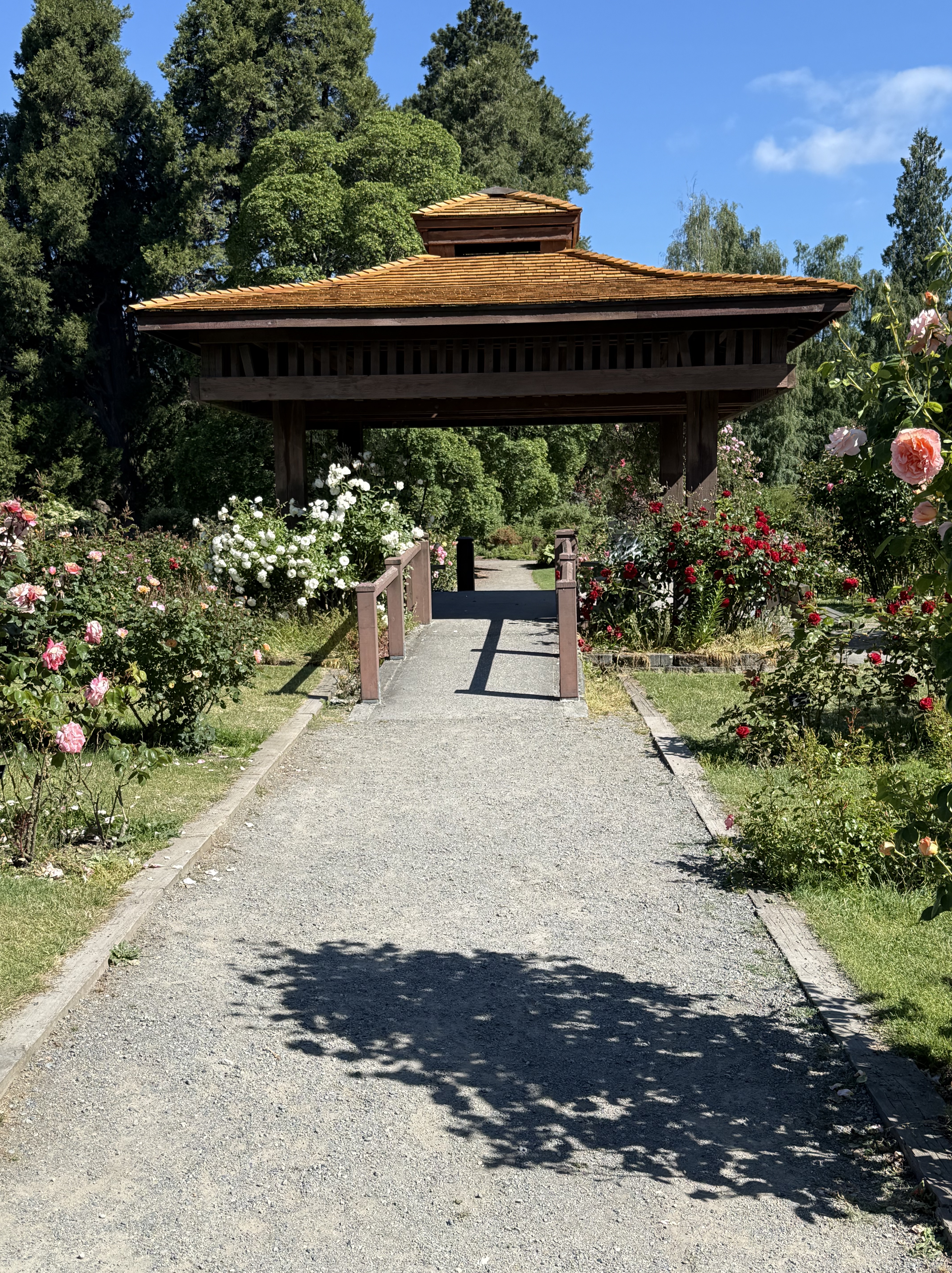
This is the central pagoda of the rose garden, which is arranged in concentric rows around it. The design philosophy of the first master gardener (Ebenezer Roberts) was more natural rather than highly organized, and that’s how the garden has remained through time.
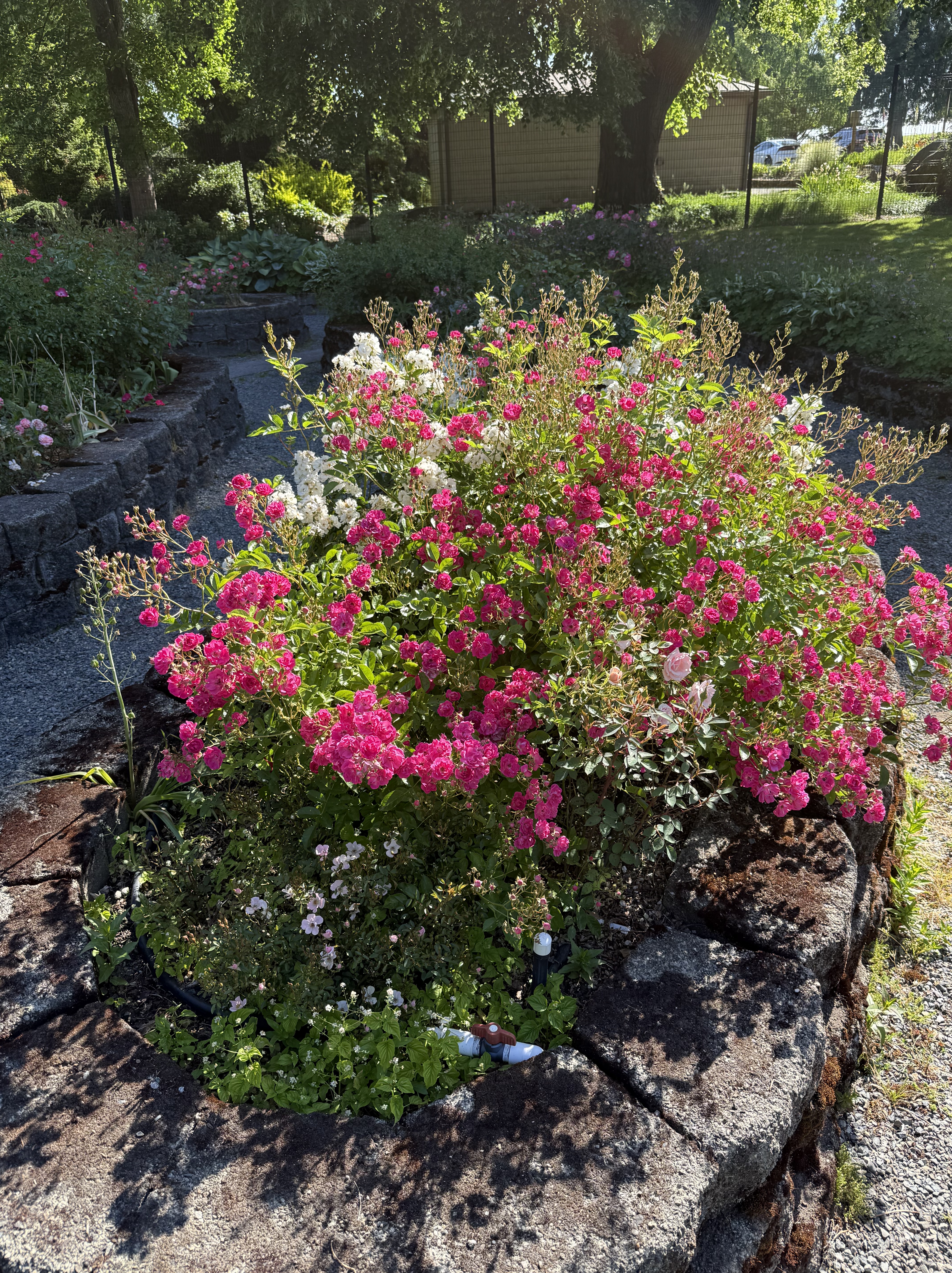
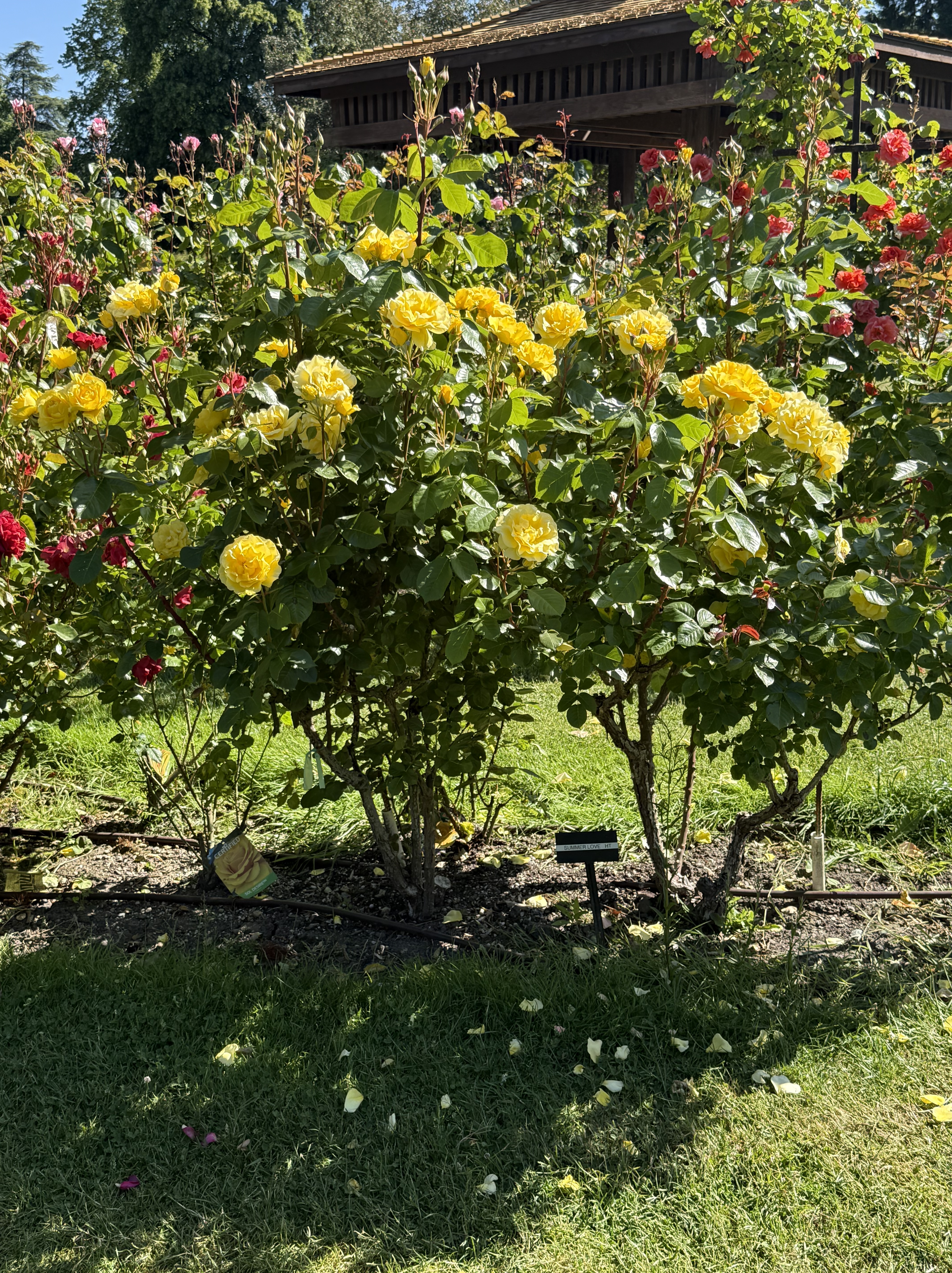
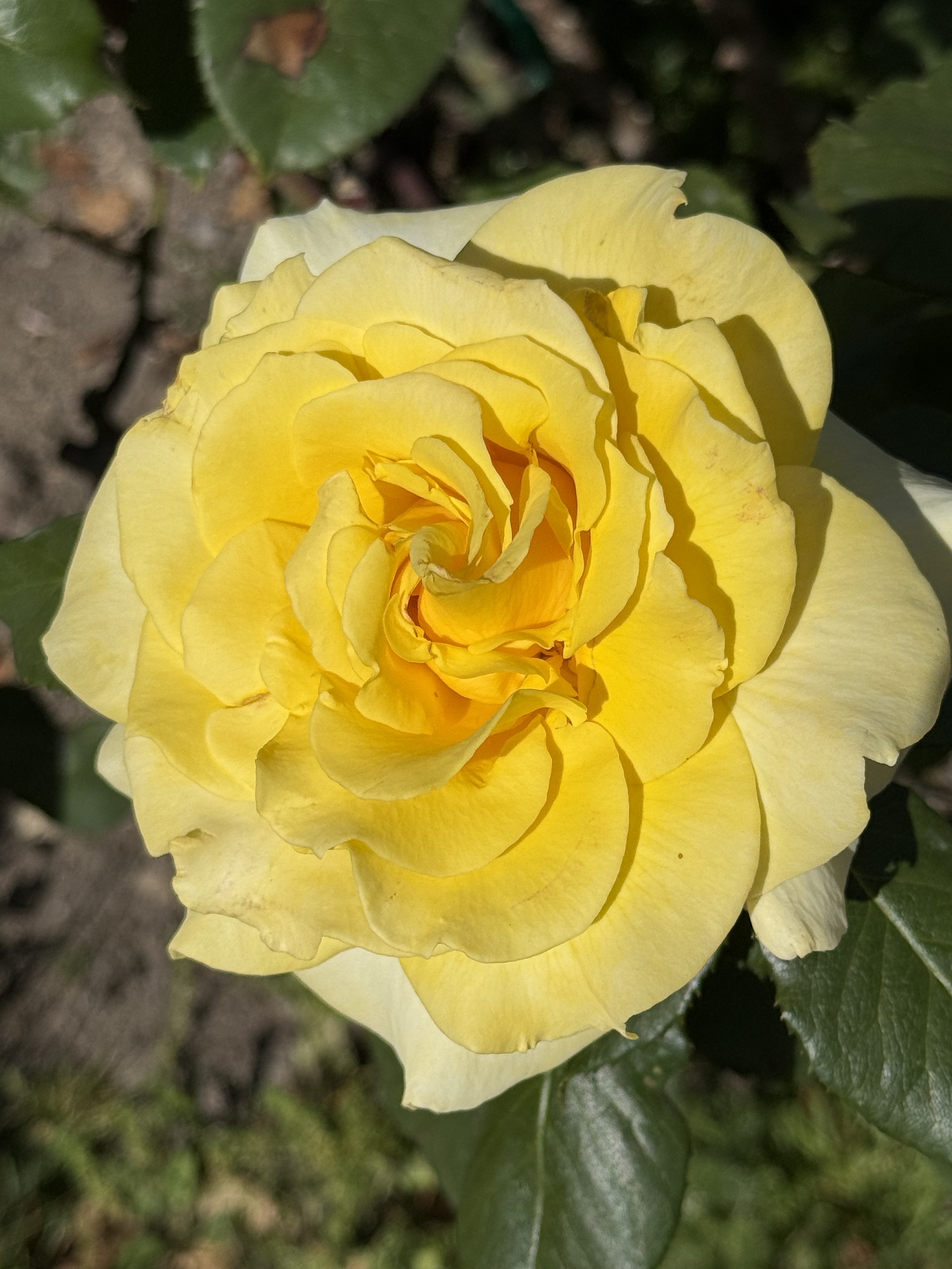
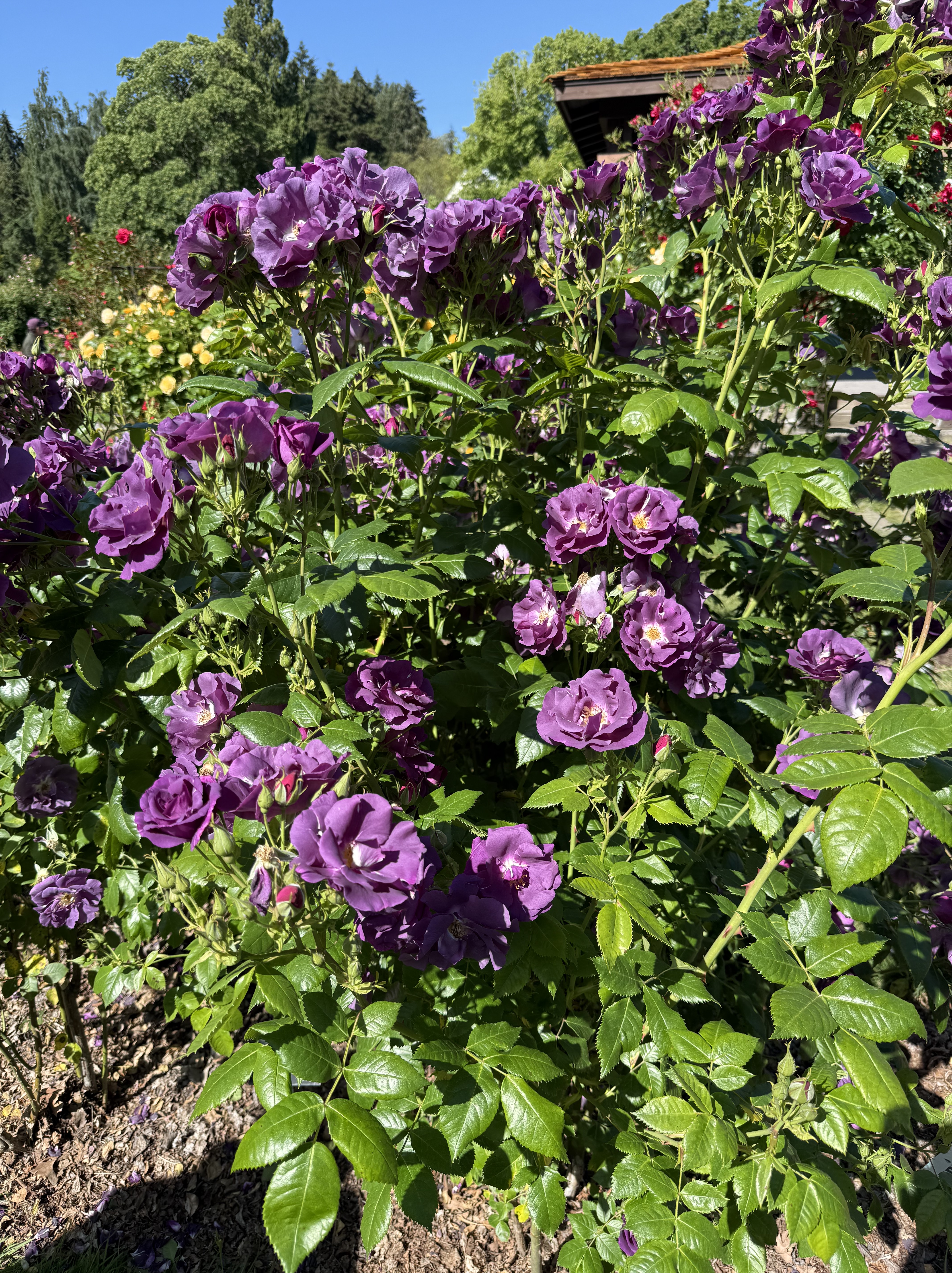
This jumble of color is typical of the rose garden on a spring day.
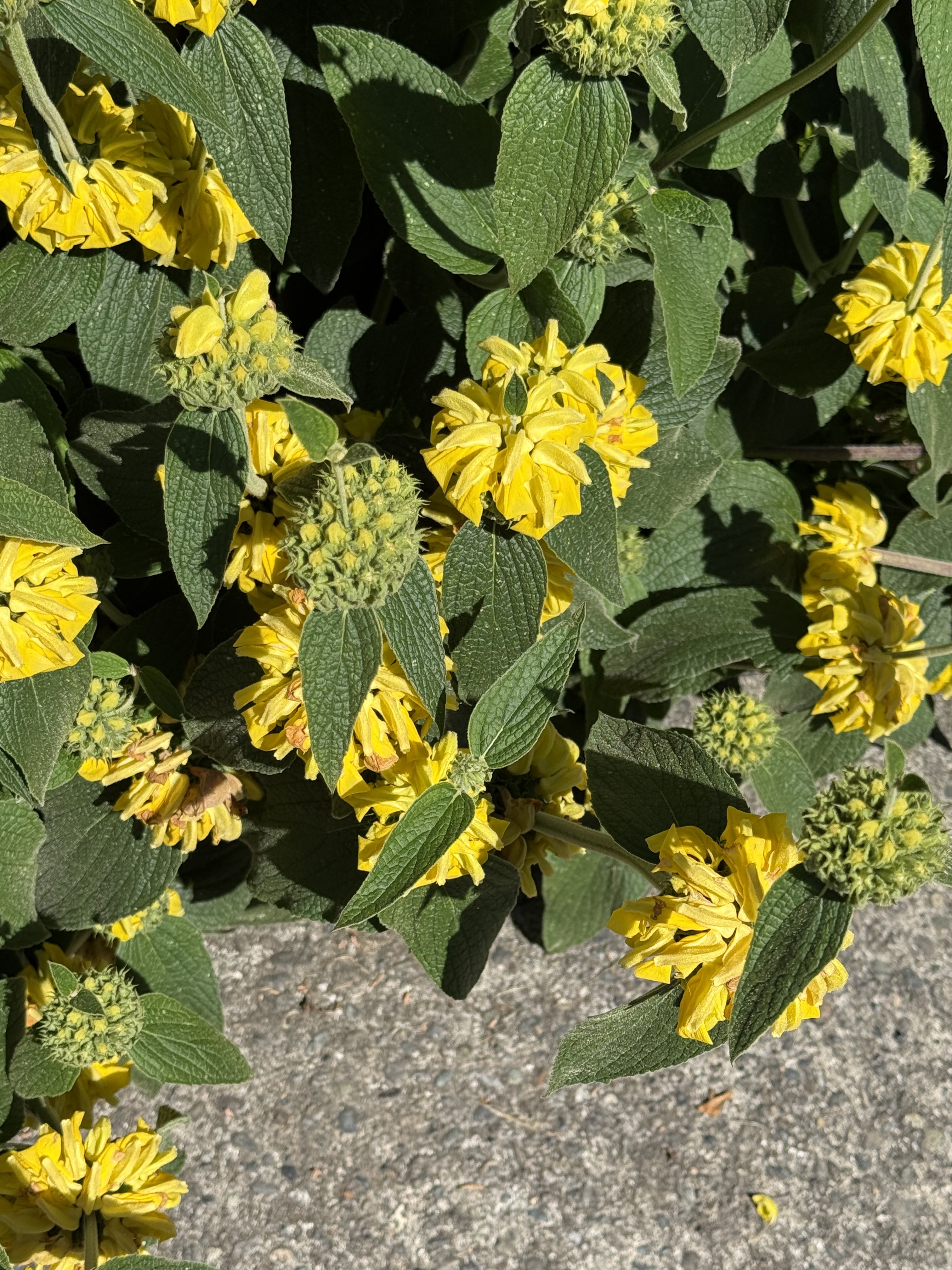
They had more than roses in the rose garden. This is Jerusalem Sage or Phlomis fruticosa,. It appears to be in full bloom.
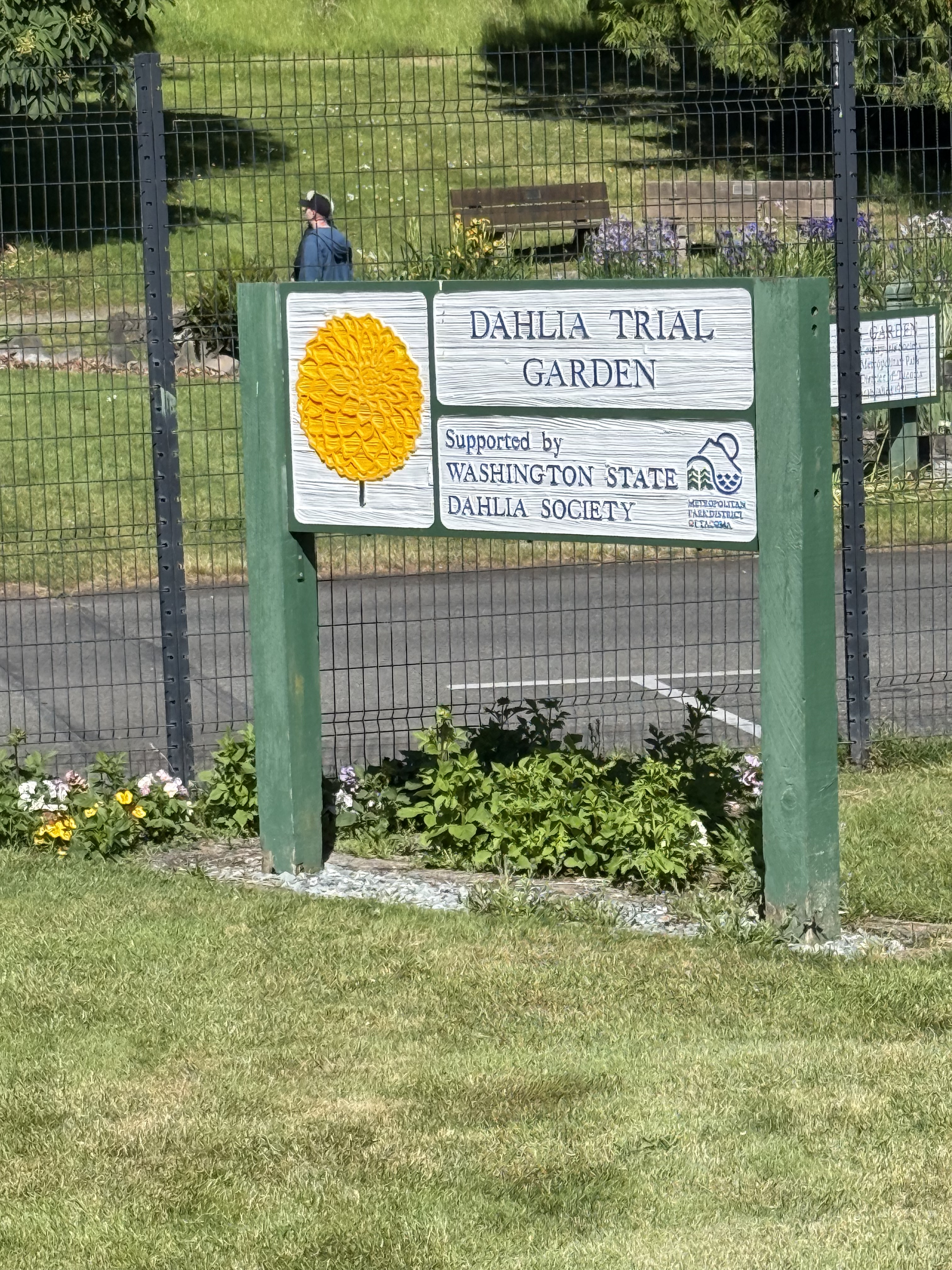
I never suspected there was a state society for a flower, but they had planted rows of numbered plants in a portion of the rose garden. The fence is to keep out the deer, which devour, stomp, and basically destroy flowering plants.
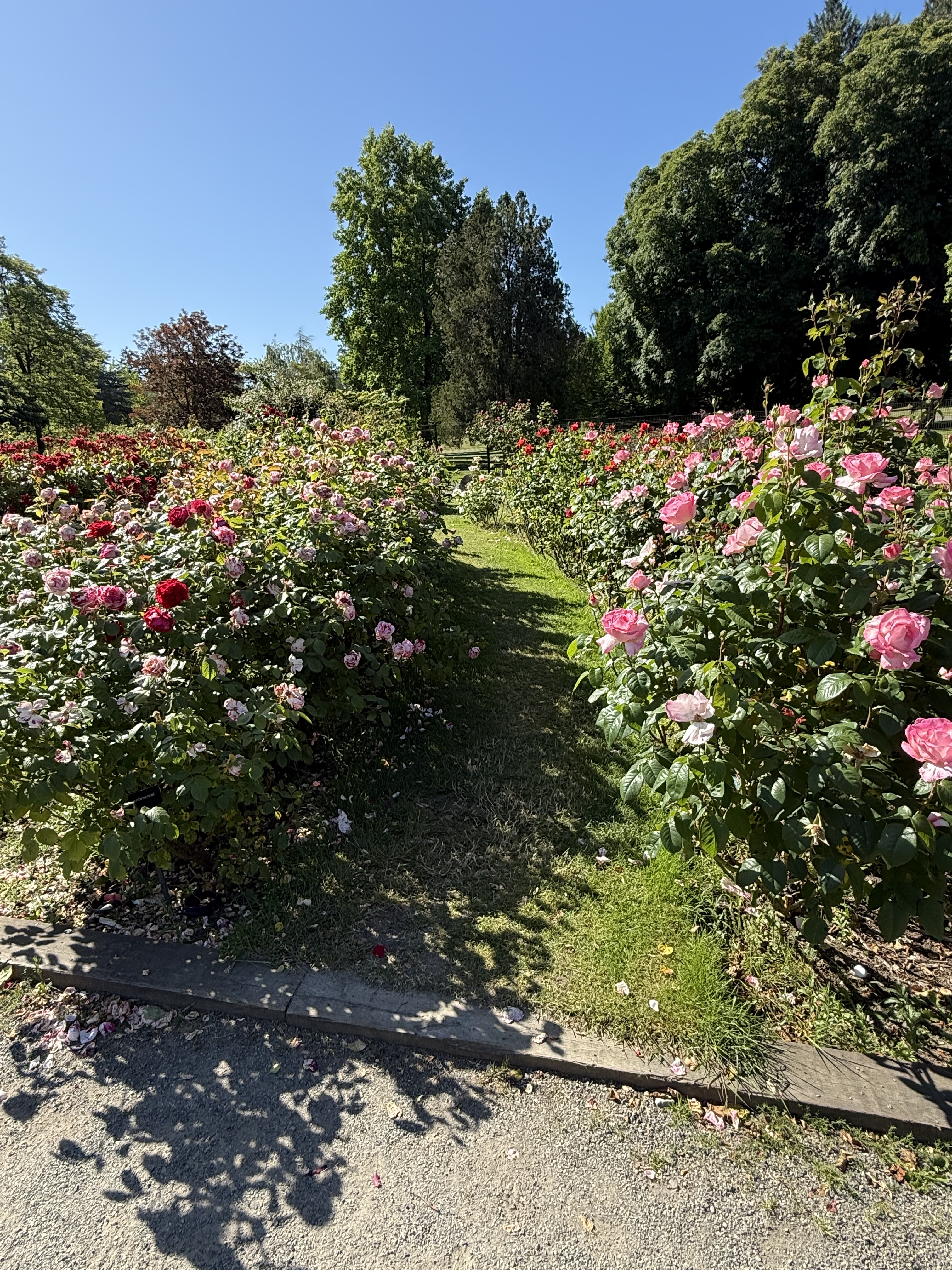
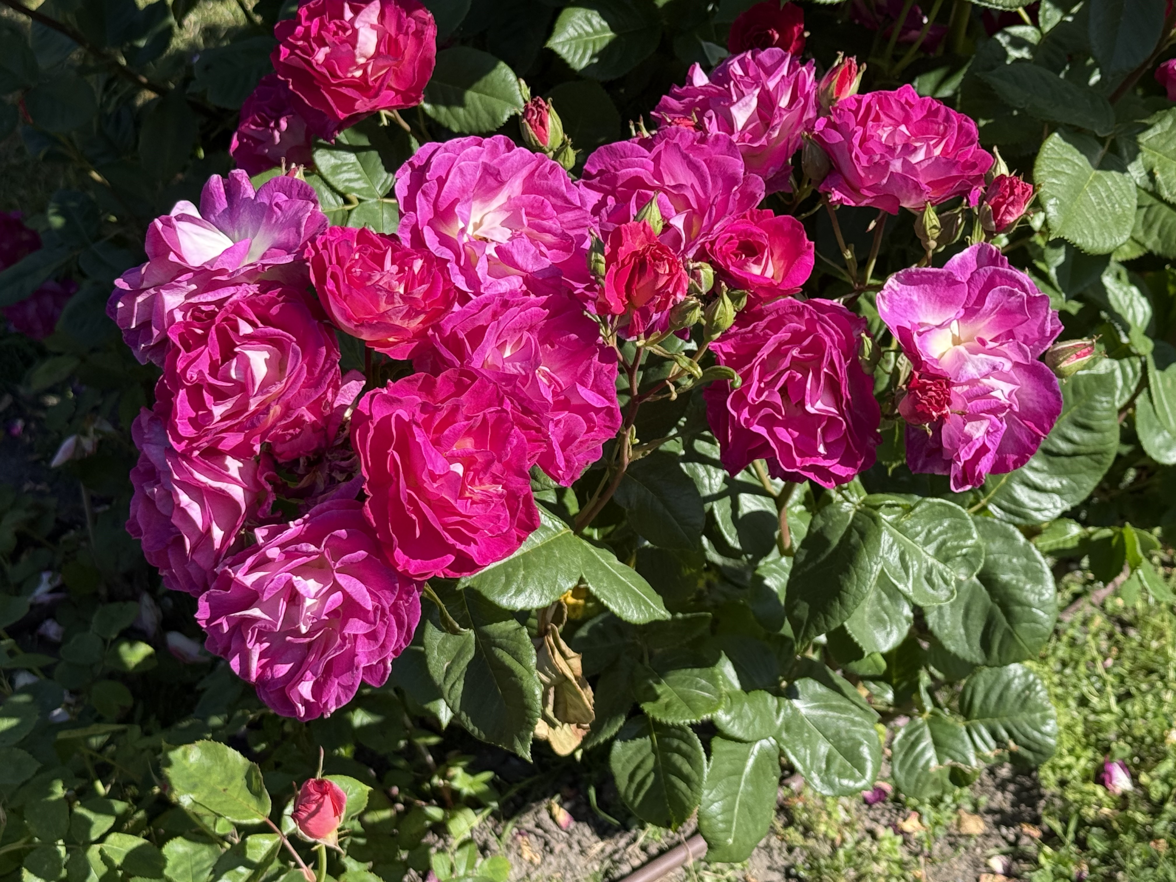
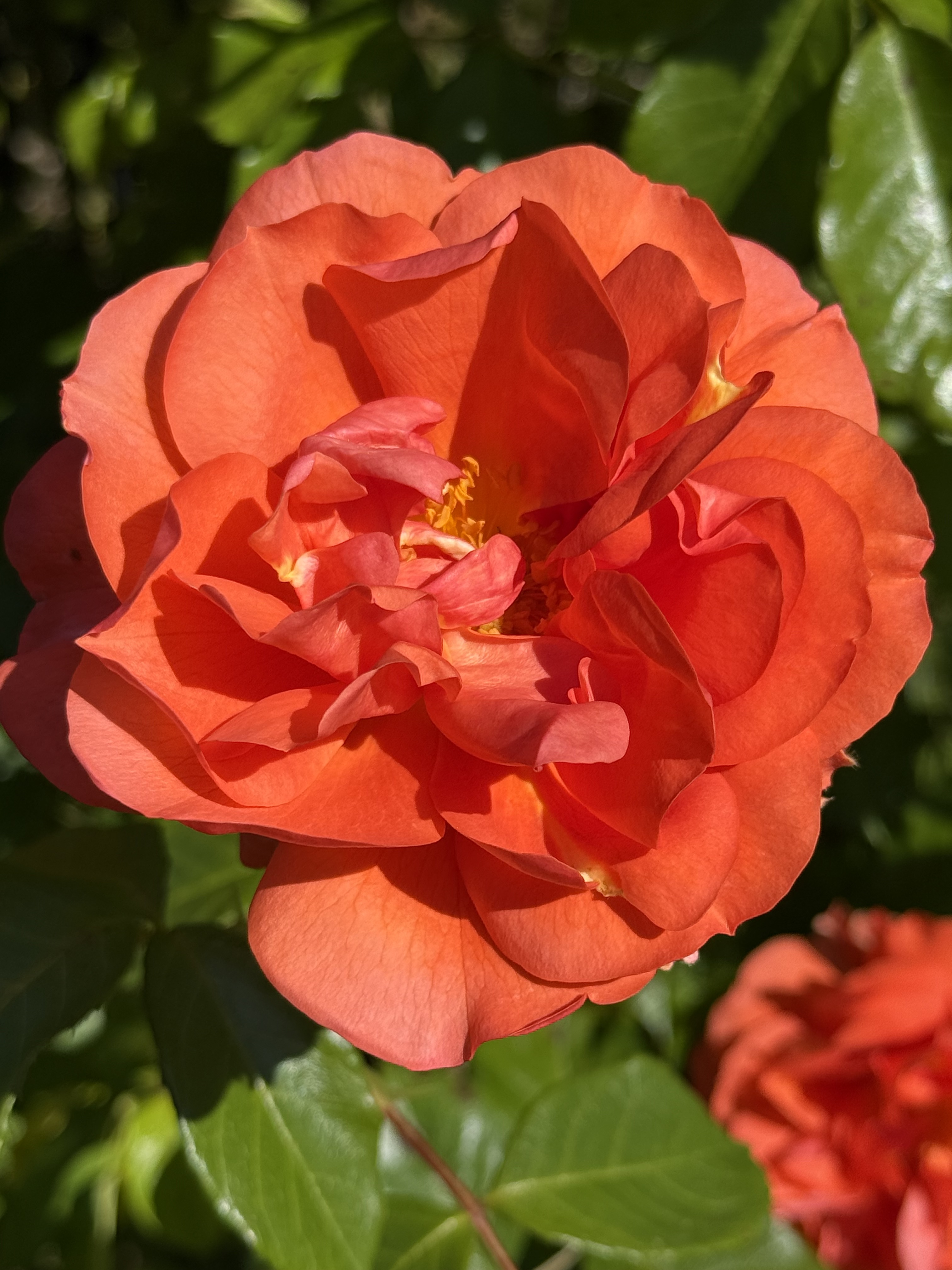
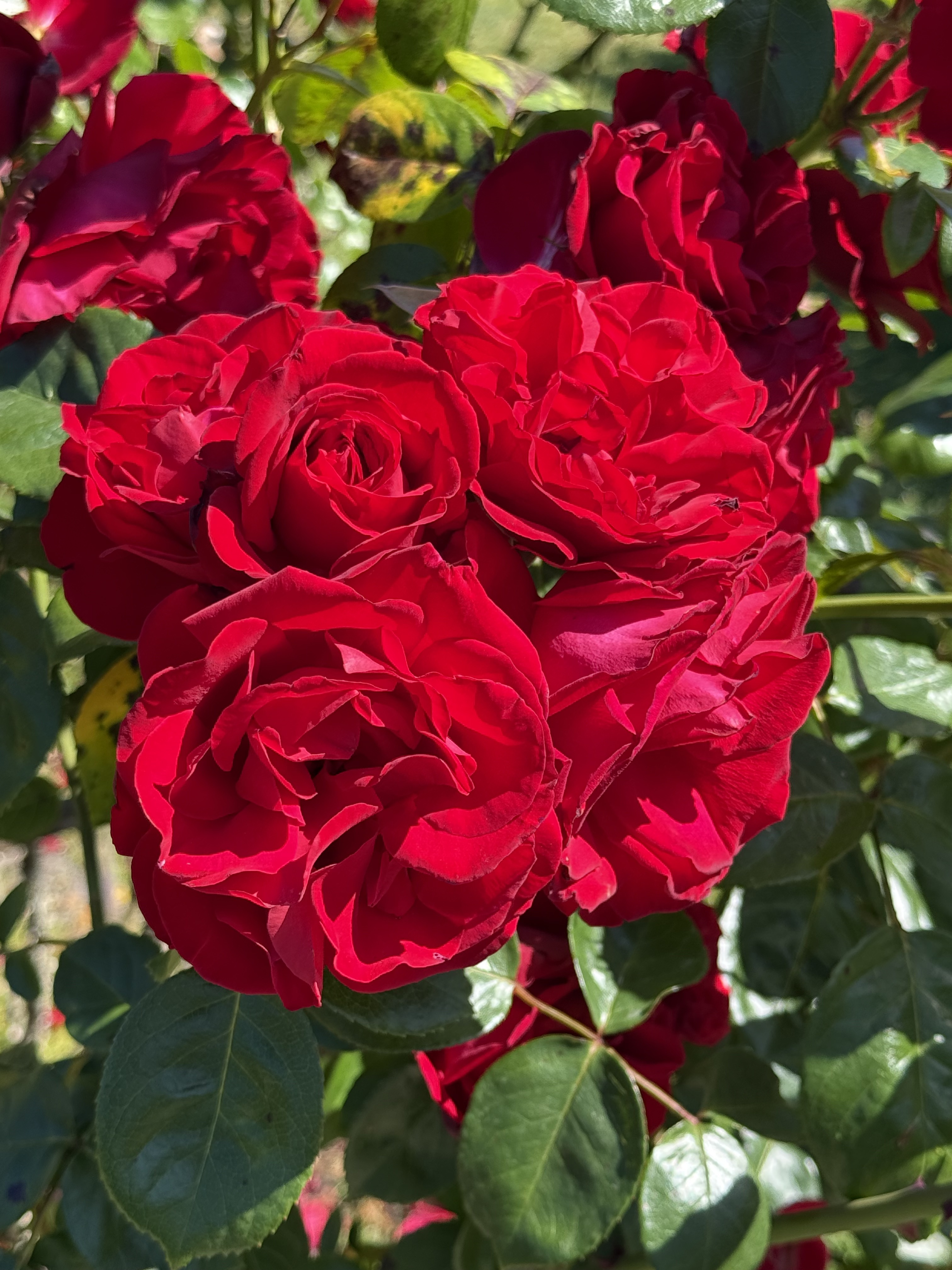
The rose beds are arranged concentrically around the center, but they are mixed up by variety. I’ll just show some photos of the gorgeous blooms we saw.
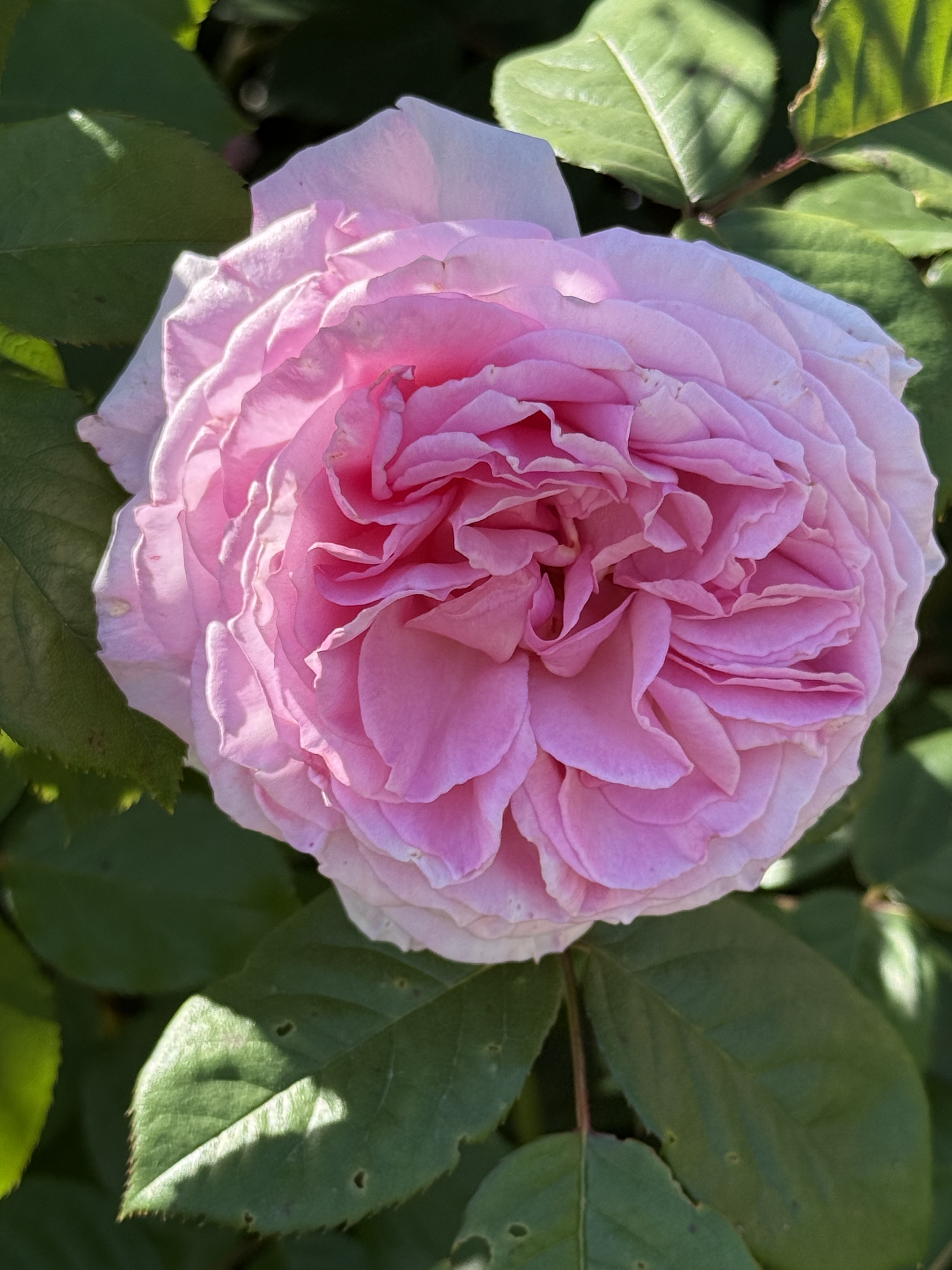
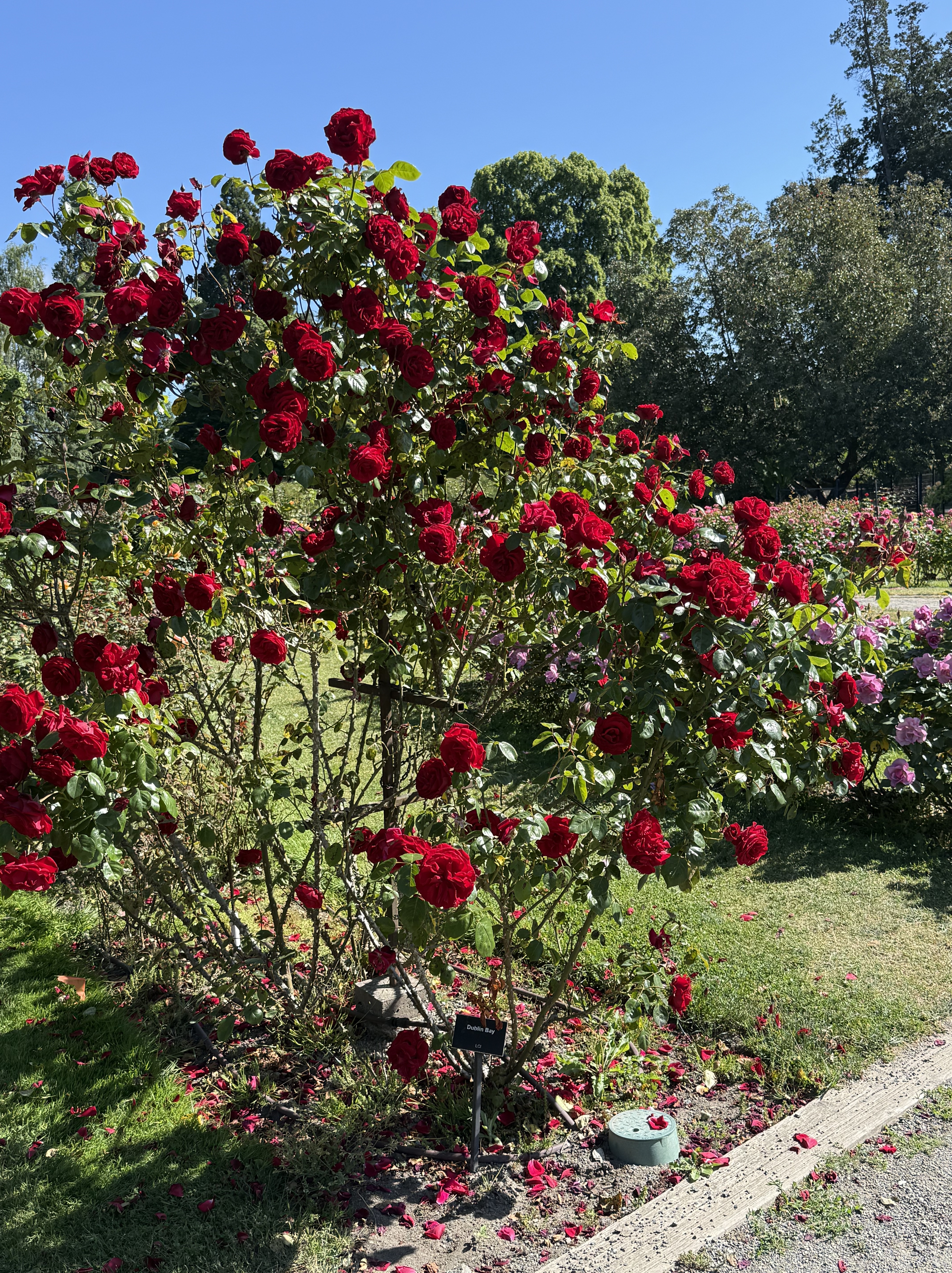
This Dublin Bay variety is distinctive because it has strong stalks and grows high, concentrating growth on the ends of very thorny branches.
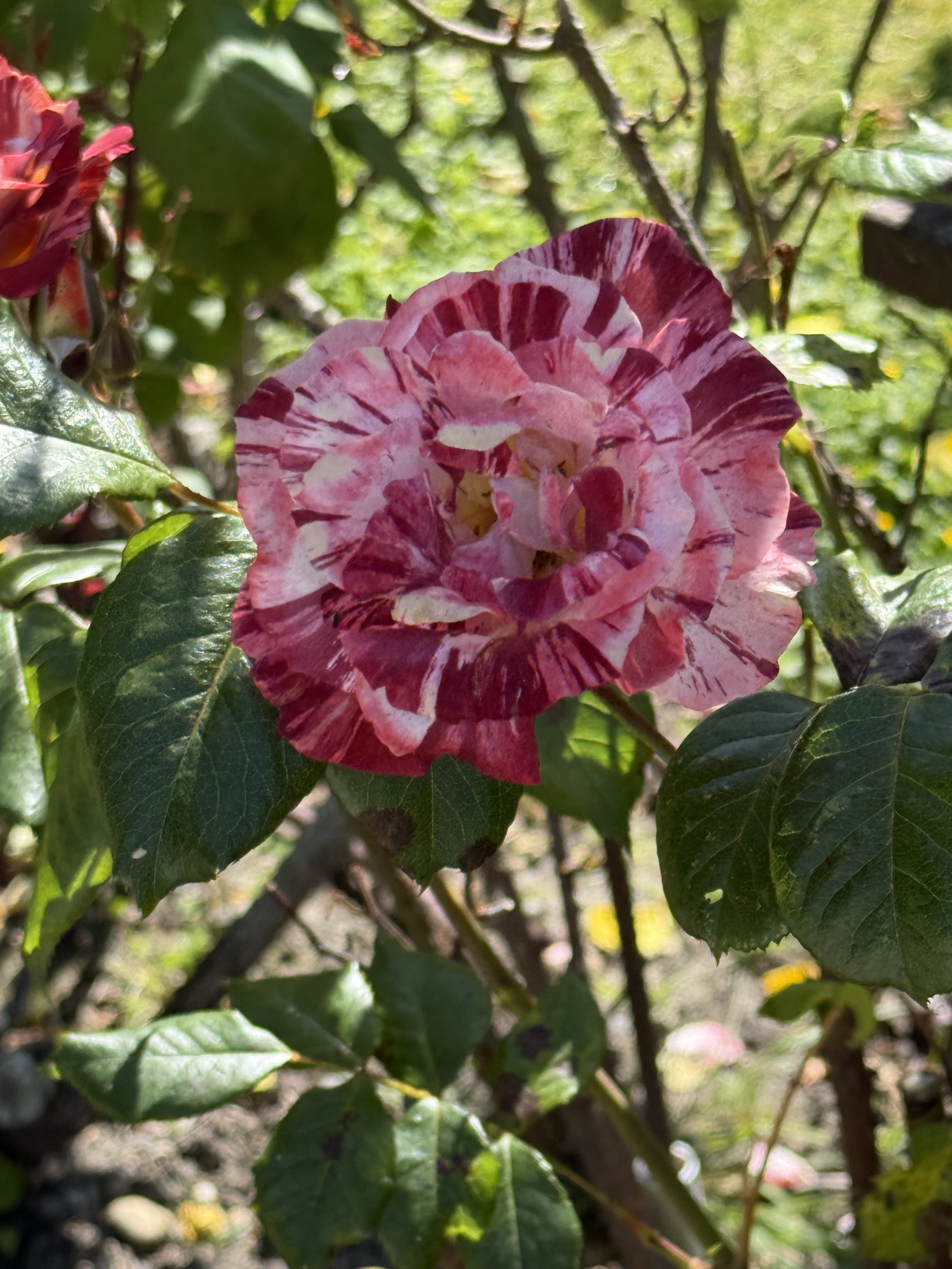
I didn’t take a photo of the sign identifying this remarkable rose, but CoPilot thinks it is Scentimental (1997, floribunda).
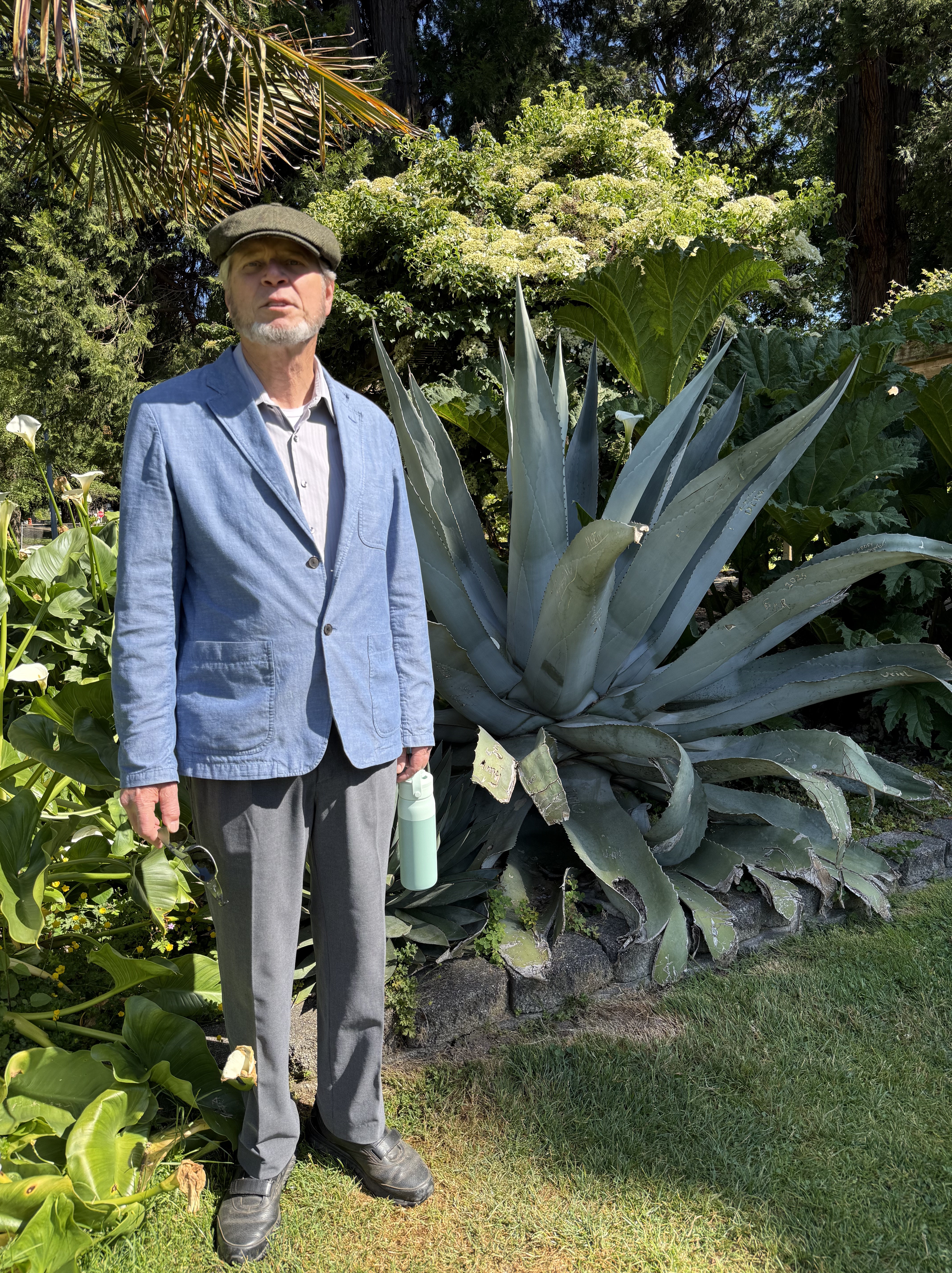
They even had agave doing very well in the PNW. We want some of this for our yard.
This is a Korean dogwood (according to CoPilot). Note the deer-protection installed around the base. Deer are very destructive to new growth and weak trunks, based on my personal experience.
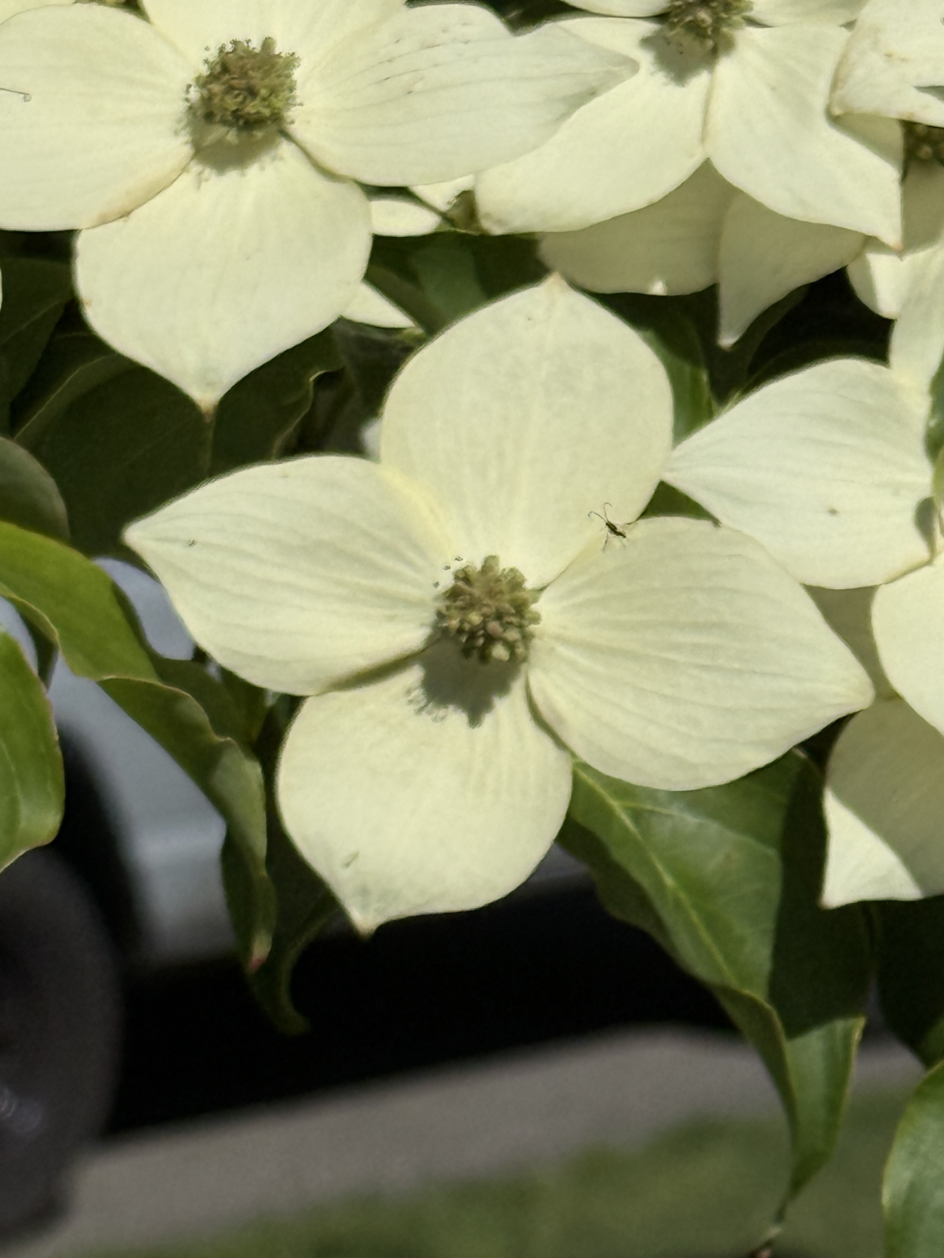
And those aren’t flower petals, they are bracts. The tiny flowers are in the center.
Note the dark purple, almost black, flowers growing from the same plant as the orange flowers.
Amazing!
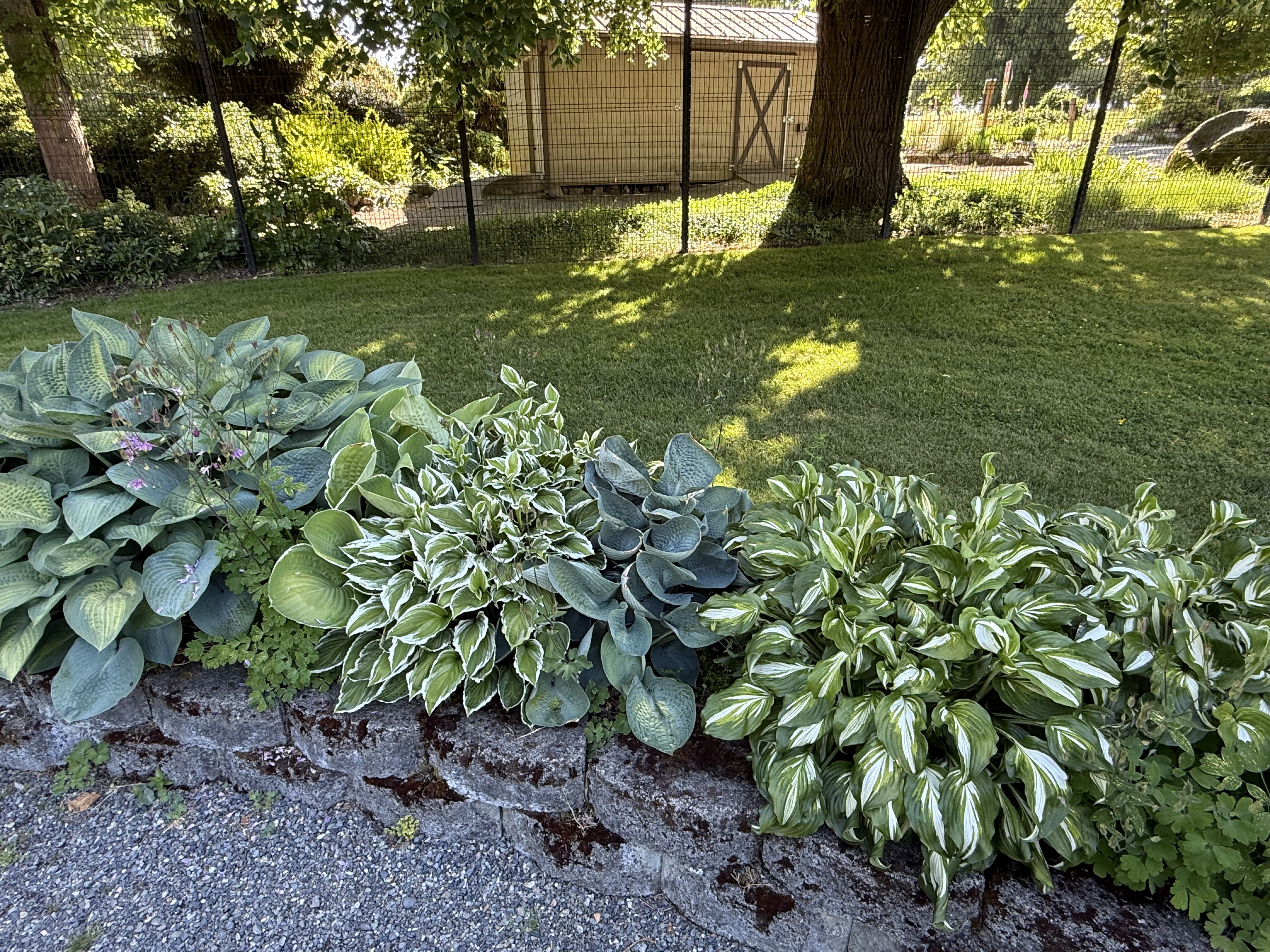
These are the plants that don’t require deer protection. They are outside the defensive fence, and they are thriving.
I thought this was a Japanese garden until…
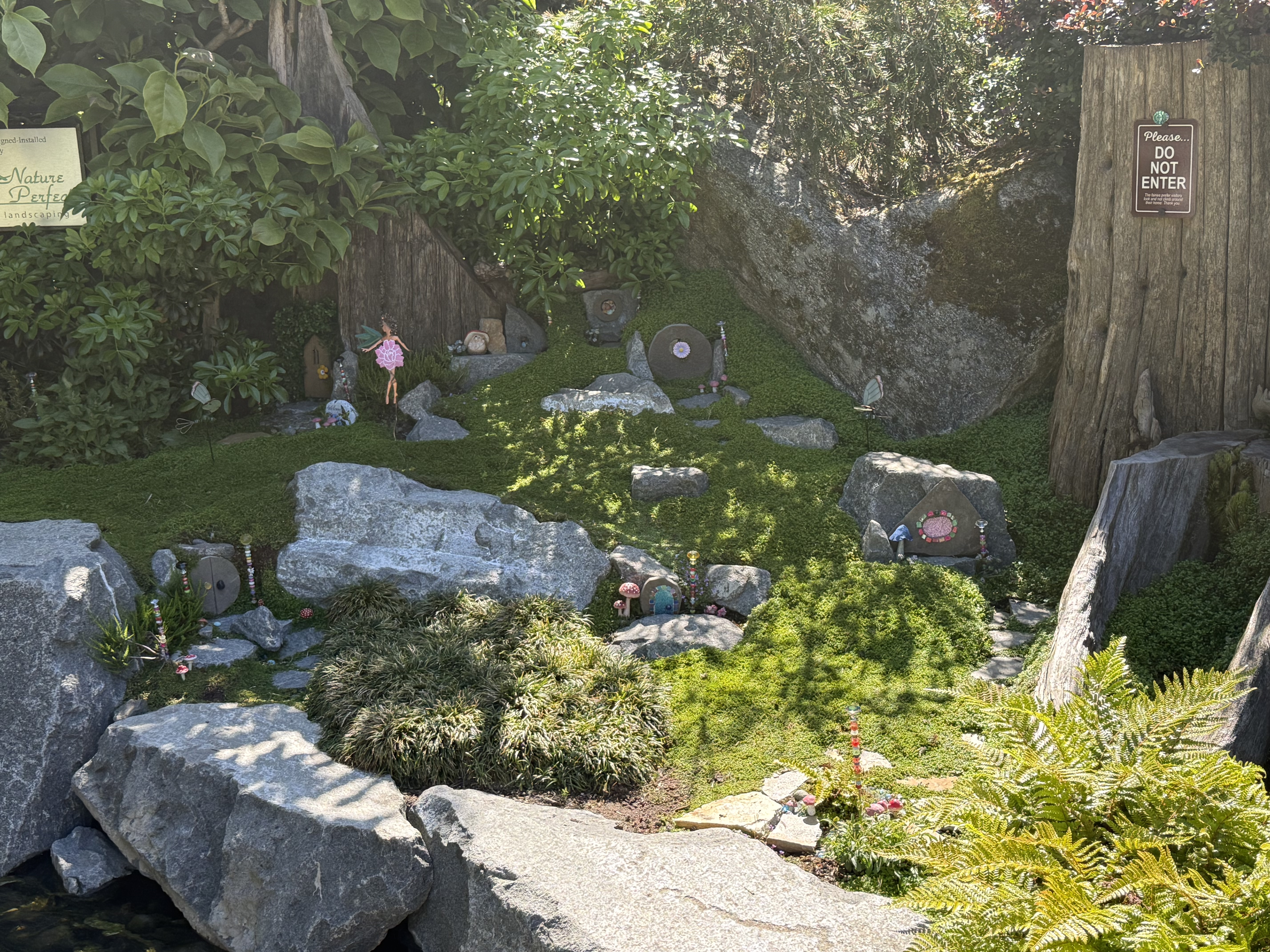
I noticed dolls arranged throughout the area. It reminded me of the horrifying Disney World ride, It’s a Small World. Now that song has returned to haunt me. Creepy … if you want my opinion.
I wasn’t very excited about going to the rose garden at first, but the combination of perfect weather and all these treasures of nature on display won me over. This is yet another reason to love living in the Pacific Northwest–especially Tacoma.
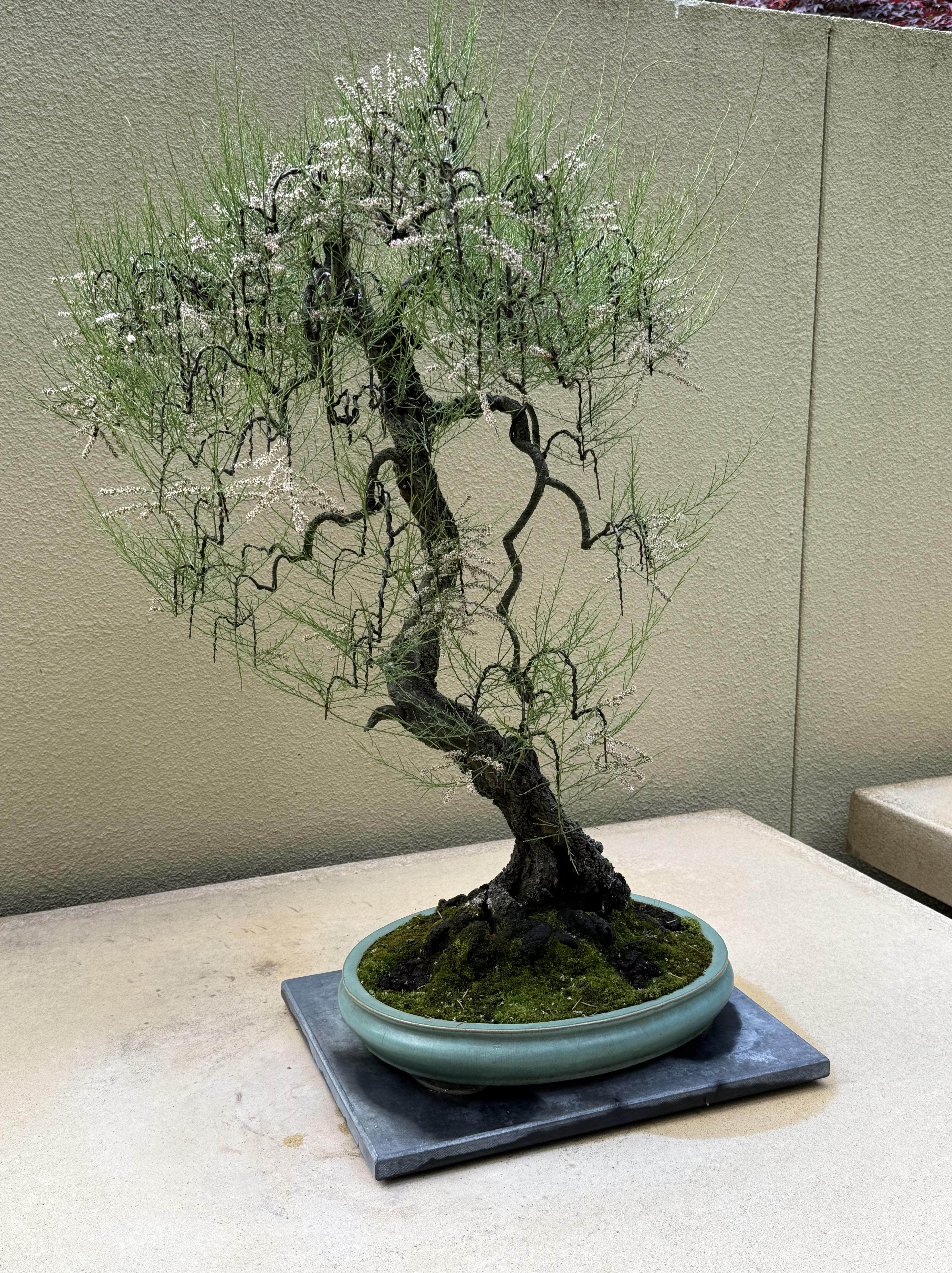
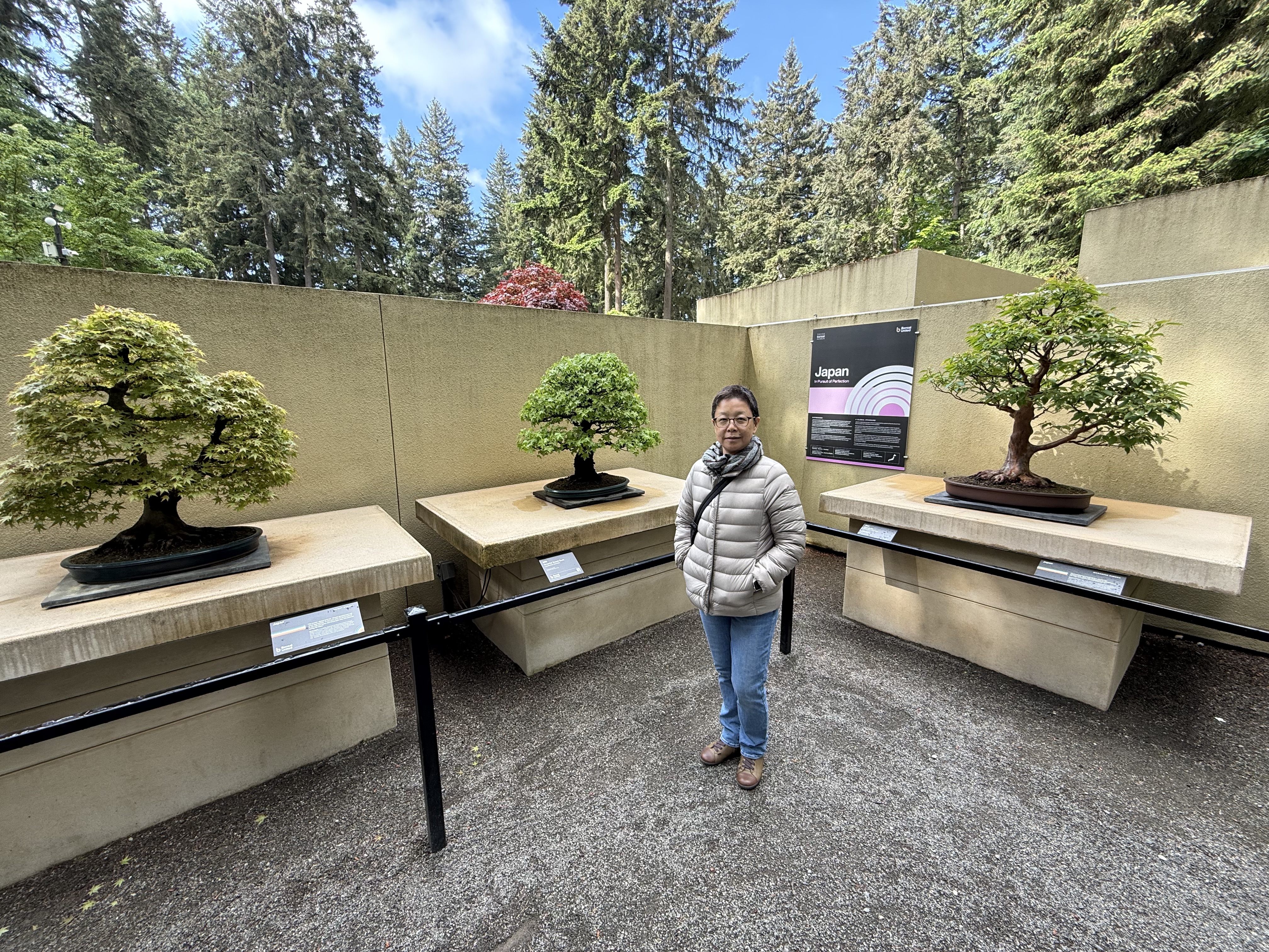
A Visit to the Pacific Bonsai Museum
Small, carefully pruned trees are fascinating. I went to the National Arboretum when I lived in the Washington DC area, so I had to see what was on display here in Tacoma. The Pacific Bonsai Museum is mostly open air, with a few sensitive examples in a greenhouse. They leave the trees out year-round and have skilled bonsai arborists trim them according to their creators’ expectations.
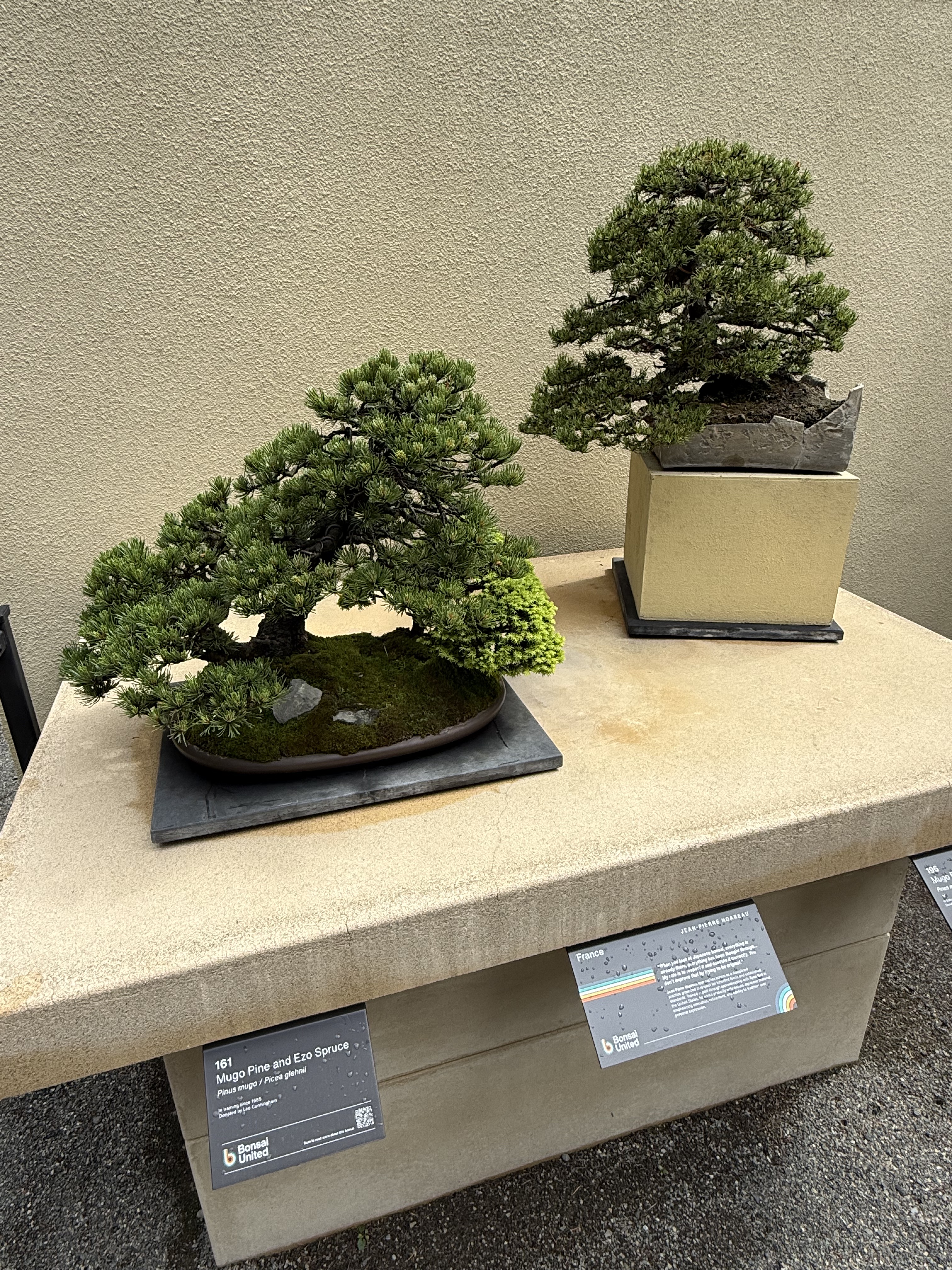
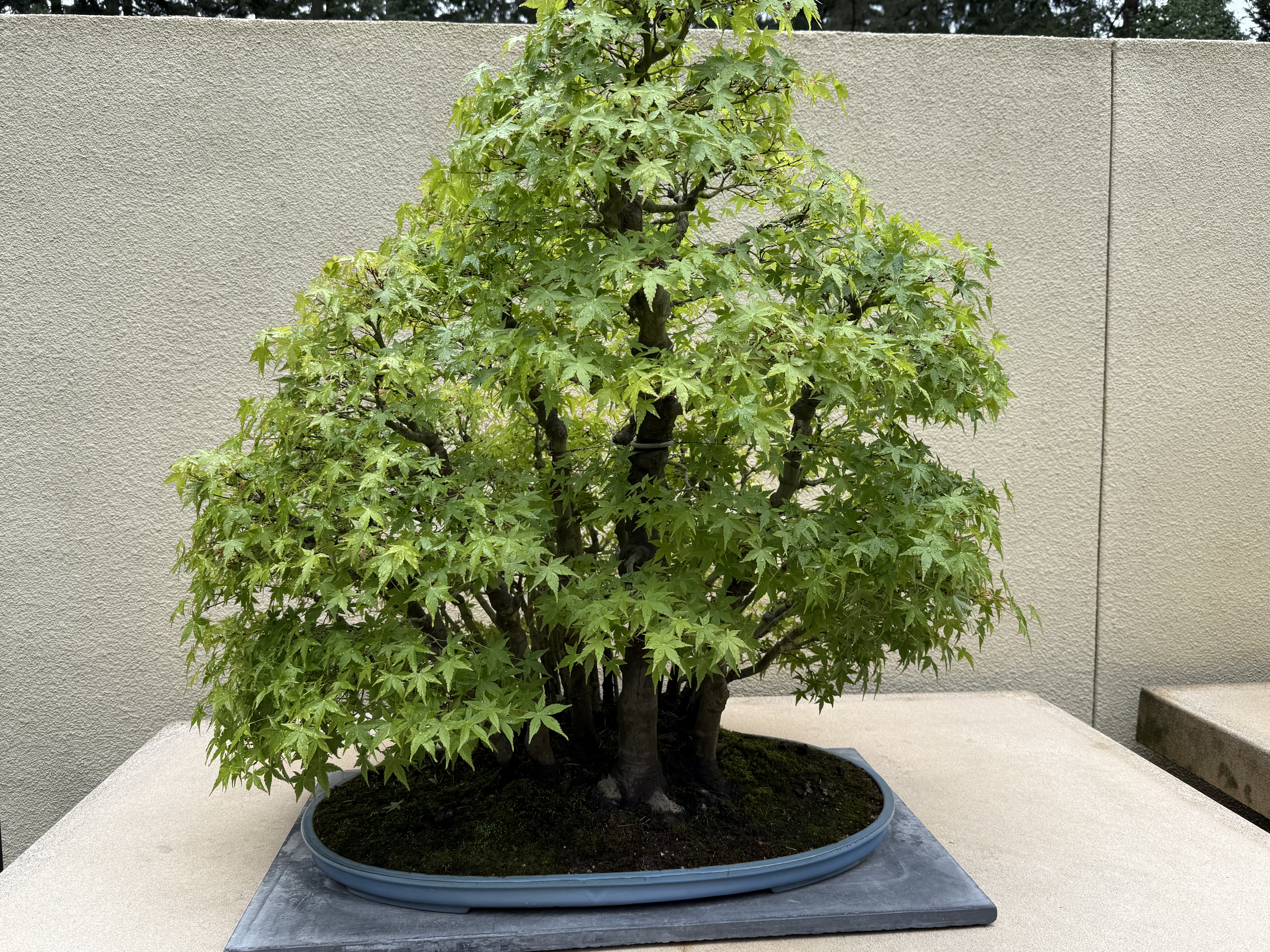
I learned that there are different schools of thought on bonsai, from growing trees and shrubs from seeds, to working with dying plants, even stumps, and painstakingly reviving them. Then there’s cultural differences that vary between nations. However, bonsai began in China where it’s called “penjing”. It means tray scenery. The museum had their displays arranged by country of origin. I didn’t take notes and my photography is spotty. Still, here are some beautiful examples of bonsai.
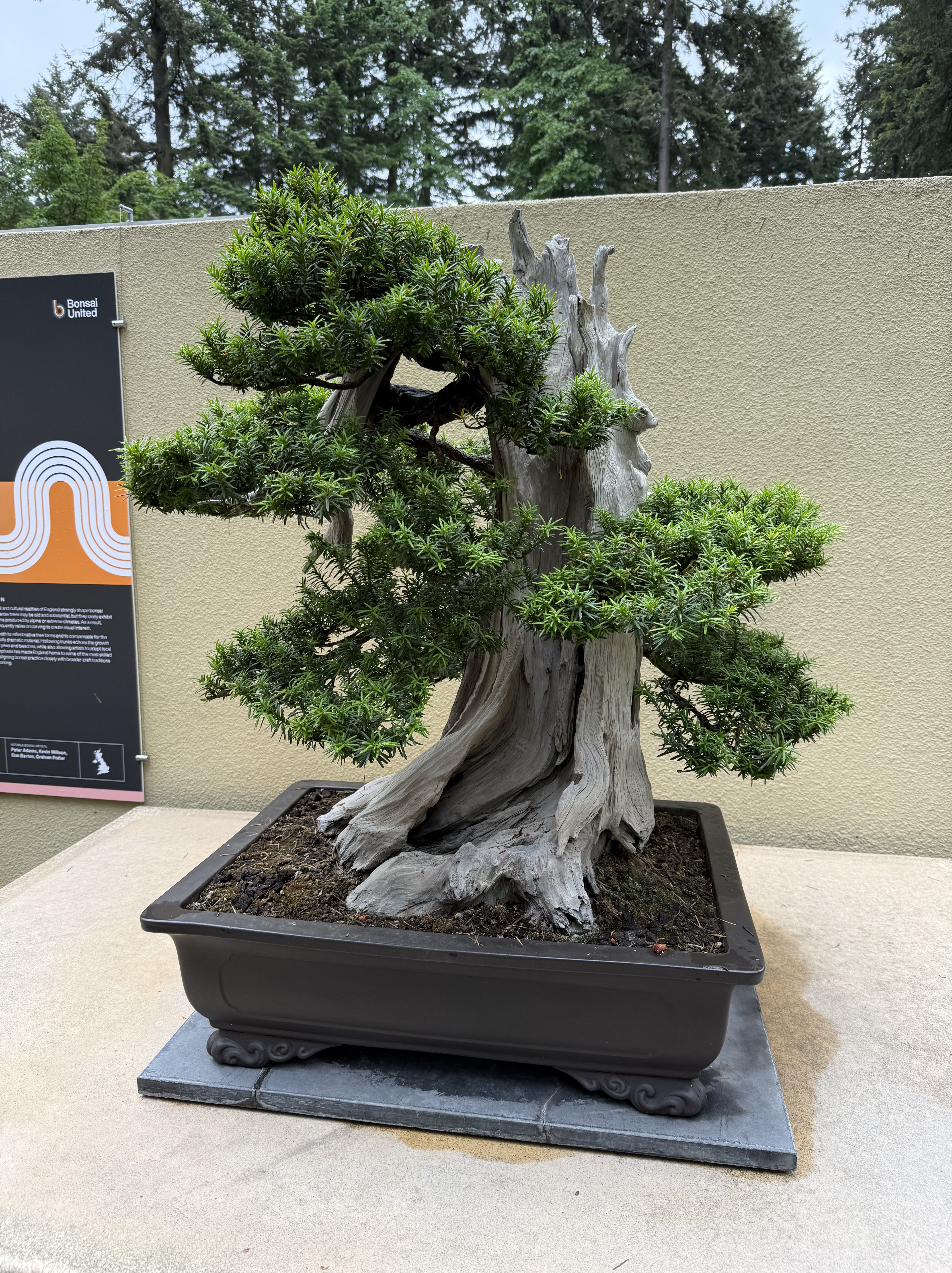
The Bonsai Museum is in Federal Way, Washington, and is supported by Weyerhaeuser, the lumber company; it’s located on a large campus they built and then sold to someone. It is free and there is no apparent security, except from the Rhododendron Garden next door. I guess vandalism hasn’t been a problem; who would want to destroy such beautiful antiques?
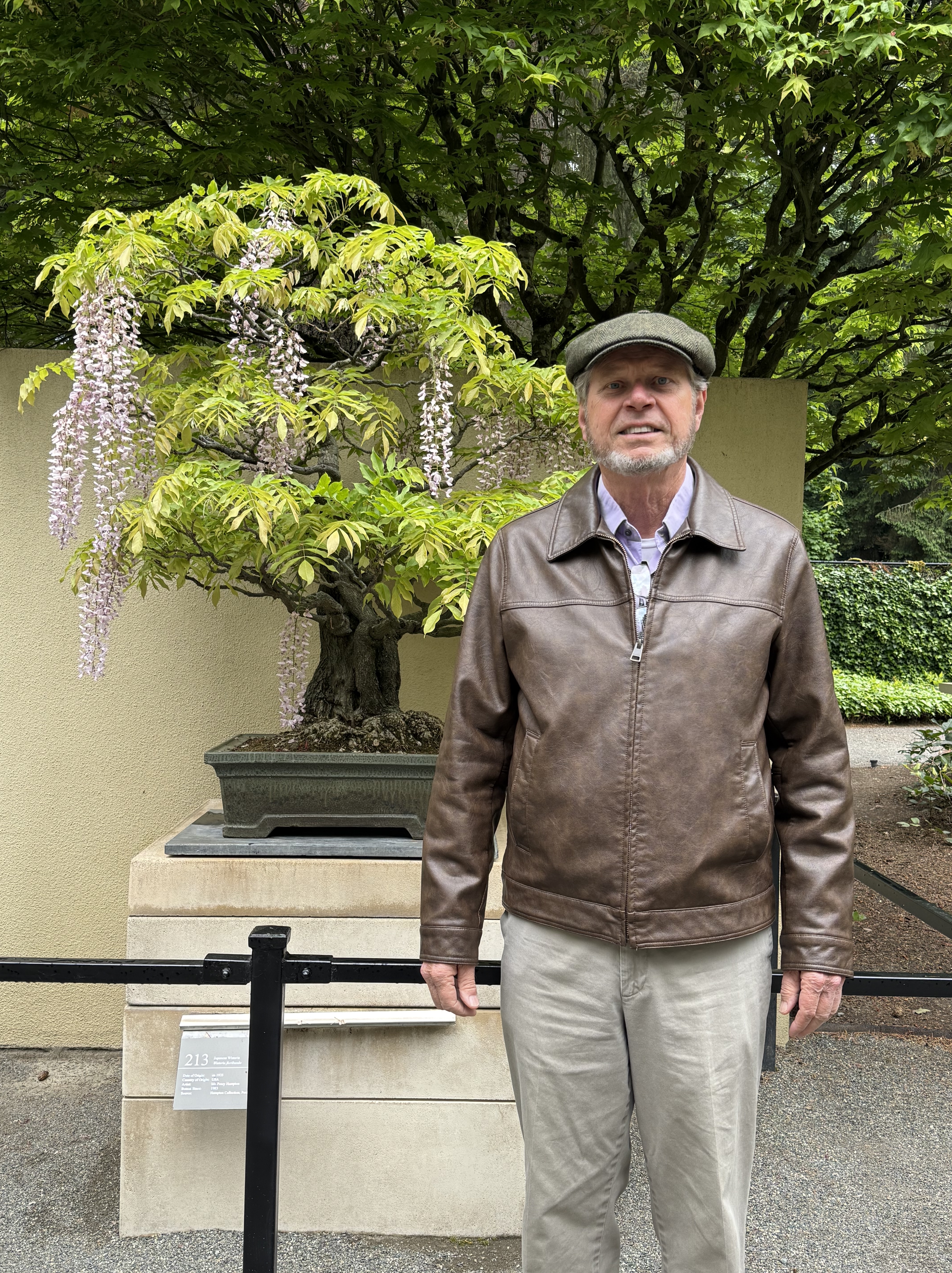
This is a wisteria. If you’ve ever dealt with this out-of-control vine (I have), you will be amazed that this old example (note the size of the trunk) is so tidy yet produces the distinctive flowers. The specimens on display ranged in age from the late nineteenth century to the seventies.
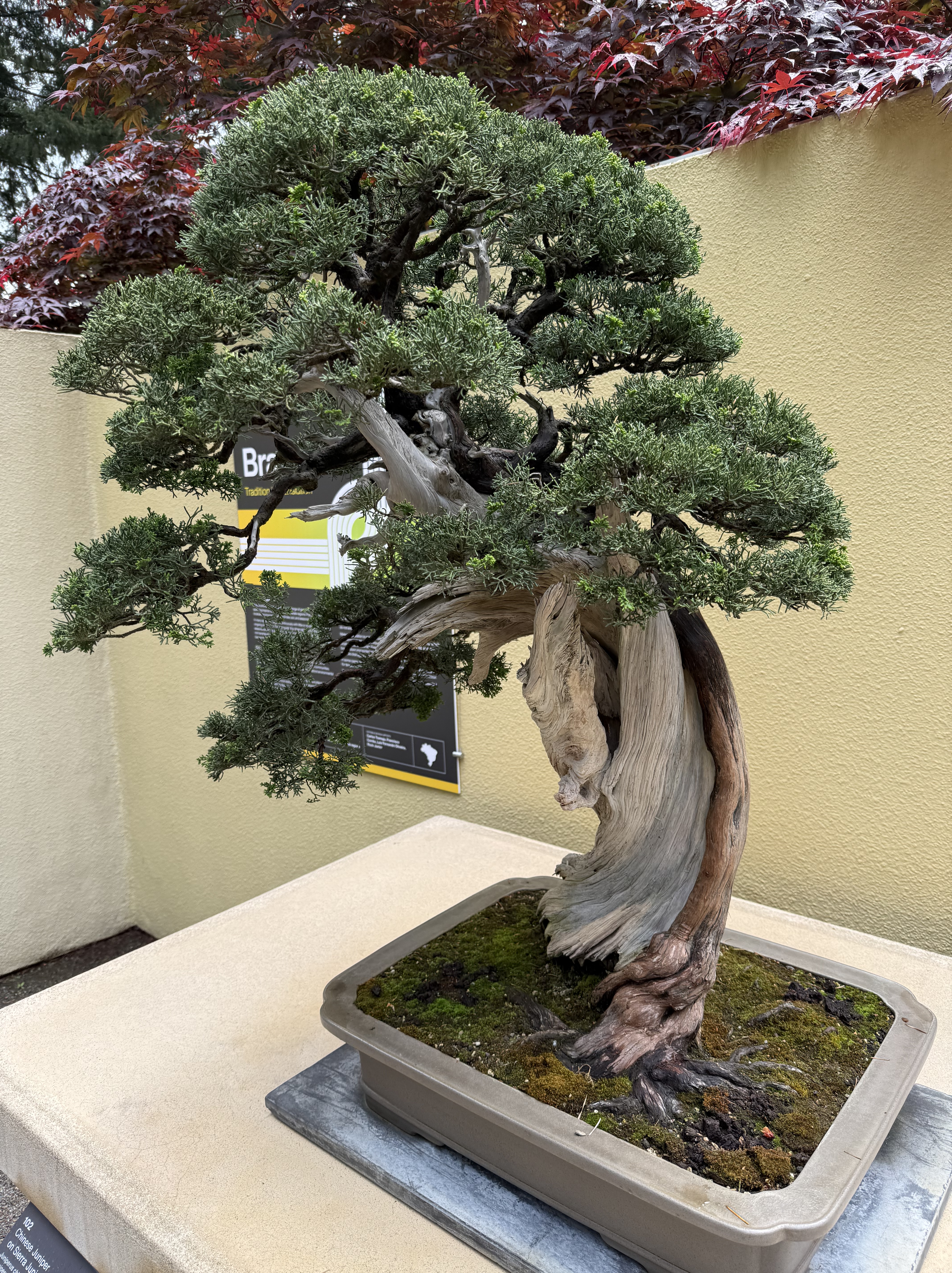
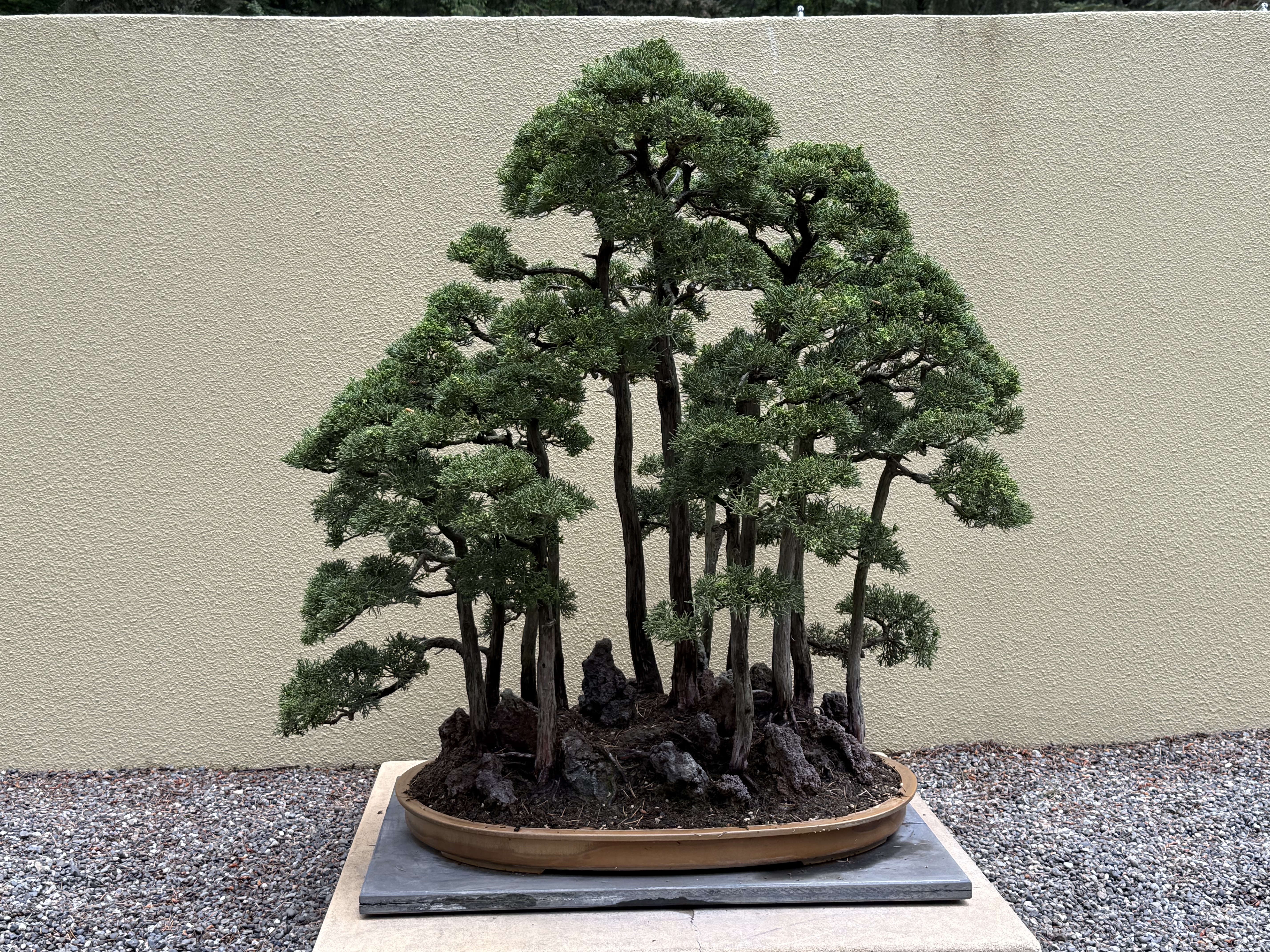
This is part of the Japan exhibit. I think these are all trees, probably juniper–a favorite among bonsai artists.
As an example of what good hands these fragile trees are in, this specimen was created by a past director of the museum. It was my favorite. I like the idea of rejuvenation from near death.
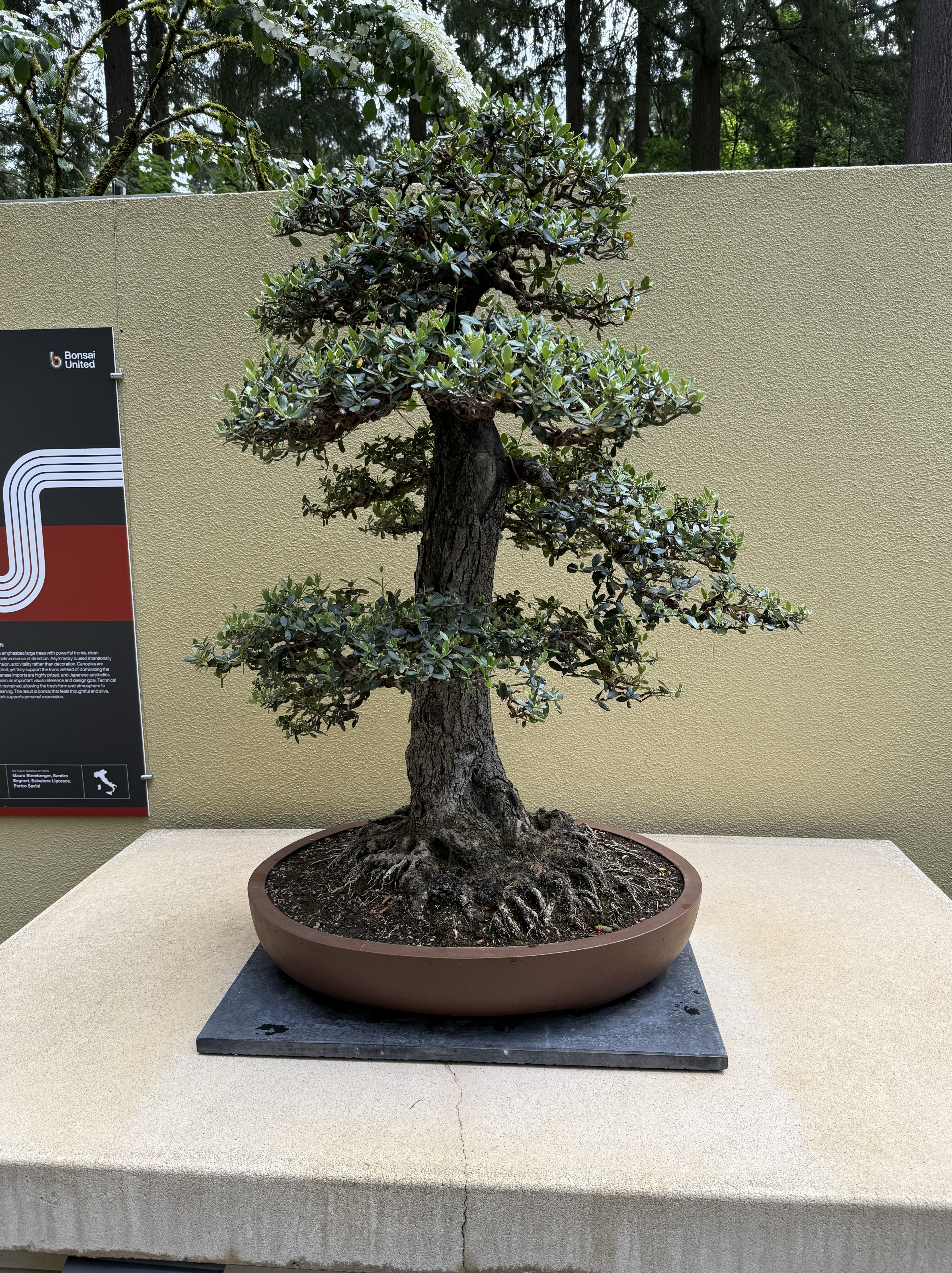
European Olive, in training since 1969, from Italy.
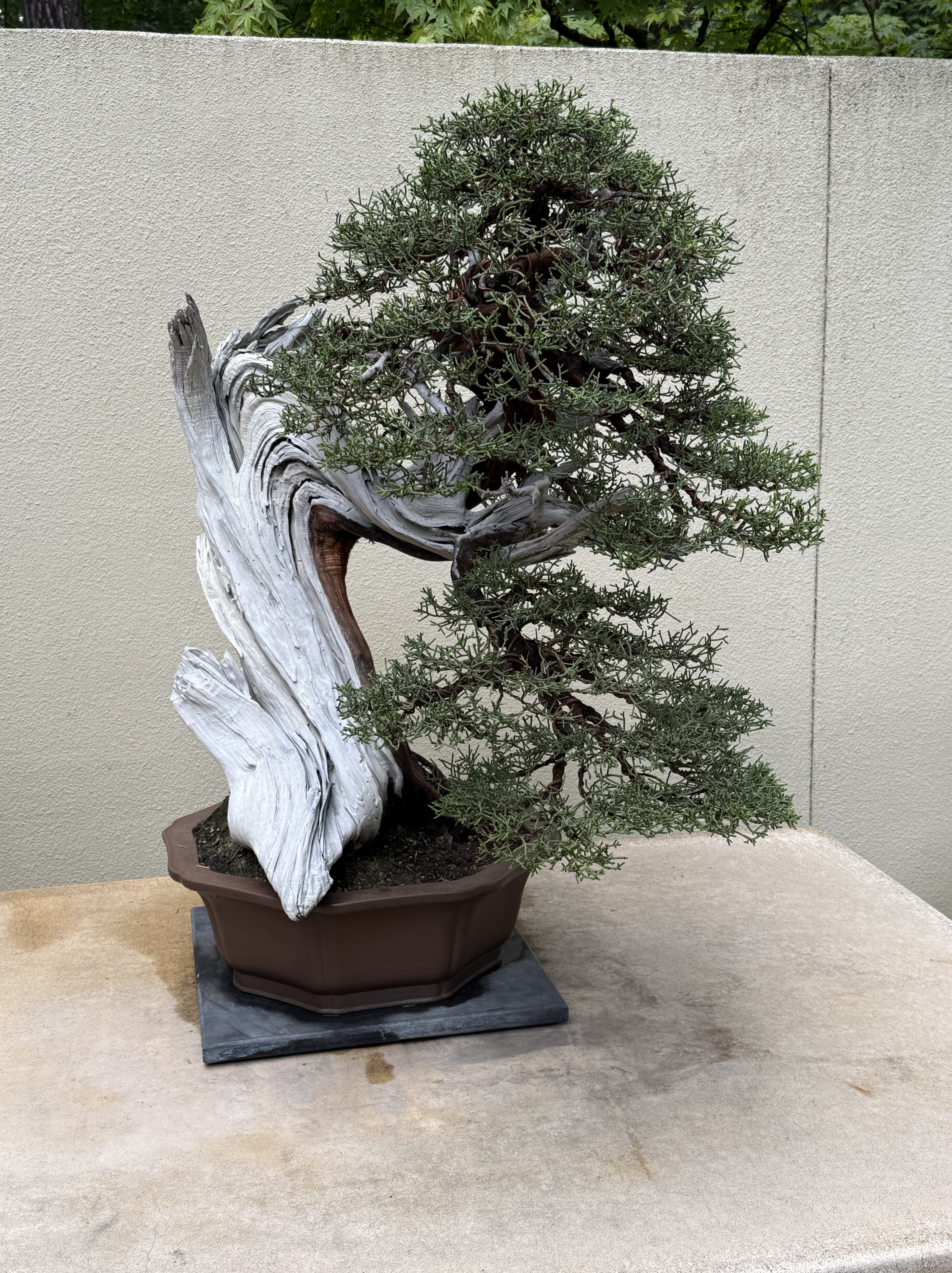
You can see the difference between the trees/shrubs grown from seeds or youth (and those that are saved from the dust heap) in this recovered specimen. I love the intermingling of dead (white) wood and living tissue.
This German artist created a forest, but the individual “trees” were falling over so there are wires holding it together. I imagine there are a lot of failures in practicing bonsai.
This successful “forest” is by an Australian. Note the “rocks” at the base; they are actually dead knobs from a large stump. Also note the very shallow pan: this is truly penjing–tray scenery–and not a potted plant.
The Rhododendron Garden
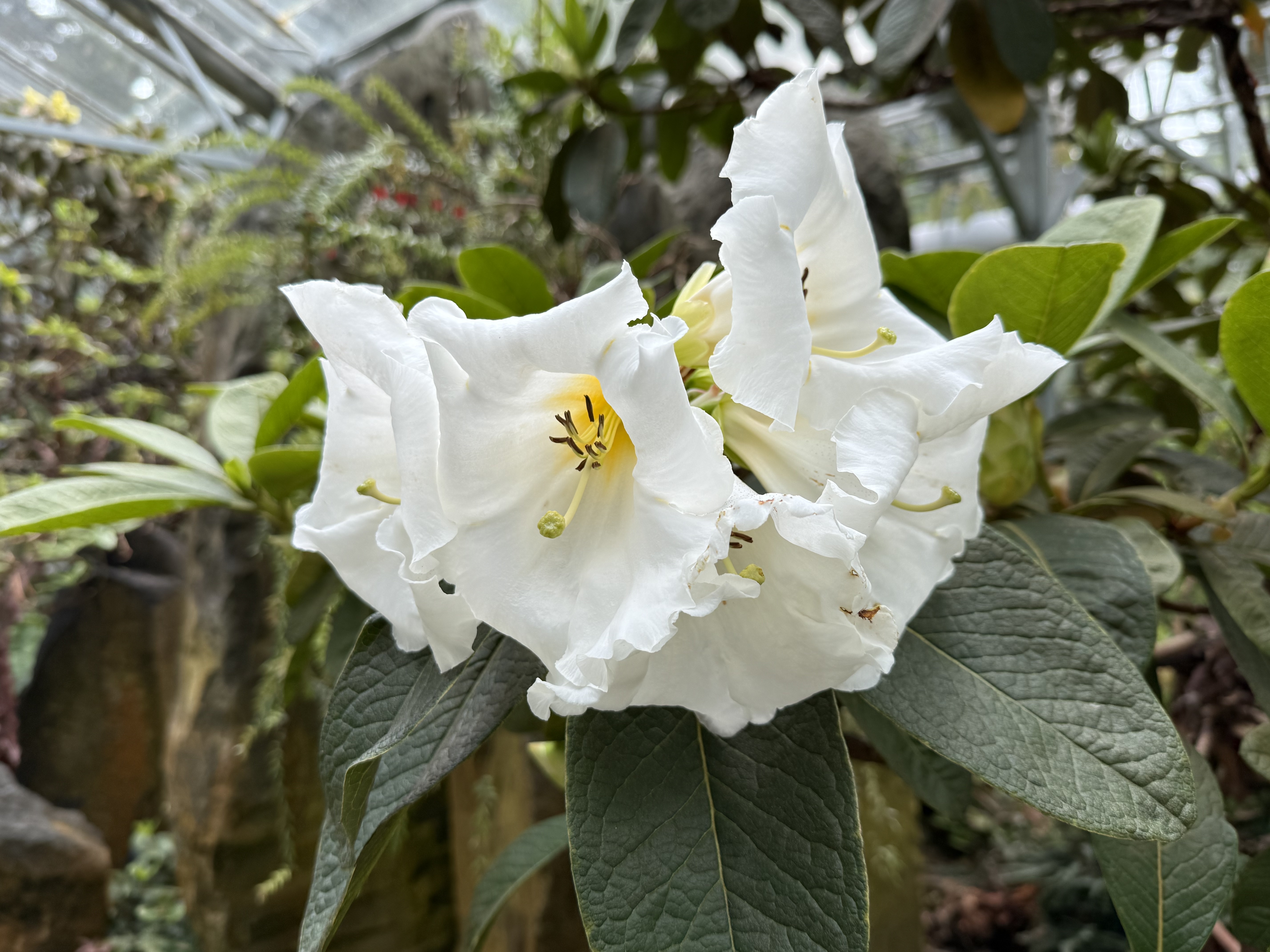
We crossed the gravel plaza and paid a visit to the Rhododendron Garden. The casual stroll through every imaginable color flower was worth the price of admission, even on a chilly spring day in the Pacific Northwest.
I’ve commented about “nurse logs” before. Here they are part of the landscaping.
I love the flowers peaking out of one end of this log while a bush is struggling to escape from the other end.
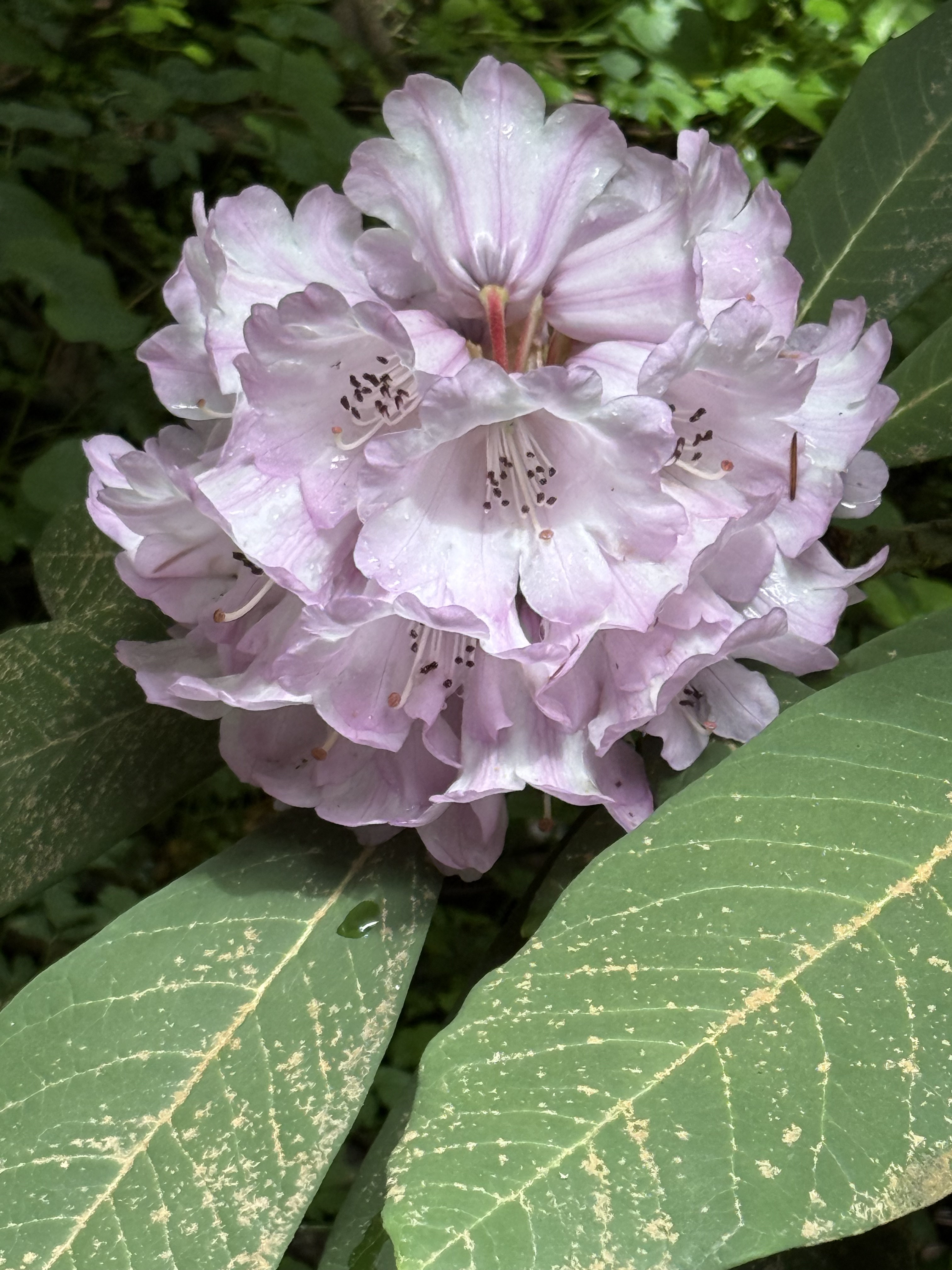
Rhododendron is one of the most common groups of plants, native to every continent although most of them originate from SE Asia. They do well in the Himalayas–not so much here in the PNW.
This caught my eye as we left the museum/garden…
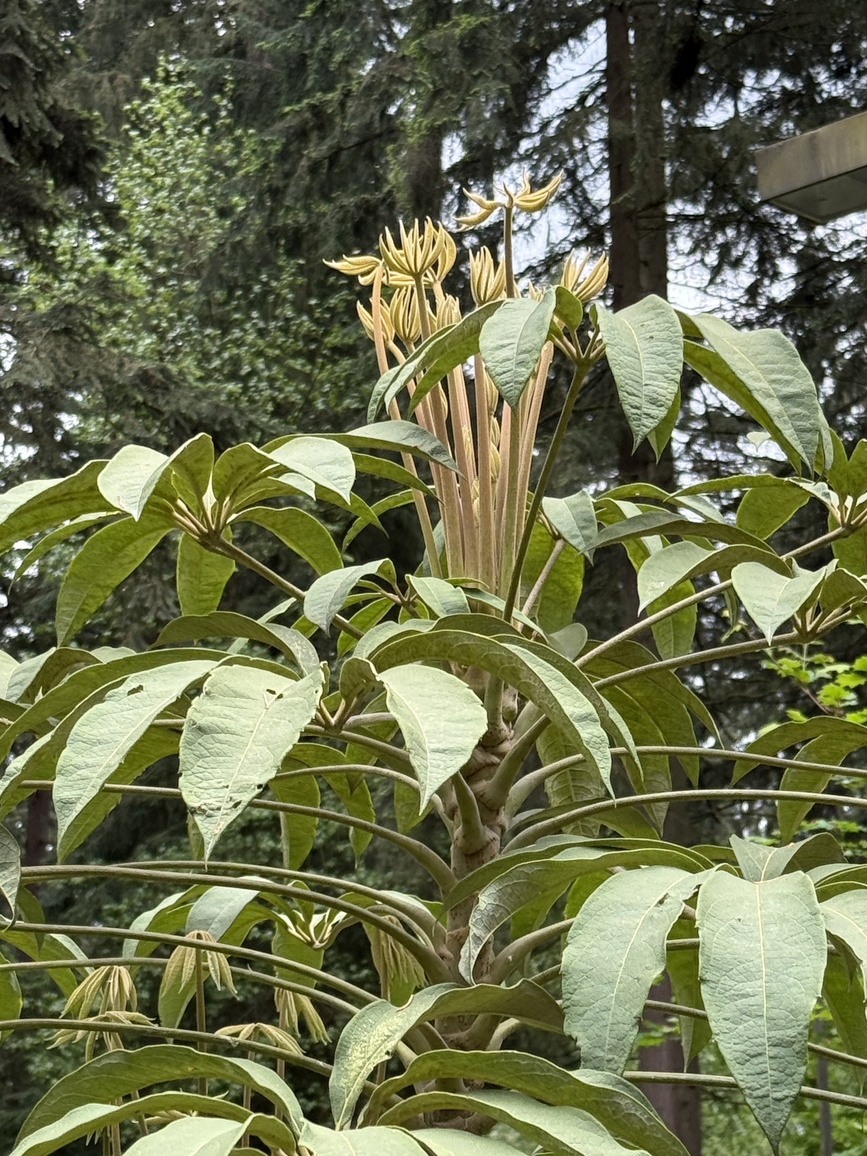
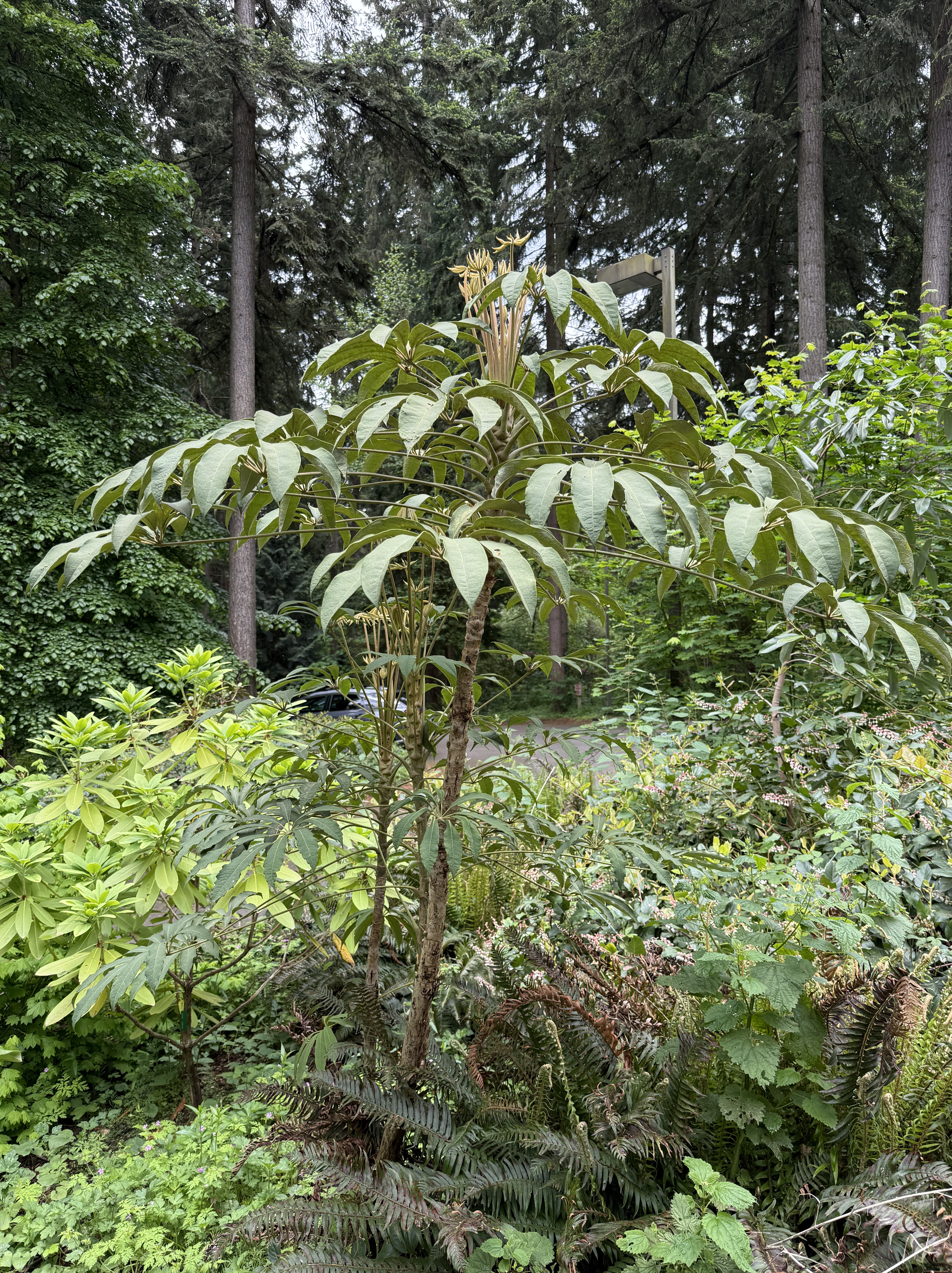
What the hell is growing out of the top? I’d love to see what kind of flowers this tall shrub will produce later this spring…
Ecology Notes from Vancouver, British Columbia
Every time I go outside here in the Pacific Northwest I find something new and mysterious, so I’ll keep posting these notes on my discoveries. This time I crossed the border and entered our northern neighbor, Canada. It’s only a three-hour drive, not counting the time spent at the border patrol station.
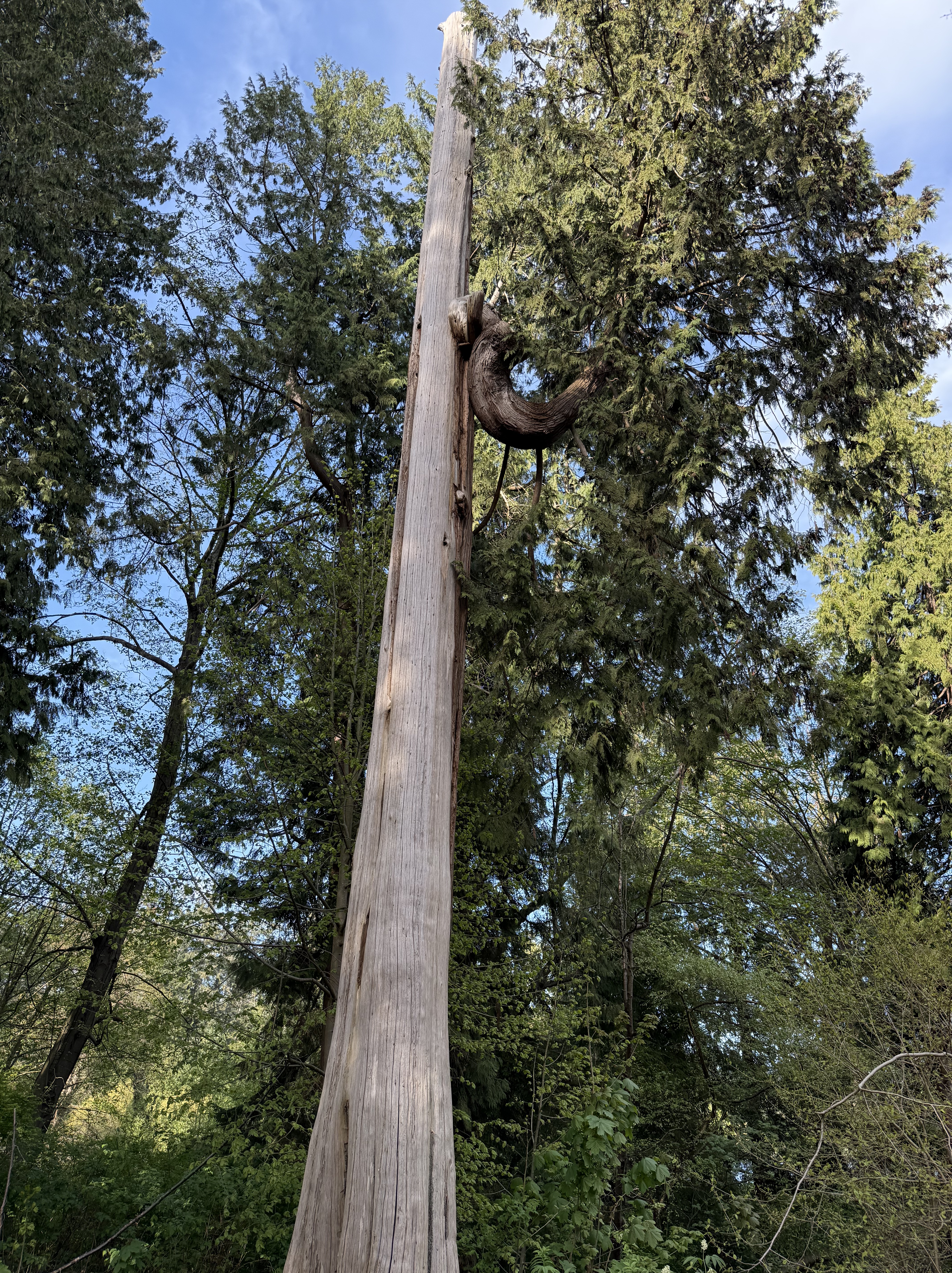
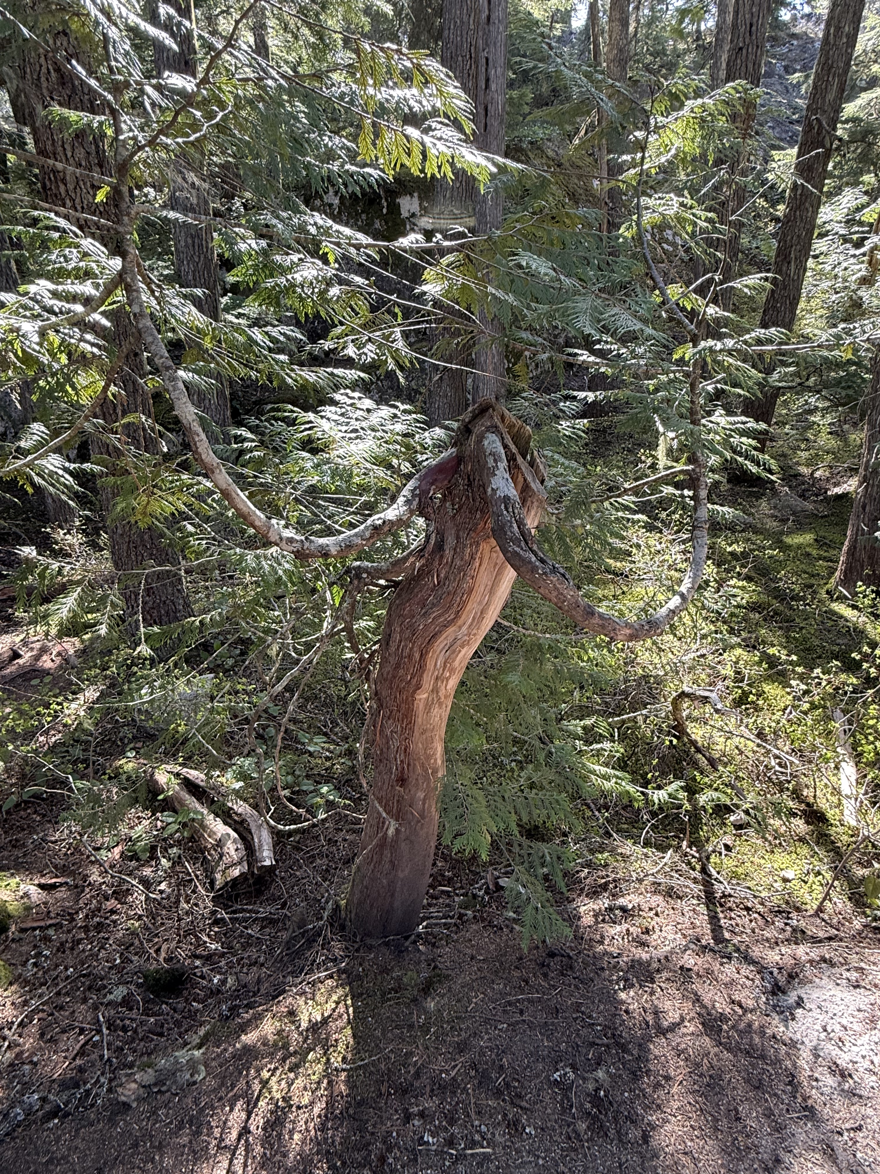
There is no old-growth forest in this part of British Columbia but that doesn’t mean the forest has died. It is regrowing and adapting to a more urban environment. We were strolling through Stanley Park, on the waterfront of Vancouver, when this bizarre tree caught my eye. The tree looks dead, including no crown and a trunk that appears ready to fall over; but near the top a curved branch has appeared. It is almost as large as the trunk and has a thick canopy. Unbelievable!
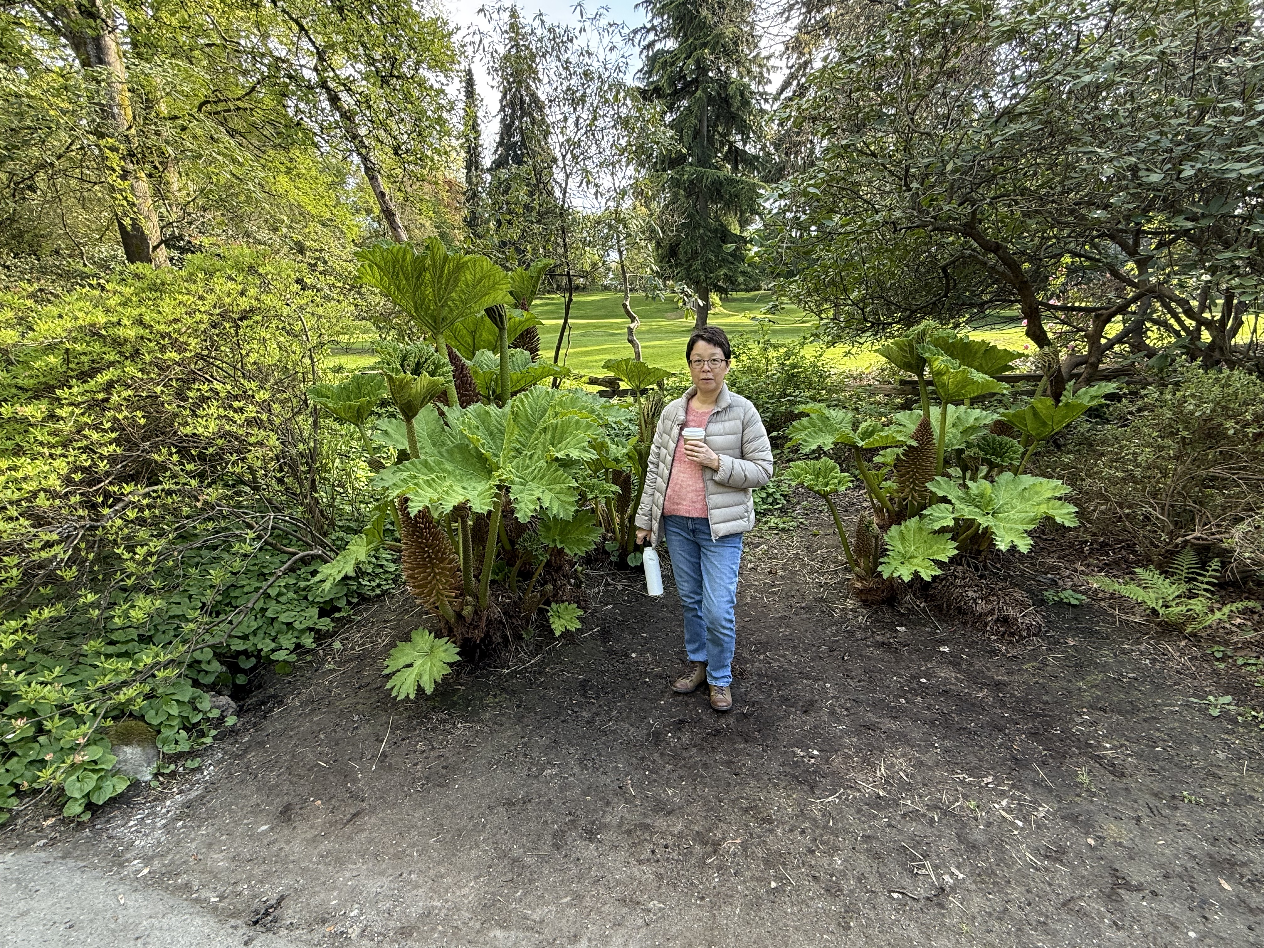
This tropical appearing plant is Gunnera manicata, also known as giant rhubarb (according to CoPilot). It is originally from Brazil, but it does well in the PNW because of the wet climate and mild winters.
We drove a little up a fjord to Shannon Falls and discovered that nurse-log trees occur here as well as in Washington. This one is probably a Western Hemlock growing from a stump comprising multiple roots from clumped trees that merged into one. That’s why it looks like a bamboo thicket.
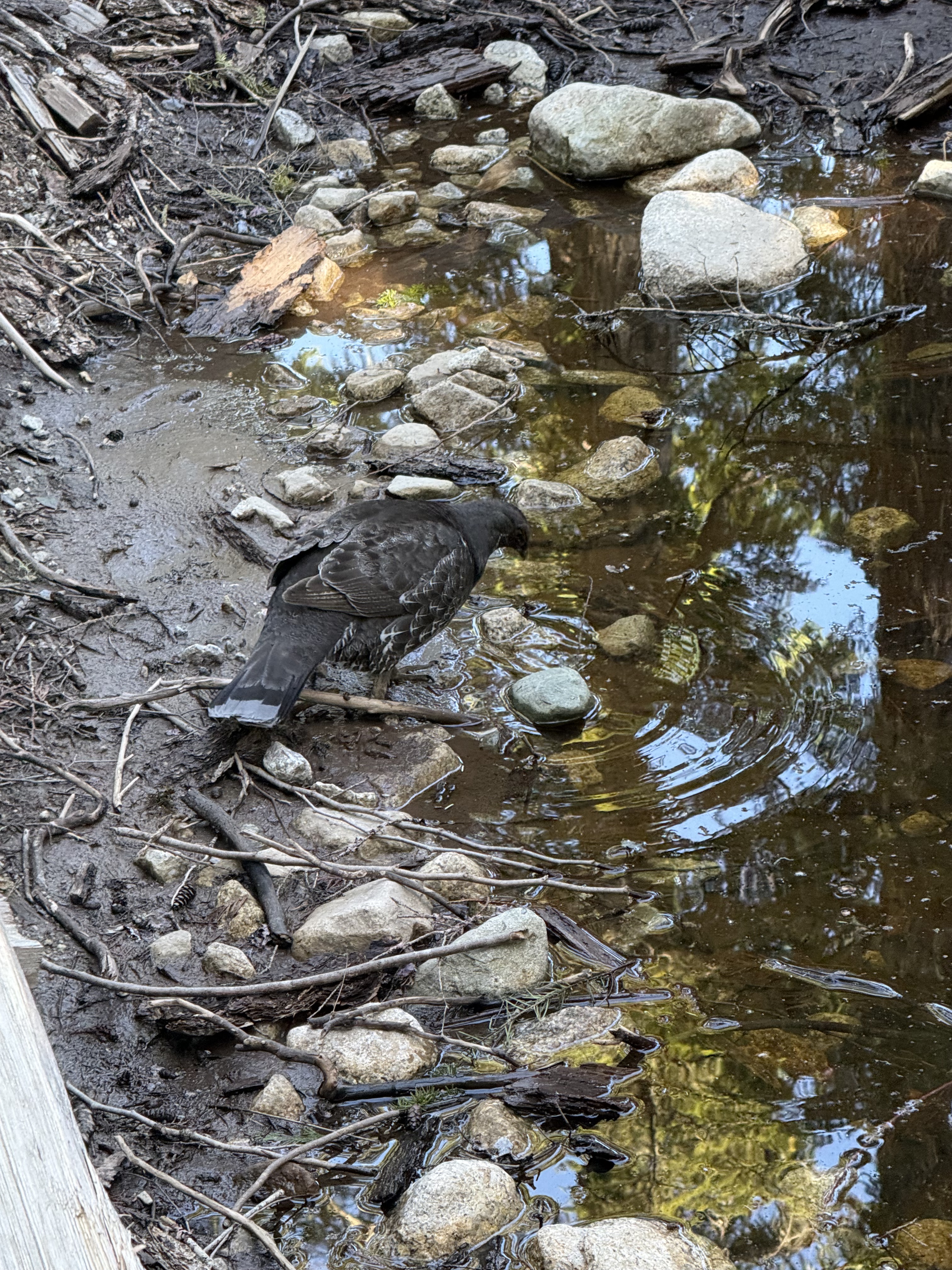
This Sooty Grouse didn’t seem to mind being photographed as it poked around this water hole in Squamish and Chief Viewpoint park.
This reminded me of the tree I saw in Stanley Park, a dead stump with curved growth full of foliage. I asked CoPilot about it and, surprisingly, it had a plausible explanation. It is so damp in the coastal PNW that trees don’t just grow out of stumps, they can actually grow from dead trees well above the ground. Apparently, the young tree has sent roots down through the decaying stump to reach the ground…another biological wonder. Simply awesome!
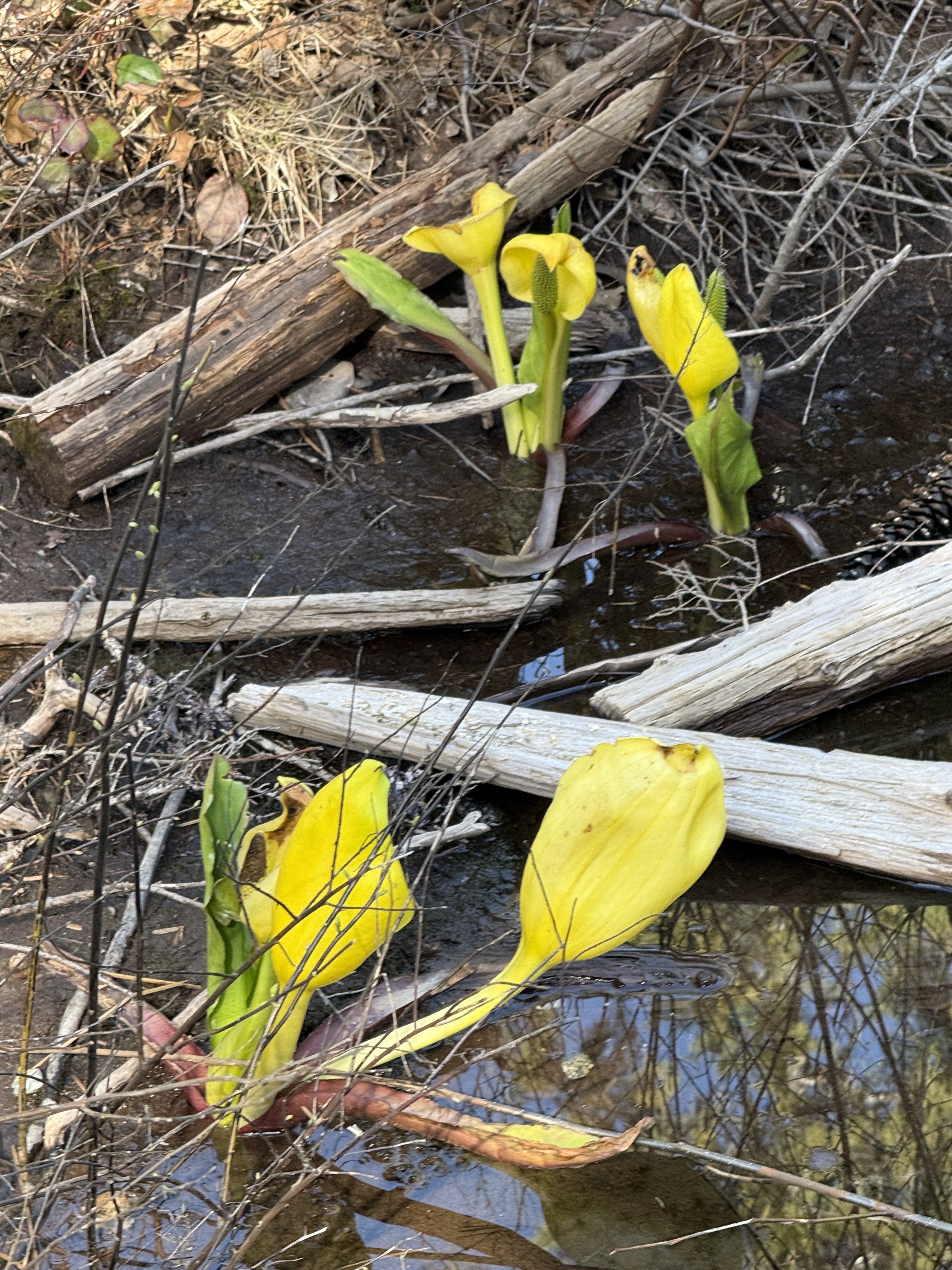
I thought these bright flowers looked familiar, but I don’t trust my intuition on biological matters (all yellow flowers are the same); as it turns out, according to CoPilot these are Western Skunk Cabbage–the same plant I saw in a wetland along the Olympic Peninsula. I was right…but I had forgotten the name. LOL!
I enjoyed this trip and writing this post, thanks to CoPilot. Its identifications may be wrong but they are better than mine. I think of its comments as those of someone who took a biology class in college.
I hope you enjoyed it too.
Sights around Lake Washington
It promised to be a beautiful day, so we decided to take a look at Lake Washington, just east of Seattle. This elongate water body was carved by glaciers between 19 and 16 thousand years ago. It was part of Puget Sound until about 5700 years ago, when river sediment isolated it from the sea, allowing it to become fresh water. The original outlet at the southern end wasn’t good enough for early American settlers, so they got approval from Congress to construct a canal with locks to connect Lake Washington to Puget Sound, a drop of 20 feet in elevation. As fans of technological progress, we wanted to see this for ourselves.
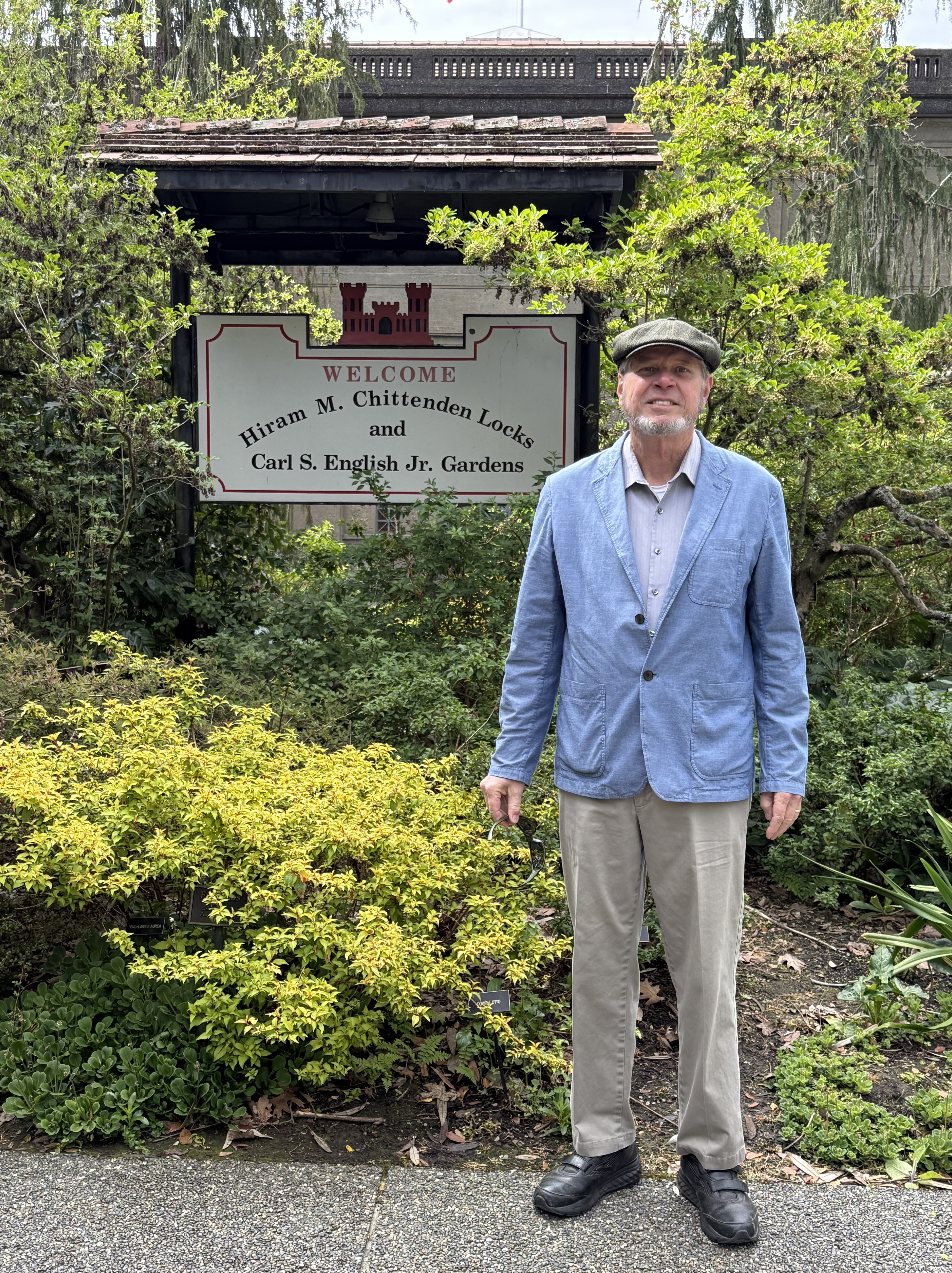
The Army Corps of Engineers began construction of a set of locks in 1911, under the supervision of Hiram M. Chittenden. As the sign proclaims, his name remains associated with them; however, they are more commonly known as the Ballard Locks after the city where they were built. The site includes a number of stone-faced buildings and has since come to include a botanical garden.
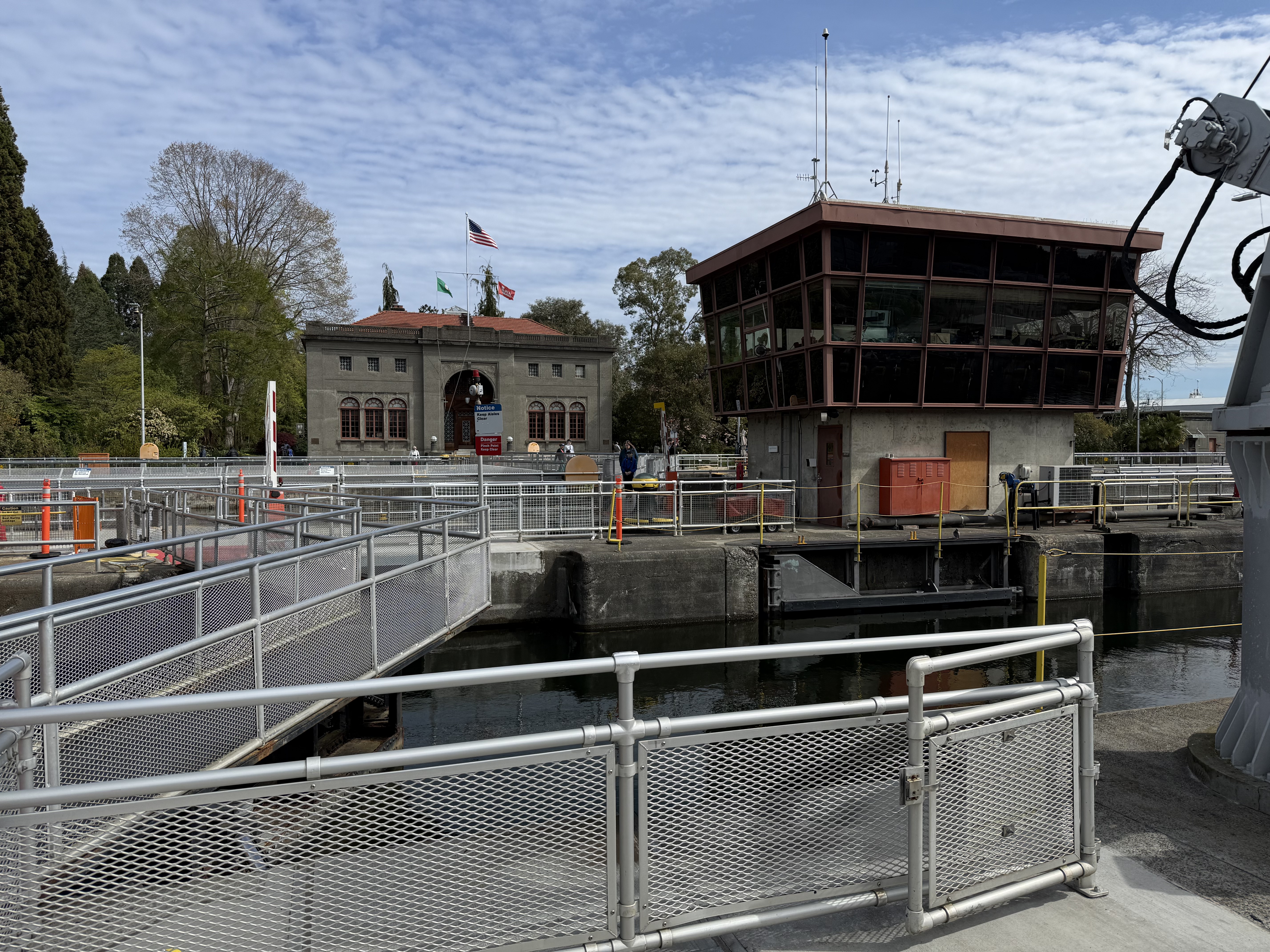
There are two locks, one for larger, commercial vessels (on the other side of the control building) and a smaller lock. The larger one has two sets of gates to accommodate barges.
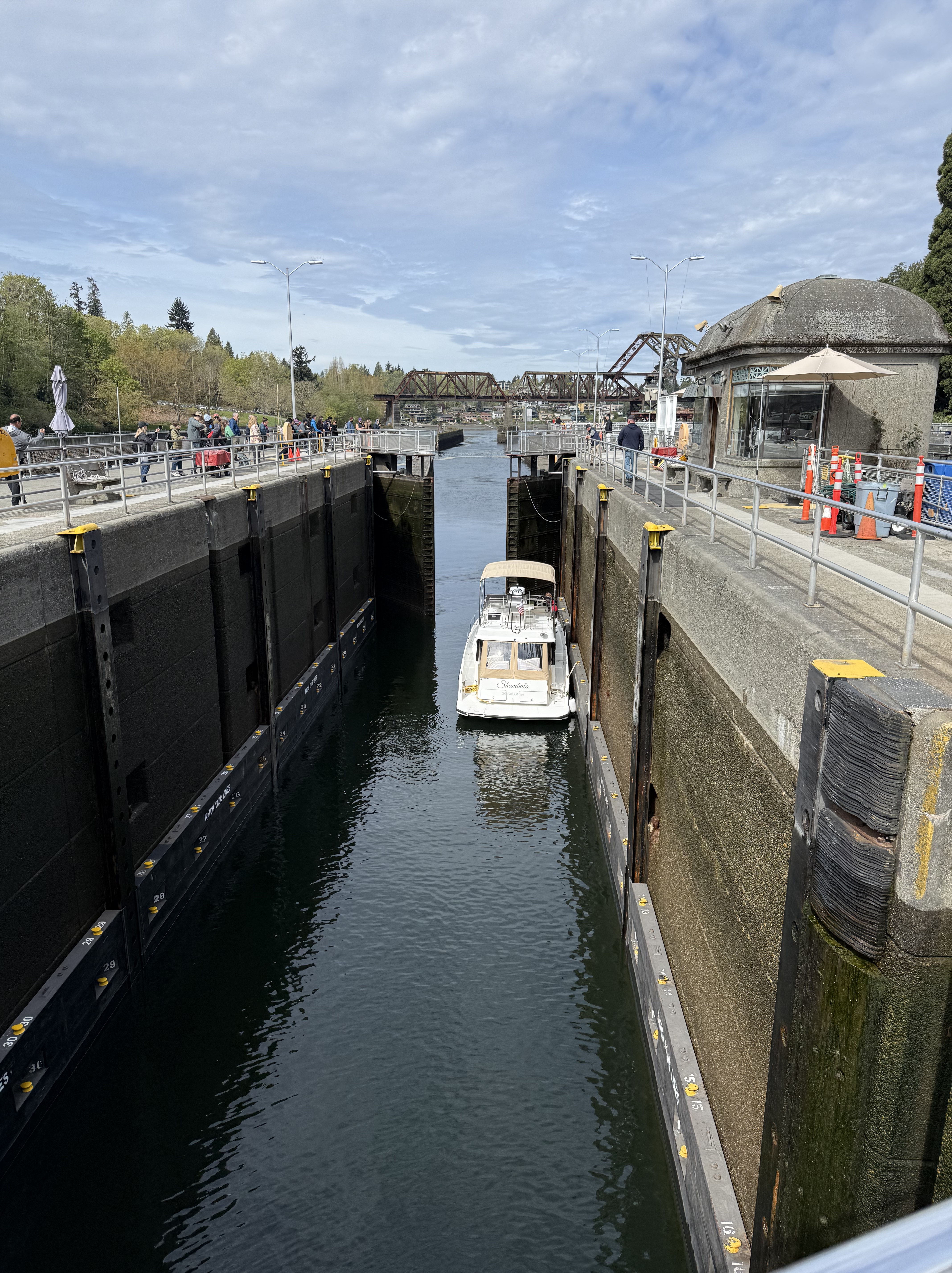
Several private boats used the lock while we were there. It takes maybe 15 minutes for the water level to equilibrate whether going upstream or downstream (towards Puget Sound).
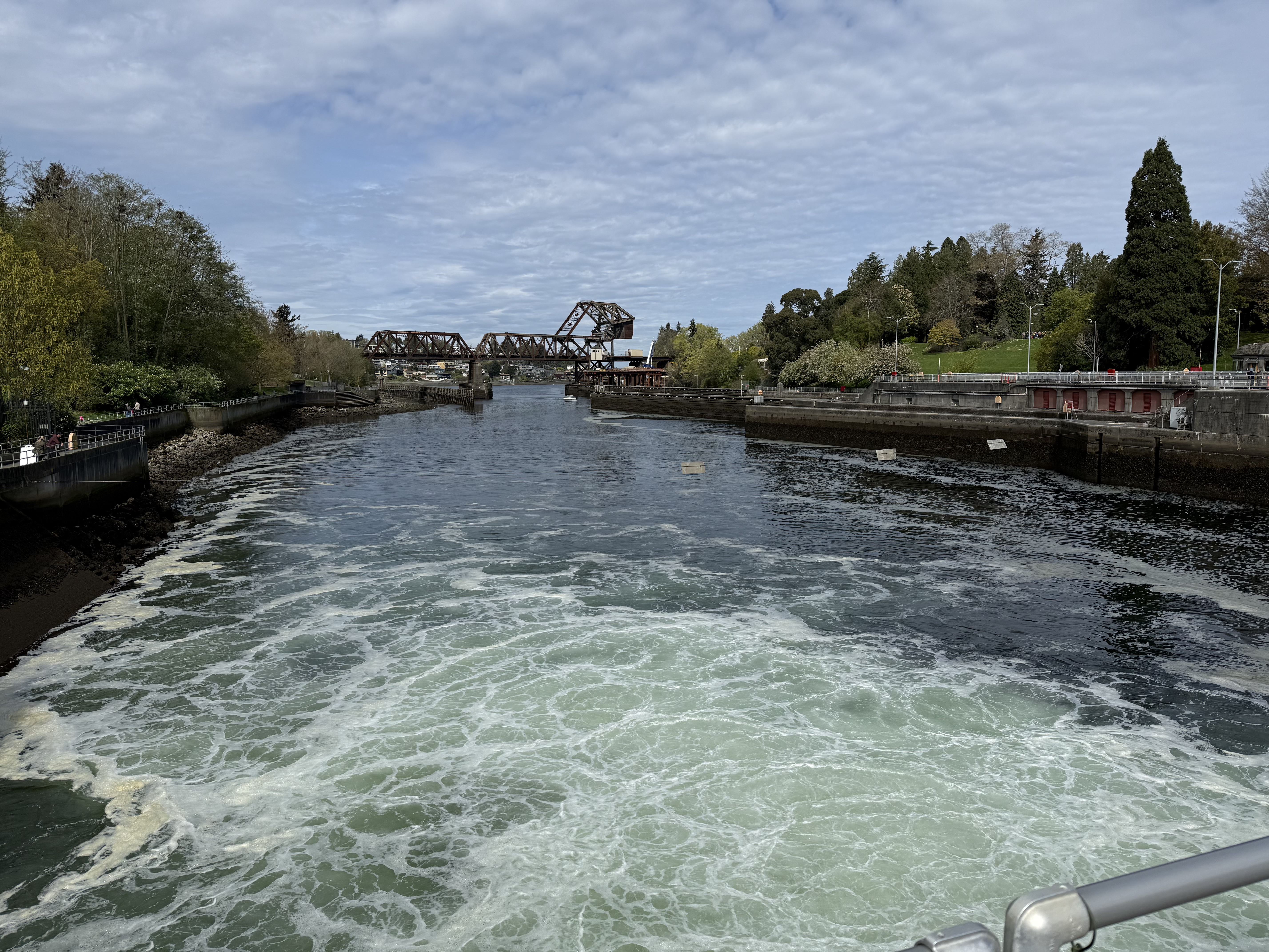
The spillway was partially open and the turbulent flow created a very dangerous scene. I wouldn’t want to fall into that water.
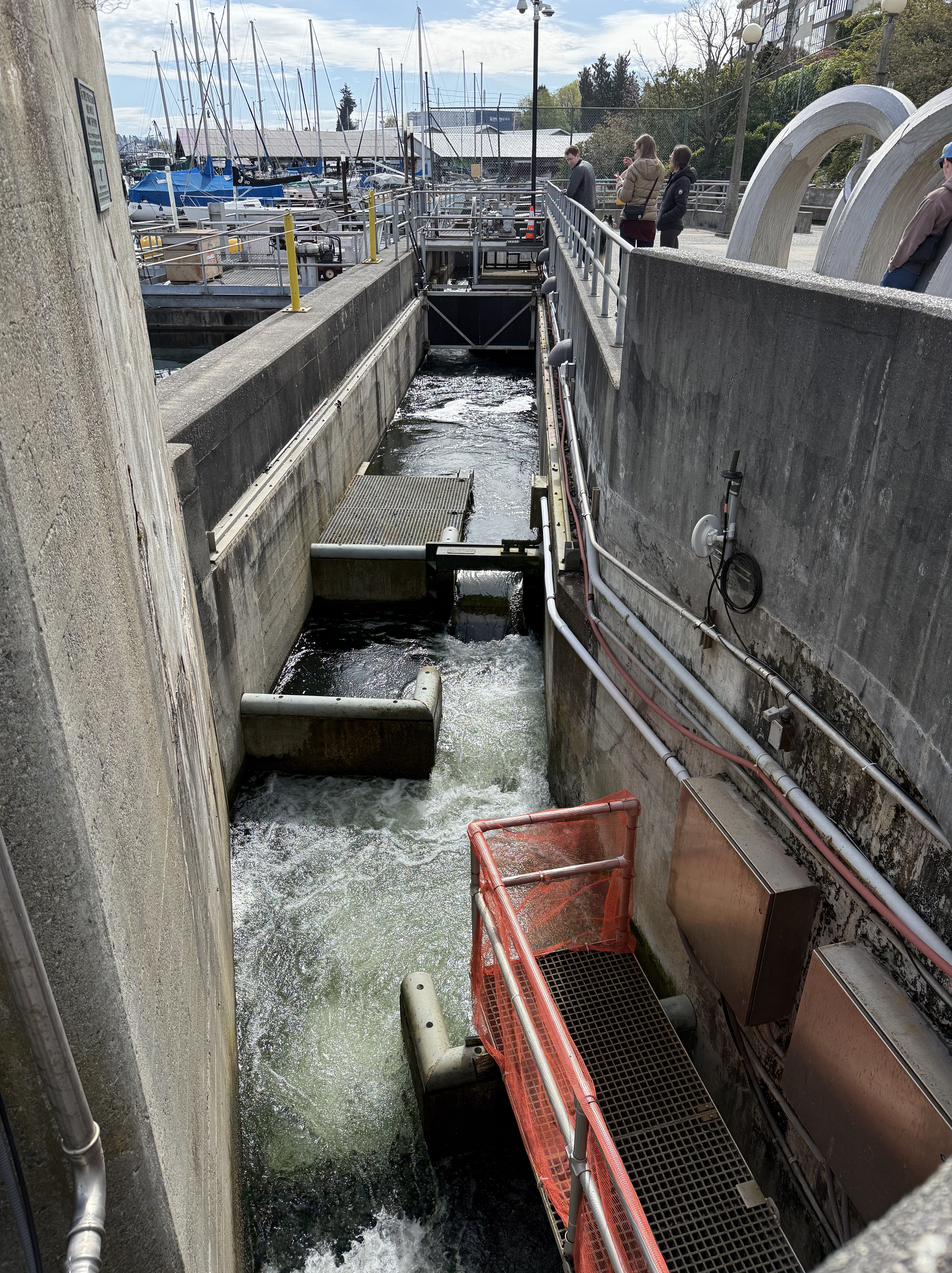
Salmon have historically swam into Lake Washington to spawn through the small river (Black River) that drained it before the ship canal was constructed. That outlet is apparently filled with sediment now and the area completely covered with development, including Boeing Aircraft’s main plant, where the Museum of Flight is located. The lock design includes a series of pools called a fish ladder that allows the salmon to get to their spawning areas. I guess they figured out the new route. There’s a viewing room to the right where the fish can be seen making their way up the ladder, but there were no fish on this day; and I forgot to take a picture.
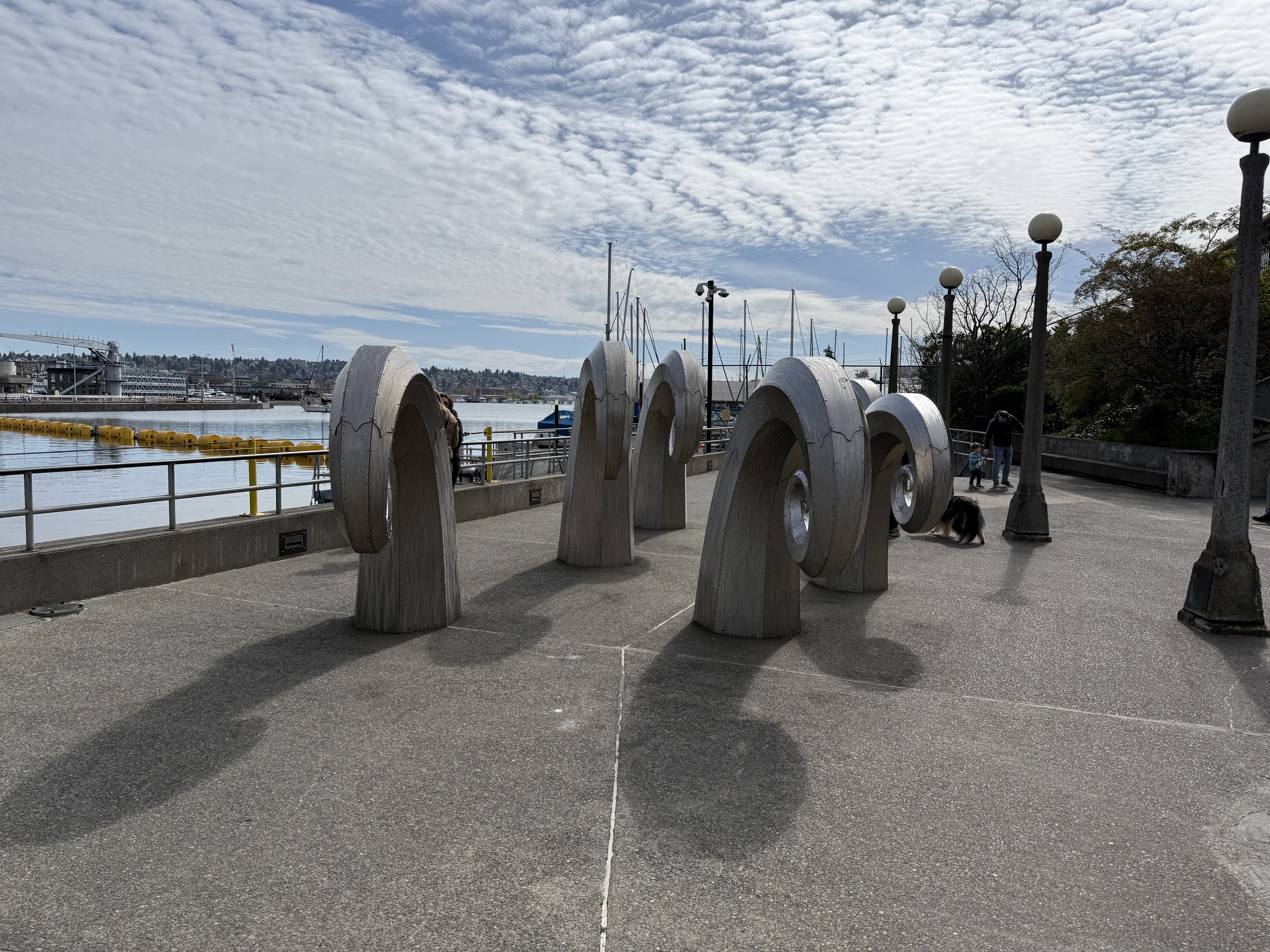
The roof of the fish ladder observation room is decorated with this unlabeled artwork.
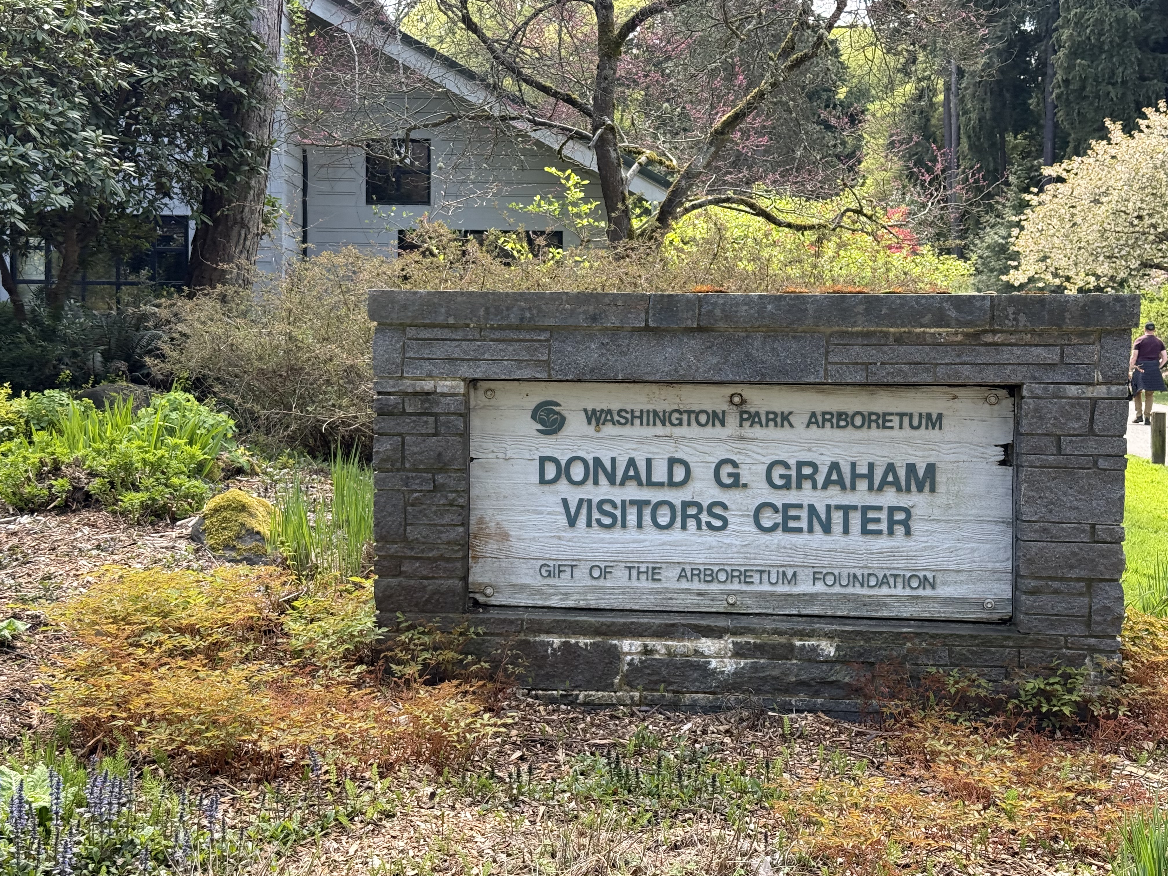
Just a short drive from Ballard Locks is Washington Park, which includes an arboretum and Japanese Garden. We took a long walk around the park but didn’t make it to the Garden, which has its own parking area.
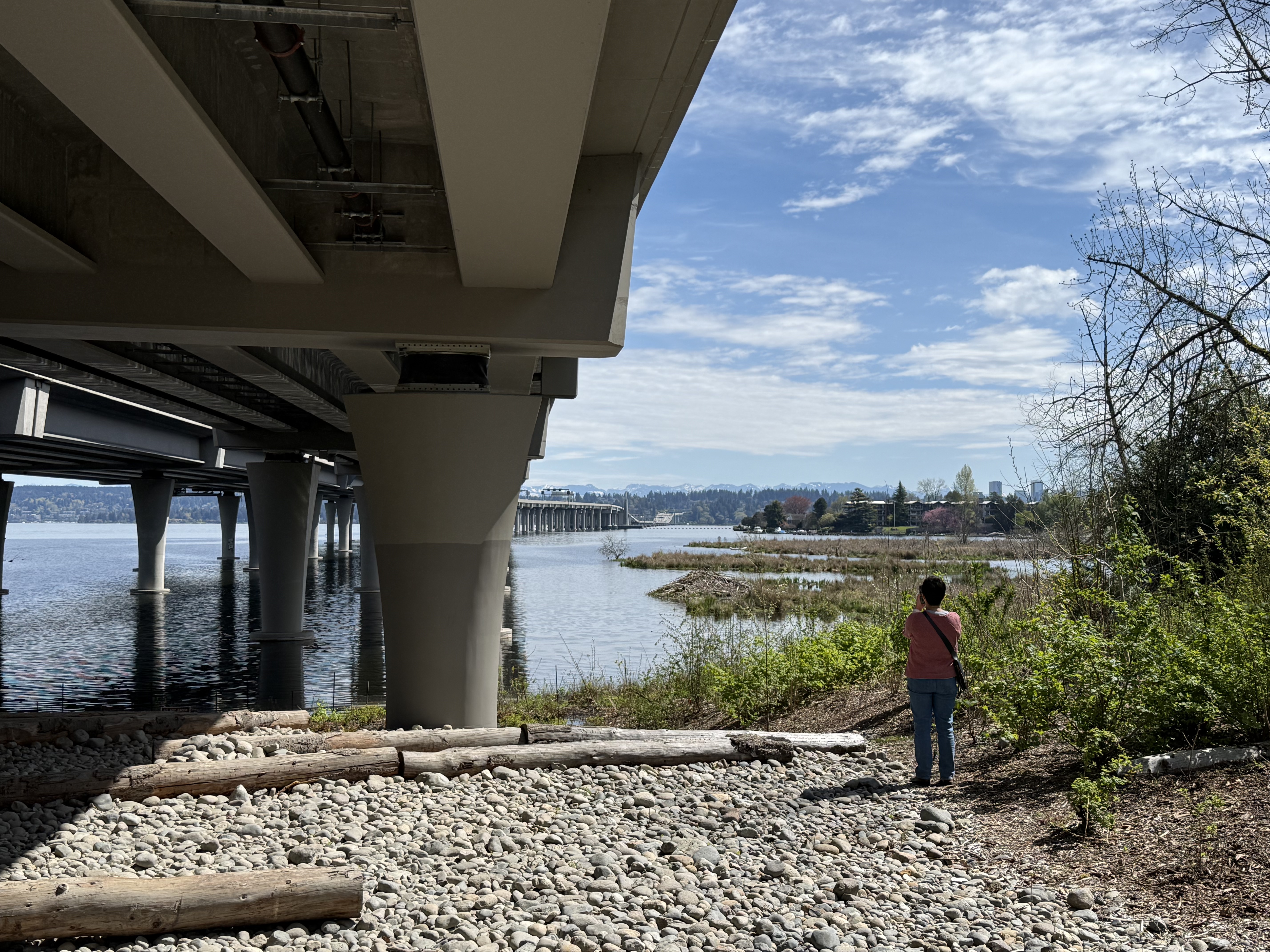
The walking paths go out to an island, where State Route 520 crosses Lake Washington, partly using a unique floating bridge construction. Traffic was pretty loud out there. I wouldn’t enjoy having lunch on one of the picnic tables.
These are typical plantings along the paths in the arboretum. I don’t know anything about plants, so I asked CoPilot (giving it the location): the low, flowering shrub is probably Pieris japonica (aka Lily of the Valley shrub); and the tree may be Stewartia.
There were numerous masses of flowering shrubs like this, which is probably a dwarf Rhododendron (according to CoPilot). There were a lot of plants within a group, which didn’t look anything like each other; however, the signs explained that the arboretum had large collections of Rhododendrons and Magnolias, for example.
It was a beautiful spring day, and Lake Washington was the perfect place to spend it. I won’t post a photo of the excellent, home-made hamburger and cold beer I enjoyed at Skillet and Vine after a tiring morning of basking in a warm sun.
Mount St Helens After Forty-Five Years
Introduction
I was a geology student at Arizona State University in May, 1980, when Mount St. Helens made the headlines. It is the largest volcanic eruption in North America, and when one-cubic-mile of mountain collapsed, it became, and remains, the largest landslide in human history. I followed the progress of geological investigation into the eruption with interest as I pursued my education, but progress was slow. It isn’t easy to reconstruct an event that occurred in a few minutes. The area was too dangerous to approach for more than a year because of gas explosions from within the pile of debris, which reached 600 feet in thickness.
Mount St. Helens faded from memory for decades, eventually becoming just another geologic event in a long chain of cataclysms covering billions of years. I never thought about it until I found myself living less than 100 miles from ground zero. I had to check it out. This post is a brief summary of what I found when I visited Mount St. Helens National Volcanic Monument. I hope I can convey some of the excitement I felt at stepping on ground that was literally on fire less than fifty years ago.
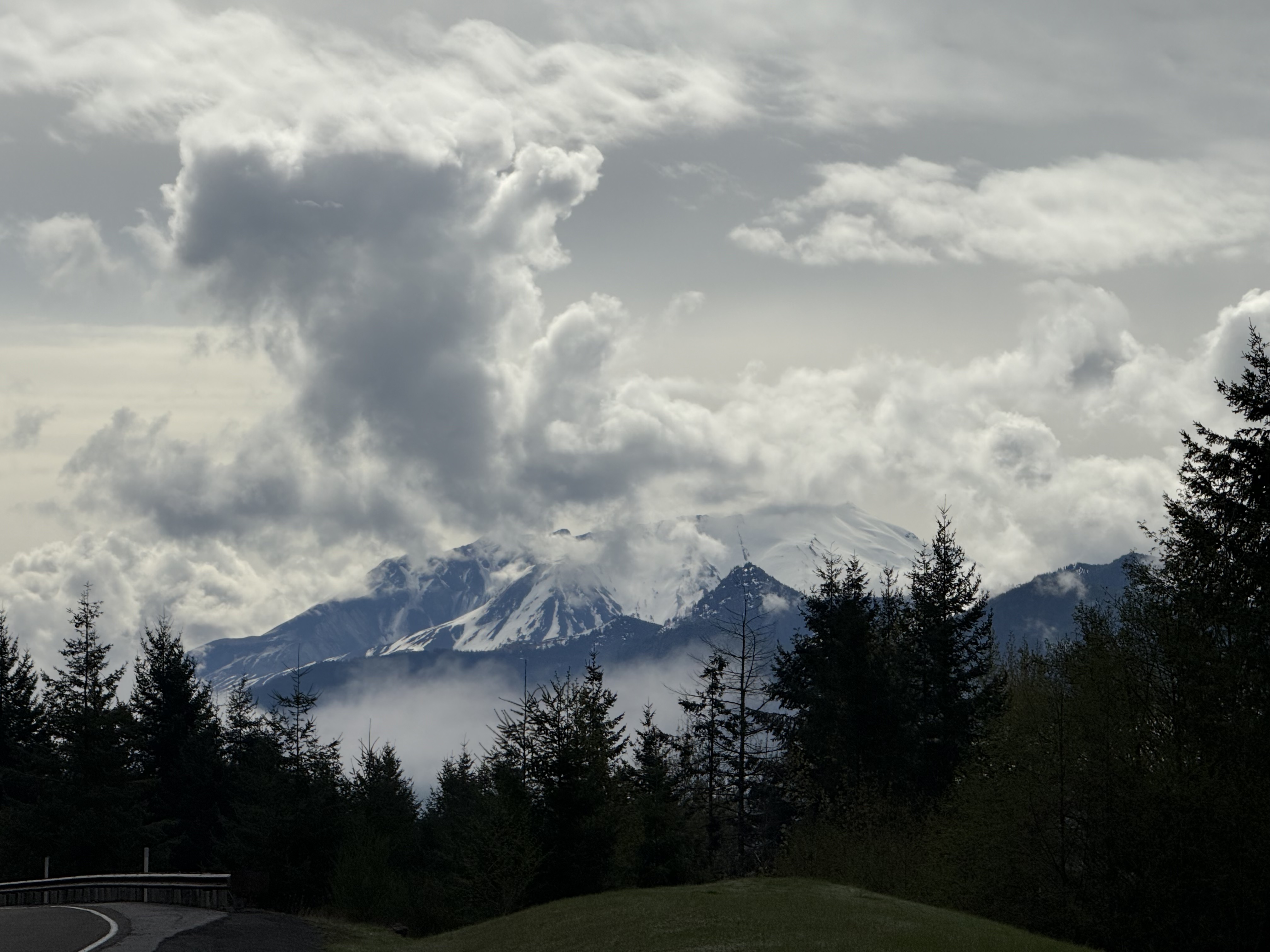
Figure 1. I arrived at about 10:30 in the morning and got this image before low clouds settled in, accompanied by fog later in the day. The characteristic volcanic cone is missing; the top of the mountain slants slightly upward to the right in the center of this image. That isn’t a lake in front of St. Helens, just fog collecting in the valley that feeds the Toutle River.
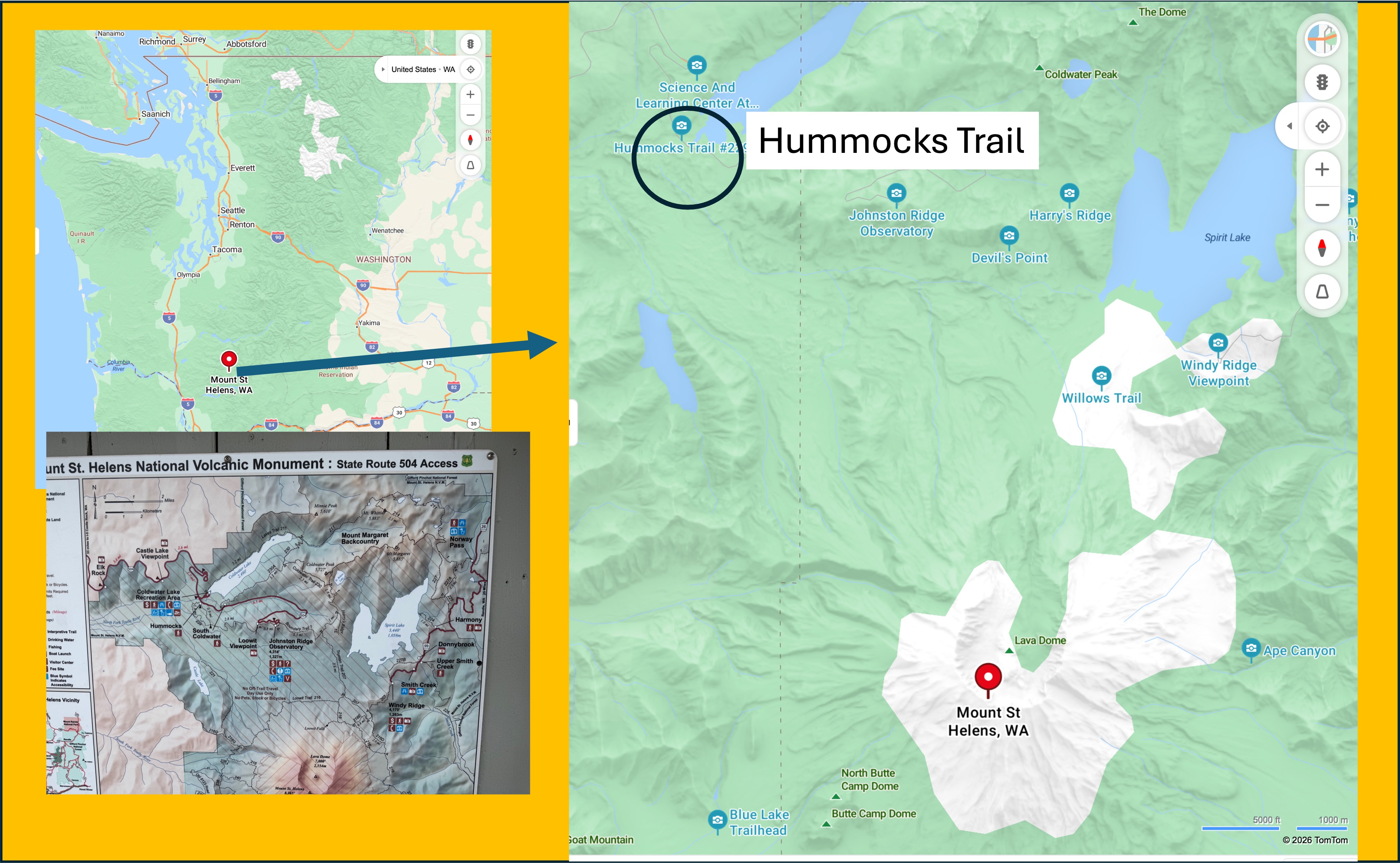
Figure 2. Mount St. Helens is about 2.5 hours from Tacoma. The closest you can drive is Hummocks Trail, but a four-mile hike will take you to the rim of the caldera. Maybe another time.
Older Volcaniclastic Rocks
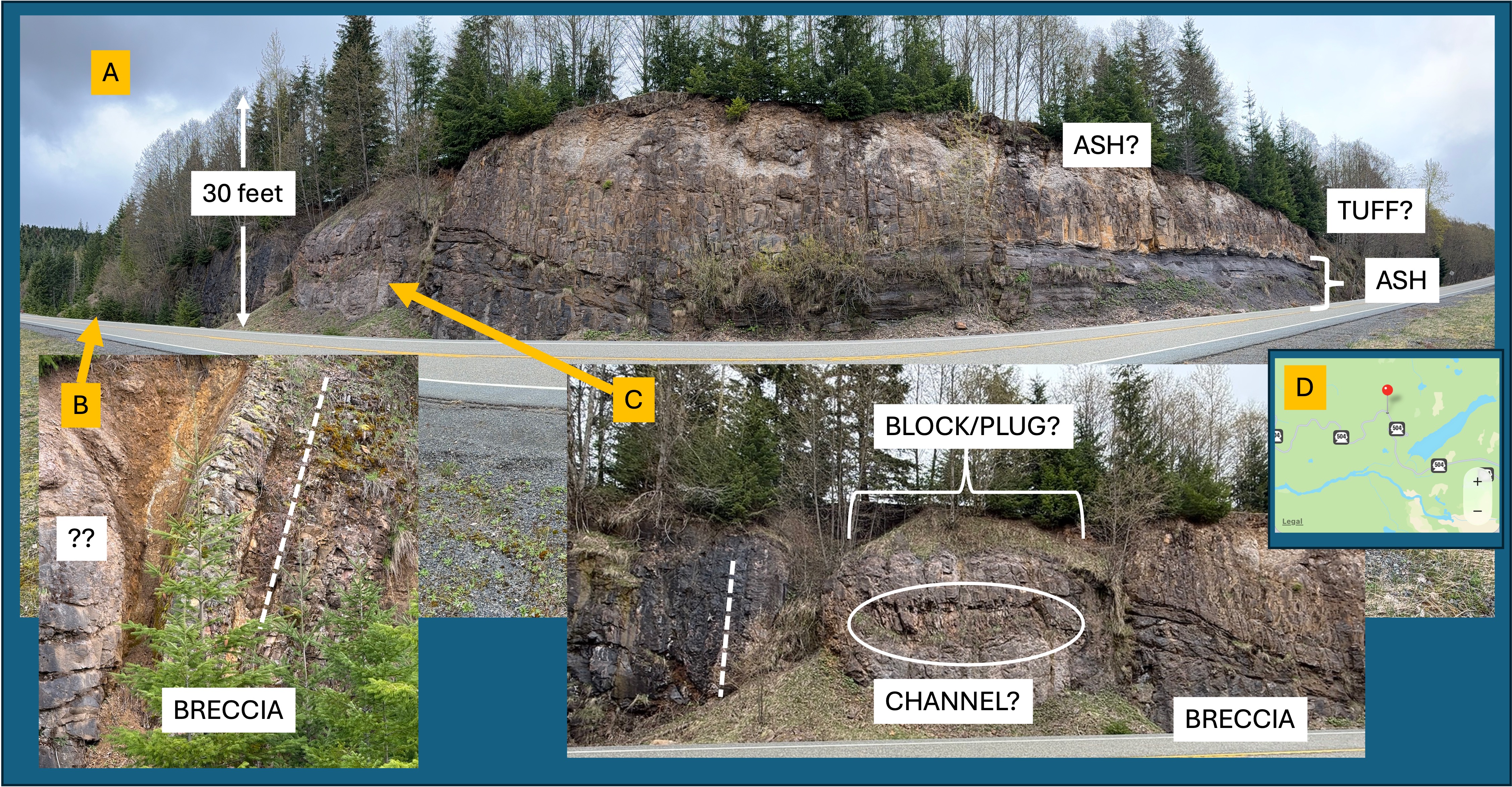
Figure 3. Mount St. Helens is less than forty-thousand years old, but it is constructed on a thick sequence (~2 miles thick) of volcanic rocks as old as 300-thousand years. Beneath these Pleistocene volcaniclastic rocks mixed rocks of uncertain age that comprise “bed rock” in this area; however, these igneous and sedimentary rocks are much older–spanning the Oligocene epoch (~34-23 Ma). I stopped to look at several road cuts along the new Highway 504 (the original is buried under debris).
A. Exposure of andesite volcanic rocks showing a complex eruption history, which includes ash layers and what looks like tuff (ash so hot it melted together to form a glass-like volcanic rock).
B. Close-up from the left side of (A) showing a layer of volcanic breccia that is now vertical. Individual clasts are visible but there is very little matrix. The dashed line indicates the approximate bedding plane of the layer. The rounded block labeled with ?? is about 12 feet in diameter. This is a puzzling structure. My guess is that there was a collapse of one or more volcaniclastic layers into a ravine after deposition. A jumble of material.
C. Photo of a complicated structure separating the left side of the exposure (tilted beds and blocks) from the right side (horizontal ash layers). The dash line is meant as a reference to the vertical beds in (B), but it was difficult to determine orientation. However, a clear change in texture suggests a depression, which may have been a conduit for volcanic material to erupt. The BLOCK/PLUG label reflects this interpretation. Within this “BLOCK” there is a discrete region of thin, irregular bedding that I’ve labeled (for convenience) as a CHANNEL? The question mark reflects my doubts about this identifier. Nevertheless, this road cut exposes a sequence of events: lava and ash being erupted onto an irregular volcanic landscape; probable surface erosion for some period of time; physical disruption and collapse, probably while still hot, of some part of later volcanic material. I don’t have enough experience with volcaniclastic sediments to say anymore than that.
D. The pushpin shows the location of this road cut. The blue ribbon is Coldwater Lake, where Hummocks Trail is located (see Fig. 2); this exposure is more than ten miles from the caldera, and hundreds of feet above the valley floor.
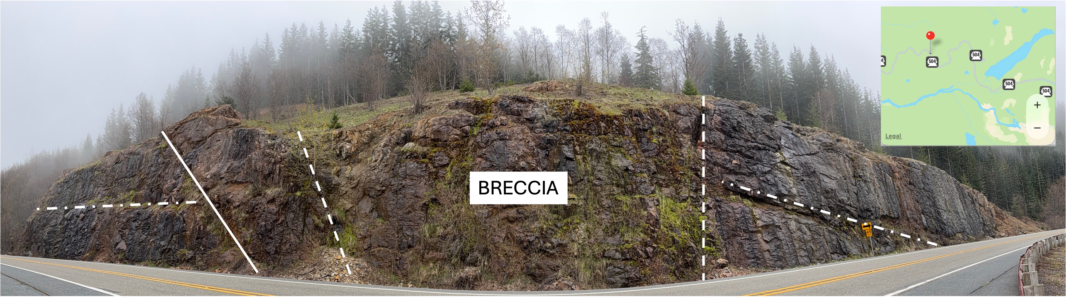
Figure 4. This post-eruption road cut is a mile or more further from the caldera. The solid line was a striking lineation that could be a fracture or possibly a contact between eruption beds. The dash-dot lines are apparent bedding planes between andesite flows. There is no ash present at this location. The dash lines delineate what I’m calling a BRECCIA because there is no evidence of bedding and the overall appearance is irregular; also, some large blocks were evident, although they could be a result of differential weathering. Lava flows are notoriously difficult to trace any distance laterally. Nevertheless, this exposure is similar in appearance to Fig. 3 with respect to the discontinuity between identifiable volcaniclastic deposits.
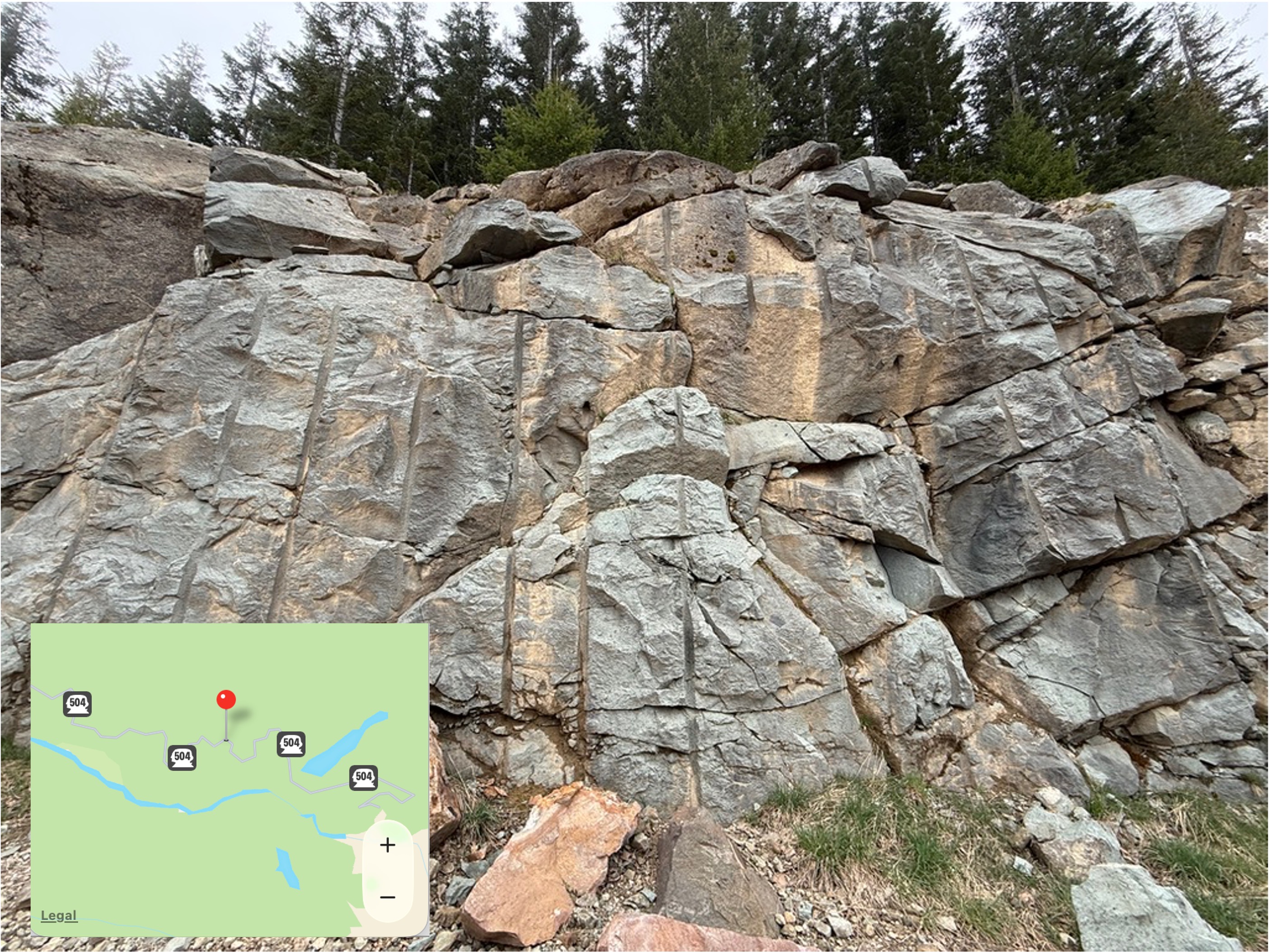
Figure 5. This road cut is located (see inset map) in an area the geologic map (Rock D) identifies as volcaniclastic rocks of Oligocene age (33.9-23.04 Ma). This is a smaller exposure than seen in Figs. 3 and 4, but it is also very different in appearance. That could be an optical illusion; close examination of the photo (I took it from my vehicle stopped in the middle of the road) suggests to me that this is ash that was so hot it formed what is called a welded tuff when it fell, after being blown into the atmosphere by an eruption. The light color suggests a magmatic composition more like granite than gabbro, or even diorite. That wouldn’t be surprising in the complex magmatic environment of a subduction zone, where partially melted, oceanic crust (e.g. gabbro and basalt) chemically mixes with continental crust (e.g. granite and diorite).
This completes my survey of older volcanic rocks near Mount St. Helens. There are no rocks exposed that explain the apparent hiatus in volcanism between about 23 and 2 million years ago. That is a story for another day…
Volcaniclastic Deposits from May 1980 Eruption
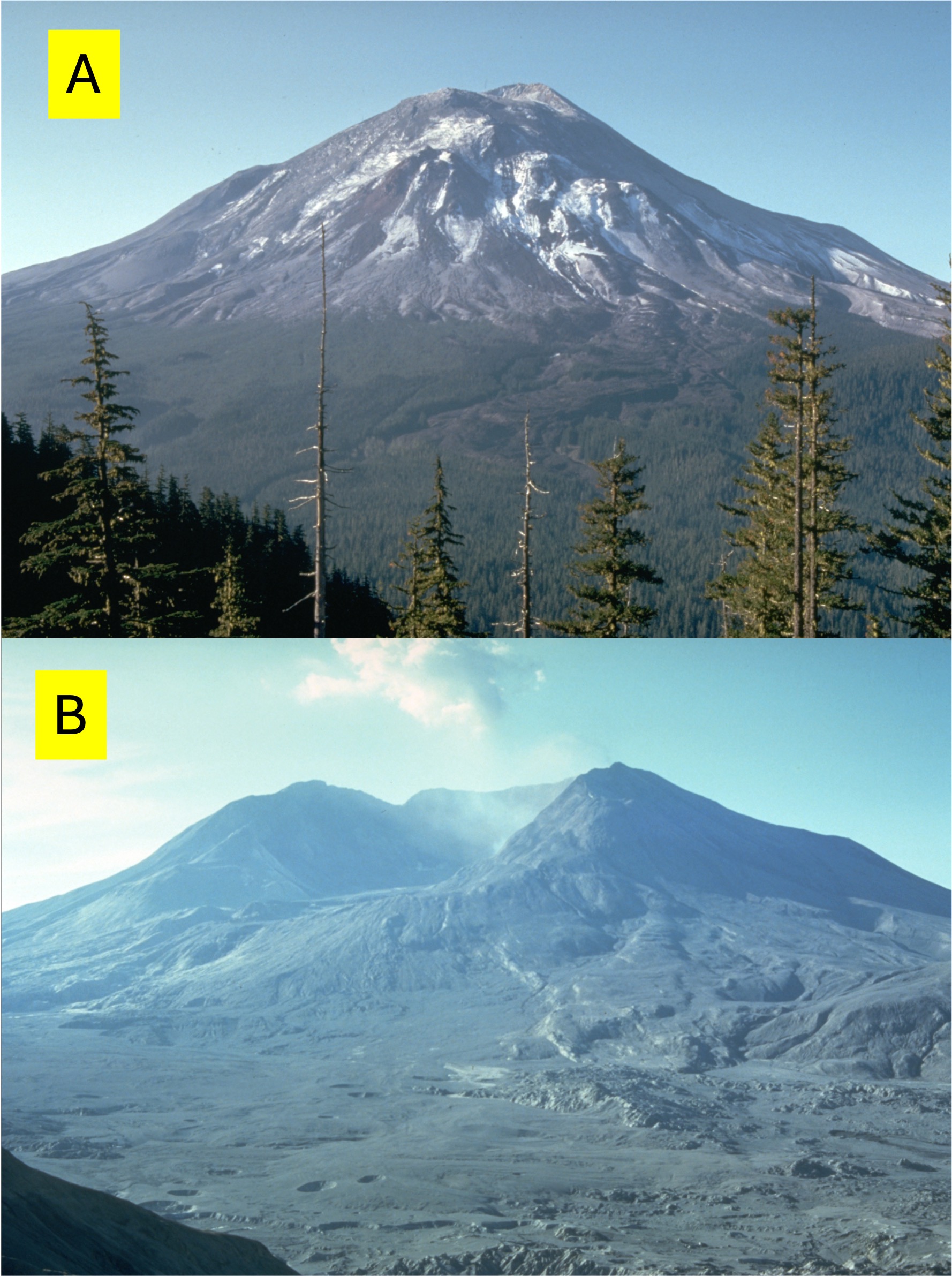
Figure 6. Photo A was taken a few days before the eruption in May, 1980. Image B was taken a few days afterward. The pre-eruption volcano was 9677 feet tall, but the obliterated peak is only 8365 feet. The total volume of material displaced exceeded one cubic mile, most of which was rock that collapsed during the rock slide preceding the actual eruption. The flat area fronting the volcano in (B) is a large fraction of the previous peak, which filled in several channels originating at the volcano. Note the holes in (B), which are probably blow-outs of gases trapped in the debris.
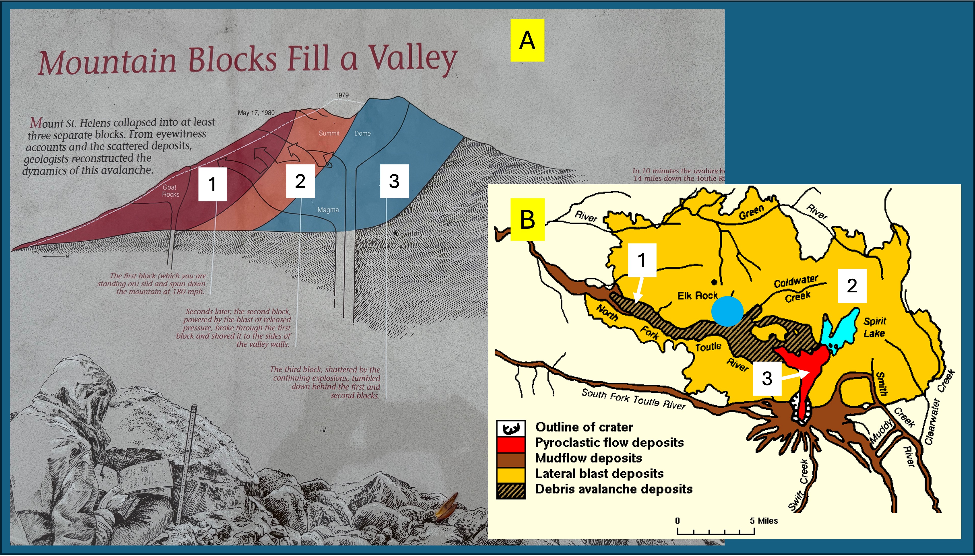
Figure 7. (A) This plaque was located along Hummocks Trail. I’ve supplemented it with the map of volcaniclastic deposits shown in (B). I will focus on the three major volcaniclastic deposits I encountered at Hummocks Trail (blue circle in B), which are numbered 1-3 in both figures.
The first stage was collapse of the north flank of Mount St. Helens (brown in A and cross-hatched in B). This was a run-of-the-mill massive landslide that followed existing drainage, until stage two occurred.
When the rock containing the highly pressurized magma was removed. The resulting release of pressure created an explosion equivalent to 10-50 megatons of TNT; although a volcanic eruption is not analogous to a nuclear explosion, the energy released was roughly 1600 times the energy of the Hiroshima atomic bomb. It moved a lot of rock. This blast occurred seconds after stage 1 began; the hot gases overtook the rock slide, driving rock and debris up the sides of the valley, removing everything, including top soil, within a few miles of the volcano. The orange area in B shows how widespread this explosion was.
Stage 3 was a pyroclastic flow (red in B), which was limited to the immediate vicinity of the caldera; however, what goes up must come down, so several inches of ash were deposited as far as Spokane, Washington–400 miles distant.
Video 1. This video shows debris from the landslide (Stage 1) that was pushed at least 300 feet from the original valley floor to the ridge by the unimaginable blast of Stage 2. The main slide followed Toutle River (North Fork), but with this impetus, debris was launched over the canyon walls. That’s what this video shows. It’s like the heavy stuff collected at the top of the ridge whereas the sand/gravel-sized debris was blown miles further.
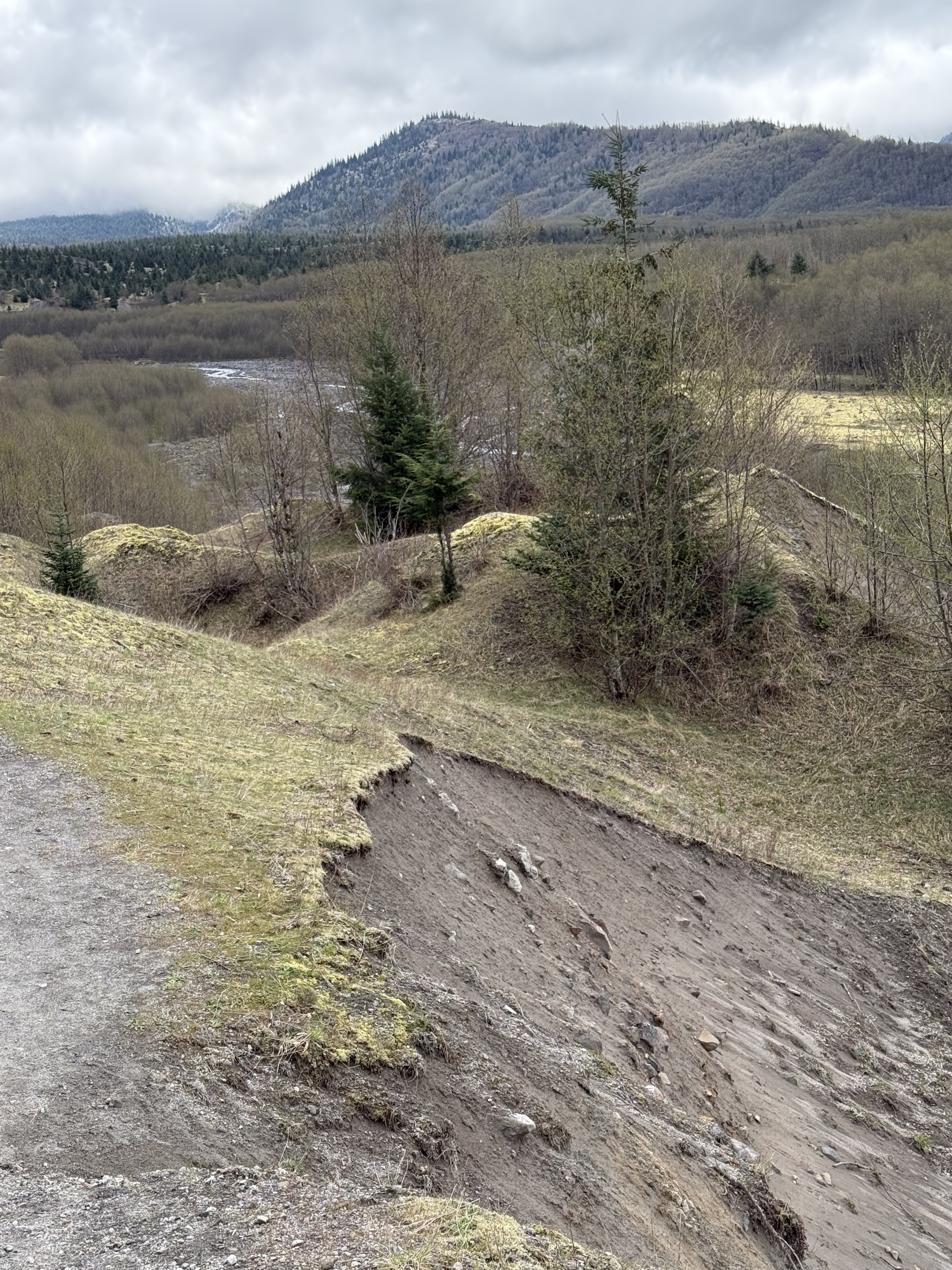
Figure 8. This photo is looking south towards Mount St. Helens from Hummocks Trail (see Figs. 2 and 7B for location) along the Toutle River (North Fork), which is more than a hundred feet lower, even after being filled with debris from the 1980 eruption. Note the difference between this scene and the deposit from Video 1. It’s difficult to comprehend the dynamics of a blast (Stage 2) capable of pushing rock (Stage 1) up this slope; when the explosion lost energy it simply dumped its load, creating a surreal landscape. The debris has very little clay and is thus non cohesive; thus slumps like this are common. Note the small hill and “ridge” in the middle of the photo. This terrain makes no sense, other than erosion has been etching it for 40 years.
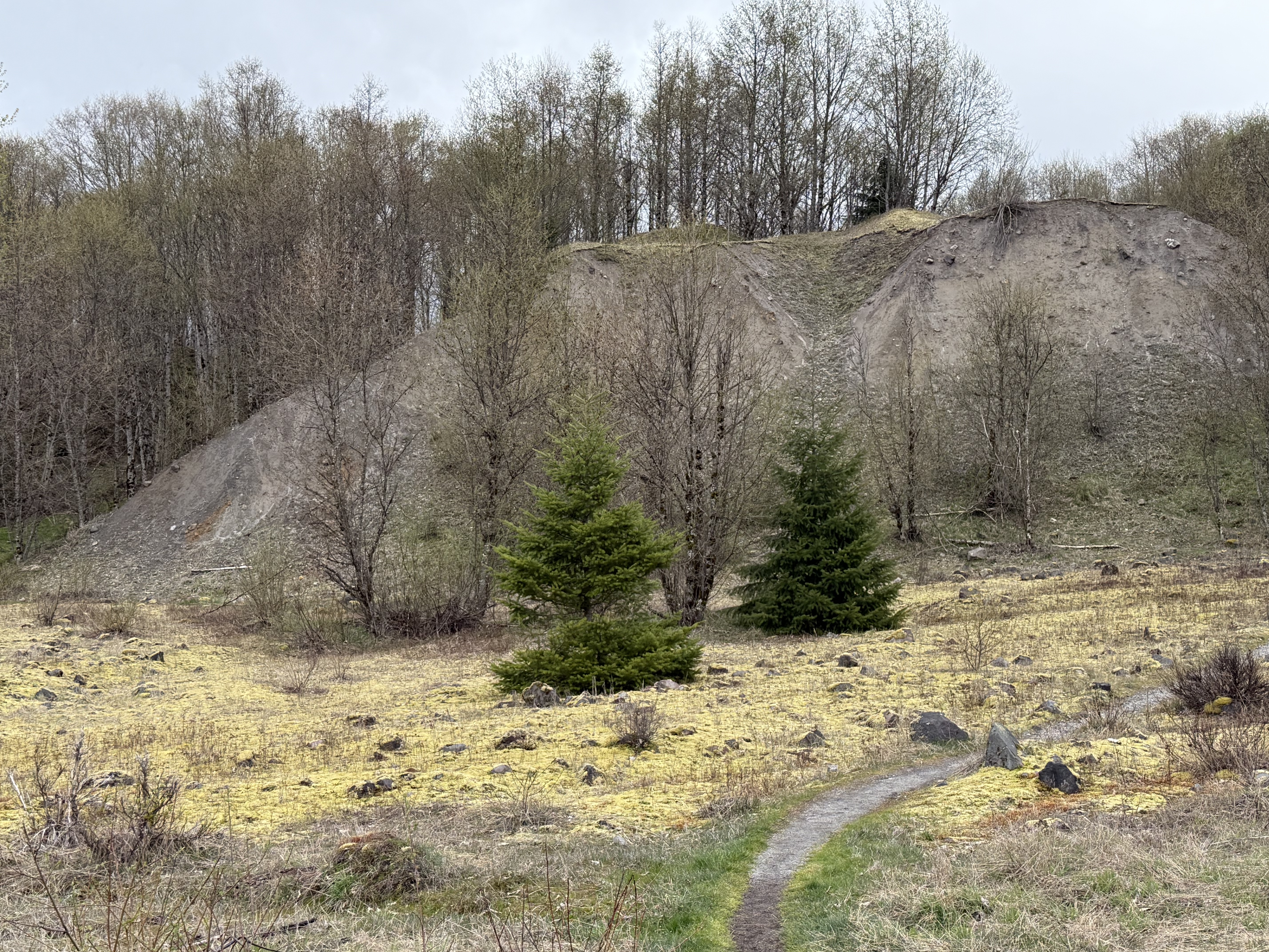
Figure 9. This layer of ash I encountered along the Hummocks Trail is a remnant of a vast sheet originally deposited during Stages 2/3–breaking such a continuous eruption sequence into stages is useful but not particularly elucidating. It all happened too fast to comprehend. You might call this an “over-bank” deposit, like when a river tops its natural levee and deposits fine-grained sediment on its floodplain.
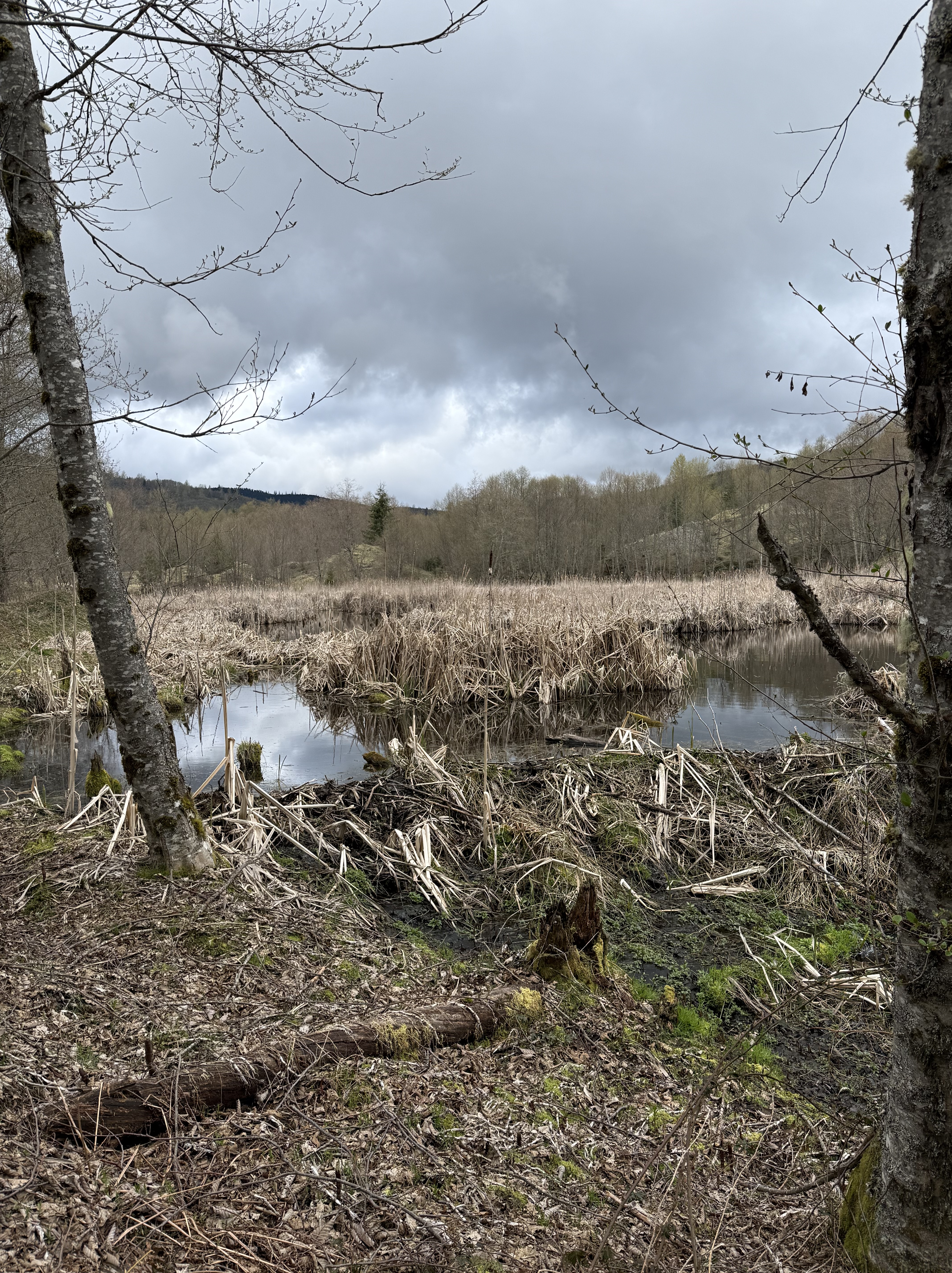
Figure 10. Hummocks Trail followed a small stream through a bizarre landscape comprising multiple small ponds like this one. A dam constructed of eruption debris (left-to-right in the center of the photo) has blocked the stream flow, creating a meandering channel during low-water conditions; but I can imagine all those dormant grasses erupting later this spring. I encountered several of these marshes, each one defined by water trying to find a way out of this labyrinth. According to Fig. 2, this is the outflow from Coldwater lake; the eruption partially blocked its path but nature is finding a way through this discombobulated landscape.
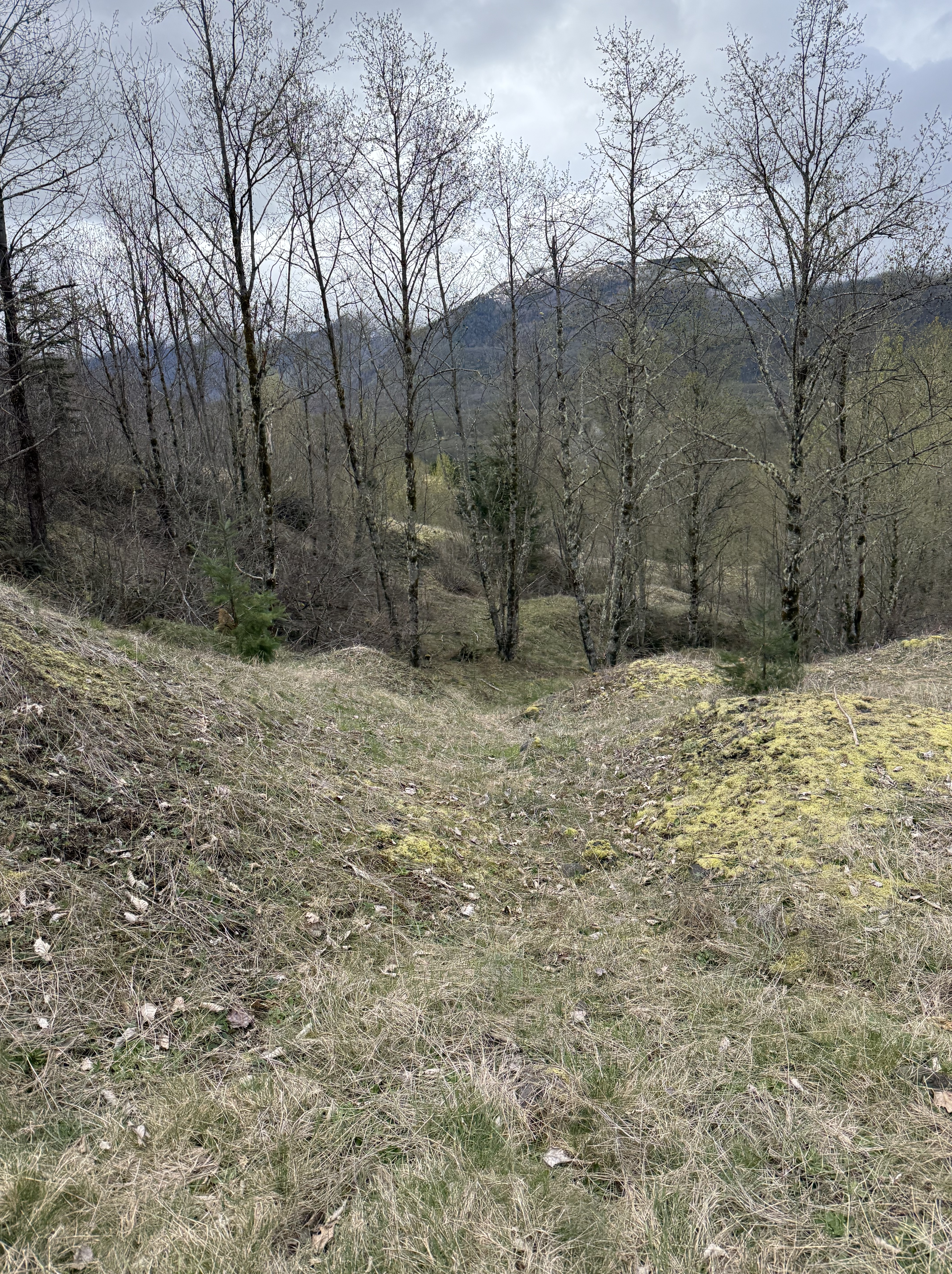
Figure 11. This photo perfectly captures the topography of Hummocks Trail. This is the northern end of the trail, which is a little higher; the Toutle River (North Fork) is more distant and the cliffs we saw in Fig. 8 have receded, replaced by moderate slope; however, note the fine-scale nature of the hummocks here. They are ubiquitous but contain only a few scattered boulders.
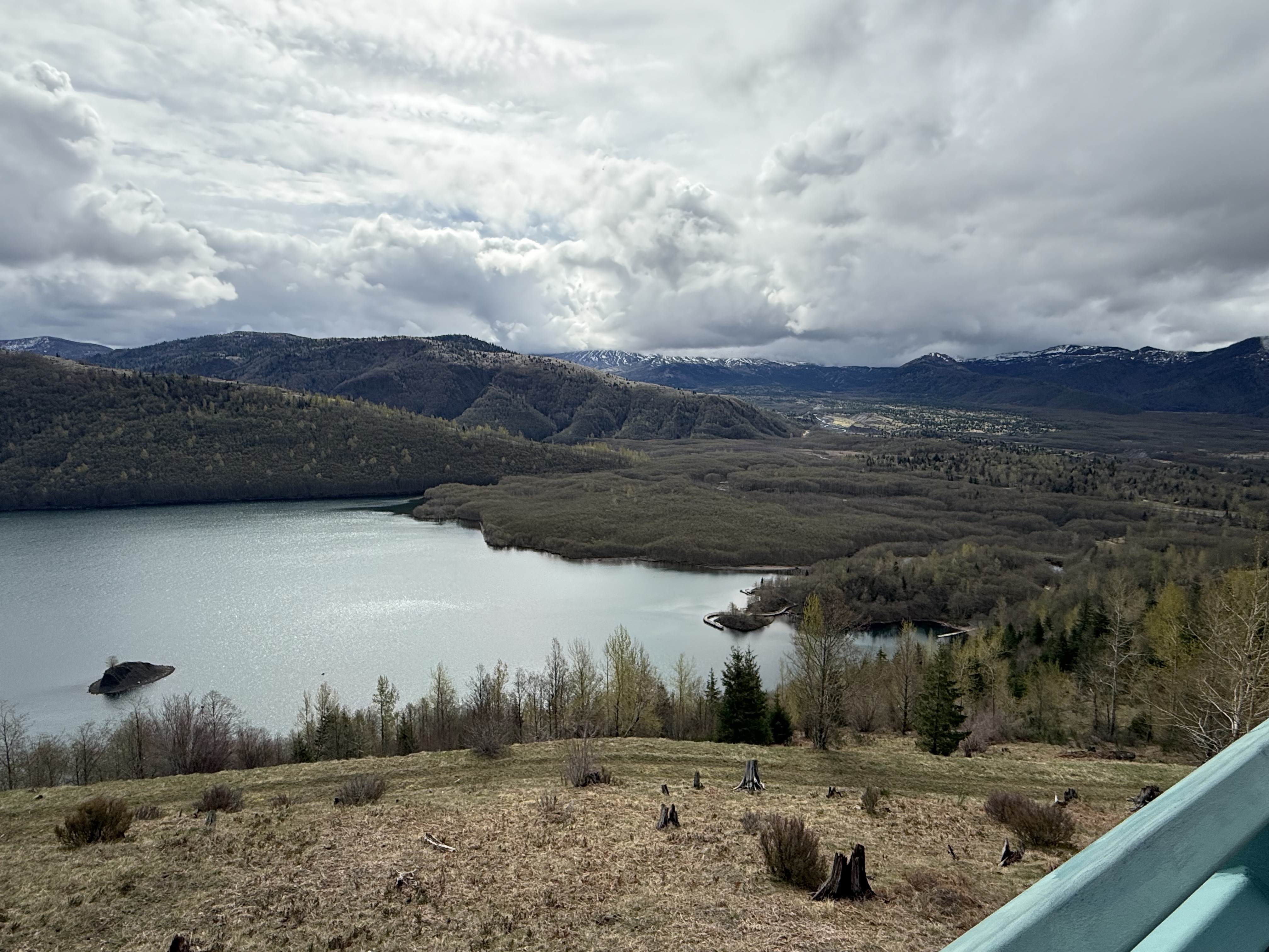
Figure 12. This is a view of Coldwater Lake from the visitor center, looking south towards Mount St. Helens. There are two things to note from this image: 1) the Toutle River valley is a broad, flat plain because it was filled with debris from Stage1; 2) the overflow deposits (e.g. Video 1) have blocked the lake and raised its level. The source of water we saw in Fig. 10 is evident in the center of the photo. This isn’t a sedimentary dam, created by flood deposits, or even a glacial dam produced from the debris scraped up by thick ice sheets. The shoreline was modified when Mount St. Helens collapsed and then exploded with unbelievable violence.
Final Thoughts
The eruption of Mount St. Helens in 1980 gave geologists a rare opportunity to see how Earth produces sausage. Let me explain my metaphor.
Ocean crust is denser than continental crust it encounters at a convergent plate boundary, and at a lower elevation. It is thus overridden by the continent, forcing it to dive into denser and hotter rocks at depths of hundreds of miles. This obviously displaces hot and ductile rocks, heating the subducting rocks even more; the sausage-making operation has begun. Still pushed from behind by the conveyor belt of oceanic crust being subducted, this basalt/gabbro mixture heats enough to boil off the water contained in its sedimentary cover as well as any constituents with a reduced melting point (e.g. silicon-rich minerals). This superheated material rises through tens-to-hundreds of miles of crust, heating it and producing a mixture of oceanic and continental crust.
Plate tectonics keeps turning the crank on the sausage machine for tens (even hundreds) of millions of years. The molten mass of magma keeps rising because it is less dense than the rocks through which it is passing, until the pressure has decreased enough for it to find cracks in the solid crust. The magma fills these cracks, which often lead to fissures in the surface; the magma erupts. The magma cools and begins to solidify, forming a pluton at depths of several miles to tens of miles.
This process keeps operating, in fits and starts, until the tectonic plates change direction. In the meantime, the upper crust has been filled with multiple plutons (solidified magma chambers), sometimes squeezed into the volcanic rocks from previous eruptions. Individual magma chambers/plutons are about one mile in diameter, although they take many shapes, and remain active for less than one-hundred-thousand years (often much less). These are injections of fluid rising through weak points in the crust, driven by pressure paths–not missiles launched from the mantle. They are like the sweat on your brow after a hard workout.
Mount St. Helens has released a lot of pressure, although it is still very dangerous at human scales. Chances are that this magma chamber will solidify within the next hundred-thousand years; but the unstoppable sausage machine will continue cranking out more mixed material in a molten form until it has filled every nook and cranny in the upper crust. That’s how mountain ranges like the Sierra Nevada were formed. It takes a really long time.
Mount St Helens probably won’t erupt again at the scale of the 1980 event, but that doesn’t mean much if you happen to be camping near the caldera when a smaller eruption occurs. After all, the magma chamber is still extruding lava in an unsteady process that is currently pretty slow. However, we humans can’t see fractures in bed rock; thus, the next and the next, etc, magma chamber could appear anywhere from Northern California to British Columbia. There are plenty of young volcanoes in the Cascades that haven’t blown their tops yet.
Who’s next?
Ecosystem Notes from Quinault Rainforest
Introduction
I’ve spent the past few months wandering the Olympic Peninsula with my attention fixed mostly on rocks—tilted beds, breccias, sea stacks, and the stories they tell about deep time. But along the way I’ve been noticing the living world with the same quiet fascination. I’m not a biologist and I don’t pretend to be; I can’t name any of the plants I pass. What I can see is how each organism plays a role in the larger system, the way geology shapes life and life responds in turn. These are simply notes from a wanderer paying closer attention.
I’ll try to remember to label these environmental posts as NOTES to avoid any confusion, especially on my part. This first post arises from a short walk on a semi-muddy trail through the Quinault Rainforest, on the Olympic Peninsula. I won’t have much to say about the photos, and all identification will come from CoPilot (aka ChatGPT). I’m certain its identifications will be better than mine after hours of searching the internet.
Quinault Rainforest in Olympic National Park
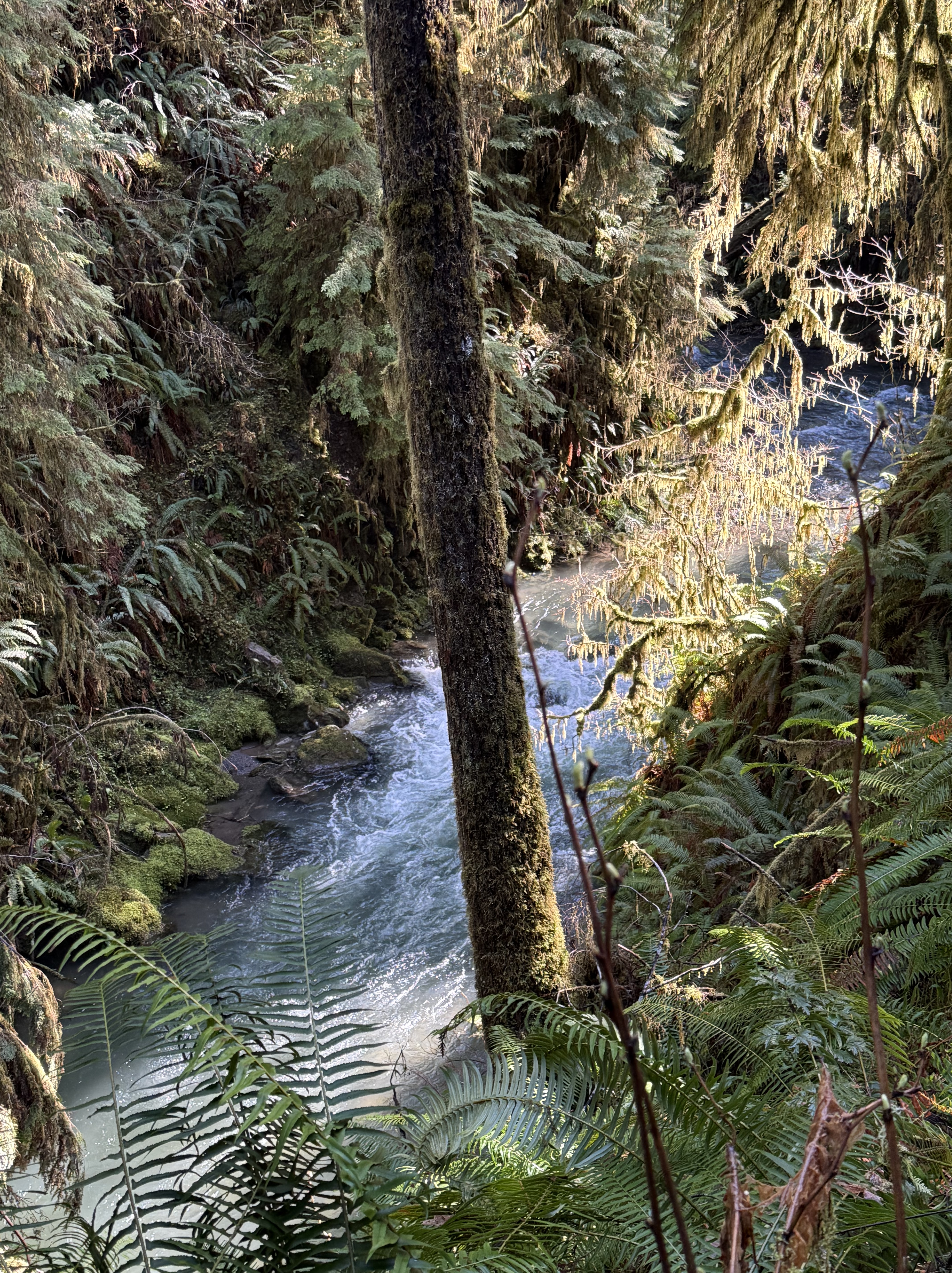
Plate 1. That raging stream about 50 feet below me is one of hundreds draining this temperate rainforest, which gets about 12 feet of rain per year. Note the ferns, which are everywhere, even in the temperate forests of northern Virginia. Ferns must be the most common plant in cooler forests. I am in a narrow strand of Olympic National Park that has never been logged. This is primordial nature, viewed by a geologist, but I’ll do my best.
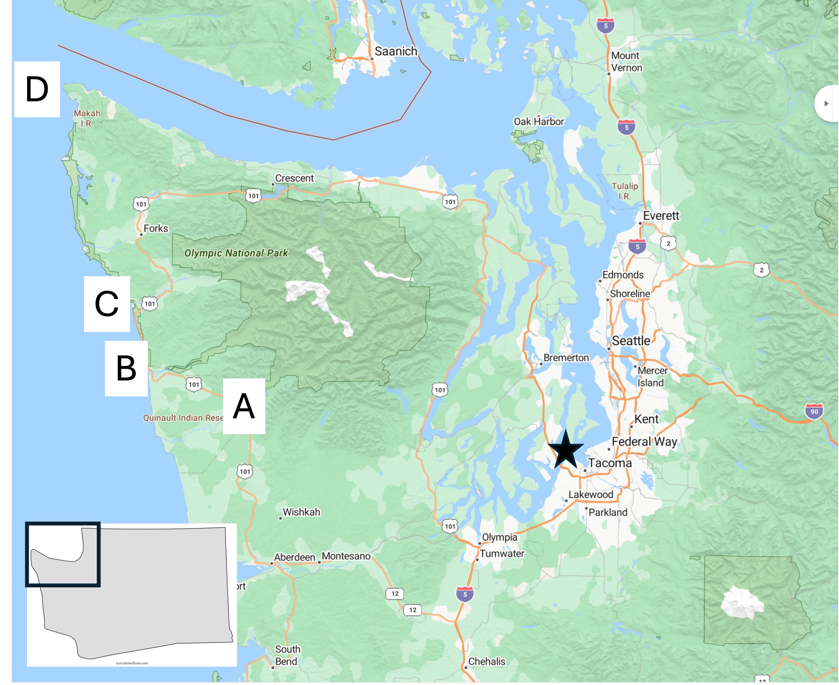
Plate 2. Map of the Olympic Peninsula showing the areas I reported on in previous posts. I’m going to be focusing on Site A today, with a few photos from D.
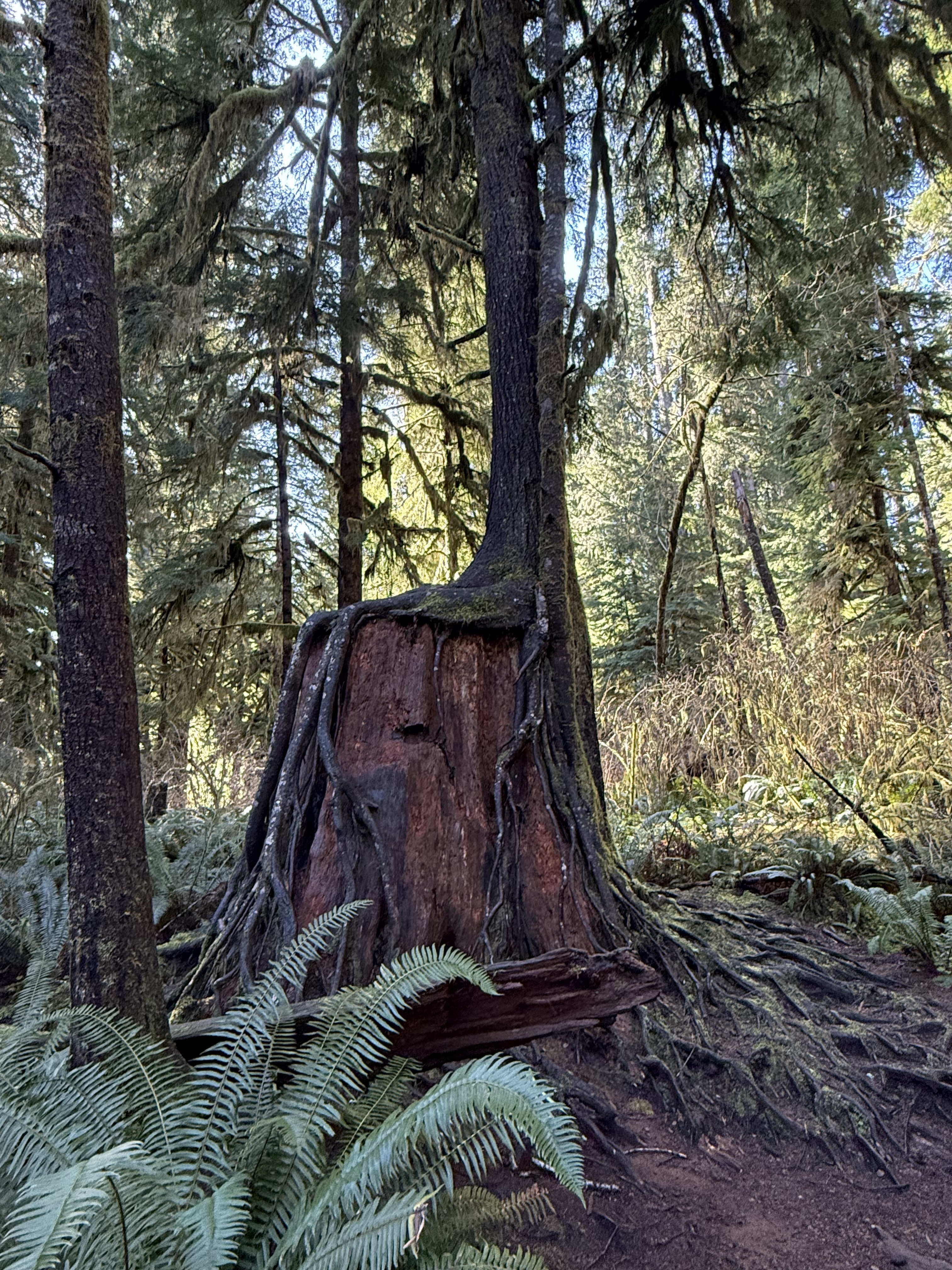
Plate 3. I haven’t seen this anywhere else I’ve lived, not even northern Virginia, but they occur everywhere here in Washington. Apparently this is a common occurrence in rainforests, where the ground is a dangerous place for seeds. I couldn’t identify the species in this photo, but this practice is very common for hemlock.
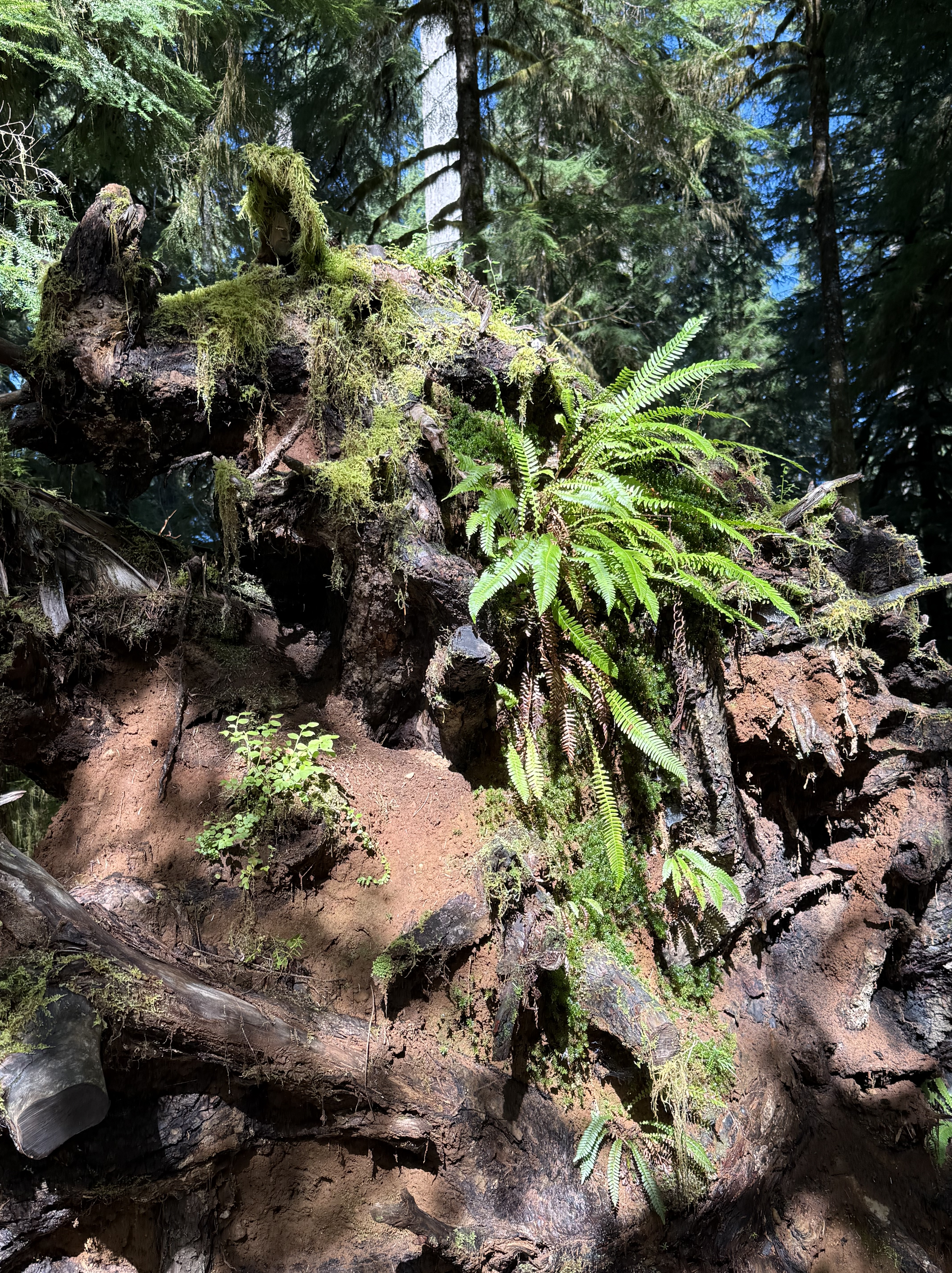
Plate 4. This pile of debris is a large log turning into compost and supplying nutrients to a variety of plants. The top of the photo shows the base of a young tree growing out of all this chaos. According to CoPilot and the Olympic National Park map, this area has never been logged, so I am in wonder of this pile of “forest garbage”. Is that sandy soil I see? Where did it come from? I don’t know.
Plate 5. If you look close in the exact center of this photo, you’ll see daylight on the other side of the base of this unidentified tree. It’s about six-feet in diameter and covered with an epiphyte community of mosses and liverworts. Those aren’t leaves or fronds, but communities that mimic ferns–for their own reasons.
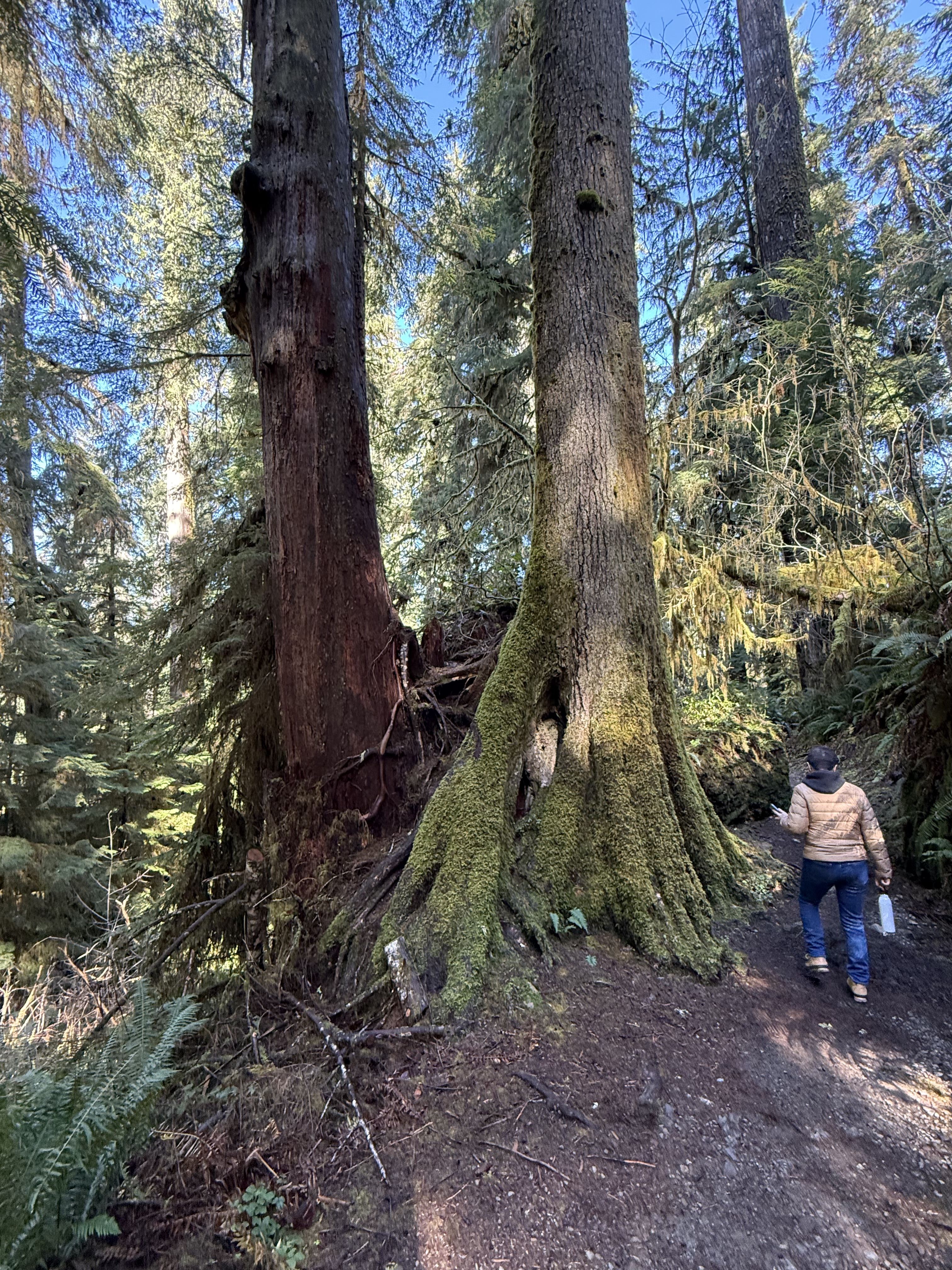
Plate 6. Here’s an example of a Western Red Cedar that has grown into a mature tree after being nursed by a stump. I guess it will eventually absorb the rotting stump and grow to full height, but this is the largest I’ve seen so far in the region.
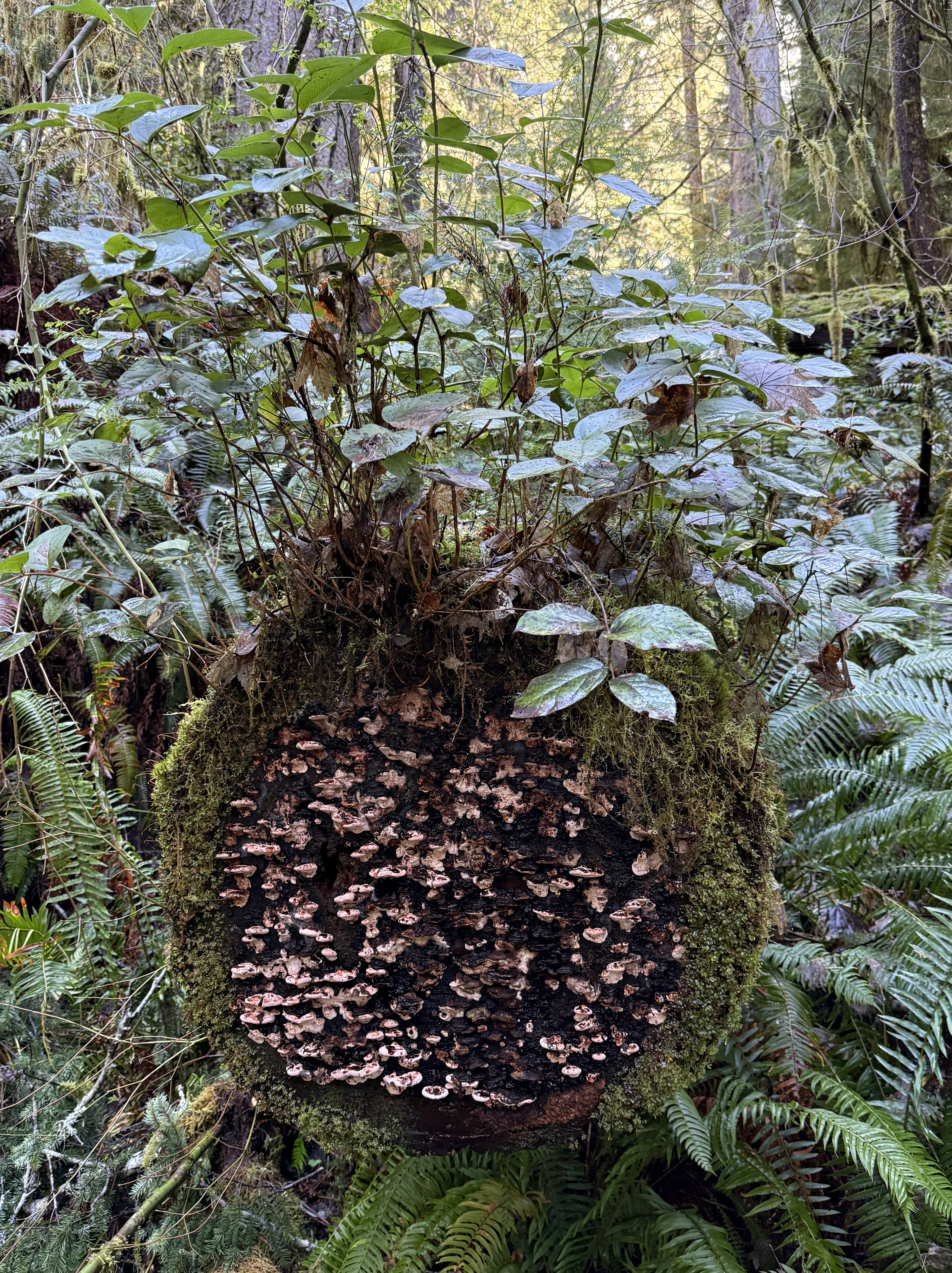
Plate 6. This miniature ecosystem caught my eye, but I had to turn to CoPilot to get an idea of what’s going on. As a tree trunk decays it goes through five stages: 1) moss; 2) liverworts; 3) fungi; 4) shrubs; and 5) young trees. This one seems to be in stages 1-4. I didn’t see any seedlings on it. The shrub is probably huckleberry and the mushrooms a bracket fungus, probably Trametes or Stereum.
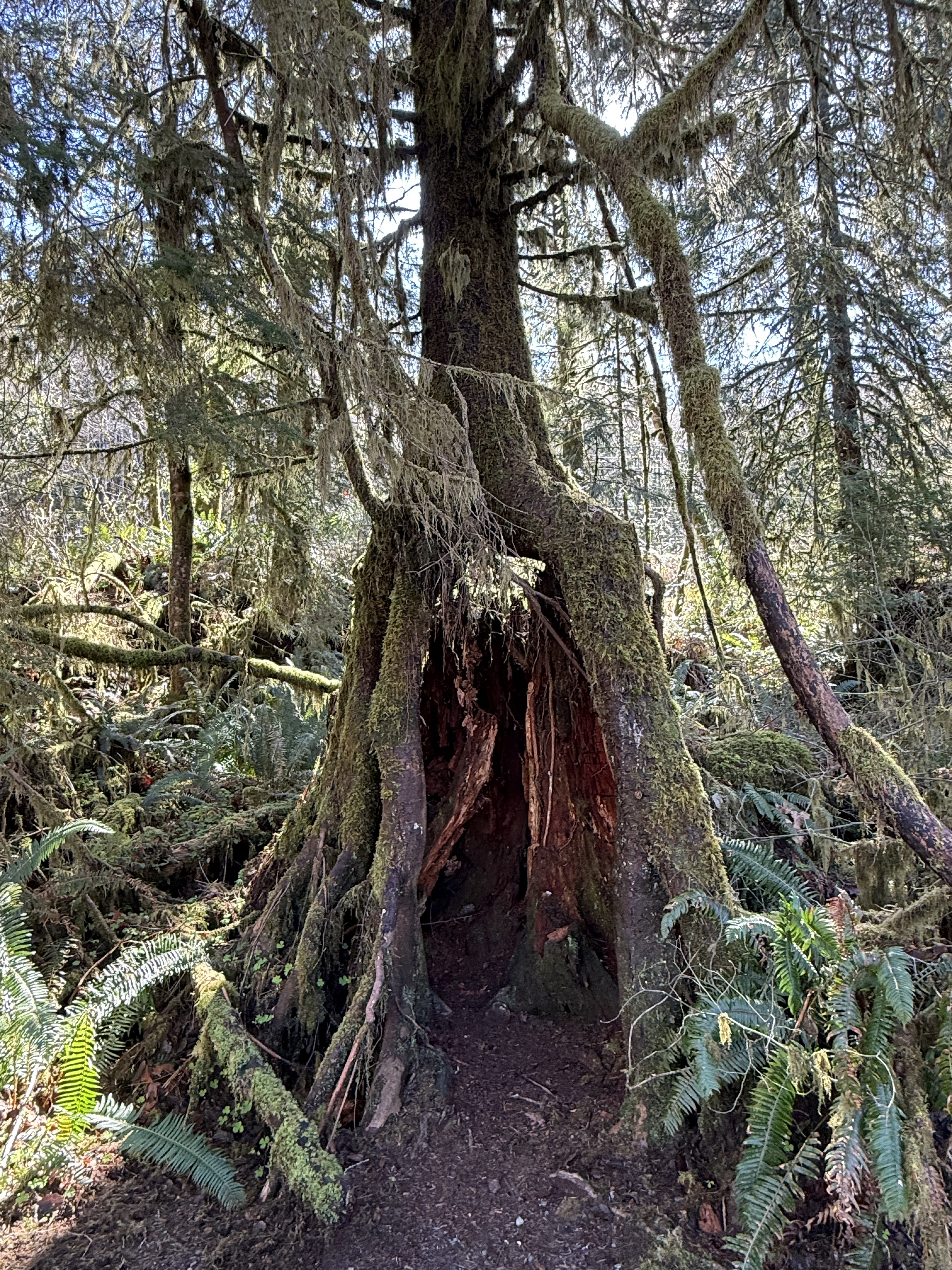
Plate 7. I am fascinated by these nurse trees after seeing species of fig trees in Australia that devour living trees, like a giant fungus or alien. These are nursing on dead trees, however, so it isn’t as gross; but this one is now standing on its own legs after the original stump has begun to collapse.

Plate 8. This is the largest Spruce tree in the world. It’s 191 feet tall and about 1000 years old. It is growing in a swampy wet land at the inflowing stream to a glacial lake, Lake Quinault.
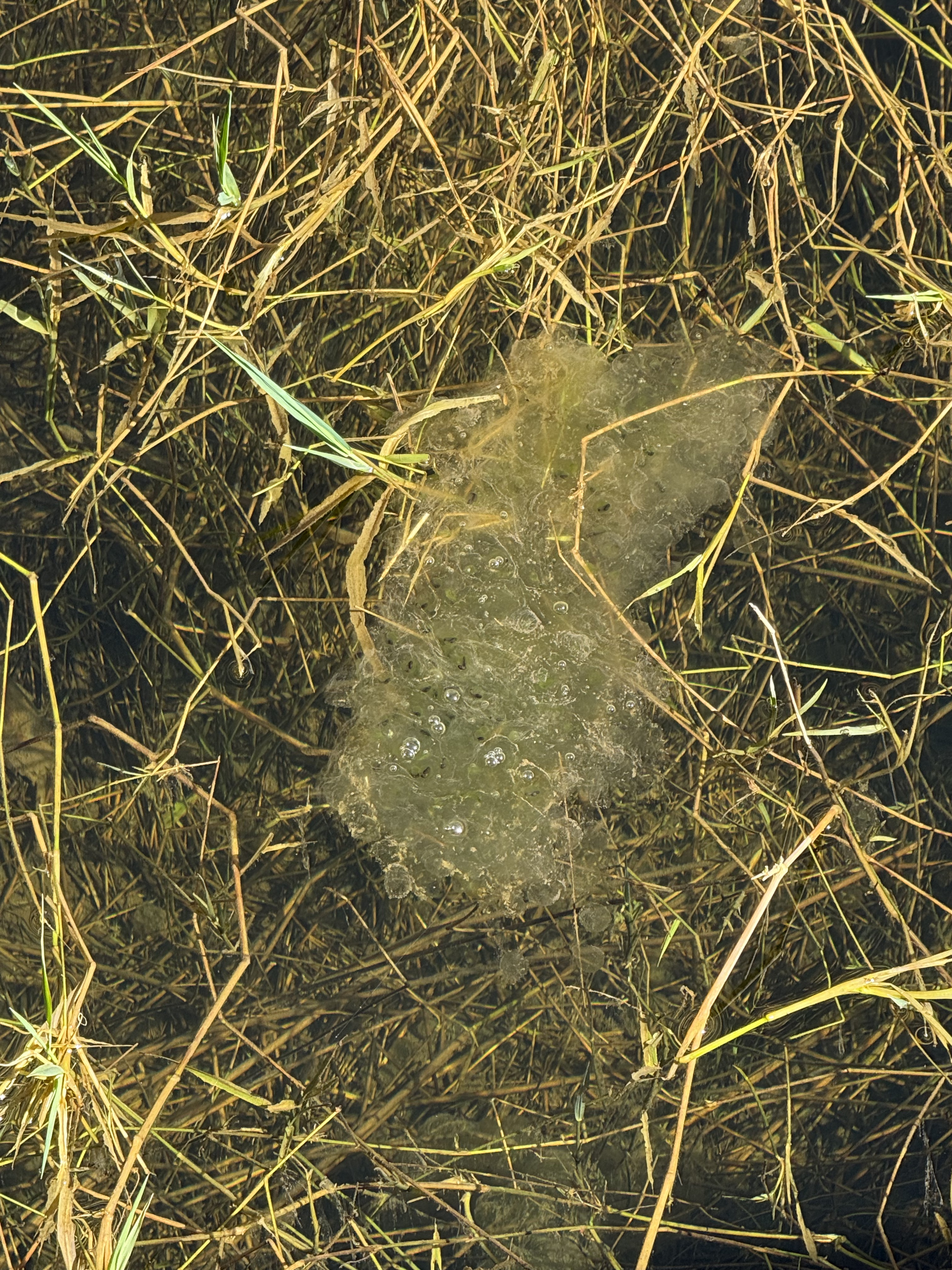
Plate 9. I thought this was toxic waste until CoPilot took a look at the photo: this is a mass of frog eggs (probably northern red-legged frog). There were several more at the shallow, marshy wetland where a stream fed Lake Quinault. The water is so clear you can see the bottom, which is only a couple of feet down.
Kalaloch Beach in Olympic National Park
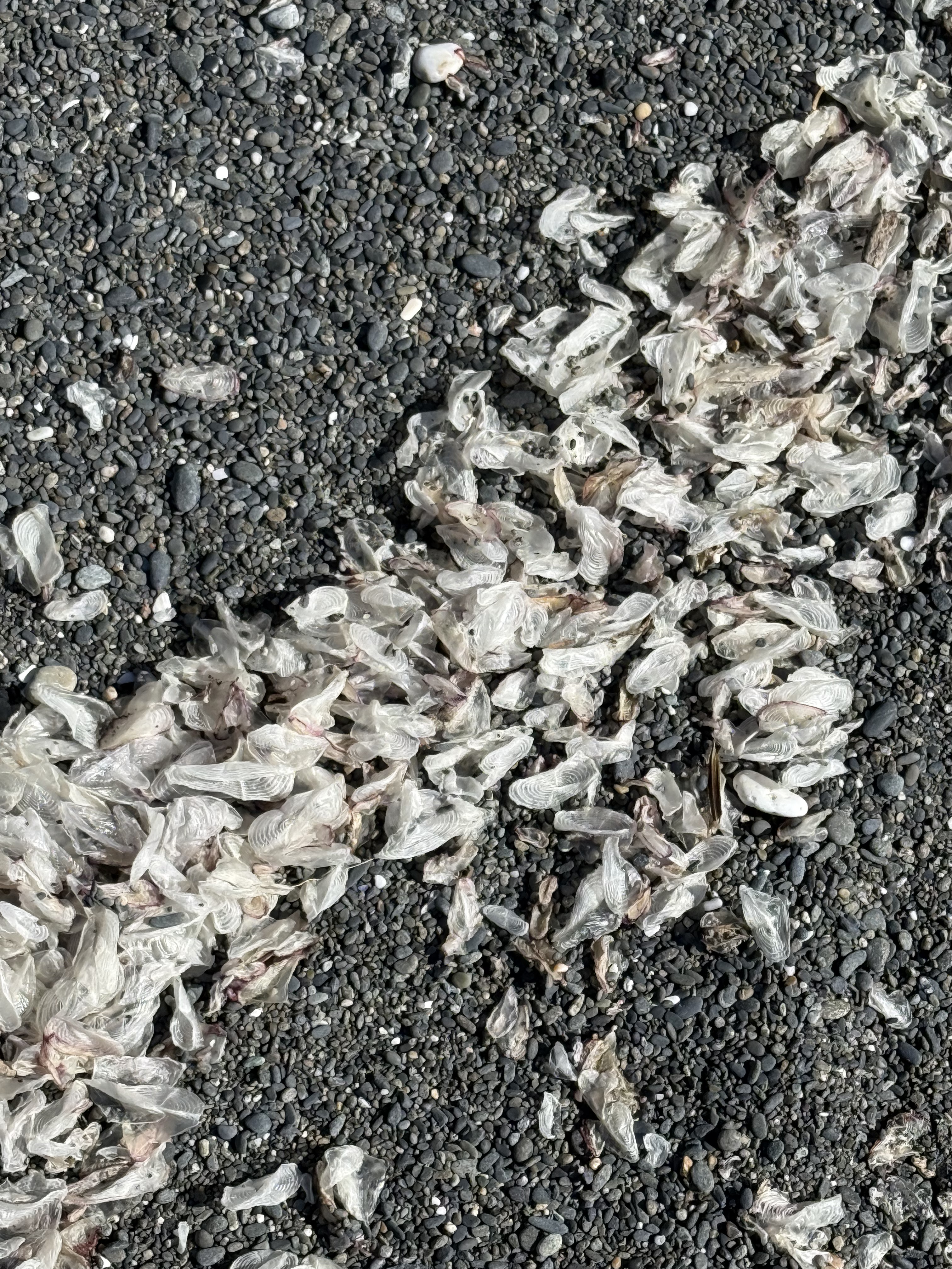
Plate 10. This one was a doozy. These objects are one-two inches long, thin, translucent, and oval in general shape. At first, CoPilot suggested insect wings (until I told it the size), then gull secondary feathers (until I said, “no way”), then settled on small fish cranial bones–e.g. the opercula, the bone that covers the gill. I asked for references, but it supplied me with titles and no links (how did it find them?). I spent longer on this photo than I wanted to. I don’t fault CoPilot for its ambiguous response because I found nothing when I looked very specifically. This phenomenon is either so common that no one bothers mentioning it, or infrequently observed that no serious beachcombers have stumbled across it. I’m going to have to agree (for now) with CoPilot that these are small bones from a school of fish that was decimated by either predation, coastal fishing, or disease and only these translucent cranial bones survived by floating, until waves concentrated them on this beach. This is the only beach where I saw them. I guess there are no easy answers to some questions–unless someone who reads this is a marine biologist.
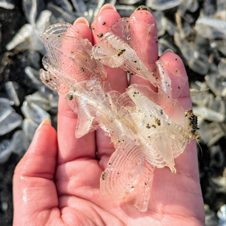
Plate 11. I solved the mystery of the white objects on the beach (Plate 10). I spoke to an ecologist I know who suggested they are a Hydrozoa called Velella-velella, which floats on the ocean like a jellyfish. They are a colonial organism that is blown about by the wind. They don’t swim so they are easily blown onto a beach and carried by waves. (Here’s a good article about them.)
Cape Flattery
I reported on this amazing location in a previous post. You can scan that post to get an idea of where these photos were taken.
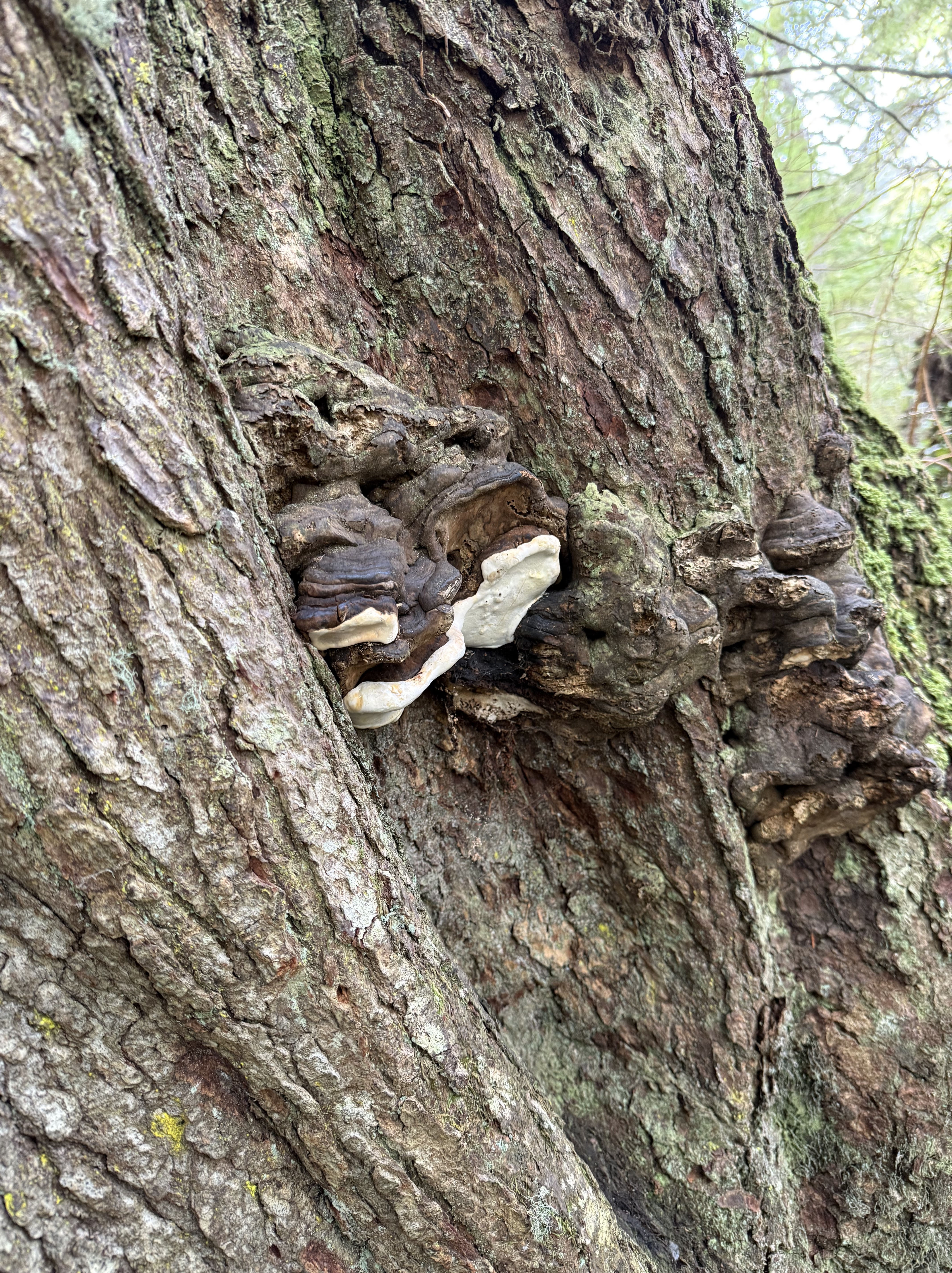
Plate 11. I don’t know if this living (it looked healthy to me) tree was stressed or not, but CoPilot thinks these are perennial bracket fungi, which favor environmentally stressed conifers. There were only a few on this tree. I noticed that this forest didn’t show nearly as many signs of decay as Quinault Rainforest, despite its exposed location.
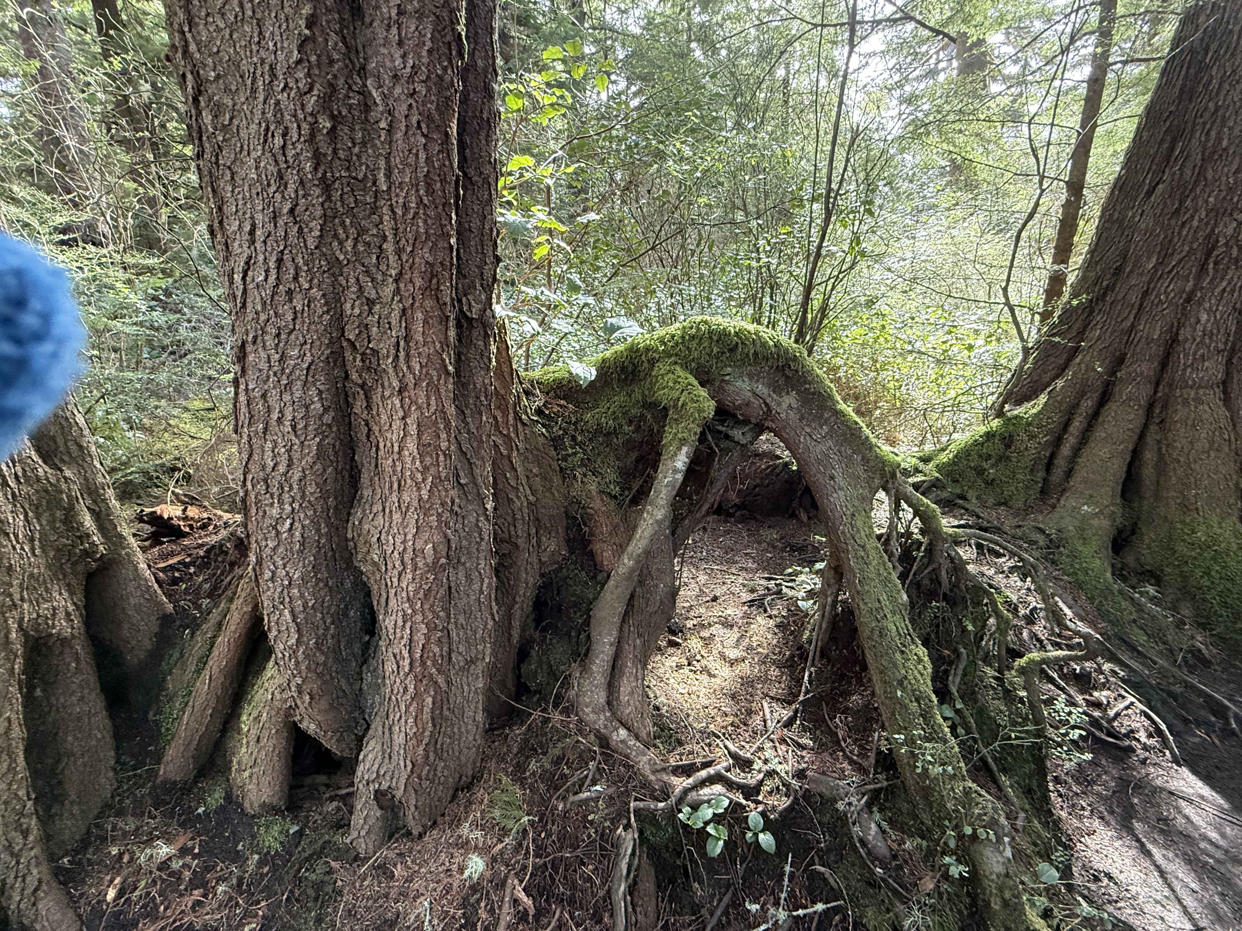
Plate 12. I had to throw this photo in because the root growing out of the tree(s) on the left looks like a dog that got its head caught in a hole, and died there. Its limbs of limp. Overactive imagination, I know. Nevertheless, this is a bizarre image because the dog is lying on top of a mound of soil. I’d bet there was a stump there that has decayed because the trees visible in this image are both composed of multiple trunks. A large tree died here (like the dog) and these are its adopted offspring. I would add that Cape Flatters, which is part of the Makah Reservation, has never been commercially logged. This is old-growth forest and this is a naturally occurring phenomenon.
Summary
Moisture drives everything on the Olympic Peninsula, soaking old volcanic and sedimentary foundations until the forest grows straight out of its own decay. Fallen logs become elevated nurseries, their wood breaking down under fungi and mosses until they’re more sponge than tree. Hemlock, cedar, and huckleberry take root on these platforms, sending roots around stumps and into the thin soils draped over ancient bedrock. Even the beaches tell the same story: waves sorting bones, shells, and driftwood carved from headlands shaped by tectonics and storms. It’s an ecosystem built on slow collapse and constant renewal.
Acknowledgment
I am experimenting with using CoPilot (aka ChatGPT) to help as I pursue my growing interest in ecosystems. I have been up front about where it contributed. It has been a great help, as well as an inspiration; if not for CoPilot, I wouldn’t have had the time of inclination to add these ecosystem NOTES to Rocks and (no) Roads. In fact, I’m tired of this entire series of posts, for which I get no compensation other than sharing my observations of the world. As a final note, CoPilot wrote the Summary and I stand by it.
Now I have to think about more than just rocks…
Coastal Geology of Kalaloch Beach
This report is the geology supplement to my general post about the Olympic Peninsula. It focuses on the geology of the beaches because, to be honest, Quinault Rainforest was impenetrable, physically and geologically, without massive logistical planning and support. What I found was more than I expected.
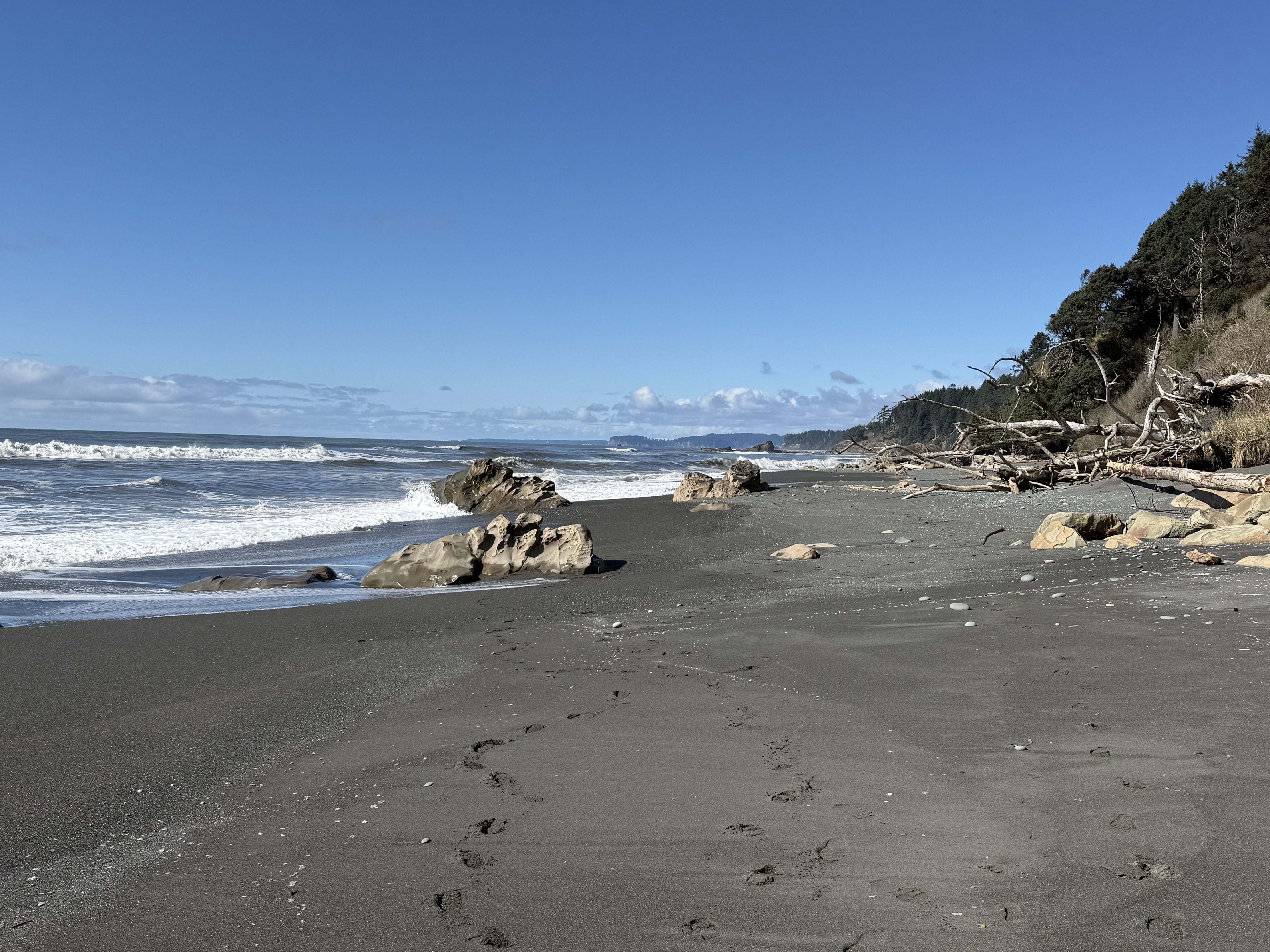
Figure 1. Photo looking north along Beach 4 at Site B in Fig. 2. The tidal range is about 10 feet here and the primary sediment consists of sand with a substantial mud component. The rocks seen in this image are bedrock that protrudes above the veneer of beach sediment. The cliffs to the right comprise glacial till that is less than 2.4 my old (Ma hereafter) deposited by glaciers during the Quaternary geological period. This photo was taken near low tide. The dark color of the beach surface is caused by the relatively large clay component (i.e. mud).
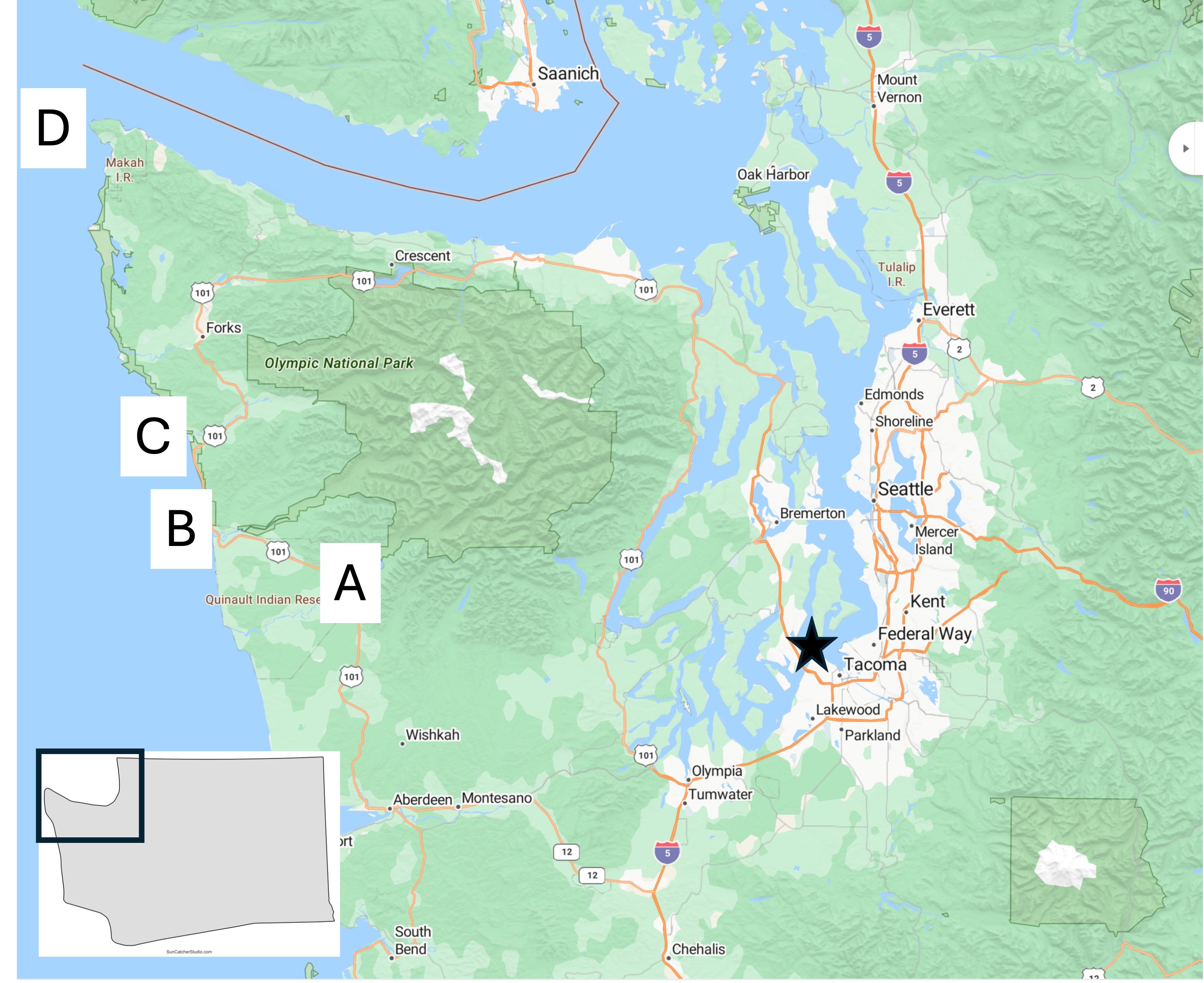
Figure 2. Location map of today’s field area, which will focus on Site B.
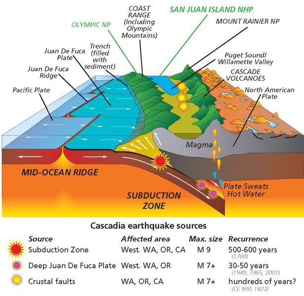
Figure 3. Schematic of the Cascadia Subduction Zone as it appears today. The Coast Range, which includes the Olympic Mountains, consists of sediments and volcanics that have been scraped off the subducting ocean crust. The white arrows at the front of the image don’t reflect the actual geometry of these sedimentary rocks. We’ll get to that in a minute. Today’s post will focus on these sediments and discuss their original depositional environment during the Tertiary period (~65.5-2.4 Ma), as well as evidence for structural deformation.
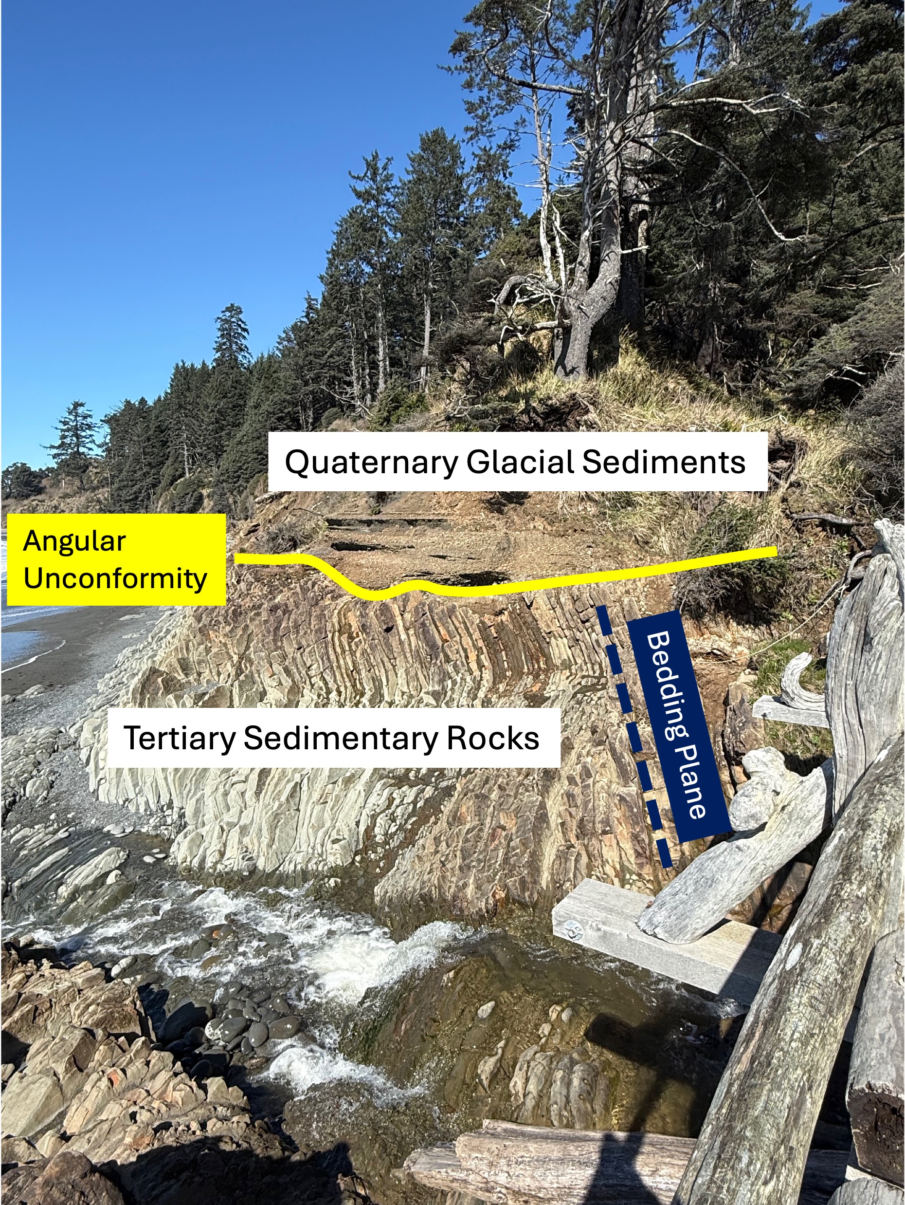
Figure 4. This photo has been marked-up to highlight what might not be obvious to a non-geologist. First, older sedimentary rocks have been tilted to a high angle (dark blue bedding plane line) by faulting, as suggested in Fig. 3, and exposed to erosion at the surface. This erosional surface is shown by the yellow line. These Tertiary sediments were buried several miles beneath the ocean surface where the grains were cemented by heat and pressure. We don’t know exactly when this occurred or how long this process took, but they were later overlain by younger glacial sediments during the Pleistocene epoch (2.4 Ma to present). The age of sedimentary rocks can’t be pinned down unless they contain material datable by radiometric methods or, more qualitatively, by the fossils they contain. Sandy sediments don’t contain fossils very often and I didn’t find any radiometric ages in either Rock D or the USGS geologic map, so I guess the Tertiary date is the best we can do for now.
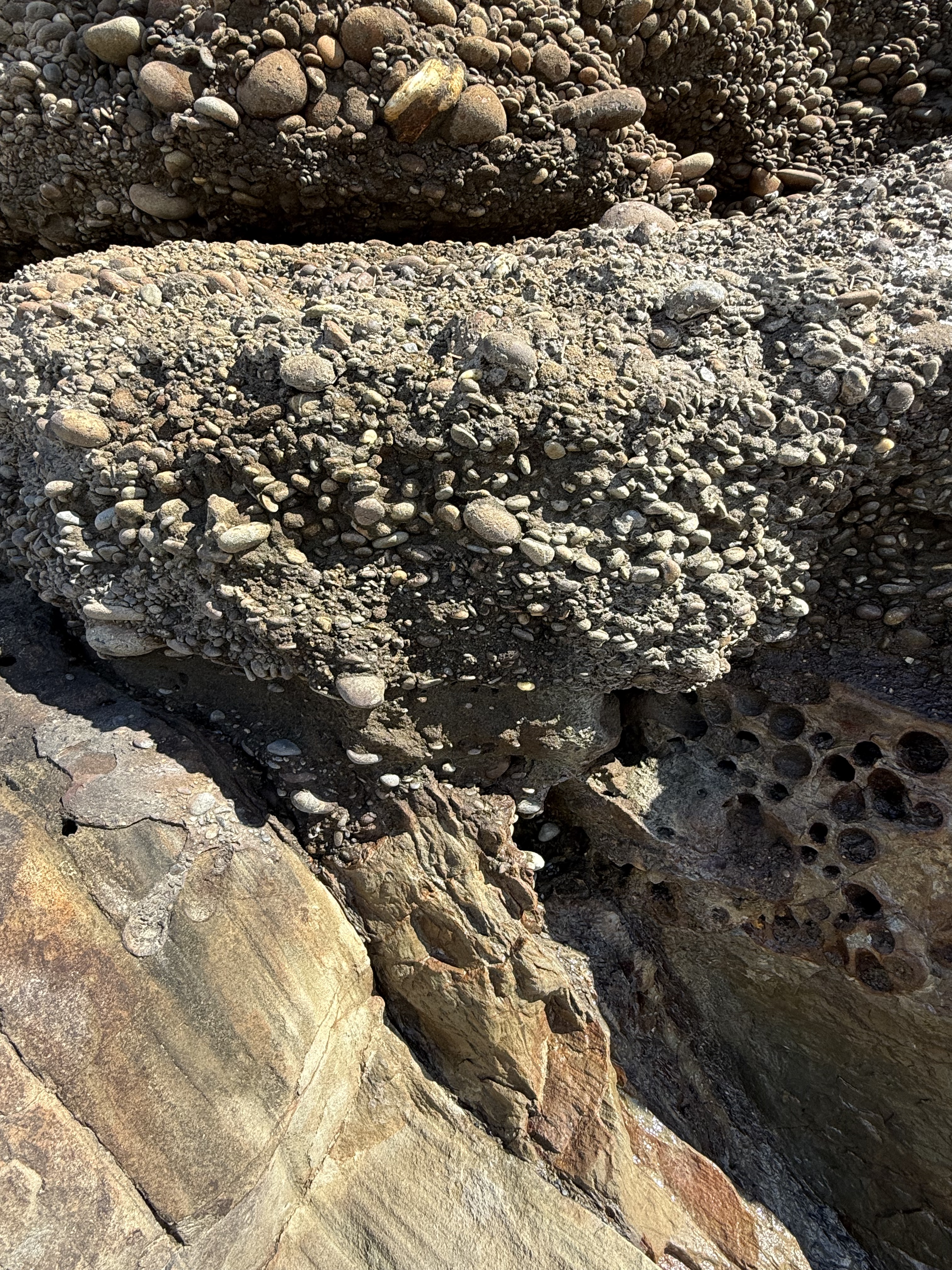
Figure 5. Close-up photo of the contact between the Tertiary rocks and the glacial till. Note that the cobbles aren’t falling out of the fine matrix sand and clay; this is because these young (>2.4 Ma) conglomerates have been partially cemented and, in fact, they were stuck to the older rocks below. This photo tells us a lot: 1) the older rocks were tilted at depth (maybe a mile or more) and then pushed upward as suggested in Fig. 3 until they were exposed to the atmosphere; 2) in a very short time they were covered by cobbles (~2 inches or less) that had already been rounded in a river, which takes several miles of transport; 3) the type of sediment varied rapidly, from coarse sand to cobbles, probably within decades if not years, due in part to periodic changes in surface drainage (e.g. the advance and retreat of glaciers); 4) this is a good example of the principle of Uniformitarianism–the present is the key to the past: we see similar processes occurring today along the many streams and rivers draining the Olympic Mountains. But what about those pesky Tertiary sandstones?
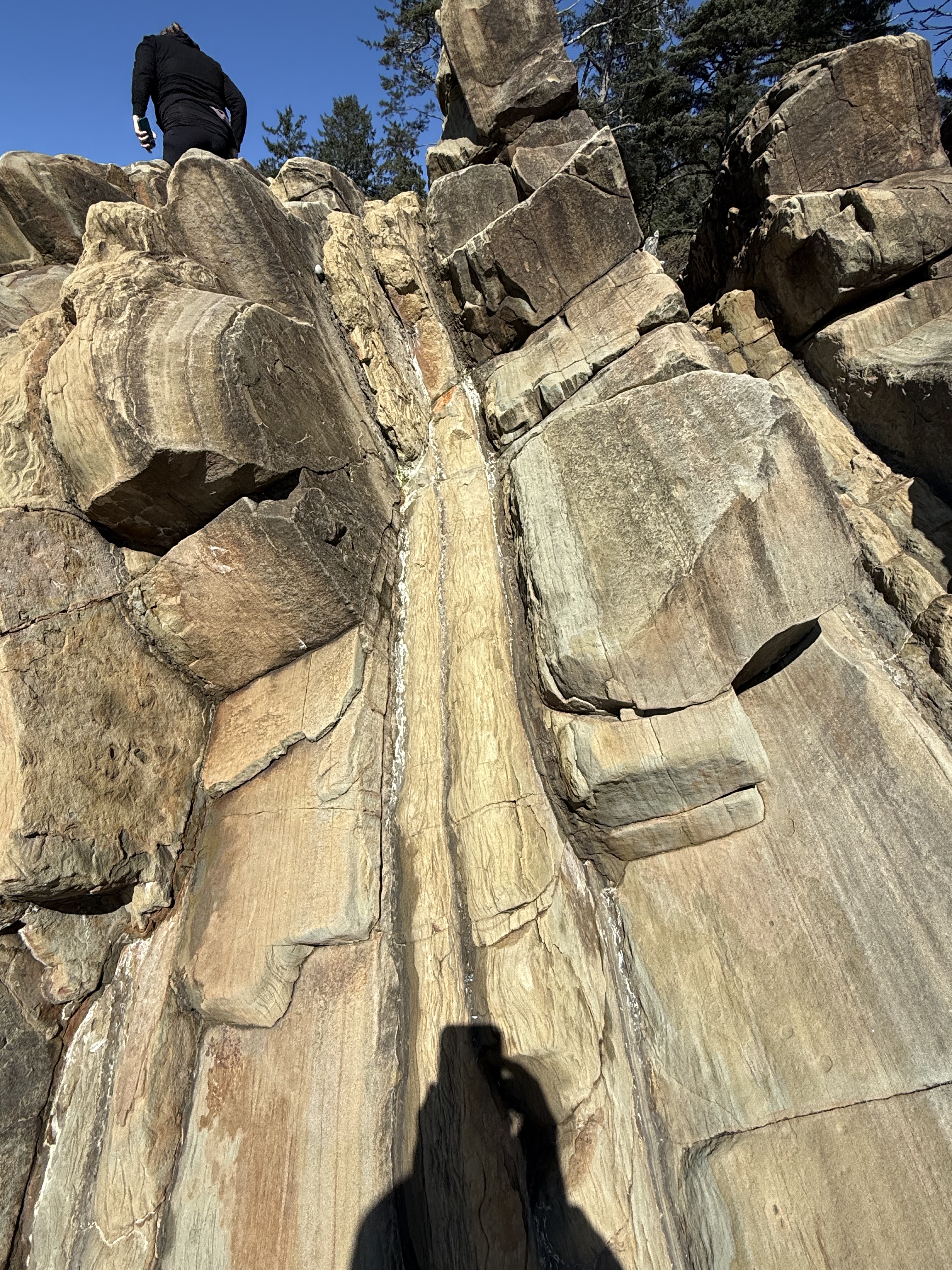
Figure 6. This photo of the Tertiary sedimentary rocks reveals packets of thin-bedded fine sandstone with intercalated dark layers of (presumably) mud. I didn’t see any cross-bedding, which would indicate deposition in a river or nearshore dominated by waves or currents. What is obvious that this ancient (~50-2 Ma) shoreline was receiving sediment from a distant source, probably the volcanic highlands of the modern Cascades (see Fig. 3). Let’s take a closer look at one of those wavy layers.
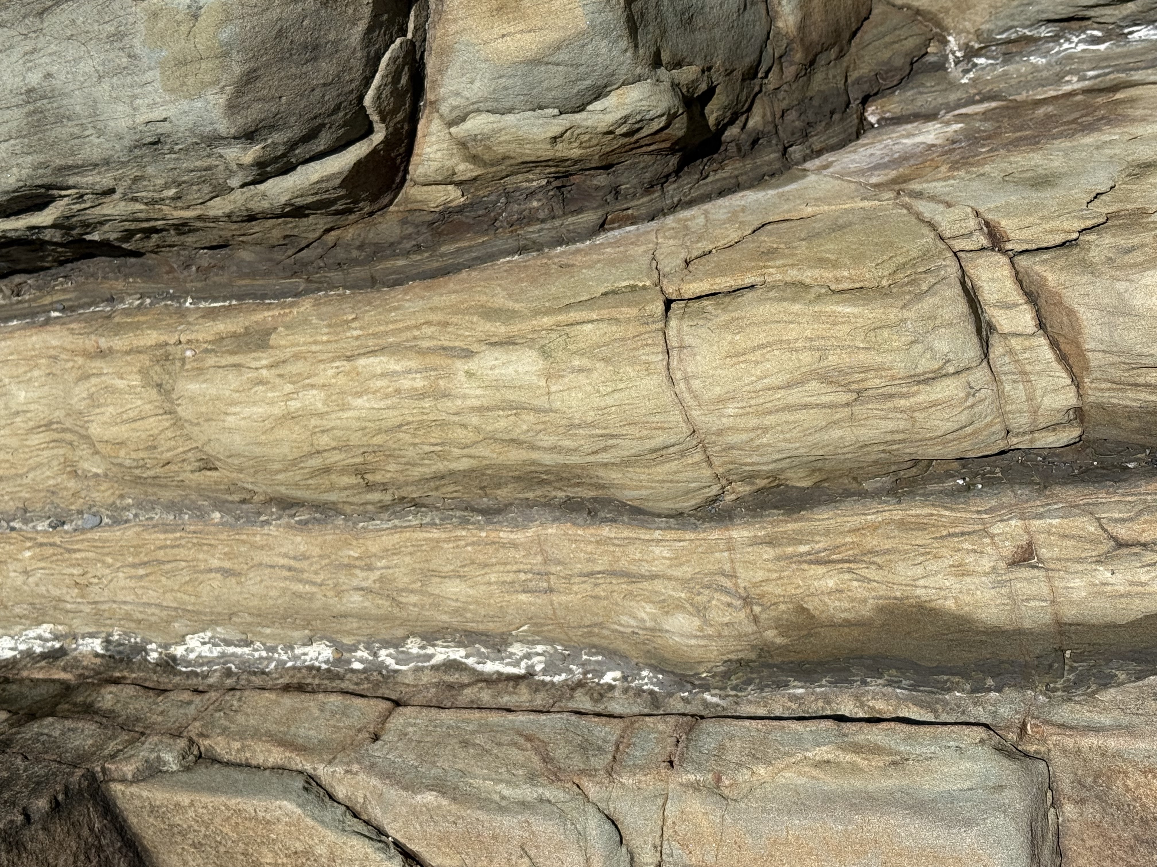
Figure 7. Close-up image of a thin layer (about 3 inches), showing what is called Flasier bedding. This is found in modern environments where high-energy (e.g. waves and tides) periods are interrupted by quiet times during which fine sediment can be deposited between ripples. It is indicative of a shallow marine environment.
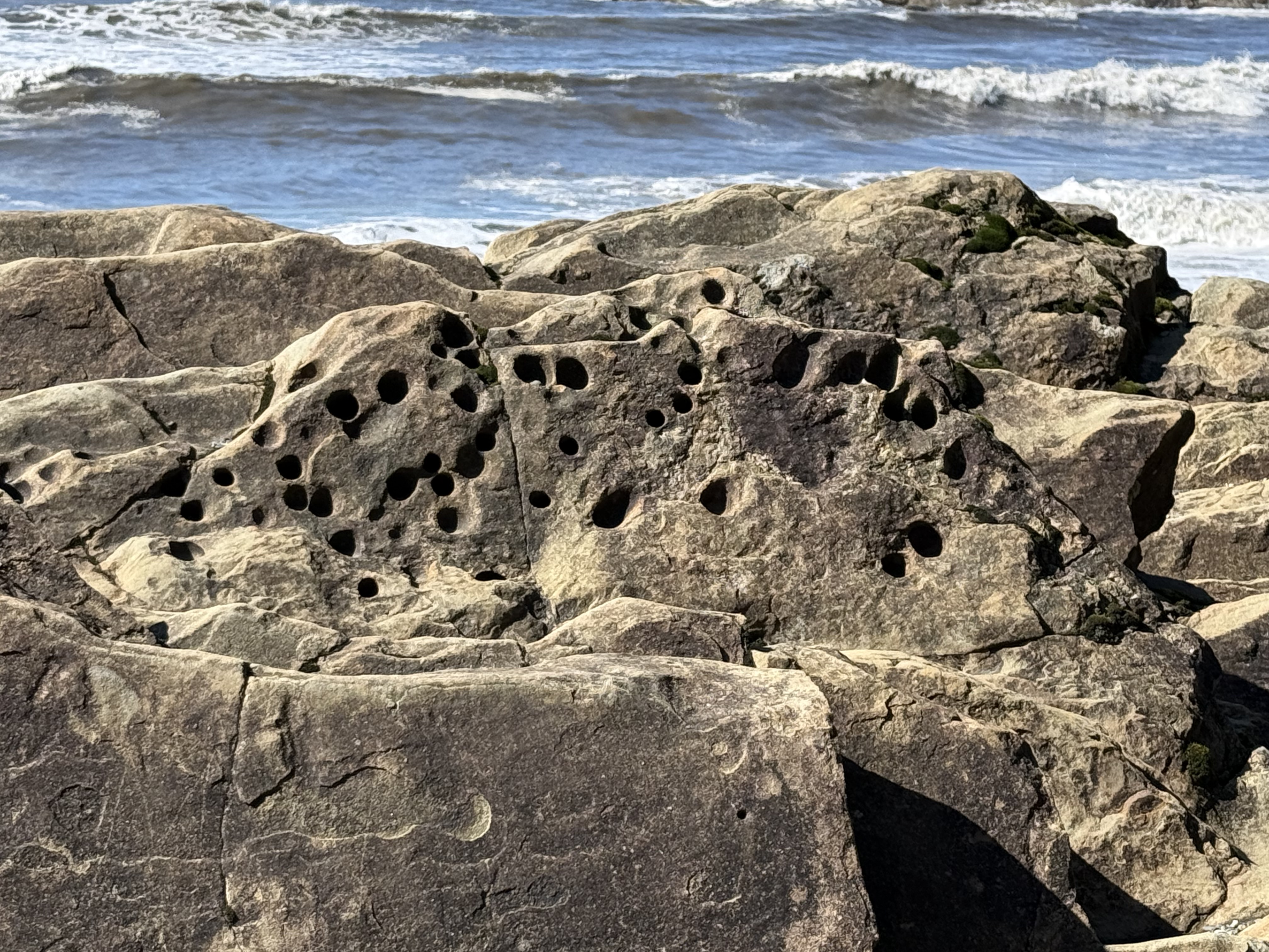
Figure 8. These holes were evident throughout the exposure. They are problematic and probably originated in several ways; however, one plausible explanation is that soft-bodied animals like worms burrowed in the sediments and their burrows filled with sediment with a different composition (e.g. fecal pellets). These channels then preferentially eroded when subjected to the harsh nearshore environment in which they are found. The presence of such holes at the unconformity (see Fig. 5) proves that they predate deposition of the overlying glacial till. Unfortunately, such trace fossils don’t tell us anything about geologic age, only that this seashore was teeming with life.
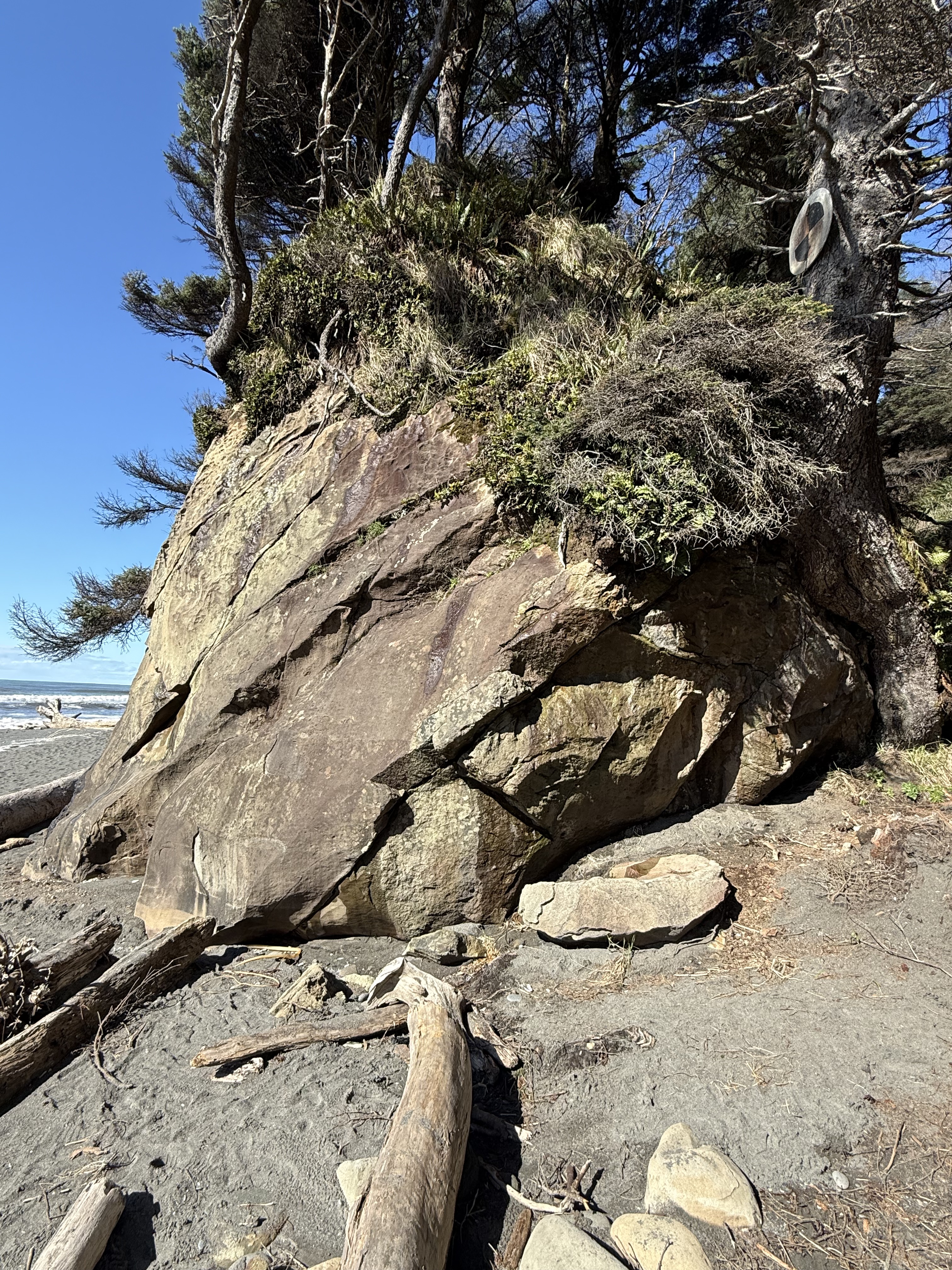
Figure 9. I stopped at another accessible beach a couple of miles south, but still indicated as Site B in Fig. 2, where the rocks were sandstone but with very little clay. The beds seen in this photo were thick (1-3 feet). They were not deposited in a high-energy, environment like those we saw before; they were probably deposited on the shoreface below fair-weather wave base–possibly part of a nearshore bar or barrier island. After deposition and burial, they were tilted less steeply than those seen further north (Fig. 6). The unconformity is seen in the upper part of this image, but it doesn’t seem to have as many rounded cobbles as before (Fig. 5). I have no way of knowing the relative age of these two exposures; this Tertiary rock unit is approximately 3000 feet thick and represents millions of years. All we can say for certain is that this shoreline wasn’t that different from what we observe today. Uniformitarianism in action.
Figure 10. This exposed outcrop within the tidal zone reveals what are probably concretions of iron oxides, formed during early diagenesis. They superficially resemble fossils, but that is not the case. As the sediment was squeezed during burial, incompatible elements like iron formed irregular blobs in an otherwise uniform quartz sand matrix.
Summary
This coastline was part of the Cascadia subduction zone during most of the Tertiary period. Sediment, including a lot of sand, was eroded from rocks being uplifted further inland where volcanism was active, especially during the Eocene (55-35 Ma). Beaches like those we see toady were common, as well as the various depositional environments found along the Olympic peninsula, including fluvial and submarine fans, beaches, and cliffs. But no glacial sediment.
These sediments were buried as more material was removed from the rising orogenic belt, which included granitic rocks with lots of quartz. Eventually they were caught by the complex trench uplift (see Fig. 3) and scraped onto the edge of N. America. This involved faulting primarily, suggesting this was a fairly shallow process (folds occur at depth where rocks are ductile). The tilted rocks were eroded for millions of years; then, about 2.4 Ma glaciers (nothing to do with subduction) covered the region and deposited all kind of sediment: rivers, lakes, undifferentiated till, moraines, etc.
Just as the East Coast of America has been a passive margin for more than 200 my, the West Coast has been a convergent margin. Instead of being steadily worn away by wind and water, these rocks are rising out of the sea at about 2 inches per year. And what a ride it is…
The Olympic Peninsula: Quinault Rainforest to Cape Flattery
This is the first in what I hope will become a regular series of blogs from my travels around the Pacific Northwest (PNW) as well as trips throughout the world. This series accompanies my main blog, Rocks and (no) Roads, which reports on the geology of various places to which I travel. You could see I’m expanding my horizons; in addition to posting about general sights in this post, I will also be including environmental and ecological observations that are of interest to me. My background is in geology, but I’ve become aware of a lot more since moving to the PNW. So this is a learning experience, thanks in large part to the availability of expert assistance from CoPilot, Microsoft’s version of ChatGPT. I’ll be turning to it to identify plants and evidence of animal activity in future posts.

This is the base map I’ll be using in many of my posts from the PNW. The star indicates my base in Tacoma. Today’s post describes a two-day trip to circumnavigate the Olympic Peninsula. Although this area is the wettest in the contiguous United States, with annual rainfall up to twelve-feet, it was clear for the duration of my visit. The labeled areas indicate where the photos described below were taken.
Location A: Quinault Rainforest. Photographs can’t do justice to the experience of being surrounded by a temperate rainforest. There are many trails of different lengths, but I followed a shorter one (about one mile) that followed Willaby Creek for a while before turning into the depths of the forest. This image shows the creek rushing by about 50 feet below the trail as it races to the south shore of Lake Quinault.
Location A: Quinault Rainforest. This rotted log is about six-feet in diameter. It is representative of the ongoing decay and rebirth of the forest. I’ll talk more about that in another post. Note the ferns growing out of the decaying wood.
Location A: Quinault Rainforest. There are at least half-a-dozen species of giant evergreen trees in the rainforest, and I can’t identify any of them; but CoPilot suggests it might be a Coast Redwood, part of a local population found in this area. This example is typical in an area known for its “Champion Trees”. We’ll get to that in the next photo.
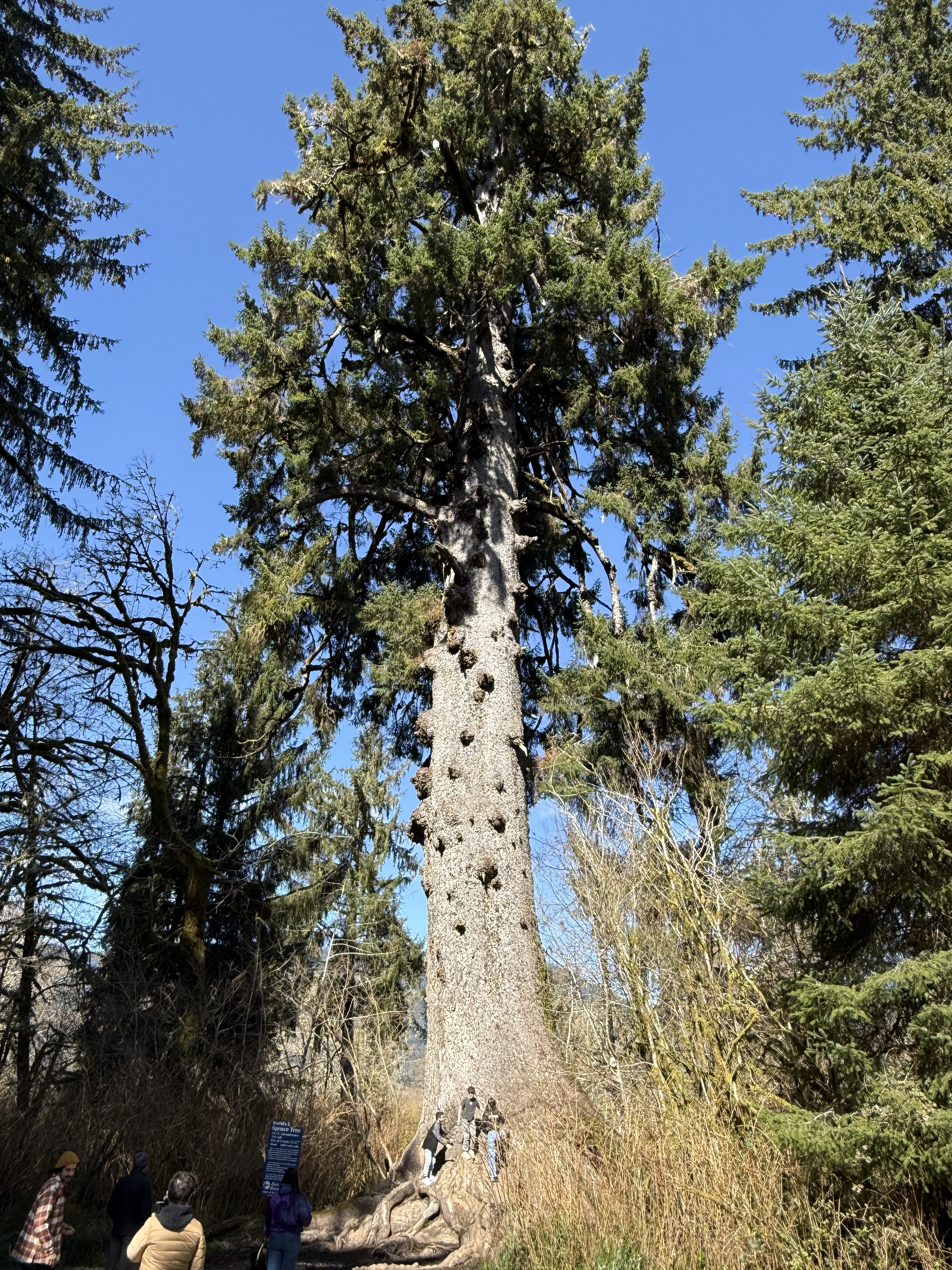
Location A. Quinault Rainforest. This is the world’s largest Spruce tree. It is 191 feet tall and about 1000 years old. It is one of the six champion trees located in Quinault Valley. The other champion trees are: the world’s largest Western Red Cedar, Douglas Fir, and Mountain Hemlock; and the largest Yellow Cedar and Western Hemlock in the U.S. This tree is growing in a wetland area at the NE end of Lake Quinault.
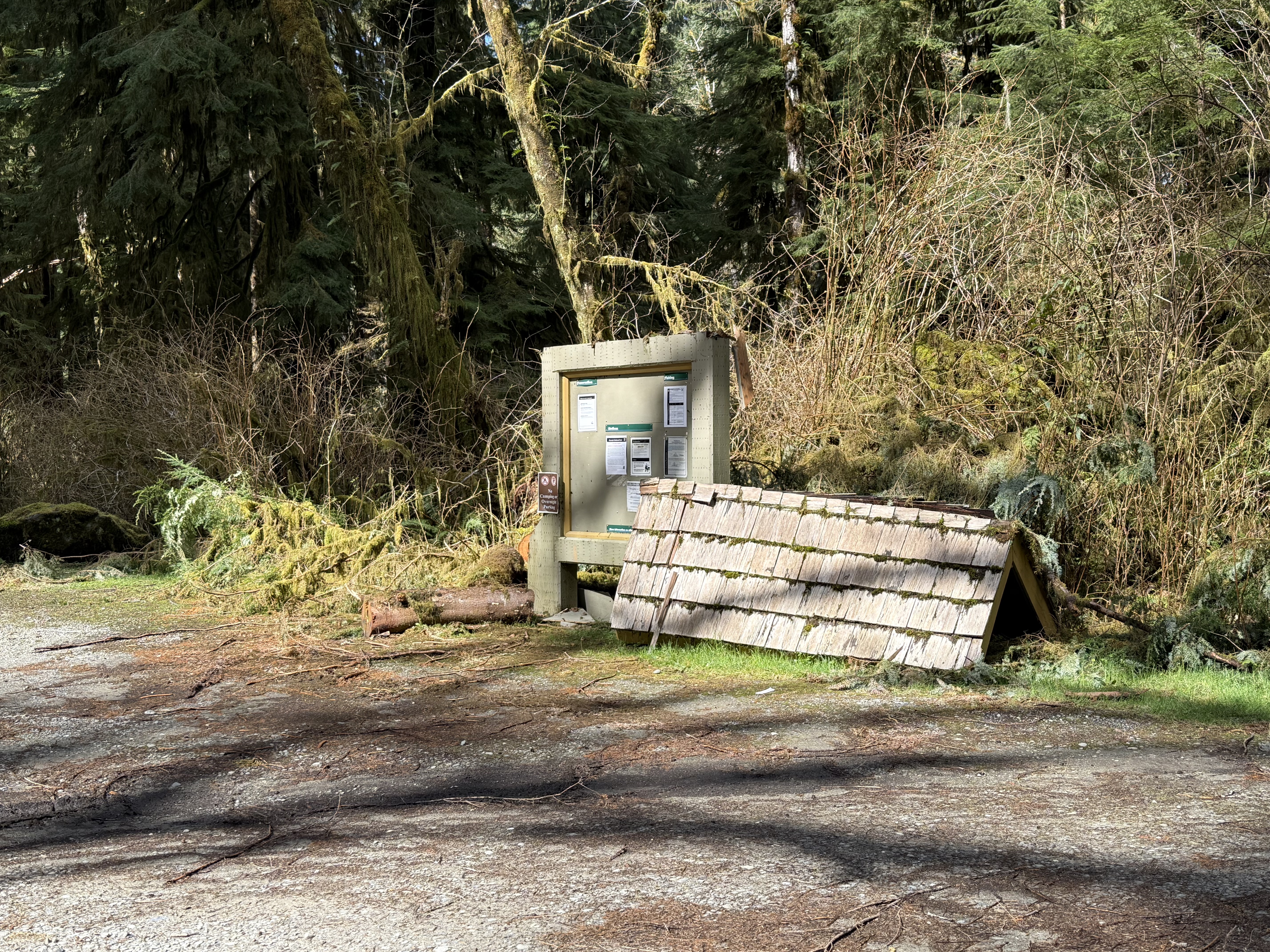
Halfway between Sites A and B. During my day-trips around the area, I’ve noticed a what appears to be a regional interest in post-industrial art, including but not limited to large concrete facilities that have been left to decay in place, as well as small sculptures and other curiosities scattered throughout the cities and forests. I don’t know if this is intentional or not: the roof of the information board collapsed (no doubt because of 12 feet of rain per year) and was set aside, possibly as a monument to nature?–or evidence of the poor funding and mismanagement of the National Park Service.
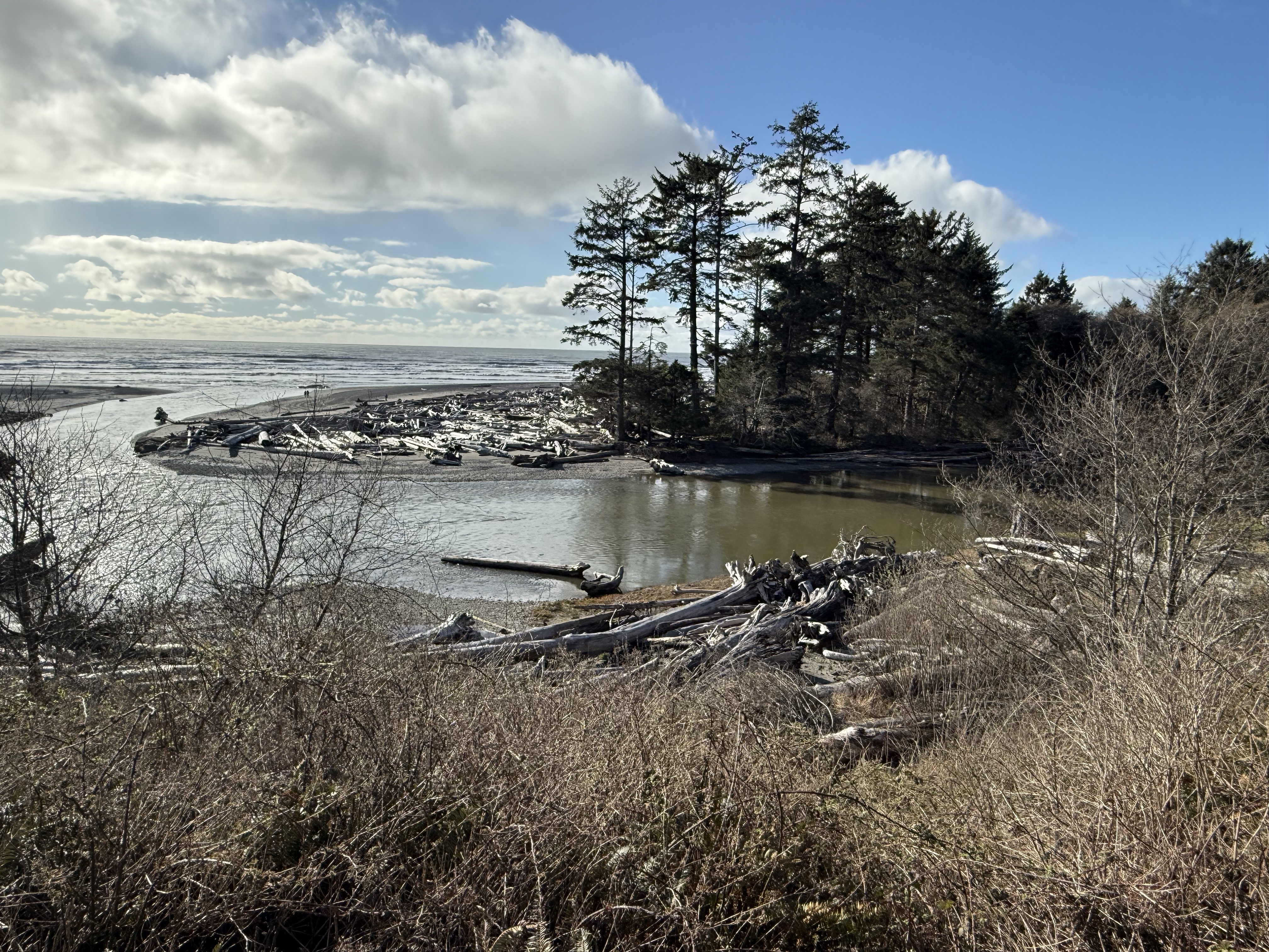
Location B: Kalaloch Lodge. This is the view from the deck of the lodge where I spent the night. Kalaloch Creek meanders as it approaches the coast and enters the Pacific Ocean here. An impenetrable pile of driftwood (actually logs and entire trees) has collected on a sand spit deposited on bedrock.
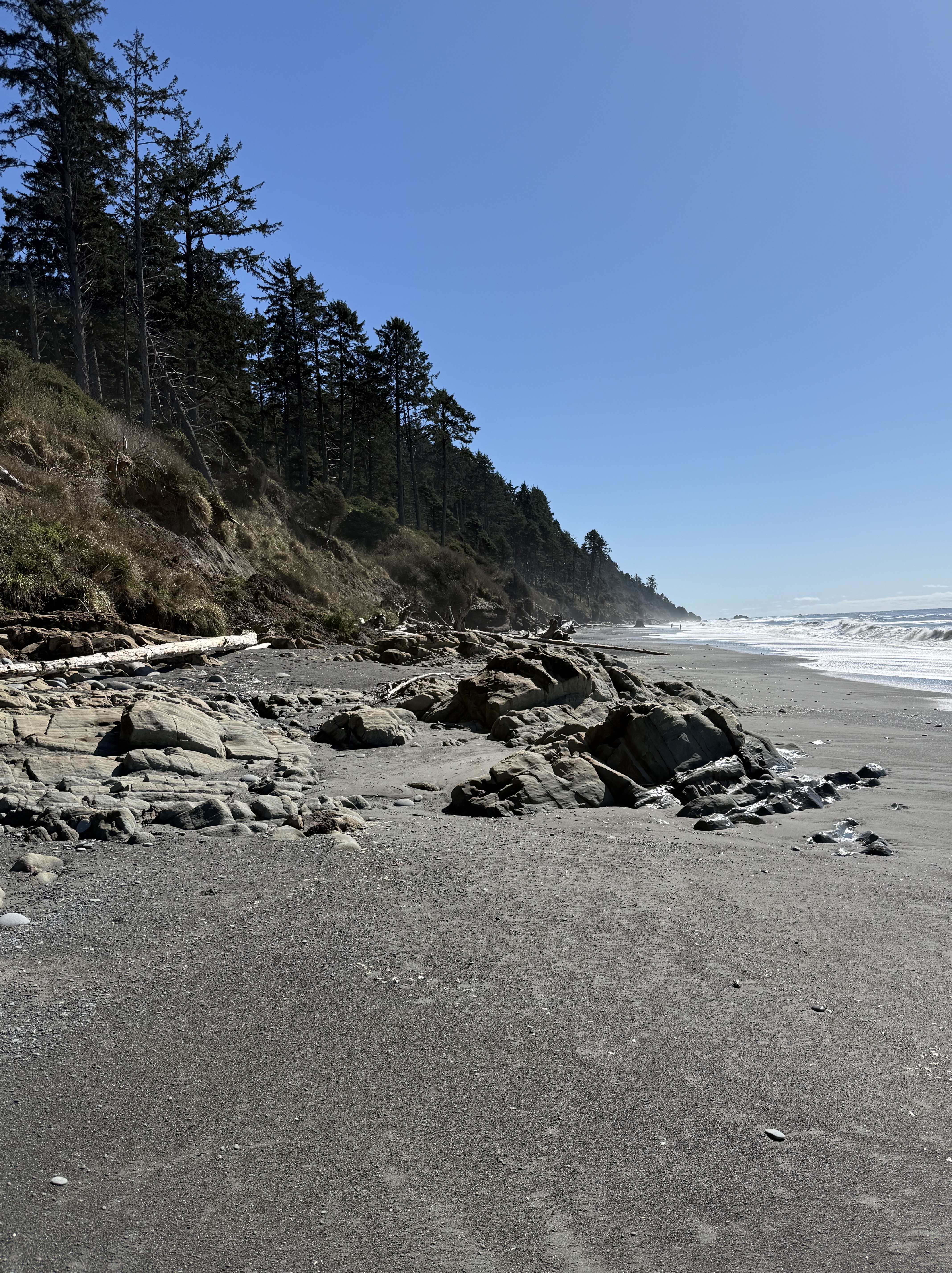
Location B: Beach 4 at Kalaloch. Steep bluffs of glacial till front a wide beach with many exposures of rock, which I’ll discuss in my next post.
Location C: Ruby Beach. This was the last beach before US 101 turned inland for ten miles. I took a video because a series of photos can’t possibly convey the beauty of this location as the sun was rising. Note all the rocks protruding from the water at low tide. The rocks are rising from the earth as we make our way north.
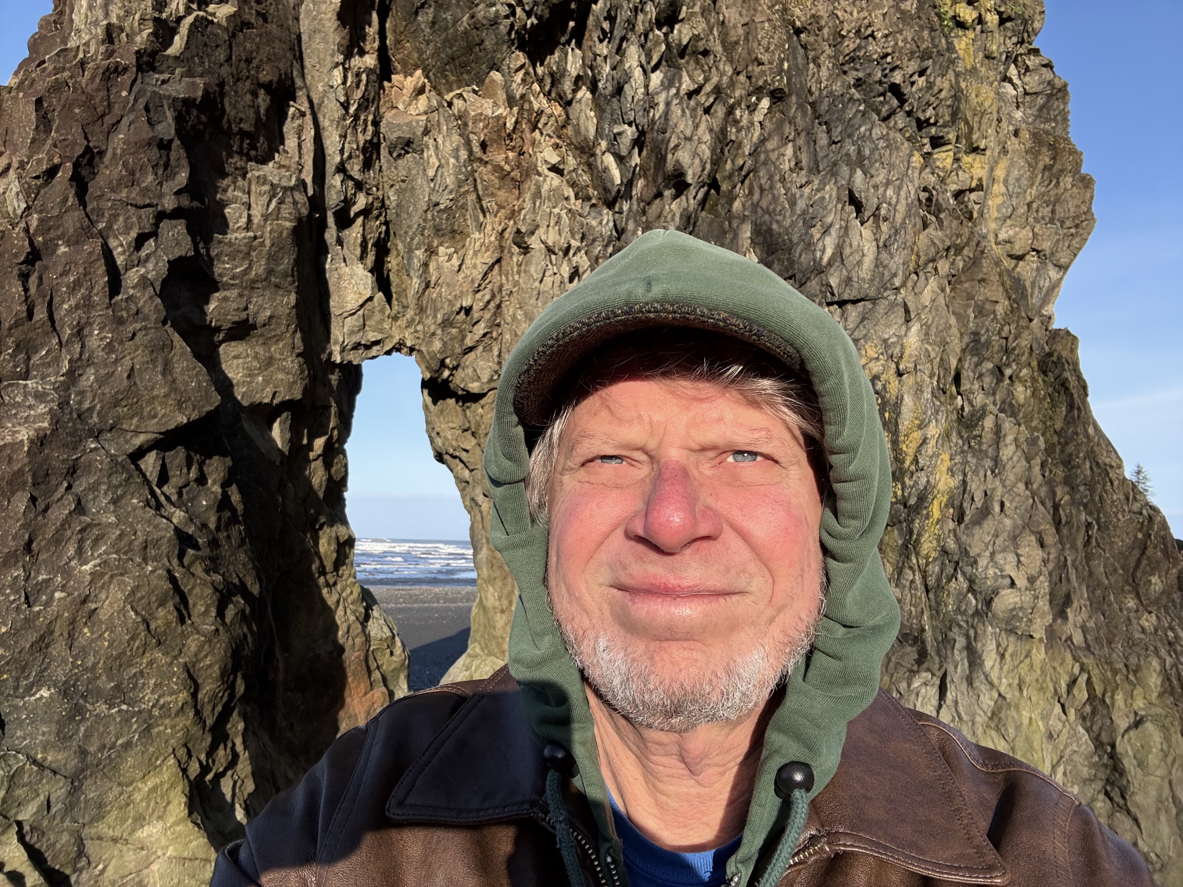
Location C. This selfie demonstrates how chilly it was, with the temperature below 40F. Rock formations like this are called stacks; they are erosional outliers as the coast recedes over millions of years, pounded day and night by rocks carried by waves; and tides that exceed nine feet–twice a day! You have to time your visit accordingly or all you’ll see is water.
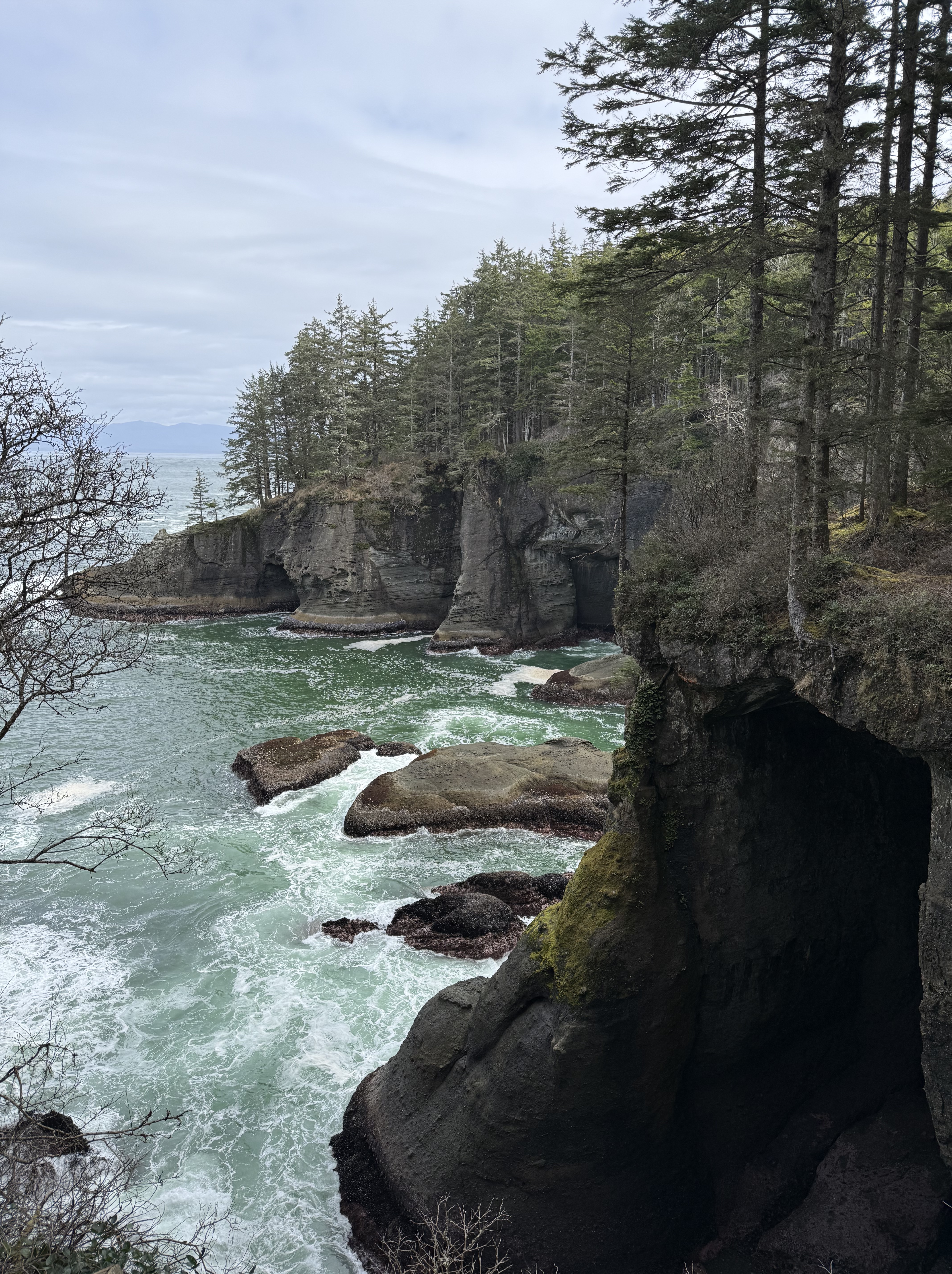
Location D: Point Flattery. This is the extreme tip of the contiguous United States. The bedrock we saw further south, at Ruby Beach, now forms wave-cut cliffs that tower 40-80 feet above the waves. The top of the bluffs is 330 feet above sea level. The view from the catwalks is breathtaking. Vancouver Island, BC, is visible in the background, with peaks around 6000 feet.

More PNW Humor. All of the toilets we saw along the coast were constructed over septic tanks, with warnings about what to put in them. Someone with a sense of humor modified just one word of the official message…
If you get the chance, I strongly recommend visiting Olympic National Park, but you’re going to want to spend a week unless you live nearby in the PNW.

Recent Comments