
Fraser Preserve
We had a chance this week to see what the Nature Conservancy does with our donations. They buy land and either maintain it or return it to the state or local government as public parks.

FIGURE 1. This post takes us back to the Potomac River, where we hiked around Fraser Preserve, a plot of land owned by the Nature Conservancy and open to the public. The photo above shows a stream flowing under an old concrete bridge as it cuts its way to the Potomac River. Downcutting here was similar to what we’ve seen elsewhere along the VA side.
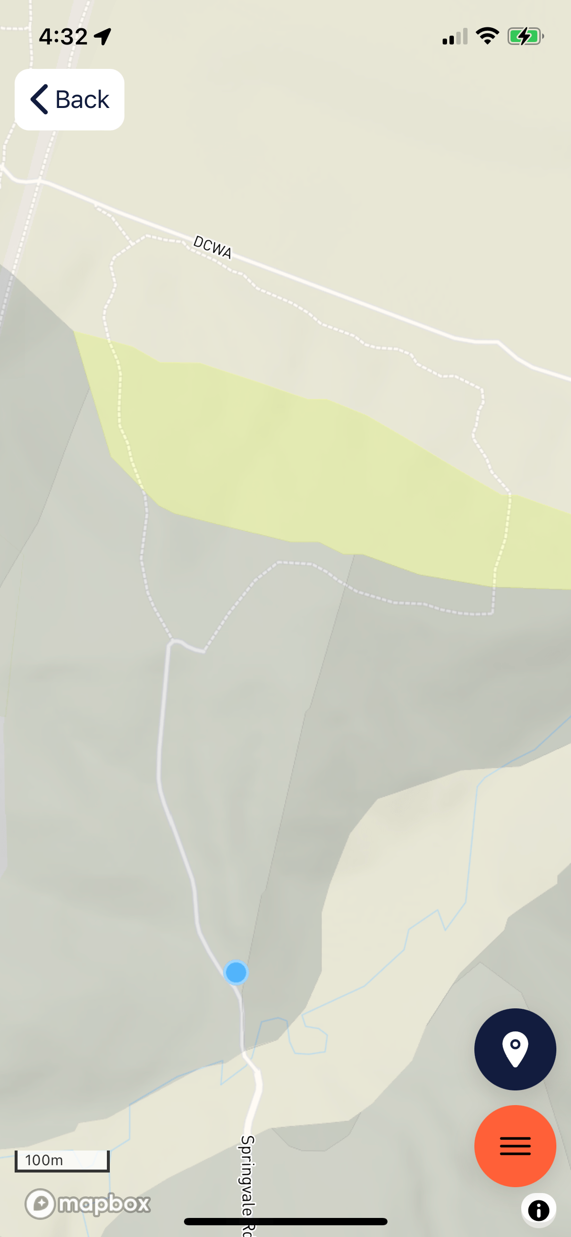
FIGURE 2. The blue dot marks the gravel road that leads to the trail we took, which is indicated by the dashed line. The light-green area to the left is the schist (1000-511 Ma) we’ve seen along this stretch of the Potomac. The darker area to its right is a metagraywacke from the same era. These rocks were originally deposited in an ocean trench where ocean crust was being subducted beneath continental crust. They were buried along with the ocean crust and deformed into medium-grade metamorphic rocks.
We left the nature preserve and briefly entered Seneca Regional Park (north of the road marked DCWA in Fig. 2) to get access to the Potomac River.

FIGURE 3. A side channel of the Potomac River with a gravel bed and pristine water flowing over outcrops of schist. The elongate dark areas are lenses of schist on the river bed. Similar features were observed at River Bend park and discussed in a previous post. The banks here are gravel and would be a great place to cool off on a hot summer day.

FIGURE 4. This is a view of an abandoned channel of the Potomac River, taken from the top of a steep bank, probably 40 feet above the river. This area is about a half mile downstream of Fig. 3. The water seen through the foliage is part of a cut-off lake that is active only during high-water. Similar features have been seen further upstream but with some water flow year round, as discussed previously.
FIGURE 5. Close-up of a small exposure of metagraywacke along the access road at the blue dot in Fig. 2. Note the thin bedding and striations aligned perpendicular to the hillside. These are probably sole marks that indicate the flow direction in the original sediments. These rocks appear as lenses within the larger volume of schist, which was originally deep-sea mud. Imagine submarine flows flowing down the steep face of a submarine fan as turbidites.
This is a short post because we have seen most of these rocks and geomorphic features before. The novel feature that prompted me to write this was the wide floodplain (at least 300 yards across) and totally abandoned channel (Fig. 4). I also haven’t seen such clear water with no mud deposited at the shoreline. This location isn’t far from the narrow chasm that created Great Falls, where the river turns southward. I also noted a large number of steep gullies that appeared with no warning, indicating recent erosion from the surrounding hills, which are a couple hundred feet above river level. It seemed that some of the higher ridges were supported by cobblestones rather than bedrock, a feature we noted in Claude Moore Park that suggests ancient point bars.
Photographs can’t capture the complex topography of Fraser Preserve, especially with such colorful foliage interfering, so I encourage anyone who has the time to get out and see this beautiful landscape for themselves.
One final note: I support Nature Conservancy in their efforts to preserve natural lands and keep rampant development in check…

Recent Comments