Geologic Survey of the Northern Cascades: 2. The Central Orogen
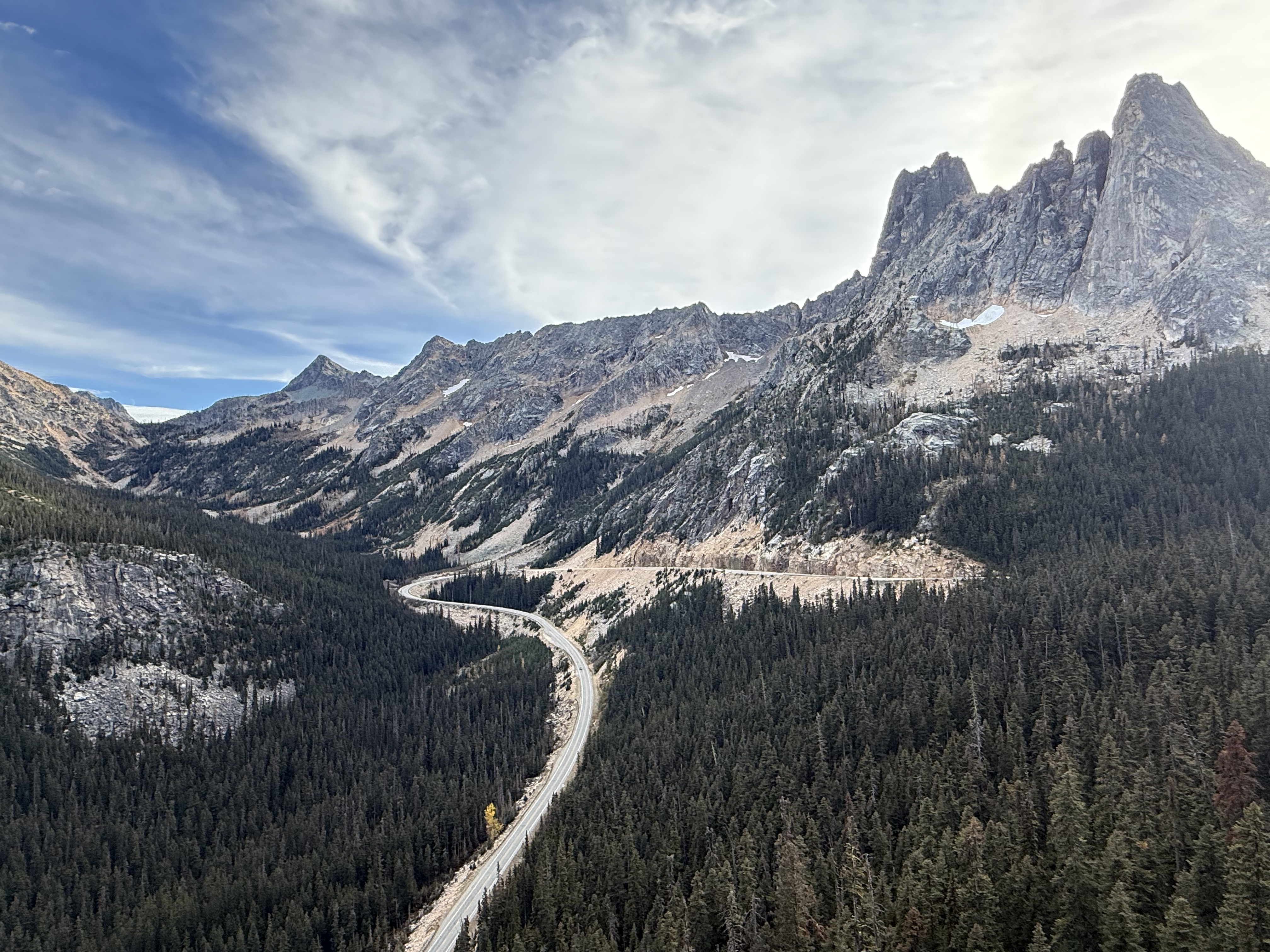
Figure 1. This magnificent vista of Washington Pass, at an elevation of 5477 feet, is representative of the core of the Northern Cascades. Highway 20 has to change direction to get out of this dead end, created by glaciers among massive mountains of high-grade metamorphic rocks, some of which have been exhumed from depths greater than twenty miles. Some of the intrusive rocks were emplaced at much shallower depths. Remember that it took tens of millions of years for this striking rock-scape to evolve on the surface of a dynamic planet.
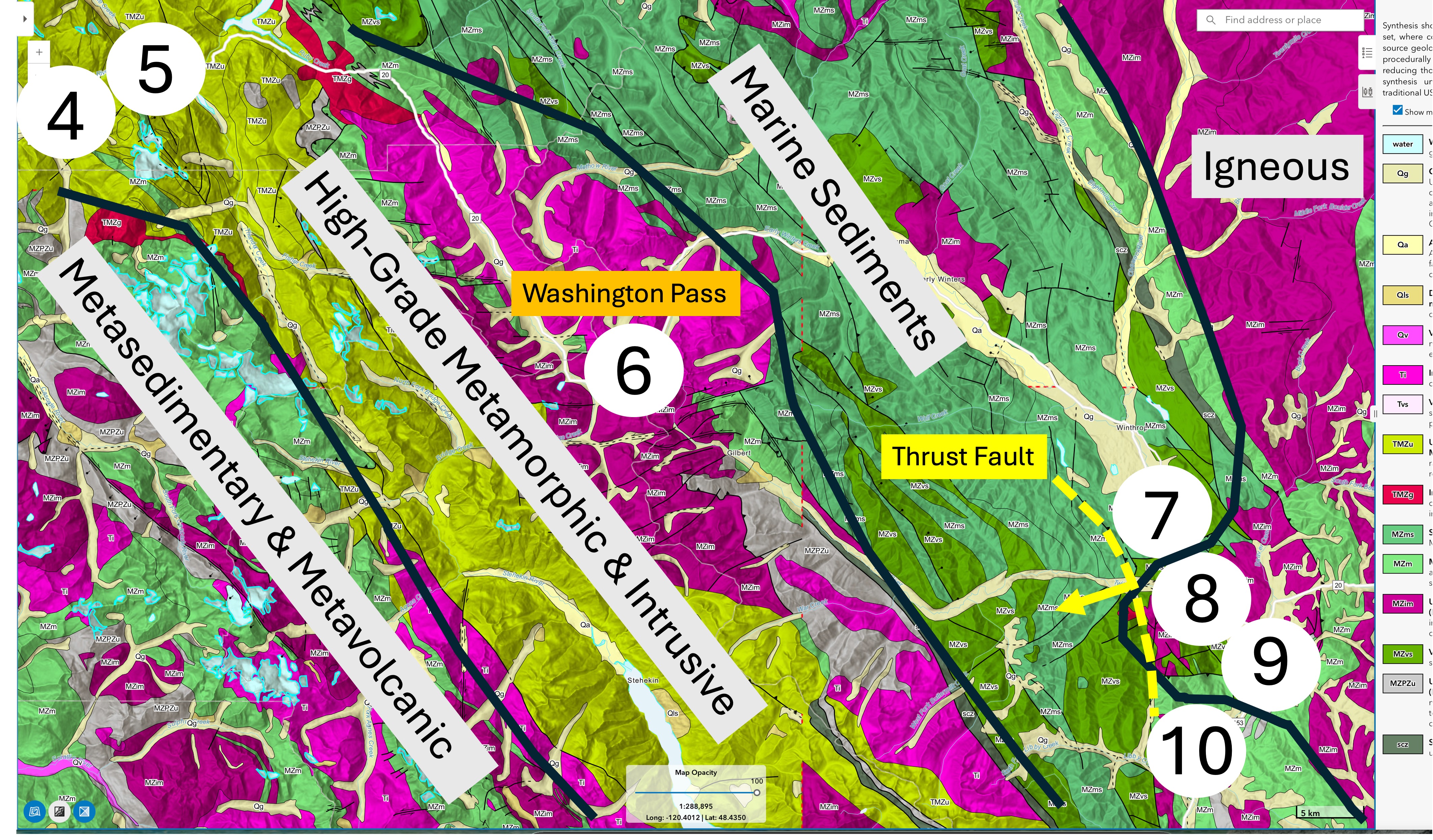
Figure 2. I have annotated this piece of the USGS national geologic map to give an overview of the terrain we traversed. Today’s post will only be discussing Sites 4-6, which fall within the core of the orogen. We saw low-grade metamorphic rocks in my last post. The bright-colored area represents rocks that are classified as orthogneiss–a mixture of non-plutonic rocks that were subjected to high pressure and heat. The dark-purple shades are Mesozoic intrusive rocks and the lighter hues are Tertiary. Site 6 is approximately where Fig. 1 was photographed.
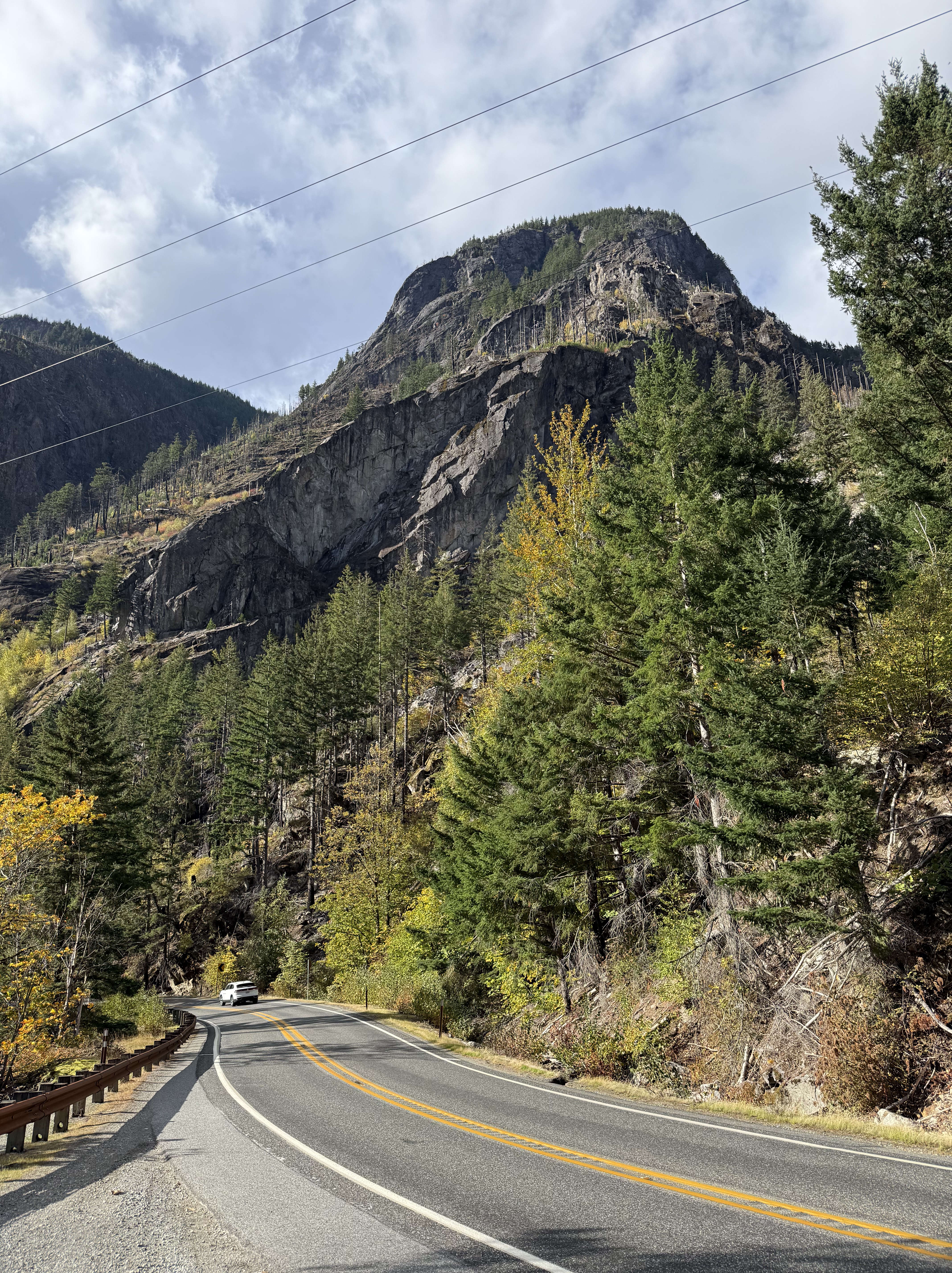
Figure 3. Steep peaks like this one (near Site 4 in Fig. 2) replaced the ridges seen in the sedimentary prism rocks to the west. When you see spires and domes, it is safe to assume that you are looking at high-grade metamorphic/intrusive igneous rocks.
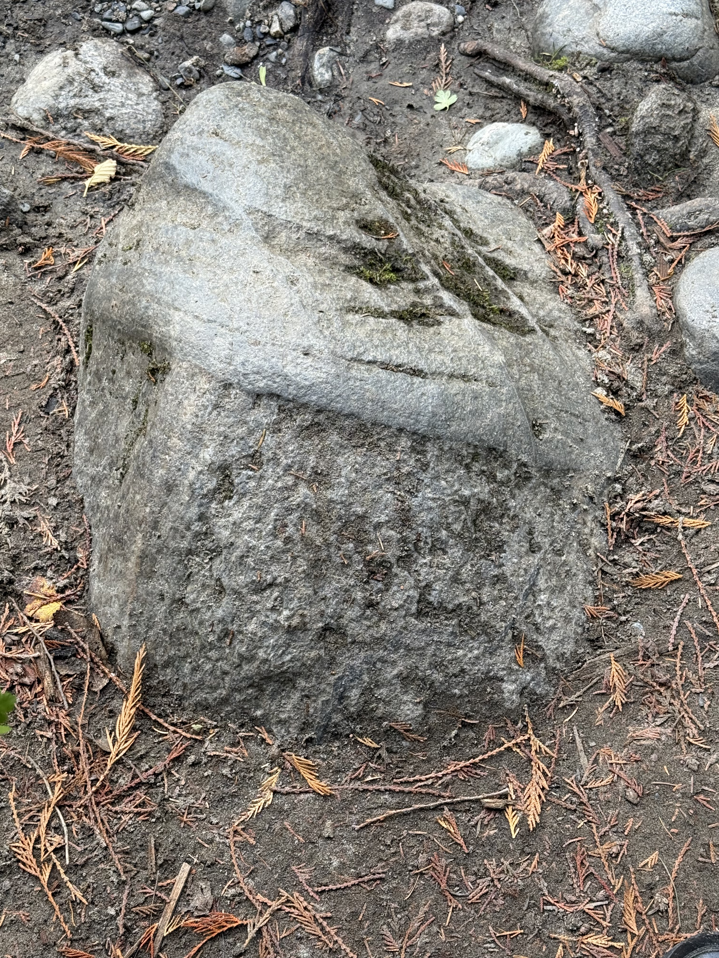
Figure 4. The Skagit River canyon between Sites 4 and 5 is filled with boulders and gravel, but there are no exposures. This boulder is interesting because it is composed of two lithologies with different properties. I think this is a piece from miles upstream; the irregular part looks like a coarse-grained intrusive rock like granite whereas the smoother component is probably an intrusive rock that filled cracks in the host rock.
Extreme physical erosion in the river has emphasized several sets of intersecting dikes that were filled at different times in this rock’s history.
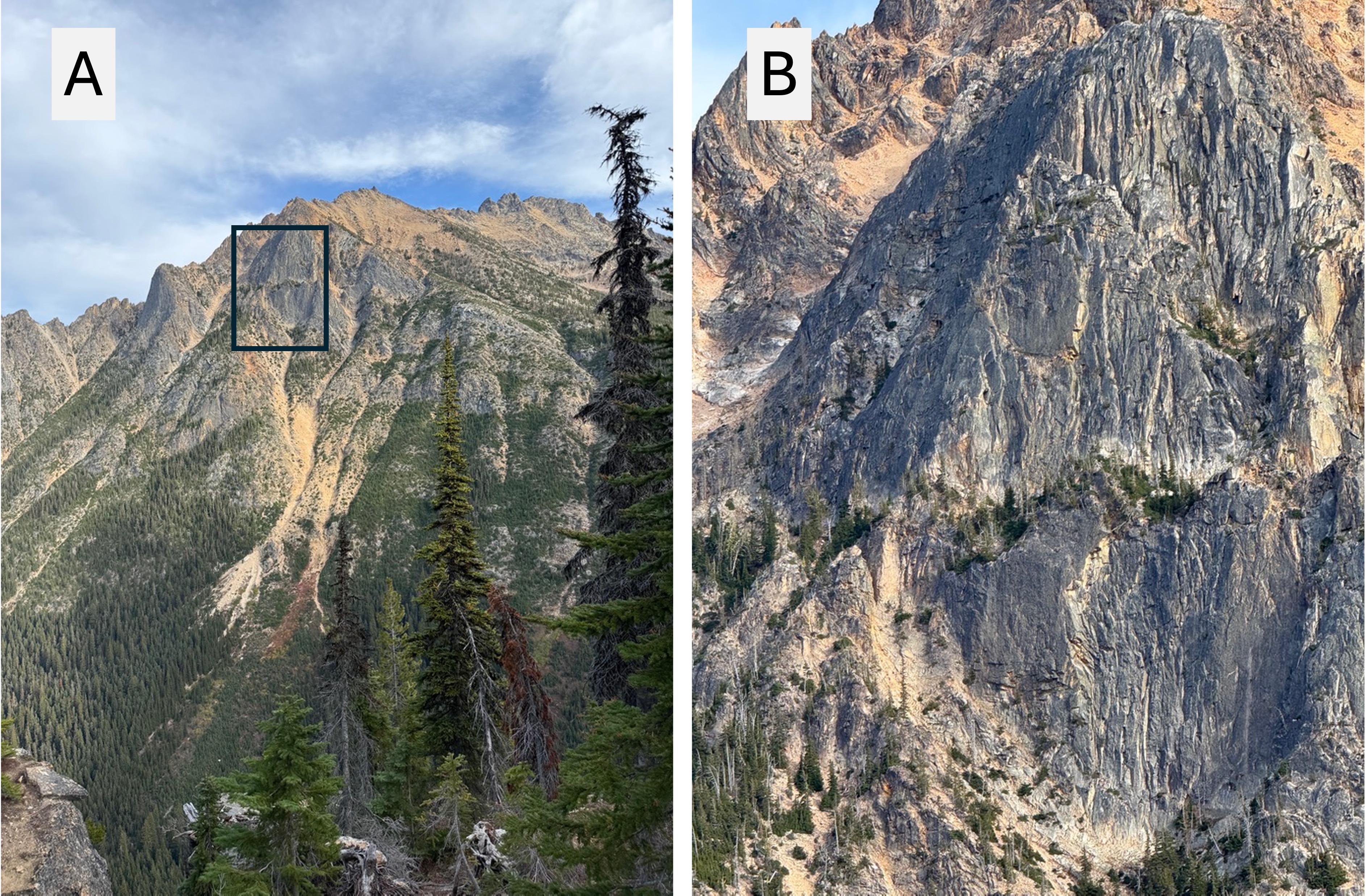
Figure 5. (A) Photo looking north from Site 6 in Fig. 2. According to the geologic map, this mountain comprises Tertiary (~66-2.3 Ma) intrusive rocks that don’t contain a lot of quartz (e.g. diorite).
(B) This is a closer view of the rectangle in A, showing vertical lineations that form ridges in the steep face of the mountain. At first glance these structures remind me of columnar jointing in basalts, but similarity in appearance doesn’t indicate a common origin. These lineations are irregular and wavy in some places. They probably followed jointing that developed as the massive rock cooled…under a continuously changing stress environment; e.g., uplift from erosion of overburden, sliding along a transform fault just to the west of here, and a jumble of motion along numerous tensional and compressive faults.
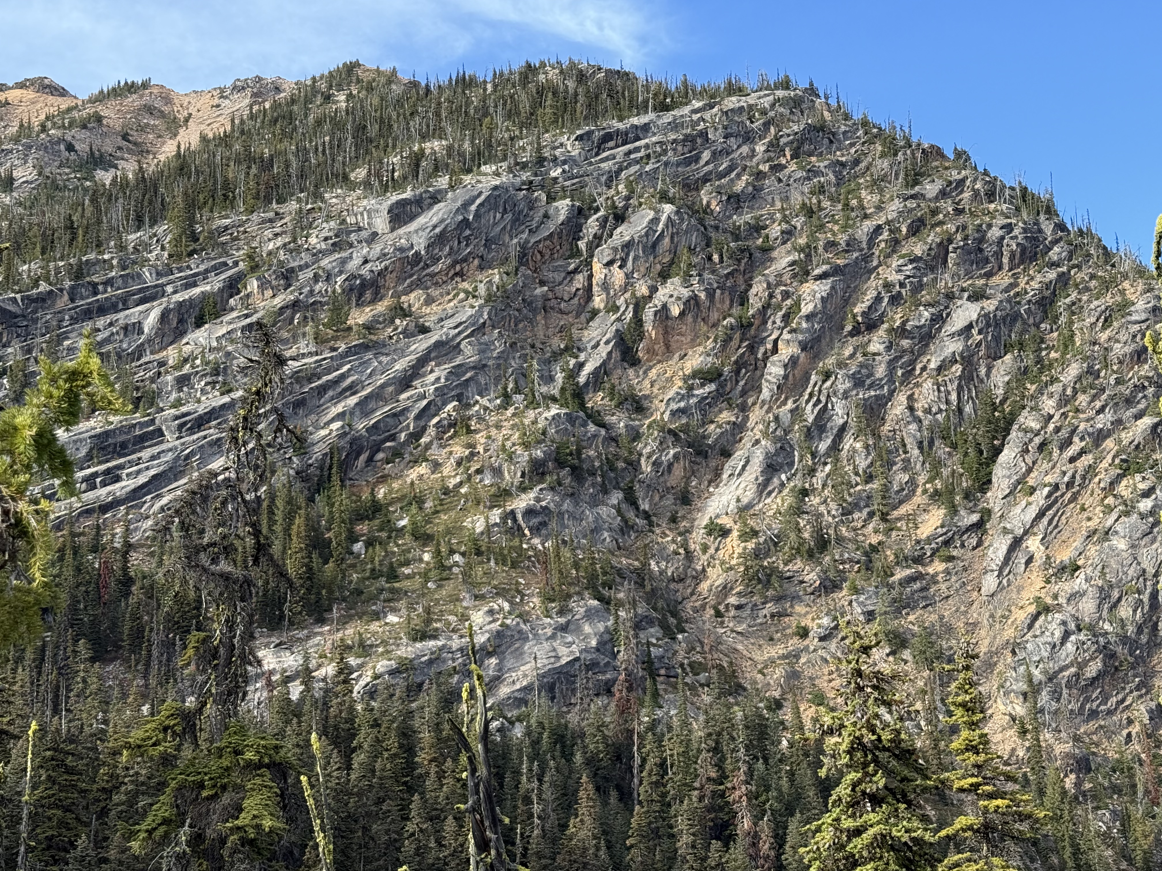
Figure 6. This view is looking southward towards a mountain comprising Paleozoic-Mesozoic (~250-66 Ma) intrusive rocks. The pluton in Fig. 5 was injected into this mass of far-older rock with a similar composition. This difference is striking at this distance: these older rocks present a curvilinear pattern of joints and fractures. I could speculate about the complex, almost turbulent, flow suggested by this view–but I won’t.
These rocks are so much older than those in Fig. 5 that they experienced several lifetimes before the tectonic stress field of the Tertiary (~66-2.3 Ma) developed; nevertheless, they reveal the cumulative effects of continuous deformation associated with ocean crust subduction.
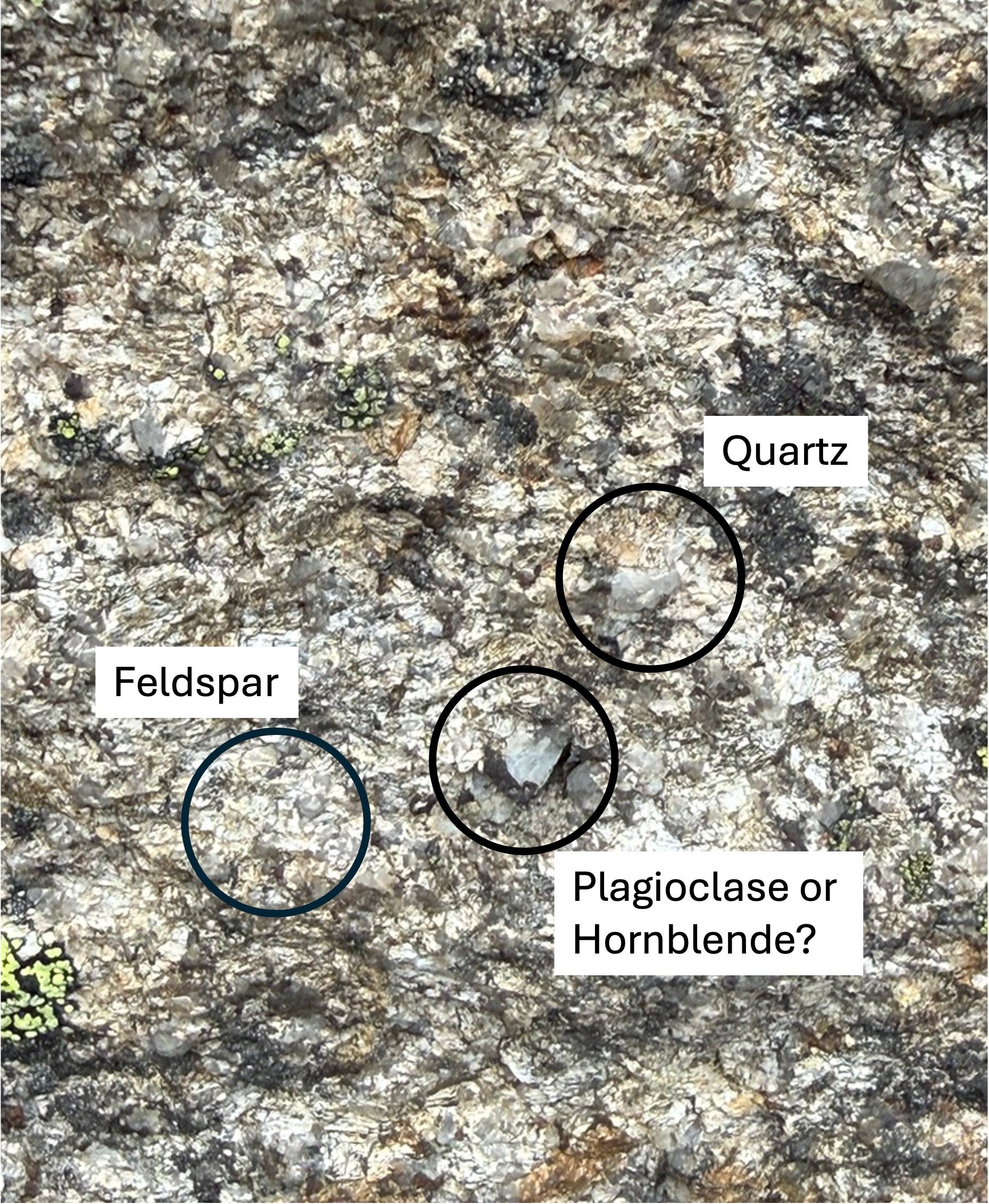
Figure 7. I included this high-resolution (~20x) photo as a baseline for some rocks we’ll see later. This is the Tertiary intrusive rock, but the fabric (i.e. mineralogy and structure) has been modified from the original magma. Most of the minerals are feldspar, but only chemical and microscopic analysis can differentiate potassium and sodium end members. The anomalously large, dark crystal is probably the result of solid-state diffusion after the magma cooled. There is quartz, identifiable as the amorphous gray areas, throughout but not at high concentrations.
The description in the geologic map covers a wide range of quartz-poor plutonic rocks, so I won’t try to name it. What matters is that this is not a rock that simply cooled and was frozen in time.
Final Thoughts
Driving through batholiths, which are built up over millions of years from multiple plutons, gives plenty of opportunities for panoramic photography, but the real geological story is buried within the minerals themselves.
Washington Pass has exposed the beating heart of the Northern Cascades. We’ll have to look at the periphery to learn more.


Recent Comments