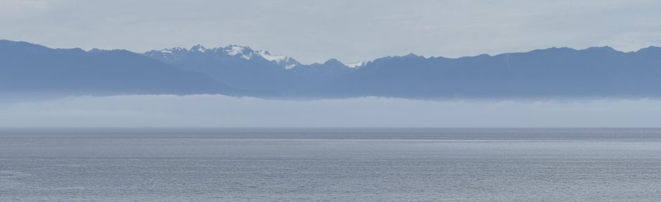
Geologic Survey of the Northern Cascades: 4. Thrust Faulting within a Subduction Zone
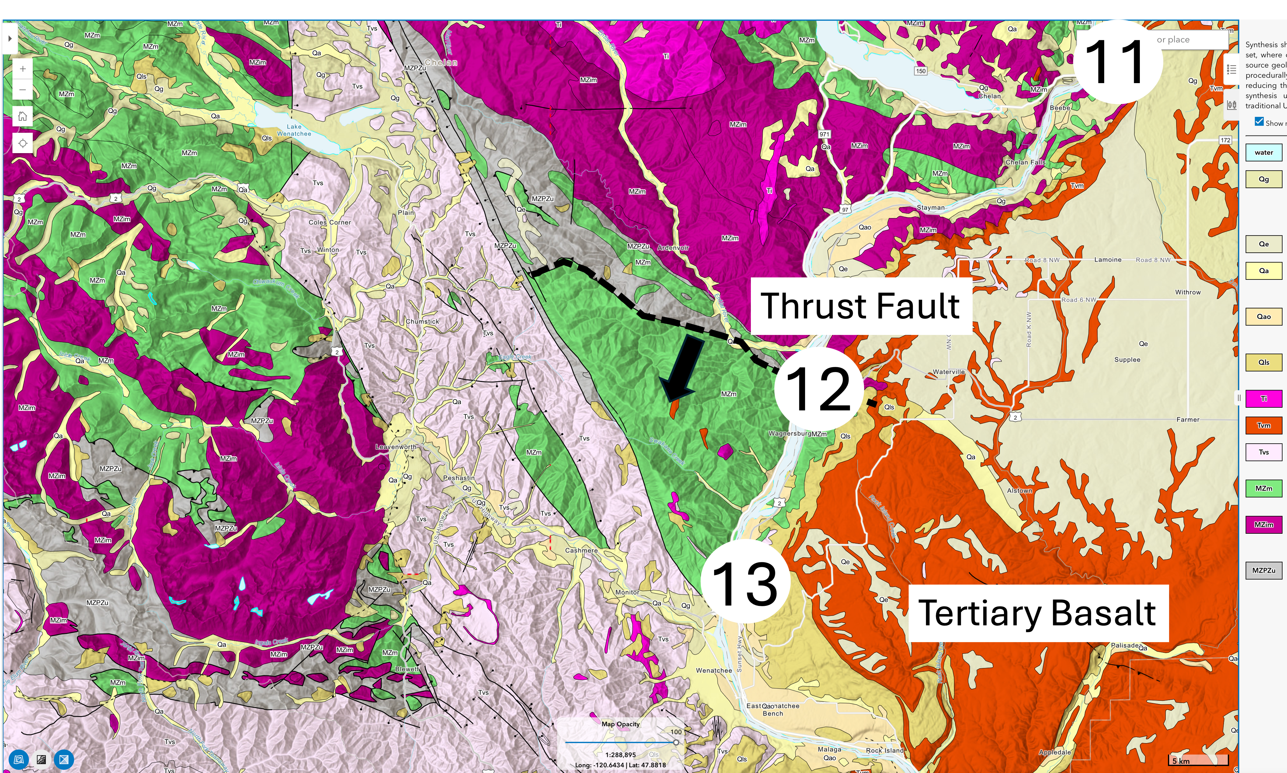
Figure 1. This is my last post from our Cascades Loop drive. The geologic map shows a wide variety of rock types west of the Columbia River, some of which we’ve seen before. But we also see two unfamiliar lithologies: Tertiary basalts that erupted throughout eastern Washington between 17 and 6 million-years ago; and mixed Paleozoic/Mesozoic metamorphic rocks (539-66 ma), which appear as a sliver of gray pointing like an arrow towards Site 12. These older rocks have been thrust over younger Mesozoic metamorphic rocks along a thrust fault (dashed line with arrow indicating direction of relative movement).
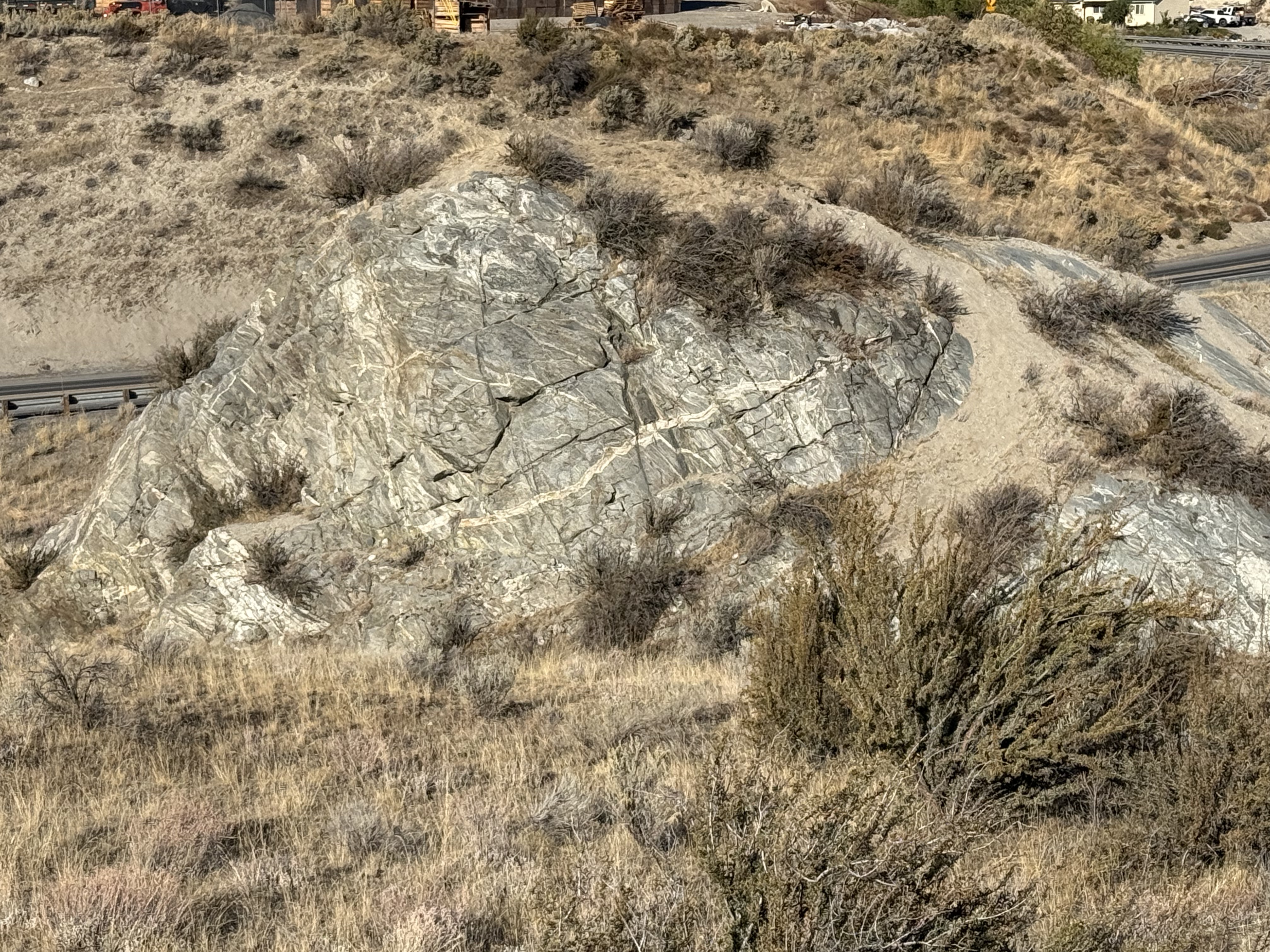
Figure 2. Stop 11 is located along the Columbia River, where steep slopes conceal high-grade, metamorphic rocks generally assigned Mesozoic ages. This image shows a knob dissected by numerous intersecting dikes. Ages for metamorphic rocks indicate the time when they were transformed into gneiss, schist, etc. The description from the NGMDB map describes a jumble of rocks in complex interrelationships.
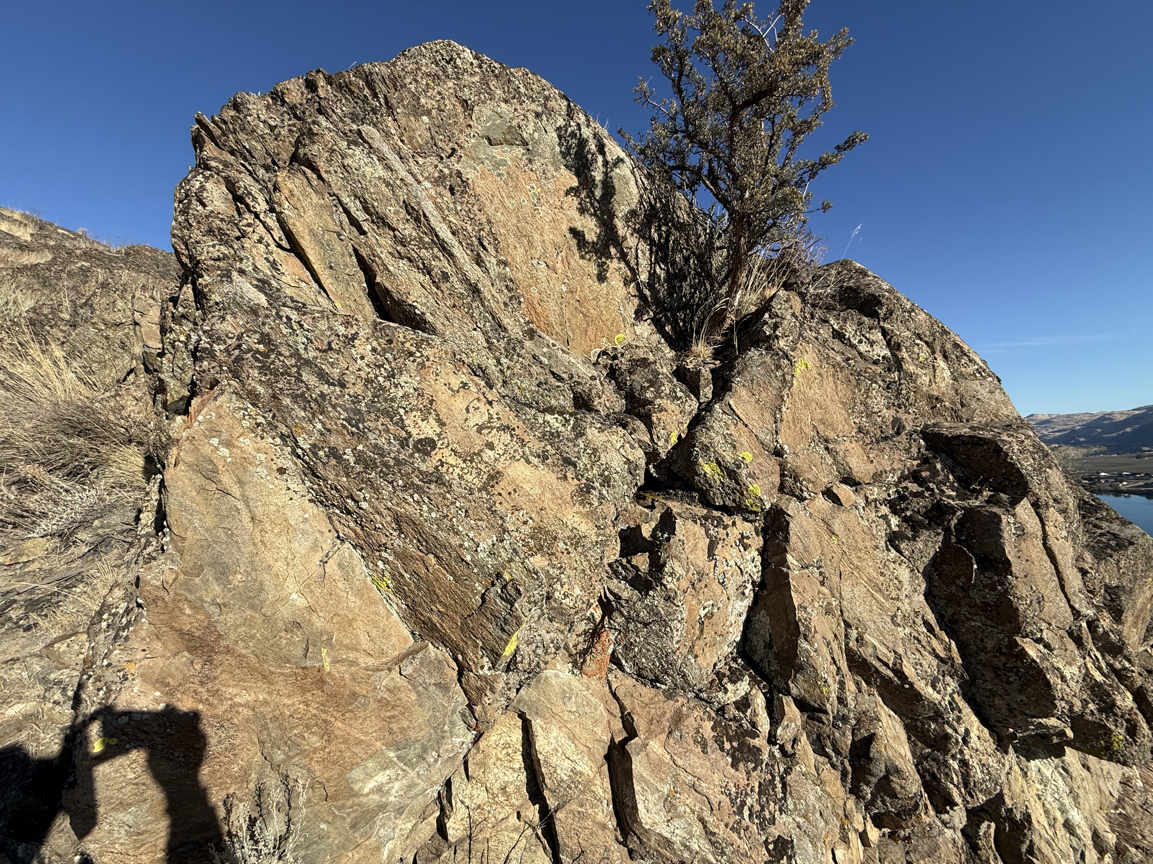
Figure 3. This outcrop is about 10 feet across (the tree is young); it shows what the geologic map’s metadata are saying. There is no continuity visible, yet thin layers of sandstone/mudstone are visible, adjacent to blocks of buff material in the lower left; meanwhile, the right side reveals quite different layering.
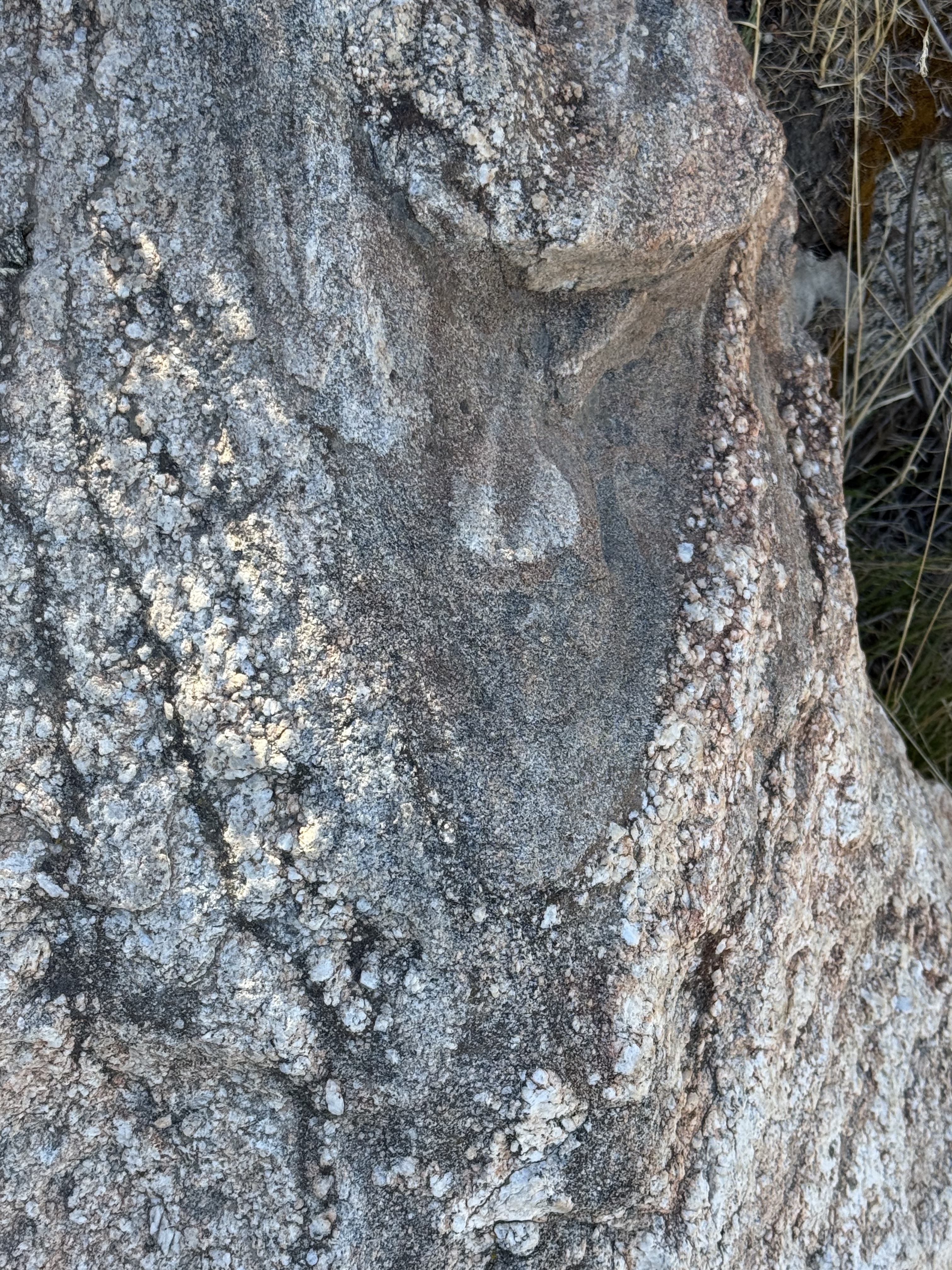
Figure 4. This image reveals an intrusive, igneous texture that has been modified into what I would call an orthogneiss. Large grains of feldspar have formed layers because dark minerals like amphibole and biotite have been remineralized into the dark laminae. None of these minerals (except perhaps an occasional zircon) is original. The entire outcrop appears to have been folded into a three-dimensional, origami form. The gray area exposes the core of this spheroidal structure.
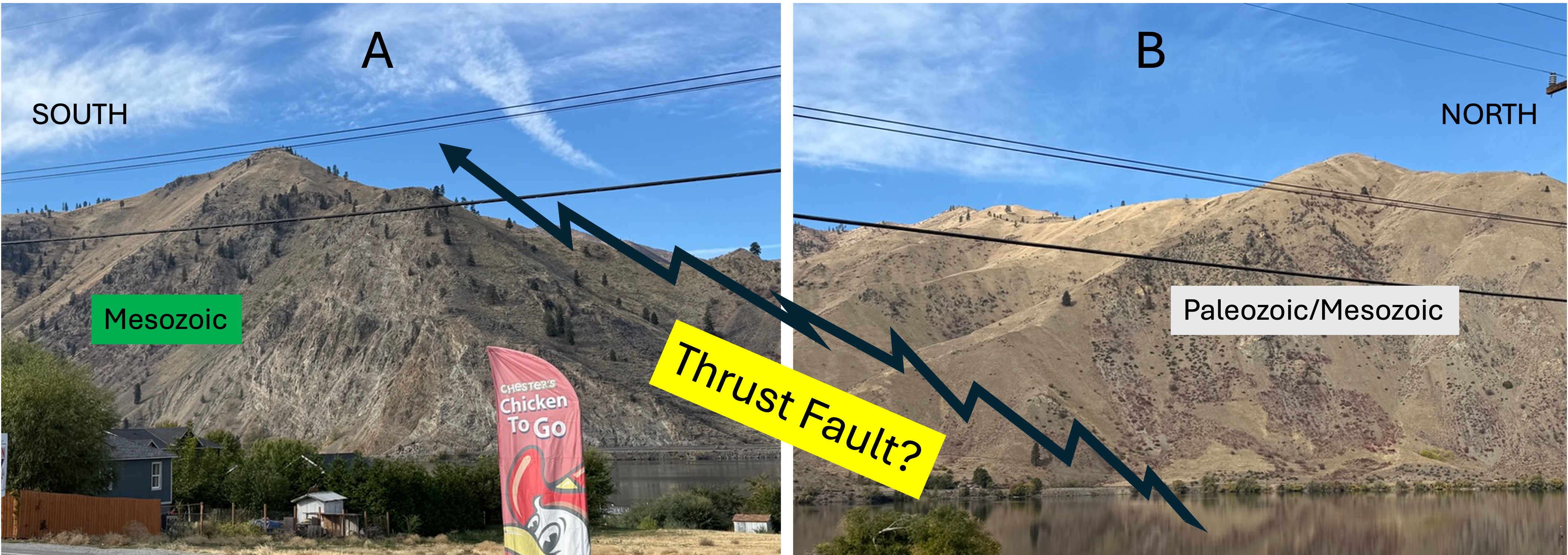
Figure 5. These two photos from Stop 12 are so speculative that they could be considered as schematic. I included them to demonstrate the change in geomorphology when crossing something as subtle as a thrust fault. These images are from the intersection of US-2 and US-97; I don’t need GPS to know where I am. The NGMDB map shows a thrust fault crossing the Columbia River at this spot.
(A) This mountain forms steep, rock faces. It is composed of Mesozoic metamorphic and igneous rocks. (B) This mountain, only a few miles north, is predominantly covered with loose soil and has a few outcrops on the upper slope.
There is an identified thrust fault between them, pushing the northern rocks over the younger rocks to the south (some time in the past). At first glance, the two look alike but, on closer examination, we can identify differences even from a mile away. I should add that a thrust fault is not cut with a knife; instead, it is a general zone of brittle failure within colliding rock masses. The result is seldom obvious.
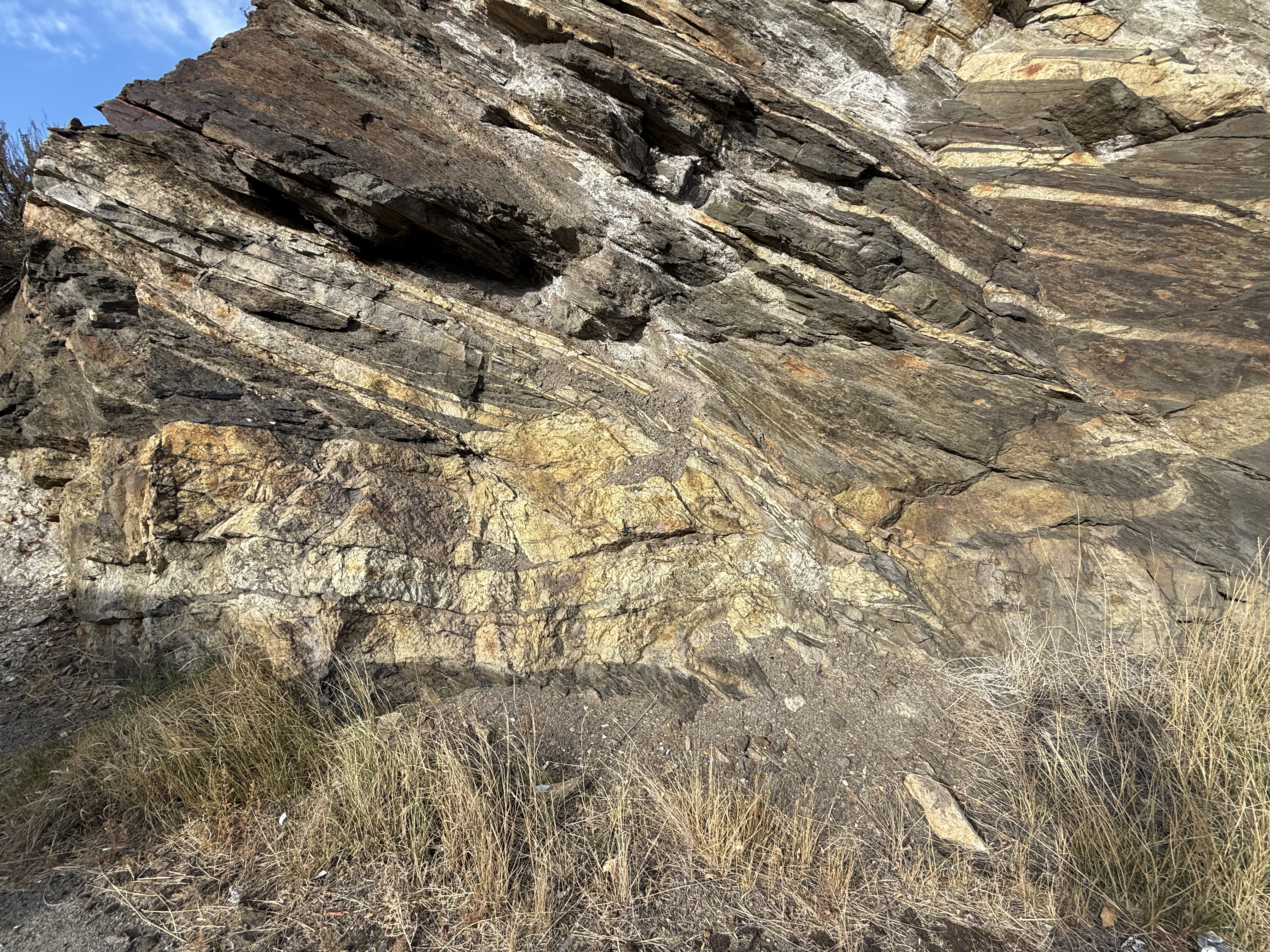
Figure 6. Stop 13 in East Wenatchee revealed deformed rocks similar to those at Chelan (Stop 11), which isn’t surprising; however, this road-cut revealed larger exposures that aren’t as criss-crossed by veins. The lighter colors are the result of illusive changes in chemistry that interact with the environment, but they seem to reflect subtle differences in lithology. Note the massive, layered section at the bottom that seems to have been cut off; perhaps this is an outcrop-scale expression of regional compression and thrust faulting.
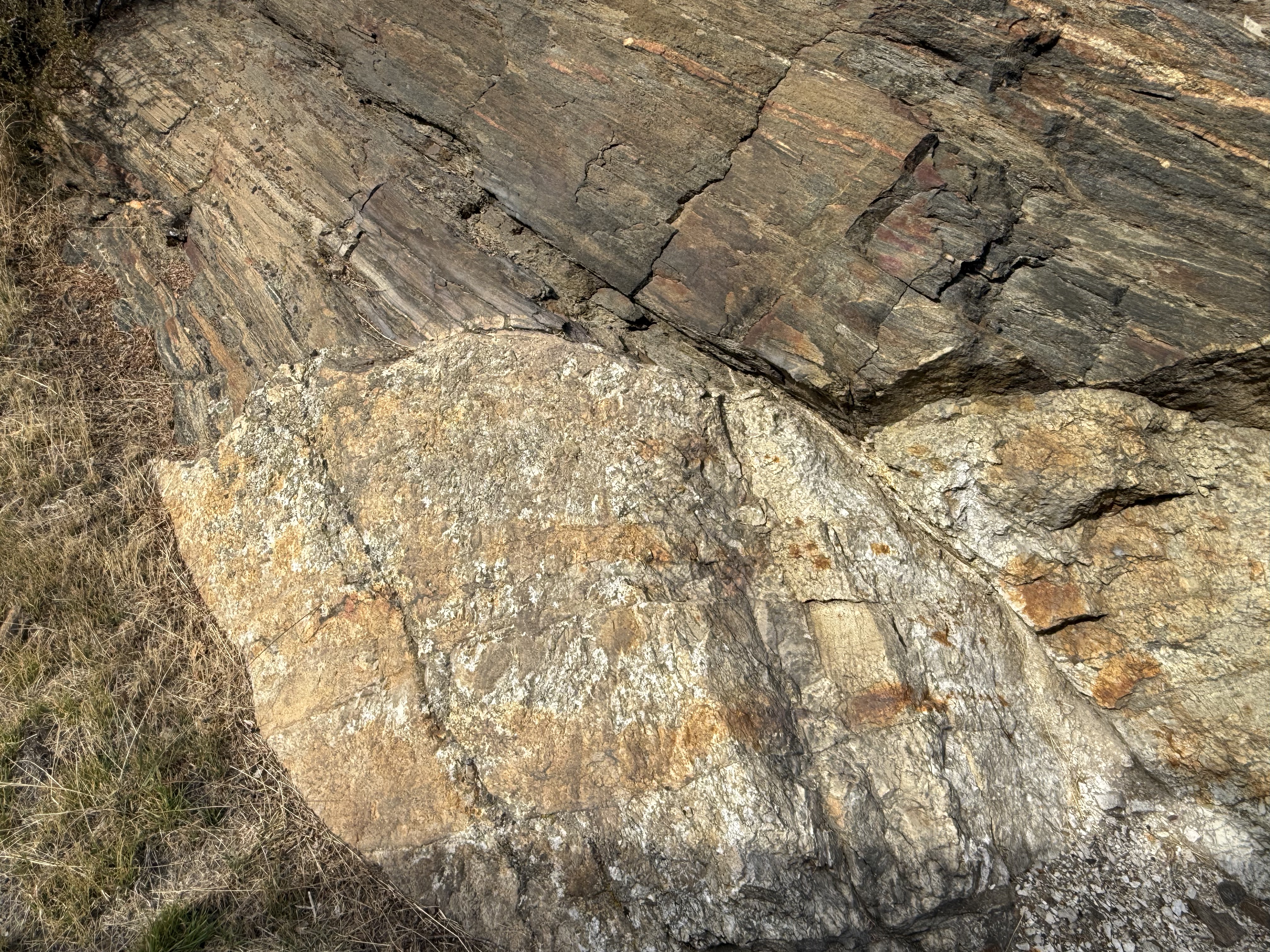
Figure 7. This photo is difficult to explain. Thin layers of what was once an intrusive rock abut an intrusive rock that hasn’t been as altered. This is an opportunity to point out the fallacy of jumping to geological conclusions: this might look like a sedimentary rock laid down on a granite boulder, which once formed a shoreline–it is NOT.
Final Thoughts
These four posts have explored a subduction-zone orogen, from youngest to oldest. The rocks got progressively more complex during our transit. They tried to fool us repeatedly by revealing patterns that, at a glance, seemed familiar and could be mistaken for textbook schematic concepts.
The rocks are never wrong, but they are known to have a bit of fun at our expense.


Recent Comments