
Coastal Restoration on the North Sea
Today’s post takes me to the North Sea coast of Germany, the city of Husum, and to one of the famous mud flats from the region. Rivers running from the Alps drain Germany, transporting mud (silt and clay) to the north coast, where it is transported along the coast and stirred around by strong tidal flows. We are going to look at efforts to stop dramatic erosion caused by a reduction of sediment input, because of dams and coastal construction, leading to a serious threat to the levee protecting Husum from the North Sea (Fig. 2).
The mud flats schematically shown in Fig. 1 are covered with fence-like structures designed to catch mud brought in the the high tide (Fig. 3).

A quick look at the past. This area was covered by glaciers that filled the North Sea and transported rocks from Sweden to the north. These glacial erratics are rounded and scattered around the land in a random manner (thus the name). We found one used as street decoration in Husum (Fig. 4).
In addition to boulders transported during the ice ages (less than a million years old), there are remnants of sandy sediment from the Quaternary, before the area was overwhelmed by mud (Fig. 5).
The result of the sediment retention project can be seen in Fig. 6.

This are represents an attempt to reconcile the problem of coastal development (the port of Husum ships out grain) and the protection from storm waves provided by a wide mud flat (which dissipates wave energy). Another issue is the encroachment of sheep grazing, which appears to be legal (there are fences and gates, etc). And then there is entertainment; this is a popular swimming location during high tide. Not to mention environmental degradation and fish hatcheries. Several attempts at mixing these applications can be seen in the hardened and dredged channel leading to the port (Fig.7), and buried groins which were apparently intended to keep the shipping channel open (Fig. 8).
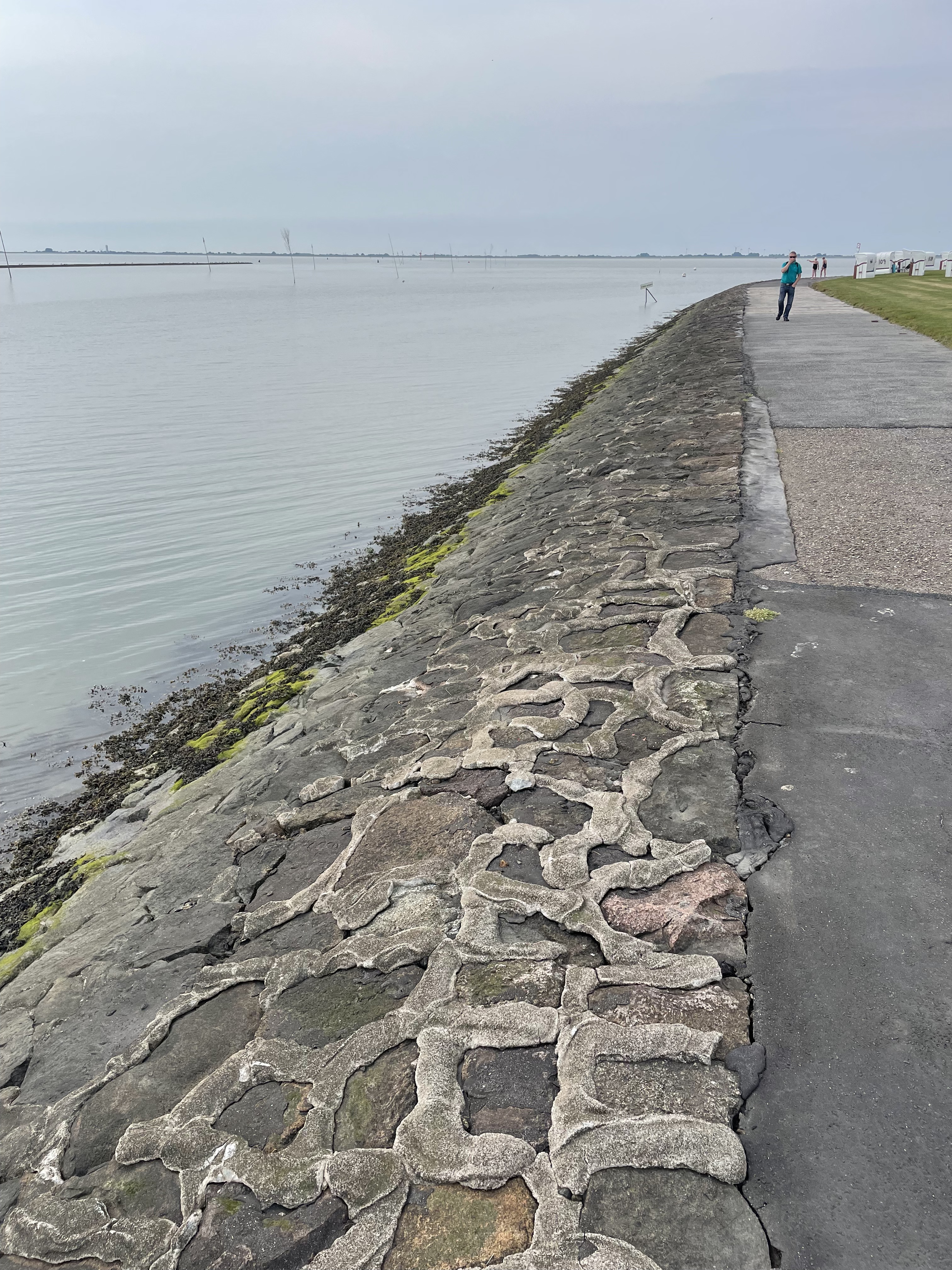

It is difficult to reconcile the many uses the coastline is required to fulfill. This trip revealed that it is unreasonable to mix methods designed to preserve the status quo (Figs. 7 and 8), and those intended to change it (eg. Fig. 6), especially when these techniques are mixed (Fig. 3). A difficult decision will have to be made soon, or the levee protecting the bustling cit of Husum will be in danger of breach during a severe storm, which is becoming more common in the North Sea.
The Last Few Miles
This is going to be a brief post, mostly because it is very difficult to convey what I want to communicate in photographs; the camera lens (on my iPhone) simply doesn’t capture image depth well. For example, Fig. 1 was actually pretty steep, but it looks as unintimidating as my driveway.
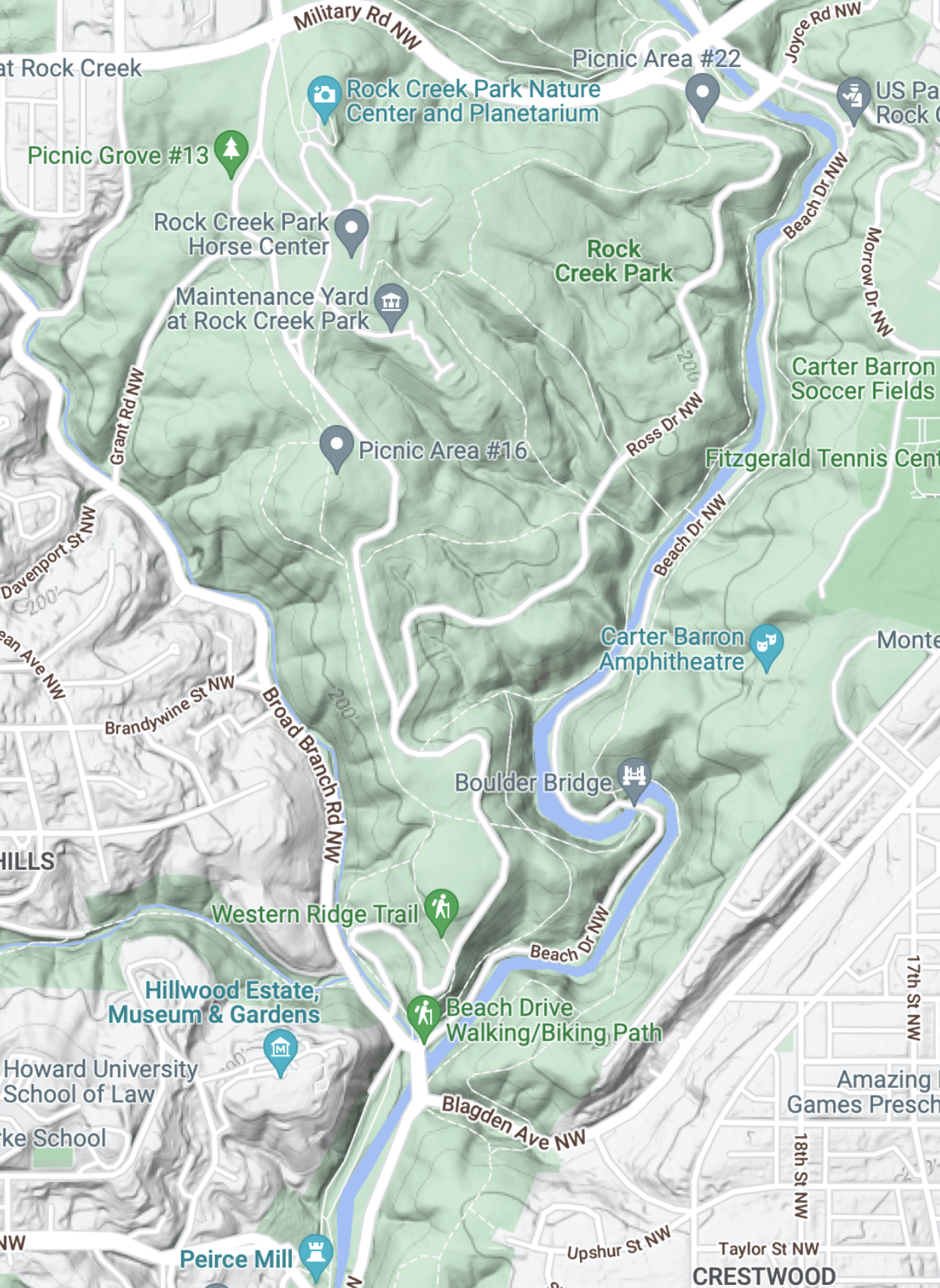
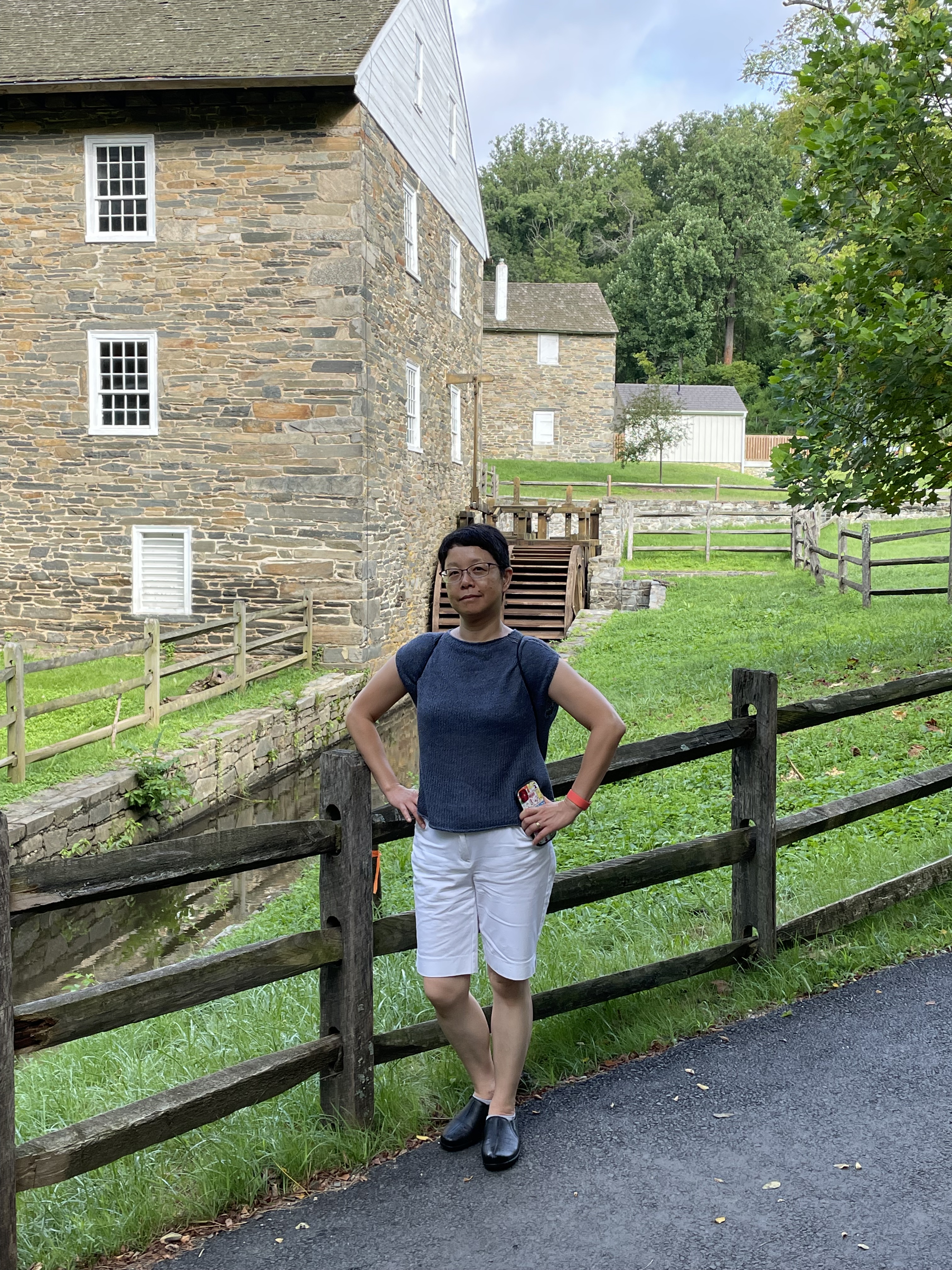
I’ve been talking about the bedrock exposed along the bed of the Potomac in several posts (e.g., Geological Bottleneck and Great Falls), but those are specific locations. Those significant drops in river elevation are part of a larger pattern, one that is displayed even at the scale of Fig. 1. It doesn’t take much of a drop to generate enough potential energy to spin a waterwheel (Fig. 3), which can do a wide variety of work–from grinding corn, to operating a machine shop.
The staircase structure of streams along the transition from crystalline rocks to coastal plains (aka the Fall Line) is so important to the ecosystem that artificial barriers were constructed within the park to ameliorate the impacts of road and bridge construction (Fig. 4).

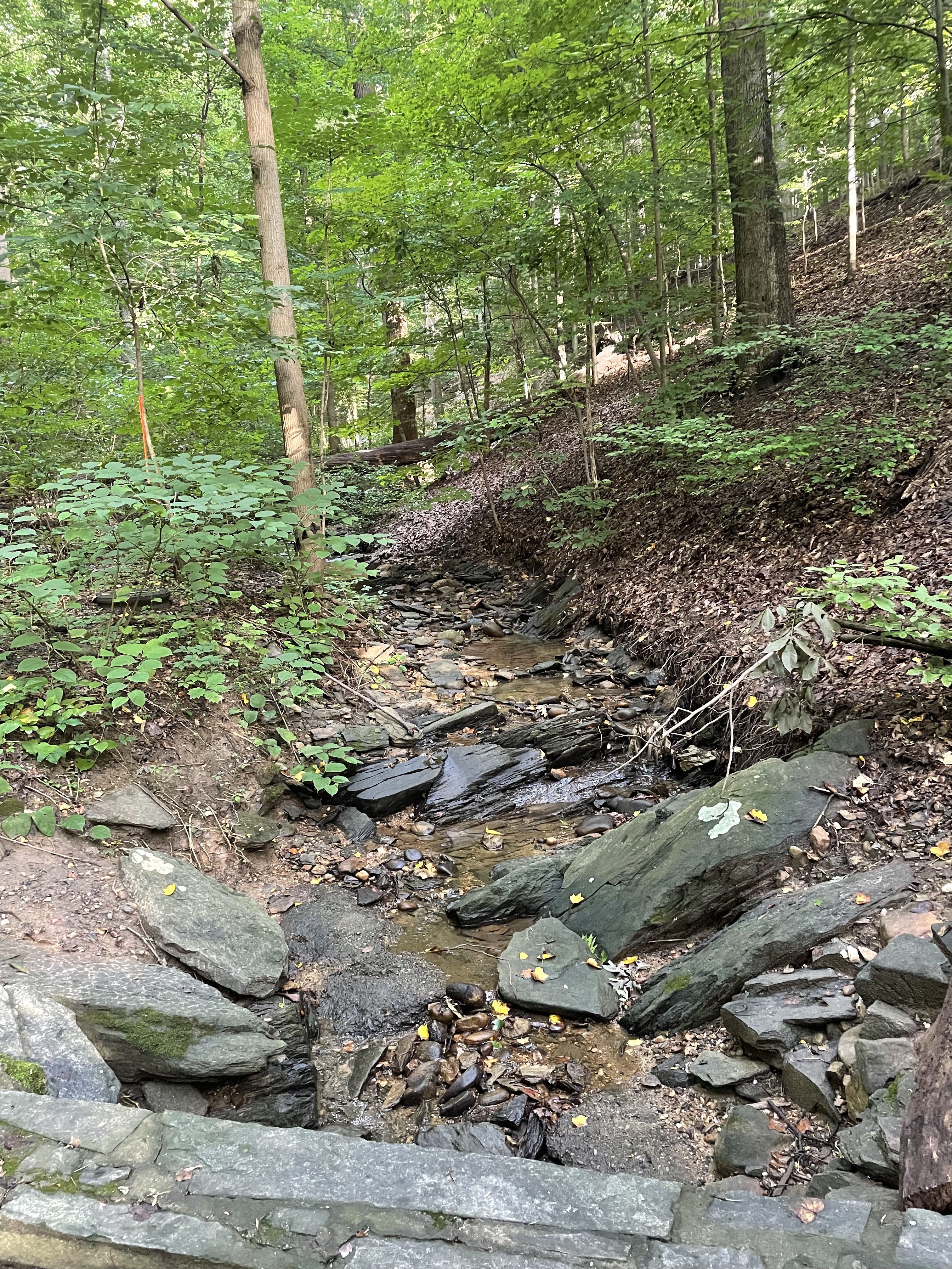
Rock Creek National Park deserves its name, not just because of its rock bed. Cambrian sedimentary rocks exposure along the steep tributaries leading to the creek (river?) suggest that bedrock lies not very far beneath our feet (Fig. 5).

Water has been struggling with rocks for the last 200 million years, always trying to reach the sea. It exploits every nook and cranny in the bedrock until it forms a stream, then a river, and it cannot be stopped. Thanks to the perseverance of water, driven by the steady pull of gravity, the first European immigrants to North America were able to establish a toe hold on what was (to them) a new land…
Ball’s Bluff Battlefield Requiem
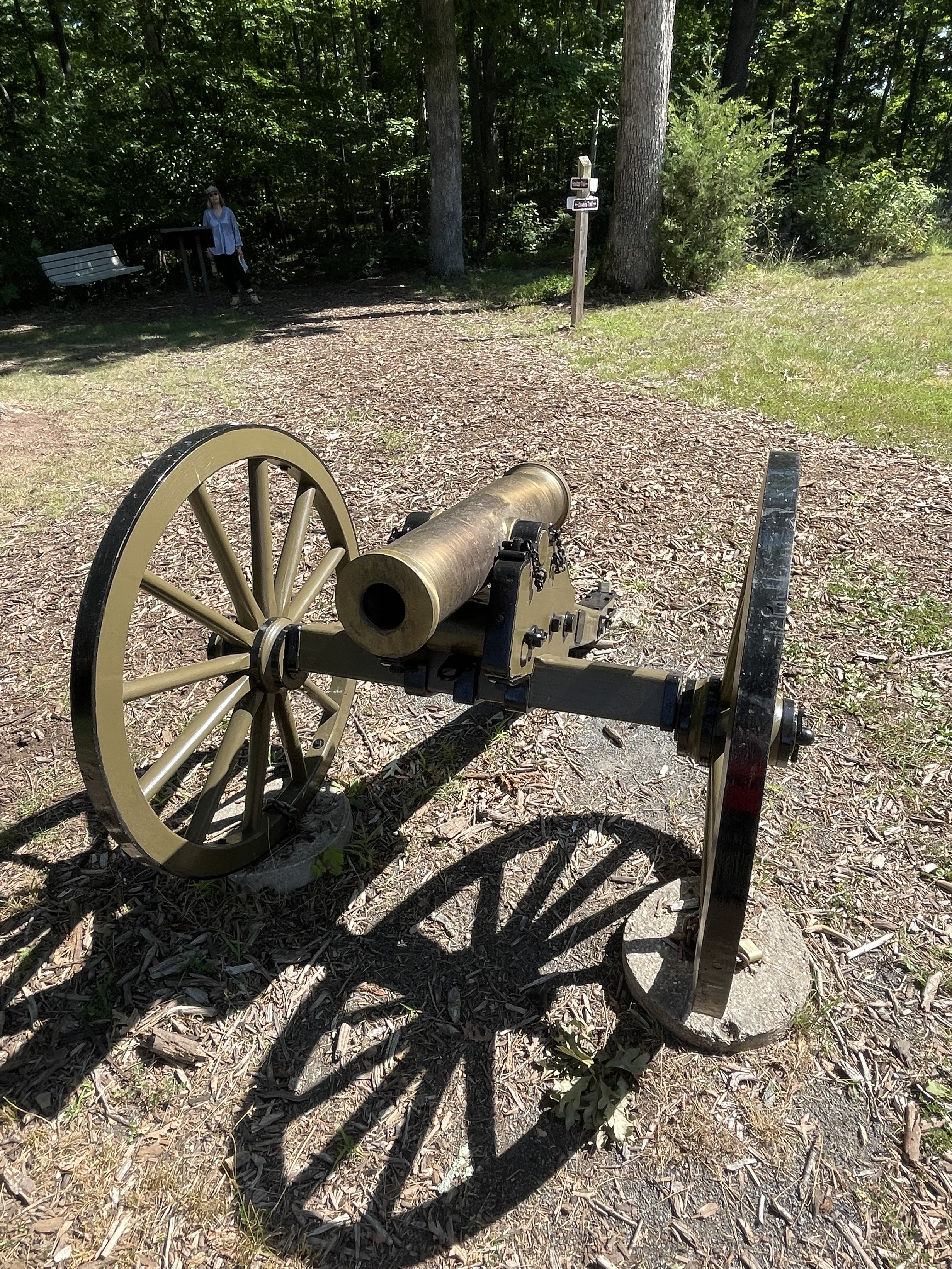
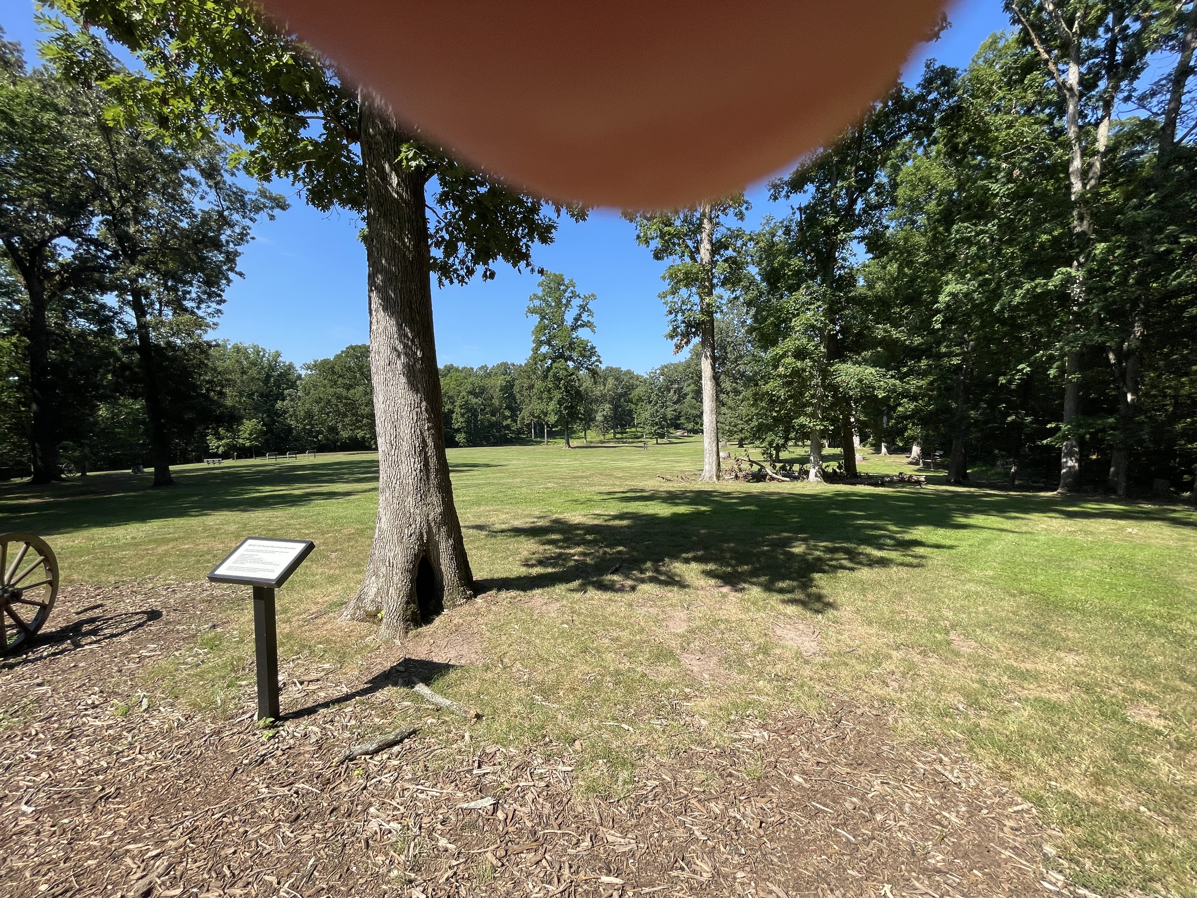
I reported on the geology of this area in a previous post, but I didn’t have much time to explore the area on that outing, so this trip I followed trails all the way around the park. This was the site of a battle early in the American Civil War, October, 1861. The cannon (Fig. 1) is a metaphor of how geology is always in front of us; it isn’t just about really old rocks, but also rivers and beaches, even gas and lava being belched out by volcanoes. That’s all geology too. For example, this battle took place in a field (Fig. 2) .
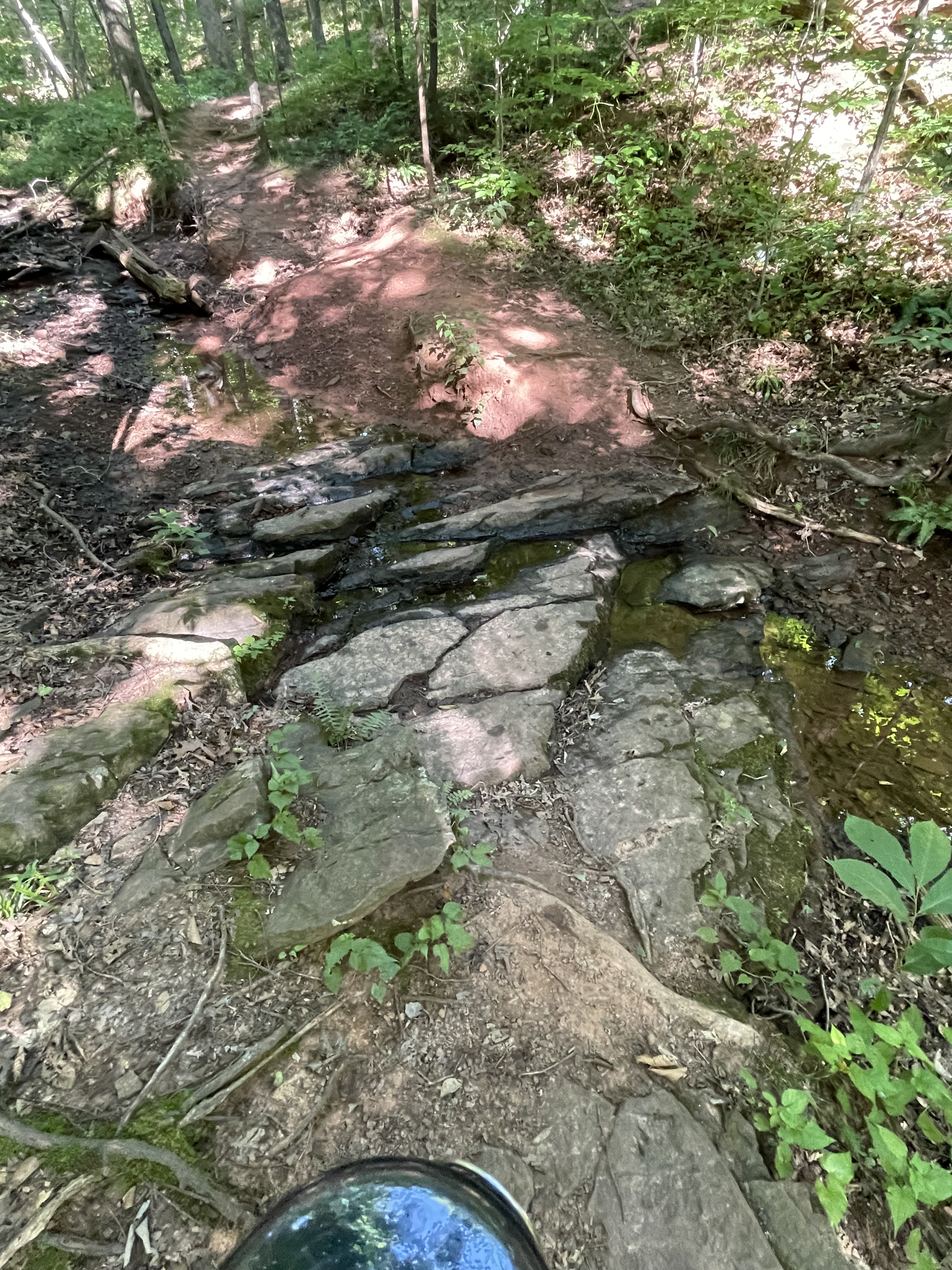
There isn’t much arable land along the Potomac River here because of the rocky soil, but there are a few pockets of land suitable for farming–flood plains left as reminders of the ancient river’s meandering, while it cut its way through rock, gravel, and mud to reach its current position (Fig. 3).

The bottoms of the gullies were paved with tilted layers of sandstone and siltstone (Fig. 4), sediment originally deposited in intermontane basins like those that occur in western North America (Fig. 5).

I’d like to finish this post with a thought experiment: Imagine the sediments being carried away from the camera in Fig. 5, passing into the distance to collect in the wide valley that fronts the major fault-block mountain range, seen in the distance; now, imagine everything you see in Fig. 5 being worn down by water and wind and ice, until the sand and silt filling the lowlands in front of the camera is buried beneath the erosional product of Piestewa Peak; imagine that pile of sand and silt and clay being buried many miles beneath the surface, for millions of years.
Can you imagine the rocks seen in Fig. 4?
Review of “The Law of Innocence” by Michael Connelly

Apparently, this is another “Lincoln Lawyer” novel (I think I saw the movie), so this is going to be a short review because, in general, series become formulaic and predictable, especially if the main character (also the first-person narrator) has been arrested for murder.
This read more like a technical report than a courtroom drama. There were plenty of motions filed and argued before the judge, but I got the feeling that it was all a farce, despite finding myself enthralled at times, especially in the first half of the book. A few tantalizing clues were introduced and I anticipated some surprises, like in an episode of Perry Mason. I had the overall impression that the author was fulfilling a book contract when it got to the end and the FBI saved the day. What a cop-out.
The problem with first-person narrators is that their thoughts have to be shared with the reader. This was attempted half-heartedly in this story; I got tired of hearing how Michael (Mickey) Haller’s life was on the line, repeated so often that I wanted to stop reading. The entire ordeal came across as a bored description of someone else’s encounter with the justice system.
I hope this isn’t representative of legal drama…
Review of “Ward No. 6 and Other Stories” by Anton Chekhov
The author is famous for writing short stories that explore the life of Russians in the late 19th century, but this collection is timeless in the way it presents the human condition, not through carefully crafted plot but instead by way of the actions of his characters. The range of personalities and life situations is boundless. This book was translated into English by Constance Garnett less than thirty years after most of the stories were written, so the overall sense of the times is carried into this translation.
There are no happy endings and the reader is left with more questions than answers. I wouldn’t go so far as to say that there are lessons to be learned; instead, one is left with a sense of the hopelessness of life, and the mess we make of it through our decisions and acts.
These tales of misery and woe are replete with stark humor in the way the characters are presented. The narrator doesn’t think much of them, while respecting their humanity. The poor and wealthy are equally at a loss about their situations, and I was reminded of the book of Ecclesiastes in the Bible: all is vanity and there is nothing new under the sun; happiness is unattainable and the best we can hope for is some satisfaction, and even that is fleeting.
What keeps this from being as depressing as “Crime and Punishment” is the rich detail supplied about the characters and their lives. If not for the unrelenting imagery and often humorously simple language, this would have been difficult to read. It helped that most of the stories are short and the reader has a break between the relentless parade of hapless individuals.
The language is often ponderous (clumsy descriptions of scenes), and yet I had to look up a lot of words. I have to assume (not speaking Russian) that this was in the original text, and was Chekhov’s intent. Part of this may have been that the stories were written over several decades and his writing style changed somewhat. However, all of these stories follow similar trajectories.
From my grim review you might think I don’t recommend this book, but nothing could be further from the truth. As hopeless as the situations and lives depicted in this collection of short stories are, they are entertaining to read–just not all at once.
If there is a message hidden in these pages, it is that the most fulfilling event of one’s life is when they can finally stop dealing with the burdens imposed on them, whether by their own decisions and thoughts or by other people. If I may be so bold as to read between the lines:
Death is the ultimate escape…
Review of “Como agua para chocolate” by Laura Esquivel

This is the latest book in my Spanish reading. I don’t know if I’ll ever speak Spanish or even develop an intermediate vocabulary, but I do enjoy reading novels in their native language (i.e. Spanish). The English translation of the book was turned into a movie that I never saw, “Like Water for Chocolate.” That phrase always escaped me, until I read the book. Now I get it.
I will make my usual comments about novels written in Spanish: the authors (no exceptions so far) don’t seem to want to use subject pronouns and so it can be downright impossible to know who is speaking in a crowded room; they also don’t like to use commas, which can be very tricky for a beginner because of the use of some articles (i.e. la and las) as direct object pronouns. Comprehension depends on context, which doesn’t work so well for a beginner who is struggling with the vocabulary (I understand the grammar pretty well).
The story jumps around a lot in time and space, and I got lost a few times, partly because I took several months to read the book. The idea of monthly recipes for chapters was intriguing but I didn’t get how the recipes fit the plot; they seemed random to me, but the characters were preparing them while the action was taking place. Sometimes the menu was central; at any rate, this was a great plot idea, which kept the story alive long after it should have died. It is a simple plot that uses gimmicks (e.g. magic and jumps in the action), so that the author didn’t have to actually write a full novel. It’s more like a collection of stories with a central character. (I could be wrong there because, like I said, I took a while to read it and my Spanish is not great.)
Overall, I enjoyed the story but the ending was a massive cop-out. I’m not sure that it’s a good read for someone learning Spanish because there’s a lot of culinary vocabulary that SpanishDict was only moderately helpful with.
Just between us, I think Tita is schizophrenic and…well, you’ll have to read the book and decide how to interpret the ending for yourself.
Review of “Crime and Punishment,” by Fyodor Dostoevsky

It says a lot about this Russian classic that the front matter in the book doesn’t say when it was originally published. I looked it up on Wikipedia; it was published (in Russian) as a series in 1866. This English translation was published in 1992. That is important because, as I’ve learned from other translations, the translators are the real authors of this novel. I will address this divided authorship below.
There were very few typos and grammatical errors, so hats off to Richard Paver and Larissa Volokhonsky. Since they have apparently won international acclaim for their translations, I have to assume that this is as close as an English translation can get to the intent of the author. Nevertheless, when I refer to the “author” below, I am necessarily including them in my comments.
This is a psychological thriller. The author gets into the head of the protagonist, not through a few well-chosen phrases and thoughts, but by using an omniscient narrator. Nevertheless, word by word, page by page, chapter by chapter, we finally are convinced that Raskolnikov is obsessed by his crime, even if it requires the entire book (580 pages). The details about his life and who he encounters are excruciatingly rich. Despite this, I didn’t feel like I was reading a novel written more than 150 years ago, in another language. The story is conveyed (painfully) as a timeless examination of why some people commit heinous and stupid crimes. No thought goes unexplored in this quest for the very essence of Raskolnikov’s inner being, his interpretation of the meaning (or lack thereof) of life.
There is a hint as to why the story unfolds so circuitously in its original publication as a series of chapters. The author simply forgot. It is repetitive and the style changes inconsistently. Sometimes, the other characters are the center of the action, their thoughts shared as easily as the protagonist’s (thanks to an omniscient narrator who jumps between heads within a paragraph). Then, Dostoevsky seems to remember what he’s trying to do and returns to the central theme. Finally, confirming my skepticism about unnecessarily long novels, he wraps the whole story up with an epilogue. All the loose ends are ties up neatly in a bow, just as Tolstoy did with “War and Peace.” Maybe that’s the defining characteristic of Russian authors–ramble forever then, coming to their senses, they write a quick summary.
This would have been a good novel if it were half as long. There is simply too much repetition, and too many distracting, unimportant side stories that added nothing to the plot. However, despite being a barbarian (I didn’t study literature in college), I appreciate the frank look into the conditions in Czarist Russia that inevitably led to the Communist revolution and civil war (between the white and red communists). The plight of everyone except the wealthy was deplorable. Got it!
I would like to add that sometimes dialogue can be too realistic. This novel is a good example of that literary trap. Very few of the characters could complete a sentence, from beginning to end, without a few “well,” “ahem,” “sir,” and too many other realistic, but horribly distracting, interruptions before they (failed to) make their point. Whether intentional or not, the author conveys the fallibility of oral communication between people, even when they truly want to talk openly. This failure to communicate makes sense for Raskolnikov, who had plenty to hide, but less so for the other characters.
Tolstoy published War and Peace serially, but he chose a different approach, using multiple points of view for his characters. That novel is much easier to read, despite being more than twice as long, and it was published at about the same time (1869). So, I’m not opposed to Russian literature, just poorly written novels…
Review of “The Case Against Reality,” by Donald D. Hoffman

As you can see from the book cover, the entire title was a lot longer than the title of this post. I heard an interview with the author on Lex Fridman’s podcast, and I was intrigued because I’m working on a novel (i.e. fiction) with a similar theme. This book is not a work of fiction (at least, not explicitly), however, but an overview of multidisciplinary research by the author and several collaborators on Evolutionary Biology, with a focus on Evolutionary Psychology. That got my attention because I think that is an oxymoron: Evolutionary Psychology–give me a break!
The book is well written, or else it had a good editor. (I think that Hoffman probably didn’t need a lot of corrections.)
I am not qualified to comment on the validity of his research or his conclusions. He is very honest about voicing criticisms made by his peers; however, his dismissal of their complaints is a bit too quick and unconvincing. The second major complaint I have is that the subtitle, How evolution hid the truth from our eyes, is repeated so often (often as a refutation of criticism) that it begins to sound like a mantra. Just keep saying it and you will believe. Who is he trying to convince?
He saves the quantitative basis of his work for the appendix. I would have appreciated more of a discussion of the unenumerated parameters his “mathematical” model incorporates to represent choices made by virtual “beings” in his game-theory-based model, which he declines to describe in adequate detail for the supposed semi-literate reader of the book to comprehend. I think he doesn’t want to say the obvious: he ran thousands of simulations, tweaking parameters, until he got the result he wanted. This is not scientifically unethical–by no means–but it is disingenuous, especially when presented to the non-expert as a scientific result.
For someone who has read a variety of “non-fiction” books on psychology and neuroscience (both medically and computationally based), the sickeningly common references to apples, vision, evolution “choosing,” and so on, are filler. Boilerplate. Nevertheless, his conjecture that our perceptions are nothing more than an interface with reality is interesting; however, until his research produces more than an infinity of simulated results using a model of (admitted) simplicity, his conclusions remain nothing more than speculation. To Hoffman’s credit, he admits this openly; but dismisses it just as quickly.
How many angels can fit on the head of a pin?
I don’t know and don’t care because I don’t believe in angels…
Recap…
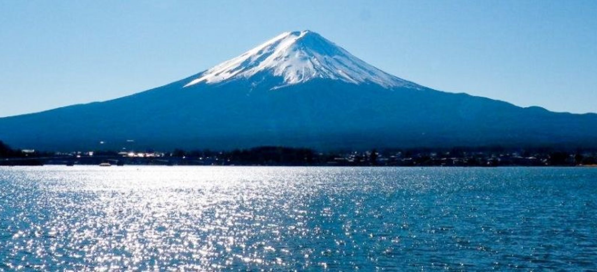
This is a quick post to summarize what I said about modern Japan being an analogue to the Taconic orogeny. For example, here’s a photo of Mt. Fuji, seen from the ocean (Fig. 1). (Imagine being in the back-arc basin during the Cambrian period.)
The Sea of Japan is more than 500 miles across at its widest point, so sediment eroding from the mountain chain that forms the backbone of Honshu is collecting along the western coast of Honshu as well as in deeper water offshore.
Here’s a schematic cross-section of the most-likely geography during the Taconic orogeny (Fig. 2). Imagine Honshu as the island arc shown offshore of the ancient North American continent (to the left in the cartoons).

Modern Honshu and the Sea of Japan are most representative of the Taconic orogeny earlier than 543 my, before subduction began on the western margin in the top panel. There is no subduction in the Sea of Japan today; in fact, spreading stopped about 20 million-years ago; details are hard to find because there are no easily accessible seismic sections of the Sea of Japan. Thus, to apply the cartoon from Fig. 2, ignore the subducting back-arc ocean crust (black layers) and focus on the deformed gray areas in the middle panel.
The lower panel is probably what will happen to Honshu in the distant future. For example, the Pacific plate is being subducted at ~10 cm/year (4 inches). We can use an average width of 1000 km (625 miles) to estimate that it will take 10 million years [1000 km/(10 cm/y)] for the lower panel of Fig. 2 to become reality.
With respect to the scale of the analogous processes occurring in the Japanese Islands and N. America (during the Taconic orogeny), we can do a simple comparison (Fig. 3).

This has been a very simple, hypothetical reconstruction, but I hope it helps you envision what the proto-north American continent was experiencing. The key point is that a massive mountain-building event, something like the Taconic-Acadian–Alleghanian orogenies, which lasted throughout the Paleozoic era, wouldn’t have been an earth-shattering event…
What Goes Up…
I’ve been talking about mountain building events that continue for hundreds of millions of years a lot in my posts, referring to the erosion of mountains into mud, silt, and sand, carried by rivers to be deposited as broad expanses of sediment. On sufficiently long time scales, this is an accurate representation of the delicate balance between uplifting mountains and the inexorable influence of rain, ice, wind, and water to eradicate all evidence of an orogeny. For example, the collision of North America with Europe and Africa required nearly all of the Paleozoic Era, beginning with the Taconic Orogeny (550-440 Ma), reaching a crescendo during the Acadian Orogeny (375-325 Ma), and culminating in the Alleghanian Orogeny (325-260 Ma). By the way, the abbreviation Ma (mega annum) is used to indicate dates that were determined by radioactive dating, rather than the more ambiguous “my” for millions of years. There is uncertainty (error bars can never be zero), but not with respect to the general timing of geologic events.
This post is going to examine details of how uplifted rocks can be broken down into pieces that are weathered while being transported to their final resting place, whether in a river, lake, shallow bay, or the deep ocean.
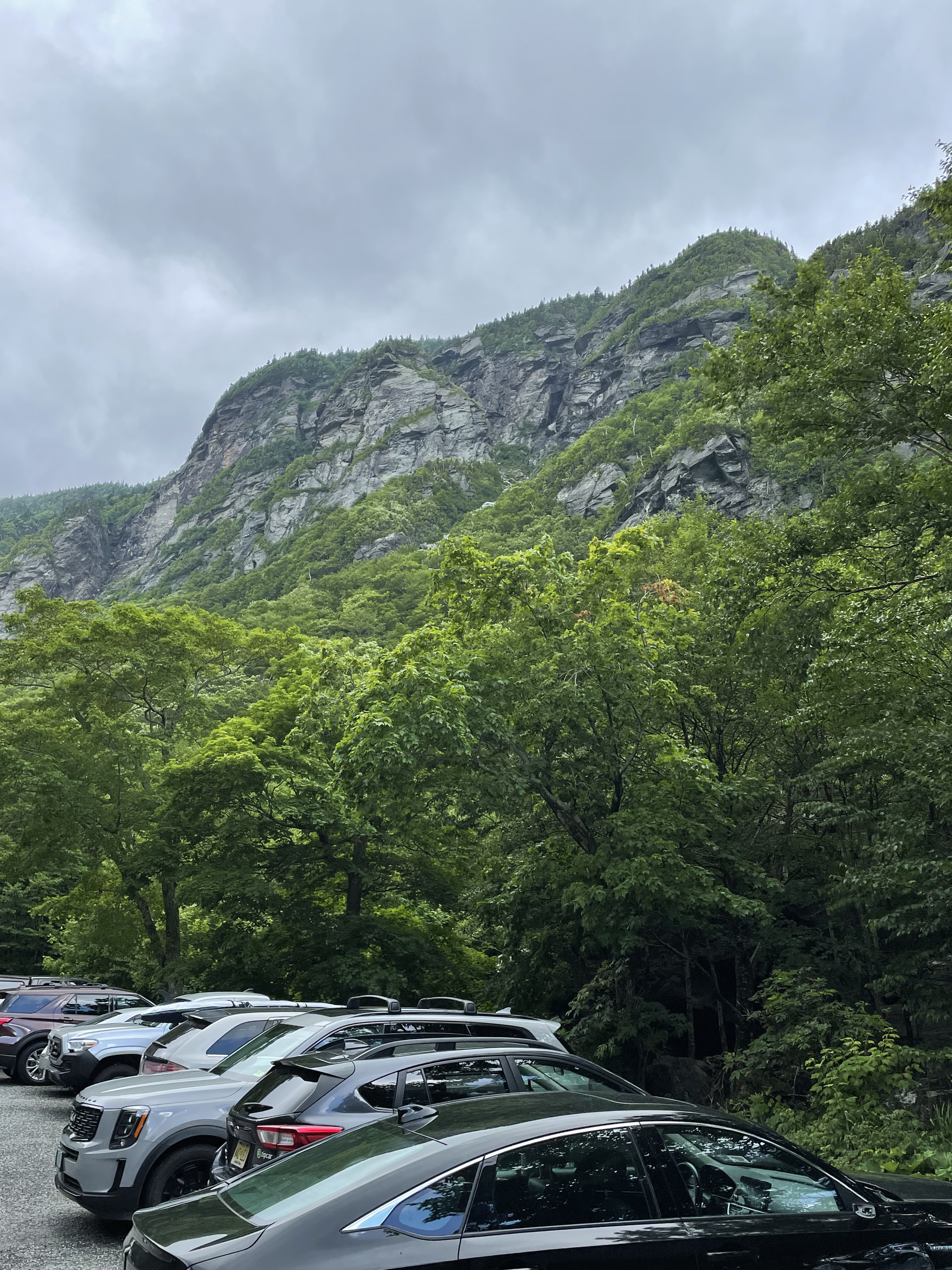
Vermont (Fig. 2) was entirely covered by ice several times during the last couple million years.
The rocks at Smuggler’s Notch are the same ones we saw in the Taconic Mountains and along the White River. They are equivalent to those we encountered along the Potomac River, 500 miles to the south. What happened when rocks formed as much as 20 miles beneath the surface are exposed to low pressure and temperature?
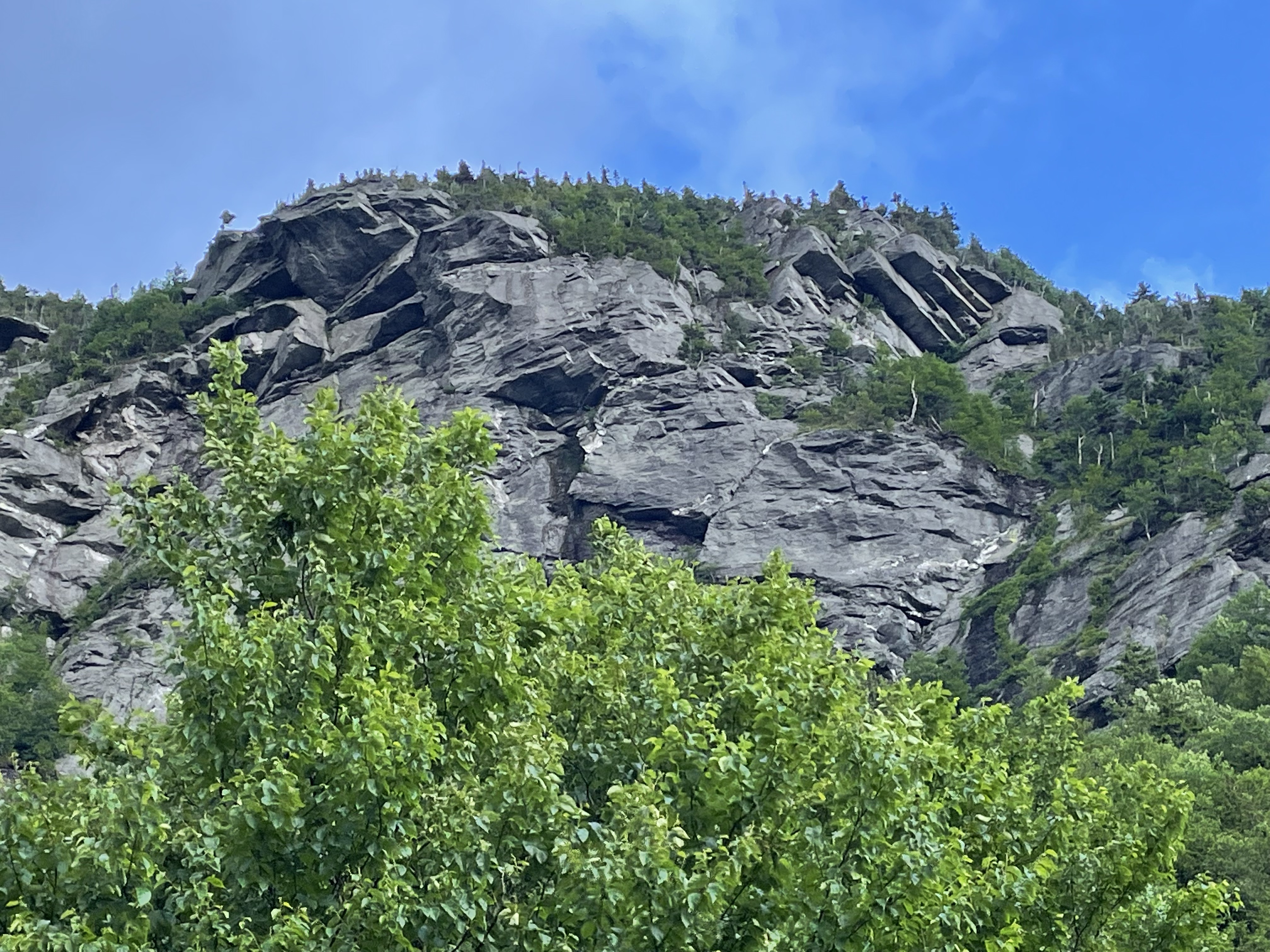
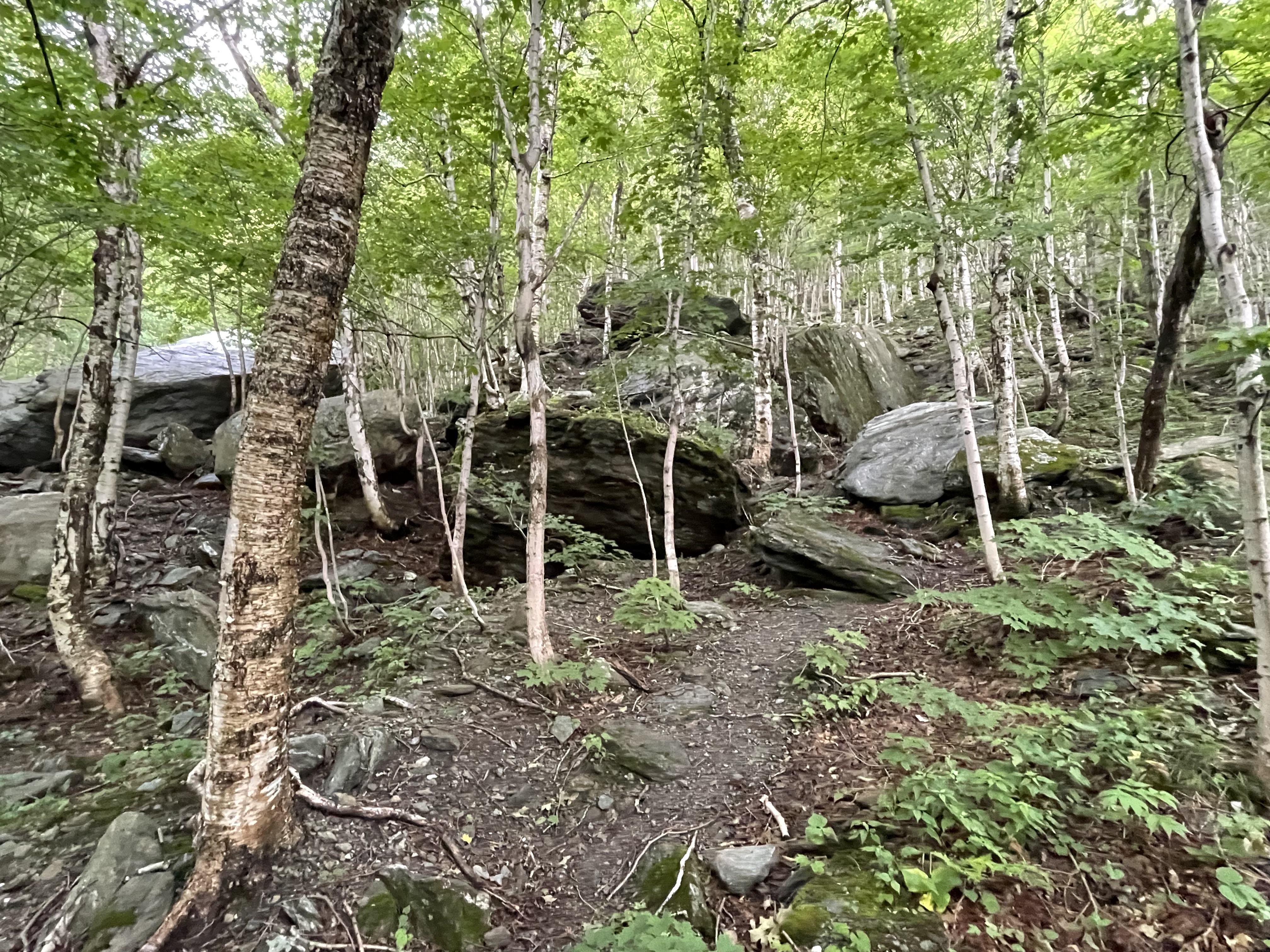
There is a lot of missing rock from the cliff shown in Fig. 3. Where did it go?

How did these huge blocks get where we find them today?
Mechanical weathering doesn’t stop when the fallen block comes to rest. Then, water carries small grains and uses them as abrasives to grind the once-humongous blocks into gravel (Fig. 6).
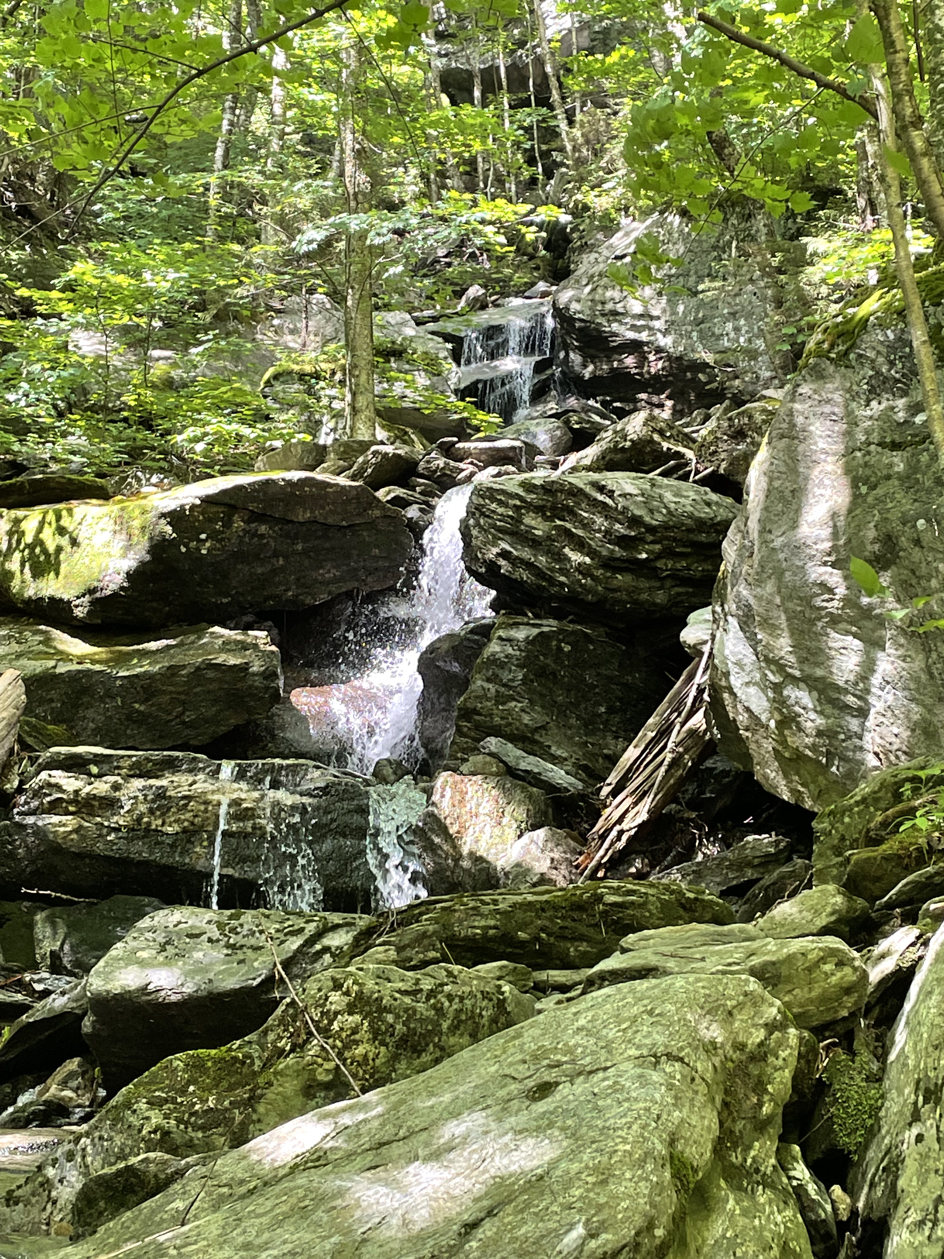
All that bumping and grinding eventually produces a scene like that seen along the path of the White River (Fig. 7), with bedrock resisting the seasonal onslaught of gravel and sand carried by intermittent, torrential flows.
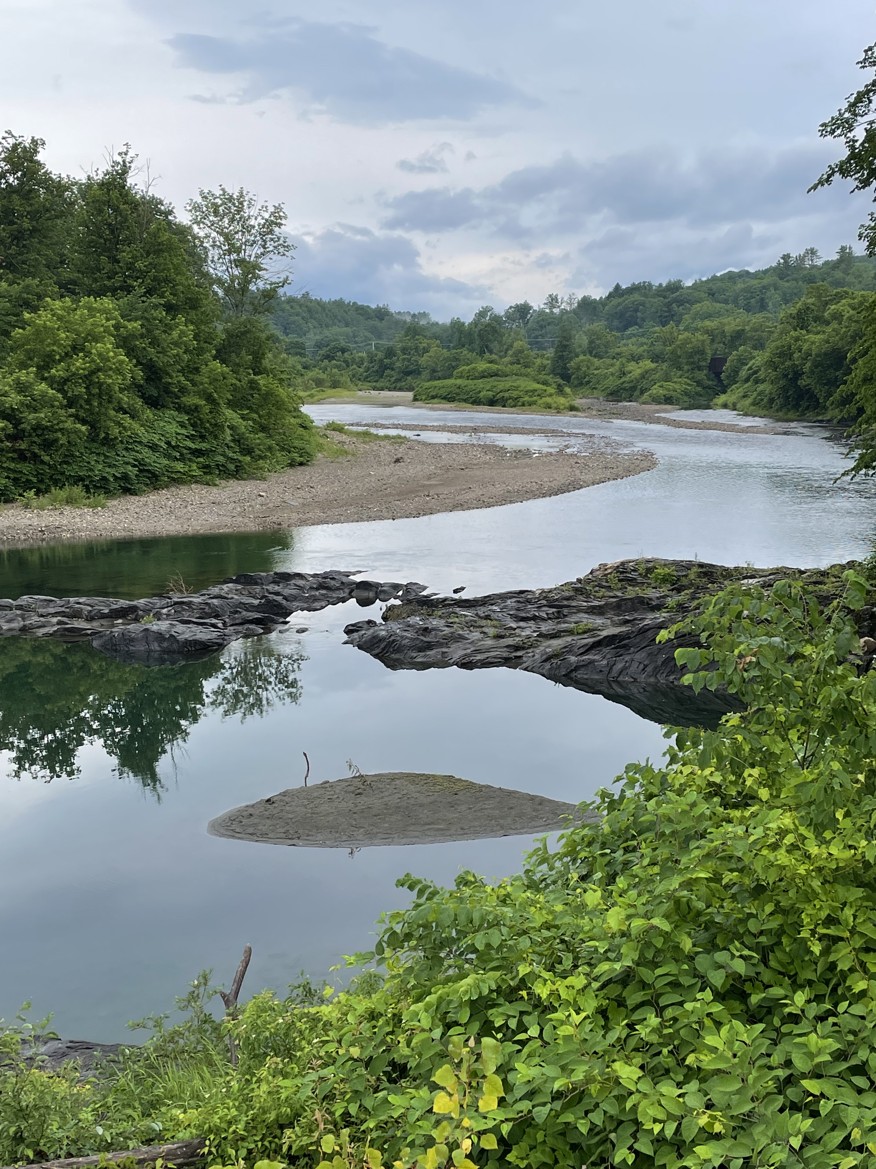
I hope this post connects the dots between the loftiest peaks (Fig. 1) and the lowest streams (Fig. 7).

Recent Comments