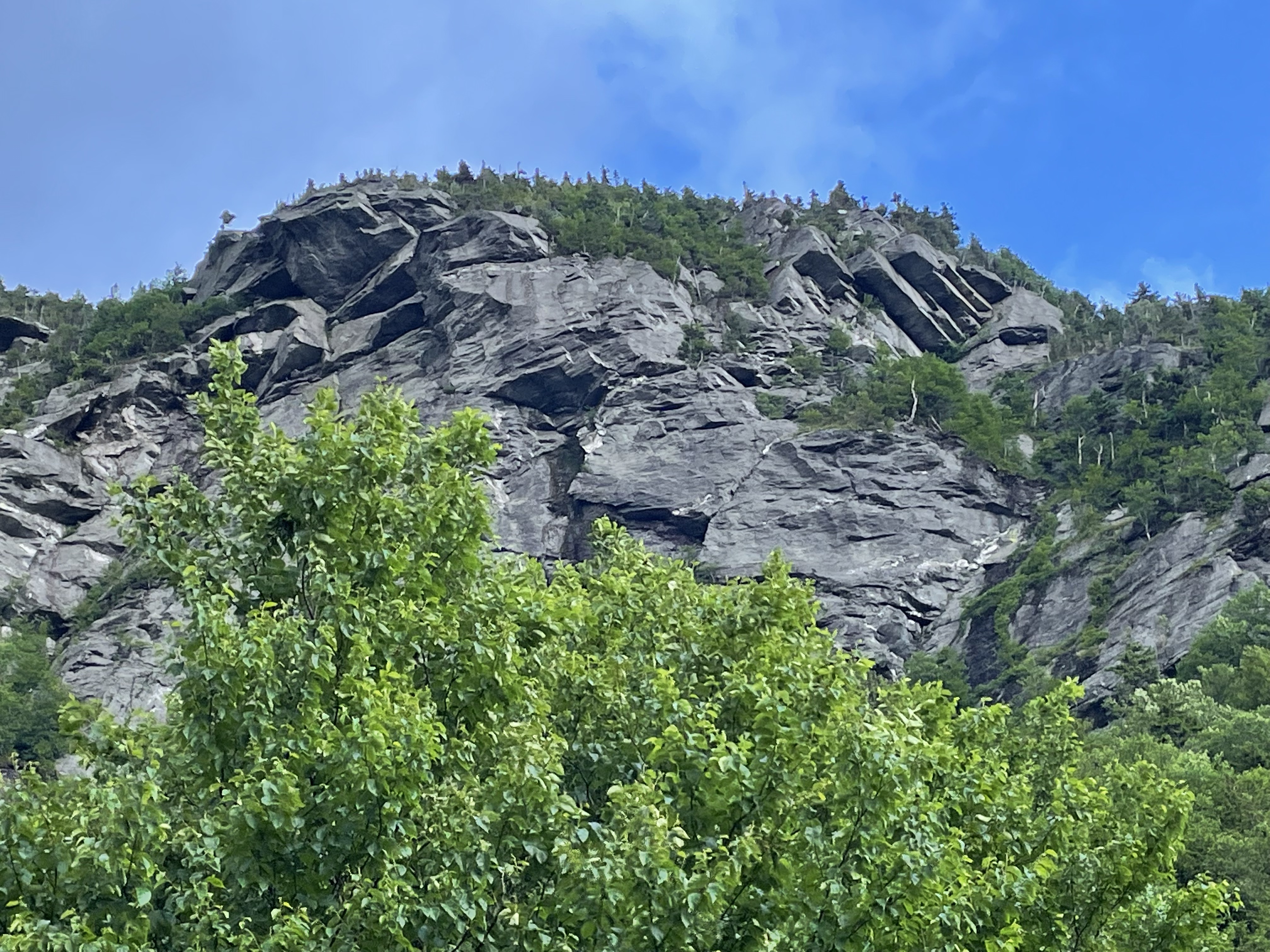
I’ve been talking about mountain building events that continue for hundreds of millions of years a lot in my posts, referring to the erosion of mountains into mud, silt, and sand, carried by rivers to be deposited as broad expanses of sediment. On sufficiently long time scales, this is an accurate representation of the delicate balance between uplifting mountains and the inexorable influence of rain, ice, wind, and water to eradicate all evidence of an orogeny. For example, the collision of North America with Europe and Africa required nearly all of the Paleozoic Era, beginning with the Taconic Orogeny (550-440 Ma), reaching a crescendo during the Acadian Orogeny (375-325 Ma), and culminating in the Alleghanian Orogeny (325-260 Ma). By the way, the abbreviation Ma (mega annum) is used to indicate dates that were determined by radioactive dating, rather than the more ambiguous “my” for millions of years. There is uncertainty (error bars can never be zero), but not with respect to the general timing of geologic events.
Figure 1. Ridge of Precambrian schist, metamorphosed and transported along thrust faults during the Taconic orogeny; it was subsequently uplifted during the following approximately 400 my, and is now exposed to weathering. This photo was taken on the south side, looking northward.
This post is going to examine details of how uplifted rocks can be broken down into pieces that are weathered while being transported to their final resting place, whether in a river, lake, shallow bay, or the deep ocean.
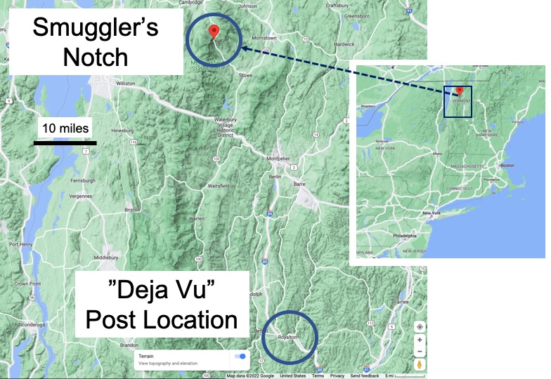
Vermont (Fig. 2) was entirely covered by ice several times during the last couple million years.
Figure 2. Topographic map of northern Vermont (See inset for location.) Smuggler’s Notch is the local name for the area shown in Fig. 1, a region covered by as much as one mile of ice during the last glacial maximum. The peaks in Fig. 1 were covered by glaciers, which carved U-shaped valleys as well as creating cliffs on the south sides of topographic highs.
The rocks at Smuggler’s Notch are the same ones we saw in the Taconic Mountains and along the White River. They are equivalent to those we encountered along the Potomac River, 500 miles to the south. What happened when rocks formed as much as 20 miles beneath the surface are exposed to low pressure and temperature?
Figure 3. Photo of a different part of the ridge seen in Fig. 1, revealing large, overhanging blocks of schist. This rock is permeated with joints, created when overburden, and thus pressure, was reduced dramatically. Brittle fracture is the result, and all of those flat surfaces implicate the effects of ice and gravity on physical weathering.
There is a lot of missing rock from the cliff shown in Fig. 3. Where did it go?
Figure 4. Huge blocks fell to the narrow valley formed by glaciers during the last couple-hundred-thousand years, littering the base of the cliff with blocks as large as houses. The largest recorded is estimated to weight 6000 tons. These blocks are piled up like dominoes, forming caves that have been used for millennia by wildlife and people as refuges. (Climber for scale.)
How did these huge blocks get where we find them today?
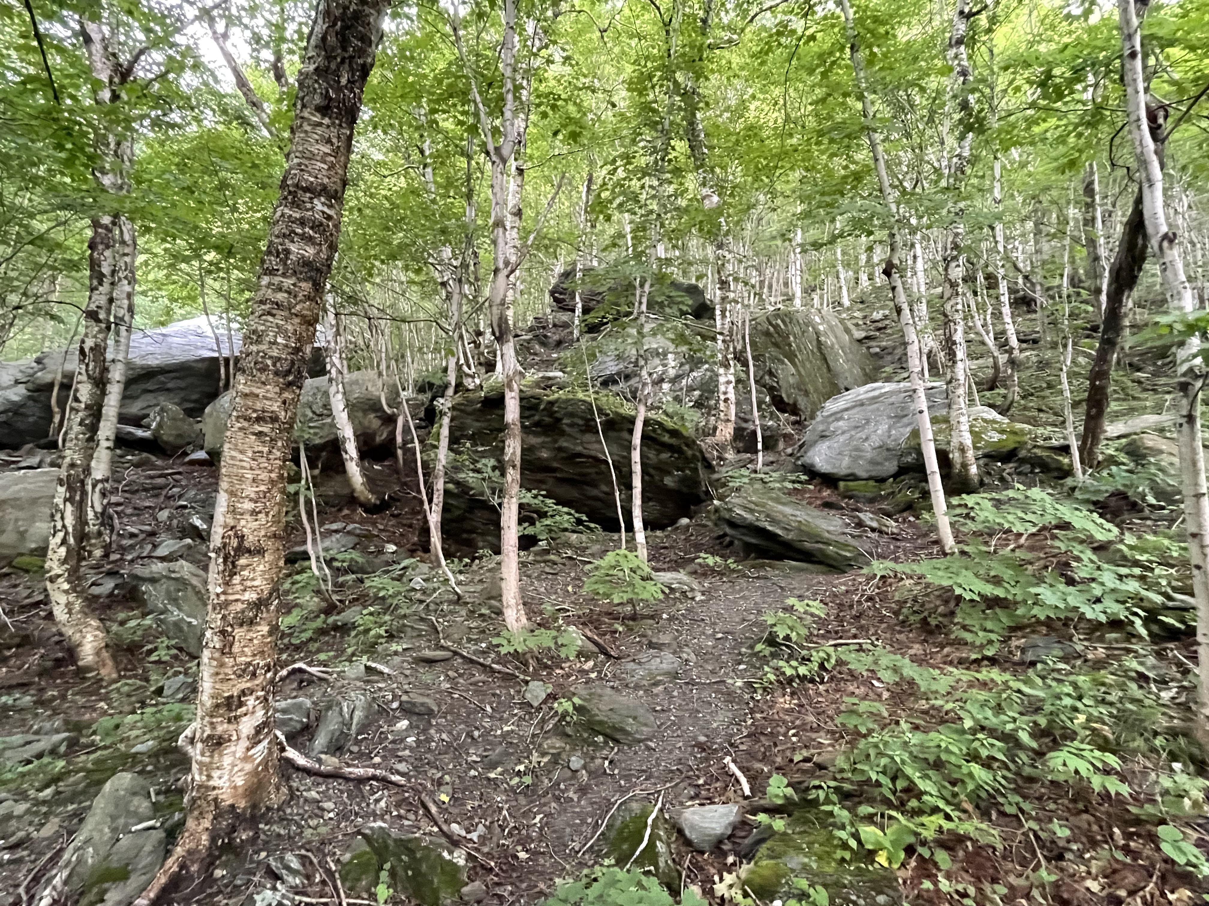
Figure 5. Photo of disrupted forest where a block rolled down the slope at the base of the cliff seen in Fig. 3, before coming to rest. Note the young trees and gravel slope. Falling hundreds of feet is the second stage of breaking down the mountain. The first is dislodging the block along joints, which allow water to weaken the rock by changing the chemical composition of the minerals.
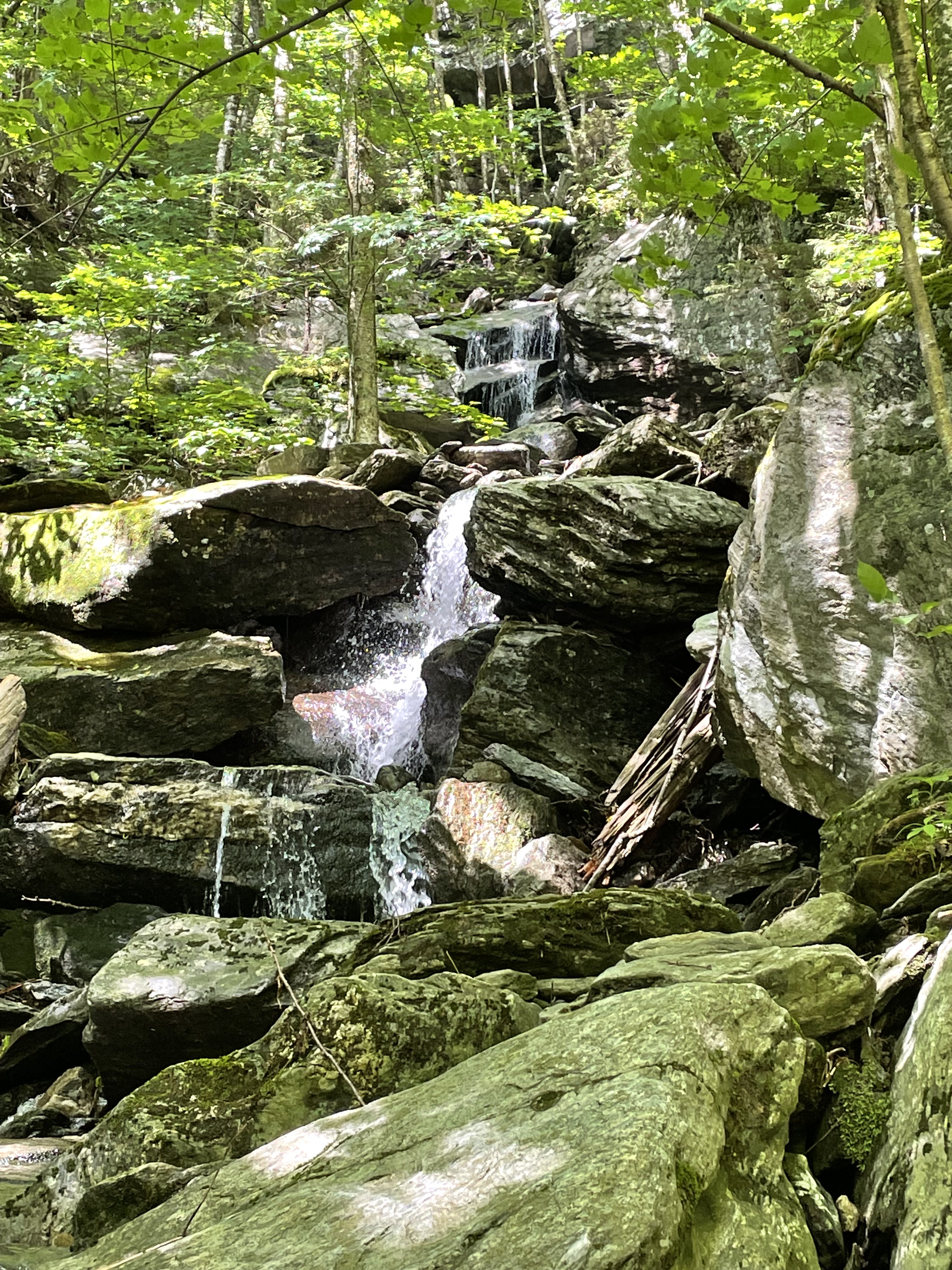
Mechanical weathering doesn’t stop when the fallen block comes to rest. Then, water carries small grains and uses them as abrasives to grind the once-humongous blocks into gravel (Fig. 6).
Figure 6. Rock debris collected along a nascent stream, filled with smaller blocks of schist that originally fell from the cliffs that tower above the narrow valley. Gravel fills every nook and cranny in the jumble of rock, grinding away whenever water power is sufficient to mobilize the harder and more resistant minerals (e.g. quartz and feldspar).
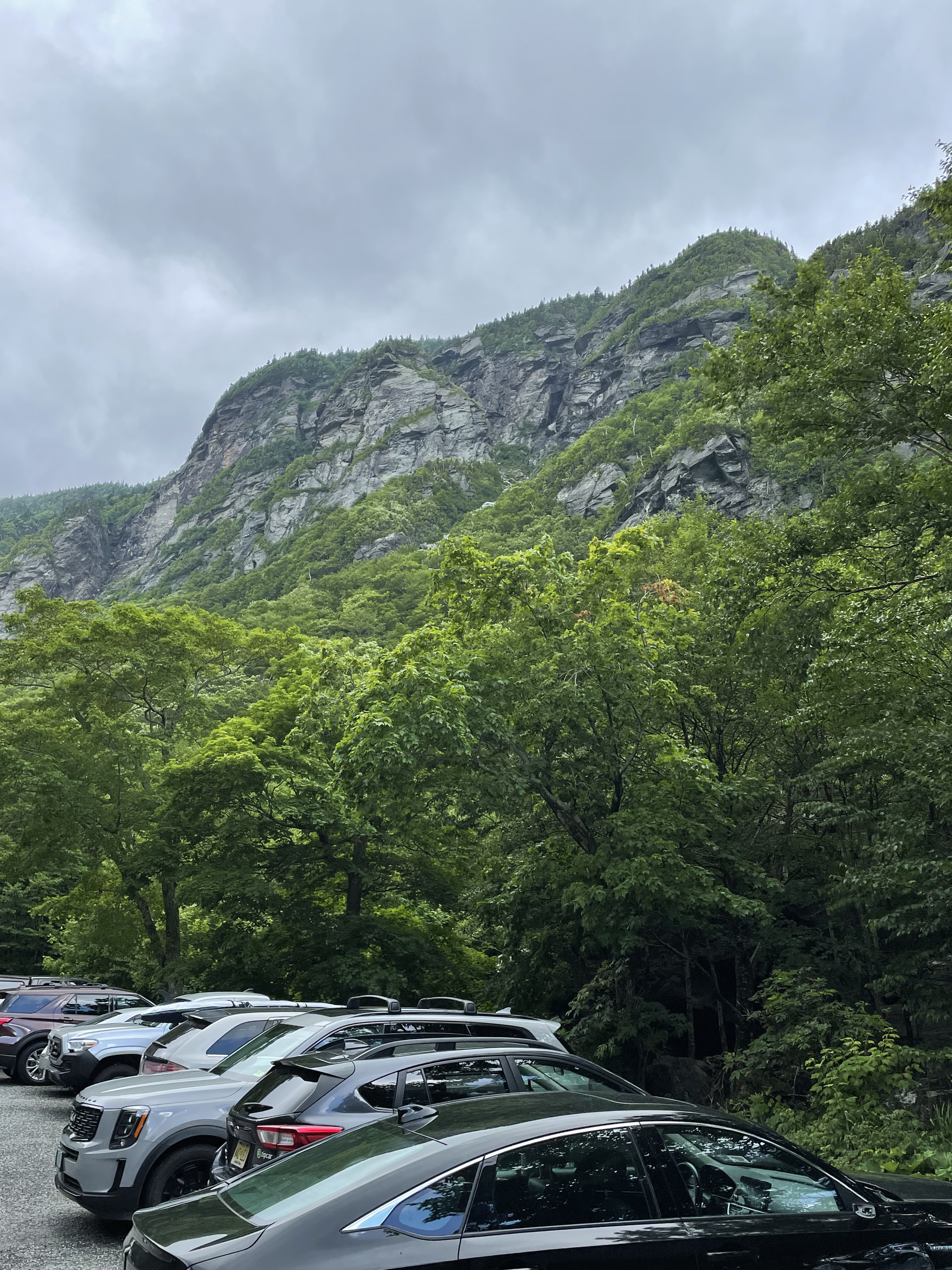
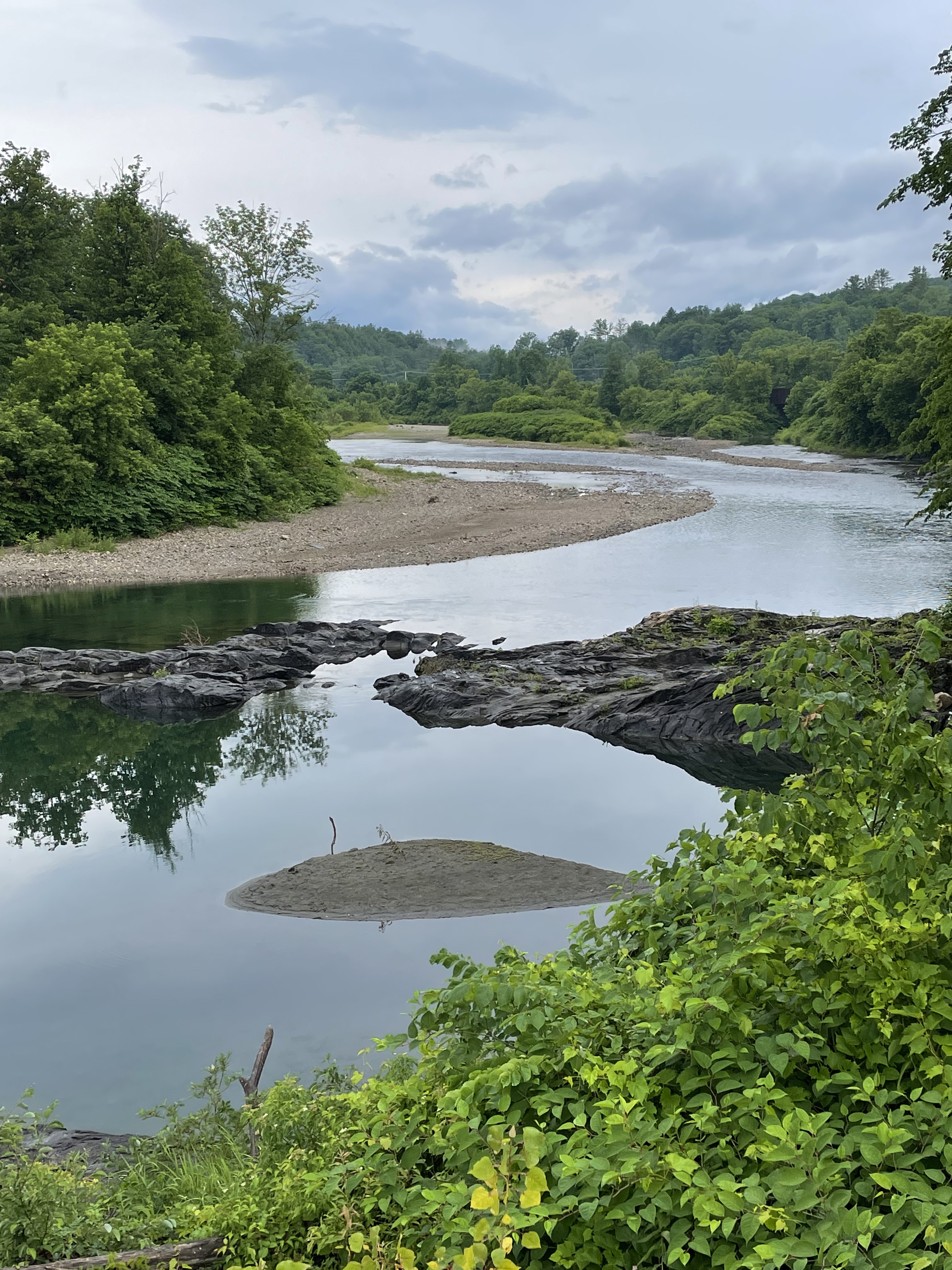
All that bumping and grinding eventually produces a scene like that seen along the path of the White River (Fig. 7), with bedrock resisting the seasonal onslaught of gravel and sand carried by intermittent, torrential flows.
Figure 7. View of White River (see Fig. 2 for location), showing the eventual outcome for peaks like those seen in Fig. 1. The bedrock blocking the channel will be eroded in its turn as it is exposed to surface weathering, by isostatic uplift.
I hope this post connects the dots between the loftiest peaks (Fig. 1) and the lowest streams (Fig. 7).


Trackbacks / Pingbacks