
When Geography and Geology Meet
These early posts will be interspersed with any new activities but I am going to follow the introductory theme today by merging geology with geomorphology or physical geography. I mentioned travelling around AZ in our cars on roads, which can be quite an experience in the western US. The concept of a terrane is convenient to merge the rocks and geography. A picture is really worth a thousand words when it comes to geography, as seen in this USGS relief map of AZ.
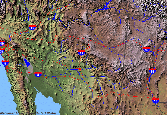
These maps use shading to give the impression of elevation. For example, the entire NE part of AZ is the Colorado Plateau at 5000-7000 feet above sea level. Phoenix is at an elevation of ~1100′. These are excellent examples of terranes; The Colorado Plateau and the Basin and Range–PHX is in a basin but it is surrounded by small ranges, like Phx Mtns, South Mtn, White Tank Mtns, etc).
The soils within these basins are sandy with clean sand in the river beds (note how many there are in the Phx area, as indicated by blue lines). They can be very fertile because the sediment was carried from the distant mountains (and chemical/physical weathering are strong in rivers); such soils, like those in Maricopa County, i.e., modern Phx, are an ideal combination of sand and clay.
These terranes are also seen in the geologic map of AZ.
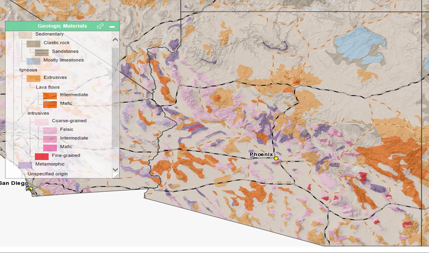
This map shows relief with shading as well as the rock types. It shows that the CO Plateau is fairly uniform sedimentary rocks whereas the Basin and Range terrane includes small patches of darker colored metamorphic (purple) and igneous (red/brown) rocks associated with local high relief in the small mountain ranges. These are surrounded by sediment that eroded from these mountains. I am not going to get into these specific rocks types on this page because excellent layman descriptions can be found in Roadside Geology of Arizona by Halka Chronic (Mtn. Press Publishing, Missoula, Montana), and

Recent Comments