
Geologic Survey of Eastern Vancouver Island, British Columbia

Figure 1. View looking west along the coast from Beacon Hill, in Victoria. The cliffs on Vancouver Island are similar in height to those across Juan de Fuca Strait, in Washington. However, the bluffs are composed of glacial deposits further south in Seattle, rather than bedrock. The large tidal range (7-10 feet) exposes rocky platforms at low tide. I’ll examine several of these features in this post.
Introduction
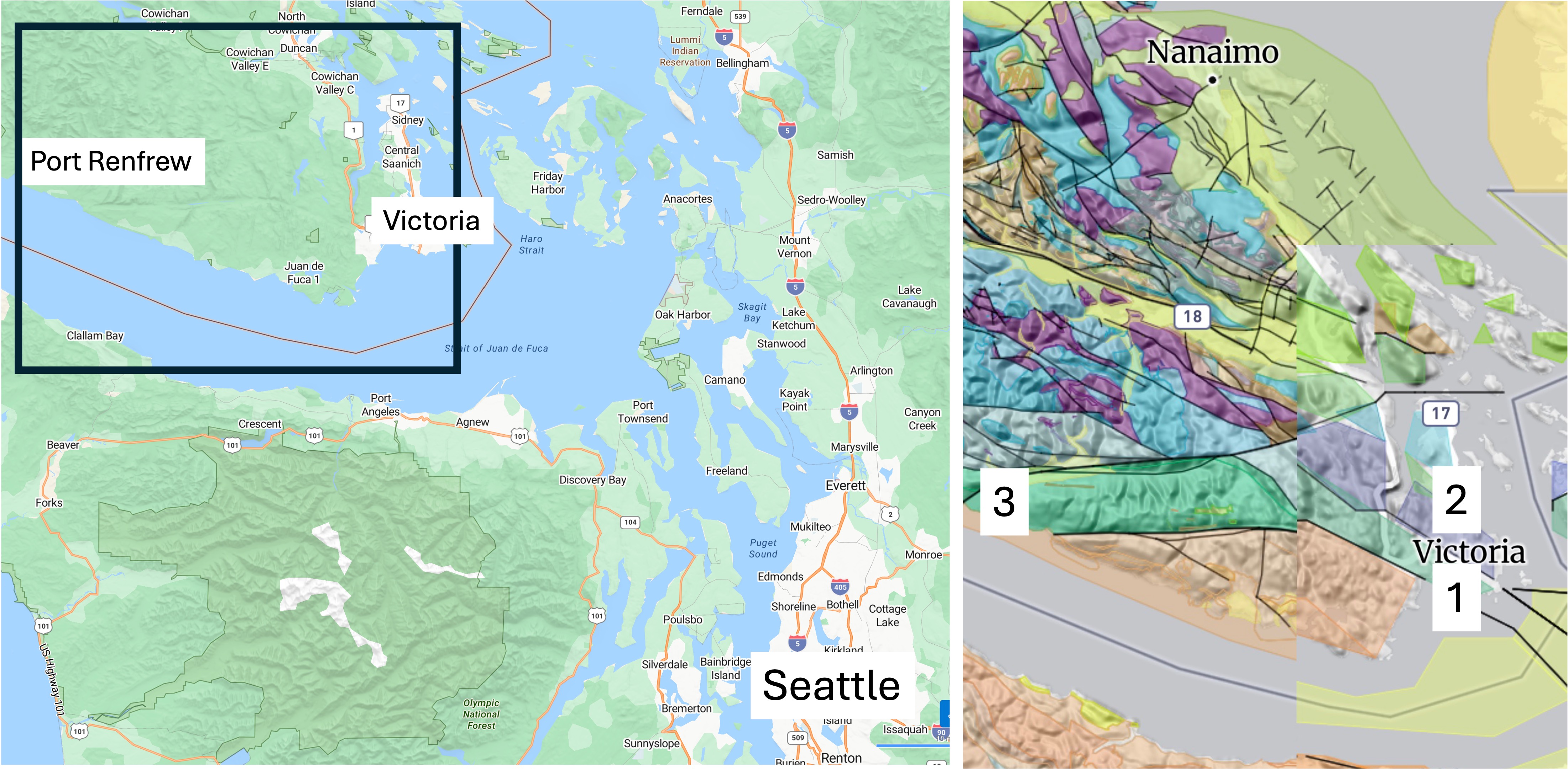
Figure 2. We drove to Port Angeles on the Olympic Peninsula and took a ferry to Victoria. We also drove about 70 miles west to Port Renfrew. The inset geologic map reveals a maze of faults and rock types. The rocks around Victoria comprise the Westcoast Crystalline Complex, which includes granitic and metamorphic rocks dated between 540 and 143 Ma (colored green). The purple area indicates a suite of granitic intrusions from the Jurassic period (200-160 Ma). The numbers indicate locations discussed below: (1) Beacon Hill; (2) Mount Douglas; and (3) Port Renfrew.
Beacon Hill
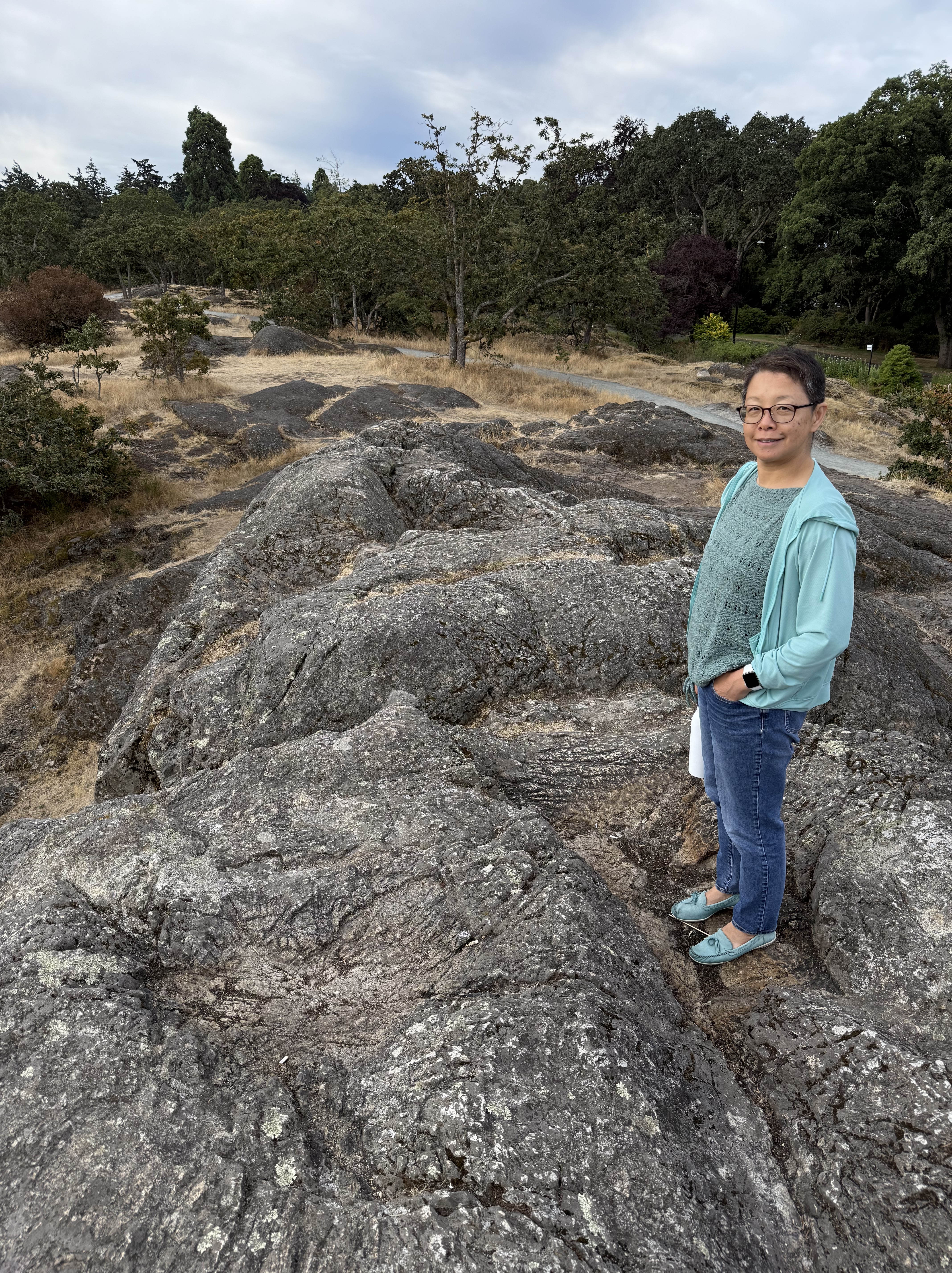
Figure 3. This exposure of the Westcoast Crystalline Complex at Beacon Hill Park doesn’t tell us much. These rocks are weathered and stained, making identification difficult without breaking off a fresh piece. We don’t do that here at Rocks and (no) Roads. Nevertheless, I am relatively confident that they are not sedimentary rocks.
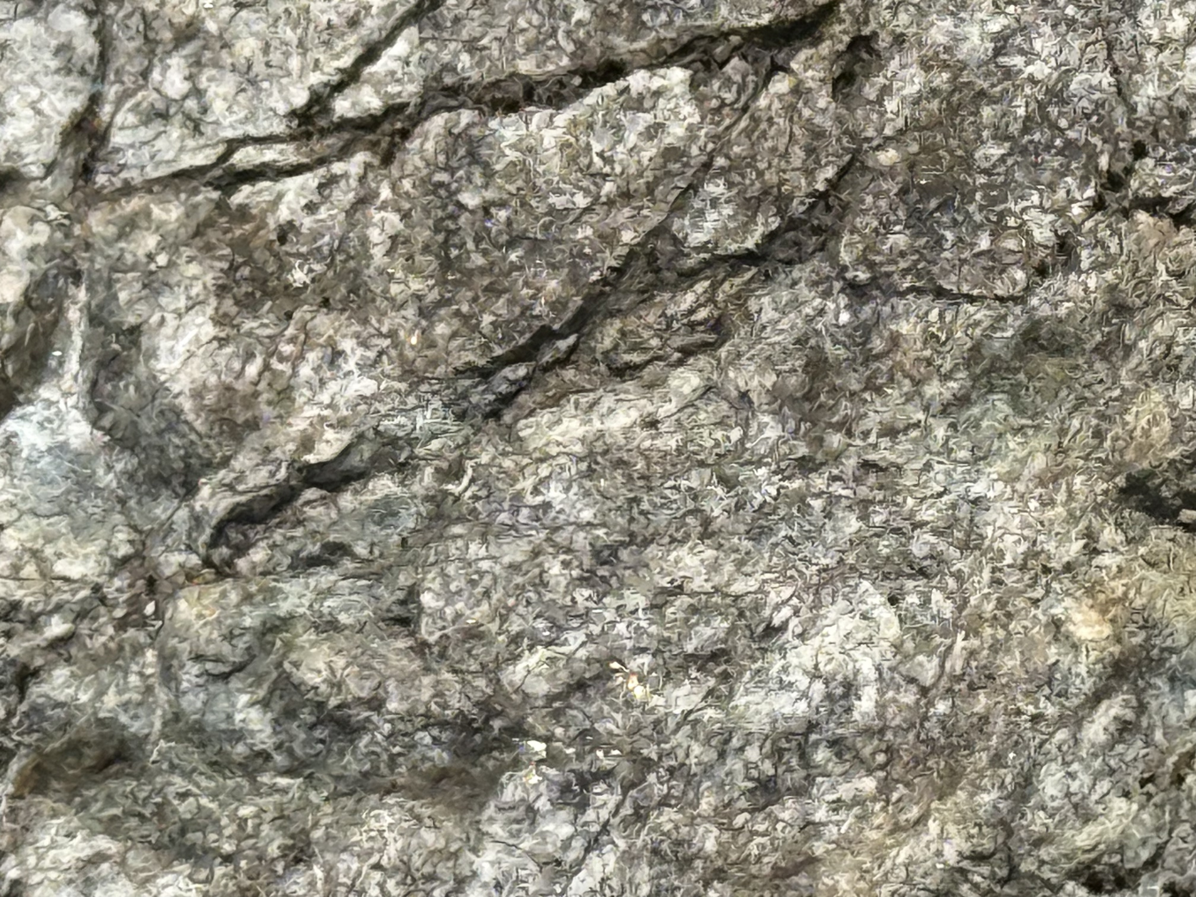
Figure 4. This photo uses a magnification of 10x, and the field of view is less than an inch. Individual crystals of feldspar can be seen throughout the image, recognizable by flat surfaces that form irregular boxes. These light-colored feldspars are indicative of continental intrusive rocks like you would find in a subduction tectonic environment. The gray blobs are quartz. Based on this brief examination, I think these are granodiorite, an intrusive rock rather than metamorphic.
Mount Douglas
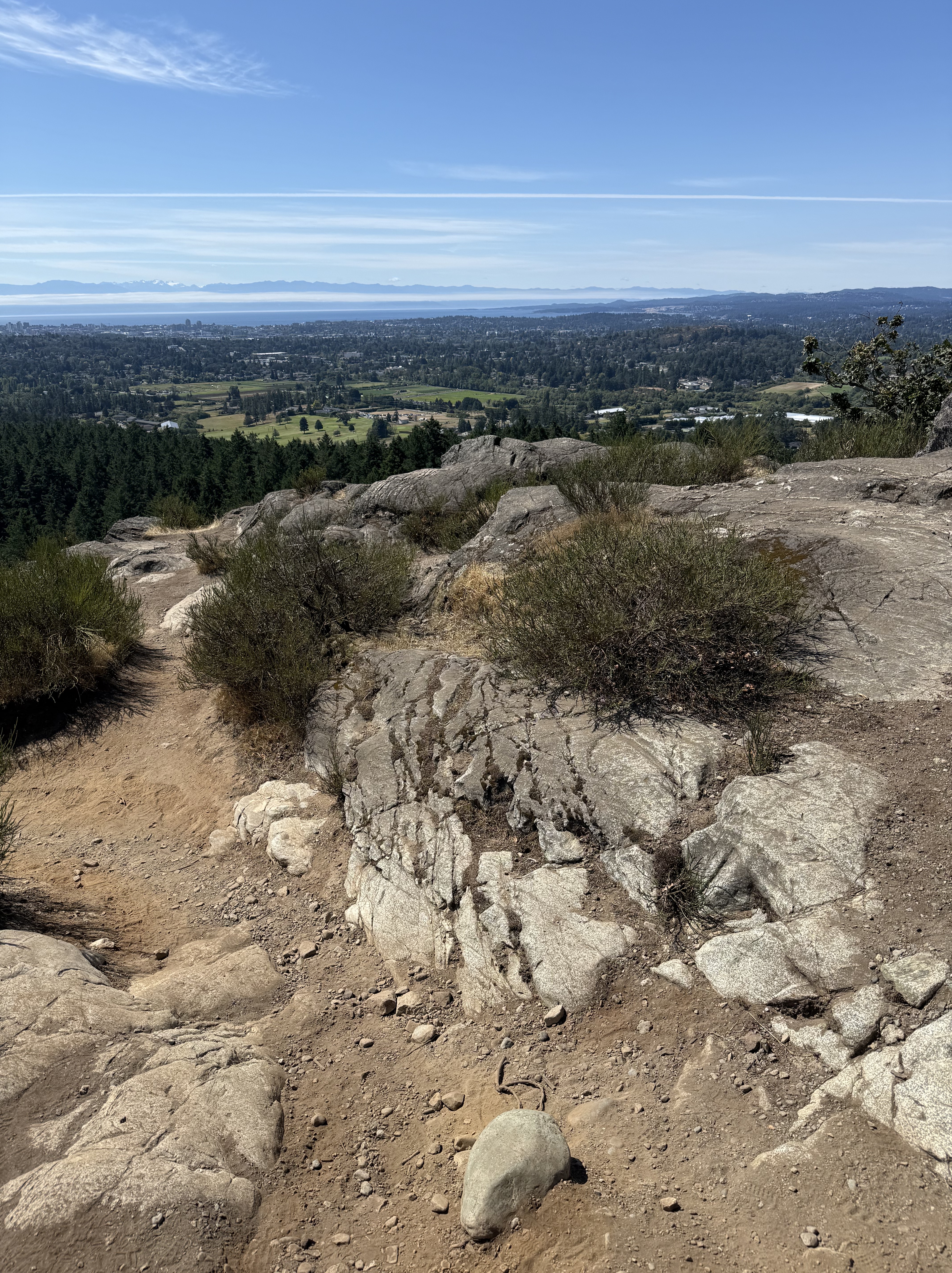
Figure 5. The view, looking south from the top of Mount Douglas (see Fig. 2 for location), reveals Mount Olympus (snow-covered peaks in the distance); and intrusive rocks with the characteristic salt-and-pepper color of granodiorite. This exposure also contains a set of joints (large X pattern enhanced by weathering) that would have appeared as the rock rose through the crust as overlying rocks were eroded. Victoria is visible in the distance.
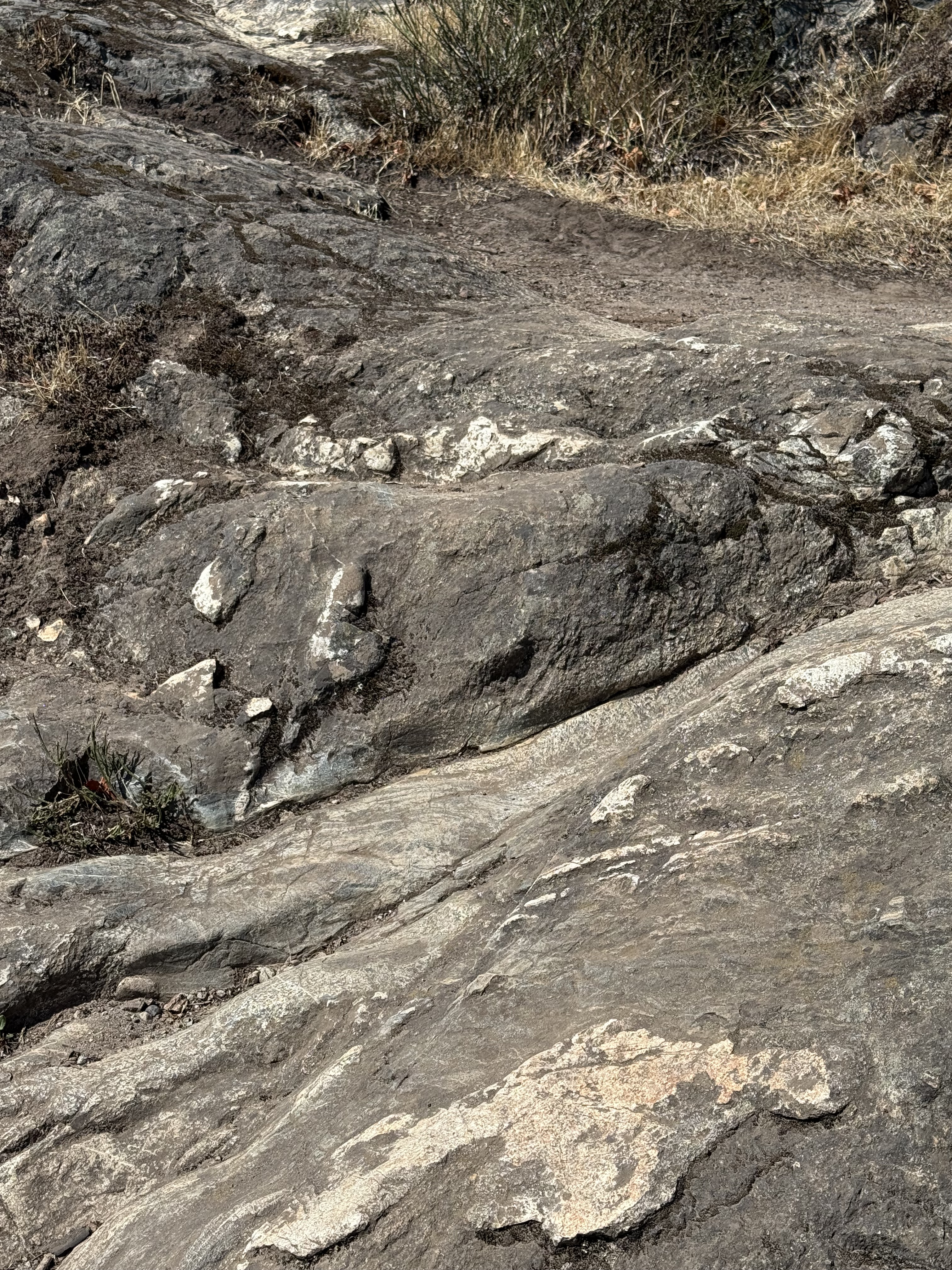
Figure 6. This image shows veins of quartz or feldspar (white material) that would have filled cracks and voids after the main magma had solidified (tens of miles deep), but residual liquids were still present.
Port Renfrew
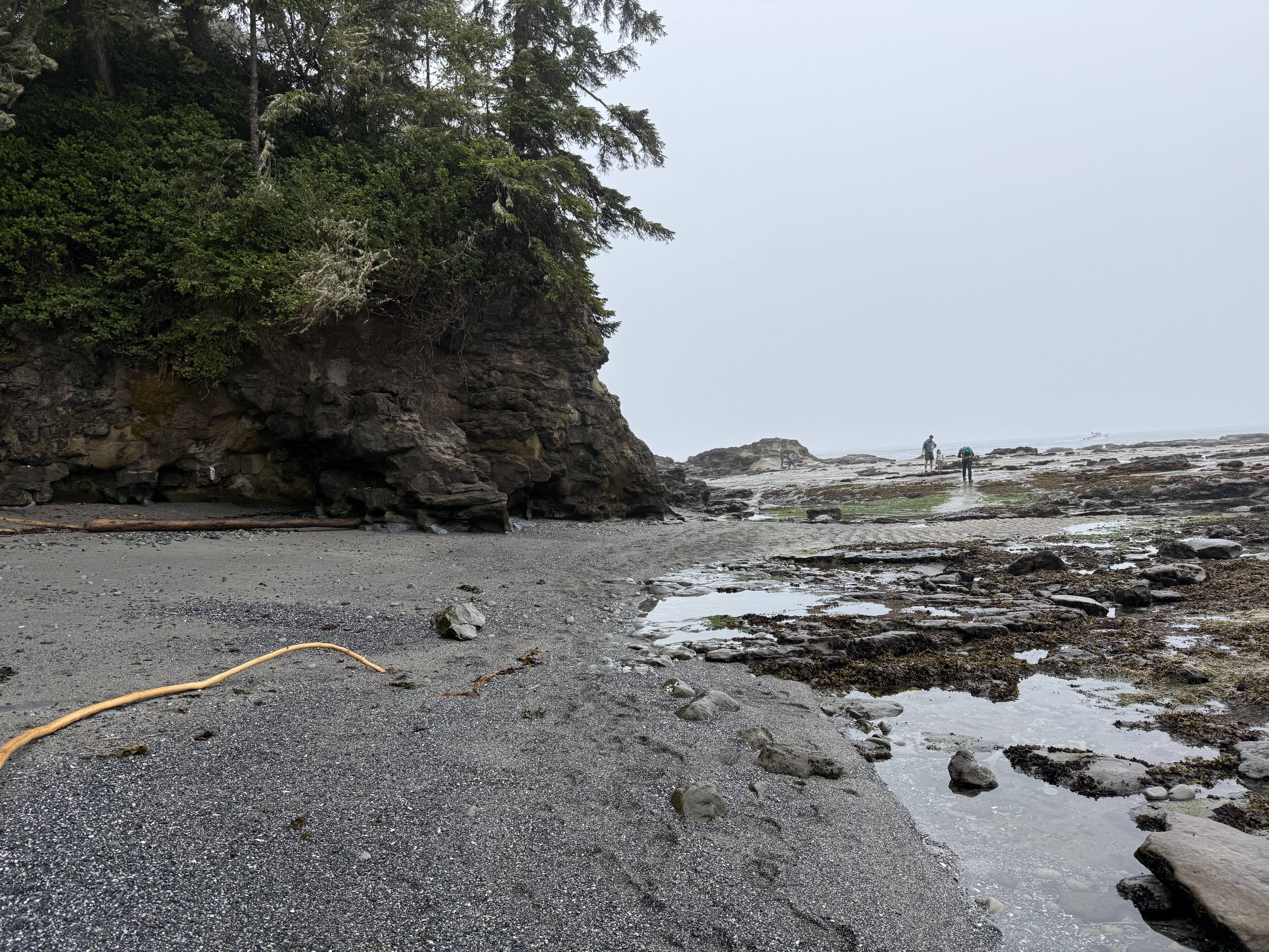
Figure 7. The cliffs at Port Renfrew are lower than in Victoria (compare to Fig. 1). They also don’t appear to be the same intrusive rocks we saw at Beacon Hill Park or Mount Douglas. The beach is covered with boulders and dark, coarse sand that couldn’t have originated from the erosion of granitic rocks. Let’s take a closer look.
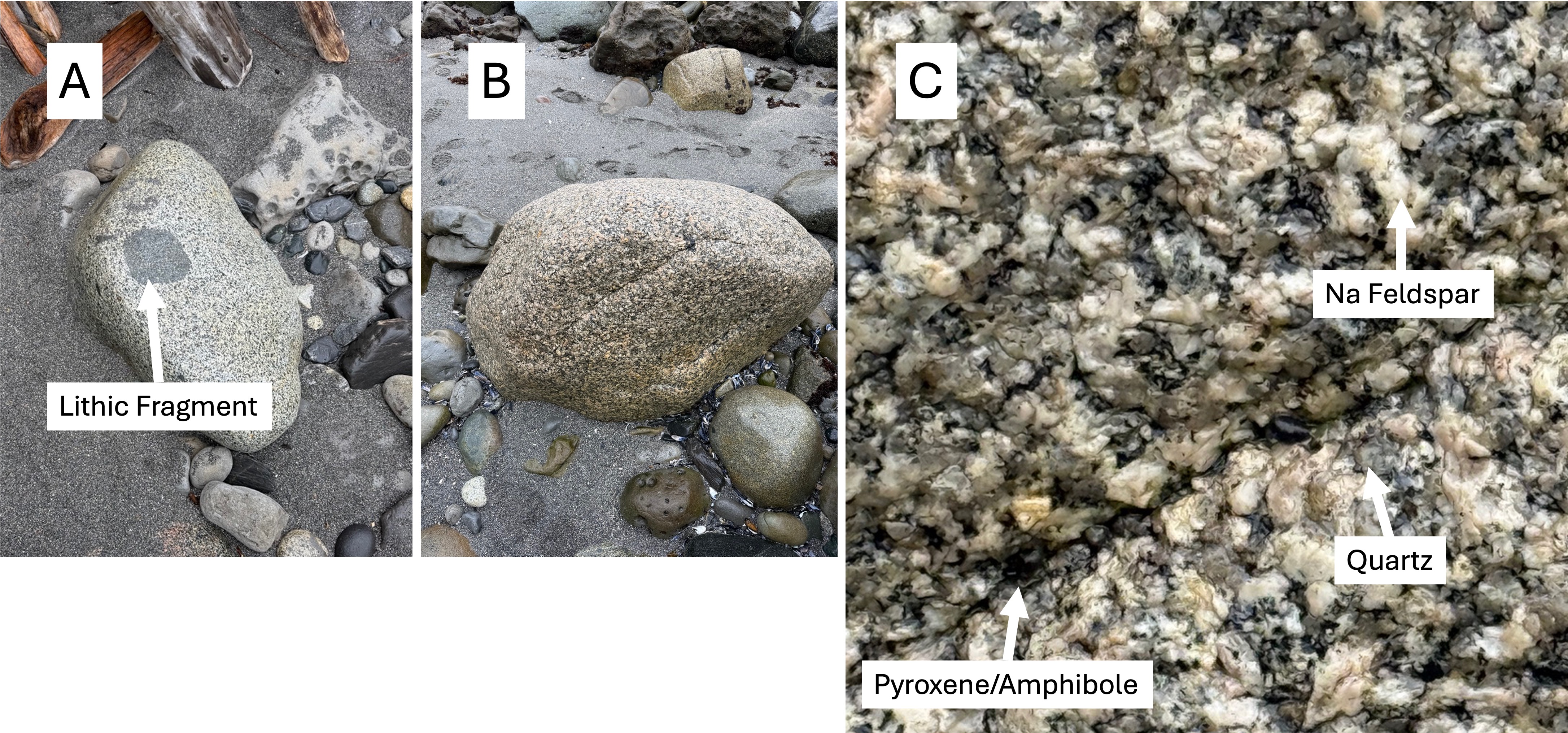
Figure 8. (A) This boulder includes a piece of the rock the magma was intruded into. The rounded edges suggest that the magma was still hot enough to partially melt the fragment; furthermore, the lack of a halo surrounding the inclusion implies that the melted material was incorporated into the magma by mixing. (B) This looks a lot like the granitic rocks in Fig. 5. (C) This boulder is fresh and individual minerals can be identified. Being wet enhances the contrast. The low quartz composition (I estimate it at ~20% from the gray blobs) suggests that this is either granodiorite or tonalite, depending on the amount of Ca-bearing feldspar. That requires either a chemical or mineralogical analysis. These boulders were transported along rivers from the center of the island, which is composed of granitic rocks (Fig. 2).

Figure 9. These ripples are almost a foot long, measured from crest to crest; and the troughs are filled with larger fragments of rock and shell. You don’t see these sedimentary structures preserved in the rock record very often, even if they do survive the vigorous tides on Vancouver Island.
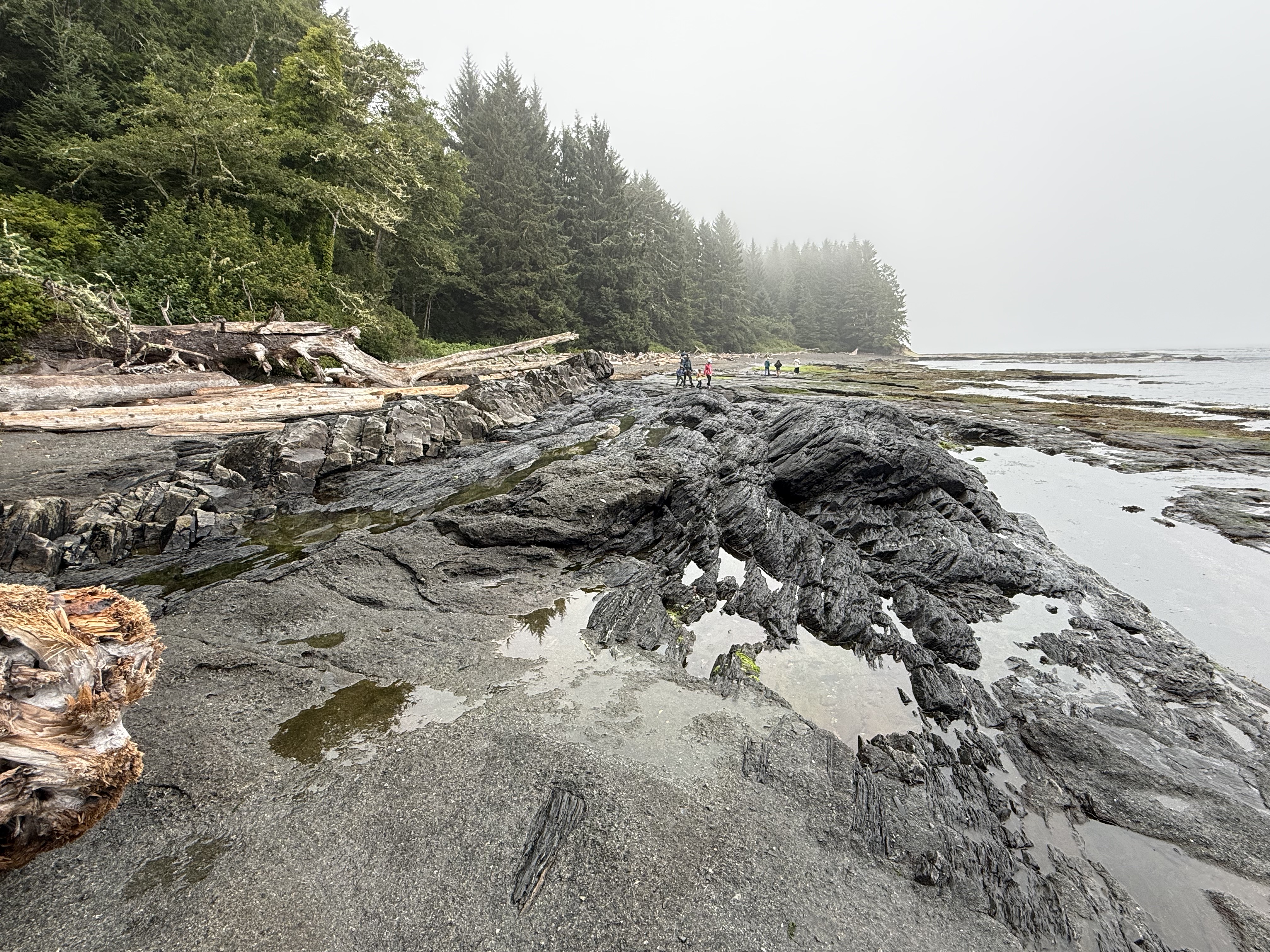
Figure 10. Exposures like this make geology fun. The darker rocks are tilted about 30 degrees to the left, but there are two distinct rocks types here: the lighter colored rock to the left is the same sandstone that makes up the cliff (Fig. 7); and the darker rock is schist, highly altered mudstone. In other words, a mildly altered rock is in direct contact with a metamorphic rock.
I checked with RockD, which integrates a global geologic map with location, and discovered I was standing on the contact between Leech River Complex metamorphic rocks (200-66 Ma) and Carmanah Group unaltered sedimentary rocks (37-23 Ma). This is a textbook unconformity that represents at least 29 million years.
The younger rocks are nearly horizontal, so I think this is an angular unconformity. During the missing millions of years, the older sediments were buried and heated enough to create schist; then uplifted and exposed to the sea, whereupon the younger rocks were deposited on a beach not that different from what we see today.
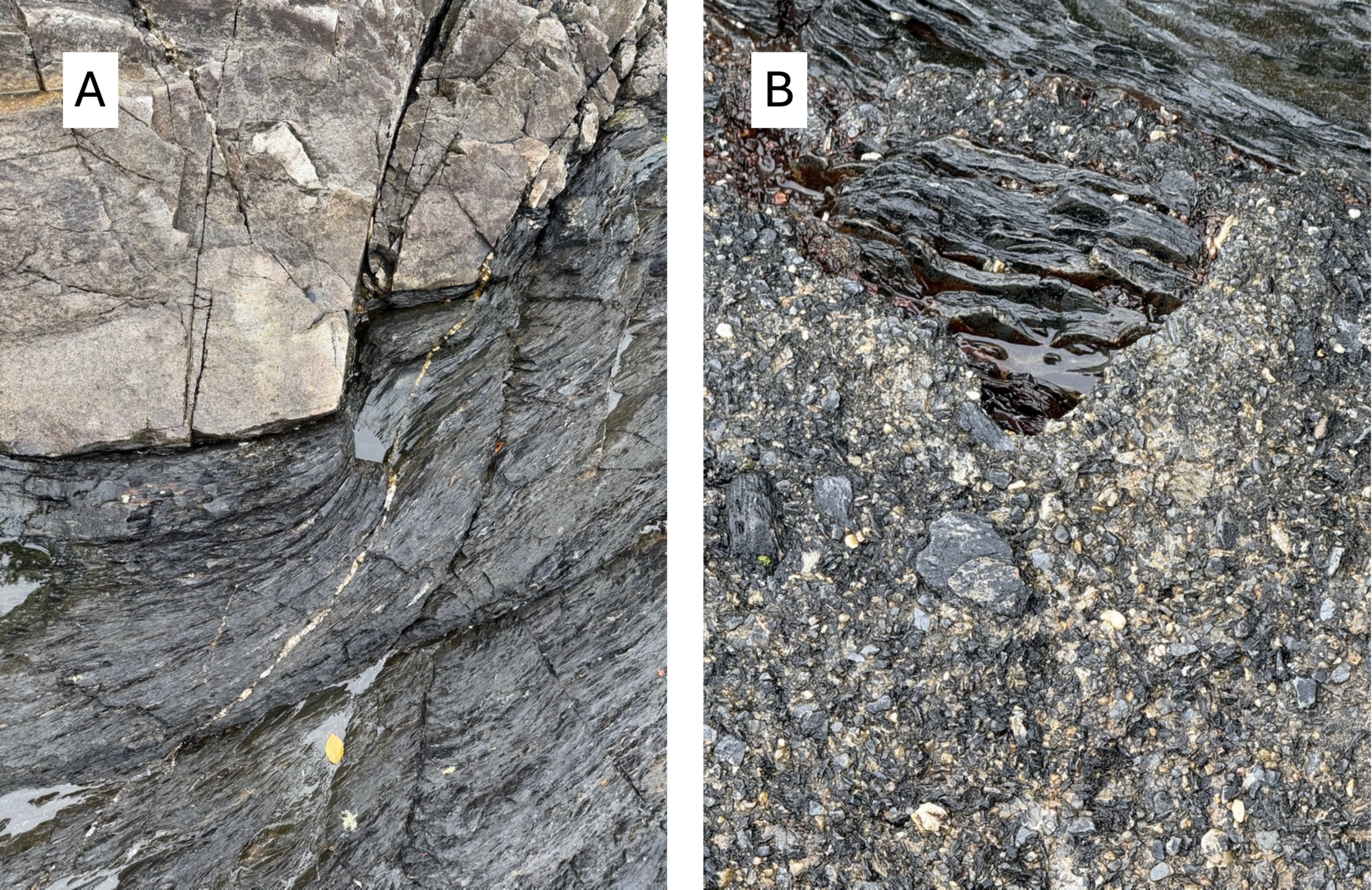
Figure 11. The devil is in the details, as shown in these images. (A) The older rock was folded during burial and, when exposed to the waves, eroded along relict bedding surfaces. Coastal sediments were then deposited in nooks and crannies like we see today. (B) Those dark fragments that look like they’re lying on the beach are actually cemented in place; the background pebbles aren’t modern sand, but instead sand frozen in time at least 29 million years ago.
Amazing.
Summary
Sometimes you can tell a story about the rocks you find, and this is one of those times. And it’s a story that unfolds across the globe. However, this story can’t be easily told because it unfolds on a sphere–the Earth. I’ll do my best.
For hundreds of millions of years, way back in the Paleozoic era, what we now call North America was drifting eastward and the West Coast (e.g. the Pacific Northwest) was a passive margin, like the East Coast is today. Suddenly, geologically speaking, the supercontinent, Pangea, which had been created from all the continents, split apart. North America reversed direction and the passive margin became a collisional plate boundary.
Ocean crust, and any islands or microcontinents that were in the way, were swallowed by the mantle or crushed by North America, creating the igneous rocks we saw at Beacon Hill Park and Mount Douglas. Muddy ocean sediments were swallowed and transformed into the schist we found at Port Renfrew. Volcanoes erupted all along the West Coast.
Then the story gets complicated and controversial.
Because the earth is not flat, crustal plates don’t slide beneath one another like sheets of paper. They crumple at the edges, forming transform faults (e.g. San Andreas fault of California) along which tectonic plates (or pieces of them) can slide past each other horizontally. This probably occurred between 200 and 66 million-years ago; if so, the rocks of Vancouver Island were originally deposited/intruded in Eastern Washington before sliding hundreds of miles to the NW.
When the crumpled edges of the colliding plates had taken up the slack, subduction resumed to the SE and the Cascades Range of volcanoes was born. This process continues to this day.
That’s the best story I’ve heard so far.


Recent Comments