
Geological Cycles at Wolf Trap National Park

Figure 1. (A) Wolf Trap National Park for the Performing Arts is located about twenty miles west of Washington DC, near several parks I’ve discussed in previous posts, especially Great Falls National Monument. The geology of the area is dominated by Neoproterozoic-to-Cambrian (1000 – 511 Ma) metasedimentary rocks that originated in oceanic environments near rapidly rising mountains (e.g., a volcanic island arc). The dates are from the time of metamorphosis, which is why they give such a long time span. Taking into account the accuracy of the dates in general, this region was undergoing erosion with the resultant sediment buried in marine trenches, probably near a subduction zone, for hundreds of millions of years. The majority of the material would have been mud. There would have been hiatuses (perhaps an ocean basin briefly emerged), but such detail is lost to us after so long. (B) This map of Wolf Trap Park shows the trail we followed. The map doesn’t show topography, but the ridges are short, with maximum relief less than 100 feet. Wolf Trap creek enters from the west (left side of panel B) and flows through a wetland area (indicated by blue ellipse) before meandering a little and following the east side of the valley.
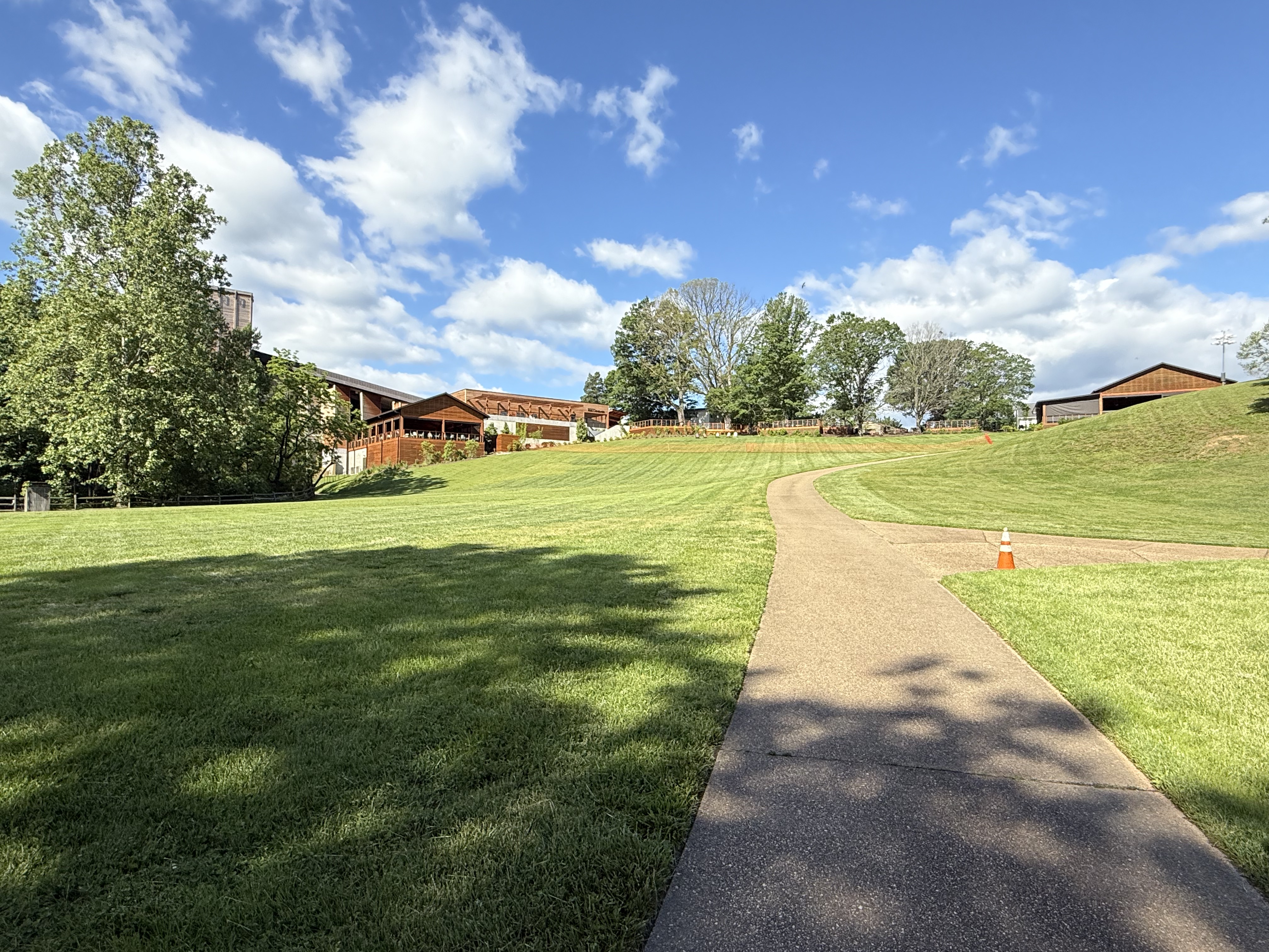
Figure 2. View of Filene Center from the SW side of our trail loop (see Fig. 1B), showing typical topographic relief at Wolf Trap park.

Figure 3. View of Wolf Trap creek where it enters the valley (Fig. 1B), showing boulders of Precambrian schist to be blocky–eroded nearby and gravitationally slid into creek but were not transported. These recently exhumed blocks are covered by Quaternary fluvial sediments, which are visible along the left side of the creek.
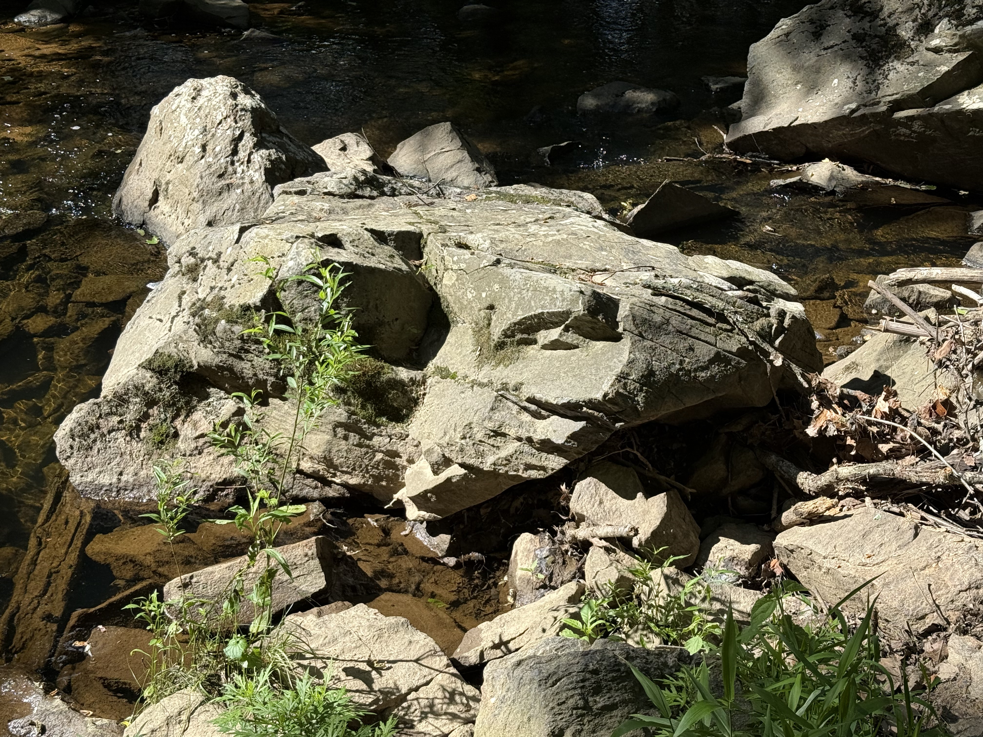
Figure 4. Large block (less than 6 feet in diameter) of schist that has been moderately weathered in place. Note the thin bedding (fissility) between thick layers with a conchoidal fracture pattern (center of image). This is the upstream side, which is pockmarked by rolling and bouncing boulders during high water. Mud becomes schist when buried deeply, retaining the lamination of the original fine-grained sediments, but remineralizing to familiar clays easily at the surface. Mud to schist to mud.

Figure 5. Meander in Wolf Trap creek along the north side of the park (see Fig. 1B), where a shallow pool of quiet water collects between runs (turbulent creek segments).

Figure 6. View looking upstream from a pedestrian bridge crossing Cthse Spring Branch, a tributary crossing our trail (dash line in Fig. 1B) before it joins Wolf Trap creek (NE side of trail in Fig. 1B). The boulders are smaller than downstream (Figs. 3 and 4), and their long axis are aligned with the stream flow. These angular blocks are sliding along on a stream-bed comprising miniature versions of themselves (note the clear view of the bottom in center of image). Even gravel and pebble-sized particles are platy because of the characteristic fissility of schist.

Figure 7. This photo dramatically reveals the effect of water on erosion.

Figure 8. This image is one I’ve seen too often here in northern VA. The sewer systems frequently follow streams because they are low points and run downhill (a good property for a sanitary system). However, when stream levels exceed expected values, the system is compromised and raw sewage can be released into the environment.
Summary. Over a billion years ago, this area was submerged beneath an ocean or marginal sea. Distant mountains eroded rapidly in a time before land plants. Vast quantities of sediment accumulated in layers of erosional debris that were subsequently buried by younger sediment. Between a billion and five-hundred million years ago, these sediments became rocks that were subsequently deformed as continental plates collided. They didn’t melt, however, and survived the cataclysm relatively unharmed, becoming schist and related metasedimentary rocks. For the last 200 million years, they have been slowly working their way to the surface as younger rocks are removed by water erosion in streams like we see all throughout NoVA. They are now exposed to the elements and are weathering to form new layers of sediment in the Atlantic Ocean, beginning a new cycle.
Washington Monument State Park, MD: Familiar Cambrian Metasediments
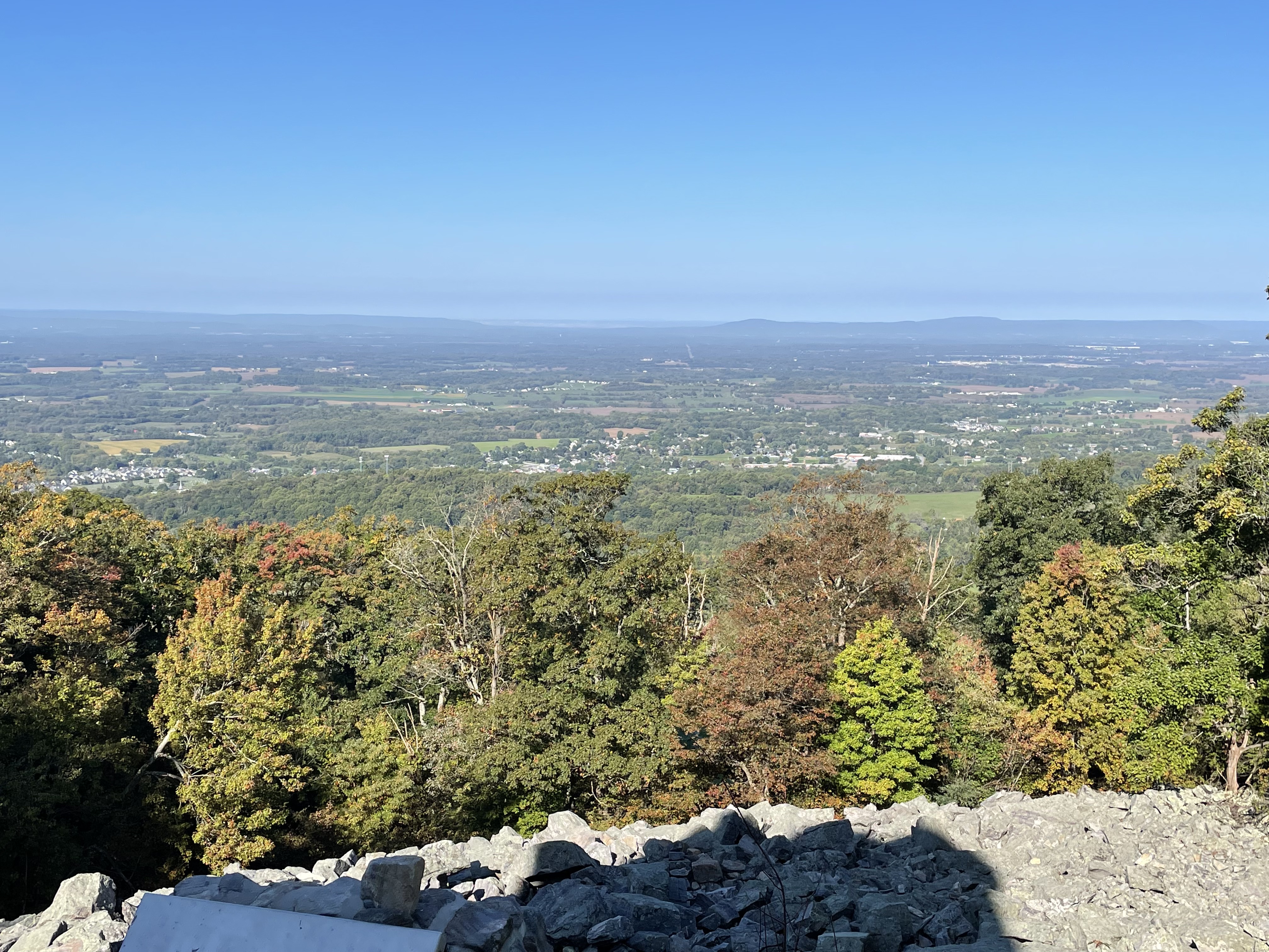
Figure 1. Looking west from Washington Monument, atop the Blue Ridge in Maryland. The valley is equivalent to the Shenandoah Valley in VA (see Fig. 2), but I couldn’t find a map with it labeled. The Appalachian trail follows the ridge through MD; we encountered it a few miles south of here in a previous post. We expect to see some of the same Proterozoic-to-Cambrian (2500-500 Ma) metasedimentary rocks here that we saw before, in addition to a surprise from an older post.
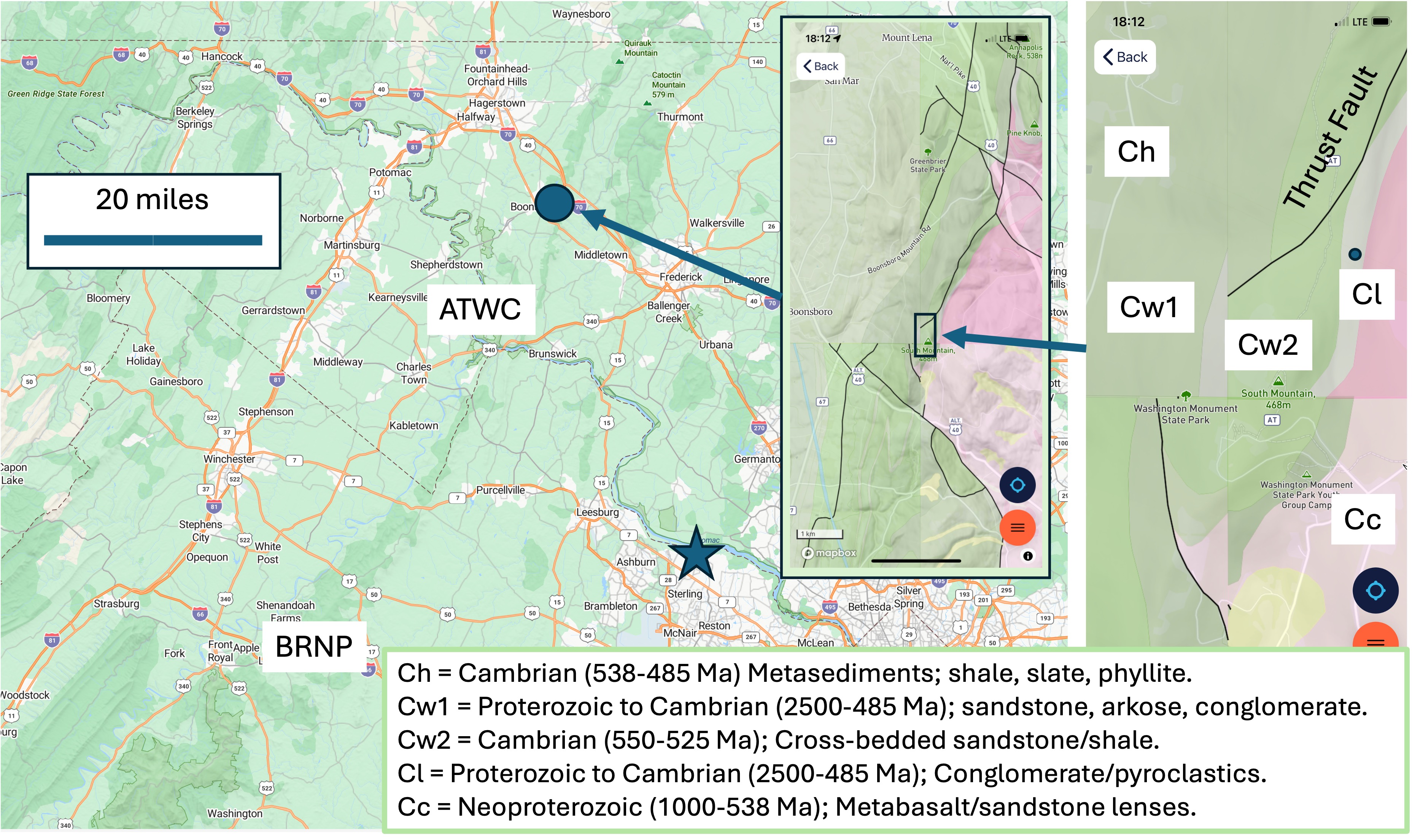
Figure 2. The field site. Washington Monument is indicated by the purple circle and arrow in the large map. The first inset map shows the geology around the monument. Note the mismatch in geology from different quadrangles; this must be a problem with either the data or Rock D, but the units (indicated in the smaller inset map to the right) were consistent when I clicked on a point. My home is indicated by the star, so you can see we haven’t traveled far. ATWC refers to the Appalachian trail at Weverton Cliff, MD, which I recommend you read to get some background. BRNP represents Bull Run Nature Preserve, which I posted last year. The geological legend for the detailed inset map is at the bottom of the figure. Note that Ma stands for a radiometric age of one-million years; this age is indicative of cooling below the threshold to set the atomic clocks within the minerals, but sedimentary rocks can’t be dated this way. Therefore, these are dates when deep burial and/tectonic deformation/magmatism ceased (i.e. when an orogenic period ended).

Figure 3. Rubble near the monument that resulted from in-place weathering of Weverton Formation rocks (Cw1 and Cw2 in Fig. 2). All of the weathering products (e.g. clays and carbonates) have been washed away, leaving large slabs (~6 feet) piled up. This is a common feature of rocky knolls with good drainage.
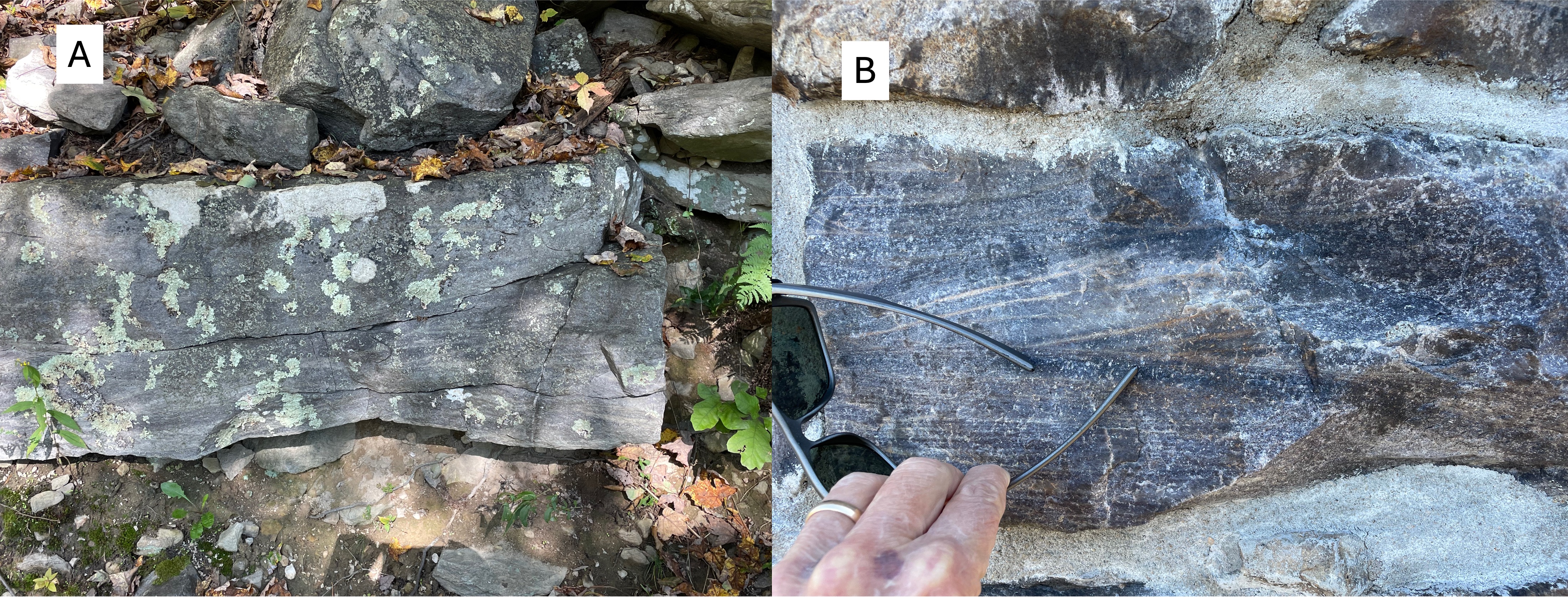
Figure 4. (A) Outcrop of older Weverton formation rocks (Cw1 in Fig. 1), revealing weathered material below and boulders on top. This outcrop contains cross-bedded layers on close examination. (B) Photo of a block of Cw1 used in the monument , which shows the crossbedding better than panel A because a fresh surface was cleaved during a recent repair of the 30-foot tower. The color is important: green sedimentary rocks like these represent marine environments, where there is less oxygen; sedimentary rocks deposited in rivers tend to be reddish because of oxidation (rusting) of Fe-containing minerals. These are probably shallow marine sands.

Figure 5. (A) Quartz in a vein (<1 inch thick) from near the monument. Note that the cross-bedding is very similar to Fig. 4 but more weathered. (B) Less-common view of a quartz vein seen obliquely, showing the surface that was against the country rock. These veins would have been injected during a period of magmatism, sometime between 2500 and 511 Ma; I can’t be more specific because I don’t know exactly where the radiometric ages were measured within these rocks. However, the Weverton formation is approximately 4500 feet (1.4 km) thick here; thus it’s possible that these rocks were deposited episodically during this immense time interval; but no unconformity (i.e. erosion or non deposition) is mentioned in RockD.

Figure 6. View looking east from the Appalachian Trail, showing the terrain typical of the Appalachian foothills. To the left of center, outcrops of Weverton rocks (Cw1 and Cw2 in Fig. 2) can be seen.
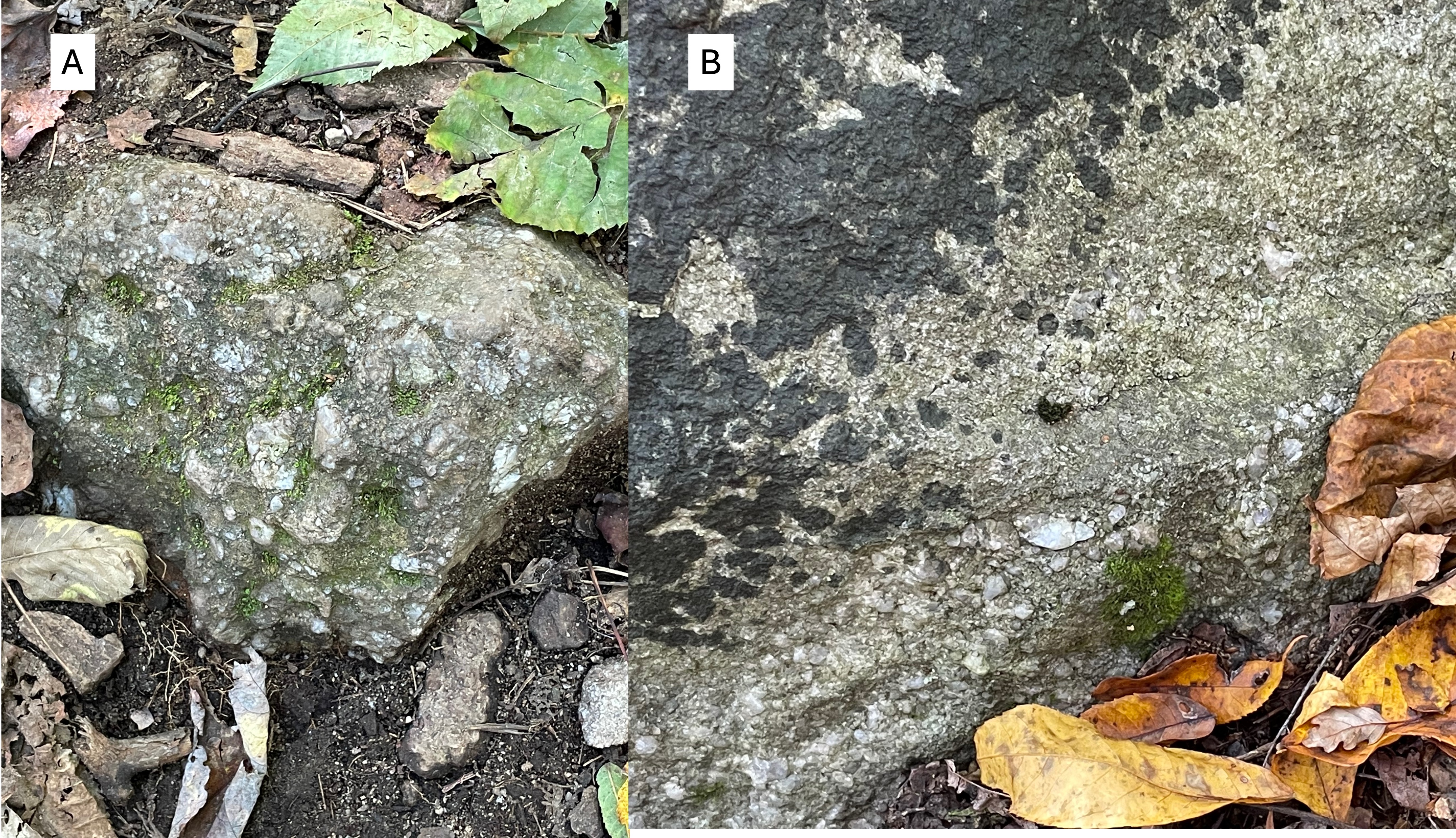
Figure 7. (A) Boulder (~2 feet across) of arkose, revealing angular clasts of rock fragments in a sandy matrix. (B) Poor outcrop of conglomerate with rounded rock and quartz in a similar, sandy matrix. Comparing these images to Fig. 4 shows the variability of sedimentation (and thus depositional environment) during relatively short time intervals (say … tens of millions of years, for example). This kind of variability implies changing sediment sources, possibly caused by tectonic uplift (with magmatism) to the east.

Figure 8. This figure is from the Bull Run Nature Preserve field trip. It is a schematic of how layers of sedimentary rocks (shown in different colors) can slide over one another along thrust faults. This process results in stacking of similar sediments, making stratigraphic analysis of sparse field data problematic. The rocks on the left are sliding upward to the right along a series of thrust faults (dashed line). At Bull Run Nature Preserve, a fault like this could be identified by older rocks clearly being stratigraphically higher than younger ones. That isn’t the case at Washington monument, where the interleaved rocks (blue and green) are too similar in lithology and age to be differentiated.
SUMMARY
The thrust fault labeled in Fig. 2 has been confidently identified (represented by a solid line), no doubt through more investigation than I was willing to spend time on. This unnamed fault underlies the northern Blue Ridge, and marks the beginning of the Valley and Ridge province; the Blue Ridge was thus an anomaly, which has been identified as a belt of older rocks thrust over younger ones about 500 million-years ago, when the supercontinent of Pangea was being created.
We have followed the Weverton formation through time (2500-485 Ma) and space (more than 40 miles). During this unimaginable interval, this small piece of the Earth’s crust has moved thousands of miles. Only the last 500 my of its journey is known with any confidence. This tectonic plate has been carrying these sediments to unknowable latitudes, colliding with immovable objects while spreading the remnants of mountain ranges that are now forgotten, deconstructed by the irresistible power of water, wind, ice and time.
Some things aren’t meant for us to know …
Turkey Run State Park

Figure 1. View looking upstream in a small creek flowing into the Potomac River (see Fig. 2 for location). The hills are covered with a thin veneer of fine sediment deposited on Proterozoic and Paleozoic (i.e. 585-443 Ma) rocks. This image shows several ledges of this basement rock, which is the topic of this post.
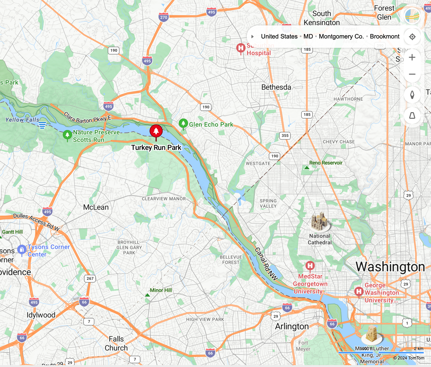
Figure 2. Map showing Turkey Run Park relative to Washington DC. Further upstream, at Scotts Run (labeled on the map), we saw Proterozoic (2500 – 542 Ma) metamorphic rocks.
INTRUSIVE ROCKS

Figure 3. Outcrop of the Ordovician (488-423 Ma) tonalite, a medium-to-coarse-grained intrusive rock. Tonalite contains little or no quartz. This is a typical exposure in this area. This rock doesn’t form cliffs and the river isn’t contained within a narrow gorge as we saw further upstream. Large blocks have fallen away as the low and irregular bluffs erode. We’ll examine this tonalite in closer detail next.
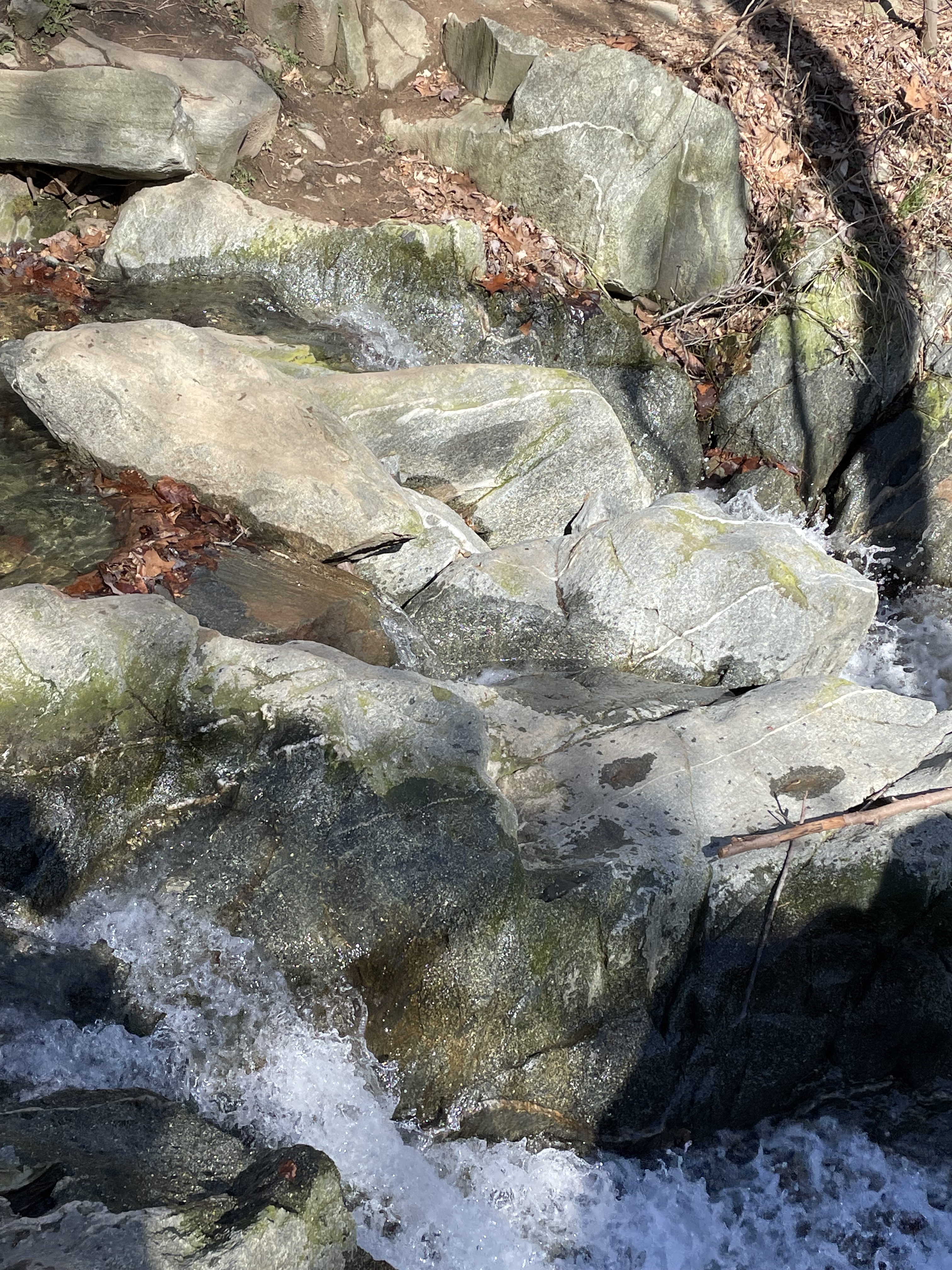
Figure 4. Tonalite exposed further downstream from Fig. 1. Note the veins of light-colored minerals running through the rock. These are veins of quartz that filled fractures in the magma after it had cooled, but was still above quartz’s melting temperature. These veins are irregular because intrusive rocks aren’t layered like sedimentary rocks; they probably also reflect slow deformation of the semisolid magma on geologic time scales (i.e. millions of years).
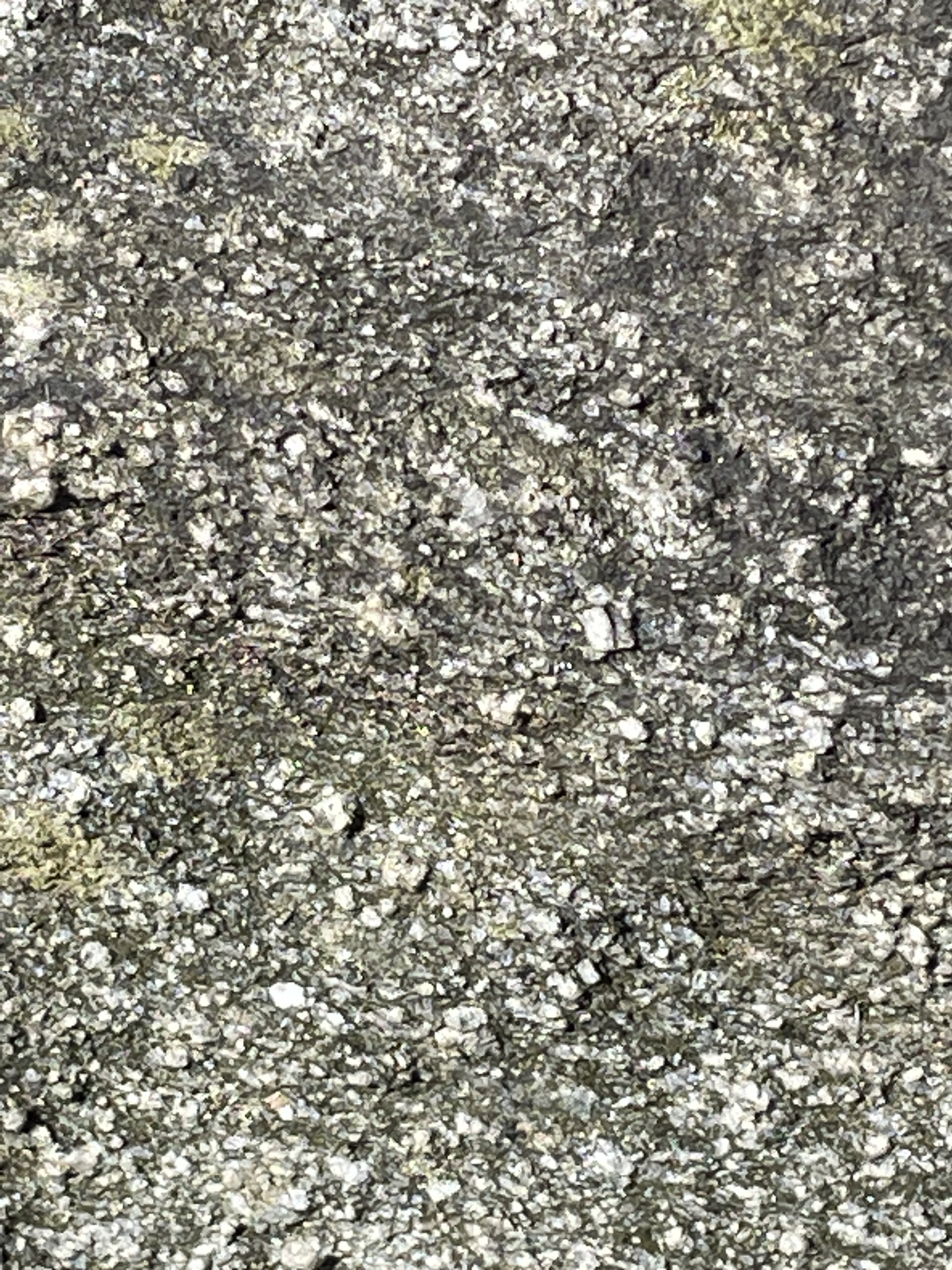
Figure 5. Close-up of tonalite (image about 2 inches across), showing rectangular feldspar crystals and darker biotite and hornblende, which make up about half the composition. The darker minerals weather faster than the feldspar, leaving the latter protruding from the surface. This image also shows a slight foliation, running from the upper left to lower right. Foliation in igneous rocks can be syndepositional (i.e. as the magma cooled) or created when the solid rock is reheated enough to deform without breaking. I think these rocks fall in the first category.
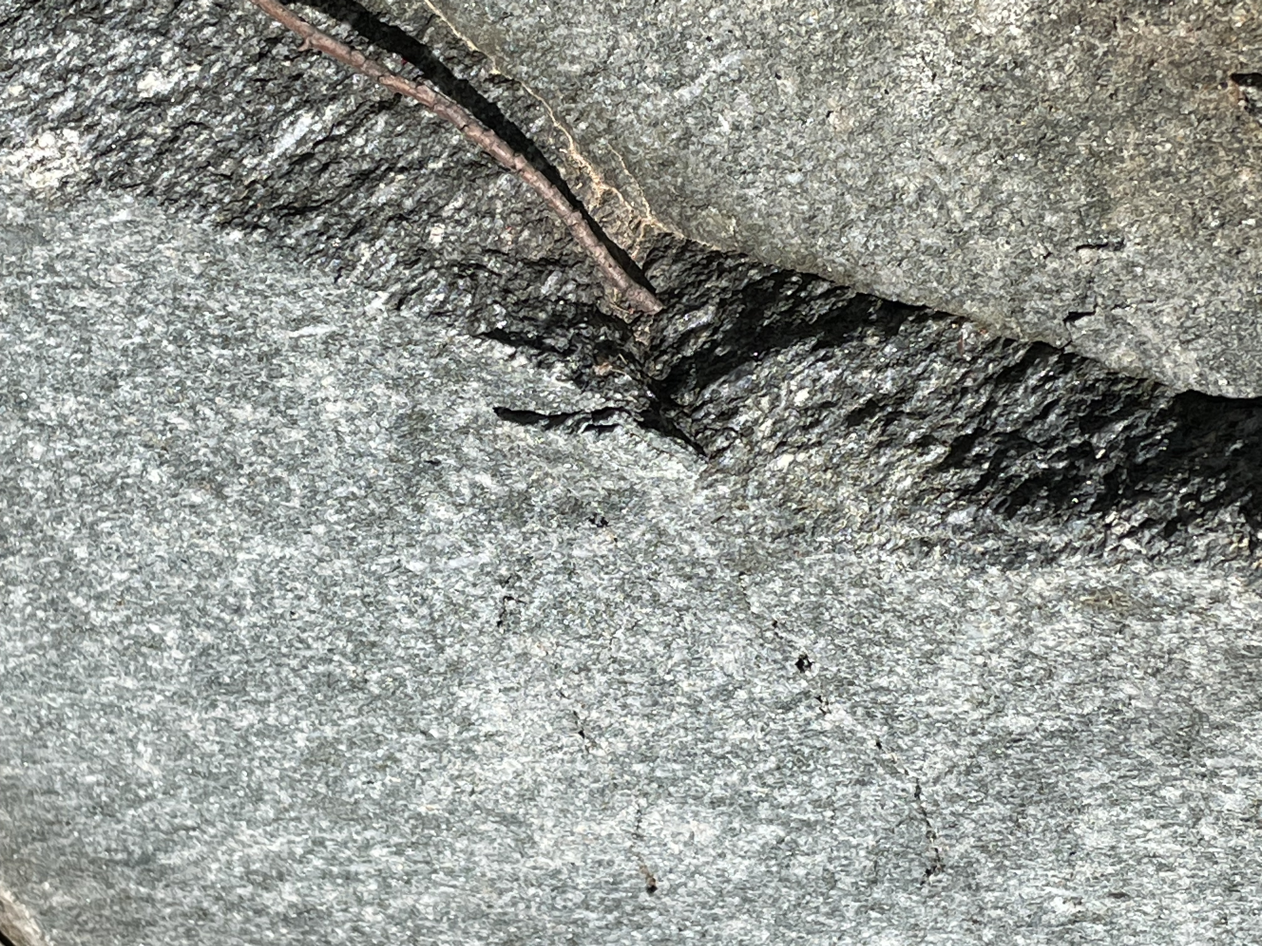
Figure 6. This unusual image shows a layer of foliated tonalite sandwiched between two blocks that appear undeformed. This is probably an illusion caused by irregular weathering; however, Rock D reports this rock unit as containing fragments of older rock and previously solidified tonalite. The emplacement of a large batholith takes tens-of-millions of years to complete, during which time there was probably considerable crustal shortening associated with collisional plate tectonics. (Honestly, I wish I hadn’t taken this photo because it is really strange …)
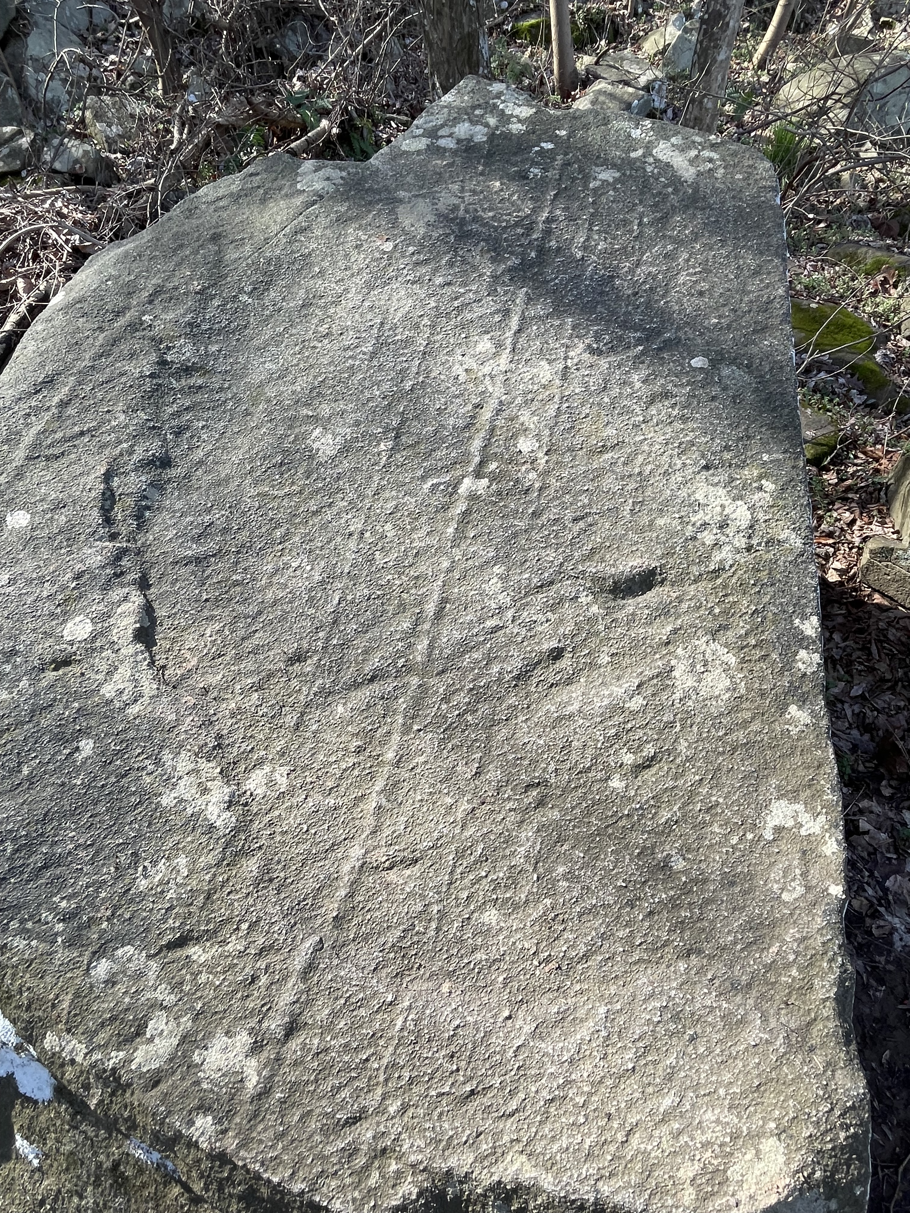
Figure 7. Joint surface within the tonalite. Joints form when the magma has solidified and is brittle, tens if not hundreds of millions of years later. These joints were almost perfectly symmetrical, with 90 degrees between intersecting planes. Such an orientation suggests that the stress regime was uniform (horizontally and vertically). In other words, they occurred during uplift (isostatic stress regime) and not during an orogeny, i.e., they occurred a long time (geologically) after the events these rocks record.
METASEDIMENTARY ROCKS
Figure 8. This photo shows the approximate contact between the Ordovician intrusive tonalite and the older, overlying Cambrian (542-488 Ma) metasedimentary rocks (intrusive rocks come from deep within the earth). The boulders lying around are mixed lithologies, representing the two rocks. Whether the stream flowing towards the camera followed the contact (they are often weak points) or not is an open question.

Figure 9. Exposure of the Cambrian Sykesville Formation metasedimentary rocks into which the tonalite was intruded. These rocks were deposited in an ocean floor/deep-sea trench environment millions of years before they were buried deeply and heated enough to be metamorphosed. Their geologic age is uncertain but Rock D reports an age of 497-470 Ma. Considering that they had to be deposited and buried before being metamorphosed, it is reasonable to assume that they were deposited about 540 million-years ago. The tonalite age of 485-443 Ma is on firmer ground because this is an intrusive rock that can be dated by radioactive isotopes trapped in the minerals comprising it. Nevertheless, their ages overlap, which requires some explanation. Such large age ranges reflect the errors associated with dating rocks this old, but also the duration of orogenic events (I’ll get to that later). I tend to trust the oldest age reported because, when radiometric daughter products (used to calculate ages) escape from the rock, the apparent age will only decrease; thus I think the tonalite was intruded sporadically starting about 485 million-years ago. Note that the bedding is tilted to the right, which is to the west; I didn’t measure strike and dip, but the orientation is consistent with regional trends — dipping to the WNW at about 35 degrees.
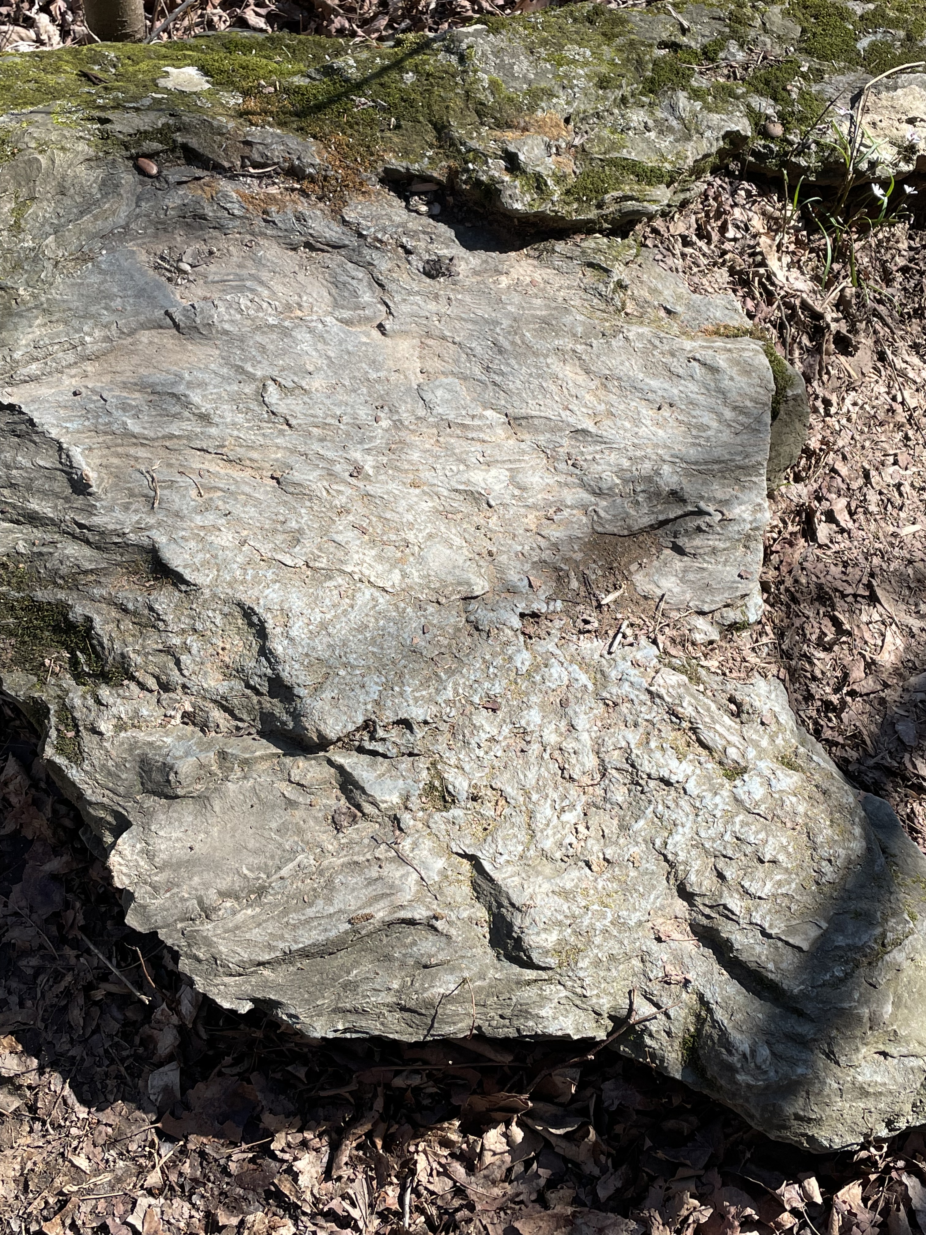
Figure 10. Original bedding plane of the metasedimentary rocks. The lumpy surface is very similar to muddy sediments in modern submarine fan and trench settings, where sediment slides down steep slopes. Any fossils (if there ever were any) were destroyed during metamorphosis, which contributes to the dating problem I alluded to above.
FIELD RELATIONS
Figure 11. Exposure of the metasediments, showing light-colored layers within the darker beds of these rocks — exemplified by the thin layer just below the tree leaning to the right in the center of the photo (No, I didn’t tilt the camera; the tree is growing like that).

Figure 12. Photo of a block that fell away from the exposure seen in Fig. 11. This is mostly quartz but it contains several elongate fragments of metasedimentary rock. Although tonalite contains very little quartz, the original magma contained enough silica (Quartz is SiO4, pure silica) that magmatic fluids high in silica were infused into the overlying rocks as the magma cooled. Note that the country rock didn’t melt but was broken off during injection.

Figure 13. Exposure of a quartz-rich area within the metasedimentary rock.
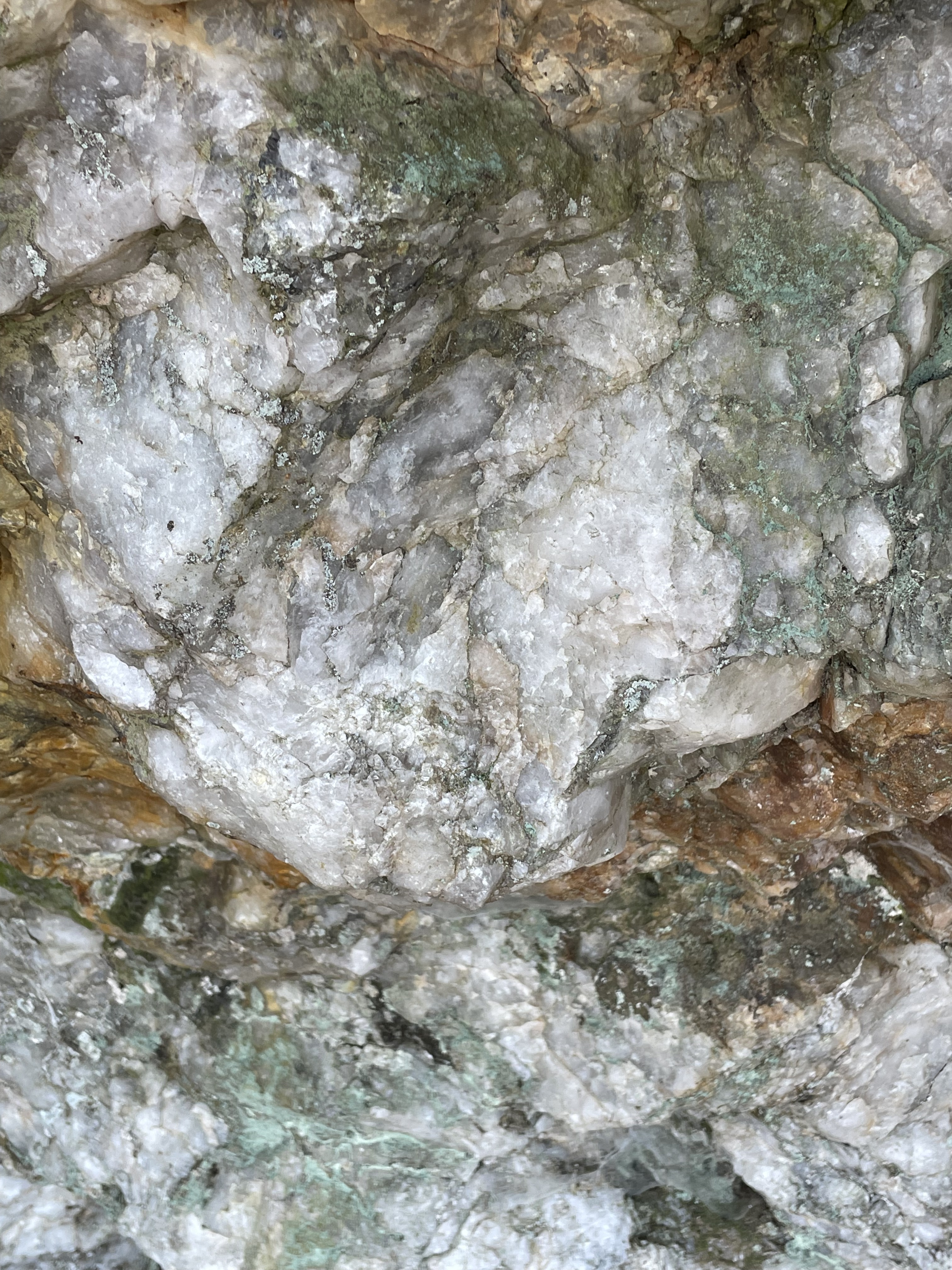
Figure 14. Close-up of the exposure in Fig. 13, showing large quartz nodules. The red stains come from oxidation of iron-rich sediments in the country rock. The image is about two-feet across. The magma didn’t contain an abundance of rare-earth elements, but this looks like a pegmatite to me. Pegmatites form from excess quartz and other incompatible elements (e.g. lithium, tantalum, molybdenum) that remain in the last bit of semifluid as the magma cools; thus they are injected into the country rock as veins following weak zones (e.g. Fig. 11) to form large inclusions.
SUMMARY
We saw a lot today. More than 500 million-years ago, muddy sediments were deposited in a deep-sea environment, probably a subduction trench created as the Iapetus Ocean closed. This wasn’t a continental collision but more like we see in modern Japan or the Philippines. These sediments were buried over millions of years, finally heating enough under sufficient pressure to form new minerals but not obliterating their original sedimentary structures. About 485 million-years ago, magma rose from deep within the crust and forced its way into these ductile (but not molten) rocks, forcing high-pressure fluids rich in silicon along bedding planes, breaking off pieces of the older metasedimentary rocks and entraining them.
Today’s walk in the park took us to a time when an ocean basin was being subducted beneath a continent to form a supercontinent called Pangea.
These rocks record the Taconic Orogeny, the first in a series of collisional events that shook porto-north America to its roots. It was followed by continuous mountain building, culminating with the Allegehanian Orogeny, which ended approximately 260 million-years ago.
Radiometric ages tell us that the closing of Iapetus began at least 500 million-years ago and continued for 240 million years. However, the collision of tectonic plates isn’t defined by a single orogeny, as recorded in the rocks when continents are involved. I would like to point out that this massive tectonic event coincides with the evolution of animals, from the first mollusks to complex vertebrates like reptiles.
The evolution of life is closely correlated with plate tectonics so, the next time you see a rock in its natural state, take a moment to appreciate the debt we all owe to the earth …

Recent Comments