
Proterozoic Metasediments at Scott’s Run
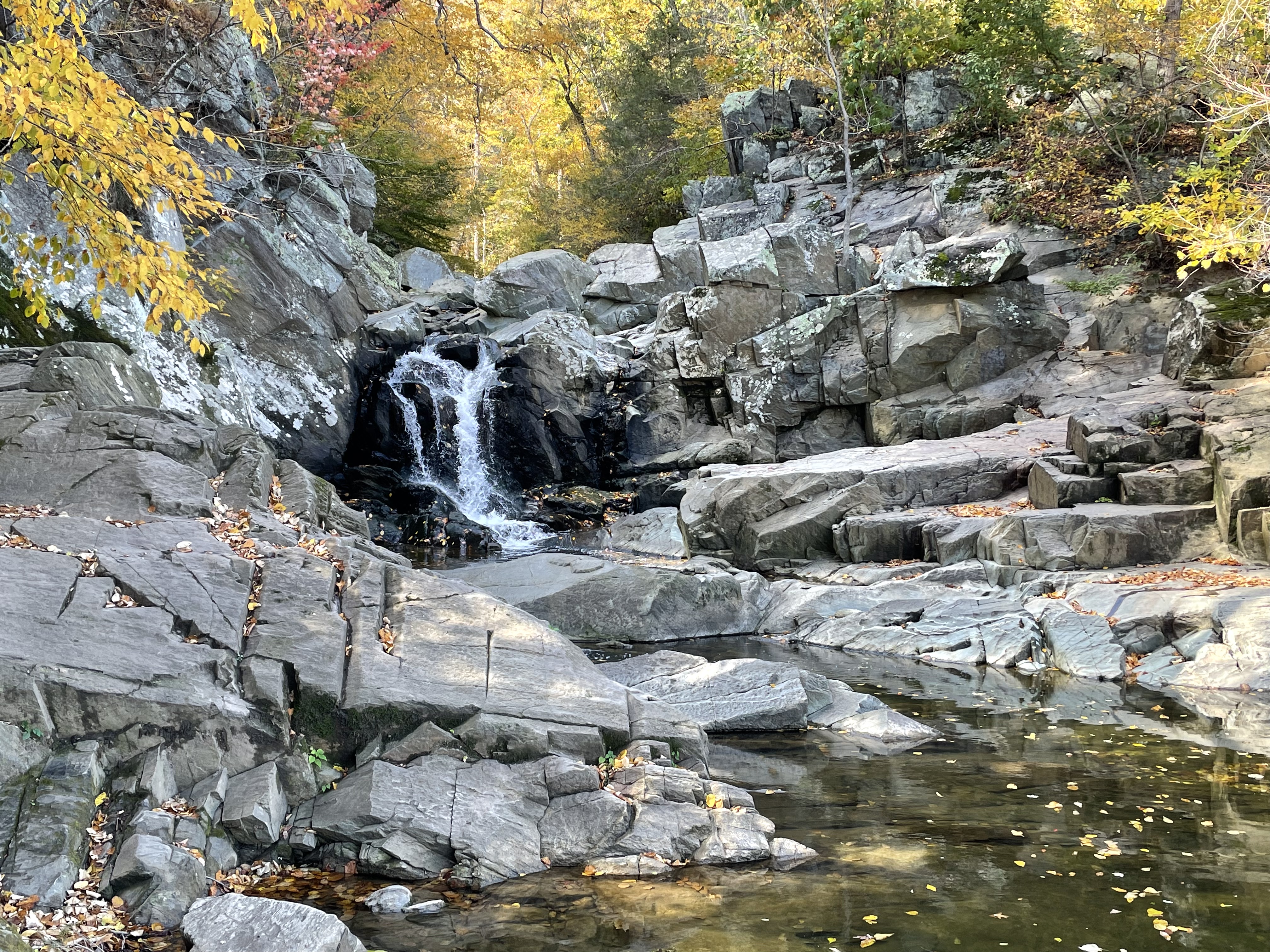
Figure 1. This post explored some of the Precambrian (1000 – 511 Ma) metamorphic rocks we’ve seen before along the Potomac River in Northern Virginia (NOVA). We followed Scott’s run to the waterfall (see Fig. 2 for location), where the creek dropped about ten feet at the current level of the Potomac. This photo shows a massive metasedimentary rock with no foliation. According to RockD this is a metagraywacke, which is a poorly sorted sand-silt sediment deposited on submarine fans (e.g. at the mouth of rivers), with distinctive structures that indicate slumping. The dates are indicative of the age of metamorphism rather than deposition. This is a thick formation but I couldn’t find a measured thickness but, based on its exposure along the Potomac, it must be thousands of feet thick; the large range in ages supports a model of continuous deposition/burial/low-grade metamorphism for hundreds of millions of years. Like a conveyor belt. There is no evidence of magmatism in this area, although a thick sequence of greenstone (metamorphosed basalt and associate volcaniclastic sediments) of this age is exposed in Shenandoah National Park.

Figure 2. Geologic map of Scott’s Run Nature Preserve. The waterfall (Fig. 1) is labeled in the inset map; the geologic map (right panel) indicates the exposure of metagraywacke (Pc Metaseds) in the area with thin lines. Our path followed Scott’s run to the left of the inset map, then the Potomac, before turning south at the Ridge, which will be discussed below.
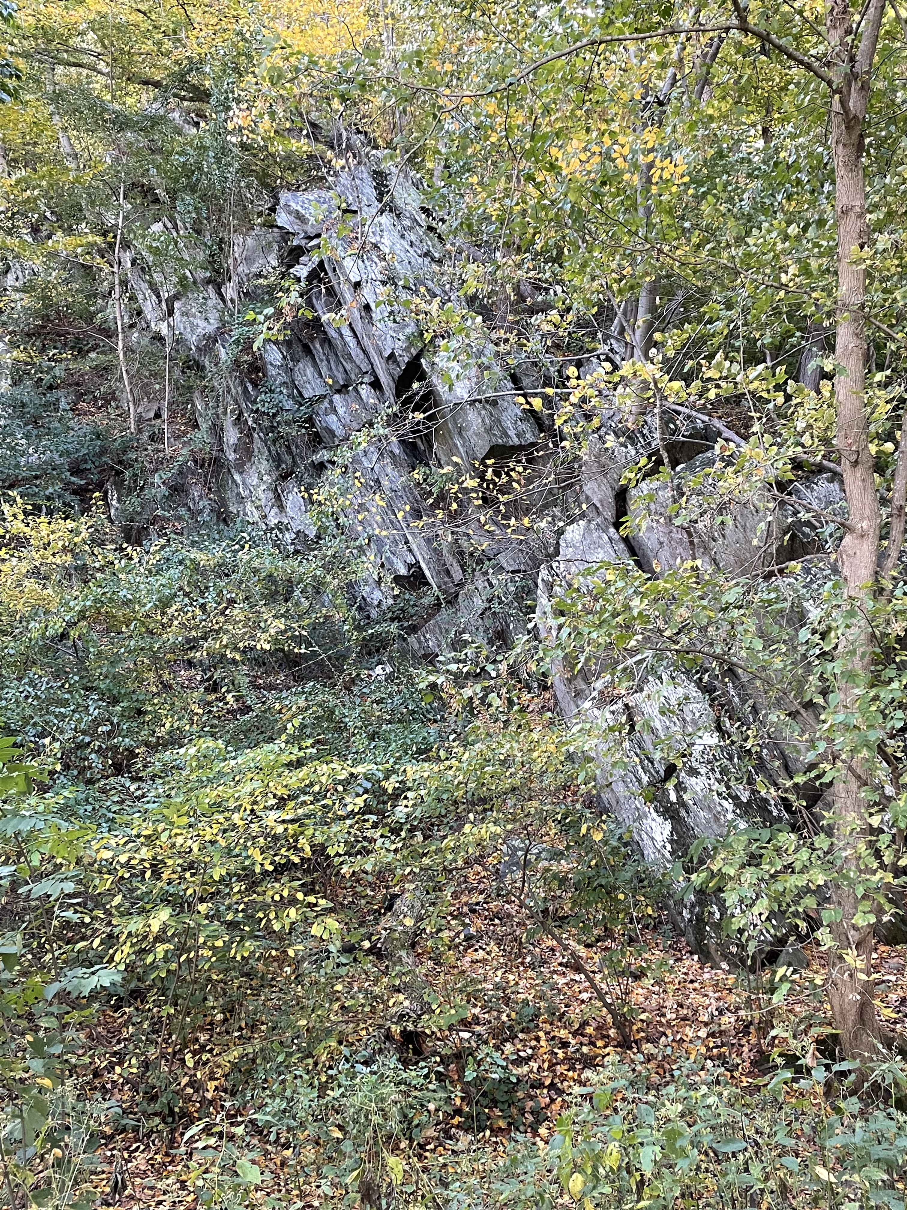
Figure 3. Photo of a ridge of schist (see Fig. 2 for location) the same age as the metagraywacke seen in Fig. 1. Schist is the result of burial and heating of mud at great pressure. Notice the distinct foliation of this outcrop, which is tilted about 70 degrees from horizontal to the west, the same trend we have seen throughout NOVA. The tilting is partly due to normal faulting during the rifting of Pangea about 200 million-years ago. I don’t know how these rocks’ original bedding (i.e. foliation) was deformed when they were buried and metamorphosed into schist. We’ll probably never know. The graywacke we saw in Fig. 1 has a large sand component, which tends to form thicker beds than mud; these schists were originally mud, with minor sand. The origin of foliation is complex; I conjecture that the high water content of mud (clay minerals have lots of bound water) leads to an excess of water that has no where to go when they are heated under pressure for long periods of time (i.e. millions of years). As new minerals crystallize, this water is forced into irregular layers (i.e. surfaces) within the sediments during diagenesis; I’ll go further and say (with significant justification)that sediments that slump into the deep-sea trenches that delineate subduction margins contain excess water and are rapidly buried. The result — schist is my answer.
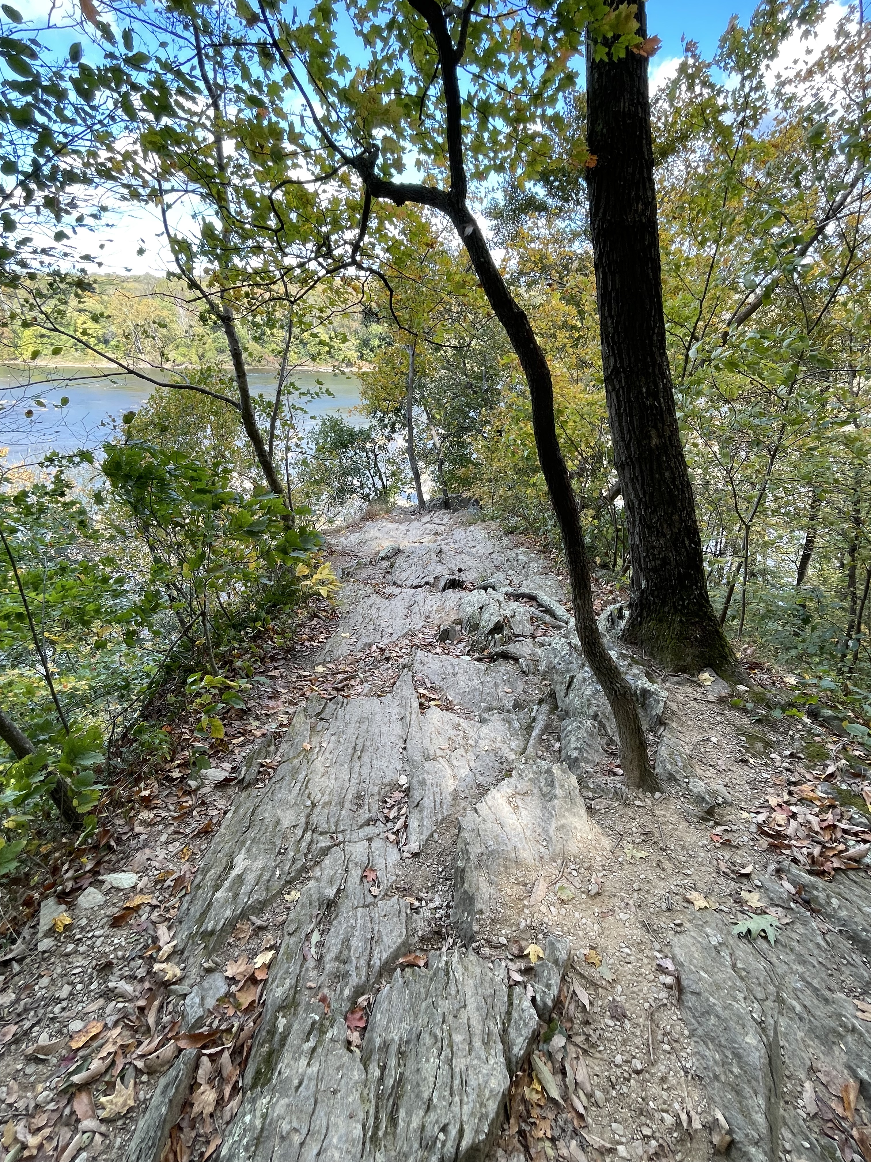
Figure 4. Photo from the top of the cliff seen in Fig. 3, showing the foliation I was talking about. This ridge (see Fig. 2 for location) is demarcated by short streams with steep slopes on both sides. Here, about 60 feet above the Potomac, it narrows to less than 10 feet along its spine.

Figure 5. This image reflects the incredible power of water on a metamorphic rock filled with excess water. Mud doesn’t form quartz or feldspar (chemically resistant minerals) during low-to-medium-grade metamorphism because there isn’t enough silicon in these minerals; they consist of layers of aluminum, iron, calcium, etc, bound with silicon and sandwiched between what are basically water molecules. The result is a fissile rock like this, where the slivers of resistant minerals are getting worn away.
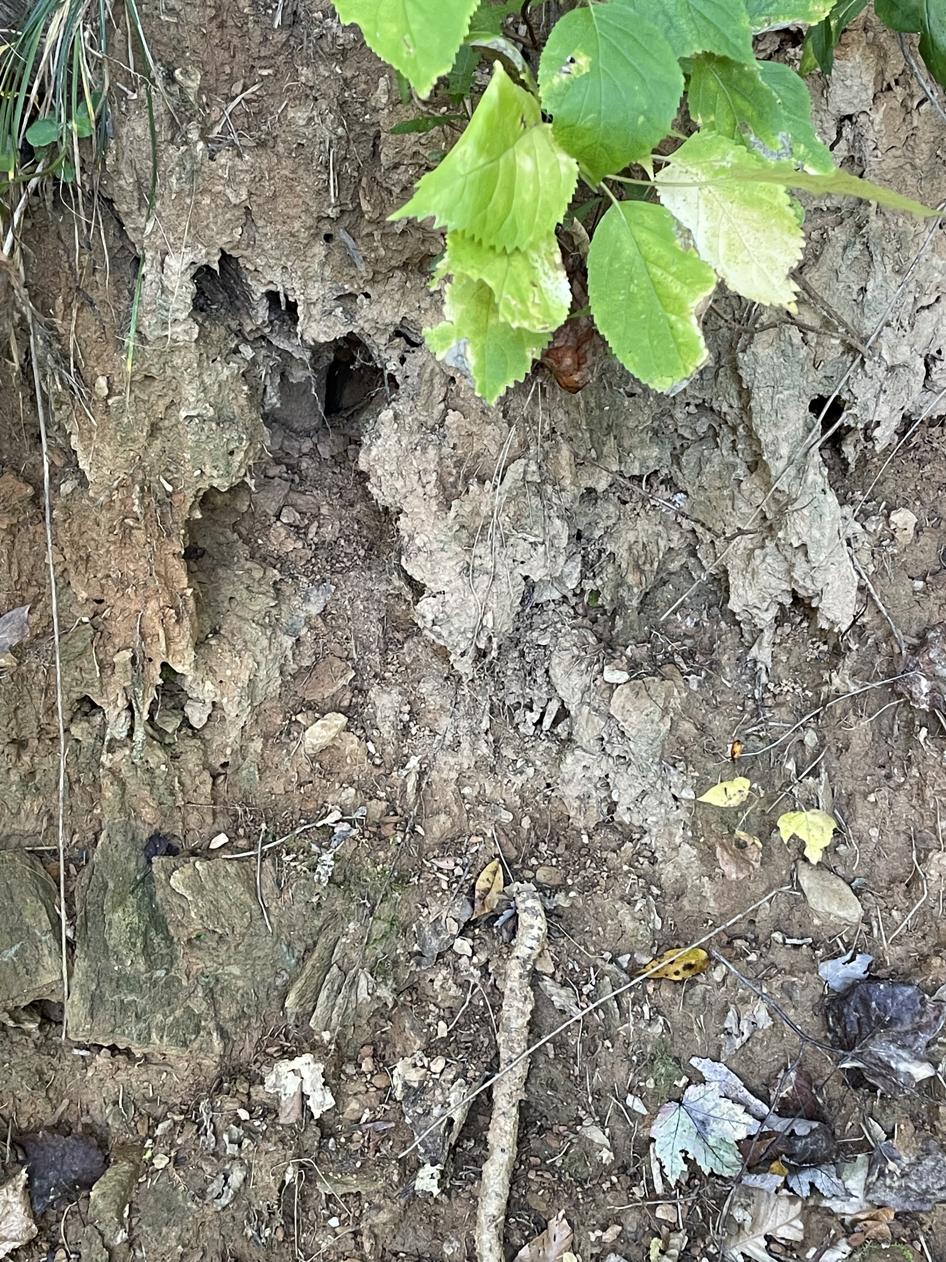
Figure 6. This photo, taken less than 20 feet from Fig. 5, shows the end result of the microscopic weathering of schist. It is turning into mud as the trapped water is released and the aluminosilicates (clays) break down into smaller and smaller grains. This soil is rich in aluminum and is mined for that element in tropical areas where plentiful rainfall maintains the conveyer belt that recycles mud into mud.
Summary. Between one-billion and five-hundred-million years ago, NOVA was a deep sea trench, probably associate with subduction of oceanic lithosphere beneath another tectonic plate. There were, doubtless, interludes in this process, but the geologic evidence suggests that subduction was the game plan. Muddy sediments eroded from what were probably volcanic islands (i.e. the Catoctin Formation) and slid down deep slopes into trenches like we see today in the western Pacific.
This process was heterogenous just as in the modern world. Volcanic activity was dominant in Shenandoah National Park, less than a hundred miles west of Scott’s Run Nature Preserve. The best image I can conjure up is the Philippine Islands, which the irresistible force of mantle convection is crushing against the immovable object of the Eurasian tectonic plate.
I am in awe of the planet we inhabit …

Trackbacks / Pingbacks