
Geological Survey of the Columbia River Gorge
The popular route east from Portland, Oregon, is I84 following the Columbia River, which cuts across the Cascades range. There are plenty of scenic views and geology to examine, but few safe places to stop. Thus we followed the Washington shoreline along state route 14.
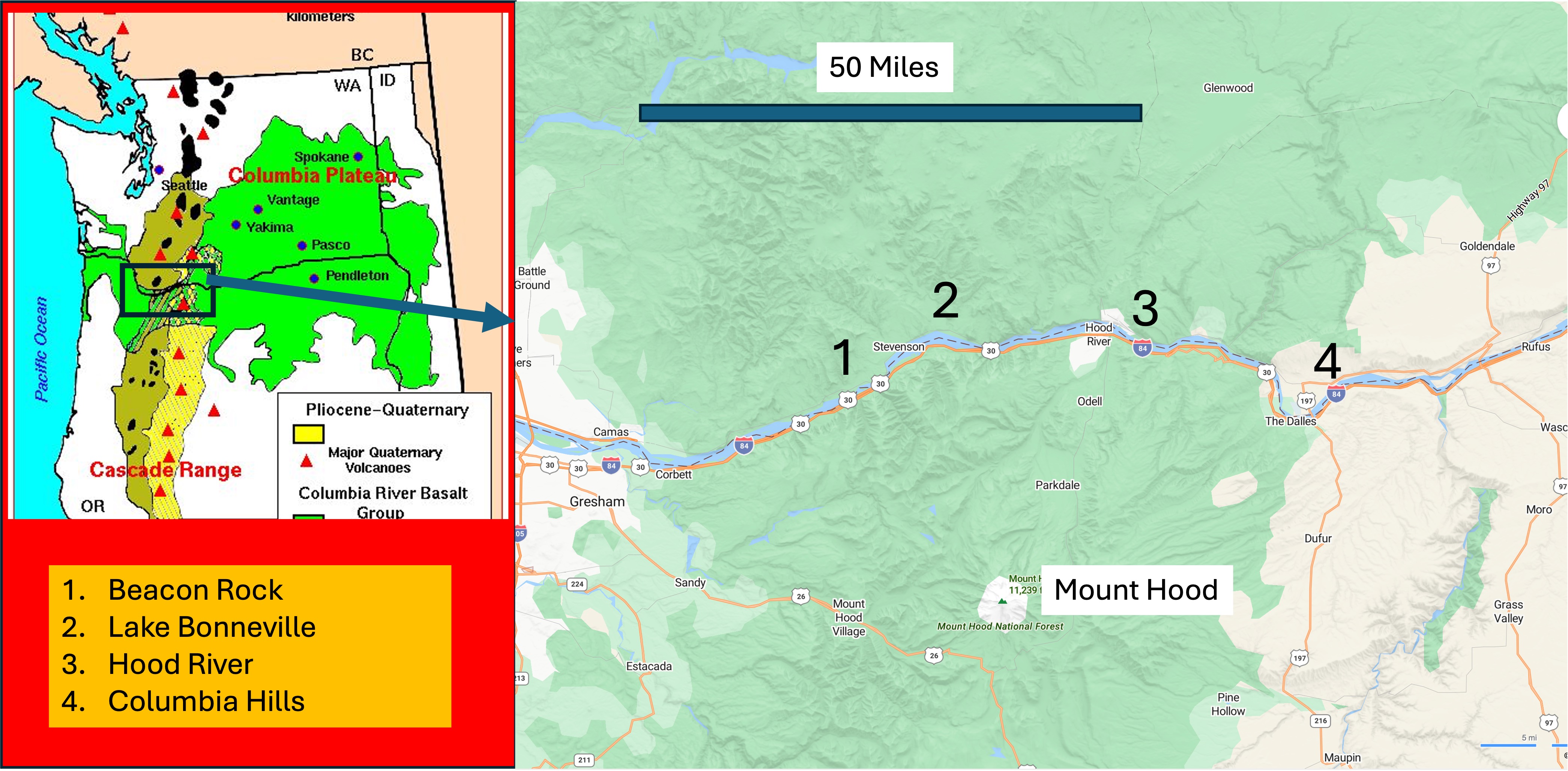
The inset map shows the distribution of volcanic rocks within Washington and Oregon. The oldest are predominantly andesites erupted from volcanoes (triangles) within the Cascades between about fifty and five million years ago (Ma), shown in light brown. The bright green represents the Columbia River Basalt Group, which flowed from fissures between seventeen and five Ma. The youngest rocks are primarily andesite erupted from volcanoes within the last million years (e.g. Rainier, St. Helens, Hood, Baker). The rectangle shows the area we are traversing, which contains a mixture of these rocks.
We stopped frequently, but I’ve lumped the photographs into four areas: 1) Beacon Rock is near the beginning of Columbia River Gorge; 2) Lake Bonneville and 3) Hood River give a good picture of the central canyon; and 4) Columbia Hills is where the river enters the gorge before cutting through the thickest section of volcanic rocks.
1. Beacon Rock
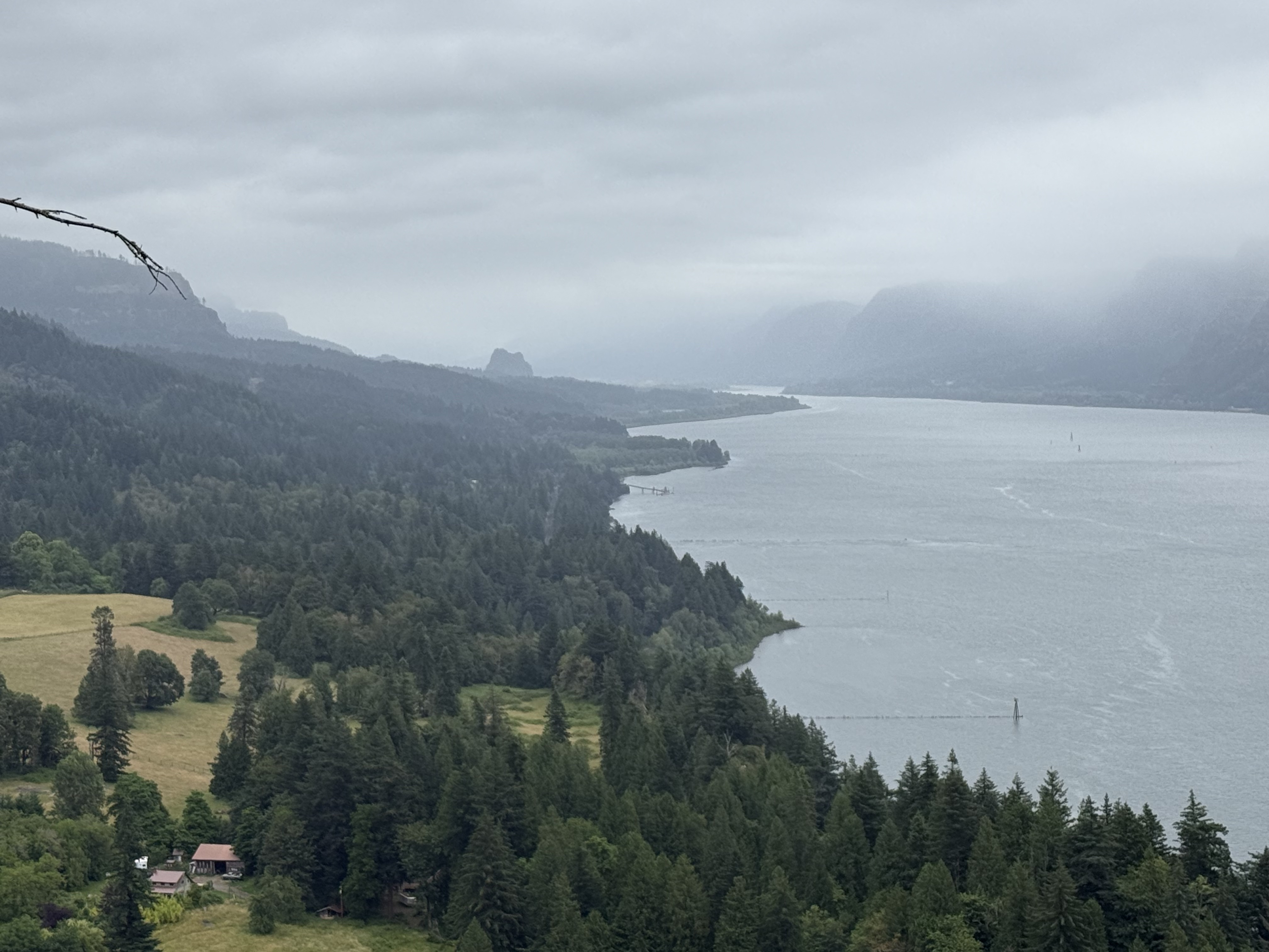
This photograph looks east towards Beacon Rock, which has an interesting origin. It was originally injected into a cinder cone volcano about 60 thousand years ago (Ka). Subsequent, multiple glacial floods eroded the loose material away, leaving the core, which is called a neck. This region was never covered by continental glaciers, although there is evidence of alpine glaciers like those still existing on the high volcanoes (e.g. Rainier or Hood). During numerous advances and retreats of continental glaciers into Canada, large lakes formed and periodically drained catastrophically. These floods, which were as deep as 1000 feet, naturally followed the Columbia River to the Pacific Ocean.
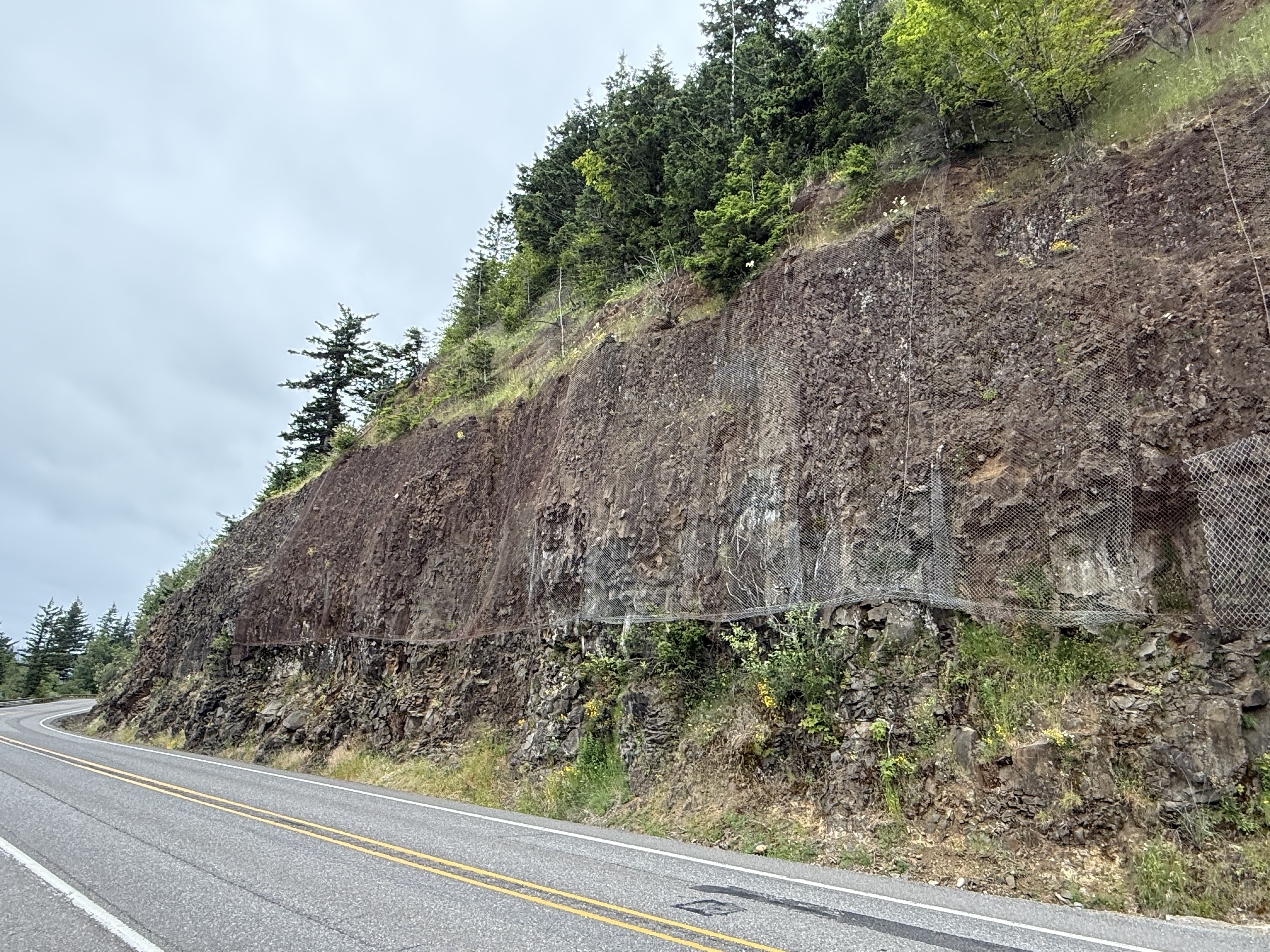
This low road cut reveals a thick layer of volcanic rock (basalt, according to Wikipedia) overlain by volcaniclastic rocks, which are loosely cemented. That’s why the DOT placed netting over the friable layer. These are sedimentary rocks consisting of volcanic ejecta as well as material transported by water.
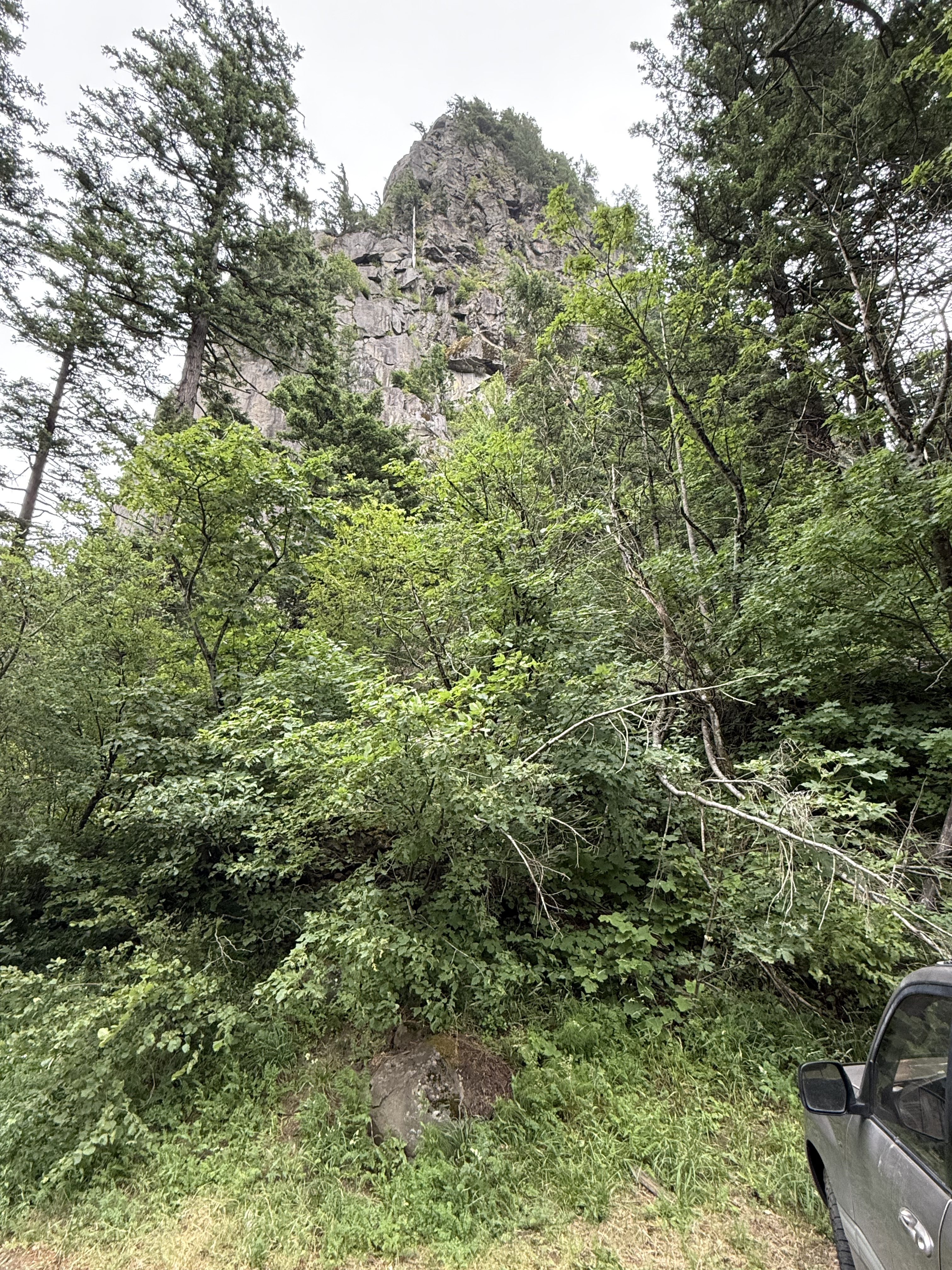
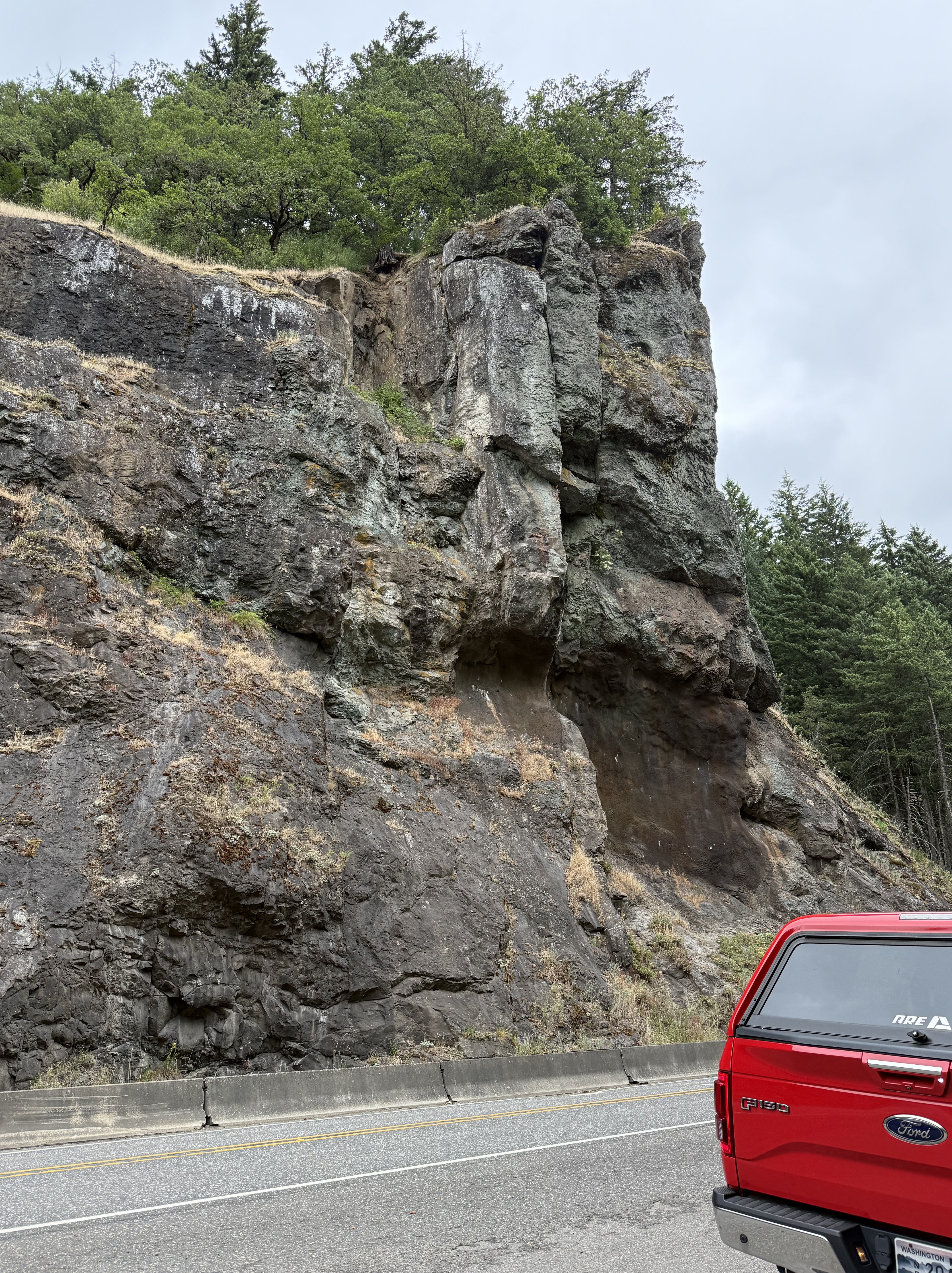
According to Wikipedia, Beacon Rock is 848 feet tall and there is a trail to the top that is popular with hikers. It doesn’t look that high from the bottom, but I’m glad I didn’t trust my first impression and climb it; as stubborn as I am, I would have made it–and wished I hadn’t for the next week. It looks a little pale to be basalt, including the boulder visible at the bottom of the image; in a terrain with continuous volcanism, spanning the gamut from rhyolite to basalt, for 50 Ma, you just can’t tell from surface features. Some basalt is a little lighter colored and some andesite is darker–it’s a spectrum based on mineralogy, not color.
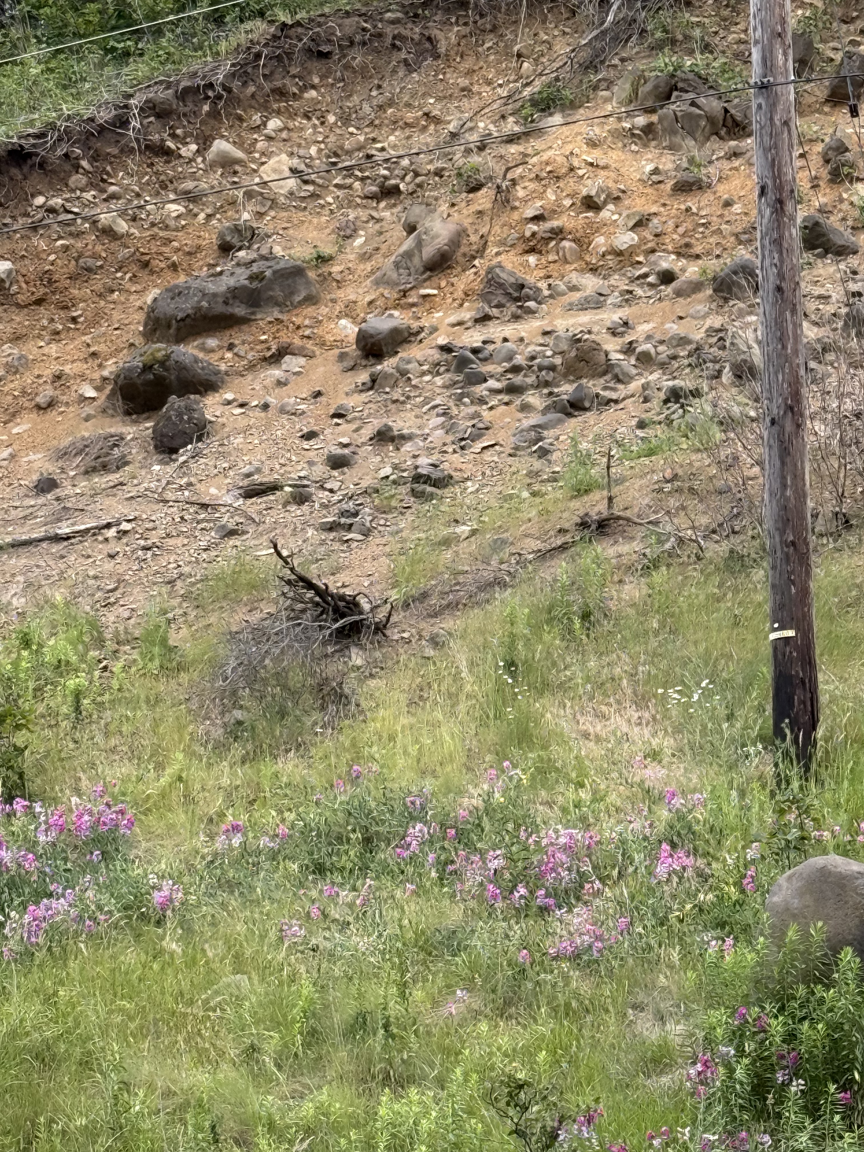
This eroded slope got my attention because it reveals an interesting juxtaposition of an exposed basalt outcrop that is rounded (unlike the earlier exposures we saw) and light-colored boulders of much smaller size (less than three feet). These rocks are too uniformly light in color to be weathering of basalt or andesite. There is some rhyolite (a leucocratic extrusive rock found within the Cascades) in the region, but an alternative explanation is that these are flood deposits from the aforementioned glacial lakes. There are many deposits from these mega floods within the gorge, but I couldn’t (easily) find a map of them. Anyway, this is what I would expect to find in such a sedimentary deposit–mixed rock types that are rounded by transport tens, if not hundreds, of miles during flooding episode. The bedrock would be rounded by collisions with these boulders. If the shoe fits…
2. Lake Bonneville
The central part of Columbia River Gorge is characterized by several broad valleys with sediments filling the margins of the canyon. This is a typical exposure from this area. The rock looks like basalt to me; the map (see first plate) shows a mingling of volcanic rocks along the river, which would have been a low point for lava to flow towards. However, this is not a volcaniclastic deposit as we saw before; instead, there are several, heavily weathered (i.e. smooth) flows of lava (3-10 feet thick). The lowest layer seems to be dipping towards the camera as if flowing down a steep slope. Maybe…
3. Hood River
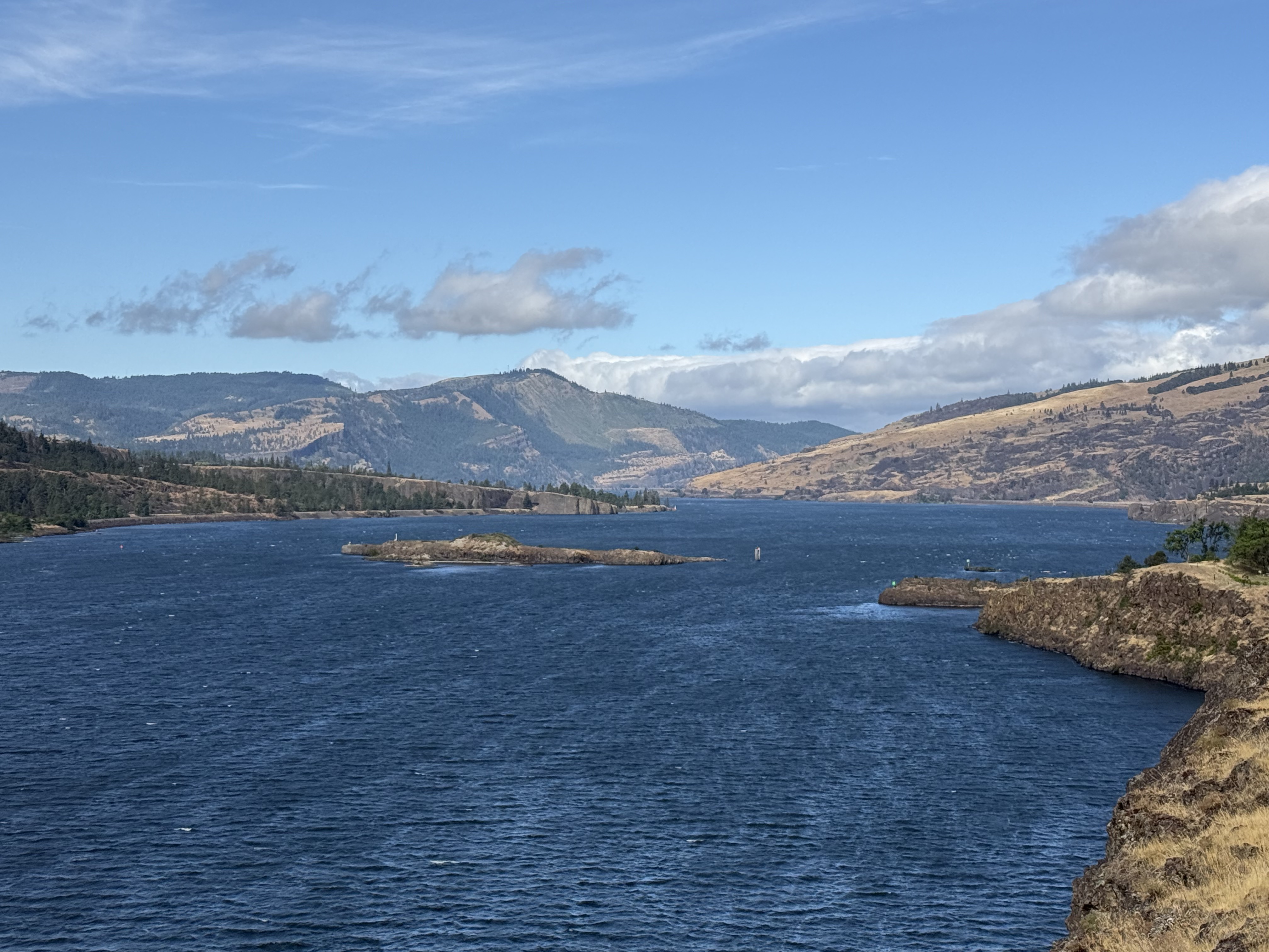
This location is close to the eastern entrance to Columbia River Gorge, where flood basalts erupted from multiple fissures in the crust. In other words, there are no nearby volcanoes and steep slopes; thus, the basalt flowed over a relatively flat landscape, forming rolling hills. This photo reveals basalt flows that gently slope to the left, as seen in the middle-right and background of the image. These massive flows partially blocked the river many times–long before glaciers dominated the landscape. The island in the center of the channel is a remnant of one. I haven’t heard of any glacial lakes in this area, however, so the blockage must have been partial–these thick sequences of basalt didn’t occur at one time, but over millions of years, giving the ancient Columbia River time to erode passages through them.
4. Columbia Hills
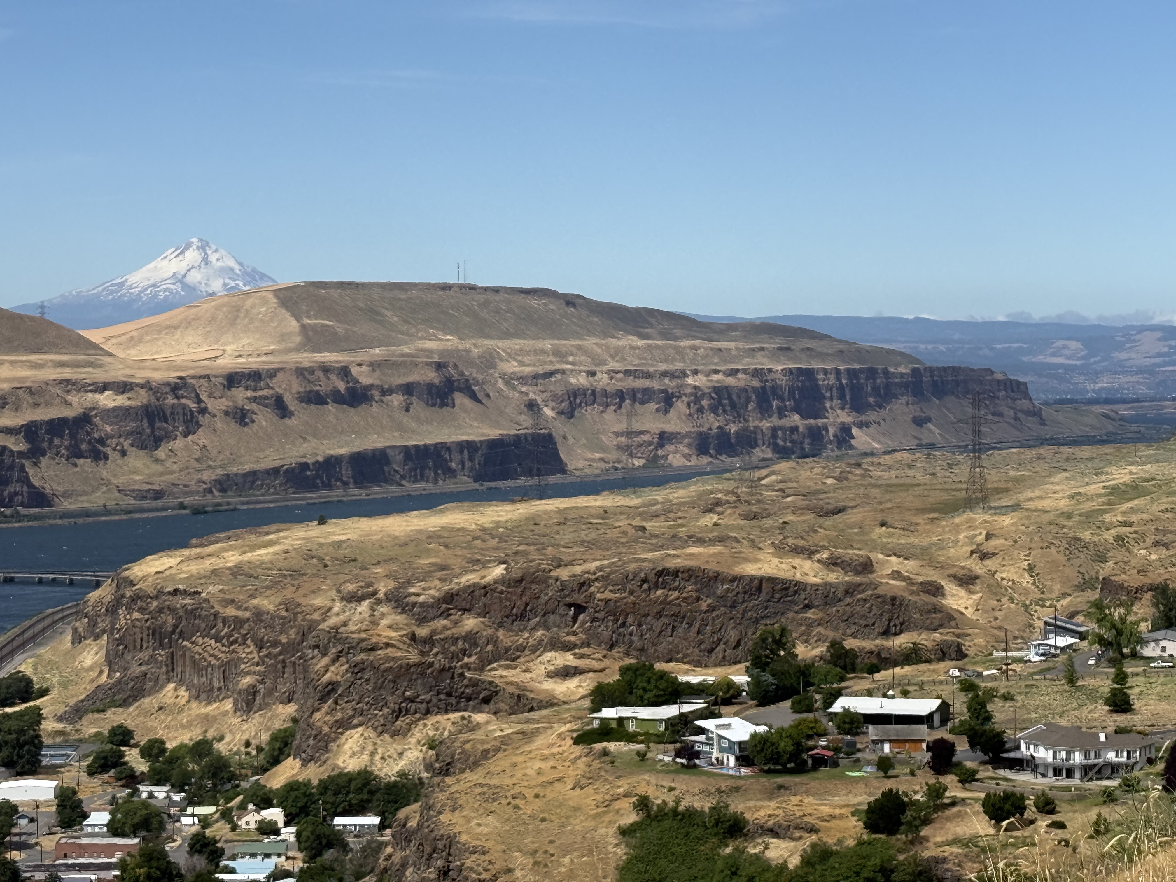
Columbia Hills is the eastern end of the gorge, where the Columbia River ends its meandering path to the Pacific. The rocks are basalts erupted from many fissures between 17 and 5 Ma. According to the latest interpretation, these rocks were ejected from the same mantle plume that now underlies the Yellowstone caldera in NW Wyoming. They have nothing to do with subduction or the Cascades volcanic belt, even though the much younger Mt. Hood (in the background) towers over them.
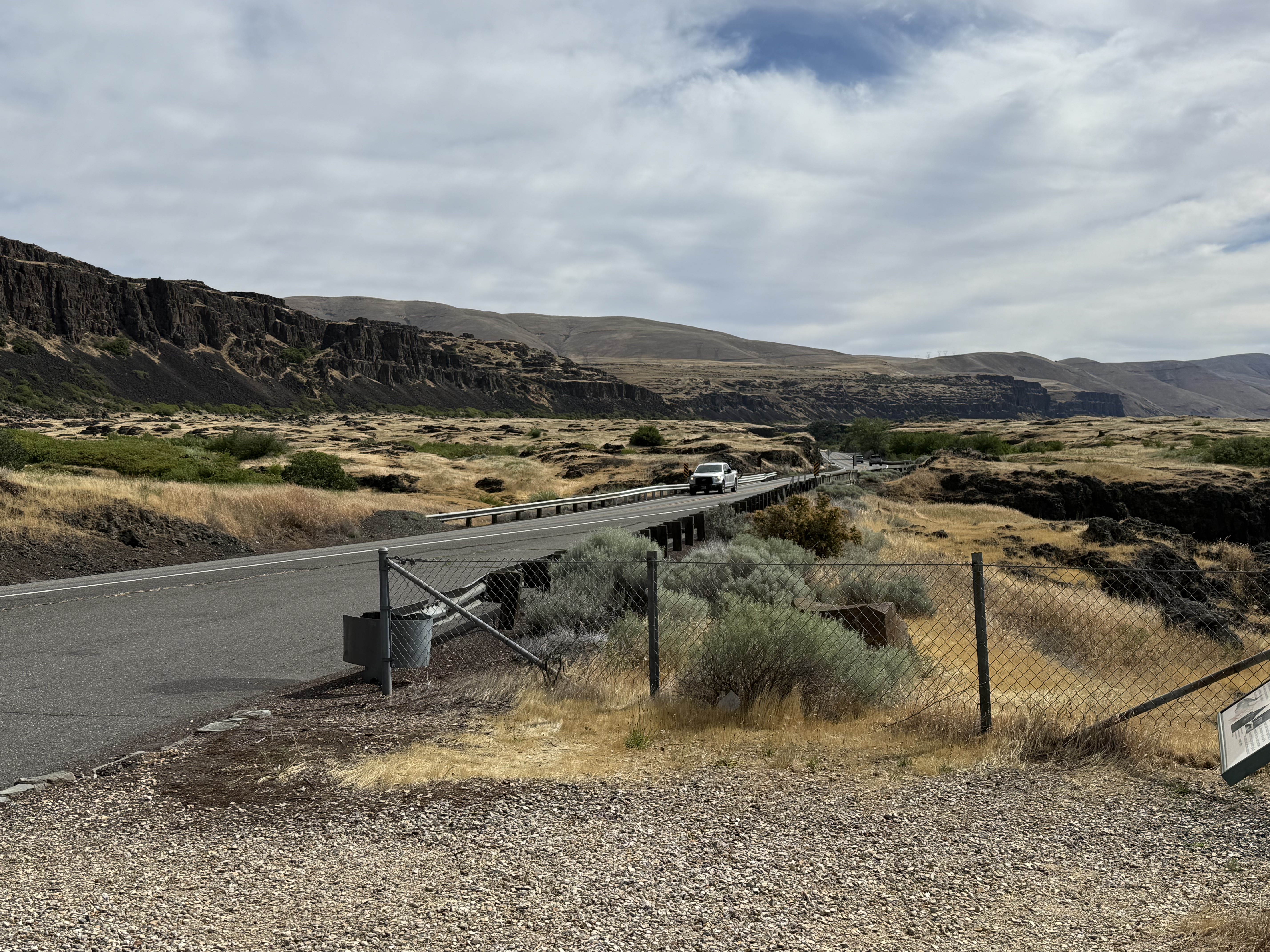
We are now in Eastern Washington, a climatic zone with completely different characteristics than west of the Cascades. This volcanic range creates a rain shadow and resulting precipitation is less than 20 inches here; and it shows in the scrubland ecosystem. These extensive basalt flows are no longer covered by younger andesites from the high Cascades (the young volcanoes like Mt. Hood).
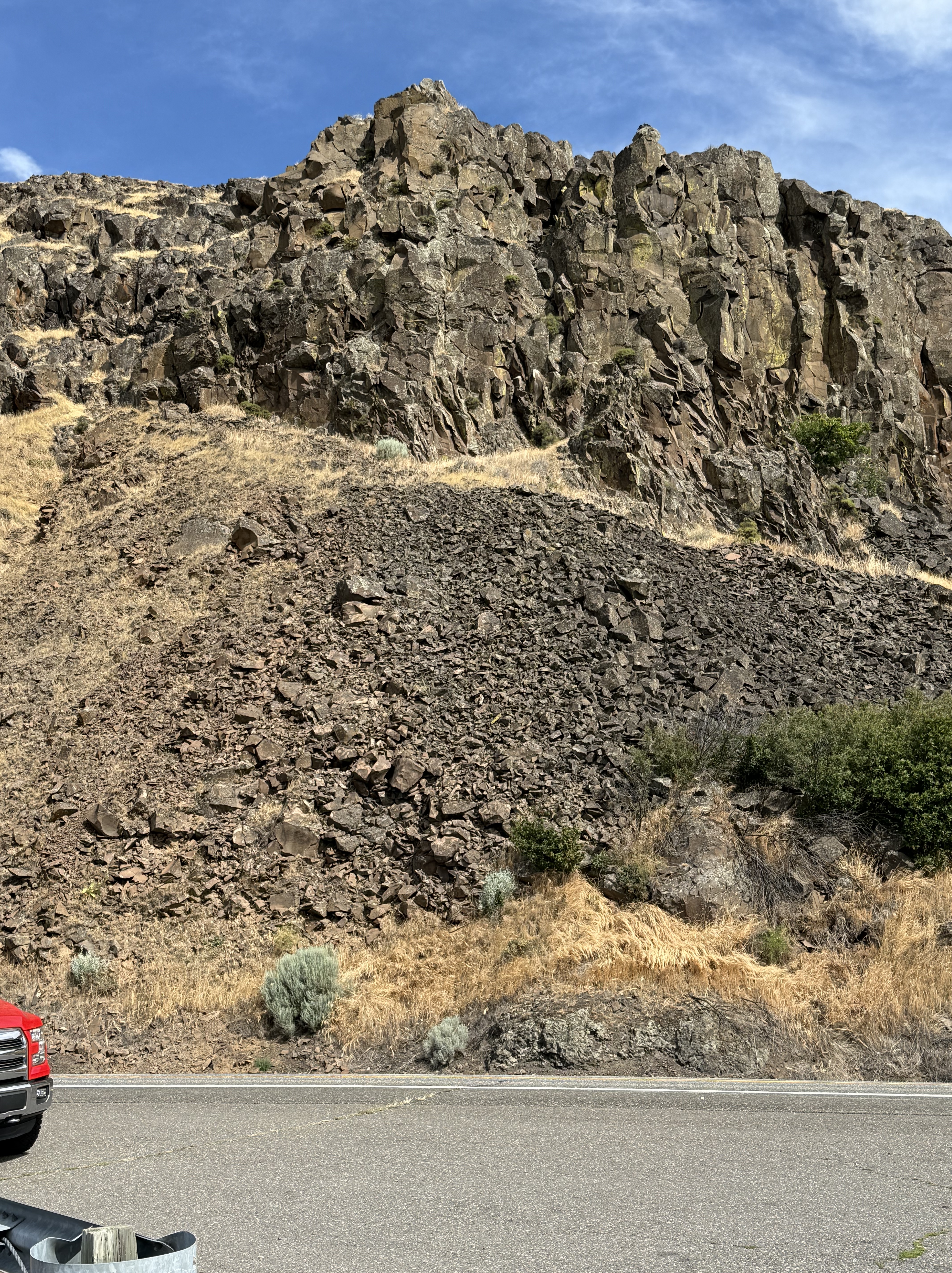
The volcanic layers are thin and extensive (see the map at the beginning of this post). They include columnar joints as I described in a previous post. The textures seen in this photo reveal the variability of lava coming from a single source; for example, individual, blocky layers cap this exposure whereas the rock presents a ropy texture lower down (middle-right of the photo).
Summary
The Pacific Northwest (PNW) didn’t exist before the Tertiary period, which began at 65.5 Ma. However, Pangea began to split apart at about 200 Ma, which should have created plate collisions here because the N American plate would have necessarily overrun the plates comprising the ancient Pacific Ocean. The west coast of N America was located approximately at the WA-ID boundary. So why don’t we see Jurassic and Cretaceous volcanoes and their associated volcanic deposits in the PNW?
This question has perplexed geologists for decades. After carefully collecting data from far and wide, a still-controversial theory has evolved: For more than 100 million years, this tectonic collision was accommodated by transform faults (e.g. the San Andreas fault system in California). A tectonic plate collision is not a conveyer belt as shown in schematic representations.
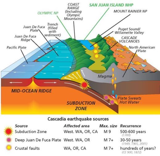
This schematic profile of the PNW shows several transform faults, which misalign the Pacific mid-ocean ridge (note the misalignment of the dark, Juan De Fuca Ridge. This tectonic scenario didn’t develop until those transform faults, which were not perpendicular to the mid-ocean ridge, could no longer accommodate the displacement of these microplates with N America. That apparently happened about sixty-million years ago. Some of these slivers of volcanic terrain have probably become exotic terranes that are now part of Alaska.
That is probably why we didn’t encounter any Mesozoic ((251-65.5 Ma) volcanic rocks within the Columbia River Gorge. Instead, we discovered a Tertiary volcanic landscape dominated by andesite/basalt lava flows, preserved because the transform faults had stopped absorbing the collisional, crustal tectonics. A real subduction zone emerged from this chaos and created the Cacades.
Superimposed on this was the unexpected (tectonically speaking) effusion of basalts as the westward-propagating N American plate rode over a mantle plume, which buried the evidence for this slipping history beneath miles of volcanic rocks. I can’t say anything else about this because I’m not actively researching the PNW’s geologic history.
My last word is that I can’t wait to see what new discoveries the PNW holds for me.

Recent Comments