
Jurassic Diabase Exposed by Drought!

Plate 1. View looking south from the northern end of Beaver Dam reservoir, which serves as a secondary water reserve for Loudon County, Virginia. According to signs posted around the shore, it was drained for maintenance. This photo shows an outcrop of Jurassic diabase that is unusually leucocratic (light colored minerals).

Plate 2. Geologic map of the area around Beaver Dam Reservoir. The outcrop seen in Plate 1 is a high-titanium, quartz-normative tholeiitic diabase, which occurs in dikes and differentiated sheets throughout the map area labeled as Jdh on the map (Jurassic age). The high titanium content and available quartz indicate that this intrusive rock originated within a larger magma chamber (deeper within the crust) and multiple intrusions were emplaced over a period of time as the chemistry evolved. Tholeiitic magma is associated with mid-ocean ridges, which indicates a mantle source rather than melted crustal rocks. A different diabase (Jdg on the map) is younger and was injected into the pre-existing diabase (Jdg) as granophyre, an intrusive rock that indicates a highly evolved magma chamber. These intrusive rocks were injected along bedding planes, faults, and fractures within the Jurassic-Triassic Bull Run Siltstone (JTrtm on the map). Two other Jurassic diabase units (Jdl and Jd) are indicated by circled areas where they cut across Triassic sedimentary rocks (lower area where Jd cuts JTrtm) and Jurassic diabase (upper circled area where Jdl cuts Jdh).

Plate 3. View of the reservoir showing the man-made shoreline and boulders scattered on a sandy-muddy substrate. The title of this post is intended as geological humor disguised as a newspaper headline. I wondered why the reservoir was so low.

Plate 4. This image (approximately 2 feet across) reveals a medium-sized crystalline texture and color similar to granite, which was the initial field identification. An important difference between these rocks and granite is the lower quartz and alkali feldspar content, which isn’t visible in this exposure. Note at least one set of joints, indicated by the weathered “X” rotated slightly to the left, in the center of the photo; then let your eye go down a little and you will notice another X, this time rotated to the right. This second X is repeated throughout the exposure. This type of joint is associated with fracturing of the rock as it cools and pressure is reduced because of erosion of overlying rocks. The suggestion of multiple patterns (I admit it isn’t that obvious) implies several steps in cooling; however, interpreting joints is complex, requiring many detailed measurements, and beyond this post. I just wanted to mention it because joints tell us about the geologic history of a rock after its formation, millions of years later.
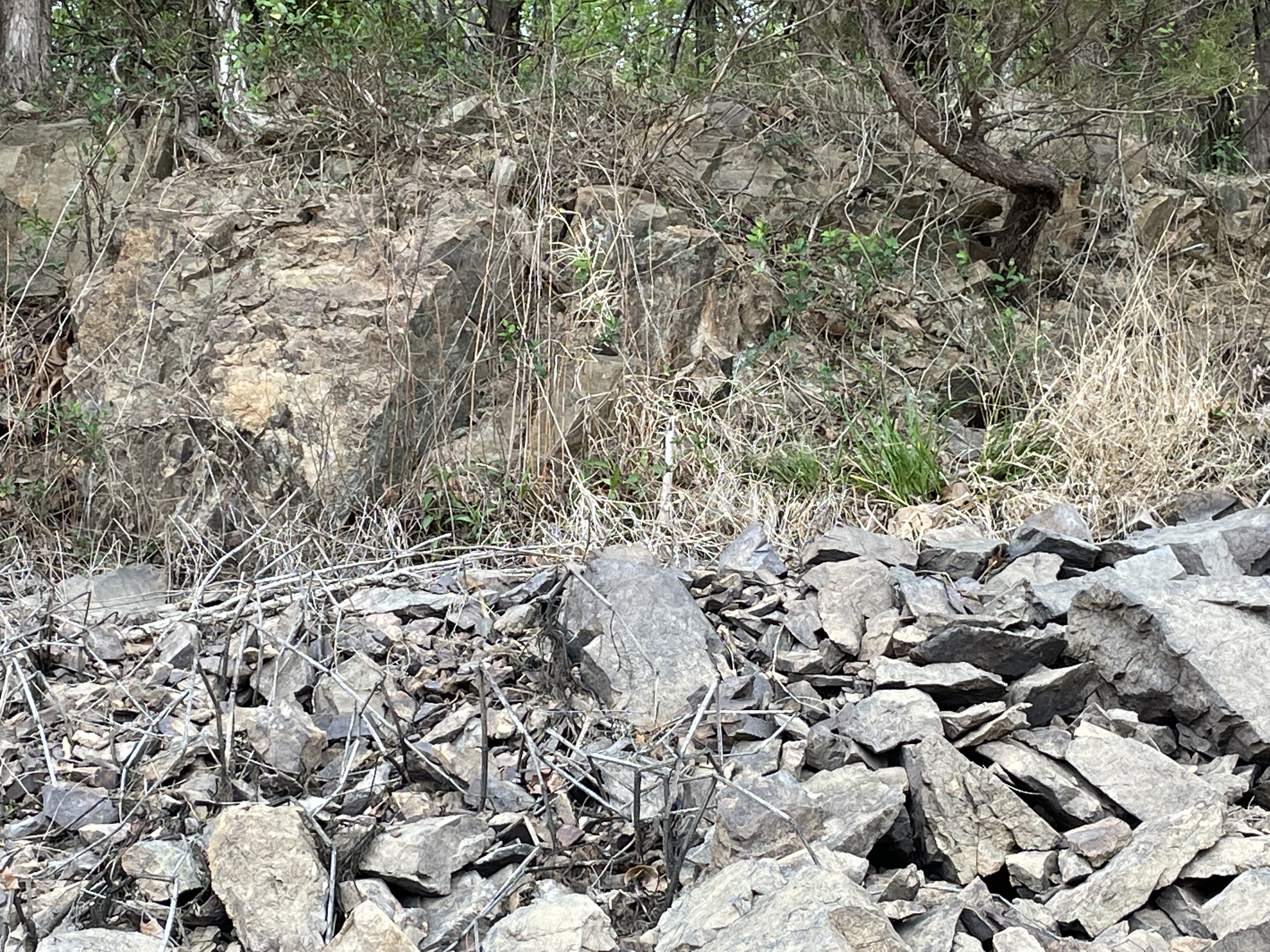
Plate 5. This photo shows a large outcrop at the high-water mark of the reservoir. Note the angular structure of the outcrop (lighter rock at the upper left of the image) and the pieces broken off during construction of the reservoir.
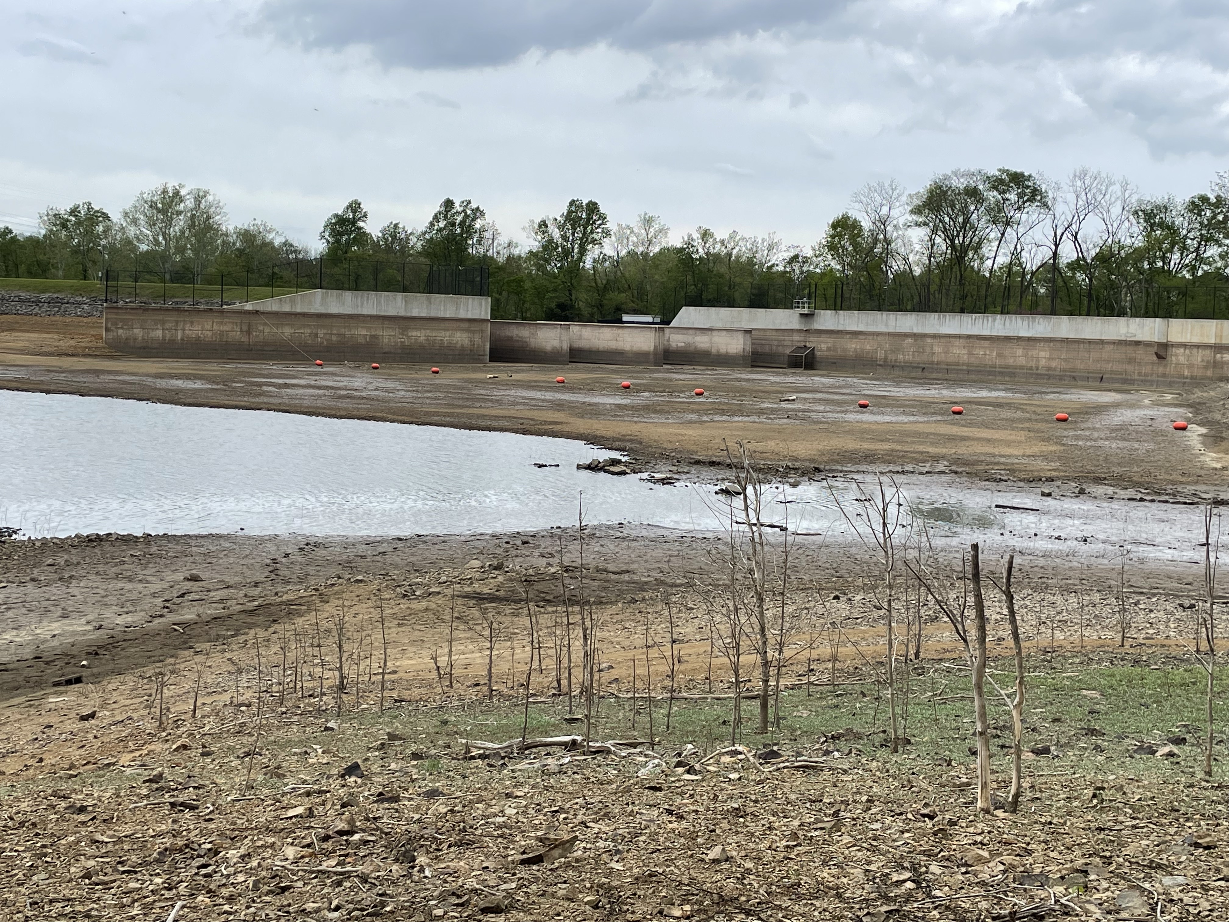
Plate 6. View looking north towards the outflow gate of Beaver Dam reservoir, showing the weirs and maximum water level (about fifteen feet above present level). The low water level suggests that evaporation and ground-seepage (not much with the subsurface comprising diabase) exceed local run-off. This is the reason for the post title. Rainfall has been low enough that the water level keeps dropping, even after the reservoir was emptied. Is it a drought?
The last post reported a generic Jurassic diabase (Jd) west of the Bull Run fault (BRF), less than 10 miles NNW of Beaver Dam reservoir, which was intruded into Precambrian sediments. However, Jd also occurs as small intrusions throughout Loudon County (not shown). In other words, it wasn’t emplaced as sills or sheets, but rather filled fault and other fractures in older rocks. Using general principles of stratigraphy (e.g. Steno’s Laws), we can speculate about what we’ve seen in these two recent field trips.
The unspecified Jurassic diabase dike we saw at Morven Park (Jd in Plate 1 of the last post) cuts through Proterozoic sediments but wasn’t seen east of Bull Run fault in that area. The younger (Triassic) sedimentary rocks in the area of Beaver Dam reservoir (JTrtm in Plate 2), as well as Jurassic intrusive rocks (e.g. Jdh on Plate 2) are cut by dikes of diabase (Jd and Jdl, circled areas in Plate 2) that suggest the continuous chemical fractionation of a magma chamber, which produced smaller amounts of magma that had less space to fill.
I propose that magma with a composition like most of the world’s ocean floor formed (tholeiitic basalt, or Mid-Ocean-Ridge Basalt–MORB) beneath the oldest rocks in the area (more than 500 million years old) when Pangea was stretched by upper mantle convection during the early Jurassic (about 200 million years ago), sending tentacles of molten rock to fill every weak point in the overlying rock, sheets and dikes were created, possibly even laccoliths, between layers of sediments. This stage created the large area of diabase in the study area (Jdh in Plate 2). As the magma chamber lost material and cooled, it injected smaller volumes of magma into even smaller fissures and weak points in the overlying rock, including earlier diabase. These late-stage injections are seen as dikes of Jd and Jdl in Plate 2.
Finally, the crust throughout this area stretched to the breaking point and Bull Run fault formed, with the east side sliding downward and to the east. All of the Paleozoic and Mesozoic rocks on the west side of Bull run fault, including diabase sills and dikes, were eroded by wind, water, and ice, leaving only the final, highly fractionated late-stage magmatic dikes (e.g. the granophyre of Plate 2) protruding out of the Precambrian sediments. The deep source of all of these diabase plutonic rocks remains buried deep beneath western Loudon County.
Finally … the only Jurassic diabase I found on the USGS geologic map of Loudon County occurs as thin exposures parallel to Bull Run fault and within a mile of it, which suggests that BRF defines the western limit of the fault zone associated with the break-up of Pangea.
That’s my story and I’m sticking to it …

Trackbacks / Pingbacks