
The White Tank Mountains: Anatomy of a Metamorphic Core Complex
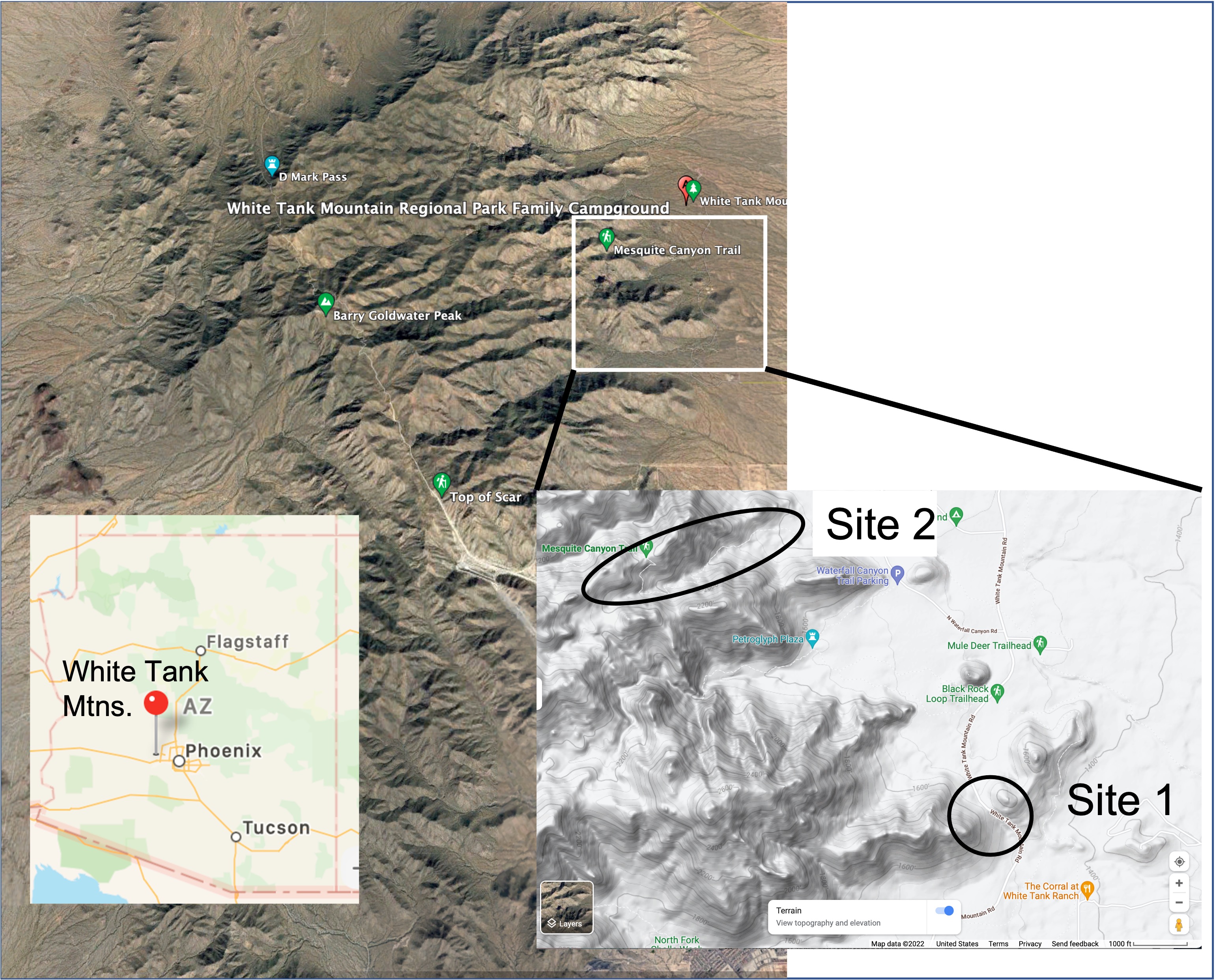
My last post set the stage for this report, but this time I did a lot of walking to get the facts. A short drive took me to White Tank Mountain Regional Park, about 30 miles west of Phoenix. I studied geology at Arizona State University in Tempe…it must have been 40 years ago, and Metamorphic Core Complexes (MCC) were a big thing then. Let’s start with a map (actually several maps that focus ever closer on the field area).
Now for a view from the ground.
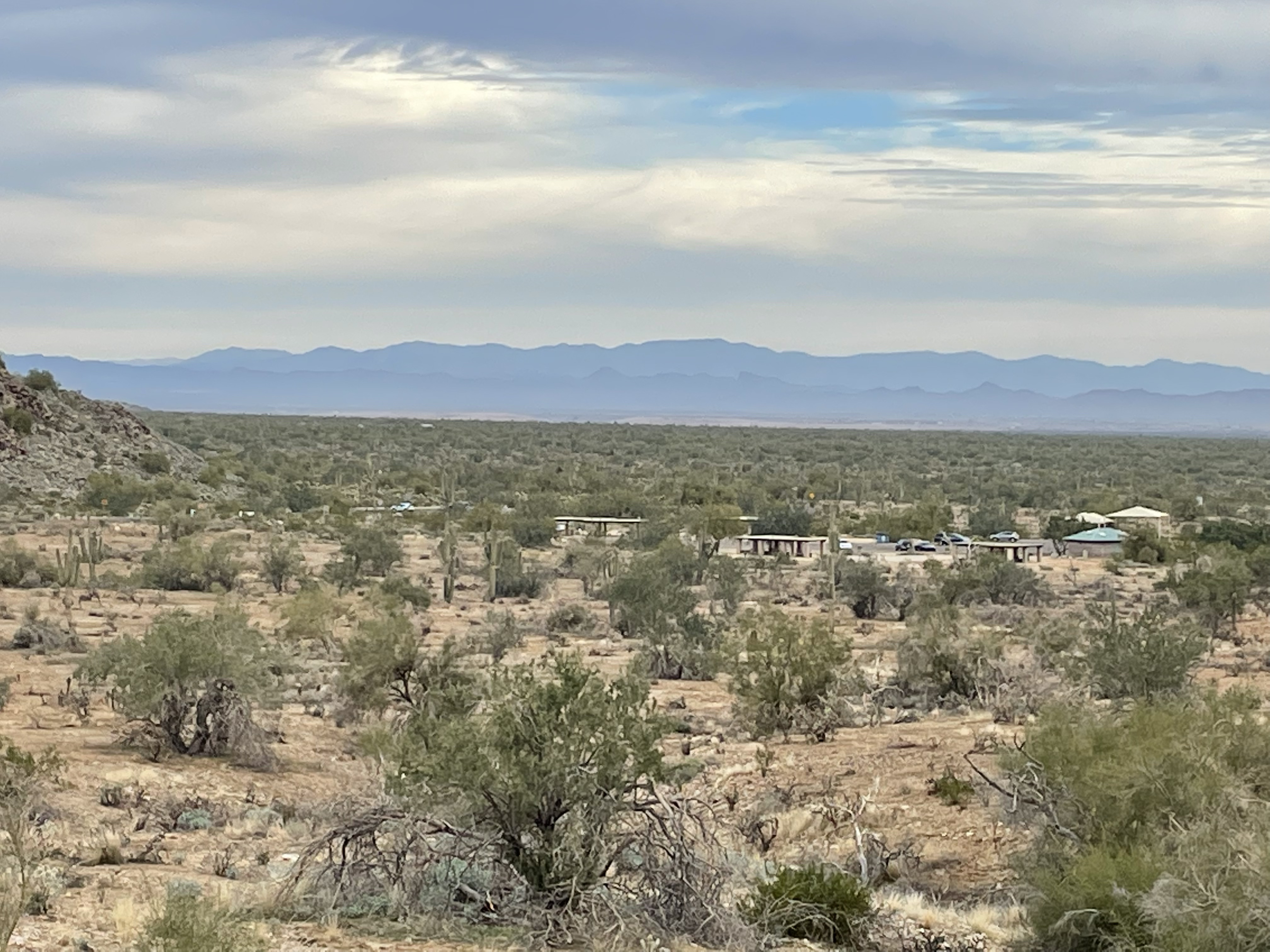
Site 1.
The White Tank MCC is located within the Basin and Range Province. In the middle of a low-lying flat desert, MCCs appeared within the last 60 my, in close proximity to a region defined by faulting and the uplift of Precambrian rocks on a huge scale. Time to look at some rocks.

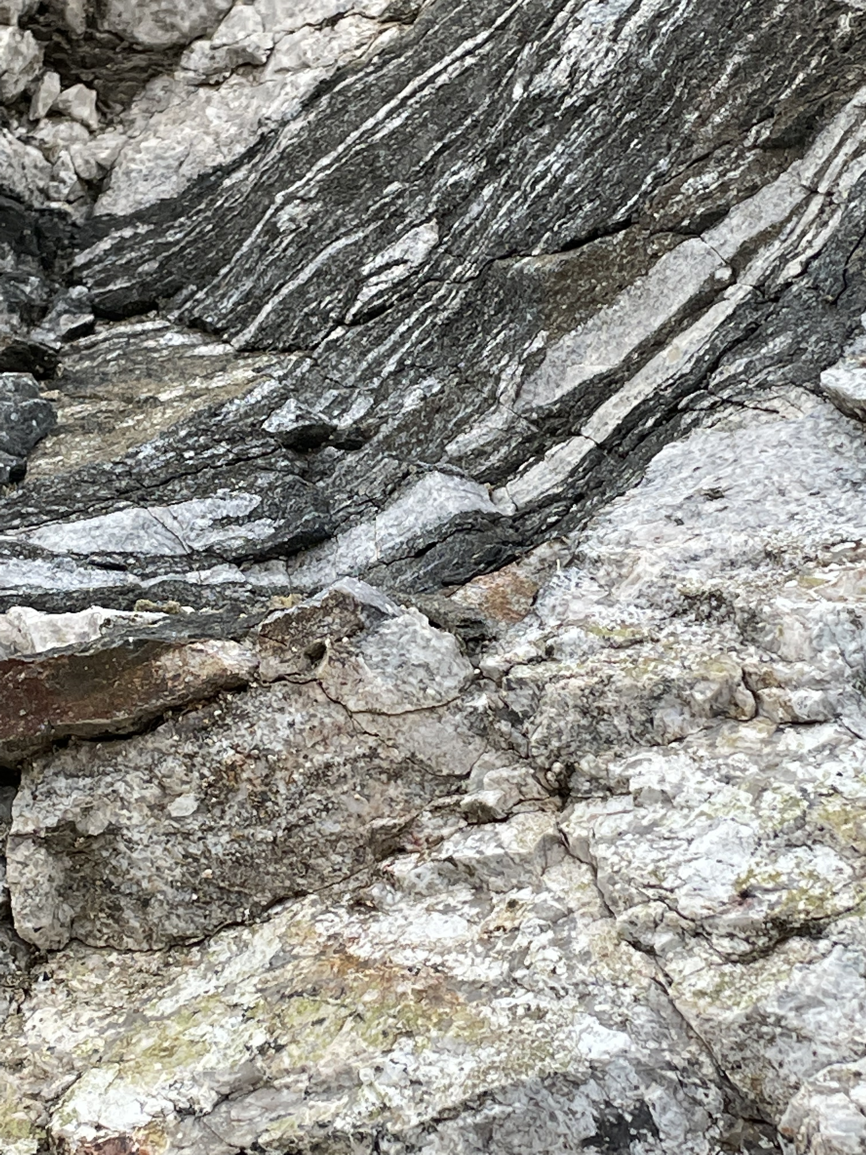
Figure 3 reveals a complex pattern of deformation and magmatism. The most striking feature of this outcrop is the brilliant white veins that cut across the dark rocks, and folded in a crazy pattern on the right side. What is going on here?
The background is that the dark rocks are Precambrian metamorphic rocks and granites. As I discussed before, these rocks were deformed several times during the billion years spanning the resetting of their radiometric clocks and the tectonics associated with the uplift of the Colorado Plateau. The lighter-colored rocks are of Cretaceous age, injected as veins into preexisting weak fracture zones.


SIte 2.
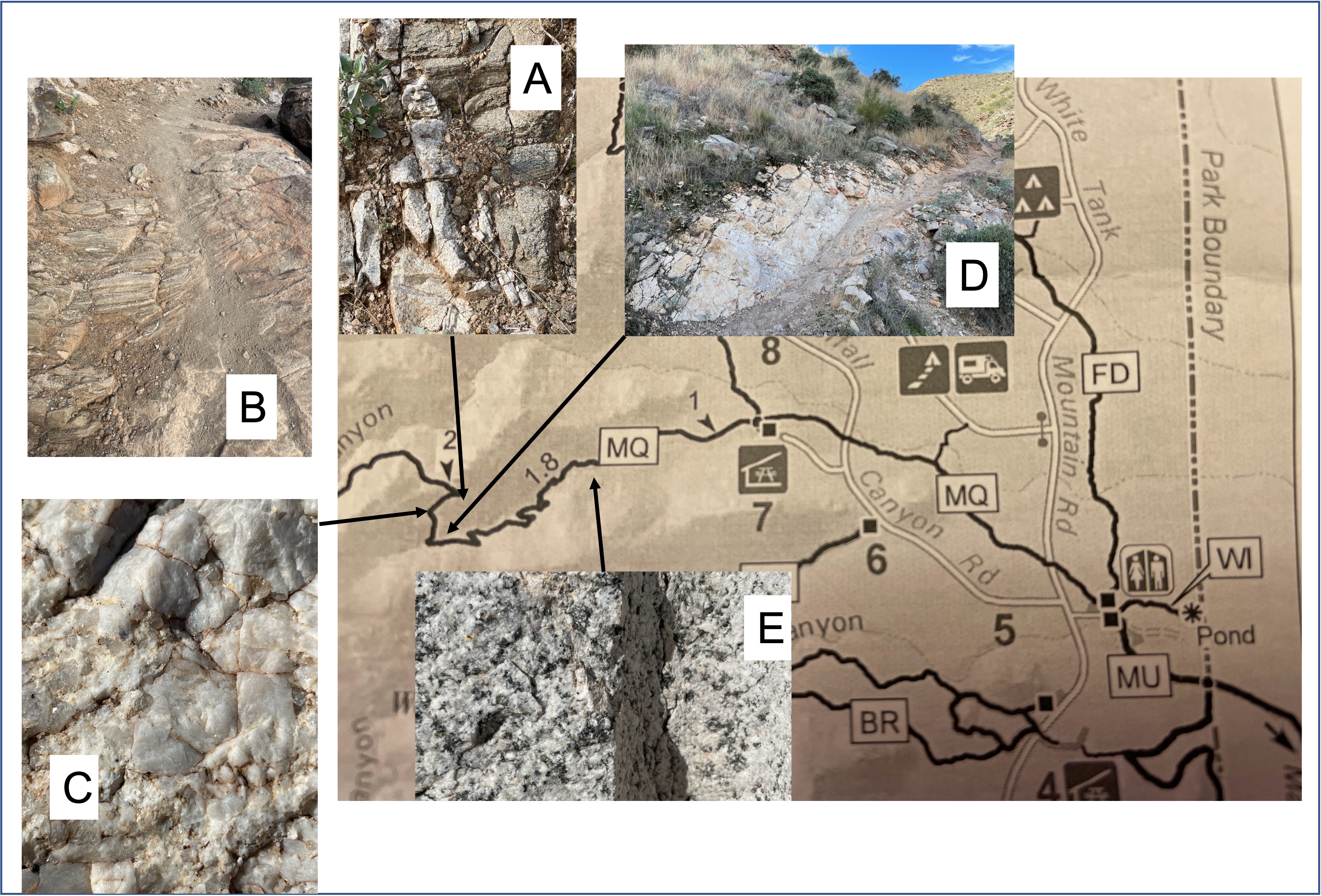
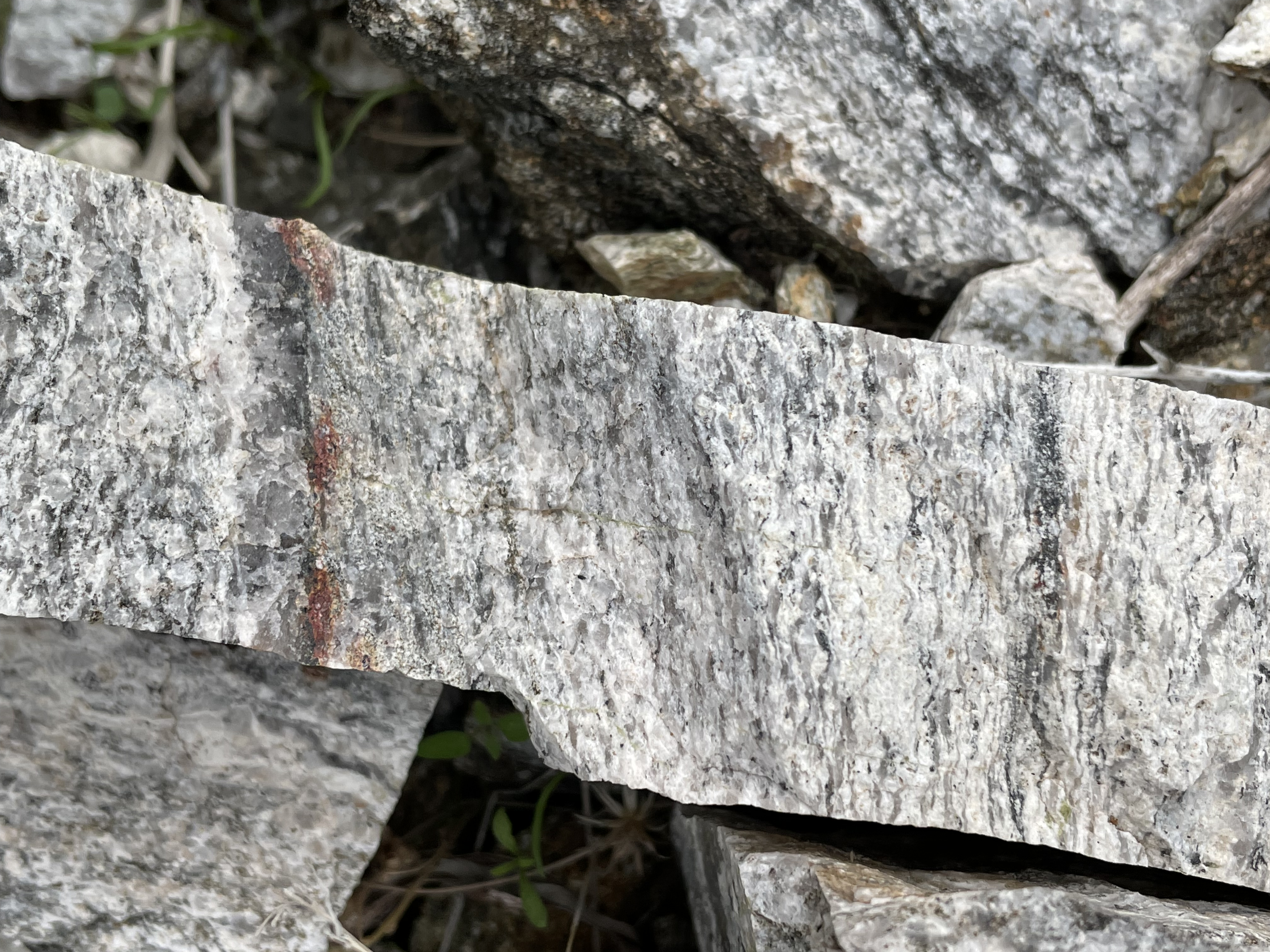
Figure 10 reveals some of the field textures seen along the trail, starting at the uphill end, where medium and small blocks litter the landscape as the granite weathers in place (Fig. 11). Panel A (Fig. 10) shows a sharp contact between the main granite and a whiter material with microcrystalline structure similar to what we saw at Site 1 (Fig. 3). As the magma was intruded, the melt was fractionating into a component with a lower melting temperature and so it filled fractures, which indicates there was tectonic movement at that time. Panel B is evidence of syntectonic intrusion because it shows a lineation that was present in many of the rocks. Panel C is a close up (5x magnification) showing larger crystals in a finer matrix. All of it is feldspar (dominated by Na also known as albite). Panel D is a good exposure of the relationship between the finer grained material that forms veins in the main rock. Panel E shows a salt-and-pepper texture that dominates the rocks along the trail.

A close up of a fresh surface near Sample D (see Fig. 10 for location) shows simple mineralogy of the main rock body (Fig. 12). I would estimate 70-80% albite, >15% quartz, and minor biotite (a platy mineral, a variety of mica).

The mineralogical composition can be used to classify this granite as tonalite. Tonalite is a granite that contains no potassium feldspar (no pink color), very little quartz, and mostly feldspar containing sodium and calcium. These rocks originate deep in the earth where ocean crust (basalt) melts and rises, losing much of the iron and magnesium it originally contained. The tectonic setting is an island arc, like Japan.

Summary
Just as in the Central Highlands, sediments were deposited here in ocean basins as long ago as 2.8 by and subsequently buried and deformed, changing through heat and pressure into gniess, and injected with veins of quartz and feldspar during metamorphism. Several orogenic events followed, deforming the assemblage further. It was exhumed slowly over the ensuing billion years, and eventually injected with a tonalite granite created deep beneath an island arc. This was the time when the White Tank granite was emplaced. This magma was intruded when the region was undergoing extensional stress (pulling apart) as part of the adjustment to complex tectonic process associated with uplift of the Colorado Plateau.
Rather than breaking into irregular blocks as in the Central Highlands, the White Tank mountains (and other MCCs in the western Cordillera), were formed by the uplift of Precambrian basement along deep sub-horizontal surfaces called detachment faults. In other words, the crust stretched in the Basin and Range rather than breaking into fragments.
I haven’t attempted to describe the complex tectonics of central Arizona, a task that is well beyond my experience. This is a topic that is hotly debated in the geological community to this day. This has only been a brief effort to relate the rocks I saw with my own eyes to what is known about the history of the earth.
Always listen to the rocks…

Trackbacks / Pingbacks