
Road Trip: The Central Highlands of Arizona. Precambrian Rocks Torn Asunder.
To keep this post from going off the rails and becoming a treatise on metamorphic textures and their relationship to regional tectonic trends, I’m going to address the bullet list I ended the last post with. I hoped to find the following rocks, from youngest to oldest:
- Quaternary gravel
- Quaternary and Tertiary lava flows
- Tertiary stream deposits of sand, silt and gravel with rounded pebbles
- Tertiary lake sediments of horizontal, whitish, fine-grained rock with layers of volcanic ash
- Precambrian granite
- Precambrian gneiss and schist
The descriptions in The Roadside Geology of Arizona include unique features, from outcrop to hand sample scales. By the way, the “Roadside Geology” series books (available for many U.S. states) include introductory sections for the layman, and a level of detail that will increase anyone’s appreciation of the natural world, whether driving cross-country or on a daily excursion.
I’m going to dispense with my usual lengthy introduction. For the first figure, which becomes the de facto icon for the post, I’m going to skip maps and cut to the chase. I was driving north from Phoenix on Interstate 17, scoping for interesting exposures, checking the mileposts, and trying to remember several outstanding stops from the previous night’s reading. Frustrated at having passed the exit for Crown King, the ramp and interchange (beneath the I-17 roadbed) magnificently adorned by a long road cut that displayed interlayered dark and lighter colored rocks (Fig. 1), berating myself for not taking the path less traveled, I searched for the on-ramp and, when it came into view, I hit the brakes hard and cut onto the last fragment of the slip road. Traffic on the ramp was nonexistent and, with no unmarked Arizona Highway Patrol vehicles within sight, I backed several hundred yards while avoiding the drainage ditch and concrete barricade.
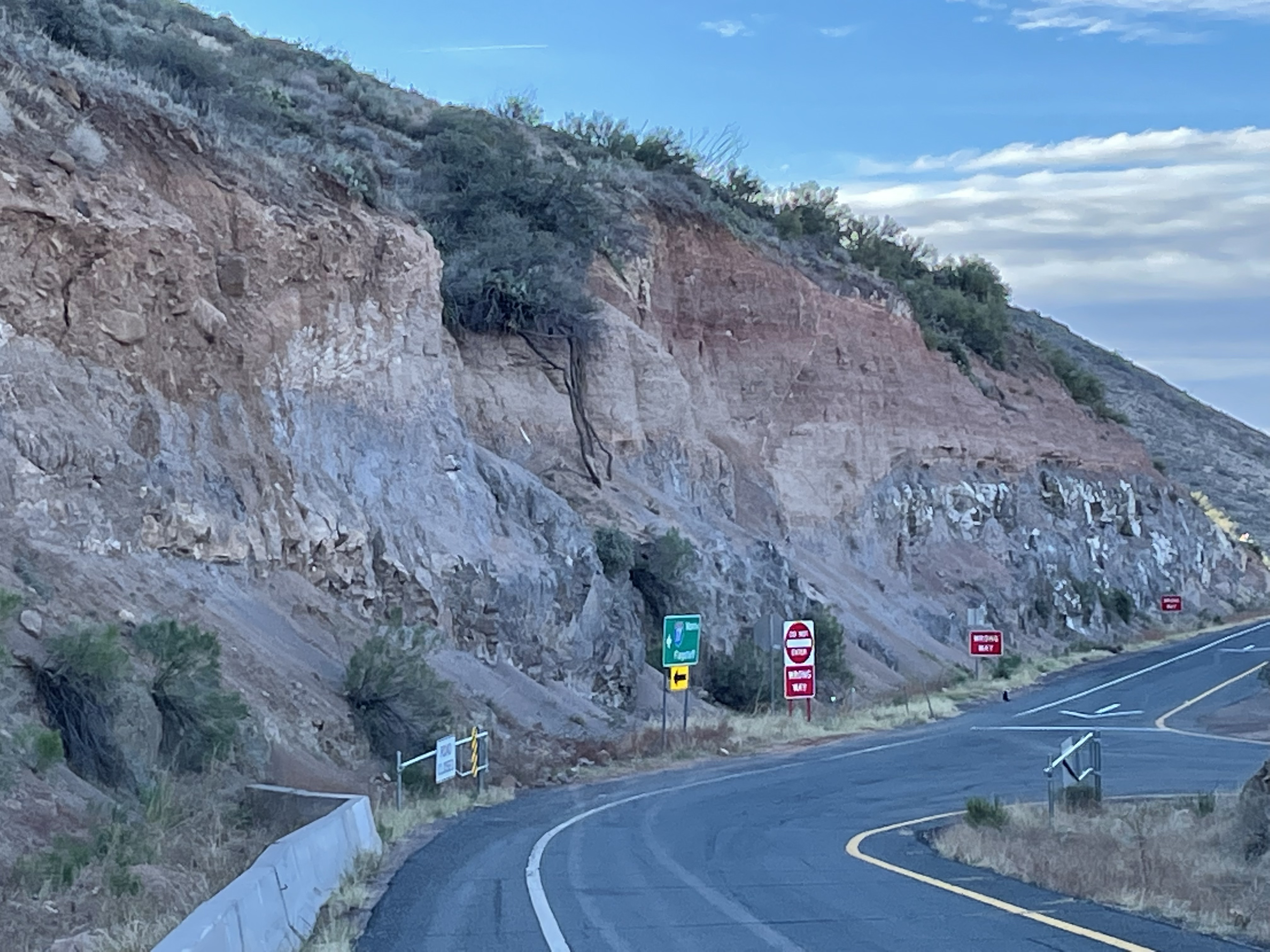
All I’m going to say about Fig. 1 right now is that this was the exposure that prompted me to drive — shall I say “recklessly?” But it is only the tip of the iceberg in the Central Highlands.
This post isn’t a typical report. Instead of a trip log, I’m going to show examples of the six rock-types from my list. I took a lot of photos but I will try (really hard) to limit the interpretation to a concluding paragraph.
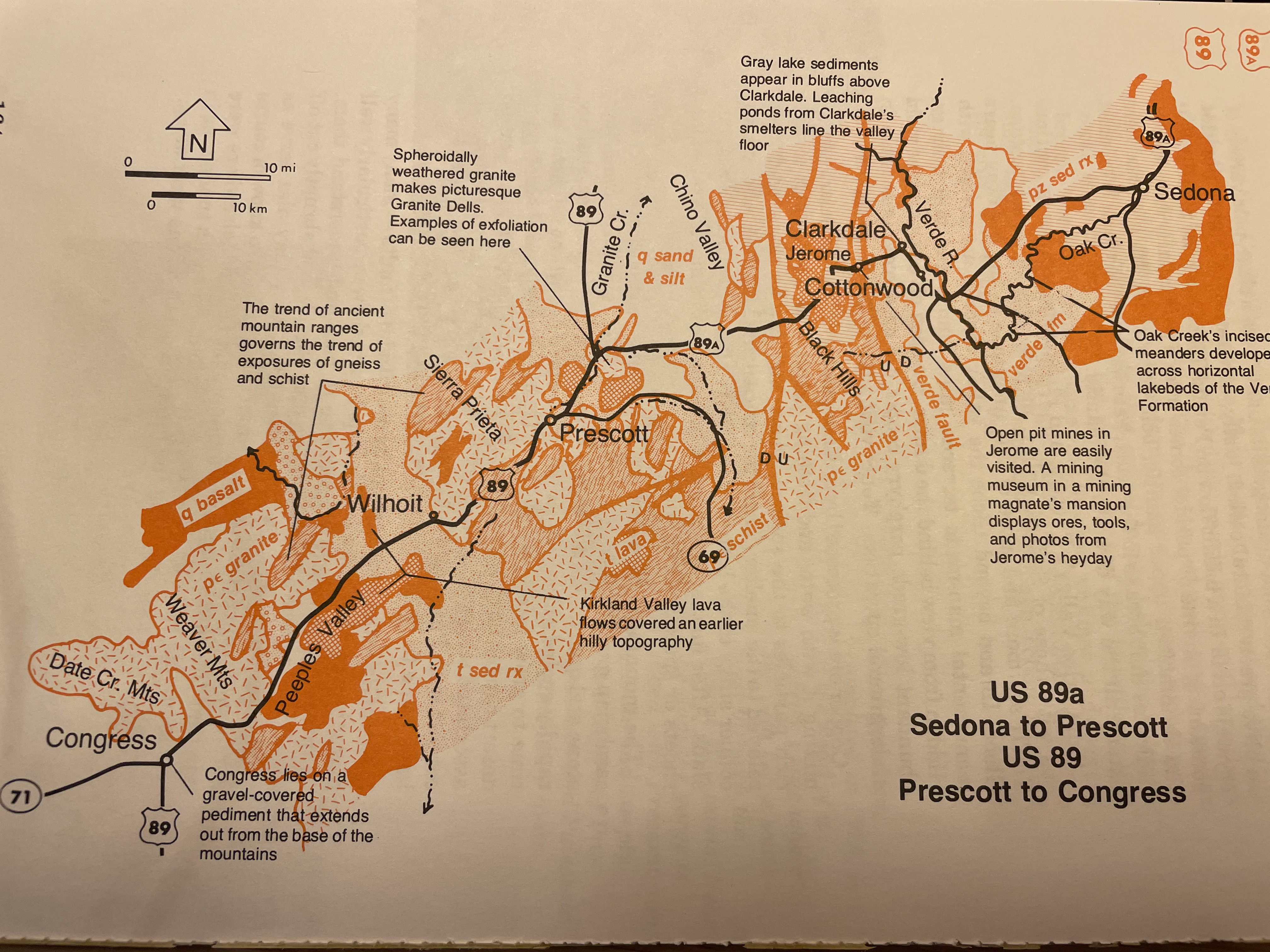
The block faulted mountain ranges of the Basin and Range province, accompanied by Metamorphic Core Complexes like South Mountain or the White Tank Mountains, bounding Phoenix, Arizona, on the south and west, respectively, suggest extensional forces at play. The Colorado Plateau, on the other hand, reveals no significant evidence of either crustal extension or shortening, instead comprising relatively undeformed Paleozoic sedimentary rocks that appear to have been exhumed vertically. The earth’s crust had to accommodate not only 6000 feet of differential uplift, but a change in tectonic regime, within the distance from Phoenix to Prescott in the last 80 million years, creating the Central Highlands.
Quaternary Gravel
The Quaternary Period spans the last 2.58 my. It is identified with the most recent occurrence of extensive continental ice sheets.
Dating sediments deposited during the Quaternary is extremely difficult because of a scarcity of suitable material for radiometric dating of the time of deposition. Thus, stratigraphic relationships are used, along with sedimentary textures, to determine the relative age of sedimentary rocks. For example, Lithology (1), Quaternary gravel, contains very little organic debris for carbon-14 dating; Lithology (3), on the other hand, may occasionally contain some plant fragments in the finer-grained components; but carbon-14 dating can’t be used for rocks older than 500 ky (thousand years).
Gravel was present everywhere, filling topographic lows and even forming cliffs. Often, these sediments were found in thick intercalated beds of silt and gravel, but sometimes cross-cutting relationships reveal erosion of older sediments before infilling (Fig. 2).
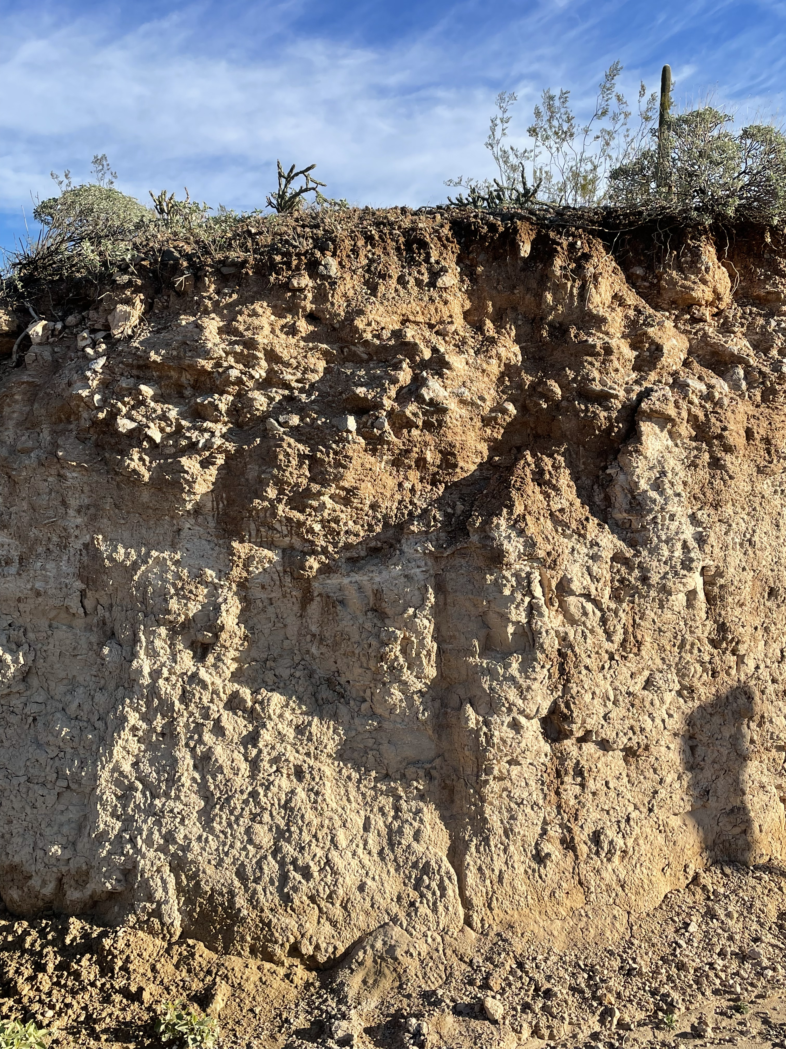
The darker gravel in Fig 2 fills a channel in the finer, buff-colored silt. The difference in lithology, and presence of an erosion surface, suggest that the upper unit is representative of the Quaternary gravels of Lithology (1). The underlying rock is a siltstone representing the Tertiary (66-2.58 my) stream deposits of Lithology (3).
Quaternary and Tertiary Lava Flows
Several volcanic complexes were active during the last 66 my in the Central Highlands. The lava sometimes flowed from fissures and often from central cones. Their remnants can be seen in the arid landscape.
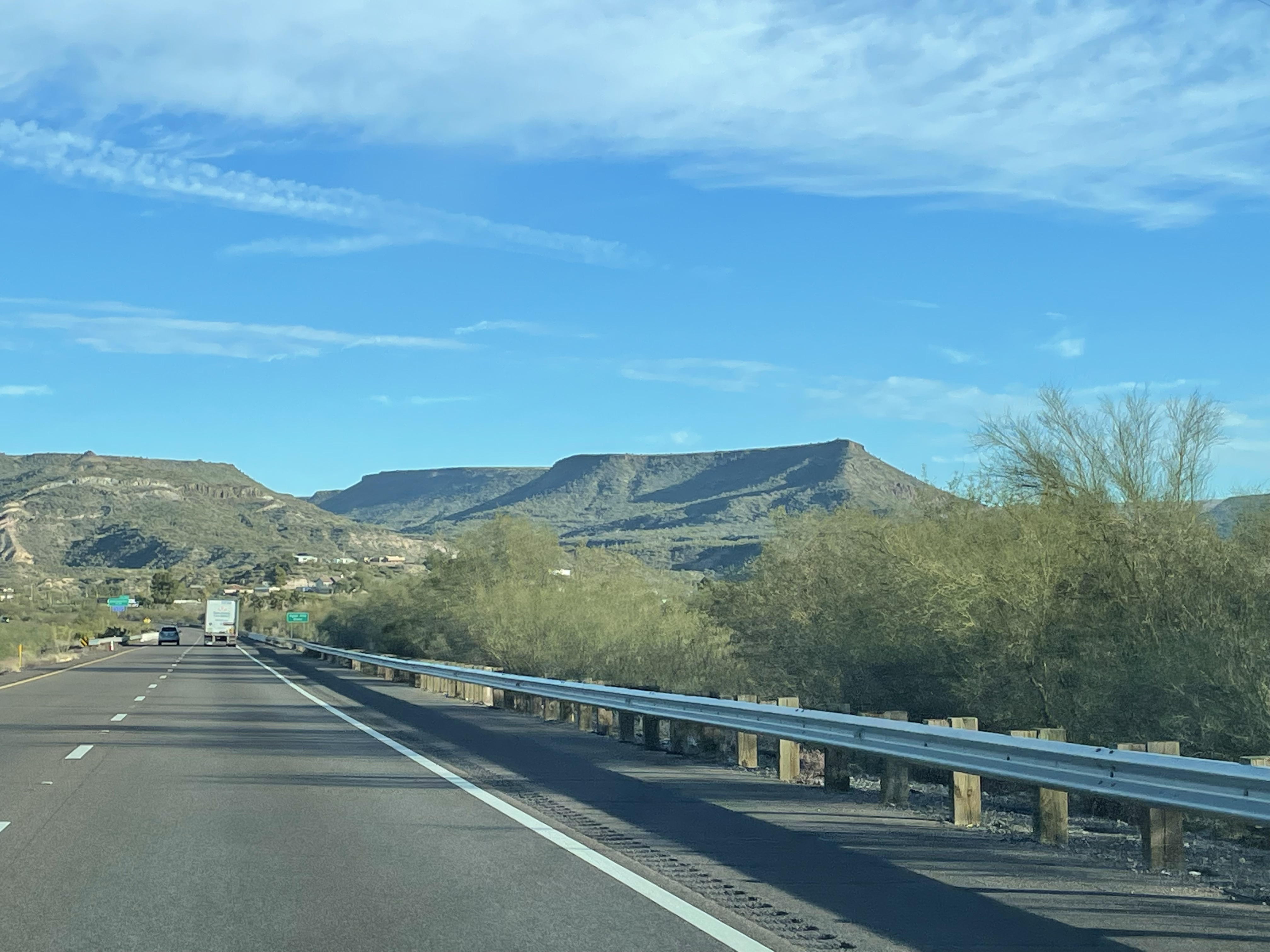
The lava flows are not very thick and individual flows can be identified. I’ll say more about the lava in the following discussions because of its relationship with the other lithologies.
Tertiary Stream Deposits
Figure 2 shows a silty bed that I have attributed to older Tertiary sediments, which could have been deposited over a 60 my time span. However, specific thickness of stream deposits can be dated by their relationship to the rocks of Lithology (2), because volcanic rocks can be easily dated. When such data are unavailable (as in this situation), we can’t be more specific.

An interesting thing about Fig. 4 is that ancient stream sediments are eroding to form new stream sediments in an endless cycle of deposition, erosion, etcetera.

Tertiary Lake Sediments

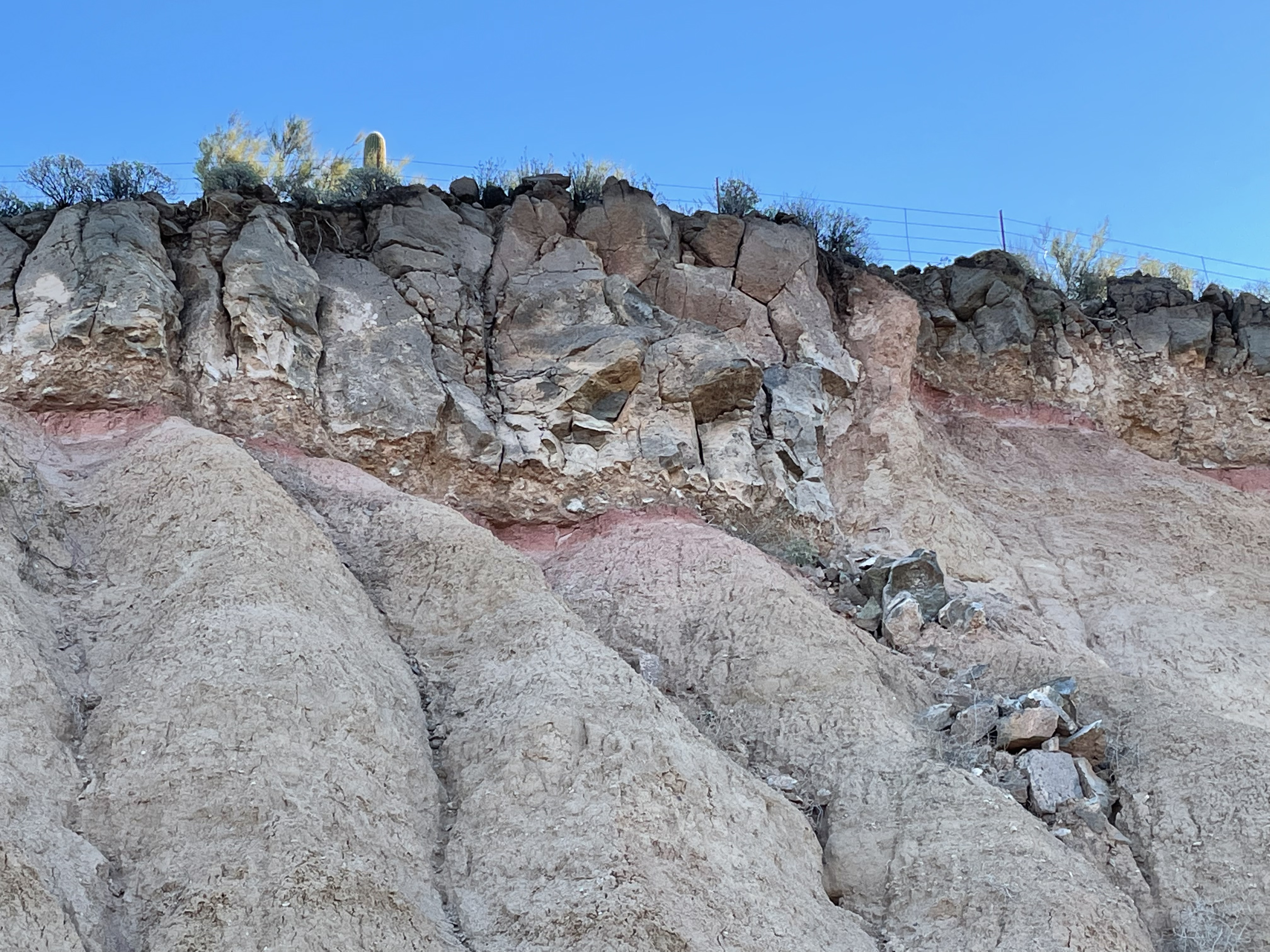
Lithology (4) was broadly distributed near Black Canyon City but it wasn’t safe to stop and examine them. Figure 6 reveals some evidence of soft-sediment deformation in the underlying chalky sediment. The implication that the lava flowed into a lake is further supported by pillow structures (Fig. 7).
Precambrian Granite
The oldest rocks I’ve discussed so far were less than 70 my, but now we’re going to jump back to between 2.5 and 1.5 billion-years ago. There are no rocks from the Paleozoic or Mesozoic Eras in this part of the Central Highlands.
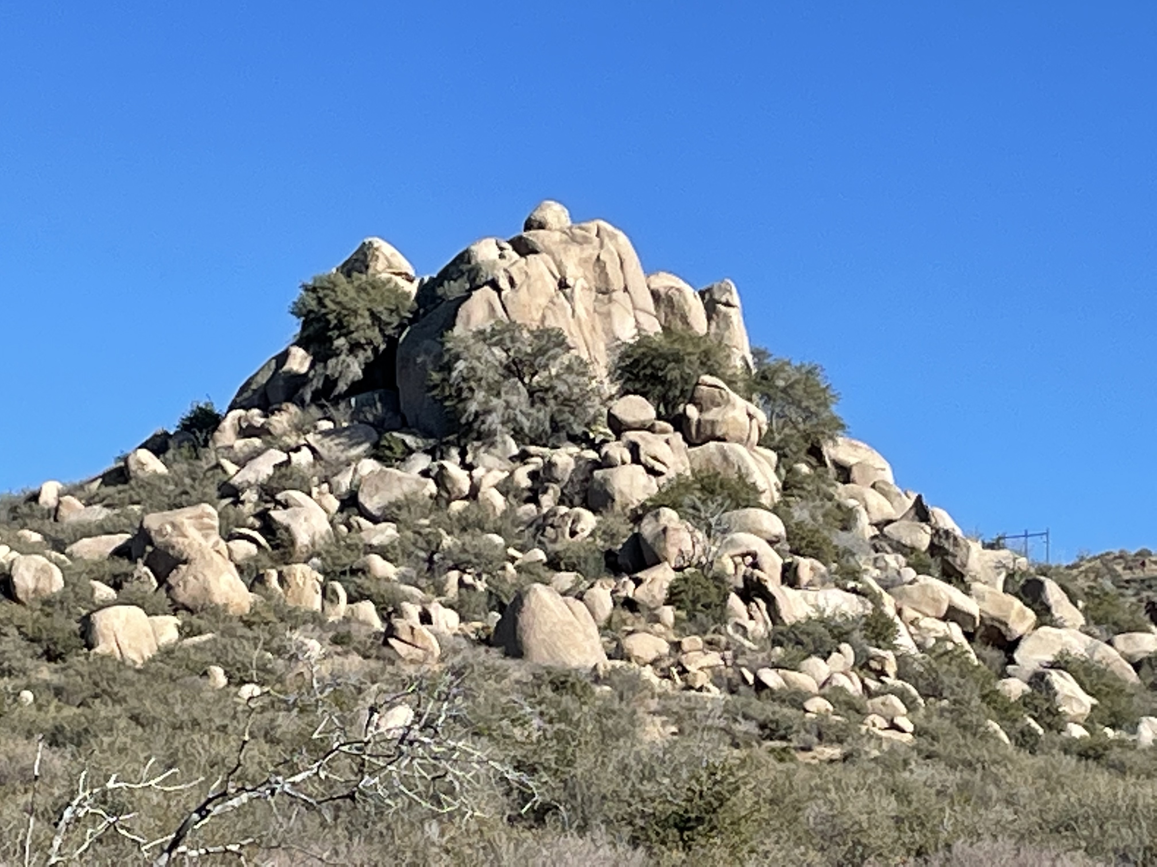
Granite outcrops weren’t ubiquitous along the highway until Prescott, although they are everywhere within the area — just not next to Interstate 17. I had an opportunity to see them up close on the return, which took me through Peeples Valley to Congress (Fig. 8).
I drove through overlapping plutons, with variations in the granite composition indicated by differences in their color, which varied from orange (orthoclase feldspar) to light gray (plagioclase feldspar). Most were weathered to a reddish color by the oxidation of iron-containing minerals, and they were all rounded as seen in Fig. 9. The one-billion year duration of magmatism suggests that this was a time of intense continent building.


Precambrian Metamorphic Rocks
Arizona (as well as most of the earth’s surface) is underlain by a crumbled, jumbled, layer of metamorphic rocks — reflections of long-forgotten oceans that teemed with life, collecting fine particles eroded from the slowly emerging continents, as well as the bodies of earth’s first inhabitants. In other words, for metamorphic rocks to have formed about two-billion years ago, sedimentary particles must have collected in ocean basins a couple hundred million years earlier. The earth is only 3.8 billion-years old, so there could have been only so many cycles of metamorphism in any given location. I’m guessing…maybe two or three?
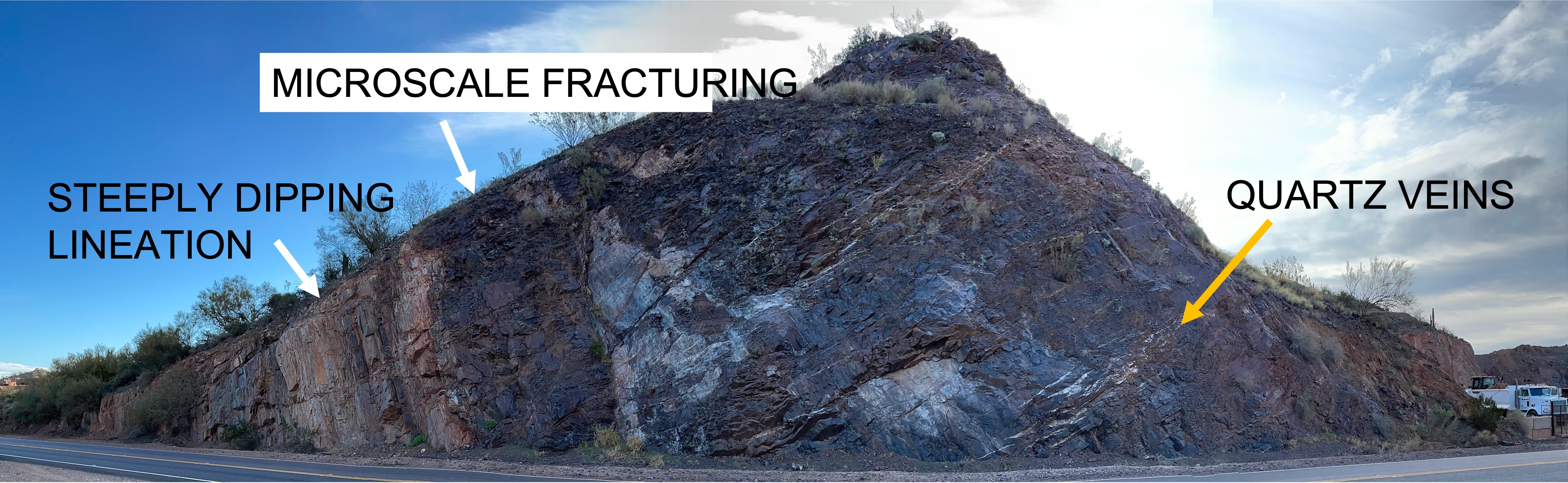
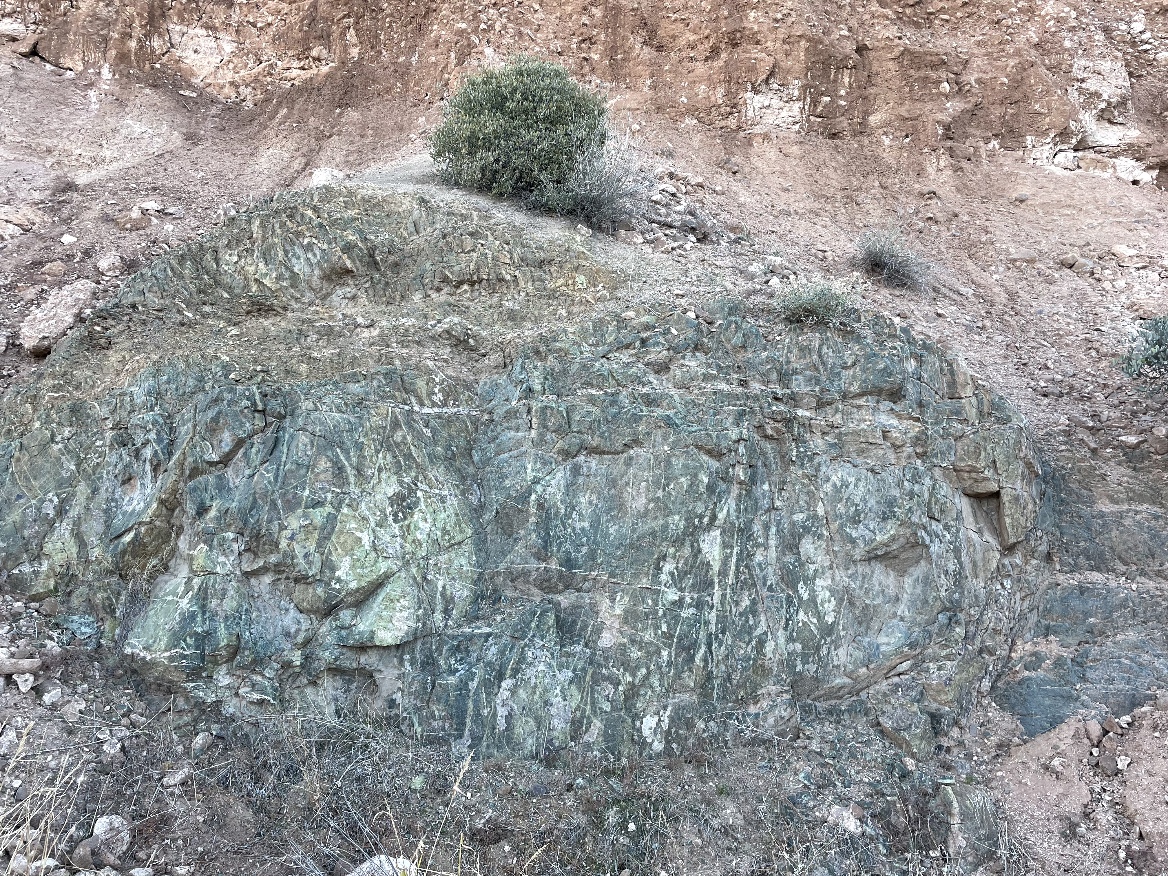
The title of this post refers to Precambrian rocks being torn apart during the separation of the Colorado Plateau from the lowlands represented by the Basin and Range province. Figure 12 exemplifies this dynamic process. To the north (left side of Fig. 12), it is difficult to ignore the nearly vertical lineation of rocks that are more like schist, with a sheen caused by the alignment of muscovite minerals. The tan color suggests that the original sediment contained a lot of quartz. The rocks exposed on the south (right in Fig. 12) end of the road cut are dark in color and include lenses of quartz (white flecks beneath the yellow arrow), suggesting a very different post-depositional history. They were probably mudstones before alteration.
The dark rocks (below the white arrow…) that conjoin these discordant blocks exhibited fine-scale jointing (scales of inches) and conchoidal fractures, an indicator of microcrystalline structure. I haven’t shown the photographic evidence of my description, to shorten the report. (I really wanted to.) These metamorphic textures indicate stress regimes with different orientations. Figuring it out would require substantial, detailed field work to measure stress indicators, and geochemical analyses. Not being in a position to do any of that, and unaware of any reports on this area, I’m going to treat this as a fault that cuts the plane of the road-cut at an angle similar to the steep dip of the lighter beds on the left of Fig. 12.
It is time to address the geological questions raised in Fig. 1 which, it turns out was a cause of confusion in deciphering the geological history of the Central Highlands.

The black, metamorphic rock in Fig. 14 gave the name Black Canyon to the region because it outcrops throughout the area, underlying both volcanic and sedimentary rocks.

Summary
Almost three-billion years ago, the western half of what is today North America was an ocean margin, possibly like the East Coast. Mud and sand was accumulating in environments much as we find today except there were no plants so erosion was probably more intense. By about 2.5 Ga (billion years ago) these sediments were buried to depths as great as 35 km (~20 miles) and were compressed as tectonic plates collided. This process continued, no doubt in pulses, for another billion years, producing the complex textures we see in Figs. 12-15. This area was on the trailing edge of proto-North America during the formation of the supercontinent Gondwana, between ~500 and 200 Ma. When the modern Atlantic Ocean began to open, subduction of oceanic crust began and new continental crust was created, forming modern California.
Streams crisscrossed the area much as we see today, but in a different climate. The volcanism associated with subduction of the Pacific Ocean crust didn’t reach Arizona until ~30 Ma, when volcanoes spewed out numerous lava flows such as those that cap the mesas seen in Fig. 3, and the Colorado Plateau began to rise by thousands of feet. This is when the Central Highlands (aka Transition Zone) formed, a buffer between the block-faulted Basin and Range of central Arizona and much of the western deserts of Nevada, and the uniform and mostly undisturbed Paleozoic sedimentary rocks of the Colorado Plateau.


Trackbacks / Pingbacks