
A Special Moment Caught in the Sands of Time
The previous post examined a couple of beaches along the eastern Tasmania coast and discussed coastal erosion in areas with very little sediment input. We finally reached our destination after a couple more hours, Freycinet National Park, located on an isolated peninsula (indicated by the pin in Fig. 1).
 Fig. 1
We drove across the Tasmanian Dolerite (green/gray areas in Fig. 2) and quaternary colluvium (yellow in Fig. 2) to get there, but the rocks changed drastically on the peninsula itself.
 Fig. 2
The peninsula is entirely composed of Devonian granite (393-359 MY). The best reason for this magmatism without major deformation (i.e., an orogeny) that I could find is that Tasmania was squeezed between Australia and Antarctica during assembly of Gondwana. The upper mantle was hot and would have produced granitic magma. It’s safe to assume that this area would have had relatively high elevations at that time as well, delivering sediment to the ocean.
This post isn’t going to discuss the granites in and around Coles Bay, but instead continue our examination of coastal geology. Great Oyster Bay is a relatively sheltered body of water. Coles Bay is even more protected from waves because it faces west (see Fig. 2) and the larger bay is only 10 miles across.
The nearby granite supplies crystals of minerals like quartz and alkali feldspars, which are more resistant to chemical weathering than the minerals comprising dolerite, so an ample supply of sand-sized grains is available from two rivers that enter Great Oyster bay at its northern end. This wasn’t the case at the beaches we visited in the last post. Consequently, a wide, shallow beach has been produced at the eastern margin of Coles Bay (Fig. 3).
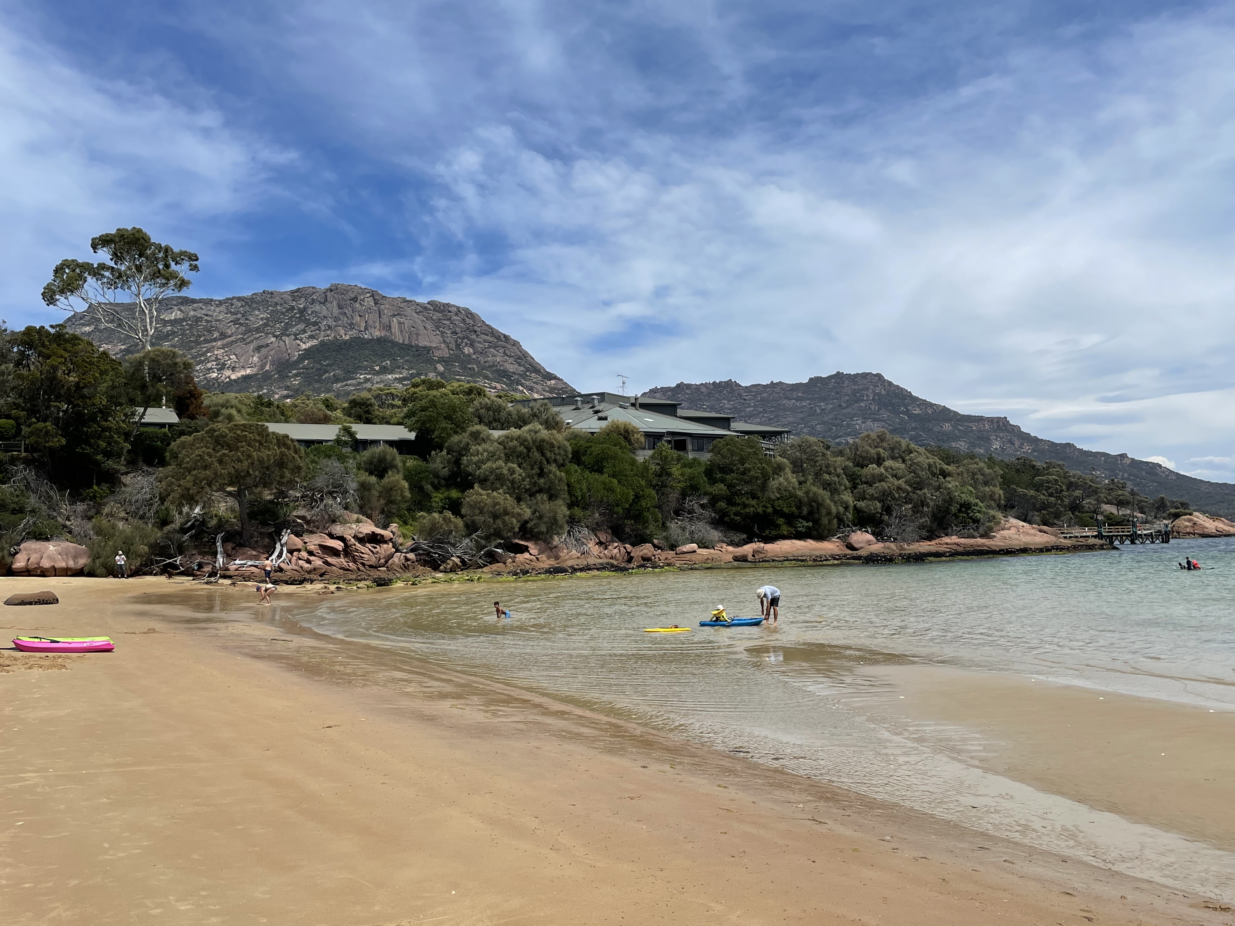 Fig. 3
The beach terminates to the south against the monolithic granite mountains that form the peninsula. Note how shallow the water is at approximately low tide in Fig. 3. Also take notice of the lack of surf because of the very shallow water. This is very interesting.
Looking to the north (Fig. 4) we see a berm at the high-tide line with a runnel (darker sand to the right) behind it. The tidal range is predicted to be 4.5-6 feet in Great Oyster Bay. Note the relatively steep beach face.
 Fig. 4
High tide laps at the toe of the dunes (Fig. 5), which consist of individual-to-merged primary dunes (created by sand blowing from the beach) with irregular spacing, rather than a single, continuous dune facing the beach. Plants appear to be important in building and maintaining the dunes.
 Fig. 5
There are some anomalies in Fig. 5, however; for example, there are black areas (organic matter), that should be buried, as well as wave-eroded scarps. We can take a look along the beach (Fig. 6) and notice some more features.
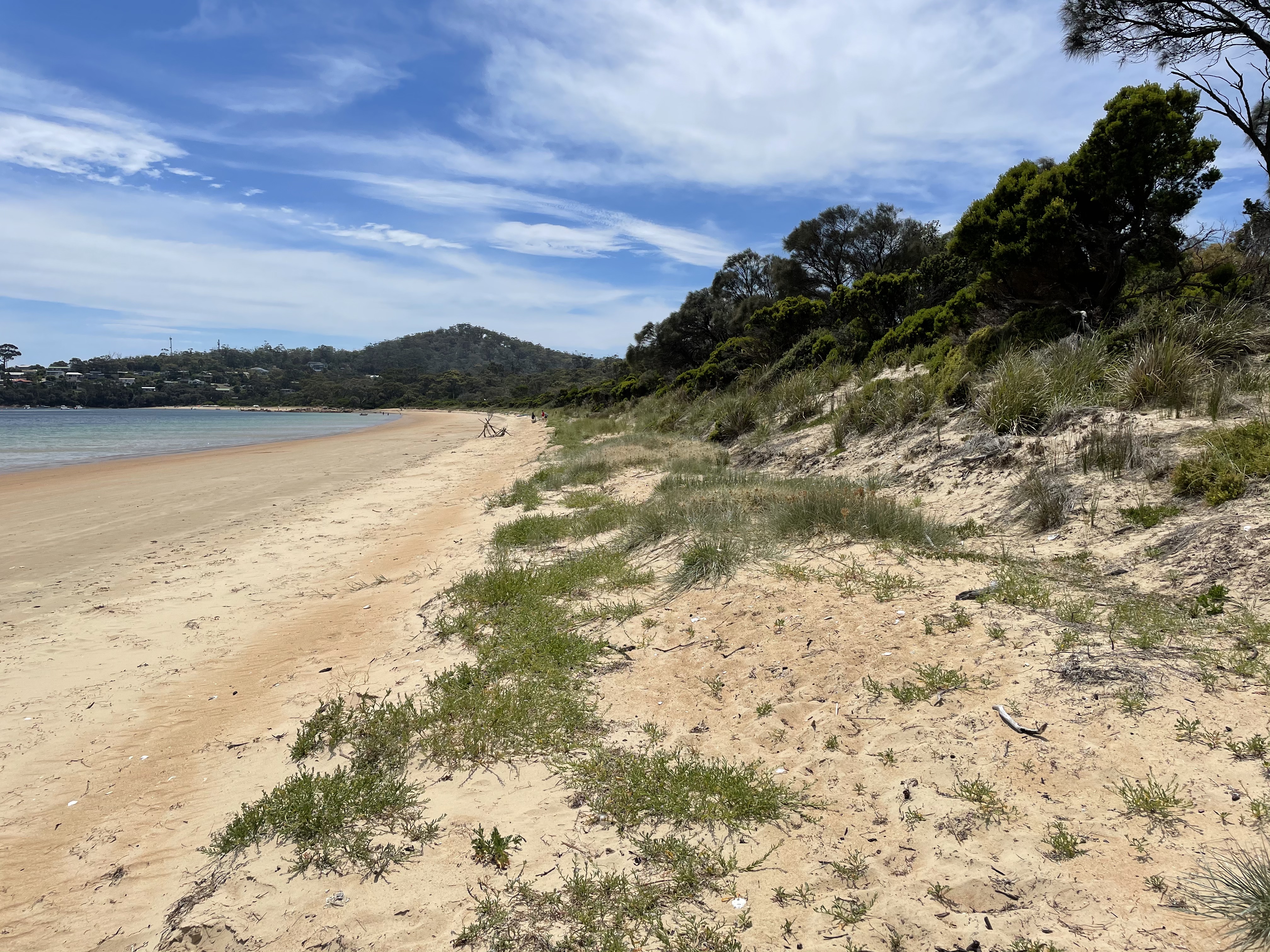 Fig. 6
To the right, on the larger dune, we see the erosional surface stained dark. It is recovering, however, unlike at the previous beaches we observed. In fact, in front of the main dunes, incipient dunes are forming, as seen across most of the foreground of Fig. 6. High tide reaches and thus limits development of these dunes. There is a good supply of sand.
About 100 yards north of where Fig. 6 was taken, incipient dunes are not evident (Fig. 7) although sand is collecting at the toe of the main dunes. Note the low (~12 inches) scarp at the base (aka toe) of the dunes.
 Fig. 7
Near the northern extent of the beach, the dunes are low and irregular (Fig. 8). They are also more fully covered by plants.
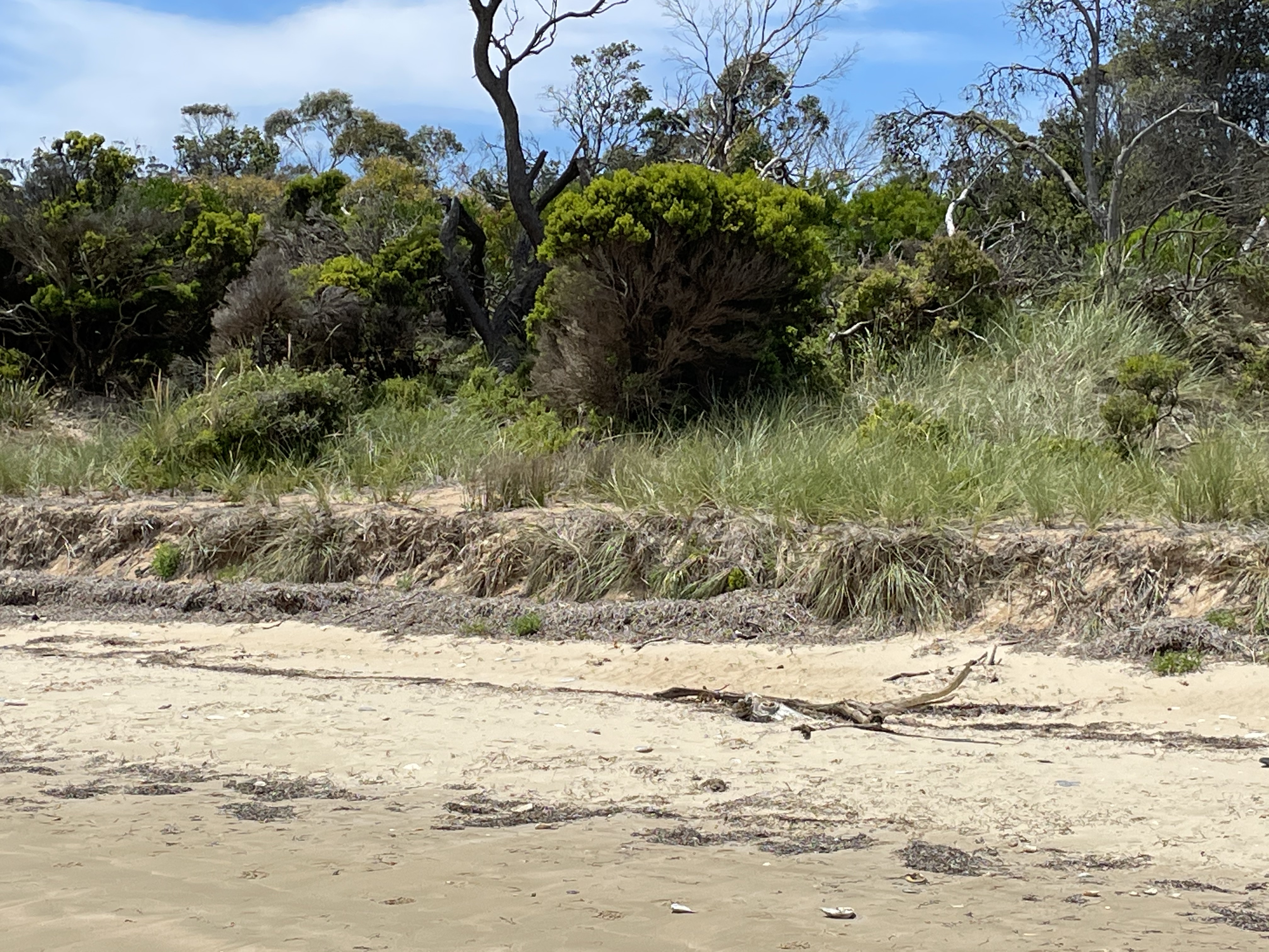 Fig. 8
Another interesting point in Fig. 8 is the lack of recovery of the beach toe. Dead grass covers the rough and steep cut in the sand. A line of debris marks a previous high-water event, possibly a spring tide or a storm.
The beach and dunes change character over the extent of this beach, which is less than a mile in length. How is that possible? The short answer is that there is more sand available at the southern end of the beach. More sand to build a berm and a robust dune system, and then to recover those dunes when they are eroded by storm waves. Let’s try and dig a little deeper.
Figure 9 is a view looking south from the northern end of the beach. Besides showing the granite peaks we’ll talk about next time, they show a wide, flat beach. It looks like it was created with a bulldozer, by the Corps of Engineers. It wasn’t. This beach hasn’t been modified in any way because it’s in a national forest.
 Fig. 9
This is an example of the limitations of models. Beaches have been classified by their dynamic behavior as either dissipative, with large waves expending their energy over a wide surf zone with several bars, or reflective. The latter type of beach has very low waves and a narrow surf zone on a steep beach face.
Do you see any waves in Fig. 9? There are nearshore bars visible in Fig. 3, however. So what’s up?
I have to rely on my experience with storm deposition on low-energy beaches in the Gulf of Mexico (see Keen and Stone, 2000). This is a topic not often addressed in the scientific literature because of the rarity of such situations. I have proposed in the past that a low-energy beach (small waves), with bars and a wide, shallow face (dissipative), is relict — leftover from a high-energy event. It’s a snapshot frozen in time because the low waves that usually occur are unable to move sand around. Such a beach, out of equilibrium, may persist for years before returning to its proper configuration. It’s even possible that it could last decades if storms are sufficiently rare.
What about the other question: Why is the northern end of the beach (Figs. 8 and 10) so different from the southern end (Fig. 3)?
 Fig. 10
The beach face is about as steep at the northern limit as at the southern terminus (compare Figs. 10 and 4), and both are much steeper than in the middle (Fig. 9). The northern end is becoming reflective (steep and narrow beach face) because sand is being removed, allowing the weak waves to do their wimpy thing. The sand has been transported to the southern end of Coles Bay by waves in a process called longshore drift. Waves never approach the coast at ninety degrees and thus they slowly roll sand particles in one direction or the other, up and down the beach face. This can be reinforced by tidal circulation, which is also an asymmetrical hydrodynamic process.
The southern end is becoming more reflective, despite the high sediment load, because of slightly higher wave energy and help from the large tidal range, which allows higher waves to approach closer to shore during high tide. The center of Coles Bay is not recovering and remains a wide flat beach typical of a “storm” profile.
Finally, let’s look across Coles Bay at the granite plutons we’ll be examining next. Figure 10 reveals that this beach, like so many pocket beaches in Tasmania and Australia, is a quantity of sand trapped between rocky headlands. The sediment has no where to go but back and forth, to and fro, for eons, until plate tectonics changes the situation drastically.
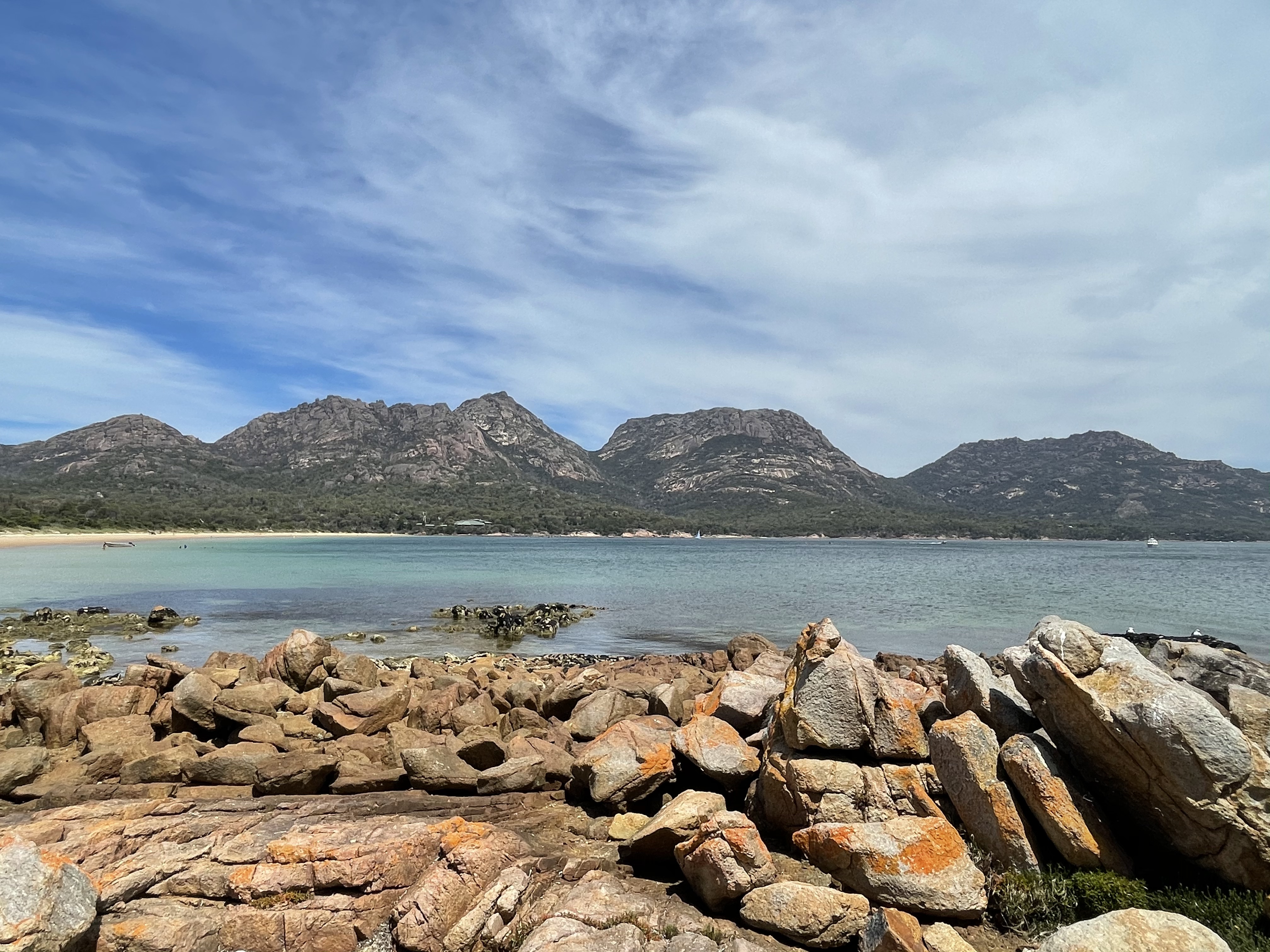 Fig. 11
Which it always does…

Trackbacks / Pingbacks