
Coal Mine Classic 2014: The Appalachian Mountains
Today, I covered the southern Appalachians and drove along the axis of the famous Shenandoah Valley, which was settled in the 19th century. It is bounded by the Blue Ridge Mountains on the east and the Ridge and Valley mountains to the west. This is also the fast lane that General Lee used to drive the Union army crazy in the American Civil War. But before entering the Shenandoah, I had to drive up hill some more from my starting point in Chattanooga, TN (black square on the map) and cross a complex geologic province that includes the Roanoke Valley, which follows the Roanoke River in a general east-west direction. In other words, it cuts across the trend seen in the contours of this excellent Appalachian geologic map by Crop and Hibbard.
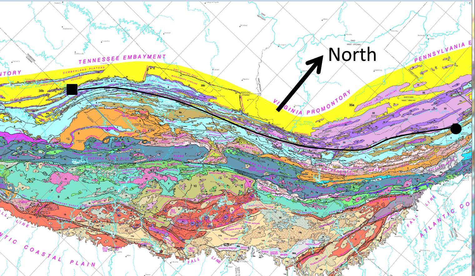
The circle is where I am staying tonight, Martinsburg, West Virginia. The black line is my approximate route up the southern Appalachian Mountains.
I must make a short interlude on Paleozoic limestones. There is no good single reference on this phenomenon but most of the eastern U.S. was covered by seas of varying depths between 500 and 250 million years ago (rough approximation). Sea animals like shrimp, oyesters, etc., lived in them as they do today and when they died, their shells settled. This went on for millions of years and eventually these shells were buried along with any sand/silt/clay that may have been brought into these seas from the eroding land (much like the plumes we see in modern rivers like the Amazon). These accumulation of shells and land-derived sediment were transformed into limestone over millions of years and deep burial (like 10 miles).
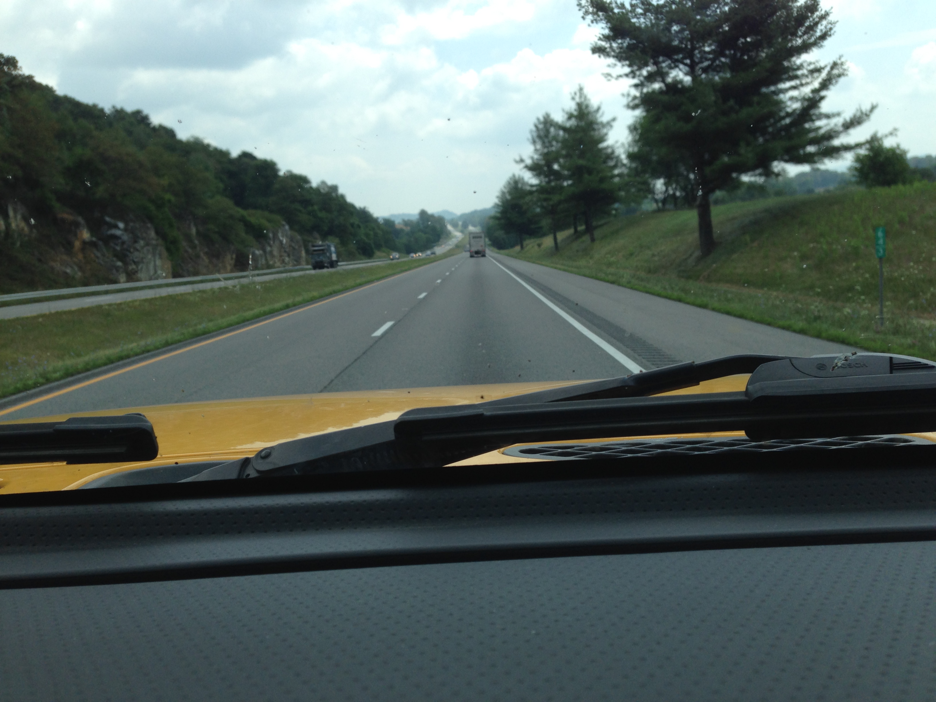
The primary rock I saw on this day’s journey was Paleozoic limestone. These rocks were deformed when the great continental collisions of the later Paleozoic occurred, like the Appalachian Orogeny. I saw these limestones as I passed Birmingham yesterday but now we seen them more deformed by folding and faulting during the Appalahcian Orogeny. This image shows them near the Roanoke Valley, where they are tilted in a southerly direction.
As I travelled northward and crossed several ridges I found these same (kinds of) rock were almost vertical or tilting to the east. This is within the Shenandoah Valley. They also varied from thin to thick bedded (obvious lines in the rocks are called bedding). I couldn’t get a picture of these but they were impressive over 10’s of miles. I also saw some thin (<3 feet thick) beds of shale (mud stone), which indicates contamination by land-derived sediment. This makes the limestone less pure and can contribute to poor strength, as well as breakage by faults. The result of these processes (and others I am not discussing) leads to road cuts like these.

These were more common in the southern part of my drive (see path above). When I drove further north, however, the limestone was very strong and supported multiple road cuts for north and southbound lanes.

I wanted to stop and examine these exposures up close but my schedule didn’t allow it. Next time I will plan accordingly and do a better job of correlating my photos to the geologic and topographic maps (still not easy to do with an IPhone). One last note (of many I would like to make) is that I saw no more pine trees; I have left the pine woods of the coastal plane behind.
This is the beautiful world of the temperate deciduous forest (this time of year)!

Recent Comments