
Coal Mine Classic 2014: Getting There
This is the first real-time post on this site and I am working out the kinks. This post is going to cover the preparation for the trip and the ride up, which takes a couple of days. Before embarking, I need to do some background work to understand where I am going. The rest of the posts on this trip will refer to this post, which introduces the geology of eastern Pennsylvania.
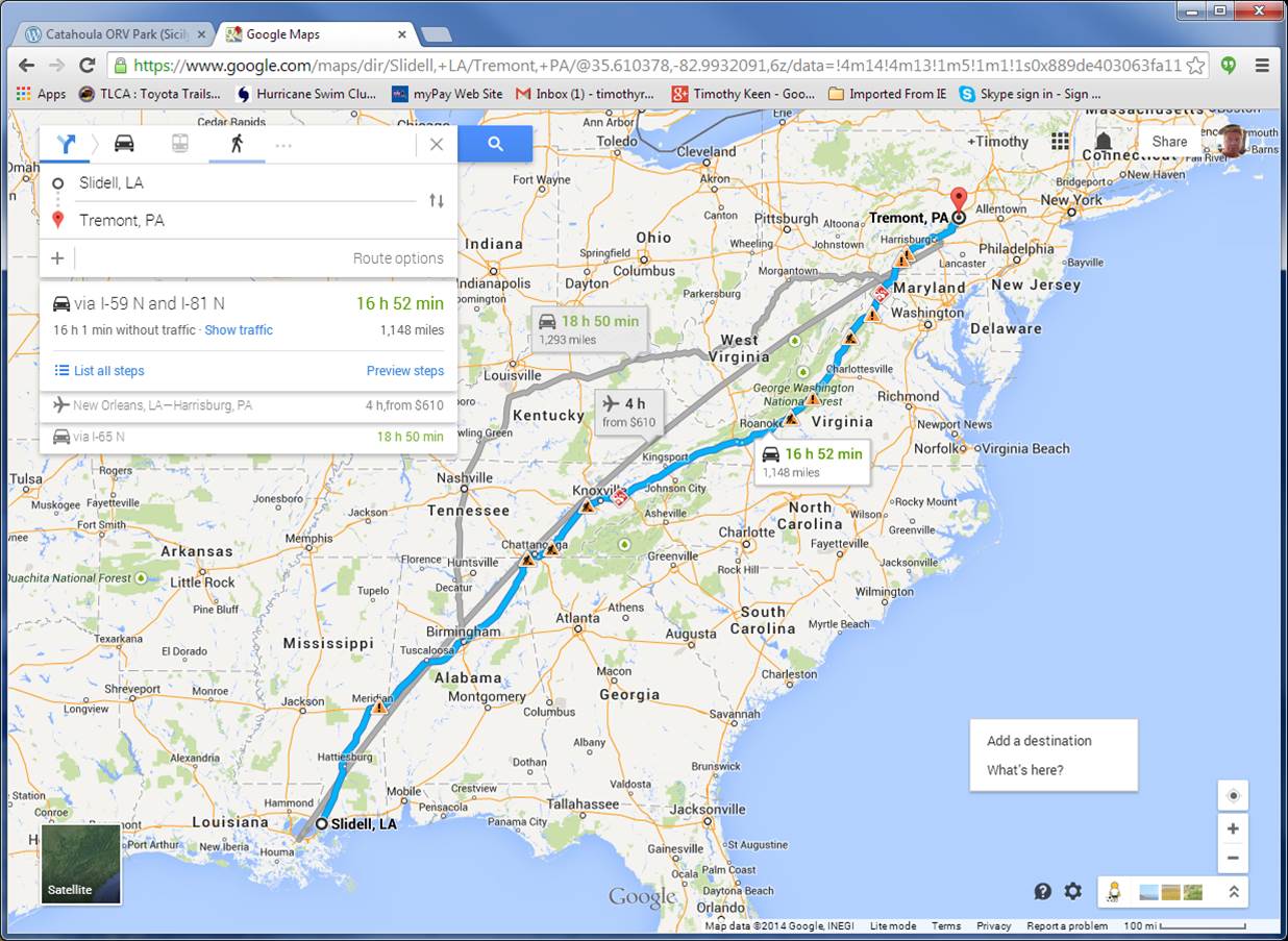
This image shows the trip route going (blue) and returning (gray). The aircraft route is shown for reference, but I couldn’t afford to fly my 5000 lb truck so I have to drive. As an overview, the eastern route follows the natural geography of the Appalachian Mtns after we get to Chattanooga. I will talk about this more later, but these are the roots of an ancient (~400 million year) mountain range when America collided with Europe.
The destination is at Tremont, PA (marked on map). As with previous excursions, we have to zoom in real close to see the tiny areas we are operating in. The following image from the official PA geologic map shows the area in a rectangle.

This is much larger than Rausch Creek ORV Park but it shows us that we are going to be off road in the Pennsylvanian Period of the past (~350-300 my). The tan-colored area is the Llewellyn Formation, which consists of sandstones at the bottom of sequences that are probably cyclothems, which represent alternating increases and decrases in local sea level. These rocks include coal seams, as reported by the Rausch Creek ORV management, i.e., they warn drivers they may drive into an open pit if unwary! Here is a close-up of the area.

I will try and get good exposures (no problem on a rock-crawling trip!) to verify the rock types. It is going to rain before the event so we will see if it is like Catahoula ORV Park!
The final point I want to make is the preparation for the trip. I used Google Map to find the area and checked Google Earth to see what the area looked like (so forested that the trails are not visible), and then checked for geologic maps. The last point yields many sources and there was a lot of work to focus on Tremont. I am not going to use satellite images (Google Earth) because of the number of trees! I will be referring to the Roadside Geology of Pennsylvania (B. B. van Diver, Mtn. Press Publ., Missoula, Montana, 1990) when I get to PA.

“Happiness is not a station to arrive at, but a manner of traveling”.
LikeLike