
Day Tripping
I am developing this reporting method using old pictures from my time as a Geology student at Arizona State University (ASU). A lot of fun and challenging off-roading could be had in a day; I often spent Saturday doing this. This post is a revisionist day trip blog post, i.e., I don’t remember much (it was 1983) but I have the kind of pictures I still take (incomplete and episodic), so this is kind of what to expect in newer reports.
Eventually, I needed a smaller and more capable vehicle than the 6500 lb truck, so I swapped it for a 1980 Jeep CJ5 and dropped 3000 lbs and several feet of length and width.

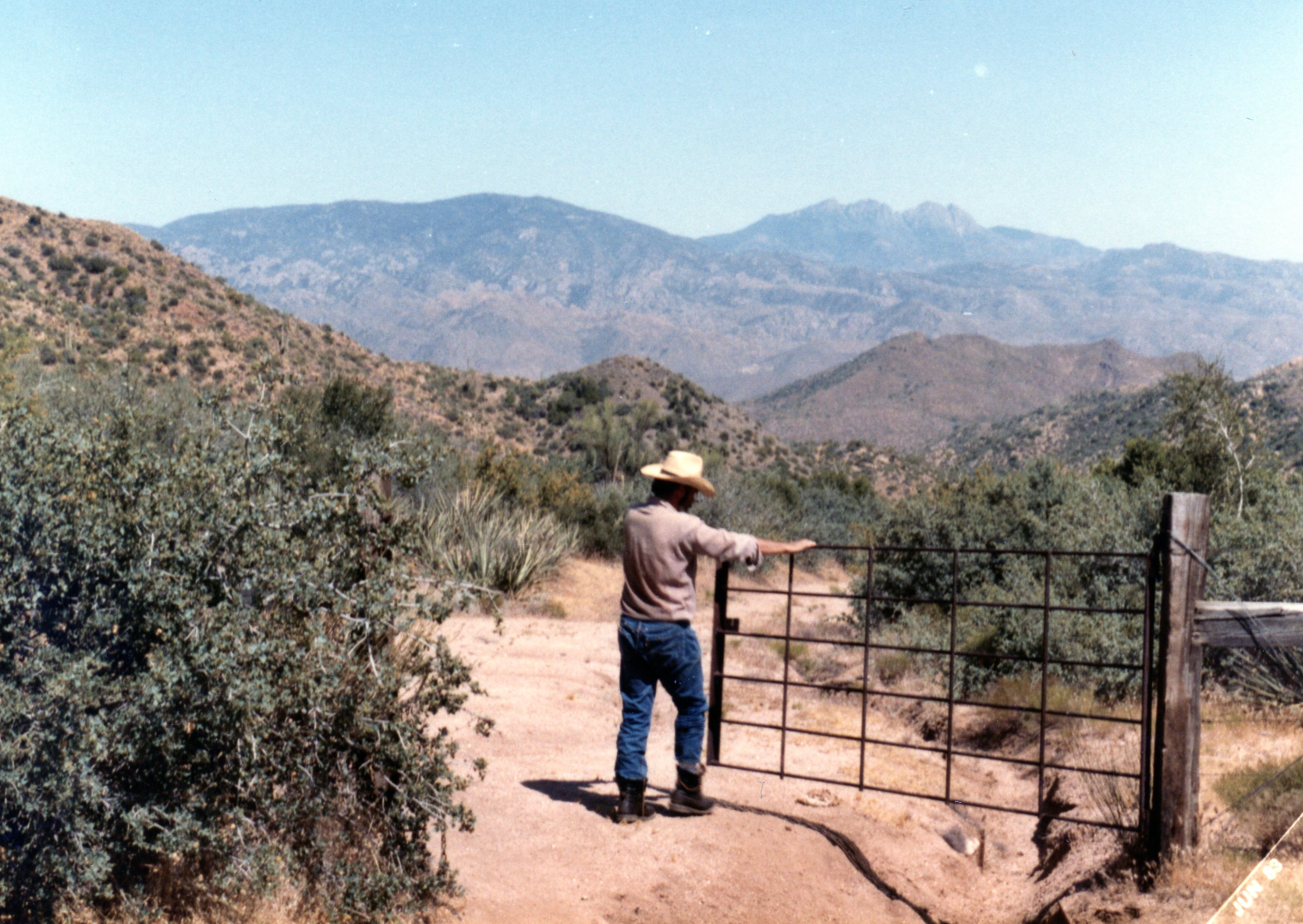
This proved a wise choice, for this report describes a trip with a new friend, who rode with me in the Jeep because his truck couldn’t get through the gate (i.e., a really narrow crevice that even squeezed the Jeep). I met a fellow off-roader (anonymous) on this day, and never saw them again. We met by accident at the gate, which we both hoped led to a new route to Bartlett Reservoir that didn’t involve a road. This Google Earth image shows the region NE of Phx.

This image has been annotated to show the overview of the geology on the recent image. We (independently) drove out of Phx on the Beeline Hwy (route 87) and left at a randomly chosen trail (elevation ~2500 feet). We followed (sort of) the solid black line and met somewhere within 1/2 mile of the road where an interesting wash (possibly Log Corral Wash) was blocked by a LARGE (house-size) block of pC metamorphic rock–no picture?
We drove up a narrow rocky wash, which suggests that we were travelling thru a very hard rock rather than the recent volcanics, as seen in the geologic map. To be sure, I should have gotten a sample, because, if memory serves, this looked like pC Mazatzal Quartzite (really hard metamorphic rock), which I later studied as a geology student. It is possible that we were in a fault zone where some of the older rocks could be expected to be exposed.

After passing thru the narrow point in the wash, we climbed up the ridge in the Quaternary lava flows (< 2.6 million yrs.) to an elevation of ~3000 feet, and came to a real gate (this is open range), which we followed downhill towards the reservoir.
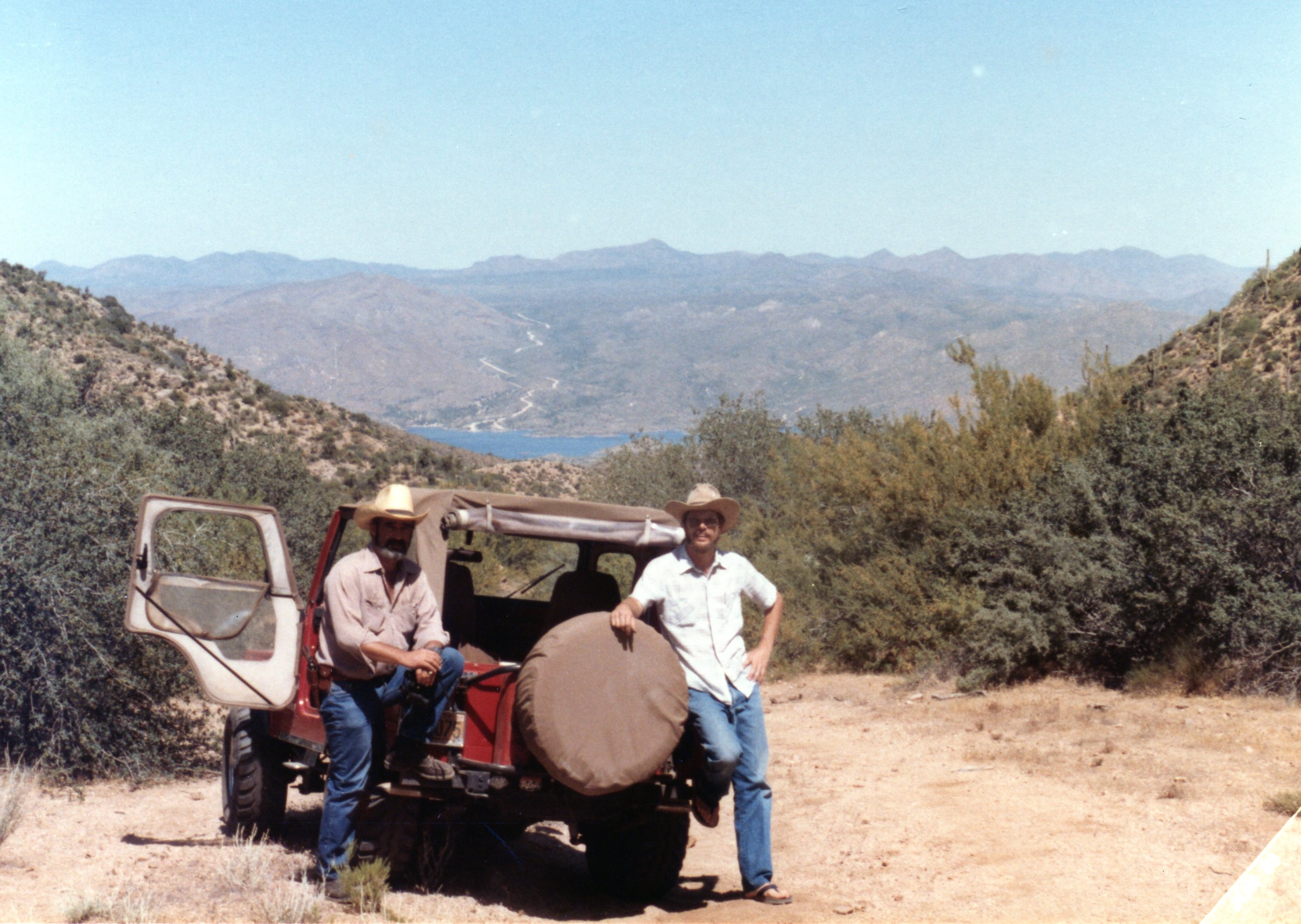
We joined up with the service road for the 115 kV power line and continued downhill on this unmaintained trail. The peaks in the background of this image and the previous are remnants of the PC Mazatzal Quartzite, which forms most peaks in the area. The reservoir can be seen in the background.
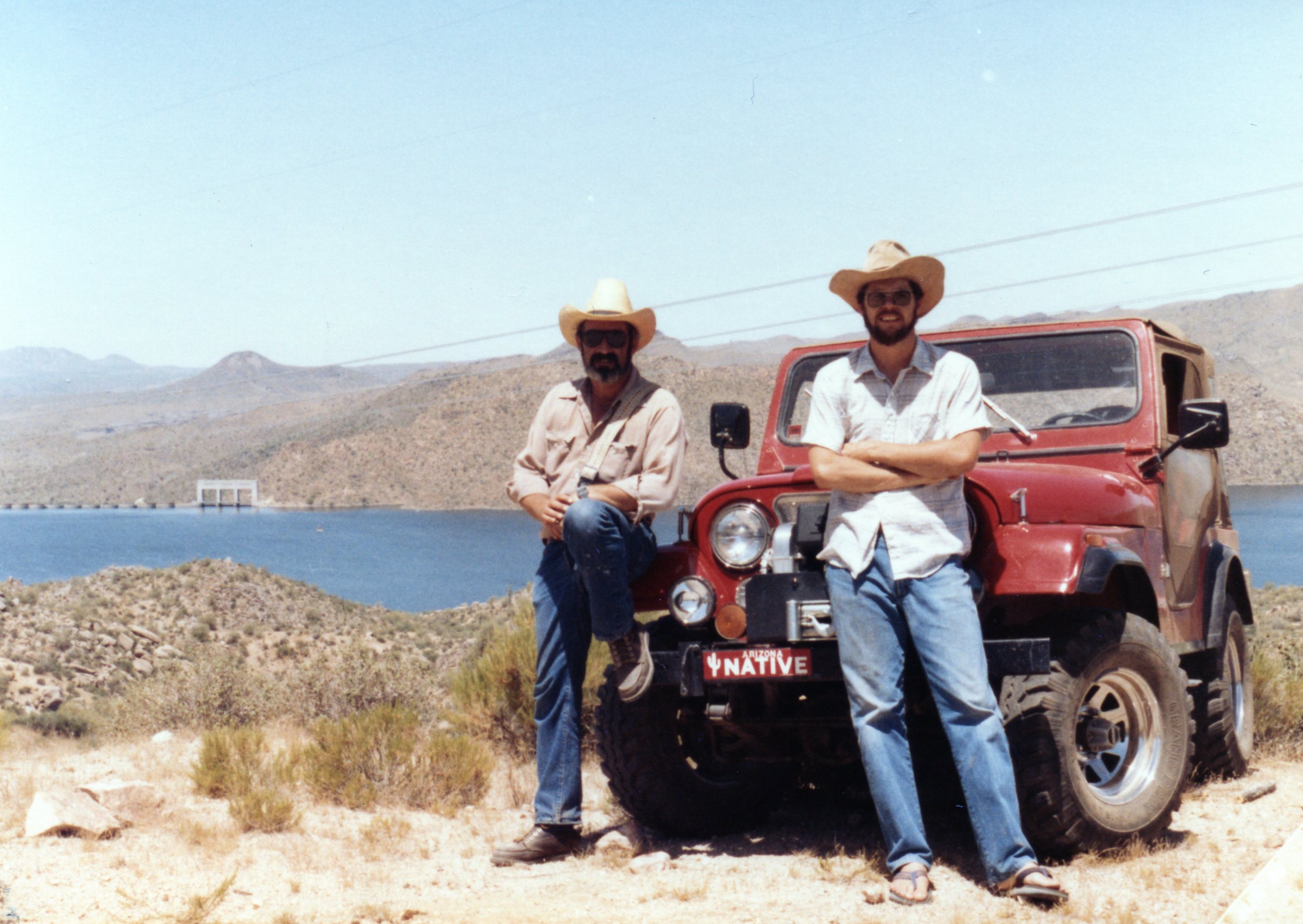
The road on the opposite side of the lake is the main access seen in the satellite image above. We continued through the pC rocks, which are highly faulted in this area and followed the service “road” around the east side of Bartlett Dam, constructed in 1936-1939 (spillway elevation is 1600 feet). The image below is a poor-man’s panorama. I missed the middle of the sequence. Downstream is to the left and the dam is to the right.

It turns out that service roads are not really trails or roads; this one ended in a bare exposure of pC rock that could not be climbed without (possibly) modern rock-crawler rigs! We had to backtrack and retrieve the truck anyway. One last photo op at Bartlett Dam.
This post hopefully demonstrates why we like to go offroad. This view and great ride can’t be had any other way, except for hiking. I can’t hike (never could) because of my knees so this is my best shot, not to mention it doesn’t require a week to do. The second point is the summary of this trip. We explored the Central Highlands of AZ, which is a transition between the Basin and Range and the CO Plateau in this area. We saw the change in geomorphology and rock type as we passed from young volcanic rocks to pC metamorphic and igneous rocks. We also saw the impact of extensive normal faulting, which produced this juxtaposition of different rocks.
One final point: these volcanic rocks look like the ones from the L. Pleasant area (see previous post) but they are millions of years younger. Only radiometric dating methods could have determined this in such a variable geological terrane.
Cheers to a great day!


Recent Comments