
Volcanic Rocks at Cowiche Canyon
Introduction
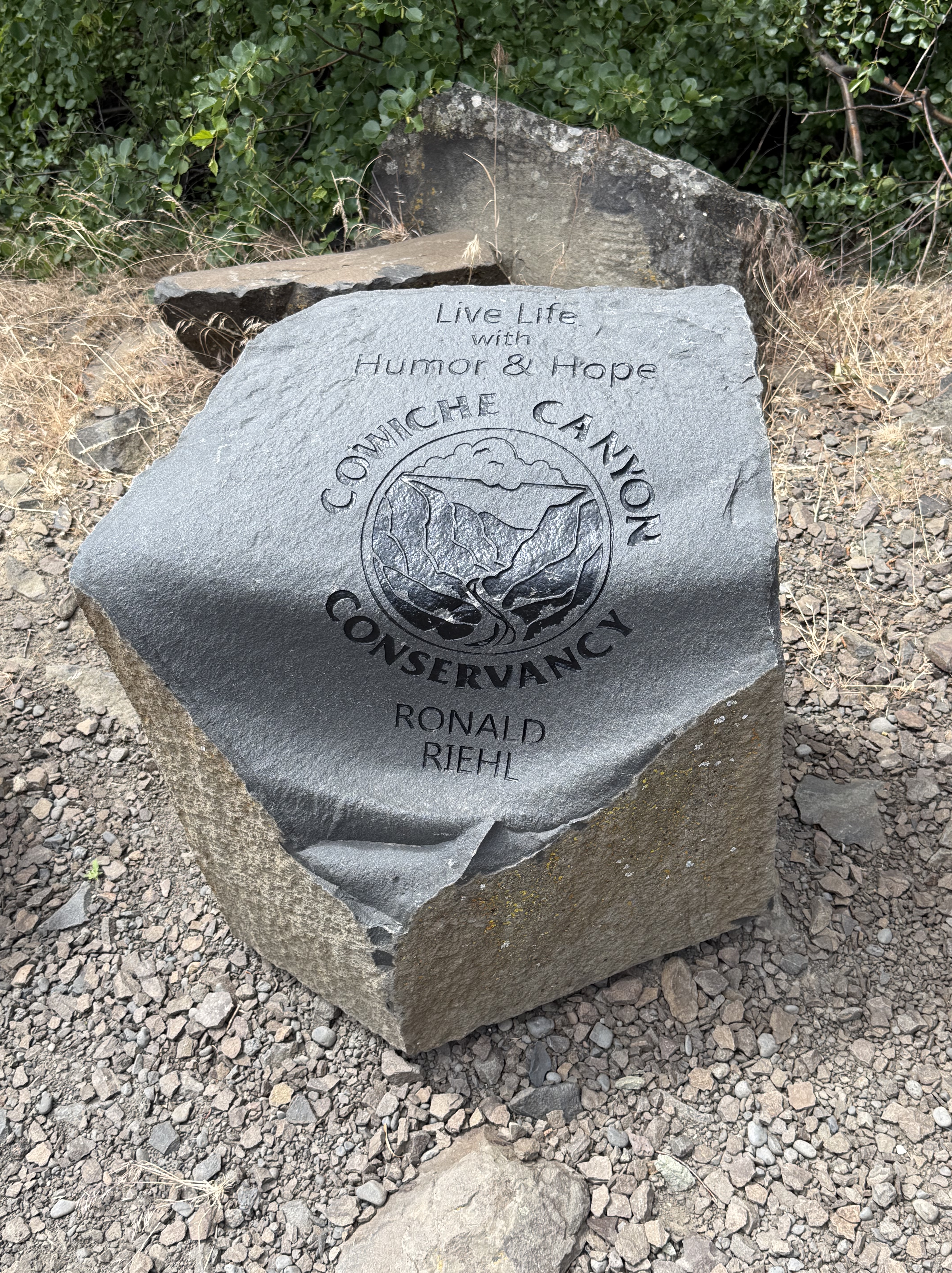
Burlington-Northern Railroad built a line through Cowiche Canyon in 1913 to transport apples, but it was abandoned in 1984 and the land was acquired by the Cowiche Canyon Conservancy for a non-motorized vehicle trail system. The main trail extends 2.9 miles along the South Fork Cowiche Creek, crossing the 11 bridges constructed for the railroad line.
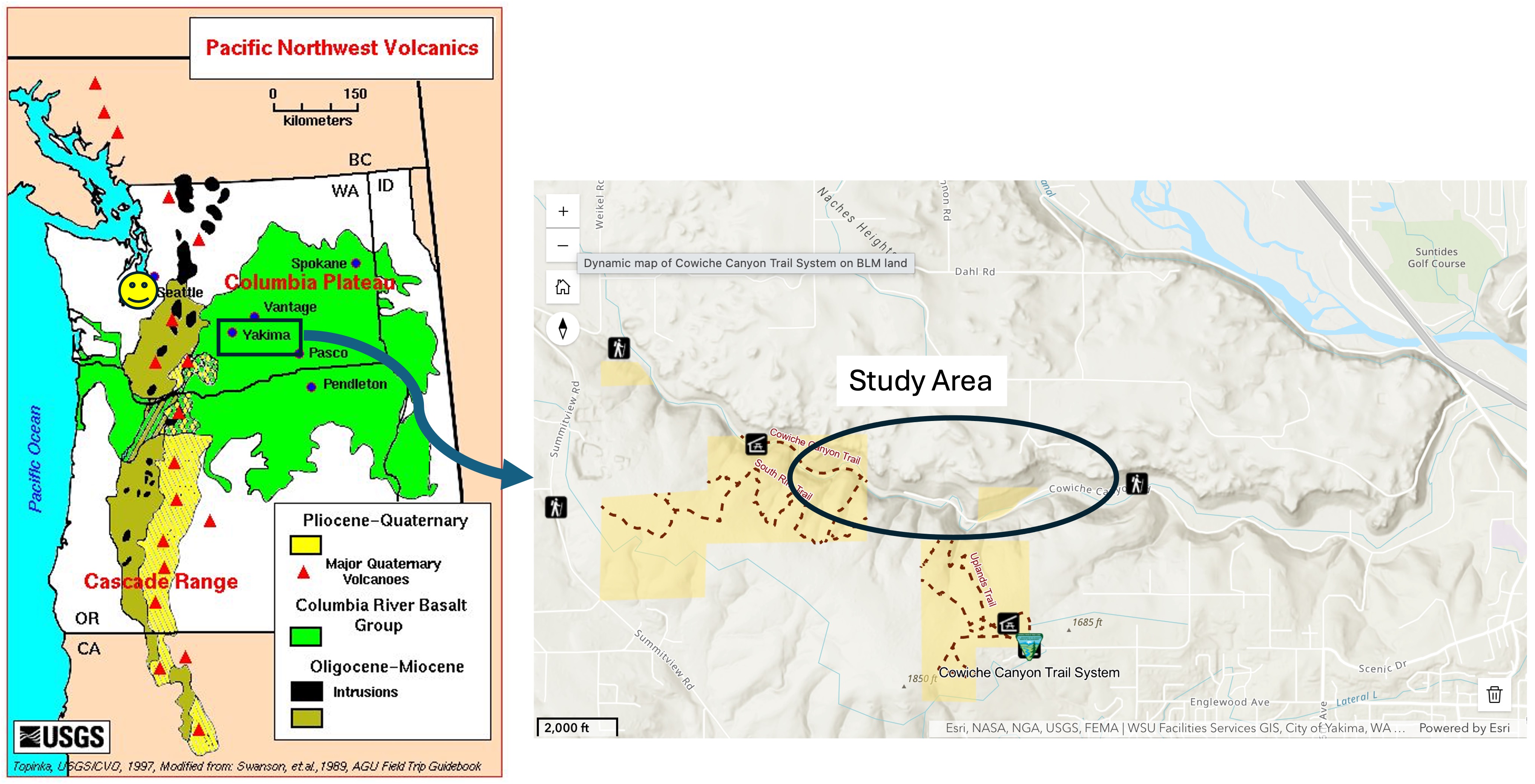
The left panel shows the distribution of Columbia River flood basalts, deposited between 16 and 6 Ma. Yakima and Cowiche Canyon are outlined by a rectangle. These volcanic rocks were erupted in overlapping flows with erosion and landslides occurring between individual layers, which are irregular and not shown in this map. The ages from the USGS national geologic map are Tertiary (66-2.6 Ma). Tacoma is marked by a smiley face.
The right panel shows the Cowiche Canyon trail system and the specific area discussed in this post. The stream itself hosts a riparian habitat whereas the uplands comprise a shrub-steppe environment.
Observations
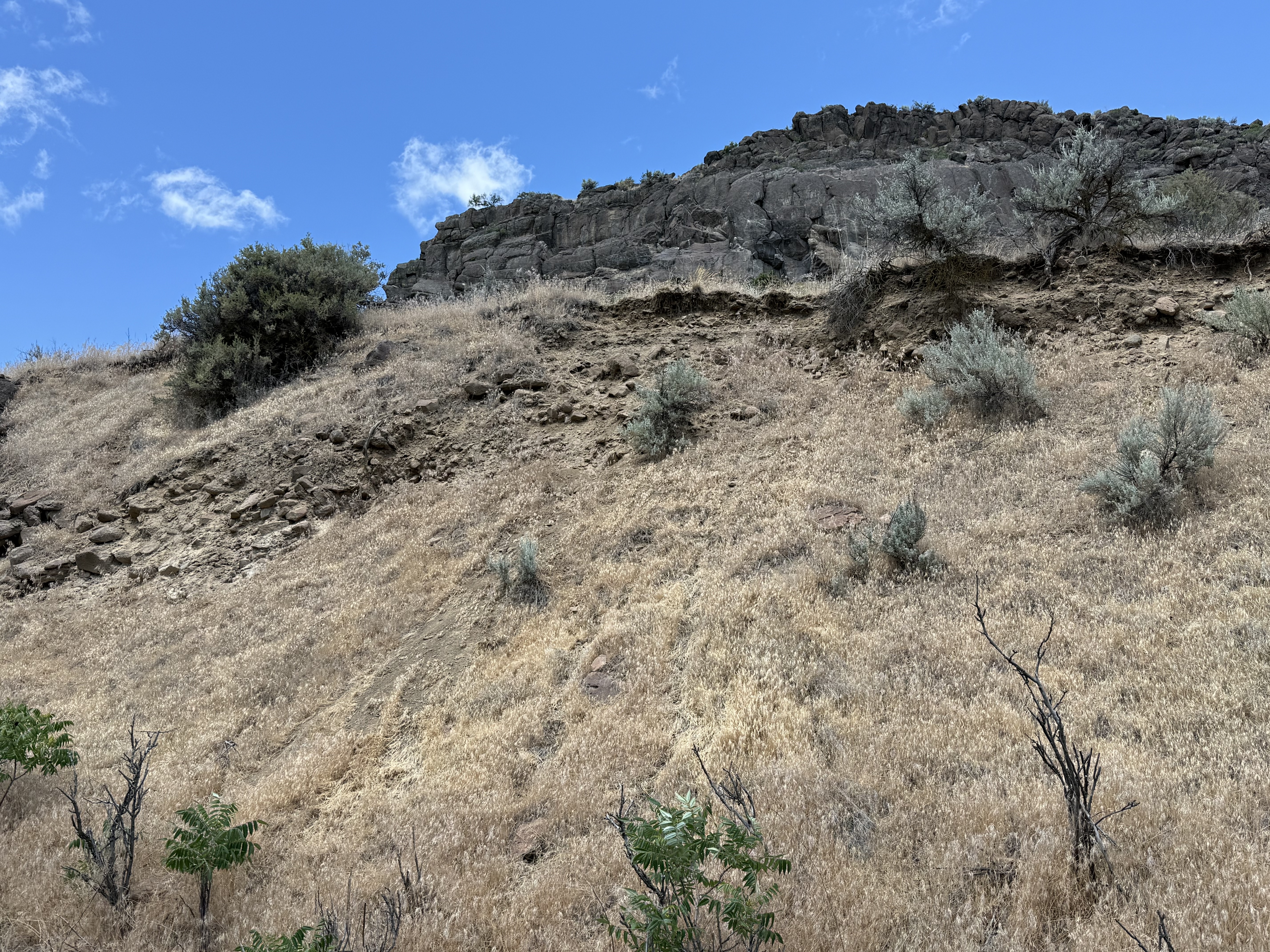
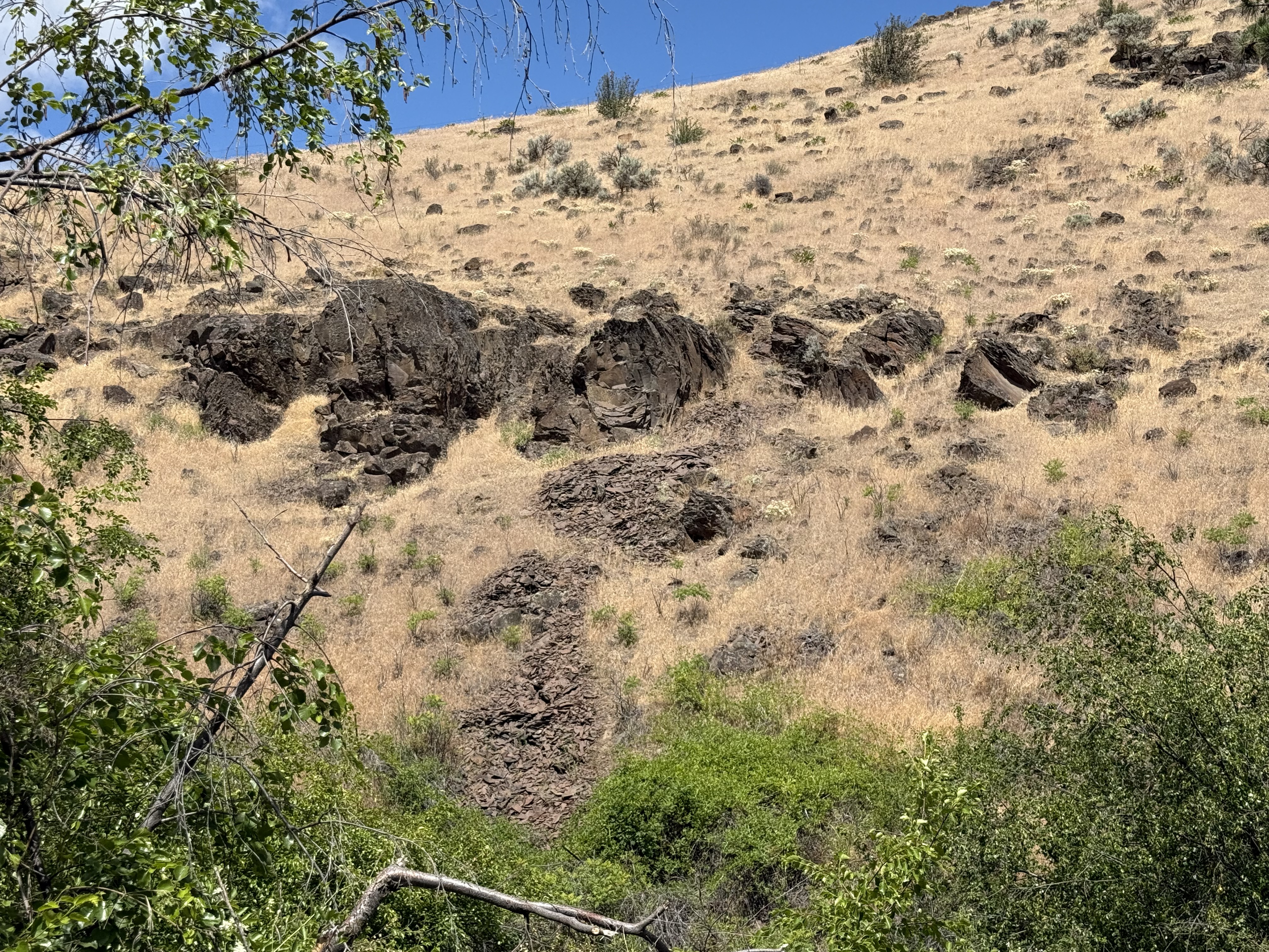
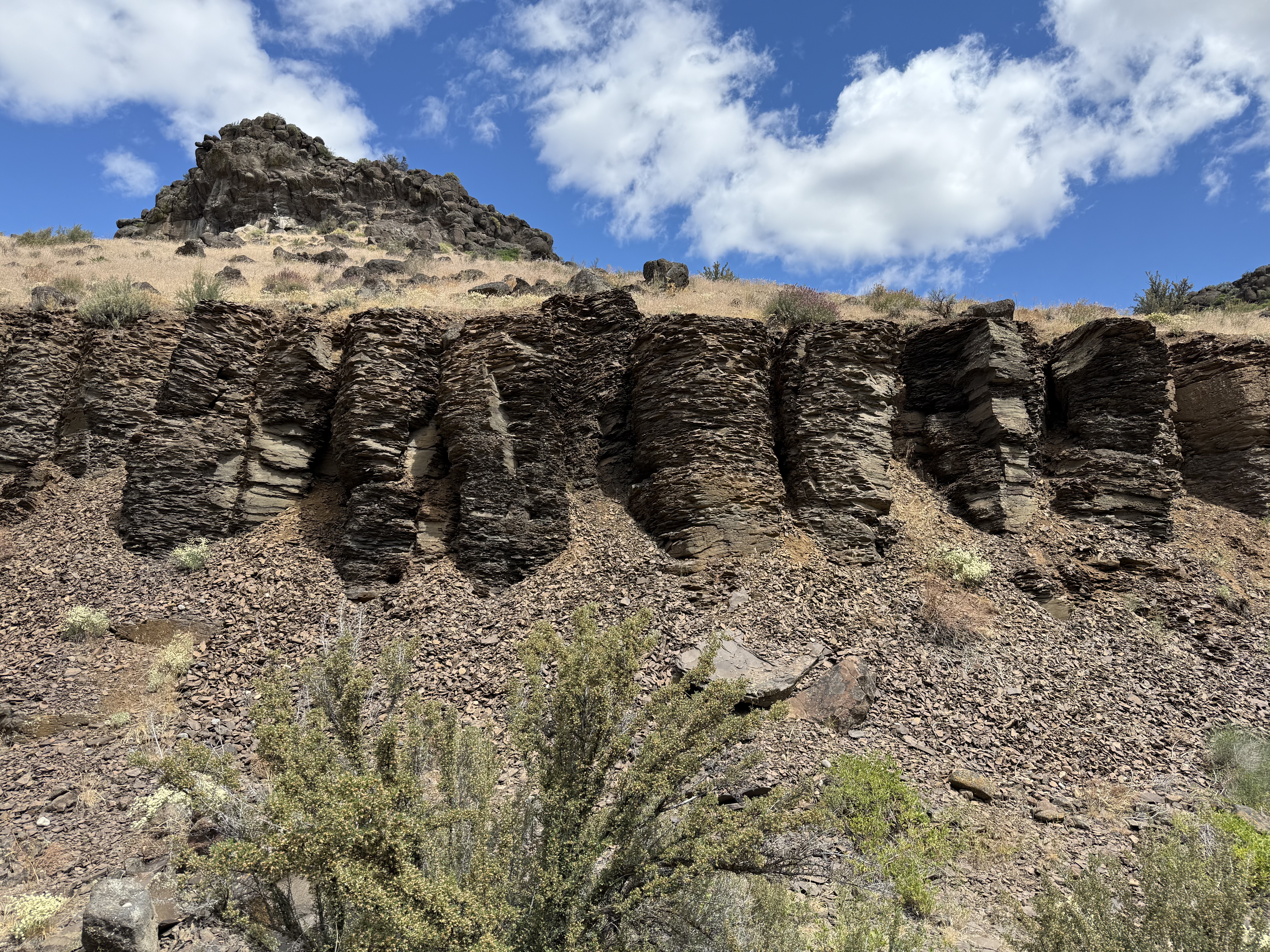
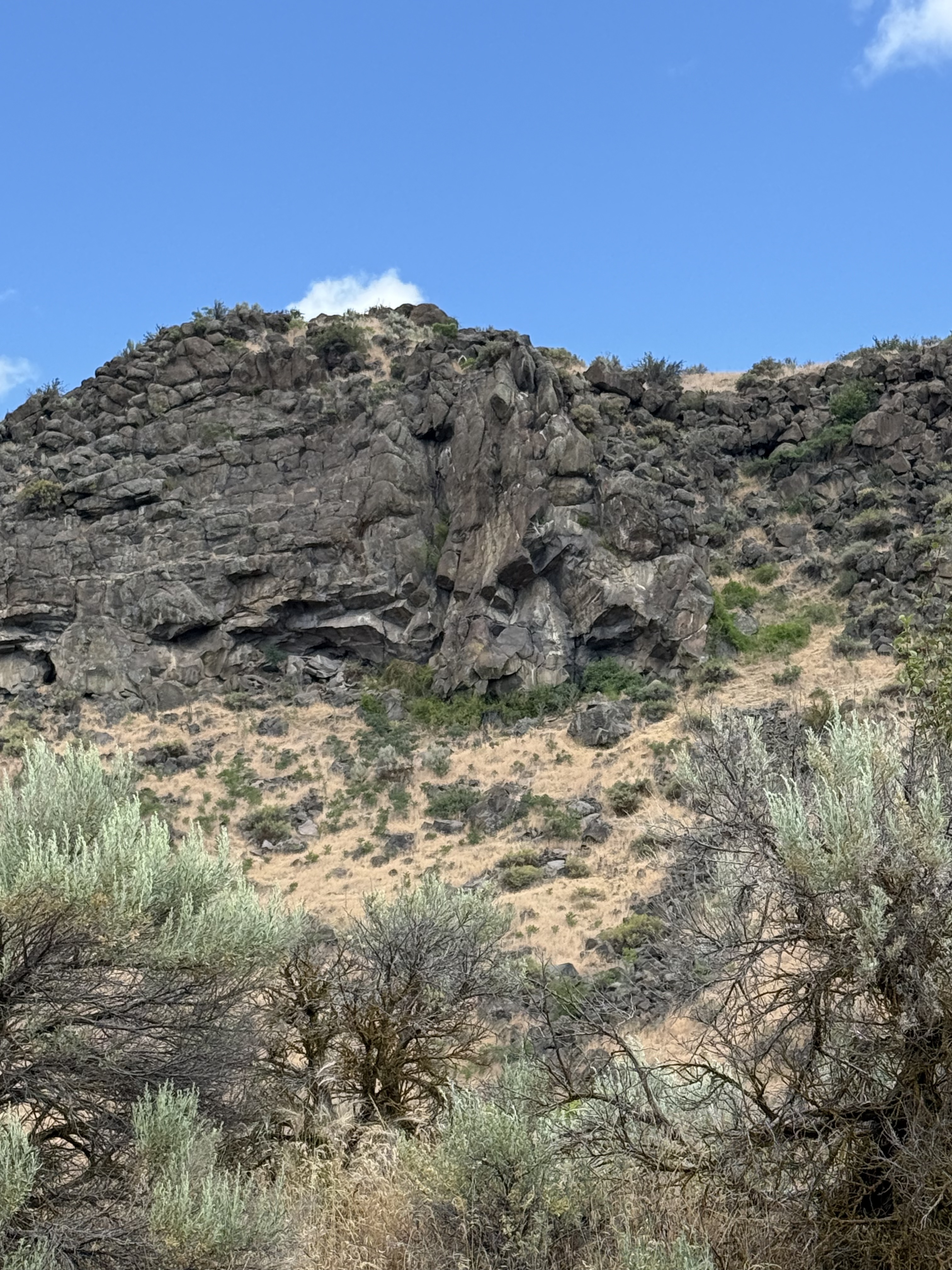
The canyon walls consist of a series of ledges like this with eroded slopes between them. The ledges are erosional margins of basalt flows and the slopes consist of talus and fine sediments weathered from the mafic rocks.
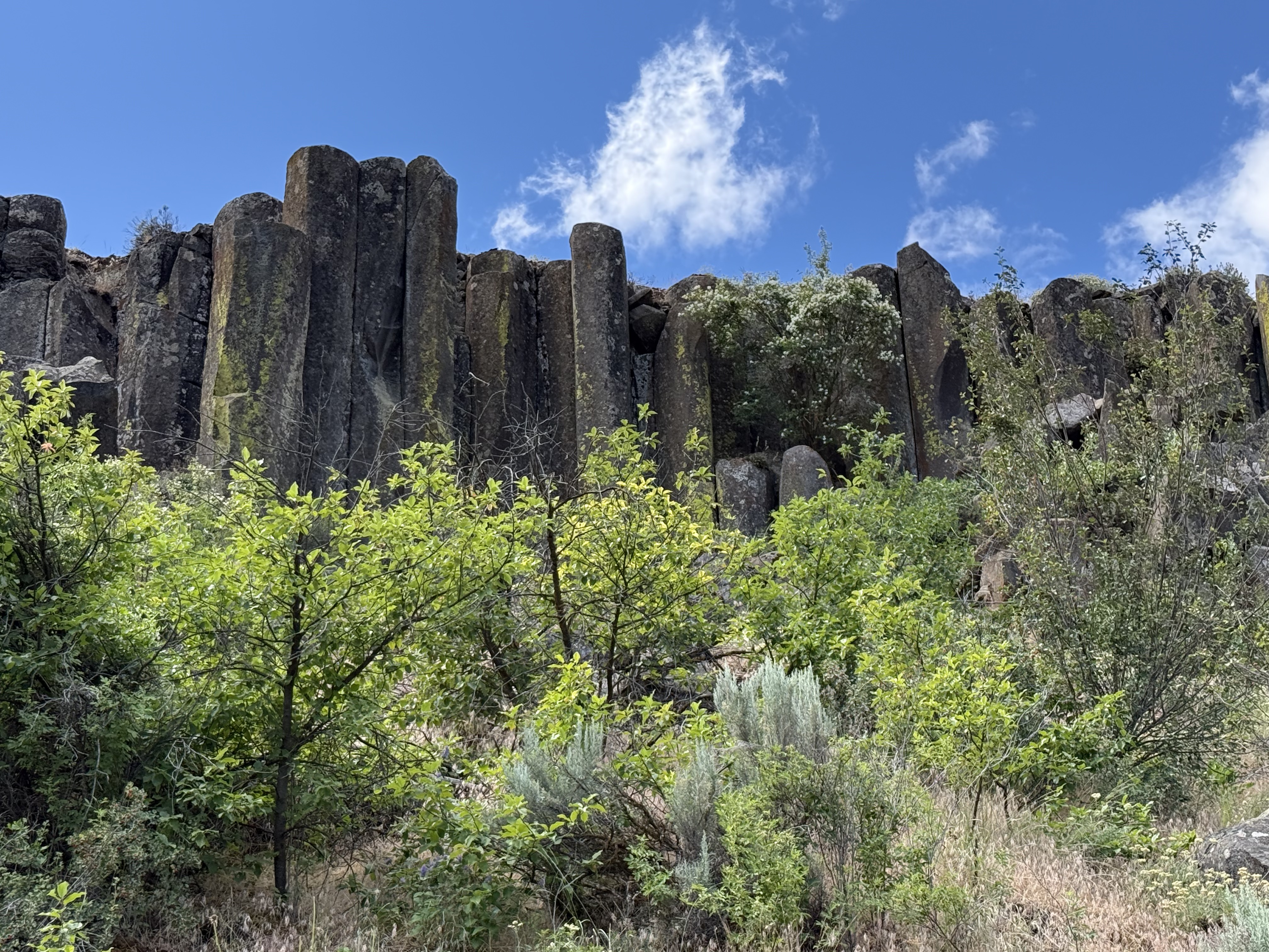
As we traveled west up the canyon, columnar-jointed basalt began to appear in the ledges overlooking the trail. Several pieces had rolled down the slope into the stream bed; these were about three-feet in diameter. Columnar jointing results from slow cooling of a uniform basalt flow, which causes joints to form hexagonal blocks like these because of thermo-mechanical failure during a decrease in volume.
These semi-circular blocks got my attention because, if you look closely, they appear to be eroded hexagons I estimate to be more than six feet in diameter. These are very large basalt columns that have either toppled or…
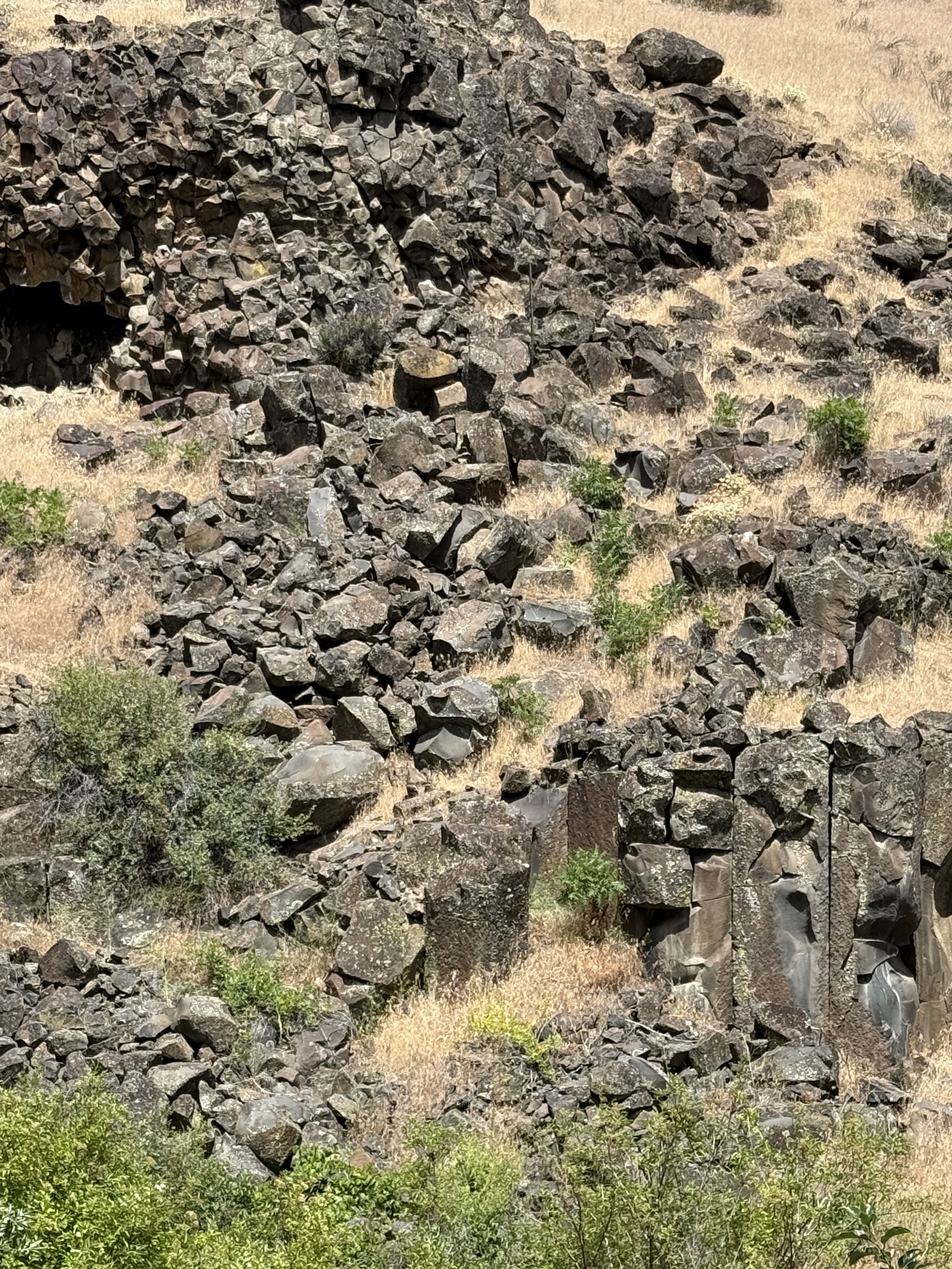
The top of this photo shows a birds-eye view of columnar basalt blocks because of their horizontal position. The size varies from smallest on the left to the largest blocks on the right. I reported on similar, horizontal columnar joints in a previous post and proposed that the lava flowed down a slope before solidifying.
The lower-right part reveals columnar basalt in a vertical position. This juxtaposition suggests (if my model is correct) that the lava from multiple flows covered an irregular landscape–sometimes flowing into canyons like Cowiche Canyon, and somtimes over fairly level ground.
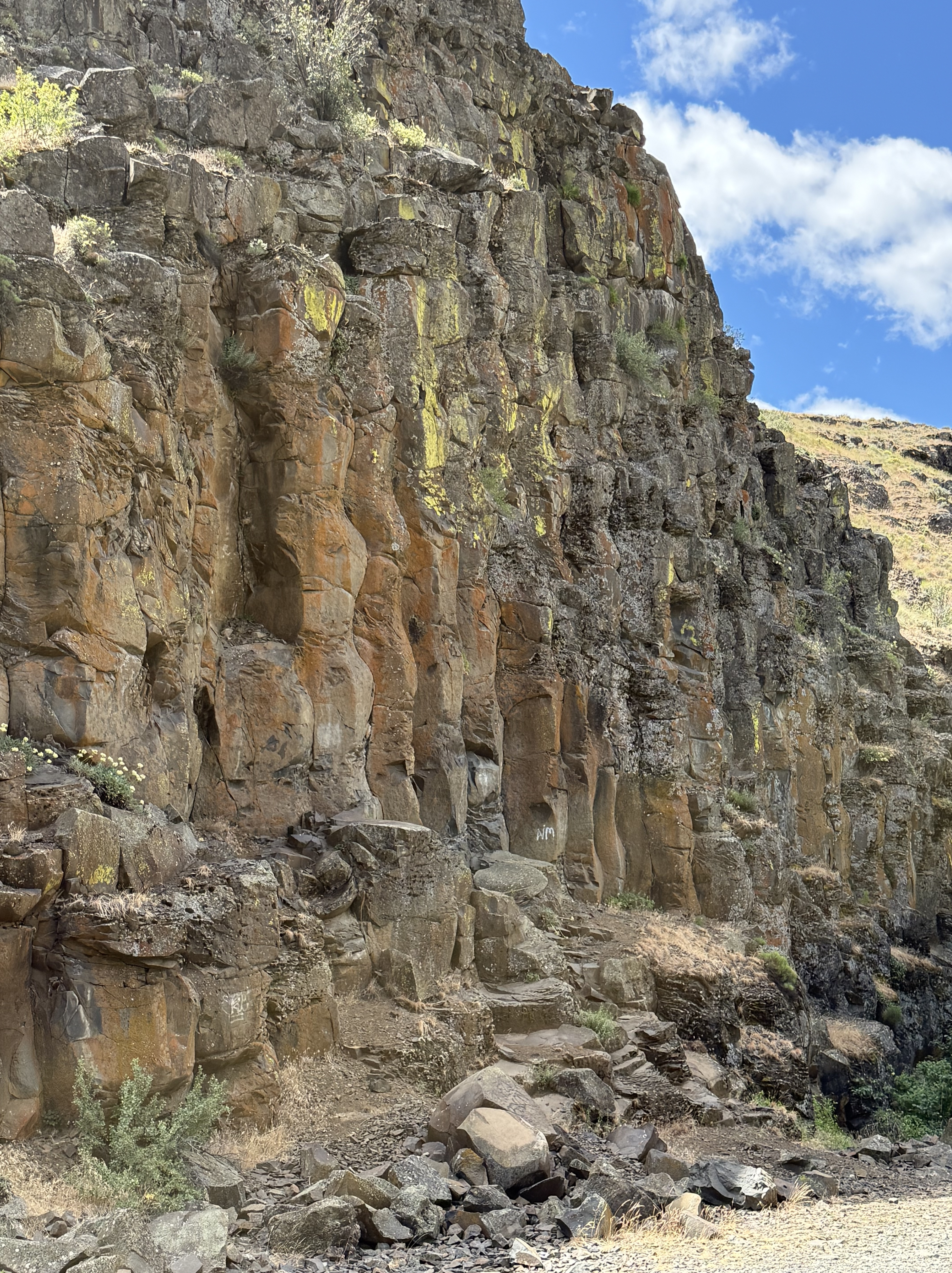
This remarkable set of columnar joints got my attention because of their undulating form. I’ve never seen anything like this before. This style of jointing (supposedly) results from uneven cooling and weathering; for example, a heavy load on the layer during cooling leads to pinching and swelling at fairly uniform spacing. That sounds reasonable to me.
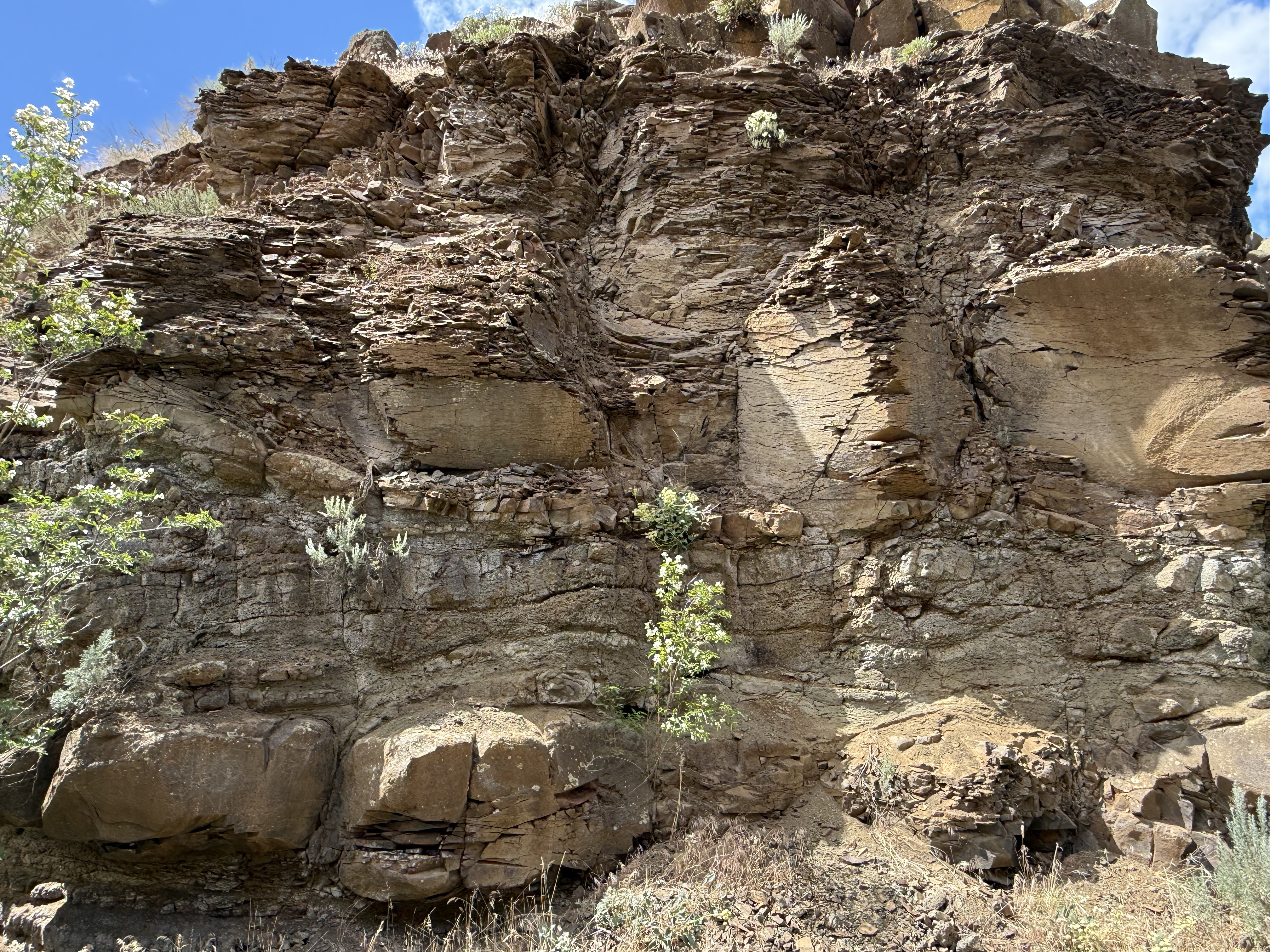
Another weathering feature of these rocks is the fissile structure revealed in this image. More solid blocks are interspersed with flaky layers, possibly (I’m speculating here) associated with necked and wider segments of an individual column. For example, the wider sections might undergo shear during stretching, resulting in microscopic shear layers within the minerals comprising the original lava. These weak layers would permit water to penetrate and weather the mafic minerals of which basalt is made.
These highly weathered columns are more than six-feet in height. They suggests an alternative mechanism, shear from flowing as the basalt cooled; this might disrupt the microscopic structure without interrupting the macroscopic jointing process. Maybe…
This photo really got my attention. It reveals horizontal columnar joints abutting vertical ones in the upper-center of the image. There’s a lot going on as hot lava flows over an irregular landscape, but I think this is a vent where more magma flowed out; not a large eruption, but enough to have a separate cooling history from the rock it penetrated. I should note that the Columbia River basalts flowed from fissures rather than point sources like volcanoes. The entire area shown in the map above was cut by fissures that led to a shallow magma chamber, which is still down there although it has probably solidified by now. Or not…
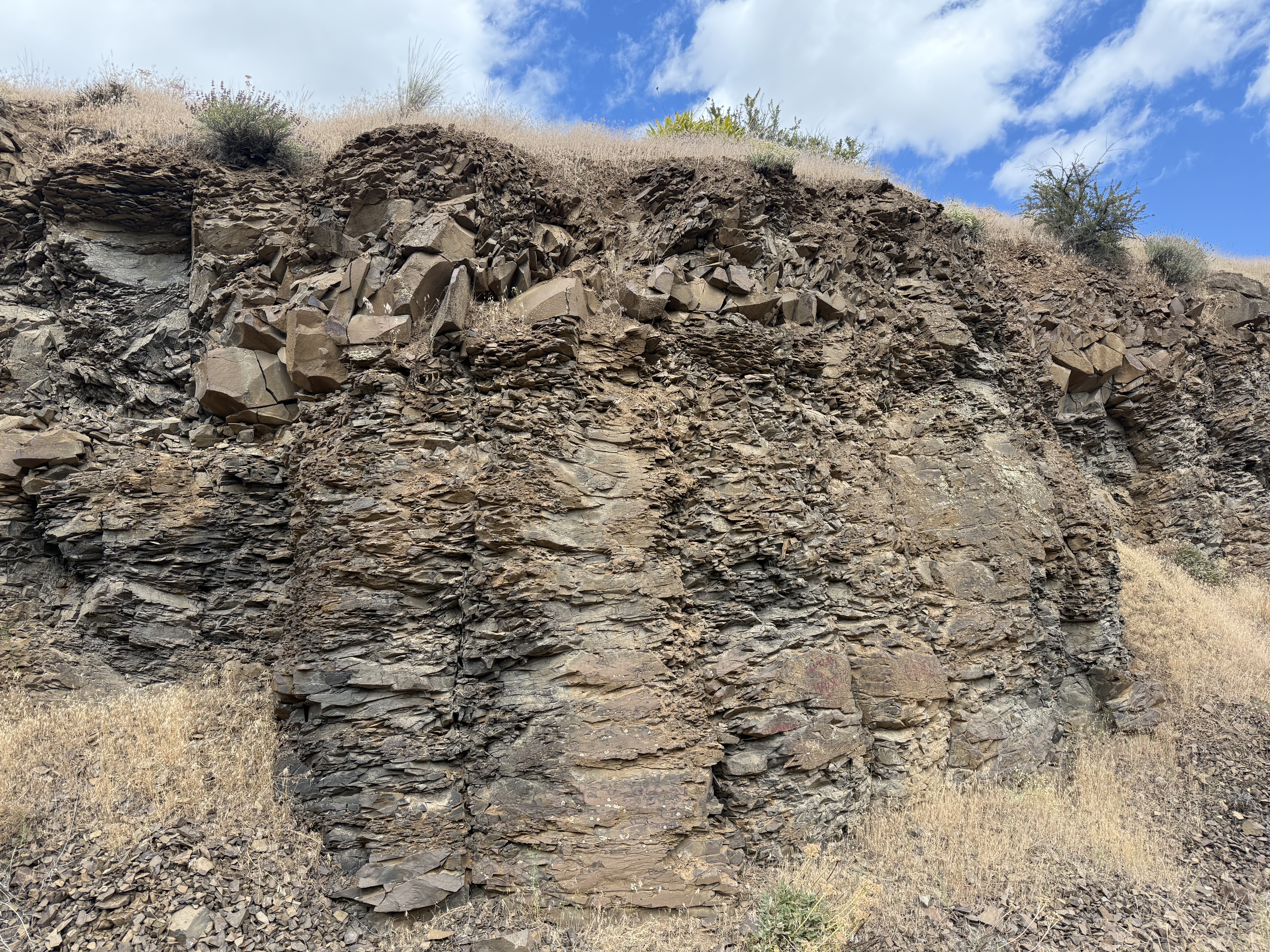
I like this picture because it reveals how much weathering can change the appearance of what was once molten lava in only a few million years. Note the layer of angular blocks sandwiched between weathered columns.
Conclusions
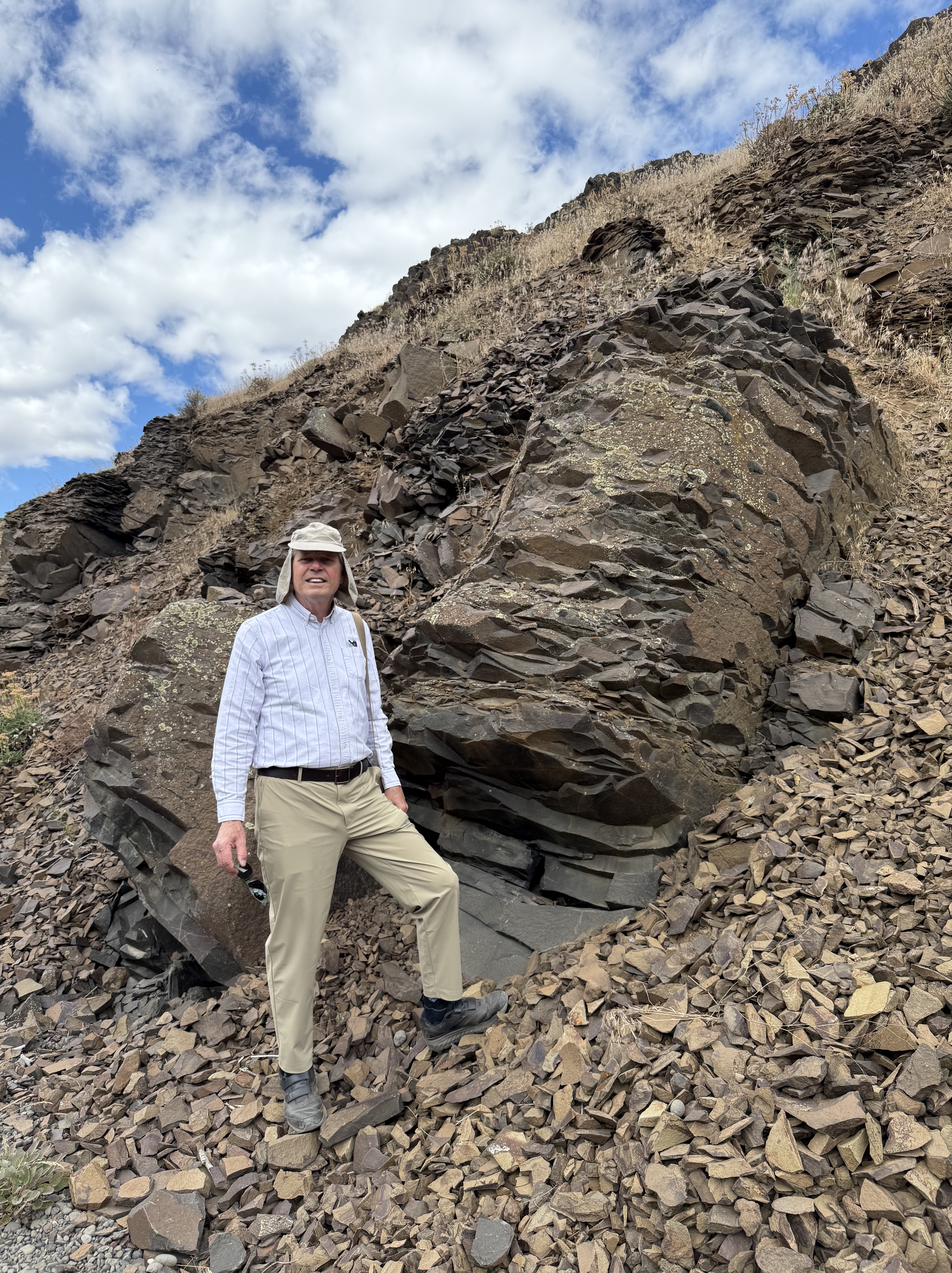
This is a typical basalt column that isn’t as weathered as some of the others. All those shards I’m standing on resulted from the breakdown of the rock by water seeping into its internal structure, where it altered the mafic minerals (e.g. pyroxene, plagioclase feldspar, biotite), which are susceptible to chemical weathering. This is where all the mud in the world comes from.
It was a great day to drive over the Cascades at Chinook Pass, where it snowed on us (in June), and explore the Columbia plateau. I’ve never seen so much variability in basalts before. The magma chamber underlying central Washington was a giant chemical reactor that released pressure by erupting a mix of fluids that cooled to form minerals and then these magnificent rocks. These rocks tell us how the magma chamber evolved over several million years; and once they were exposed to the atmosphere, they began to record the slow process of being reduced back to their basic constituents (fine-grained minerals like clay), which can remain suspended in water and begin their long and perilous journey to their final resting place–sometimes a lake but, ultimately, the ocean.
Everything eventually returns to the sea…

Recent Comments