
Ecosystem Notes from Quinault Rainforest
Introduction
I’ve spent the past few months wandering the Olympic Peninsula with my attention fixed mostly on rocks—tilted beds, breccias, sea stacks, and the stories they tell about deep time. But along the way I’ve been noticing the living world with the same quiet fascination. I’m not a biologist and I don’t pretend to be; I can’t name any of the plants I pass. What I can see is how each organism plays a role in the larger system, the way geology shapes life and life responds in turn. These are simply notes from a wanderer paying closer attention.
I’ll try to remember to label these environmental posts as NOTES to avoid any confusion, especially on my part. This first post arises from a short walk on a semi-muddy trail through the Quinault Rainforest, on the Olympic Peninsula. I won’t have much to say about the photos, and all identification will come from CoPilot (aka ChatGPT). I’m certain its identifications will be better than mine after hours of searching the internet.
Quinault Rainforest in Olympic National Park
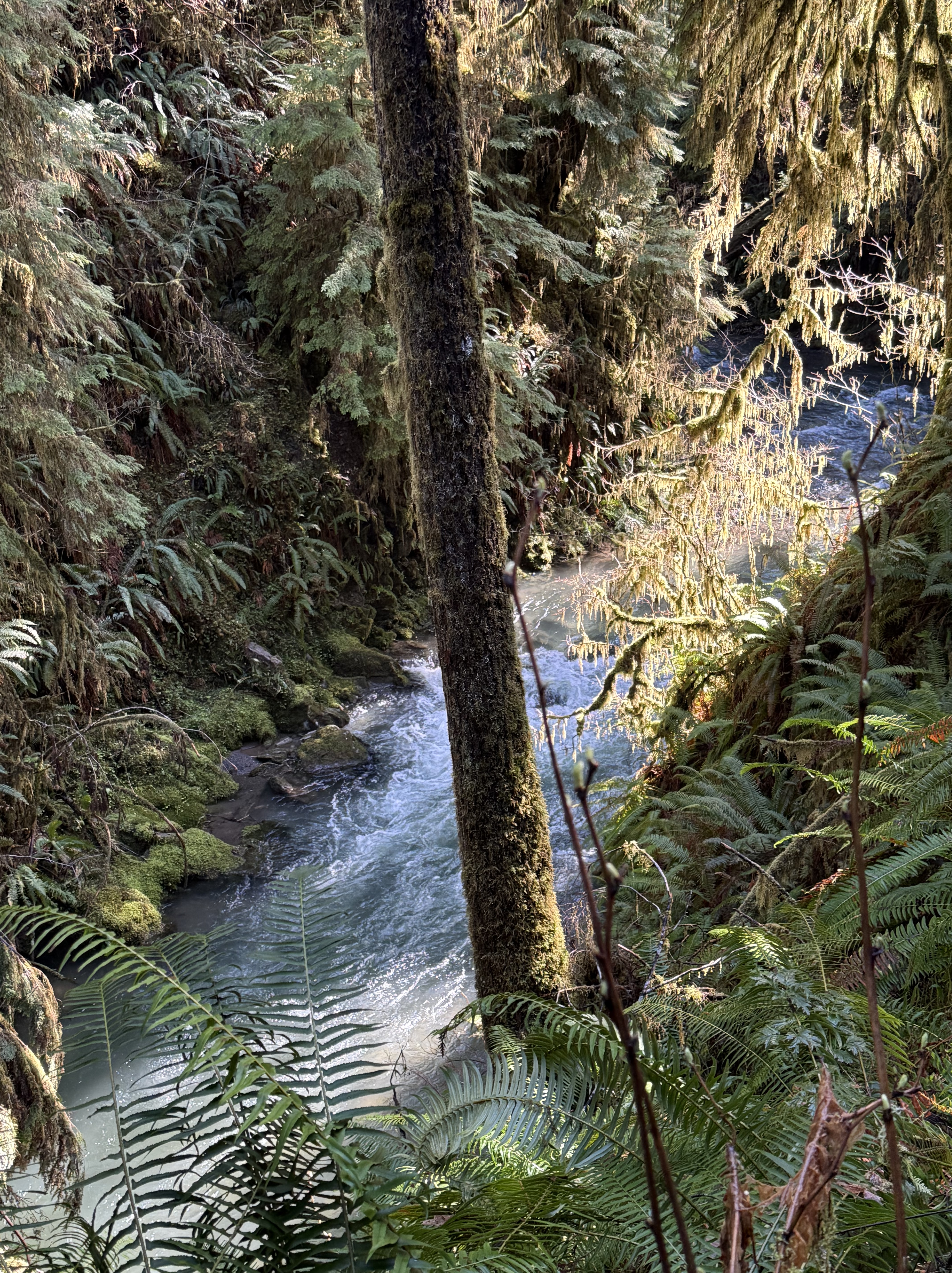
Plate 1. That raging stream about 50 feet below me is one of hundreds draining this temperate rainforest, which gets about 12 feet of rain per year. Note the ferns, which are everywhere, even in the temperate forests of northern Virginia. Ferns must be the most common plant in cooler forests. I am in a narrow strand of Olympic National Park that has never been logged. This is primordial nature, viewed by a geologist, but I’ll do my best.
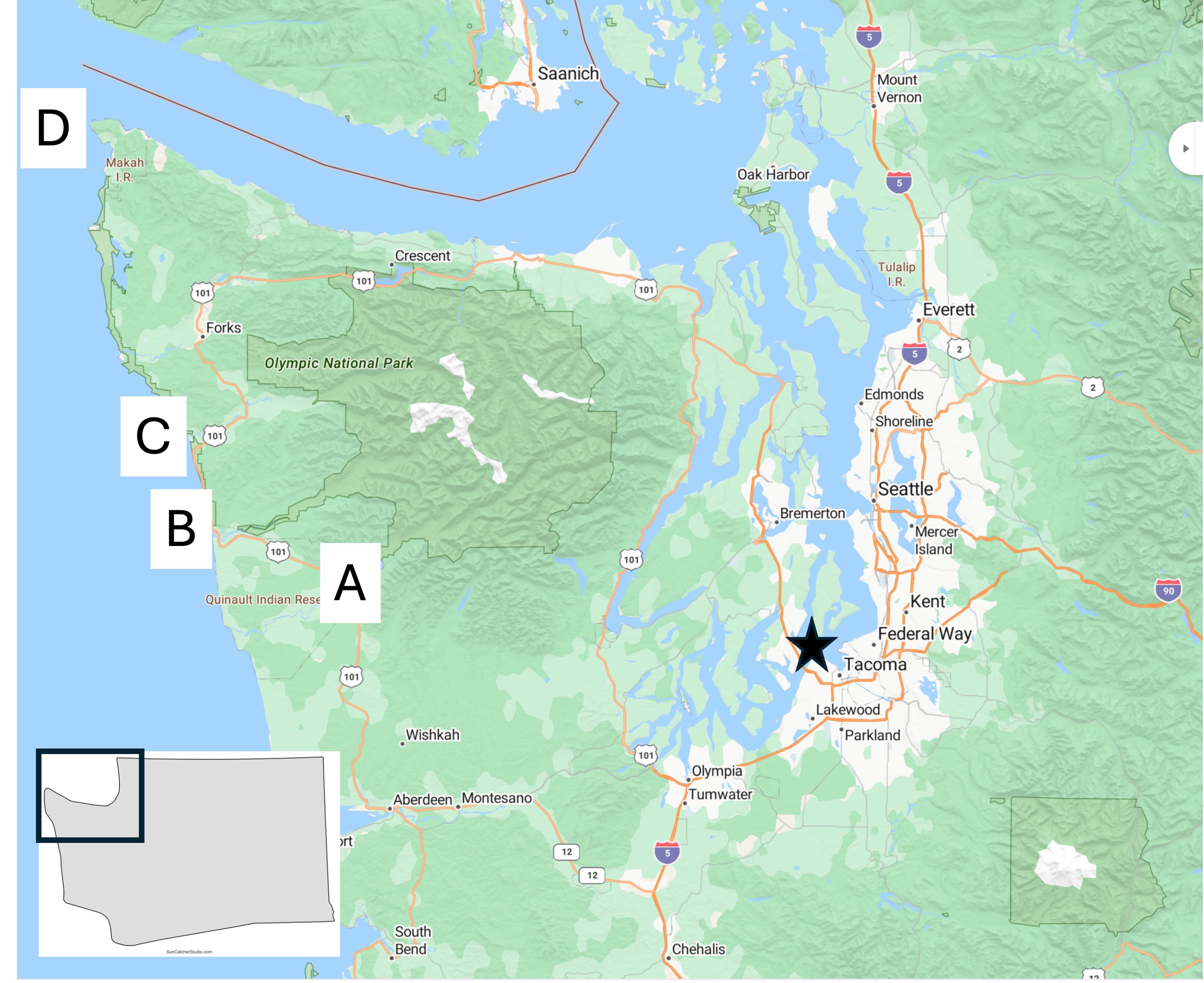
Plate 2. Map of the Olympic Peninsula showing the areas I reported on in previous posts. I’m going to be focusing on Site A today, with a few photos from D.
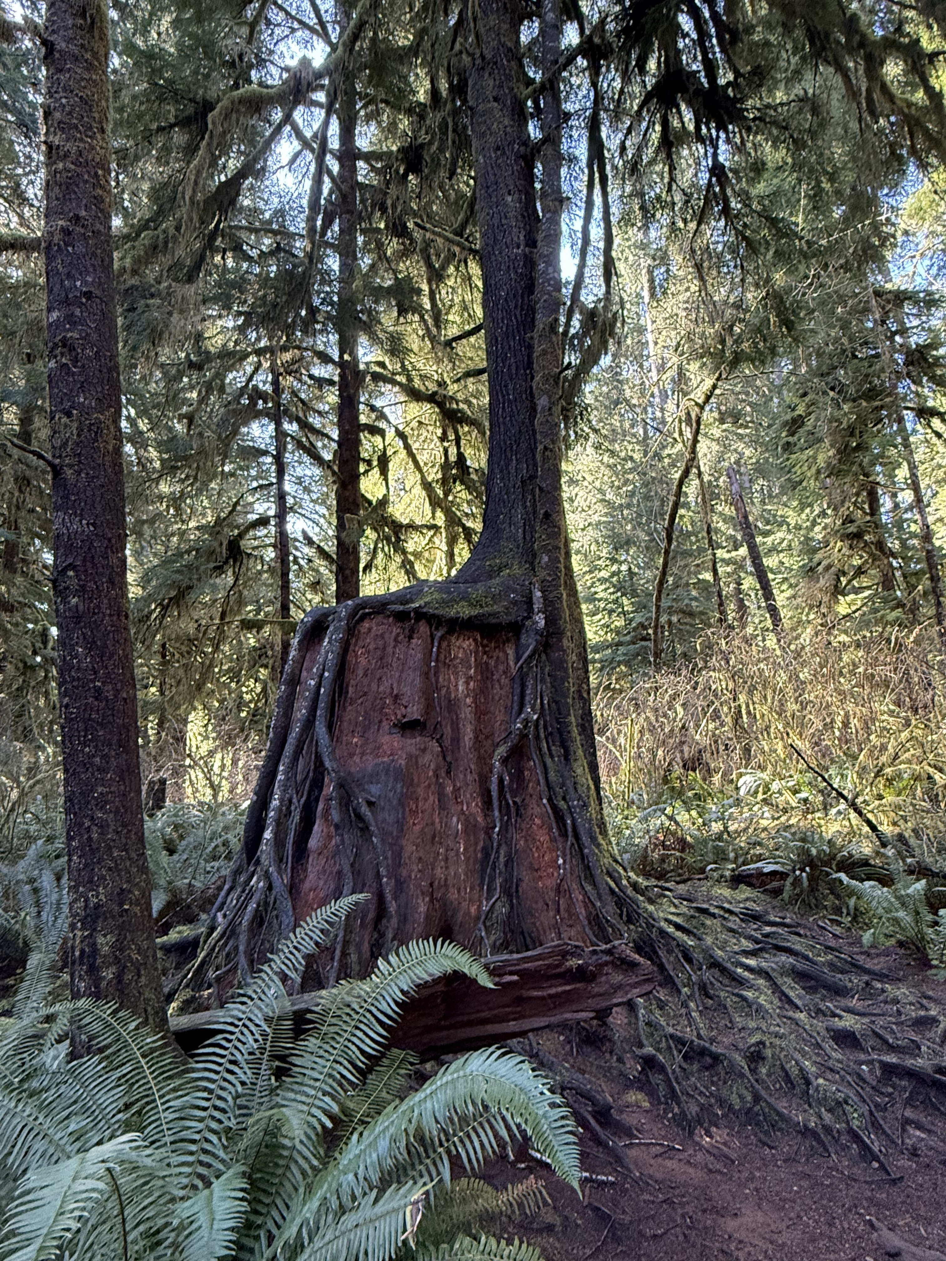
Plate 3. I haven’t seen this anywhere else I’ve lived, not even northern Virginia, but they occur everywhere here in Washington. Apparently this is a common occurrence in rainforests, where the ground is a dangerous place for seeds. I couldn’t identify the species in this photo, but this practice is very common for hemlock.
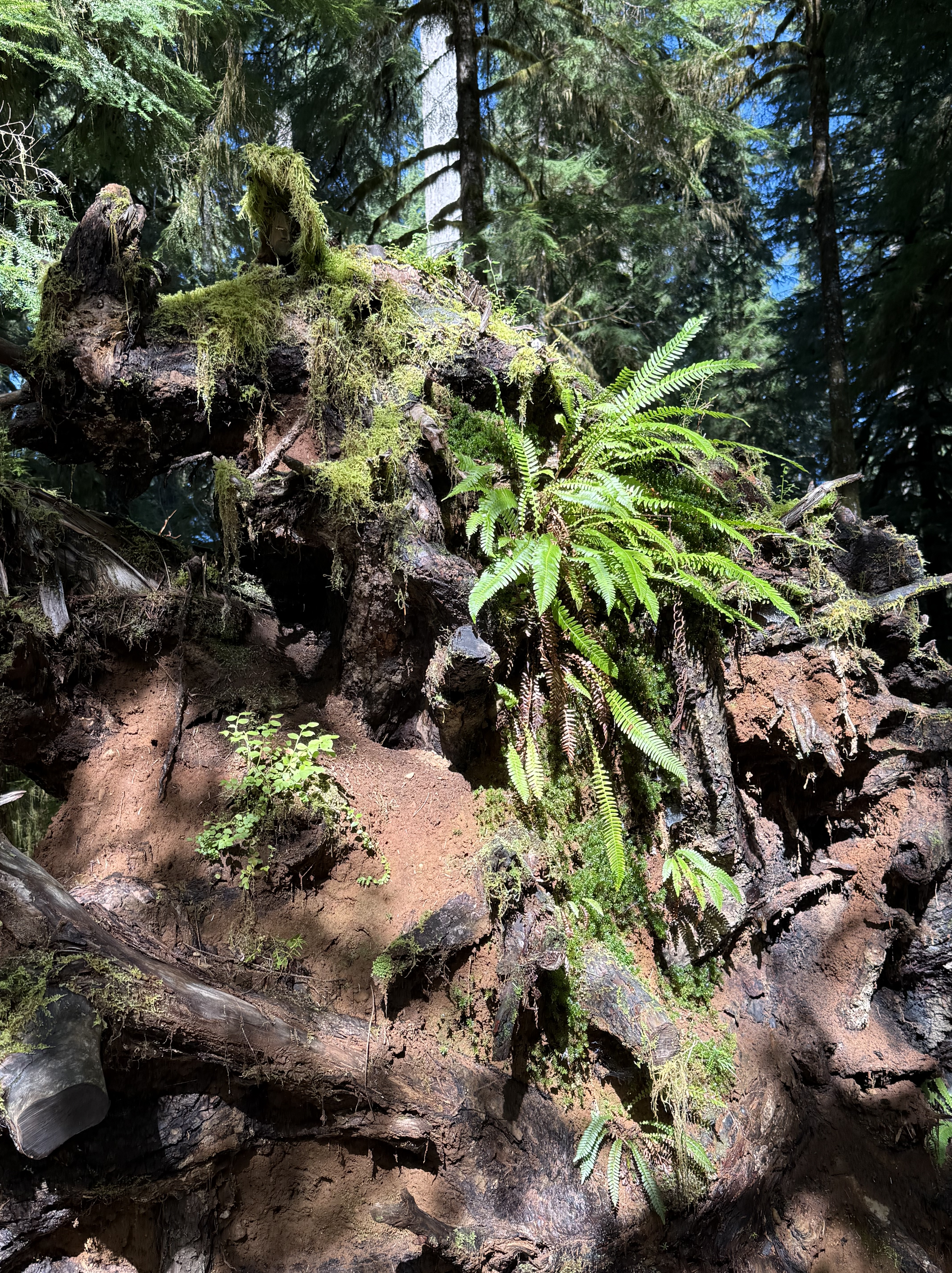
Plate 4. This pile of debris is a large log turning into compost and supplying nutrients to a variety of plants. The top of the photo shows the base of a young tree growing out of all this chaos. According to CoPilot and the Olympic National Park map, this area has never been logged, so I am in wonder of this pile of “forest garbage”. Is that sandy soil I see? Where did it come from? I don’t know.
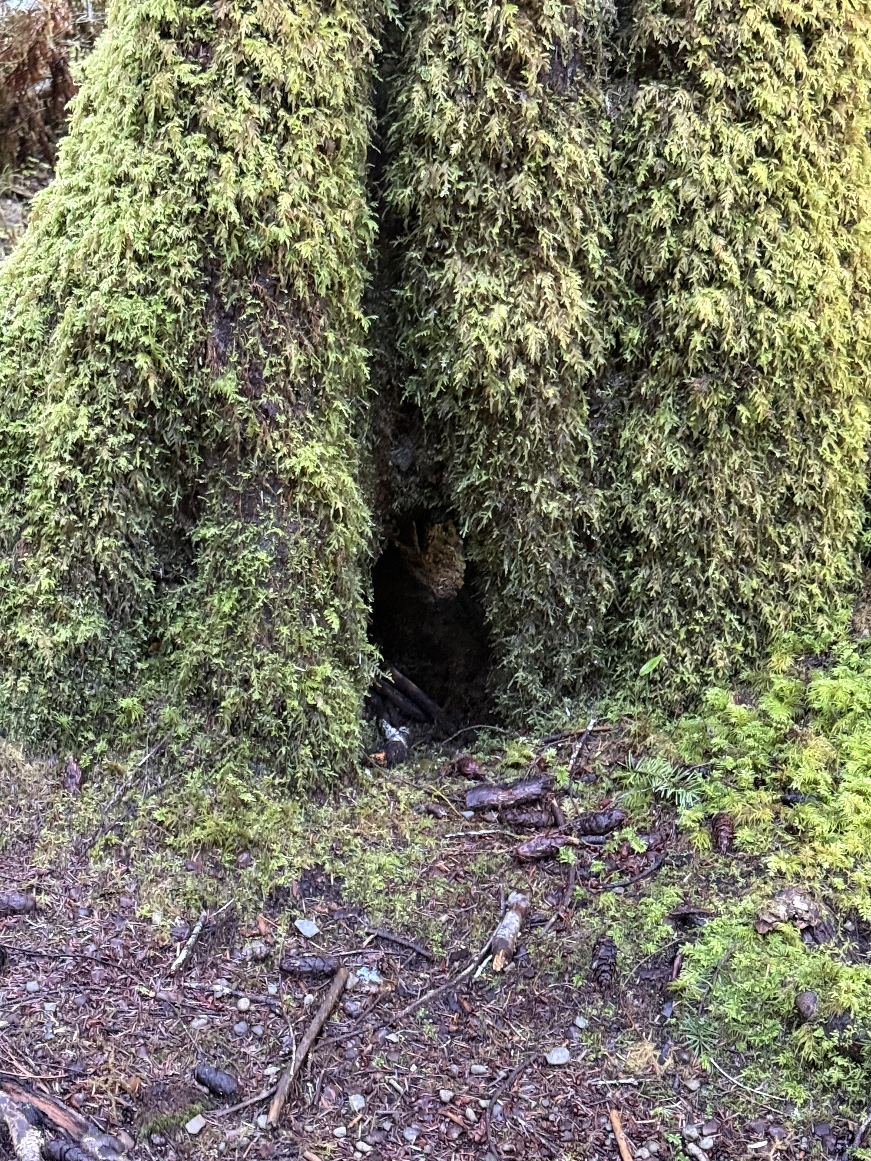
Plate 5. If you look close in the exact center of this photo, you’ll see daylight on the other side of the base of this unidentified tree. It’s about six-feet in diameter and covered with an epiphyte community of mosses and liverworts. Those aren’t leaves or fronds, but communities that mimic ferns–for their own reasons.
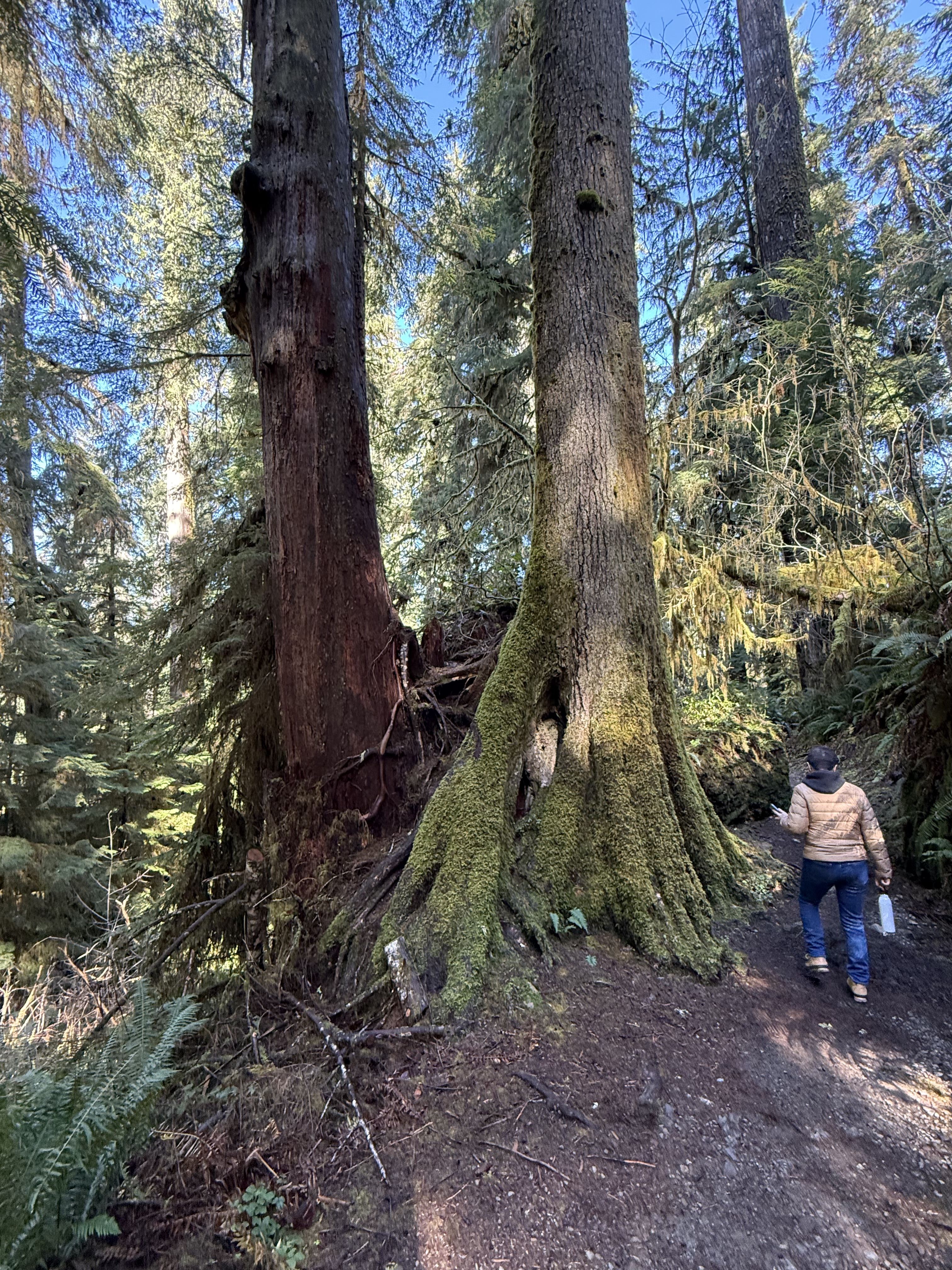
Plate 6. Here’s an example of a Western Red Cedar that has grown into a mature tree after being nursed by a stump. I guess it will eventually absorb the rotting stump and grow to full height, but this is the largest I’ve seen so far in the region.
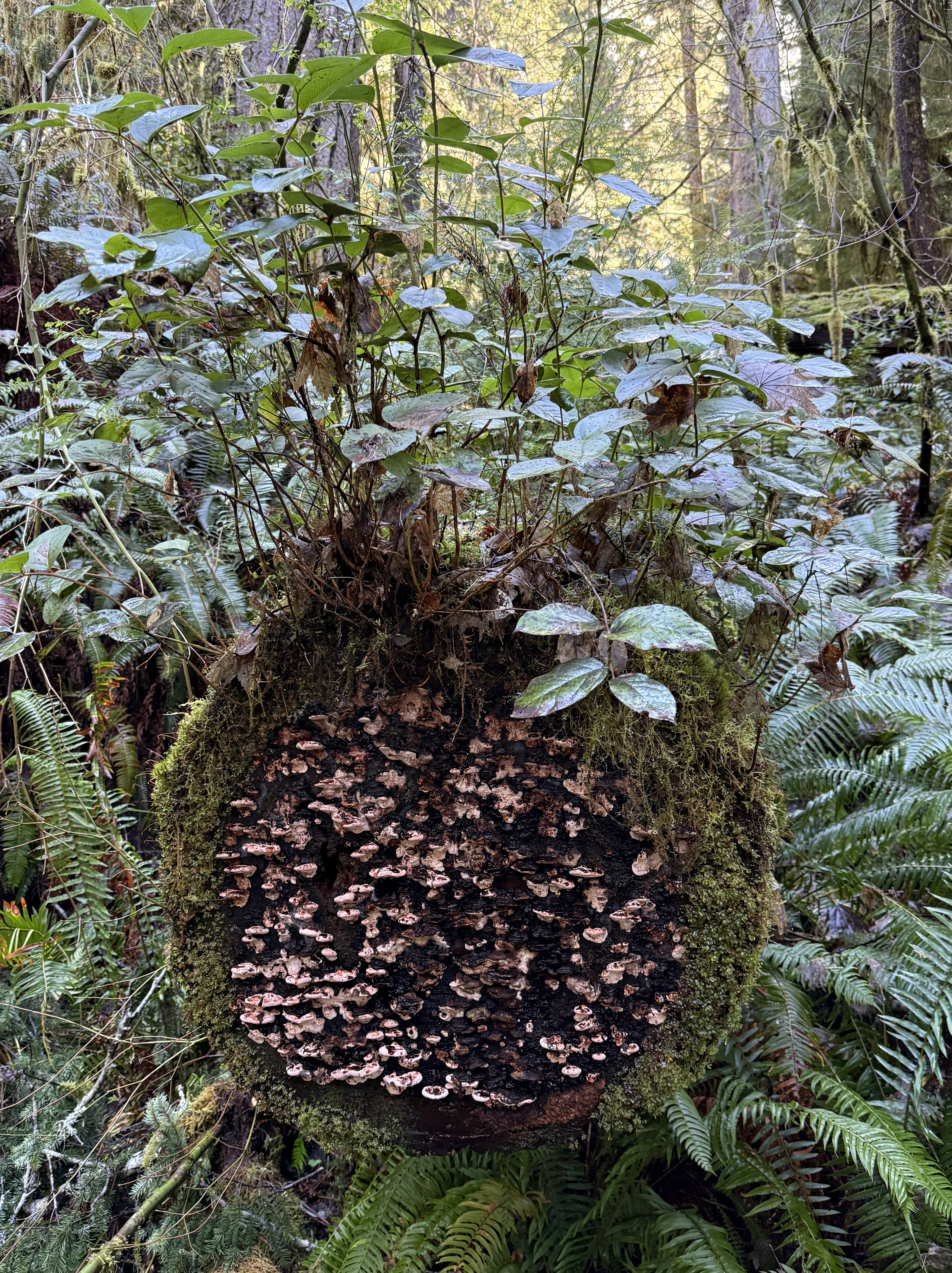
Plate 6. This miniature ecosystem caught my eye, but I had to turn to CoPilot to get an idea of what’s going on. As a tree trunk decays it goes through five stages: 1) moss; 2) liverworts; 3) fungi; 4) shrubs; and 5) young trees. This one seems to be in stages 1-4. I didn’t see any seedlings on it. The shrub is probably huckleberry and the mushrooms a bracket fungus, probably Trametes or Stereum.
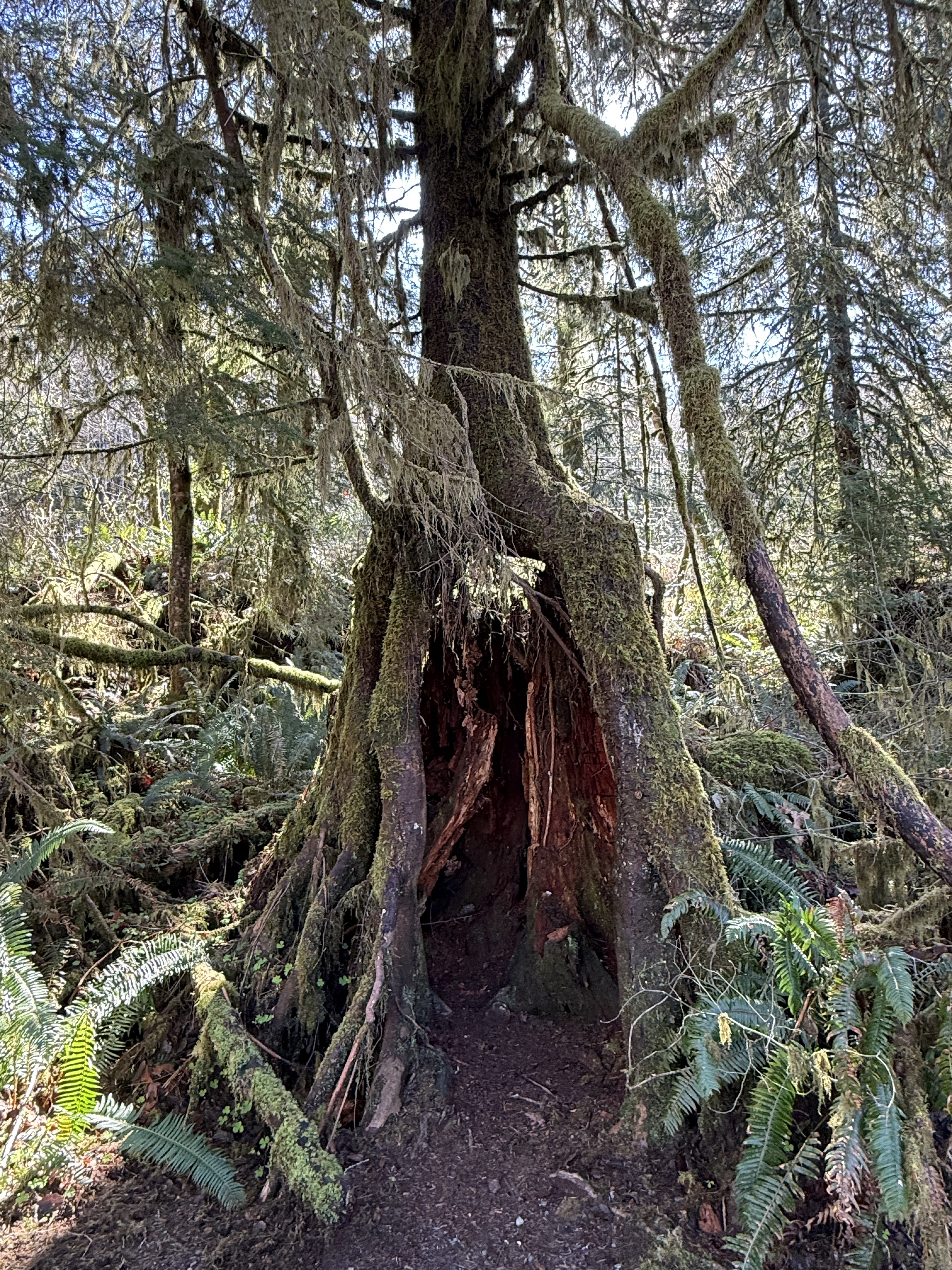
Plate 7. I am fascinated by these nurse trees after seeing species of fig trees in Australia that devour living trees, like a giant fungus or alien. These are nursing on dead trees, however, so it isn’t as gross; but this one is now standing on its own legs after the original stump has begun to collapse.

Plate 8. This is the largest Spruce tree in the world. It’s 191 feet tall and about 1000 years old. It is growing in a swampy wet land at the inflowing stream to a glacial lake, Lake Quinault.
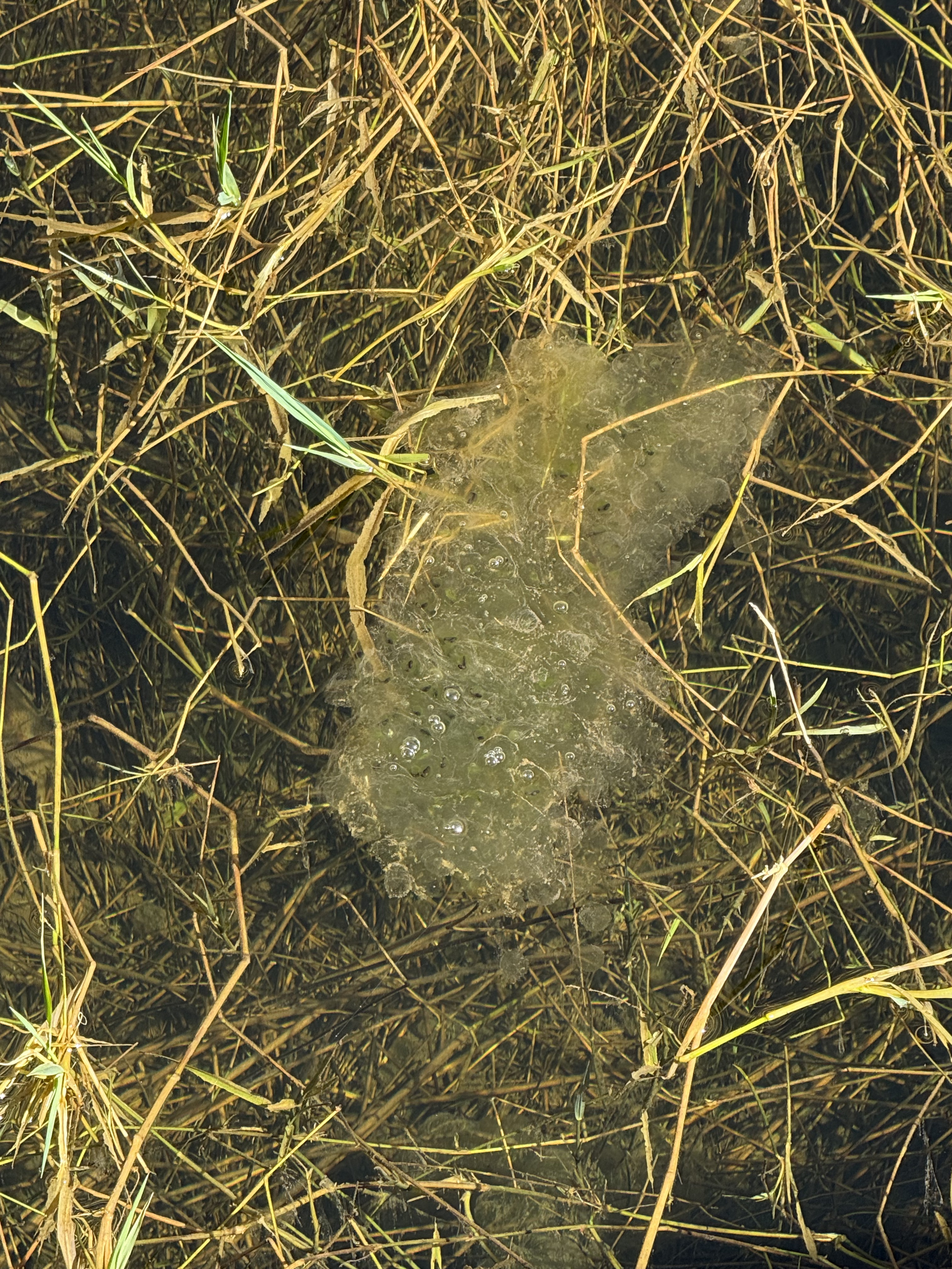
Plate 9. I thought this was toxic waste until CoPilot took a look at the photo: this is a mass of frog eggs (probably northern red-legged frog). There were several more at the shallow, marshy wetland where a stream fed Lake Quinault. The water is so clear you can see the bottom, which is only a couple of feet down.
Kalaloch Beach in Olympic National Park
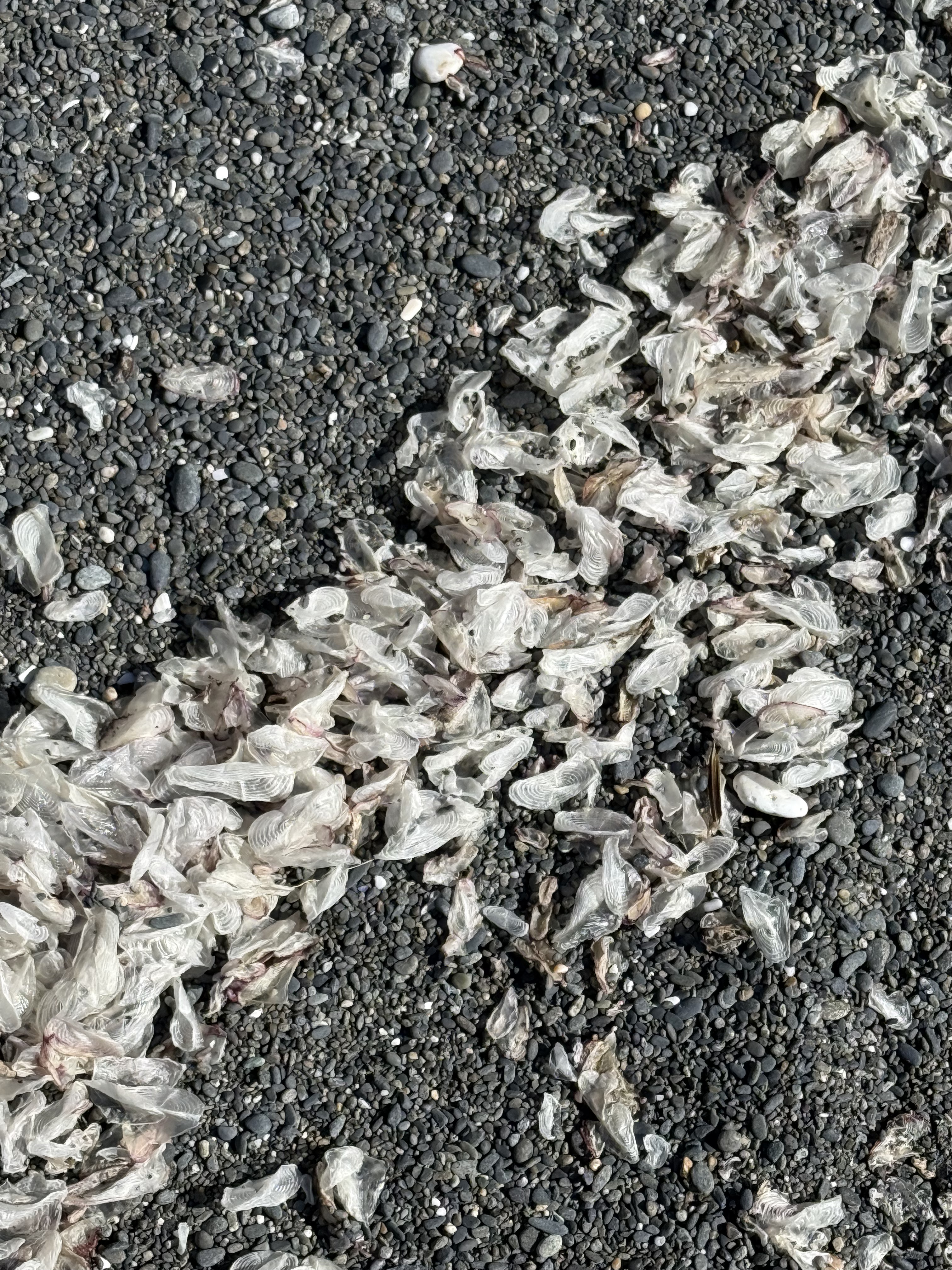
Plate 10. This one was a doozy. These objects are one-two inches long, thin, translucent, and oval in general shape. At first, CoPilot suggested insect wings (until I told it the size), then gull secondary feathers (until I said, “no way”), then settled on small fish cranial bones–e.g. the opercula, the bone that covers the gill. I asked for references, but it supplied me with titles and no links (how did it find them?). I spent longer on this photo than I wanted to. I don’t fault CoPilot for its ambiguous response because I found nothing when I looked very specifically. This phenomenon is either so common that no one bothers mentioning it, or infrequently observed that no serious beachcombers have stumbled across it. I’m going to have to agree (for now) with CoPilot that these are small bones from a school of fish that was decimated by either predation, coastal fishing, or disease and only these translucent cranial bones survived by floating, until waves concentrated them on this beach. This is the only beach where I saw them. I guess there are no easy answers to some questions–unless someone who reads this is a marine biologist.
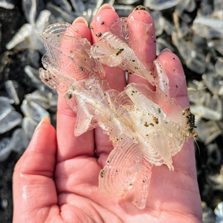
Plate 11. I solved the mystery of the white objects on the beach (Plate 10). I spoke to an ecologist I know who suggested they are a Hydrozoa called Velella-velella, which floats on the ocean like a jellyfish. They are a colonial organism that is blown about by the wind. They don’t swim so they are easily blown onto a beach and carried by waves. (Here’s a good article about them.)
Cape Flattery
I reported on this amazing location in a previous post. You can scan that post to get an idea of where these photos were taken.
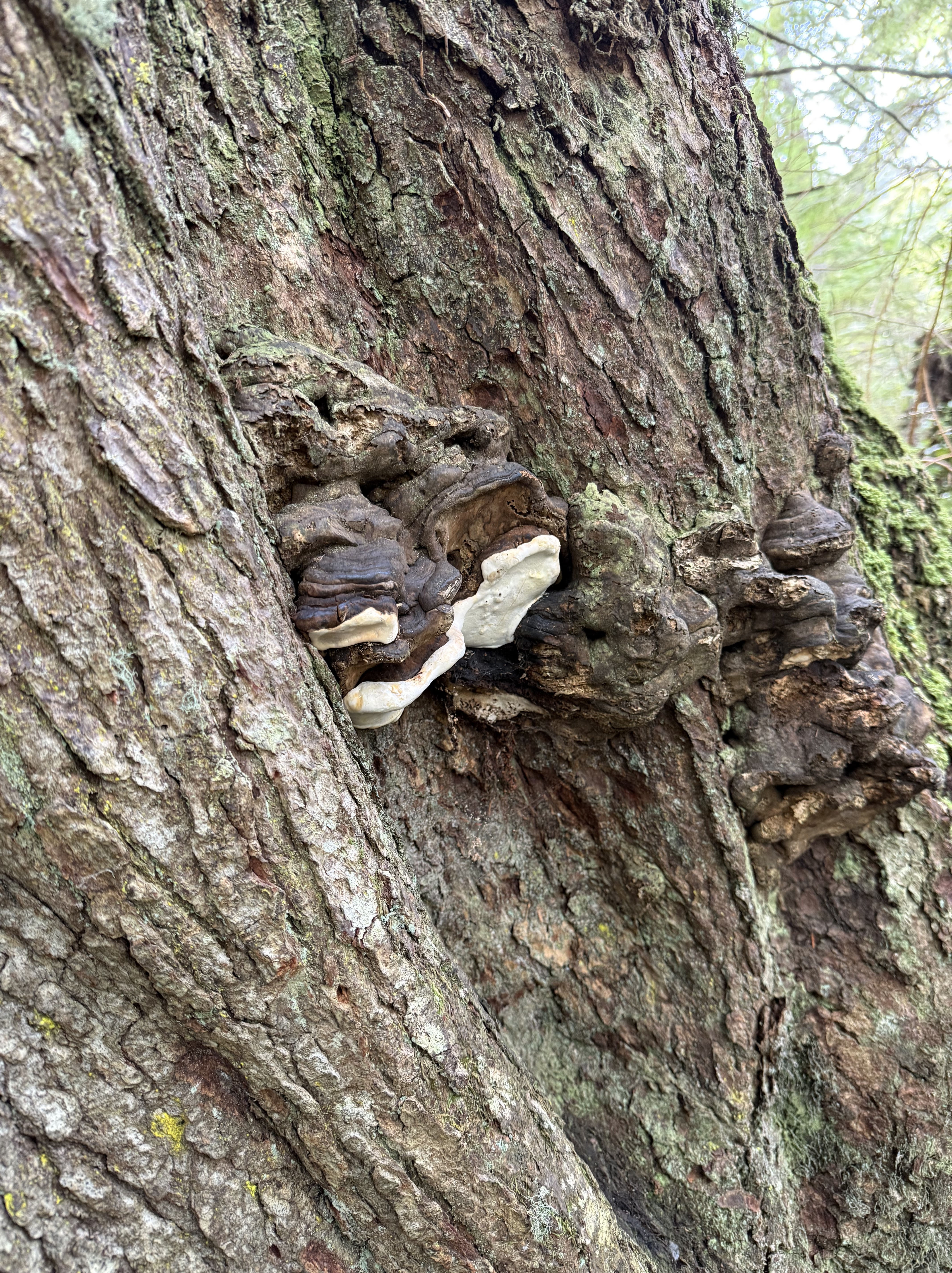
Plate 11. I don’t know if this living (it looked healthy to me) tree was stressed or not, but CoPilot thinks these are perennial bracket fungi, which favor environmentally stressed conifers. There were only a few on this tree. I noticed that this forest didn’t show nearly as many signs of decay as Quinault Rainforest, despite its exposed location.
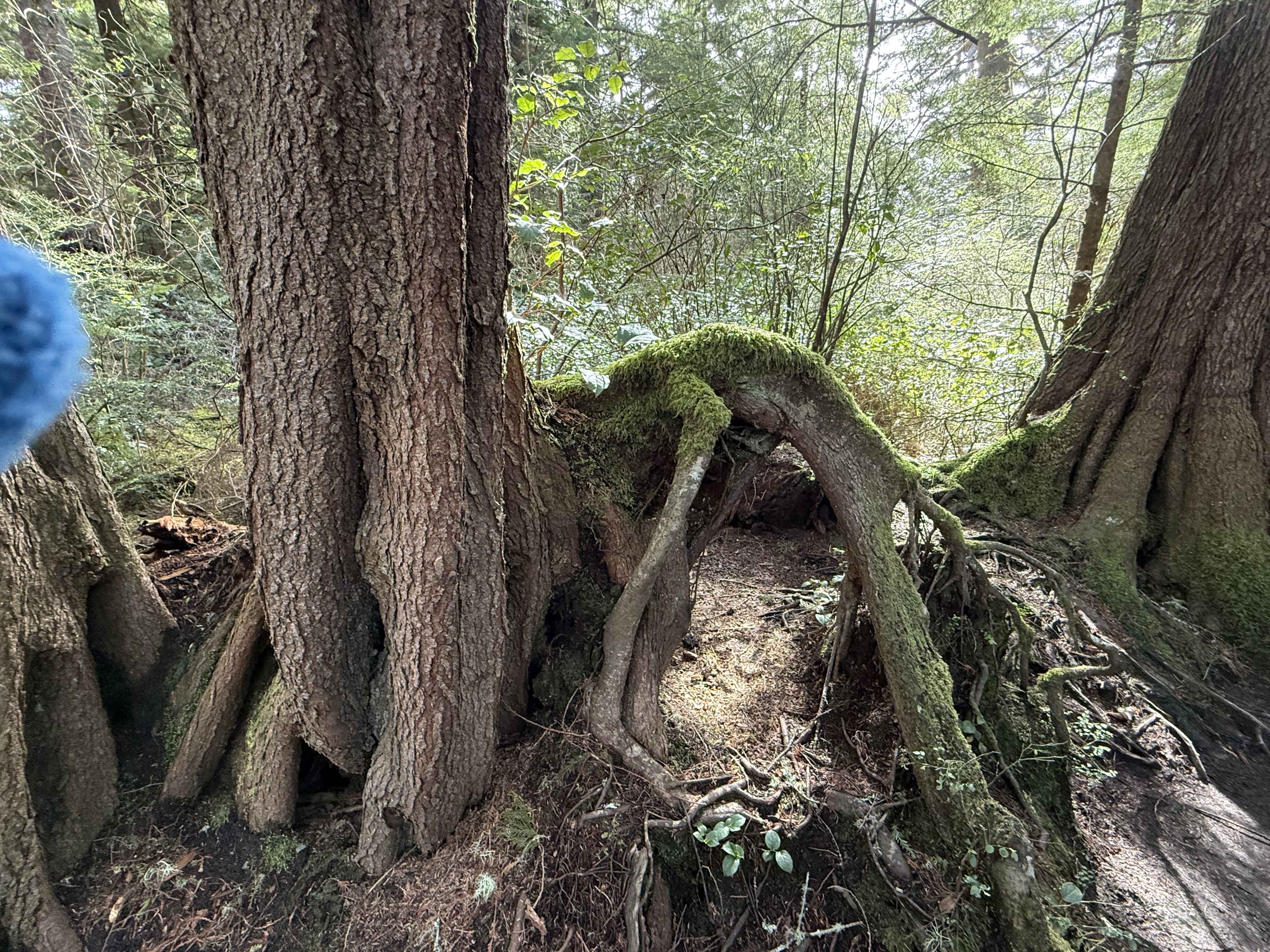
Plate 12. I had to throw this photo in because the root growing out of the tree(s) on the left looks like a dog that got its head caught in a hole, and died there. Its limbs of limp. Overactive imagination, I know. Nevertheless, this is a bizarre image because the dog is lying on top of a mound of soil. I’d bet there was a stump there that has decayed because the trees visible in this image are both composed of multiple trunks. A large tree died here (like the dog) and these are its adopted offspring. I would add that Cape Flatters, which is part of the Makah Reservation, has never been commercially logged. This is old-growth forest and this is a naturally occurring phenomenon.
Summary
Moisture drives everything on the Olympic Peninsula, soaking old volcanic and sedimentary foundations until the forest grows straight out of its own decay. Fallen logs become elevated nurseries, their wood breaking down under fungi and mosses until they’re more sponge than tree. Hemlock, cedar, and huckleberry take root on these platforms, sending roots around stumps and into the thin soils draped over ancient bedrock. Even the beaches tell the same story: waves sorting bones, shells, and driftwood carved from headlands shaped by tectonics and storms. It’s an ecosystem built on slow collapse and constant renewal.
Acknowledgment
I am experimenting with using CoPilot (aka ChatGPT) to help as I pursue my growing interest in ecosystems. I have been up front about where it contributed. It has been a great help, as well as an inspiration; if not for CoPilot, I wouldn’t have had the time of inclination to add these ecosystem NOTES to Rocks and (no) Roads. In fact, I’m tired of this entire series of posts, for which I get no compensation other than sharing my observations of the world. As a final note, CoPilot wrote the Summary and I stand by it.
Now I have to think about more than just rocks…
The Olympic Peninsula: Quinault Rainforest to Cape Flattery
This is the first in what I hope will become a regular series of blogs from my travels around the Pacific Northwest (PNW) as well as trips throughout the world. This series accompanies my main blog, Rocks and (no) Roads, which reports on the geology of various places to which I travel. You could see I’m expanding my horizons; in addition to posting about general sights in this post, I will also be including environmental and ecological observations that are of interest to me. My background is in geology, but I’ve become aware of a lot more since moving to the PNW. So this is a learning experience, thanks in large part to the availability of expert assistance from CoPilot, Microsoft’s version of ChatGPT. I’ll be turning to it to identify plants and evidence of animal activity in future posts.
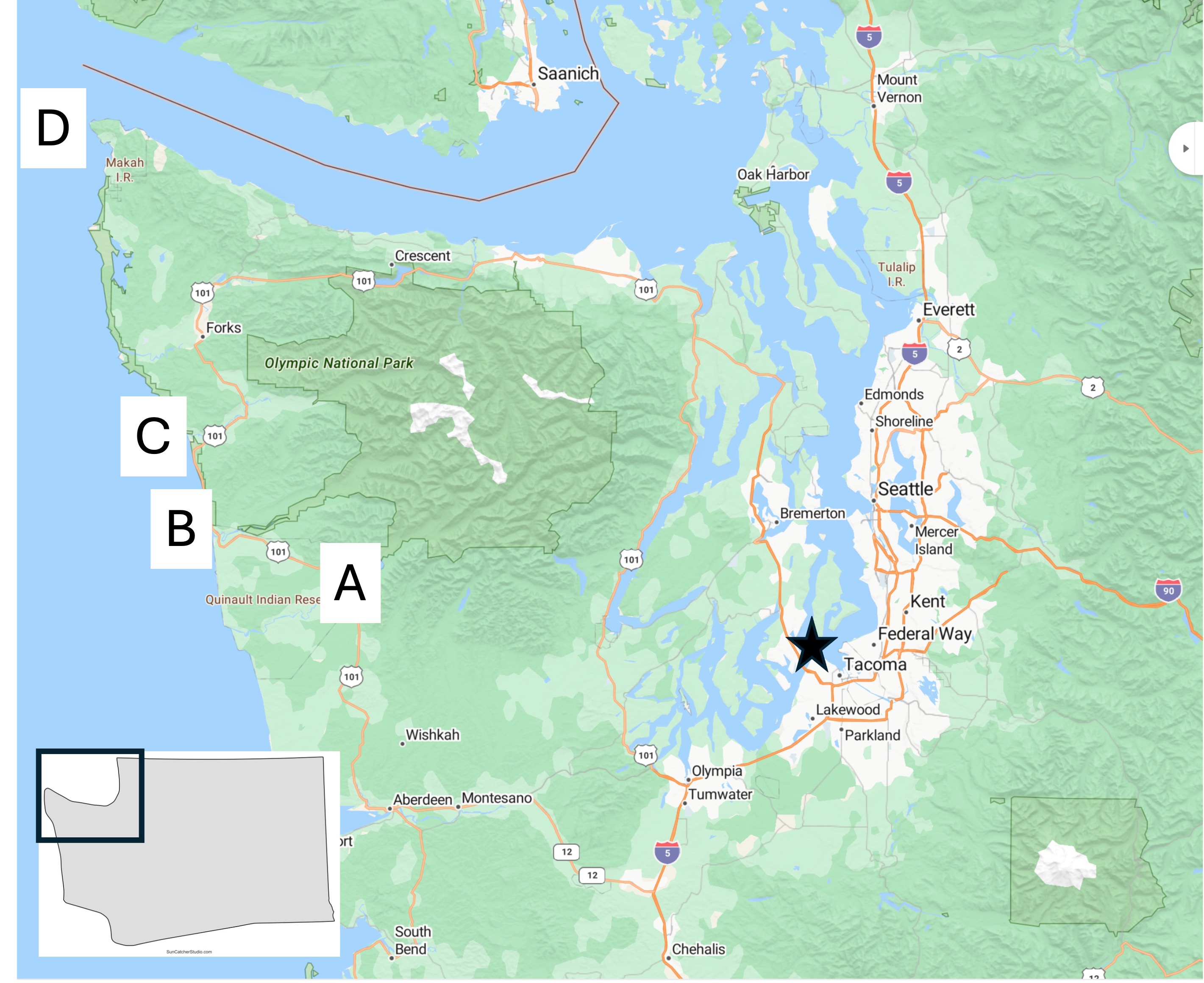
This is the base map I’ll be using in many of my posts from the PNW. The star indicates my base in Tacoma. Today’s post describes a two-day trip to circumnavigate the Olympic Peninsula. Although this area is the wettest in the contiguous United States, with annual rainfall up to twelve-feet, it was clear for the duration of my visit. The labeled areas indicate where the photos described below were taken.
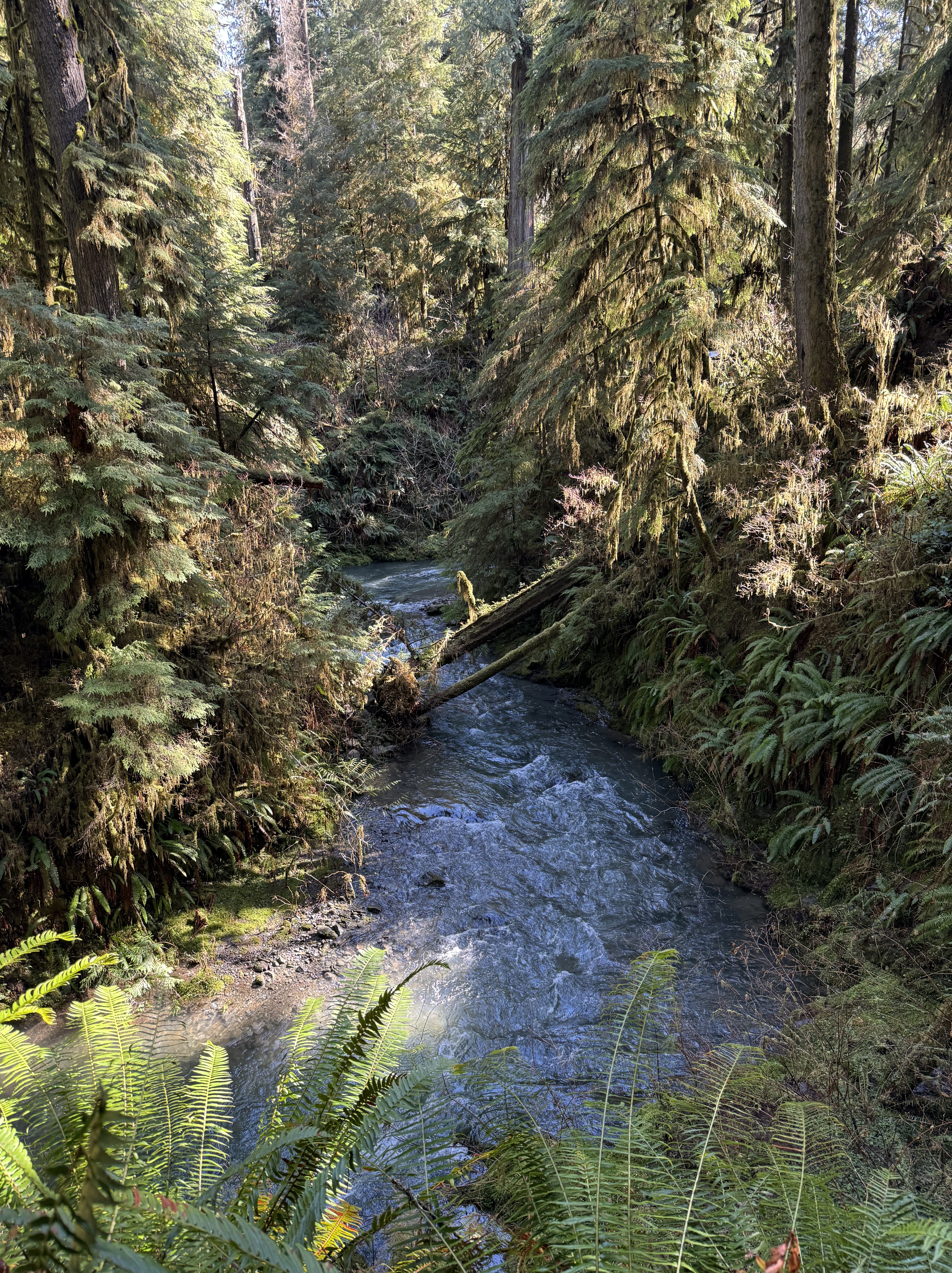
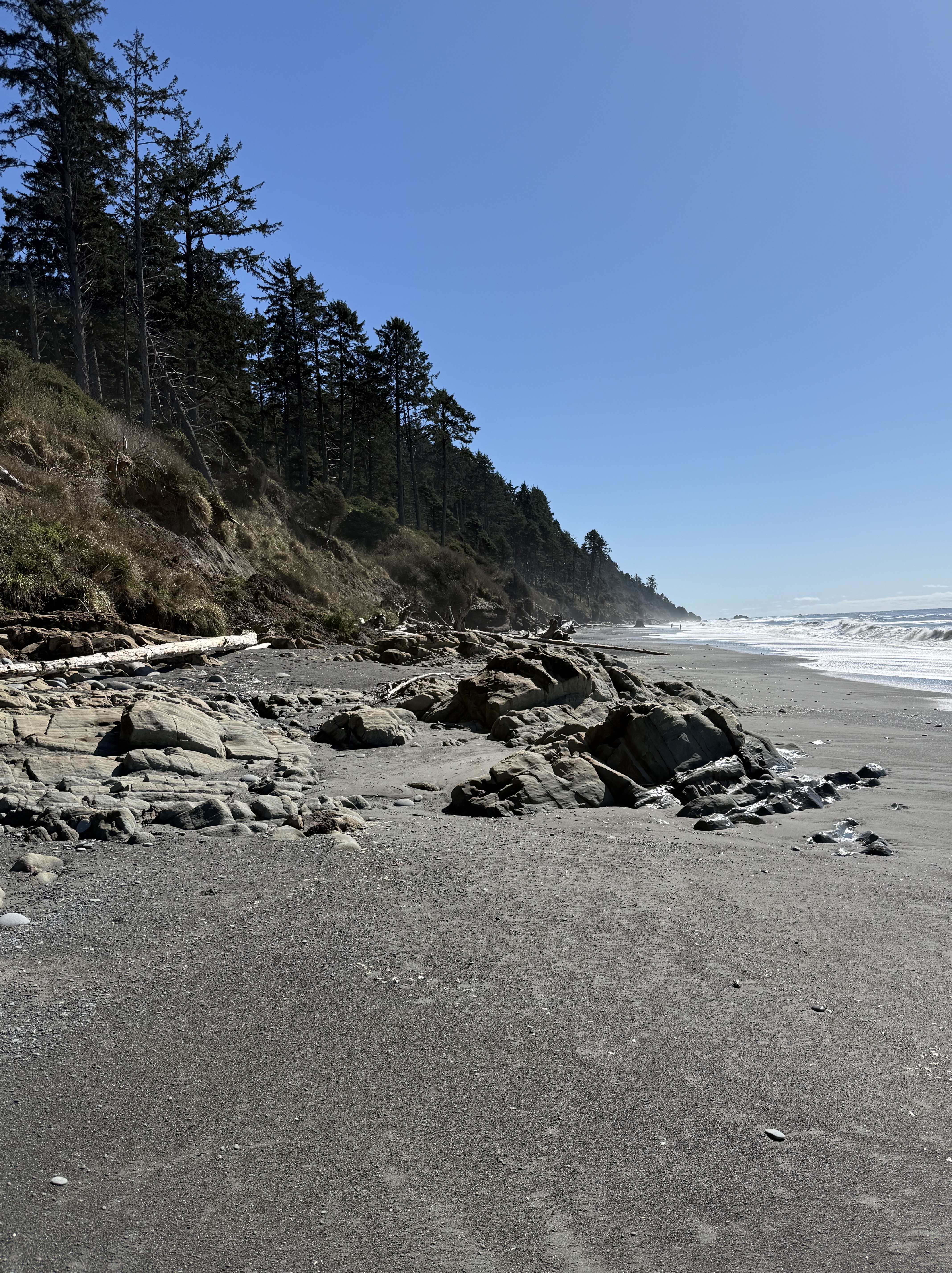
Location A: Quinault Rainforest. Photographs can’t do justice to the experience of being surrounded by a temperate rainforest. There are many trails of different lengths, but I followed a shorter one (about one mile) that followed Willaby Creek for a while before turning into the depths of the forest. This image shows the creek rushing by about 50 feet below the trail as it races to the south shore of Lake Quinault.
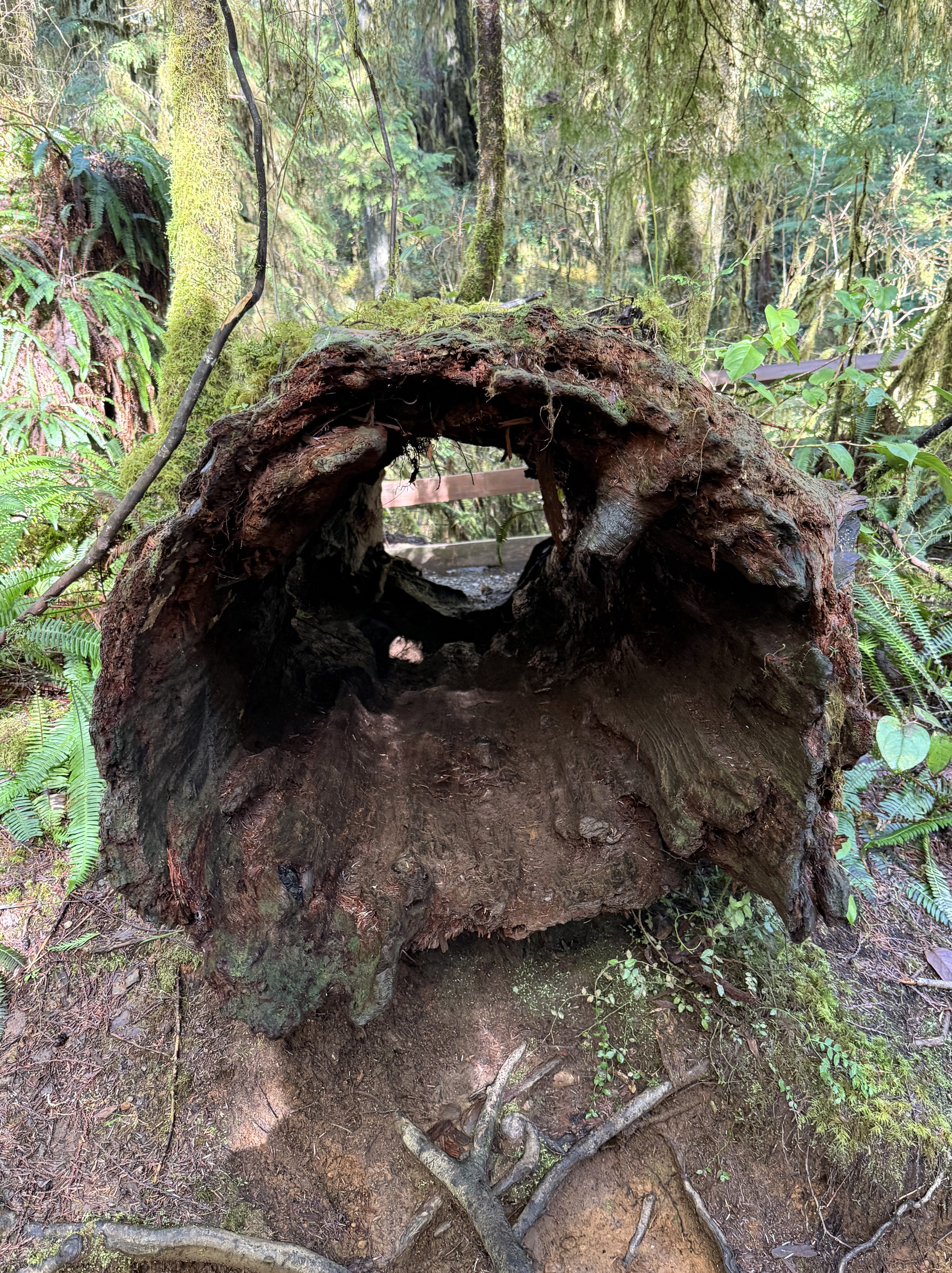
Location A: Quinault Rainforest. This rotted log is about six-feet in diameter. It is representative of the ongoing decay and rebirth of the forest. I’ll talk more about that in another post. Note the ferns growing out of the decaying wood.
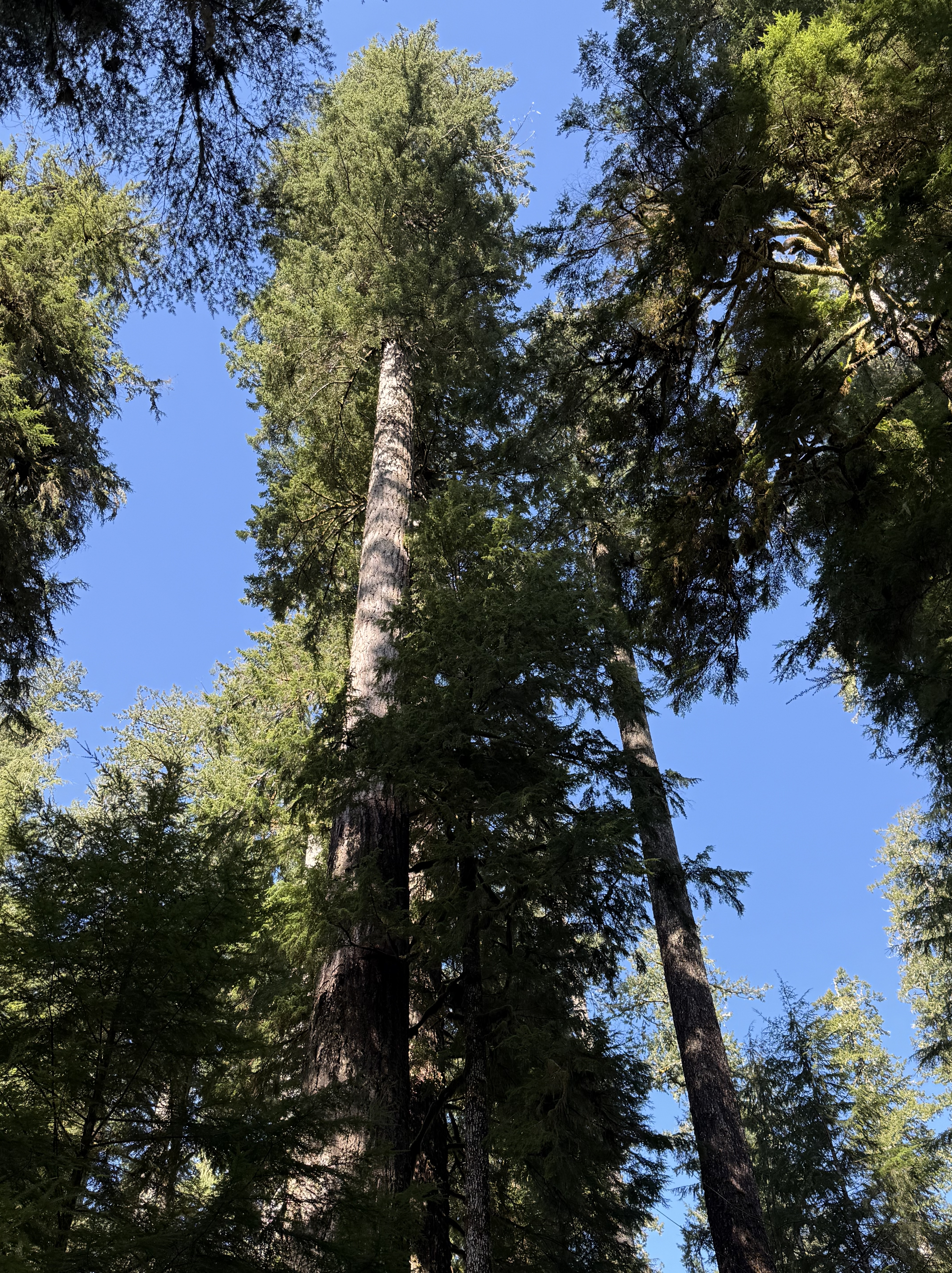
Location A: Quinault Rainforest. There are at least half-a-dozen species of giant evergreen trees in the rainforest, and I can’t identify any of them; but CoPilot suggests it might be a Coast Redwood, part of a local population found in this area. This example is typical in an area known for its “Champion Trees”. We’ll get to that in the next photo.
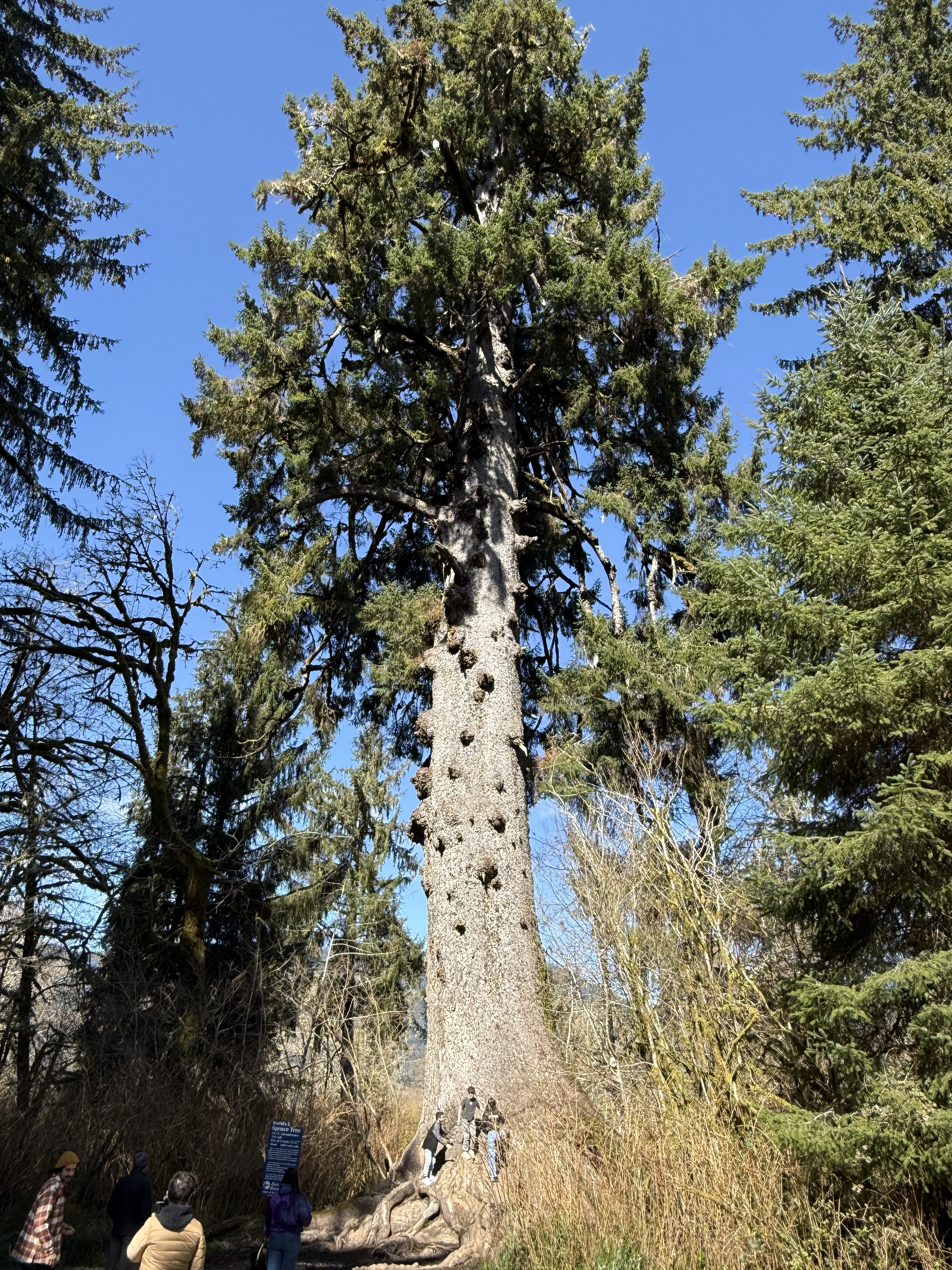
Location A. Quinault Rainforest. This is the world’s largest Spruce tree. It is 191 feet tall and about 1000 years old. It is one of the six champion trees located in Quinault Valley. The other champion trees are: the world’s largest Western Red Cedar, Douglas Fir, and Mountain Hemlock; and the largest Yellow Cedar and Western Hemlock in the U.S. This tree is growing in a wetland area at the NE end of Lake Quinault.
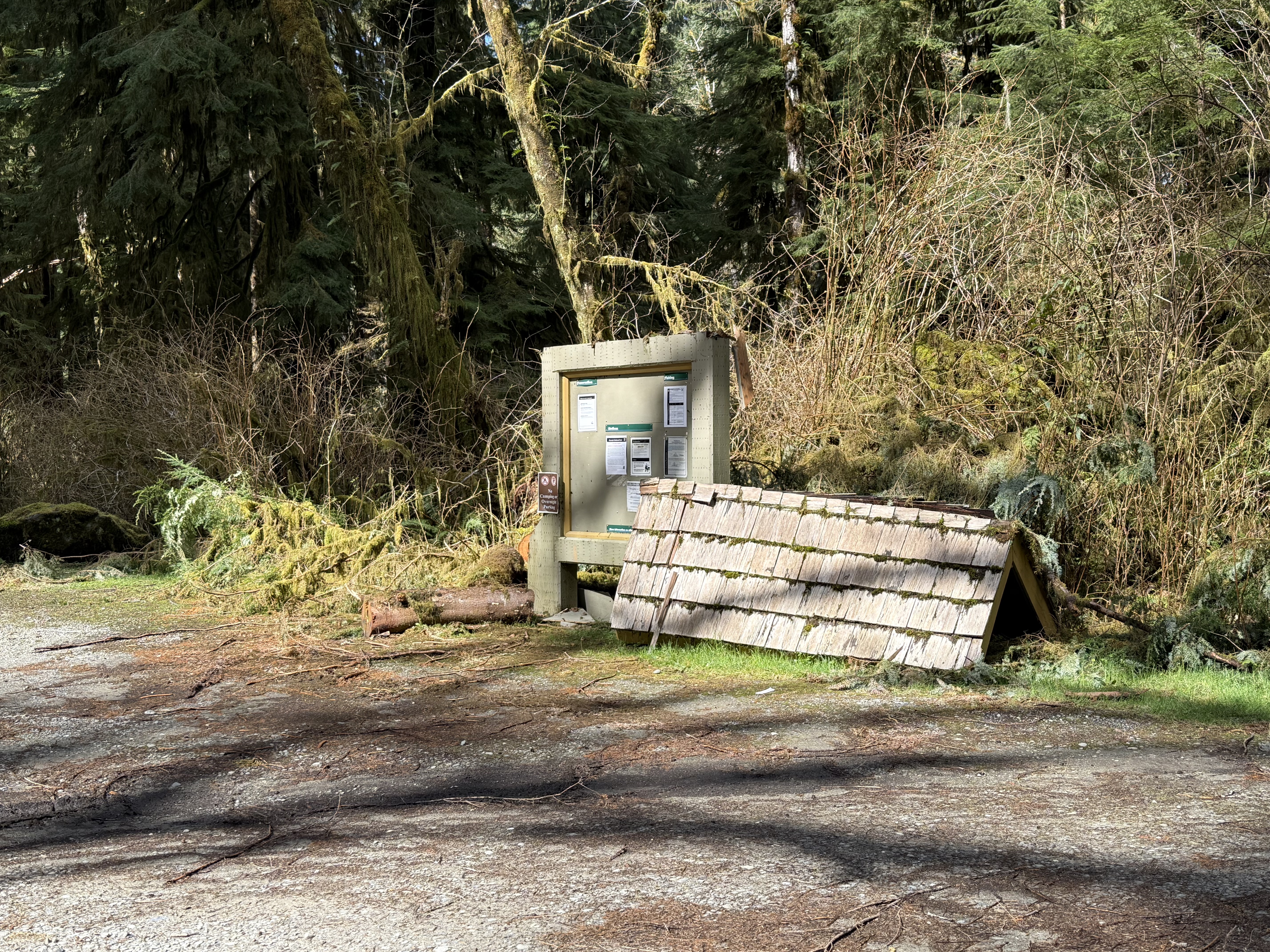
Halfway between Sites A and B. During my day-trips around the area, I’ve noticed a what appears to be a regional interest in post-industrial art, including but not limited to large concrete facilities that have been left to decay in place, as well as small sculptures and other curiosities scattered throughout the cities and forests. I don’t know if this is intentional or not: the roof of the information board collapsed (no doubt because of 12 feet of rain per year) and was set aside, possibly as a monument to nature?–or evidence of the poor funding and mismanagement of the National Park Service.
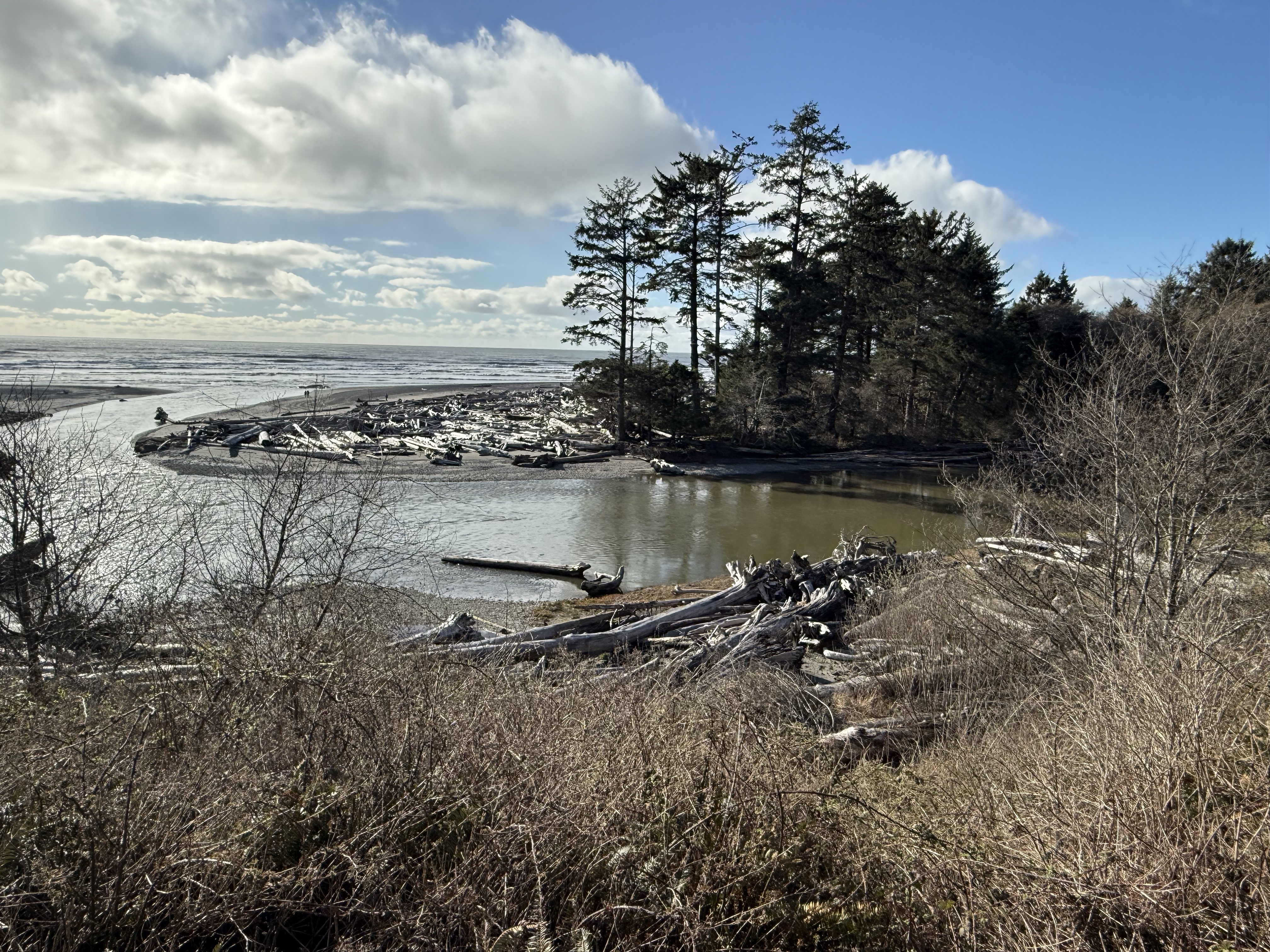
Location B: Kalaloch Lodge. This is the view from the deck of the lodge where I spent the night. Kalaloch Creek meanders as it approaches the coast and enters the Pacific Ocean here. An impenetrable pile of driftwood (actually logs and entire trees) has collected on a sand spit deposited on bedrock.
Location B: Beach 4 at Kalaloch. Steep bluffs of glacial till front a wide beach with many exposures of rock, which I’ll discuss in my next post.
Location C: Ruby Beach. This was the last beach before US 101 turned inland for ten miles. I took a video because a series of photos can’t possibly convey the beauty of this location as the sun was rising. Note all the rocks protruding from the water at low tide. The rocks are rising from the earth as we make our way north.
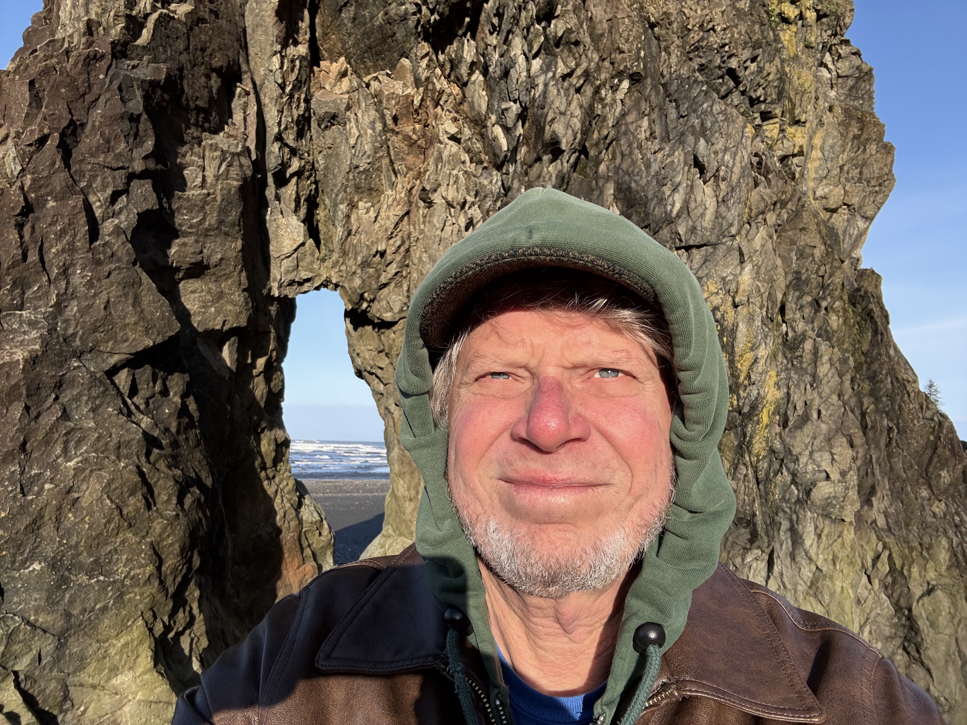
Location C. This selfie demonstrates how chilly it was, with the temperature below 40F. Rock formations like this are called stacks; they are erosional outliers as the coast recedes over millions of years, pounded day and night by rocks carried by waves; and tides that exceed nine feet–twice a day! You have to time your visit accordingly or all you’ll see is water.
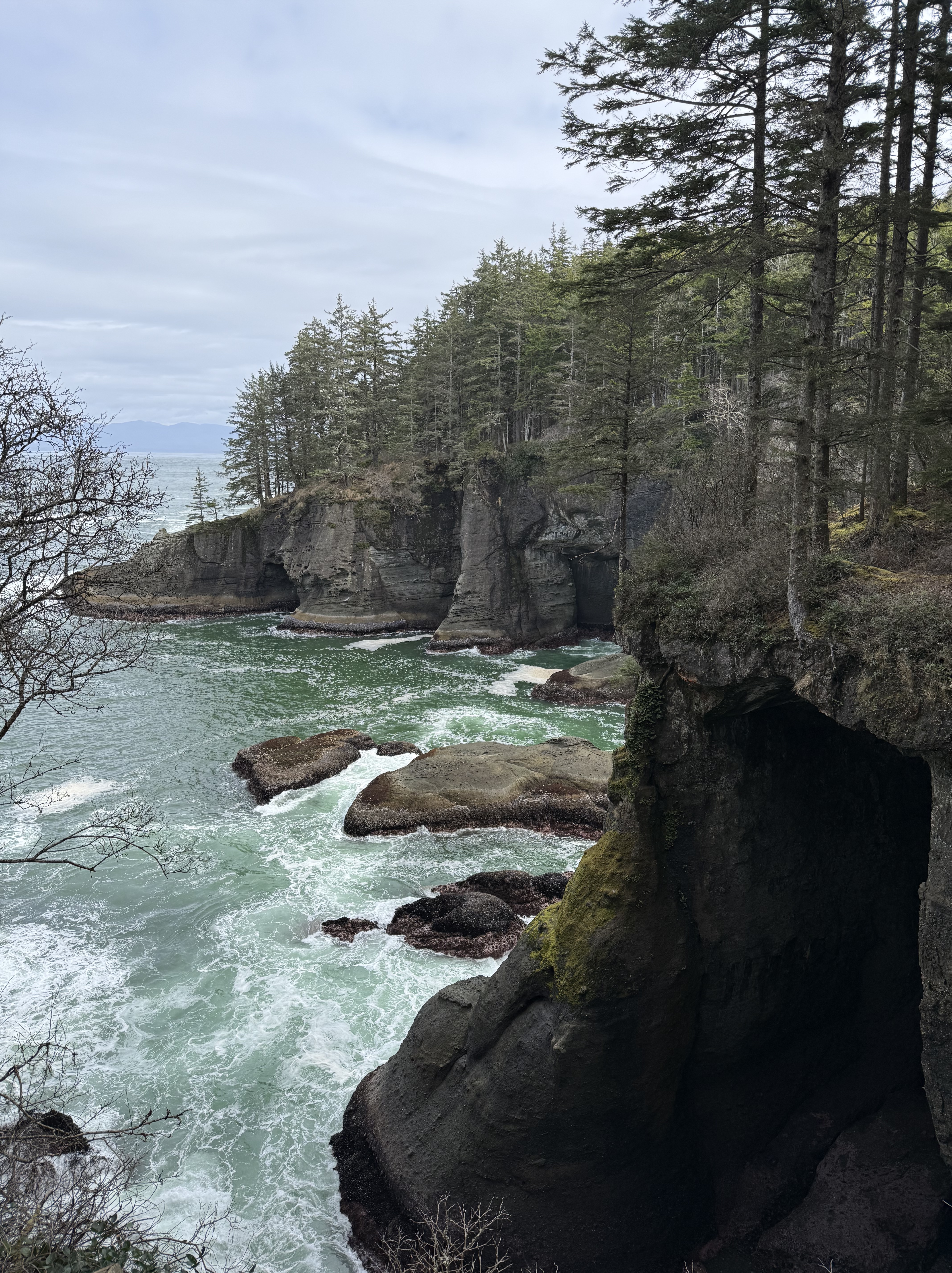
Location D: Point Flattery. This is the extreme tip of the contiguous United States. The bedrock we saw further south, at Ruby Beach, now forms wave-cut cliffs that tower 40-80 feet above the waves. The top of the bluffs is 330 feet above sea level. The view from the catwalks is breathtaking. Vancouver Island, BC, is visible in the background, with peaks around 6000 feet.
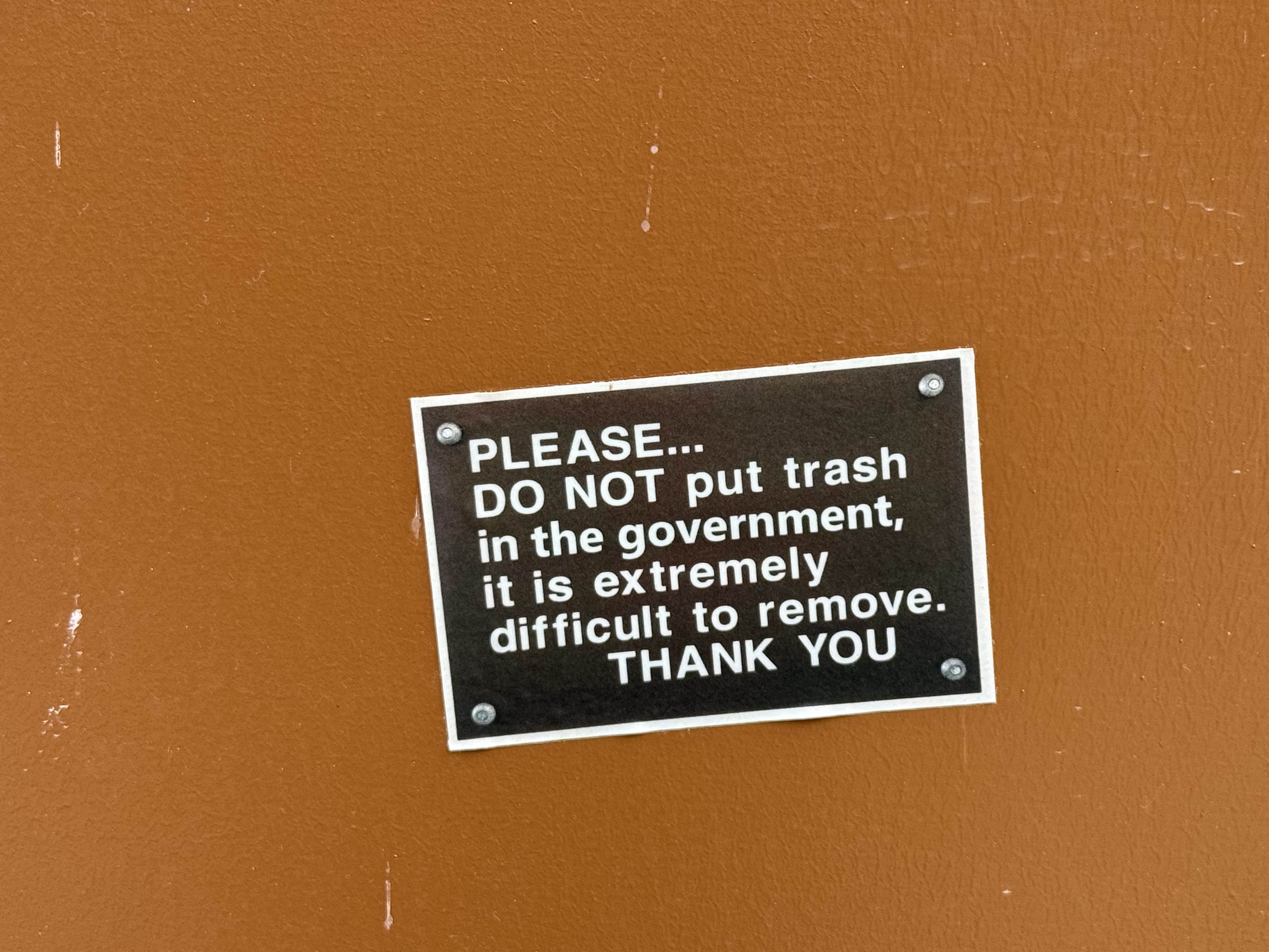
More PNW Humor. All of the toilets we saw along the coast were constructed over septic tanks, with warnings about what to put in them. Someone with a sense of humor modified just one word of the official message…
If you get the chance, I strongly recommend visiting Olympic National Park, but you’re going to want to spend a week unless you live nearby in the PNW.
America’s Car Museum
This is the main repository of the Lemay collection of automobiles.
I’m going to have to pay it another visit…
The Museum of Flight is a Smithsonian-like Experience
These are several posts from Facebook that I wanted to share with aviation enthusiasts who don’t happen to live in the Seattle area.
There was a covered outdoor pavilion with a collection of bombers and commercial aircraft. I wish I’d taken more photos…
The WWI collection is amazing!
I definitely should have taken more photographs. The memorabilia on display with the aircraft from WWII was fascinating in its own right. I have to go back…
The Lemay Auto Collection
The museum occupies the entire grounds of a 20th century boys school, so they have a lot of cars!
A Trip to the Burke Museum of History and Culture in Seattle
I’m reposting some Facebook posts from recent excursions around the Tacoma area for now.

Recent Comments